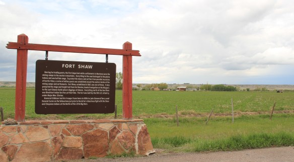
Another common features of heritage areas are properties associated with the nation’s military history and the process of nation building in the post Civil War United States of America. Cascade County has two major sites, one old and often forgotten, the other still at the heart of the nation’s defense. Let’s start with the oldest federal facility, Fort Shaw along the Sun River Valley in western Cascade County. As I was conducting the survey for the state historic preservation plan in 1984-1985, Fort Shaw was on everyone’s mind at the state historic preservation office. A proposal to list it in the National Register of Historic Places had been received, and the response was, generally, it is about time. This place had an important story to tell and was listed in 1985.

Commanders’ Quarters at Fort Shaw
As I noted in A Traveler’s Companion to Montana History, “Built in 1867 in what was then the heart of the country dominated by the Blackfoot Confederacy, Fort Shaw stood just a few miles west of where the Mullan Road [the important pre-Civil War federal military road through the region] crossed the Sun River. Colonel I.V.D. Reeves designed the fort, which was built with timber from nearby hills and sandstone and fieldstone found nearby. The soldiers also made adobe bricks that were used to construct the walls of many buildings at the fort. You can still see [in 1986 and 2015 as well] several of the original buildings, including two sandstone washhouses for the officers, the officers’ living quarters, and the commanding officer’s house.”
I emphasized in 1985 the property’s military significance in protecting the Mullan Road and the mining camps throughout western Montana. I also noted how it became a focal point for white settlement in the region. But I missed the bigger picture on what the site says and means.
Heritage Areas do a good job of looking at the “whole story” and how a landscape can have multiple meanings. Fort Shaw is an important military story: established two years after the end of the Civil War it represents an extension of federal military might into the West and how federal officials understood that occupation posts (Fort Shaw remained a post until 1891) represented federal power and authority, some 2000 miles away from Washington D.C. But certainly part of that process of nation building post 1865 was the federal policy to convert Native Americans. Here at this same place the Fort Shaw Government Industrial School was established, and here that federal officials and missionaries undertook that process of “civilizing” the Blackfeet. The idea behind industrial schools was that Native American children would be taken from their families, boarded at the school, and then taught skills that allowed them to contribute and compete in the modern white man’s world.
In the last decade, historical markers have been installed to help tell that story at Fort Shaw, highlighting the accomplishments of the 1904 girls’ basketball team, truly a remarkable story. Again, heritage areas like to talk about cultural history, and basketball and Indian nations across the northern plains are linked by this sport. The story of these girls and their successful run to a “World Championship” at the 1904 World’s Fair has been the subject of a PBS documentary (Playing for the World, 2009) and a recent book by Linda Peavy and Ursula Smith,
Full-Court Quest (2014). Their accomplishments are also marked by a monument at the old

industrial school site, an interpretive site not there in 1984-1985 and another great example of how public interpretation of Montana’s landscape has broadened and improved in the last 30 years.
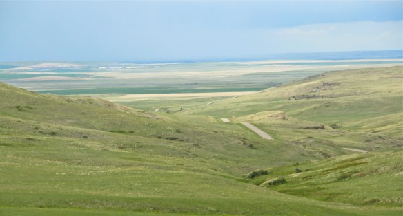 Fort Shaw was not the region’s earliest mission site. That designation belongs to St. Peter’s Mission, located on the winding Mission Road to the south of Fort Shaw. An earlier blog discussed St. Peter’s but this special property is worth further discussion, as it is linked in time and purpose to what happened at Fort Shaw.
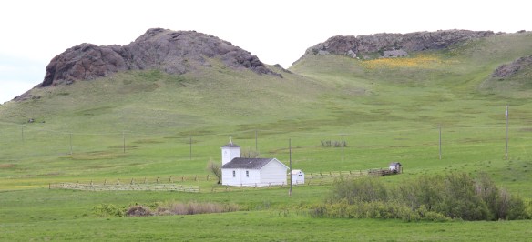 The property has limited public accessibility as an active ranch surrounds it and uses some of the remaining historic buildings. But since my first visit in 1984, a small metal interpretive marker has been installed, which emphasizes its founding date of 1865-1866 by Catholic missionaries, many
whom are buried on a hill, along with some of their Blackfeet converts, overlooking the mission. The Jesuits established this outpost a year or so before the military post at Fort Shaw. In 1884 they too established a girls school for Blackfeet children at the site.
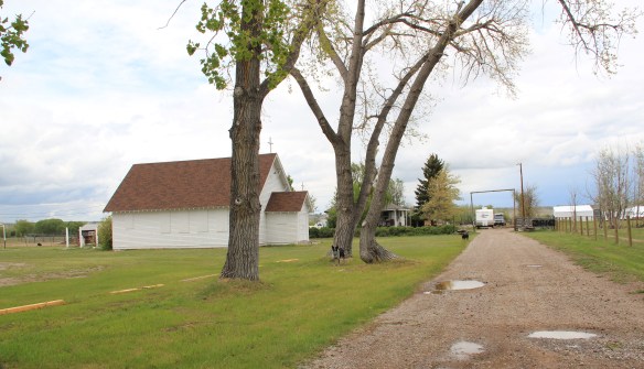 Often we forget these connections between religious missionaries and the nation-building process of government. Within a few hundred yards of Fort Shaw school, for instance, is the old road connecting the school to the historic St. Ann’s Catholic Church (seen above is the historic church building; the congregation has built a modern church in recent years).
 And we further forget, or choose to ignore, how the messy present lies side by side with these older, seemingly sacred places. Along the Mission Road and the Simms Road are nuclear missile bases, some active, some inactive, that are administered by the Malmstrom Air Force Base in Great Falls. Much like Fort Shaw from 100 years earlier, military commanders in the 1960s saw Cascade County as part of the edge of America’s national defense, the ideal location for nuclear bases that could protect, or retaliate, in case of a nuclear strike from the nation’s enemies.
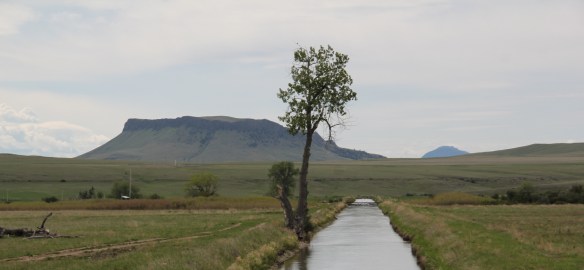 The Sun River Valley was transformed by homesteaders and irrigation during the great boom of the early 20th century; it shares that story of course with many towns in the Great Falls heritage area. Montana Highway 21 (shown above) connects with Montana Highway 200 to provide great opportunities to explore that landscape. The Sun River project of the U.S. Bureau of Reclamation especially left its mark.
While the old roadside stores at Fort Shaw, the project’s headquarters, suggested that the homesteader landscape was everyday vernacular, not designed to last, other properties, such as the wonderful Simms school complex, tells us that some built to last.
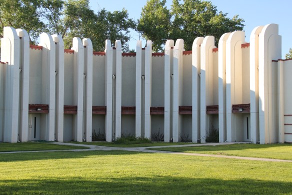
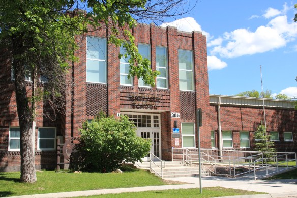
At Simms, reclamation engineers designed what they considered to be a model townsite plan, with the school at the center, and broad avenues radiating out from the school. Simms no doubt never reached the population that the planners envisioned, but here too in an unlikely place is the hand of the federal government, re-orienting the landscape in ways that can be seen, if you know where to look.

The school is very much the focus of the community–and the gymnasium at the rear has been the place for community events and sports for almost 100 years. The football and track field is in great shape too–a reminder of how sports bind the valley’s residents.
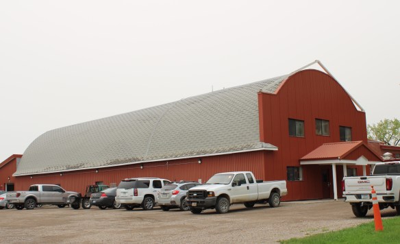

Not far from the school is another community building, the women’s club hall that dates to the Sun River project’s beginning years. I hope to see this building listed in the National Register in the future along with the other historic women’s club buildings scattered across the state.

West of Simms was property of note to my SHPO colleagues in 1984 was the J.C. Adams Stone Barn, which had received a grant for “brick and mortar” work as part of President Reagan’s efforts to jump start the economy in 1982-1983. This magnificent structure predated the federal agricultural programs, dating to the mid-1880s. It rather spoke to the promise of stock-raising and freighting–Adams did both–as the region began to develop in the last years of the Montana territorial period.
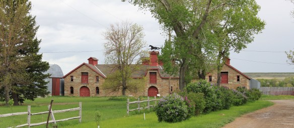 The barn is part of a still active ranch and is on private property. But the stone masonry can be viewed and appreciated from Montana Hwy 200.
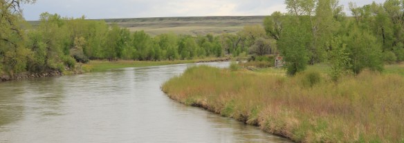 When one considers a Great Falls heritage area, the Missouri River of course will take center stage; as the next postings will show, it should be at the center of the story. But what happened along the Sun River, and what remains today, adds immeasurably to the national story and the overall significance of the region.



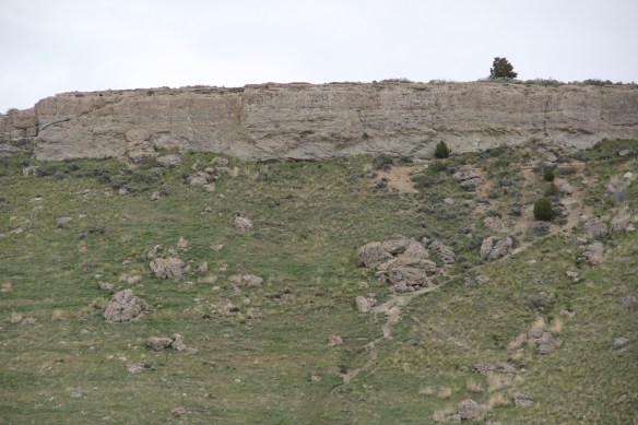 I used a slide taken in 1982 in all of my public presentations about the Montana state historic preservation plan back in 1984-1985. I found out that few Montanans knew of the place and its history. What has changed since the 1980s? The park is still little known and receives infrequent visitors. In my 2015 fieldwork, I saw signs of new heritage development–the park sign, a bit of improvement to the outdoor interpretive center, and new interpretive exhibits with a more inclusive public interpretation and strong Native American focus.


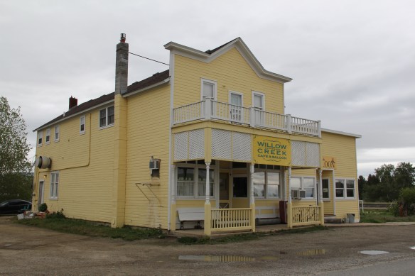
 Willow Creek was the end of the line for both the Northern Pacific and Milwaukee Road railroads as they vied for dominance in turn of the 20th century western Gallatin County. The Northern Pacific came first with its spur line to Butte in the late 1880s then the Milwaukee arrived c. 1908. Both used the same corridor, along what is now called the Old Yellowstone Trail on some maps; the Willow Creek Road (MT 287) on others. It was a route that dated to 1864–the town cemetery, according to lore, dates to that year and Willow Creek has had a post office since 1867.


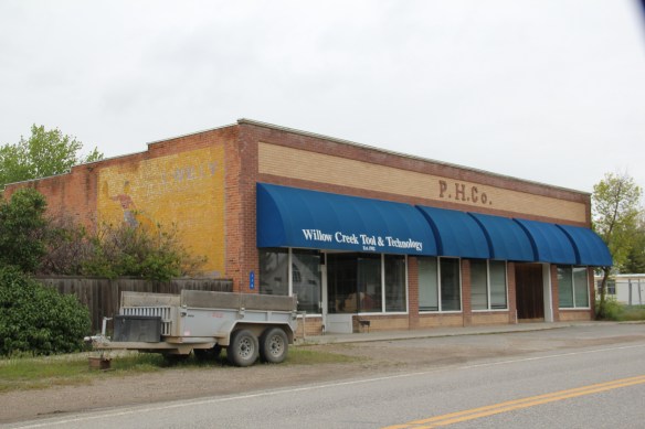
 Across the street is the “employment center,” the Willow Creek Tool and Technology which sells its wares across the west out of its brick building from the 1910s. (Note the faded advertising sign that once greeted travelers on the Yellowstone Trail highway.)
 The cultural side of Willow Creek is represented by several places: homes and galleries of different artists, a monthly arts festival in the summer, and two special buildings from the 1910s. The Stateler Memorial Methodist Church, c. 1915, is listed in the National Register of Historic Places. Built from rusticated concrete blocks (from the cement factory at Three Forks) designed to resemble stone masonry, the church building is home to one of the oldest congregations (1864) in the Methodist Church in Montana. The Gothic Revival-styled sanctuary is named in honor of its founding minister Learner B. Stateler.
 Nearby is another crucial landmark for any rural Montana community–the local school. The Willow Creek School is an excellent example of the standardized, somewhat Craftsman-styled designs used for rural Montana schools in the 1910s. Two stories of classrooms, sitting on a full basement, was a large school for its time, another reflection of the hopes of the homesteading era.
 Additions in form of a gym and added rooms had come to the north and the school and its lot is the town’s community center. Although so close to Three Forks, the school kept its


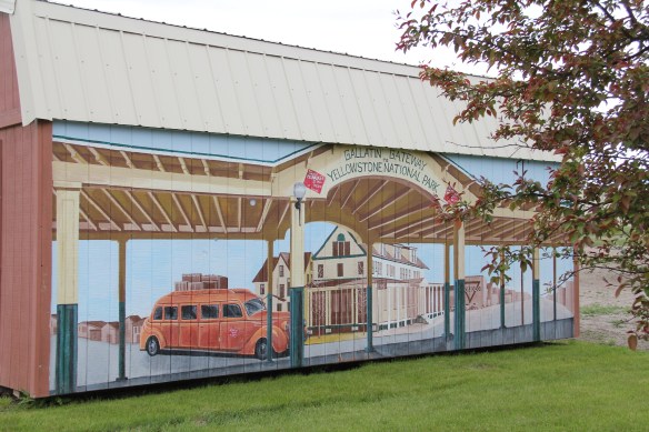
 Three Forks, Montana, is unique in how competing railroads shaped this one small town between the 2008 and 2010. The last post discussed how the Milwaukee Road came first, and its landmark Sacajawea Inn stands at the north end of the town’s main street. On the east side–see the Google Map below–became the domain of the Northern Pacific Railroad and its spur line to the copper kingdom of Butte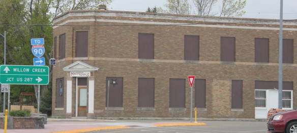


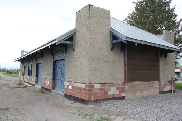 Company. In 1914 Charles Botcher bought the plant, renamed it the Ideal Cement Company and kept it in business under that name until the 1980s.


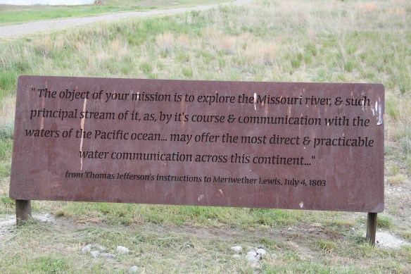


 As you leave the Missouri Headwaters State Park access road (Montana 286) and return south to old U.S. Highway 10, you encounter a plaintive sign hoping to attract the thousands of heritage tourists who come to the state park–go a bit farther south and west and find the town of Three Forks.
 The story of Three Forks, on the western edge of Gallatin County, is not of rivers but of railroads, of how both the Northern Pacific and the Milwaukee Road corridors shaped this part of the state at the end of the first decade of the 20th century.


 The two lanes of U.S. Highway 89 as it winds northwest from Choteau to the southern boundary of the Blackfeet Indian Reservation, cross a stark yet compelling landscape, a jaunt that has never ceased to amaze me. To those only with the mountains of Glacier National Park in their minds will see merely open land, irrigated fields, scattered ranches.
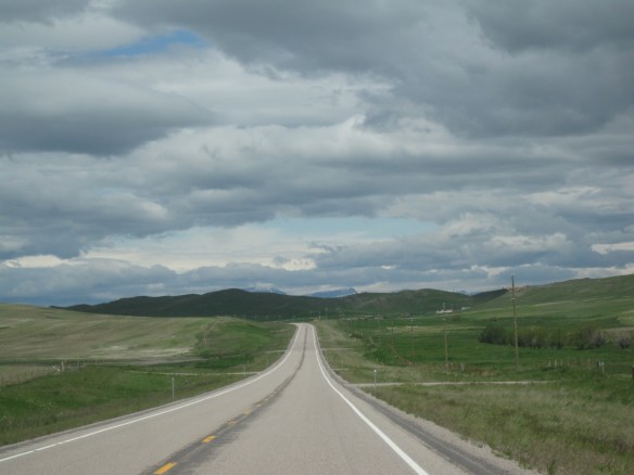 But there’s a deeper landscape here, some embodied in the tiny towns along the way, others in places just ignored, certainly not recognized. In the first post of 2016, and the 200th of this series of explorations of the Montana landscape, let’s once again look a bit harder.
 For one, this is a landscape shaped by Cold War America. Nuclear missile silos were installed throughout the region with some easily accessible from the roadway. You wonder how many tourists realize that.
 The federal imprint has lingered on this land for almost 150 years. Today north of Choteau this highway historical marker, and a lonely boulder set square in the adjacent field, mark the first federal intrusion, the creation of the Teton River Agency, where in 1868-69 the federal government established its reservation headquarters for the Blackfeet Indians. The agency was only here for about 7 years but this spot was where the first white-administered schools for Blackfeet children began, in 1872.
 Irrigation systems would be a third federal imprint on the landscape and it came early to this region–through the Reclamation Service’s Valier Irrigation Project–but to find that place you need to venture a bit east of U.S. 89 to the town of Valier, on the banks of Lake Frances, which was created as a reservoir for the irrigation project.
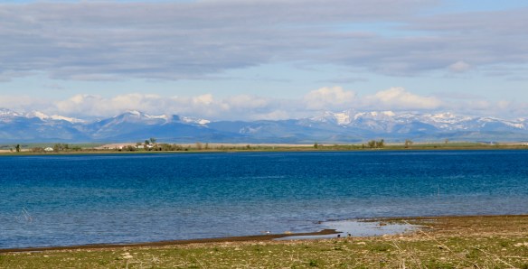 Valier has never been a very big place, but its investors in 1908, including William S. Cargill of the powerful Cargill family of Wisconsin (today’s Cargill Industries), had high hopes that the engineered landscape could create a ranching and farming wonderland.

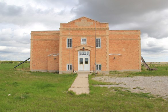
 Listed in the National Register of Historic Places, the school remains in use today, as a bed and breakfast establishment. Even though Valier never reached the dreams of the Cargills and other outside investors, it has been a stable agricultural community for 100 years–the population today is only 100 less than what the census takers marked in 1920. Valier has that


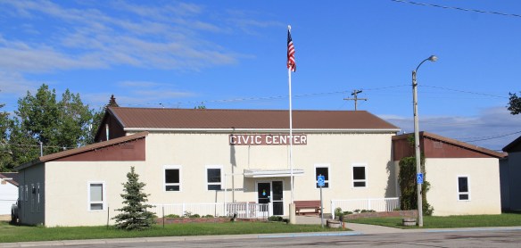


 Heritage tourism also remains alive along U.S. Highway 89, and for those travelers who slow just a bit there is now the Two Medicine Dinosaur Center at Bynum.
 One of my favorite county seats is Choteau, where U.S. Highways 89 and 287 meet. Both of those roads were and are among my favorite to take in the state, and Choteau I quickly found had one of my favorite local dives the Wagon Wheel. Back in the day, however, I did not appreciate how the town’s history and built environment was shaped by the Sun River Irrigation project and the overall growth in the county during the first two decades of the 20th century and later a second boom in the 1940s.
 Choteau has a different look than most towns from this era of Montana history. The centerpiece of the towns plan is not a railroad depot but the magnificent Teton County Courthouse (1906), which occupies a spot where the two federal highways junction. Designed by architects Joseph B. Gibson and George H. Shanley, the National Register-listed courthouse is made of locally quarried stone in a late interpretation of Richardsonian Romanesque style, similar to, but to a much lesser scale and detail, than H. H. Richardson’s own Allegheny County Courthouse (c. 1886) in Pittsburgh.

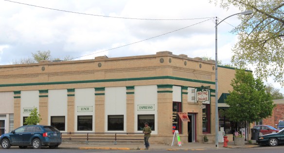 This historic neoclassical-styled bank building is now home to a coffee shop but other commercial buildings have changed very little, except for the mix of retail business. This is not a dying business district but one with a good bit of jump, of vitality.


 where the historic Bella Vista Motel–a perfect example of a 1950s motel with separate units like tiny Ranch-styled houses–has given way to a c. 2015 conversion into apartments.


 As the highway leaves the central plains east of Great Falls, it heads east through coal country (see the earlier post on Belt) and south into the Little Belt Mountains and the old mining towns of Monarch and Neihart (above). Both Cascade County towns are proud of their heritage, a story embodied in the Monarch-Neihart School, a wonderful bit of log craftsmanship from the New Deal era, a WPA project finished in 1940 that is listed in the National Register of Historic Places.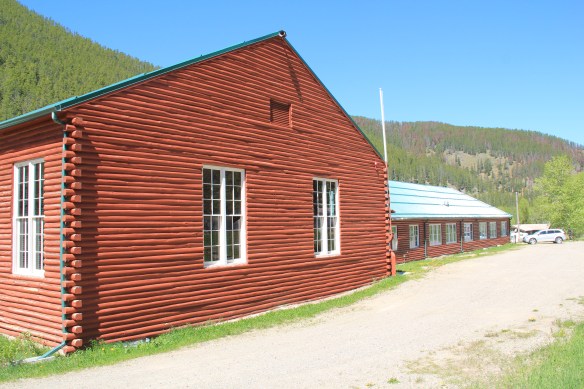


 When I last visited there in 2015 the combined route of U.S. 89 and 12, which passes in front of the courthouse and the center of town, was being rebuilt, giving the historic business district the look of a ghost town.

 U.S. Highway 89 continues south, crossing the historic corridor of the Milwaukee Road at Ringling, another Meagher County town discussed in an earlier post, marked by the landmark St. John’s Catholic Church.
 Travelers continuing south soon find themselves in Park County, entering the Shields River Valley just north of Wilsall, where highway markers and monuments, like that for “Thunder Jack” (2006) by sculptor Gary Kerby, convey the significance of the place.
 Wilsall was not much a place 30 years ago, a small trade town on the edge of a Northern Pacific Railroad spur line, a past still recalled by the tall elevator and old railroad corridor.
 But the growing popularity of the Shields River Valley has led to a new boom in Walsall, with old banks converted into bars and old general stores

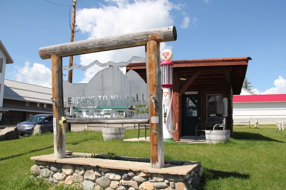

 Clyde Park Tavern is still the place to go for an adult beverage, or two. Historic grain elevators still serve local ranchers, marking the railroad line that defined the town’s landscape until the impact of the highway in the early 20th century.


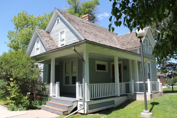



 project, and the Art Moderne landmark Intermountain bus station–once so proudly featured in the Clint Eastwood and Jeff Bridges movie, “Thunderbolt and Lightfoot,” part of that decade from the mid-1970s to mid-1980s when Montana was suddenly in the lens of Hollywood.
 All of these buildings and places help to give Great Falls its unique sense of self, and its sense of achievement and promise. And that is not to even mention the fun, funky stuff, such as the Polar Bears and having the
 supper club experience of 50 years ago at Borrie’s in Black Eagle. Stepping back into time, or looking into a future where heritage stands next to the
 atomic age, Great Falls and its environs–from Fort Benton to the northeast to Fort Shaw to the southwest–can give you that memorable heritage area experience.
 Many heritage areas in the eastern United States emphasize the relationship between rivers, railroads, and industrial development and how those resources contributed to national economic growth and wartime mobilization. Great Falls can do that too. Situated on the Missouri River and designed by its founders to be a northwest industrial center, entrepreneurs counted on the falls to be a source of power and then on the railroads coming from Minnesota, especially the promising Manitoba Road headed by James J. Hill, to provide the transportation.
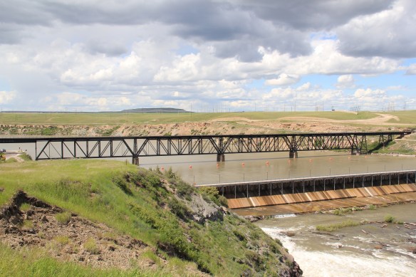 Paris Gibson, the promoter of the Electric City, allied his interests to two of most powerful capitalists of the region: Marcus Daly, the baron of the Anaconda Copper Company interests and James J. Hill, the future rail king of the northwest. Their alliance is embodied in several different properties in the city but the most significant place was where the Anaconda Copper Company smelter operated at Black Eagle until the last decades of the 20th century. When I surveyed Great Falls for the state

 decade of the 20th century and soon erected its tall tower depot right on the Missouri River. But wherever you go along the river you find significant buildings associated with the Great Northern and its allied branch the Montana Central Railroad, especially the downtown warehouses. Some are still fulfilling their original function but others


