Harlowton and the Milwaukee Road Division Point

In my work of 1984-85 for the state historic preservation plan, there were few places in Montana that fascinated me more than Harlowton, a division point for the Milwaukee Road and the place where the railroad began its electric line to the west.

from the Milwaukee Road Depot Museum at Harlowton.

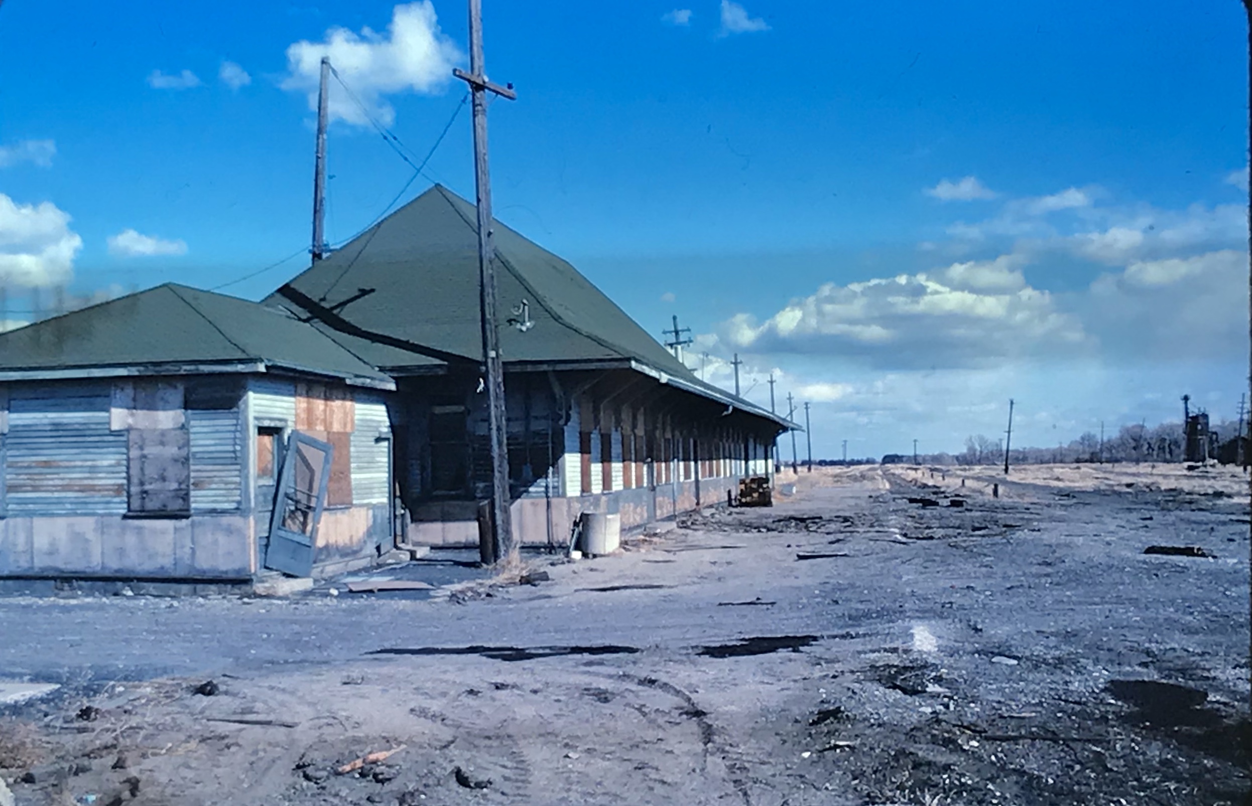
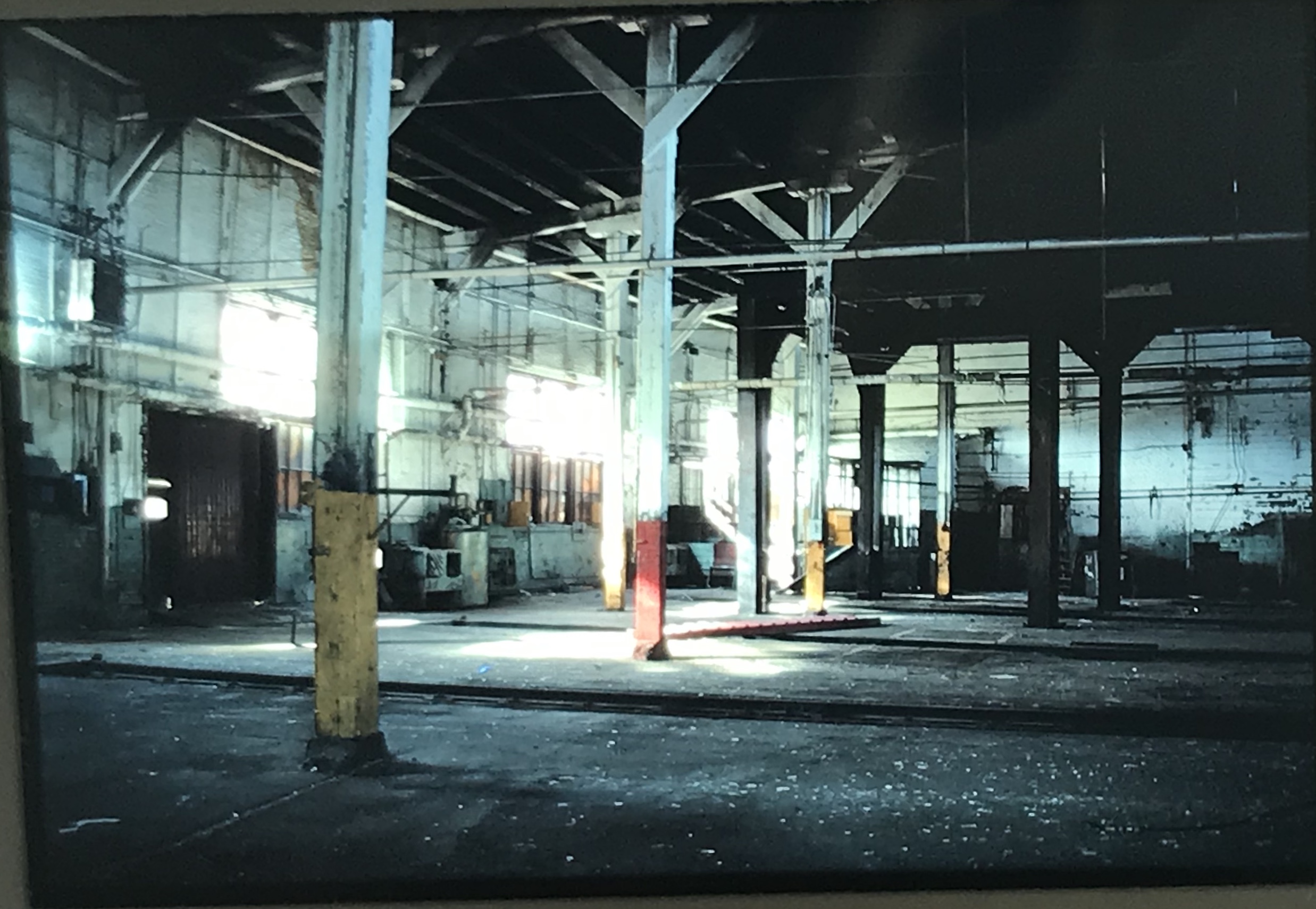
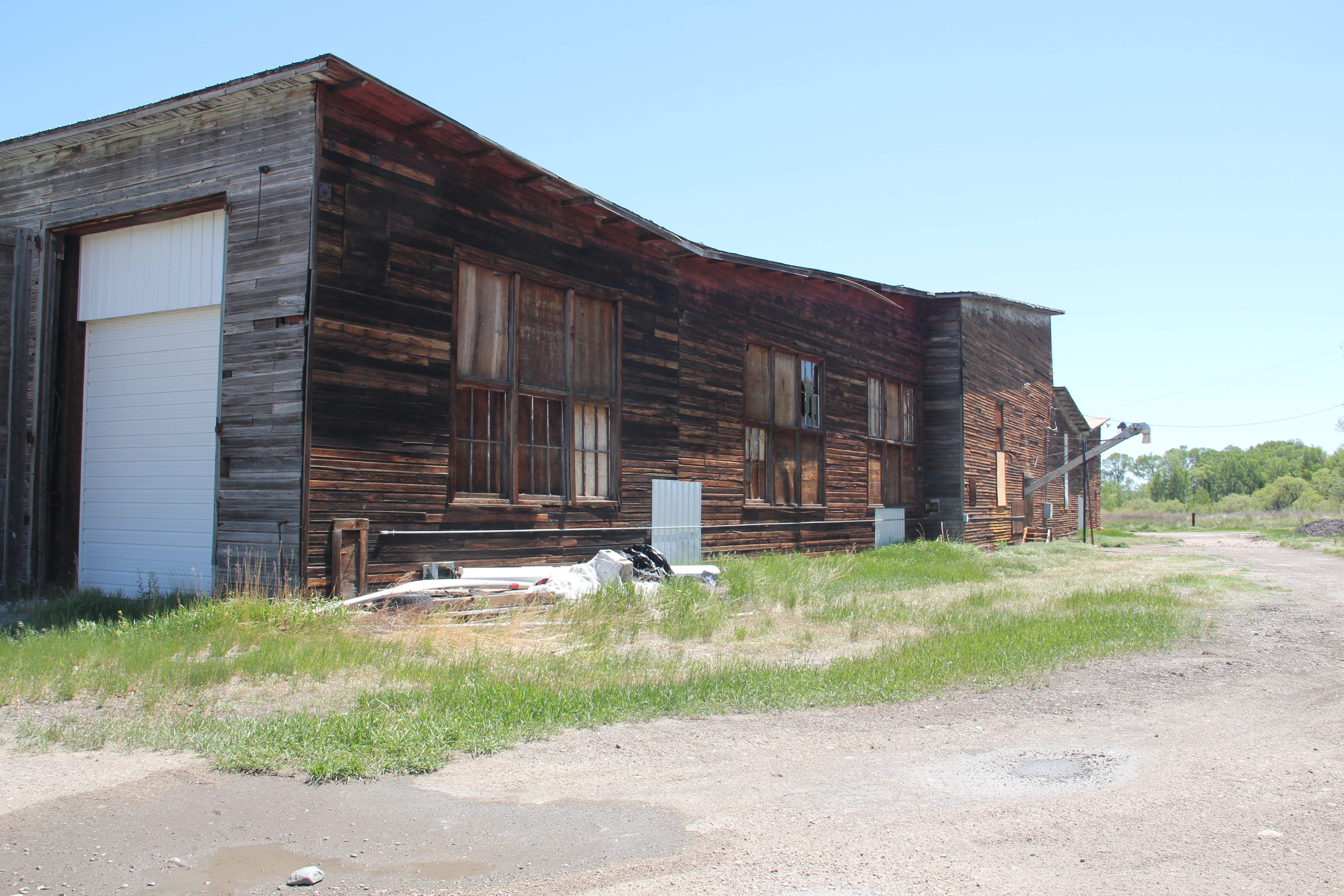
The line abruptly stopped work in 1980 and declared bankruptcy, devastating not only Harlowton but many other towns and villages in the west. By the time I began my work in 1984 the dismantling of the railroad was well underway, and I was playing catch-up as track was ripped up for the steel and buildings began deteriorating.

Colleagues in the preservation field had been at work on documenting and understanding the railroad’s history. Dale Martin produced an insightful overview of the railroad and its landmarks for the Montana Historical Society Press in the 1980s. Others carried out preservation studies and in the cities key landmark depots became restored office buildings, restaurants, and other businesses.

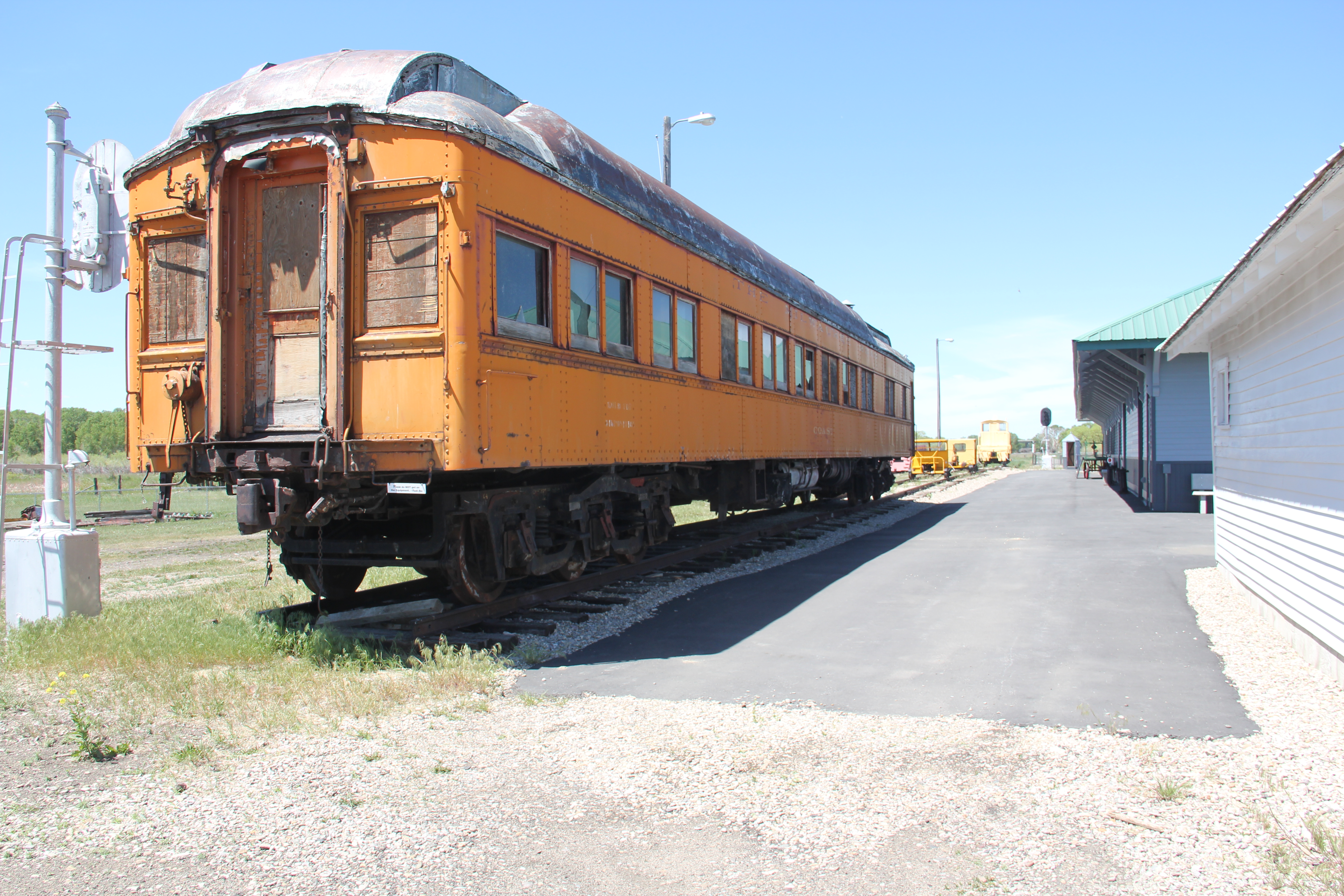
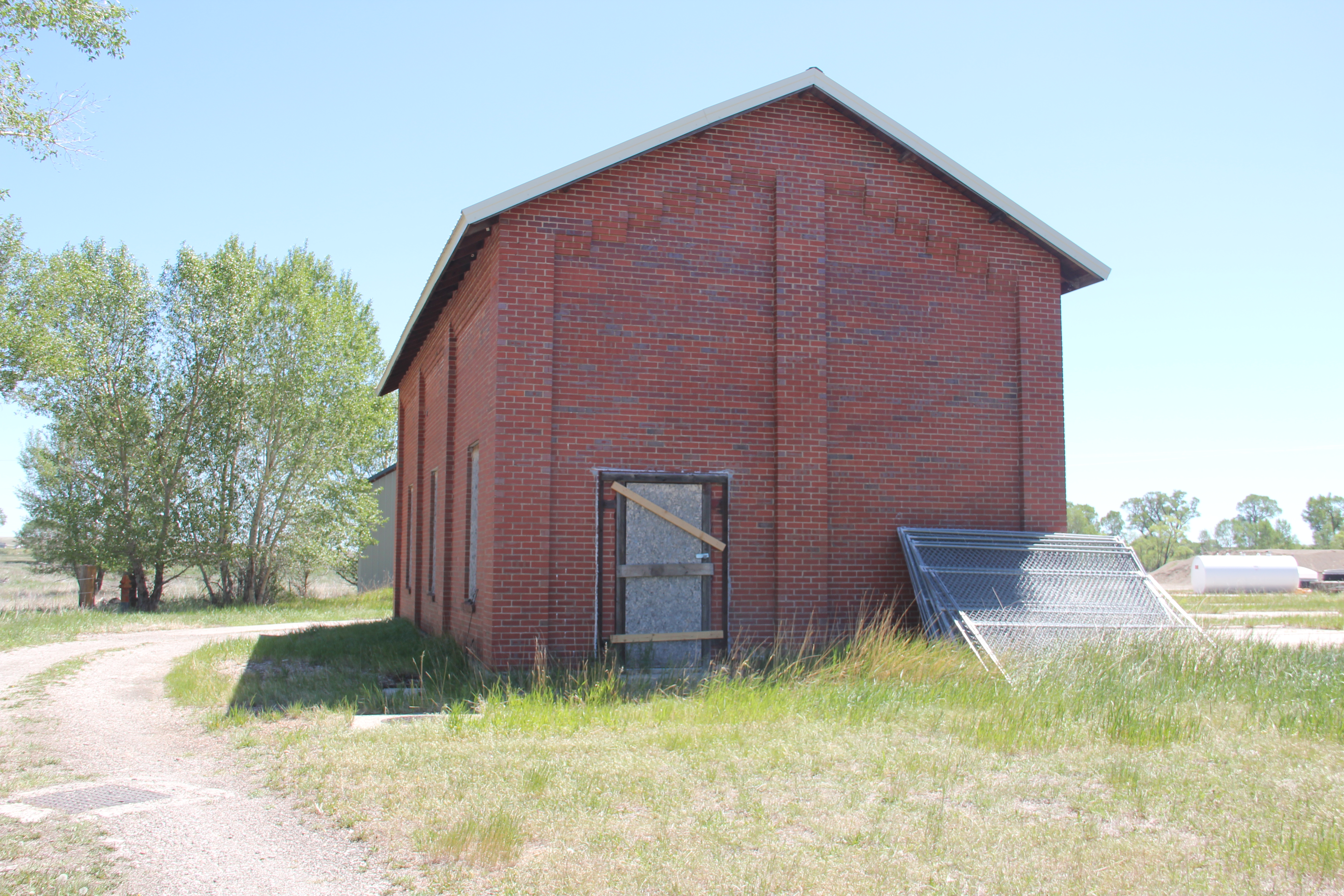
But the complex in Harlowton–despite its overall significance to the railroad’s story and its national significance–withered. Compared to the resources in Butte, Missoula, and Great Falls, where the depots were already under preservation and adaptive reuse, the task at Harlowton just seemed to be overwhelming, and some said impossible. Below are copies of some of the images that I took from the mid-1980s to c. 1990, which mark the deterioration of the division point complex but also the fact that resources were there–they just needed help.

the passenger station from the rail yard c. 1985
passenger station and abandoned tracks, c. 1985
the roundhouse and maintenance shops c. 1985
roundhouses and maintenance shops c. 1985
interior of roundhouse c. 1985

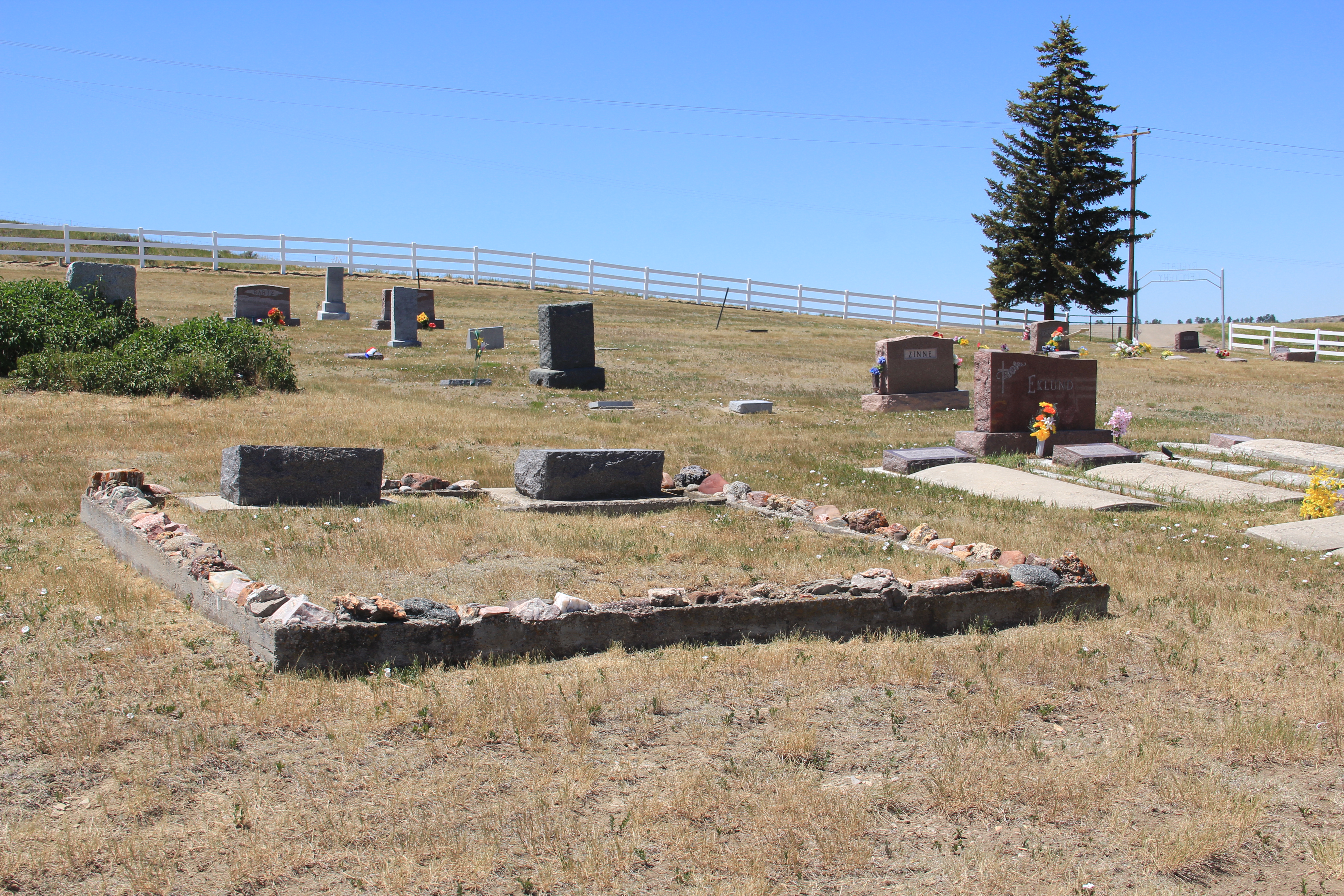
The division point complex was listed in the National Register in 1988 and by the 1990s some preservation efforts and underway, with the installation of a historical marker and some repair work on the passenger station.

repair work from the town (street side)
repair work and roundhouse in background, c. 1990

Would enough help come in time to preserve this nationally significant place–by start of the 21st century I thought not. Imagine my complete delight in 2021 when visited the magnificently restored passenger station, which had become a well-conceived and executed museum, not just about the Harlowton division point but a place of research for the entire line.

passenger station and railcars from the rail yard
Part of the archives and library room for researchers.
The Winnecook post office has been moved to the site as another museum building

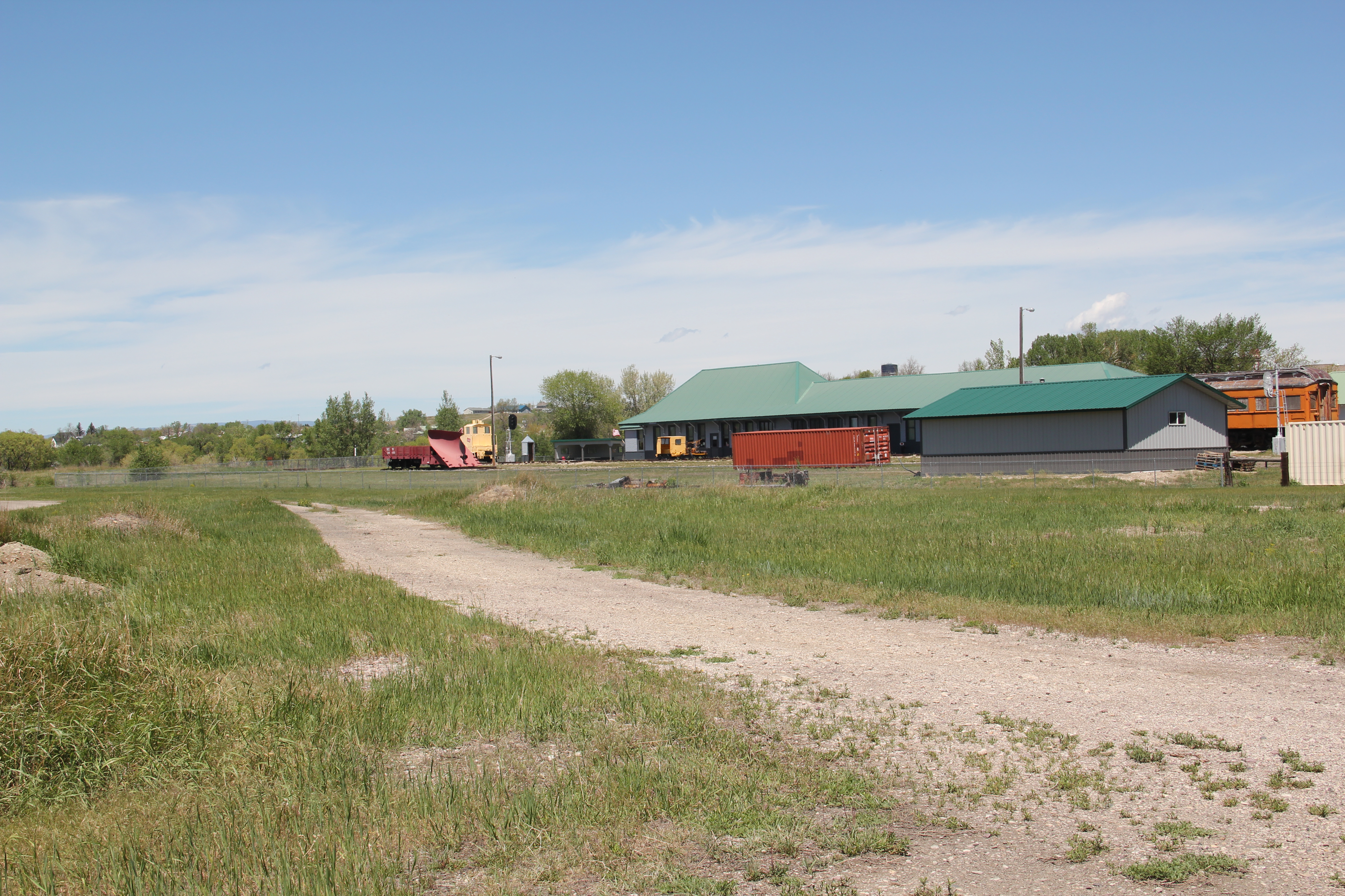
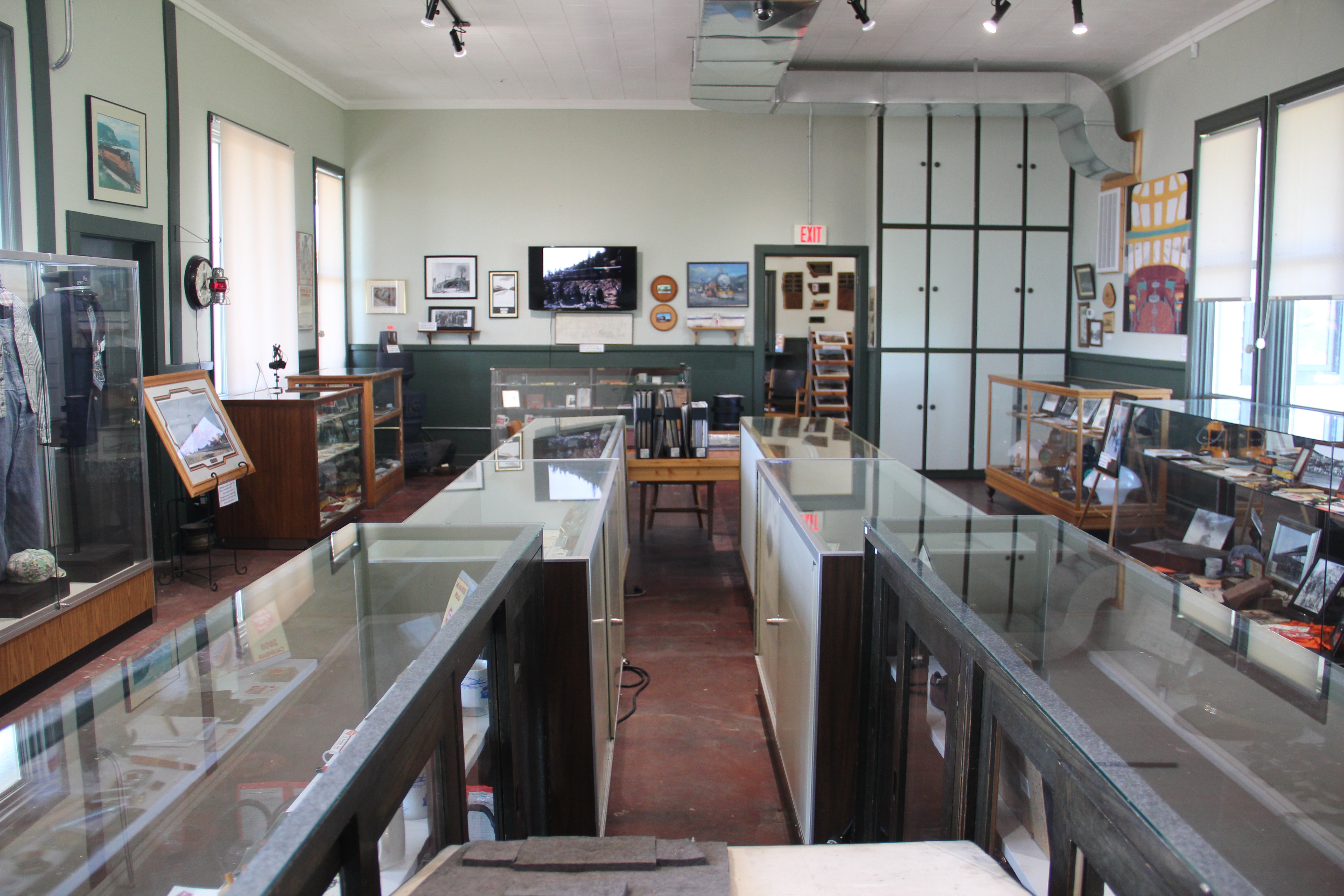
What has been in accomplished in the last few years is impressive and must be commended. What an achievement by a group of dedicated volunteers and residents. Finally, one of Central Montana’s most important stories can be fully explored. But, still, there is work to be done, on the roundhouses and maintenance buildings.

I look forward to my next visit to Harlowton and the continued preservation and interpretation of this nationally significant property in the railroad history of not just Montana but the United States.

Red Lodge Cemetery, Carbon County, Montana

As you leave downtown Red Lodge on Montana Highway 78 heading towards Roscoe, you find the Red Lodge Cemetery high on the bluffs overlooking the town, and not far from the gateway to the county fairgrounds. The cemetery is remarkable. A few years ago residents worked with the Montana State Historic Preservation Office to place the Red Lodge Communal Mausoleum, from the 1920s, in the National Register of Historic Places. The impressive Classical Revival styled building is certainly the centerpiece of the cemetery.

Red Lodge Mausoleum

But as the grave markers in the front of the building document, the cemetery itself makes a powerful statement of the ethnic diversity of Red Lodge, especially during its coal mining era from the late 1880s into the middle of the 20th century. Twenty years ago Bonnie Christensen’s book on the ethnic groups who worked in and around Red Lodge, mostly in coal mines but not always, documented how local history went against the stereotypes of the mythic West. A walk through this cemetery, with grave markers from residents who came from the United Kingdom and Ireland or Central Europe or the Mediterranean and especially from Scandinavia, makes history books like that of Christensen become jarringly real.

Two of the more interesting markers bookend the mausoleum and mark the lives of immigrants from Italy who were also members, judging from the markers’ form and style, of the Woodmen of the World.

The mausoleum is not the only crypt. Located behind the mausoleum and facing the mountains to the west is the Powers grave house, built of concrete.

Scattered throughout are child grave markers from the early 20th century, perhaps none more poignant that the hand-scripted concrete marker for Angjelka Grubisic who died not even one year old in 1923.

The concentration of ethnic markers around the mausoleum and to the north of the building is the central pattern of the cemetery. But to the southwest of the mausoleum is the veterans section, marked by an American flag, which documents the long tradition of military service from the 20th century, and 21st century, residents of Red Lodge and Carbon County.

The veterans section in the center of the cemetery is a powerful reminder of what the United States is about. We are a nation of nations–here that reality is loud and clear–but when faced by the enemy, we bind together and sacrifice for the good of the country.

Boulder Cemetery, Jefferson County, Montana

Boulder (population 1200 in 2020) is the seat of Jefferson County. Since the time of my historic preservation survey of Montana in 1984-1985, Boulder has lost about 200 residents (the state’s closure of the historic Montana Development Center a few years ago definitely didn’t help). But there remains a vibrancy and hope to the place, centered as it is within easy distance of a larger rural boom in Lewis and Clark, Silver Bow, and Gallatin counties.

Note the streetscape improvements as you enter Boulder from the north on Highway 69.
Jefferson County Courthouse, listed in the National Register.
The local heritage center in a stone building faced with brick.
The historic Northern Pacific Railroad depot still serving the community as a senior center.

The cemetery is on a hill overlooking the town with the entrance modern by a modern sign formed out of stones from the Boulder River. The view from the top of the cemetery provides a great overview of the town’s residential, commercial, and government areas.

Boulder Cemetery, looking southwest.

As observed in many other Montana cemeteries that date to the nineteenth century, the Boulder Cemetery has several family plots marked by Victorian posts and fence, even though over time some of the fencing may have been replaced by other wire panels.

McDonough family plot, c. 1891

The cemeteries have many Victorian-themed grave markers as the previous images have shown. The urn-topped marker for Michael Lynch, a native of Ireland who died in 1910, is an excellent example of Victorian grave art in the cemetery.

There are several historic markers for veterans of the Indian Wars of the 19th century, and a beautiful stone marker for John Norman, who died in a World War I training camp in 1918.

The Boulder Cemetery could be eligible for the National Register of Historic Places as a marker of early settlement and development of the town and for its cemetery art. But then a simple boulder marker tells of a more contemporary significance. The Boulder Women’s Club restored the cemetery from 1972-1976 as its contribution to the American Bicentennial commemoration. The Bicentennial saw thousands of history projects and events take place all over the nation. Here is a place that local women carried out a preservation project that clearly created a new place for community pride and identify, marking a unique and lasting contribution to the Bicentennial period. Impressive.

Ryegate Cemetery, Golden Valley County, Montana

Ryegate, facing north

During a break in the infection rates of the pandemic in the late spring of 2021, I was able to get to Montana and spend a bit over a week considering historic cemeteries in places large and small. Many of these towns I had visited multiple times, such as Ryegate, the seat of Golden Valley County along U.S. Highway 12. A town that developed along the mainline of the Milwaukee Road about 115 years ago, Ryegate is a small town, population 223 in 2020, nestled between the railroad tracks, highway, and the bluffs of the Musselshell River.

Ryegate’s Main Street MT 238), on a quiet weekday midday

The cemetery is located on a rising set of hills as you travel south on Montana 238, perhaps a mile or so south of the railroad tracks. A white picket fence marks it and a metal gate allows access.

There are no grave markers that are large and pretentious, a reflection of the hard life but solid values of a rural community of ranchers and homesteaders. With markers covering every decade of the twentieth century, the cemetery is an understated but telling marker of community continuity, faith, and pride.

The family plot marked by a low concrete wall topped by local rocks–a tradition you find more in the south than in Montana.
This early sandstone marker is one of the very few disfigured by time in the cemetery.