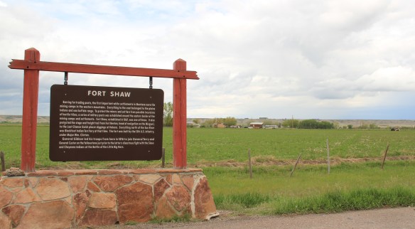
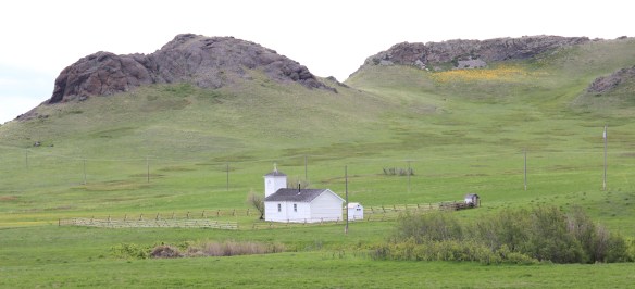
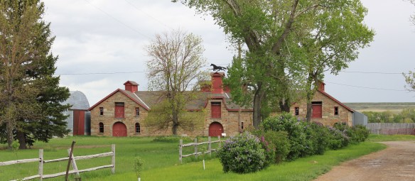
Another common features of heritage areas are properties associated with the nation’s military history and the process of nation building in the post Civil War United States of America. Cascade County has two major sites, one old and often forgotten, the other still at the heart of the nation’s defense. Let’s start with the oldest federal facility, Fort Shaw along the Sun River Valley in western Cascade County. As I was conducting the survey for the state historic preservation plan in 1984-1985, Fort Shaw was on everyone’s mind at the state historic preservation office. A proposal to list it in the National Register of Historic Places had been received, and the response was, generally, it is about time. This place had an important story to tell and was listed in 1985.

Commanders’ Quarters at Fort Shaw
As I noted in A Traveler’s Companion to Montana History, “Built in 1867 in what was then the heart of the country dominated by the Blackfoot Confederacy, Fort Shaw stood just a few miles west of where the Mullan Road [the important pre-Civil War federal military road through the region] crossed the Sun River. Colonel I.V.D. Reeves designed the fort, which was built with timber from nearby hills and sandstone and fieldstone found nearby. The soldiers also made adobe bricks that were used to construct the walls of many buildings at the fort. You can still see [in 1986 and 2015 as well] several of the original buildings, including two sandstone washhouses for the officers, the officers’ living quarters, and the commanding officer’s house.”
I emphasized in 1985 the property’s military significance in protecting the Mullan Road and the mining camps throughout western Montana. I also noted how it became a focal point for white settlement in the region. But I missed the bigger picture on what the site says and means.
Heritage Areas do a good job of looking at the “whole story” and how a landscape can have multiple meanings. Fort Shaw is an important military story: established two years after the end of the Civil War it represents an extension of federal military might into the West and how federal officials understood that occupation posts (Fort Shaw remained a post until 1891) represented federal power and authority, some 2000 miles away from Washington D.C. But certainly part of that process of nation building post 1865 was the federal policy to convert Native Americans. Here at this same place the Fort Shaw Government Industrial School was established, and here that federal officials and missionaries undertook that process of “civilizing” the Blackfeet. The idea behind industrial schools was that Native American children would be taken from their families, boarded at the school, and then taught skills that allowed them to contribute and compete in the modern white man’s world.
In the last decade, historical markers have been installed to help tell that story at Fort Shaw, highlighting the accomplishments of the 1904 girls’ basketball team, truly a remarkable story. Again, heritage areas like to talk about cultural history, and basketball and Indian nations across the northern plains are linked by this sport. The story of these girls and their successful run to a “World Championship” at the 1904 World’s Fair has been the subject of a PBS documentary (Playing for the World, 2009) and a recent book by Linda Peavy and Ursula Smith,
Full-Court Quest (2014). Their accomplishments are also marked by a monument at the old

industrial school site, an interpretive site not there in 1984-1985 and another great example of how public interpretation of Montana’s landscape has broadened and improved in the last 30 years.
 Fort Shaw was not the region’s earliest mission site. That designation belongs to St. Peter’s Mission, located on the winding Mission Road to the south of Fort Shaw. An earlier blog discussed St. Peter’s but this special property is worth further discussion, as it is linked in time and purpose to what happened at Fort Shaw.
 The property has limited public accessibility as an active ranch surrounds it and uses some of the remaining historic buildings. But since my first visit in 1984, a small metal interpretive marker has been installed, which emphasizes its founding date of 1865-1866 by Catholic missionaries, many
whom are buried on a hill, along with some of their Blackfeet converts, overlooking the mission. The Jesuits established this outpost a year or so before the military post at Fort Shaw. In 1884 they too established a girls school for Blackfeet children at the site.
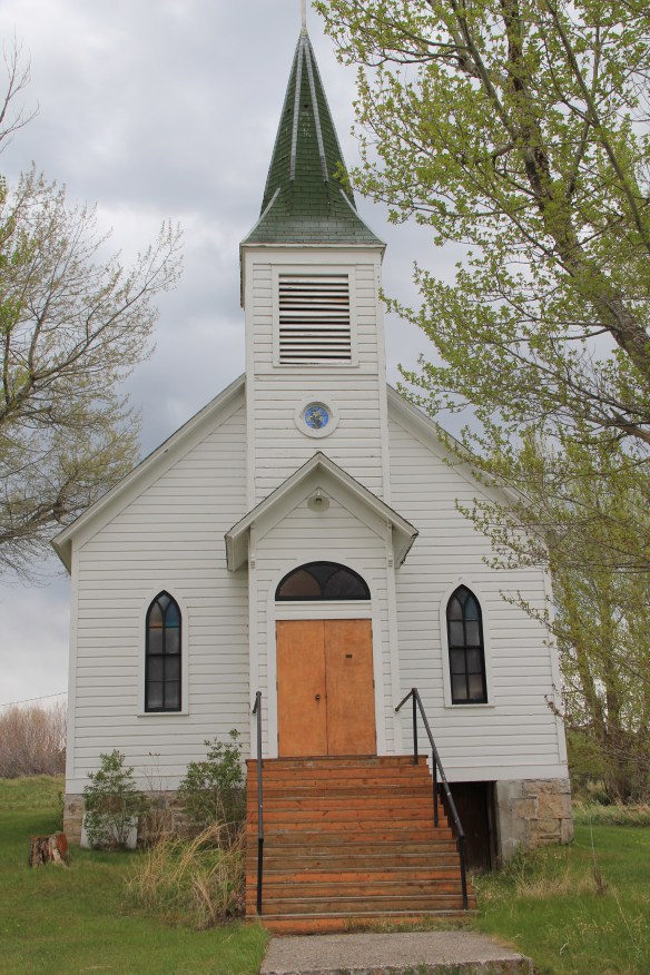
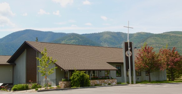
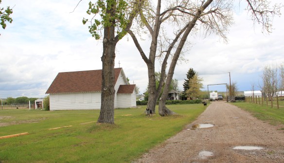 Often we forget these connections between religious missionaries and the nation-building process of government. Within a few hundred yards of Fort Shaw school, for instance, is the old road connecting the school to the historic St. Ann’s Catholic Church (seen above is the historic church building; the congregation has built a modern church in recent years).
 And we further forget, or choose to ignore, how the messy present lies side by side with these older, seemingly sacred places. Along the Mission Road and the Simms Road are nuclear missile bases, some active, some inactive, that are administered by the Malmstrom Air Force Base in Great Falls. Much like Fort Shaw from 100 years earlier, military commanders in the 1960s saw Cascade County as part of the edge of America’s national defense, the ideal location for nuclear bases that could protect, or retaliate, in case of a nuclear strike from the nation’s enemies.
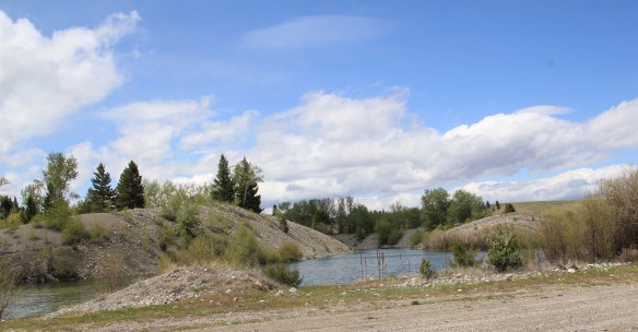
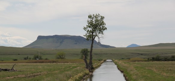 The Sun River Valley was transformed by homesteaders and irrigation during the great boom of the early 20th century; it shares that story of course with many towns in the Great Falls heritage area. Montana Highway 21 (shown above) connects with Montana Highway 200 to provide great opportunities to explore that landscape. The Sun River project of the U.S. Bureau of Reclamation especially left its mark.
While the old roadside stores at Fort Shaw, the project’s headquarters, suggested that the homesteader landscape was everyday vernacular, not designed to last, other properties, such as the wonderful Simms school complex, tells us that some built to last.
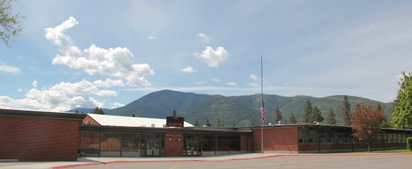
At Simms, reclamation engineers designed what they considered to be a model townsite plan, with the school at the center, and broad avenues radiating out from the school. Simms no doubt never reached the population that the planners envisioned, but here too in an unlikely place is the hand of the federal government, re-orienting the landscape in ways that can be seen, if you know where to look.

The school is very much the focus of the community–and the gymnasium at the rear has been the place for community events and sports for almost 100 years. The football and track field is in great shape too–a reminder of how sports bind the valley’s residents.

Not far from the school is another community building, the women’s club hall that dates to the Sun River project’s beginning years. I hope to see this building listed in the National Register in the future along with the other historic women’s club buildings scattered across the state.

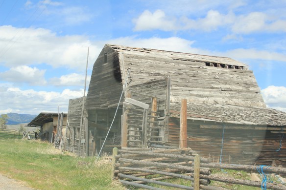
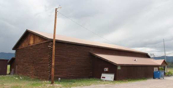
West of Simms was property of note to my SHPO colleagues in 1984 was the J.C. Adams Stone Barn, which had received a grant for “brick and mortar” work as part of President Reagan’s efforts to jump start the economy in 1982-1983. This magnificent structure predated the federal agricultural programs, dating to the mid-1880s. It rather spoke to the promise of stock-raising and freighting–Adams did both–as the region began to develop in the last years of the Montana territorial period.
 The barn is part of a still active ranch and is on private property. But the stone masonry can be viewed and appreciated from Montana Hwy 200.
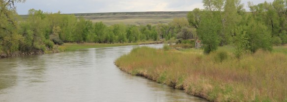 When one considers a Great Falls heritage area, the Missouri River of course will take center stage; as the next postings will show, it should be at the center of the story. But what happened along the Sun River, and what remains today, adds immeasurably to the national story and the overall significance of the region.


 Ranchers had taken bits of older buildings from Pioneer and incorporated them into later structures between the mining district and Gold Creek. Pioneer as a ghost town barely existed then and little marks its past except for the scars of mining.


 But the most important community institution (yes, the Dinner Bell Restaurant out on the interstate exit is important but it is a new business) is the Gold Creek School, a rather remarkable building in that residents took two standard homestead era one-room schools and connected them by way of a low roof “hyphen” between the front doors.
 Adaptation and survival–the story of many buildings at Gold Creek and Pioneer. Historical markers are scarce there but the history in the landscape can still be read and explored.
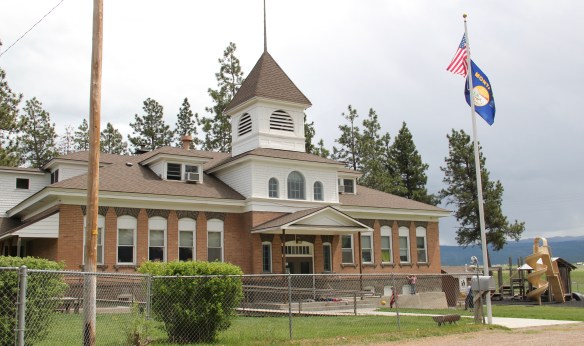
 It is a land watered by the river, framed by the mountains, and famous for its beef–which they even brag about at the crossroads of Montana Highways 200 and 83.
 But soon after passing the junction, you enter a much different landscape, particularly at the point where the Blackfoot River meets the Clark’s Fork River. This is an industrial world, defined by the company town design of Bonner and the active transportation crossroads at Milltown. Suddenly you shift from an agricultural landscape into the timber industry, which has long played a major role in the history of Missoula and northwest Montana.
 In 1881 the Northern Pacific Railroad was approaching the river confluence. It contracted with a company led by E. L. Bonner, Andrew Hammond, and Richard Eddy to supply everything the railroad needed but steel as it passed through the region. Two years later the railroad provided the capital for Bonner, Hammond, Eddy, and M.J. Connell to establish the Montana Improvement Company. In c. 1886 the improvement company dammed the rivers and built a permanent sawmill–the largest in the northern Rockies, and created the town of Bonner. The sawmill works and town would later become the Blackfoot Milling and Manufacturing Company and eventually by the late 1890s it was under the control of Marcus Daly and his Anaconda Copper Company. Anaconda ran Bonner as a company town until the 1970s.
 Although buildings have been lost in the last 30 years, especially at the sawmill complex which had a disastrous fire in 2008 and a heavy snow damaged another historic structure in 2011, I found Bonner in 2014 to remain a captivating place, and one of the best extant company towns left in Montana.
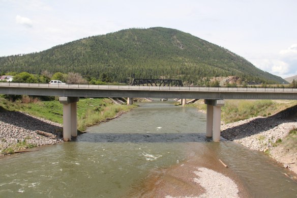 Montana Highway 200 passes through the heart of Bonner while Interstate I-90 took a good bit of Milltown when it was constructed in the 1970s. Both Bonner and Milltown are heavily influenced by transportation and bridges needed to cross the Blackfoot and Clark’s Fork rivers.
 The Milltown Bridge has been restored as a pedestrian walkway over the Blackfoot River. It is the best place to survey the Blackfoot Valley and the old sawmill complex.
 The pedestrian bridge and heritage trail serve as a focal point for public interpretation, for the Lewis and Clark Expedition, the Mullan Road, and then the lumber industry, which all passed this way over time, a conjunction of rivers and history that lie at the heart of the local and state (Milltown State Park) effort to interpret this important place.


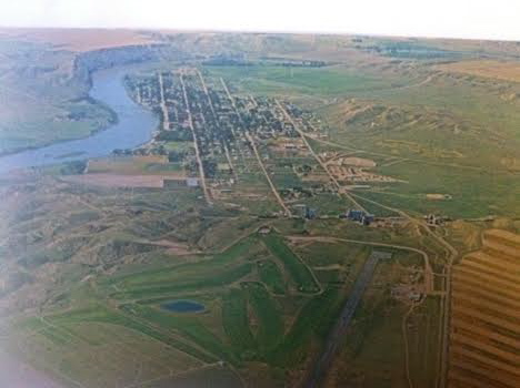
 Powell County’s Deer Lodge Valley is another favorite western Montana landscape. I visited there often during the 1980s, and in the years since I found myself often back in places like Deer Lodge, the county seat, if for nothing else to stop at the R&B Drive-In.
 Let’s start with the town of Deer Lodge, a place that has changed much in the last 30 years, a process that was underway in the early 1980s after the Milwaukee Road closed its division point and declared the entire line bankrupt. Besides Miles City, it is difficult to find a town more impacted by the Milwaukee’s failure than Deer Lodge.


 Yet, Deer Lodge was not a typical small town base for the Milwaukee Road; railroads typically wanted to create their own place. But Deer Lodge was one of the oldest places in the state, where ranchers in the 1850s first arrived–the early site is now interpreted at the Grant-Kohrs National Historic Site of the National Park Service–soon followed by Capt. John Mullan as he and his soldiers built the Mullan Road through this valley.

 The Northern Pacific passenger depot exists across the tracks from the Milwaukee Road station. It too has a new use: the Northern Pacific depot is now the senior citizens center.
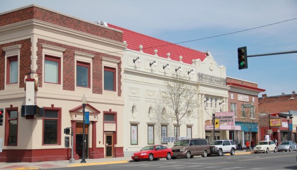

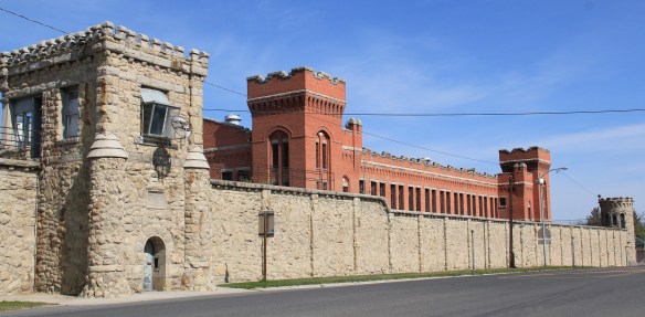 Before Deer Lodge was a railroad town, it was a prison town, the location for the Territorial Prison, and later the state prison. Most of the buildings you can visit today are from the state prison era. It operated here until 1980 when it moved to a facility outside of town.

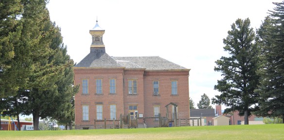 Deer Lodge also was an early center for education, represented by Trask Hall (1870s), which, like the territorial prison, is listed in the National Register. So with the themes of settlement, ranching, railroads, education, prisons, and the beauty of the valley why has Deer Lodge struggled to be recognized as one of Montana’s premier heritage designations? As the next post will discuss, citizens are taking steps to remedy the situation.
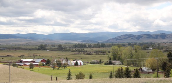 Montana Highway 1, the Pintler Scenic Route as I knew it during the 1984-85 state historic preservation plan survey, provides travelers with two distinct experiences. The southern half is a mining landscape, centered on the urban places of Anaconda and Philipsburg. The northern half is very agricultural, a place where cowboys and cowgirls still roam. It is one of my favorite parts of the state. Fret not, I won’t explore every nook and cranny but I will talk about three favorite places.
 First up is the village of Hall, which is north of Phillipsburg. The Northern Pacific Railroad ran its spur line from Drummond to Philipsburg through the middle of the valley, leaving Hall as the halfway stop between the larger towns. Just as in 1984, the old town bank still served as the post office. Hogan’s Store still stood near the railroad tracks and a lone grain elevator stood along the old railroad corridor.
 So too was the historic school at Hall still standing–in fact this c. 1920 brick building continues to serve local children as it has for decades. The same was true for the Stockman
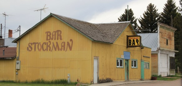 Bar–maybe not as old as the school building but not far behind and still in business despite the proximity to Drummond and Philipsburg. Then there is a wonderful piece of yard art in Hall–leaving no doubt about the primary agricultural product here.
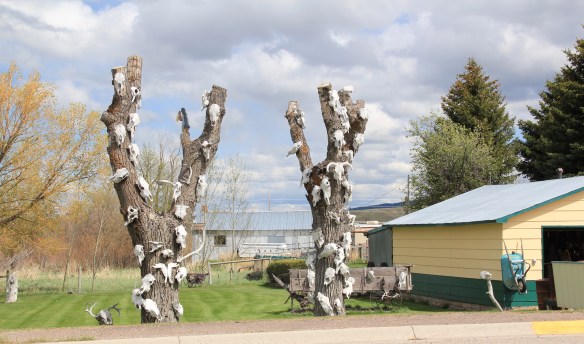
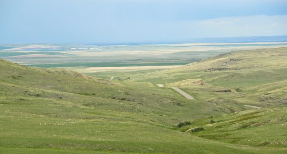
 As you travel north on Montana Highway 1 you next, unexpectedly, cross the historic Mullan Road, one of the oldest roads in the northwest. Parts of the road are graveled and graded, others are paved, but whatever the condition the road takes you to 19th century log
 buildings, even a dog-trot type log dwelling as well as the spectacular Valley Cemetery. I call it spectacular not for its cemetery art–although there is more than you would expect–but for its setting in the Flint Valley.

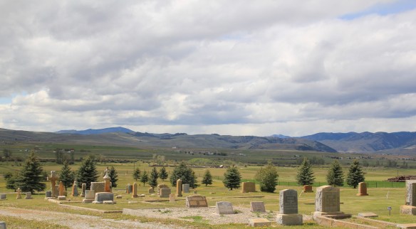 Wherever you look the vista is jaw dropping and can’t be that different than what Capt. Mullan and crew experienced in the late 1850s as they trekked this way. The Annie Milroy grave marker and statue (1912) speaks to the sadness that many homesteaders experienced as they tried to make a go of it in this demanding land.


 The nearby elaborate carving of the Bergman family marker is just another indication that this cemetery deserves additional, full research. (Not far away from Hall is the lone obelisk marker for the historic Emmitsburg Cemetery, another early settlement site.) My next post will finish the Pintler Scenic Route with a deep look at Drummond.
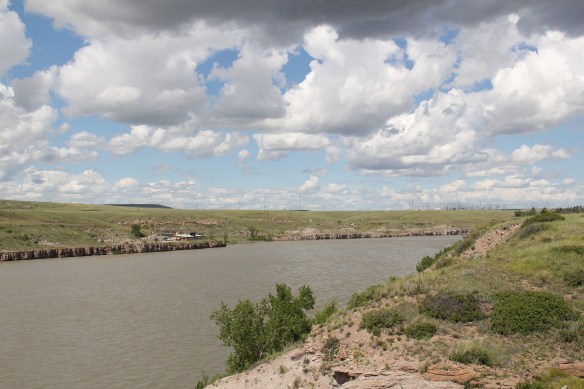 The Missouri River runs through Cascade County and is at the heart of any future Great Falls Heritage Area. This section of the river, and the portage around its falls that fueled its later nationally significant industrial development, is of course central to the story of the Lewis and Clark Expedition of 1803-1806. The Lewis and Clark story was recognized when I surveyed Cascade County 30 years ago–the Giant Springs State Park was the primary public interpretation available then. But today the Lewis and Clark story has taken a larger part of the public history narrative in Cascade County. In 2003 the nation, state, and city kicked off the bicentennial of the expedition and that key anniversary date spurred the
 Despite federal budget challenges, the new interpretive center was exactly what the state needed to move forward the story of the Lewis and Clark expedition, and its many levels of impact of the peoples and landscape of the region. The center emphasized the harrowing, challenging story of the portage around the natural falls of what became Great Falls but its
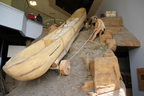 exhibits and programs have significantly broadened our historical understanding of the expedition, especially its relationship with and impact on various Native American tribes from Missouri to Washington.
 The contribution of the interpretive center to a greater local and in-state appreciation of the portage route cannot be underplayed. In the preservation survey of 1984, no one emphasized it nor pushed it as an important resource. When threats of development came about in last decade, though, determined voices from preservationists and residents helped to keep the portage route, a National Historic Landmark itself, from insensitive impacts.

 late 1850s. Hundreds pass by the monument near the civic center in the heart of Great Falls but this story is another national one that needs more attention, and soon than later.