Traveling the historic Manitoba Line, from Havre to Big Sandy

Image

The impact of the Great Northern Railway on the settlement of northern Montana really can never be over-emphasized–its mark on the settlement landscape and later transportation routes is that important.  Most travelers, and many residents, do not realize that the railroad, then named the St. Paul, Minneapolis & Manitoba, did not initially strike straight across the plains to Glacier National Park.  In 1887 it turned at Havre and headed southwest towards Great Falls, creating a distinct modern landscape along Big Sandy Creek that you may still follow today.

Image 

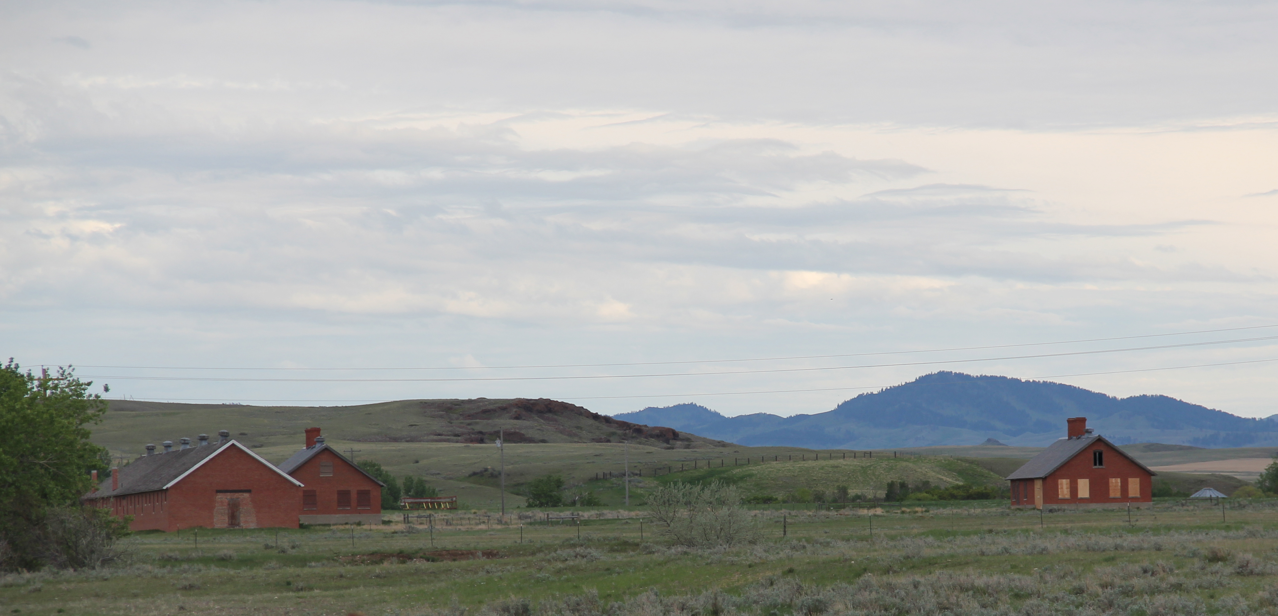
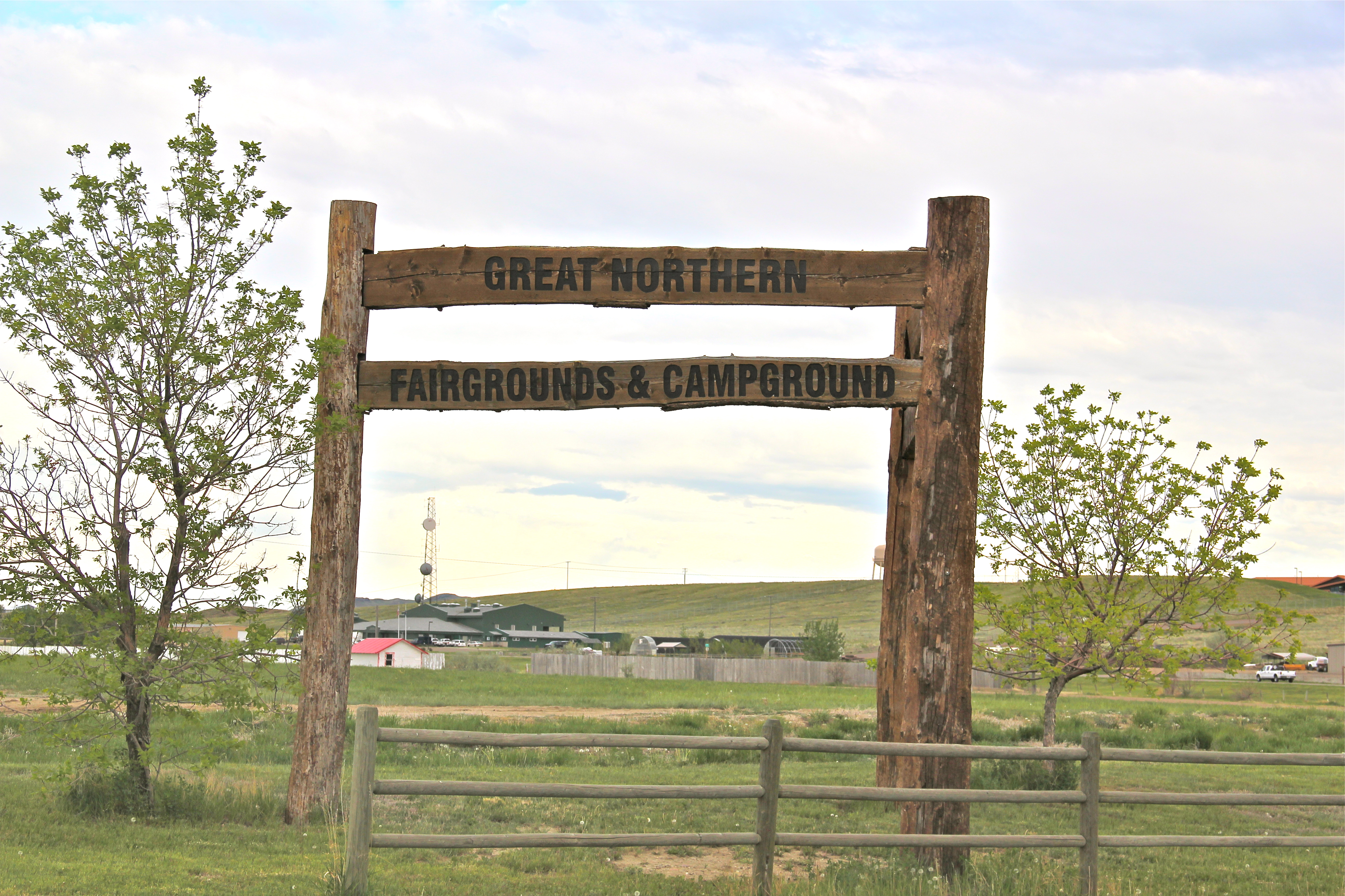
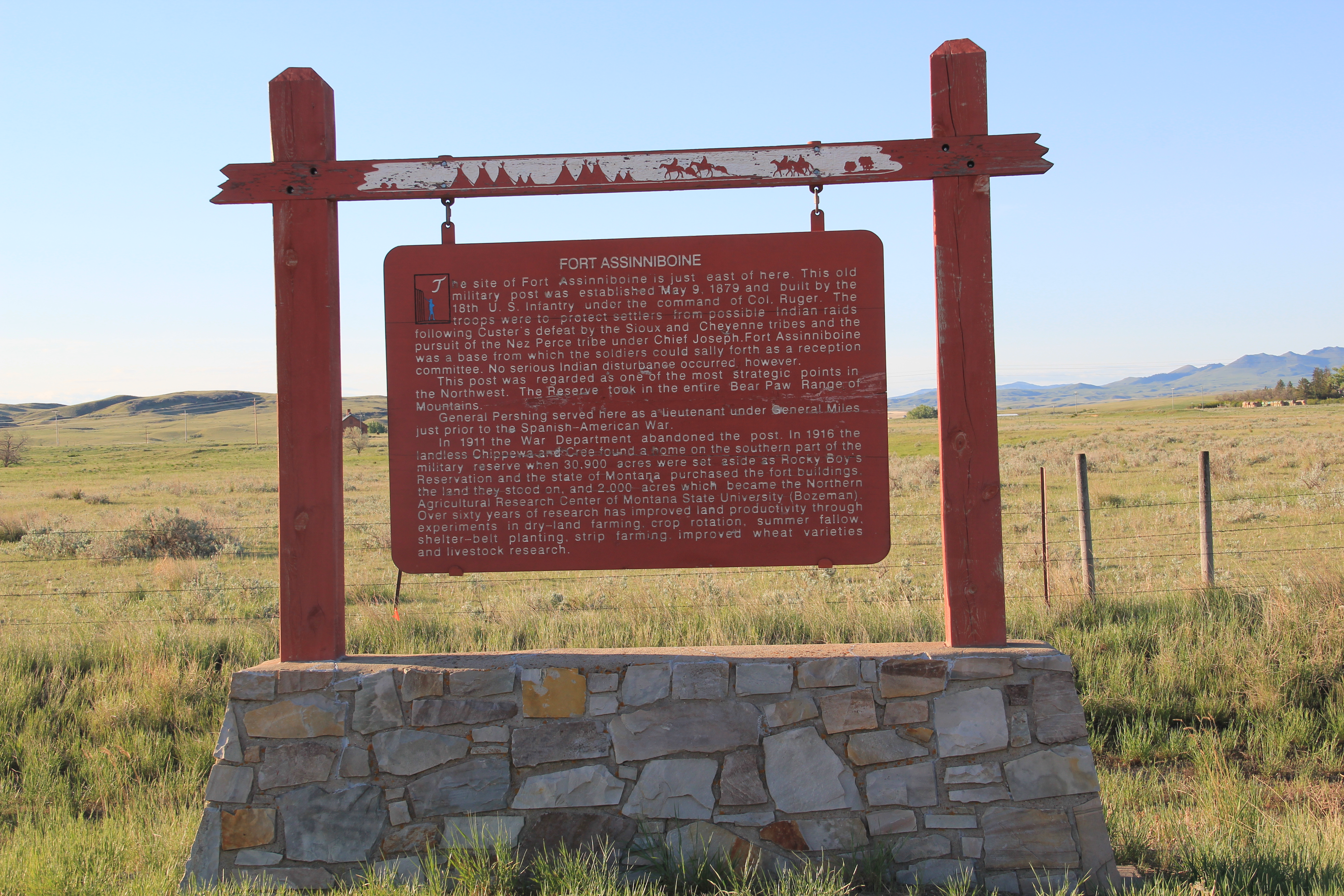
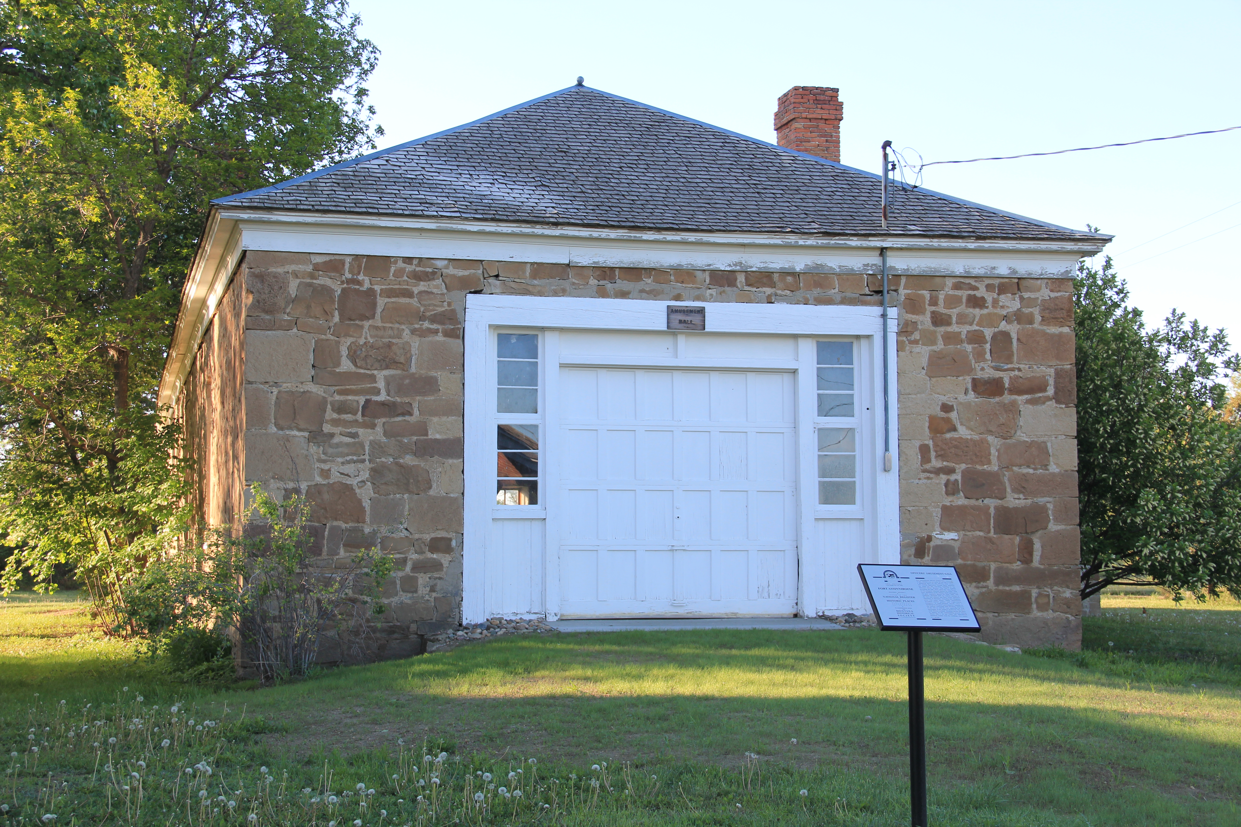
The first important stop was Fort Assinniboine, a U.S. army base established in 1879, before the first settlers arrived. The army maintained this major base until the 1910s and later in that decade its land and buildings became the Northern Montana demonstration farm, allowing state and federally supported agricultural reformers learn and demonstrate best practices in farming techniques and crops for the region.  Today it remains part of the state’s extension service, which has adapted some buildings for new uses while keeping others preserved as part of the nationally significant story of the U.S. military and its occupation of the northern plains.  

Image Image 

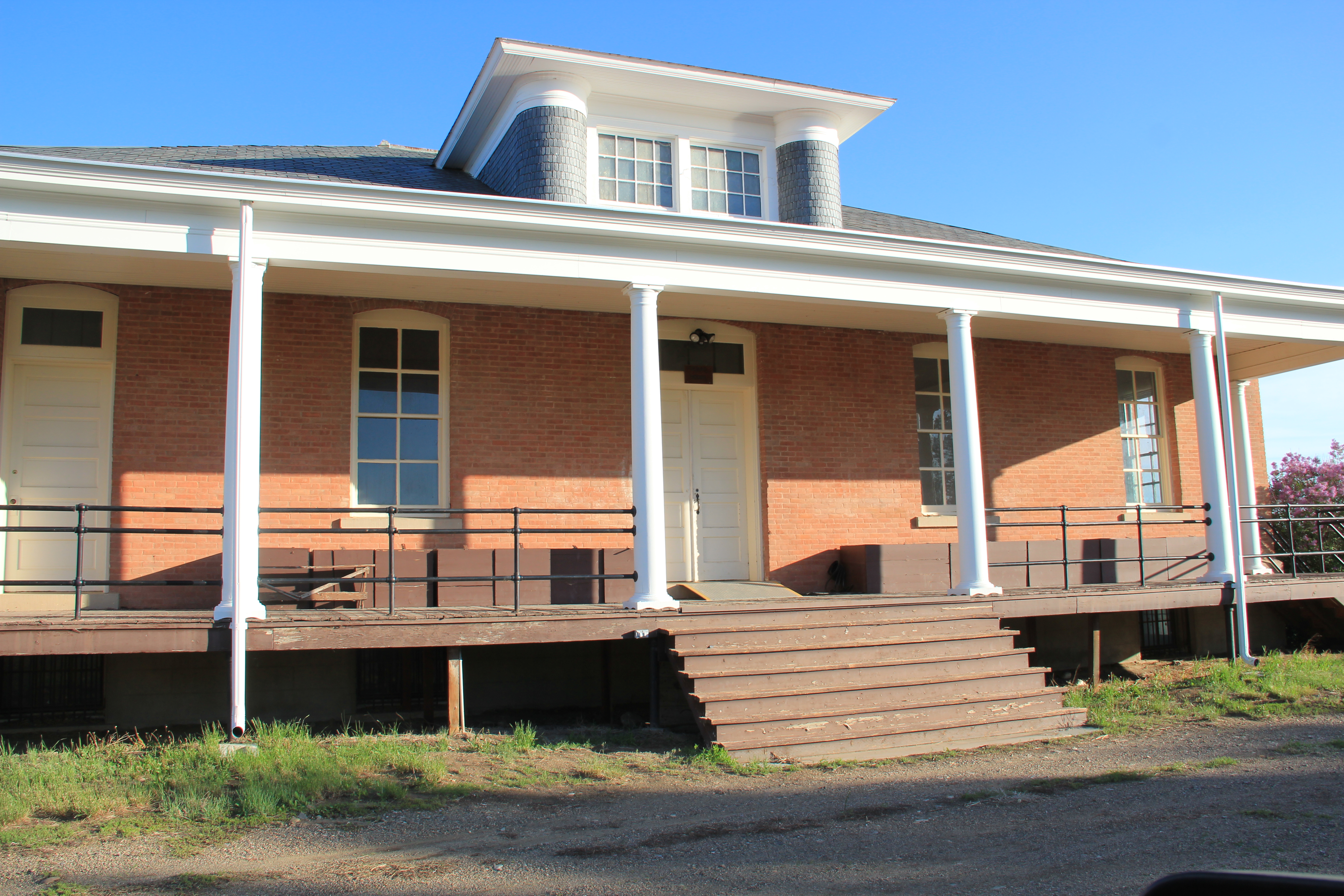
When I visited the fort site in 1984, the highway marker was the primary interpretation.  The farm’s administrators have since worked with the Montana State Historic Preservation office to locate interpretive markers outside of several buildings.  Tours of the complex are also available by reservations.

Image

Image Image

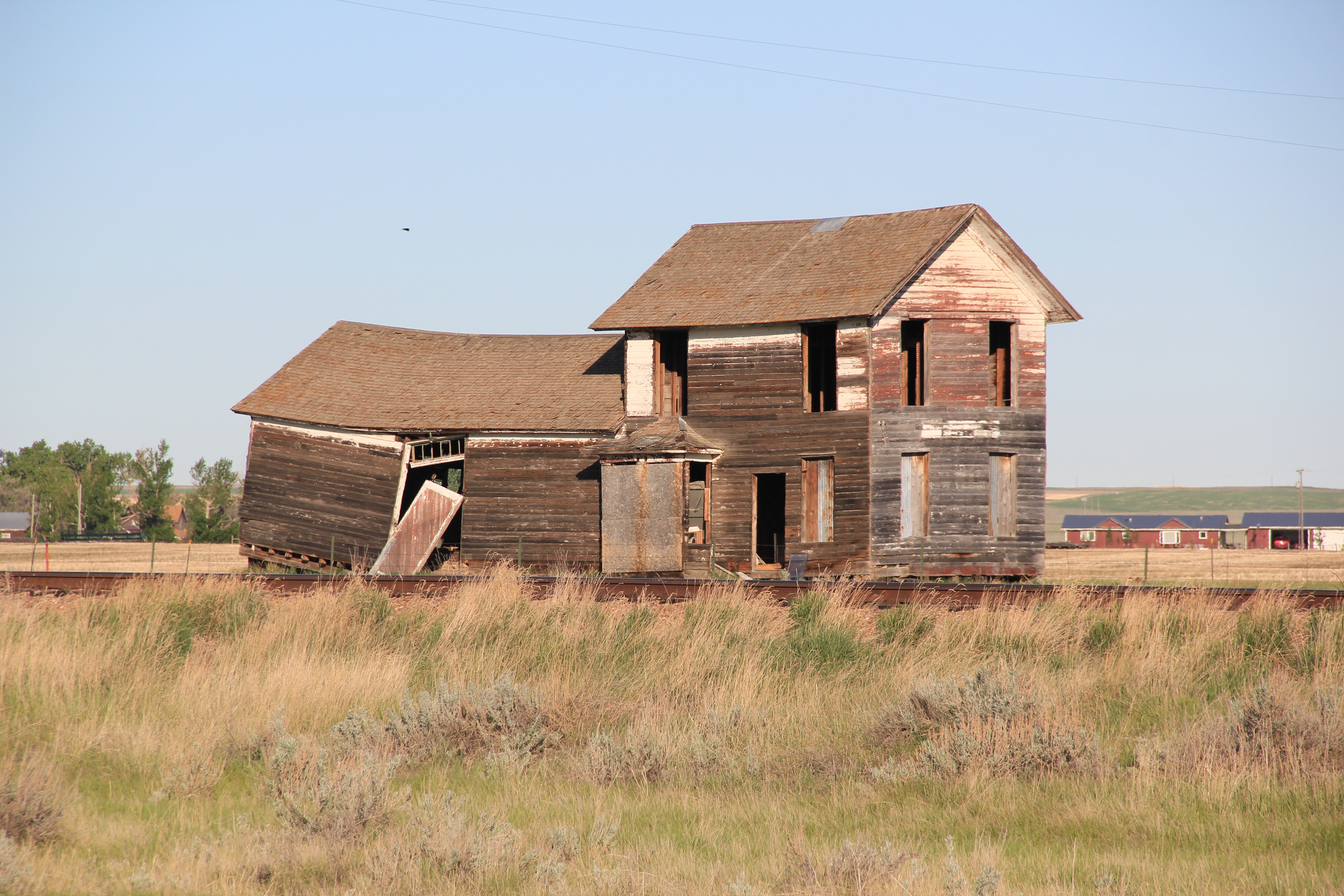
 As part of the federal process of transforming the landscape of Big Sandy Creek, the homesteading boom left its mark everywhere in the 1910s.  But also in 1916 the federal government established the Rocky Boy Indian Reservation for the Chippewa Cree.  The Manitoba Road’s intersection with the reservation came at Box Elder, at the border between Hill and Chouteau counties.  In 1984 one of the early Great Northern-era combination depot still stood at the town, although it seemed destined for destruction. Imagine my surprise in 2013 when the depot still remained, but barely so. 

Image Image

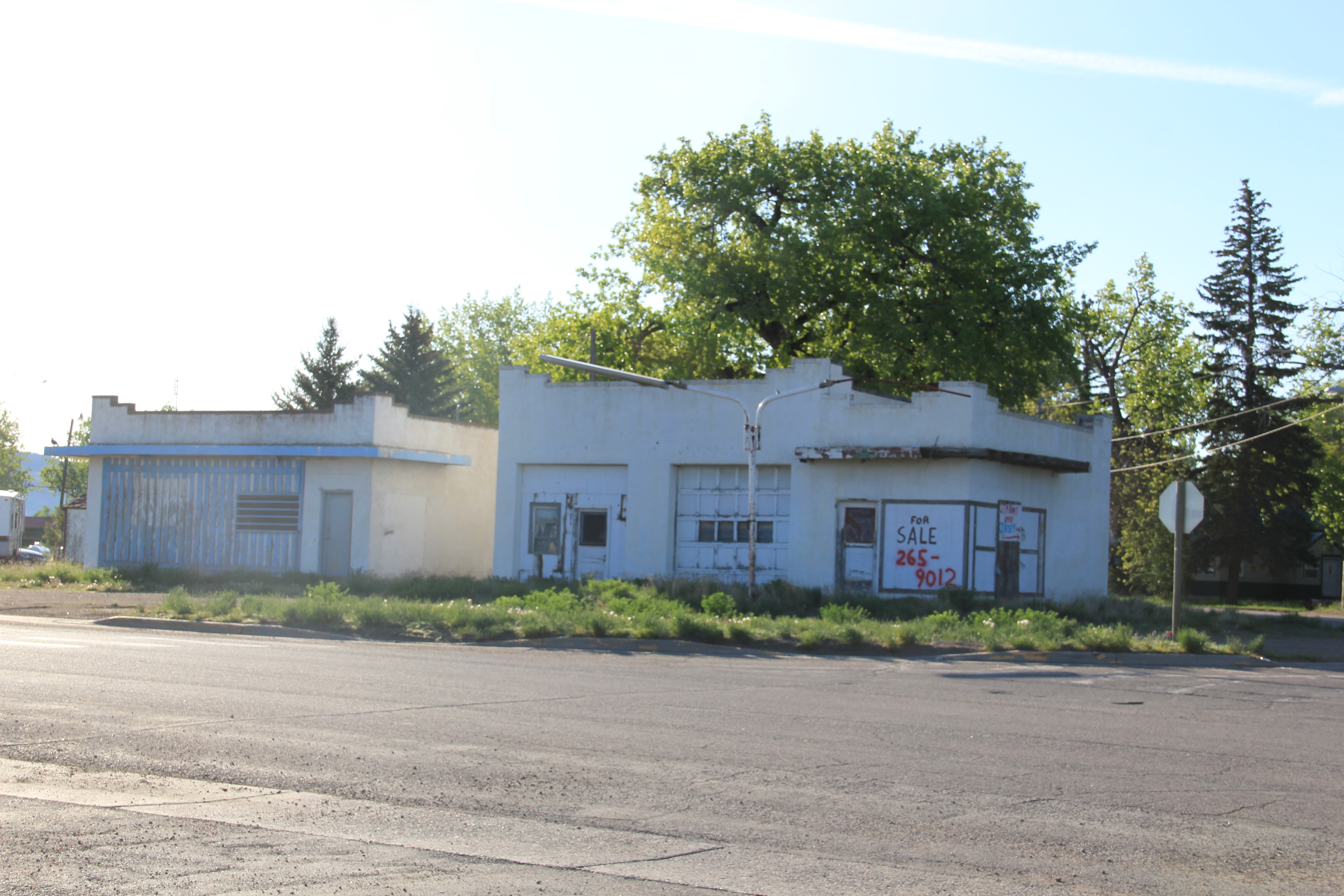
The gas station’s roadside architecture also faces an uncertain future.  But St. Anthony’s Catholic Church remained a key landmark and along U.S. 87 in the reservation stood a new architecturally distinctive building:  the Northern Wing Casino.  

 ImageImage


Image

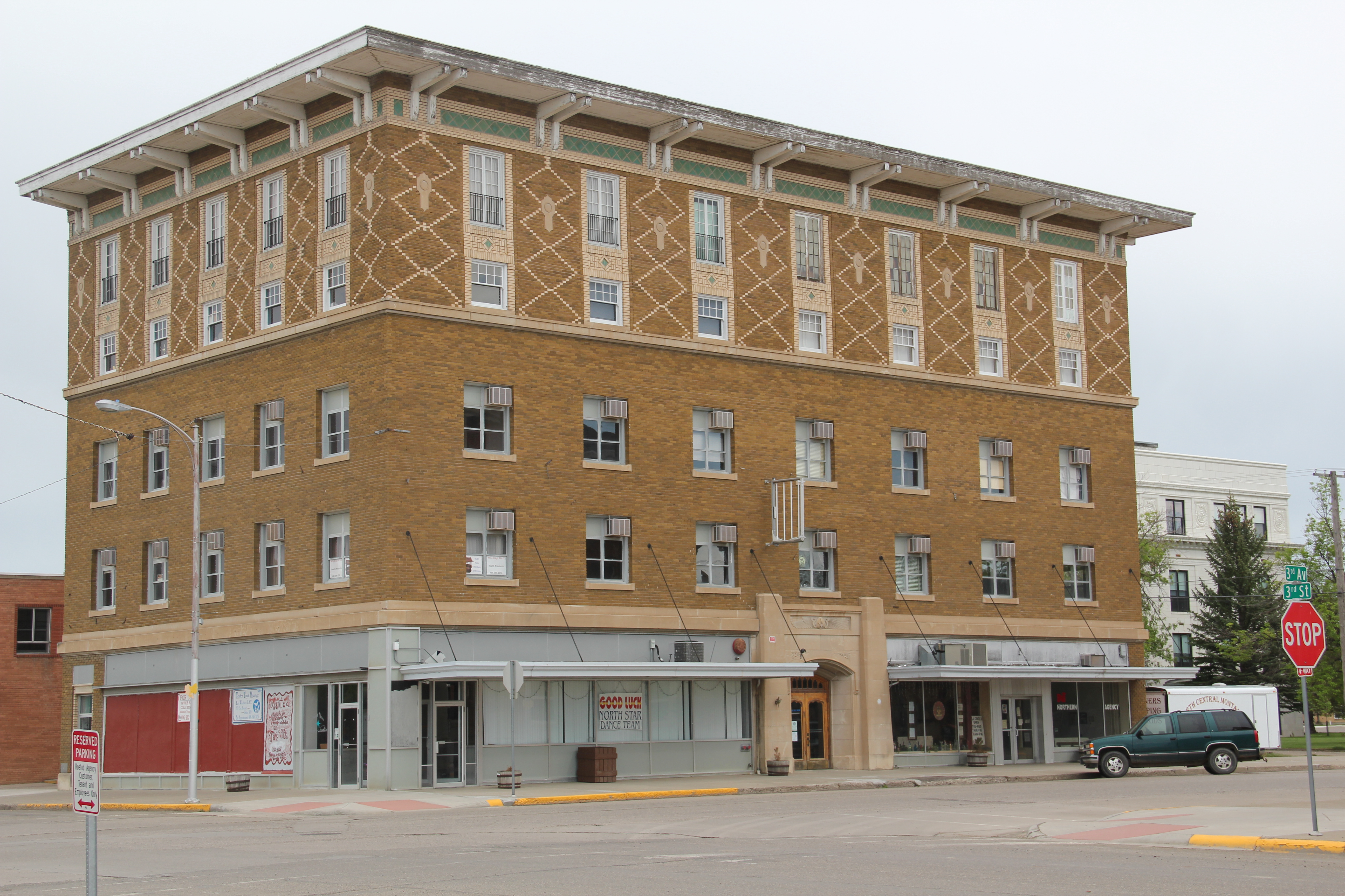
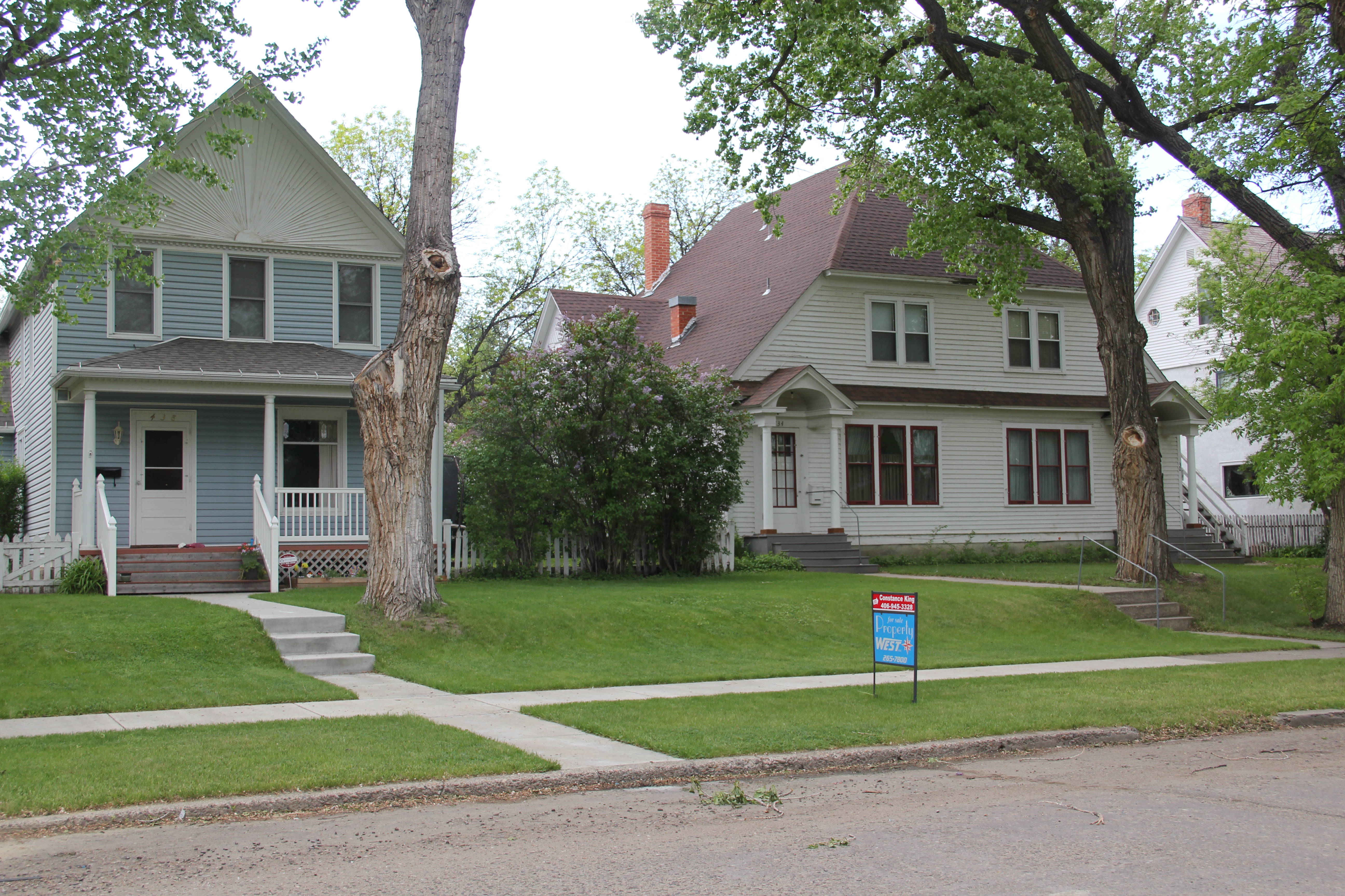
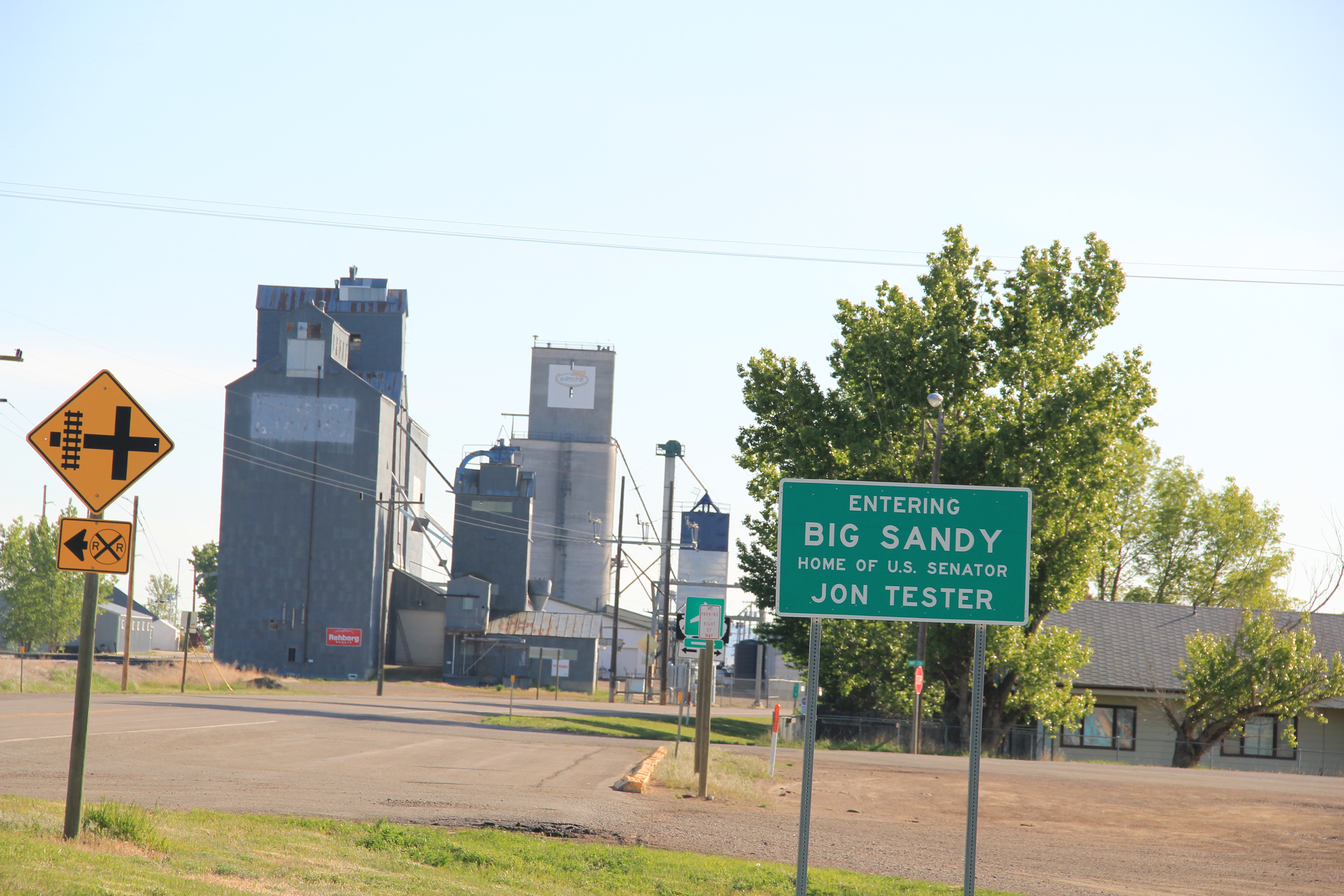
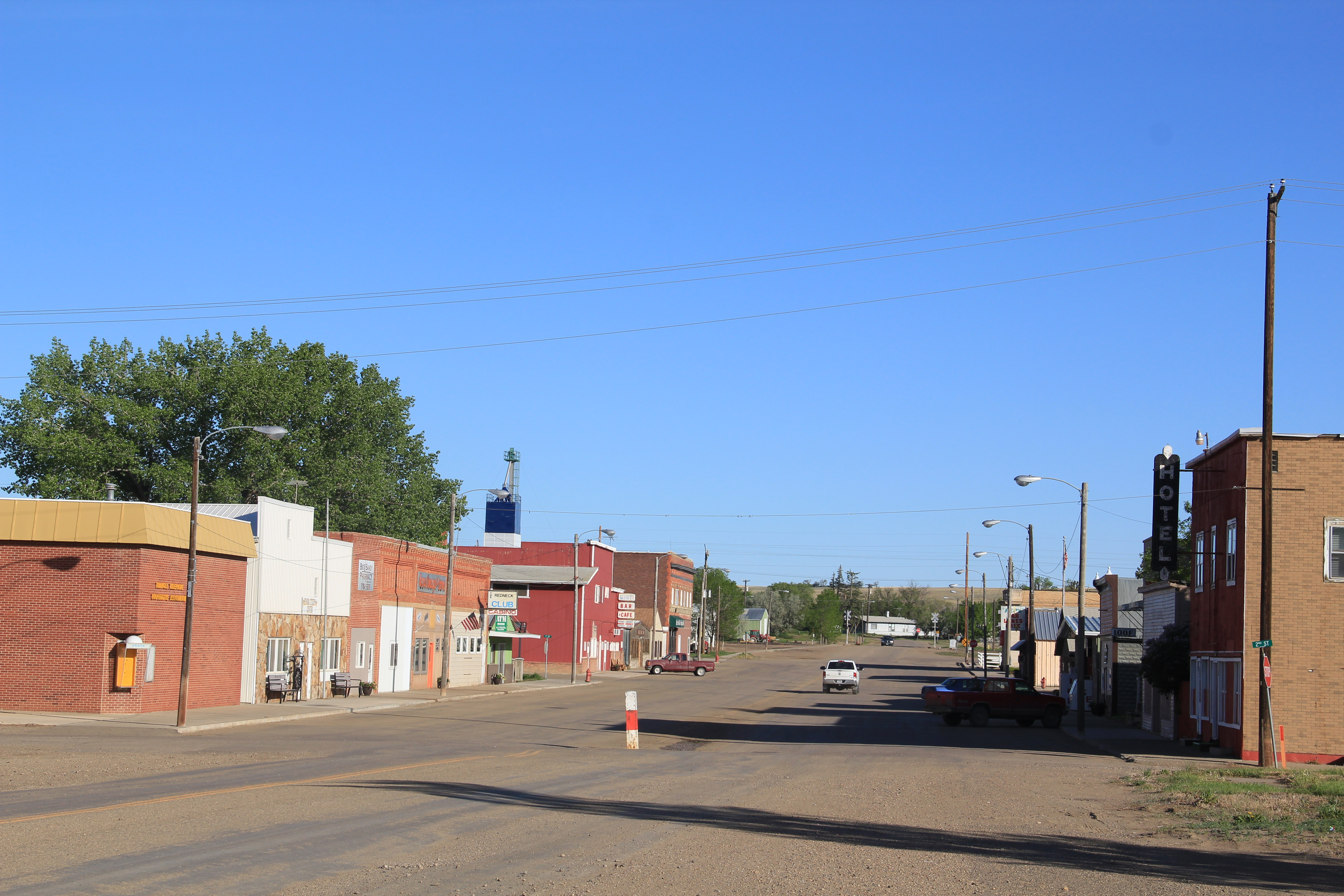
Big Sandy is easily the largest town of northern Chouteau County, a place that abounds in surprises.  In 1984 the town’s old homesteader hotel remained, and so many other Montana towns had lost these artifacts of the early 20th century settlement. 

Image


Image

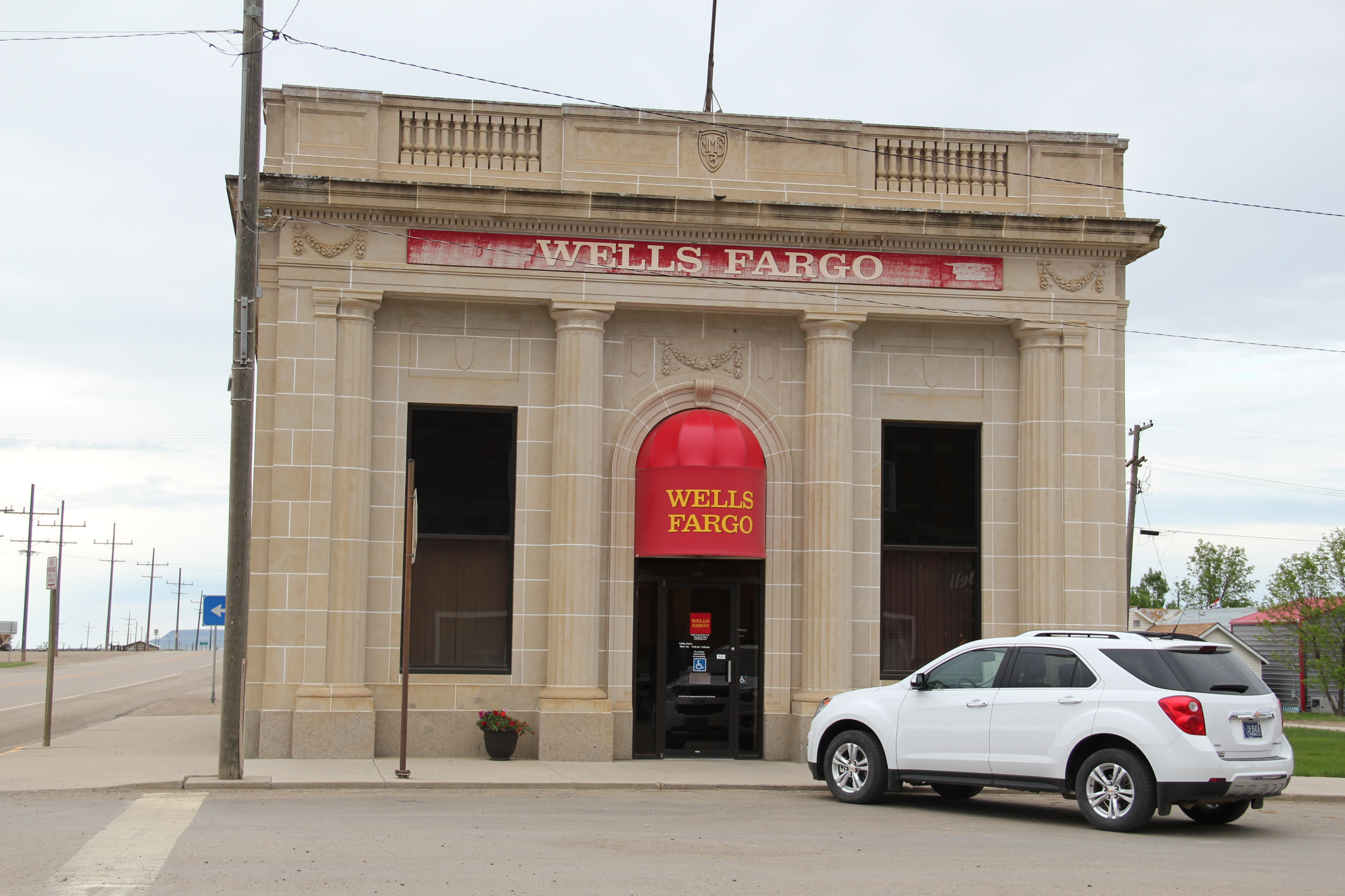
Thirty years later, the hotel remains in place, as do several other architecturally important buildings, from the Northern Monana State Bank, a vault-like neo-classical style building to the modern contemporary styling of St. Margaret Mary’s Catholic Church.

Image

Image

 Impressive adaptive reuse projects also had taken place, with the community turning the historic Great Northern depot into a center for its historical society and museum.  Big Sandy has a t-town plan, with its stem lined by businesses and other ventures, such as the false front Odd-Fellows Lodge or the recently established coffee shop.

Image


Image

The town’s New Deal era school remained, although the building’s original International Style design was somewhat muted by a new roof and other cosmetic changes. Yet, here was the school that nurtured Jeff Ament, who moved to Seattle and gained fame as part of the internationally significant band, Pearl Jam.  

Image

Big Sandy has steadily lost population since 1984–600 people remained in the 2010 census–but key landmarks remain standing and in use.  Impressive.  The days of the Manitoba Road are long gone but this early railroad town still makes a powerful historical statement.

Havre’s preservation legacies: final thoughts

Image

In its first year of existence, this blog has looked at Havre several times, from its historic African American church building located near the Great Northern Railway shops to its impressive statement of modern design, from the roadside architecture of U.S. 2 to the impressive campus buildings at the former Northern Montana University. This is a last look, considering especially the impact of that first generation of entrepreneurs and residents who left behind in the downtown and older residential neighborhoods such an impressive array of buildings and homes.

First and foremost, Havre is a railroad town, with its monumental statue of James J. Hill, the empire builder himself, still standing proud outside of the depot at the head of town’s central business district.  When first established, Havre was little more than a stop where the line turned southwest to Great Falls, the initial terminus.  But once Hill decided to push his mainline directly west of Havre in the first decade of the twentieth century, the town’s history changed drastically.  Havre became the seat of a new county–Hill County–and soon houses all throughout the town competed architecturally with the impressive Beaux-Arts classicism of the Hill County Courthouse, designed by Frank Bossout.

Image

Bossuot stayed in Havre and left quite a legacy in domestic architecture.  Not all homes are by Bossuot but certainly he was the trend setter.  In 1989 property owners worked with the Montana State Historic Preservation Office to place a huge chunk of the residential district in the National Register of Historic Places; at the turn of the present century, Havre had created a historic district commission to ensure the continued restoration and preservation of these dwellings.

ImageImage

Image Image

Image

This Spanish Colonial design is attributed to builder Charles Harper. The local Catholic Church is also a Spanish Colonial design.

Another key decision made by city leaders and heritage advocates in the new century was the conversion of the monumental Federal Building into a heritage center, where the Clack Museum, once isolated away from downtown at the fairgrounds, could be relocated and other heritage groups could also maintain a presence.  When you pair the colossal Colonial Revival design of the Federal Building with the similarly overstated Mission style of the neighboring Masonic Temple, the town is messed with two architectural anchors for the rest of the century.

ImageIMG_8418

But there is work remaining in this classic town of the Hi-Line:  especially in the commercial area, where muddled rehabs have taken quite a bit away from the grandeur that once marked these streets.


IMG_8414IMG_8512


But the spark created by homeowners in the late 1980s, and then added to by heritage advocates in the last decade, has given Havre a heritage tourism foundation, upon which now is a growing heritage tourism industry.  Havre has found its heritage assets, and is building new futures for its residents through the promotion and conservation of its distinguished past.

IMG_8416

Havre’s historic preservation legacies

Havre, the seat of Hill County and more importantly the commercial and transportation hub of the Hi-Line, has already been the topic in several posts over the past year.  In 1984, it was the first place where one of the state historic preservation review board members, Eleanor Clack, took me around and explored the town’s history.  So let’s review the historic Havre of 1984 and consider what Mrs. Clack showed me, and what we see today as significant properties.

Clack’s spouse was Earl Clark, a businessman with concerns up and down the Hi-Line and a heritage advocate to boot.  The county museum bears his name and that is where we started, at the fairgrounds along U.S. Highway 2 west of downtown on a bluff overlooking the Milk River.

Image


The fairgrounds acknowledged the role of the Great Northern Railway in the town’s and county’s history–indeed Havre was a virtual shrine to the Empire Builder as I would discover–but Mrs. Clack was especially hurried to cross what was then a two-lane highway and go to the other side of the bluff, where she unlocked a fence and we explored the Wahpka Chu’gn buffalo jump, then one of the handful of properties in Hill County on the National Register.


Image


Today, it is difficult to find the property, even with the buffalo sculpture and signage along U.S. 2.  When the highway doubled in size, that improvement led to intensive development of the river bluffs, and today access to the site is behind a shopping center.

Image


The site was the Clacks’ pride and joy.  Not only was the setting stunning, with the valley crossed by the Great Northern mainline, they had worked with other preservationists to open the property for tours and interpretation.  At that time, it was the best interpreted buffalo jump–make that the best interpreted prehistoric site–in the region, if not the entire state.

After hours of exploring the property, Mrs. Clack next took me to the town’s turn of the century historic neighborhood.  There I encountered the first of several historic Carnegie-funded public libraries I would see in Montana (the actual town library had already moved into new quarters).

Image

Carnegie library, 1984

Image

Carnegie library, 2013

We also visited the Young-Almas house, a rambling Classical Revival dwelling, which was the second National Register anchor in the historic residential neighborhood.

Image


Today, of course Havre has a large National Register residential district, with state-funded markers telling the stories of the houses and families on almost every block.

Image

Finally we turned into the business district, where we stopped at the Federal Building and Post Office–a New Deal building–and then the commercial district.

Image

Mrs. Clack expressed her hope for the future, that the distinguished set of two-story commercial buildings that lined U.S. 2 would find a new future through historic preservation.

Image

U.S. 2 corridor, north, downtown Havre, 1984

ImageImage


As these 2013 photos attest, Havre’s historic downtown survives 30 years later, although the historic preservation potential still waits to be fully tapped.  After all, the historic preservation funding available in 1984–and the assumption that the movement’s early successes in sustainable urban renewal would bring about more–never happened.  Federal funding, in adjusted dollars, reached its hey-day in the Reagan administration, and has declined ever since. Mrs. Clack and I could not know the future in 1984.  But if she could see Havre today, I think she would be pleased with how residents and officials have built on the early foundation:  that is the topic of the next posting.

The Irrigated West: U.S. Bureau of Reclamation and Montana’s Hi-Line

Image

Fresno Lake, Hill County, 2013

The impact of federally funded irrigation projects is apparent throughout Montana but perhaps even moreso along the Hi-Line.  As I started his fieldwork in 1984 in Toole County, one of the first places I visited was Tiber Dam, a project that turned a large chunk of the Marias River into Lake Elwell.  The dam was finished in 1952 but numerous expansions and alterations occurred in the late 1960s and then late 1970s.

Image

Lake Elwell, Liberty County, 1984


When I encountered the town of Fresno in 1984, there was not much there but a tavern, built in the 1950s to take advantage of the increasing number of folks traveling to Fresno Lake for recreation, and a huge elevator complex.

Image


Today both the elevators and tavern remain, and the only changes found at the dam was additional fencing and pre-cautions for the security of the facility.

Image Image


Fresno Dam was part of the huge Milk River Project of the New Deal era.  The dam dates to 1937-1939, but was raised in 1943 and again in 1951 when “a concrete parapet and curb walls were constructed on the crest.”

Image 

The Milk River project is the one of the state’s oldest and most influential federal irrigation projects.  Dating to 1903, the project slowly unfolded across the plains, starting at St. Mary’s in Glacier County in 1905 and moving to the Dodson pumping station in Phillips County by 1944.  The Fresno Dam was funded by FDR’s National Industrial Recovery Act, making it a rarely identified place associated with the New Deal transformation of Montana.  

Image

We will be returning to this project and the story of the irrigated West often as we move across the state.