After taking a long look at the depth of nationally significant heritage stories and historic places in and around Great Falls, I want to change regions, to the Upper Yellowstone valley and get there by one of my favorite western highways, U. S. Highway 89.
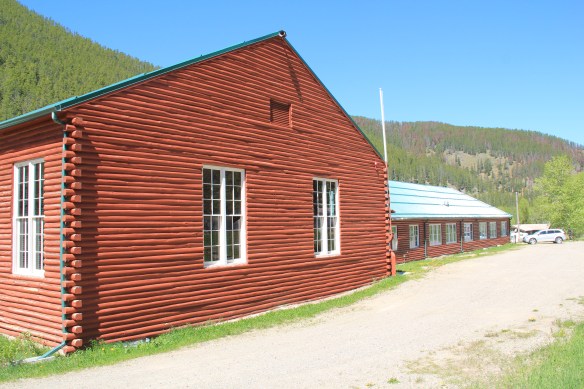
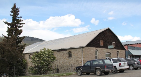
 As the highway leaves the central plains east of Great Falls, it heads east through coal country (see the earlier post on Belt) and south into the Little Belt Mountains and the old mining towns of Monarch and Neihart (above). Both Cascade County towns are proud of their heritage, a story embodied in the Monarch-Neihart School, a wonderful bit of log craftsmanship from the New Deal era, a WPA project finished in 1940 that is listed in the National Register of Historic Places.
Another point of pride is the ongoing renovation of Neihart’s Great Northern Railroad depot, a mark of the town’s beginnings, which also serves the greater Monarch-Neihart area as the local museum and heritage center. While on the other side of the road, another turn of the century historic building has been converted into a self-described junk shop where you can acquire bits and pieces of the past.


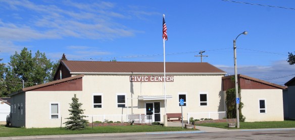
After traversing through the mountains, by a sky resort, you suddenly drop back into the central Montana plains, a landscape shaped by the Smith River, one of the state’s most compelling natural and historic landscapes. You are now in Meagher County, discussed in an earlier post, where the town of White Sulphur Springs is the county seat. It too has its New Deal landmark, the Classical Moderne styled county courthouse.
 When I last visited there in 2015 the combined route of U.S. 89 and 12, which passes in front of the courthouse and the center of town, was being rebuilt, giving the historic business district the look of a ghost town.
The Fort Logan Road, on the east side of town, was not under construction, allowing for easy access to the other significant transportation link, the railroad, and the still surviving White Sulphur Springs depot, a place certainly worth of listing in the National Register.
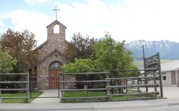
 U.S. Highway 89 continues south, crossing the historic corridor of the Milwaukee Road at Ringling, another Meagher County town discussed in an earlier post, marked by the landmark St. John’s Catholic Church.
 Travelers continuing south soon find themselves in Park County, entering the Shields River Valley just north of Wilsall, where highway markers and monuments, like that for “Thunder Jack” (2006) by sculptor Gary Kerby, convey the significance of the place.

 Wilsall was not much a place 30 years ago, a small trade town on the edge of a Northern Pacific Railroad spur line, a past still recalled by the tall elevator and old railroad corridor.
 But the growing popularity of the Shields River Valley has led to a new boom in Walsall, with old banks converted into bars and old general stores
being revived and expanded. The town has its own museum now, in a converted gas station from the 1920s that served travelers and locals. The stories preserved there, along with the mural of Walsall over 100 years ago, show the residents’ sense of place and the past.

The next town down the old Northern Pacific line, Clyde Park, has a similar story of revival from 30 years ago. Glenn’s Shopping Center is still going strong, as is the town community hall across the street, and the town park is neatly kept and in regular use.
 Clyde Park Tavern is still the place to go for an adult beverage, or two. Historic grain elevators still serve local ranchers, marking the railroad line that defined the town’s landscape until the impact of the highway in the early 20th century.
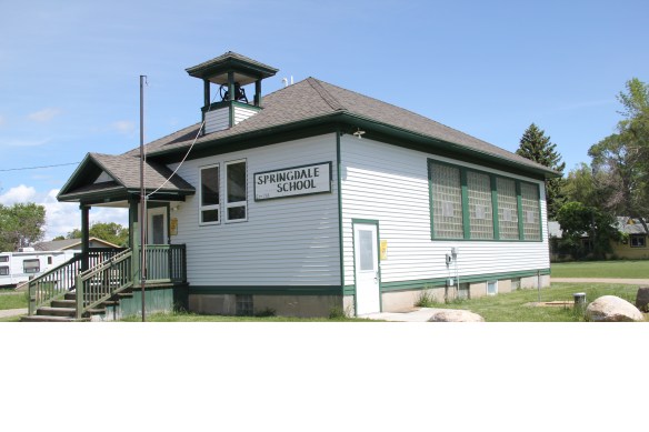
The sojourn to the Yellowstone Valley will stop here, on the edge before we cross bridges, backtrack to Springdale and Fort Parker, before we explore in some depth Livingston, Montana’s gateway to Yellowstone National Park.

 In late may I return to the Big Sky Country, my first visit in two years, when I will once again be looking for changes in the historic built environment as I speed along the state’s
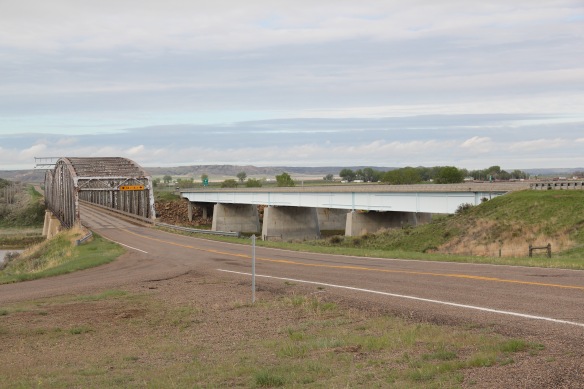 highways and backroads, crossing the bridges over the Yellowstone River, and trying my best to catch as many Burlington Northern and Santa Fe Railroad freight trains as possible, although I doubt that I will ever have such a fun moment than in 2013 when I
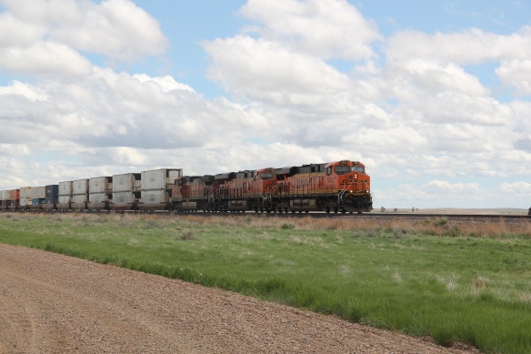 caught this freight along the original Great Northern route while I was driving on the original–still dirt and gravel–road of U.S. Highway 2 between Tampico and Vandalia.
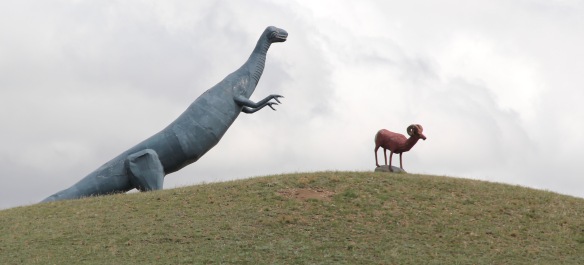 Certainly I will keep my eye out for Montana’s famed wildlife, although I don’t expect again to see a bighorn sheep outside of Glasgow, especially one being chased by a dinosaur. I will also stay on the lookout, as regular readers of this blog well know, for the beef–it is rarely a question of where’s the beef in Montana.
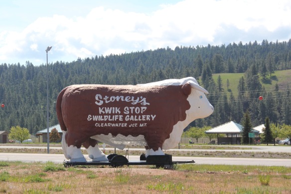 No doubt there will be both new and older historical markers to stop and read; the evolving interpretation of Montana’s roadside continues to be such a strong trend.
 And through all of the brief stay in the state–perhaps 10 days at the most–I will also stop and enjoy those local places, far removed from the chain-drives roadside culture of our
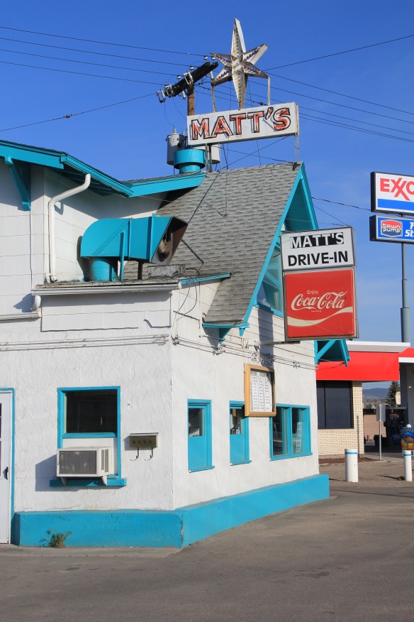 nation, where you can enjoy a great burger, rings, and shake, like Matt’s in Butte, or a good night sleep at any of the many “Mom and Pop’s” motels along the state’s highways, such as this one in Big Timber.
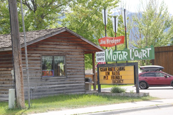
 In the 1984-1985 fieldwork for the state historic preservation plan, the impact of lodging chains in Montana was pretty limited to the larger towns, and gateways to the national parks. Many what I called “mom and pop” motels, largely from the pre-interstate highway era of the 1940s and 1950s, still operated. I was working with the state employee lodging rate of $24 a night (remember it was 1984!) and I found that the per diem eliminated the chains and I was left with the local establishments. During those months of intense travel I came to respect and really like the Moms and Pops. Several of the places I stayed in 1984-1985 are long gone–but ones like the Lazy J Motel in Big Timber remain. In this post I am merely sharing a range of historic motels from across Big Sky Country.
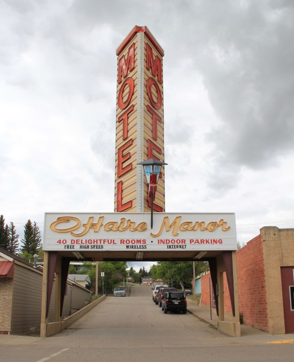 I began the fieldwork in February 1984 and the first stop was a public meeting at the Toole County Courthouse in Shelby. My first overnight was just as memorable–for good reasons–at the O’Haire Manor Motel. Its huge neon sign on the town’s main street, which was U.S. Highway 2, could not be missed, and actually the sign replaced a building that once stood along the commercial district, knocking it down so travelers would have a clear shot to the motel itself.
 Cut Bank’s Glacier Gateway, on the other hand, reminded visitors that it was that “coldest place” in the United States that they had heard about in weather forecasts.


 Another example from the old Yellowstone Trail and U.S. Highway 10 is the Shade Tree Inn Motel in Forsyth–although coal and railroad workers help somewhat to keep it going in the 21st century.
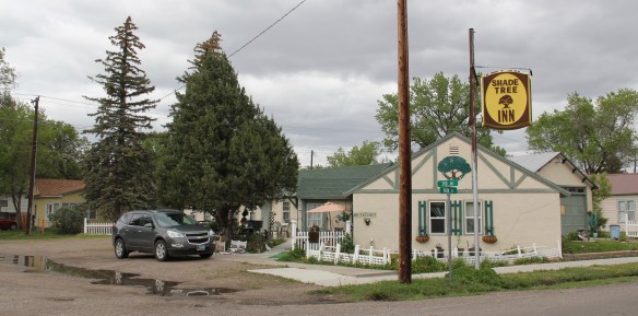 Just a block west of another historic section of U.S. Highway 10 in Deer Lodge is the Downtowner Motel, with its sloping roof and extended rafters representing the best in “contemporary” style from the 1960s. This place too was clean, cheap, and well located for a day of walking the town back in 1984.

 Not only have the changes in traffic patterns been important, the present generation’s preference for chain motels–and the proliferation of chains across the state–have shaped the future of the mid-20th century motel. A good example is the challenges facing the continuation of the Cherry Hill Motel in Polson, located along U.S. Highway 93. Here was a favorite spot in 1984–near a killer drive-in–a bit out of the noise of the town, and sorta fun surroundings with a great view of Flathead Lake.
 The place was up for sale in 2015–and the internet today tells me that it is “permanently closed.” I hope it can find a new owner and is still there when I next return to Polson but with the general boom in the Flathead Lake region, one assumes its days are numbered.
 The bear might be hugging the tree but does anyone else care enough–or want this type of lodging, complete with the “picture window” of the 1950s and 1960s, in the comfort obsessed 21st century?

 The most popular Montana gateway into Yellowstone National Park is at Gardiner, in the southern tip of Park County. Here is where the Northern Pacific Railway stopped its trains, at a Rustic styled passenger station long ago demolished, and travelers passed through the gate above–designed by architect Robert Reamer–and started their journey into the park.
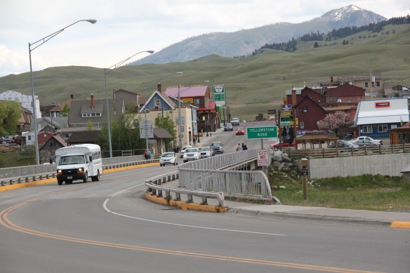 By the mid-20th century, Gardiner had become a highway town, the place in-between the beautiful drive through the Paradise Valley on U.S. Highway 89 (now a local paved road)


 The plan to develop a new Gardiner library at the old Northern Pacific depot site at part of the Gardiner Gateway Project is particularly promising, giving the town a new community anchor but also reconnecting it to the railroad landscape it was once part of. Something indeed to look for when I next visit this Yellowstone Gateway.
 My friends in the environs of Helena have been surprised that after 300 something posts I had yet to say anything about Augusta, a crossroads town in northern Lewis and Clark County along U.S. Highway 287, during my revisit of the 1984-1985 state historic preservation plan. They knew that I loved the open range drive to Augusta, whether approaching from U.S. 287 or U.S. Highway 89.
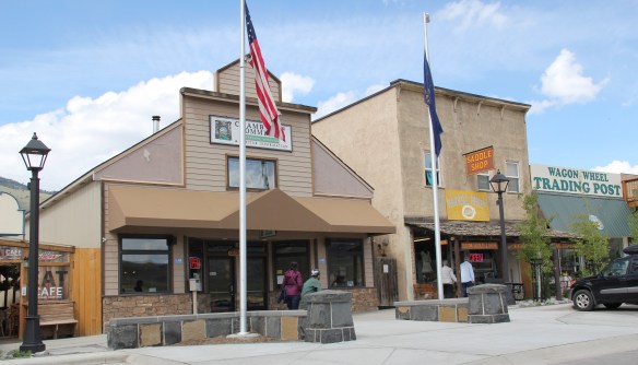
 Then, the various businesses and bars along Main Street represented not just a favorite place in rural Lewis and Clark County, but also document a classic western town with great roadside architecture such as the Wagon Wheel Motel.


 Augusta began as a crossroads town for neighboring ranches; the later extension of a railroad spur to nearby Gilman spurred competition between the two towns. But Augusta
  won that battle–today not much outside of the Montana Highway Historical marker, a steel bridge, and a disappearing railroad corridor remains of Gilman.

 But I like the football field almost as much as the historic school–could a more neighborhood setting even be imagined?
 Then there are historic commercial buildings from the early 20th century–several with National Register qualities, especially the F. M. Mack General Merchandise store–a frame building with paired bracketed cornice.


 Over 300 people call Augusta home today, a slight increase since my work 30 years ago. The community not only has kept the historic buildings noted above, residents also have opened the Augusta Area Museum–heritage is clearly part of the town’s future.
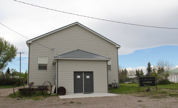
 U.S. Highway 89 enters the Blackfeet Indian Reservation on its southern border, heading for its junction with U.S. Highway 2 and the reservation center of Browning. Before the junction, you cross the historic Two Medicine River, a historic corridor for the Blackfeet. To the west of the river crossing is a highway historical marker for Coldfeet School, a one-
 room school (not extant) built for Blackfeet children in 1933 during the New Deal. To the east of the highway river crossing, however, was one of the earliest schools (1889) on the reservation, the Holy Family Catholic
")


 This panorama of the mission site today shows that neither of the dormitories remain, although the historic frame barn and mill still stand (to the left) while the chapel is still a dominating element, and has been incorporated into present-day Blackfeet culture. It is in excellent shape.
 Another change is that the Blackfeet provide public interpretation of the site, through their own historical markers, which is extended into the adjacent historic cemetery, one of the most somber places in the region. The old mission is now part of the reservation’s heritage tourism effort.
 Returning to U.S. 89 and heading northwest, you head to the junction of U.S. Highway 2 and the town of Browning. The town is a center for reservation education, as shown by the new campus for the Blackfeet Community College.
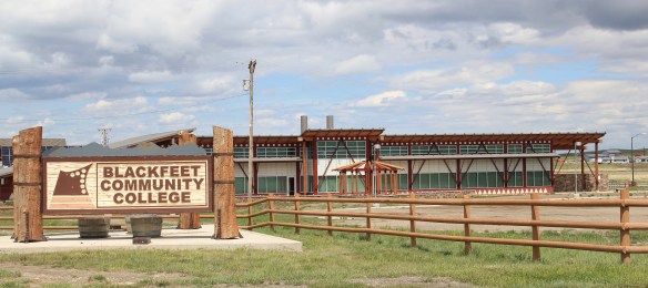 Here too is another historic Catholic Church, the Little Flower Catholic Church, built in 1931, from locally available stone in a Gothic Revival style. The congregation supports a small Catholic school next door.
 The Browning fairgrounds is an important Blackfeet recreation and cultural center, with this recent installation again providing public interpretation of Blackfeet culture.
 and U.S. 89, heading north. It created an appropriate, respectful way for the increasing number of auto tourists headed to Glacier National Park to learn about the Blackfeet in particular and Plains Indian culture in general. The famous mid-20th century anthropologist, John Ewers, had worked tribes to create the museum’s initial exhibits and collections. In the 21st century, the Blackfeet have developed additional institutions to take advantage of tourism through the nearby Glacier Peaks casino and hotel, a complex that has developed from 2011 to 2015.
 These new buildings are part of a long-term continuum of tourism in Browning, starting with this old concrete tipi, built originally as a gas station in 1934 and now converted into a coffee shop. And the Blackfeet
 Trading Post is a business found in all sorts of national park gateways–the classic place to get cheap souvenirs and t-shirts of all types, not to mention moccasins and all of the stereotypical material culture of Native American tourism in our country.
 the primary voice on what the park means, and how visitors can think about it today. The Native American presence on U.S. Highway 89 today is much more evident, with much more public interpretation, than in my travels 30 years ago.
 The two lanes of U.S. Highway 89 as it winds northwest from Choteau to the southern boundary of the Blackfeet Indian Reservation, cross a stark yet compelling landscape, a jaunt that has never ceased to amaze me. To those only with the mountains of Glacier National Park in their minds will see merely open land, irrigated fields, scattered ranches.
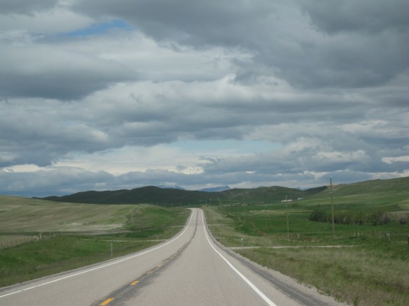 But there’s a deeper landscape here, some embodied in the tiny towns along the way, others in places just ignored, certainly not recognized. In the first post of 2016, and the 200th of this series of explorations of the Montana landscape, let’s once again look a bit harder.
 For one, this is a landscape shaped by Cold War America. Nuclear missile silos were installed throughout the region with some easily accessible from the roadway. You wonder how many tourists realize that.
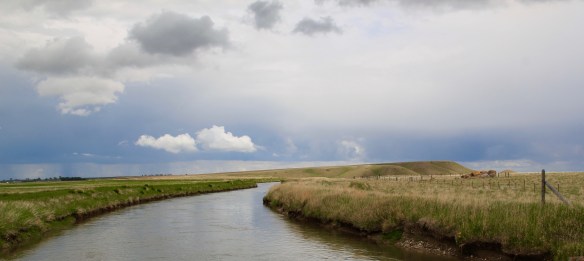
 The federal imprint has lingered on this land for almost 150 years. Today north of Choteau this highway historical marker, and a lonely boulder set square in the adjacent field, mark the first federal intrusion, the creation of the Teton River Agency, where in 1868-69 the federal government established its reservation headquarters for the Blackfeet Indians. The agency was only here for about 7 years but this spot was where the first white-administered schools for Blackfeet children began, in 1872.
 Irrigation systems would be a third federal imprint on the landscape and it came early to this region–through the Reclamation Service’s Valier Irrigation Project–but to find that place you need to venture a bit east of U.S. 89 to the town of Valier, on the banks of Lake Frances, which was created as a reservoir for the irrigation project.
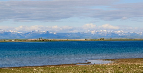 Valier has never been a very big place, but its investors in 1908, including William S. Cargill of the powerful Cargill family of Wisconsin (today’s Cargill Industries), had high hopes that the engineered landscape could create a ranching and farming wonderland.

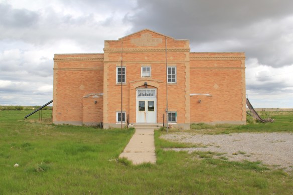
 Listed in the National Register of Historic Places, the school remains in use today, as a bed and breakfast establishment. Even though Valier never reached the dreams of the Cargills and other outside investors, it has been a stable agricultural community for 100 years–the population today is only 100 less than what the census takers marked in 1920. Valier has that


 Heritage tourism also remains alive along U.S. Highway 89, and for those travelers who slow just a bit there is now the Two Medicine Dinosaur Center at Bynum.
 One of my favorite county seats is Choteau, where U.S. Highways 89 and 287 meet. Both of those roads were and are among my favorite to take in the state, and Choteau I quickly found had one of my favorite local dives the Wagon Wheel. Back in the day, however, I did not appreciate how the town’s history and built environment was shaped by the Sun River Irrigation project and the overall growth in the county during the first two decades of the 20th century and later a second boom in the 1940s.
 Choteau has a different look than most towns from this era of Montana history. The centerpiece of the towns plan is not a railroad depot but the magnificent Teton County Courthouse (1906), which occupies a spot where the two federal highways junction. Designed by architects Joseph B. Gibson and George H. Shanley, the National Register-listed courthouse is made of locally quarried stone in a late interpretation of Richardsonian Romanesque style, similar to, but to a much lesser scale and detail, than H. H. Richardson’s own Allegheny County Courthouse (c. 1886) in Pittsburgh.

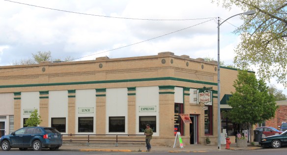 This historic neoclassical-styled bank building is now home to a coffee shop but other commercial buildings have changed very little, except for the mix of retail business. This is not a dying business district but one with a good bit of jump, of vitality.


 where the historic Bella Vista Motel–a perfect example of a 1950s motel with separate units like tiny Ranch-styled houses–has given way to a c. 2015 conversion into apartments.


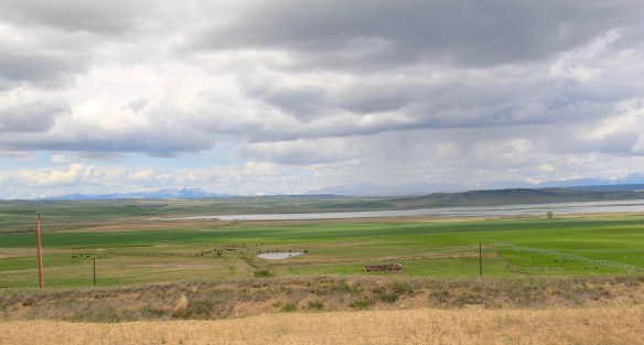
 We just finished an exploration of U.S. Highway south from Great Falls to Livingston, the gateway to Yellowstone National Park. Now let’s head in the opposite direction, north of Great Falls to Glacier National Park. In the first half of this trek, one great man-made landscape dominates either side of the road–the Sun River Irrigation Project, established by the U.S. Bureau of Reclamation in 1906 but not completed until the late 1920s.

 Feeding in and out of Fairfield are multiple canals and ditches, with the great bulk of land devoted to the production of malting barley, under

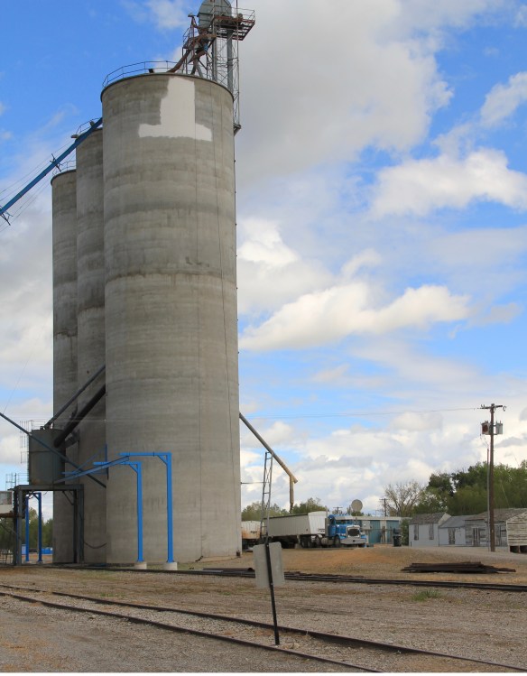
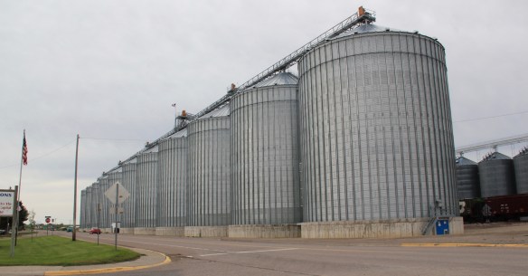 Fairfield itself is a classic T-plan railroad town. The barley granaries dominate the trackside, where also is located the headquarters for the Greenfields Irrigation District, so designated in 1926.
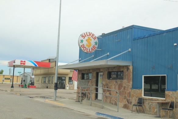
 Along the stem of the “T” plan are all of the primary commercial buildings of the town, from an unassuming log visitor center to various one-story commercial buildings, and, naturally, a classic bar, the Silver Dollar.


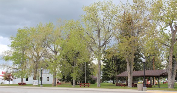
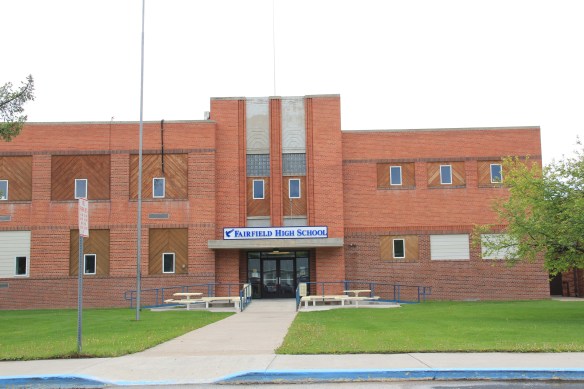
 Public spaces and institutions are located at the bottom of the “T,” including a community park and swimming pool, a c. 1960 community hall, and an Art-Deco styled Fairfield High School. The park, pool, and high school were all part of the second period of federal improvement at Fairfield during the New Deal era.

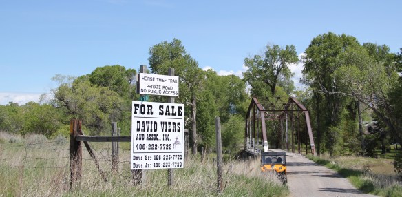 Traveling south of Clyde Park on U.S. 89, you pass by the turn-off for Horse Thief Trail, where a historic steel bridge still allows for one-lane traffic over the Shields River; this bridge and snippet of road is part of the original route of U.S 89. That means you are nearing the confluence of the Yellowstone and Shields rivers, and where U.S. Highway 89 crosses the Yellowstone River and takes you into the heart of Park County. Paralleling the modern concrete bridge is a c. 1897 steel Pratt through truss bridge, to serve the Northern Pacific Railroad spur that runs north to Clyde Park then Wilsall. The Northern Pacific called this the Third Crossing of the Yellowstone bridge; the Phoenix Bridge Company constructed it.
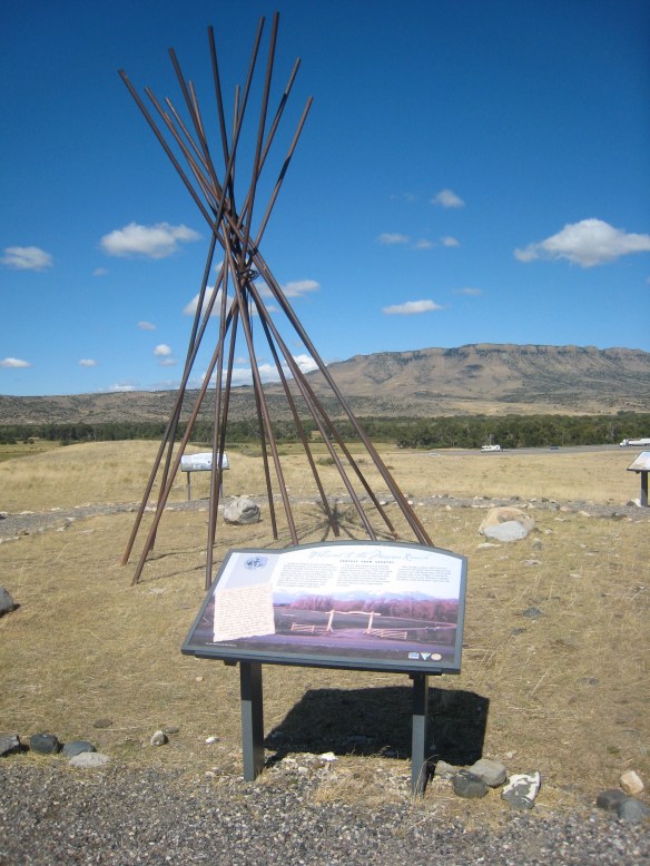
 Before jogging slightly to the west to head to Livingston, the county seat, two places east of the Shields River confluence are worth a look. First is the site of Fort Parker, established as the first Crow Agency in 1869 or the first federal facility in the valley. It operated from this location until 1875.
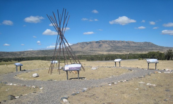 Gladly all of that changed in the 21st century. As a result of another innovative state partnership with land owners, there is an interpretive center for the Fort Parker story, easily accessible from the interstate, which also does not intrude into the potentially rich archaeological remains of the fort. The story told by the historical markers is accurate and comprehensive, from the agency’s beginnings to the land today.
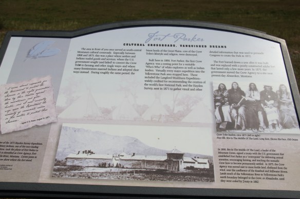
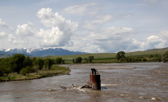
 Few remnants of that early white settlement remain today; you can find some just north of Springdale, at Park County’s eastern border, on the north side of the Yellowstone River. Hunter’s Hot Springs was the first attraction, established by Andrew Jackson Hunter in the 1870s, and receiving its last update in the early years of automobile tourism in the 1920s, as shown below in this postcard from my collection. Today, as the Google image below also shows, there are just scattered stones and fences from what had been a showplace for the valley.

 Commercial businesses once lined the town side of the Northern Pacific tracks. Nothing is open today although trains rumbled down this historic main line every day. What does survive is impressive and worthy of