In thinking about returning to Montana in 2012 and carrying out a huge “re-survey” of the places I had explored for the state historic preservation plan process 30 years earlier, Butte was high on my list of priorities. Not that the city and its surroundings had been given little attention in the early 1980s–the Copper City was already recognized as a National Historic Landmark, and a team of historians, architects, and engineers had just finished a large study of its built environment for the Historic American Building Survey and the Historic American Engineering Record. No, I wanted to go back because by 1985 many people counted Butte down and out, yet it had survived and started to reinvent itself. Not
 as a ghost town or the skeleton of a great mining city but as a revitalized place, both economically and culturally, centered in a strong core community, even though the challenges in front of it remain daunting, even overwhelming at times.
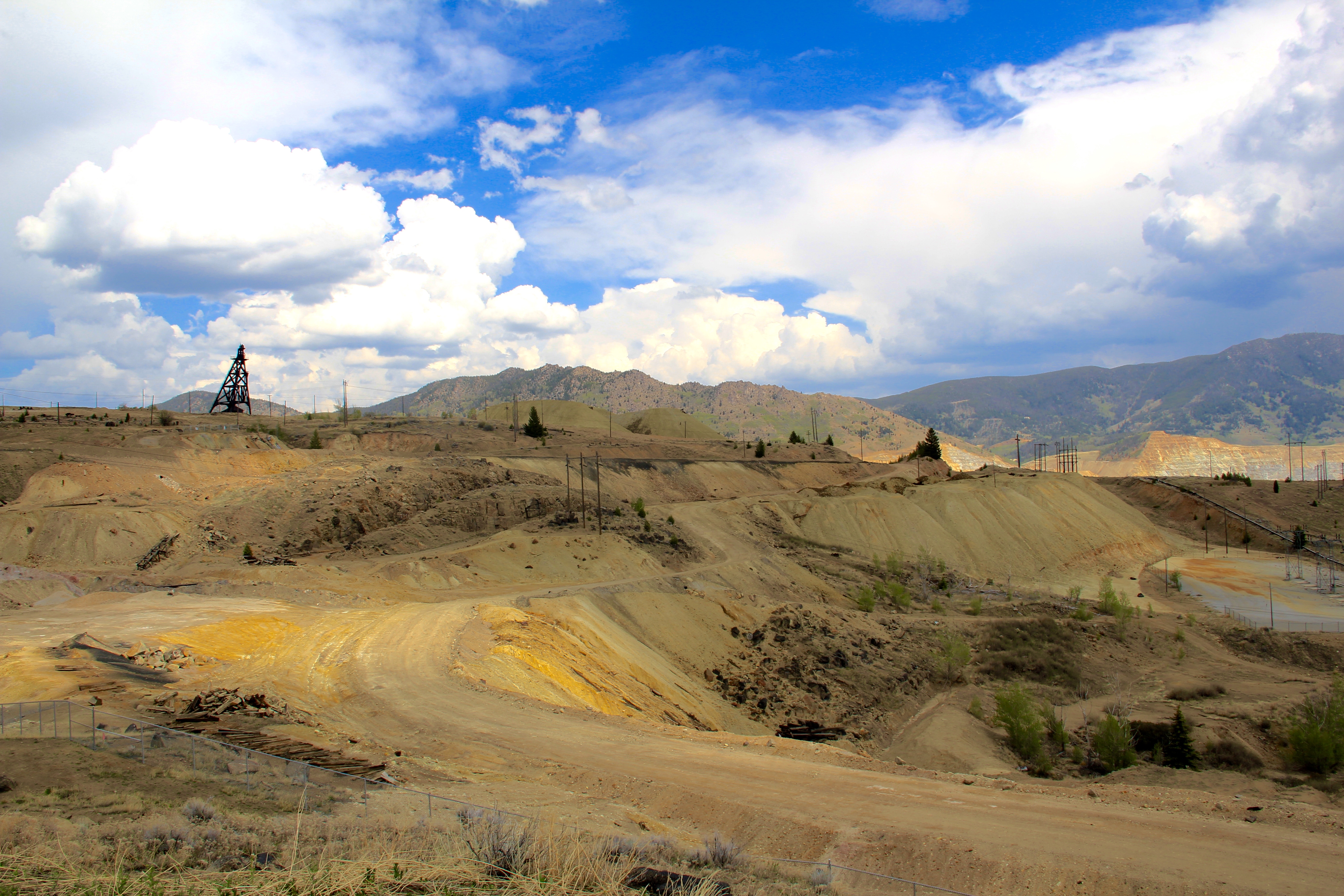 The environmental degradation left when the hard rock mines shut down is one burden that Butte has shouldered, with the help of the federal superfund program. Still, no matter how scientifically this landscape has been “cleaned up,” it remained scarred, and it is a far different challenge to build back hope into a place stripped of its life. Yet high over the city is a sign of the change to come in the Mountain Con Mine site.
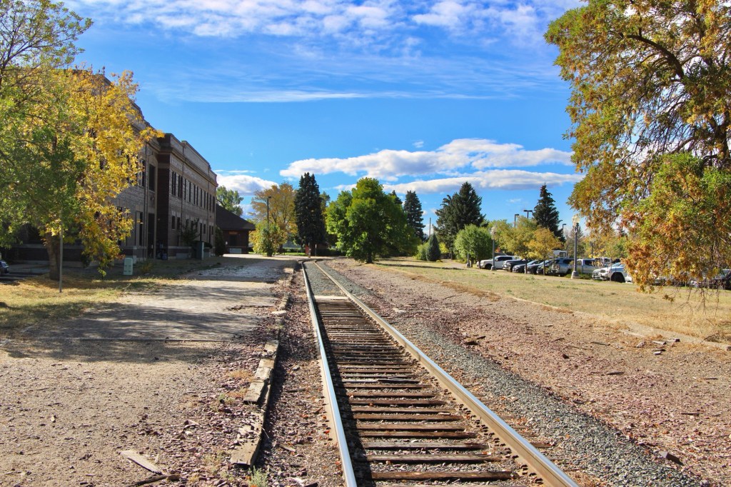
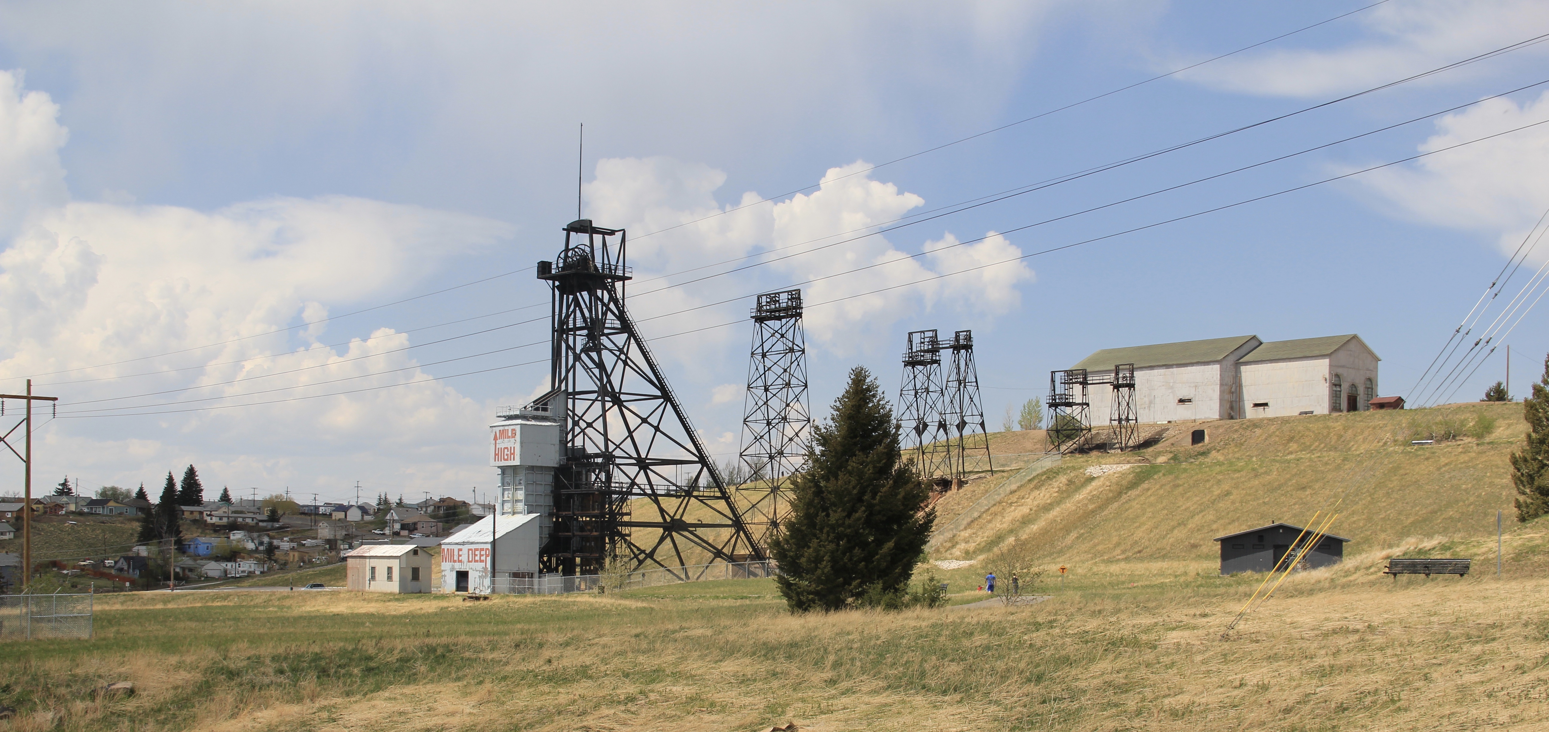 Still labeled as a Mile High and a Mile Deep place, the mine property is stunning, not only for its technological assertion–imagine working that high, and going that deep–but for its conversion into the walking/hiking/biking trails that encircle the city and present it with such potential as a recreational landscape.
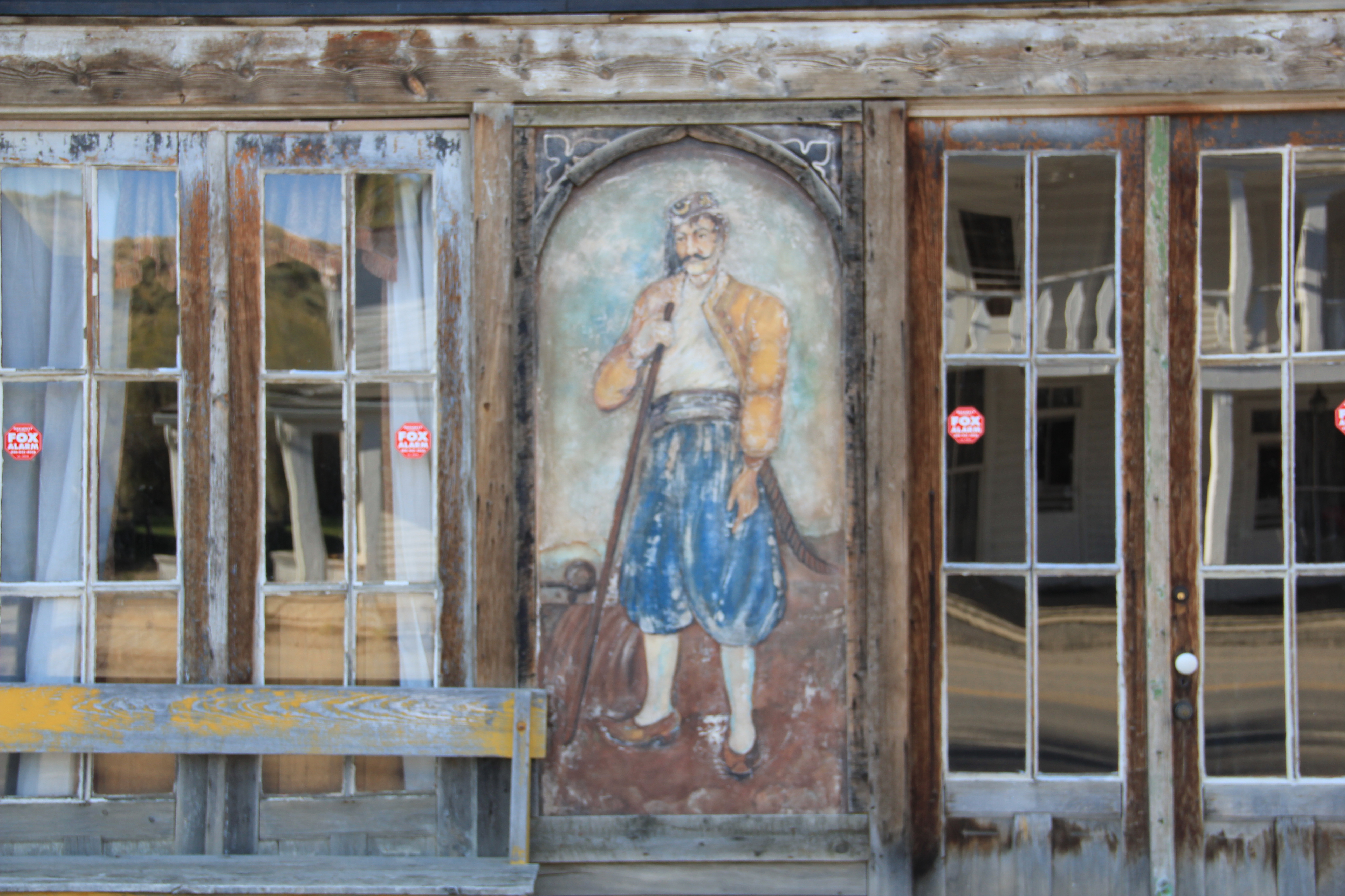
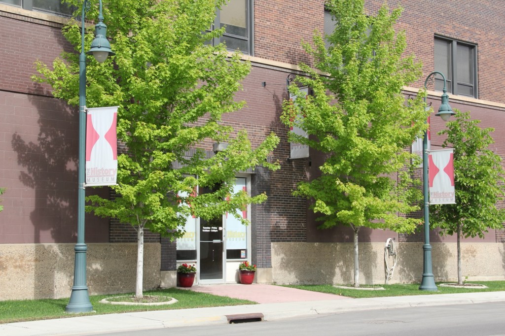
Transformation, that it is what strikes me as I wander down the trail and into Butte’s famous, or is it infamous, “Uptown” district. Butte is far from the place it was 30 years
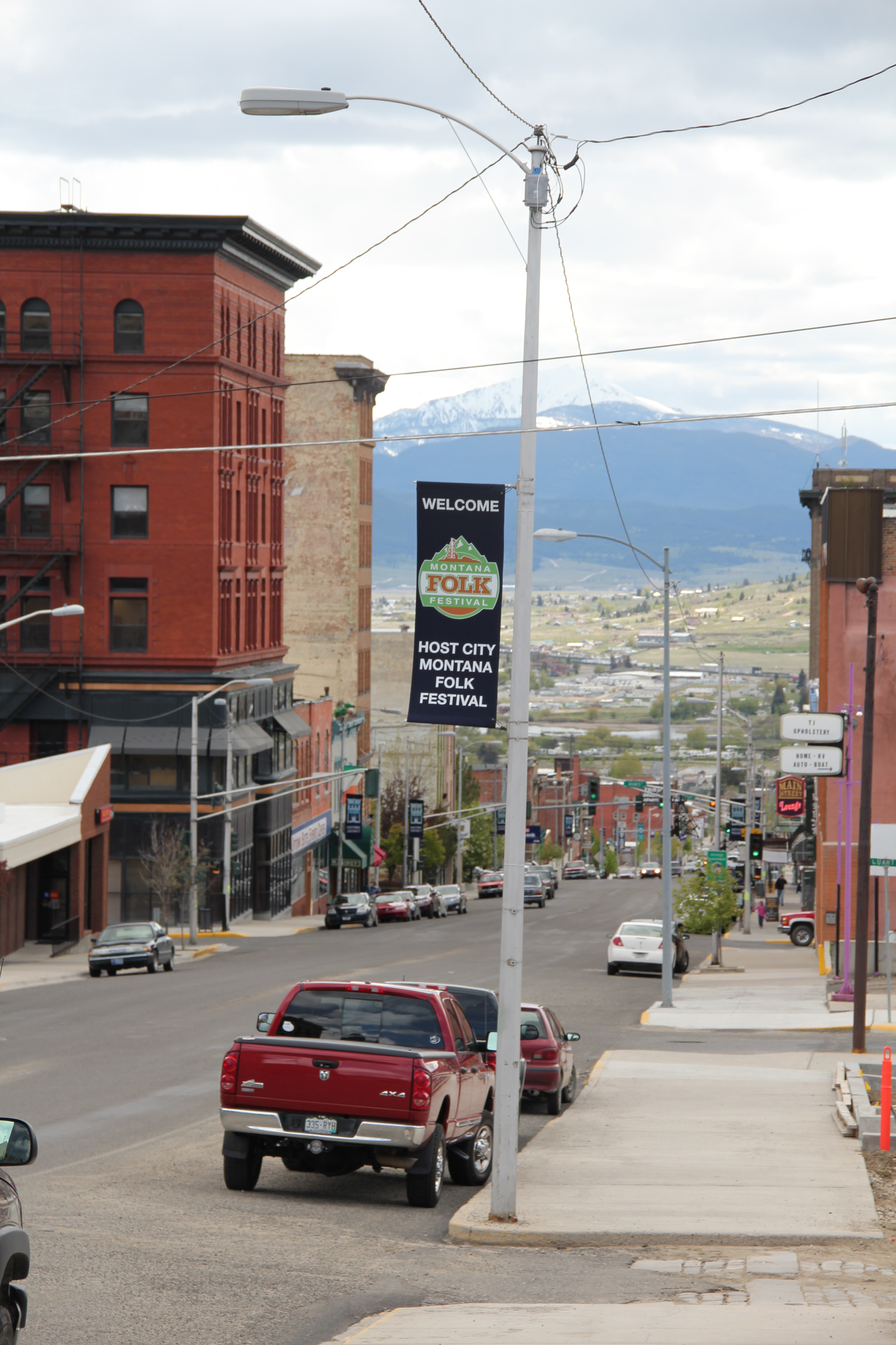 ago, with all sorts of signs of new investment, new pride, and community identity. It may have lost a step, or two, and its swagger may not be quite as exaggerated as it was in the mid-20th century, but it remains a place with its own feel, its own funk. For me, the reopening of the M&M Bar on Main Street–a legendary dive once shuttered, reopened, and shuttered again–gives me hope for Butte in the 21st century. Around the corner is
another institution, Gamer’s Cafe, which is situated within the marvelous Victorian eclecticism of the Curtis Music Hall of 1892.
Both establishments are for locals but visitors are tolerated, even welcomed. Indeed a degree of openness and acceptance have grown in Butte, a marked change from when the city’s Chinese residents lived and operated businesses on the edge of Uptown, along
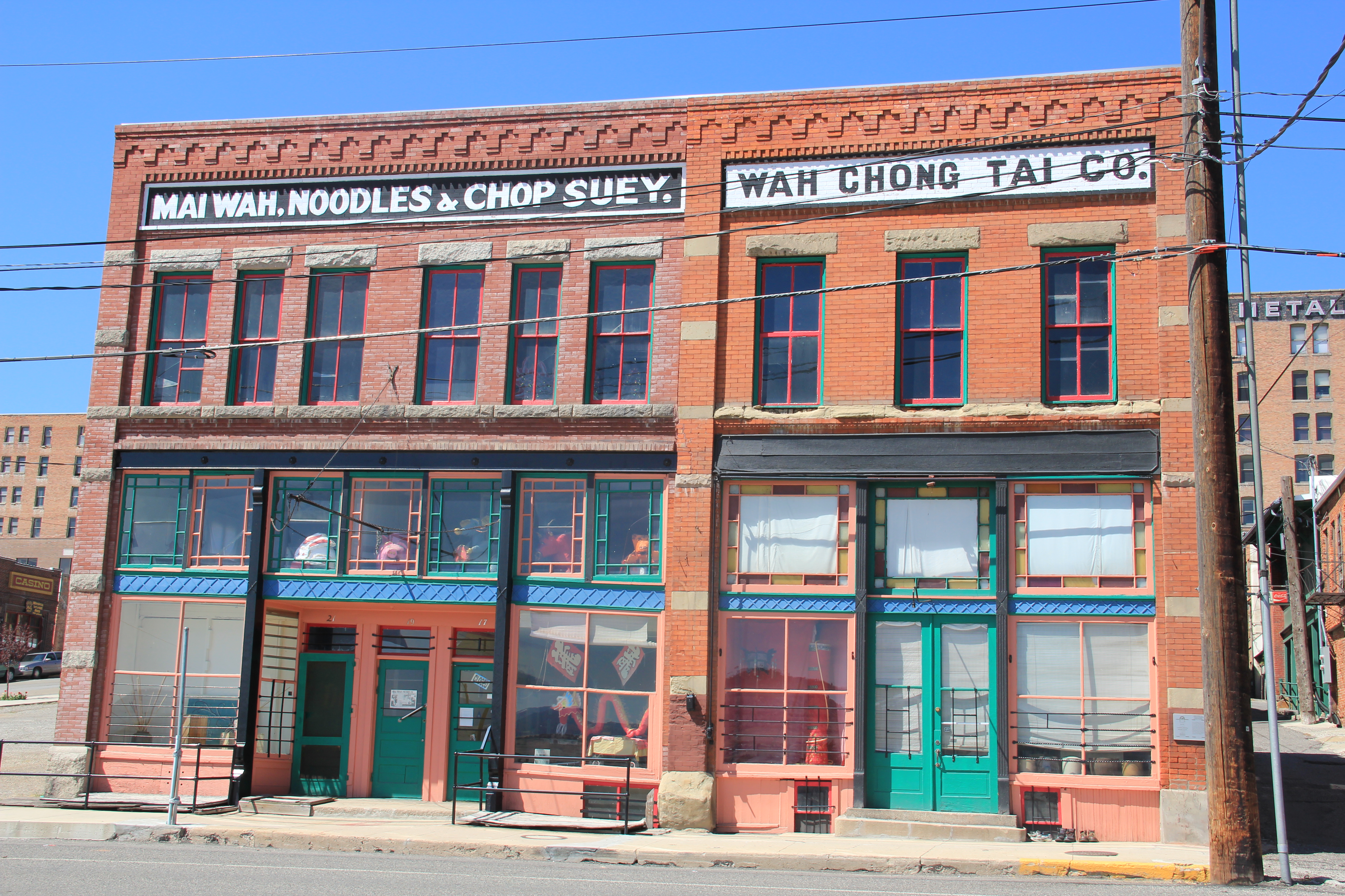 Mercury Street; at the same time the sex trade was alive and well to the east of that same street in a series of boarding houses and hotels. The Dumas Brothel, discussed in an earlier post, is listed in the National Register and its future as an adaptive reuse project and place for public interpretation is promising but not yet realized. African Americans in
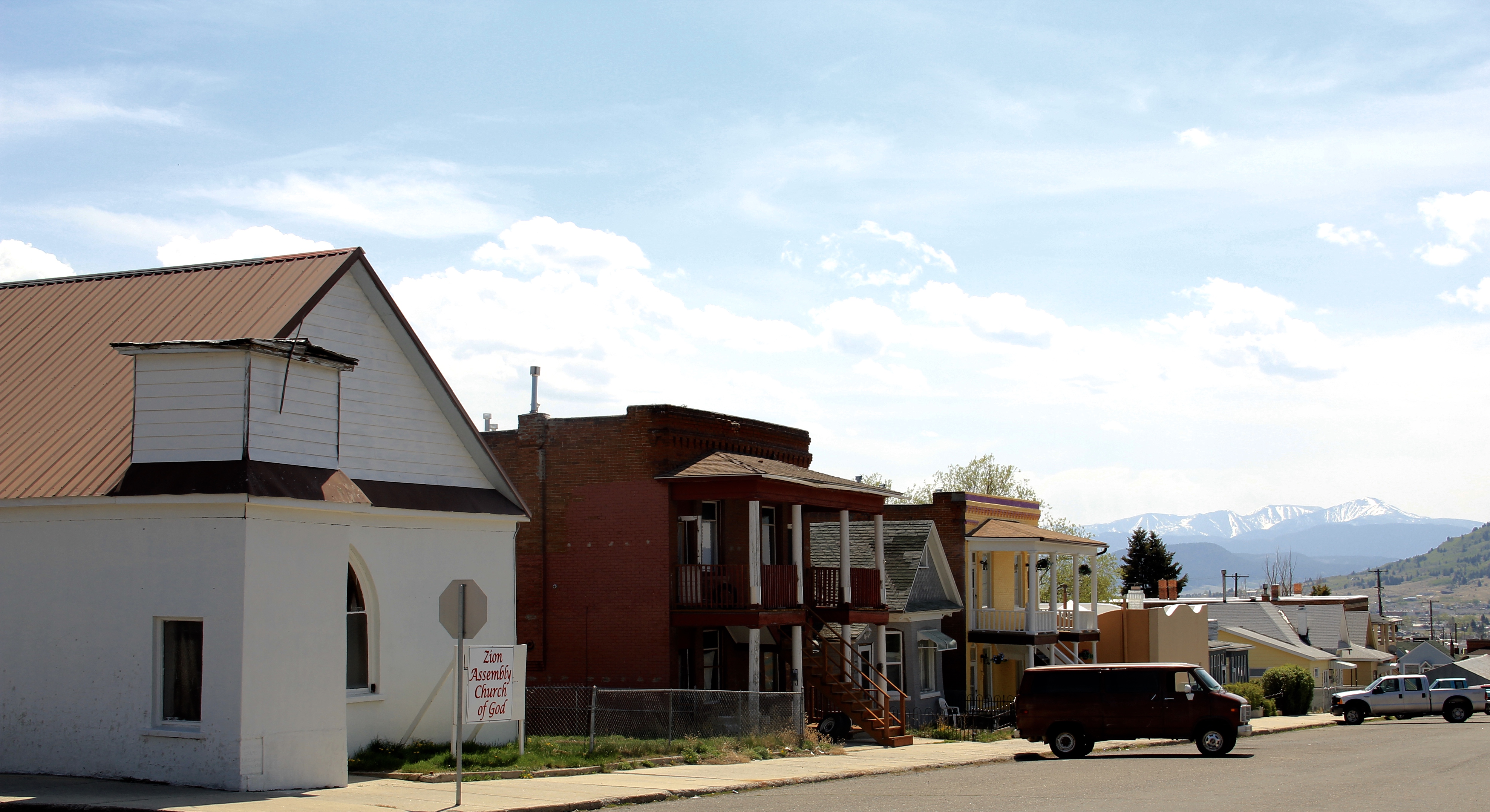
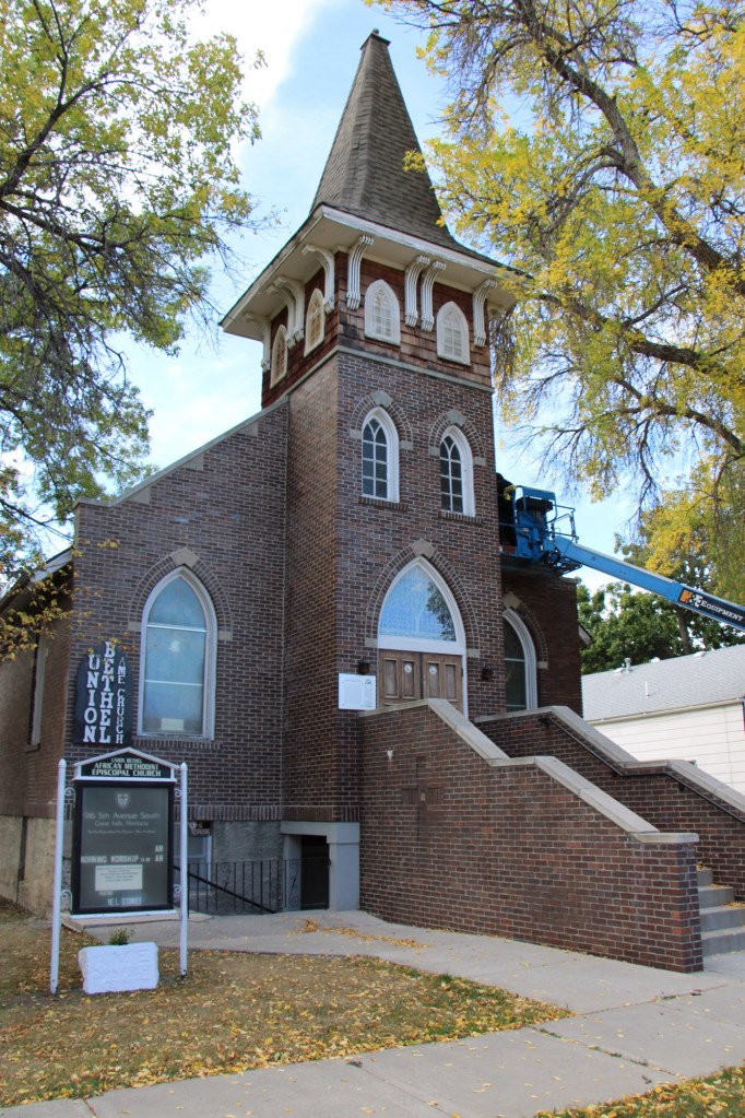
early 20th century Butte lived even farther down the hill from Uptown, in a small neighborhood around Idaho Street and the Shaffers African Methodist Episcopal Church, now a pentecostal meeting house.
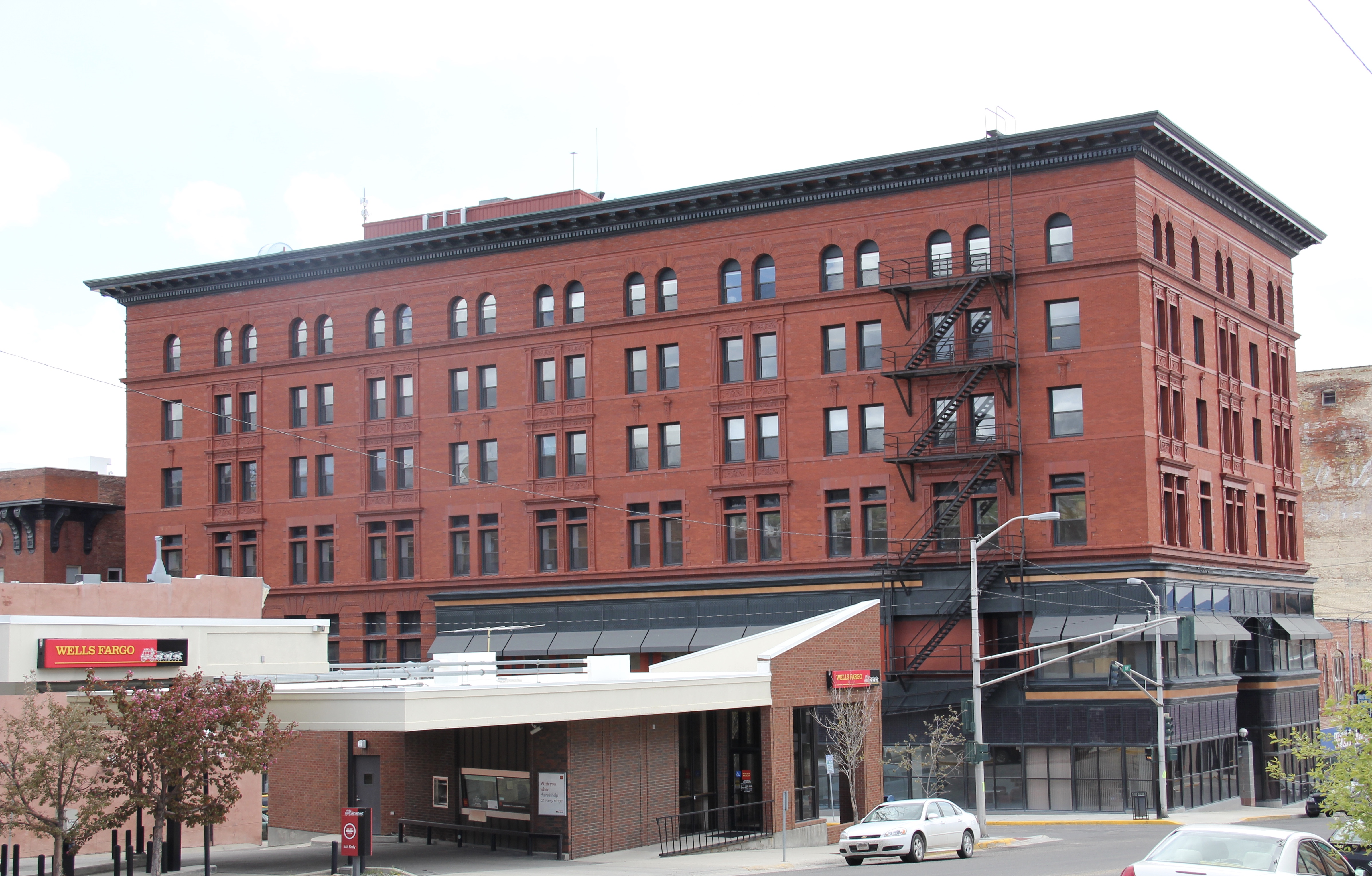
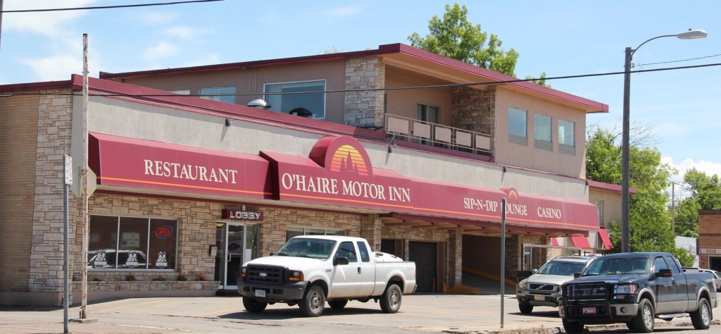
Uptown today is more a place for everyone, and has become the center of the community’s identity. It is easy to see why: massive, soaring buildings like the Metals Bank and Trust Tower and Hotel Finlen lend architectural dignity to the surroundings. Early 20th century classicism gives character and substance to Metals Bank whereas the Finlen has a classy
Renaissance Revival-style skin but then it has a spectacular contemporary Colonial Revival interior design, reminding us of Butte’s resurgence during the heyday of the Berkeley Pit boom from the mid-1950s through the turbulent 1960s.
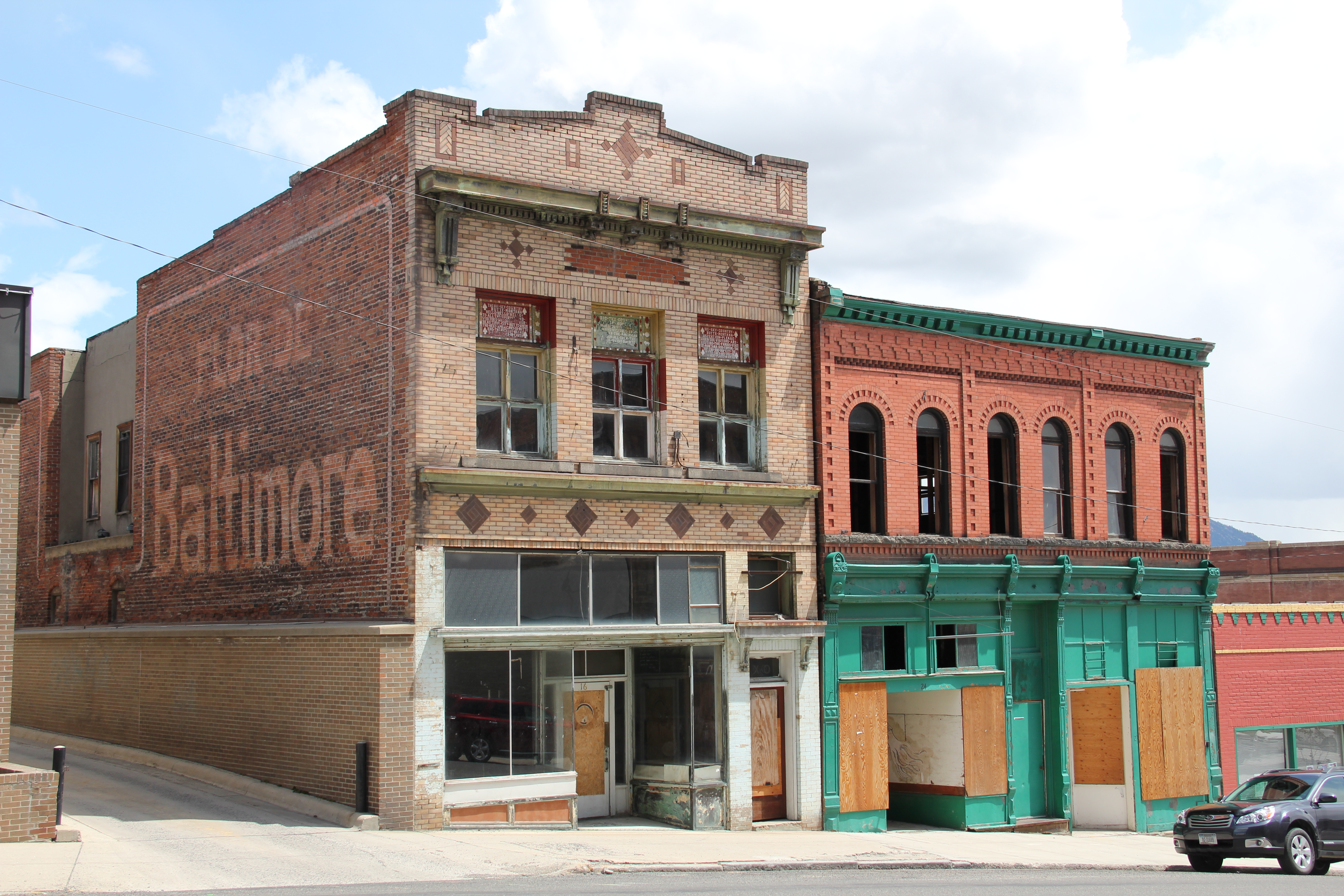
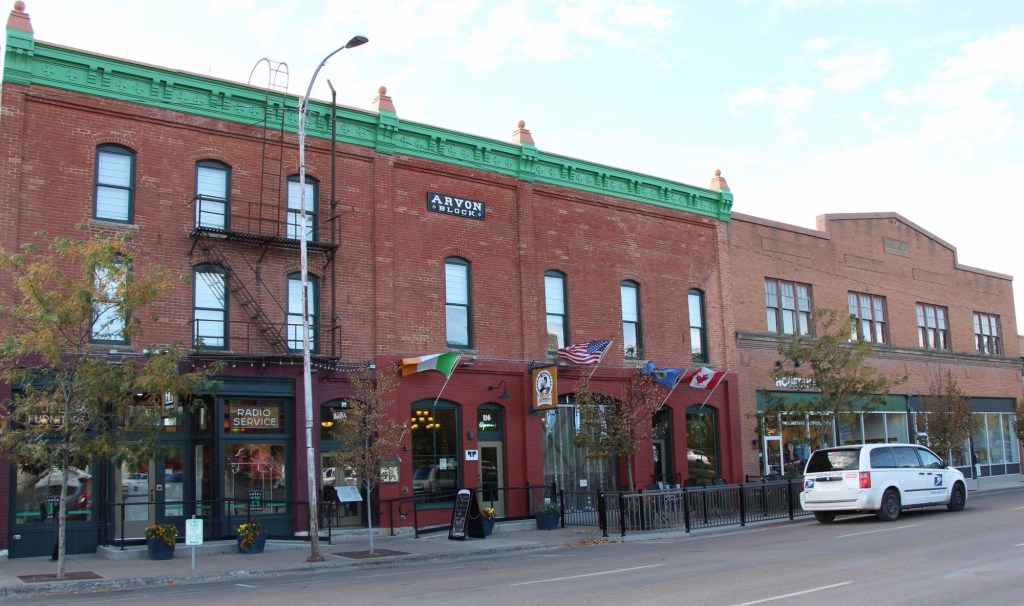
The Hennessy Block is another commercial landmark, from the city’s founding generation, that has looked for a long-term solution for decades now. Built in 1898 with support from mine magnate Marcus Daly, the building housed what most consider to be the state’s first full-fledged department store, headed by and named for Daniel Hennessy. Minneapolis architect Frederick Kees designed it in a Renaissance Revival style. In 1901 the Anaconda Copper Company moved its executive offices to the top of the building, making it perhaps the leading corporate landmark in the city.

 The massive building still dominates the Uptown building, making its closure in Butte in 1980 that more disturbing for residents. When I did my preservation plan work in 1984-1985 the issue of what to do with the Hennessy was at the forefront. By the end of the decade, ENTECH renovated the building and reopened it fully for business. In 2010 came the popular Hennessy Market–giving the growing number of Uptown residents a grocery store once again.
 The Sliver Bow Club building (1906-7) also has shifted its purpose, from being the stately and eloquent clubhouse of the city’s elite to becoming a place for public offices and meetings in its once exclusive spaces. Originally conceived by the same Spokane architects who designed the Lake McDonald Lodge in Glacier National Park, according to recent research by museum curator and preservationist Patty Dean, the building’s architects ended up being Link and Haire, the noted Montana architectural firm.
The interior design came yet from another important firm, William A. French and Company of St. Paul, Minnesota. Here you find one of the state’s best “Arts and Crafts Movement” themed interiors–and one of the best in the entire West.
The interior design speaks loudly to the gender and class focus of the social club. Its success set there table for Link and Haire’s next Butte masterpiece, the Beaux Arts-styled Silver Bow County Courthouse (1910-1912). Few public spaces in the state, save, perhaps the State Capitol, rival the Butte courthouse for its ornate exterior and interior, representing an overstatement of public authority and power in a city where a handful of mining interests made so many of the decisions.
Two years after it opened, the courthouse was not a refuge for those in need but a barracks for the state militia during the violence of 1914. Today, however, it is most definitely the people’s house, and was duly celebrated during its 100th birthday in 2012. It is part of the city’s distinguished public landscape, including the Victorian City Hall and the Beaux Arts classicism of the Police Department.
Of course, there is much more to see and say about Uptown Butte, but hopefully this is enough to show community pride at work, the value of historic preservation, and a proud city on the upswing, despite the obstacles before it.


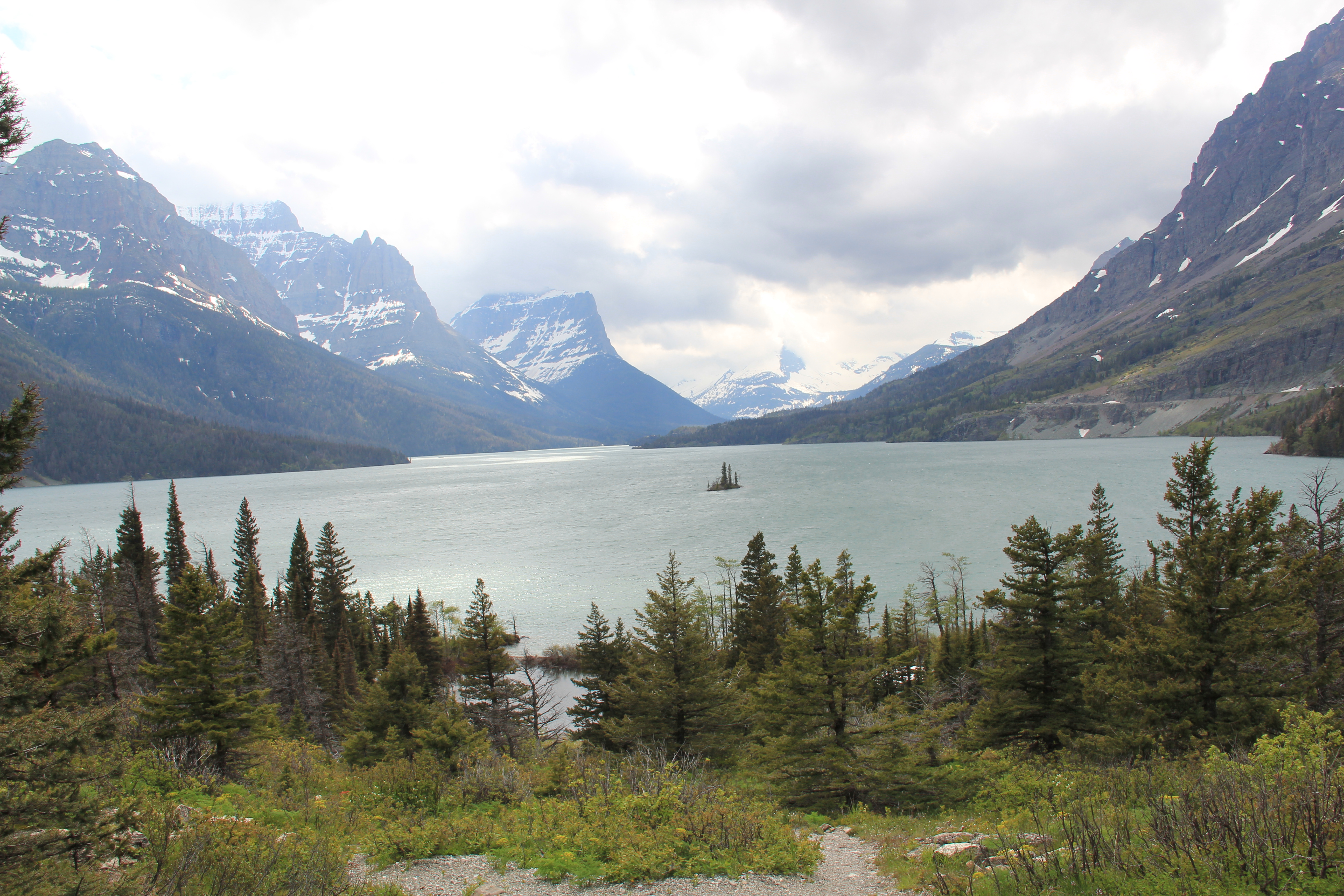
 Somehow it is most appropriate that my 300th post for Revisiting the Montana Landscape would find me back at Glacier National Park, especially the west side or Flathead County part of the park. From the first visit in 1982, Glacier always intrigued me–at first because of the tie between park creation and railroad development, then the Arts and Crafts/Chalet architecture associated with the park, and then high mountain Alpine environment. In the years since, I have eagerly grabbed a chance to get a cabin by Lake McDonald and just re-charge for a few days.
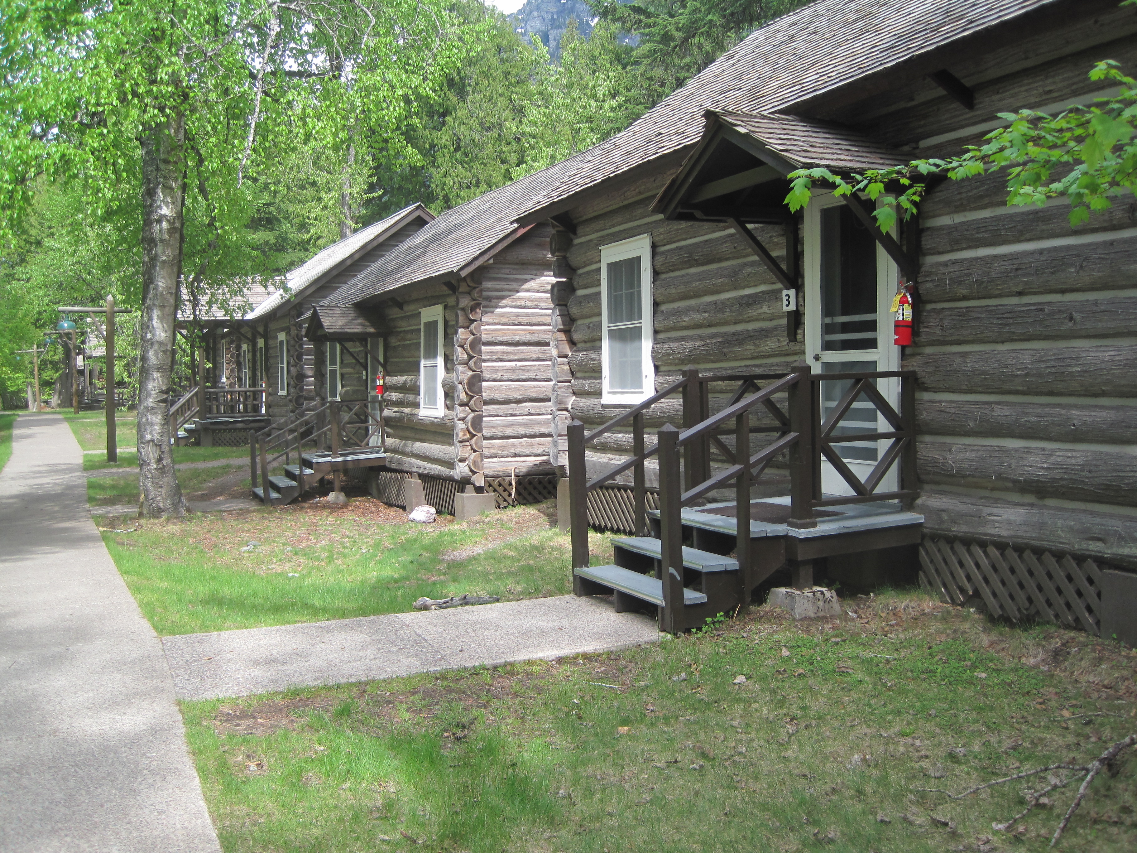 For the 1984-1985 state historic preservation plan work, however, I did not visit the west side of the park–the bulk of the travel took place between mid-February to mid-May 1984, meaning only the lower elevations such as Apgar Village were accessible. But already the state historic preservation office was aware that a major effort was underway to identify and nominate key properties within the park to the National Register of Historic Places, and by the end of the decade that process was largely complete. The National Park Service identified a range of historic resources from the turn of the 20th century to the Mission 66 program of the National Park Service during the 1960s–Glacier became one of the best studied historic landscapes in all of Montana.


 Register as an excellent example of Mission 66-associated architecture within the park. Burt L. Gewalt of the Kalispell firm Brinkman and Lenon was the architect.
 Great Northern officials considered the lodge to be the center of the mountain experience on the park’s west side. From there visitors could take overnight hikes to two other facilities, shown below, the Granite Park Chalet to the northeast or the Sperry Chalet to the southeast of Lake McDonald, both of which are also listed in the National Register.


 Since I last visited in 2012 efforts have been underway to secure additional acres and to preserve a buffer around the property since growth and highway expansion between Missoula and Stevensville has engulfed Lolo. The park now has 51 acres and represents quite an achievement by the non-profit Travelers Rest Preservation and Heritage Association, local government, and Montana State Parks.
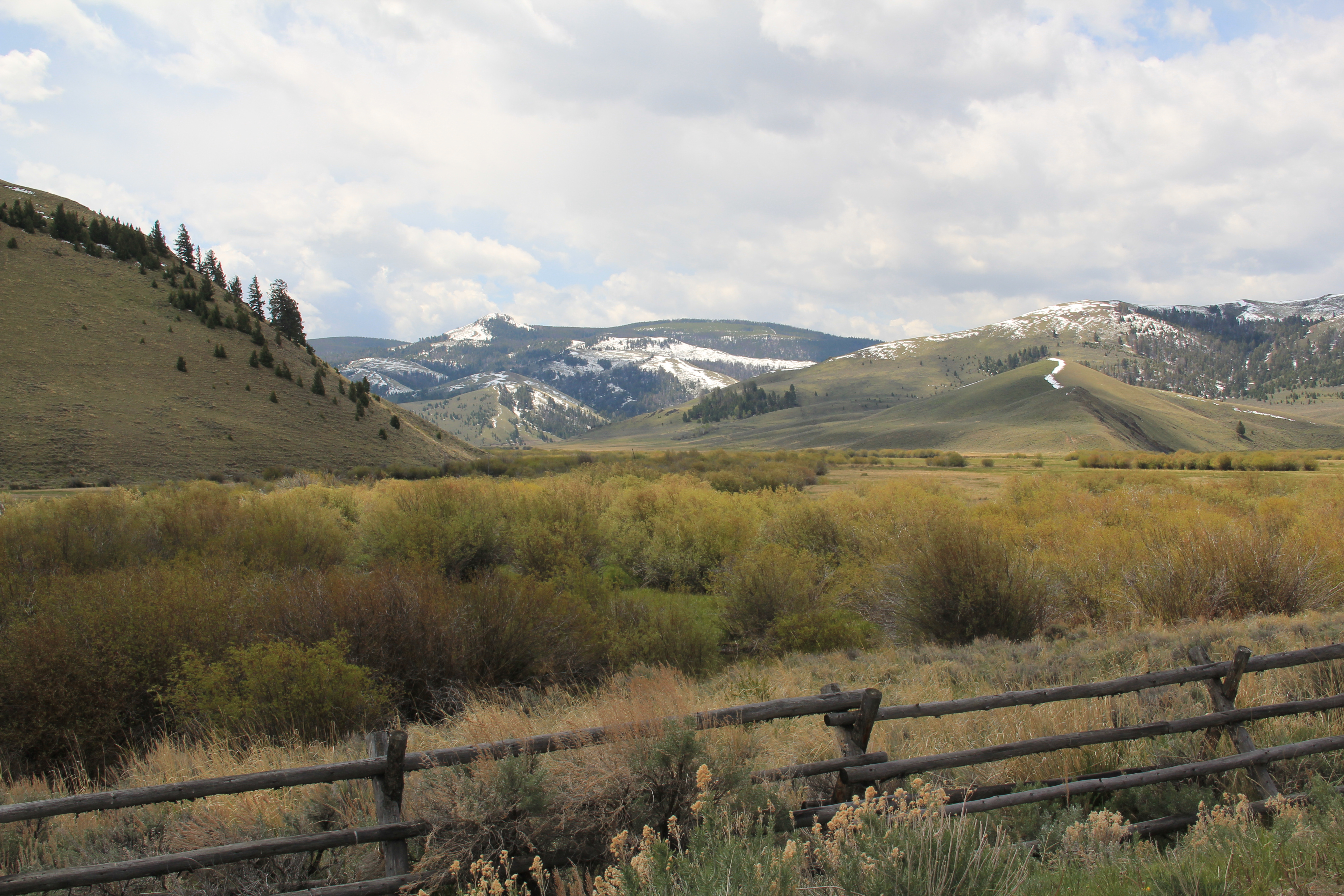 Beaverhead County’s history has deep roots, perhaps never deeper than at the high mountain passes that divide it from neighboring Idaho. We have already taken a look at Monida Pass, but now let’s shift to the western border and consider Lemhi Pass (Lemhi Road is the image above) and Bannock Pass, both at well over 7000 feet in elevation.
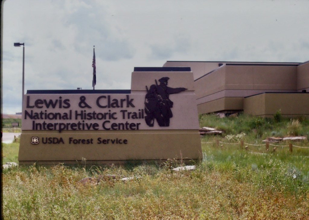
 Lemhi Pass is a magnificent place, reached by a wide dirt road that climbs up to 7300 feet. The roadbed is modern, and lies over a path worn by centuries of Native Americans who traveled this path between mountain valleys in present-day Montana and Idaho. That deep past is why the more famous Lewis and Clark Expedition took this route over the Bitterroot–and the Corps of Discovery connection is why the pass has been protected in the 20th century. The pass is also connected with Sacajawea, since her tribe, the Shoshone, often used it to cross the mountains.

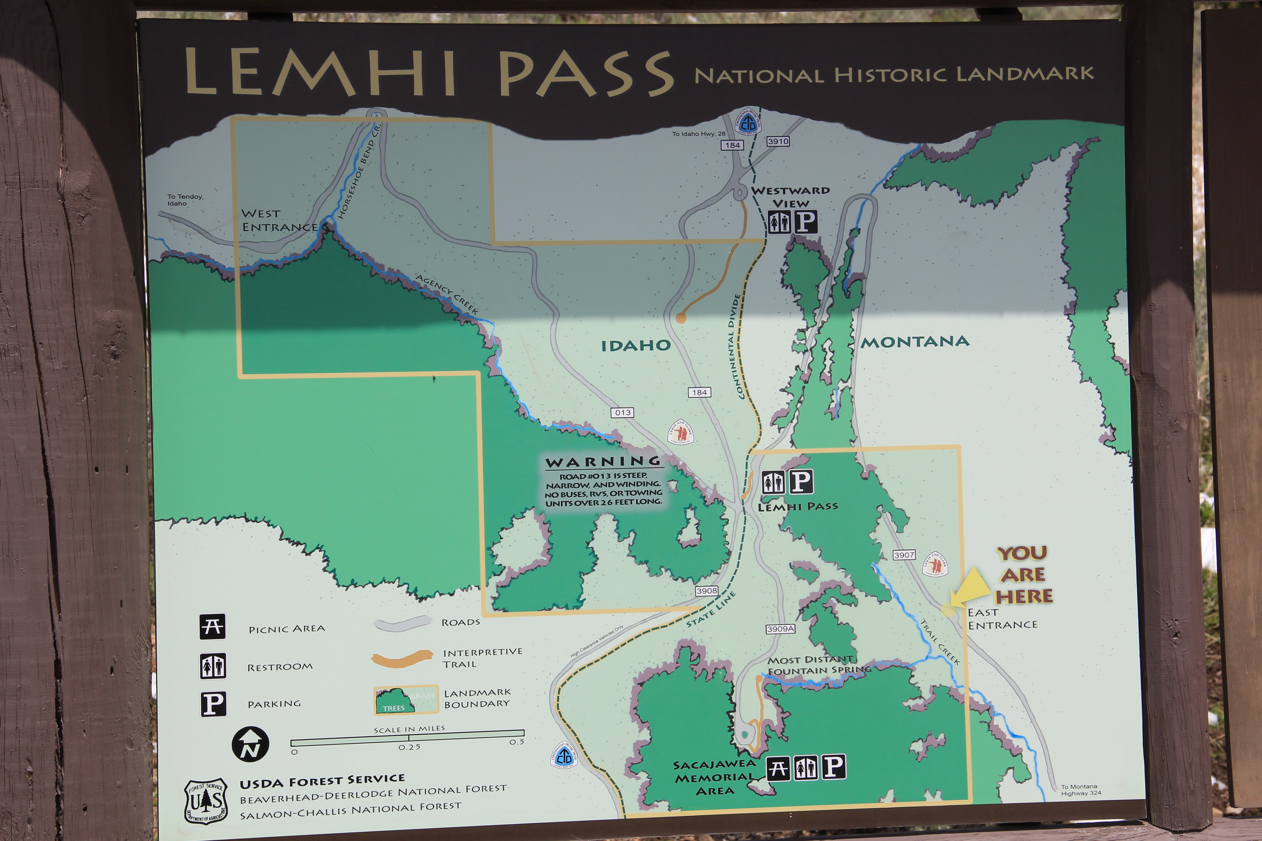 This kiosk by the U.S. Forest Service is part of the new public interpretation of the property, both at the start of the pass to the top of the mountain itself at the Sacajawea Memorial Area.
 Bannock Pass, comparatively has received little in public interpretation. Unlike Lemhi, it is not a National Historic Landmark associated with Lewis and Clark. For today’s travelers, however, it is a much more frequently used way to cross the Rockies despite its 300 foot higher elevation. A historic site directional sign leads to one interpretive
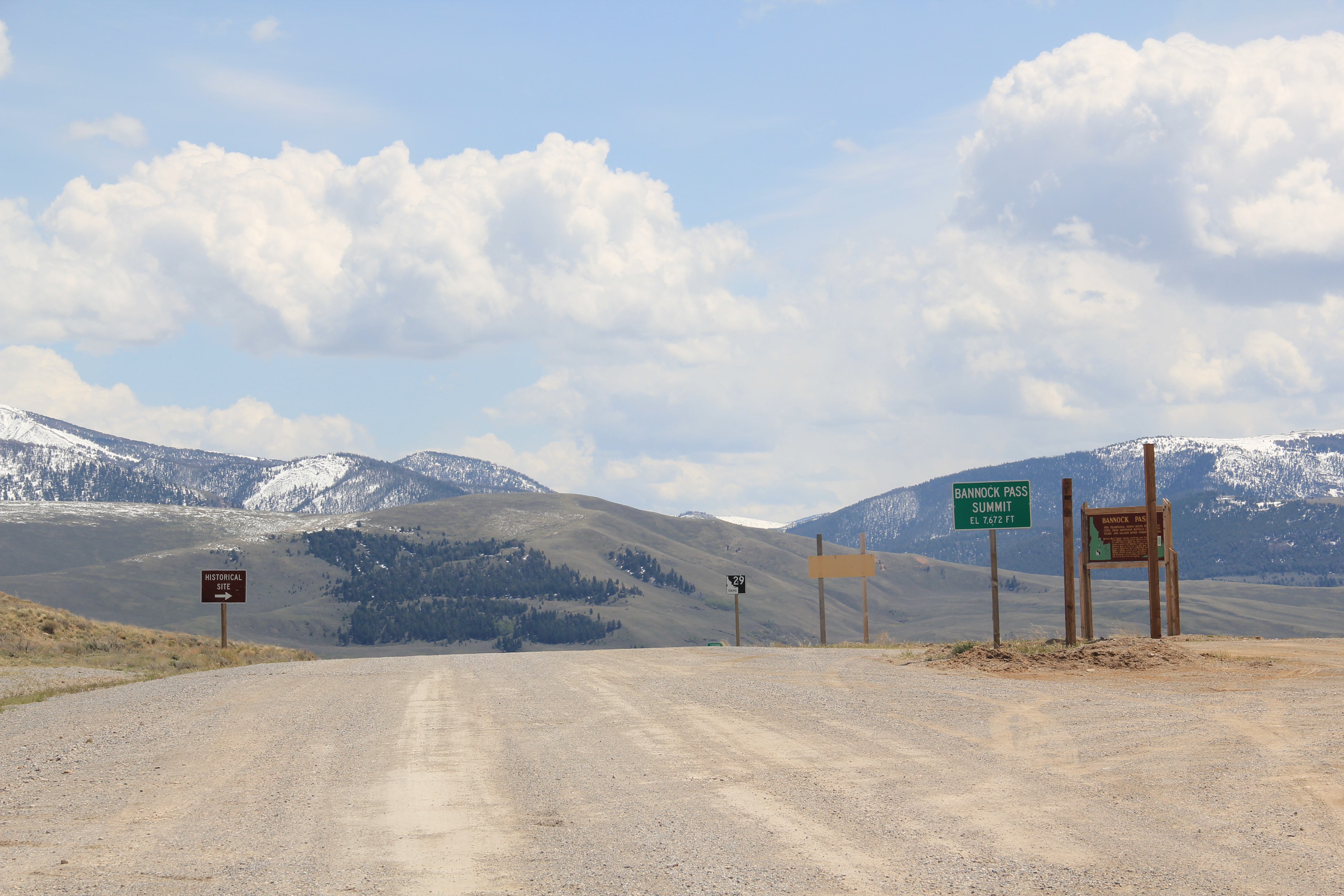


 It was a snowy Memorial Day when I crossed Lost Trail and Chief Joseph passes on my way to Big Hole Battlefield. Once again I was impressed by the recent efforts of the U.S. Forest Service to interpret the epic yet tragic journey of Chief Joseph and the Nez Perce in 1877, especially the Trail Creek Road that parallels Montana Highway 43.


 Canada was underway. Today the Nez Perce National Historic Trail and Park mark that journey into history. The park today is frankly an amazing transformation, from a preserved battlefield in the early 1980s that only hinted at the true facts of history to a modern of battlefield interpretation, one that does justice to history and to the Nez Perce story. One only wishes that more western battlefields received similar treatment.
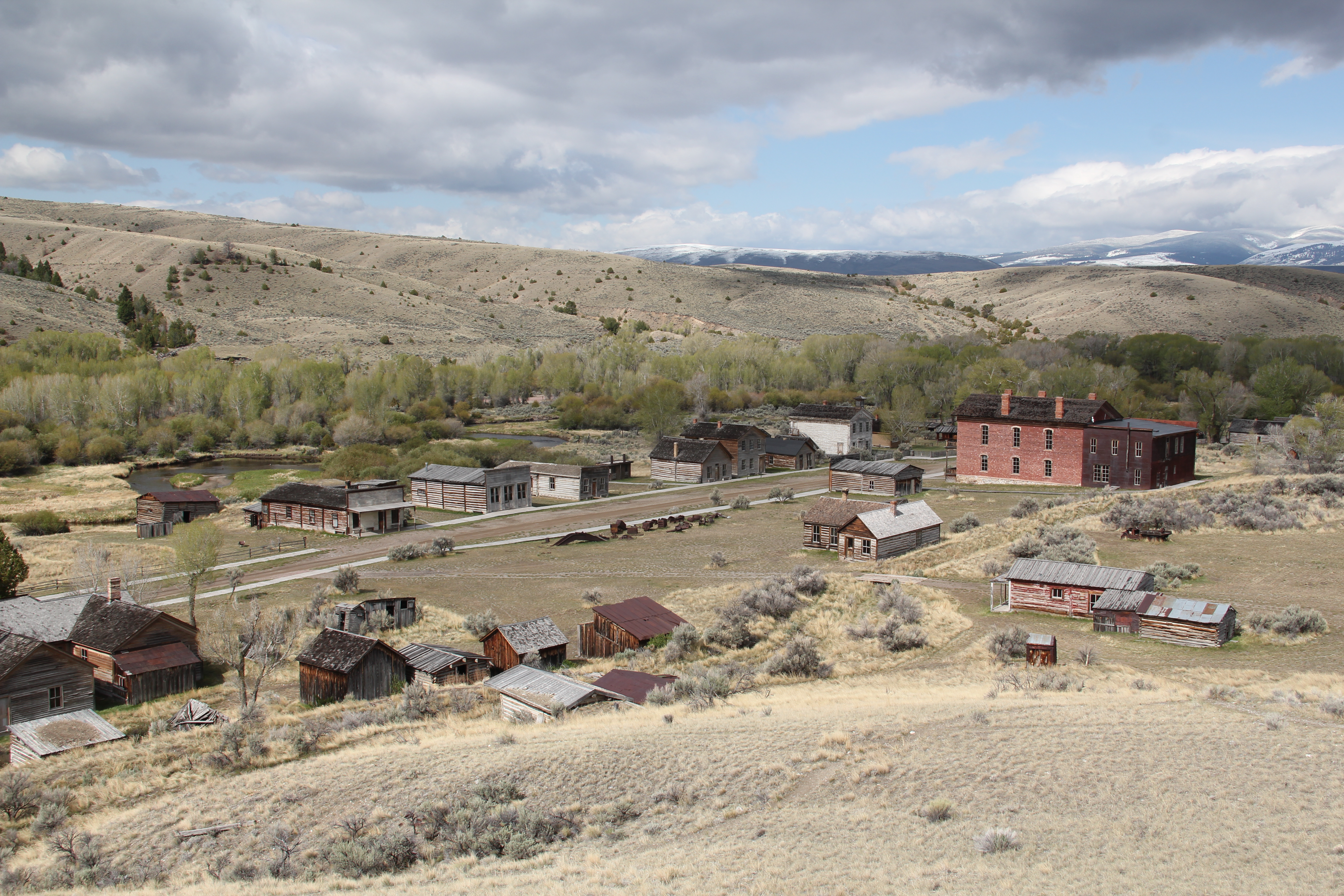 My first trip to Beaverhead County in 1981 had two primary goals–and the first was to explore Bannack, the roots of Montana Territory, and one of its best connections to Civil War America. As this simple wooden sign below remarks, here in 1862 the first gold strike in what became Montana Territory occurred.
 a path because the glistening bits of metal loose in the sands of the creek had never interested the Native Americans but news of the find was enough to drive easterners, many of them southerners, away from the landscape of war and into a wholly different place, crested by beautiful mountains.
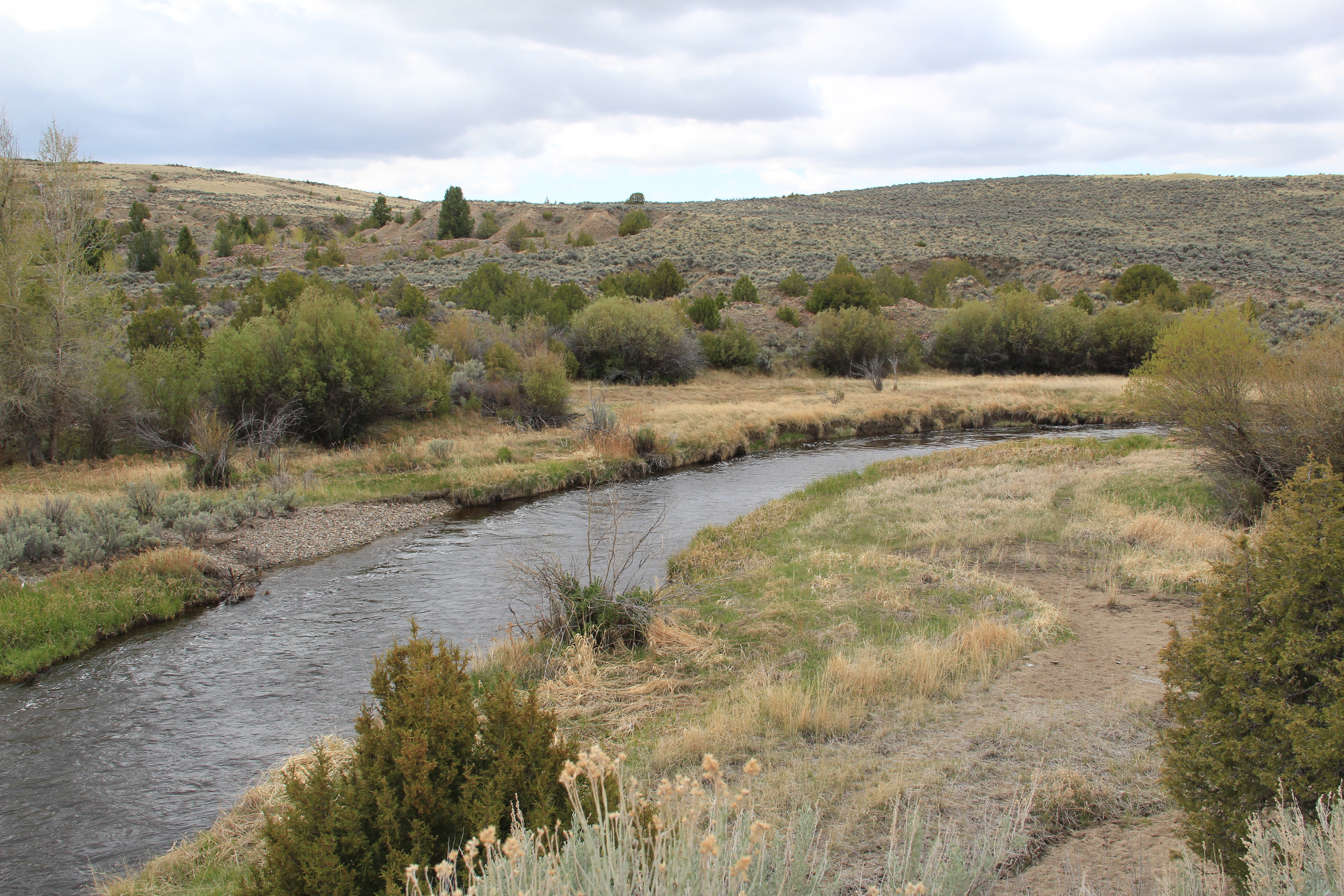 Grasshopper Creek was not much of place then, and even now, but this stream of water became the source of a boom that eventually reshaped the boundaries of the northern Rockies and nearby its banks grew the town of Bannack, a name taken in part from the Bannock Indians who had used this landscape in far different ways for many years.
 The story of the preservation of Bannock begins with local land owners, who protected the site, and kept most of the buildings from being scattered across the region. There was little official interest in the place at first. The state Daughters of American Revolution
 marked it in 1925, otherwise the buildings remained, some in use as residences or for public purposes, others melting away in the demanding climate. The Boveys moved the Goodrich Hotel to their preservation project at Virginia City and transformed it into the Fairweather Inn, which is still in use as lodging.
 In 1954, the Beaverhead County Historical Society transferred about 1/3 of the present property to the state for protection and development as a state park. Not until 1961 did the National Park Service recognize the town as a National Historic Landmark.


 Gritty, dusty, forlorn: yes, Bannack is the real deal for anyone wanting to explore ground zero of the gold rush era in Montana, and to think about how in the midst of the great Civil War, federal officials found time to support adventurous citizens to launch a new territory in forgotten expanses of the northern Rockies.
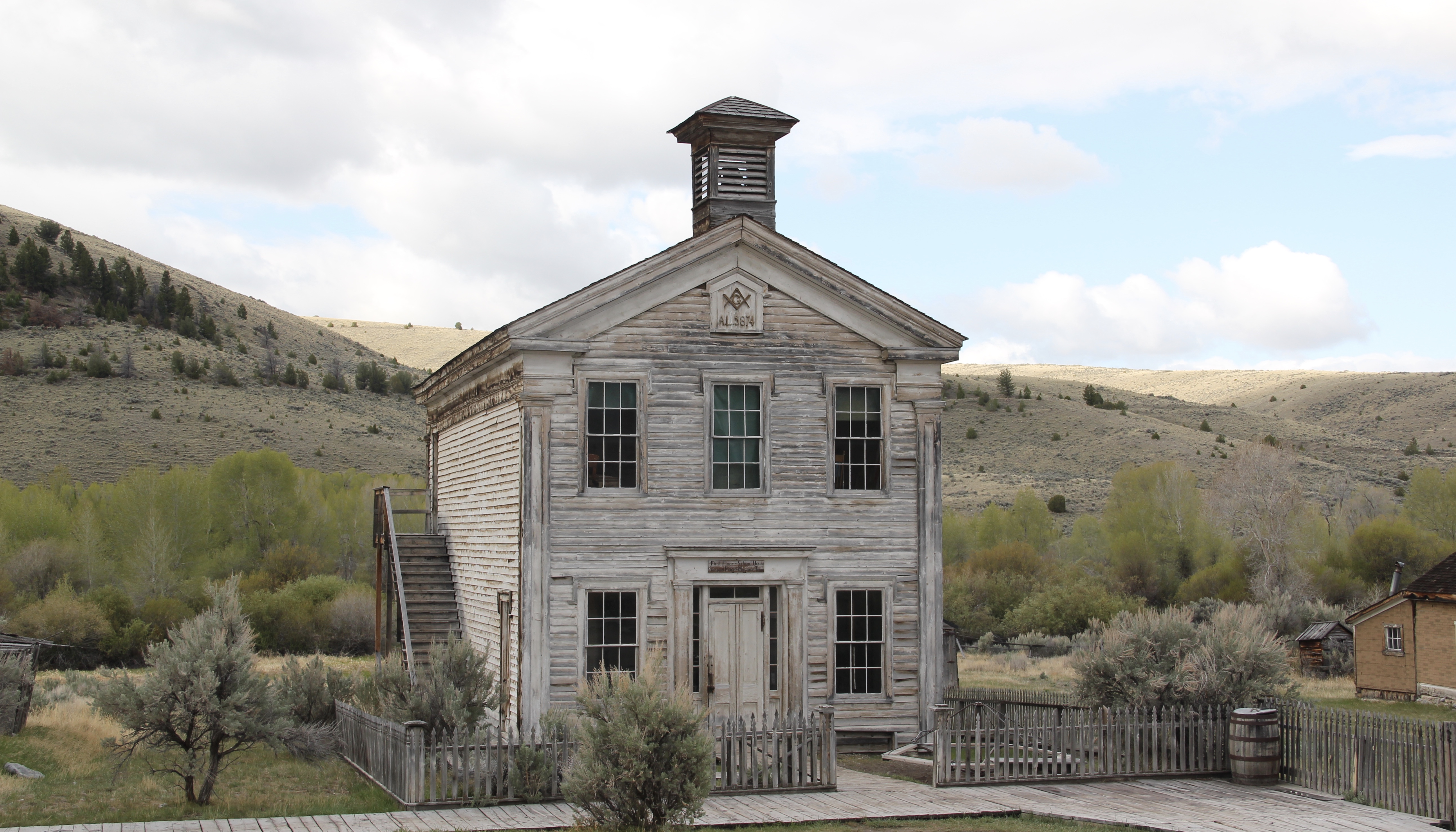 I thought that 30 years ago I “got” Bannack–there wasn’t much that I missed here. I was wrong. Probably like thousands of other visitors who fly into the town, and leave just as quickly, I missed what is still called the “new” town cemetery. Almost hidden in the sagebrush along Bannack Road, the “new” cemetery is not Boot Hill–where is Plummer
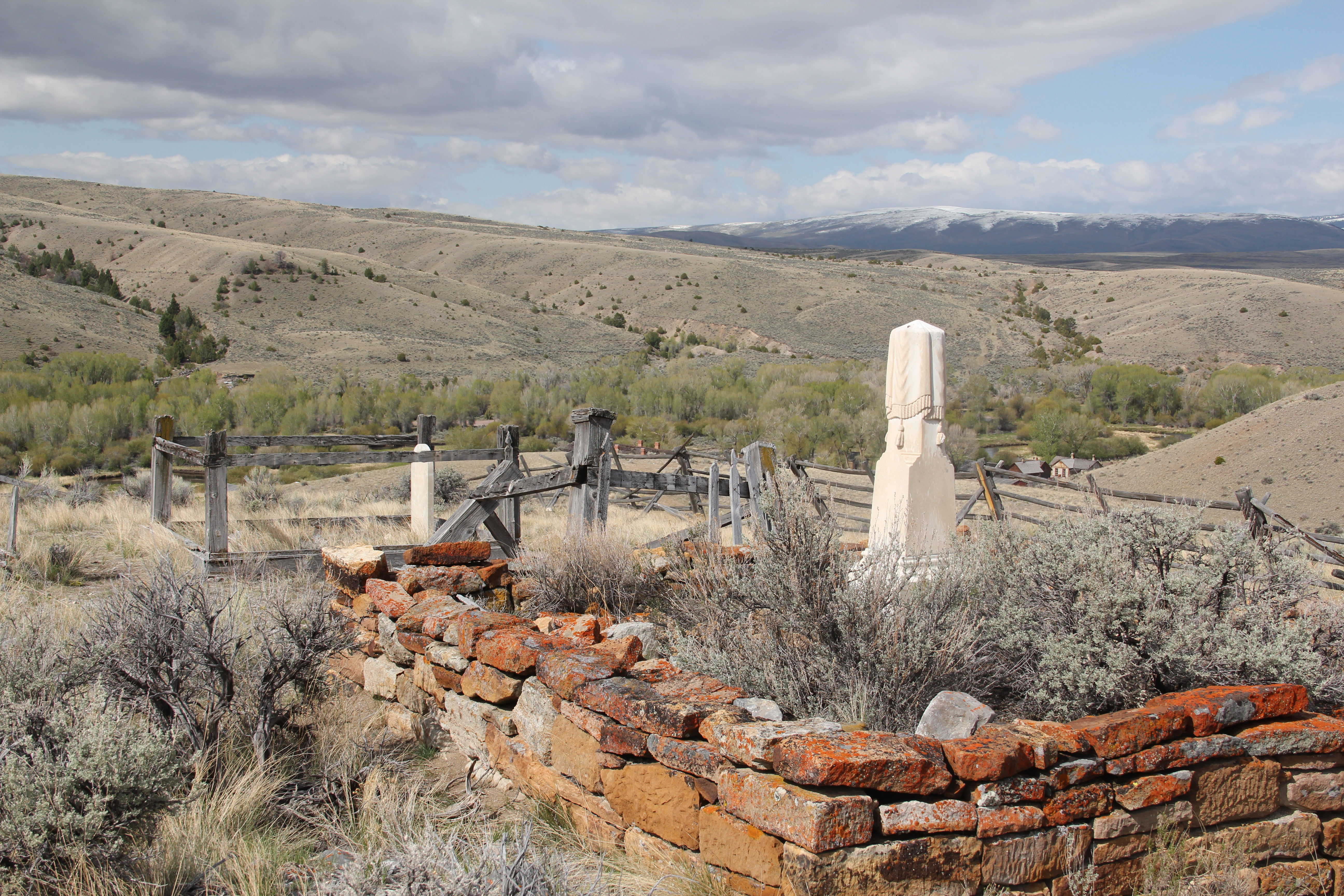 buried people still want to know–but it is a remarkable place of hand-carved tombstones, others rich with Victorian imagery, and a few that are poignant reminders of the Civil War veterans who came here and stayed.
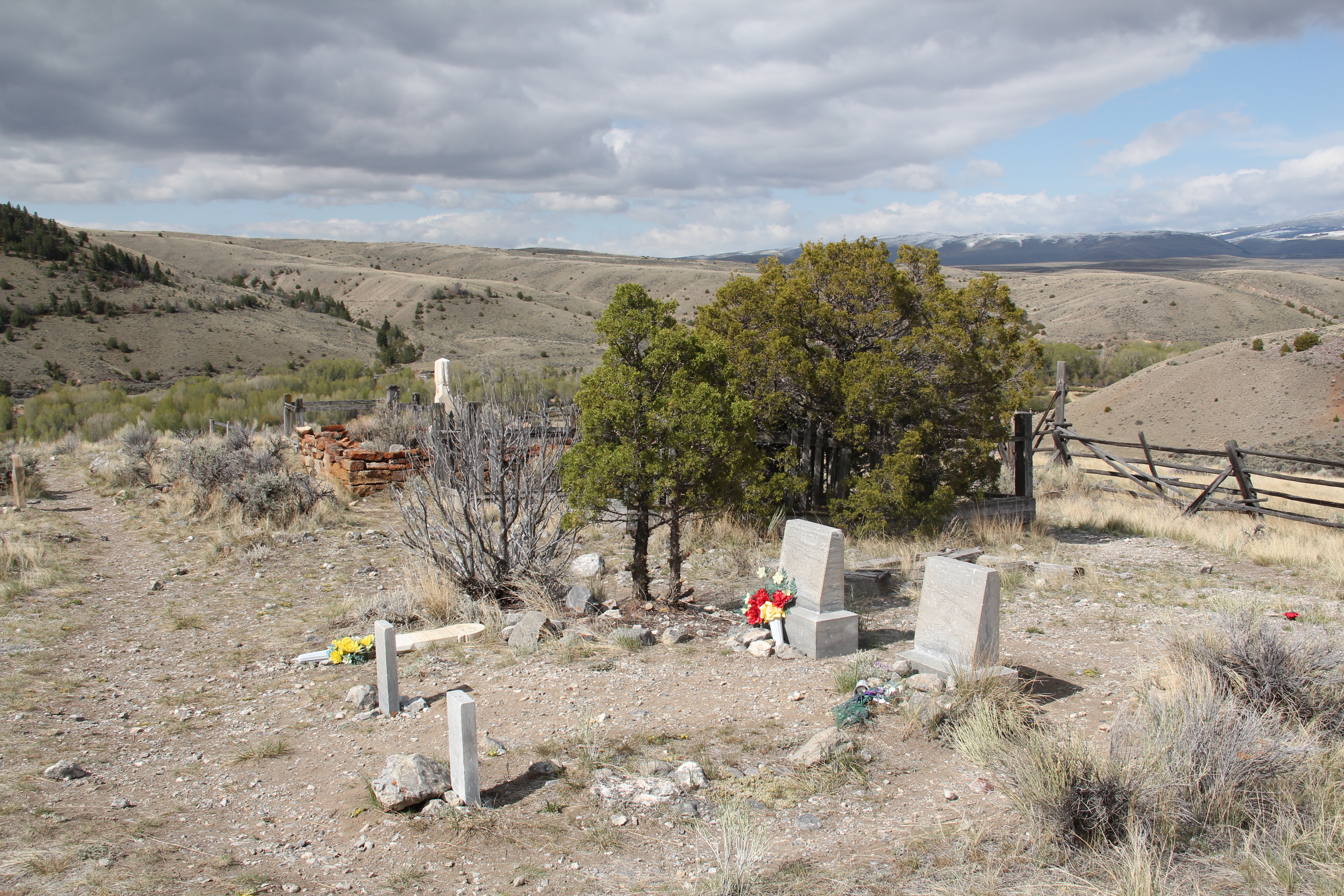


 Virginia City was Montana’s first effort to protect a large district of buildings, and it took place through private initiative. In the late 1980s, out of the earlier fieldwork that decade, I was preparing an article on Montana’s preserved landscapes, and eventually the piece appeared in a book on historic preservation in the West published by the University of New Mexico Press. Virginia City had always intrigued me, because of how the Bovey family admitted to anyone who would listen that their encouragement came from the success of Colonial Williamsburg, in Virginia, where I had began my career.

 “The Bovey family lost interest in the project during the 1990s and at one time it appeared that many of the valuable collections would be sold and dispersed. The State of Montana and thousands of interested citizens stepped forward and raised the money to acquire the
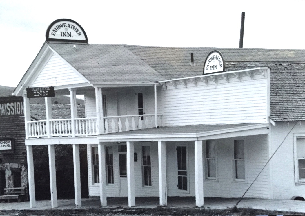


 I am speaking instead of the very interesting historic city cemetery, just a bit to the north. It has a wide of grave markers, that show the confluence of folk burial practices of the mid to late 19th century with the more popular, and mass produced imagery of Victorian burial markers. There are, just as in southern cemeteries, family plots marked by Victorian cast-iron fences. Or those, in a commonly found variation, that have a low stone wall marking the family plots.

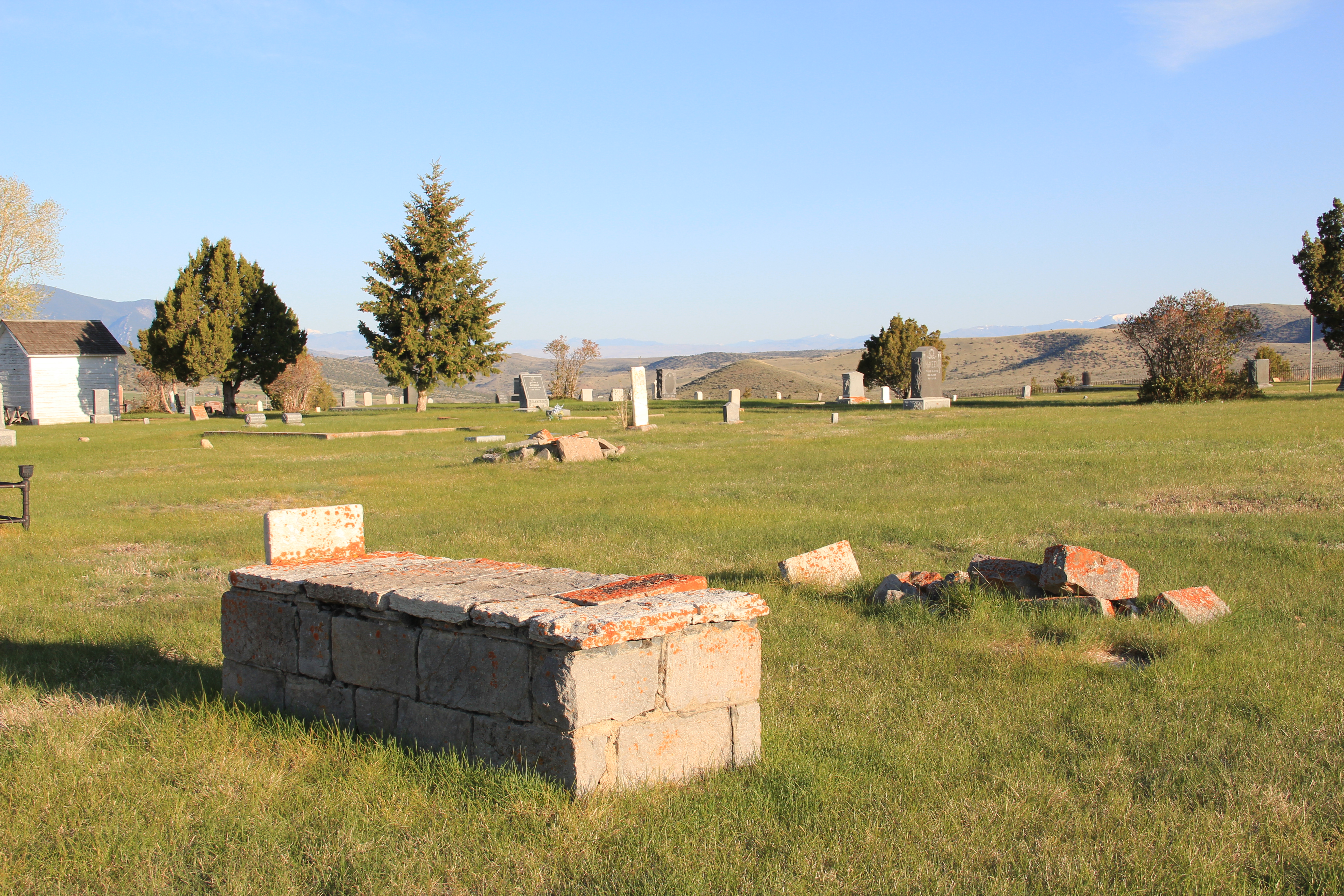


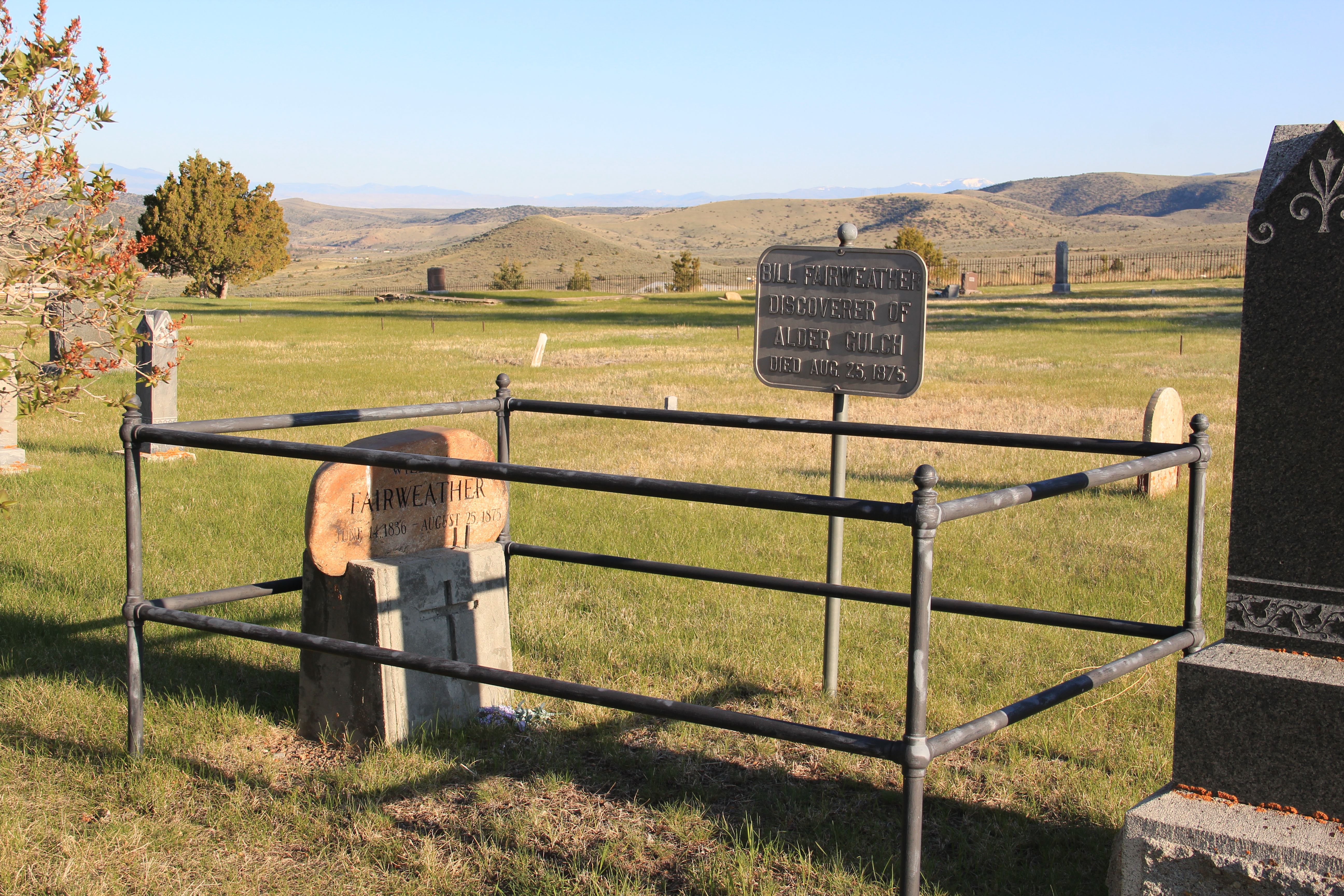
 Callaway’s grave is one of several of individuals significant in the territorial era. Thomas J. Dimsdale, the chronicler of the vigilante movement, is buried here as well as a more elaborate grave site for Bill Fair-weather, which includes a marker that describes him as the discoverer of Alder Gulch.
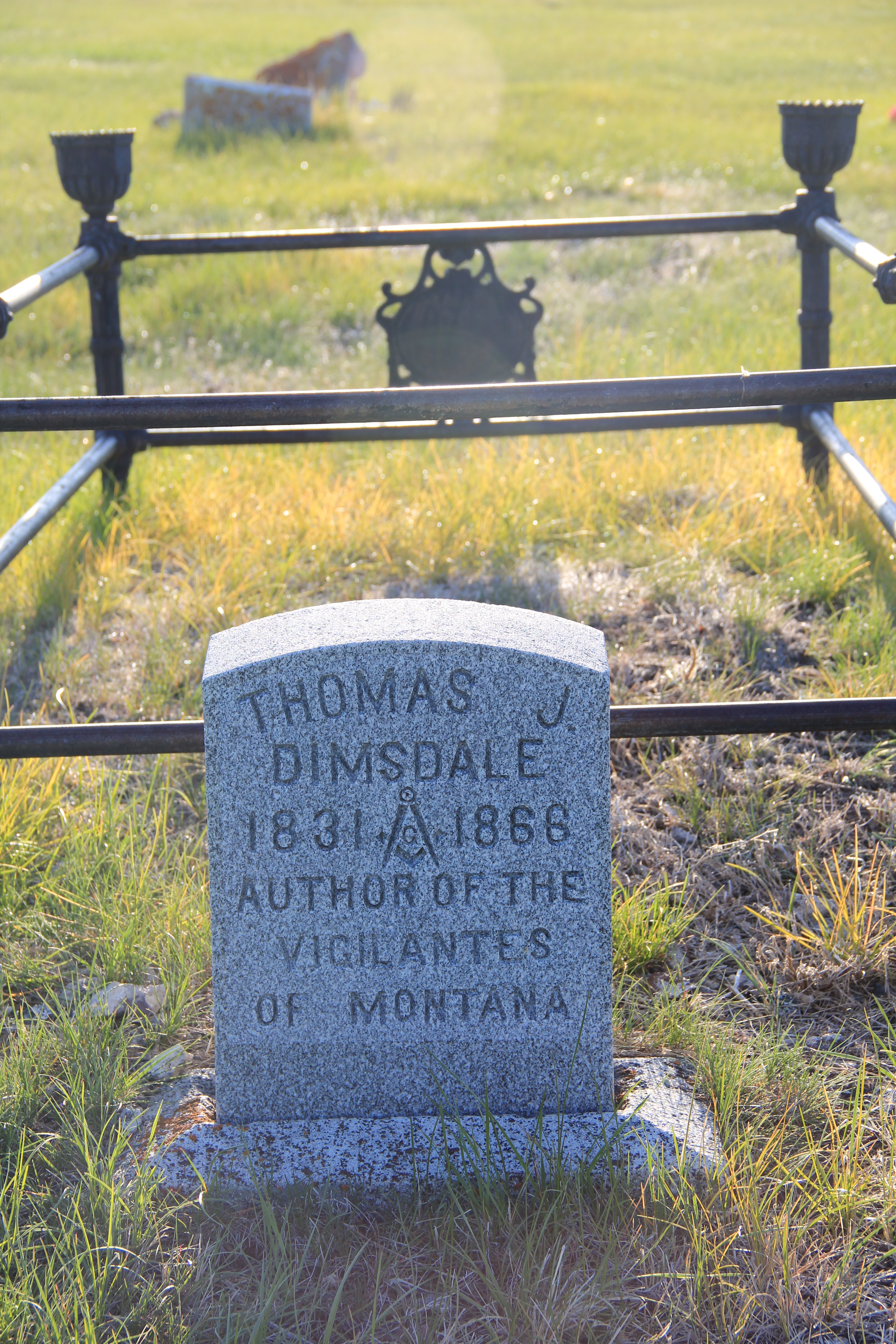


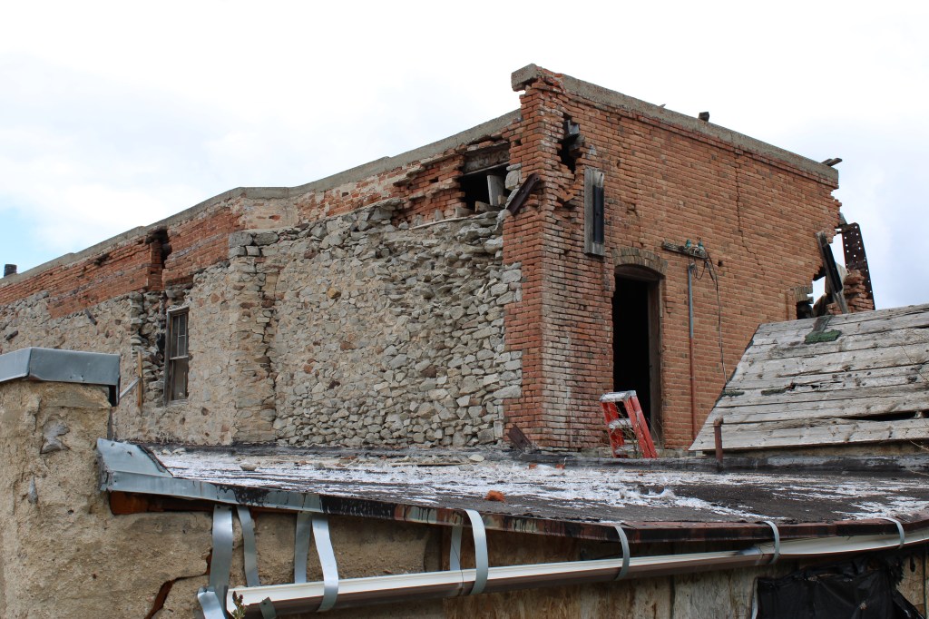
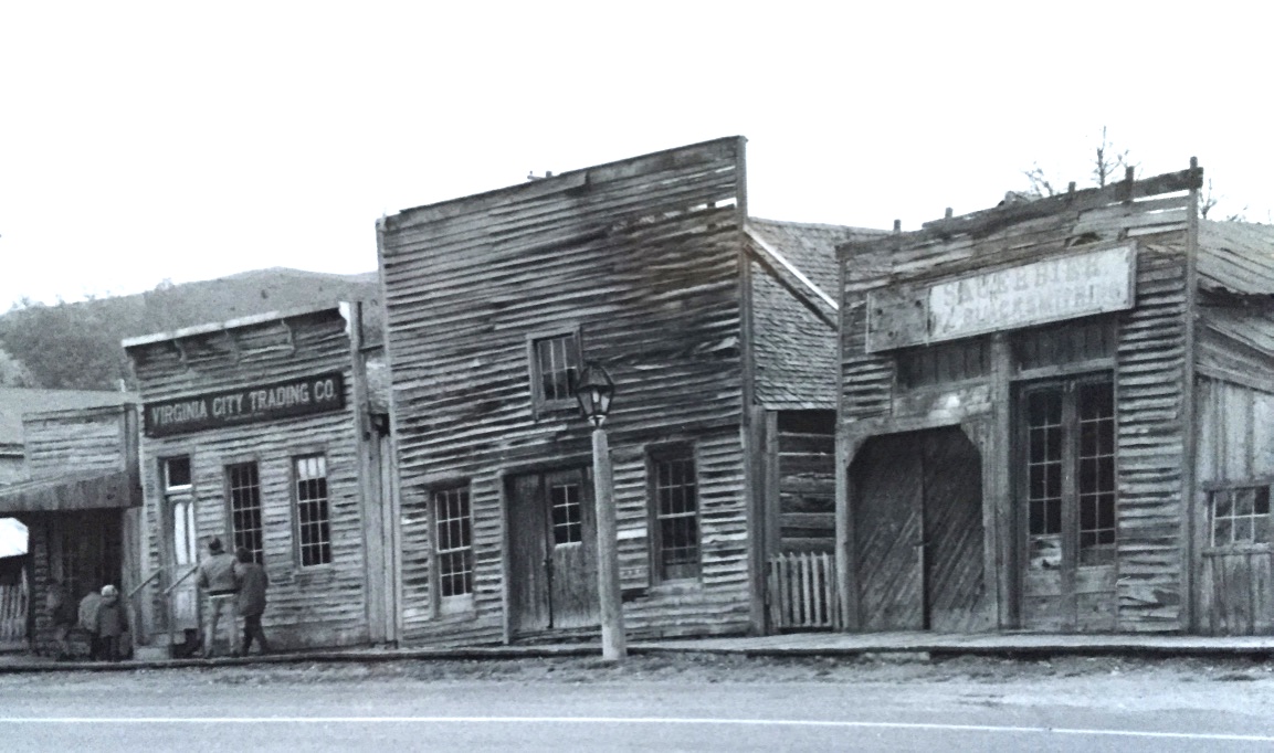
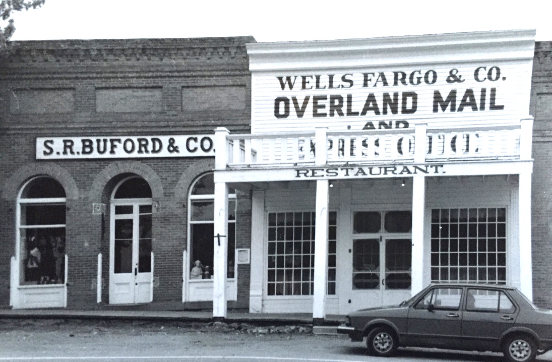
 The impact on the buildings, and the constant efforts of repair and restoration, is very clear today. Virginia City is far from a sanitized outdoor museum environment. Residents still work and live here, but the historic built environment is in better shape than at any time in the early 1980s, as the images below attest.


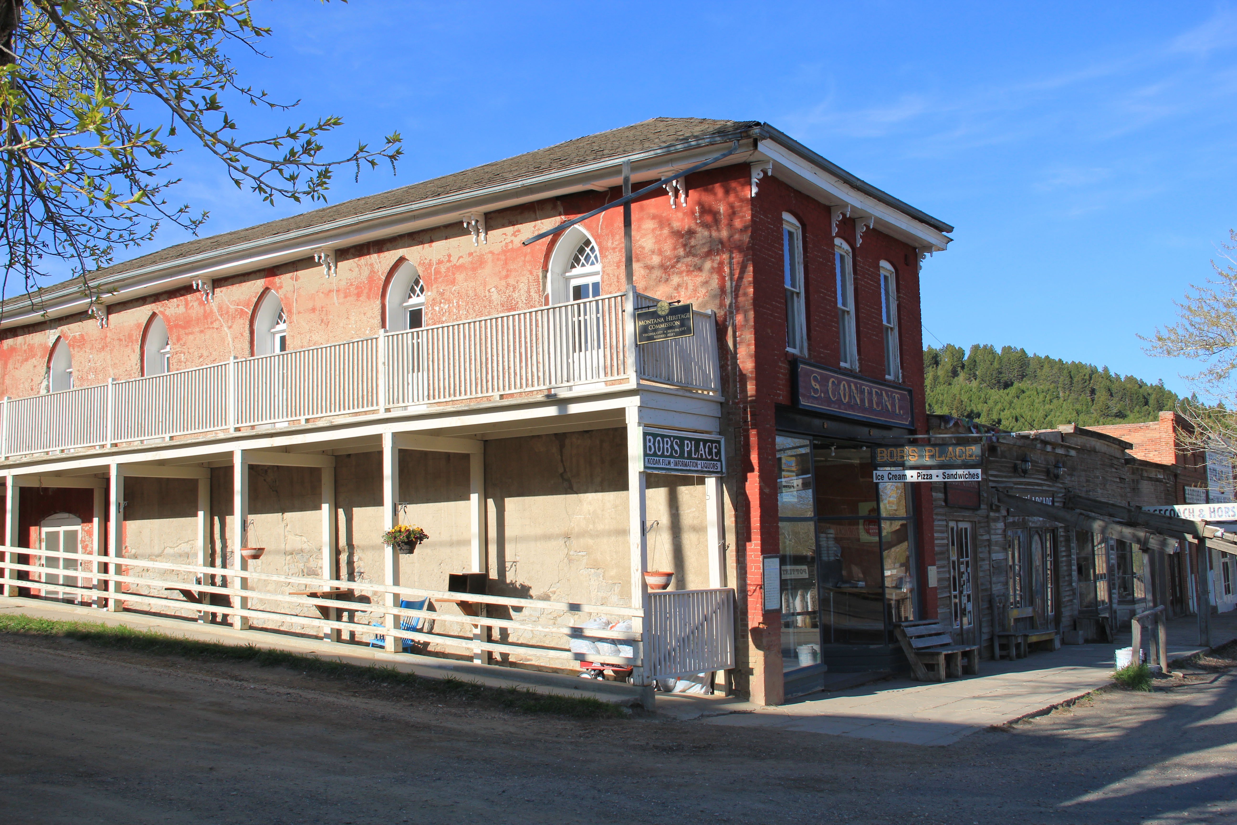 Save America’s Treasures funding has been leveraged with private donations and state funding to shore up the most significant properties. There is also a much greater, and more accurate, public interpretation found through the historic district. Visitors get much


 As the image above of the Smith Store attests, there is no need to paint too rosy of a picture about the future of Virginia City. This National Historic Landmark will always need a lot of care, attention, and funding if it is to survive another century. During the national hoopla of the Civil War sesquicentennial in the first half of this decade, the same sesquicentennial of the gold rush to the northern Rockies (Bannock, Virginia City, Helena, etc.) has passed by quietly. But both nation-shaping events happened at the same time, and both deserve serious attention, if we want to stay true to our roots as a nation.