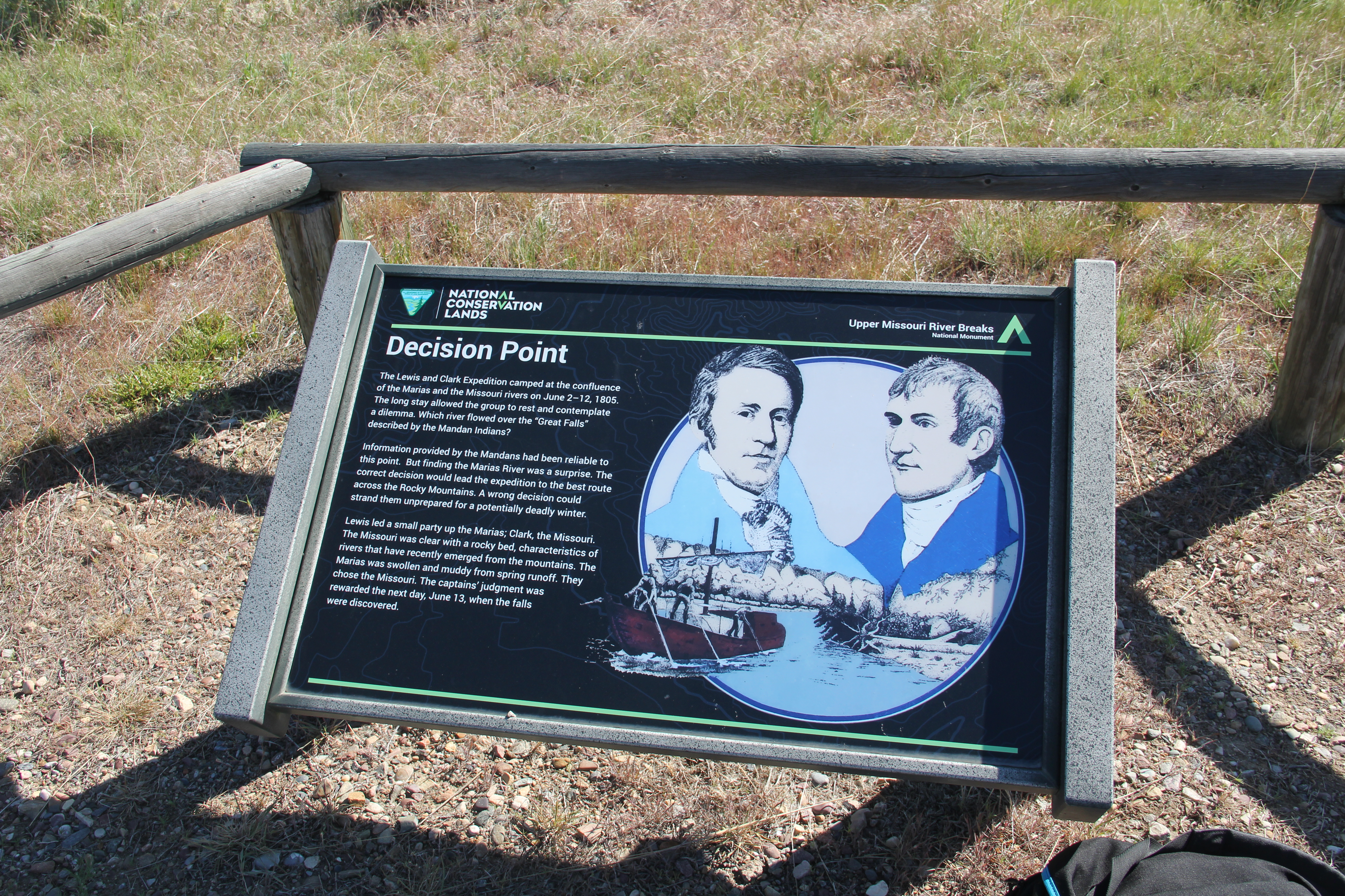
In my 1984 field study for the Montana state historic preservation plan, there were many places that were “known” to Native American tribal historians, students of the Lewis and Clark expedition, and scholars of the northern plains fur trade. But few of these places were provided public interpretation. much less public access. Such was the case with the Lewis and Clark campsite of early June 1805 at the confluence of the Missouri and Marias River.


The campsite became known as decision point because as the expedition rested and regrouped there, they also decided which river to follow. After initial investigations, the members chose correctly and soon found themselves at the great falls of the Missouri River.
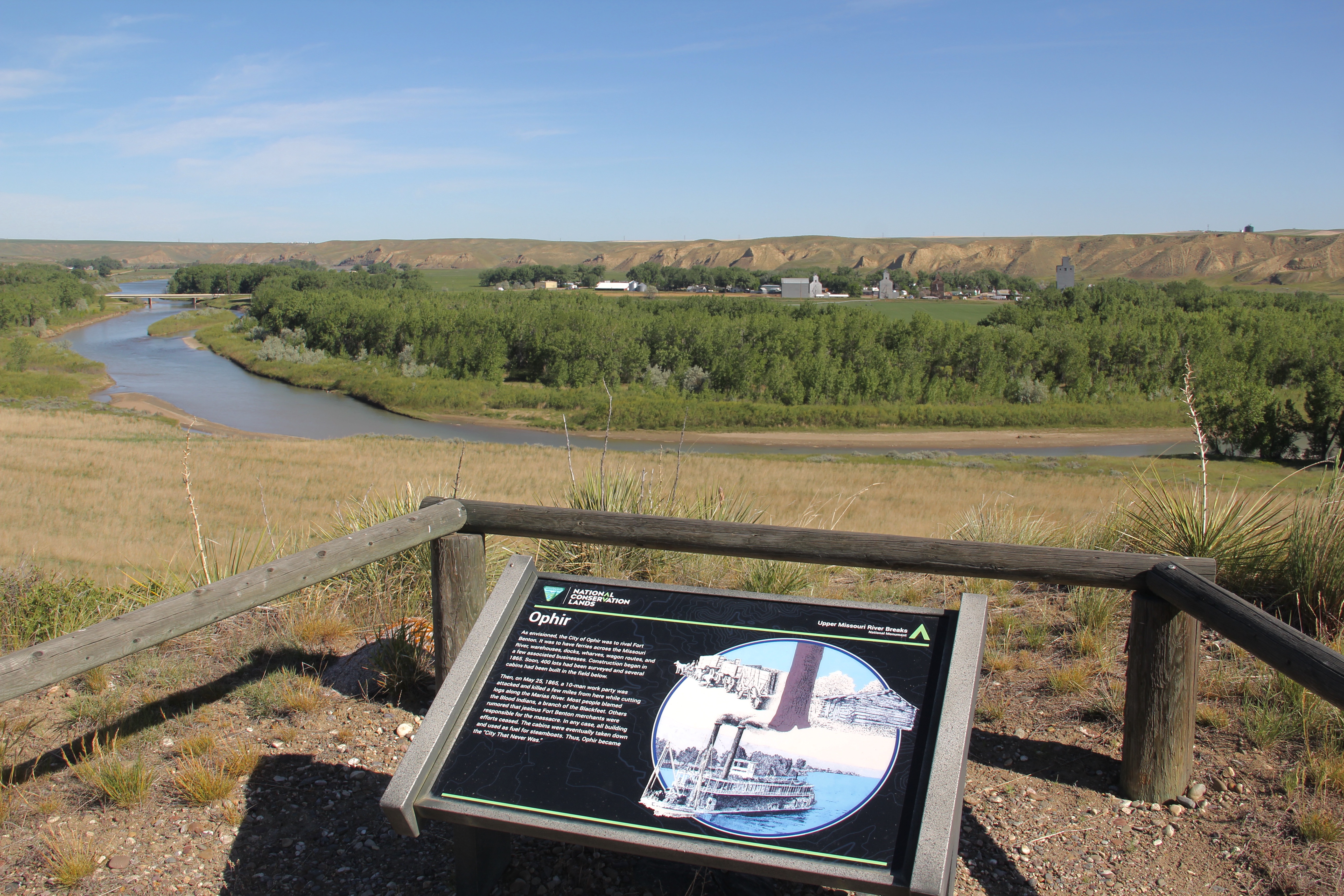
When I carried out my 1984 work, everyone knew that the confluence was at Loma, seen in the background of the photograph above. But access to the actual location and significant public interpretation was still to come. As I have written in numerous prior posts, one of the most significant changes from 1984-1985 and my recent work in Montana from 2012 to 2021 is the amount and quality of public interpretation and public access to significant historical landscapes. There has been a huge improvement, and Decision Point is an excellent example of federal agencies working with landowners and state and local government as part of the Upper Missouri River Breaks project.
The image above tells the story of the steamboat Ophir and the amount of river trade that once marked the Missouri River. The interpretive marker below tells the story of the early American Fur Company trading post known as Fort Piegan.

Even if you are not into the history of the region, the overlook created and maintained by the Upper Missouri River Breaks National Monument is a beautiful vista, and conveys strongly the landscape as encountered by generations of Native Americans and then in much more rapid succession by the Lewis and Clark expedition, American and Canadian fur traders, steamboat travelers, and by the 1880s the tracks of the Great Northern Railroad. An absolutely stunning historic site.