Montana newspapers this week featured a story about economic resurgence in Great Falls, where the population has remained basically level in the 21st century while other Montana cities have grown by leaps and bounds. Readers of this blog recognize that I am a big booster of what heritage and historic preservation has meant to the city, and certainly that pride in history and culture you find anytime you visit Great Falls as I found during a fall 2025 visit.
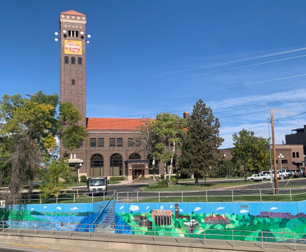
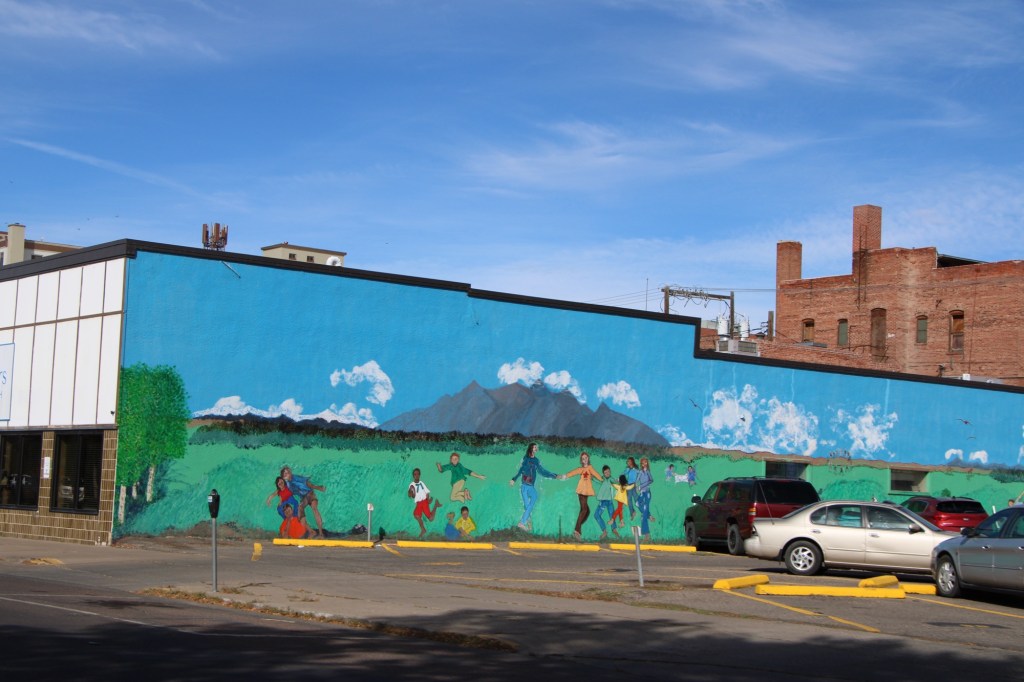
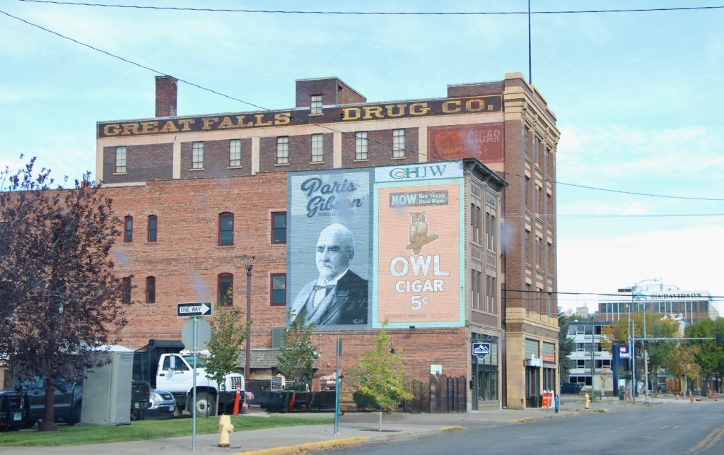
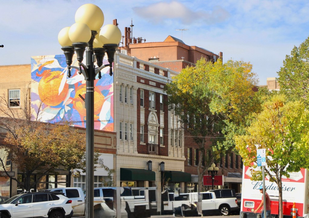
The proliferation of colorful, descriptive murals enliven downtown commercial buildings, including the highway underpass at the restored Milwaukee Road passenger station. the topic has been historic—witness the penetrating graze of town founder, Paris Gibson, below.
Or if it is a more abstract design in the city’s commercial heart ( the reproduction city street lights add charm too).
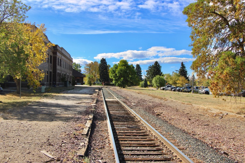
Downtown recreation is another positive change, as the river trail between the tracks of the Great Northern Railway and the Missouri River continues to expand and improve.
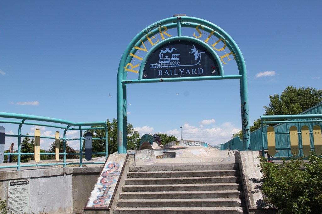
One of the state’s best skateparks also adds significantly to recreation, and community building in Great Falls.
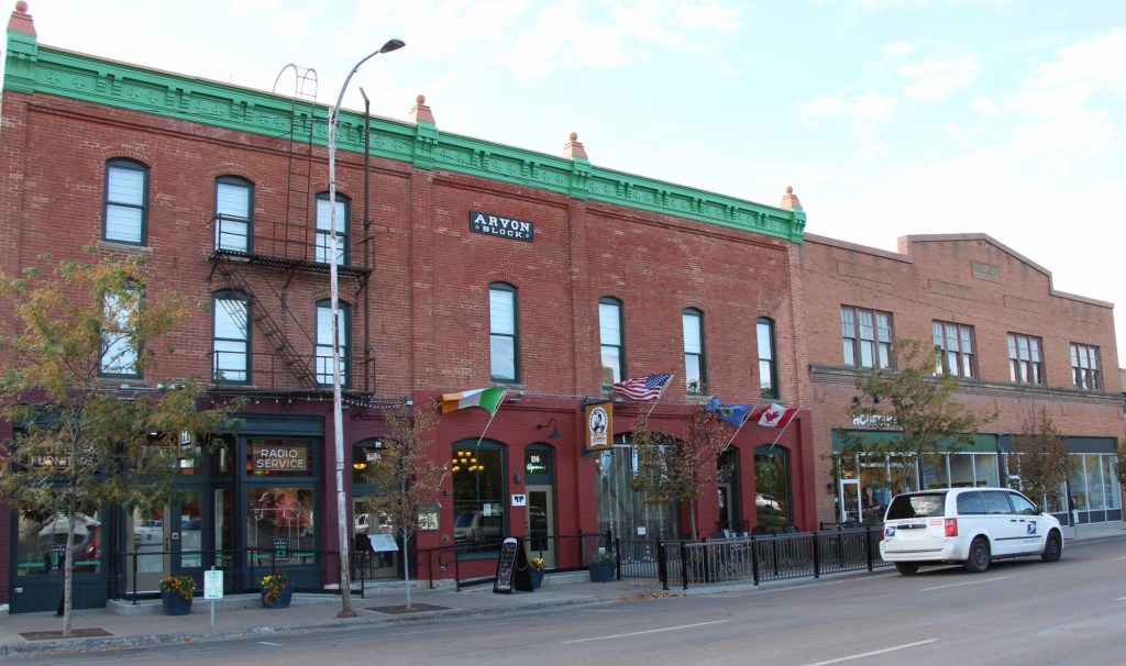
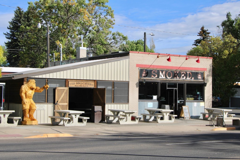
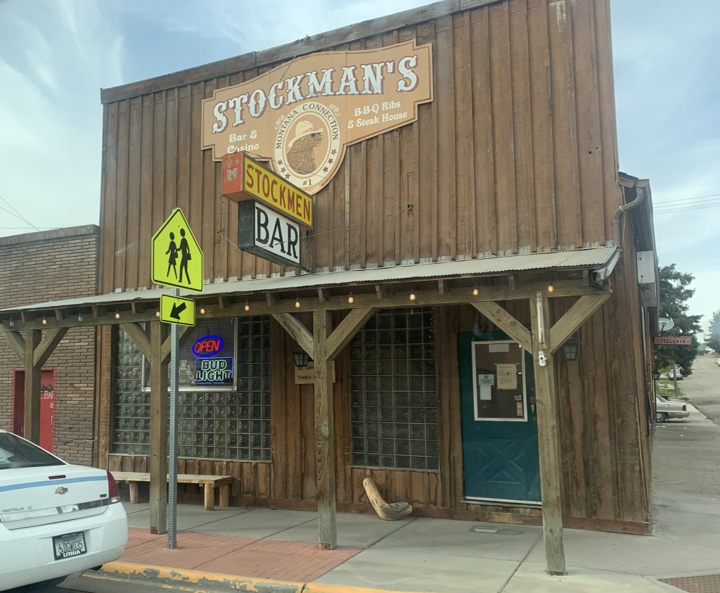
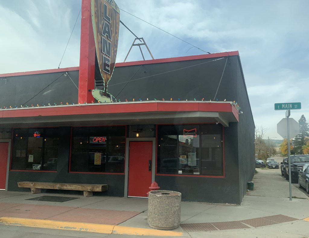
And speaking to community building the restoration and adaptive reuse of downtown buildings create nighttime gathering spots, giving residents plenty of reason to come downtown. The Celtic Cowboy, located in a circa 1890 livery building, has become a popular pub while the owe era of Smoked took a 1930s building and made it a must-stop place for Barbeque.
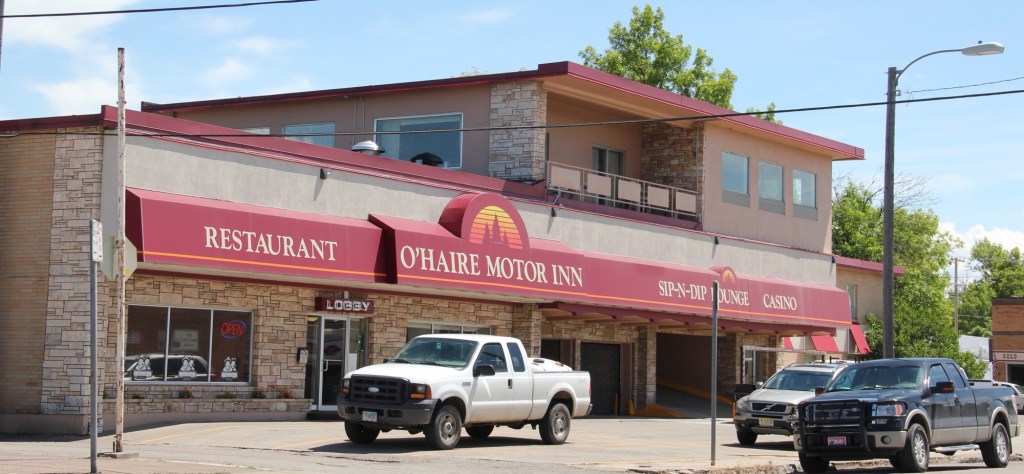
Even the iconic Sip-N-Dip lounge has announced a renovation and improvements to this mid-20th century landmark.
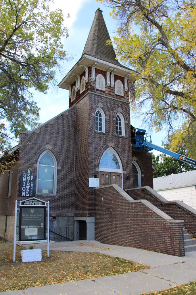
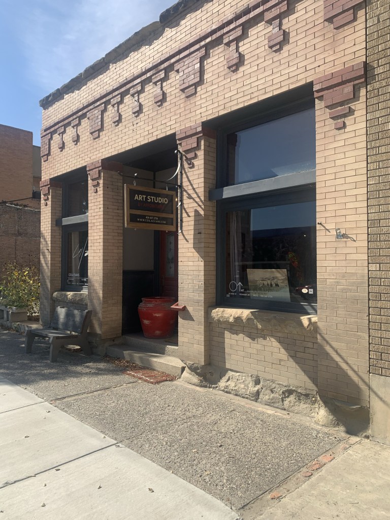
My stop in Great Falls last October centered around a check of the renovation of the National Register-listed Union Bethel AME Church. Like many others I supported its grant application and I was pleased to see work underway to ensure another 100 years for this landmark.
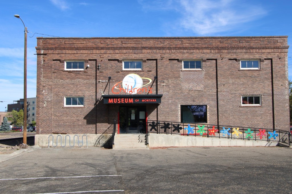
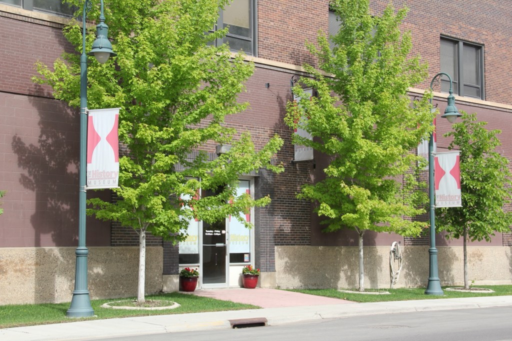
No doubt the protection of the city’s historic buildings and finding new community uses for them continues as an anchor for Great Falls, be it the Children’s Museum or the impressive History Museum and Archives. Both are located along the city’s historic railroad corridor.
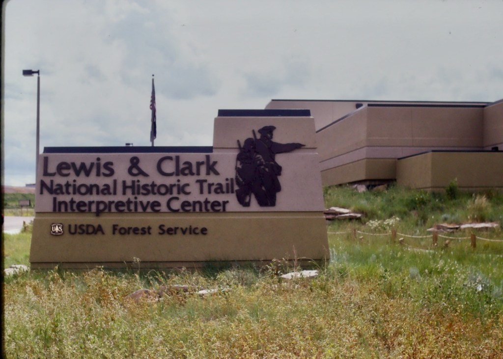
Preserving and telling local stories but Great Falls is further enhanced by two major national institutions—the Lewis and Clark National Historic Trail interpretive center and the Charles M. Russell Museum.
The Russell continues to expand, and amaze, as it evolves from a regional to truly national cultural center. The city too is trending in that direction, which means that next visit will certainly be sooner than later.
When I lived in Helena from 1981 to 1985 one of my favorite jaunts was along U.S. Highway 12 from Townsend to Roundup. It remains so today, 40 years later. My initial interest centered on railroad corridors. Helena to Townsend followed the Northern Pacific Railroad and a good bit of the Missouri River (now Canyon Ferry Lake).
Northern Pacific bridge over Missouri River near TownsendMissouri River and Canyon Ferry valley near TownsendMissouri River campground near Townsend
It was a brilliant day with fall colors just popping as we left US 287 and turned into the heart of Townsend.
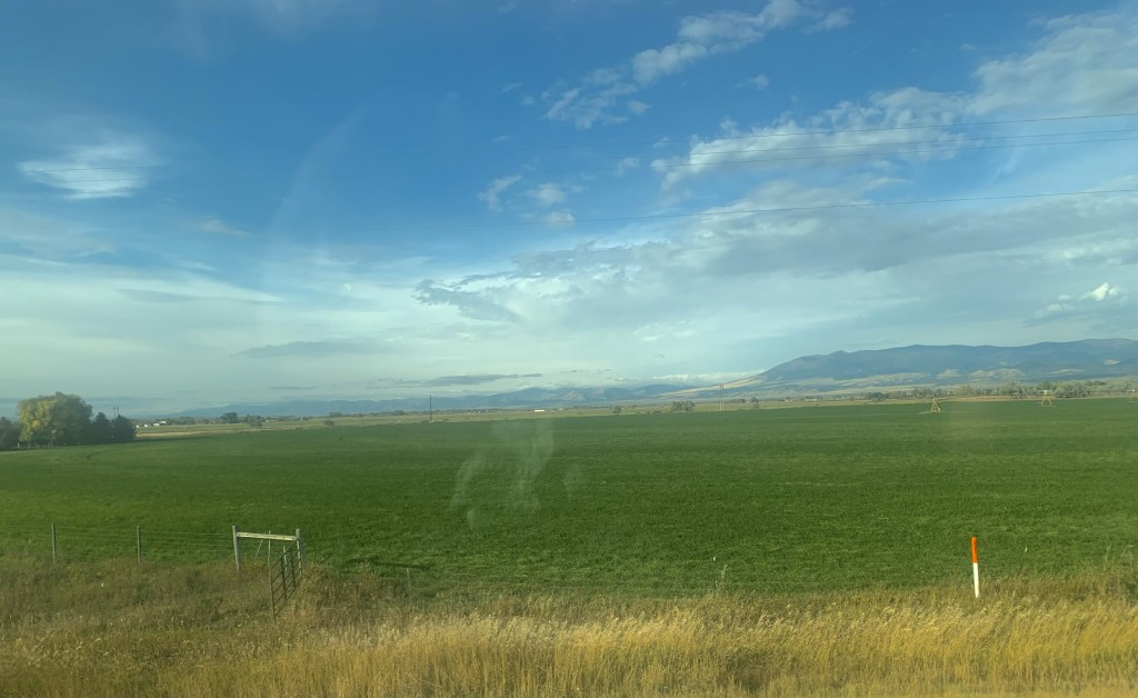
As soon as you leave town to the east you encounter a lovely mix of ranches and irrigated fields until you thread your way through a national forest along Deep Creek.
Fall colors along Deep Creek
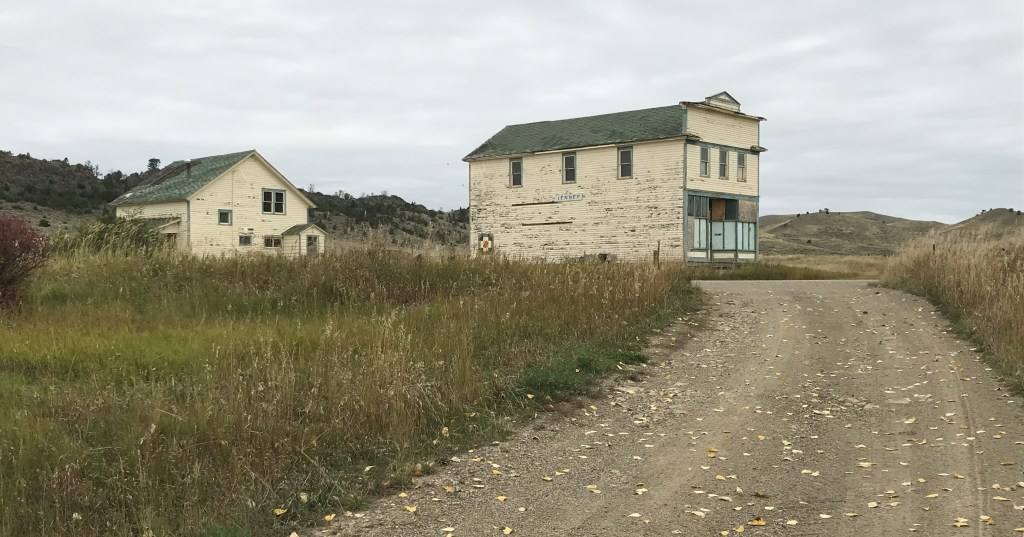
We decided to continue east by briefly jumping off US 12 and go to Montana 284 so we could follow the Milwaukee Road corridor from Lennep to Martinsdale where we would reconnect with US 12. Two of my travelers had never been to the Milwaukee Road “ghost town” of Lennep. It was a beautiful morning to be there.
Milwaukee Road powerhouse
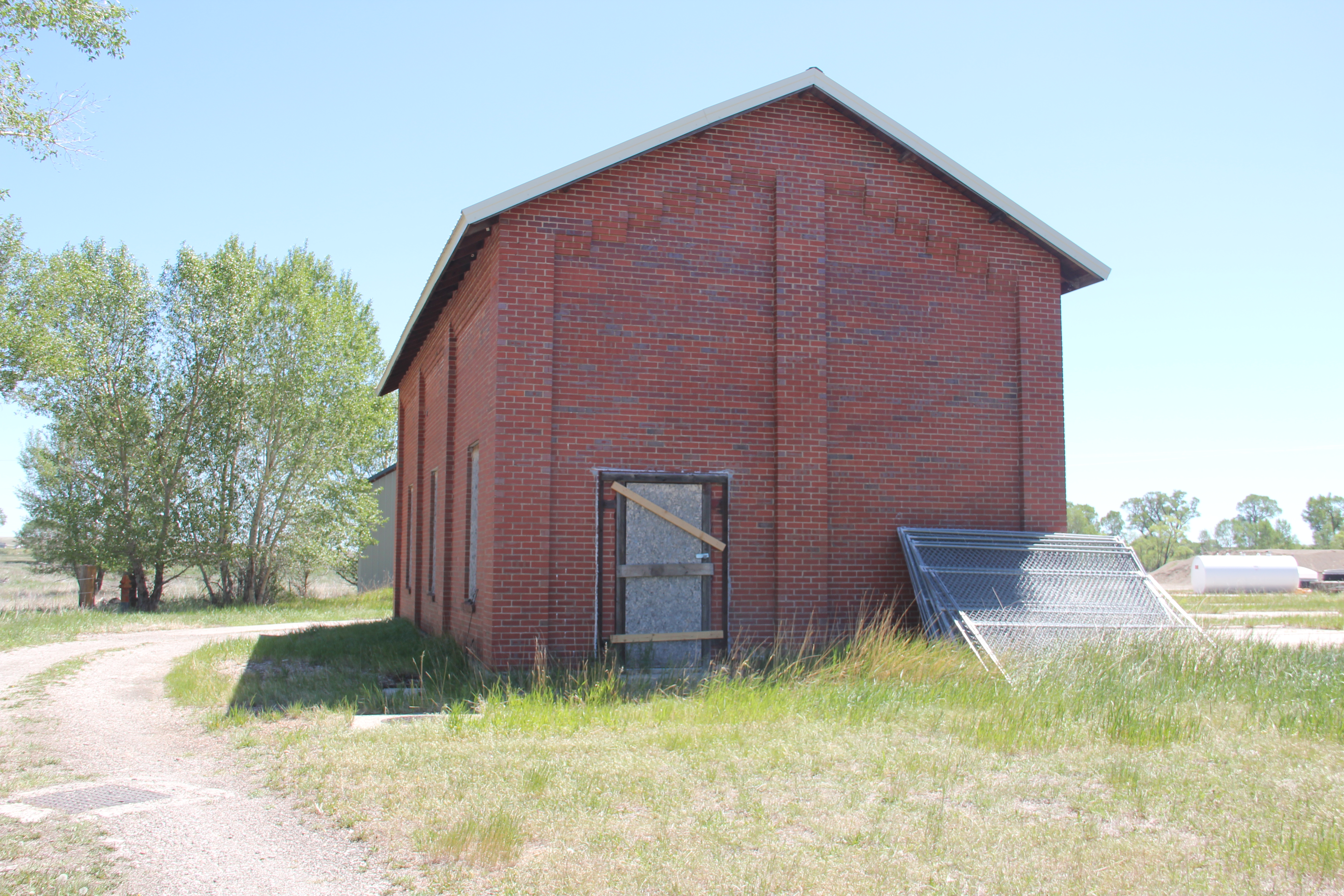
You first realize that this abandoned railroad corridor is different when you encounter an electric powerhouse—the Milwaukee Road’s tracks were electrified from Harlowton Montana west to Idaho.
Lennep
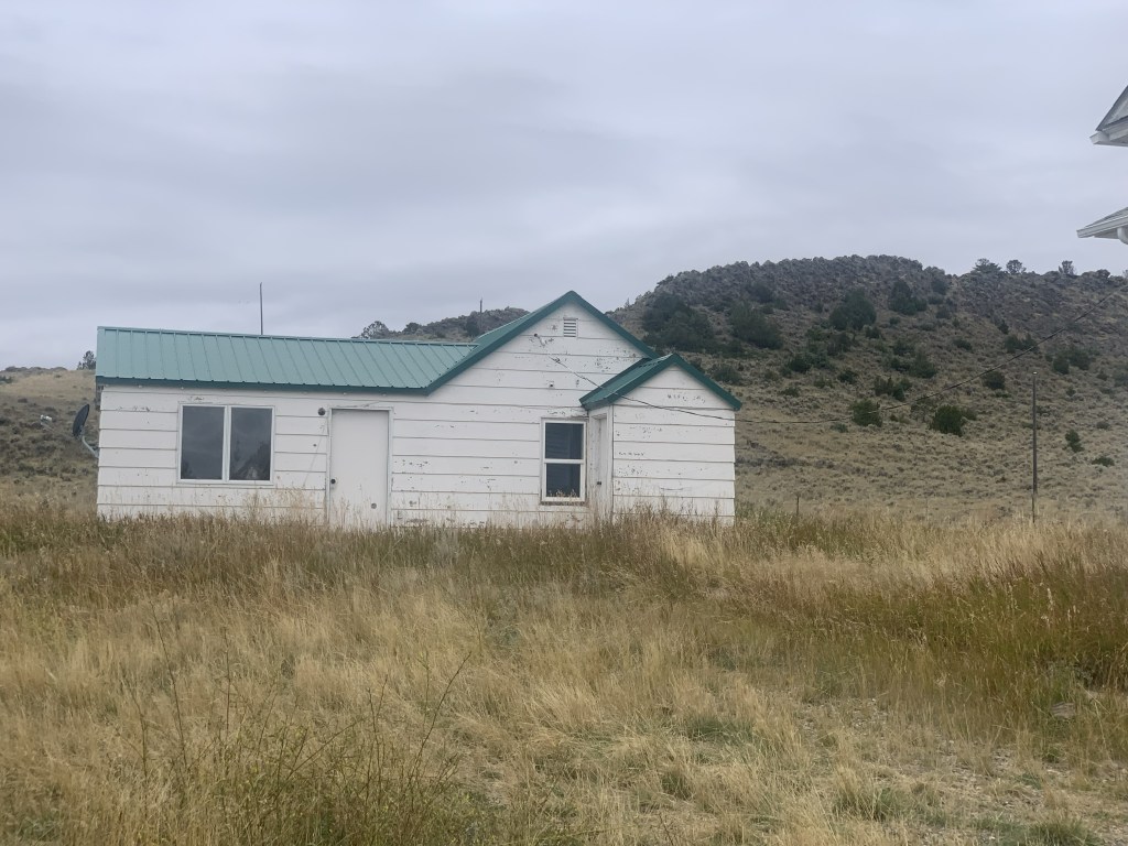
At Lennep the landmarks remain—the Trinity Lutheran Church, the store, the school, a teacher’s cottage and an early notched log house—but all were a little worse for the wear compared to my last visit 10 years earlier.
As we traveled east that morning we quickly moved through the county seats of Harlowton and Ryegate to get to Roundup by lunch. The Musselshell Valley was brilliant even as signs of the old railroad almost disappeared.
Near Ryegate Near Lavina
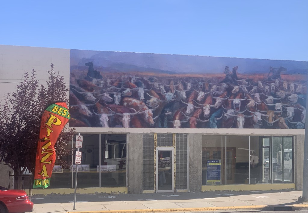
Roundup continues its renaissance with new businesses and restored buildings. The town core, clustered around the intersection of US highways 12 and 87, was busy on a fall weekend.
A mural on the great cattle drive of 1989The Backporch—great bbqNew mural at the KegArt studio doing wellAwaiting its renovation Community green spot
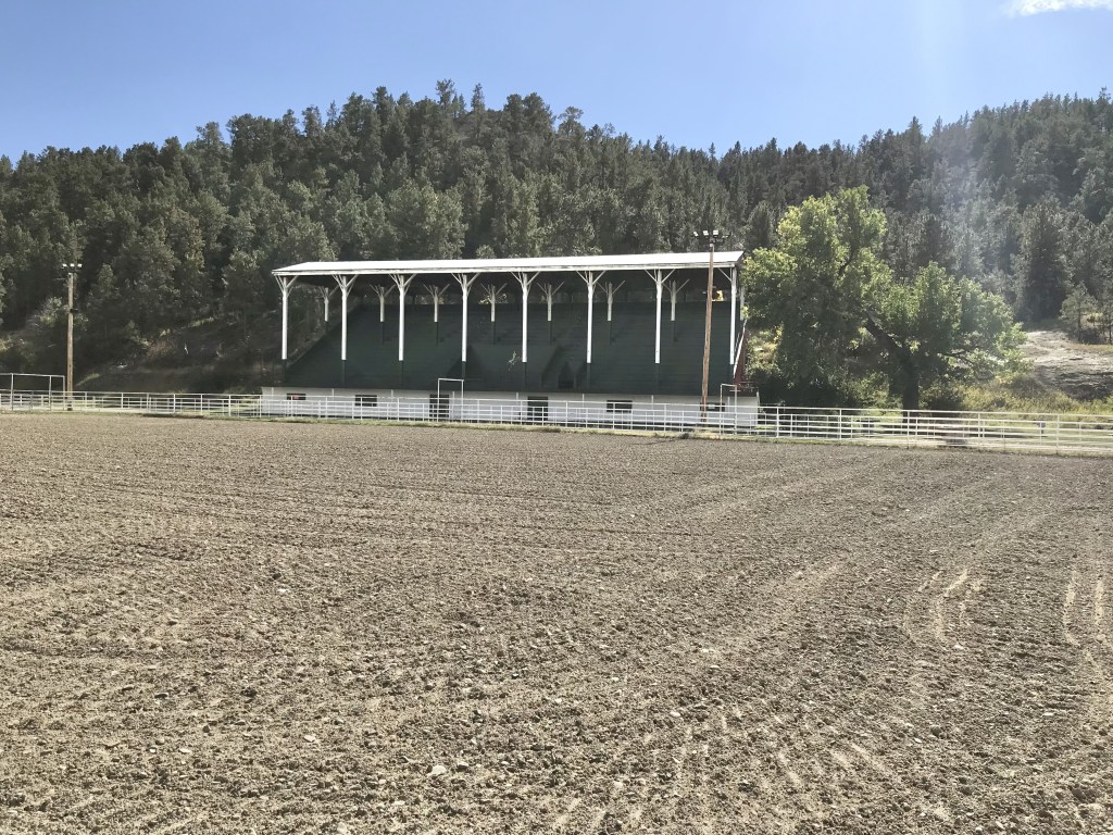
As I observed a few years ago Roundup residents worked together and created a plan—and the place continues to work the plan, from the adaptive reuse of its historic stone school to the careful stewardship of its historic fairgrounds. It’s impressive.
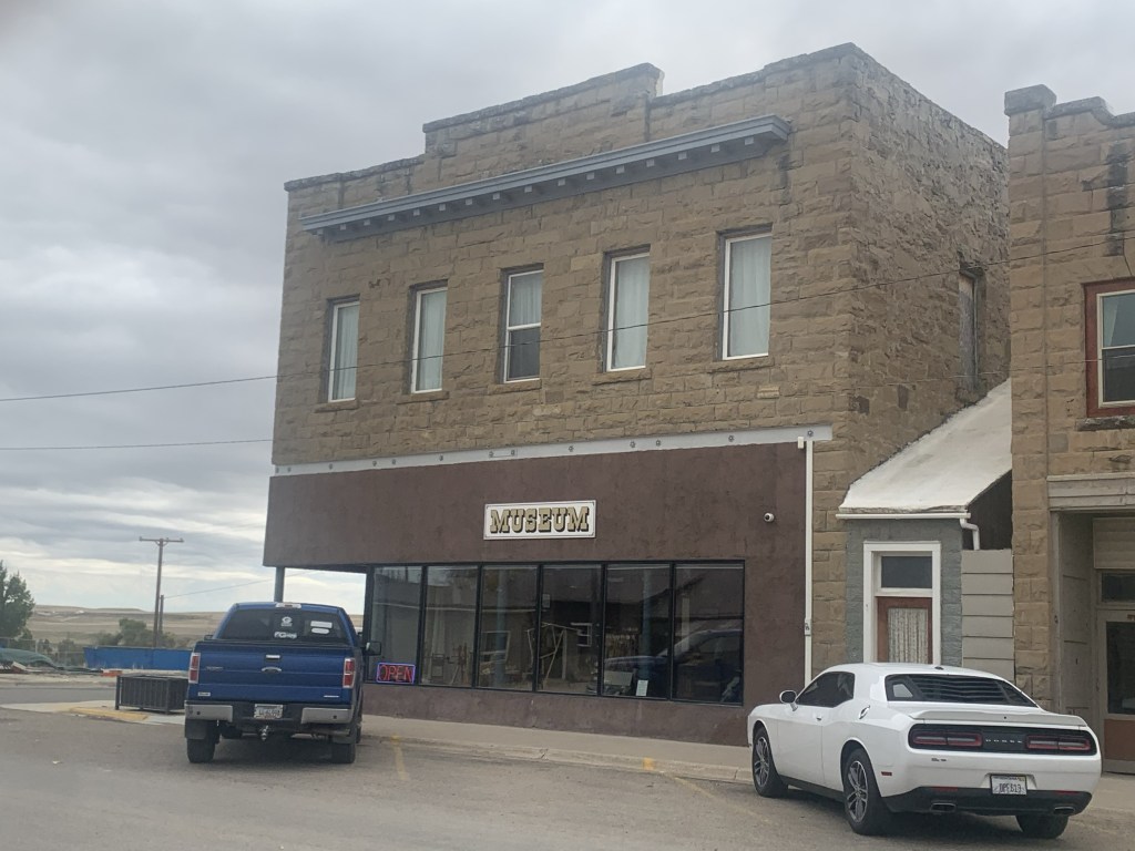
After Roundup we stopped at two county seats on the return to Helena. Harlowton was rocked by the closing of the Milwaukee Road over 40 years ago. It has struggled to reach the economic comeback achieved at Roundup. But the historic stone buildings have great potential. Three of them are now part of a large museum complex.
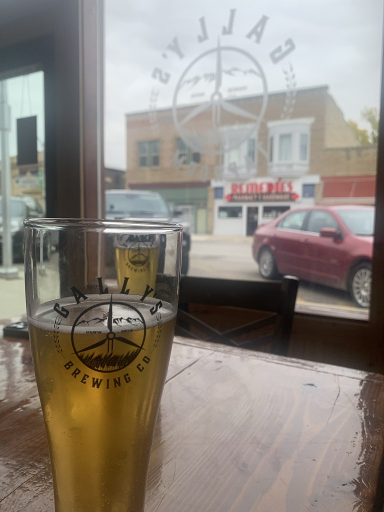
Then there’s the newcomer: the Gally’s microbrewery and pub, housed in the 1913 Montana Block.
It’s a great place for local beer and good conversation—and maybe the start of something good for the town.
US Highway 12 was torn up for major repairs when I last visited White Sulphur Springs last decade. The improvement along its population growth and the ever expanding hot springs gives the place a new look, reflected in new catchy fronts to local bars along with new businesses such as a huge Town Pump.
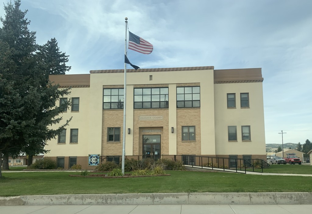
But historic White Sulphur Springs is doing ok too: the New Deal constructed Meagher County Courthouse is still a roadside landmark while the old railroad corridor, just west of the Hot Springs, remains, awaiting its rebirth.
These places are mere highlights along a historic route that’s worth a drive anytime in the fall.
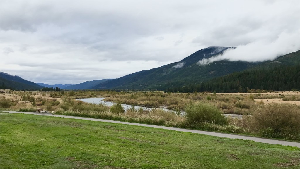
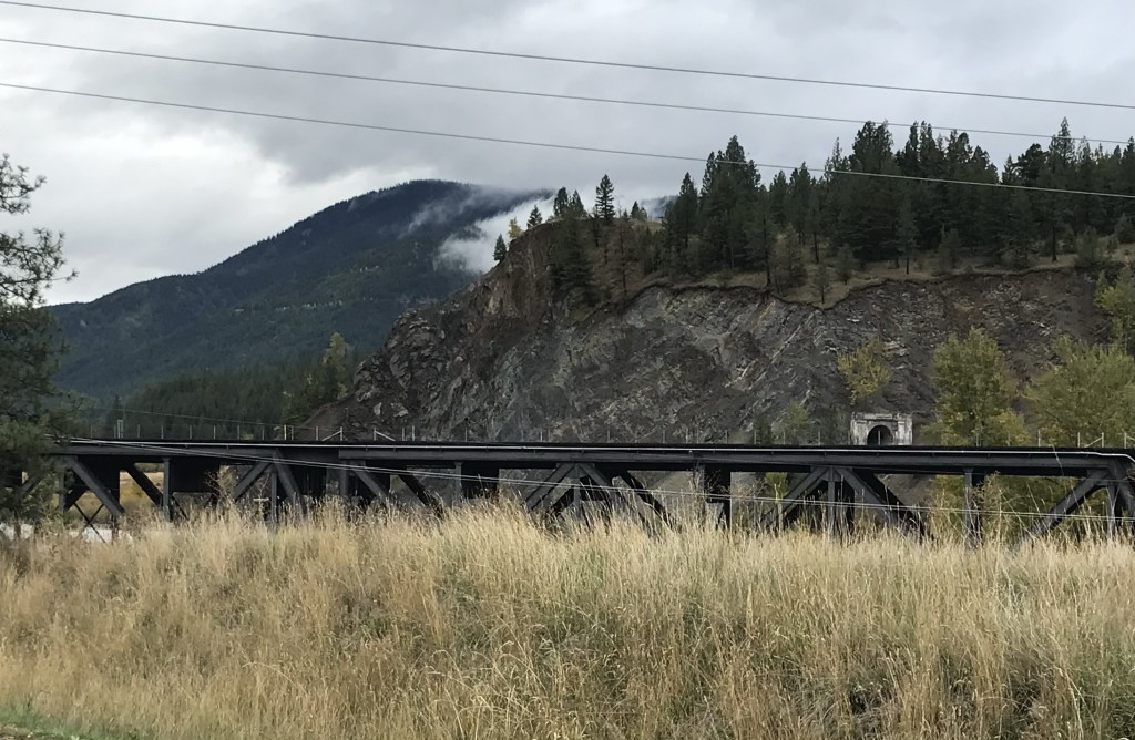
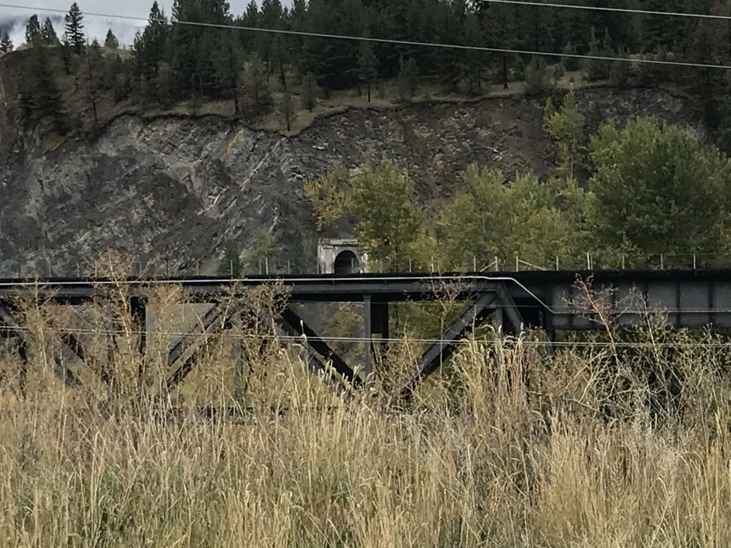
When I last explored Bonner and Milltown in 2015, the effort to reclaim the river landscape created at the confluence of the Blackfoot and Clark’s Fork rivers—but long hidden by past industrial uses—was underway but far from finished. At the end of September 2023 I was able to return to the park and see the transformation myself. It is a quite remarkable super-fund project that restored a natural landmark but also told a significant historical story.
At the confluence section of the park, the removal of the dam is now 15 years old and while you can still visualize its location, to many it must look like a place that hasn’t changed in decades.
The interpretation kiosk relates the changes well but I like how the park is not inundated with markers. Paved trails take you everywhere, and give you an up close but safe way to view the steel bridge of the Northern Pacific Railroad’s mainline along with the nearby but now abandoned tunnel for the Milwaukee Road.
Talk about a transportation crossroads for the Mountain West—still a great site from the Milltown Bridge where you have bridges for Montana 200, the Interstate and the two railroad lines easily viewable from the pedestrian bridge.
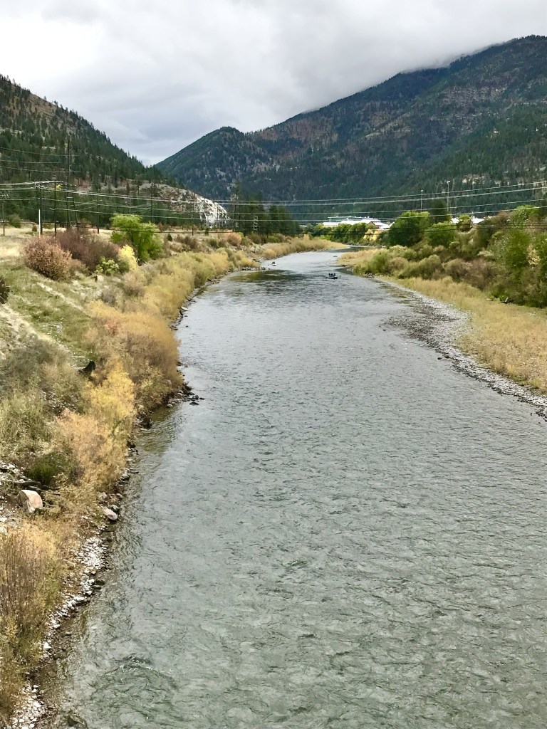
Trails that link the pedestrian bridge to the river were not complete in 2014 but now they are finished and give you another opportunity to go to the Blackfoot river bank.
Milltown State Park is a remarkable historical landscape, whether you explore by hiking, biking or by boat.
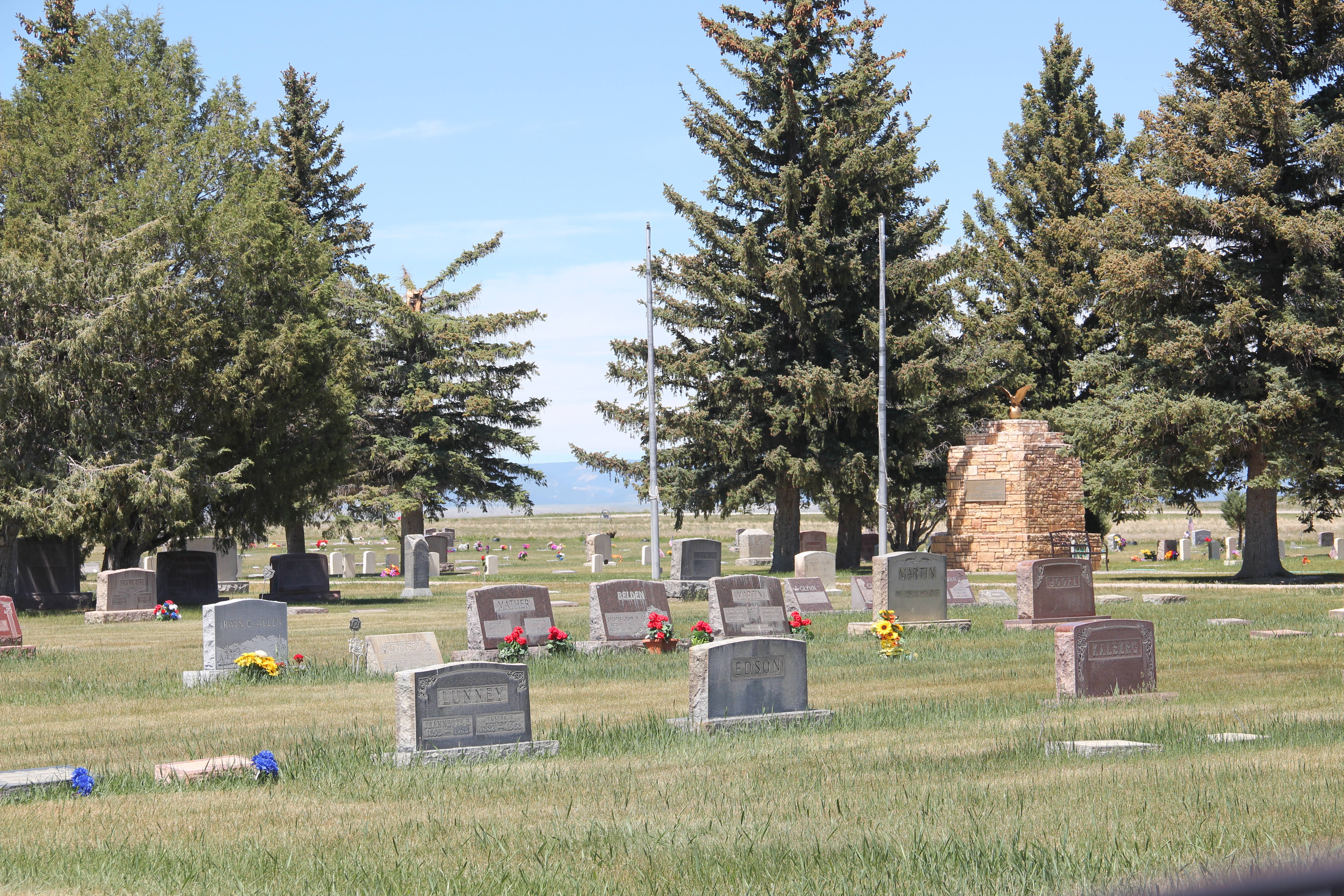
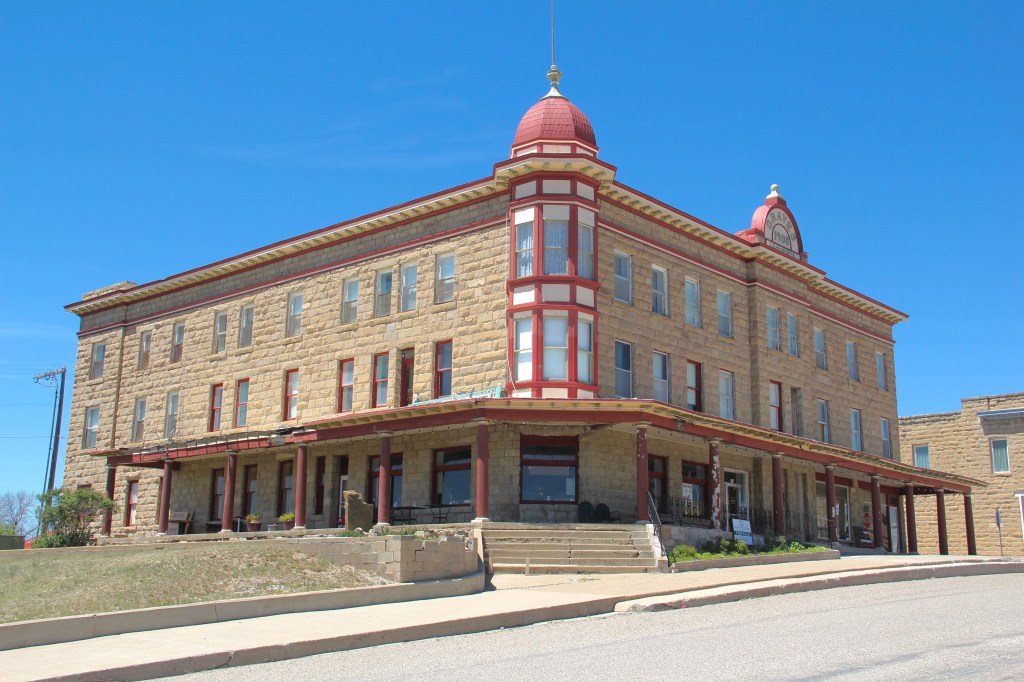
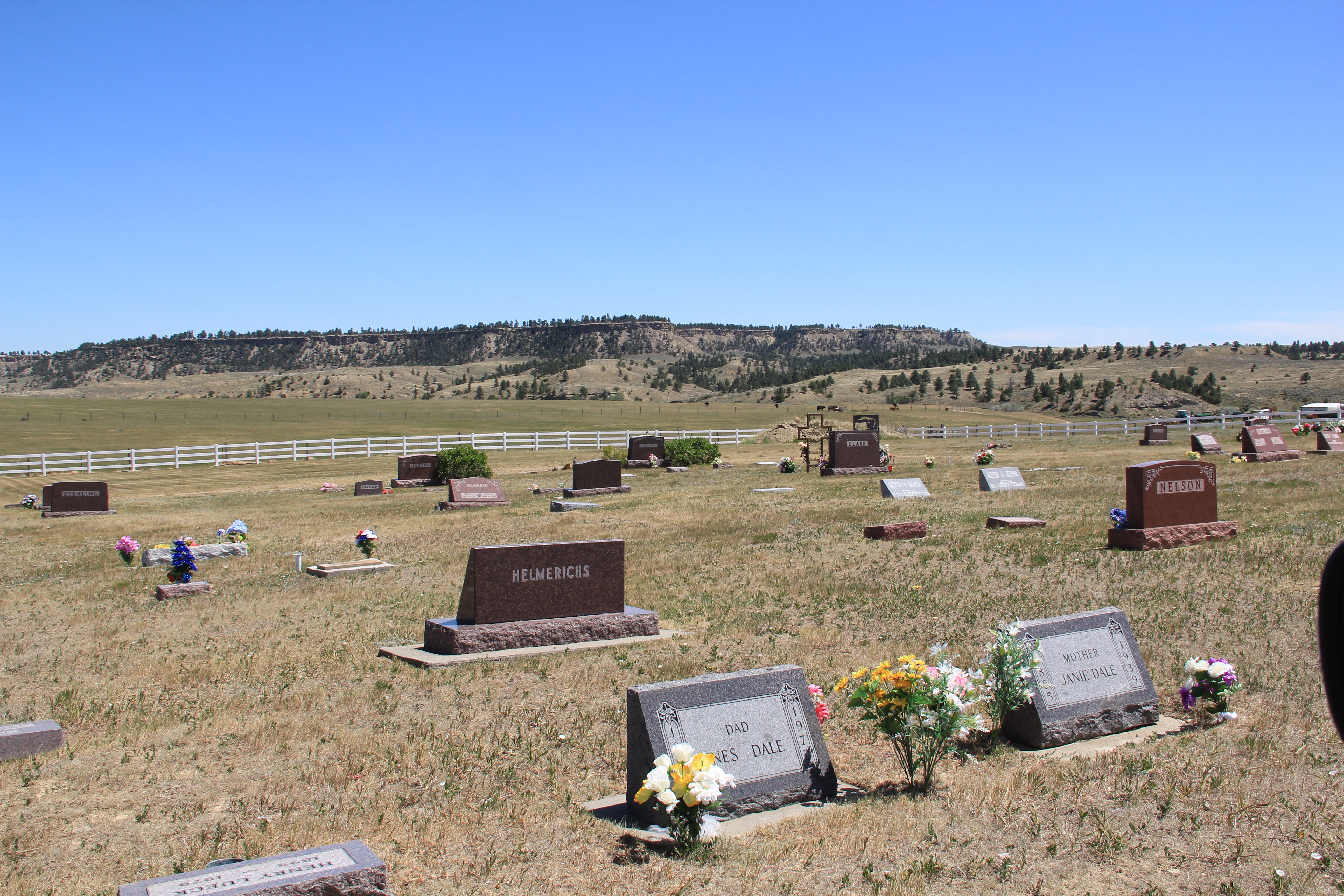
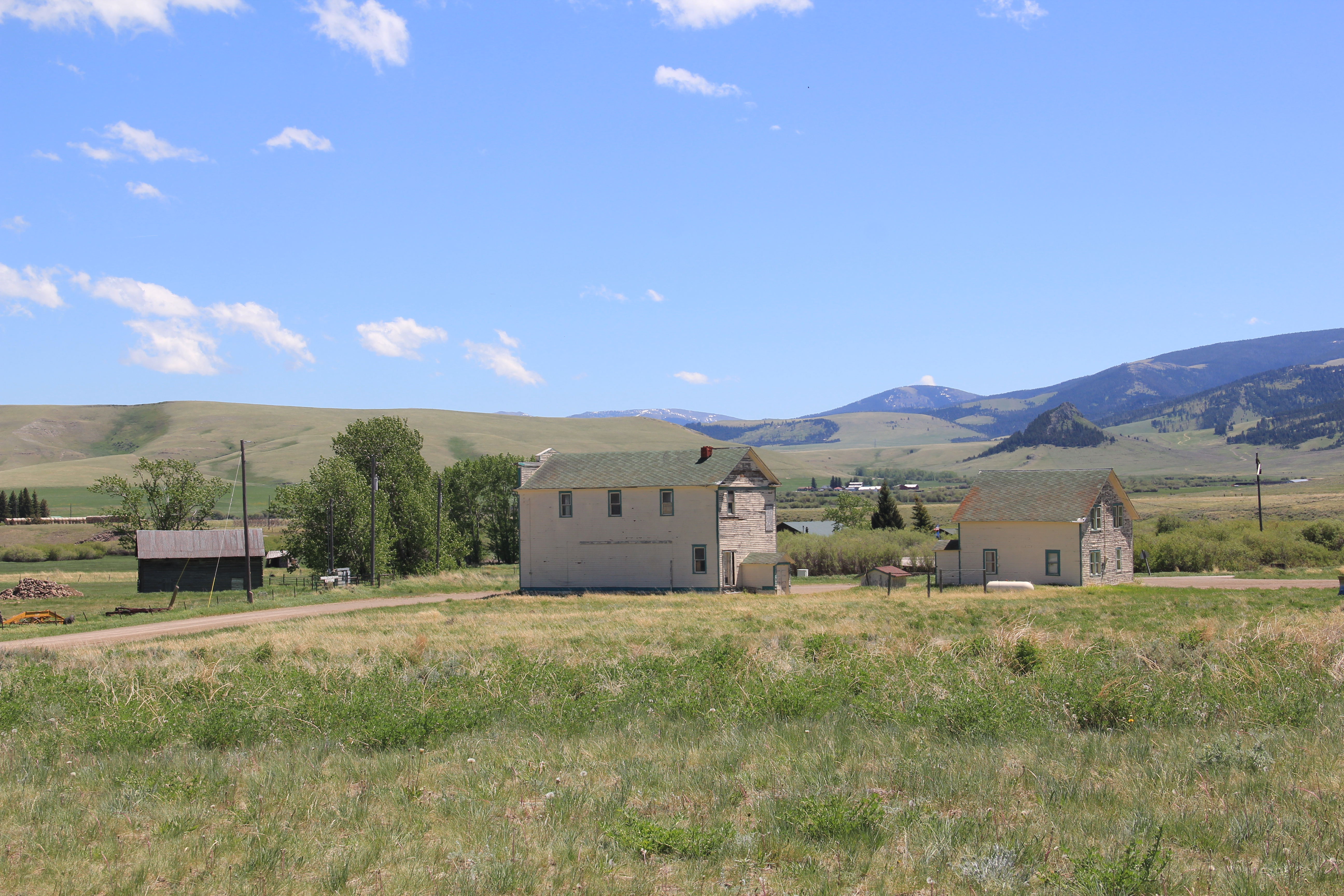
My exploration of historic town cemeteries in Montana over the last two years ends at one of my favorite county seats, Harlowton, the seat of Wheatland County. Located on bluffs overlooking the Musselshell River, Harlowton is a classic railroad town, full of interesting and architecturally compelling buildings.
The two cemeteries share that significance. The city cemetery dates to c. 1907 and coincides with the construction of the Milwaukee Road through the valley.
A key focus of the cemetery is its veterans memorial, built with local stone in 1927 by the Al-Be-Dad Shrine Club. The stone pillar is topped with a gold American eagle, similar to other war memorials across the state from the 1920s. It is dedicated to all veterans of American wars.
The distinctive metal marker for June Adeline Ehler Vezey dates to 1997.
There are over 2000 burials at the Harlowton Cemetery. The Harlowton Catholic Cemetery is much smaller. The first burials took place in late 1907.
The prominent cross marker for Leopold Labrie is dated 1884 but probably represents a memorial. Other family members are buried nearby.
The rectangular shape of the cemetery is defined by a high hedge that surrounds it.
Both cemeteries are irrigated and well maintained, a reflection of the deep respect for their past held by residents of Harlowtown and Wheatland County.
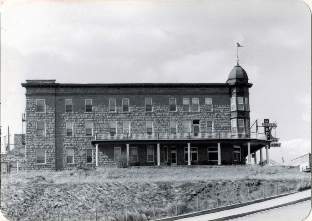
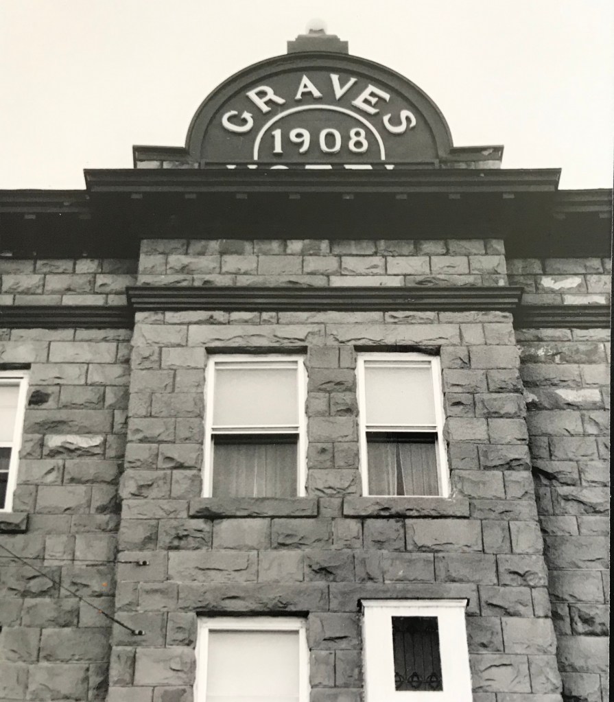
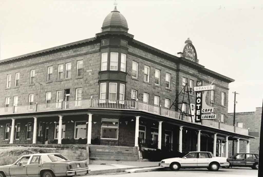
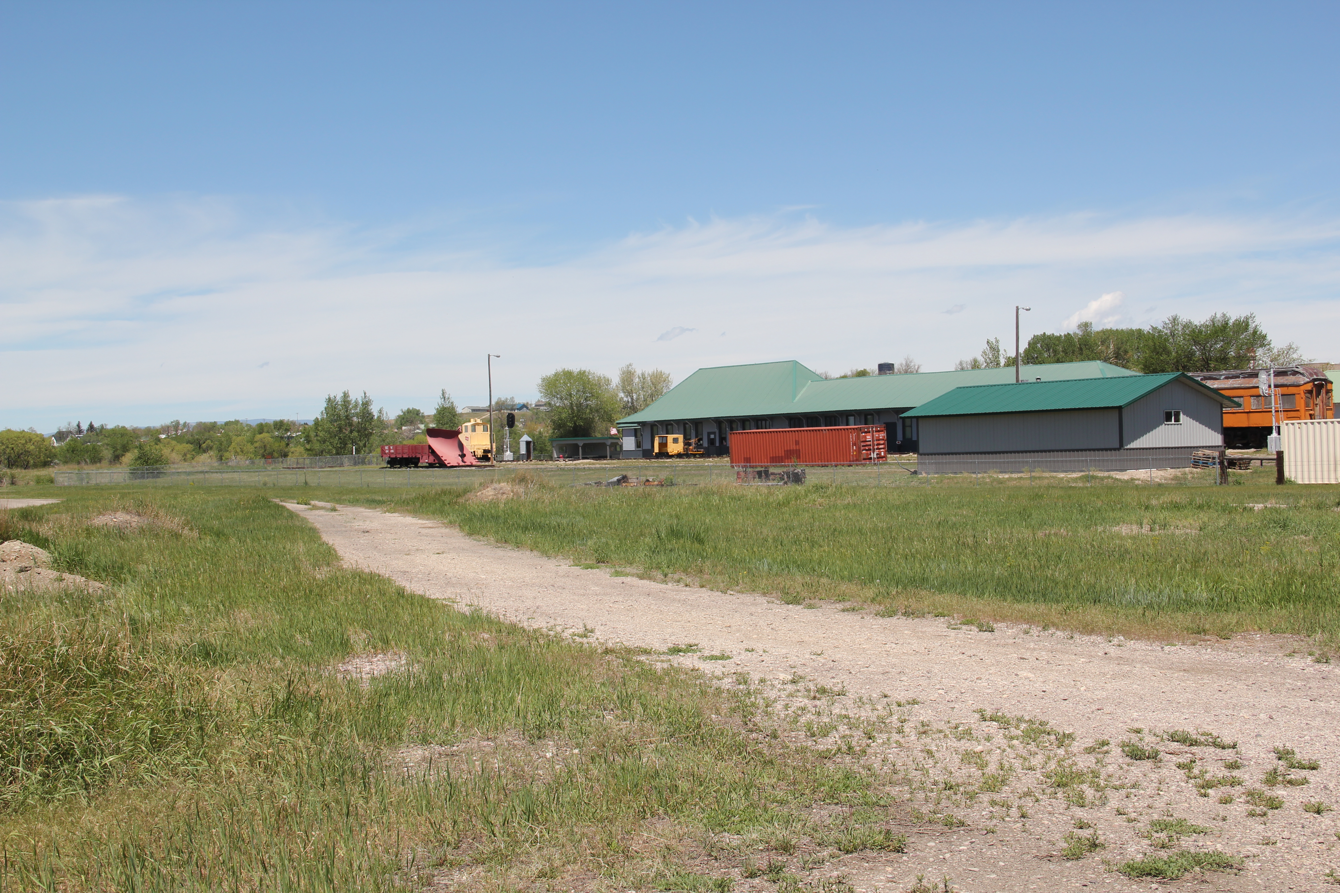
In my work of 1984-85 for the state historic preservation plan, there were few places in Montana that fascinated me more than Harlowton, a division point for the Milwaukee Road and the place where the railroad began its electric line to the west.
from the Milwaukee Road Depot Museum at Harlowton.
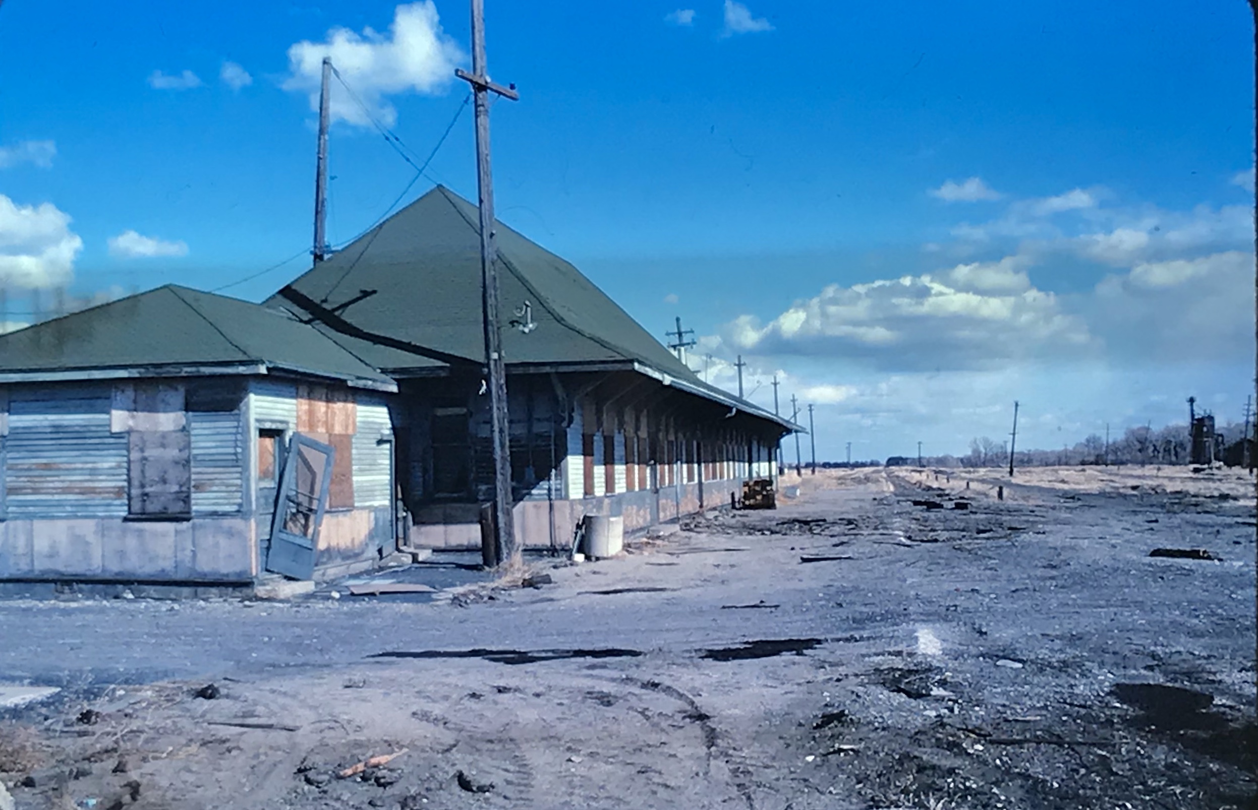
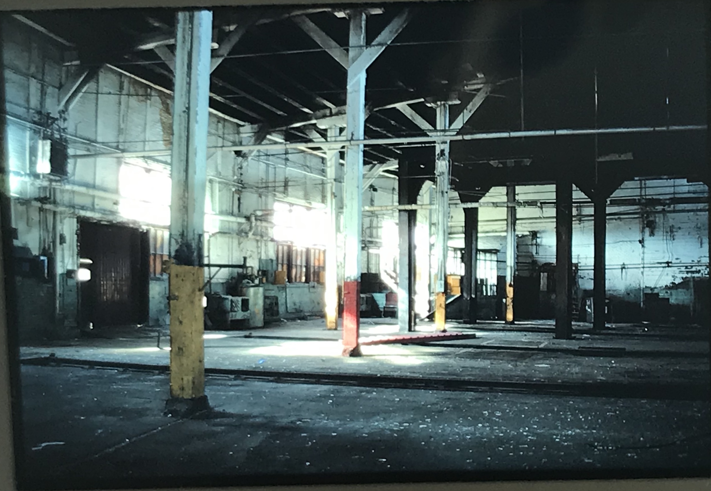
The line abruptly stopped work in 1980 and declared bankruptcy, devastating not only Harlowton but many other towns and villages in the west. By the time I began my work in 1984 the dismantling of the railroad was well underway, and I was playing catch-up as track was ripped up for the steel and buildings began deteriorating.
Colleagues in the preservation field had been at work on documenting and understanding the railroad’s history. Dale Martin produced an insightful overview of the railroad and its landmarks for the Montana Historical Society Press in the 1980s. Others carried out preservation studies and in the cities key landmark depots became restored office buildings, restaurants, and other businesses.
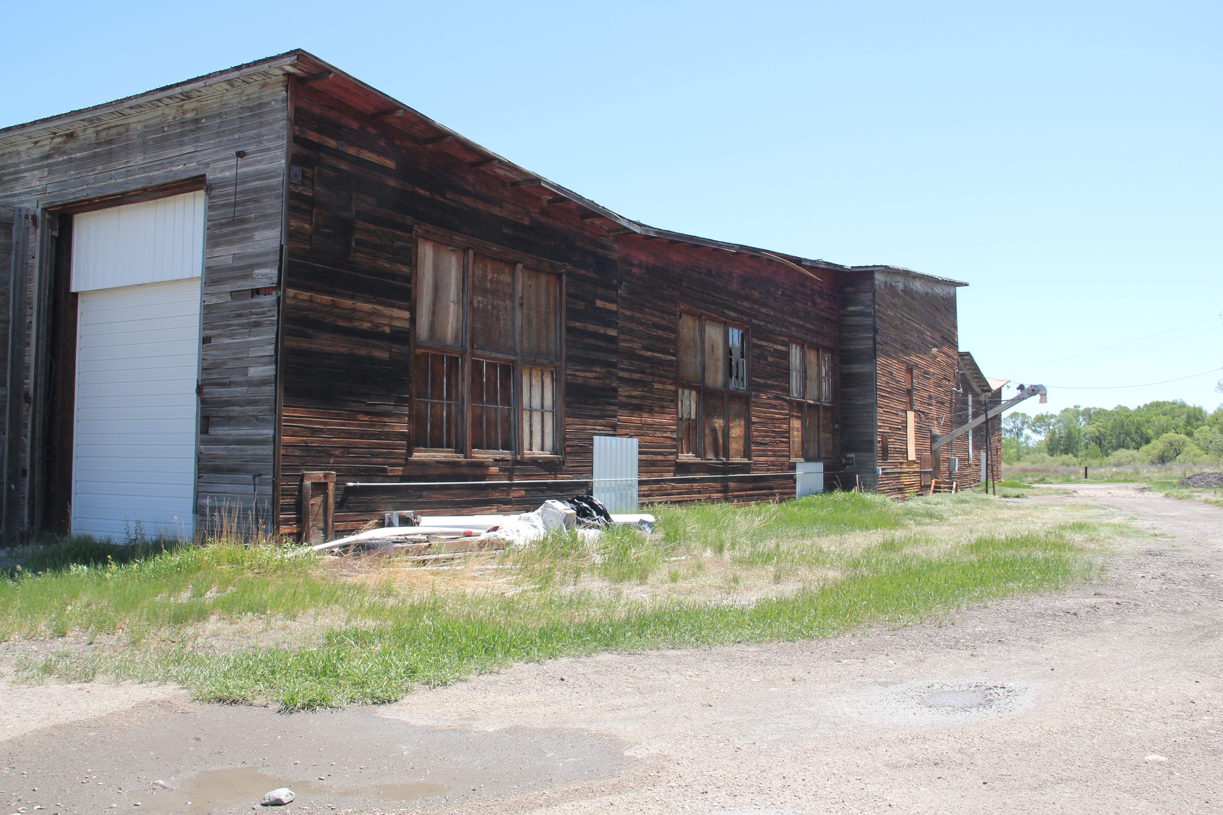
But the complex in Harlowton–despite its overall significance to the railroad’s story and its national significance–withered. Compared to the resources in Butte, Missoula, and Great Falls, where the depots were already under preservation and adaptive reuse, the task at Harlowton just seemed to be overwhelming, and some said impossible. Below are copies of some of the images that I took from the mid-1980s to c. 1990, which mark the deterioration of the division point complex but also the fact that resources were there–they just needed help.
the passenger station from the rail yard c. 1985passenger station and abandoned tracks, c. 1985the roundhouse and maintenance shops c. 1985roundhouses and maintenance shops c. 1985interior of roundhouse c. 1985interior of roundhouse c. 1985
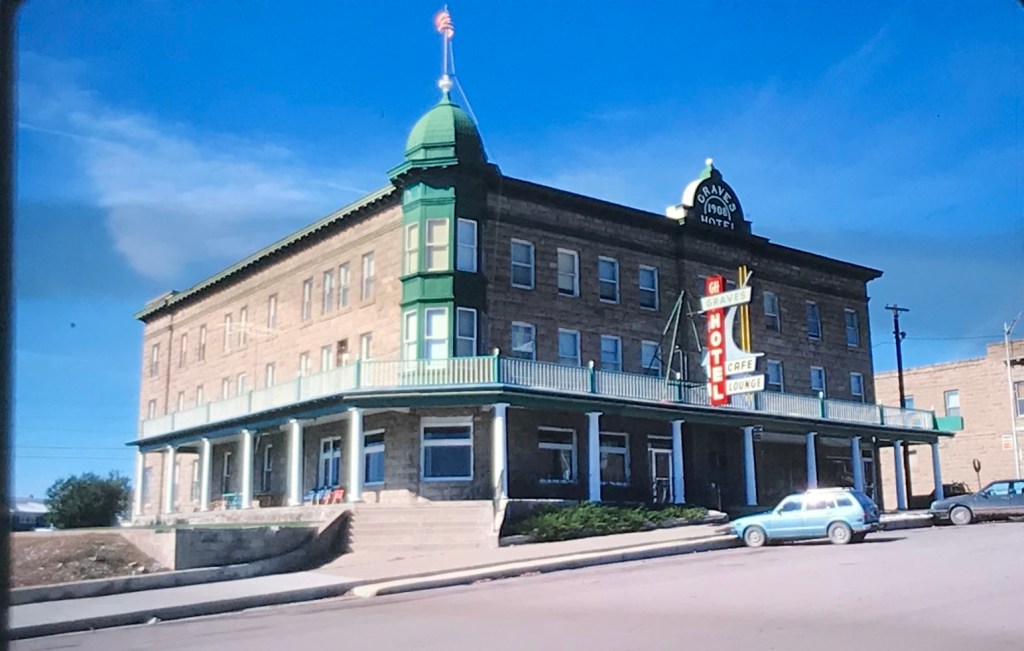
The division point complex was listed in the National Register in 1988 and by the 1990s some preservation efforts and underway, with the installation of a historical marker and some repair work on the passenger station.
repair work from the town (street side)repair work and roundhouse in background, c. 1990
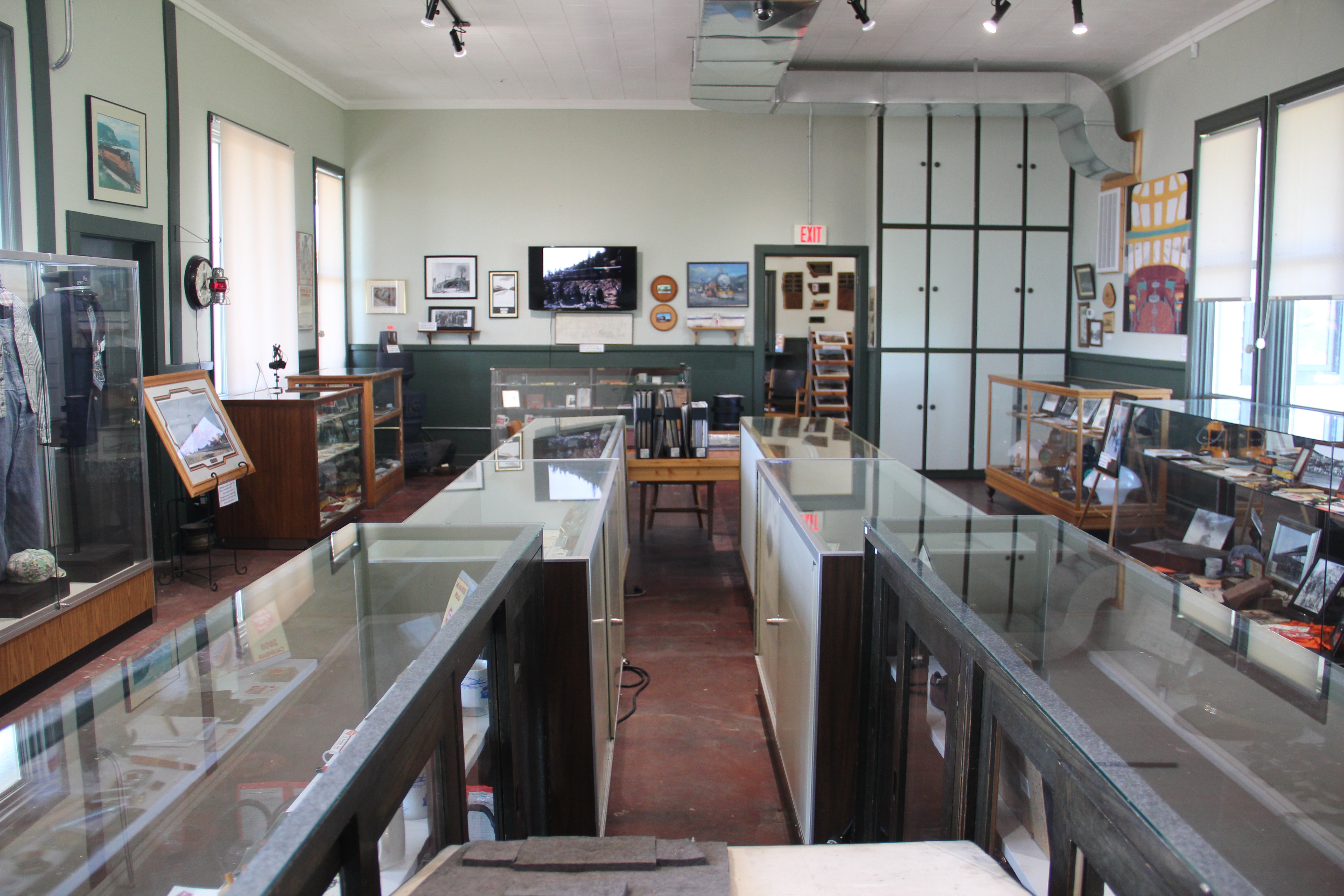
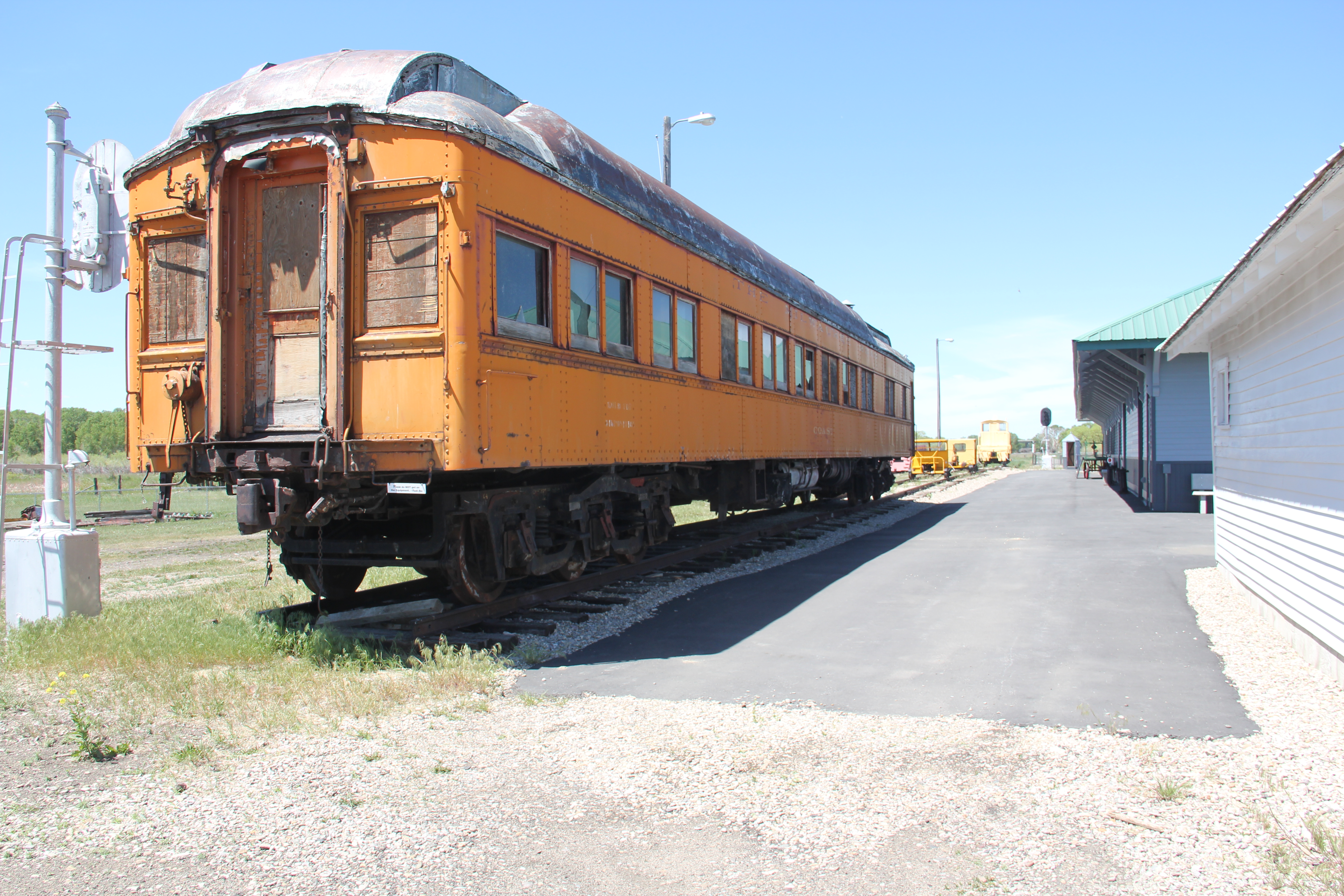
Would enough help come in time to preserve this nationally significant place–by start of the 21st century I thought not. Imagine my complete delight in 2021 when visited the magnificently restored passenger station, which had become a well-conceived and executed museum, not just about the Harlowton division point but a place of research for the entire line.
passenger station and railcars from the rail yardPart of the archives and library room for researchers.The Winnecook post office has been moved to the site as another museum building
What has been in accomplished in the last few years is impressive and must be commended. What an achievement by a group of dedicated volunteers and residents. Finally, one of Central Montana’s most important stories can be fully explored. But, still, there is work to be done, on the roundhouses and maintenance buildings.
I look forward to my next visit to Harlowton and the continued preservation and interpretation of this nationally significant property in the railroad history of not just Montana but the United States.
During a break in the infection rates of the pandemic in the late spring of 2021, I was able to get to Montana and spend a bit over a week considering historic cemeteries in places large and small. Many of these towns I had visited multiple times, such as Ryegate, the seat of Golden Valley County along U.S. Highway 12. A town that developed along the mainline of the Milwaukee Road about 115 years ago, Ryegate is a small town, population 223 in 2020, nestled between the railroad tracks, highway, and the bluffs of the Musselshell River.
Ryegate’s Main Street MT 238), on a quiet weekday midday
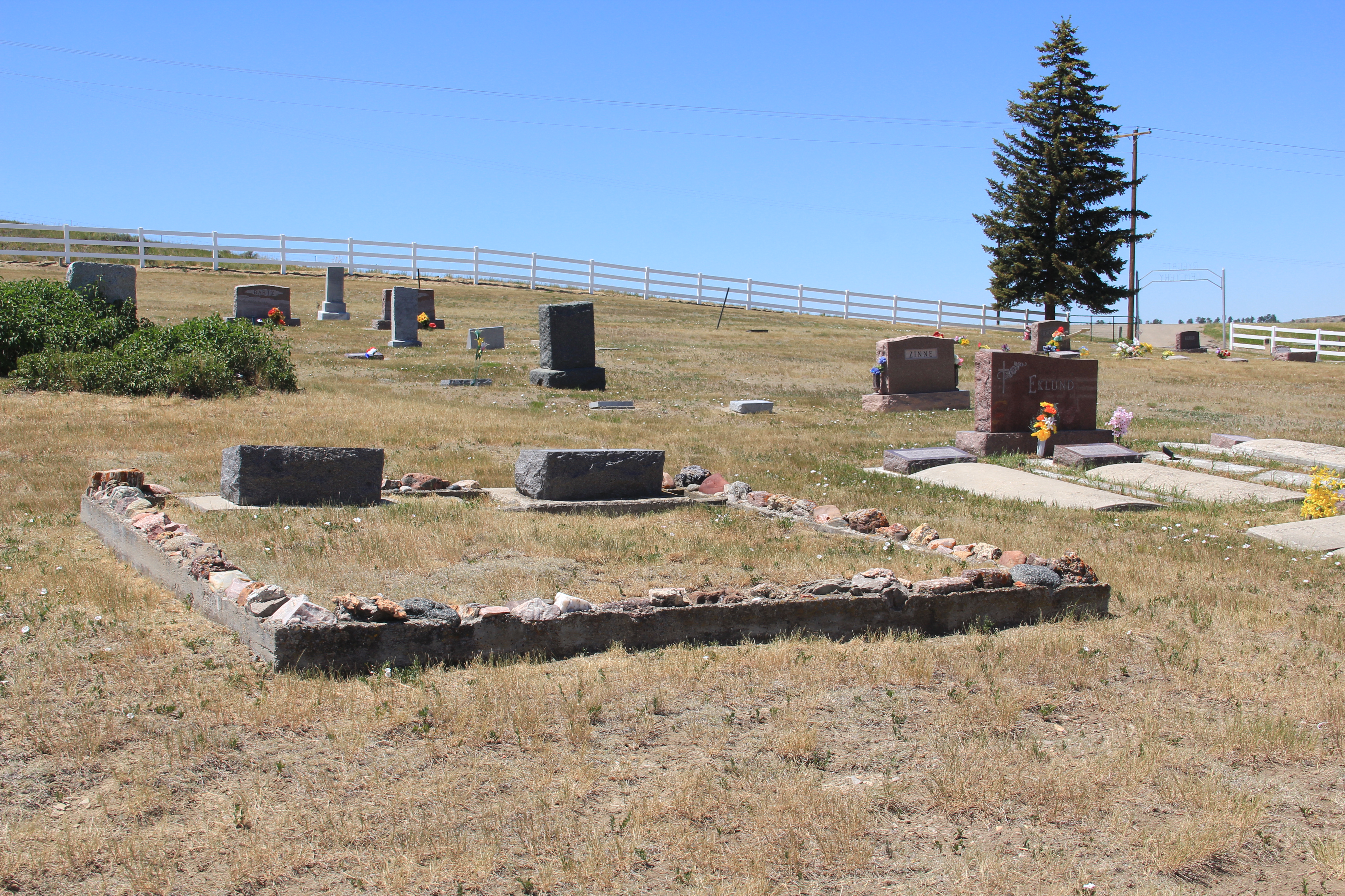
The cemetery is located on a rising set of hills as you travel south on Montana 238, perhaps a mile or so south of the railroad tracks. A white picket fence marks it and a metal gate allows access.
There are no grave markers that are large and pretentious, a reflection of the hard life but solid values of a rural community of ranchers and homesteaders. With markers covering every decade of the twentieth century, the cemetery is an understated but telling marker of community continuity, faith, and pride.
The family plot marked by a low concrete wall topped by local rocks–a tradition you find more in the south than in Montana.This early sandstone marker is one of the very few disfigured by time in the cemetery.
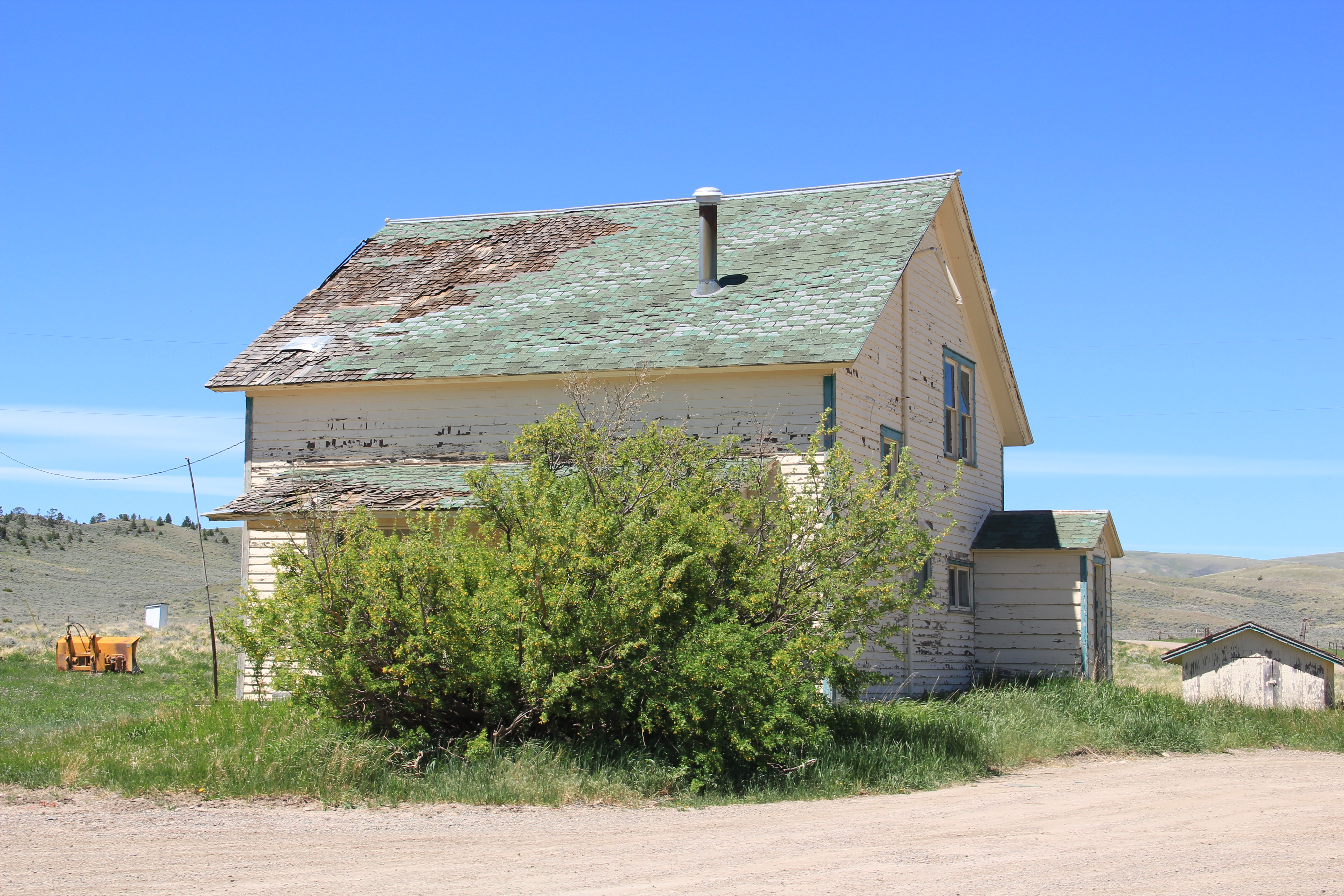
I first visited Barber, a Milwaukee Road-associated town in the Musselshell River Valley, in 1984. Now almost 40 years later, I revisited the place to see, particularly, if the landmark Grace Lutheran Church still stood. Yes, indeed, it has survived another four decades, but now had a handicap access ramp to better serve its aging congregation.
Grace Lutheran Church photo from 1984Grace Lutheran Church, Barber, MTGrace Lutheran Church, Barber, MT
This vernacular Gothic styled building dated from 1917–the one decade of Barber’s prosperity–and when I visited in 1984 it was the smallest American Lutheran congregation in the country. Its defining Gothic architectural elements–the Gothic window hoods and the tracery in the gable ends–remain intact. Clearly the surrounding ranch families are effective stewards for this National Register-listed jewel of a rural northern plains church.
Barber, MT
I noted in 1984 that a store still operated–but now it is barely hanging so, with the foundation has failed and you wonder how much longer its false-front facade will remain standing. I observed that all that was left of the town bank was the vault–that is still there–but a two-story turn-of-the-century house is now abandoned, almost on its last legs.
Abandoned Victorian-styled house, Barber, MT
The Milwaukee Road created scores of towns similar to Barber across the plains in the first two decades of the twentieth century. One hundred years later–some 40-plus years since the railroad went bankrupt–a few buildings remain at these spots on the map, physical reminders of the homesteading boom and bust of that era. Hats off to the residents keeping Grace Lutheran Church alive–as along the church remains, there will be a Barber, Montana.
In the winter/spring of 2020, a new German newspaper contacted me about using several images from the website taken at Lennep, a small Milwaukee Road Town, along Montana 294 in Meagher County. The newspaper wanted to consider its American counterpoint, its isolated location in Montana, and is history. The editors named the story Ghostown Lennep.
I won’t provide a translation of the entire article, but the author Leon Hohmann provided me a transcript in English, from which I learned quite a bit about Lennep, Montana. The author wrote:
“But the history of the small town begins with another person: Martin T. Grande settled in 1877 in the place that was probably still nameless at that time. This is what history books tell us. He was the first white man in this area an immigrant from Norway who made his living by keeping 3000 sheep. Shortly afterwards, other settlers from Grande’s home village came to the mountain region, worked on his ranch or built their farms.
But this arrival does not seem to have gone very smoothly: A descendant of the first settler reported in an interview that Indians had burned down the first buildings because the border between the area of the natives and the immigrants was moved further and further to the west. Thus the territory of the Indians became smaller and smaller.
In the following years, Martin T. Grande’s ranch became bigger and bigger, more Norwegians came, whom he gave work, and he took an increasingly important position. His countrymen called him “good old patriarch”.
But quite fast the contemplative collection of some ranches and farms became a bigger village. Almost overnight the actual town of Lennep, west of Martinsdale, was built along the Jawbones railway line and served as a small stopover, according to a dissertation on the history of the region. That must have been in 1899. It was also the year that an auditor from the operating company Montana Railroad travelled there and named the place after his German homeland. His name: Johann Wilhelm Fuchs “
Since interest in Lennep, Montana, has an international audience and it has always been among my favorite Milwaukee Road places, I made plans to revisit in 2021–ten years since my last visit–and see the condition of the town.
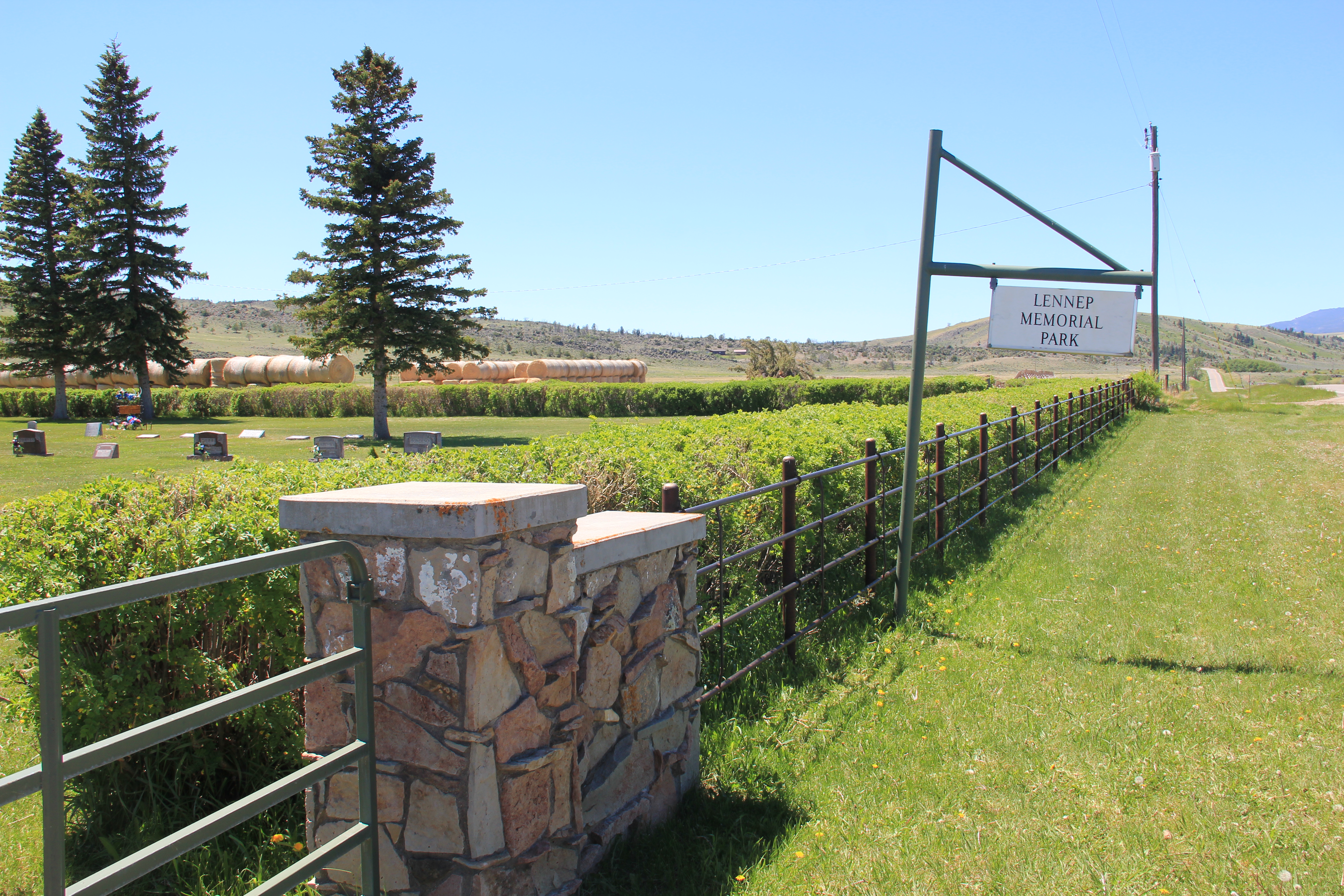
Lennep Memorial Park Cemetery
I started with a resource given a brief look in 2011–the town cemetery, which is well maintained as the Lennep Memorial Park. The names of the early settlers such as the Grande, Hoyem and Hereim families are prominent as are the Thompsons, who were Masons. The wives–not named–of Andrew Berg have a distinctive obelisk grave marker.
Martin and Karen Grande grave maker. Martin Grande founded the town in late 1870s.
Leon Hohmann continued with the story of Johann Fuchs–who became Wilhelm Fuchs in his new adopted town of Lennep, Montana. Hohmann wrote:
“Johann Wilhelm Fuchs was born on September 2, 1859, in Lennep, Sarah Baldy from the Remscheid town archive found out. His parents: Hermann Fuchs from Elberfeld, who was a teacher at the higher citizen school in Lennep, and his wife Elise a born Hilger.
Growing up on Munsterplatz, he was a young adult when he decided to train as a businessman, which was quite astonishing since his father did not have this profession. But Sarah Baldy has an idea why young Johann Wilhlem took this path: Because his maternal grandfather, Johann Wilhelm Hilger, who died only a few months before the birth of his grandson, was a merchant.
The archivist suspects that this Johann Wilhelm Hilger founded the company Gebrüder Hilger with his brother Daniel. Around 1856 the brothers built a large cloth factory in Wilhelmsthal in Radevormwald, where up to 600 people worked at times. After a fire in 1890, the company had to file for insolvency. Later, the cloth factory became a paper mill, whose production was only stopped on November 30 1970. Since then, the main building has been empty and neglected.
To what extent Johann Wilhelm Fuchs became active in his grandfather’s business has not been communicated. If he did, then probably not for too long. For at the age of 23, he left his home country to start a new life in the United States of America. This is the conclusion drawn from data in the North Rhine-Westphalia State Archive.
He arrived as Johann Fuchs on August 11, 1882, on Ellis Island, New York with two pieces of luggage. He started his journey from Antwerp on the Belgenland I of the Red Star Line as passenger number 23. What he did after his arrival is unclear.
His name only reappears around 1894, when Montana Railroad is founded as the third railway company in the state. At that time, however, he called himself Wilhelm J. Fuchs. He is said to have already planned a train route from Helena to the East with Montana Railroad President Richard A. Harlow. In 1899, in the course of the construction of the Jawbones Railroad, he also travelled to the village of the settlers from Norway. He named the railway station there “Lennep”. Whether he also lived in Lennep is not known, however. His trace is finally lost in 1904 after the operating company of the Montana Railroad had left.”
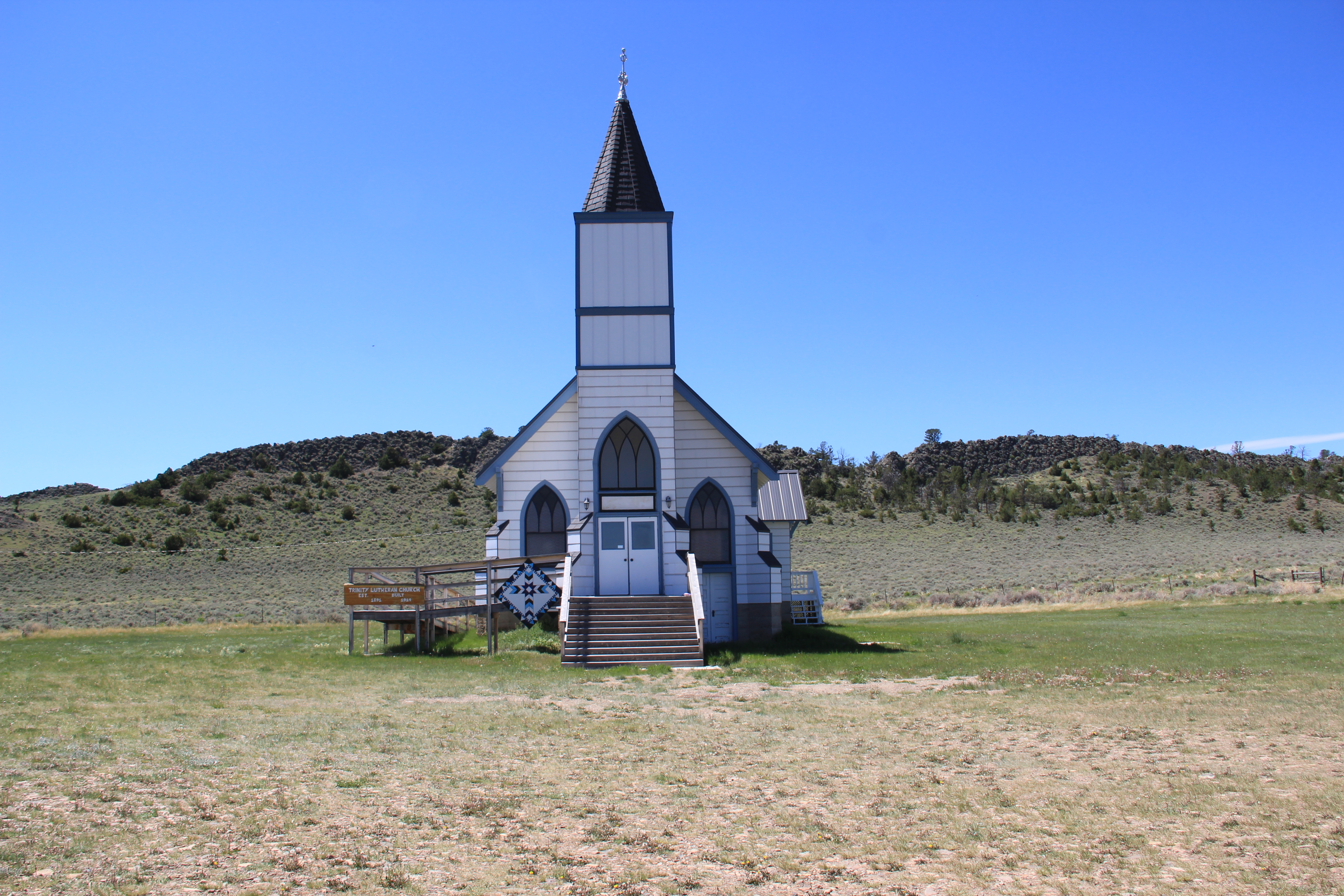
The buildings that remain today appear to date to the decade of the railroad’s arrival, from c. 1907 to 1917. Certainly that decade marked the height of population and activity here. The wind-swept setting of Trinity Lutheran Church is unchanged. This Gothic Revival church remains the town’s commanding landmark, and remains the active community center. Hohmann noted: “In 1914, the beautiful building was constructed from wooden shingles. The invitation to tender for the church was published in The Harlowtown News on 25 July 1913 with the aim that the construction should be completed by 15 November of the same year. But apparently, the structure of the Trinity Lutheran Church had been delayed. The new building cost 4300 dollars, paid by the Lutheran church congregation, which was founded in 1891.”
Trinity Lutheran Church. The handicap access ramp is an addition in the last 10 years.
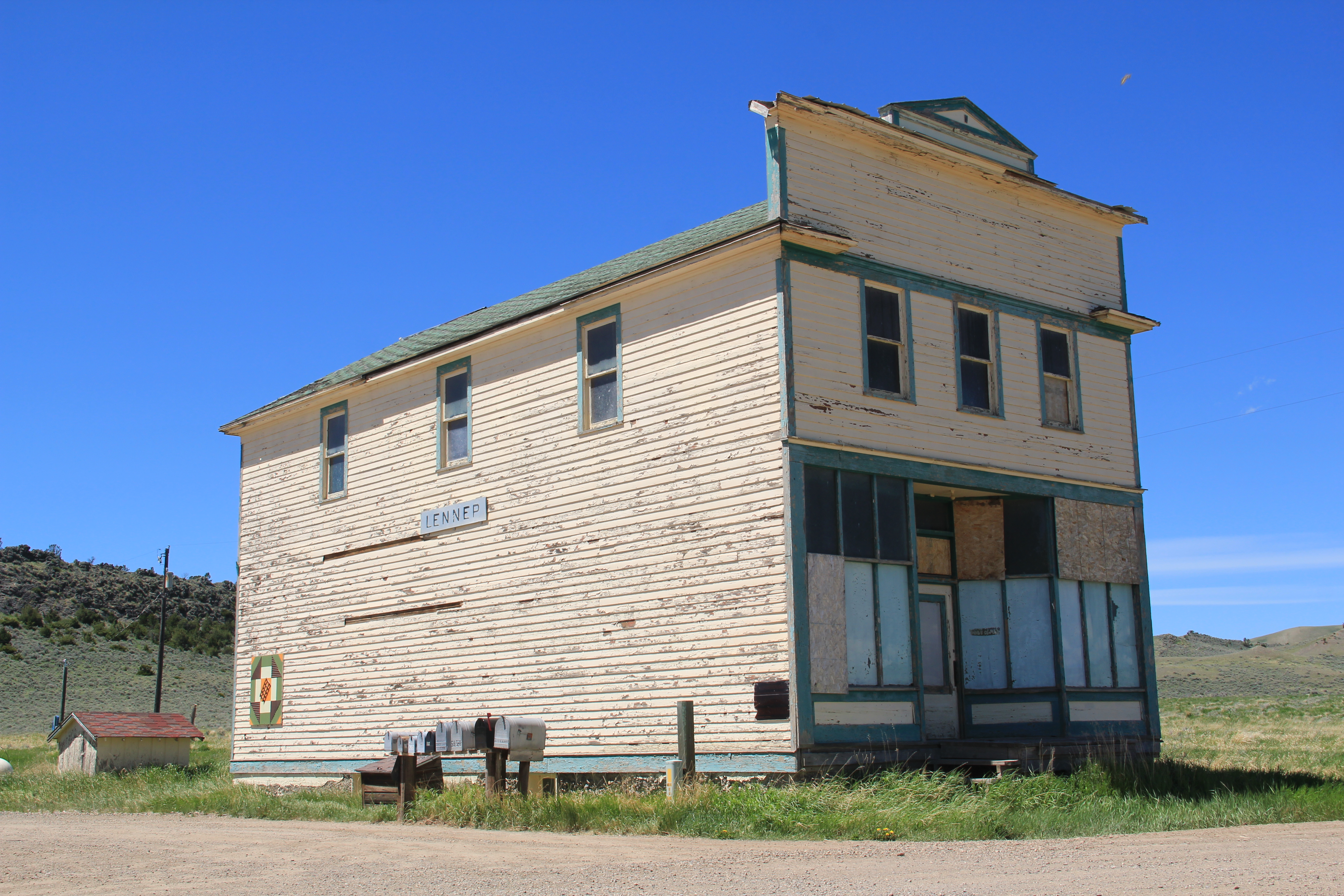
The old town general store remains closed, and it has been mothballed to a degree with plywood over damage windows, I suspect. Hohmann wrote about this building: “The train line was necessary for the inhabitants of the ranches around Lennep because the trains supplied the grocery store with food. The goods were not only sold to the people of Lennep, but also inhabitants of the neighbouring villages. Also, the gold-digger camps in the Castle Mountains to the north are said to have supplied from Lennep. At least some hobby historians in American internet forums suspect this. Furthermore, a gravel road connected the village with the Cumberland Mine. Silver and lead were mined there.” The building clearly was a center point for trade and communication. Some deterioration has occurred, but relative minor repairs and a new coat of paint would correct that. The congregation renovated the church in 2016 and at that time added the new porch and handicap access ramp.
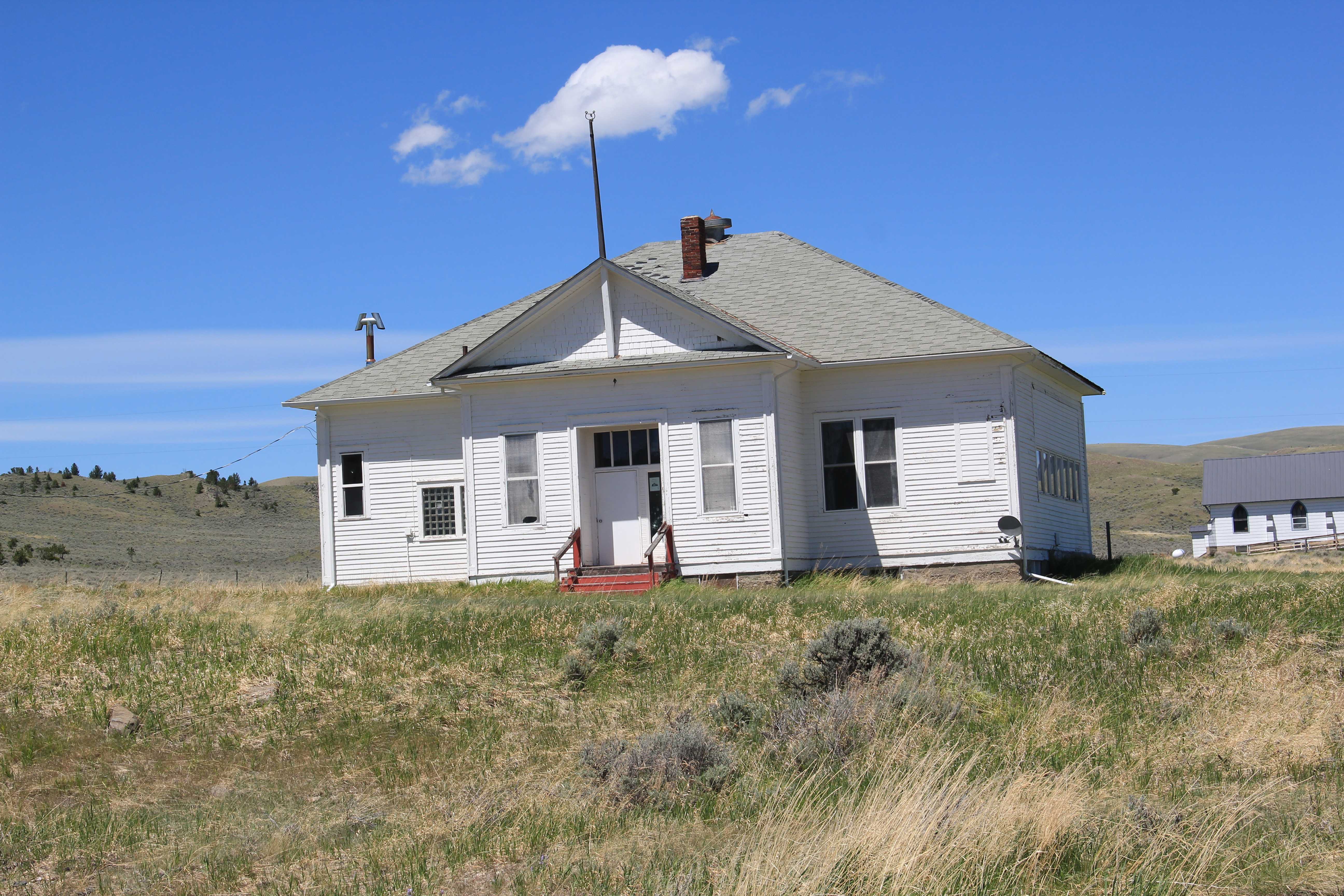
The school house–which has not had students since 2011– remains in decent condition although some missing roof shingles could pose water problems. Water and moisture is not the threat in this part of the west as I am accustomed to in the east but a leaky roof is never a good thing. A nearby dwelling has that modern replacement metal roof–it too stood quiet at the time of my visit in June 2021 but appears to be in solid condition.
The dwelling between the store and school, however, is in danger of serious deterioration. Half of its shingles are missing–the deck is not in great shape. You wonder if this building is not the next to disappear from Lennep.
Yet, when you stand back at the church and took back southeast toward the railroad line and town, the view of the buildings and landscape is little changed in ten years. Lennep might be a ghost town but it is still there, as a marker of the impact of the Milwaukee Road on the Meagher County landscape.
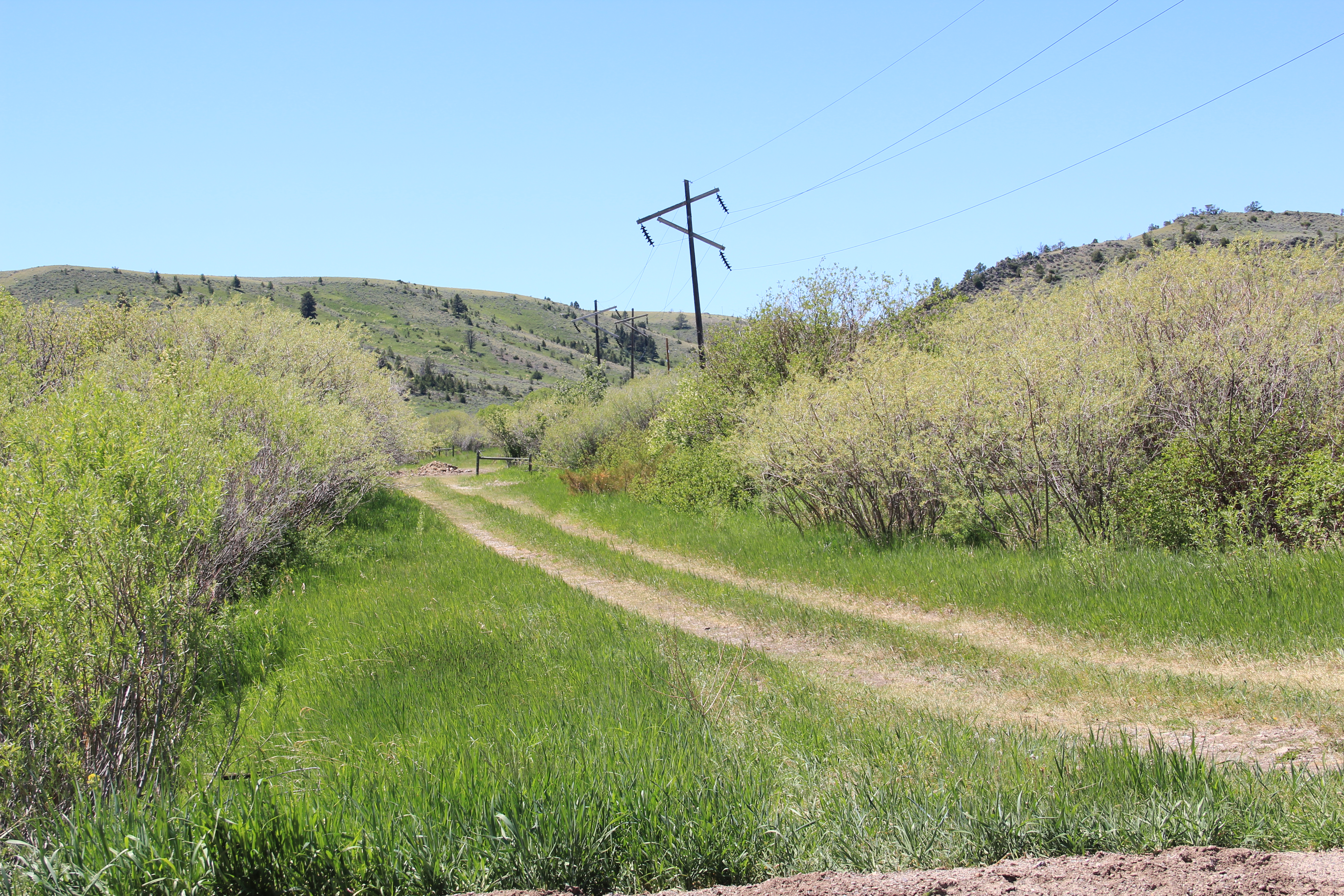
A final marker to the east can be found by continuing on Montana Highway 294, which closely follows the old Milwaukee Road corridor for several miles before the track and the highway diverge.
A portion of the Milwaukee Road corridor along Montana 294, now turned into a ranch road.
That would be the brick powerhouse necessary to power the electric engines that the Milwaukee Road used in this section of its route. Cows might surround it today but in the early 20th century the brick powerhouses scattered along the line were signs of modernity, of the electric power that distinguished the Milwaukee from all of the other transcontinental railroads in Montana.
I always enjoy driving along US Highway 12 in the Musselshell Valley. It is lightly traveled plus it was the historic route of the Milwaukee Road. Ever since the railroad ceased operations in 1980, the small towns along the line began to fade away.
Shawmut school, 1984
Shawmut was one of those towns but in 1984 it still operated an elementary school, then about 50 years old, having been built during the New Deal of the 1930s. Towns that retained enough population and commitment to keep their school but had a chance.
Shawmut school, 2021
Shawmut school district, as shown above, continued to renovate the building and make it last for another generation. The school made it into the 21st century but closed in 2015 due to declining enrollment.