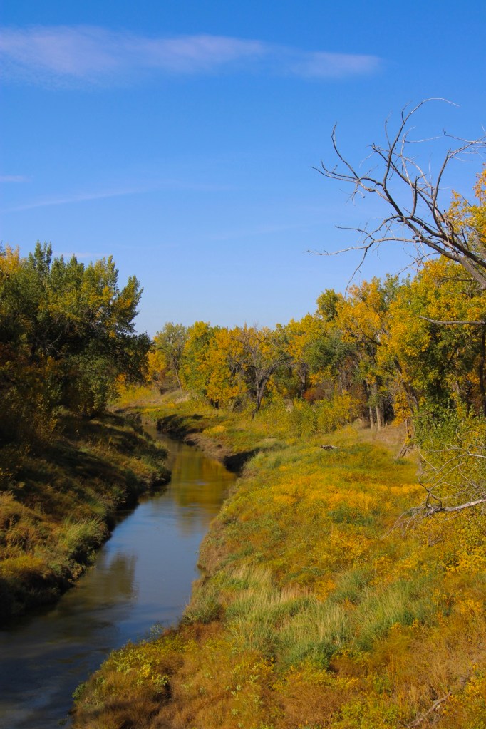
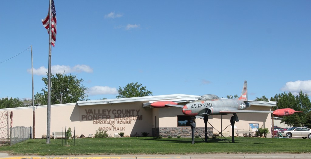
Montana Highway 246 is one of those “side” roads that few travel, unfortunately, because if you go that way from the west toward Glasgow it will take longer than US Highway 2. But the time is well worthwhile because once you cross the Milk River (by way of a modern concrete bridge) you step back to the turn of the 20th century.
Milk River crossing on Montana 246
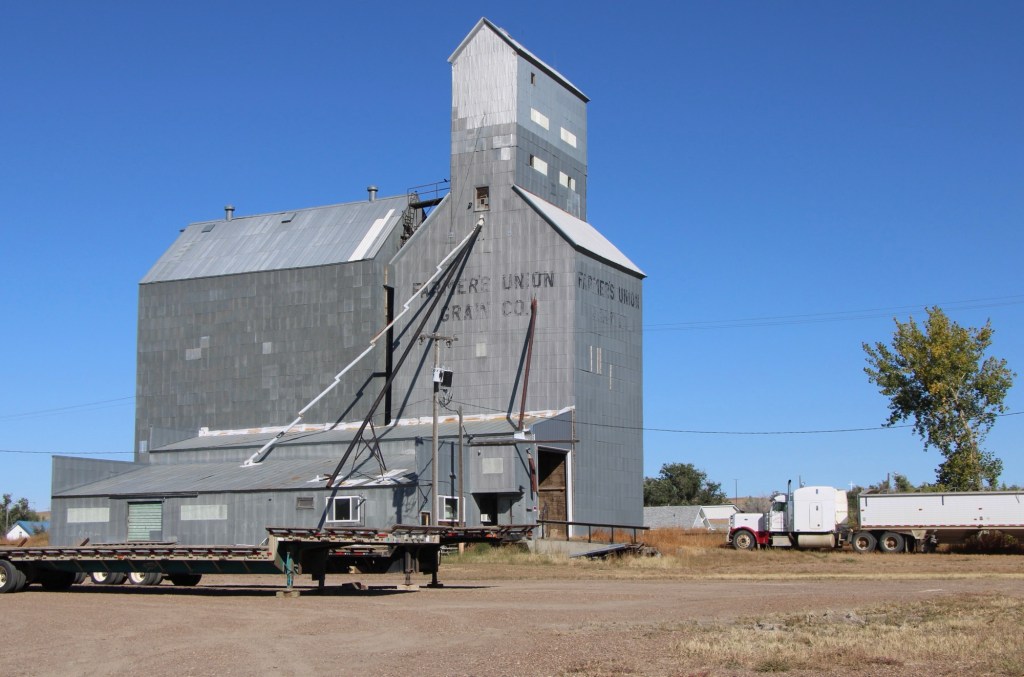
Vandalia has history as a late 19th century trading post at the crossing of the Milk River. Then it became one of the early milk River ranches. Once the Great Northern Railroad built its initial route westward the tracks came this way, following the river.
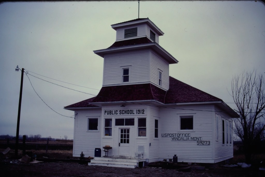
Vandalia school and post office in 1984
The tracks brought the first generation of homesteaders who built the white-painted frame school in 1912. The school later became the post office, and served that role when I first visited Vandalia in 1984.
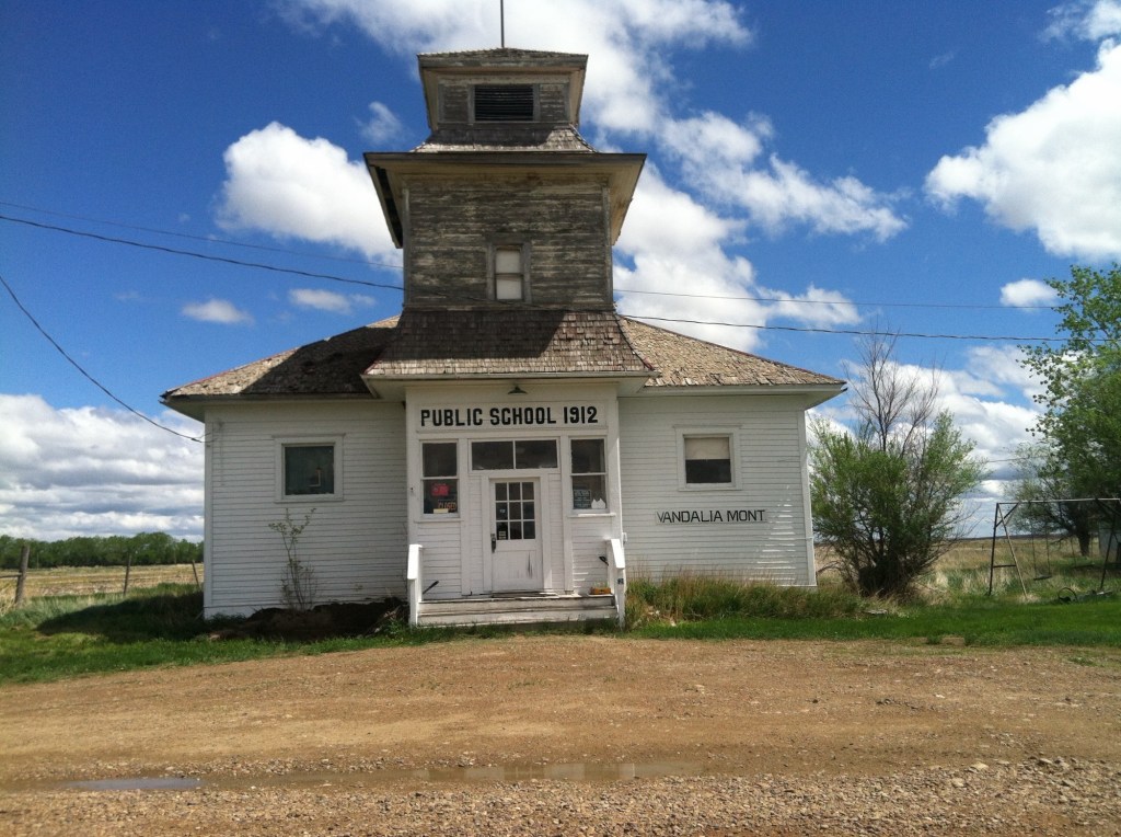
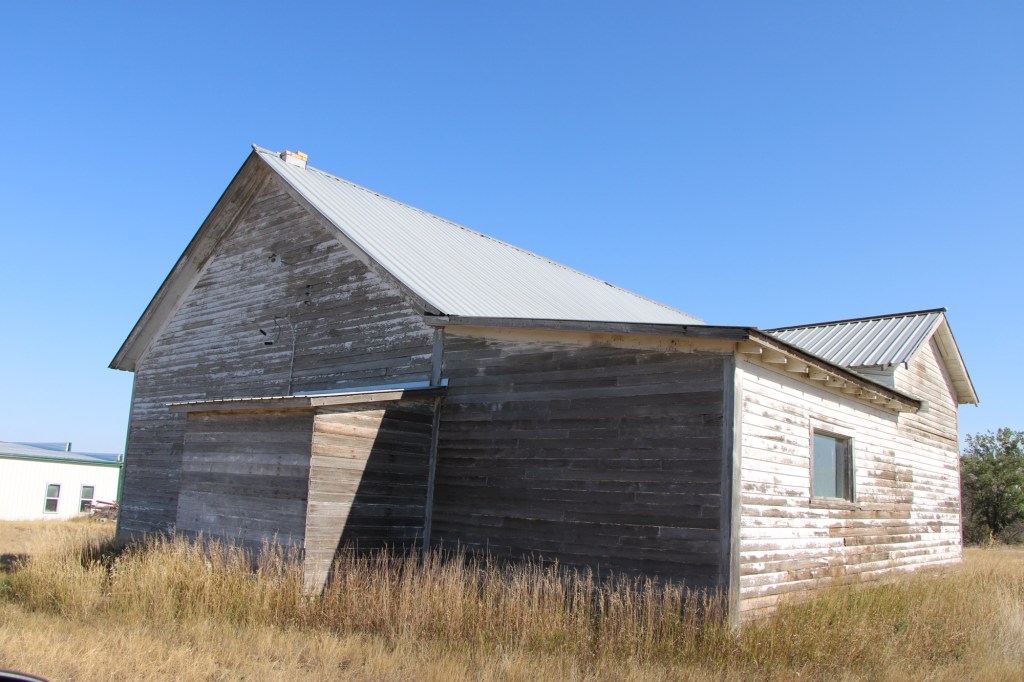
Vandalia school in 2013
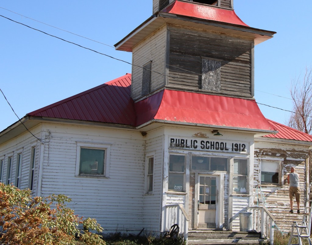
When I next visited almost 30 years later, the post office had closed and the school was in rough condition. Imagine my delight when I next stopped in the fall of 2025. The school was taking on new life. The roof had been prepared and replaced, and prep work was underway to give it a fresh coat of paint.
Vandalia school in 2025Vandalia in 2025
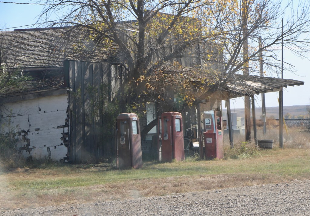
The story was not so bright for the old bar and store that was next door. The old gas pumps were still there but the porch roof was sagging and it looked forlorn.
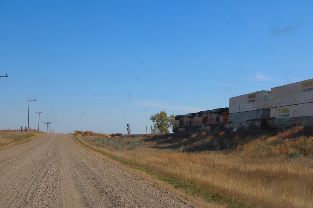
Vandalia store in 2025Original route US Highway 2 heading east toward Tampico
The drive remains fun, especially the graveled original route of US Highway 2 with the occasional Burlington Santa Fe freight train roaring by. Imagine driving cross country on this route when large sections of it remained unpaved.
Tampico in 2013
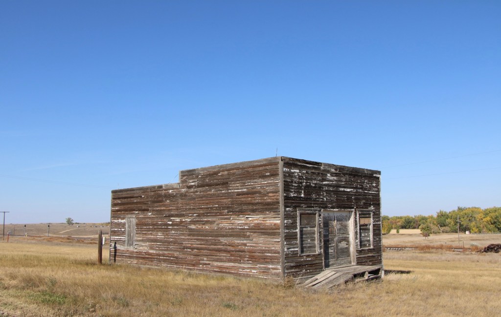
The next town to the east is Tampico, established around 1908. In 2013 the town was tiny but showed some life. Twelve years later, the abandonment was striking.
Tampico in 2025Tampico in 2025Leaning into oblivion, Tampico 2025
Most early 20th century railroad towns across the northern plains struggle one hundred years later but those off the major highways, like Vandalia and Tampico, could easily disappear.
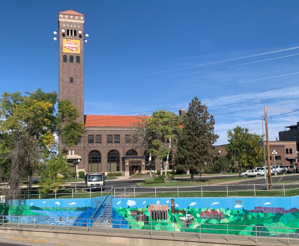
Montana newspapers this week featured a story about economic resurgence in Great Falls, where the population has remained basically level in the 21st century while other Montana cities have grown by leaps and bounds. Readers of this blog recognize that I am a big booster of what heritage and historic preservation has meant to the city, and certainly that pride in history and culture you find anytime you visit Great Falls as I found during a fall 2025 visit.
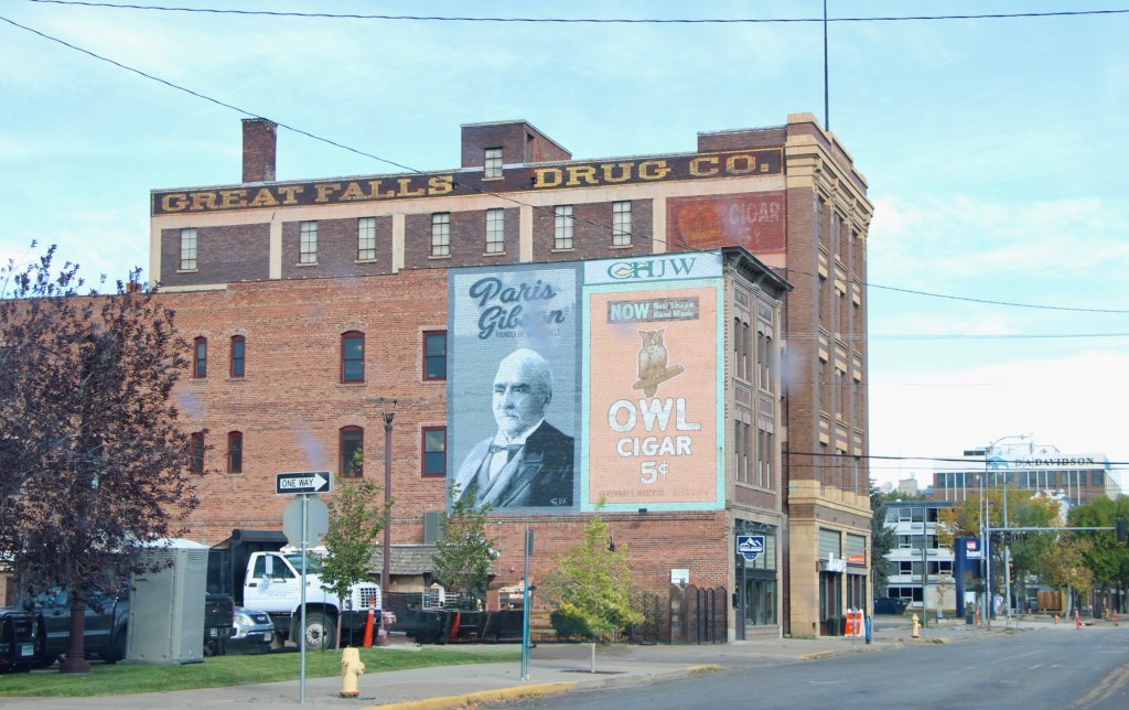
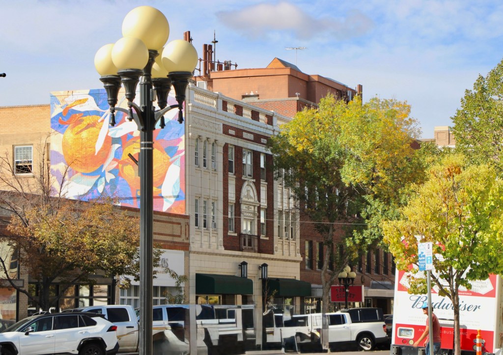
The proliferation of colorful, descriptive murals enliven downtown commercial buildings, including the highway underpass at the restored Milwaukee Road passenger station. the topic has been historic—witness the penetrating graze of town founder, Paris Gibson, below.
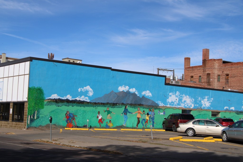
Or if it is a more abstract design in the city’s commercial heart ( the reproduction city street lights add charm too).
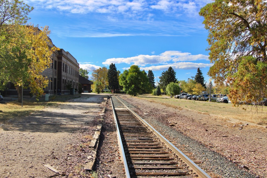
Downtown recreation is another positive change, as the river trail between the tracks of the Great Northern Railway and the Missouri River continues to expand and improve.
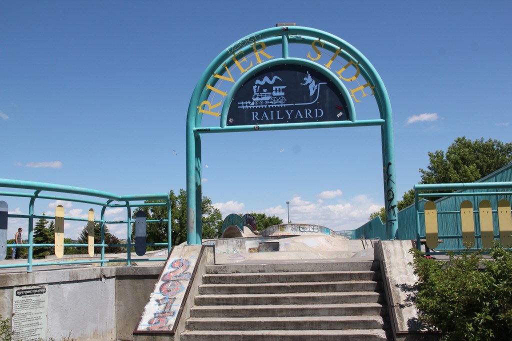
One of the state’s best skateparks also adds significantly to recreation, and community building in Great Falls.
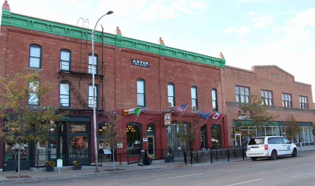
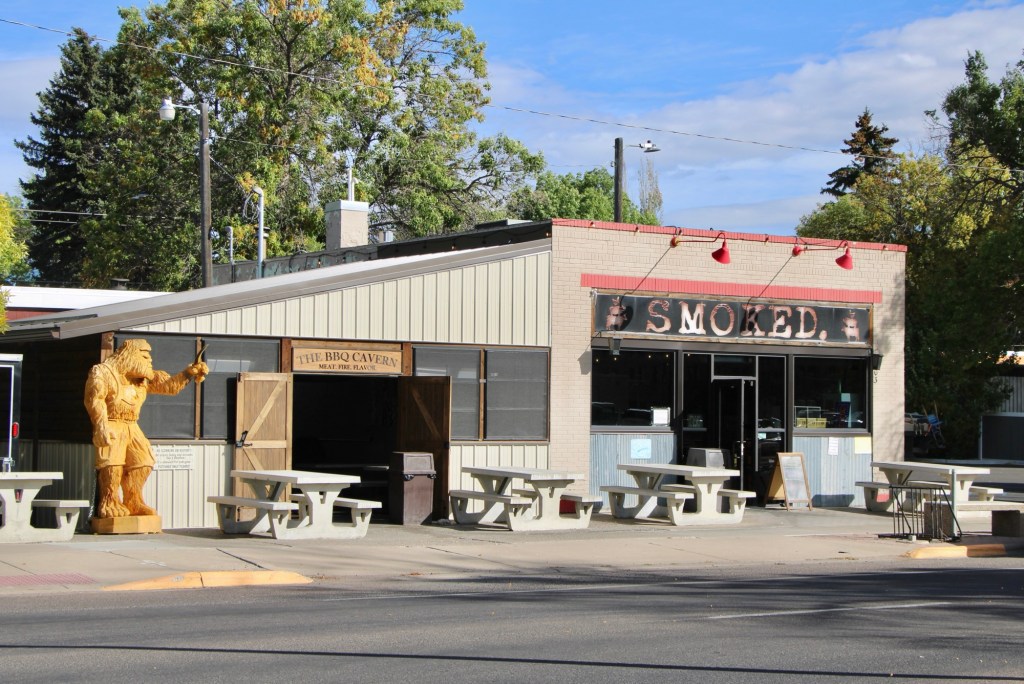
And speaking to community building the restoration and adaptive reuse of downtown buildings create nighttime gathering spots, giving residents plenty of reason to come downtown. The Celtic Cowboy, located in a circa 1890 livery building, has become a popular pub while the owe era of Smoked took a 1930s building and made it a must-stop place for Barbeque.
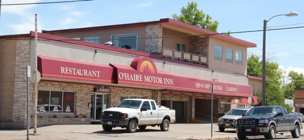
Even the iconic Sip-N-Dip lounge has announced a renovation and improvements to this mid-20th century landmark.
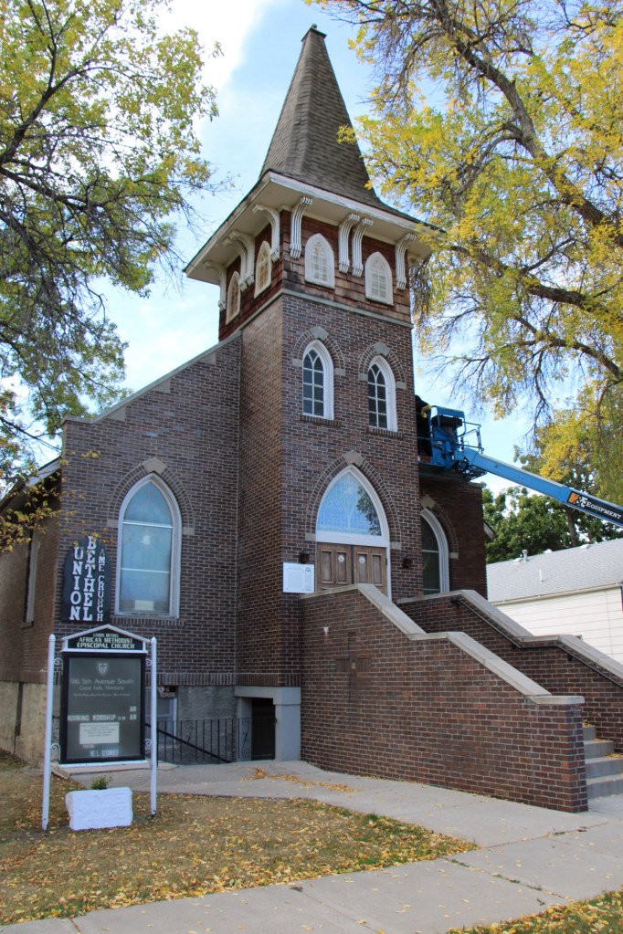
My stop in Great Falls last October centered around a check of the renovation of the National Register-listed Union Bethel AME Church. Like many others I supported its grant application and I was pleased to see work underway to ensure another 100 years for this landmark.
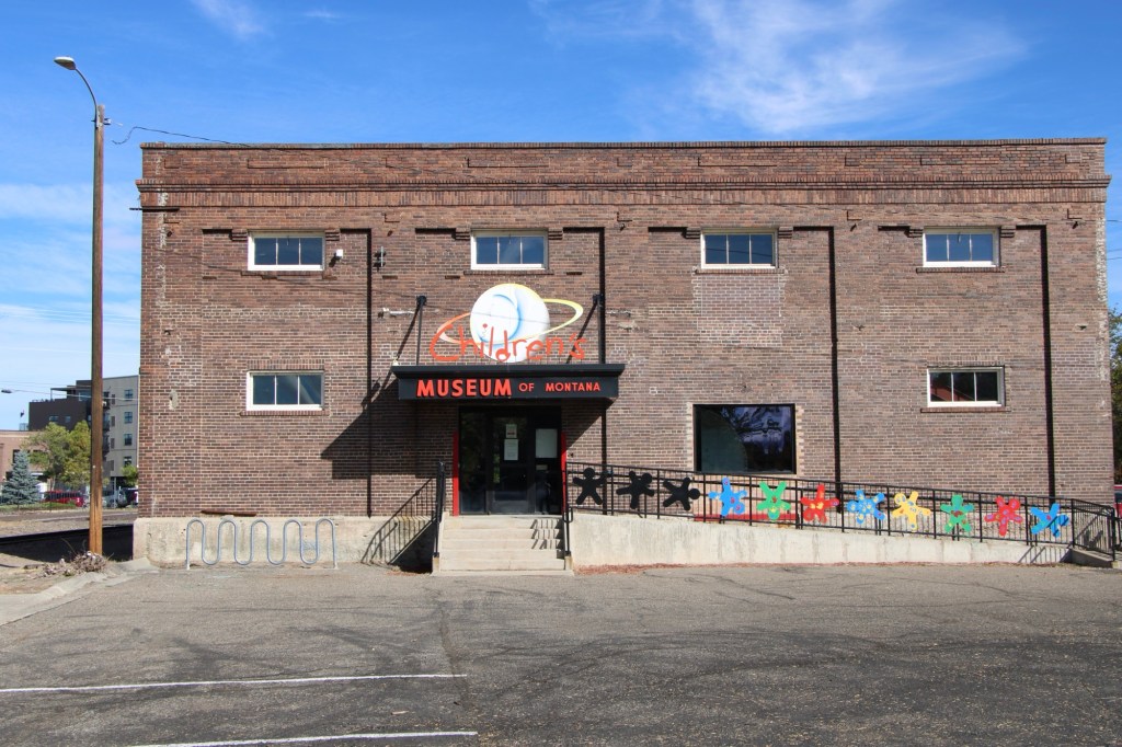
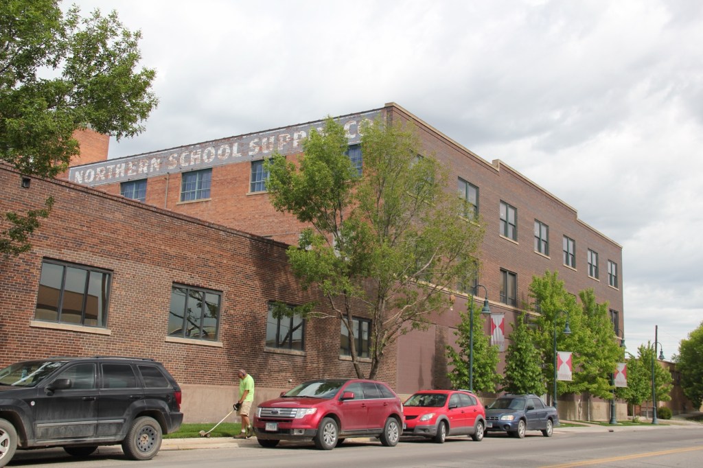
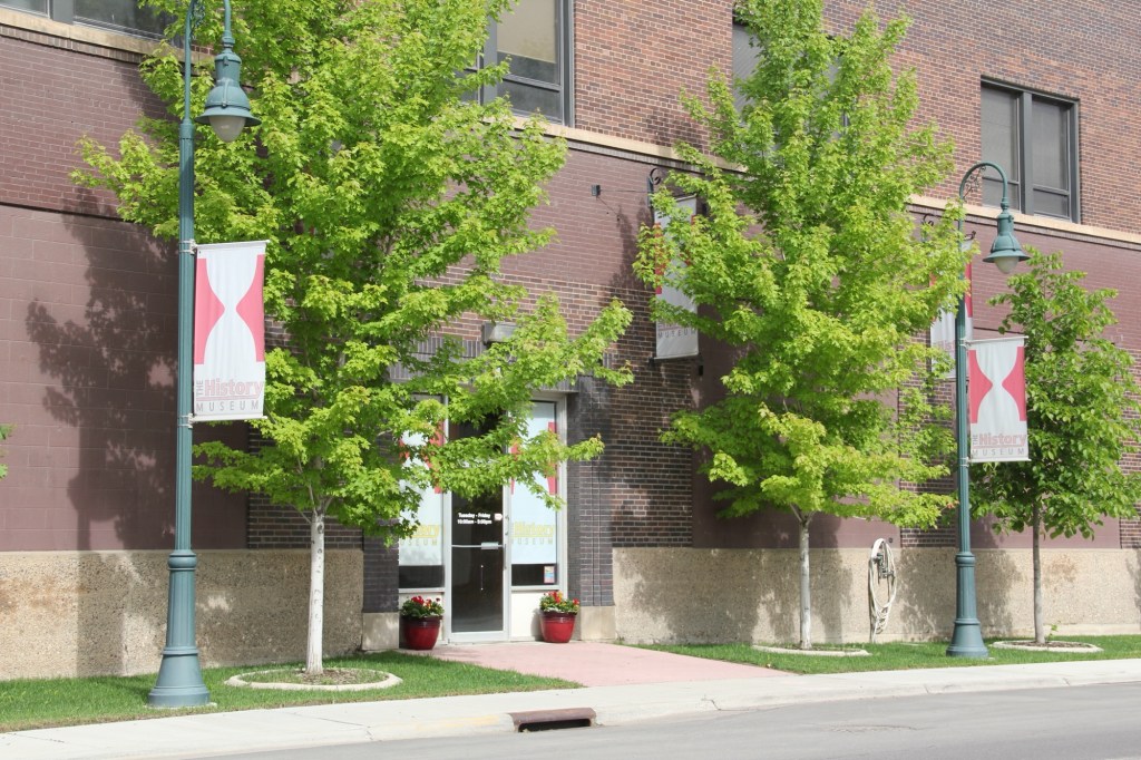
No doubt the protection of the city’s historic buildings and finding new community uses for them continues as an anchor for Great Falls, be it the Children’s Museum or the impressive History Museum and Archives. Both are located along the city’s historic railroad corridor.
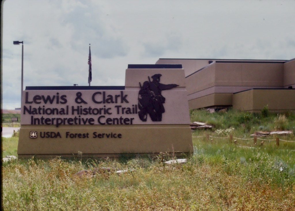
Preserving and telling local stories but Great Falls is further enhanced by two major national institutions—the Lewis and Clark National Historic Trail interpretive center and the Charles M. Russell Museum.
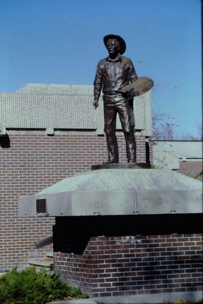
The Russell continues to expand, and amaze, as it evolves from a regional to truly national cultural center. The city too is trending in that direction, which means that next visit will certainly be sooner than later.
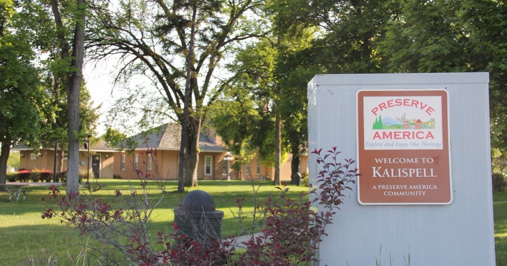
Kalispell is the seat of Flathead County, established on the Great Northern Railroad line in the 1890s. Today the city is the hub for commerce, transportation and medical care in northwest Montana. The Advisory Council on Historic Preservation designated it as a Preserve America community in recognition of its historic downtown and multiple National Register of Historic Places properties.
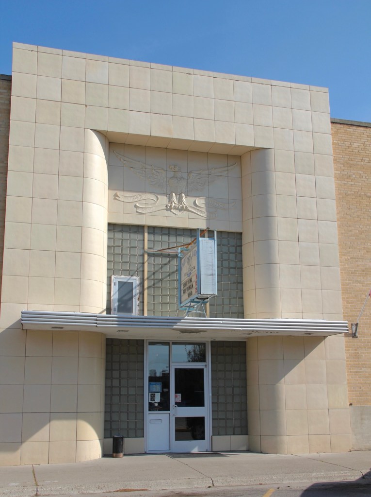
Certainly the town has many impressive late Victorian era buildings, like the County Courthouse, but this post focuses on a part of Kalispell’s historic built environment that doesn’t get enough attention—its buildings of modern 20th century styles.
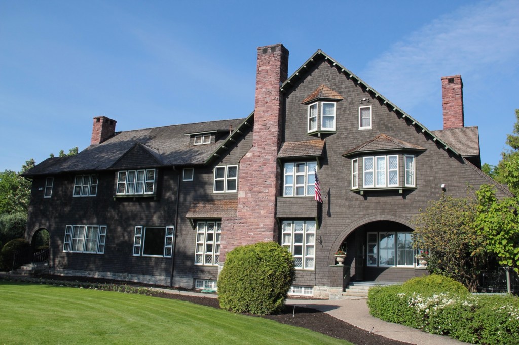
The key town founder was C. E. Conrad and similar to how he started the town, you could also say he started the modernist traditions by commissioning his grand Shingle-style mansion from architect A.J.Gibson in 1895. Architectural historians consider the Shingle style, introduced by major American architects Henry Hobson Richardson and the New York Firm McKim, Mead, and White, to be an important precursor to the modernist buildings that would flourish in Kalispell during the 1930s.
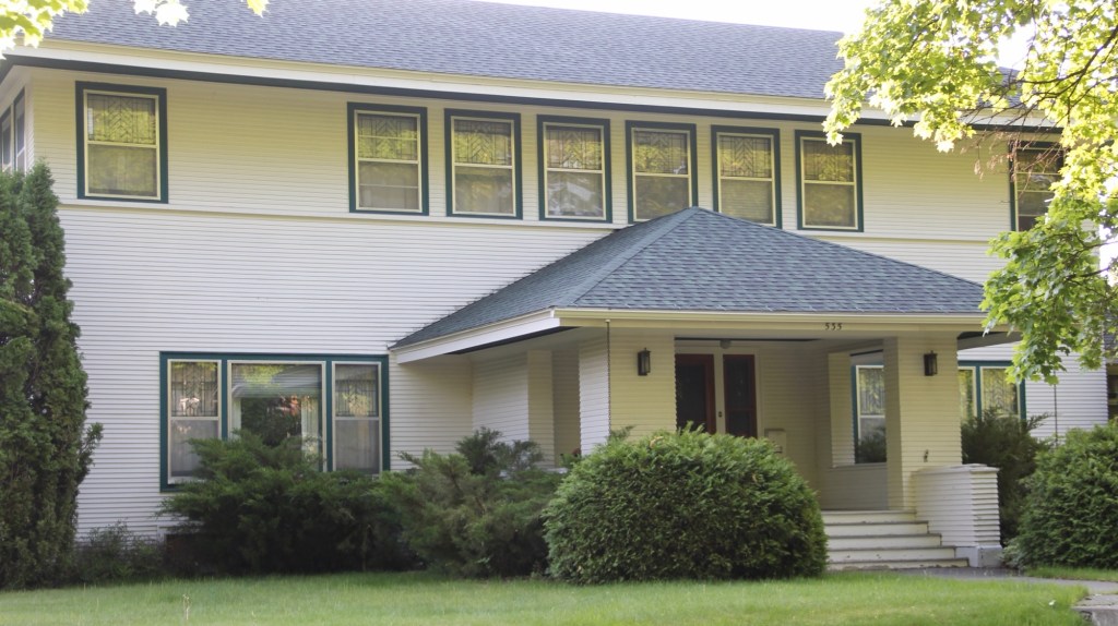
Another important example of early modernist style is this local adaptation of Prairie house style, a form introduced and popularized by the designs of American master Frank Lloyd Wright.
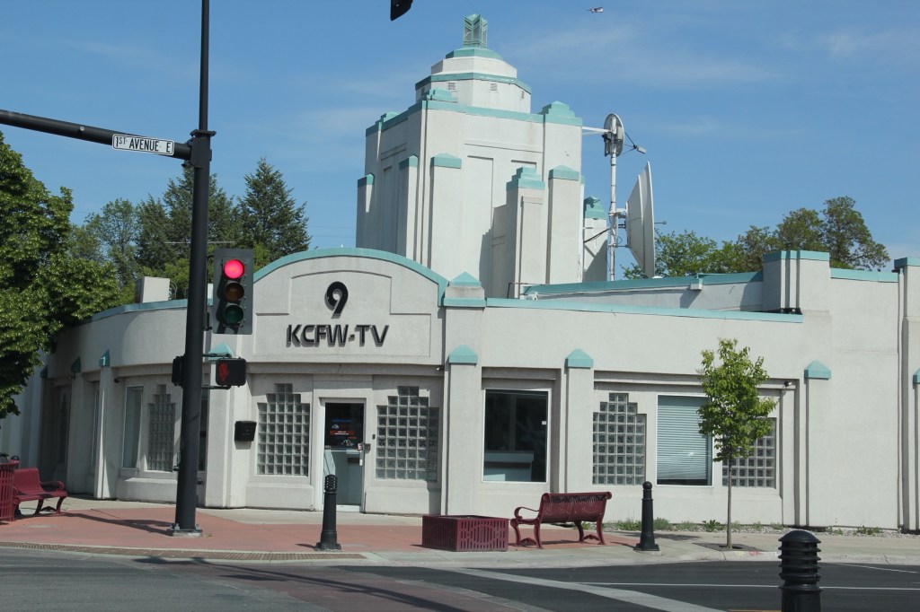
Kalispell’s best modernist examples come from the 1930s to 1960s. In 1931 Brinkman designed the KCFW-TV building in a striking Art Deco style. It was originally a gas station but has been restored as an office building with its landmark tower intact.
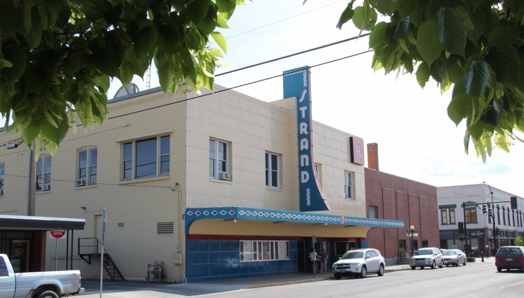
The Strand Theatre closed as a movie house in 2007 but its colorful Art Deco marquee and facade remain, another landmark across the street from the History Museum which is housed in the old high school.
The Eagles Lodge (1948-1949) is an impressive example of late Art Deco style, especially influenced by the federal “WPA Moderne” buildings from the New Deal. G.D. Weed was the architect.
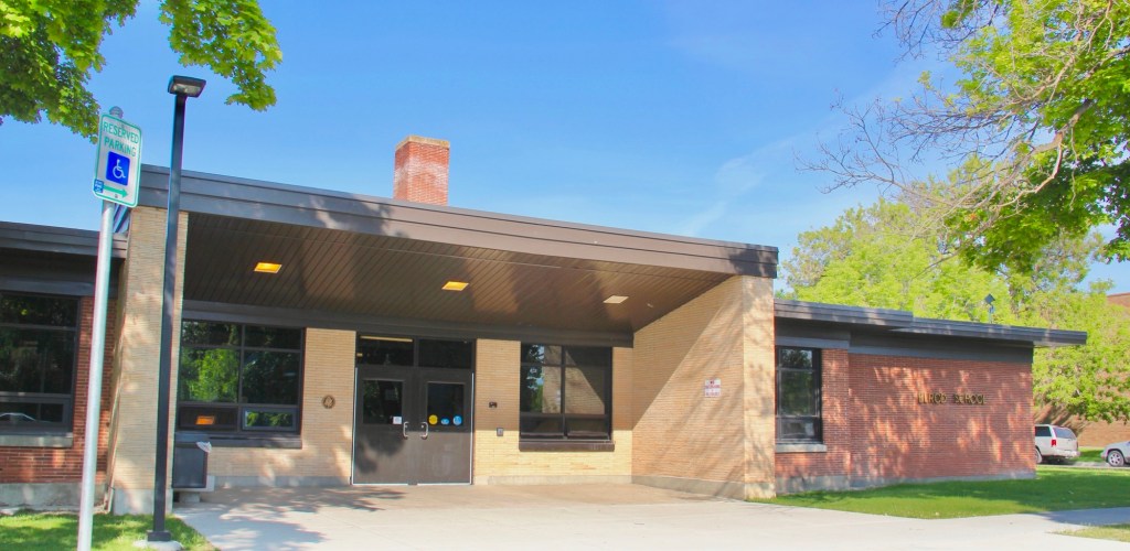
Then the town opened Elrod School in 1951. It is a good example of mid-century International style in a public building.
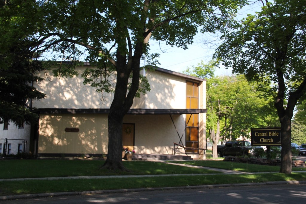
The 1950s decade witnessed new modern style religious buildings. The Central Bible Church (1953) evolved from a merger of Central Bible and the West Side Norwegian Methodist Church. Harry Schmautz was the architect.
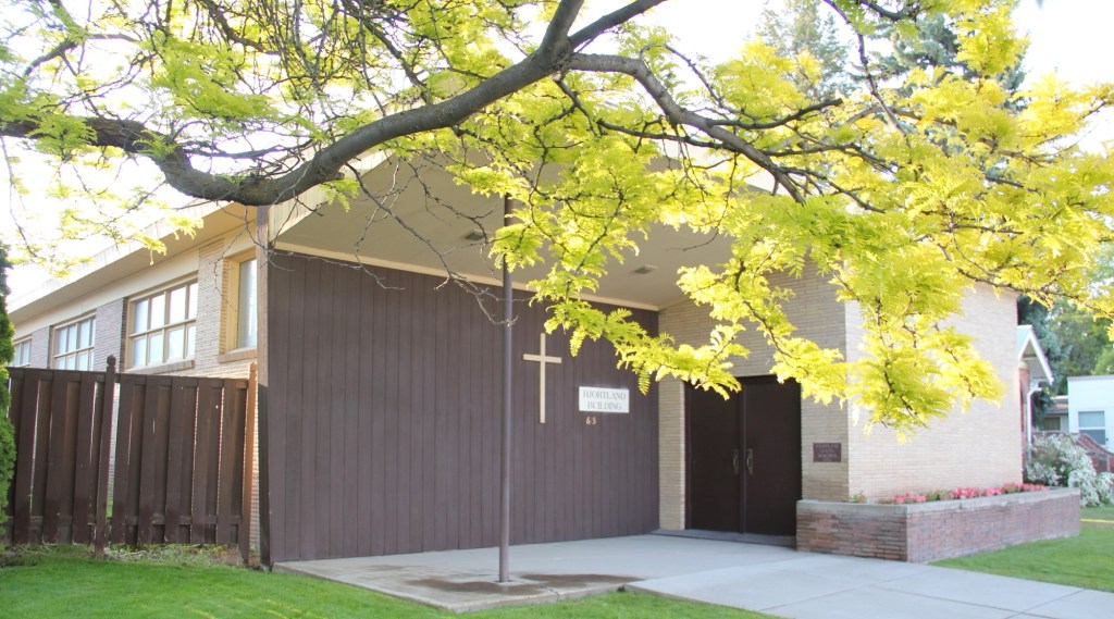
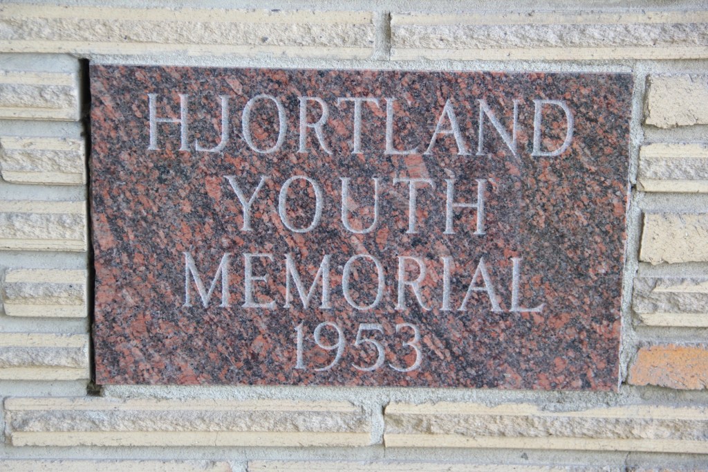
That same year, the Lutheran church added a new wing for its youth ministry, the Hjortland Memorial, which is one of Kalispell’s most impressive 1950s design. Ray Thone was the architect.
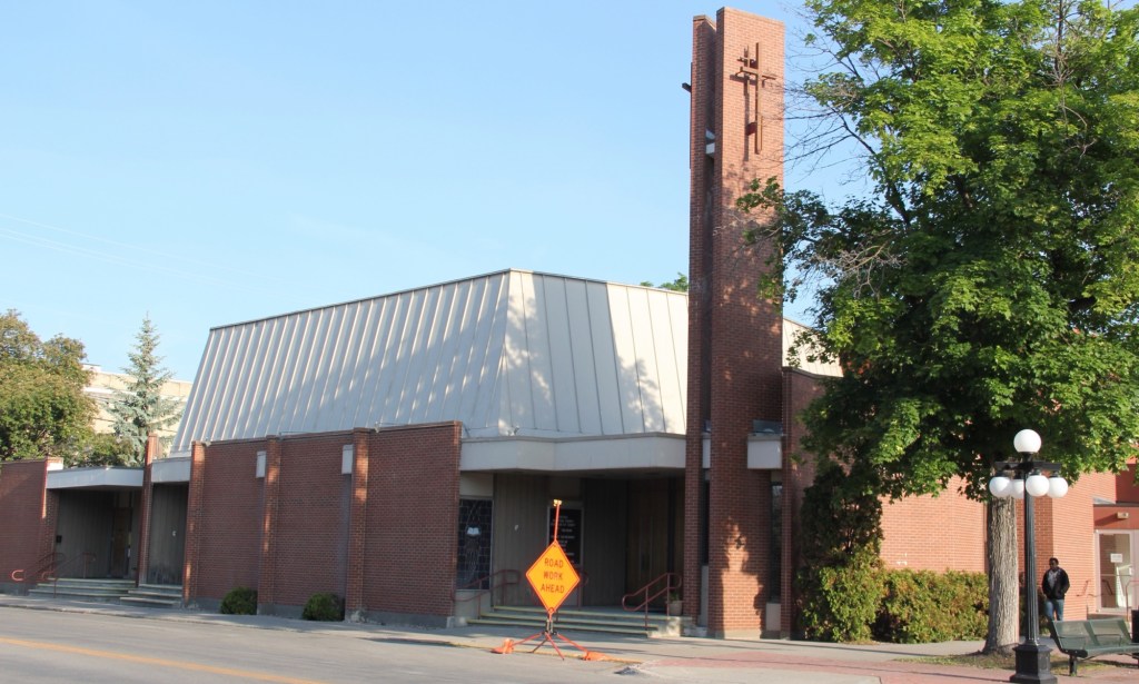
In 1958 Central Christian Church completely remodeled its earlier 1908 building to a striking modern design.
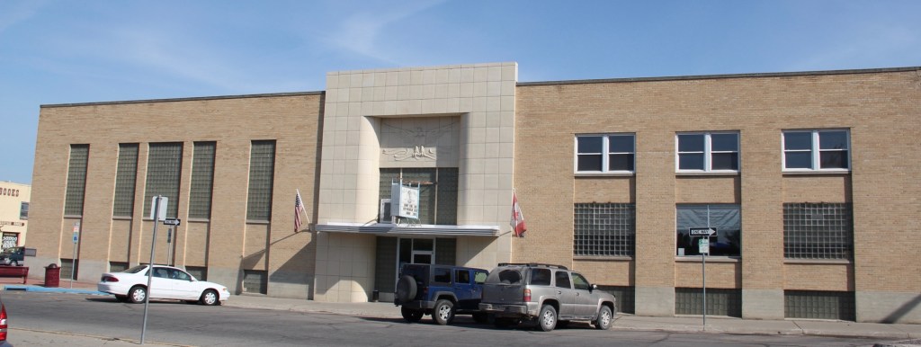
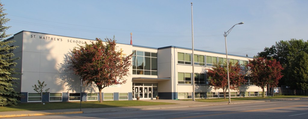
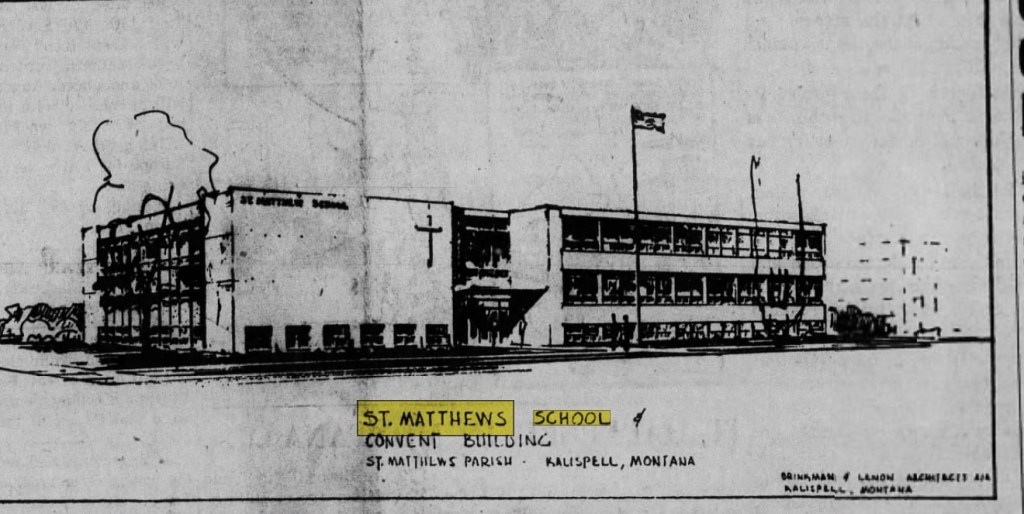
That same year came the opening of St. Matthew Catholic School, an impressive two-story example of International style in an institutional building. the architect was the firm of Brinkman and Lenon.
Architectural rendering published in Flathead News and Farm journal, May 16, 1957
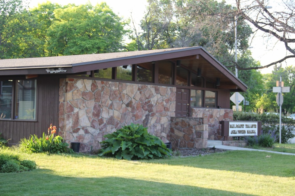
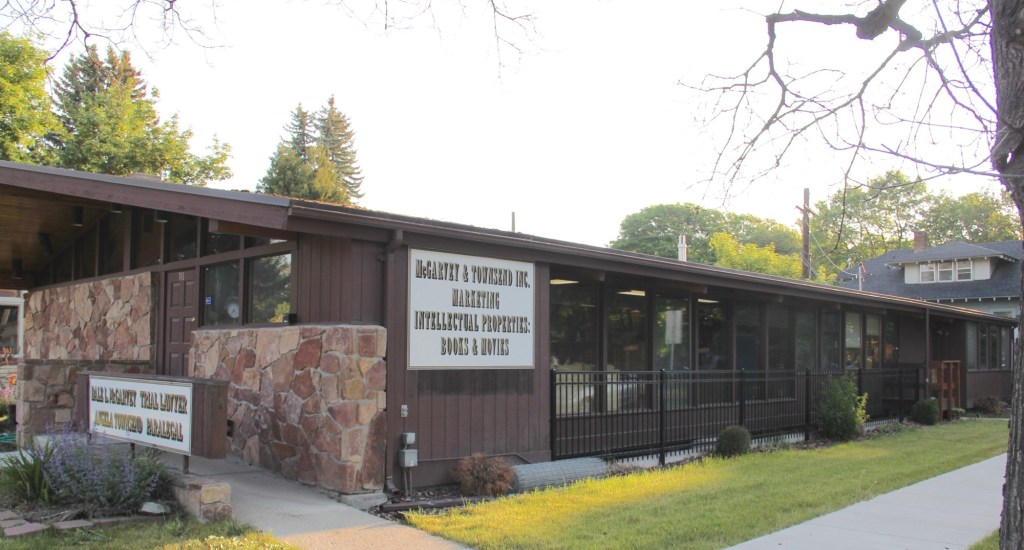
Kalispell also has two excellent examples of commercial buildings in the mid-century contemporary style. Below is the stone veneer and window wall of the McGarvey and Townsend building.
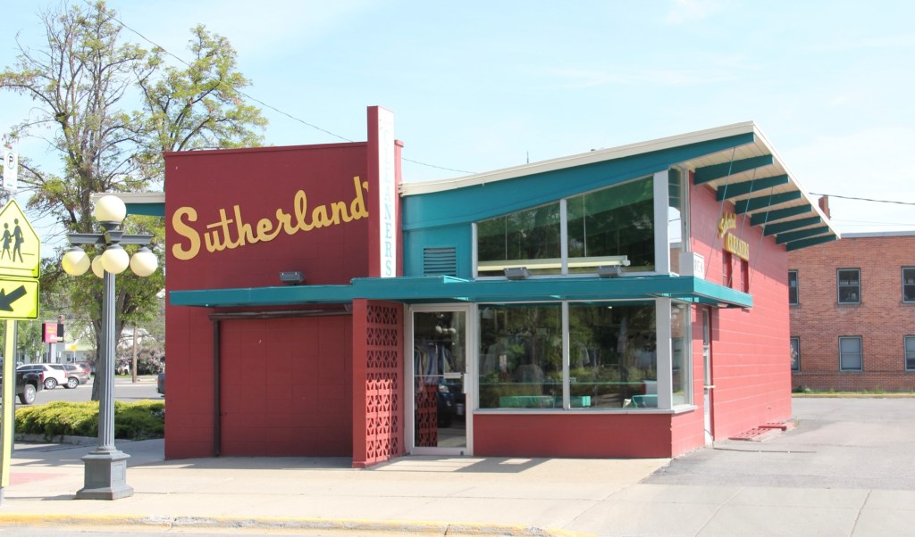
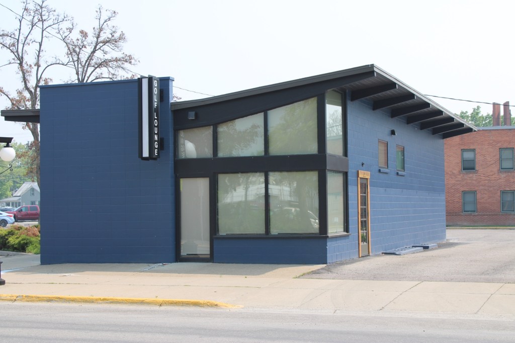
But my favorite, until a recent “remuddling,” is the Sutherland Dry Cleaners, now a golf supply shop.
The Sutherland business in 2015The same building in 2023
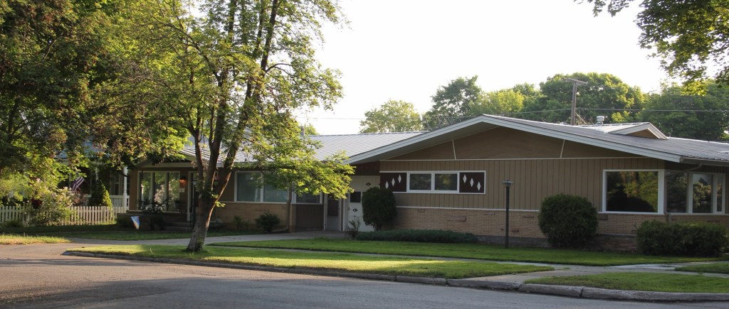
Kalispell has several good examples of mid-century domestic design. My favorite is this Ranch-style residence near the Conrad Mandion.
This post doesn’t include all of Kalispell’s modernist designs but hopefully I have included enough to demonstrate that the town has a significant modernist architecture tradition.
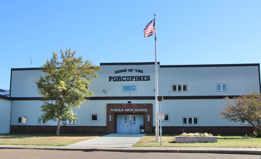
It had been over a decade since I last stopped in late September 2025 at the tiny railroad town of Nashua in Valley County. Recently in the state and regional press, there have been stories about the uptick in tourism in northern Montana. It’s about time, especially for intrepid heritage tourists. As my posts from over ten years ago emphasized, an amazing array of stories and places await those who venture beyond Havre on U.S. Highway 2.
Even tiny Nashua (probably less than 300 residents today) reflects virtues worth exploring—community pride especially as reflected at the recently renovated Nashua High School, above. Since the town had lost population since my last visit, I had wondered if the school was still there as an anchor. Indeed it was, and looked almost modern as its 1935 core from the New Deal had been layered over with a new facade.
The railroad was the dominant influence in the town’s history—save for the 1930s boom during the construction of nearby Fort Peck Dam—and the town’s rail corridor is still defined by its grain elevators.
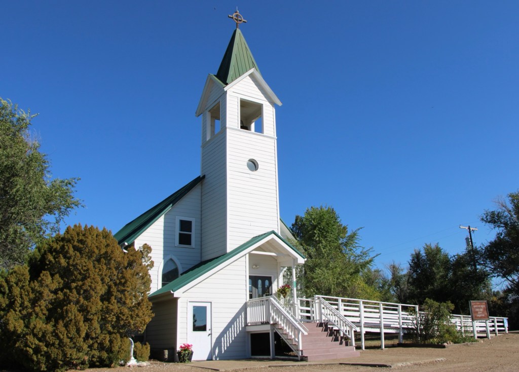
Queen of Angels Catholic Church
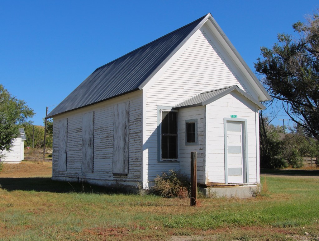
Competing for the Big Sky line of Nashua is the tall Gothic style bell tower of the Catholic Church. Established in 1917, Queen of Angeles Catholic Church began as a mission church. The Sisters of Charity worked with the diocese to establish an adjacent one-room school, below, as a way of growing and maintaining the congregation after the end of the Fort Peck Dam boom.
Then in 1953 Rev A. J. Schuh wrote an appeal to The Catholic Worker, a major newspaper, asking for the support for the construction of a rectory so that a more permanent foundation for the church’s work in Nashua could be laid. I had no idea if the appeal worked or not—but something happened. Queen of Angels Catholic Church was in great condition, and a major town landmark.
Front Street, Nashua
Along the old highway route was another landmark, of a quite different purpose: Vic’s Bar and Bowling Alley. Here is the private social center for the town. Great rural Montana towns always have at least one traditional watering hole. Vic’s is that place in Nashua.
Victor Dostert (1886-1961) homesteaded south of the town along the Milk River during the boom of the 1910s but when the bust came in the 1920s Dostert, his wife Anna, and their three sons stayed, making their mark with construction projects (from a theater to the Catholic Church) and taking advantage of the thousands of construction workers passing through by building and operating Vick’s Bar in 1935. He added the bowling alley in the 1950s—a decade when the bowling craze as a community institution reached its peak across the nation.
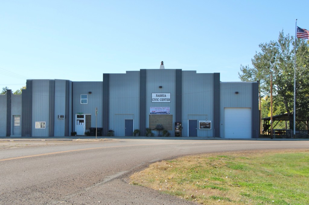
Dostert as Nashua’s town official had already been instrumental a few years earlier in the creation of the Nashua Civic Center, the public community center for this part of Valley County still today.
These places and brief stories hint at the richness of heritage experiences in Valley County. I’m glad I stopped at Nashua again (just too bad that it was early in the morning and Vic’s Bar was not yet opened). But give the residents much credit—they hung through another tough decade through commitment, community spirit, determination and faith.
Repeat visitors to this blog about historic places in Montana quickly see that the focus is very much on the era of 1860 to 1960. But I have taken time to also record the modern past. This brief detour into northeast Montana (Roosevelt, Sheridan and Daniels counties) shares commercial, public, and religious buildings from the late 20th and early 21st century.
The Montana State Bank (now in 2024 the Bank of Plentywood) in Plentywood has its business roots in earlier bank in the railroad town of Reserve. Its echoing of classical columns in a modern setting makes it my favorite modern style bank in the region.
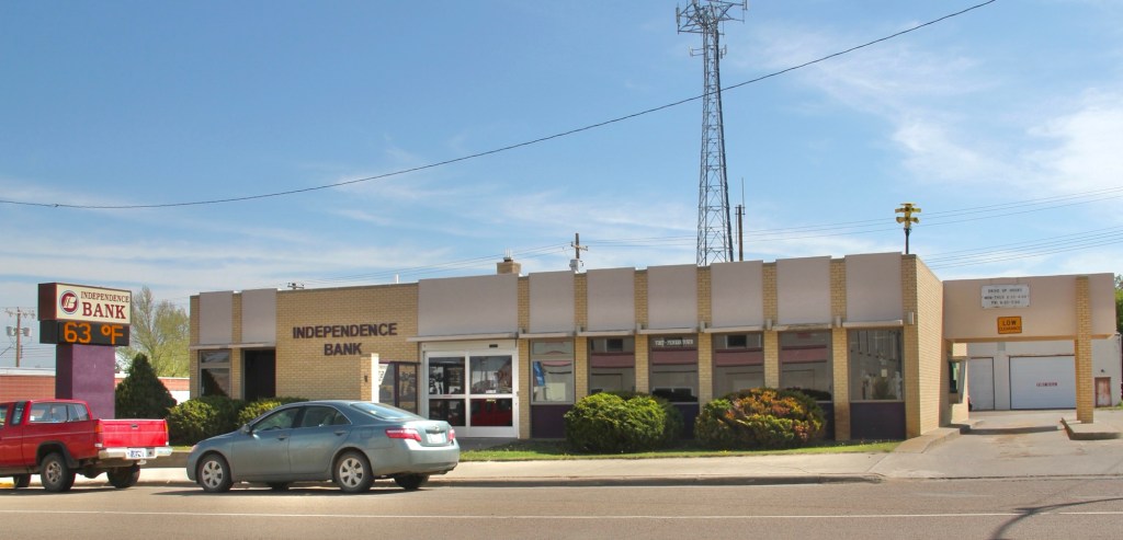
Not far behind is the Independence Bank in Scobey, built in 1972. After the First Security bank of Havre acquired the bank in 1998 it changed the name to Independence in 2000.
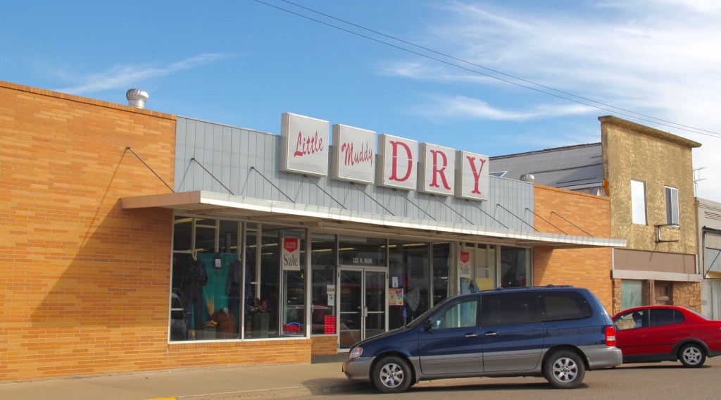
The store is now closed.The store front has changed since this image from 2013
Colorful metal sheathing over old storefronts helped owners update their businesses from the 1960s into the 1980s, enabling downtown locations seem more like shopping centers. The top example is from Plentywood while the bottom, Bryan’s, is from Wolf Point.
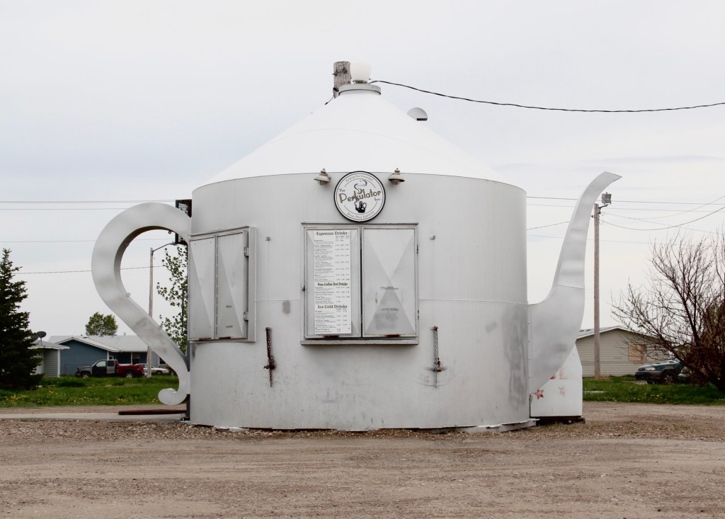
The Perkulator coffee shop is still going strong on U.S. Highway 2 in Poplar. Highly recommended!
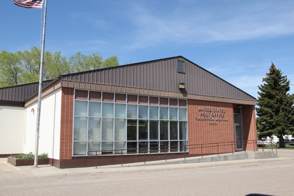
The design of U.S. post offices moved away from the preference for Colonial Revival styles in the first half of the 20th century and embraced a modern look as shown in Culbertson (top) and Scobey (bottom).
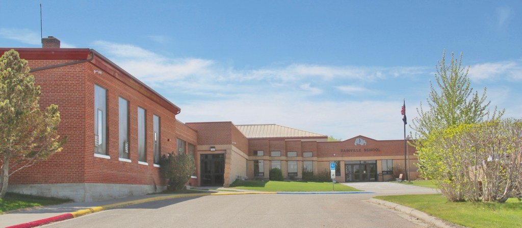
The Roosevelt County office building in Culbertson continued with modem styling into the 21st century. Staying in Roosevelt County new schools for Culbertson and Bainville in the early 21st century also shared contemporary styling. Bainville school
Fort Peck Community College in Poplar has significantly expanded its campus after achieving accreditation in 1991 and the gaining land-grant status in 1994.
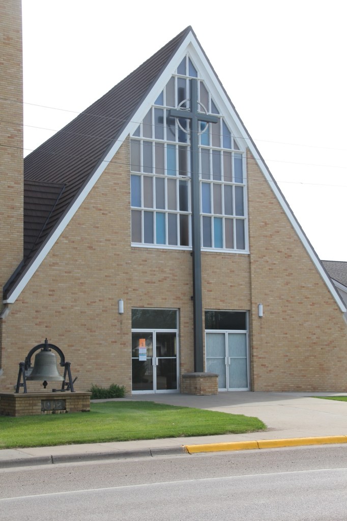
Lutheran churches in Plentywood and Wolf Point are also modern landmarks. Plentywood Lutheran ELCA dates to c. 1957-1960 while the Trinity Lutheran Church is a late 19th century congregation that worships in a 1960s building.
Plentywood Lutheran Plentywood Lutheran ELCATrinity Lutheran in Plentywood Trinity Lutheran in Plentywood
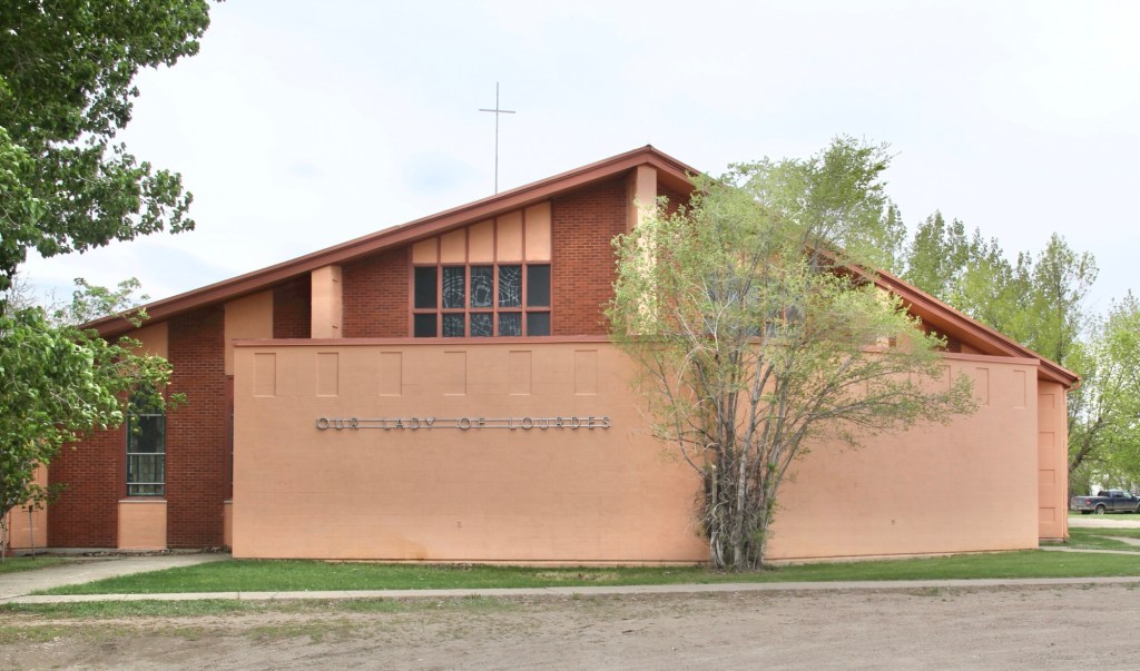
Our Lady of Lourdes Catholic Church, a 19th century congregation, in Wolf point ends our regional tour of Montana modernism. the building reflects the diocesan decision to build contemporary style churches in towns large and small through eastern Montana in the 1950s and 1960s.
Montana Highway 16 stretches north from U.S. Highway 2 following a spur line of the Great Northern Railway laid about 1910. Following that railroad corridor first brought me to Medicine Lake, the actual lake and town of that name in February 1984.
Great Northern depot in 1984
When I returned over thirty years later, the depot was gone, but the lake and town were doing ok.
Depot is gone today
Medicine Lake is a very important place in northeast Montana and the 8,000 + acre lake has been protected as a National Wildlife Refuge since 1935.
Medicine Lake NWRMedicine Lake NWR
Native Americans for centuries visited and hunted here, as hundreds of tipi rings along the lake bluffs documented. The lake remains a touchstone for several tribes today.
Medicine Lake, MT
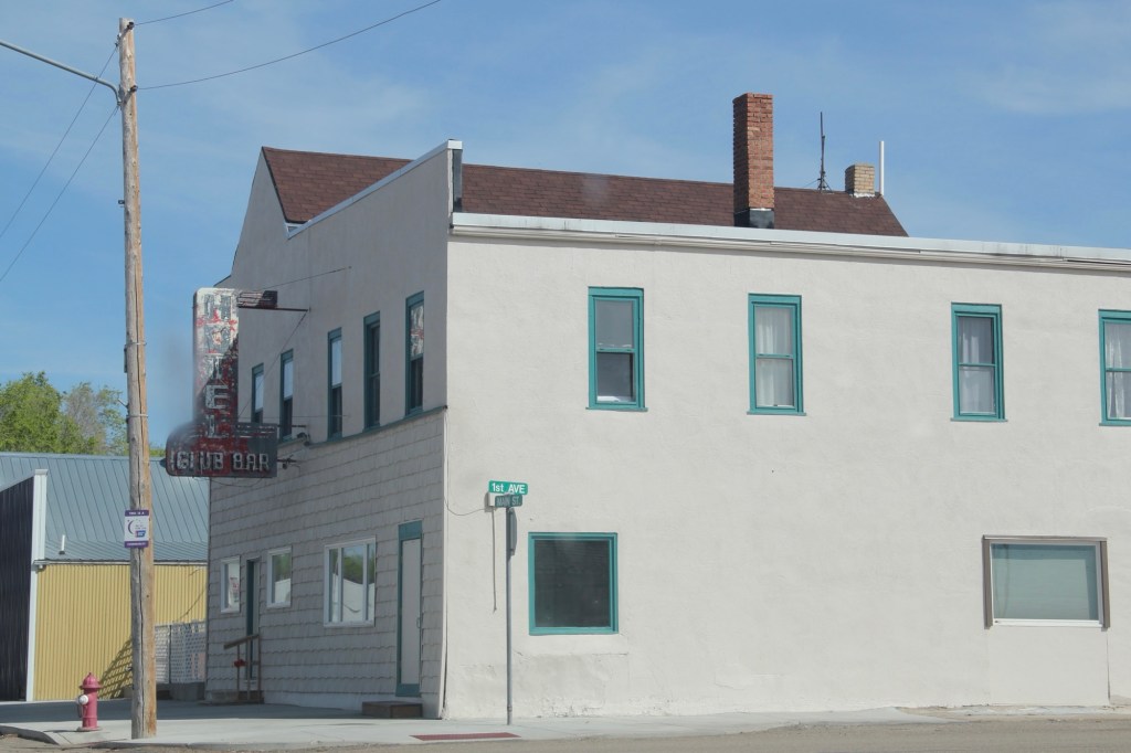
The town is much more recent, established by the railroad in 1910, with the iconic Club Hotel and Bar in business within a year.
I have stopped at the Club Bar where the old neon sign was a bit weathered but hospitality was everywhere. Don’t know about the hotel—maybe rooms was still used during the hunting season.
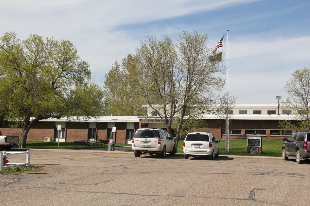
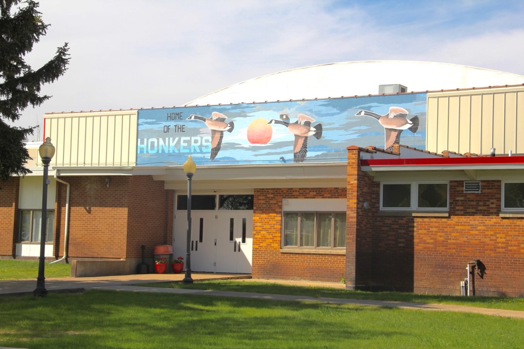
The Medicine Lake K-12 school keeps the town of about 250 people together but since my last visit the school lost its distinctive mascot name of The Honkers. For sports the school has merged with Froid and took us nickname of Red-Hawks. Did that mean that town gathering spot would change its name from the Honker Pit? Absolutely not. Great place!
Medicine Lake, the town, has several buildings from its first generation of settlement, including a corner gas station (adapted into a new business) and classic false-front one-story commercial buildings, including a lumber business and a hardware store.
Yet a dwindling population has hurt the business core. For 40 years between 1940 and 1980 the town’s population stayed around 400. The next 40 years witnessed a decline—and in a small town a loss of 150 people can really hurt.
But the town began a slight rebound in population in between 2010 and 2020, with some of it fueled by fracking man-camps
The bones of an early 20th century homestead town are still there. I hope to visit again and see new changes in 2025.
In 2024 I began to see media accounts, both regionally and nationally, of how Glasgow, the seat of Valley County, was the most isolated place you can imagine, truly in the Middle of nowhere.
Historic Great Northern Railroad corridor in Glasgow
I’m not one to argue with geographers and economists. I’m sure from their perspective, they got it right. But I never thought of Glasgow as isolated: it is on the Great Northern mainline, and part of the famed Empire Builder Amtrak route, and on U.S. Highway 2.
Great Northern depot, Glasgow
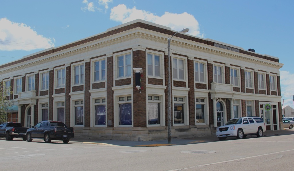
Then the town has always shown a great deal of pride and ambition, conveyed so effectively by its many historic buildings, starting with the First National Bank, built c. 1884 and listed in the National Register of Historic Places.
1st National Bank building, Glasgow
When you enter the town from the underpass of the railroad, the bank is the first landmark to catch your eye, appropriate too for the impact of local banks on a town’s economic prospects during the homesteading boom and bust of the 1910s and 1920s, respectively.
Rundle Hotel, during renovation in 2013
Another landmark from the homesteading era is the Rundle Building, once the Glasgow Hotel and restored in the last ten years as an upscale hotel in the heart of downtown. Built c. 1916 and designed by the important Billings firm of Link and Haire, the Rundle is a captivating statement of an Arts and Crafts-infused Mediterranean Revival style. I have been trying to get back to Glasgow to stay here for the last four years—maybe I will make it in 2025.
The 1930s transformed Valley County through the construction of the mammoth Fort Peck Dam on the Missouri River. Glasgow too has a major New Deal landmark in its U.S. post office and courthouse, built c. 1939 and designed by federal architect Louis A. Simon.
Post office/federal courthouse, Glasgow
Its understated New Deal Deco exterior obscures a jewel of an interior, highlighted by its New Deal-funded 1942 mural depicting local history and the changes brought about by the Fort Peck Dam by artist Forest Hill. This building too is listed in the National Register.
Glasgow post office mural
Another important New Deal supported building was all about the community, and providing new opportunities: the Glasgow Civic Center. It too has a New Deal Deco style, and its large public space has been used for almost every type of event or gathering you can imagine.
Glasgow Civic Center
Glasgow’s sense of itself today still respects it past, brilliantly conveyed by its large and expansive museum. When I first visited Glasgow 40 years
Valley County Museum
ago, I held a public meeting on the state historic preservation plan here, and the next morning residents gave me a detailed tour of the recently established museum. I was impressed with its collection then, now it sprawls through the building to the adjoining grounds.
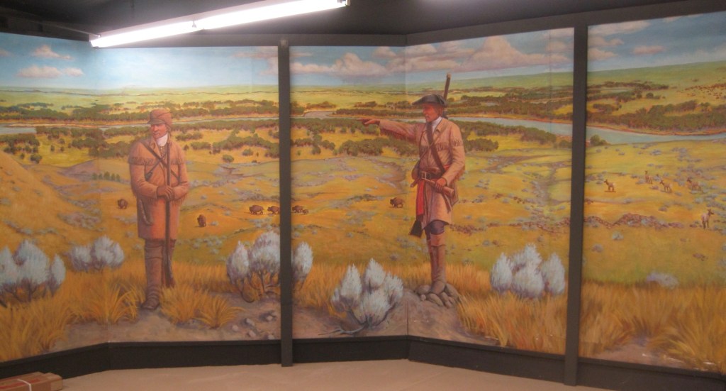
Veterans section of the museumThe high school band sectionLewis and Clark mural, 2095, by Jessie Henderson, a Chippewa/Cree artistThe back bar at saloon exhibit
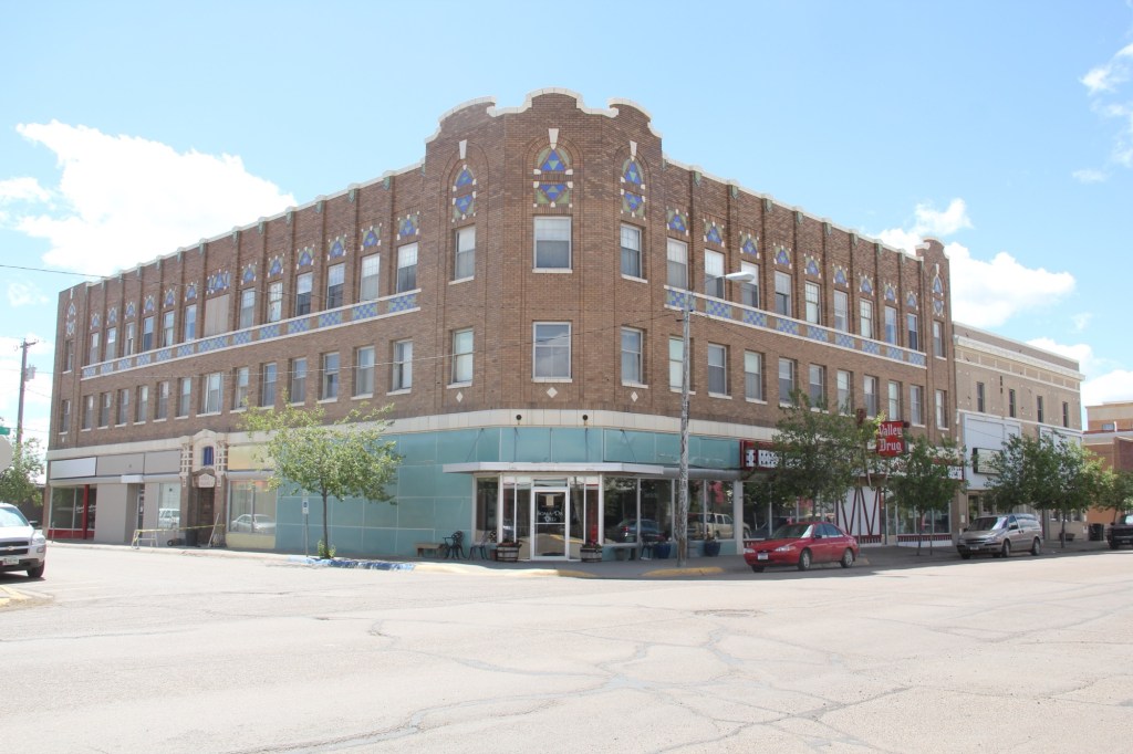
Indeed, the saloon exhibit underscores another fun part of Glasgow—across from the depot in the original route of Highway 2 is an amazing collection of bars, stores, and eateries, right out of the early 1900s.
Glasgow bars at depot
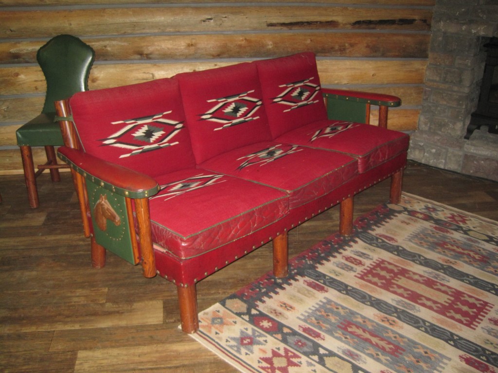
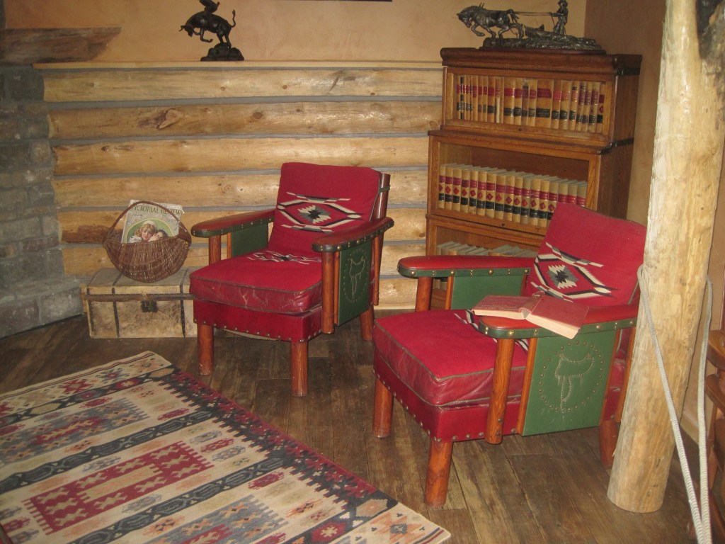
But back to the museum, and its important Montana decorative arts collection of the work of modern craftsman Thomas Molesworth, once in the town’s Carnegie library.
The newer exterior exhibits led the museum to move entire building to the property, including examples of the homestead shacks of the early 1900s that were followed by permanent homes such as this white painted bungalow.
Representative ranch house from homesteading boom
Pride of place, pride of the past. Glasgow might be in the middle but it is far from being nowhere as this small sampling of properties demonstrates.
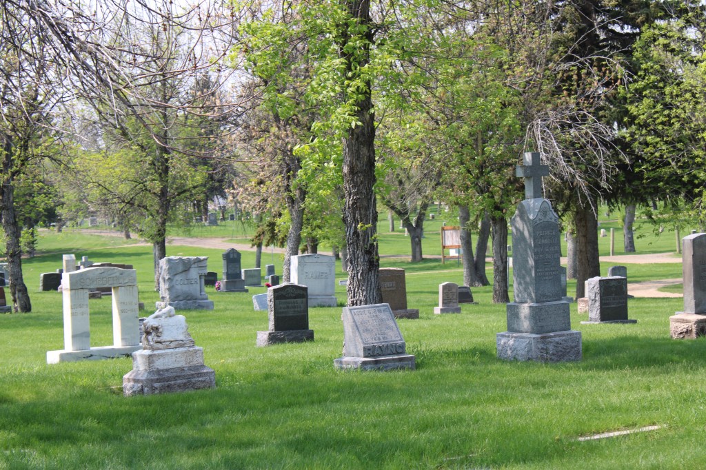
Nestled in the bluffs overlooking Havre are two adjacent historic cemeteries, Calvary (1903) and Highland (1906/7).
Entrance gate, Highland Cemetery
Catholics in north central Montana established Calvary first, taking advantage of newly located city water works to ensure that the grounds could be irrigated.
Looking north toward the Calvary Cemetery entrance. Note water works in upper right corner.
Calvary with its well manicured lawns, large mature trees, curvilinear drives and impressive view to the south set the tone for the landscaping and design of both cemeteries. Grave markers, for the most part, were modest, in keeping with the working middle class character of this Great Northern Railway division point.
Of course there were exceptions to the norm. A large Cross marks the gravesite of Judge Patrick McIntyre, one of the city’s early civic and real estate leaders who died in 1907. The classical styled marker to another of the city’s, and region’s, business leaders, Samuel Pepin, is nearby. Pepin, like McIntyre, was a Canadian who came early to Havre and developed businesses and ranches, all tied to the Railroad. Pepin died in 1914.
McIntyre markerSamuel Pepin marker
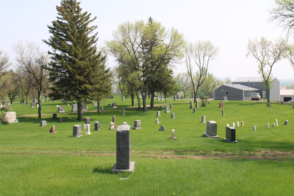
Highland Cemetery followed in the footsteps of thee catholic burial ground. Both have impressive views along the southern boundaries of the historic campus of Northern Montana University, now MSU-Northern (name change happened in 1994). The campus was established in 1929.
MSU-NorthernA panoramic view
By that year, Highland Cemetery was well established as the city’s primary public burial ground,and is still active today. Reflecting Havre’s middle class roots the cemetery is marked by rows of modest, dignified tombstones and low concrete walled family plots.
Many veterans from the 20th century are buried here, along with many tombstones marking membership in fraternal organizations from the Woodmen of the World to the Masons.
Highland Cemetery is a significant place that documents the city’s progressive response to public needs during its decade of sustained growth in the homesteading boom of the first two decades of the 20th century. Together the two cemeteries would be an excellent companion to Havre’s already established National Register-listed downtown residential district. The city does a fine job of keeping the property maintained and let’s hope that commitment stays in place for another 100 years.
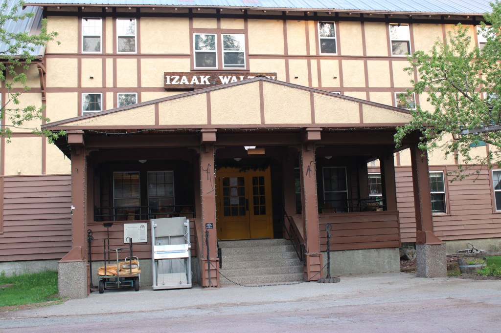
The news came like a thunderbolt in the December 16, 2022 edition of the Montana Free press: the Izaak Walton Inn had been sold to LOGE Camps.
“Street” facade of the building
I must admit that the place is special to me because it was one of the first National Register of Historic Places nominations that I had ever worked on. As I have discussed earlier in this blog, my task was to document its extraordinary significance because at that time of nomination (1984) the building was not yet 50 years old.
Historic Great Northern yards next to the inn, May 2023
Making the case was not that difficult because when it was built in 1939, it basically WAS the village of Essex: lodging for railroad workers, food, bar, post office, etc., but I have covered these points earlier in the blog. I stopped in May 2023 to document the place one last time, before n auction of interior stuff and collections and before renovations began.
In that December 16, 2022 Montana Free Press story, LOGE Camps official Slate “Olson said LOGE was well aware of the inn’s history and is not planning drastic changes to the property. However, the company does plan to make upgrades. Olson said it’ was’s too early to know exactly what those improvements will be, but that new furniture and room amenities are likely on deck in the coming year. We have a ton of respect for the history of the Izaak Walton Inn,” he said. “We want to create a destination where you feel the history, but you also appreciate the updated touches and amenities.””
May 2023May 2023
Let’s hope so. A good part of the historic integrity of the property lies with its rough edges. The old boarding houses was upgraded to a degree in the mid-1980s, certainly. But you also had the right spaces, the post office boxes, and the laid back vibe of common areas. And wi-fi: well good luck once you left the link in the lobby.
May 2023May 2023May 2023
Believe me, I get it. Historic places are always changing. But here at Essex you have to accept that the building was a key part of a working landscape of the railroad. That its history will forever be tied to the tracks and the people who worked here. Take away that gritty reality, and you lose so much.
May 2023May 2023This covered pedestrian walkway led to other cabins and trails into the park. It was a great way to see the inn and the railway working together.
Here’s to the first 38 years of the Izaak Walton Inn as a National Register landmark adjacent to Glacier National Park. Let’s hope the next generations recognize and nurture the qualities that make it special.
Standard histories tell you that Cut Bank, the seat of Glacier County, dates to 1891. But significant numbers of permanent settlers did not arrive until the first years of the 20th century, following a major investment by the Great Northern Railroad to build a huge steel bridge and railroad offices, shops, and a roundhouse. The Fort Benton River Press on February 12, 1901, reported that “Cut Bank is rapidly assuming a metropolitan appearance.”
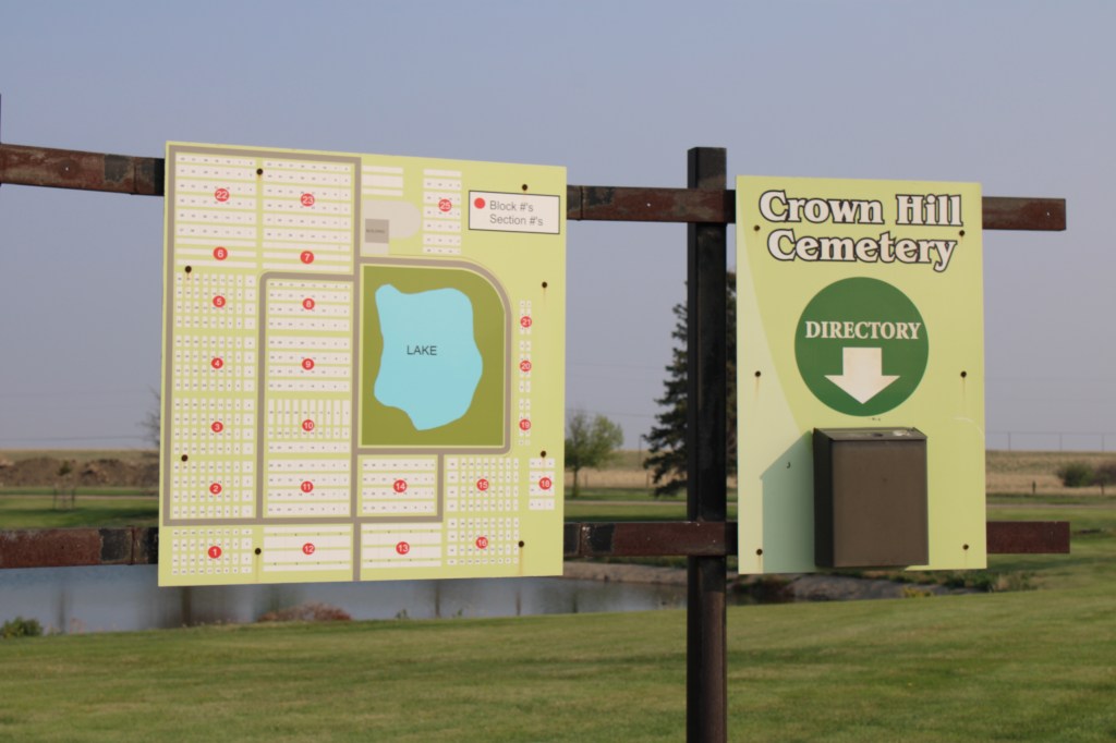
The initial railroad boom soon slowed until the homesteader movement brought new growth. In 1911 town officials agreed to discuss the creation of a permanent town cemetery with state officials. Between 1911 and 1914 citizens formed the Crown Hill Cemetery Association and the first documented burials in the local newspaper took place in 1914.
Entrance to Crown Hill Cemetery
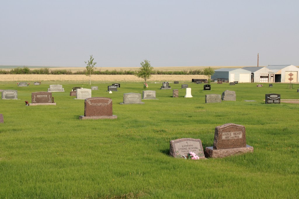
Located north of town the cemetery is on a slight rise and has an impressive view of Cut Bank to the South. A small lake is the focus of the cemetery plan.
See the grain elevators to the south.
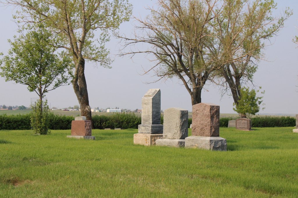
Otherwise the cemetery contains long rows in a rectangular manner and there are few huge grave markers, instead many dignified and subtly designed markers cover the grounds.
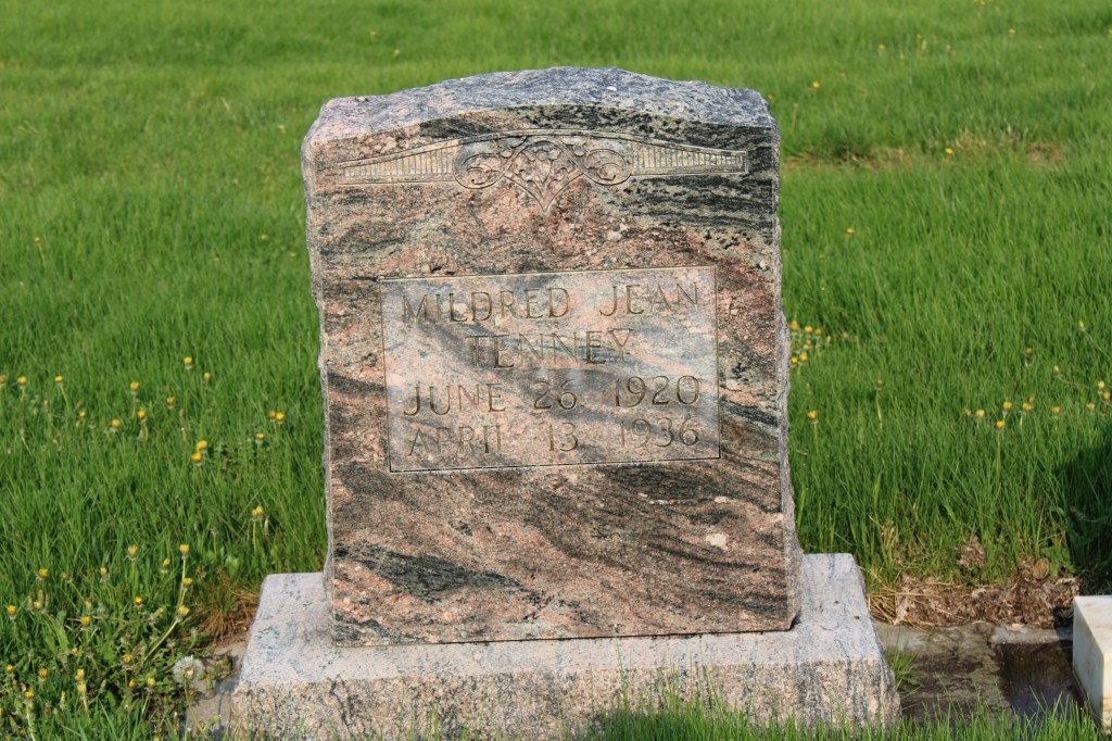
There are several interesting markers and many note a fraternal lodge association.
The Thomas marker is one of the oldest.1936 marker with Art Deco styling
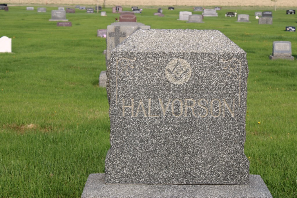
The Halvorson marker dates to be death of Mrs. Harry Halvorson who died in 1924. At that time her funeral was the largest ever held in Cut Bank. The Midland Empire of April 22, 1924 reported that 650 attended the funeral and that 77 cars went from the town Masonic Hall to the cemetery. A member of the Rebekah lodges in both Cut Bank and Shelby, Halvorson’s funeral attracted other lodge members from Shelby, Conrad, Valier and Browning. Her husband was the senior member of the Halvorson mercantile company, which started in 1901.
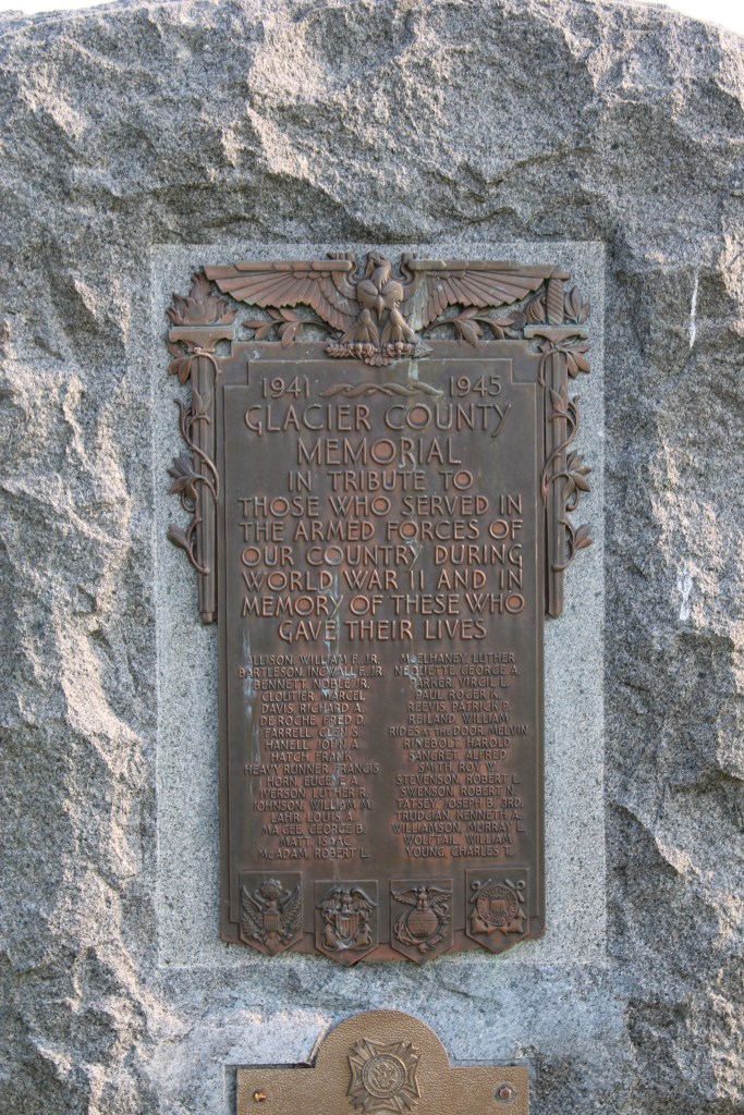
Another important marker is the veterans memorial from World War II. Cut Bank played a significant role as a satellite air field for the Great Falls Army Air Base. In 1942-43 pilots trained here in flying the B-17 Flying Fortresses. In 1948 the army conveyed the base to the town for civilian use.
Perhaps an unattended consequence of the military air base is that winter temperatures at Cut Bank was regularly available to national media, which played up the mage of Cut Bank as the coldest place in the lower 48 states. Cut Bank embraced the image, as this bit of roadside sculpture below attests. It stands at the eastern entrance into town on US Highway 2.
Crown Hill Cemetery is one of the oldest properties in Cut Bank open to the public. The cemetery is well maintained, well manicured and a testament to the respect and dignity local residents give to their past.