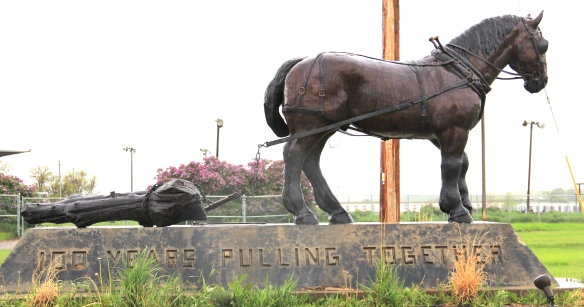
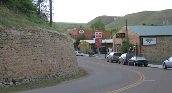
Milwaukee Road Corridor, Moore, 1984.
In my work with the State Historic Preservation Office in 1984-1985, my colleagues put up with many of my own peculiar interests and views of the Montana historic landscape, especially the focus on public buildings and the state’s railroad corridors. My interests, however, in the country towns of the Judith Basin was probably always a puzzler; staff always wished I would press on to Lewistown, where some of the best preservation work in the state was taking place in the mid-1980s (much more on Lewistown a bit later). But I must admit that the maze of small towns–never numbering more than 200 or so souls in any given place–created by the railroads as they fought for market dominance in the rich agricultural region of the Judith Basin some 100 years ago was just fascinating.

Grain elevators at Moore, 1984
And they remain so today. The geographer John Hudson had provided basic insights on the creation, distribution, and purpose of the country towns in the larger development of the northern plains–he coined the phrase “plains country towns.” The constant elements that they all shared–oriented to the tracks, the dominance of grain elevators, the prominence of depots–underscore the railroad era origins. But the towns all had their own individual places and statements, be it a woman’s club, a library, the school, and the bars and taverns. Thirty years later, much was missing from what I experienced in 1984–every place lost population between 1980-2010–but much still remained, and residents seemed determined to keep it that way.


Moore still has its grain elevators but the Milwaukee depot is long gone, creating an empty space along the corridor. Moore has the look of so many Milwaukee Road towns with a T-plan design apparent today even as the town decline from its height of 575 residents in 1920 to the 193 of today.
 But the town, which compared to many I visited in 1984 had declined to a lesser degree (229 residents in 1980 to 193 in 2010), still has its public institutions. The Moore Woman’s Club is celebrating its centennial in 2015 while the town’s public library is another key community center while the continued operation of the unassuming Moore public school

 is undoubtedly the major reason that the town is still here today.

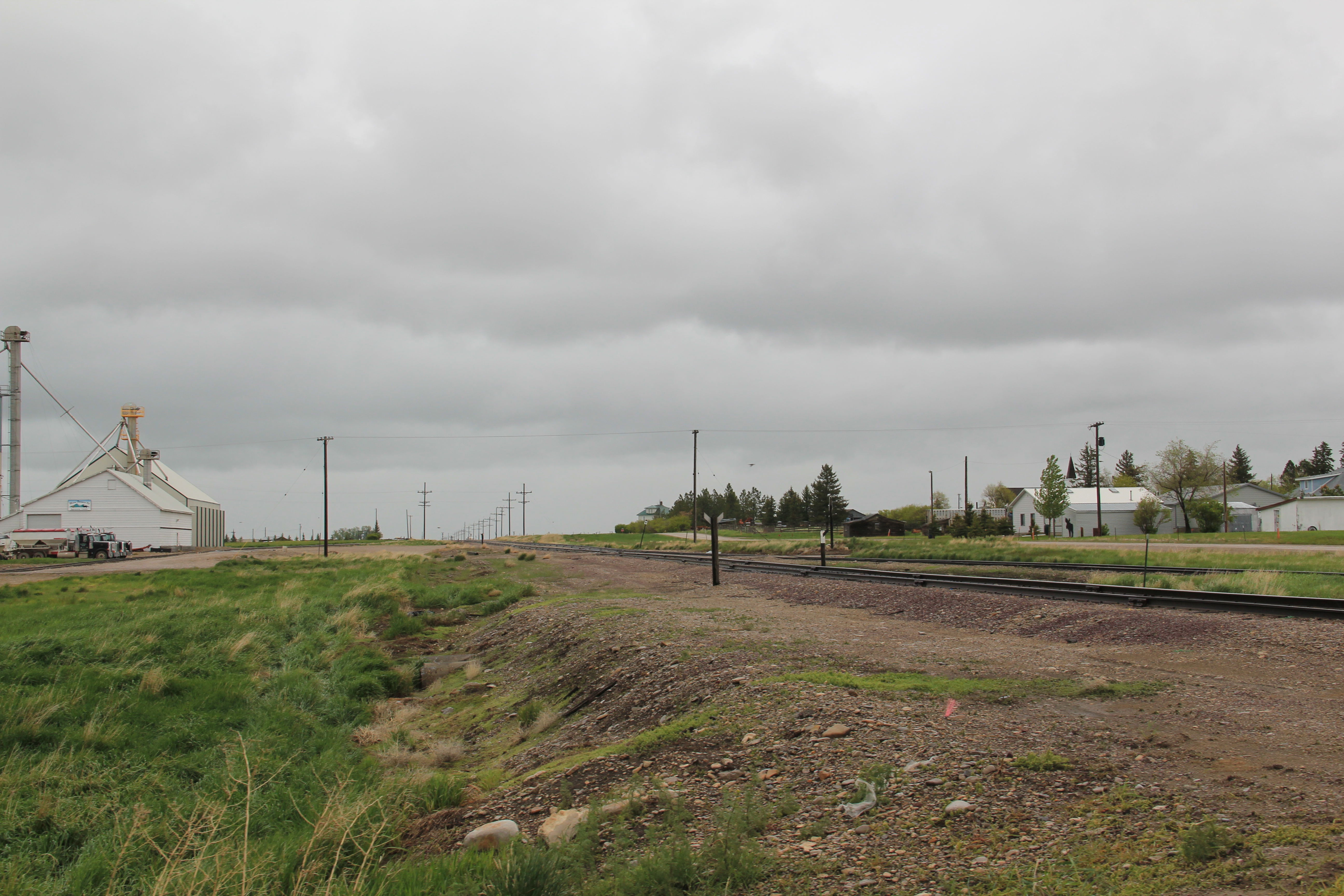
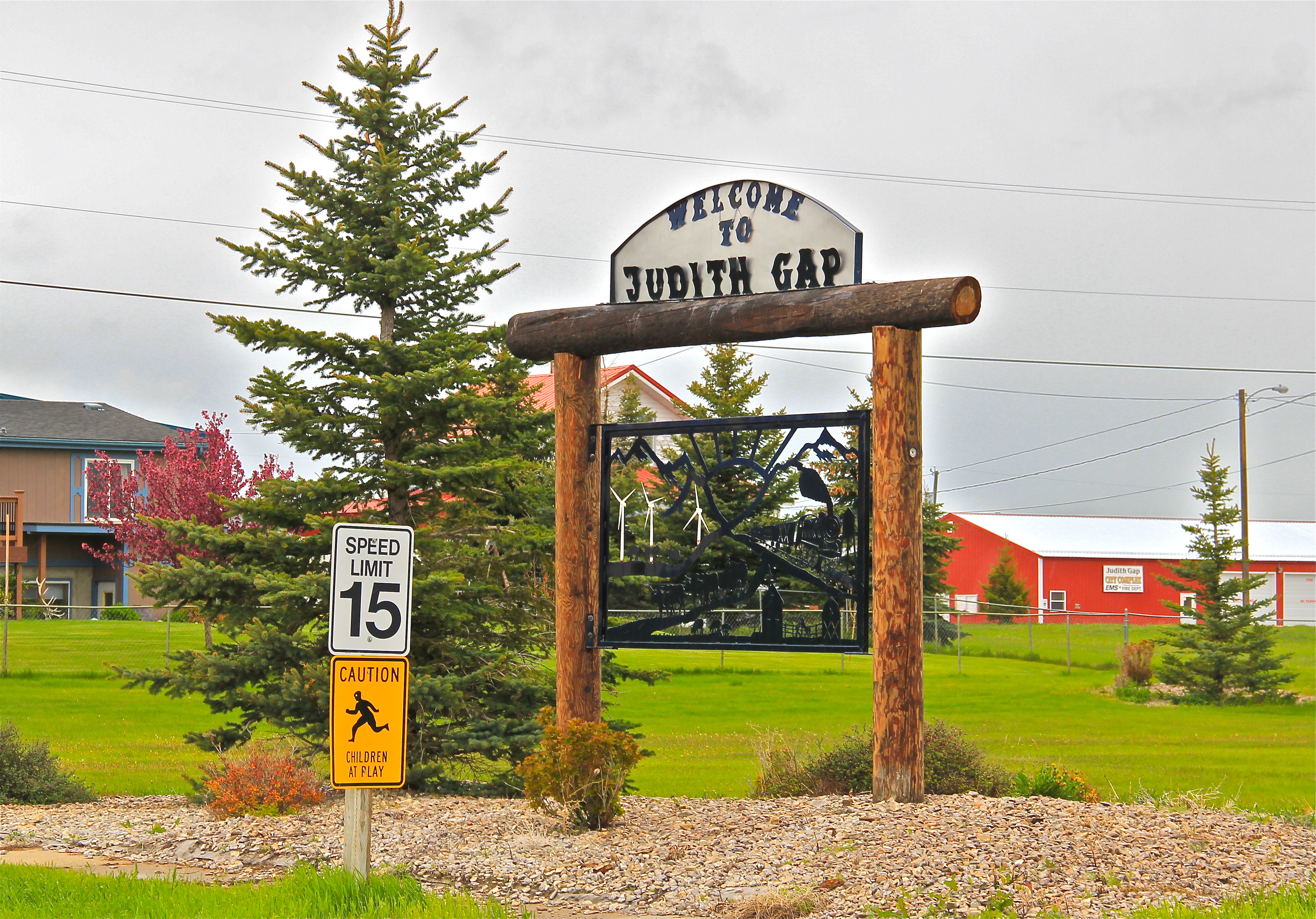
The Great Northern Railway spur line that snaked north from the Yellowstone Valley at Laurel through the Judith Gap then the basin was always a corridor of great interest to me, although the towns created along the way were small, seemingly inconsequential compared to the linking of Great Falls and Billings.
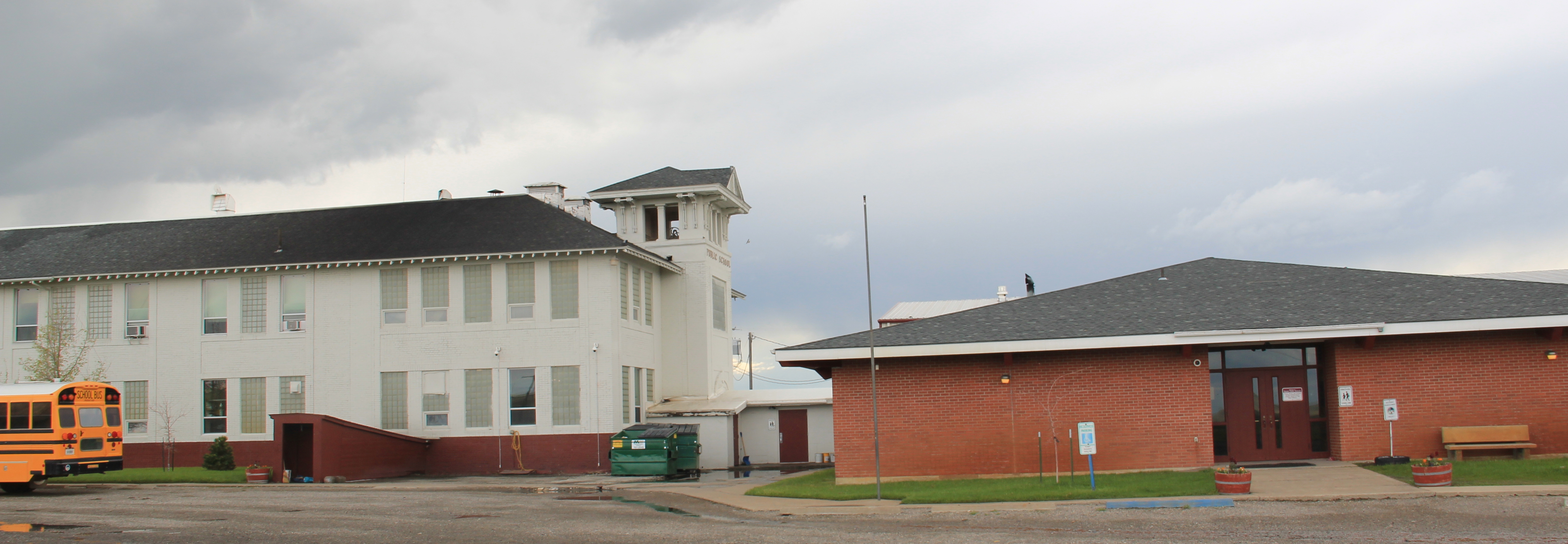
 Traveling north out of the Yellowstone then Musselshell valleys, the Great Northern line entered the basin at Judith Gap, and the homesteaders who followed built a grand two-story brick school that spoke of their ambitions.

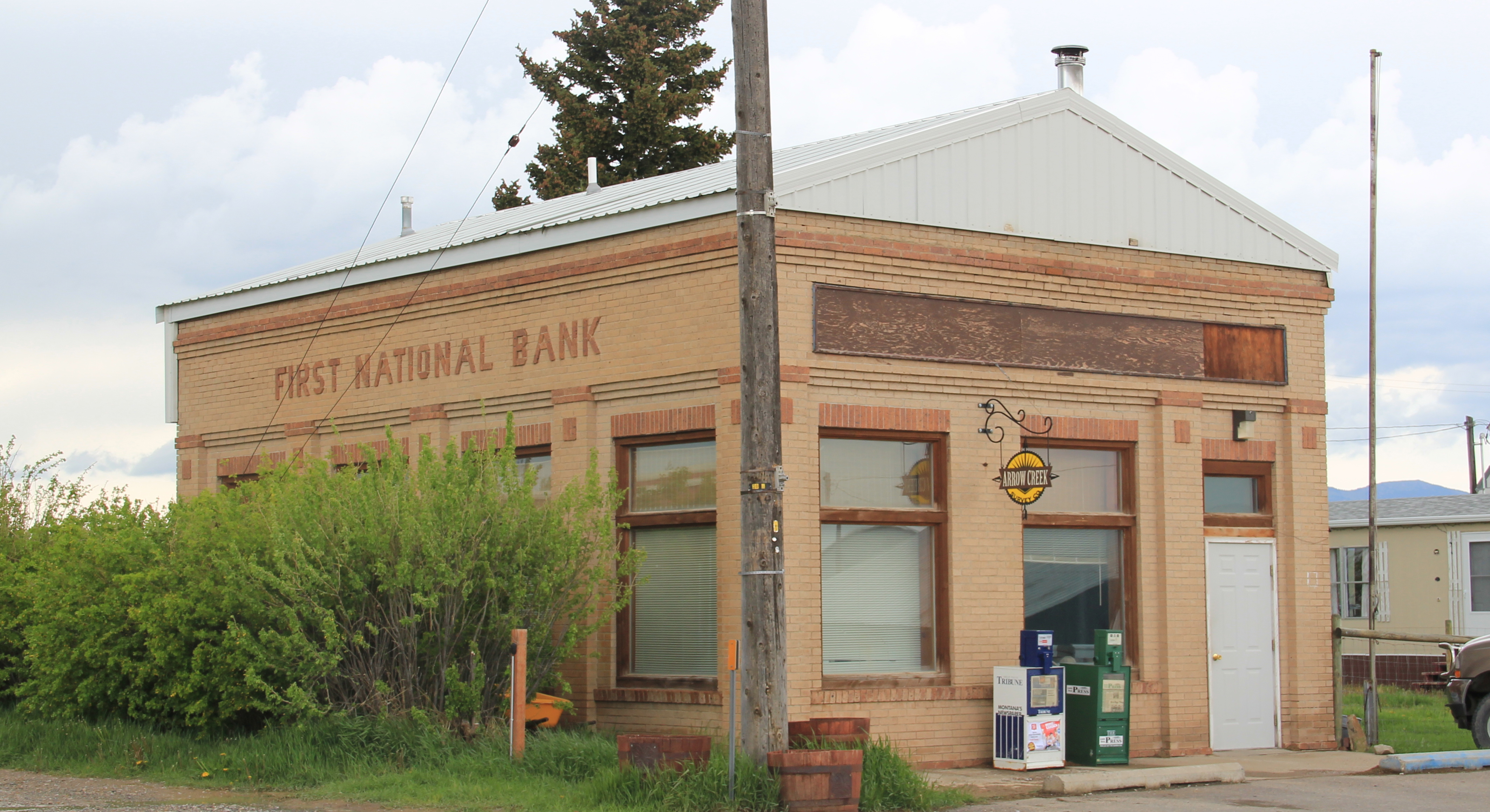
The corridor then left in its wake places forgotten today. Travelers along U.S. 191 may notice the old brick state bank building and elevators at Garneill, but they may not.

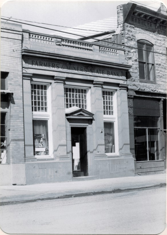
The highway veers away from the railroad line at Garneill, meaning that the old state bank at Buffalo was a forgotten place in 1984–and the town remains so today.

First State Bank, Buffalo, 1984.
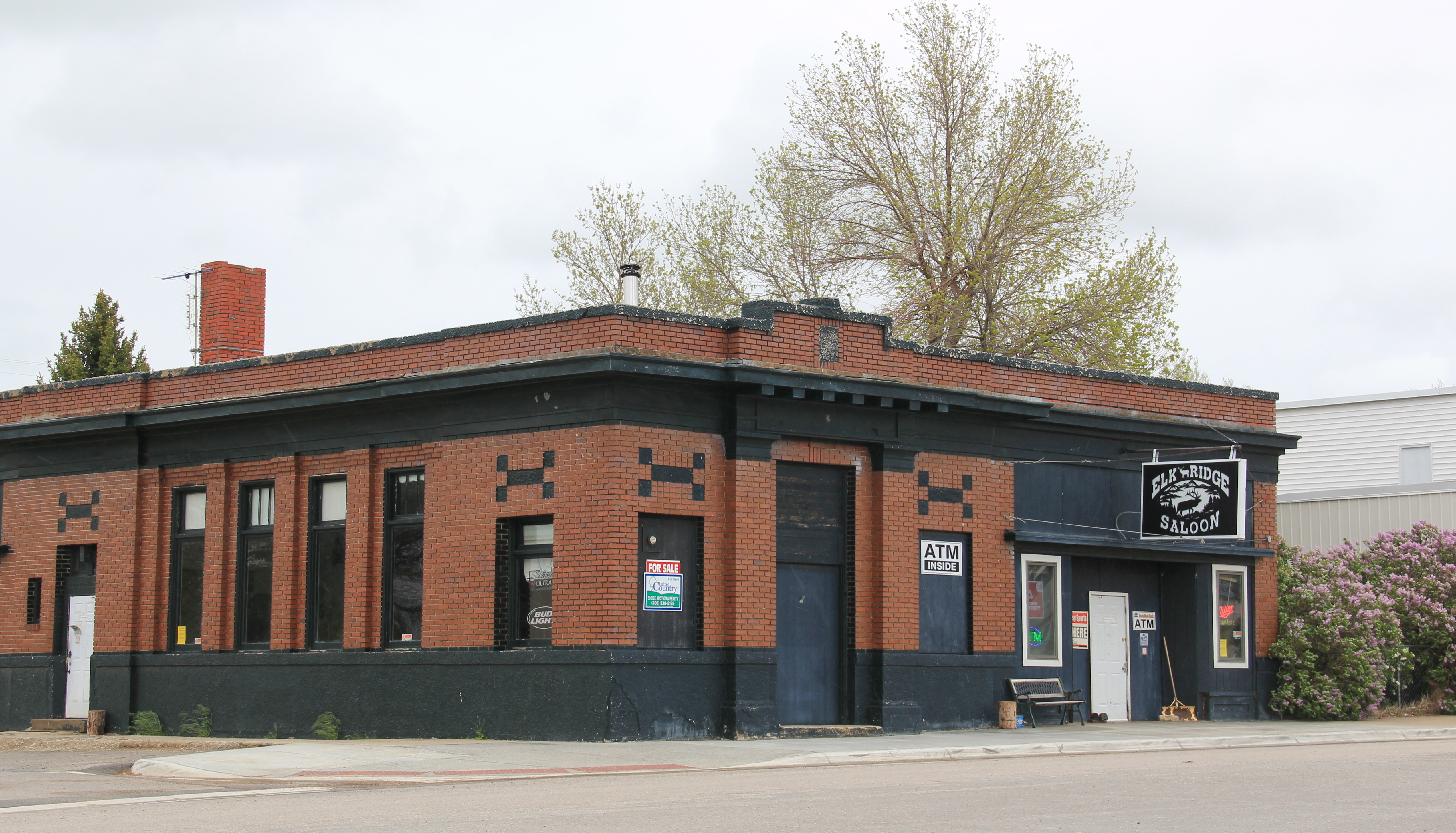
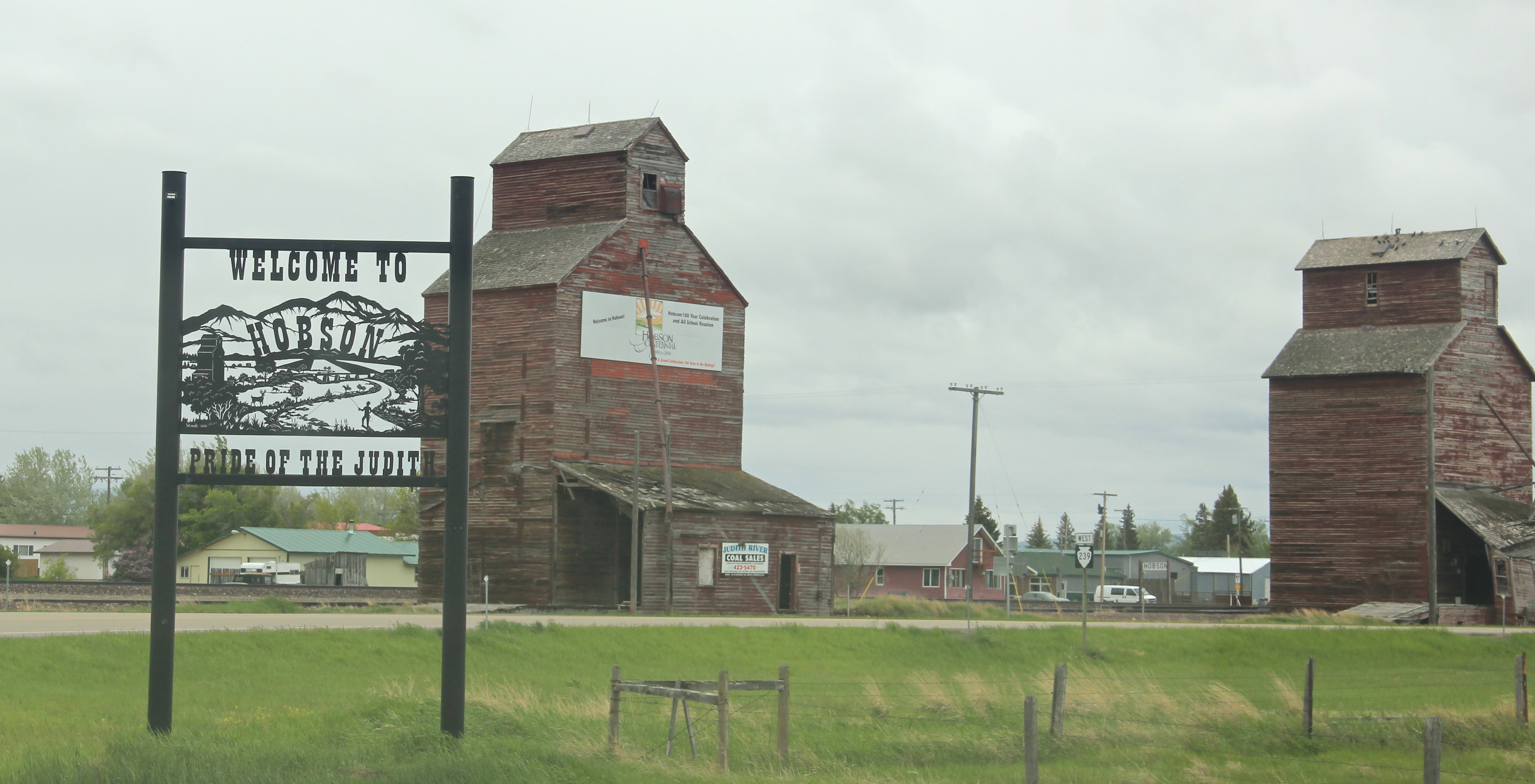
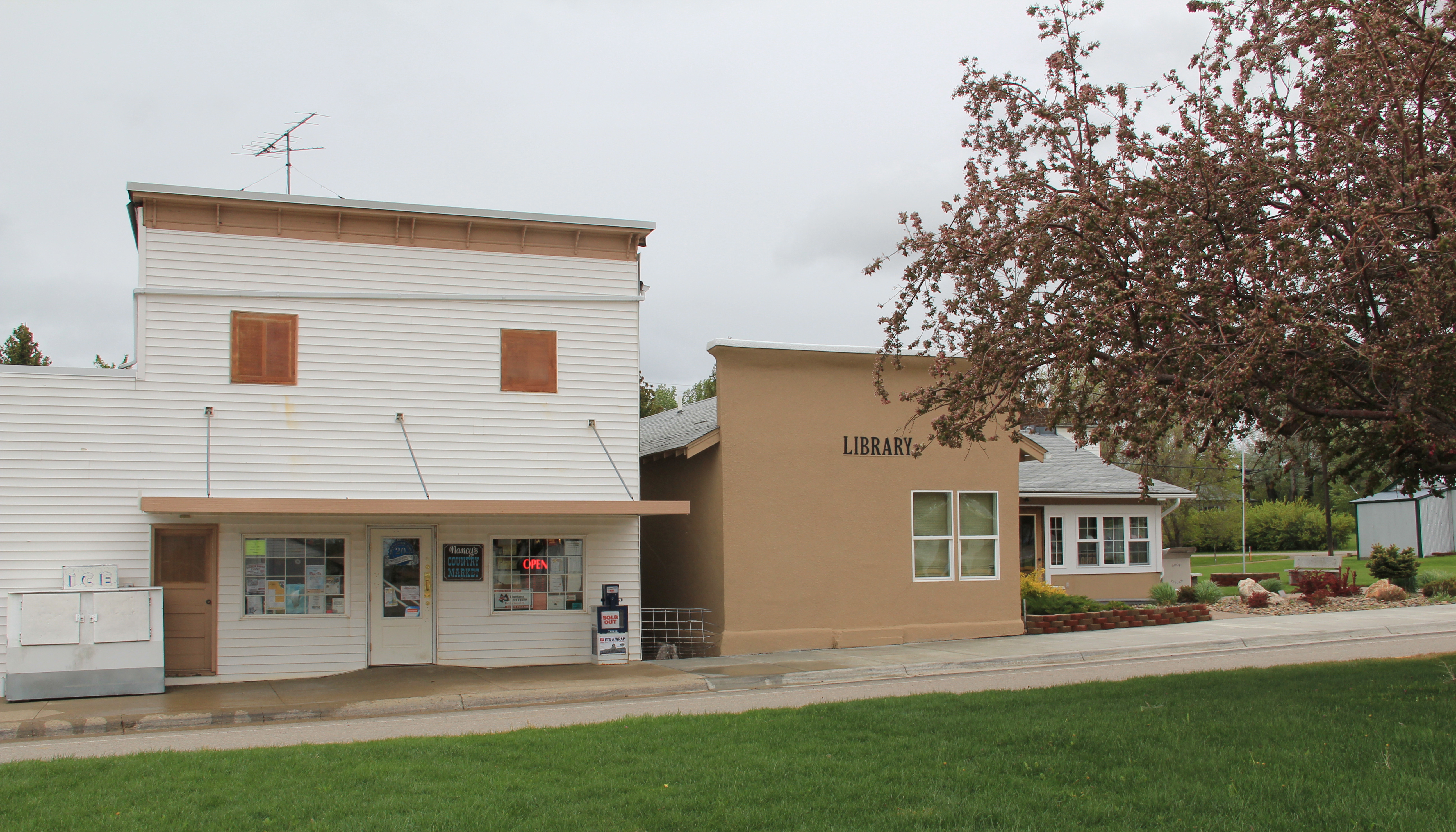
Hobson, on U.S. 87/Montana 200, has experienced a much brighter history. Its brick bank building houses a local bar. While no depot remains, the town’s railroad line remains a 
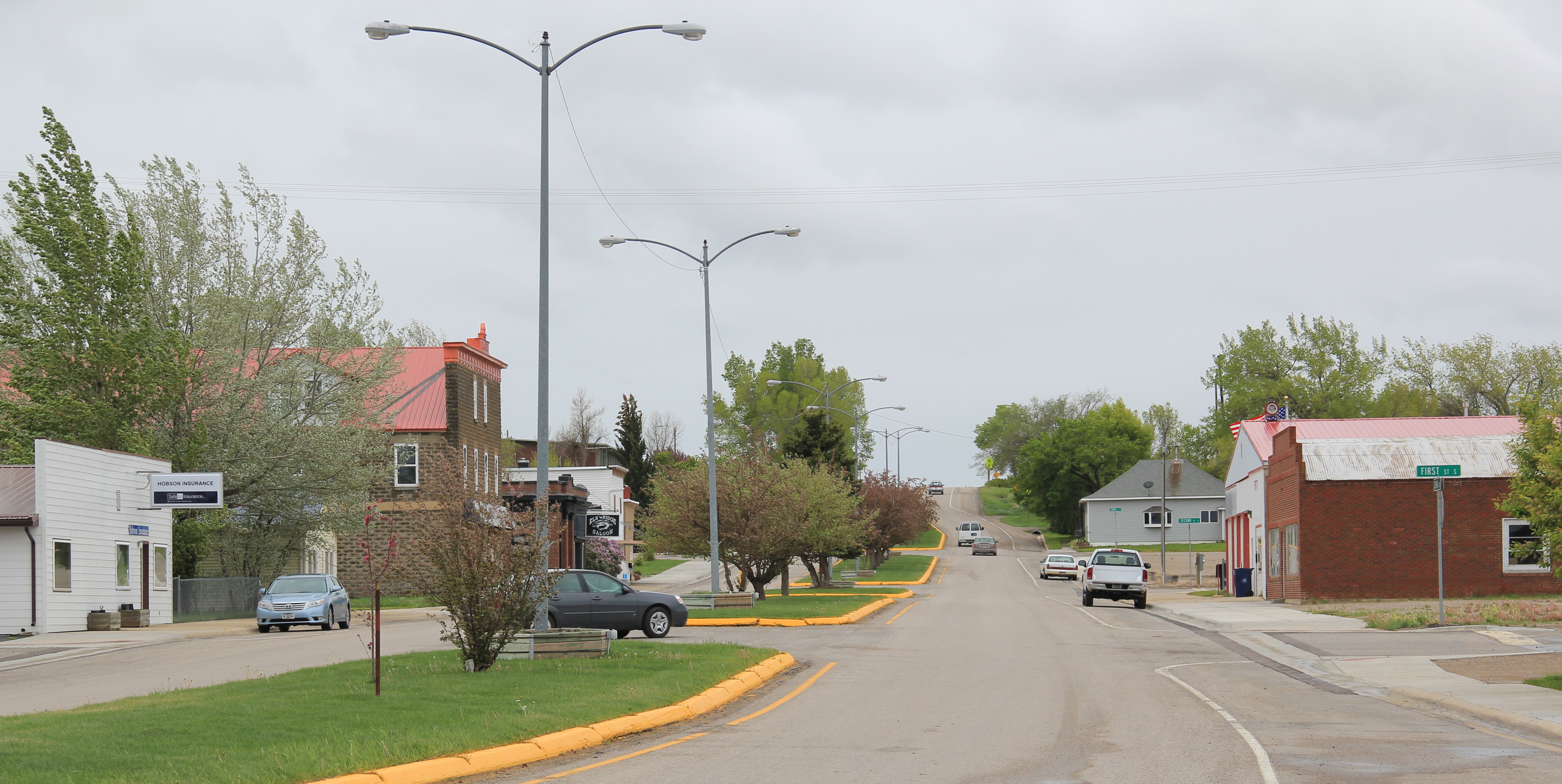
 point of focus, although most traffic, commercial and otherwise, relies on the highway. Hobson’s population when I visited in 1984 was at its height, 261 people in 1980, and it still tops over 200 today. Another defining characteristic is Hobson’s rather unique (for a plains country town) boulevard plan.
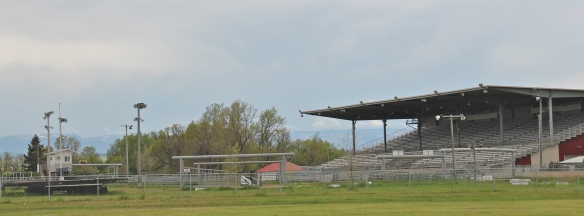
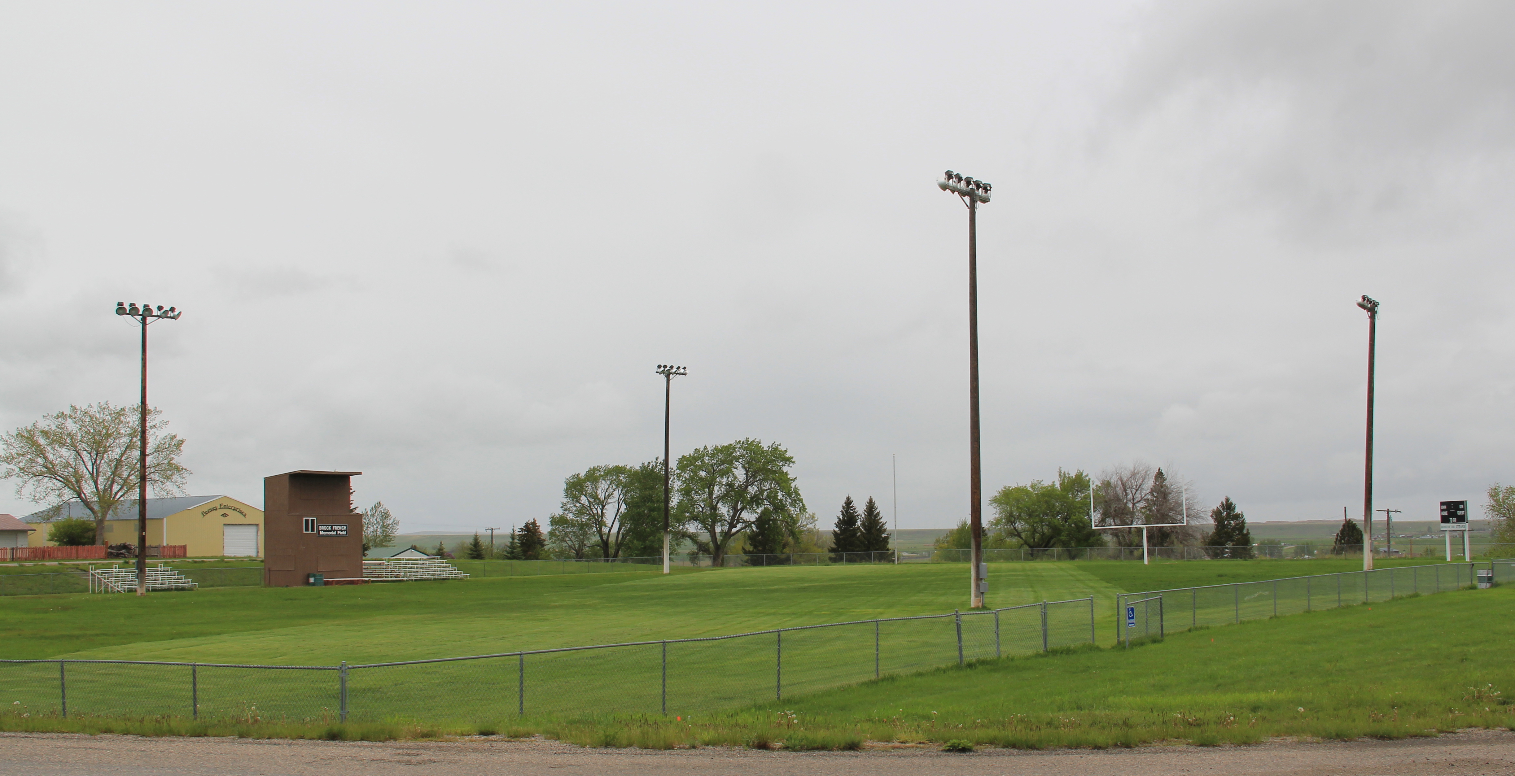
 On either side lie business and public buildings and the street ends at the high school, where the six-man football field is a central element of the community’s public landscape.
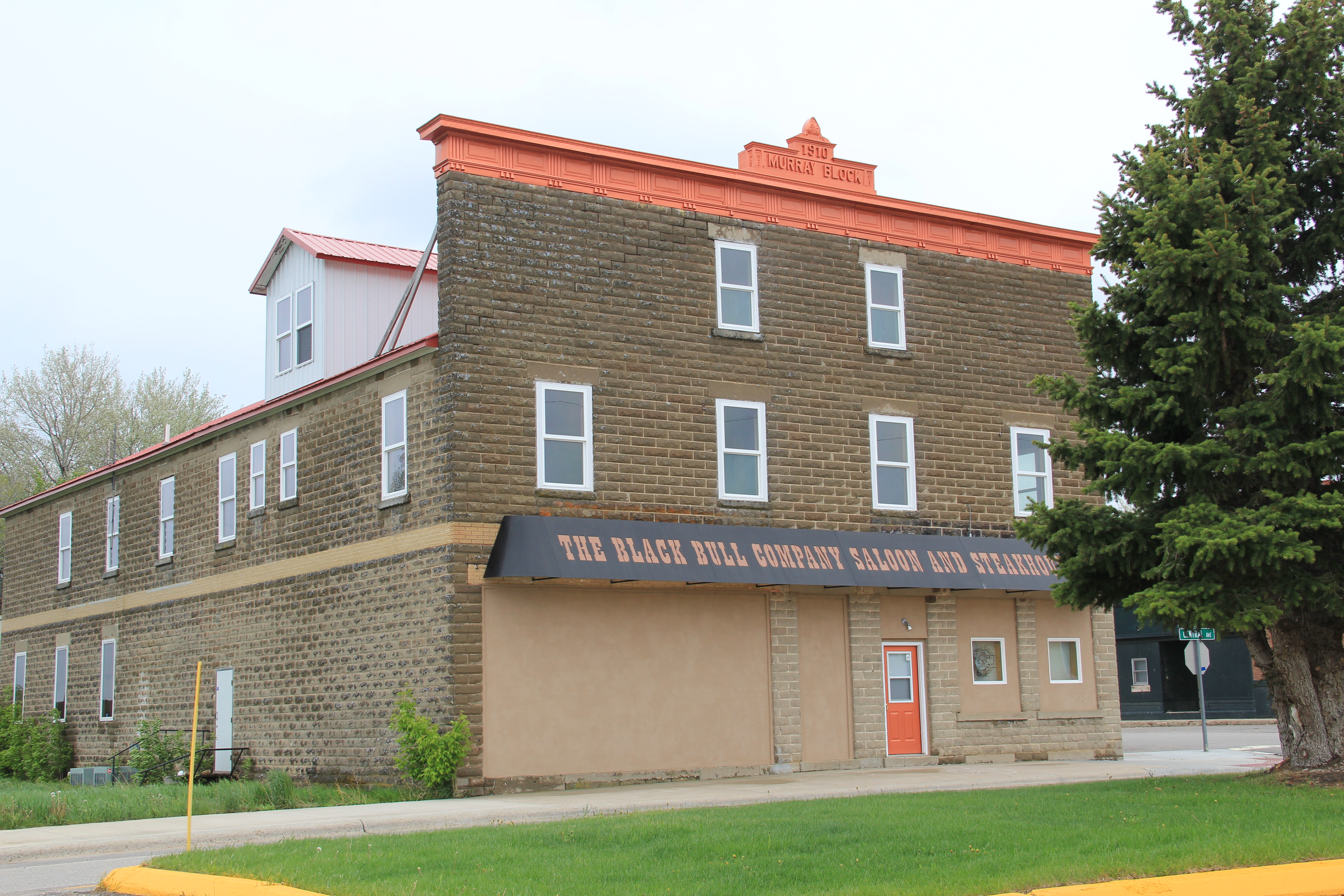
 The Murray Block, 1910, dominates the business district today as it much have done one hundred years ago–it is rare to see a false-front concrete block building. The Masonic
 Lodge probably helps to identify some of the builders of Hobson’s historic structures located on the boulevard. But whoever the builders were, here is a very interesting place


 and just as importantly the properties are in use, be they a cafe, a store, or a library. A long two-lane road, Montana 239, stretches east from Hobson along the Judith River and headed into Little Belt Mountains. The paved road ends at the earlier settlement of the
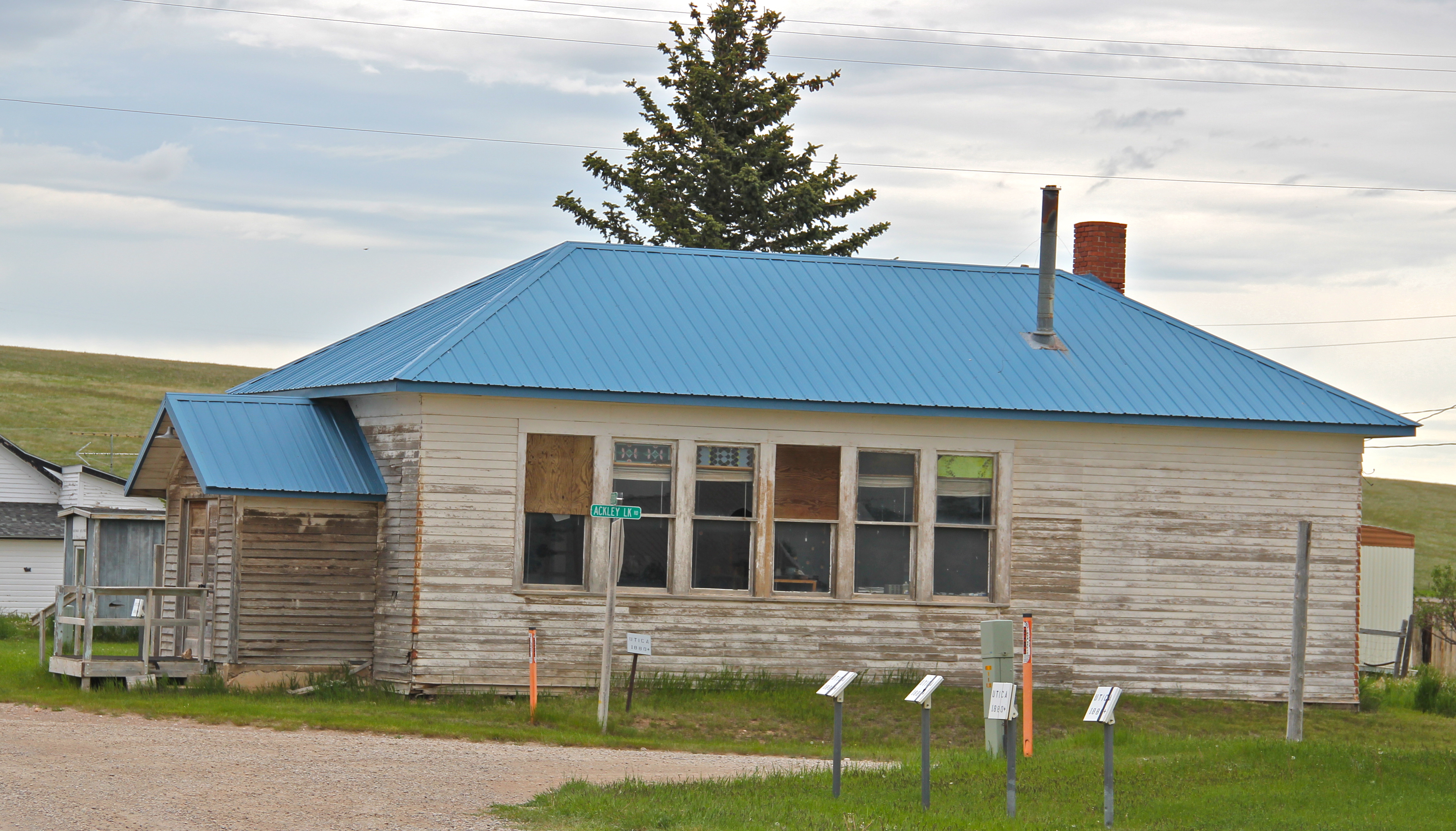
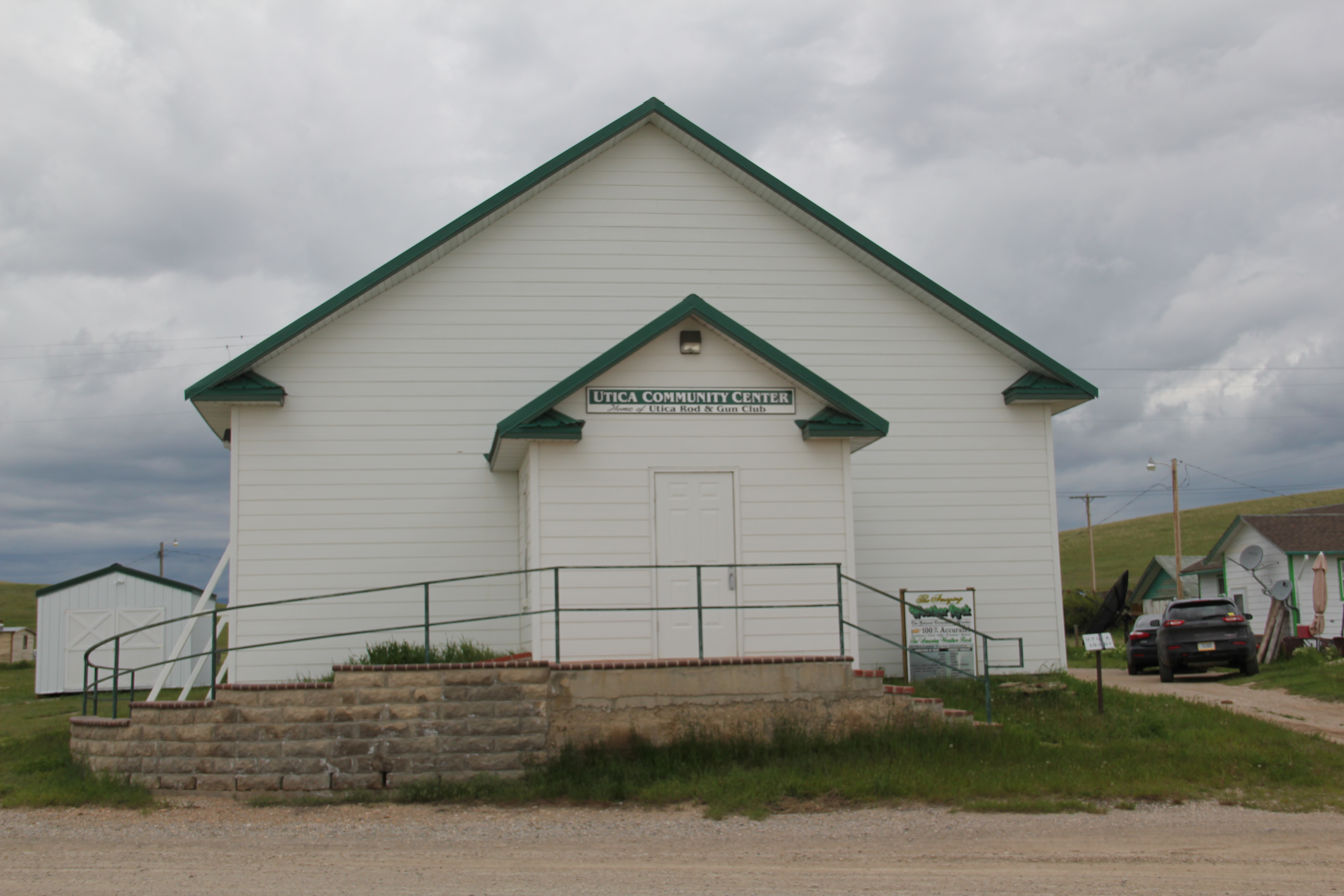
 basin, the cowboy town of Utica, made famous by the paintings and writings of Charles M. Russell, the state’s most famous artist. Utica has a strong sense of itself, although it is justa tiny place today. A large part of that sense of the past is maintained and enhanced by the work of the Utica museum, the local historical society, and the town rod and gun club. Utica has a level of public interpretation that was certainly not in place in 1984 and that today is rarely matched in a small Montana town.


 Utica also has done a commendable job of maintaining and preserving key community buildings, such as the early 20th century school and community hall, both properties associated with the homesteading boom of that time. The town’s historic store is a little

 worse for the wear of 100 years of use, but it is still here, and the stone construction speaks strongly to the vernacular quality of the area’s built environment.
 History and preservation are not the only reasons for Utica’s survival. In true Montana fashion, most people who take the long drive here come for the food, drink, and good
 times at the Oxen Yoke Inn–why else would you locate the town’s primary interpretive sign next to the bar’s parking lot.
 For most travelers the highway from Hobson at the eastern end of Judith Basin County to Stanford, the county seat, in the center of the county, is just open road. But between those two towns three Great Northern hamlets still have significant remnants of their past. Moccasin was such a favorite in 1984 that the resulting book from the survey work, A Traveler’s Companion to Montana History, had two images from the place–the New Deal school, with its totally out of place but flashy Art Deco design, and the two-story Classical Revival styled bank building.
 Those landmarks remain in Moccasin, but much worse for the wear. The school is clearly among those threatened landmarks highlighted by the National Trust for Historic Preservation in 2012. The bank is hanging on, barely.

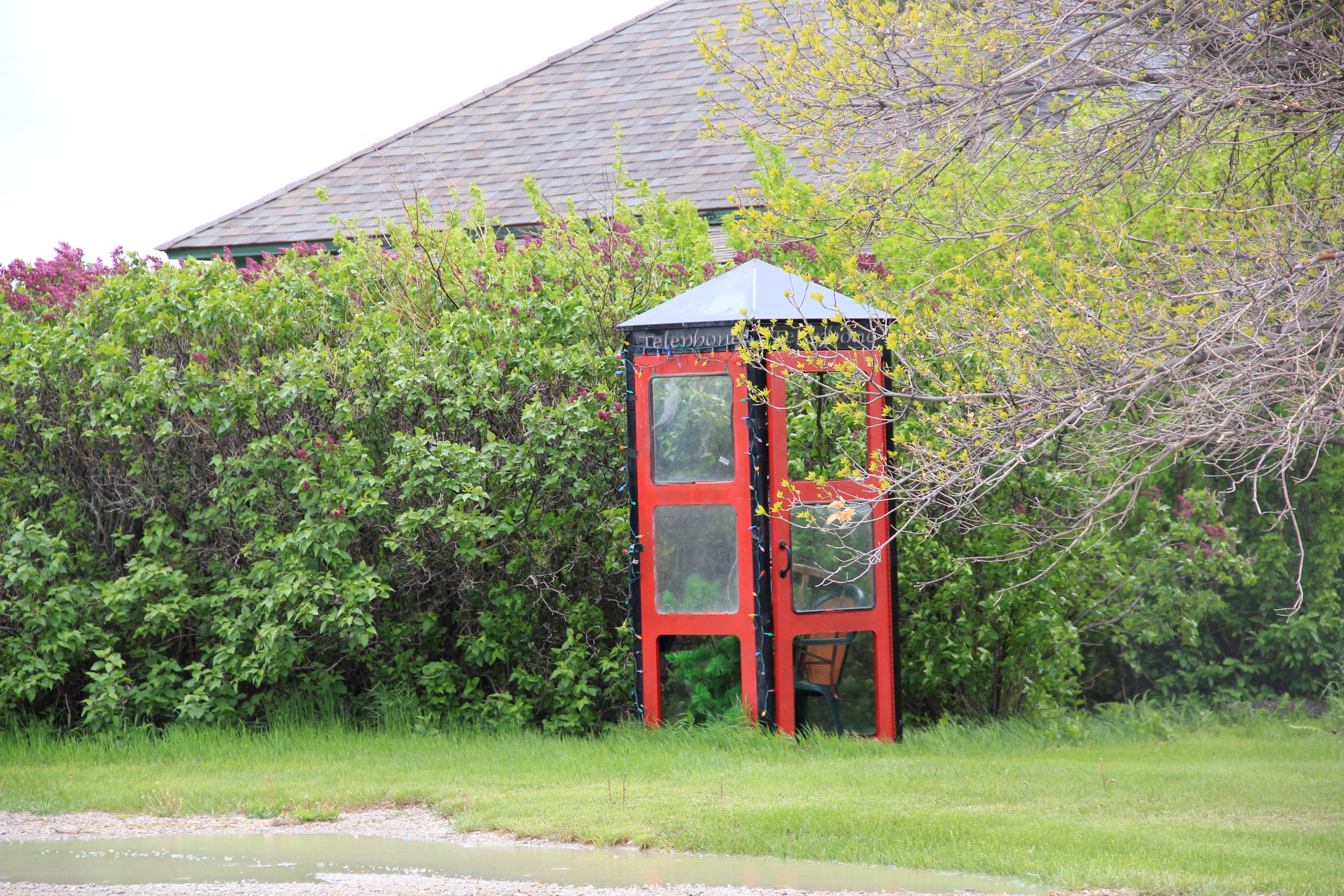
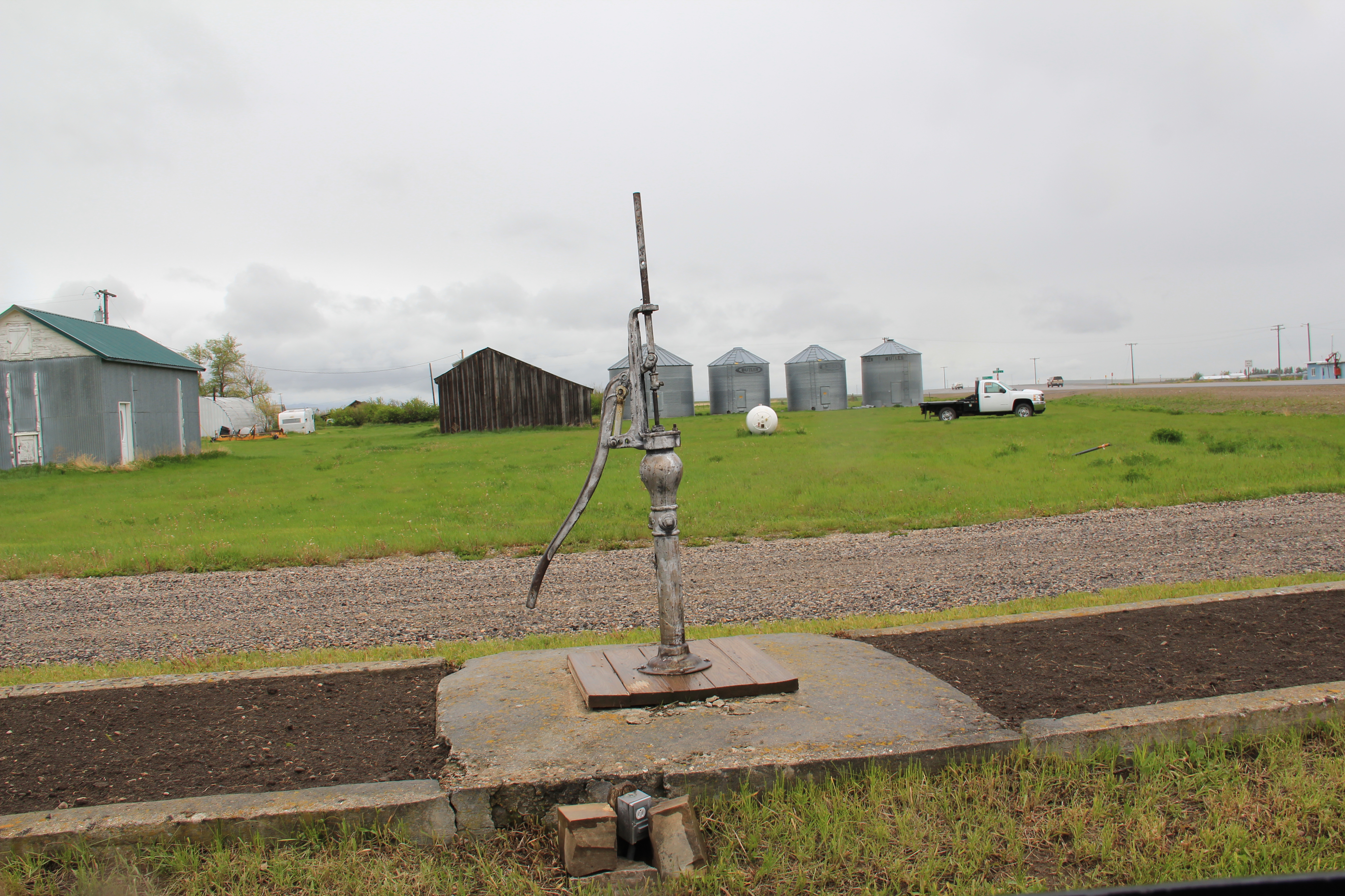
 Moccasin still has other historic buildings worthy of note, such as a church, its town pump, even a telephone booth (a real disappearing part of the landscape from 1984 to 2014).


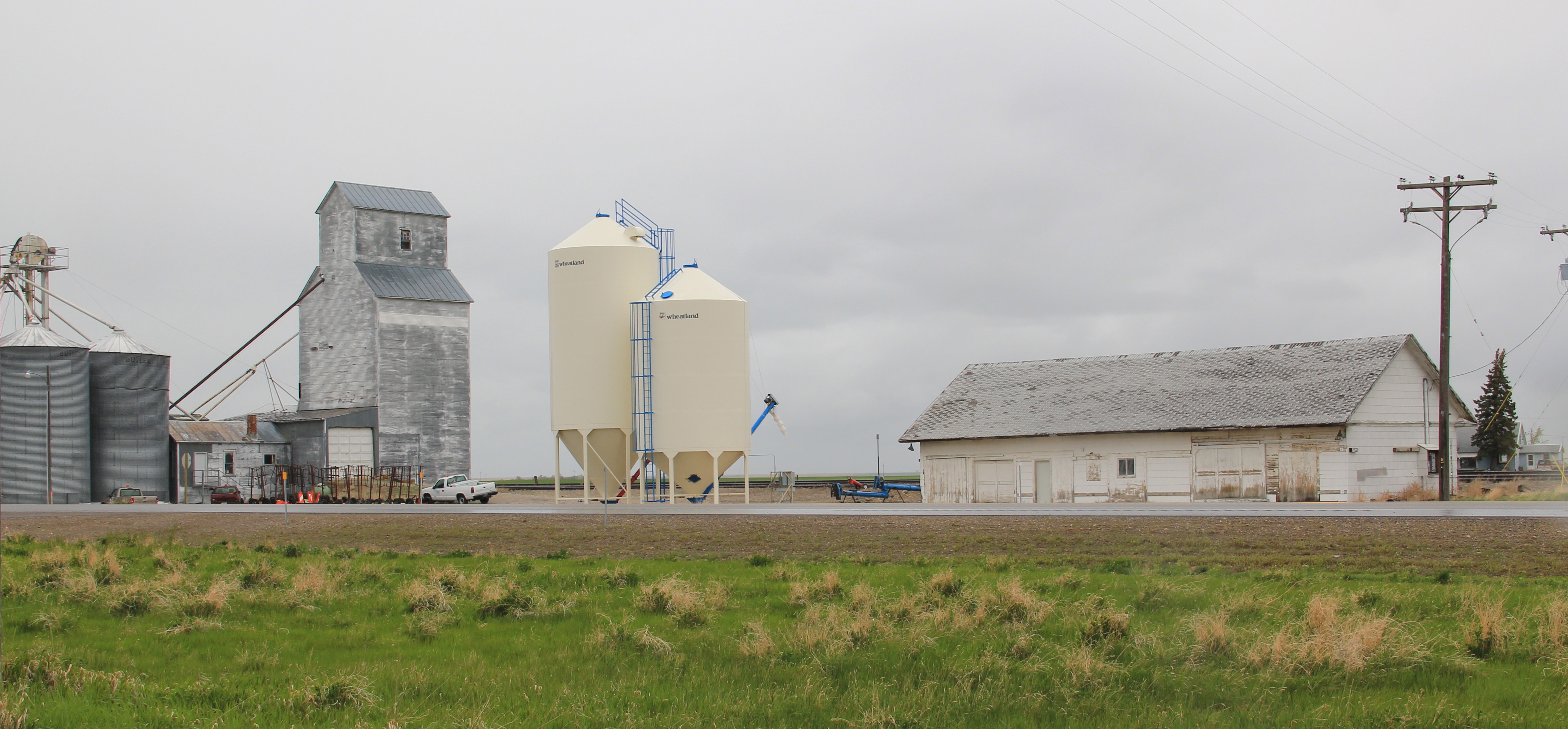
 More importantly, its historic Great Northern combination depot, although battered, still is along the tracks nearby the elevators, reminding anyone looking closely enough of the railroad roots of the place.
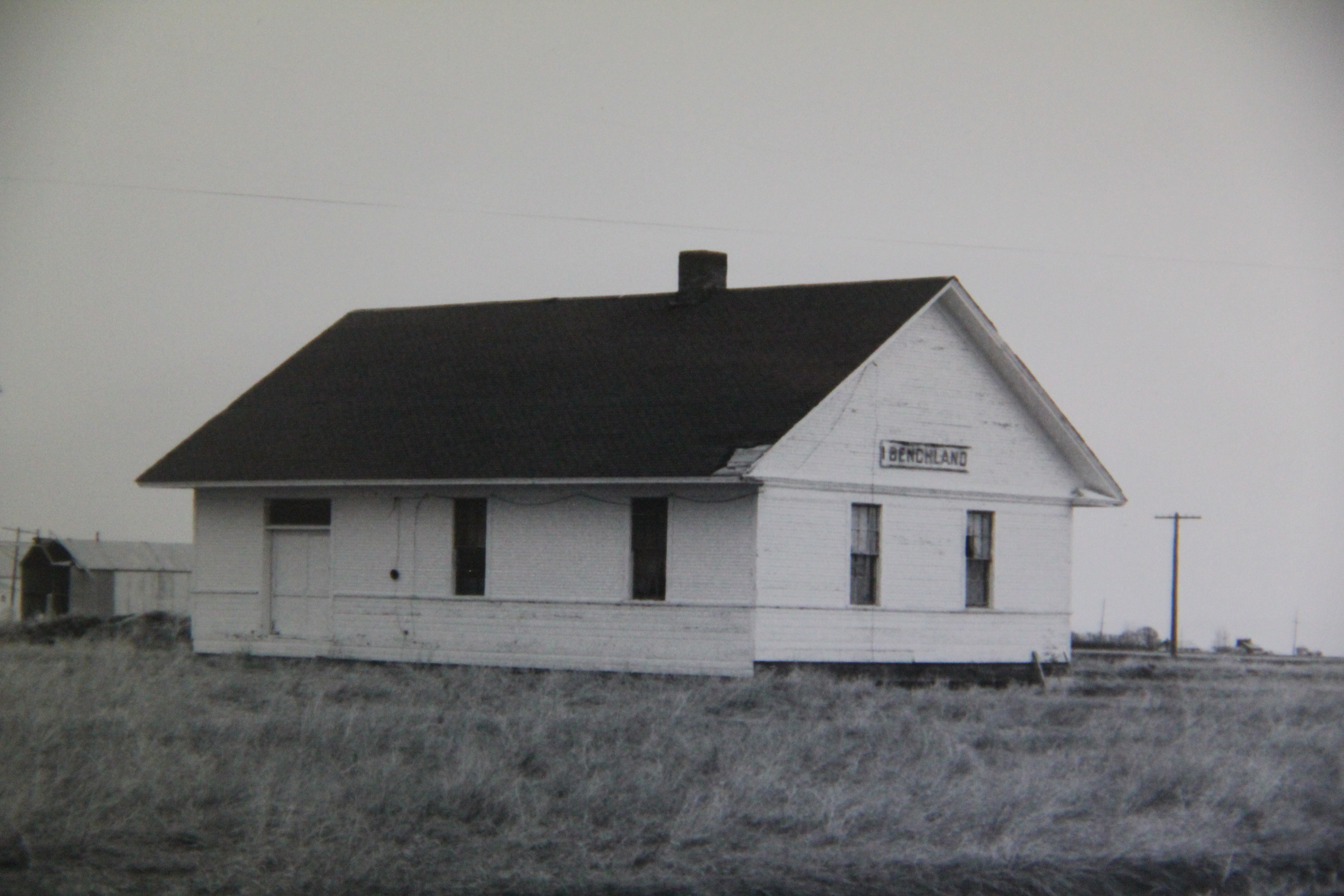
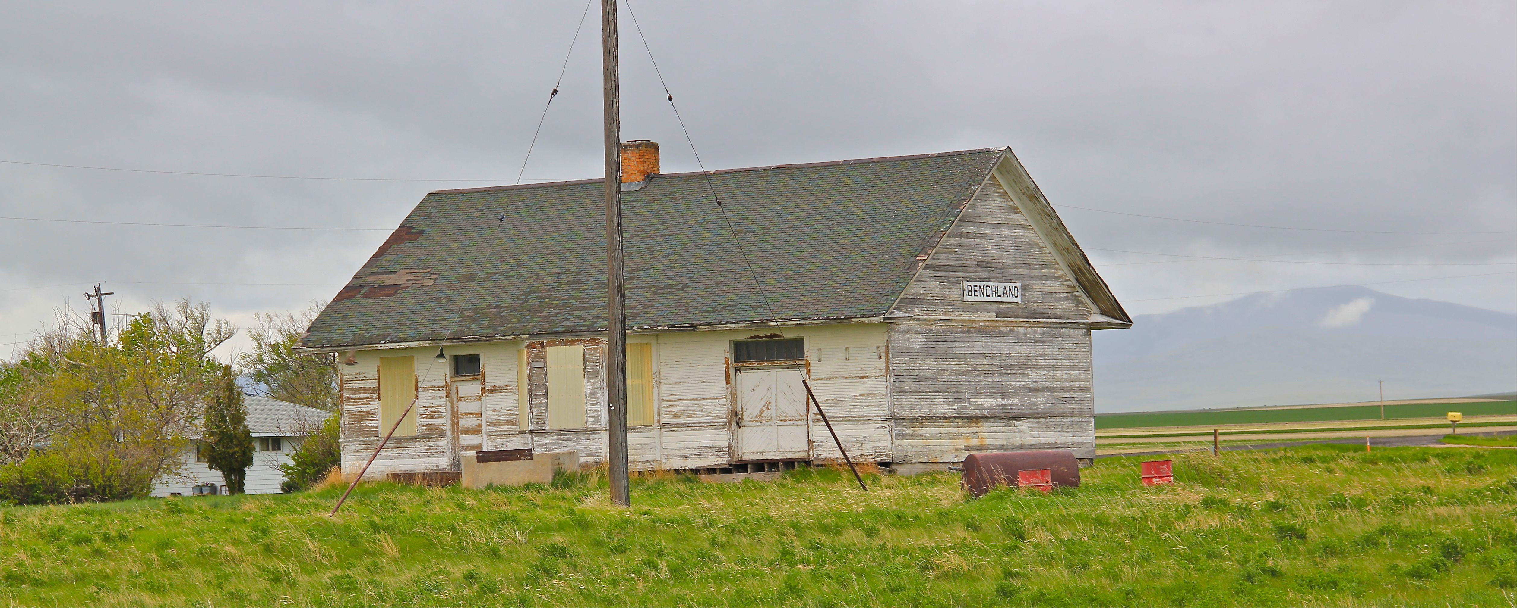
 The next two towns of Benchland and Windham also retain their historic depots. The Benchland station has deteriorated in the last generation as documented in a comparison of a 1984 image with one from 2014.

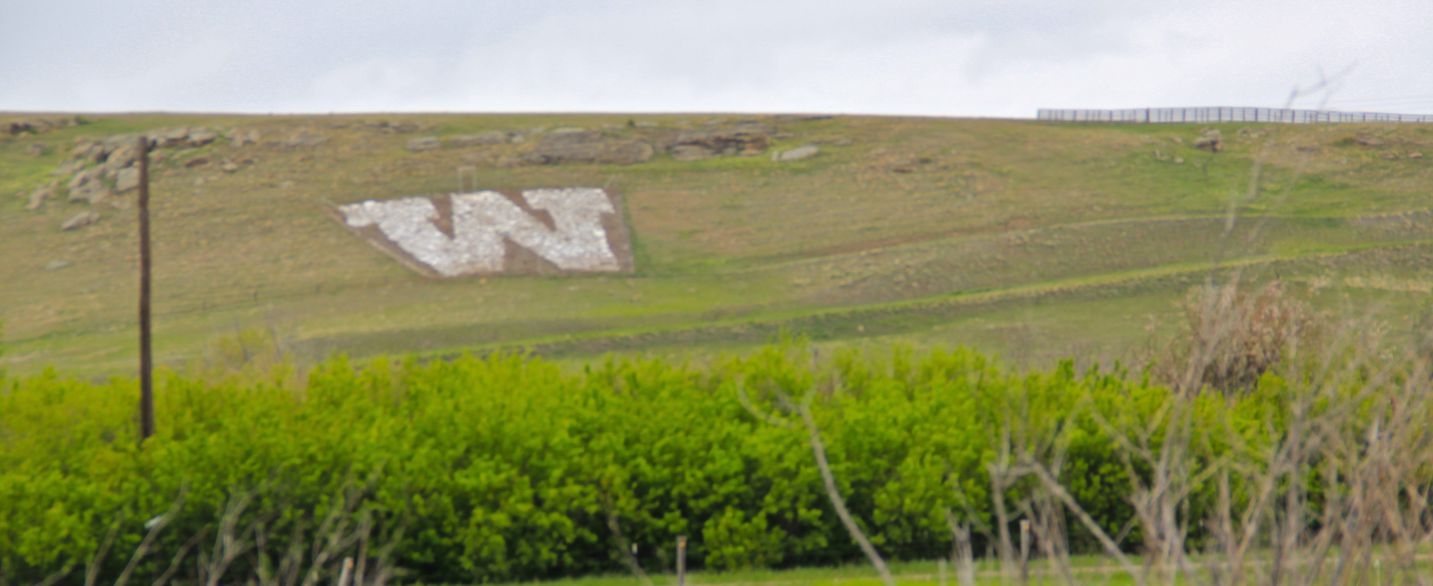
 The Windham depot has been moved slightly off the tracks–but still within a stone’s throw of the rails. The station, along with the historic commercial strip of the T-town plan, and historic elevators, still give meaning to the “W” of the town sign.


 The curve of the tracks headed to Stanford is a good place to rest with this post–more on the plains country towns of the Judith Basin in the next post.

 Many heritage areas in the eastern United States emphasize the relationship between rivers, railroads, and industrial development and how those resources contributed to national economic growth and wartime mobilization. Great Falls can do that too. Situated on the Missouri River and designed by its founders to be a northwest industrial center, entrepreneurs counted on the falls to be a source of power and then on the railroads coming from Minnesota, especially the promising Manitoba Road headed by James J. Hill, to provide the transportation.
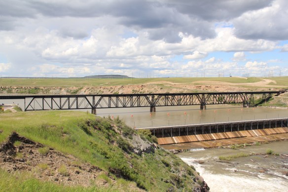 Paris Gibson, the promoter of the Electric City, allied his interests to two of most powerful capitalists of the region: Marcus Daly, the baron of the Anaconda Copper Company interests and James J. Hill, the future rail king of the northwest. Their alliance is embodied in several different properties in the city but the most significant place was where the Anaconda Copper Company smelter operated at Black Eagle until the last decades of the 20th century. When I surveyed Great Falls for the state
 decade of the 20th century and soon erected its tall tower depot right on the Missouri River. But wherever you go along the river you find significant buildings associated with the Great Northern and its allied branch the Montana Central Railroad, especially the downtown warehouses. Some are still fulfilling their original function but others


 The Missouri River runs through Cascade County and is at the heart of any future Great Falls Heritage Area. This section of the river, and the portage around its falls that fueled its later nationally significant industrial development, is of course central to the story of the Lewis and Clark Expedition of 1803-1806. The Lewis and Clark story was recognized when I surveyed Cascade County 30 years ago–the Giant Springs State Park was the primary public interpretation available then. But today the Lewis and Clark story has taken a larger part of the public history narrative in Cascade County. In 2003 the nation, state, and city kicked off the bicentennial of the expedition and that key anniversary date spurred the
 Despite federal budget challenges, the new interpretive center was exactly what the state needed to move forward the story of the Lewis and Clark expedition, and its many levels of impact of the peoples and landscape of the region. The center emphasized the harrowing, challenging story of the portage around the natural falls of what became Great Falls but its
 exhibits and programs have significantly broadened our historical understanding of the expedition, especially its relationship with and impact on various Native American tribes from Missouri to Washington.
 The contribution of the interpretive center to a greater local and in-state appreciation of the portage route cannot be underplayed. In the preservation survey of 1984, no one emphasized it nor pushed it as an important resource. When threats of development came about in last decade, though, determined voices from preservationists and residents helped to keep the portage route, a National Historic Landmark itself, from insensitive impacts.

 late 1850s. Hundreds pass by the monument near the civic center in the heart of Great Falls but this story is another national one that needs more attention, and soon than later.
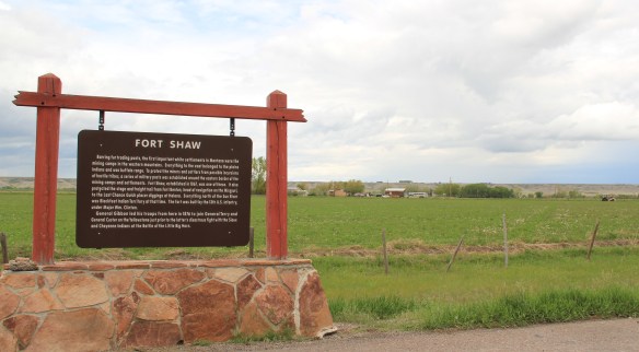


 Fort Shaw was not the region’s earliest mission site. That designation belongs to St. Peter’s Mission, located on the winding Mission Road to the south of Fort Shaw. An earlier blog discussed St. Peter’s but this special property is worth further discussion, as it is linked in time and purpose to what happened at Fort Shaw.
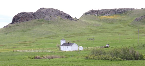 The property has limited public accessibility as an active ranch surrounds it and uses some of the remaining historic buildings. But since my first visit in 1984, a small metal interpretive marker has been installed, which emphasizes its founding date of 1865-1866 by Catholic missionaries, many

 Often we forget these connections between religious missionaries and the nation-building process of government. Within a few hundred yards of Fort Shaw school, for instance, is the old road connecting the school to the historic St. Ann’s Catholic Church (seen above is the historic church building; the congregation has built a modern church in recent years).
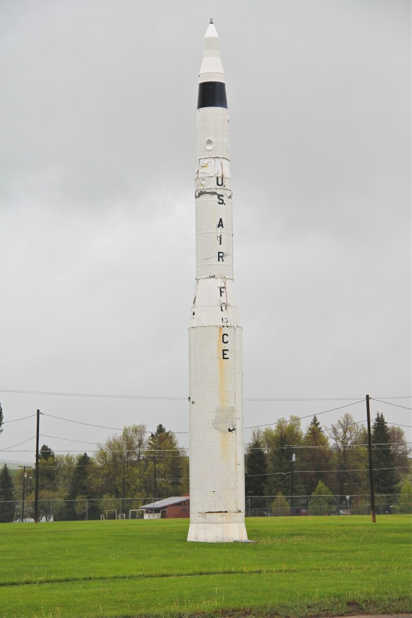
 And we further forget, or choose to ignore, how the messy present lies side by side with these older, seemingly sacred places. Along the Mission Road and the Simms Road are nuclear missile bases, some active, some inactive, that are administered by the Malmstrom Air Force Base in Great Falls. Much like Fort Shaw from 100 years earlier, military commanders in the 1960s saw Cascade County as part of the edge of America’s national defense, the ideal location for nuclear bases that could protect, or retaliate, in case of a nuclear strike from the nation’s enemies.
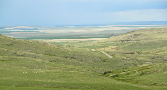
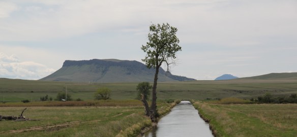 The Sun River Valley was transformed by homesteaders and irrigation during the great boom of the early 20th century; it shares that story of course with many towns in the Great Falls heritage area. Montana Highway 21 (shown above) connects with Montana Highway 200 to provide great opportunities to explore that landscape. The Sun River project of the U.S. Bureau of Reclamation especially left its mark.


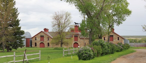 The barn is part of a still active ranch and is on private property. But the stone masonry can be viewed and appreciated from Montana Hwy 200.
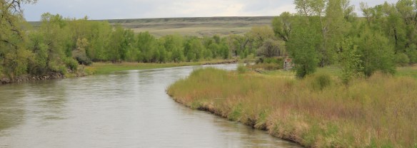 When one considers a Great Falls heritage area, the Missouri River of course will take center stage; as the next postings will show, it should be at the center of the story. But what happened along the Sun River, and what remains today, adds immeasurably to the national story and the overall significance of the region.
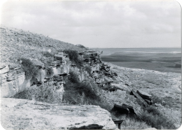 Successful heritage areas have chronological depth to their history, and places that are of national, if not international, significance. To begin that part of the story, let’s shift to the other side of Cascade County from Belt and explore the landscape and significance of the First Nations Buffalo Jump State Park. When I visited the site in 1984 there was not much to it but the landscape: no interpretive center existed and there were only a few markers. To give the state its due, it then only owned a portion of the site, with the first land acquisition dating to the New Deal. Listed in the National Register in 1974, the site only had opened as a state park a few years earlier, and no one seemed to know much about it or even how to get to it. But as this photograph from “A Traveler’s Companion to Montana History” shows, wow, what a view: it was totally impressive, and had a big story obviously to convey.
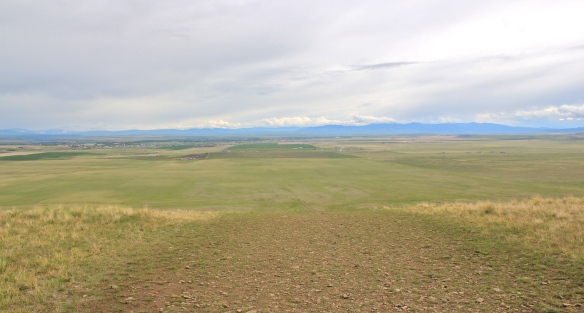
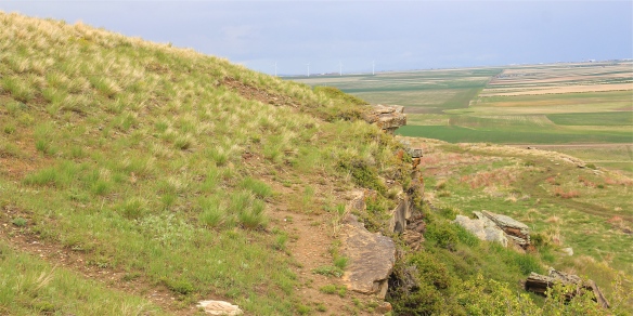 Buffalo jumps were ways that the first nations in Montana could effectively kill large number of bisons–by planning, gathering and then stampeding a herd over a steep cliff. Native Americans used this site for hundreds, if not thousands of years. The cliff is hundreds of yards long and kill sites are throughout the property.
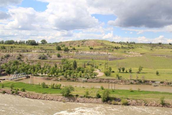
 State park officials, working with local residents and ranchers, have significantly enhanced the public interpretation at the park since the late 1990s. Hundreds of additional acres have been acquired, better access roads have been installed. and new interpretive features, such as these reproduction sweat lodges on the top of the cliff, have been added to the landscape to physically enhance the Native American feel to the park.
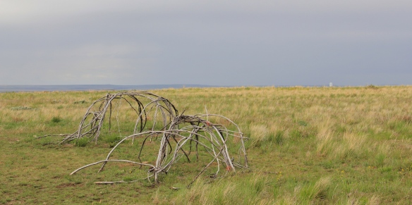 The interpretive center is a model of 21st century Native American-focus history. It provides facilities and exhibits for visitors, and encourages a longer stay and exploration of the site.
 Park managers understood that this site had special significance to all Native Americans thus they included capsule history displays about all Montana tribes of today along with displays that emphasize the Native American dominance of the landscape when the jump was in use.
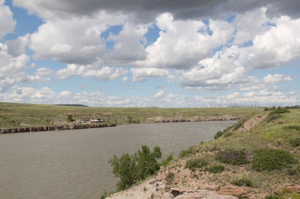
 As the park was being expanded and improved into an effective heritage asset, both in its public interpretation and visitor facilities, research on the property continued. The buffalo jump is now considered the largest in the United States, and quite likely the world. In the summer of 2015, the site was designated as a National Historic Landmark as one of the nationally significant archaeological and Native American properties in America. The bone deposits remain deep and rich in artifacts, still awaiting further exploration despite being mined for a brief time during World War II for phosphorus production. Indeed the entire site is one of reflection and respect for the cultural contributions made by the First Nations long before the arrival of Lewis and Clark just over 200 years ago.
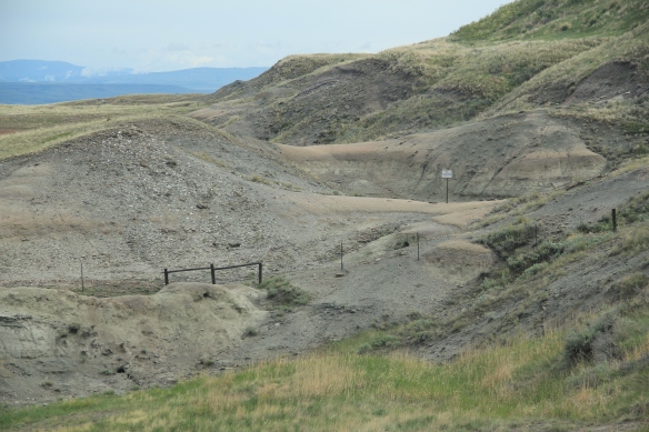 Here is a property that today tells us how the earliest Montanans used their wits and understanding of nature and landscape to enrich their diet and to make their world, one far from that of our own, and one still difficult for those of us in the 21st century to grasp.
 This buffalo jump remains a place of mystery and meaning, and when you look to the south and see the shadow of Crown Butte you glimpse into that world of the deep past in Montana,. If you look in an opposite direction you find the patterns of settlement that surround this sacred place. And that is where we go next to St. Peter’s Mission and the Sun River Valley.
 Along the Missouri River is Paris Gibson Park, deep in the heart of Great Falls, Montana. Gibson was one of the classic civic capitalists of the late 19th century who understood that as the community prospered he too would achieve this dream of building a great western empire, with his town of Great Falls as the center. Almost 100 years after his death, in 2015, residents, preservationists, historians, and economic developers began discussions on establishing a heritage area, centered on Great Falls, but encompassing the Missouri River as the thread between the plains and mountains, that has shaped the region, and the nation, for hundreds of years. I strongly endorse the discussion and will spend the next several posts exploring key resources in Cascade County that could serve as the foundation for a larger regional story.
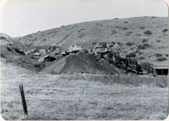
 Thirty years later, Belt’s population had bottomed out, declining to under 600 by the time of the 2010 census. But both times I have stopped by, in 2013 and 2015, the town has a sense of life about it, and hope. The town’s two historic taverns, the Harvest Moon Tavern and the Belt Creek Brew Pub, as well as the Black Diamond Bar and Supper Club attract visitors from nearby Great Falls and elsewhere, giving the place a sense of life at evenings and weekends.
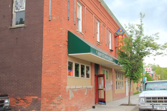
 When planners talk about heritage areas, they often focus on the contributions of local entrepreneurs who take historic buildings, like the Pioneer above, and breathe new life into them. Throughout small town Montana and urban commercial districts, new breweries and distilleries are creating such opportunities.
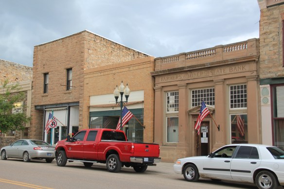
 Belt has a range of historic buildings, mostly of vernacular two-part commercial style that speak strongly to the boom of 1900 to 1920. The Victorian-styled cornice of the Belt Hardware Store (1896) speaks to the town’s origins. The Knights of Pythias Lodge of 1916 has been restored as a community theater, another reason for visitors to stop and explore.
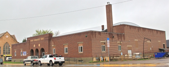
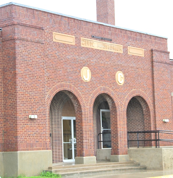
 The result is a living cultural experience, since nothing in Belt is over-restored or phony feeling. It is still a gritty, no frills place. That feel is complemented by the Belt museum, which is housed in a historic jail on road down into town and within sight on a railroad trestle, a reminder of what literally drove the town’s development, coal for the railroads.
 During the 1984 survey, I gave the jail a good bit of attention since this stone building spoke to the craftsmanship of the era, the centrality of local government as the town developed, and the reality that this building was the only thing in Belt listed in the National Register of Historic Places. But in 2004 the state historic preservation office approved the Belt commercial historic district, and that designation has done much to drive the town’s recent revival. Belt is just the first place that speaks to the promise of the Great Falls heritage area concept.

 Even the local museum was at the beginning stage, sharing quarters with the chamber of commerce in a Ranch-style building, like the park, on the outskirts of town.
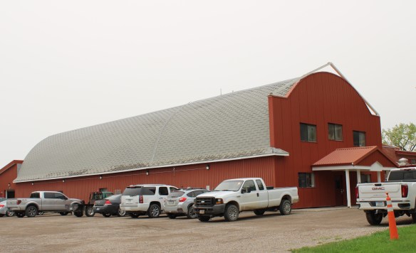
 How times changed over 30 years. The museum is still at its location but adjacent is now a new facility, replicating a huge barn, expanded exhibits and artifacts about the region’s history.
 Markers about National Register-listed properties and districts exist throughout town, courtesy of the exemplary interpretive marker program of the Montana Historical Society.
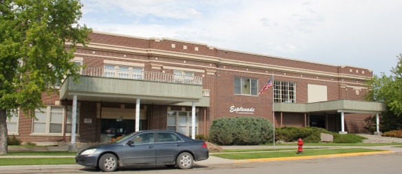
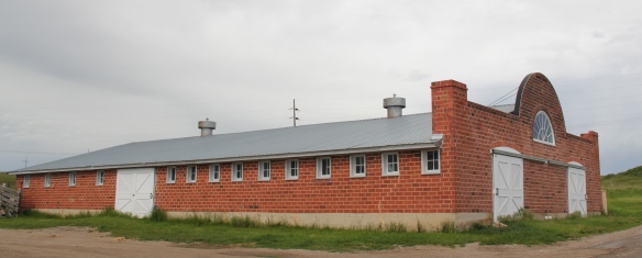
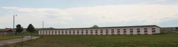
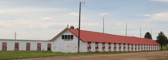
 What happens within town is supported by recent interpretive marker installations at the highway rest stop as you enter Lewistown. From this spot there is an excellent view of the historic Lewistown airfield, listed in the National Register of Historic Places, for its significance in World War II aerial supply lines and defense.
 Not only can you see the historic district, you also can learn about its significance through an interpretive marker developed by Montana Department of Transportation.
 Steps away is another interpretive kiosk, related to an earlier, sadder military story, that of Chief Joseph of the Nez Perce Indians and their attempted flight to freedom in Canada in the 1870s. Both markers also emphasized the overall theme of transportation and how Lewistown has been crisscrossed by important historical events for centuries.
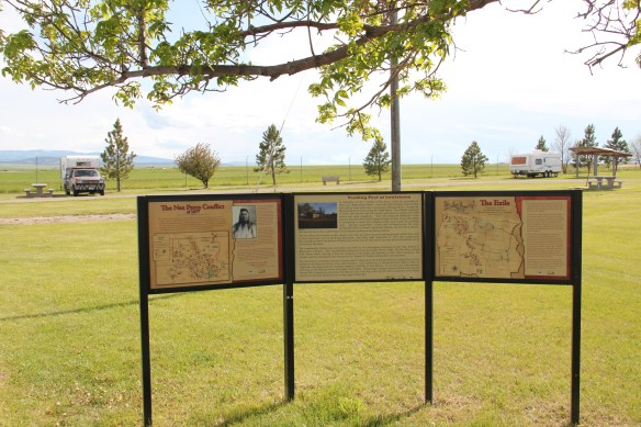
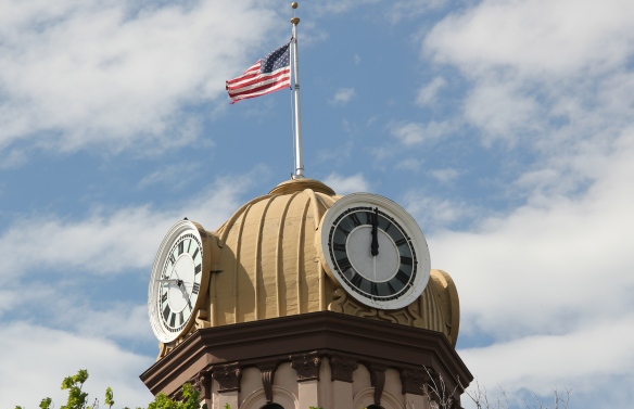
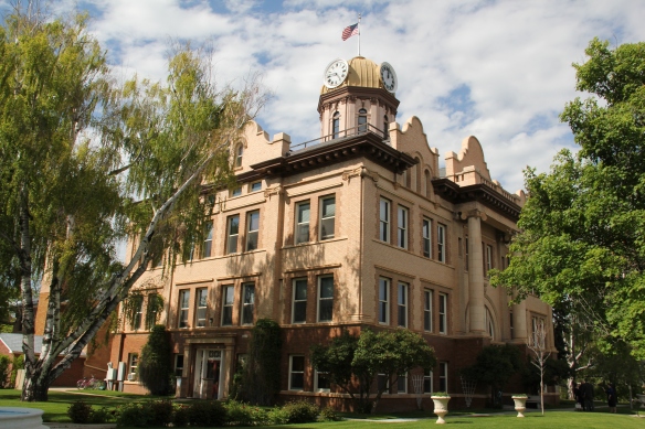
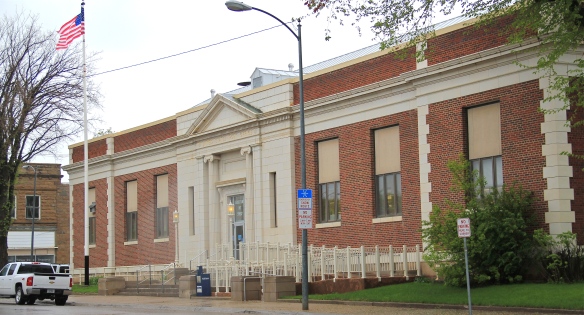
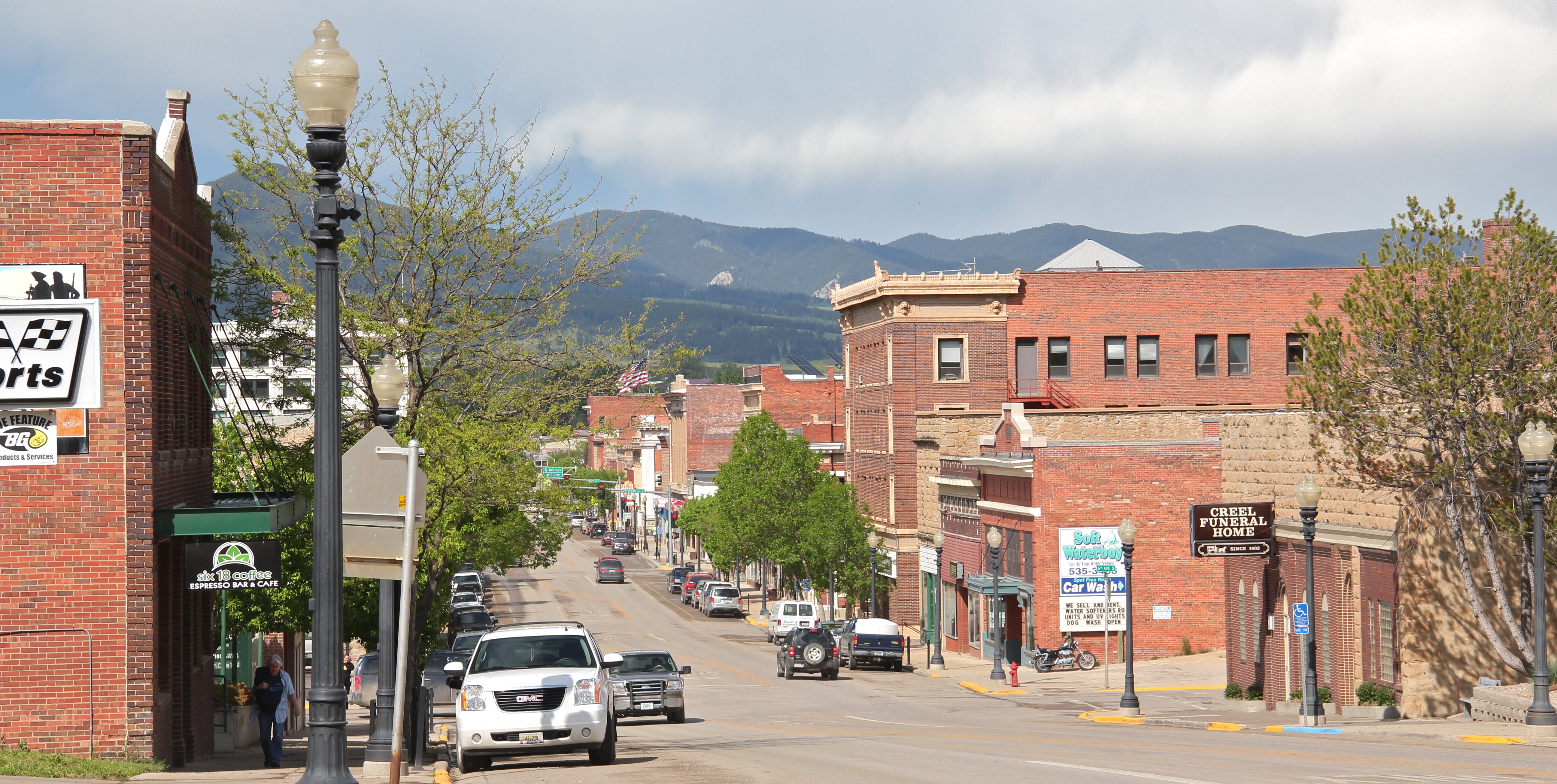
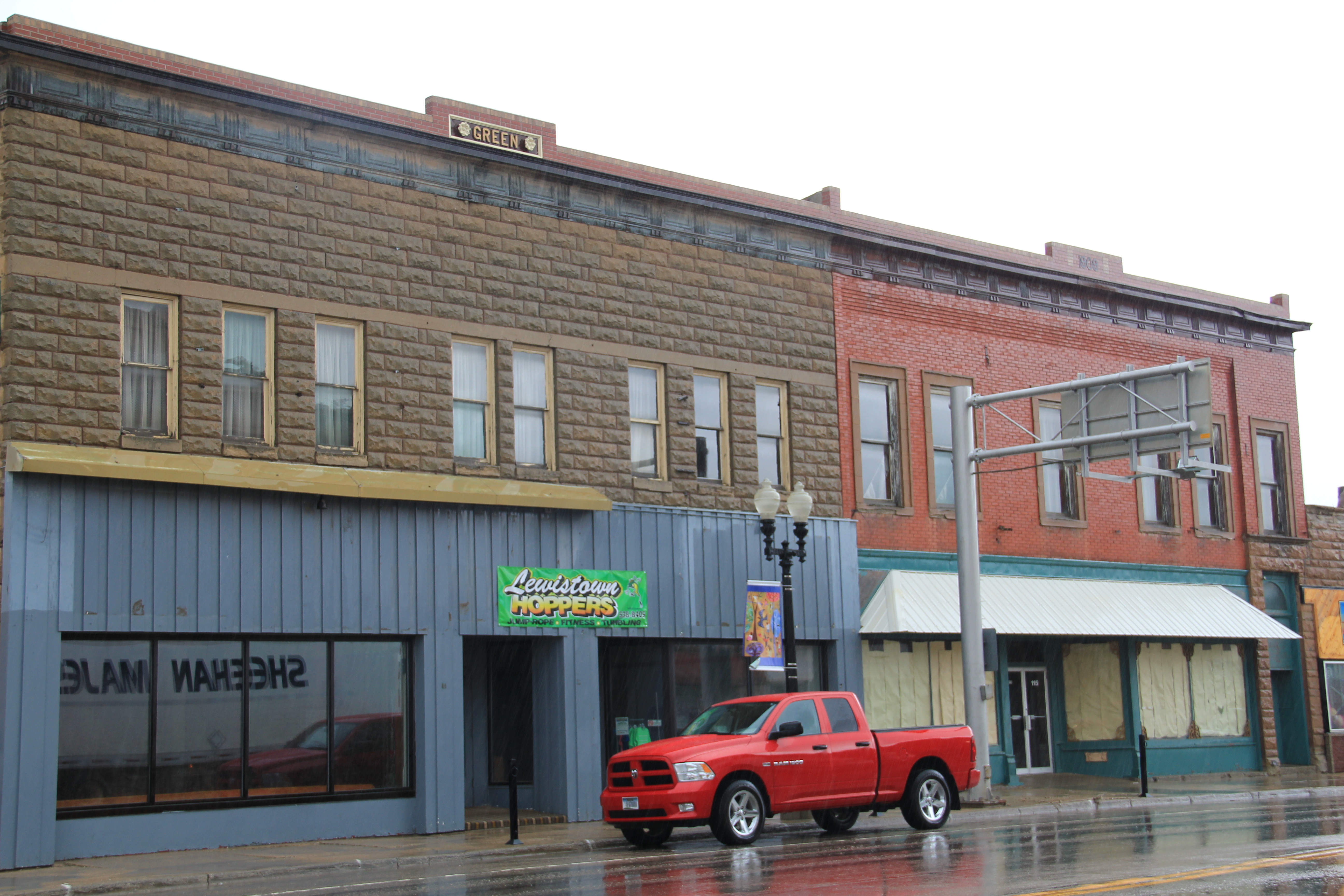
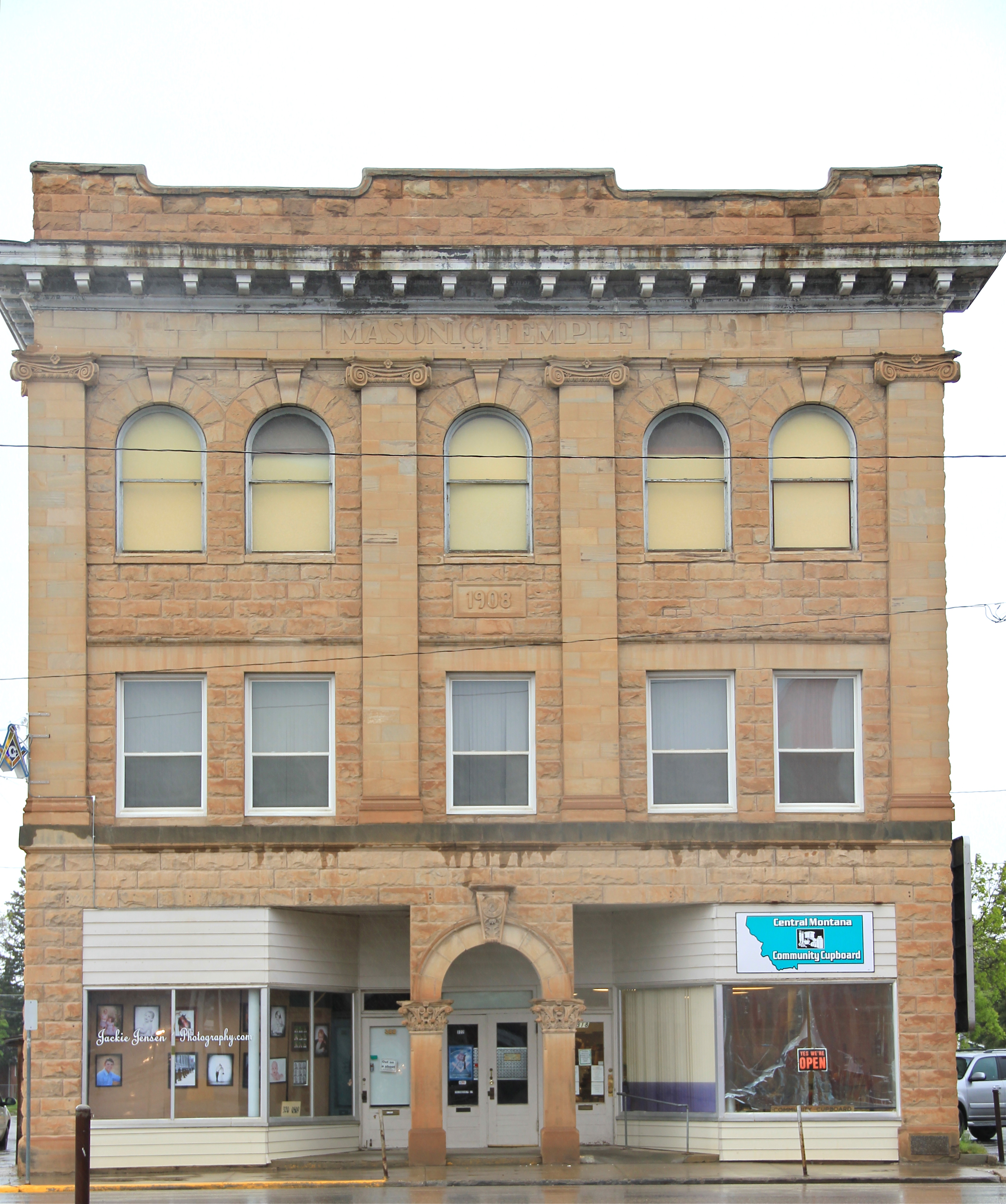
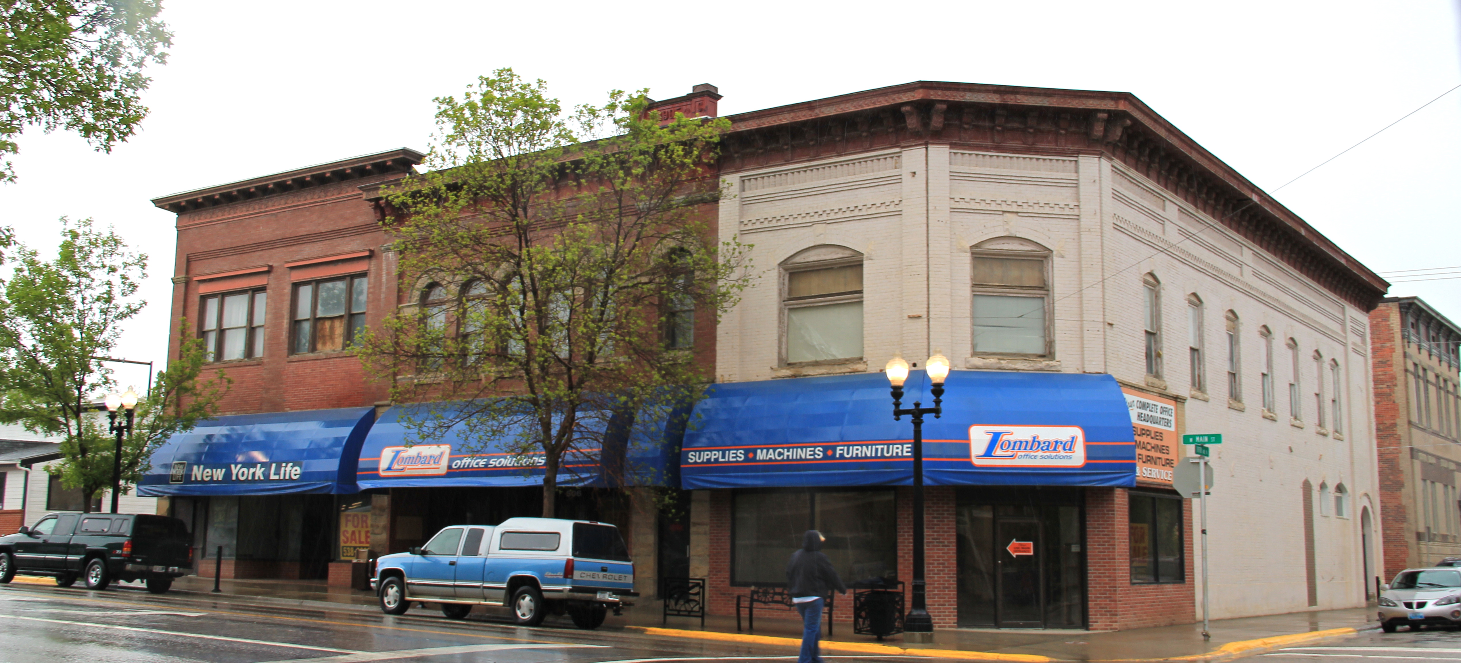
 Renaissance revival style from the prominent Montana firm of Link and Haire, and the historic early 20th century domestic architecture in the downtown neighborhoods.
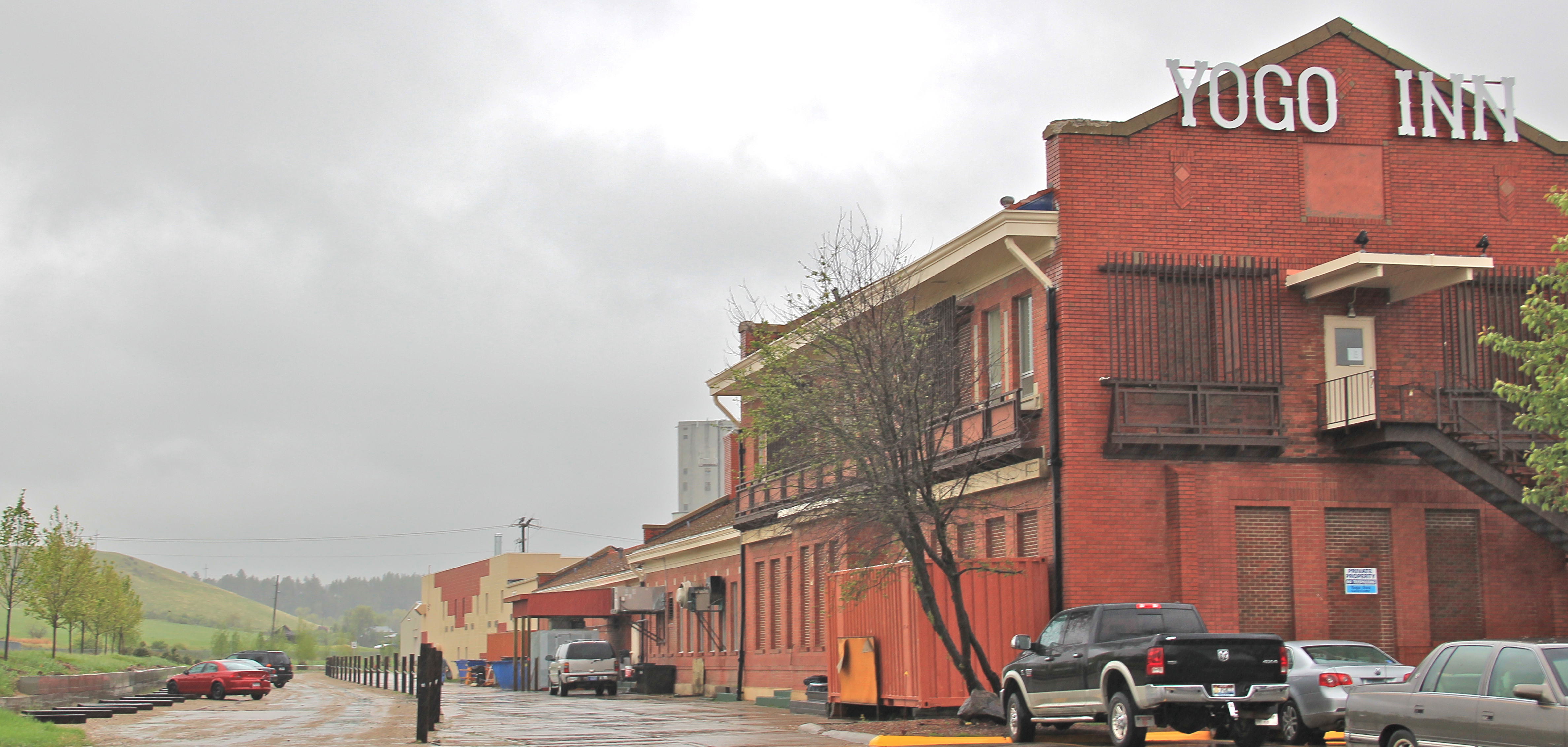
 The town’s historic districts serve as anchors within the commendable trail system developed in Lewistown over the last 20 years. Local officials and representatives, working with the state government and abandoned railroad property and corridors, have established a series of trail loops that not only provide excellent recreational opportunities, as signified in this trail head near the Yogo Inn, but also paths for heritage tourists and
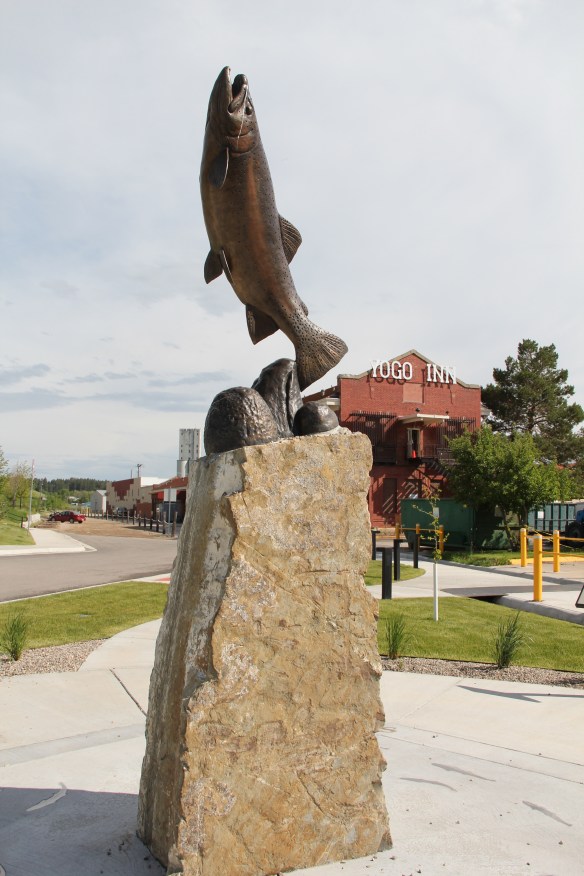 residents alike to explore the landscape, and how history in the 19th and 20th centuries created the place where they live and play today.
 As we will see later in western Montana, like in Butte and Kalispell, trail systems can be the best of heritage development because they take advantage of the state’s greatest asset–its landscape and sense of the Big Sky Country–and combine it with explanations of the layers of history you encounter wherever you go, creating an asset that visitors will like but that residents will cherish, because they can use it on a daily basis.
 Of course recreation, to my mind, is never complete unless there are nearby watering holes where one can relax and replenish, and Lewistown is rich in those too, being they the various classic roadside establishments along the highways entering and leaving town or the can’t miss taverns downtown, such as The Mint and the Montana Tavern, where the signs speak to the good times to come. Those properties are crucial for heritage development because they are important in themselves but they also are the places that get people to stop, and hopefully explore.
 Using multiple pasts to create new opportunities for communities: Lewistown has it going, and it’s far different world today than in 1984.