Glasgow’s Highland Cemetery

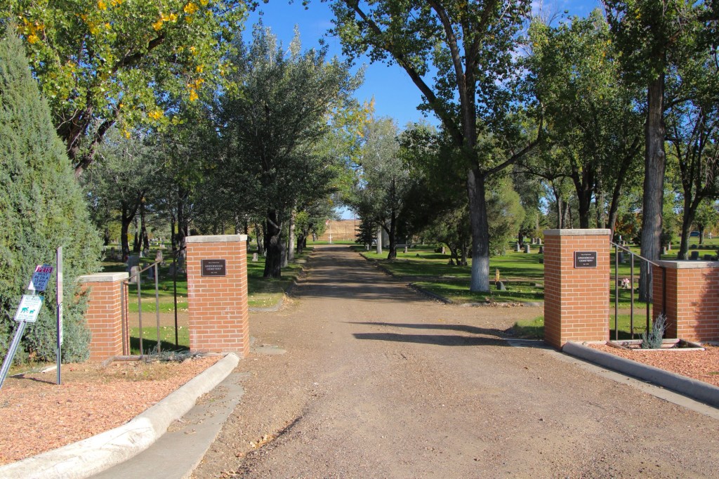
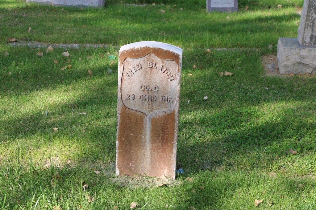
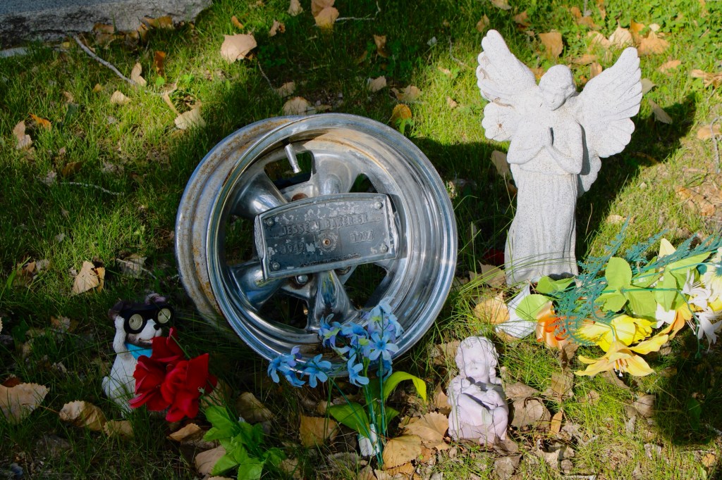
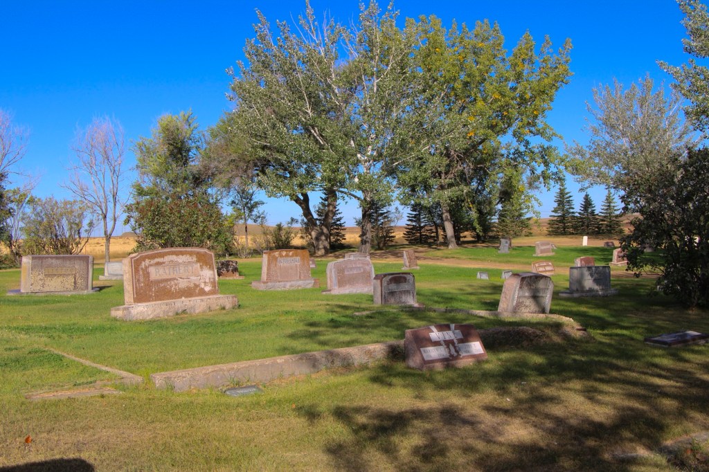
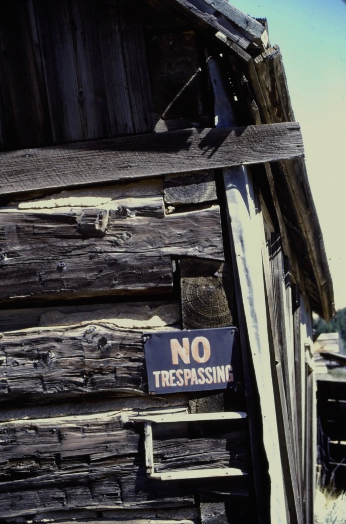
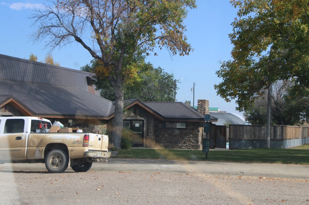
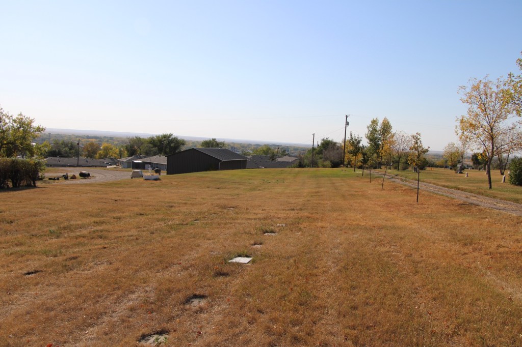
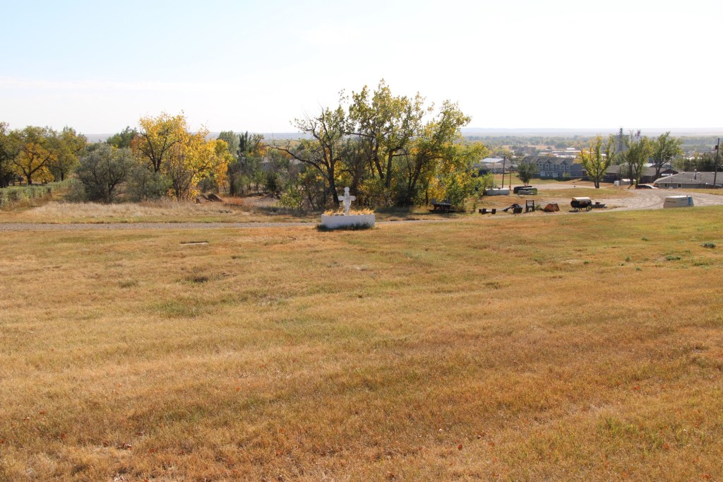
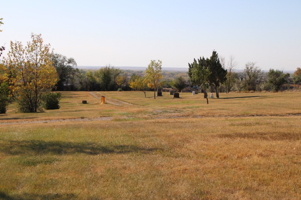
Glasgow, the seat of Valley County, dates to the late 1880s when the Manitoba Railroad (later named the Great Northern Railroad) entered the northeast corner of Montana Territory on its way west to its initial terminus in Great Falls. The first burials at what later became Highland Cemetery on a bluff northeast of the town center date to those years. The images above and below are of that first burial ground, known as Potter’s field, and part of what is designated at the first addition.

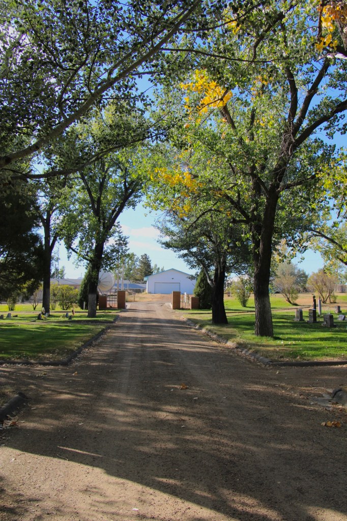
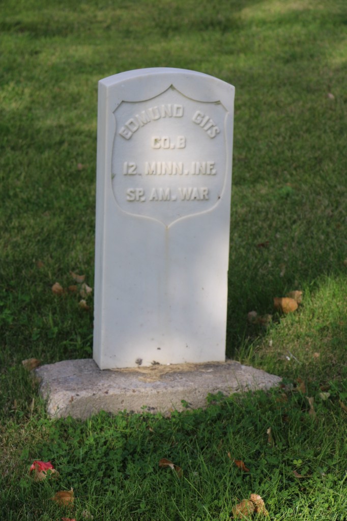
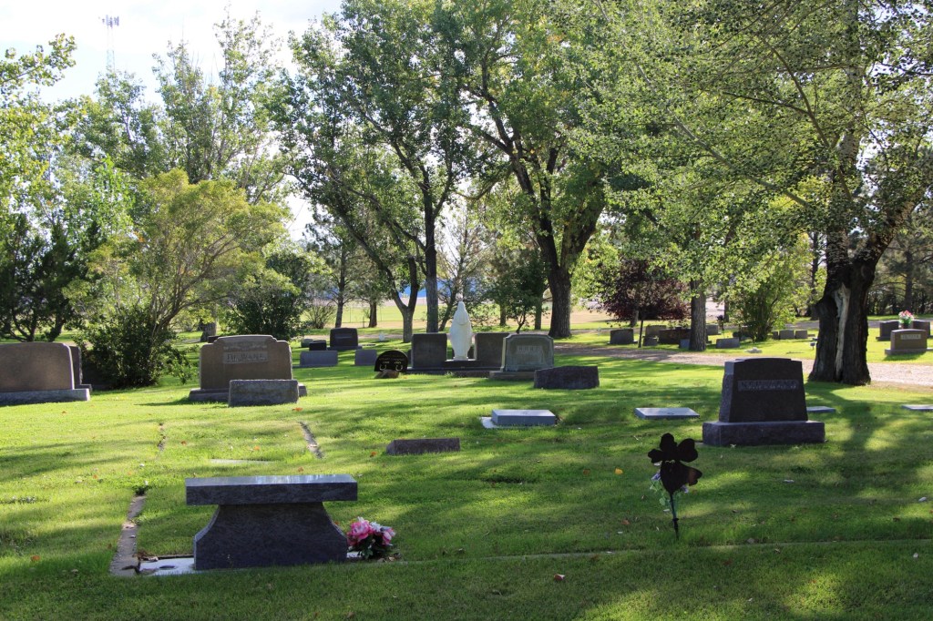
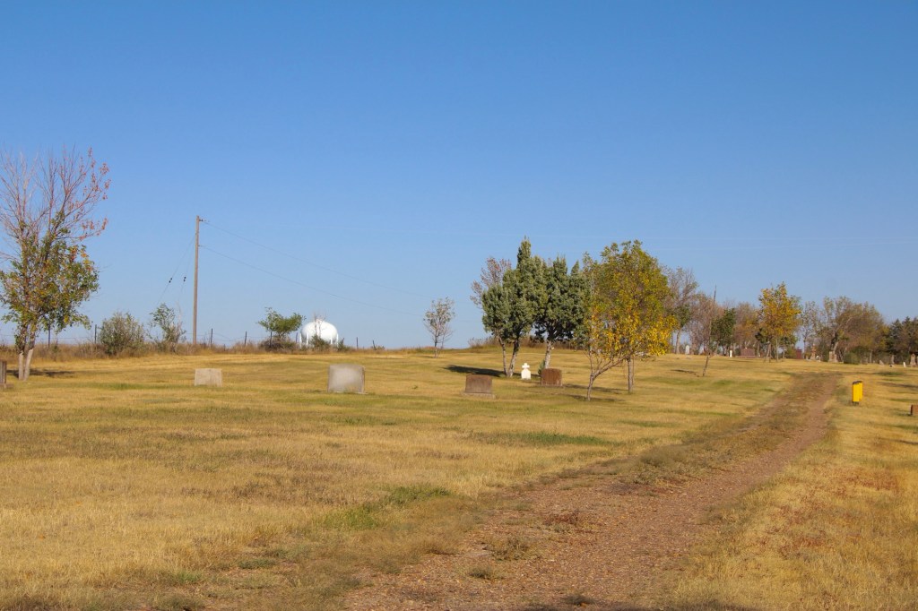
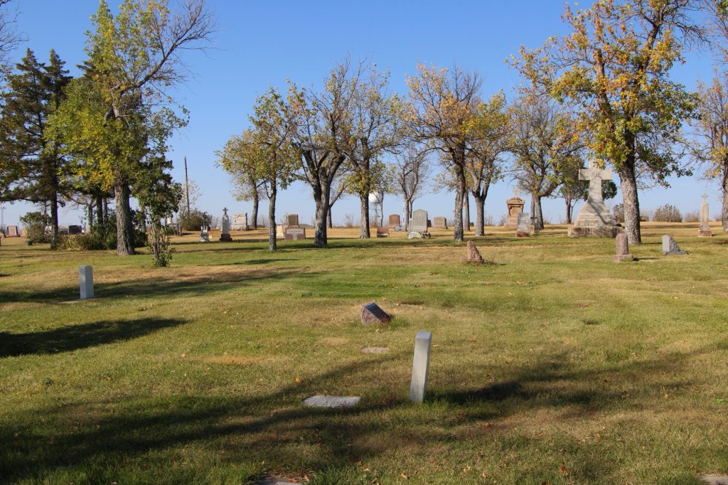
The next two images are of the cemetery’s second addition .

The section designated as Glasgow original cemetery also marks the beginning of the Highland Cemetery period. The Glasgow Montana Citizen reported on November 13, 1897: “Owing to the utter lack of system in locating the graves on the hill it was impossible to lay it [a city cemetery] out in lots so the county fathers located a strip of five acres of land adjoining the old burrying [sic] ground and laid it out into lots for future use. The cemetery is named Highland.” A couple of weeks later, the Glasgow Montana Citizen clarified the situation on December 11, 1897: The opinion prevails that the old cemetery is not a portion of the new one. This is wrong. The plat of Highland Cemetery includes a strip sixty feet wide of the old graveyard which takes in all the graves.”

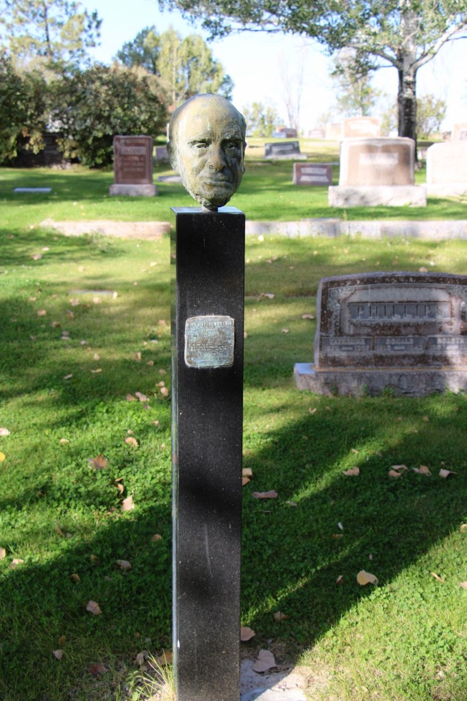
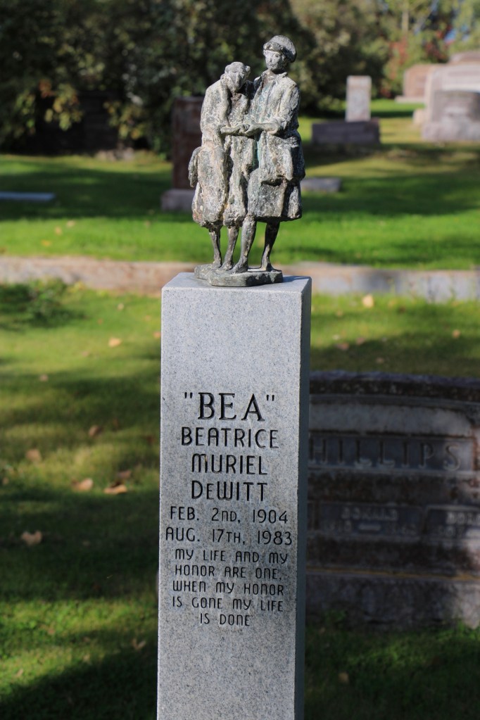
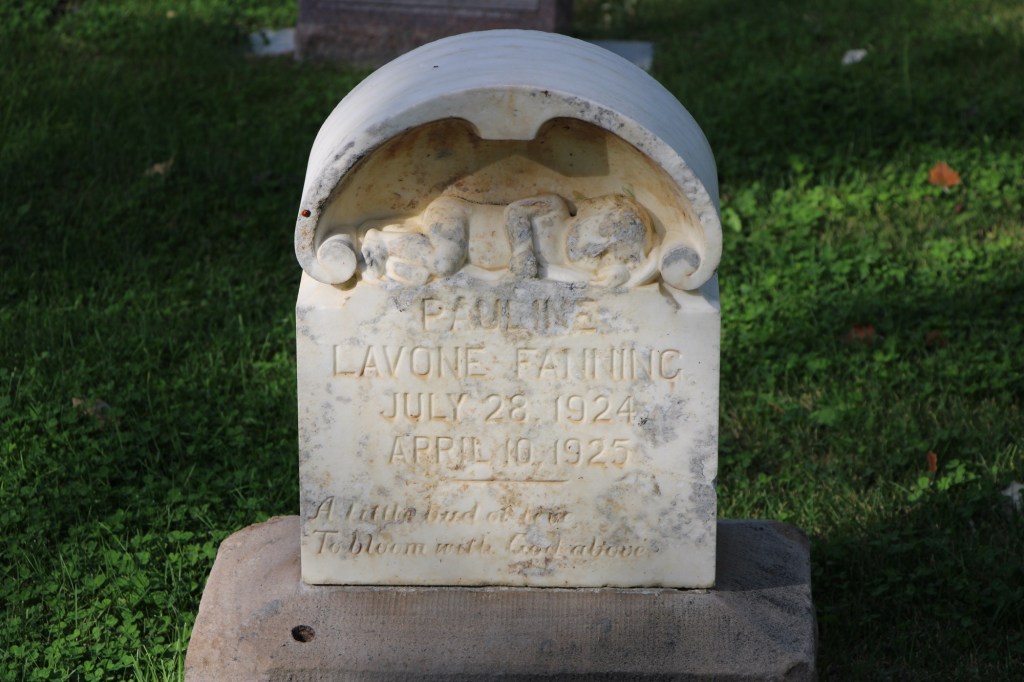
Within the boundaries of the original Highland are several remarkable gravestones, many of which have fascinating stories.

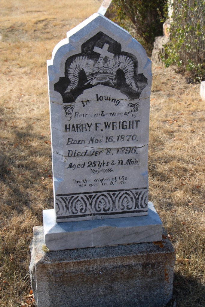
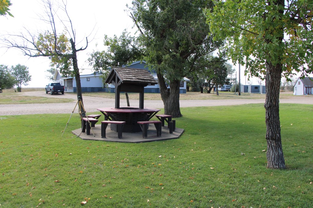
For instance, Harry Wright, according to the Glasgow Record of October 15, 1896, “was one of the best known ranchers around Saco and was a prosperous young man. He had quite a nice little bunch of cattle, a comfortable ranch and was always considered one of the most promising young men of Saco.” He was returning to England for a visit when he took ill in Buffalo, New York. He had kidney surgery which “proved most successful” but before resuming his travel Wright took a “Turkish bath” [a type of steam bath] and “death came a short while afterwards.” His sister lived in Hinsdale and had the body shipped to Glasgow to be buried in the cemetery in 1897.

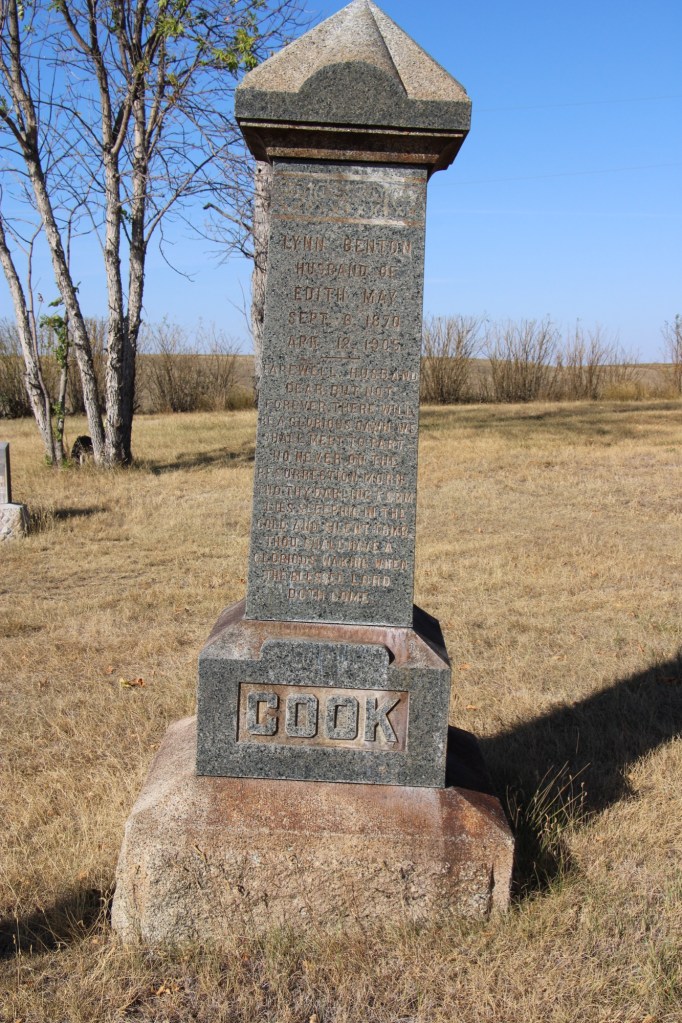
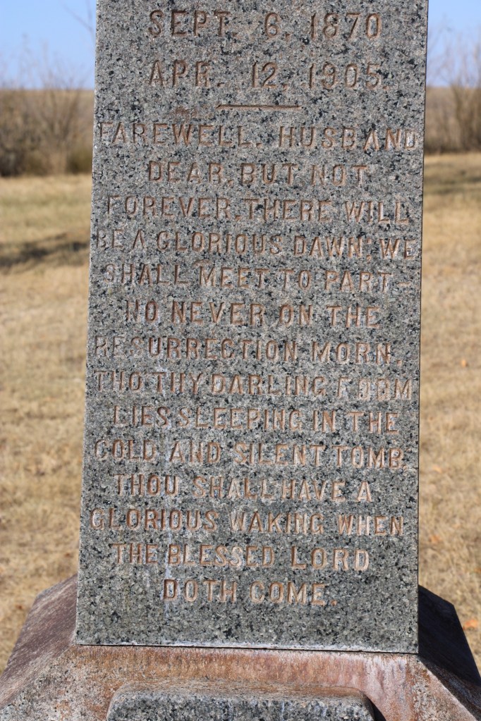
The tall obelisk marker for Lynn Benton Cook, who died at the age of 34 in 1905, has an unusually long dedication, beginning “Farewell Husband” composed by his wife Edith May.

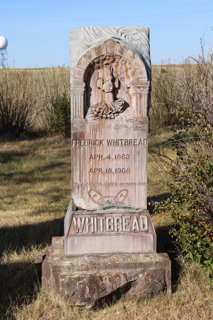
Fredrick Whitbread has a beautiful carved marker with a Richardsonian Romanesque arch framing a depiction of salvation. He was an Englishman who came to the USA in 1881. He worked as a locomotive fireman before becoming a Great Northern engineer. He left the railroad in 1897 and established a cattle ranch near Hinsdale. However in 1907 he reversed course to become the night foreman at the Great Northern’s roundhouse in Glasgow. He was a loyal member of the Odd Fellow lodge and his funeral “was the largest in the history of this city,” according to the Glasgow Montana Citizen of April 25, 1908.

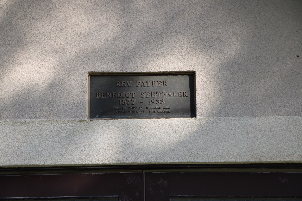
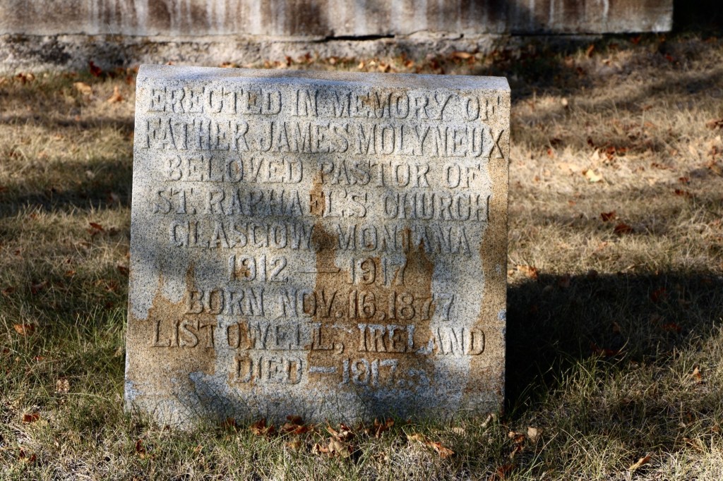
Another prominent citizen was Father James Molyneux, an Irish Catholic priest who pastored St RaphaelCatholic Church in Glasgow from 1912-1917 during the height of the county’s homesteading boom.

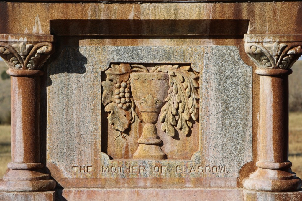
Perhaps the most compelling marker in the early history of Highland Cemetery is that of Mary Fitzpatrick Roach. She first came to Glasgow by 1780 when she worked as a cook at a local hotel before opening her own restaurant. During the railroad strike of 1895, she “became famous all along the Hi Line, by carrying her customers along whether they could pay or not.” (Glasgow Courier, June 5, 1931)

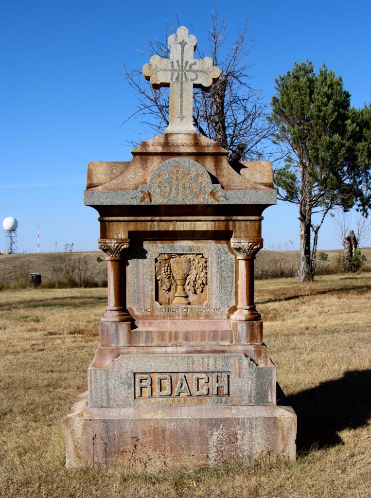
Her empathy and charity earned her the nickname “Mother of Glasgow,” which is carved in her gravestone. After the strike, her business grew and she owned a boarding house, a meat market, a large herd of cattle, and a lodging house. She married Porter Roach in 1907 and died two years later.

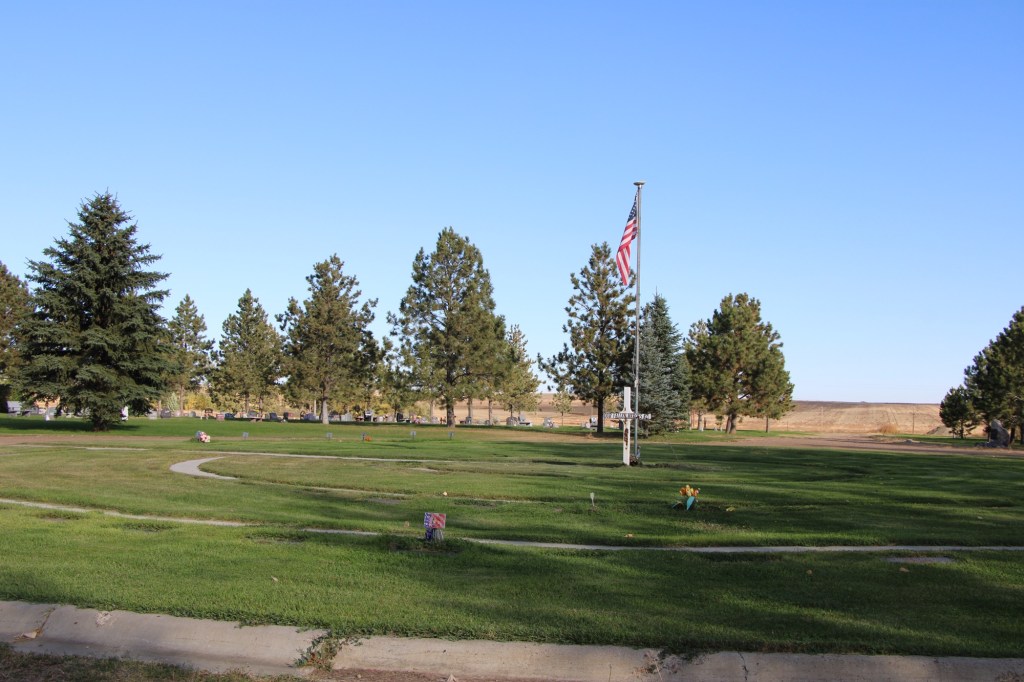
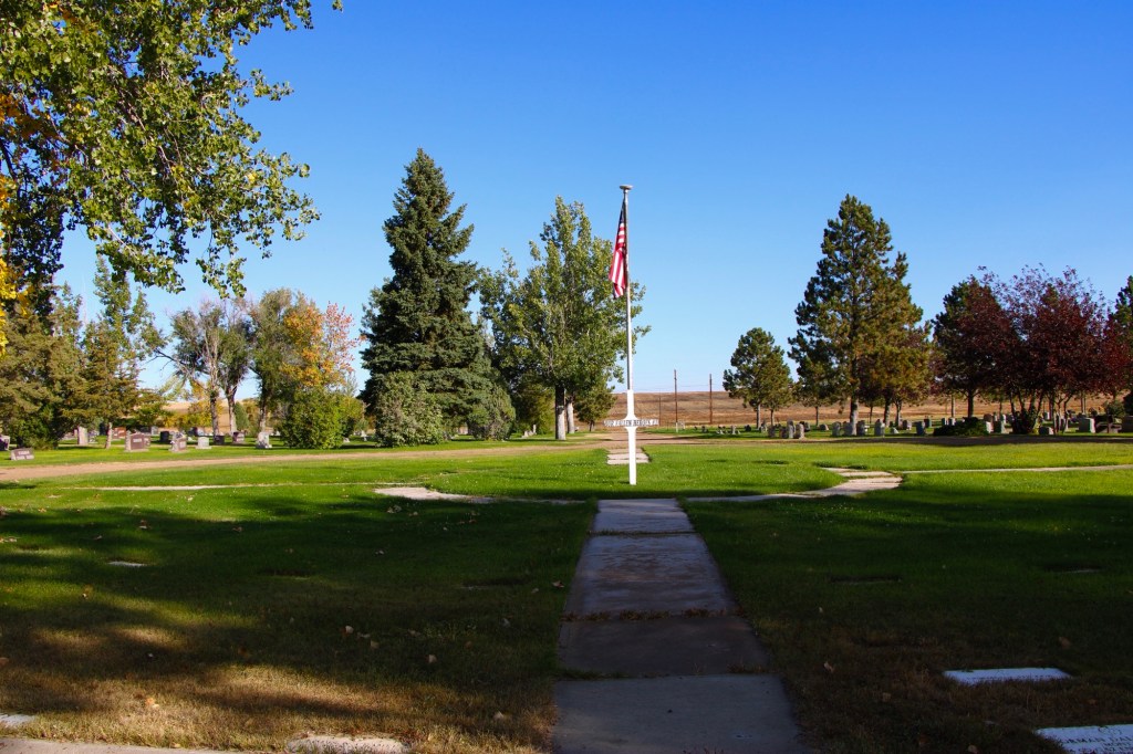
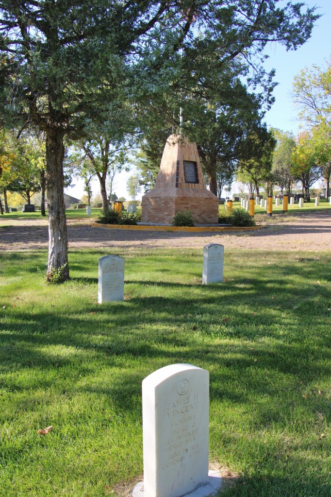
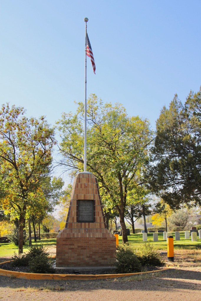
Highland Cemetery, like several other municipal cemeteries along the Hi Line, maintains an impressive Veterans section, with the four section arranged around a central flagpole.

Residents of Valley County are no doubt proud of what Highland Cemetery says about their respect for the past and those who came before. This post only begins to share the impressive grave markers and stories of this public space.

Craig, from railroad stop to Fish Town

As the Missouri River winds its way into the mountains of Montana, one of my favorite stops for 40 years is the town of Craig. Ben Stickney was the first to farm here in the 1870s. He and Frank Wagner also established a ferry crossing. Other early settlers were Warren and Eliza Craig who platted a townsite named Craig once the construction of the Montana Central Railroad between Great Falls and Helena was finished in late 1887. By 1890, the town had 77 residents.

The story of Craig in its early years was all about the railroad corridor, with houses and businesses arranged on either side of the tracks.

The Missouri River defined the east side of town as it closely paralleled the tracks. Then in 1902-1904 came the construction of a steel bridge, which replaced the ferry.

The Craig Bridge, c. 2002. Photo by Jon Axline, Montana Department of Transportation. The bridge was demolished c. 2004.

The bridge made Craig a crossroad town but it never grew that much in the next decades.

When in the 1930s the state constructed its section of U.S. Highway 91, the improved transportation led to the growth of the local school, which closed in the 21st century and now serves as a community building.

Residents also established a volunteer fire hall next to the school.

At the time historian Jon Axline documented the steel bridge c. 2002, he noted that Craig had only a bar and a fishing shop. There was not much else left. The Craig Bar is still there if you want a throwback small town bar experience.

Craig Bar on a busy day in 2015

An almost totally different Craig has emerged since the construction of the concrete bridge 20 years ago. New businesses that cater to the ever-growing fly fishing industry are everywhere it seems. Floaters and fisherman crowd the landing on weekends and in the summer.

Izaak’s is a popular bar and grille
The new taphouse caters to a different clientele than the older Craig Bar

Big Sky Journal has nicknamed Craig as Fish Town, a “quintessential fishing village” on the Missouri River. Fishing and recreation now have replaced its earlier reputation as a transportation crossroads in the Missouri River Canyon. And the concrete bridge is like a slash across the river compared to the beautiful steel trusses of the first bridge.

Kalispell’s modernist traditions

Kalispell is the seat of Flathead County, established on the Great Northern Railroad line in the 1890s. Today the city is the hub for commerce, transportation and medical care in northwest Montana. The Advisory Council on Historic Preservation designated it as a Preserve America community in recognition of its historic downtown and multiple National Register of Historic Places properties.

Certainly the town has many impressive late Victorian era buildings, like the County Courthouse, but this post focuses on a part of Kalispell’s historic built environment that doesn’t get enough attention—its buildings of modern 20th century styles.

The key town founder was C. E. Conrad and similar to how he started the town, you could also say he started the modernist traditions by commissioning his grand Shingle-style mansion from architect A.J.Gibson in 1895. Architectural historians consider the Shingle style, introduced by major American architects Henry Hobson Richardson and the New York Firm McKim, Mead, and White, to be an important precursor to the modernist buildings that would flourish in Kalispell during the 1930s.

Another important example of early modernist style is this local adaptation of Prairie house style, a form introduced and popularized by the designs of American master Frank Lloyd Wright.

Kalispell’s best modernist examples come from the 1930s to 1960s. In 1931 Brinkman designed the KCFW-TV building in a striking Art Deco style. It was originally a gas station but has been restored as an office building with its landmark tower intact.

The Strand Theatre closed as a movie house in 2007 but its colorful Art Deco marquee and facade remain, another landmark across the street from the History Museum which is housed in the old high school.

The Eagles Lodge (1948-1949) is an impressive example of late Art Deco style, especially influenced by the federal “WPA Moderne” buildings from the New Deal. G.D. Weed was the architect.

Then the town opened Elrod School in 1951. It is a good example of mid-century International style in a public building.

The 1950s decade witnessed new modern style religious buildings. The Central Bible Church (1953) evolved from a merger of Central Bible and the West Side Norwegian Methodist Church. Harry Schmautz was the architect.

That same year, the Lutheran church added a new wing for its youth ministry, the Hjortland Memorial, which is one of Kalispell’s most impressive 1950s design. Ray Thone was the architect.

In 1958 Central Christian Church completely remodeled its earlier 1908 building to a striking modern design.

That same year came the opening of St. Matthew Catholic School, an impressive two-story example of International style in an institutional building. the architect was the firm of Brinkman and Lenon.

Architectural rendering published in Flathead News and Farm journal, May 16, 1957

Kalispell also has two excellent examples of commercial buildings in the mid-century contemporary style. Below is the stone veneer and window wall of the McGarvey and Townsend building.

But my favorite, until a recent “remuddling,” is the Sutherland Dry Cleaners, now a golf supply shop.

The Sutherland business in 2015
The same building in 2023

Kalispell has several good examples of mid-century domestic design. My favorite is this Ranch-style residence near the Conrad Mandion.

This post doesn’t include all of Kalispell’s modernist designs but hopefully I have included enough to demonstrate that the town has a significant modernist architecture tradition.

Tower Rock State Park

Since my initial survey of Montana historic places in 1984-1985, Montana state parks has established several small but significant historic parks. One of these, Tower Rock State Park, is viewed by hundreds of drivers daily, as it is located directly on Interstate I-15 along the Missouri River Canyon in southern Cascade County.

Native Americans traveling from their Rocky Mountain homelands into the game-rich high plains, used the rock formation, over 400 feet high, as a landmark between the two regions. The Bitterroot Salish, Lower Kootenay, and the Piegan Blackfeet are all associated with the place. For the Piegan Blackfeet it was and is a sacred place. Groups camped in the vicinity between the Rock and Missouri River.

When on July 16, 1805 Capt. Meriwether Lewis of the famous Corps of Discovery encountered the Rock on his journey west, he noted the presence of what he called an “Indian road” around the Rock. He then decided to name the place and wrote in his journal: “this rock I called the tower. it may be ascended with some difficulty nearly to its summit, and from it there is a most pleasing view of the country we are now about to leave. from it I saw this evening immence herds of buffaloe in the plains below.

The surrounding region’s development took place in the late 19th century, accelerated by the decision of the Manitoba Road to built through the canyon a rail link connecting Great Falls, Helena and Butte. This line became known as the Montana Central Railroad.

In the early 20th century came an automobile route, U.S. Highway 91, and then the interstate highway in 1968. Interestingly, the property’s official designation as a historic site came much later. Tower Rock was listed in the National Register of Historic Places in 2002. Two years later, it became a state park of about 140 acres.

The park is day-use only but there is adequate public interpretation. There is also a maintained trail to the Rock’s base, allowing for a more direct experience with landscape and some mitigation of the noise from the highway. The importance of the place deserves a more robust treatment but perhaps more can come in the future ( and the adjacent disposal center can be moved to a more appropriate location).

Big Timber and suburban aesthetics

Readers of this blog on Montana’s historic places will see that, clearly, Big Timber is one of my favorite railroad towns of the Yellowstone Valley. Its classic T-plan is one reason why. The top of the “T” runs roughly along the river and railroad tracks, facing the Crazy Mountains, while the stem of the “T” becomes the town’s Main Street, as you can see above.

Big Timber school in 2014

Distinguished one and two-story historic buildings along Main Street and scattered throughout the town are among the other reasons I enjoy Big Timber. The fate of of one of those places is the theme of today’s post.

I have earlier talked about the town’s three primary public spaces (the courthouse, the school/library, and the Sweet Grass Mill park at the south end of Main Street.) The second oldest space is defined by its historic school and the adjacent Civic Center (which also served as the school’s gym) and the Carnegie Library, which was expanded last decade.

Civic Center in 2014. Note the rear of the school in the far right side of the image
Expanded Carnegie Library, 2021
School after fire, taken in 2018

After the disastrous fire of 2017 that destroyed the school, the future of this public space was left in doubt. Here at the end of 2025 an answer has been presented—a new outdoor space called Sheepherder Square, designed by a Bozeman-based architectural firm. A foundation has been established to support the project and fundraising is underway.

The square will be an open space with an amphitheater and other amenities that link the library and civic center. The rendering above, from the Helena Independent Record website, shows a lot of concrete walkways, perhaps too much of a suburban aesthetic for a western railroad town. Will it compete with/ replace the Sweet Grass mill park? How will it blend with pedestrian traffic at the library and the Main Street business district?

This envisioned transformation of an empty lot will be interesting to monitor over the next year or two. Is the look and feel of Big Timber headed in the right direction?

Revisiting Nashua in Valley County in 2025

It had been over a decade since I last stopped in late September 2025 at the tiny railroad town of Nashua in Valley County. Recently in the state and regional press, there have been stories about the uptick in tourism in northern Montana. It’s about time, especially for intrepid heritage tourists. As my posts from over ten years ago emphasized, an amazing array of stories and places await those who venture beyond Havre on U.S. Highway 2.

Even tiny Nashua (probably less than 300 residents today) reflects virtues worth exploring—community pride especially as reflected at the recently renovated Nashua High School, above. Since the town had lost population since my last visit, I had wondered if the school was still there as an anchor. Indeed it was, and looked almost modern as its 1935 core from the New Deal had been layered over with a new facade.

The railroad was the dominant influence in the town’s history—save for the 1930s boom during the construction of nearby Fort Peck Dam—and the town’s rail corridor is still defined by its grain elevators.

Queen of Angels Catholic Church

Competing for the Big Sky line of Nashua is the tall Gothic style bell tower of the Catholic Church. Established in 1917, Queen of Angeles Catholic Church began as a mission church. The Sisters of Charity worked with the diocese to establish an adjacent one-room school, below, as a way of growing and maintaining the congregation after the end of the Fort Peck Dam boom.

Then in 1953 Rev A. J. Schuh wrote an appeal to The Catholic Worker, a major newspaper, asking for the support for the construction of a rectory so that a more permanent foundation for the church’s work in Nashua could be laid. I had no idea if the appeal worked or not—but something happened. Queen of Angels Catholic Church was in great condition, and a major town landmark.

Front Street, Nashua

Along the old highway route was another landmark, of a quite different purpose: Vic’s Bar and Bowling Alley. Here is the private social center for the town. Great rural Montana towns always have at least one traditional watering hole. Vic’s is that place in Nashua.

Victor Dostert (1886-1961) homesteaded south of the town along the Milk River during the boom of the 1910s but when the bust came in the 1920s Dostert, his wife Anna, and their three sons stayed, making their mark with construction projects (from a theater to the Catholic Church) and taking advantage of the thousands of construction workers passing through by building and operating Vick’s Bar in 1935. He added the bowling alley in the 1950s—a decade when the bowling craze as a community institution reached its peak across the nation.

Dostert as Nashua’s town official had already been instrumental a few years earlier in the creation of the Nashua Civic Center, the public community center for this part of Valley County still today.

These places and brief stories hint at the richness of heritage experiences in Valley County. I’m glad I stopped at Nashua again (just too bad that it was early in the morning and Vic’s Bar was not yet opened). But give the residents much credit—they hung through another tough decade through commitment, community spirit, determination and faith.

Greenwood Cemetery in Wolf Point

Municipal cemeteries are key public spaces in the Hi-Line towns of Montana. As they mostly date from the 1890s to 1910s, the cemeteries are part of the region’s progressive-era history. New settlers sought to replicate their prior homes—building permanent schools, new churches, town blocks, and homes while also establishing cemeteries.

In 1915 settlers formally incorporated Wolf Point as a municipality. A year later, mortician L.M. Clayton opened a funeral business, which would operate until 2005. On a hill several blocks north of the town’s railroad tracks, Clayton established Greenwood Cemetery by 1917. The name came from his wife, Nora May Greenwood. The Greenwood Cemetery Association was organized to administer the property, and its beautification was ensured by the town’s Woman’s Club when it worked with Wolf Point leaders and the cemetery association to extend water to the place. It became a green oasis of rest and tranquility within the often brown, water starved landscape. It remains an impressive landmark of civic pride today.

There are two ceremonial areas that immediately capture your attention. Two veterans circles have been installed to honor the many from Roosevelt County who have served the nation from World War I forward.

Scattered through the cemetery are other veteran burials, including ones from the Civil War and the Spanish-American War.

Civil War veteran
Spanish-American war veteran

The second ceremonial area is more subtle in appearance but unique in its own way.

Seehaler Chapel

Father Benedict Seehaler established and led Wolf Point’s Immaculate Conception Catholic Church from 1917 to 1931. After his death, parishioners built a tiny memorial chapel in his memory. It was built over his grave.

The chapel has an altar and a carved depiction of Christ. The church on Memorial Day holds a memorial mass is held (weather permitting) at the Father Benedict Seehaler Memorial Chapel in Greenwood Cemetery.

There are many impressive grave markers at the cemetery, whether they are unadorned crosses of early settlers to ones that through the materials used help to tell a story.

Gabriel Beauchman (d. 1940)
Jesse W. Baker, Sr (d. 1994)

Two of the most unique, however, are pedestal sculptures in memory of a husband and wife, Floyd and Bea Dewitt. Floyd passed away in 1980, Bea followed three years later. Floyd’s sculpture is a likeness while Bea’s pedestal sculpture is more symbolic, with the interpretation left to the visitor, until you learn she was a beloved nurse.

Historian Patty Dean found the DeWitt’s obituaries published in the Billings Gazette, see below, and graciously shared them:

There are many more observations you can make about Greenwood Cemetery but this is enough for the posting (I reserve the right to revisit this place in the future. It is simply one of the most significant municipal cemeteries of northern Montana.

Comet, Montana: A 1985 Flashback

As I wrapped up the 1984-85 survey of Montana, I made a few specific visits to classic Montana ghost towns. Comet in Jefferson County was one of those stops and here I share for the first time the images from 1985.

In 1883, the Helena and Livingston Smelting and Reduction Company established the Comet mine, around which the town of Comet developed. Like many of the late 19th century mining towns, Comet boomed briefly until the economic crash of the 1890s.

But Comet had a second life in the 20th century. In 1900, interest in reopening the mine for copper and other base metals led to the establishment of the Montana Consolidated Copper Company. This company managed the property for a generation until 1927 when the Basin Montana Tunnel Company acquired the property.

Note the lone brick chimney to the right

The new operators built a processing center, and the town’s population reached new highs, although always remaining in the low hundreds.

Large scale operations at Comet ended in 1941 but scattered work remained for years—there was still activity at the site in 1985.

I found Comet to be an interesting combination of log buildings and balloon-frame one story buildings. So it spoke to me as both a historical place but also a surviving laboratory for studying the vernacular architecture of 20th mining camps.

I need to revisit Comet and see what’s left after 40 years. Perhaps in the new year!

The Helena Trail Riders Club House

Preserve Montana makes many wonderful contributions to Montana, from history to trades education to heritage tourism. In late September 2025 I had the opportunity to attend its fun fall event, the Hidden Helena tour.

Helena trail riders club house

There were many jewels to explore that day but my favorite was certainly the Helena Trail Riders club house at what was once the State Fairgrounds but now the Lewis and Clark County Fairgrounds.

The group began in 1939 and within a decade it had built a loyal membership and a strong regional following through its annual riding competitions. It is recognized as the state’s oldest saddle club.

The first president was the Montana artist Shorty Shope, whose imaginative depictions of the Old West became known to millions of visitors through the decorative frames on Montana Highway Historical Markers that he developed for the state department of transportation in the 1940s and 1950s.

Original Shope frame design, 1983

The Club house preserves several of Shope’s works, from metal castings to the covers of scrapbooks.

The most impressive work by far is the mural Shope created for the clubhouse wall. What an expressive example of his eye as an artist!

This clubhouse confirms my bias about most things Montana—you find the best stuff in the most unassuming places.

Changes at Sleeping Buffalo Hot Springs

In 2013 I last visited Sleeping Rock Hot Springs, just north of U.S. Highway 2 in Phillips County. The following year I posted about the obvious changes then underway to put this once vibrant mid-20th century recreational area back to greater prominence.

I returned in late September 2025 to find that, indeed, lots of improvements were made in the last ten years. A large bar/restaurant had been built, the grounds expanded and modernized, and the pool greatly enlarged.

But the hot springs’ New Deal roots were still apparent because attached to the pool facility was the pergola of the early 1930s.

This hipped roof stone structure came about due to the joint efforts of local residents and government officials. An exhibit at the Phillips County Museum in Malta (more on that place later) points out that a rancher Elbert Davison first saw the mineral springs as having medicinal qualities. He built a small pool that brought relief to his son who had polio. That effort convinced the Saco American Legion to do more and soon a local effort to gain control of the spot for public use met its success in 1931. Later that year the American Legion Hot Springs was in operation, quite a feat in Depression-era northeast Montana.

That effort caught the attention of county agent H.L. Lantz to work with the New Deal’s Resettlement Administration, then active in the Milk River Project area, to get the Public Works Administration to fund the pergola. That story is told in the marker (above) still at the pergola today.

Bruno Partzsch was the stone mason for the buildings, and some of his work is still visible in the expanded and modernized pool building of today (2025). I wonder if Partzsch is also the crafter behind the stone building at Zurich Park in Blaine County since both places have ties with the Milk River Project.

Sleeping Buffalo Hot Springs is on the market in the fall of 2025. Business is tough—actually way beyond tough—in this part of Montana’s Hi-Line. I only hope that new owners who can keep the momentum going can be found and this jewel of a historic place—shaped by a partnership between locals and government—will survive well beyond its 100th anniversary in 2031.