Roundup, Montana: 19th Century Trail Crossroads and 20th Century Railroad Town

IMG_0080

Roundup, the seat of Musselshell County, has long been one of my favorite Montana county seats.  The old 19th century cattle trails are one important defining feature of the eastern Montana landscape; another are the railroad lines that crossed the region.  Here at Roundup, a north-south cattle trail crosses the east-west railroad line,  creating a town environment rich in history.

IMG_0078

Locals gathered at the town’s several good historic bars–the Arcade being my favorite–are rich in tales of the chaos and fun of early September 1989 when cowboys and pretend cowboys gathered in mass to recreate the “Great Montana Cattle Drive.”  A monument to that crazy day stands next to Roundup’s outstanding New Deal-era courthouse.  Another sign to that time is much more lonely, on Main Street, the old historic route of the trail (now part of U.S. Highway 87). Are you supposed to stand there for a selfie if you rode in ’89?

IMG_0077

IMG_0076

Arcade Bar, Roundup, a real Montana classic

IMG_0057

There are so many Stockman Bars in Montana. The one is Roundup has these two great Art Deco-like windows.

The coming of the Milwaukee Road in 1906-1907 created a new look to Roundup.  Like many Milwaukee towns in Montana, it has a T-plan, with the route of the tracks (the rails

IMG_0050

I was glad to see this light industrial adaptive reuse of the Milwaukee depot–it was abandoned in 1985 and could have been demolished.

have been removed since c. 1985) and the location of the depot forming the top part of the T while the stem of the T is the route of U. S. 87 as it stretches to the north.

IMG_0048

U.S. 87 N (Main Street), Roundup

Earlier posts have discussed the town’s contribution to Montana modernism, St. Benedict’s Catholic Church, and the superb Musselshell County Fairgrounds, one of my favorite in the state (and a public property eligible for the National Register IMHO). Roundup has two National Register properties–its two historic schools.  The St. Benedict Catholic School (c. 1920), designed by Roundup’s own John Grant, is now the Musselshell Valley Museum.

IMG_0036

The town’s historic public school, but in two major sections in 1911 and 1913, was designed by the Billings architectural firm of Link and Haire.   It is an impressive landmark, built from stone taken from the bluffs of the Musselshell River Valley, and one maintained with pride by the community.

IMG_0235

Many historic buildings from the early 20th century line Main Street–naturally many one-story buildings but also commercial blocks of style and substance.  There is also a lot of homes that would contribute to a residential historic district.  Roundup has lost population like almost all eastern Montana towns since 1980 but not by such a severe amount–just over 200 in the last 30 years.  Thus, the town’s historic buildings remain in use and in fairly good condition.

IMG_0063

IMG_0046

IMG_0039

The historic schools in Roundup have been a great start for heritage efforts in Roundup but this quick overview shows that more can be done, to document and preserve this pivotal place in the Musselshell Valley.
Musselshell school and the Musselshell Valley

IMG_0091

Traveling west of U.S. 12 along the Musselshell River Valley, I eagerly sought out the town of Musselshell, assuming that the 30 years since my last visit had not been kind to the small country town.  I hope that the iconic 1913 school–a gleaming yellow brick landmark–was still there.  It had survived, as the photo above attests, although students no longer attend classes there.  Musselshell School closed as an education institution over 10 years ago, but a group of determined community-minded residents formed the Friends of Musselshell School and saved the building, turning it into community center for the western end of the county.  When I visited in 2013–new work to the building was evident, including newly installed windows, courtesy of a $10,000 grant from PPL Montana Community Fund.
Handel store, c. 1912, and Musselshell overview

Handel store, c. 1912, and Musselshell overview

Musselshell prospered in its first decade of existence, after the arrival of the Milwaukee Road, and has been in decline, really, ever since.  But it retains both the historic high school and elementary school (which is now headquarters for the volunteer fire department), along with early 20th century churches, community institutions for a vanishing population.

IMG_0093

IMG_0094

Community Bible Church, Musselshell

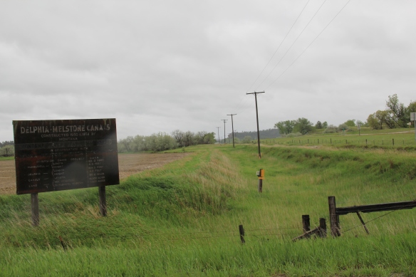
Vanishing as well is the story told by the area’s mid-20th century irrigation project, the Delphia-Melstone Canals, built in 1950 and 1953 by the State of Montana.  The diversion dam at Musselshell was the project’s largest at 182 feet.

IMG_0098

Somehow Musselshell has been able to hang on to its tiny false-front post office, a reminder of the community’s persistence along a railroad that has disappeared and a highway that receives so few travelers today.

IMG_0095

The Milwaukee Road Heads into the Musselshell Valley

As the Milwaukee Road left the Yellowstone Valley at Forsyth and struck northwest toward the Musselshell River valley, it created one of Montana’s most classic prairie railroad towns, Ingomar, established in 1908.  The hamlet, with 25 or so residents today, compared to perhaps the 100 who lived around there in 1980 has several historic buildings that document its quick twentieth century rise, and just as quick fall in the 1920s and 1930s depression years.

IMG_6844

Jersey Lily Bar, Ingomar, 1984

In the 1984 survey of Montana, Ingomar really just had one reason to stop:  the Jersey Lilly Bar, owned and managed by Bill Seward, who had done so since 1984.  That spring Seward and I became good friends.  Few people stopped there in February and March and since I was in the region, I found ways to stop in. do coffee (strong, hot, always ready) and have whatever Bill was thinking of cooking.  He was proud of his beans, and liked sliced red potatoes when he had them.  Seward added the faux western wood porch to a 1914 bank building:  he said that the tourists liked it, that it made the otherwise Classical Revival bank look “Old West.”  Until Seward’s death in 1995, I found reasons to visit Ingomar three other times, in a way just to make sure that both Seward and the bar was still going on.  Since the construction of the interstate highway to the south had so killed traffic along U.S. Highway 12, you wondered when the bar would close.

IMG_0115

This former homestead-era bank building, the Wiley, Clark, and Greening Bank, opened in 1914 and closed as a bank seven years later.  In 1933, the height of the Depression, it re-opened as the Oasis Bar (it certainly was that along U.S. 12) and it became the Jersey Lilly Bar in 1948.  Almost seven decades later, it is a well-known landmark on the highway, and was listed in the National Register of Historic Places in 1995.

IMG_0116

IMG_0126

Adjoining the bar, and accessible only through the bar, is another National Register building, the Bookman General Store, constructed as really an act of faith in 1921, replacing an earlier store that had burned.  The prospects for Ingomar was not so rosy by that time but the Bookman family stayed the course–lost the store for two years from 1933-1935–but reacquired it and kept it open to 1943.

IMG_0122

A third Ingomar landmark on the National Register is the public school, which evolved from  a one-room in 1913 to the rambling building you see today, constructed by Neils Hanson of Melstone in 1915.  When I surveyed Ingomar in 1984, the school still operated but closed for good in 1992.  It was converted into a “biscuit and bunk” later that decade.

IMG_0111

Another important historic building is the Milwaukee Road “combination-style” depot, where the passenger and freight service was combined into one building.  Many of these have disappeared along the line since its closure, and too many have disappeared or have been moved since my survey work of 1984-1985.  Ingomar has its depot, converted into a private residence along the now-gone tracks in the 1990s.

IMG_0123

Other historic properties exist, perhaps waiting new futures.  The rodeo grounds stay in use while the Riechers Brothers general merchandise and machinery store building remains standing.  Other structures are barely hanging on.

IMG_0113

IMG_0114

IMG_0109

As travel dwindles and population disappears, you worry about the future of Ingomar.  Their signs and their heritage assets beckon visitors daily but will enough even come by to make a difference?

IMG_0108

Melstone, just west of where the Milwaukee Road crossed the Musselshell River and entered its valley, is another worrisome case.  Its population has dropped to under 100–almost 150 lost since my visit in 1984.  But it still has its school, which is very much the town’s central institution and point of pride.

IMG_0103

Melstone has lost its signature building, the 1912 Antlers Hotel, located on the town’s most prominent corner between its main street, that leads to the school, and the intersection with U.S. Highway 12.

IMG_4071

Antlers Hotel, Melstone, 1984

The location of the Antlers Hotel is now a grassy spot.

The location of the Antlers Hotel is now a grassy spot.

Melstone has a hardware/general store along with Jakes Garage on the highway and the Melstone Bar and Cafe, another classic roadside stop along u.S. 12.

IMG_0104

IMG_0099

Ingomar and Melstone–I understand to most eyes they are dumps, not worth a look–but in my fieldwork they are interesting and valuable, physical signs of the 20th century determination to make rural settlements work, and despite their losses, they are still here some 100 years later.

Winnett and Petroleum County

IMG_0261
West of Jordan, crossing the Musselshell River, on Montana 200 is Petroleum County, the last county to be created in Montana in 1925. Its county seat, Winnett, was never big–even at the height of the Cat Creek oil strike the town numbered only 500 residents. It now has 188 in 2010–a slight decrease of twenty from when I first visited in 1984.

Petroleum County Courthouse, mid-1980s

Petroleum County Courthouse, mid-1980s


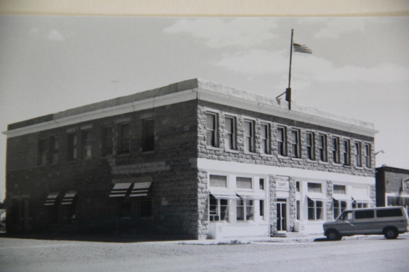
In 1928, county officials moved the courthouse into the town’s one substantial business block, a beautiful locally quarried stone building from the town’s beginnings in 1918. The courthouse is now the county’s one listed property in the National Register of Historic Places.
IMG_0255
IMG_0256
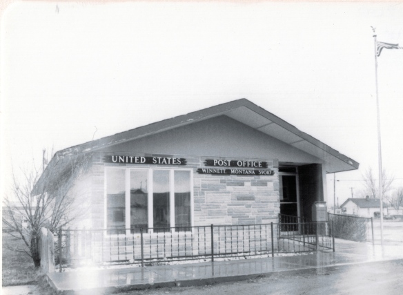
Another public building is the 1960s post office–I noted it in the 1984 because of the use of a stone veneer on the front of the building, different than many other standardized designs found in the region. That building is
Created with GIMP
still there, now as then, an important community gathering place, changed only by the growth of landscaping around it in the last 30 years.
IMG_0251
There is only a single historic grain elevator left in Winnett, but it has two bars, one a converted gas station, the other the iconic Winnett Bar, one of the most famed in the region, especially for its steaks. If you only need one reason to visit Winnett, this is the one.
IMG_0250
IMG_0260
IMG_0252
While there, you also can take in a bit of Montana modernism, in the A-frame First Baptist Church, which the town’s “W” overlooks from the bluffs above. Other earlier classic vernacular designs, such as false front stores await new futures.
IMG_0246
IMG_0254
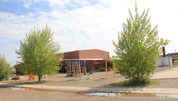
The future in Winnett and Petroleum County is naturally given a physical space by its schools–the most substantial buildings constructed here in the second half of the 20th century. with less than 500 residents in 210, the county’s future seems to be non-existent but the schools say otherwise.
IMG_0248IMG_0245