

It had been over a decade since I last stopped in late September 2025 at the tiny railroad town of Nashua in Valley County. Recently in the state and regional press, there have been stories about the uptick in tourism in northern Montana. It’s about time, especially for intrepid heritage tourists. As my posts from over ten years ago emphasized, an amazing array of stories and places await those who venture beyond Havre on U.S. Highway 2.
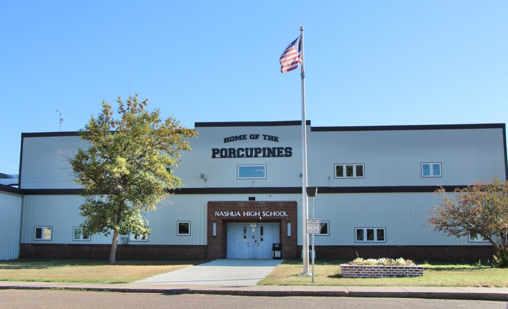
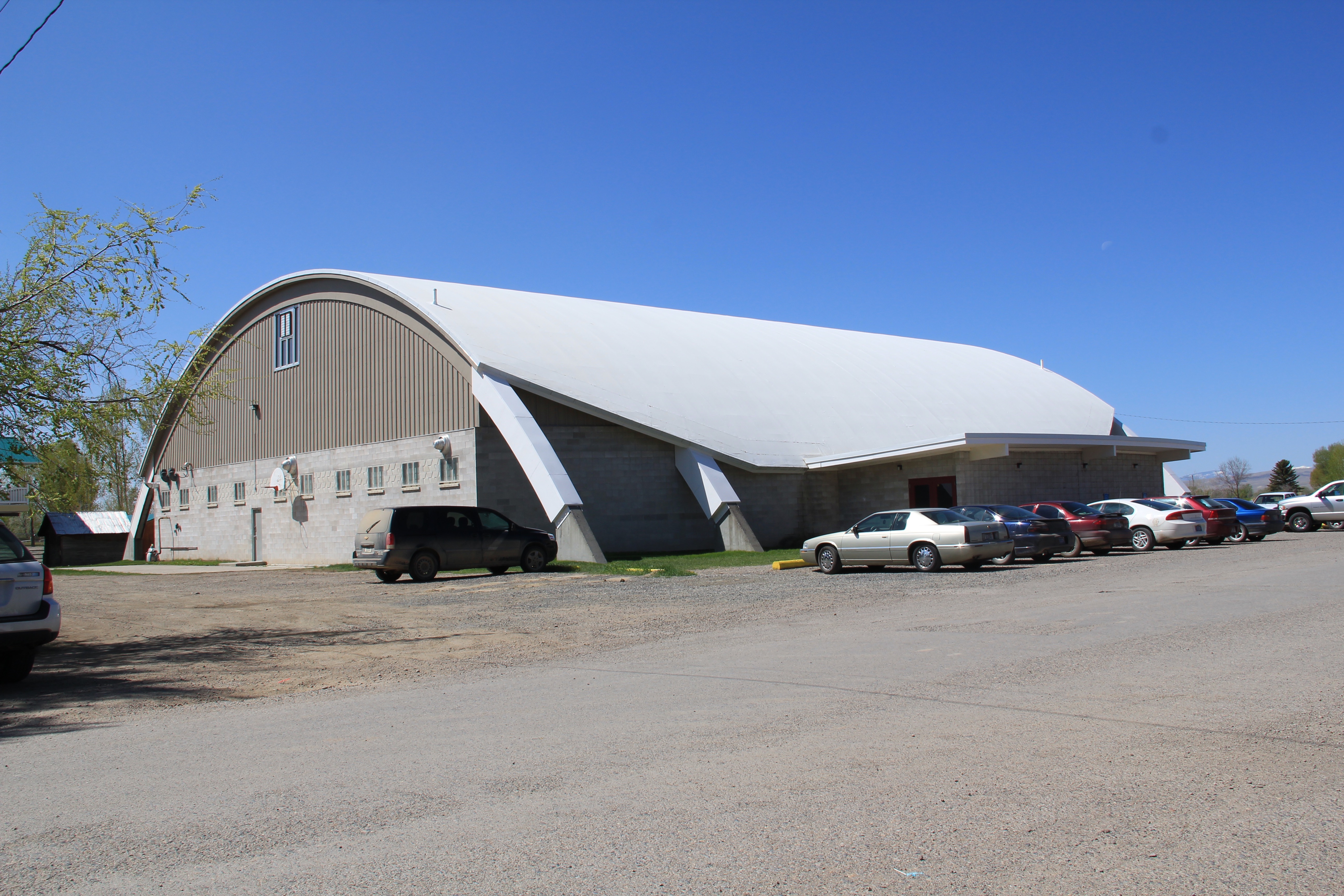
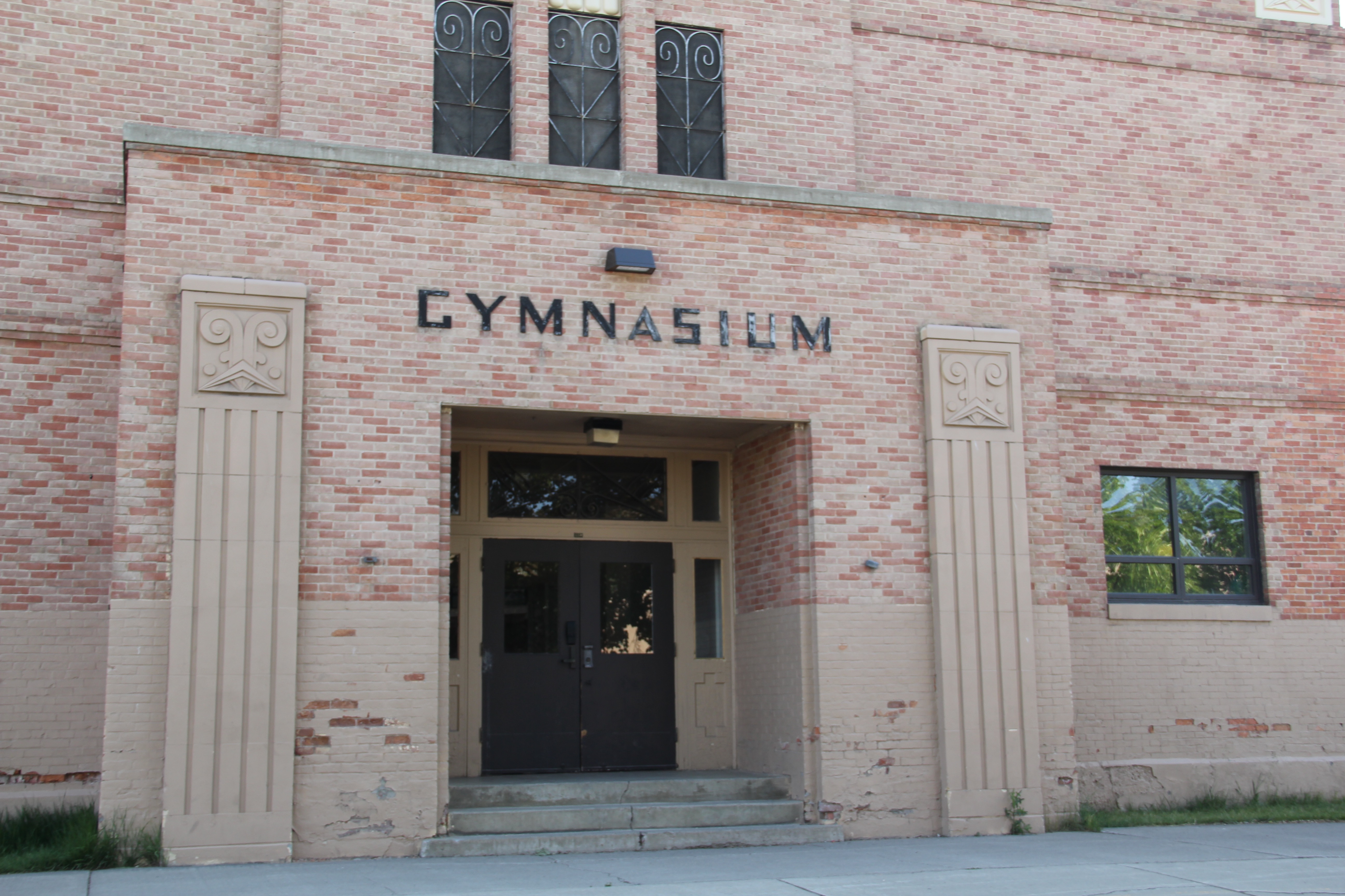
Even tiny Nashua (probably less than 300 residents today) reflects virtues worth exploring—community pride especially as reflected at the recently renovated Nashua High School, above. Since the town had lost population since my last visit, I had wondered if the school was still there as an anchor. Indeed it was, and looked almost modern as its 1935 core from the New Deal had been layered over with a new facade.
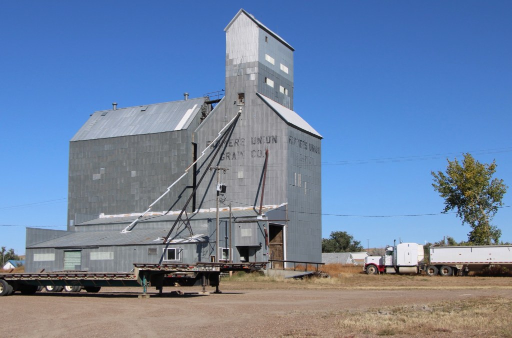
The railroad was the dominant influence in the town’s history—save for the 1930s boom during the construction of nearby Fort Peck Dam—and the town’s rail corridor is still defined by its grain elevators.
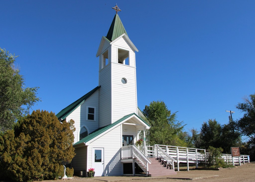
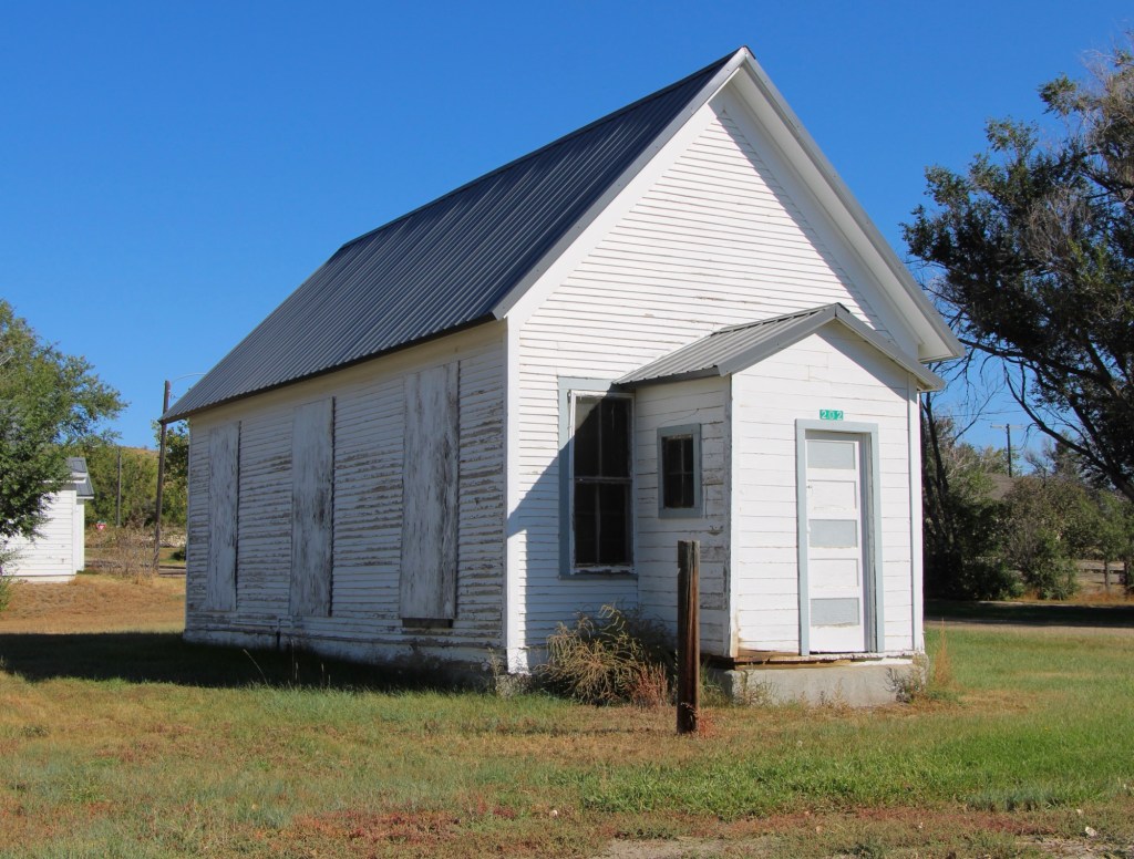
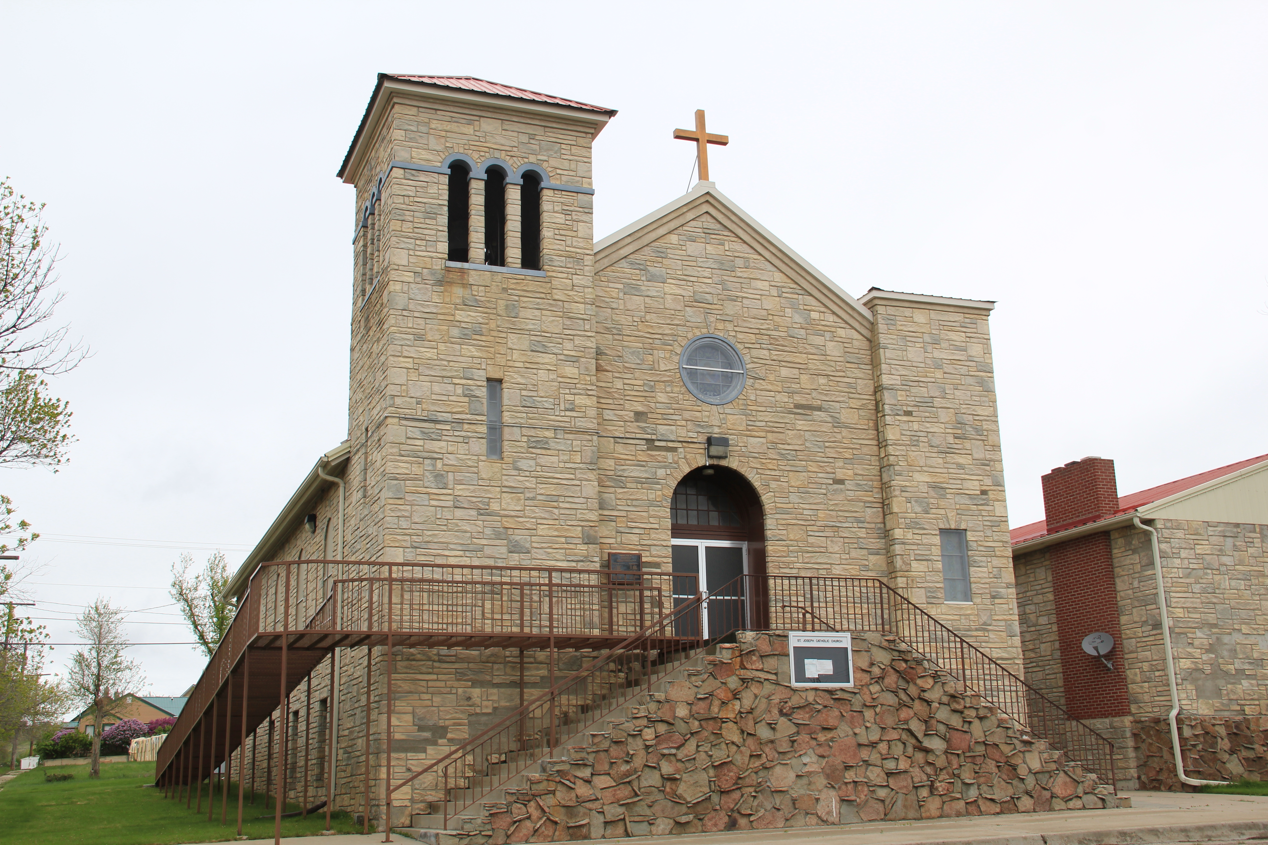
Competing for the Big Sky line of Nashua is the tall Gothic style bell tower of the Catholic Church. Established in 1917, Queen of Angeles Catholic Church began as a mission church. The Sisters of Charity worked with the diocese to establish an adjacent one-room school, below, as a way of growing and maintaining the congregation after the end of the Fort Peck Dam boom.
Then in 1953 Rev A. J. Schuh wrote an appeal to The Catholic Worker, a major newspaper, asking for the support for the construction of a rectory so that a more permanent foundation for the church’s work in Nashua could be laid. I had no idea if the appeal worked or not—but something happened. Queen of Angels Catholic Church was in great condition, and a major town landmark.

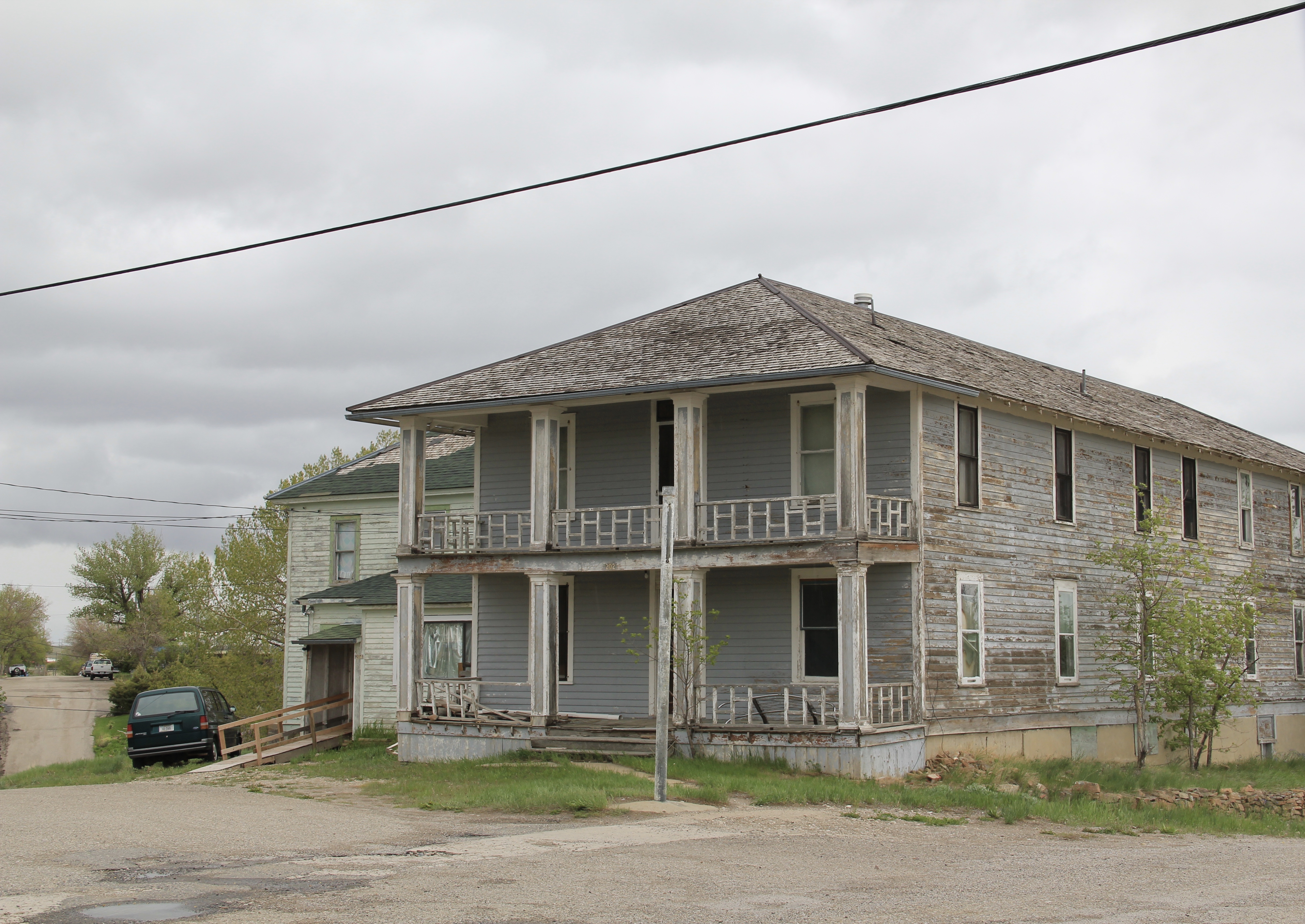
Along the old highway route was another landmark, of a quite different purpose: Vic’s Bar and Bowling Alley. Here is the private social center for the town. Great rural Montana towns always have at least one traditional watering hole. Vic’s is that place in Nashua.
Victor Dostert (1886-1961) homesteaded south of the town along the Milk River during the boom of the 1910s but when the bust came in the 1920s Dostert, his wife Anna, and their three sons stayed, making their mark with construction projects (from a theater to the Catholic Church) and taking advantage of the thousands of construction workers passing through by building and operating Vick’s Bar in 1935. He added the bowling alley in the 1950s—a decade when the bowling craze as a community institution reached its peak across the nation.
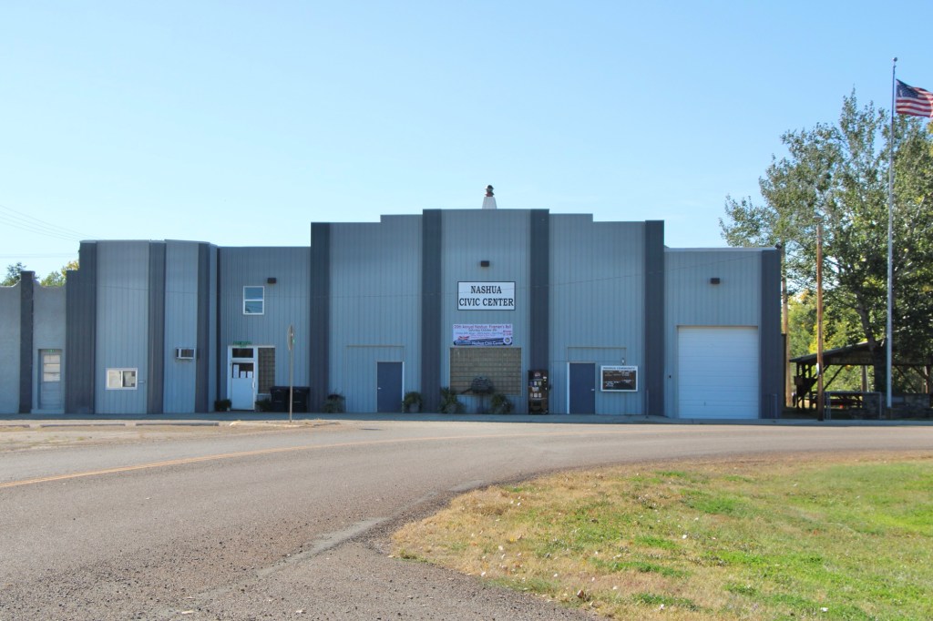
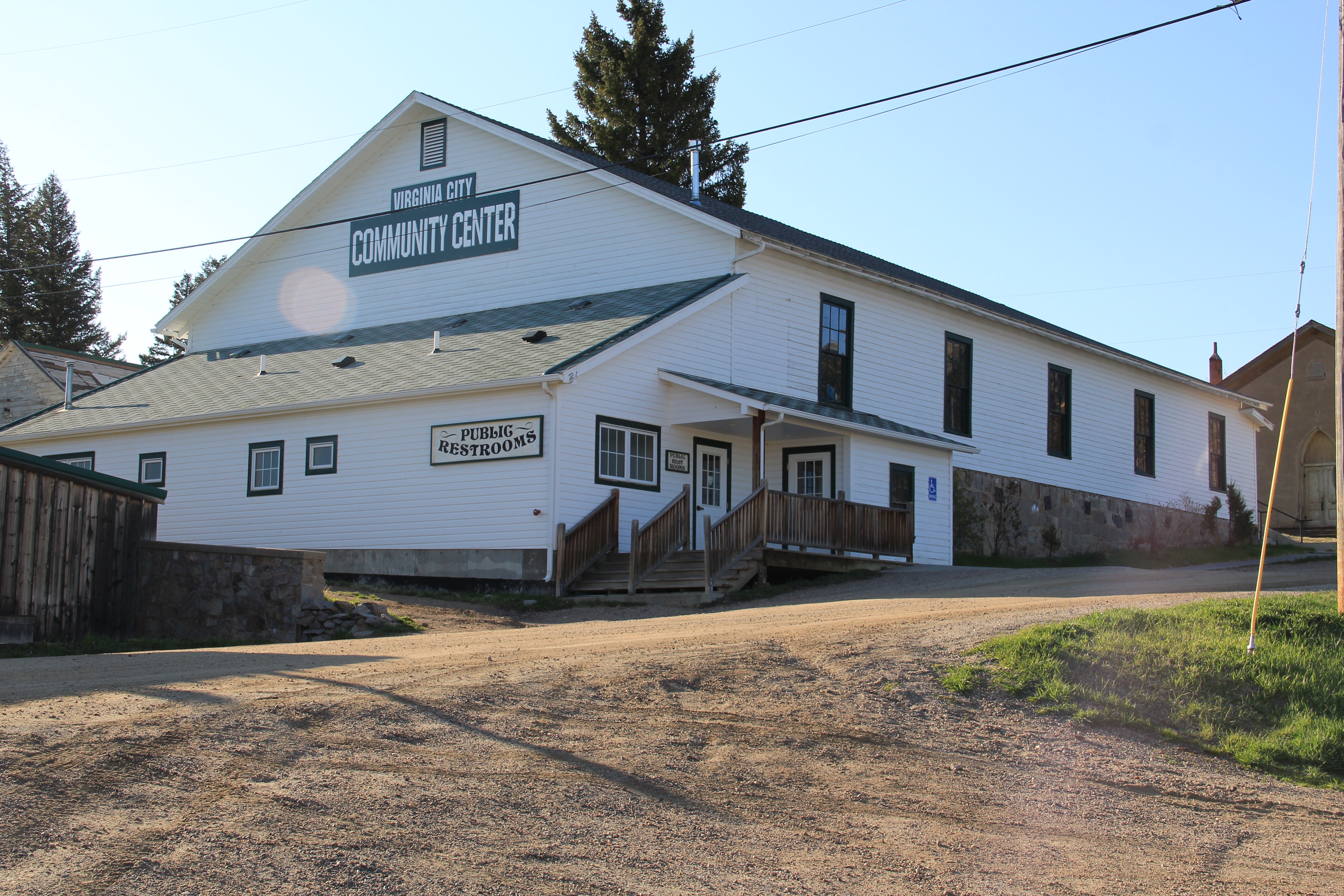
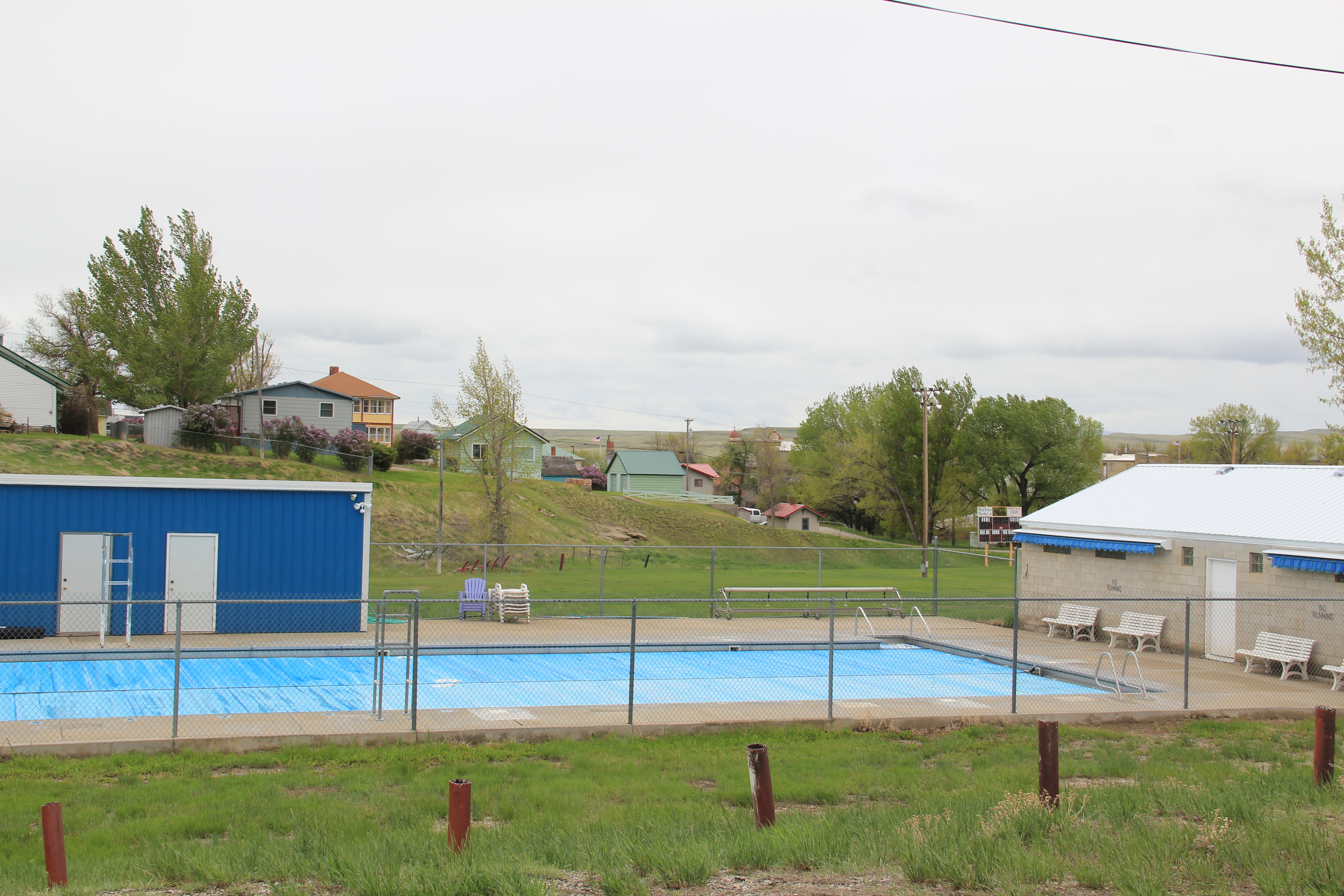
Dostert as Nashua’s town official had already been instrumental a few years earlier in the creation of the Nashua Civic Center, the public community center for this part of Valley County still today.
These places and brief stories hint at the richness of heritage experiences in Valley County. I’m glad I stopped at Nashua again (just too bad that it was early in the morning and Vic’s Bar was not yet opened). But give the residents much credit—they hung through another tough decade through commitment, community spirit, determination and faith.


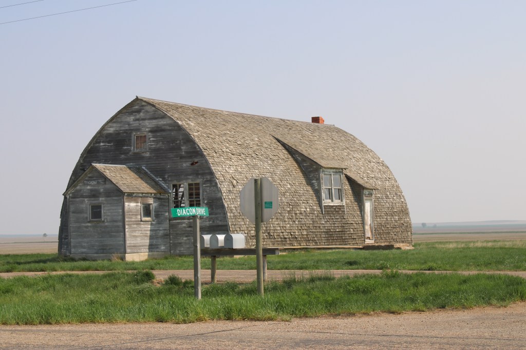

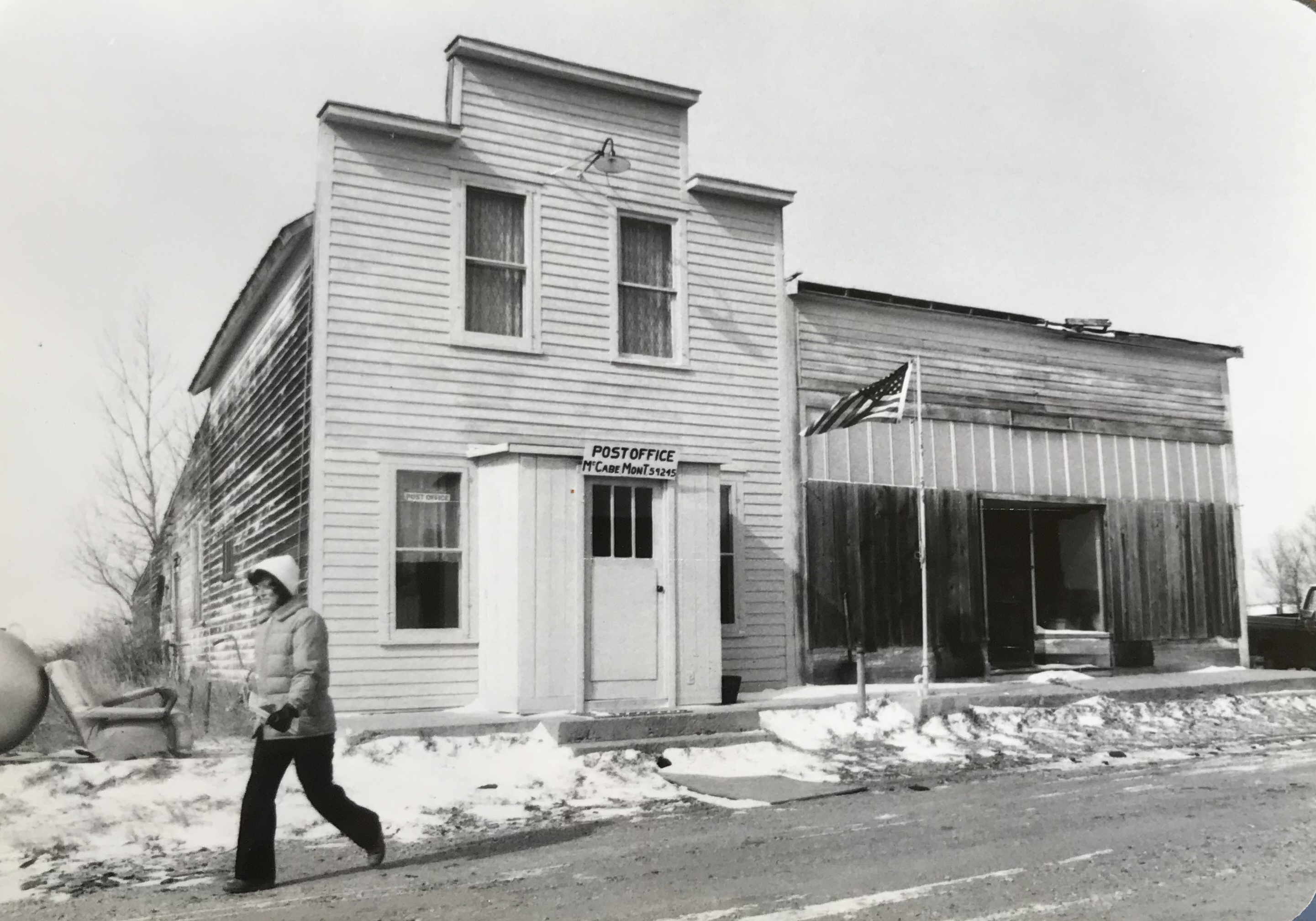 The new year will mark 35 years since I began my systematic exploration of Montana for the state historic preservation office. I am using that loose anniversary (actually I started in Toole County in February) as an excuse to share some of my favorite images from a time that seems like yesterday but certainly belongs to another era. The image of a winter morning in McCabe in the northeast corner of Montana is still perhaps my favorite of all. The idea of a town being merely a handful of unadorned buildings fascinated me, and the primacy of the post office also struck me.
 The imprint of the metropolitan corridor of great railroad corporations crossing the northern plains with their trains speeding between Seattle and St Paul never left my memory— as four decades of my graduate students will sadly attest. The image of Hoagland in northern Blaine County recorded what happened to the spur lines of the main corridors by the end of the century. The image below of Joplin along US Highway 2 is what I always think of when someone mentions the Hi-Line.
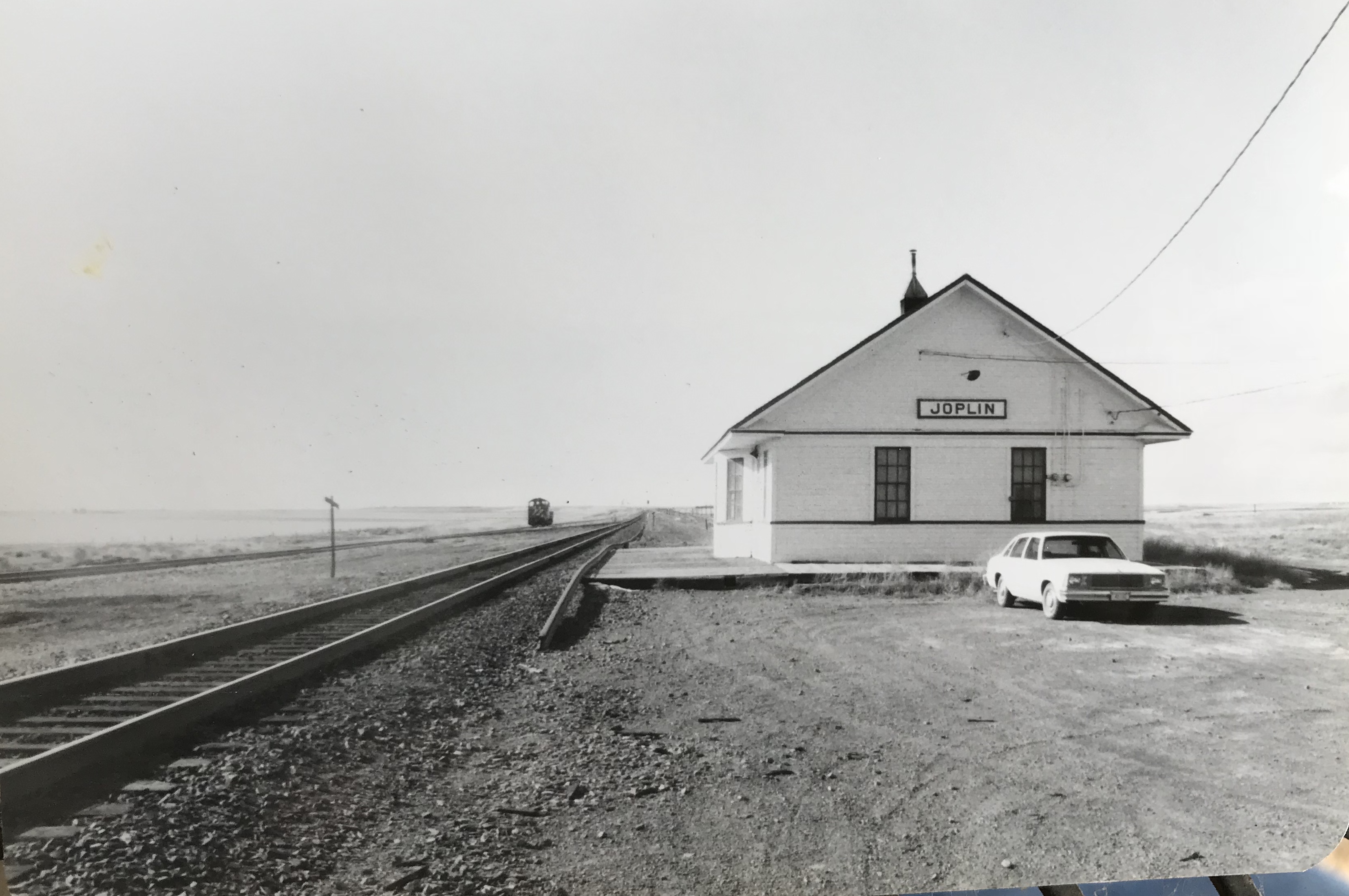 Small-town Montana is also defined by its local bars and taverns, as I have repeatedly emphasized in this blog. Swede’s Place in Drummond just said a lot to me in 1984. But I wasn’t sure which door to use— the one between the glass block windows did the trick.
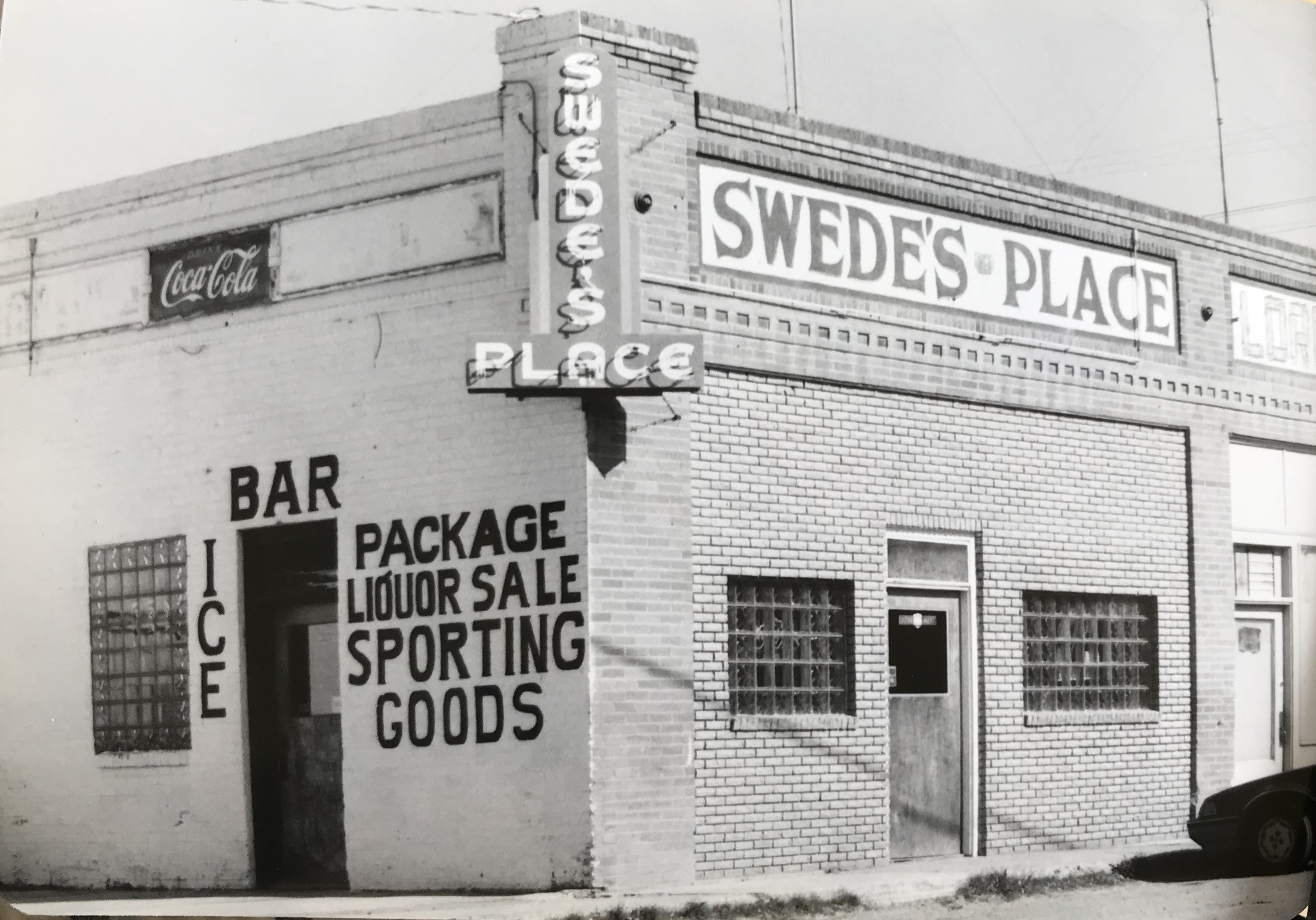 Some places I considered small town landmarks have disappeared in the last third of a century. The Antler Hotel and bar in Melstone on US Highway 12 is one I still miss.
 Rural schools were everywhere even though some had been abandoned for a generation. The Boston Coulee School still had its New Deal privy. The New Deal also built the modernist styled Shawmut School. I haven’t been that way in awhile—I wonder if it still serves that tiny town.
 The towns defined only by their community centers also fascinated me. Loring was bigger than Eden for what that’s worth but these comparatively substantial and obviously valued buildings told me that community meant something perhaps more profound in the Montana plains.
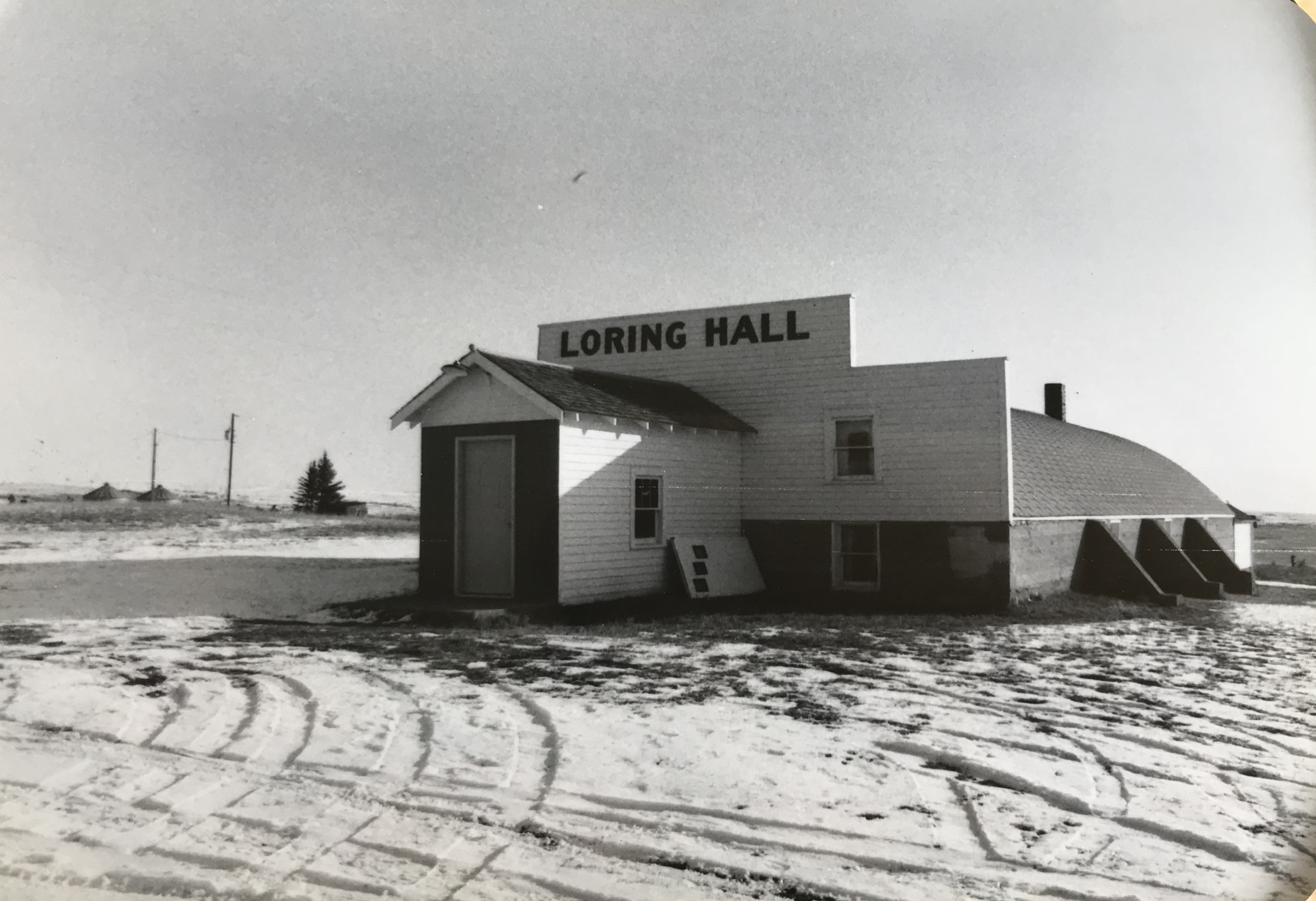
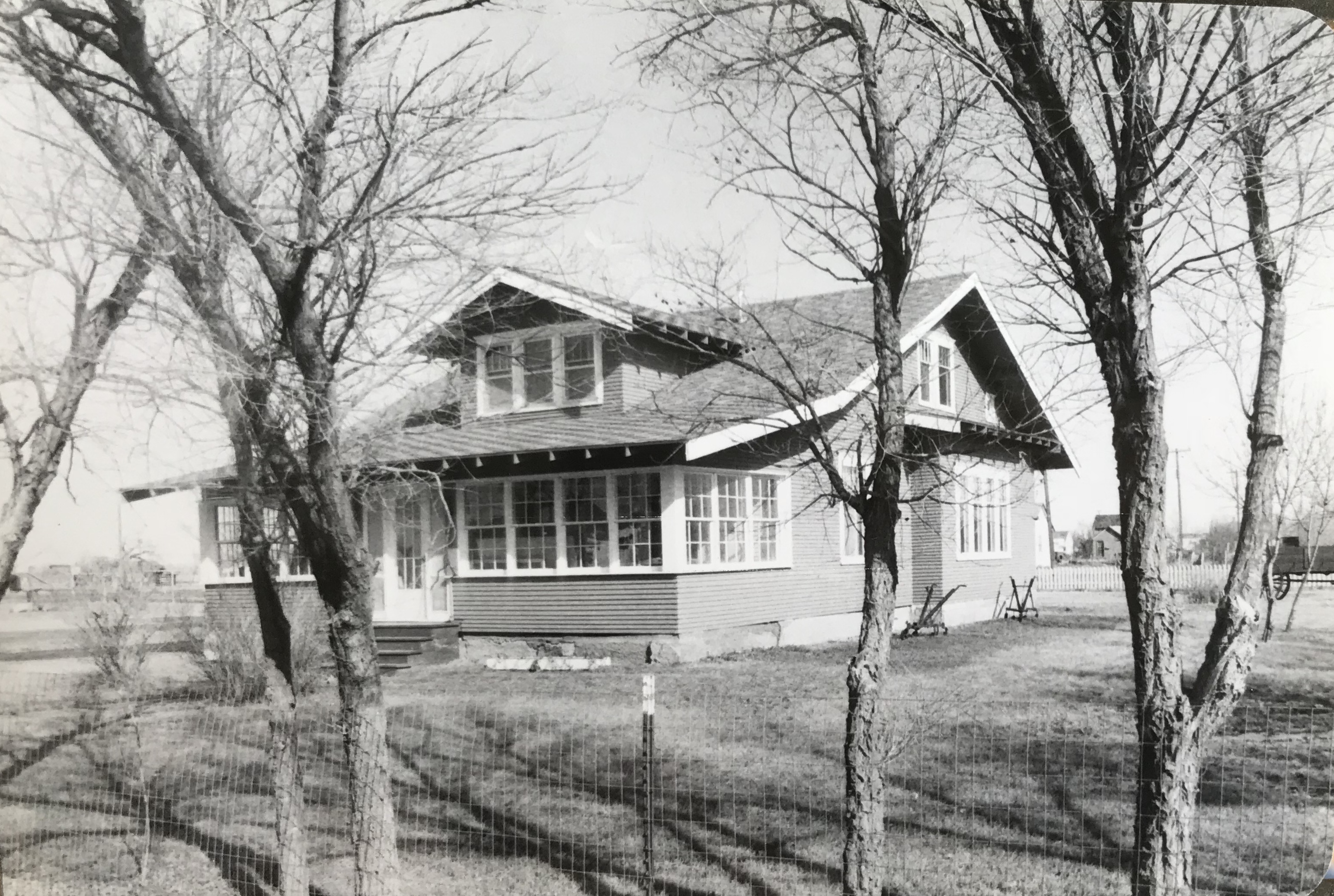
 I will always remember Saco fondly for the town tour that residents gave me—it ranged from an old homesteader hotel (no longer there) to a Sears Roebuck kit bungalow, which is still a family home in Saco although Sears Roebuck has largely closed up shop.
 These images are merely a beginning of my reconsideration of what I saw, heard and experienced 35 years ago but I know they represent places that still bring meaning to me today.


 The most popular Montana gateway into Yellowstone National Park is at Gardiner, in the southern tip of Park County. Here is where the Northern Pacific Railway stopped its trains, at a Rustic styled passenger station long ago demolished, and travelers passed through the gate above–designed by architect Robert Reamer–and started their journey into the park.
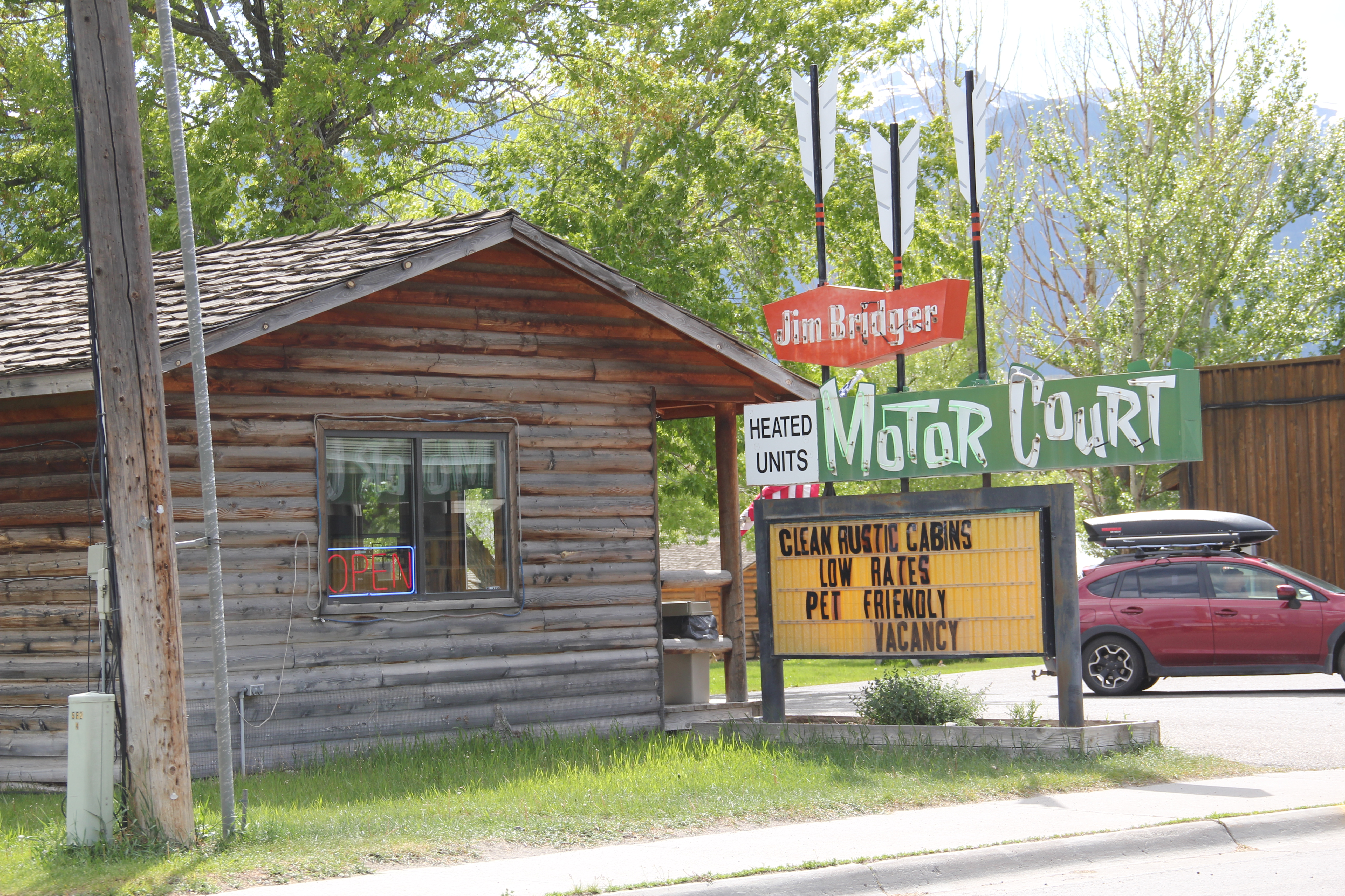
 By the mid-20th century, Gardiner had become a highway town, the place in-between the beautiful drive through the Paradise Valley on U.S. Highway 89 (now a local paved road)


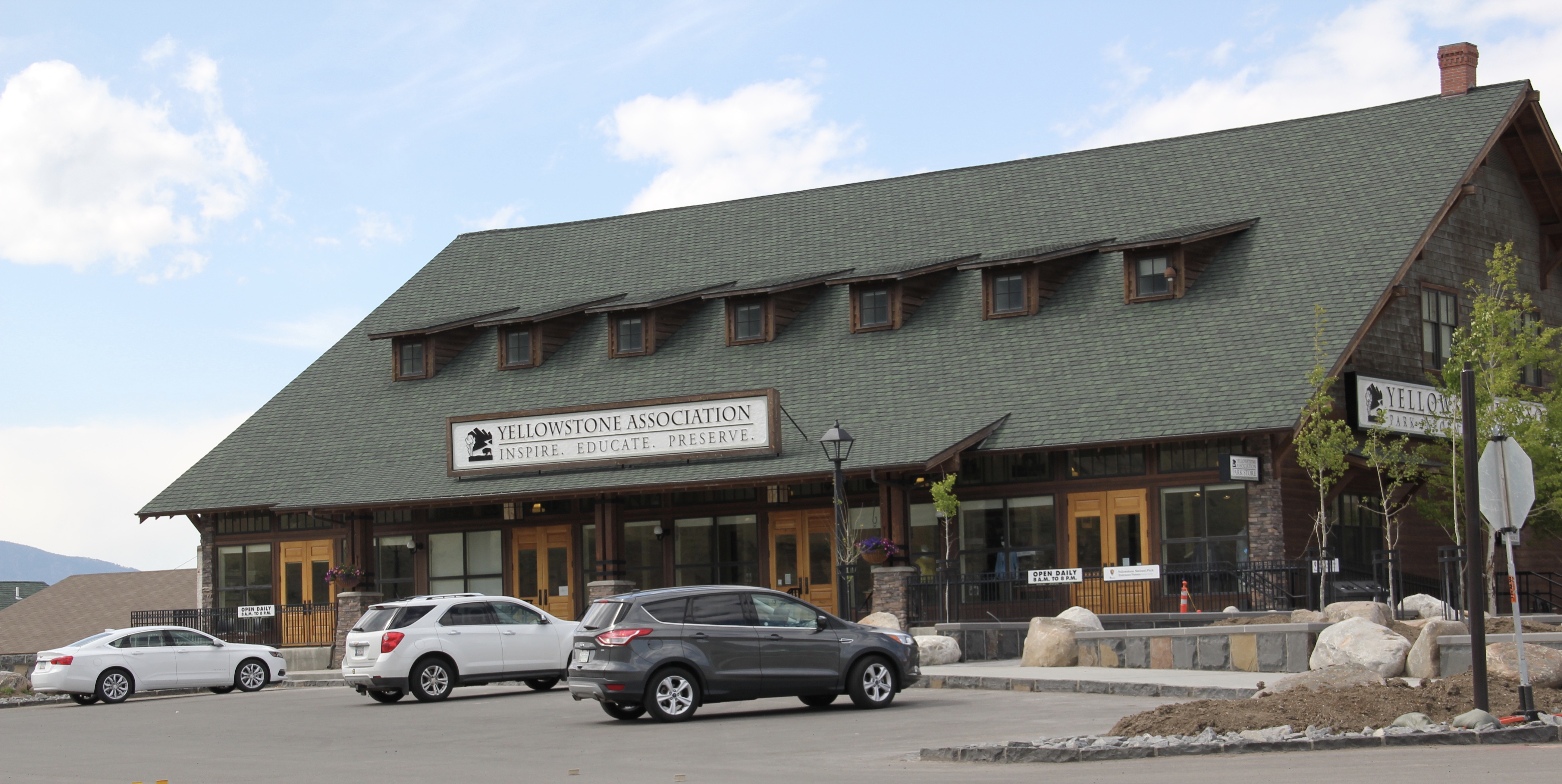


 The plan to develop a new Gardiner library at the old Northern Pacific depot site at part of the Gardiner Gateway Project is particularly promising, giving the town a new community anchor but also reconnecting it to the railroad landscape it was once part of. Something indeed to look for when I next visit this Yellowstone Gateway.
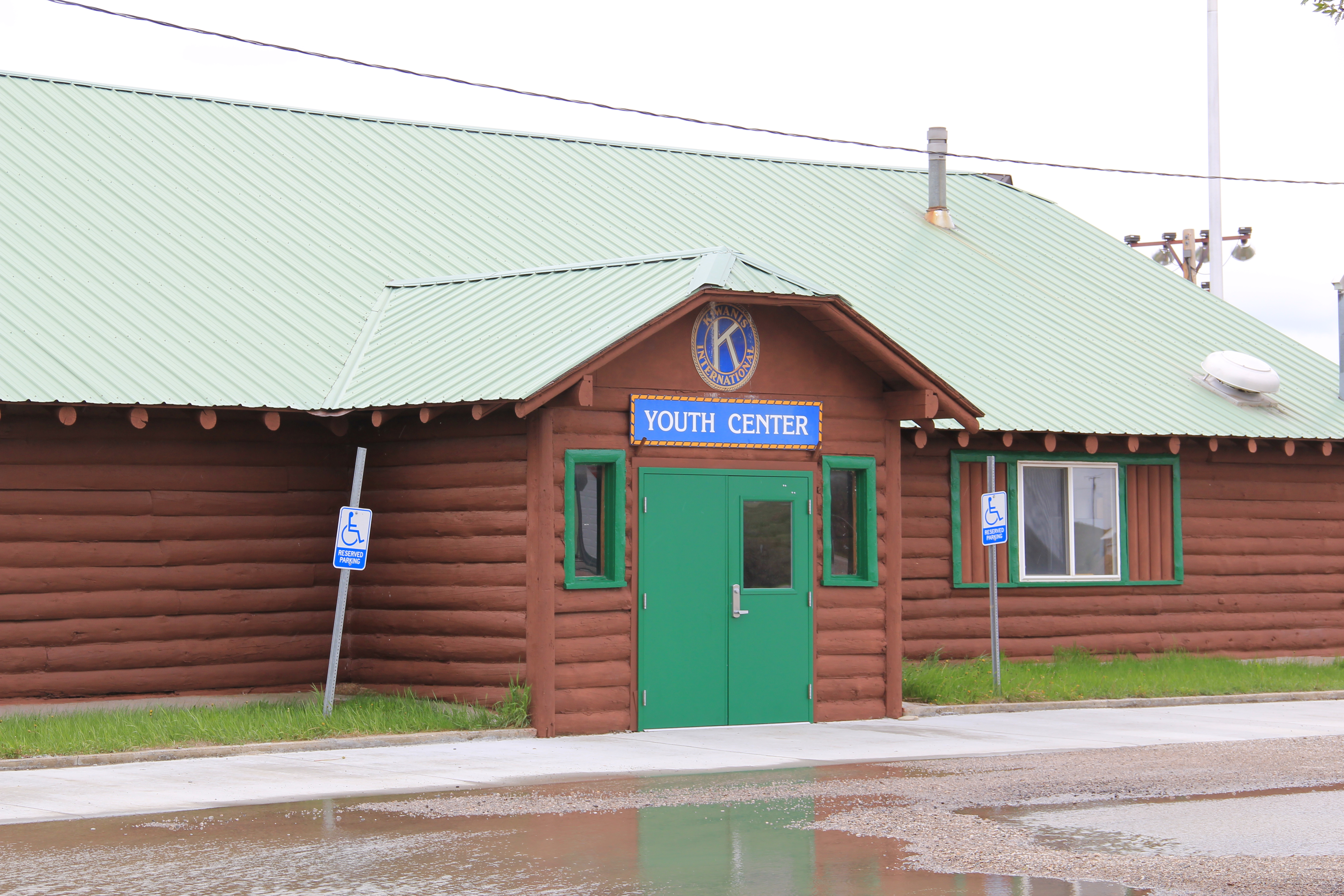 The woman’s club began c. 1921 and had already made a major contribution to the town’s well-being in establishing its first library. After World War II, however, club members felt they should once again help build the community, by building a youth center and veterans memorial garden. Mrs. Norman Good proposed the project in 1946 and Mrs. G. D. Martin provided the first substantial donation. The club then held fundraisers of all sorts. By 1950, construction was underway, with contractor Clyde Wilson building the center with logs from Colby and Sons in Kila, Montana.
 As the youth center was under construction, the woman’s club also reached an agreement with the school board to use land for the construction of a new football field, named McQuitty Field. Located behind the youth center, the field opened in 1950.
 Thus, on U.S. Highway 12 lies the public recreation heart of Harlowton–a postwar gift of residents and service clubs to the community. In 1956, the woman’s club deeded the Youth Center to the Kiwanis Club, which still manages it today.


 Road, it once also had several hotels and more short-term housing for workers and travelers–a good bit of that has disappeared, or is disappearing.
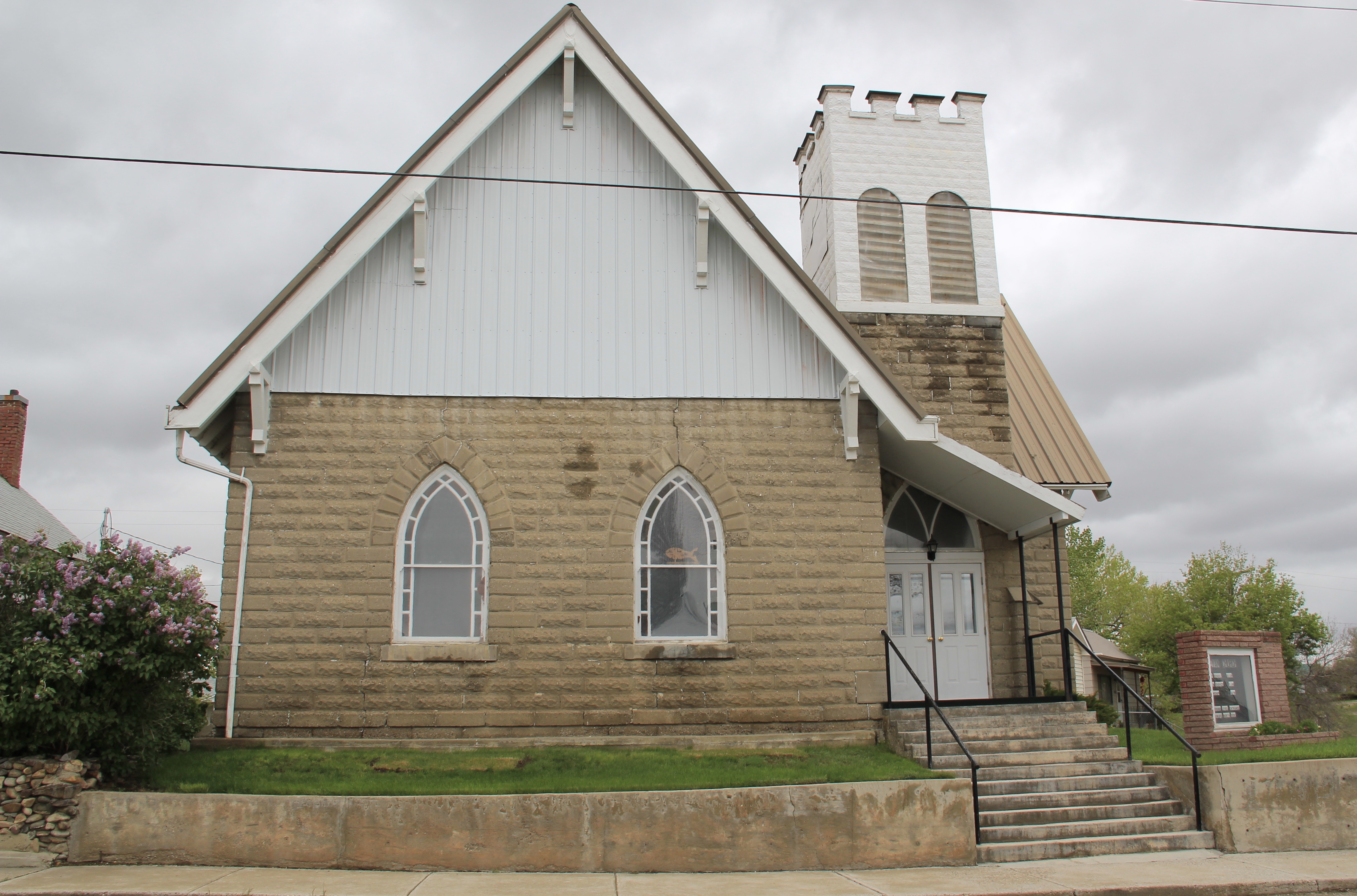
 It is difficult to visit Harlowton and not notice the mammoth Montana Flour Mills set of concrete grain silos–today’s silent sentinels of what ranchers once produced in abundance in these lands.
 The mill, made from locally quarried stone, came within months of the completion of the railroad to Harlowton–the concrete silos reflected the hopes of investors and local ranchers, as grain production soared in the 1910s–reaching some 1.2 million bushels in 1918. It wasn’t called Wheatland County for nothing. I still wish the big electric sign that once adorned the silos was still there.


 As I would come to find out, on two return trips here in 1984, the town was much more than that, it was a true bordertown between two nations and two cultures. The two trips came about from, first, a question about a public building’s eligibility for the National Register, and, second, the fieldwork for the state historic preservation plan, where such obvious landmarks as the National Hotel and Eureka passenger depot were noted. Thirty
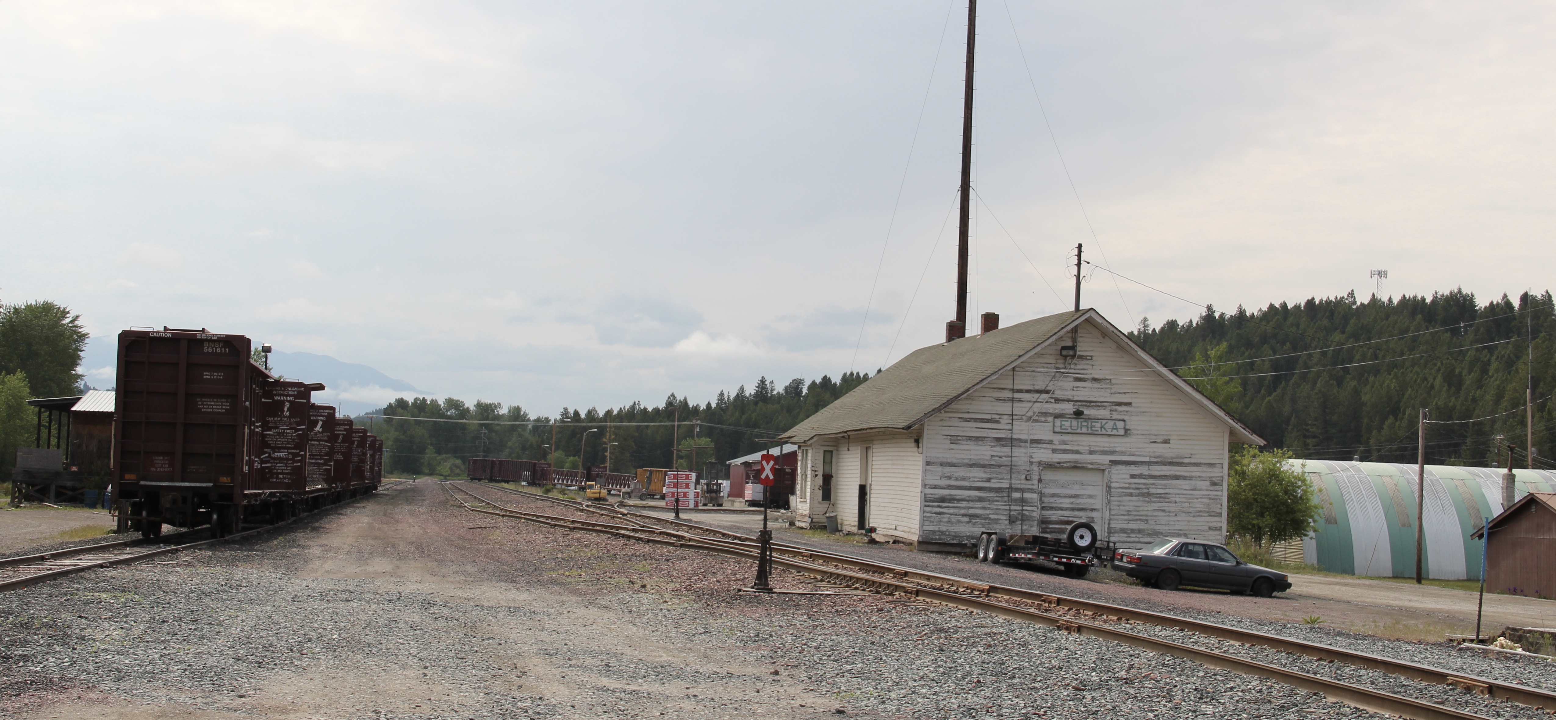 years later I was pleased to see the National Hotel in much better condition but dismayed to see the Great Northern passenger station–a classic example of its early 20th century standardized designs–is far worse condition that it had been in 1984.
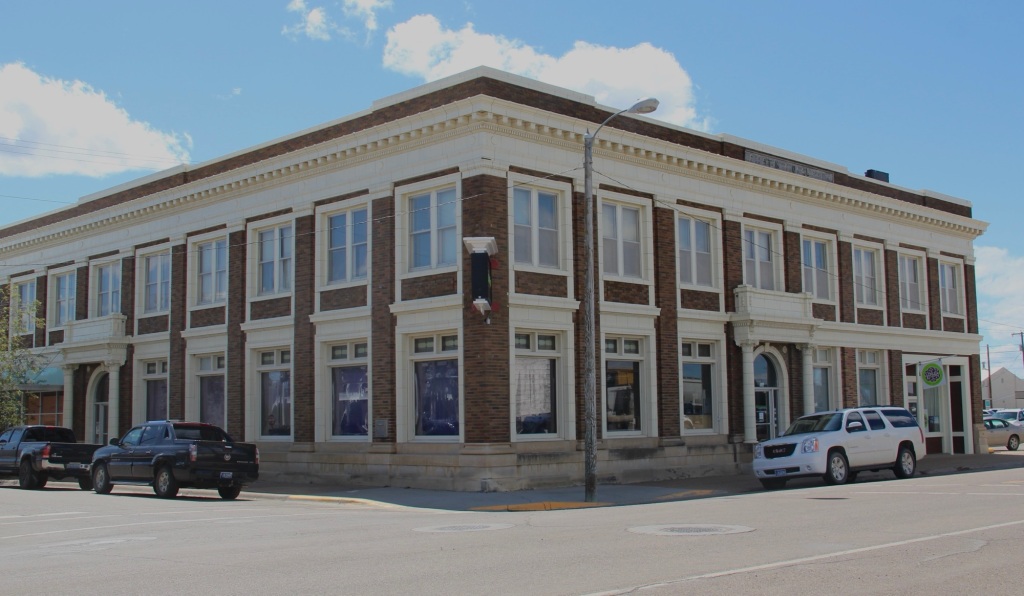
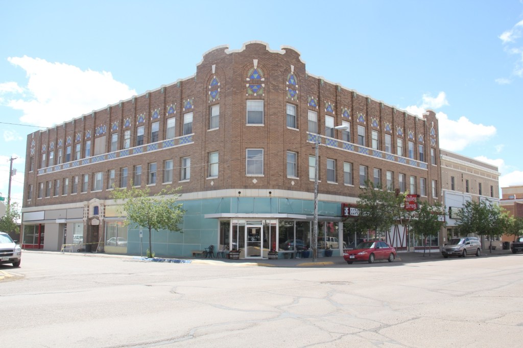
 Otherwise, Eureka has done an impressive job of holding together its historic core of downtown one and two-story commercial buildings. In 1995, owners had the Farmers and Merchants State Bank, built in 1907, placed in the National Register. Walking the town, however, you see the potential of a historic district of this turn of the 20th century place.
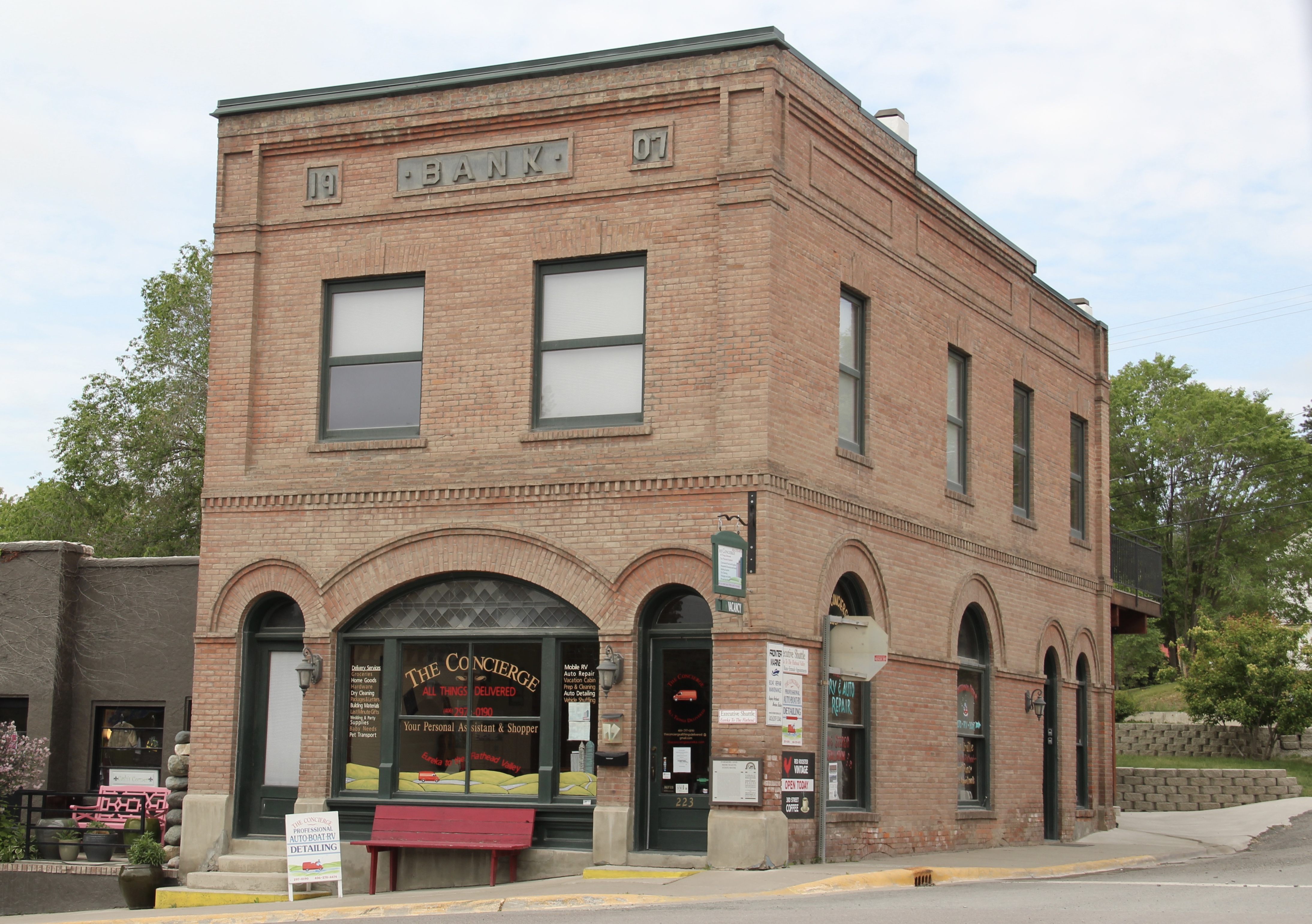


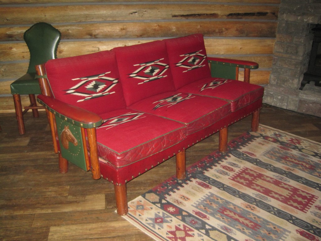
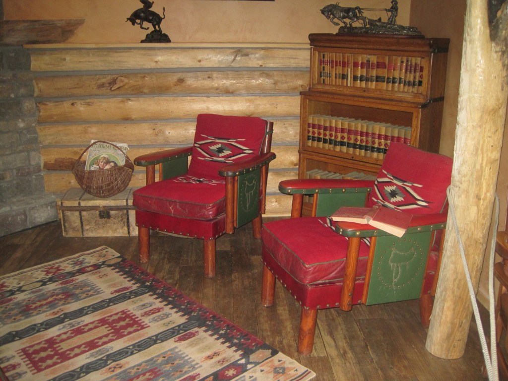
 Located on a hill perched over the town, the building was obviously a landmark–but in 1984 it also was just 42 years old, and that meant it needed to have exceptional significance to the local community to merit listing in the National Register of Historic Places. Eureka had been a logging community, and the depression hit hard. The new building not only reflected community pride but also local craftsmanship, and it became a
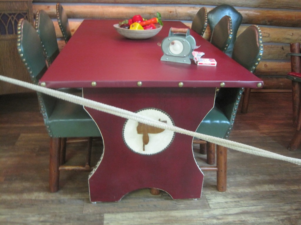
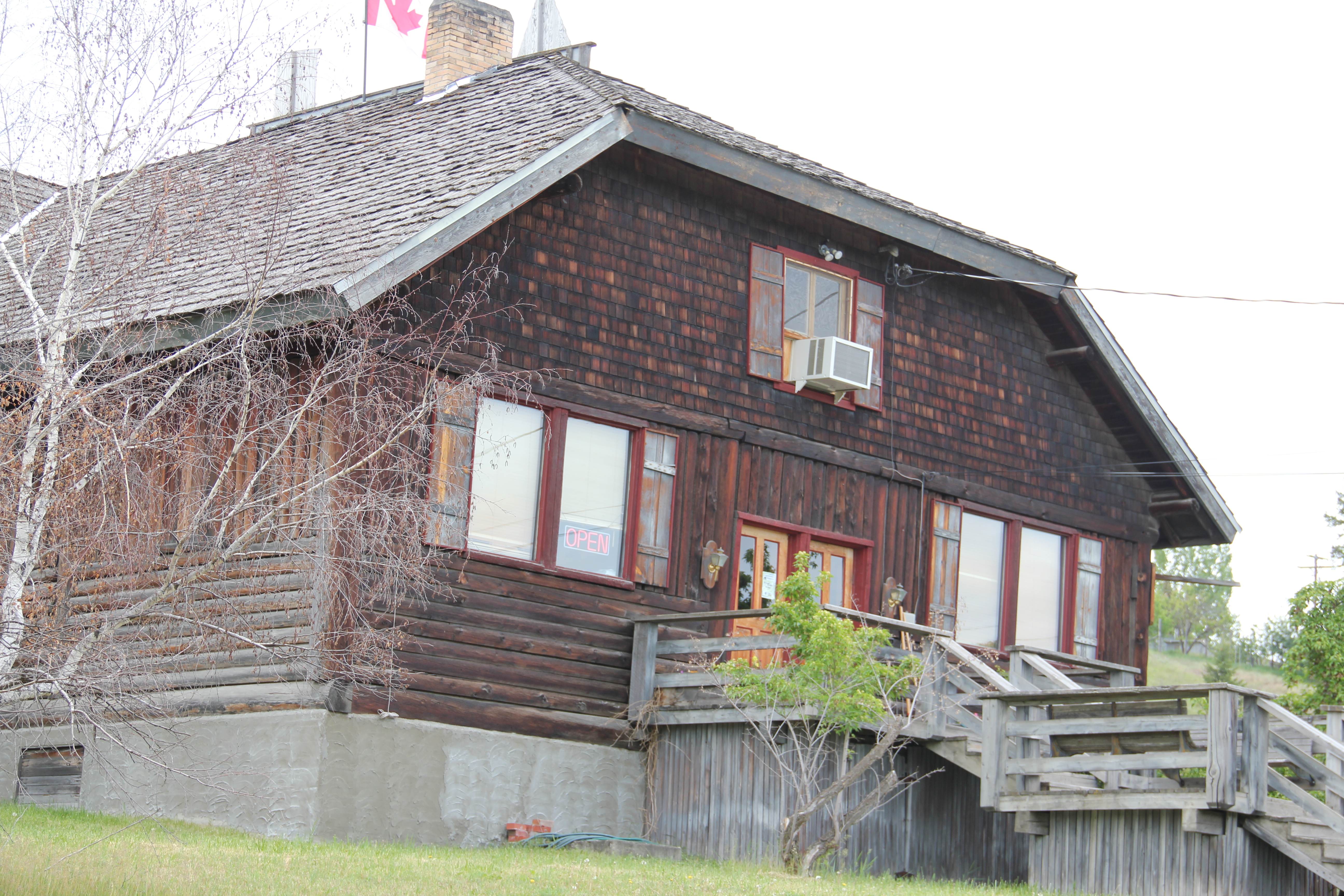 foundation for community resurgence in the decades to come. The building was listed in 1985, and was the first to have my name attached to it, working with Sally Steward of the local historical society. But credit has to go to Pat Bick and especially Marcella Sherfy of the State Historic Preservation Office for urging me to take it on, and to guide me through the maze of the National Register process. Today, it has experienced an adaptive reuse and serves as a rustic log furniture store.
 During those visits in 1984 I also held a public meeting in Eureka for the state historic preservation plan, where I learned about the Tobacco Valley Historical Society and its efforts to preserve buildings destined for the chopping block through its museum village on the southern edge of town. Here the community gathered the Great Northern depot (1903) of Rexford, the same town’s 1926 Catholic Church, the Mt. Roberts lookout tower, the Fewkes Store, and a U.S. Forest Service big Creek Cabin from 1926.


 Missoula County has grown, a lot, since my state historic preservation plan work in 1984-1985, especially in the county seat of Missoula and surrounding suburbs. Yet Missoula County still has several spectacular rural drives, like Montana Highway 83 above at Condon, along with distinctive country towns. This post will share some of my favorites.


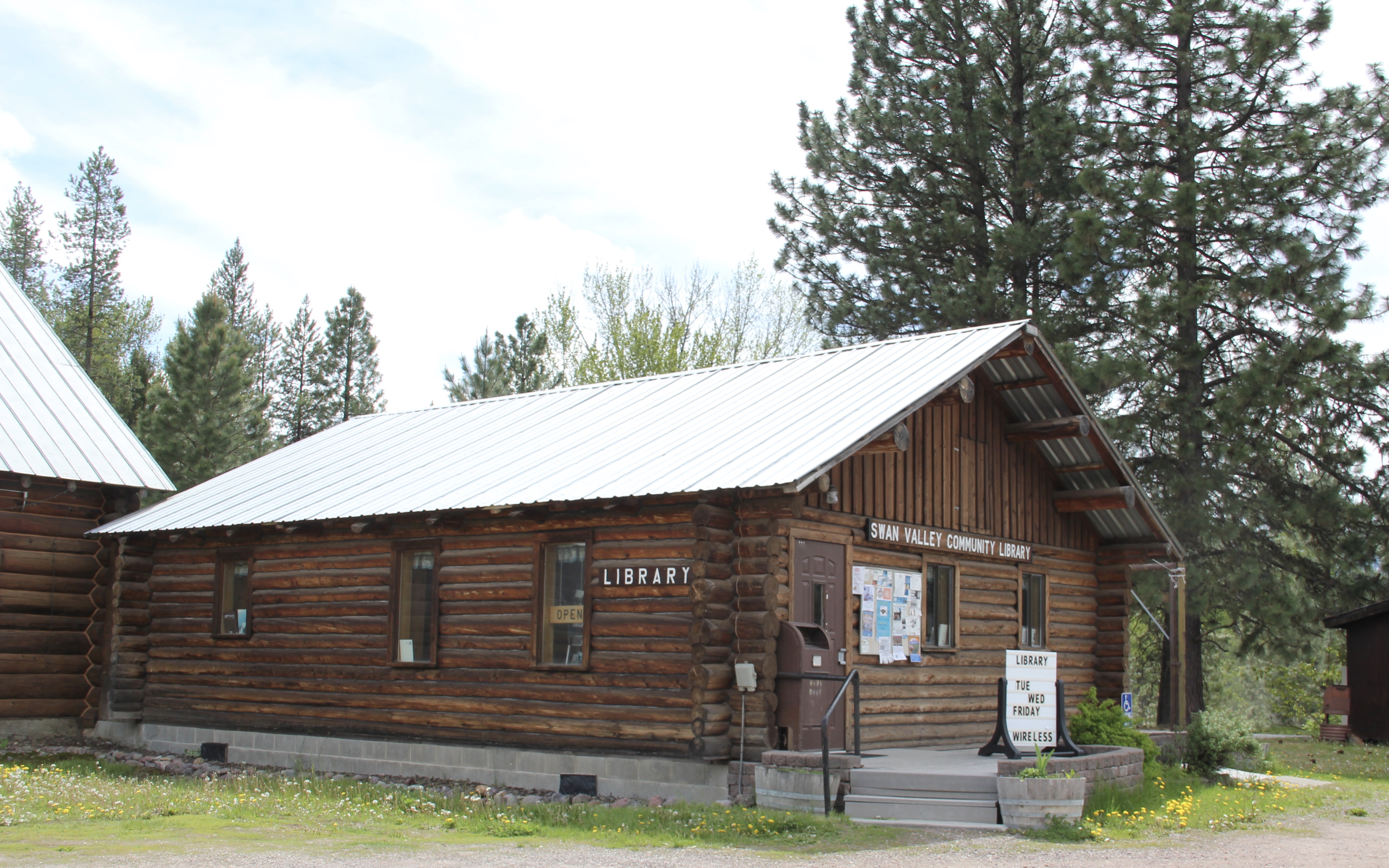 The Condon Community Center and adjacent Swan Valley Community Library serve as additional hubs for those living along the lakes and mountains of northeast Missoula County. Both buildings are excellent examples of mid-20th century Rustic style–a look that, in different variations, dominates the Highway 35 corridor.
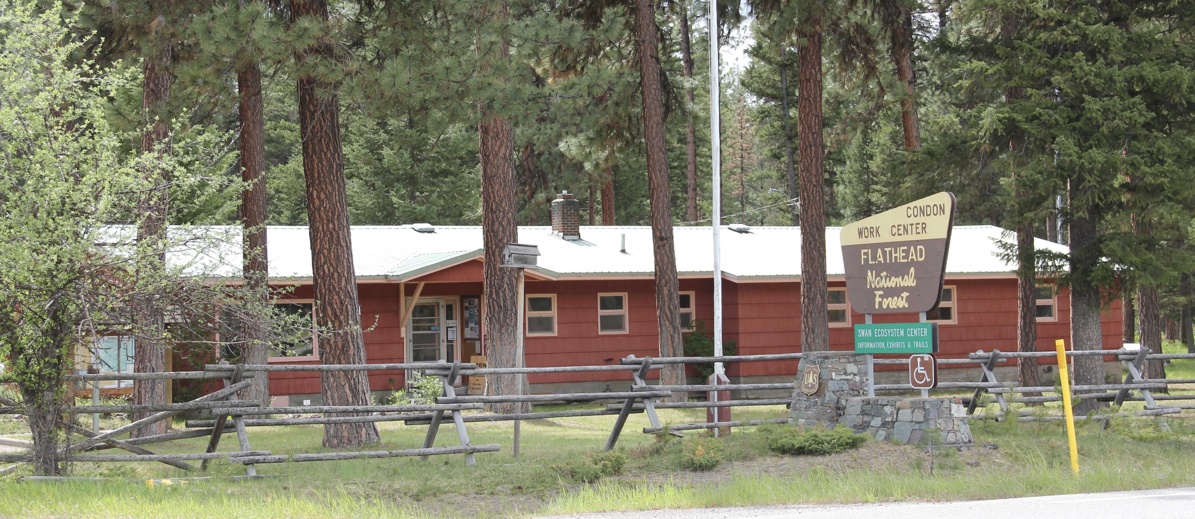
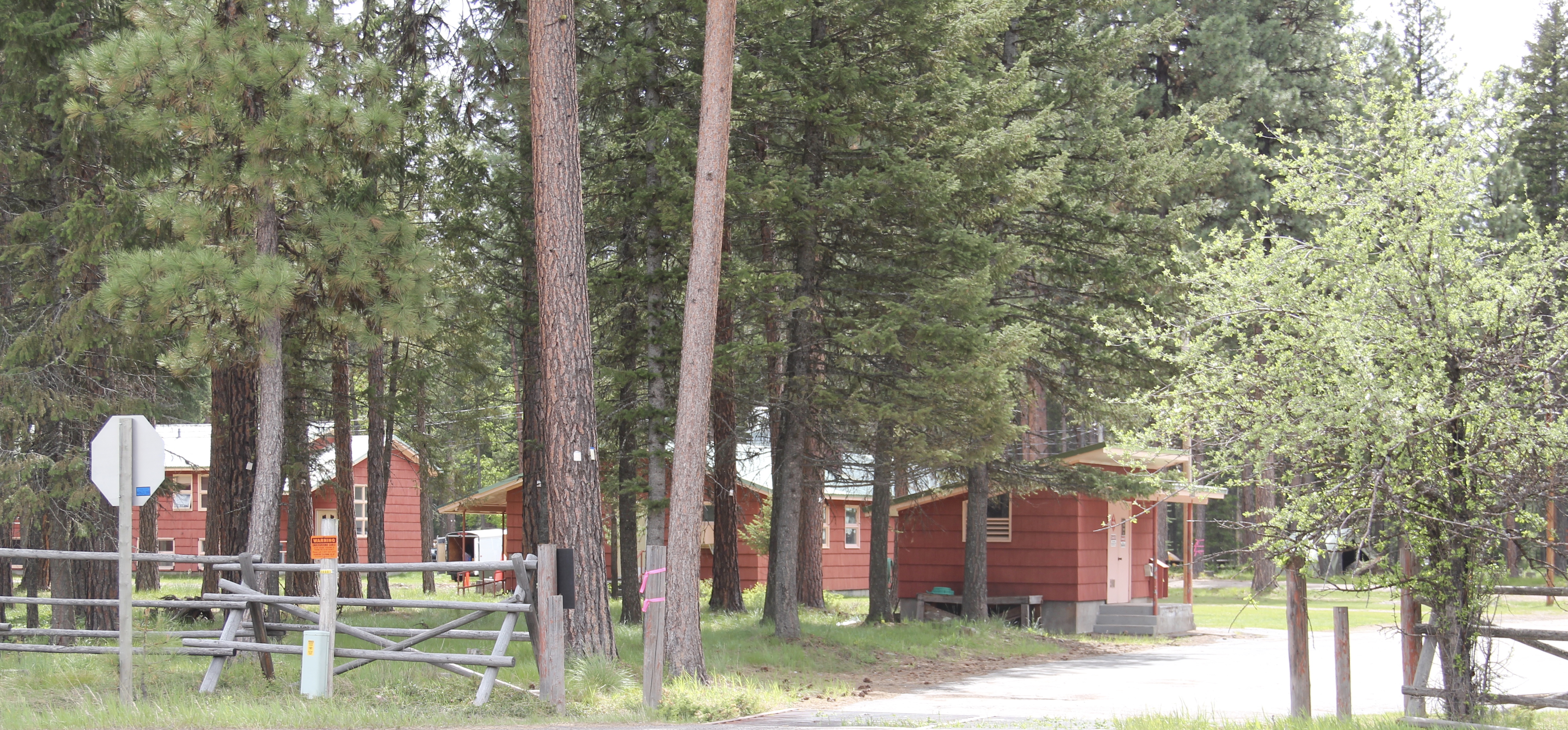 Condon is also the base for the Condon Work Center, home to the Great Northern Fire Crew, of the Flathead National Forest. Here you can take a mile-long Swan Ecosystem Trail and learn of the diversity of life in this national forest region.
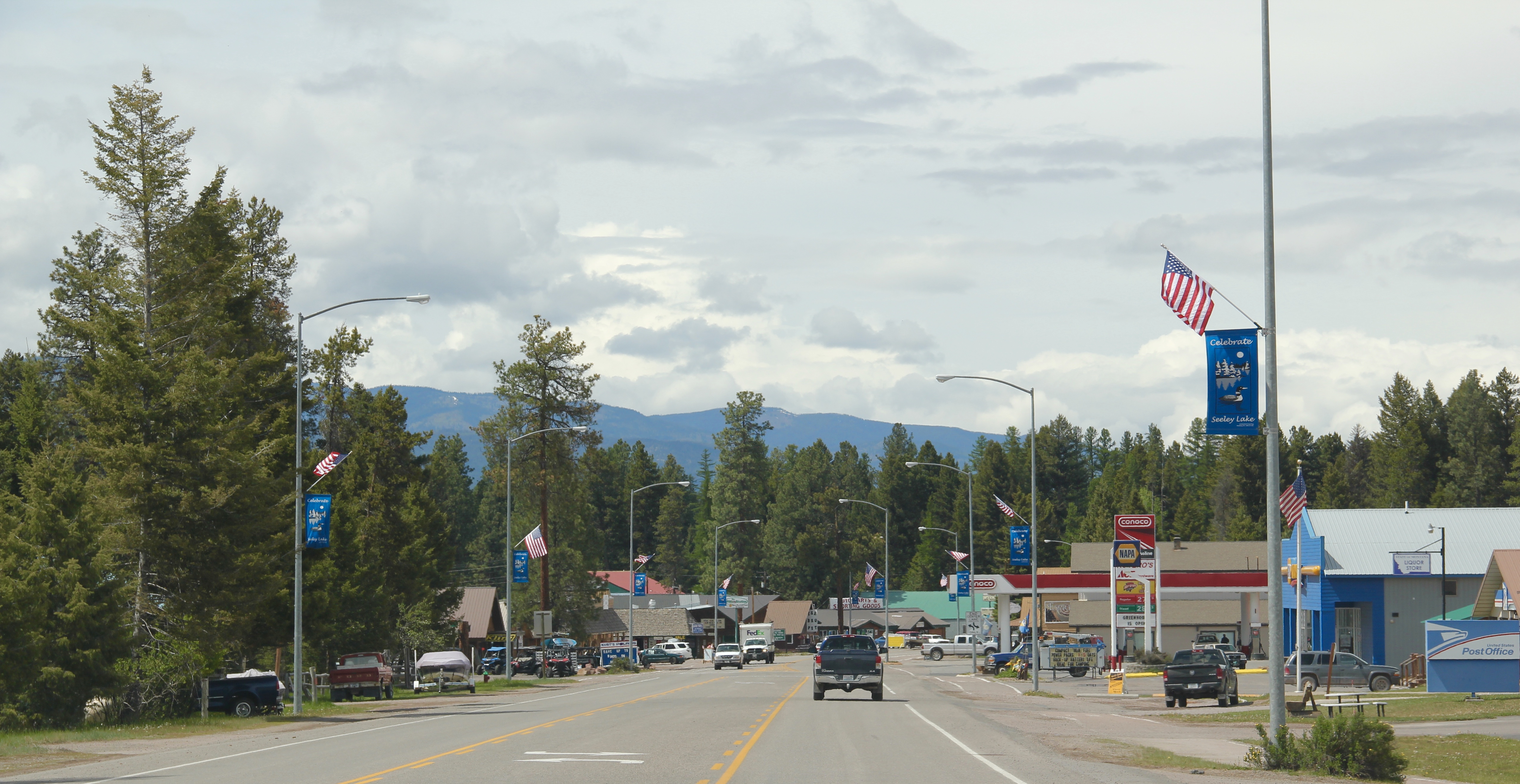 South of Condon on Montana Highway 83 is Seeley Lake–a place that certainly has boomed in the last 30 years–witness the improved highway, new businesses, and population that has increased over 60 percent since my last visit in 1992. Yet it still had places rooted in the community’s earlier history such as the Sullivan Memorial Community Hall–a good example of mid-20th century Rustic style.
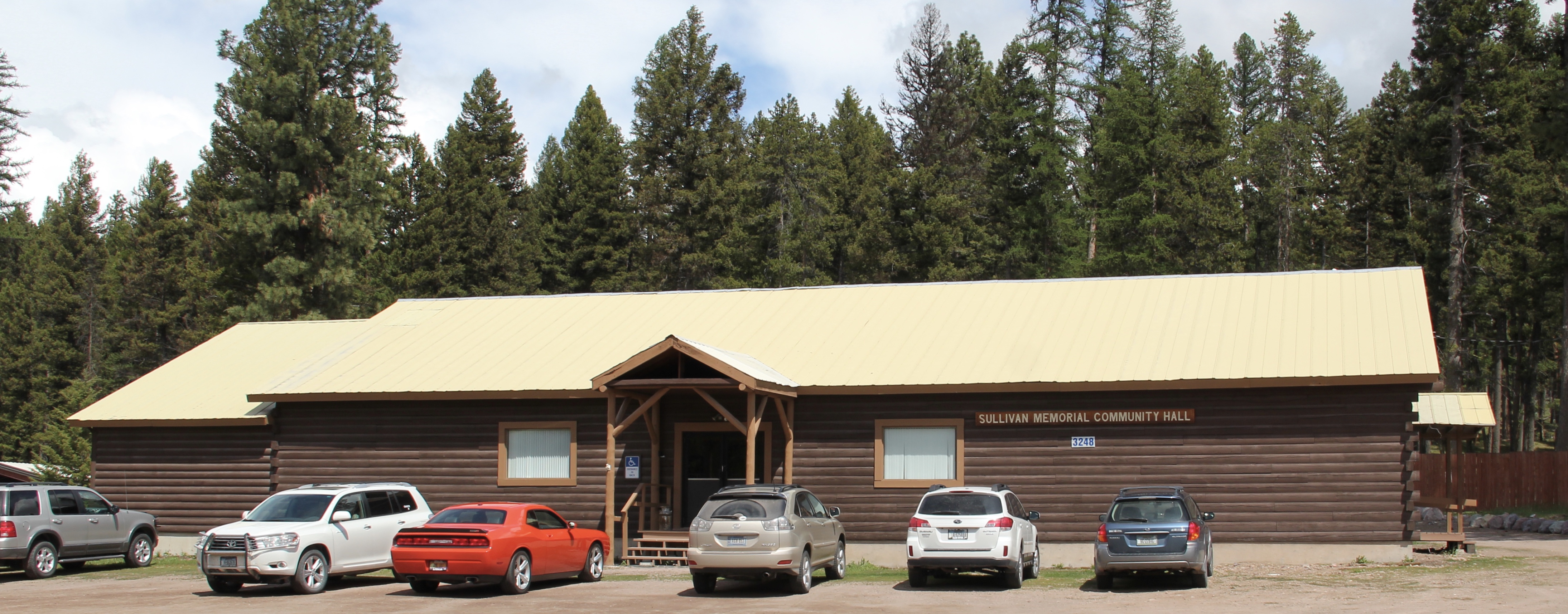 And it had added one of my favorite bits of roadside architecture in this part of Montana: the Chicken Coop Restaurant as well as opening a new Seeley Lake Historical Museum and Chamber of Commerce office at a spectacular highway location just outside of town.


 I don’t recall even thinking about the forest service facility, but here was an entire complex devoted to the forest service’s use of mules and horses before the days of the ATV that was built by the Civilian Conservation Corps. The remount depot is an interesting


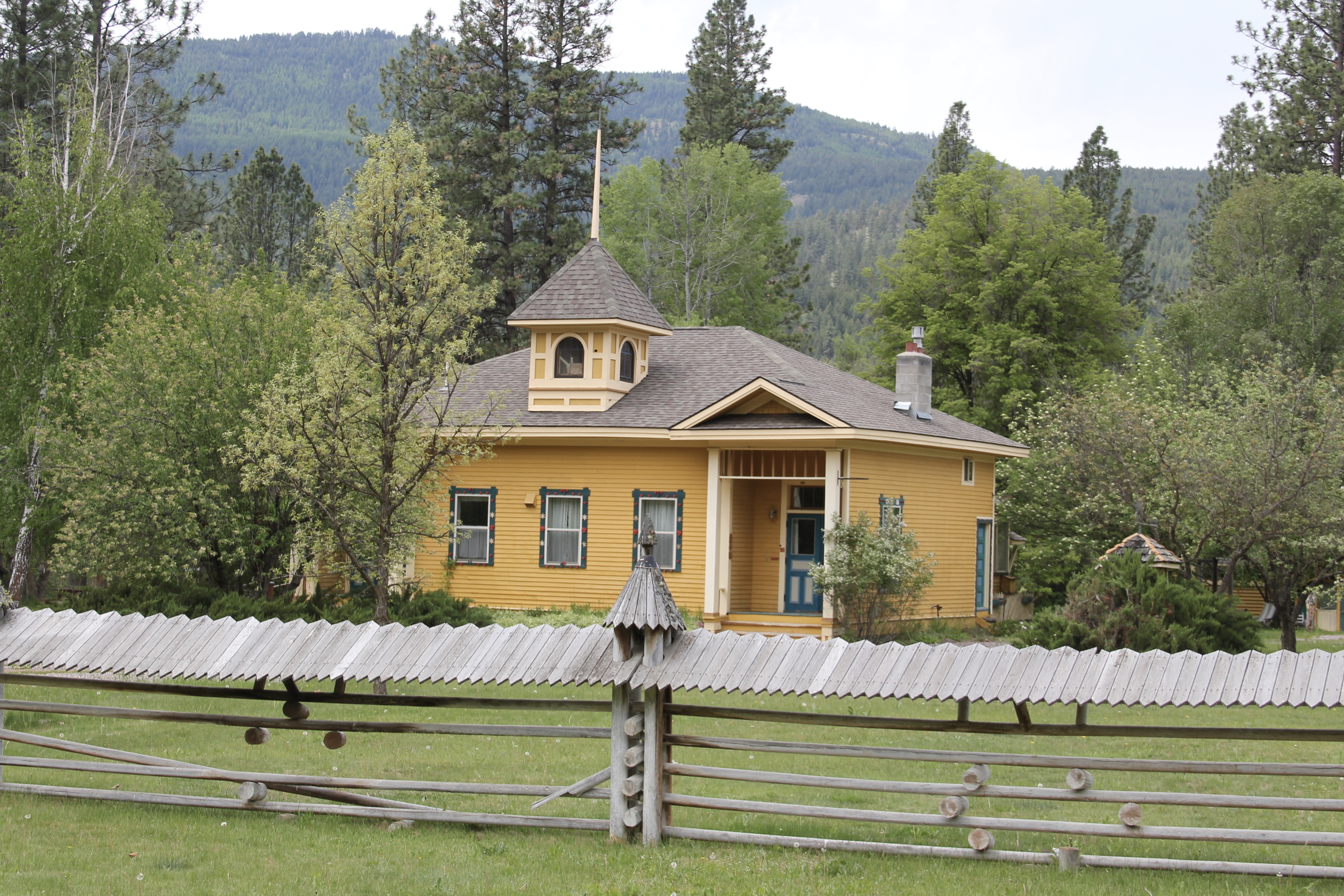
 The name Frenchtown dates to 1868 and is a reference to a number of French Canadians who moved here in the early settlement period. A National Register-listed church, the St. John the Baptist Catholic Church (1884) marks that first generation of settlers. Its classical-tinged cupola has long been the town’s most famous landmark.
 The Milwaukee Road built through here in 1907-1908 and there remains a handful of historic business buildings from the time of the Milwaukee boom. There is one landmark
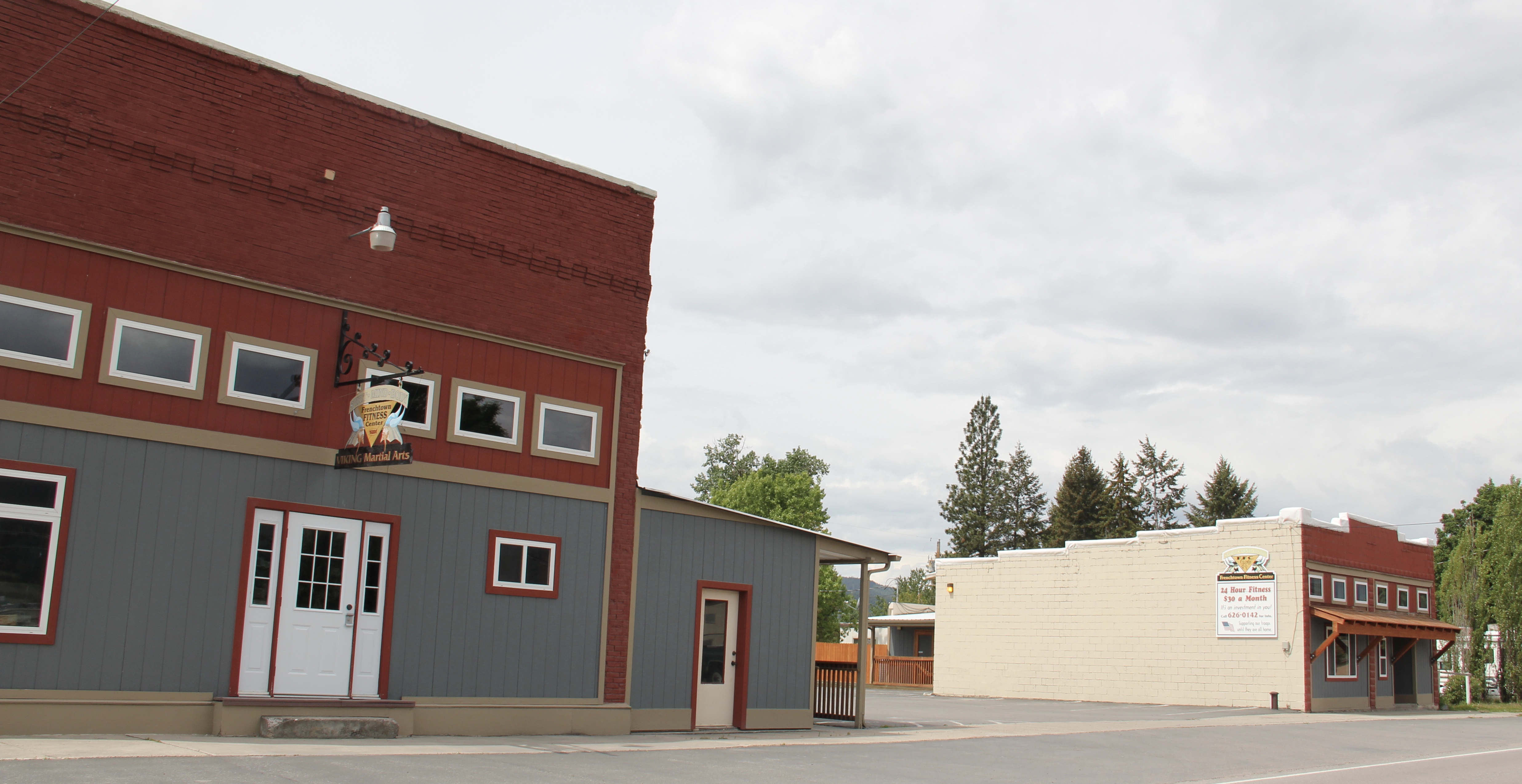
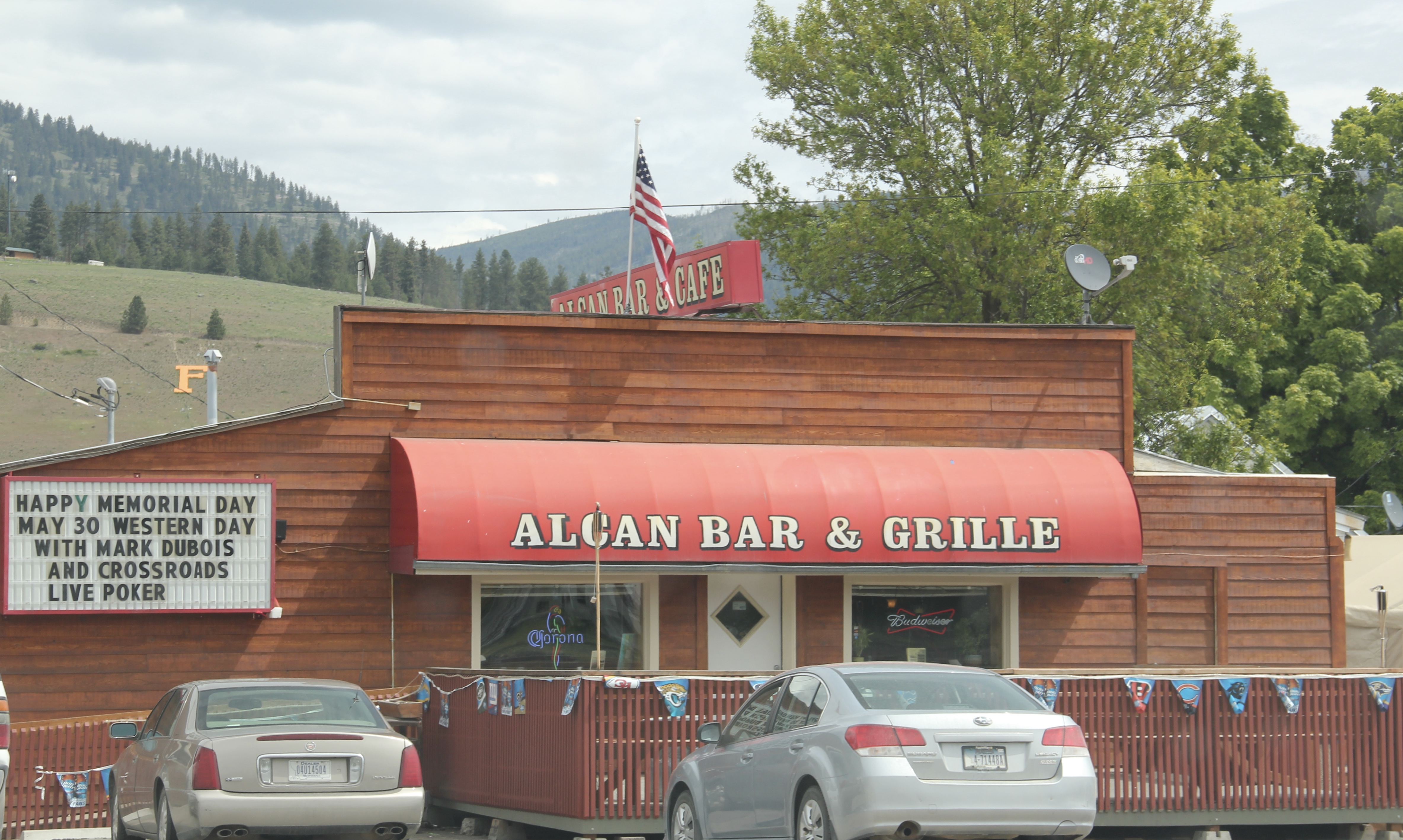
 another roadside landmark–the Bucksnort Bar, just further evidence to add to the Chicken Coop and the Alcan that you won’t go hungry if you explore the small towns of Missoula County.

