The High Prairie of Stillwater County

IMG_5914Stillwater County is one of the most beautiful spots in all of the Yellowstone Valley.   The parallel routes of the Yelllowstone River, the c. 1882 corridor of the Northern Pacific Railroad, the c. 1920 route of old U.S. Highway 10 and the modern marvel of Interstate I-90, shown above, define the county’s historic landscape for most residents, and travelers.

IMG_5894
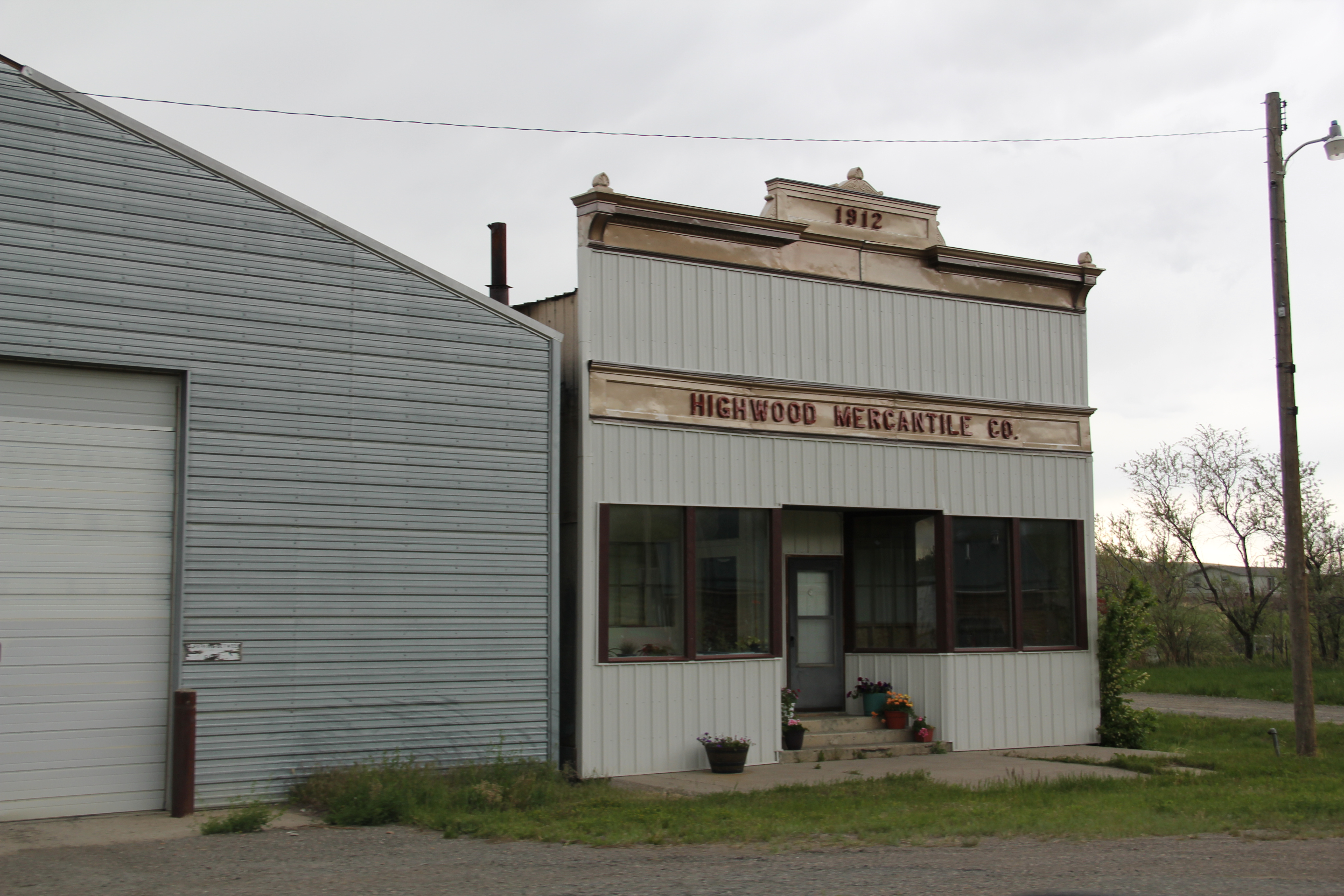
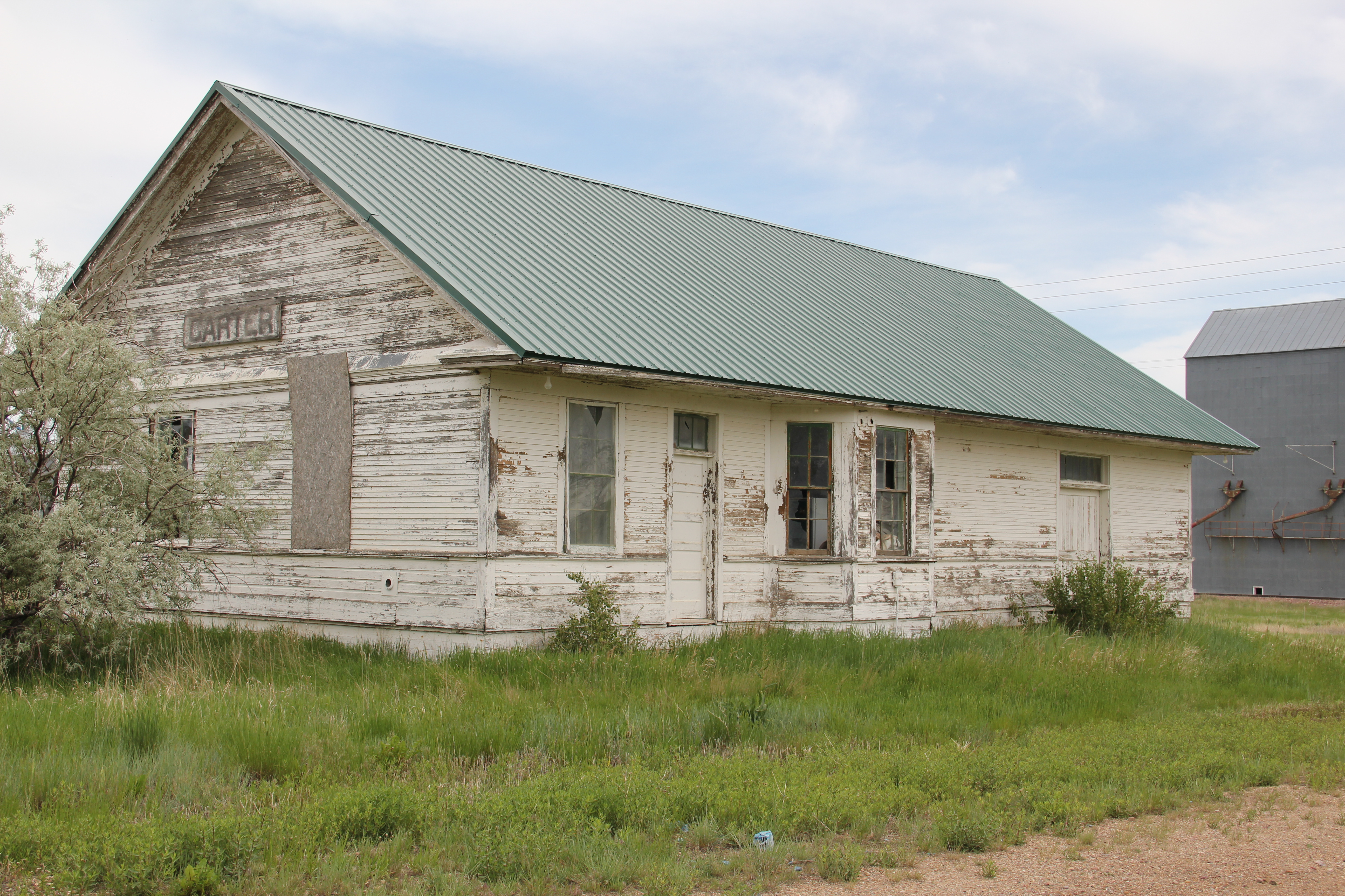
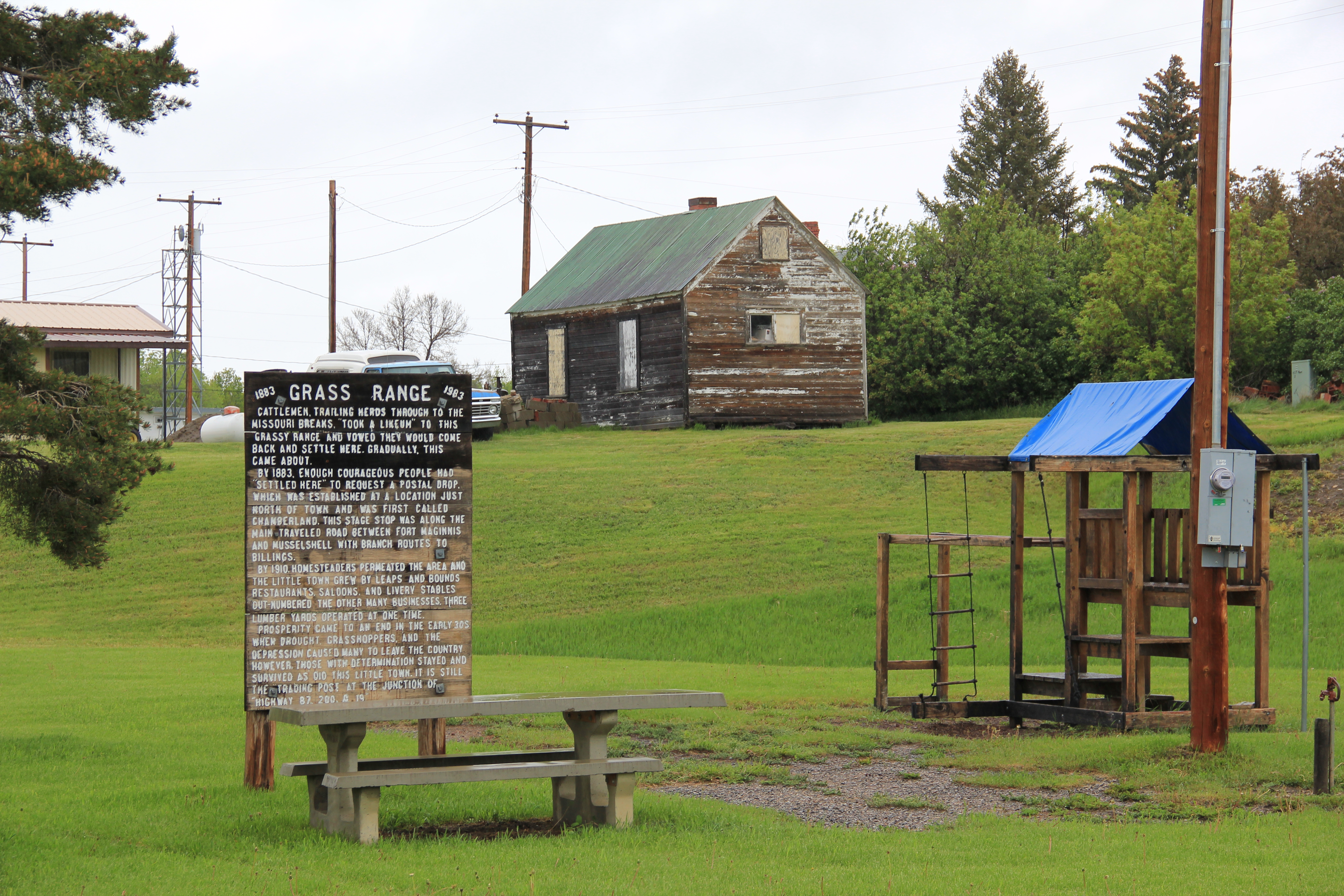
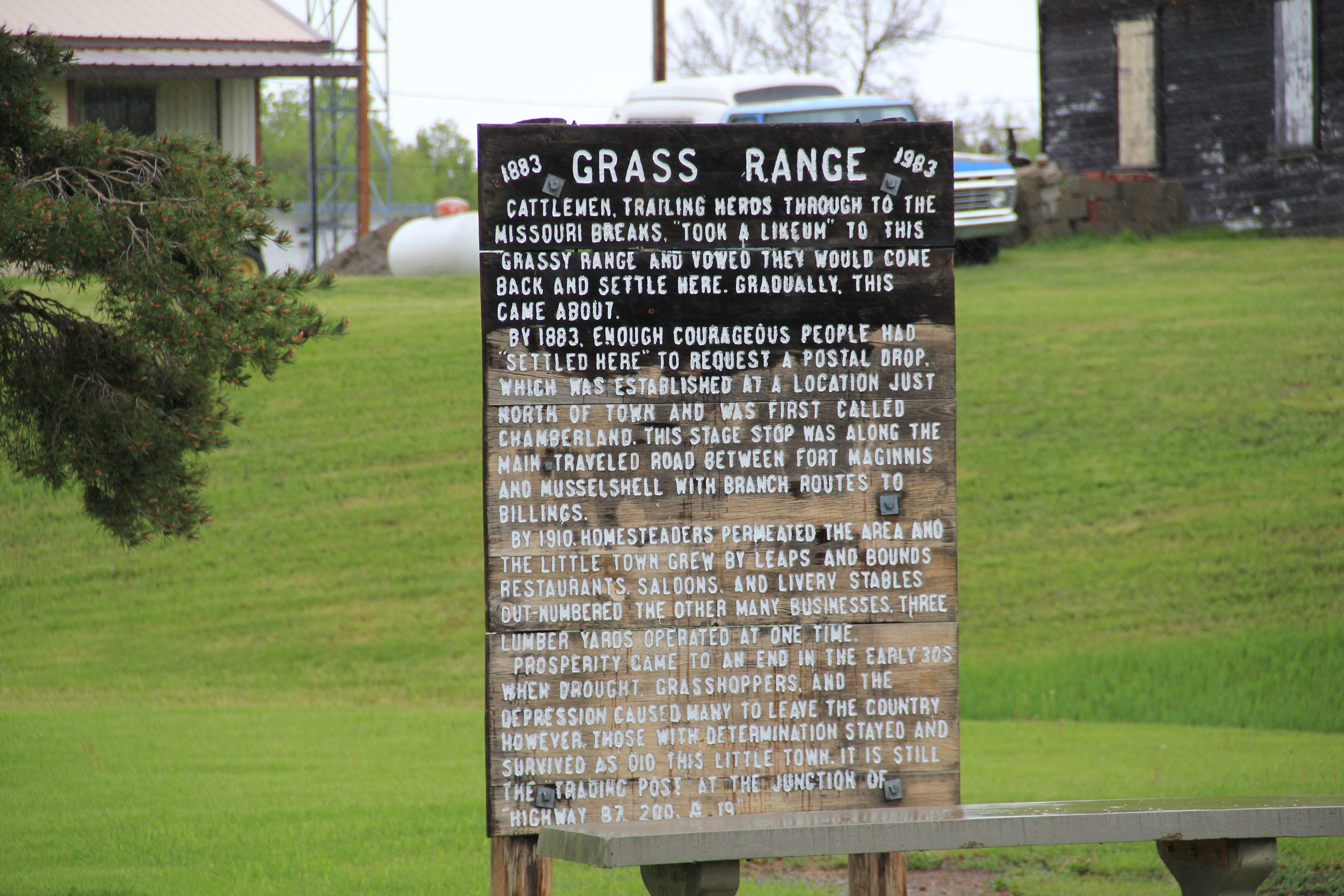
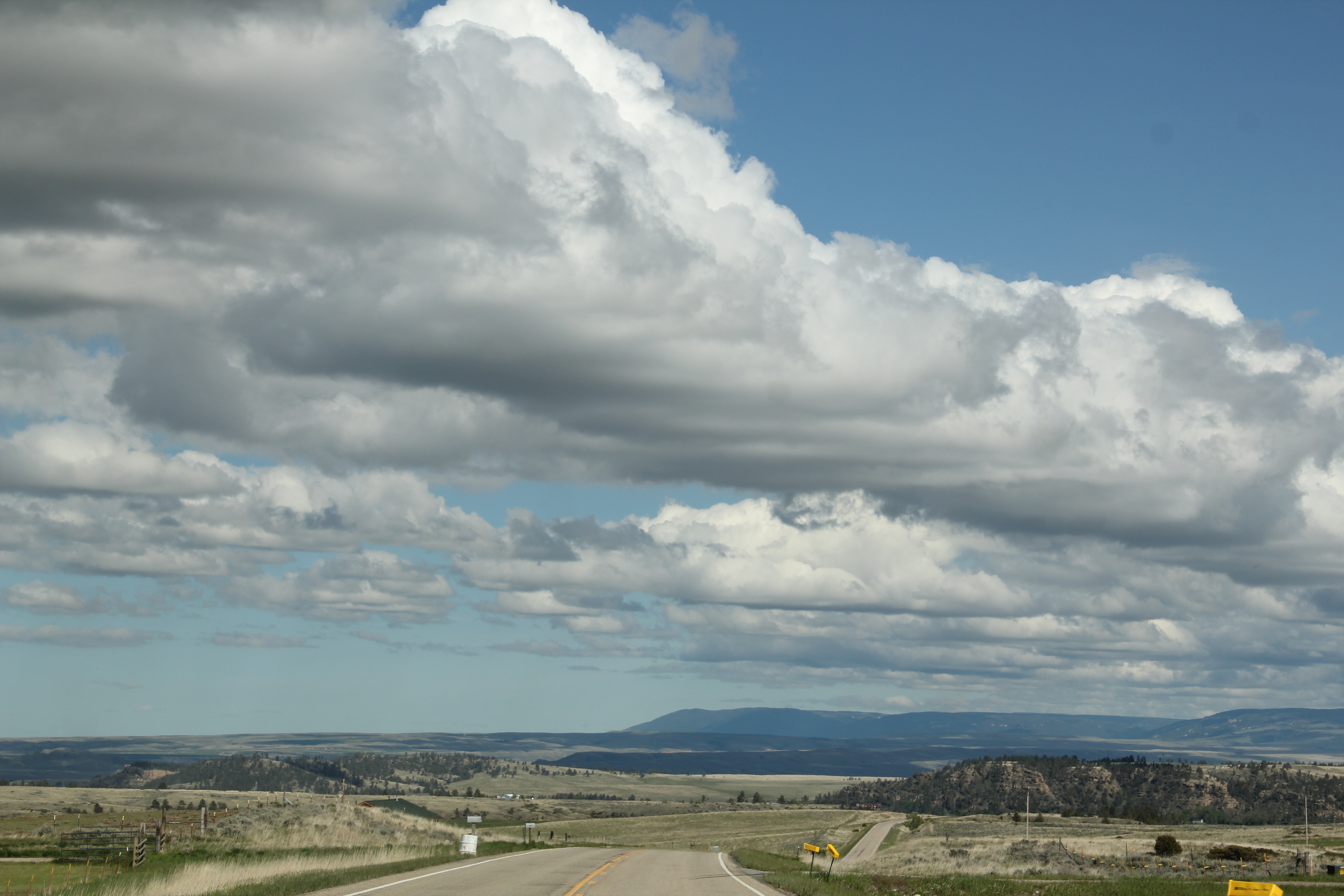
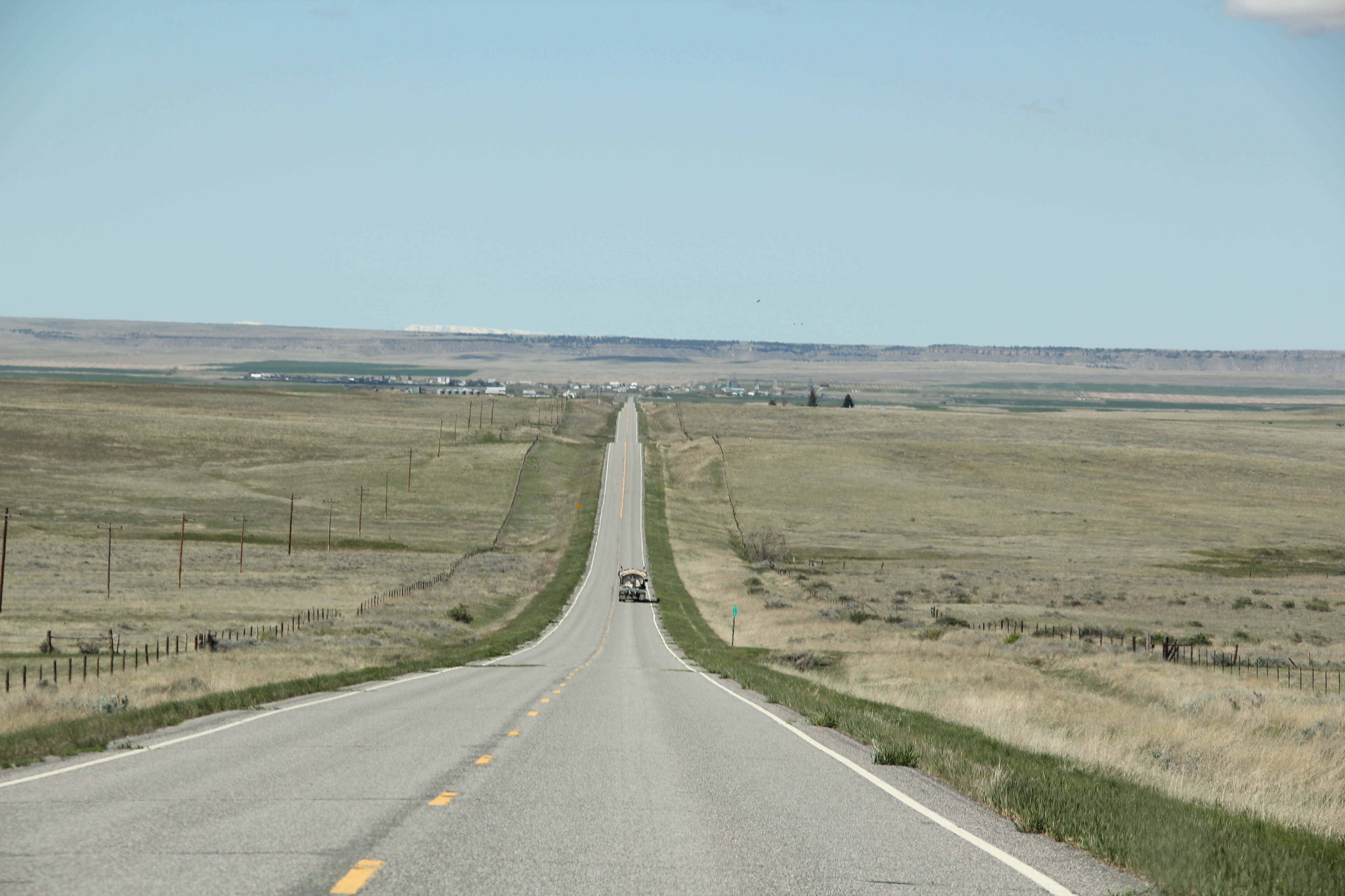
But running directly north from the county seat of Columbus  is a two-lane Montana highway that takes you to a totally different landscape, that of the high prairie of thousands of acres of wheat fields.  The road ends about 20 or so miles away at the town of Rapelje, a promising trade center when it was first established as a railroad branch in 1913

IMG_5909

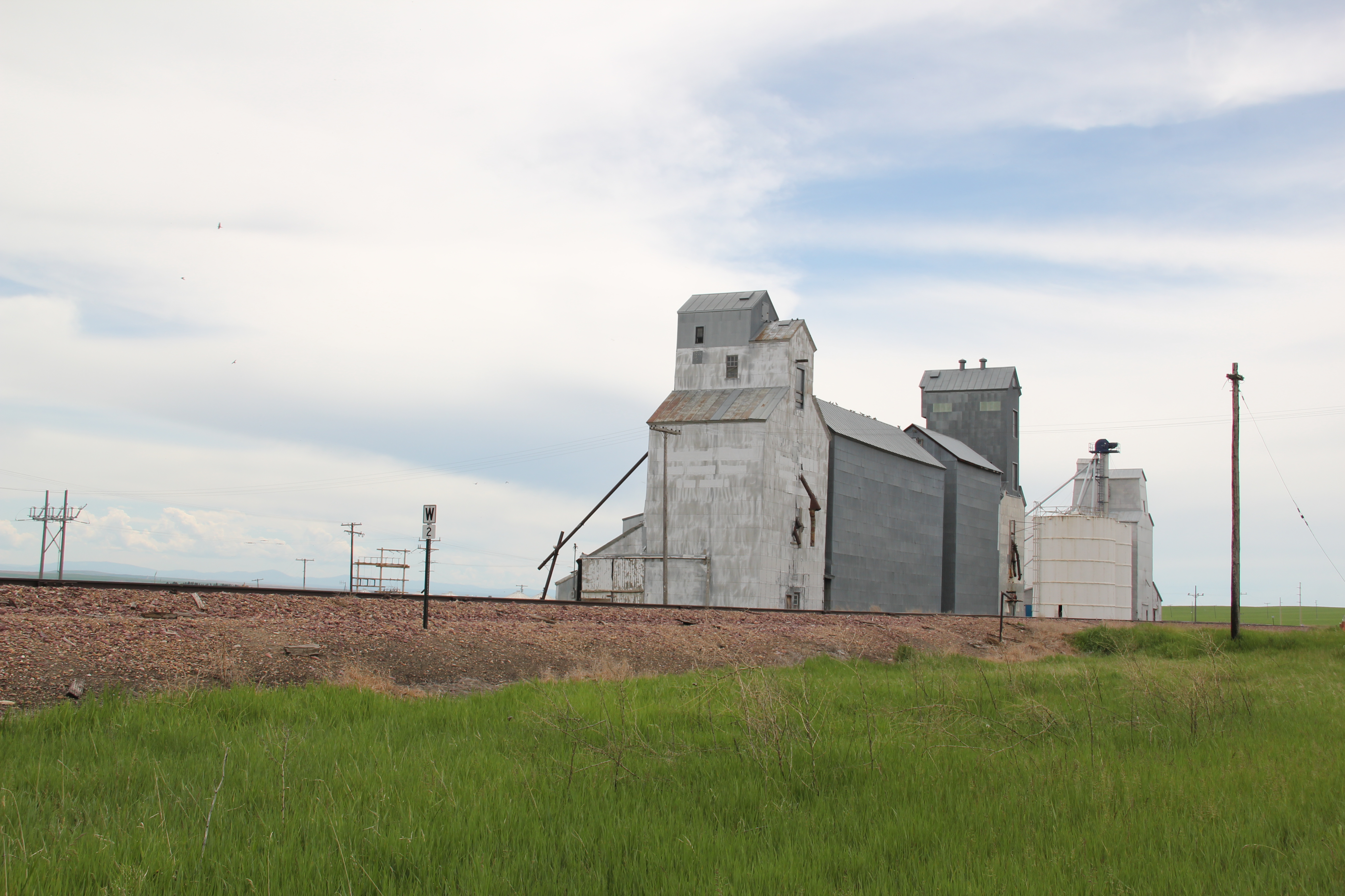
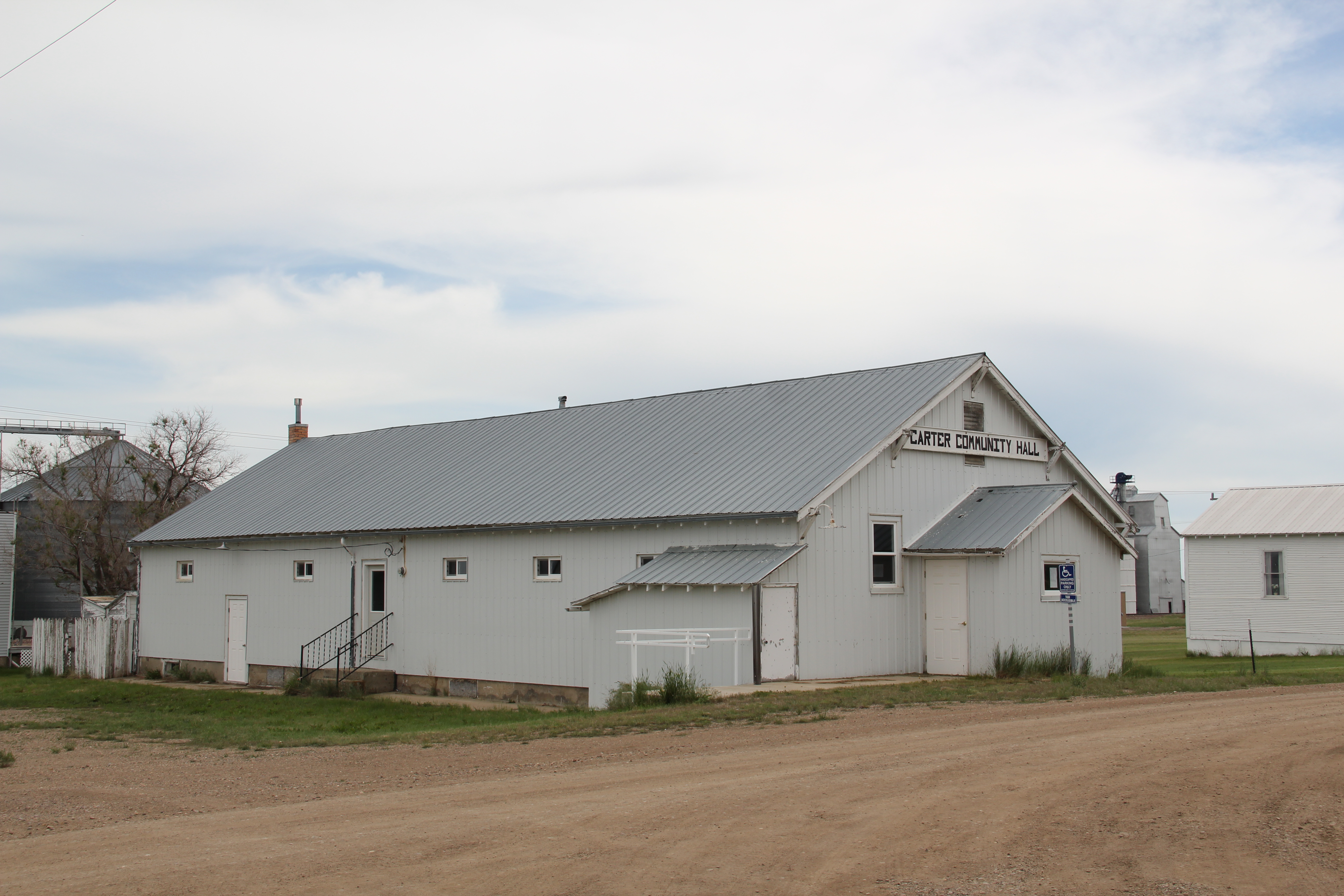
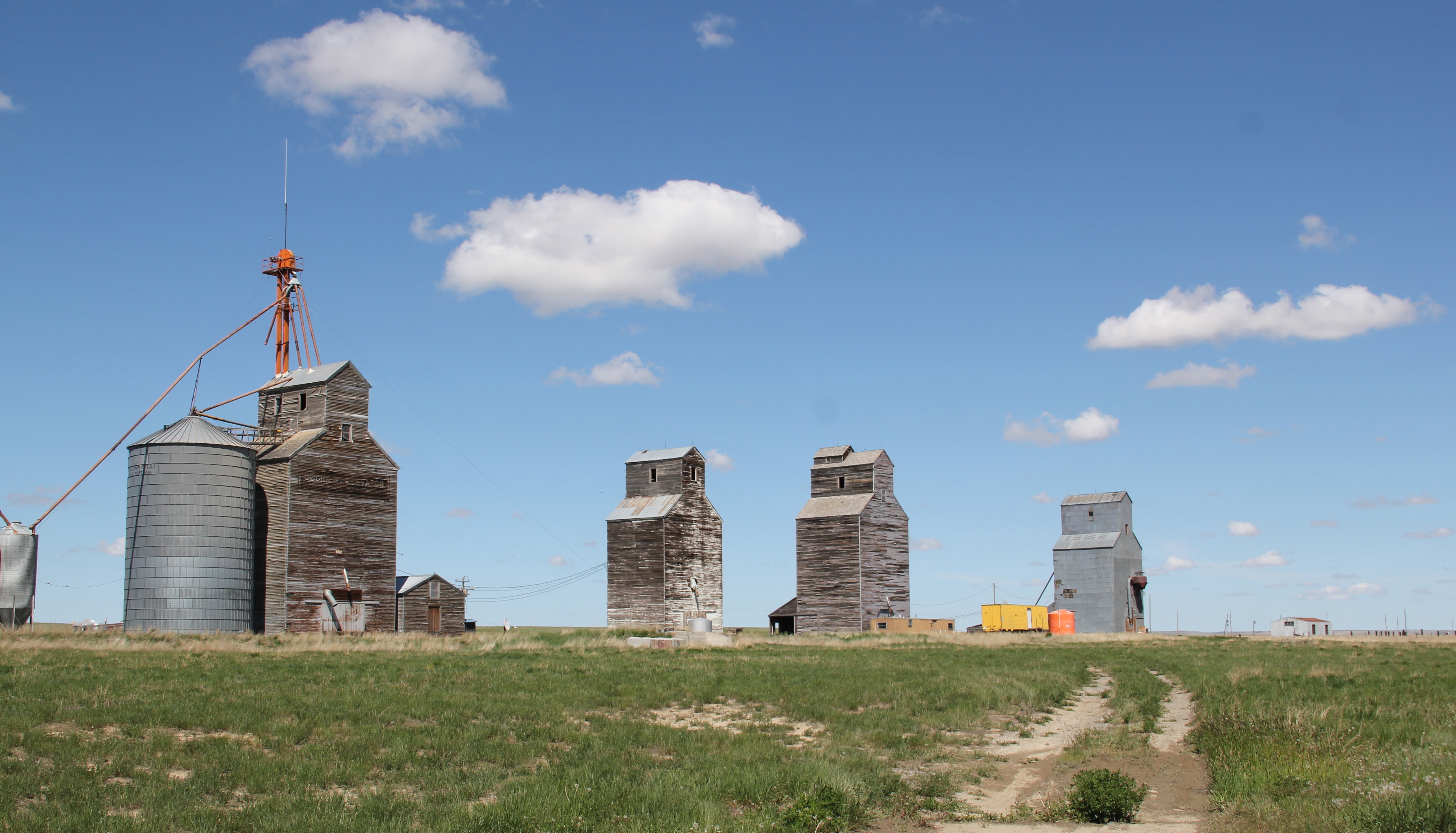
during the homesteading boom but now one of the region’s small country towns, defined by its school, its church, its cafe, and its grain elevators.  Its set of four early 20th century elevators, standing as sentinels of settlement but also as just man-made landmarks in a vast landscape of seemingly nothingness, is a remarkable statement of the built environment of Montana’s homesteading era.

IMG_5900
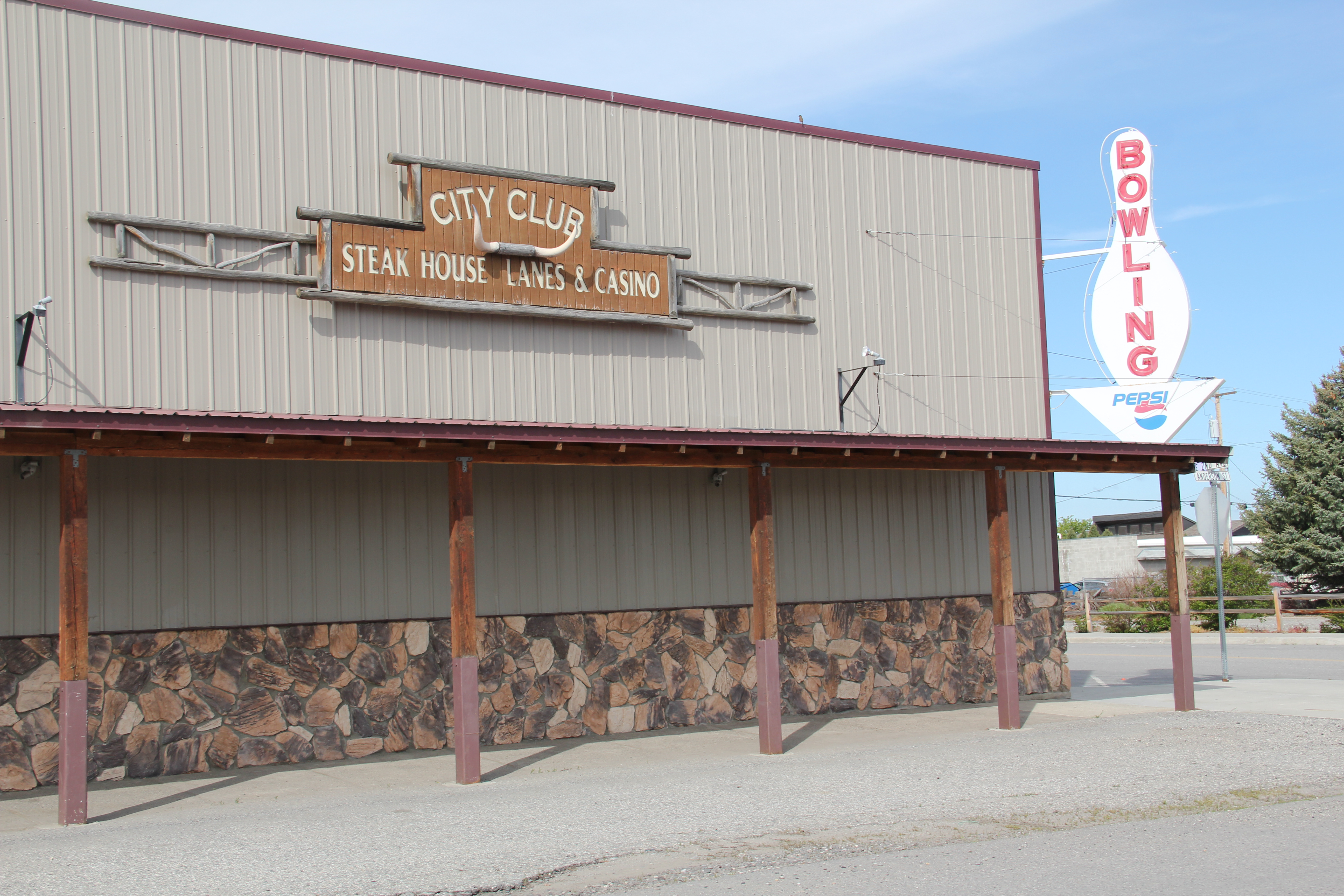
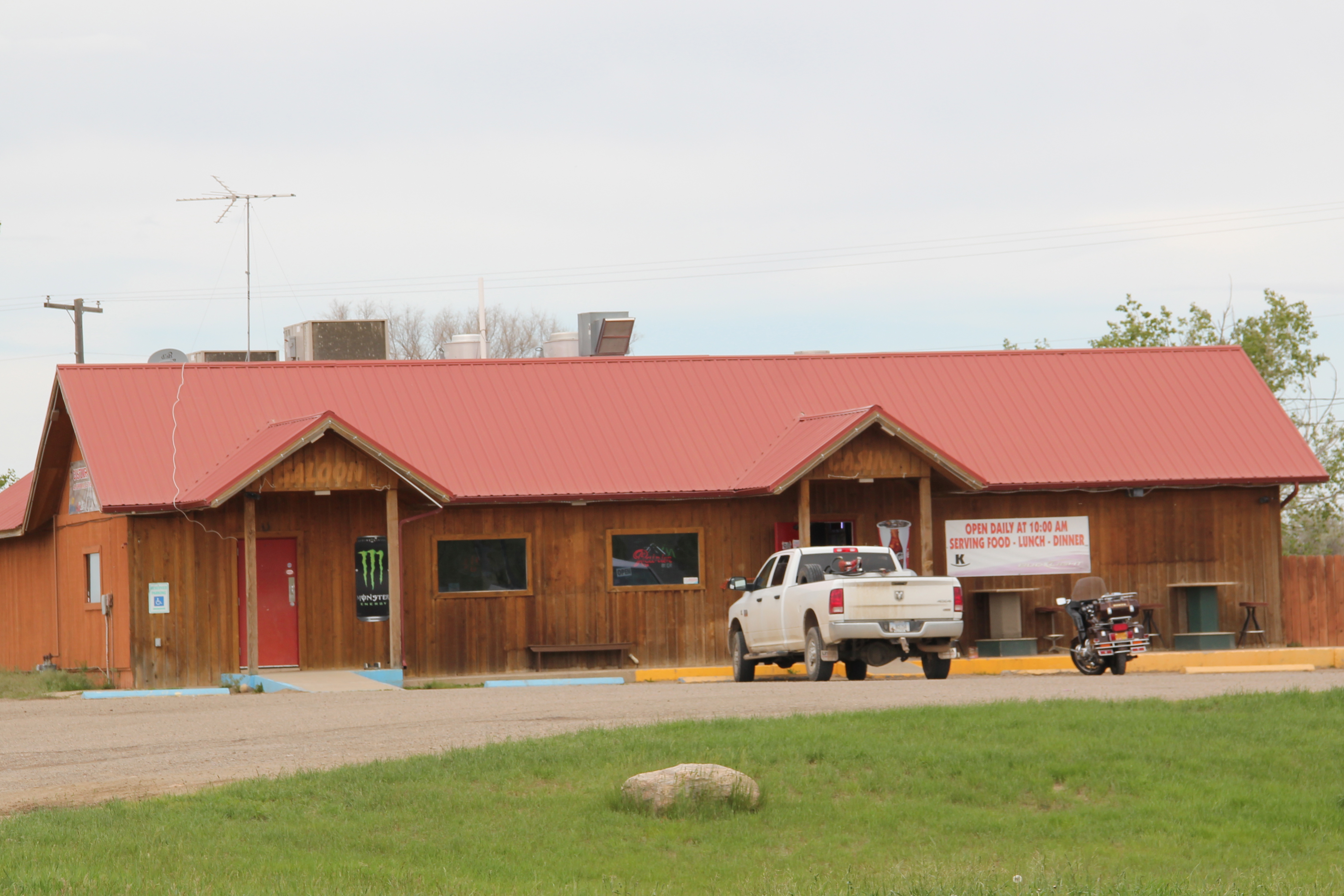
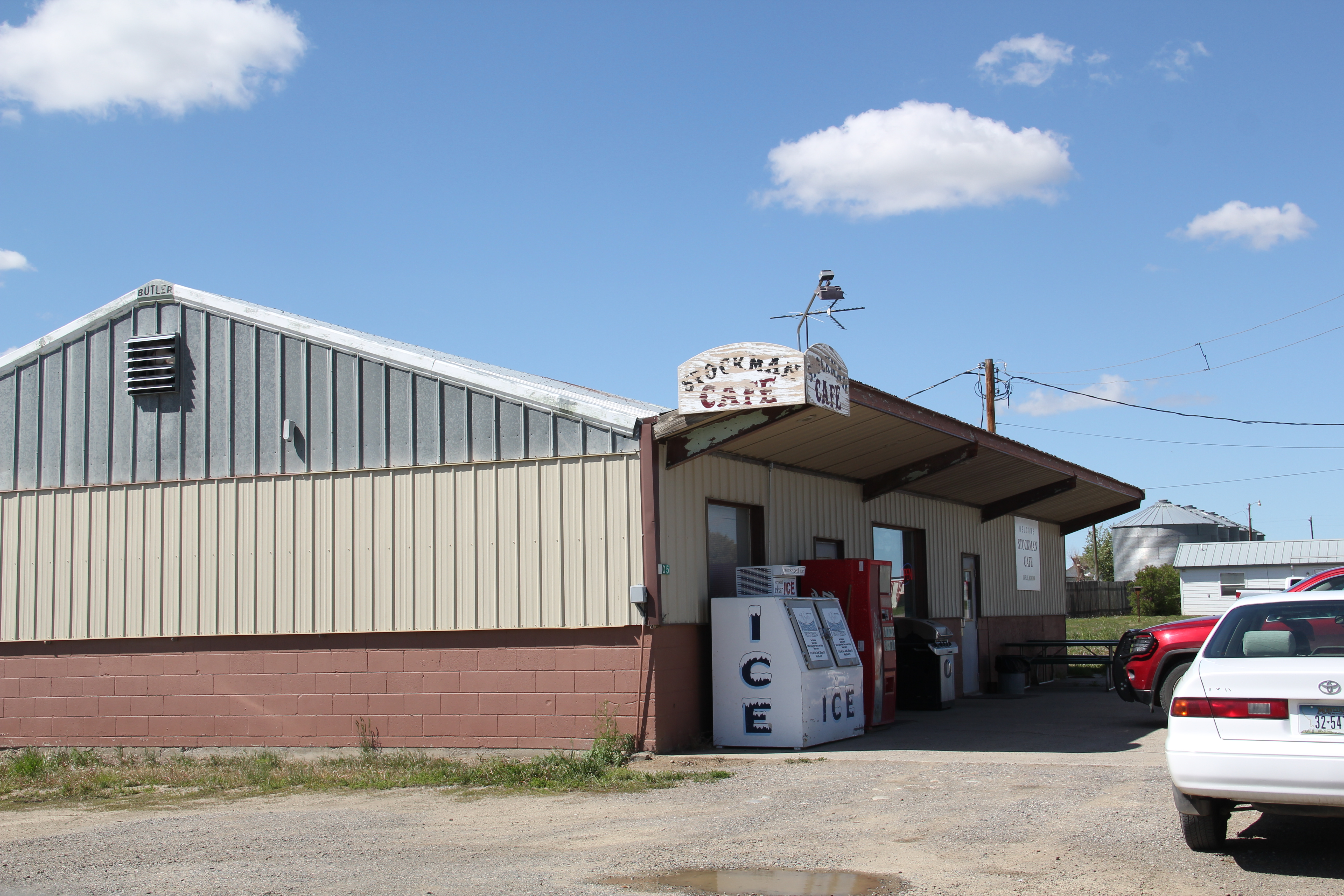
Businesses are few and far between–the handful of local residents and scattered ranch families take their business to Columbus, or a bit farther to Laurel and Billings.  There is still a town cafe–the Stockman Cafe–which is run as a volunteer cooperative for those passing through.  The past few summers a June bike race has become a popular fund-raiser for the cafe.

IMG_5907
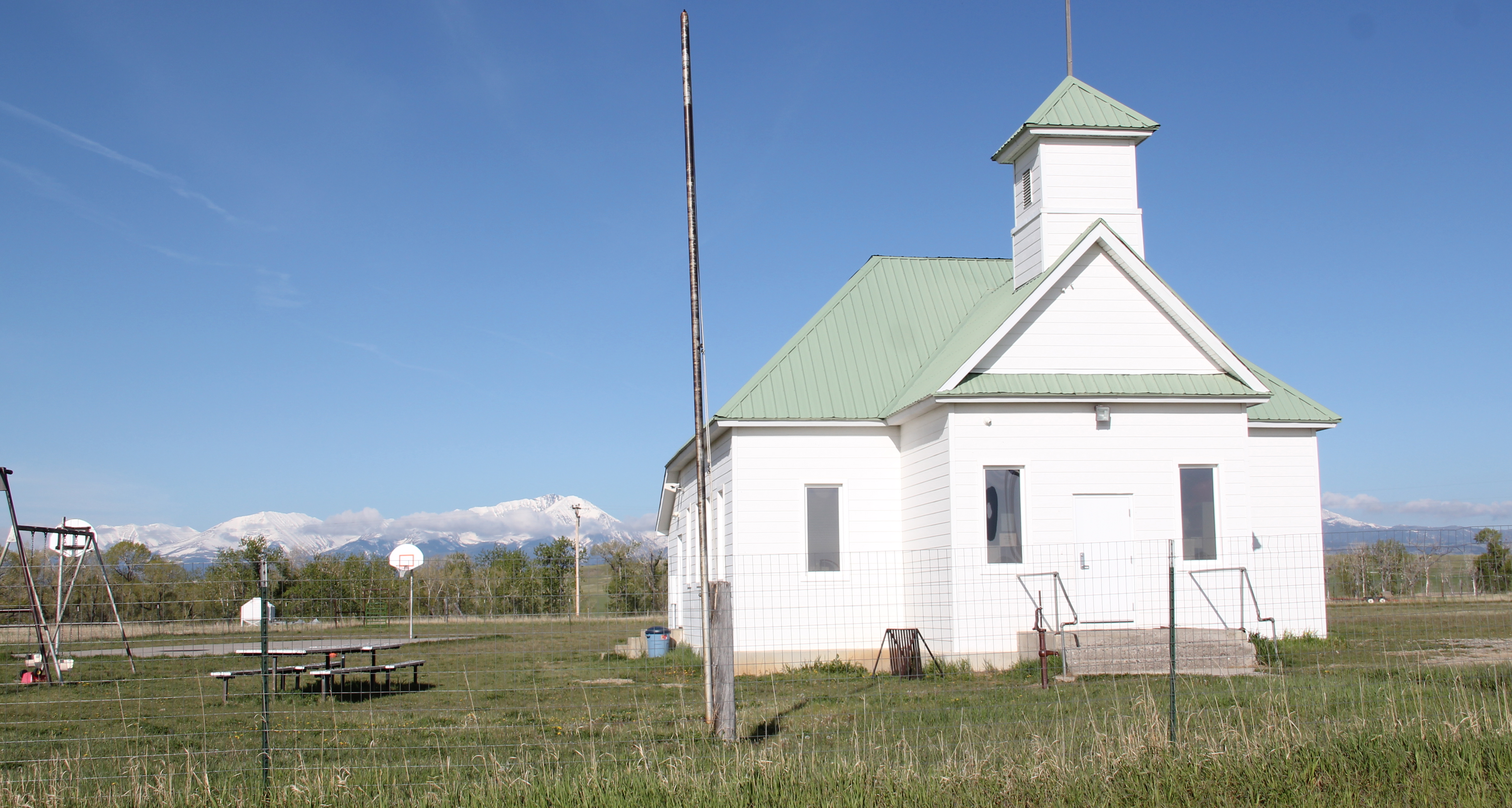
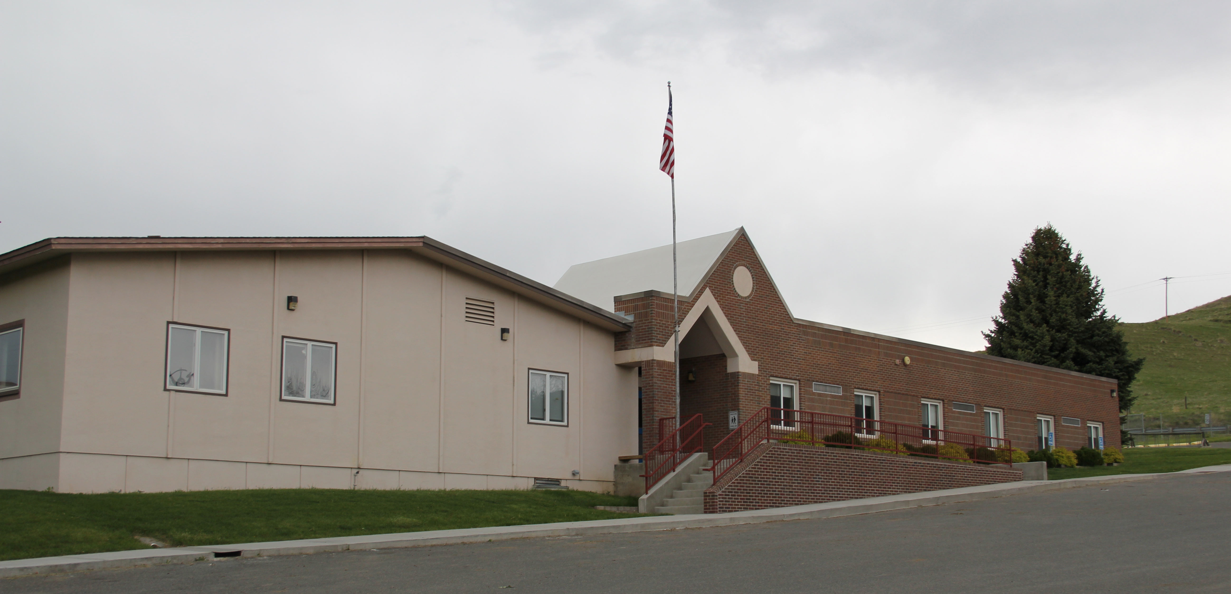
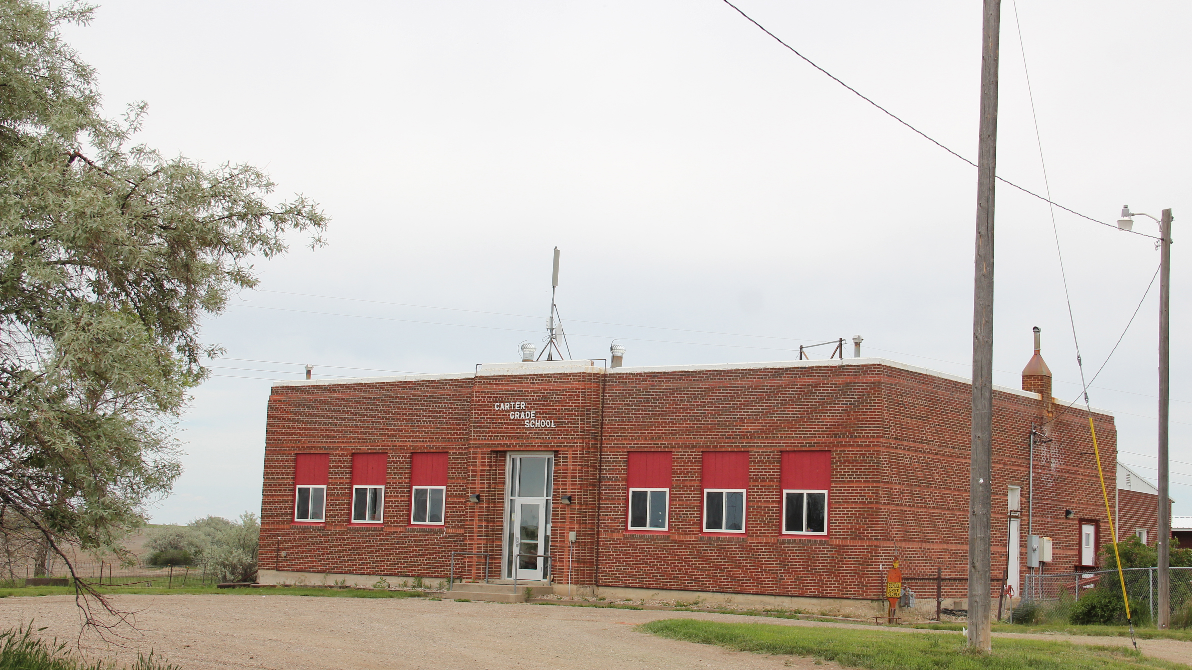
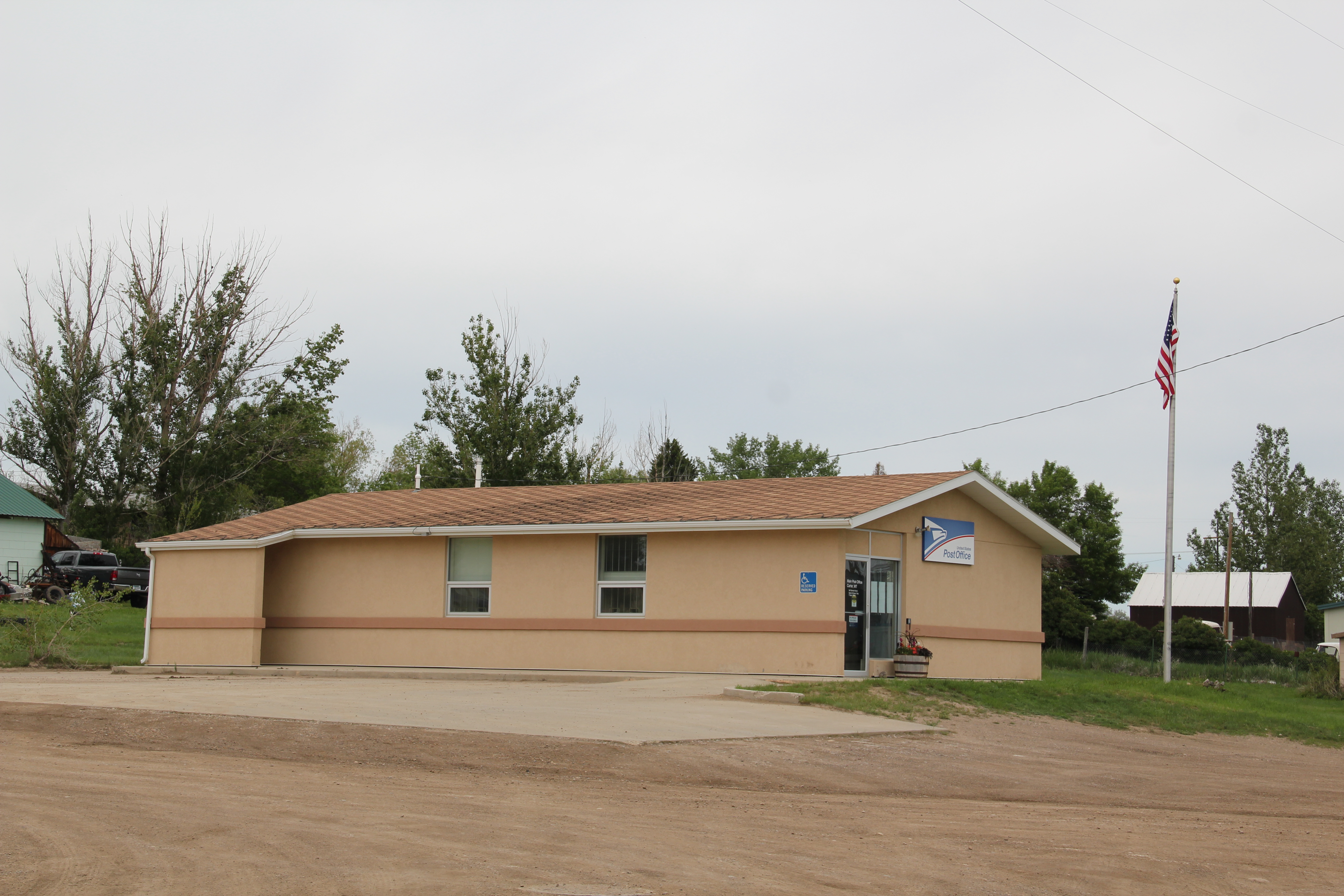
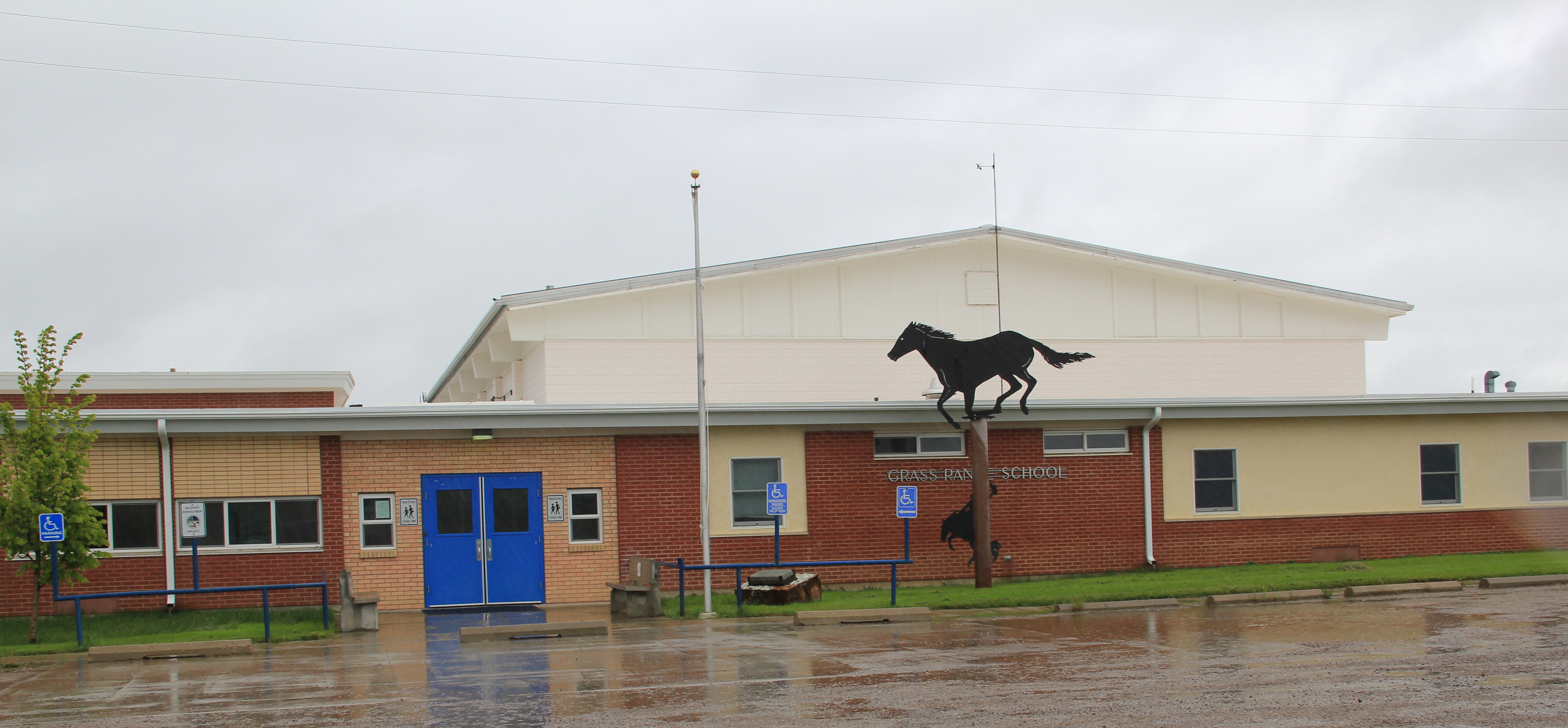
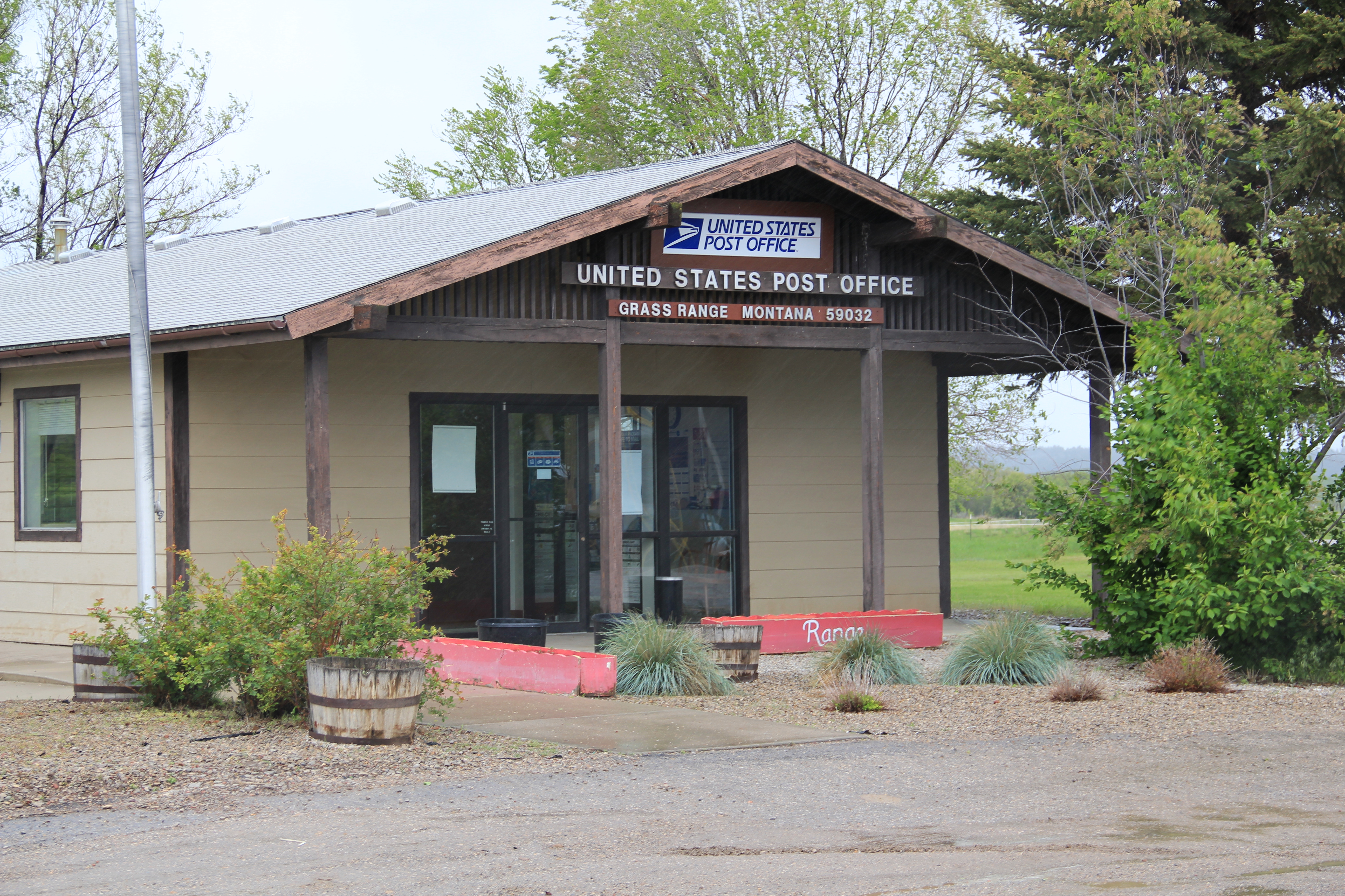
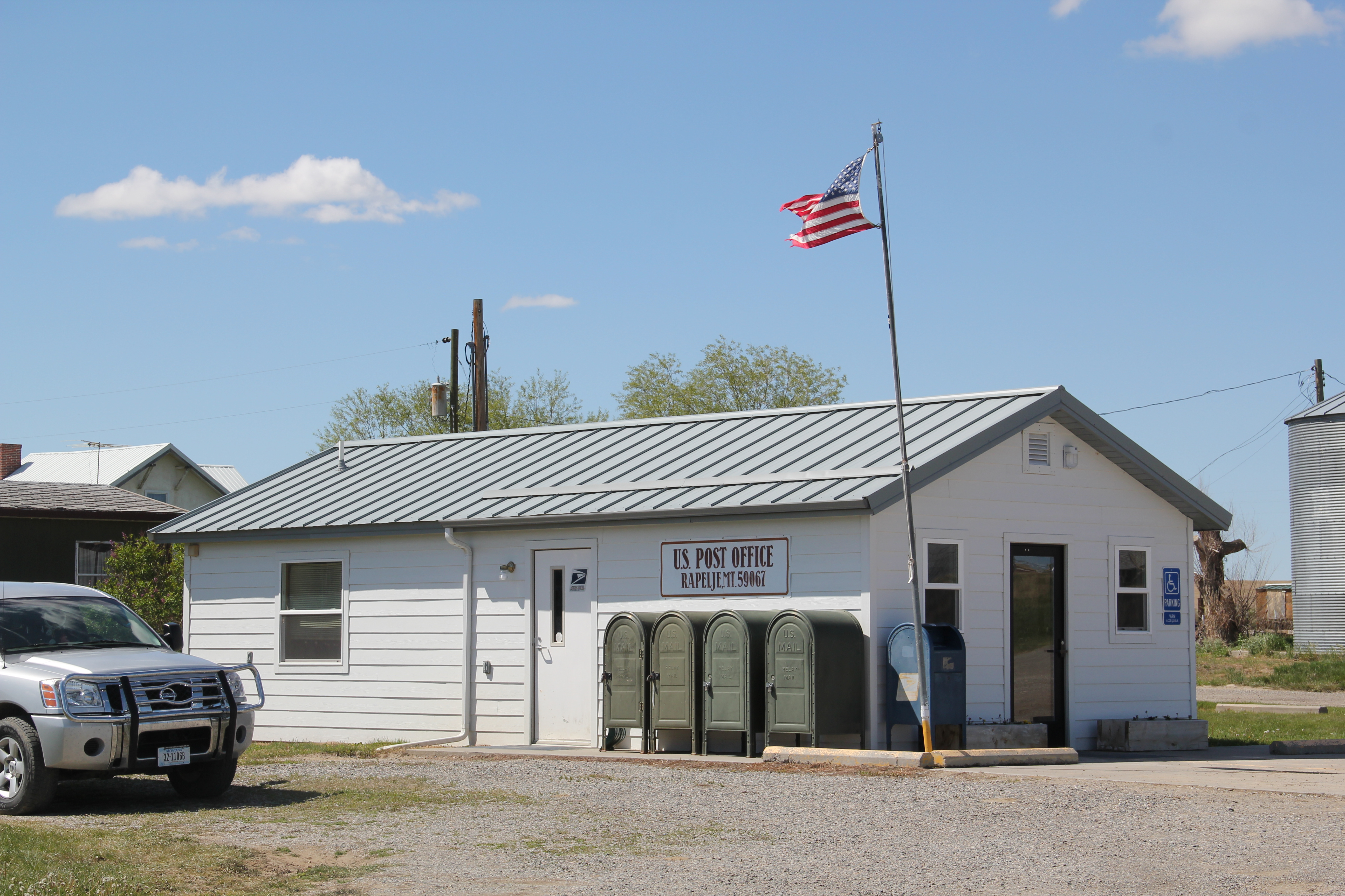
The town has retained two public buildings–its post office and its school, the pride of the community, which was built in 1920 and has since been renovated and expanded with a new wing to the rear of the historic building.  The school is home to the Rapelje Rockets.

IMG_5903
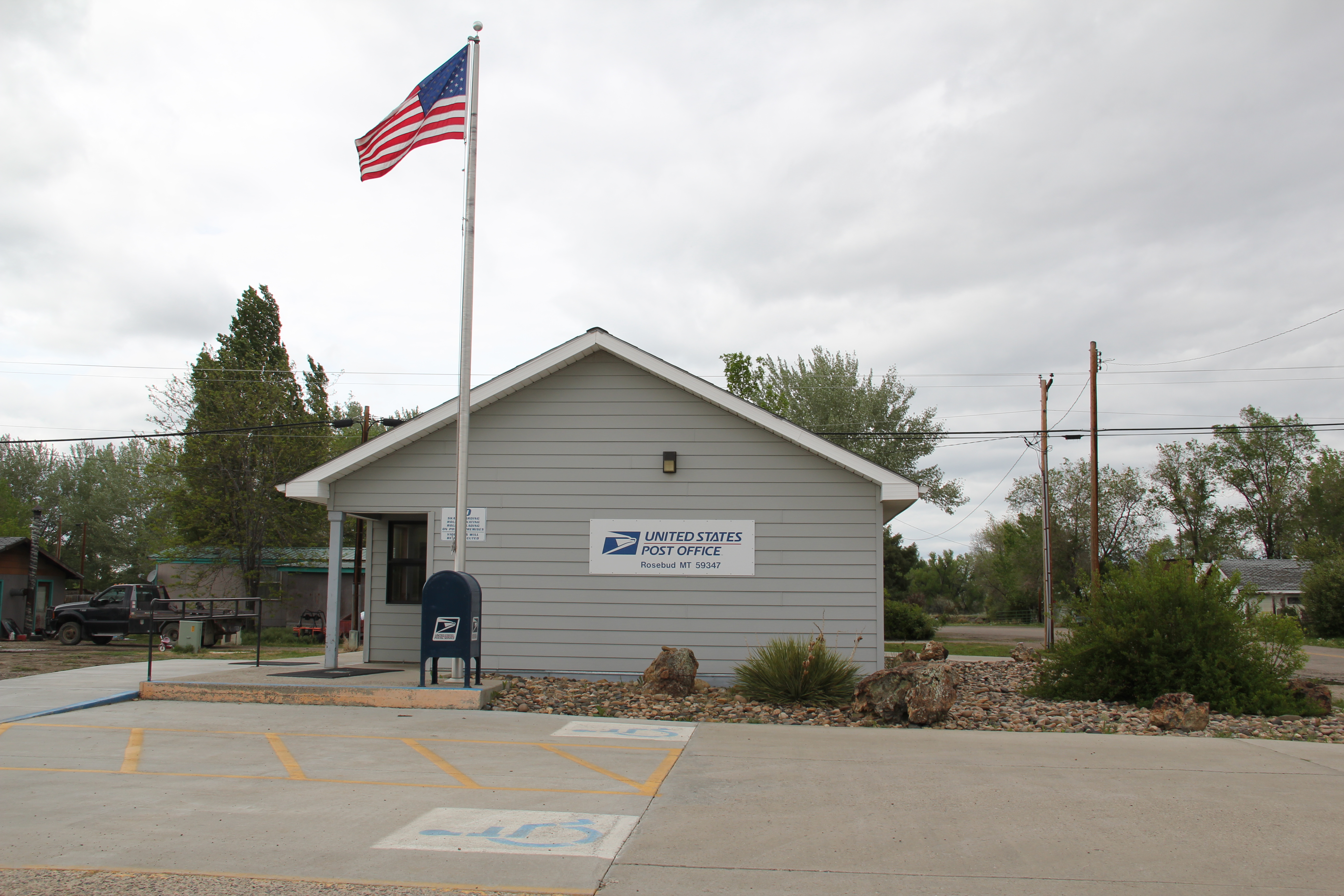
With less than 100 residents in Rapelje, the school educates ranch kids living throughout the county’s high prairie, a role similar to the local post office, which despite threats last decade to close many of the state’s rural post offices, still serves this farming community.

IMG_5898
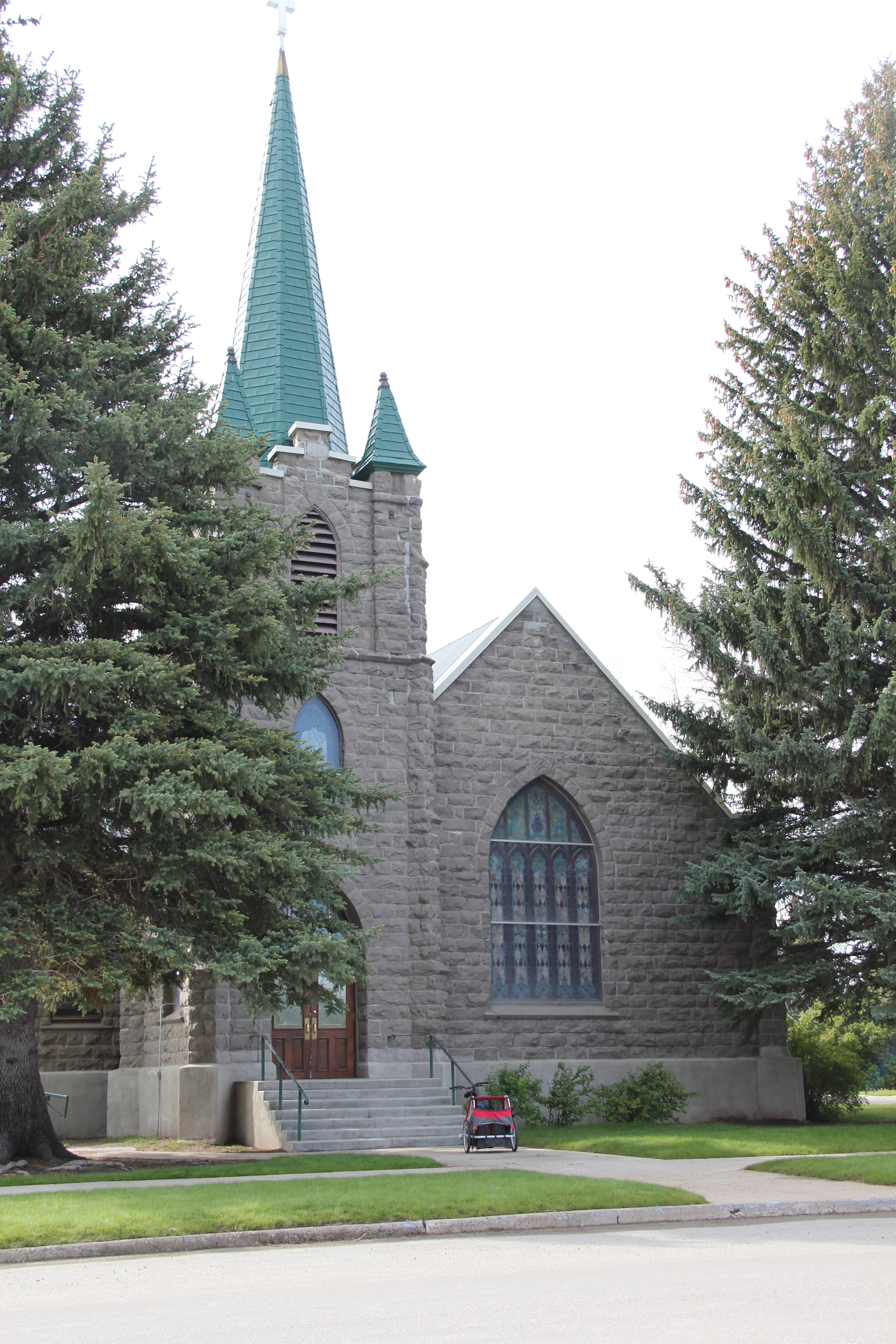
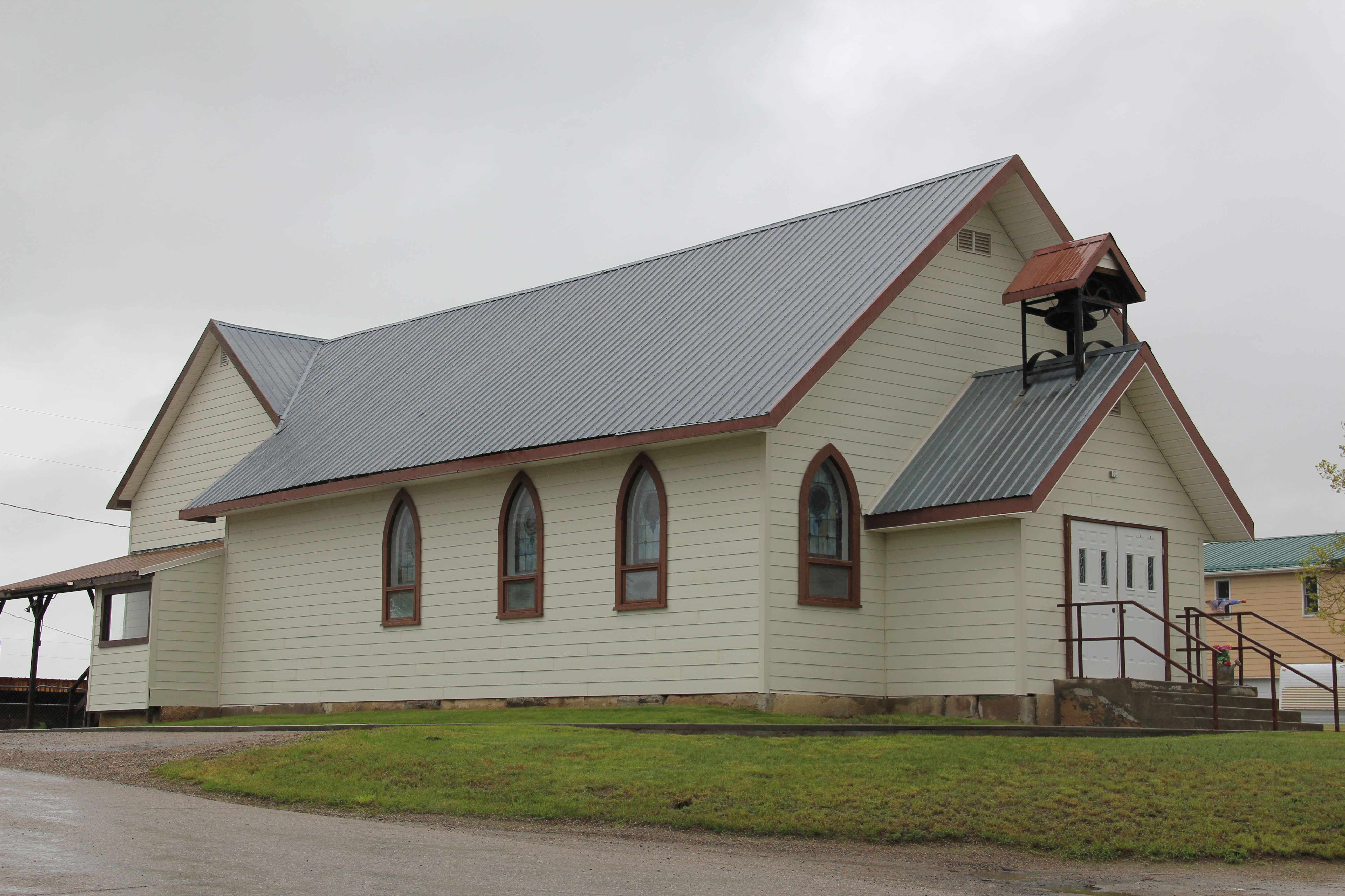
The loss of population means that Rapelje has just two primary sacred places:  the Gothic-styled community church, built during the initial decade of settlement, and the town

IMG_5901
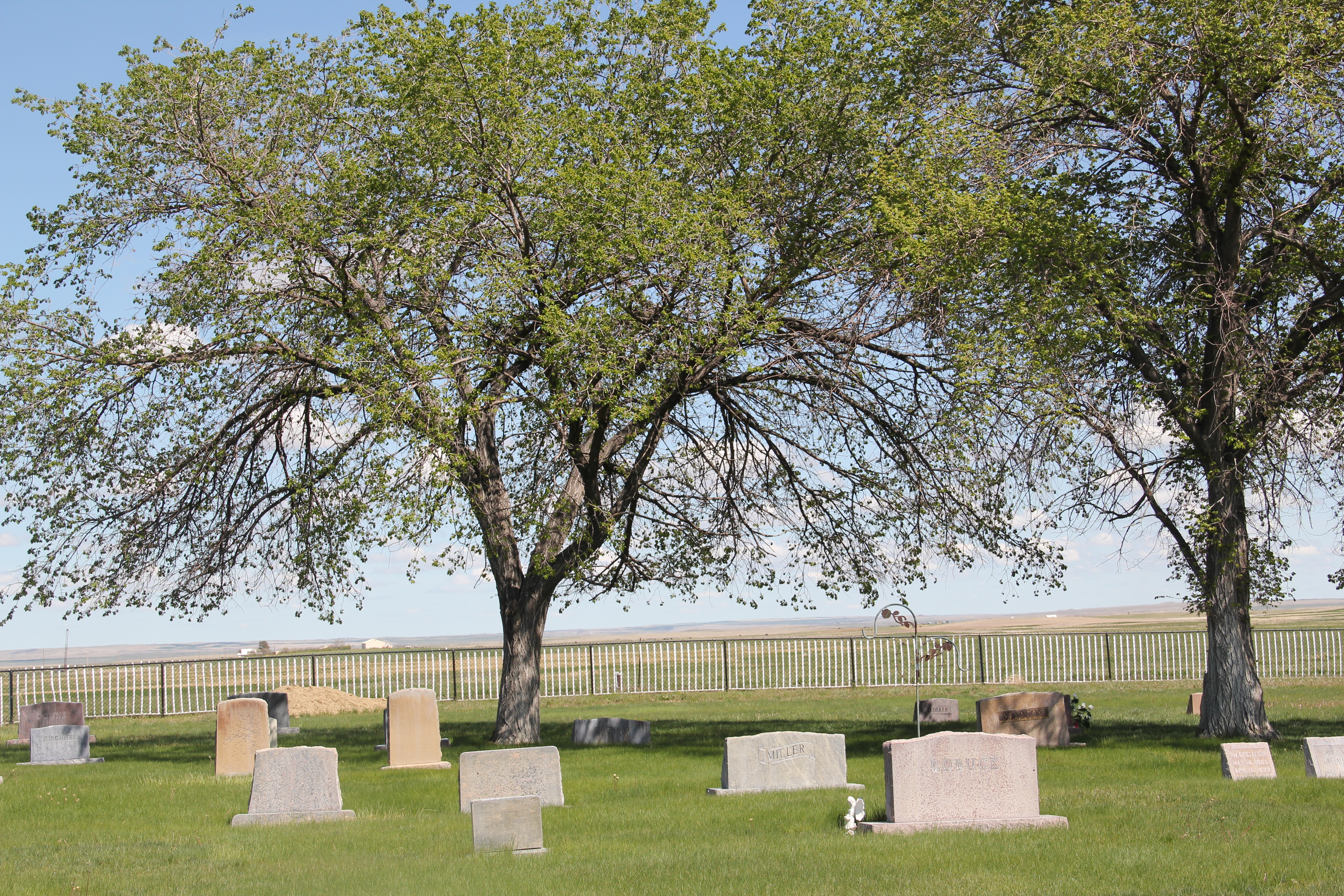
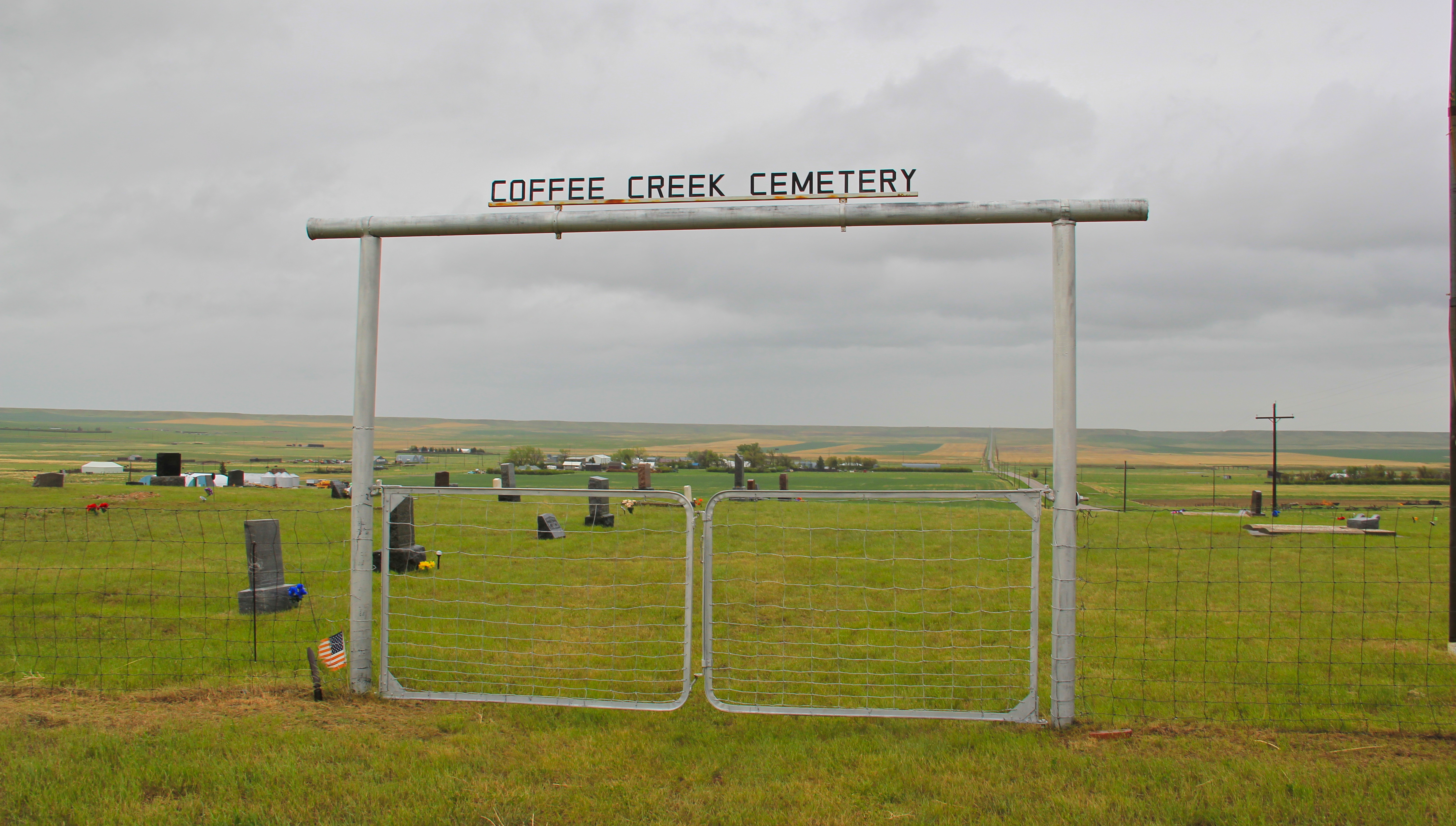
cemetery, which is located south of the village on a rise that overlooks the open prairie in all four directions.  Of course, as Rapelje fades into the past, the cemetery grows in its number of headstones–a sign of what limits the future holds for this high prairie town.

IMG_5895 IMG_5897

Essex Under Fire

For more than a week many have been anxiously following one of the 2015 wildfires along U.S. Highway 2 that threatens the town of Essex adjacent to Glacier National Park.  I must admit a very personal concern because 30 years ago there was not much to Essex, except for its historic Great Northern Railway dormitory and the switching yards, where the railroad could add engines to help trains cross the Logan Pass.  At the state historic preservation office in Helena, I had just worked with Pat Bick and Marcella Sherfy on an exceptional significance statement to place the dormitory, which was not quite 50 years old then but certainly the town would have existed without the presence of the dormitory, in the National Register of Historic Places.

Izaak Walton Inn c. 1985

Izaak Walton Inn c. 1985

Back then travelers wishing to stop there just crossed the tracks, as generations of railroad workers had done, and came into the dormitory, which actually was little changed except the lobby had a desk to greet visitors, and the basement floor became a very nifty bar.

2011 MT Glacier Park and communities 150

2011 MT Glacier Park and communities 152Since the mid-1980s, Essex grew as a place as the Izaak Walton Inn grew as a business.  Additional buildings were added to the north side of the tracks, even an old school building was repurposed into a mini-meeting lodge.

2011 MT Glacier Park and communities 137At some point in the 1990s or early 2000s (I didn’t get to Essex between 1995 and 2005) a  pedestrian bridge was installed over the tracks, which suddenly gave you a different perspective on the old dormitory and the railroad tracks that it had served.

2011 MT Glacier Park and communities 133This view of the historic Great Northern main line, looking east toward Logan Pass, became one of my favorite spots in the state.  Here you still had the look and feel of the early 20th century when the railroad created a new engineered landscape through the mountains, and also had modern marketing had taken hold of the railroad’s image, as the vaguely Swiss Chalet look of the dormitory fit well into the entire design aesthetic that the railroad pursued in its Glacier National Park operations.

IMG_9210The Inn now has a busy winter season as skiers come here for lodging, often traveling by Amtrak train.  The business has expanded in many different ways, with even old Great Northern engines being repurposed into overnight lodging.

2011 MT Glacier Park and communities 149 spent a night at the Izaak Walton in May 2015, and now with the serious threat of fire to the entire town I am glad I did.  Thirty years ago, I enjoyed the isolated feel of the place and watching the passing of the occasional train through the night.  In May the train traffic was much heavier–thanks to the region’s overall growth but also the impact of the shale oil

IMG_8968explosion in North Dakota–and the place was not so isolated.  Essex had significantly grown in size.  That’s why the news of the past few days is so distressing.  Not only could the fires take an important Montana landmark, they could also destroy a town that has grown so much in the last 30 years.  Today comes news that the fires had so concerned

2011 MT Glacier Park and communities 131officials of the BNSF Railroad that the company is wetting down its historic avalanche sheds not far from Essex and visible from U.S. Highway 2 at several places.  If luck doesn’t come, a distinctive historic landscape could disappear.

IMG_9207

More Landmarks from Sweet Grass County

IMG_6338Big Timber and Sweet Grass County, in the heart of Montana’s Yellowstone Valley, create an imposing built environment set in a beautiful county, framed by mountains and defined by historic river corridors and later transportation routes. In the last post, I focused on Big Timber, its public spaces, its town plan, and the properties there already listed in the National Register.  Today I want to focus on other just as worthy historic properties found both in town and in the county.

IMG_6336 IMG_6337 IMG_6341

Let’s start with landmarks from the New Deal era.  The town city hall/ fire hall is recognized but just southwest of Big Timber is the Mountain View Cemetery, which received a new stone gate, cemetery office, and other landscaping improvements from the WPA in the late 1930s.  It is a splendid small town historic cemetery, with its majestic setting providing a proper dignity to those town founds, and generations of later residents, buried there.

IMG_6310The beautiful stone masonry of the cemetery reflected a vernacular theme already noted in the Sweet Grass County Courthouse and St. Mark’s Episcopal Church.  But the smart use of stone throughout the town’s residential district is a significant design theme, from the magnificent Lutheran Church above to numerous examples of early 20th century homes.

IMG_6312

IMG_6322

IMG_6321Indeed, community institutions could be another important theme to explore in the built environment of Sweet Grass County.  In addition to the town’s churches, schools, courthouse, and New Deal-era public park, downtown Big Timber still has a thriving bowling alley, the American Legion Hall,  and the active Civic CenterIMG_6294 IMG_6293

IMG_6302Certainly community landmarks are a useful way to think about Melville, once an important trade town at the north end of the county on U.S. Highway 191.  The town now lies just west of the realigned highway but it is worth a brief detour, if for no other reason than one of the state’s great rural churches, the Melville Lutheran Church.

Melville Lutheran Church, Sweetgrass Co (38-7)

When I encountered this gable-front vernacular Gothic church in March 1984, its unadorned beauty framed by the Crazy Mountains was a take-your-breath away experience.  I featured the church in my A Travelers Companion to Montana History book on page 121, and noted the congregation, established in 1885, had built the church in 1914.  It has weathered the subsequent 100 years well, as the image below shows.  The stewardship of the congregation in maintaining the building, when so many other rural churches have closed in the last 30 years, is to be congratulated.

IMG_6243But Melville has more than the church–its rural school is still there, and probably as old as the church, serving as public space within the shadows of the Crazy Mountains.

IMG_6254

Finally, back in the center of the county, let’s close with the Yellowstone River.  Now at a public access site just north of Big Timber and just west of U.S. 191 is a Lewis and Clark National Historic Trail site that interprets the expedition’s experience at this spot in 1806.

IMG_6261

IMG_6255This beautiful spot sums up the special quality of Sweet Grass County–a beautiful natural landscape that has been shaped in expected, and unexpected, ways by 200 years of history.

The Sweet Grass of the Yellowstone Valley

IMG_6258

Sweet Grass County has one of the most spectacular landscapes of the entire state of Montana.  Located in the middle of the Yellowstone Valley, the county has long been a significant crossroads, from the prehistoric era to today.  At the county seat of Big Timber, Interstate Highway 90 (along with the historic route of old U.S. Highway 10) parallels the Yellowstone River.  The town is also the southern point of origin for U.S. Highway 191,

2011 MT Sweetgrass county 014

The Lazy J, near the intersection of U.S. 191 and old U.S. 10, is a classic bit of mid-20th century roadside architecture.

which strikes northward cutting across Central Montana and continuing until the highway ends at the Canadian border, north of Malta.

IMG_6331Established by the Northern Pacific Railroad in 1882-1883, Big Timber has the classic T-Plan town plat found on so many Northern Pacific towns.  But one reason I have long liked this place is the quirkiness of its town plan.  The depot and the elevators are where they

IMG_6329should be, forming the top of the “T,” but the beautiful early 20th century stone masonry Sweet Grass County Courthouse is neither on McLeod Street (the stem of the T) nor at the end of the T, dividing the town’s commercial area from its residential neighborhood.  No, it IMG_6333is a block west of the intersection of McLeod Street and old U.S. Highway 10–an uncommon arrangement of public space in northern plains railroad towns.  A public park

IMG_6314

effectively marks the end of the historic town.  When I first surveyed the town in 1984, I found that an old 1946 highway marker for the Lewis and Clark Expedition had been moved to the park a year prior to my visit, and the interpretive sign told me that the town had a sense of its place in history.  In the decades since, residents have added a monument to the town’s early wool industry along with a bronze sculpture, titled “Free Spirit” by Dave Hodges, linking the place to the open spaces and cowboy culture of the valley.  Coming soon will be the new headquarters for the Montana Cowboy Hall of Fame, an institution that searched high and long for a home until finding Big Timber.

IMG_6316

IMG_6313

IMG_6271Public interpretation through art is another change I encountered in Big Timber.  The most striking dates to the Lewis and Clark Bicentennial at the start of this century.  On the walls of the local grocery store are three panels telling the story of the expedition in Sweet Grass County as the men encountered the confluence of the Boulder and Yellowstone rivers.  IMG_6296On another commercial building near the intersection of U.S. 191 and old U.S. 10 was an unexpected surprise:  a mural recreating–or is it reinterpreting–the famed Milwaukee Road promotional poster from the turn of the 20th century that encouraged homesteaders

IMG_6267to head to Montana. Oddly the reproduction mural gives the Northern Pacific corporate emblem but the route shown is the Milwaukee’s route, admittedly also showing where the two lines ran side by side in parts of the Yellowstone Valley.

IMG_6290

Public interpretation has not extended into an intensive involvement with the National Register of Historic Places.  In 1984, only one property–a segment of the Bozeman Trail where it crossed the Yellowstone–in the county was listed, and that stood on Sweet Grass’s far western border to Park County.  Then, right after I had finished the project, the iconic western hotel, The Grand, was listed in the National Register.  In the 30 years, a handful of Big Timber landmarks also have been designated on the National Register:  the Classical Revival-styled Carnegie Library, St. Mark’s Episcopal Church, and the Big

IMG_6324

Sweetgrass Co Big Timber 6 - Version 2 IMG_6306Timber City Hall.  Little doubt these landmarks are cherished–when more library space was necessary this century the expansion of the historic building was done appropriately, keeping this landmark in service for decades.

IMG_6308But when you consider just how intact the town’s historic environment from the 1880s to the 1950s is today, you think a National Register historic district nomination in order, or at least one for the historic commercial district, which has a wonderful array of building types, designs, and, luckily for Big Timber, open businesses, including one of my favorite bars in all of the state–at least favorite bar signs–the Timber Bar.

IMG_6273

IMG_6274

IMG_6275IMG_6284The next post will look deeper in the historic buildings of Big Timber, and then stretch north to a real jewel, the Melville Lutheran Church.

Chouteau County’s Plains Country Towns

IMG_9327

Thirty years ago geographer John Hudson wrote a series of articles and a book on the topic of “plains country towns,” addressing the landscape patterns he found among the railroad-established towns of the northern plains.  Ever since Hudson’s concept of plains country towns has influenced how I look at the Montana’s small towns.  Even in such river counties as Chouteau County where the Missouri River trade base of Fort Benton has dominated the county’s economy and population since the mid-19th century, you can still find the unmistakeable imprint of the railroad and the grain elevators that mark the presence of a town.

IMG_8832

Earlier in this blog I have discussed Square Butte (above) and Geraldine.  Today I want to review two other small towns, Highwood and Carter.  Highwood is the largest, counting

IMG_8873

just about 175 people in the last census.  Like most plains country towns, it has steadily lost population in the last 50 years.  In fact this weekend’s Great Falls Tribune discussed how the Highwood High School was going to forge a co-op for sports with Geraldine so both schools could continue to have basketball, volley ball and 7-man football, played at this tiny field in Highwood.

IMG_8875

IMG_8877

The Highwood School is no doubt the pride and center of this community, a place not often found by travelers nestled as it is in a gulch formed by Highwood Creek along Montana Highway 228.  It began in the 1880s as cattle country but with the coming of the railroad in the 1910s t became an outlet for grains, as its set of tall elevators makes apparent.  A small one-story false front building for the 1912 Highwood Mercantile Company also remains to mark the town’s railroad years.

IMG_8881

IMG_8880

Carter has one-third the population of Highwood–only about 50 people in the 2010 census–but is better known to travelers due to its location along U.S. Highway 87 between Great Falls and Fort Benton.  The Rocking K Bar is the roadside landmark but travelers

IMG_9334should turn south and drive down into Carter proper since the town, despite its tiny number of residents, still has many of the community institutions that defined a proper plains country town of 100 years ago.

IMG_9318

First, there is the still operating Carter Elementary School, probably the one institution that keeps the town alive–when country towns lose their school soon everything else goes too.

IMG_9319

Next comes the tracks, railroad depot, and the grain elevators–while not public institutions they do give the community commercial lifeblood, and as long as the trains roll by there remains an economic reason for Carter to exist.

IMG_9326

The depot has been moved from its original location paralleling the tracks, but this early 20th century standardized designed combination depot for the Great Northern Railway still stands–there were hundreds across the state in my survey of 1984-1985 and one of the more disturbing trends of the new survey of 2013-2015 is how many Great Northern depots are gone, eliminating from the landscape they once dominated.

IMG_9325

Faith too has remained in Carter, with the persistence of the town’s small vernacular styled gable-front little white Methodist church, although in its first generation several congregations had been established here.

IMG_9329

Carter also still has its Community Hall–an institution across the northern plains that defined hope and persistence in the years following the homesteading bust of the 1920s.
IMG_9331
Community halls too were more numerous in 1984-1985 than today–the building in Carter is a significant community link between past and present.

IMG_9330Finally there is the federal presence–marked by a concrete block post office from the last decades of the 20th century.  The threat a few years ago to close hundreds of rural post offices across the region brought new, and necessary, addition to role of post offices as modern community landmarks for plains country towns.

Admittedly, Carter is a place that hundreds roar pass daily as they drive U.S. Highway 87. But with its extant school, depot, brace of elevators, church, community hall, and post office, Carter is a valuable physical document of the plains country towns that once populated eastern Montana, serving as important way stations along the metropolitan corridors of rails and sidings that crisscrossed the west.

Circling Back to Rosebud, Montana

IMG_6998

Rosebud, Montana, is a small Northern Pacific era railroad town in Rosebud County.  A recent commentator on the blog asked for more about this town, admitting that a real loss had been a fire that destroyed its historic school from the turn of the 20th century.  But Rosebud has rebuilt a modern school and like any credible Montana town, students maintain a “R” for the school on a bluff outside of town, and when the football season starts this month, this tiny field will be full of spectators, family, and players.

IMG_6999

IMG_6995

One reason I liked Rosebud back in 1984-1985 was the town bar, which had great food.  I didn’t remember it as the Longhorn Bar, but that’s the name today and the place still is friendly and worth a stop along old U.S. Highway 10. Another blog reader reminded me that it has always been known as the Longhorn Bar–so that shows you what you can forget in 30 years plus of Montana field study.  Note also in this photo–at the far right in the background is the football field goal posts, a visual of how small the place is.

IMG_6992

Rosebud was never a major railroad town in this part of the Yellowstone Valley but it has kept its school, a handful of businesses, and its post office, which had been updated since my last visit here. It’s still an important part of the valley’s historic landscape. And an important intact 1920s section of the Yellowstone Trail–the initial transcontinental highway that followed the Milwaukee Road’s tracks into eastern Montana.

IMG_6993

Grassrange: Fergus County Crossroads

IMG_0025

Grassrange is a central Montana crossroads, where U.S. Highway 87 meets Montana highways 19 and 200, and it serves as the eastern gateway to Fergus County.  The wonderful vernacular roadside statement of “Little Montana”–an obvious homage to the much larger and more famous “Little America” in southeast Wyoming–reminds even the most oblivious traveler that you have reached a highway crossroads.

IMG_0028

As the name implies, this is ranching country, with several of the state’s most famous spreads nearby.  The school reflects the pride in ranching, witness its school emblem and name the Rangers.

IMG_0030

There is more than livestock to the history of Grassrange, as the elevators attest.  This is also farmers’ country since the early 20th century homesteading boom.  Yet Grassrange has never been a bit town itself.  It dates to 1883 when the first post office was stab listed to serve surrounding ranchers; the town still has its standardized 1970s post office building.

IMG_0020

IMG_0021

Grassrange has a definite sense of its past.  Despite its scant population–just over 100 in the 2010 census–it has a city park (top image of this blog) plus its own public interpretation of its history, literally carved from local hands.

IMG_0026

It also has surviving historic landmarks, from a false-front Masonic Lodge to a vernacular Gothic-styled United Methodist Church, to a well-worn one-block commercial building that, considering its add-ons and alterations, has served the community in several different ways over the last 100 years.

Fergus Co Grassrange masonic hall  - Version 2

IMG_0027

IMG_0022

Many rural Montana crossroads are little more than a combination bar/cafe/store/gas station today.  Grassrange has dwindled in size since my first visit in 1984 but it has kept its school and such community buildings as the church, Masonic hall, and city park.  It is home than the home of “Little Montana”; it’s a reminder of the precarious state of Montana’s small towns across the vastness of the northern plains.

Coffee Creek: More than a Romance Novel

IMG_9870

Coffee Creek, Montana, located on the high plains of northeastern Fergus County, is undoubtedly best known today as the backdrop for a series of Harlequin romance novels. The setting and the starkness of the landscape is probably not what you envision in a romance novel but it does convey the reality of what Coffee Creek was, and is, today.

IMG_9878

Coffee Creek was a railroad town, established in the same year as many of its neighbors, in 1913.  Unlike Denton to the east or Stanford to the south, Coffee Creek never grew beyond its booster beginnings.  Like the others it had a state bank, a post office, school, churches.  Today the post office remains–one of the best rural historic post offices of the region–but most everything else is closed.  The church is a well-kept example of early

IMG_9875

20th century vernacular Gothic design, but it no longer holds regularly scheduled services. It remains a community landmark.

IMG_9872

Another community landmark is the building above, which I believe is a Community Hall from the 1920s or 1930s.  Throughout rural Montana in the 1920s a movement began to build structures where the homesteaders who stayed could gather and have events, play basketball, or dance the night away.  New Deal agencies in the 1930s built many more, like the one this blog has already recorded in Sanders, Montana.  This building in Coffee Creek reminds me of the Sanders community hall–hopefully someone reading this blog can add details about it.

IMG_9874

The volunteer fire hall, like the post office, is one community institution still in service to local residents and surrounding ranches as is the town cemetery, perched to the north, high on a hill overlooking the town, Highway 81, and ranches as far as you can see.

IMG_9871

As the buildings of Coffee Creek fade away, here the cemetery will record the names of those who staked out this place as their home, while those who return to pay their respects will keep the memories of this disappearing place alive for as long as they remember to return.