
In my work on the state historic preservation plan in 1983-1994, I was excited about the new insight I could bring to the state’s landscape–the impact of the transcontinental railroads and the transportation and settlement corridors that they established in the late 19th and early 20th century. Railroads were of course not a new theme then–books abounded on the railroad barons and the romance of the rails. But as a built environment–that was new, reflecting current scholarship from John Hudson, John Stilgoe, and Roger Grant. So whenever I hit a major railroad division point–like Livingston–I only saw the rails and what happened around them.
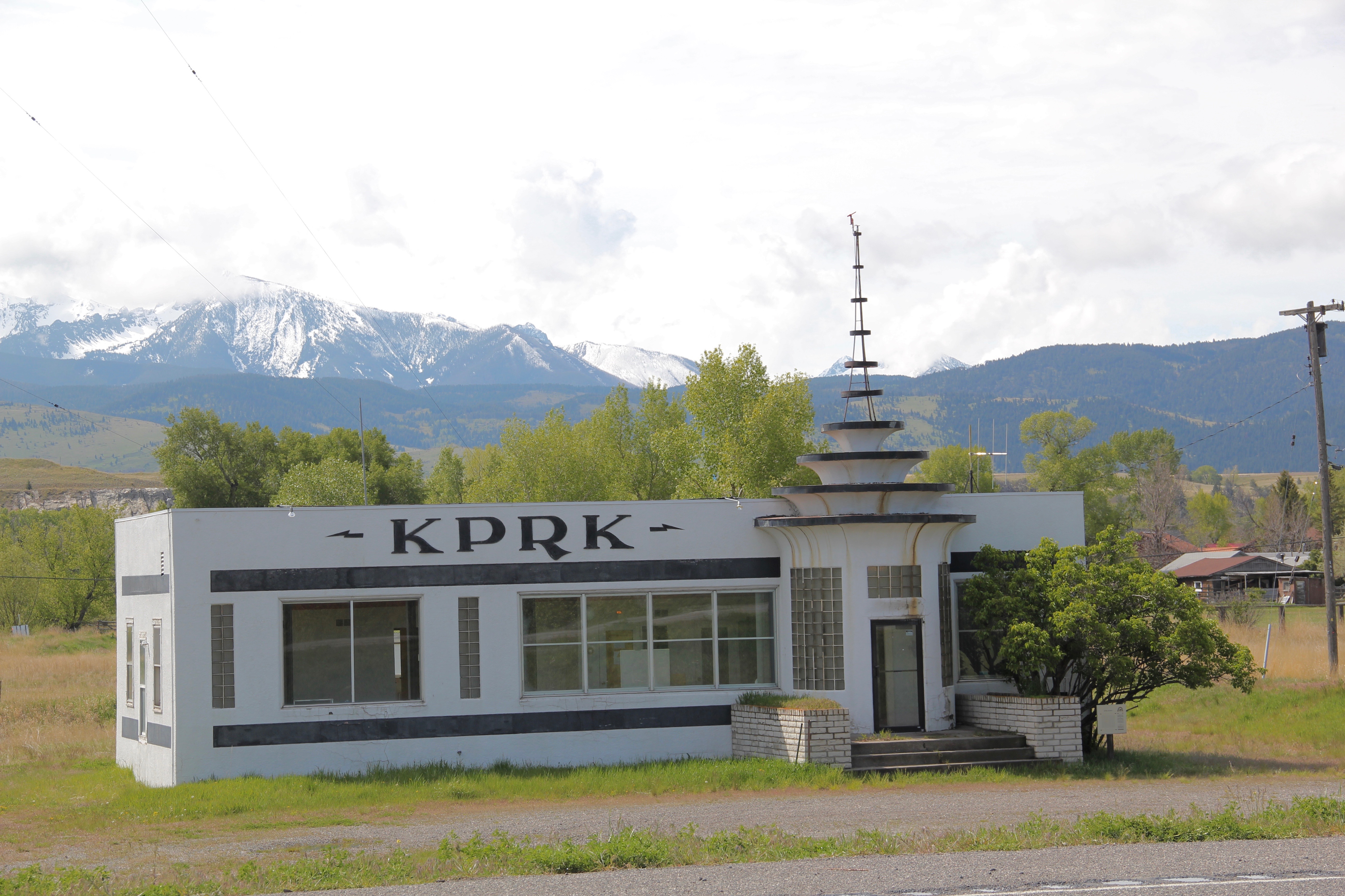
That was certainly easy enough to do coming into Livingston from the west on old U.S. 10. The railroad tracks were directly to the north, as well older elements of the town’s roadside architecture, like the exquisite Art Deco-styled radio station, KPRK, now closed for broadcasting (the station’s signal comes from Bozeman) but listed in the National Register. William Fox, a Missoula architect, designed this jewel in 1946.
 Continuing west you soon encounter post-World War II service stations and motels, some updated, some much like they were, on the outskirts of town and then, boom, you are in the heart of Livingston, facing the commanding presence of the Northern Pacific depot complex with warehouses–some now converted to new uses–coming first and then
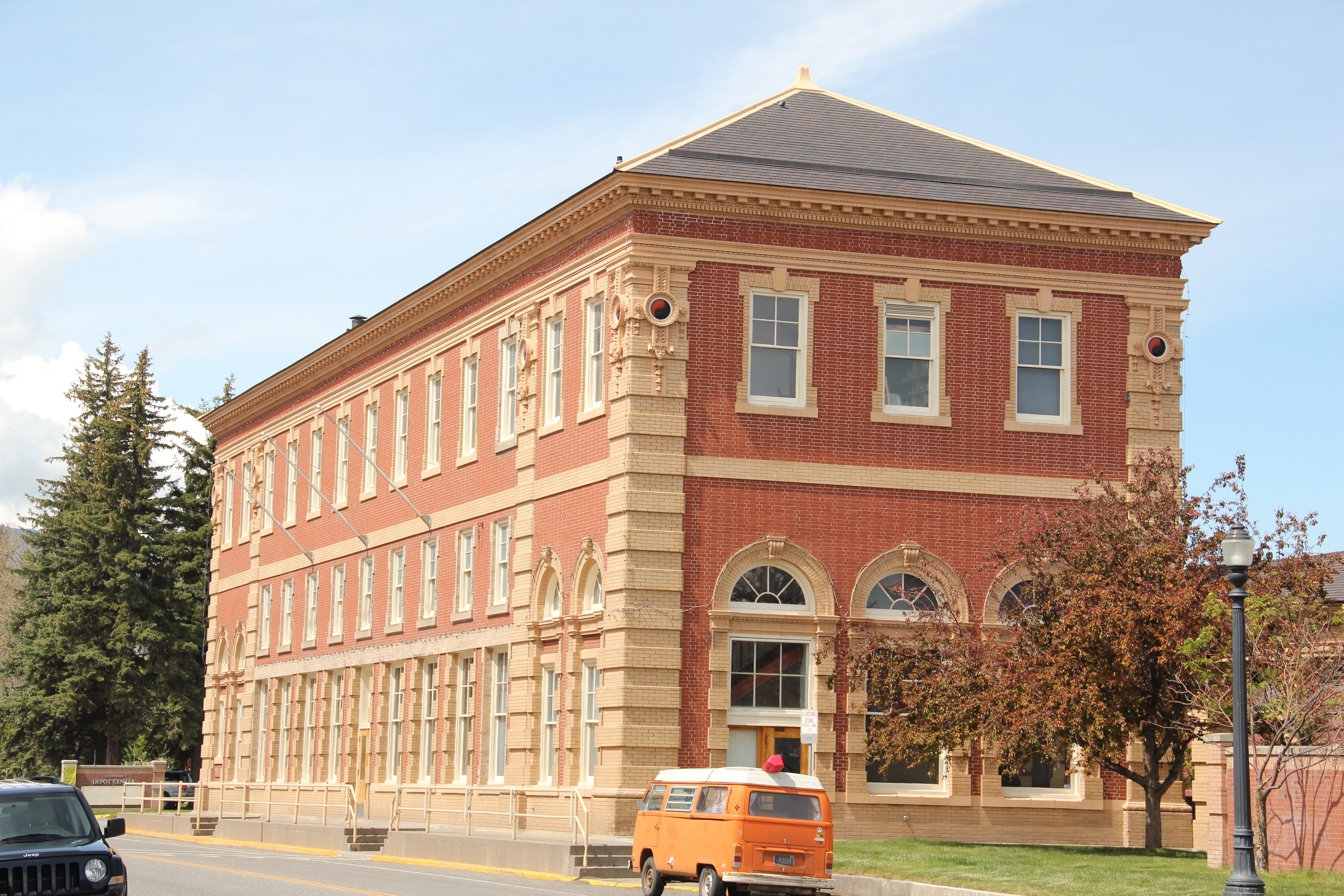
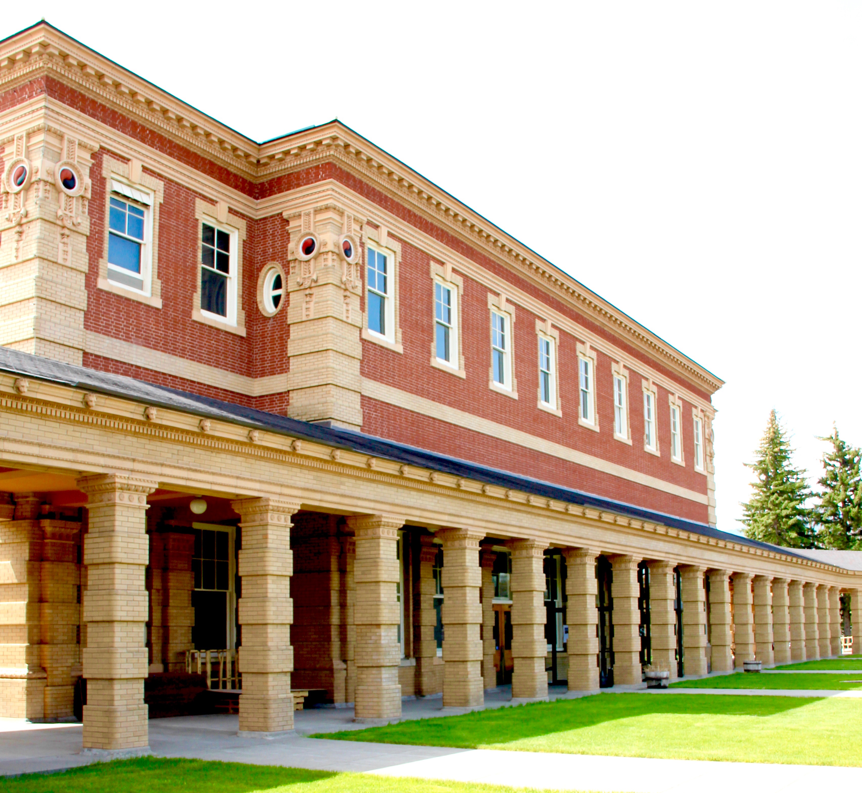
 massive passenger station itself. Opened in 1902, the passenger station was an architectural marvel for the new state, designed by Reed and Stem, who would continue on to great fame as the architects of Grand Central Station in New York City. The station, interestingly, is not Classical Revival in style–certainly the choice of most architects for their grand gateways along the nation’s rail line–but a more restrained interpretation of Renaissance Revival style, completed in red brick.
 The building is not particularly inviting for locals coming from the business district to the depot–that was not its primary audience. Rather the grand entrance is track side, where passengers headed to Yellowstone National Park could depart for food, fun, frivolity, whatever they needed before the journey into the wildness of Yellowstone.
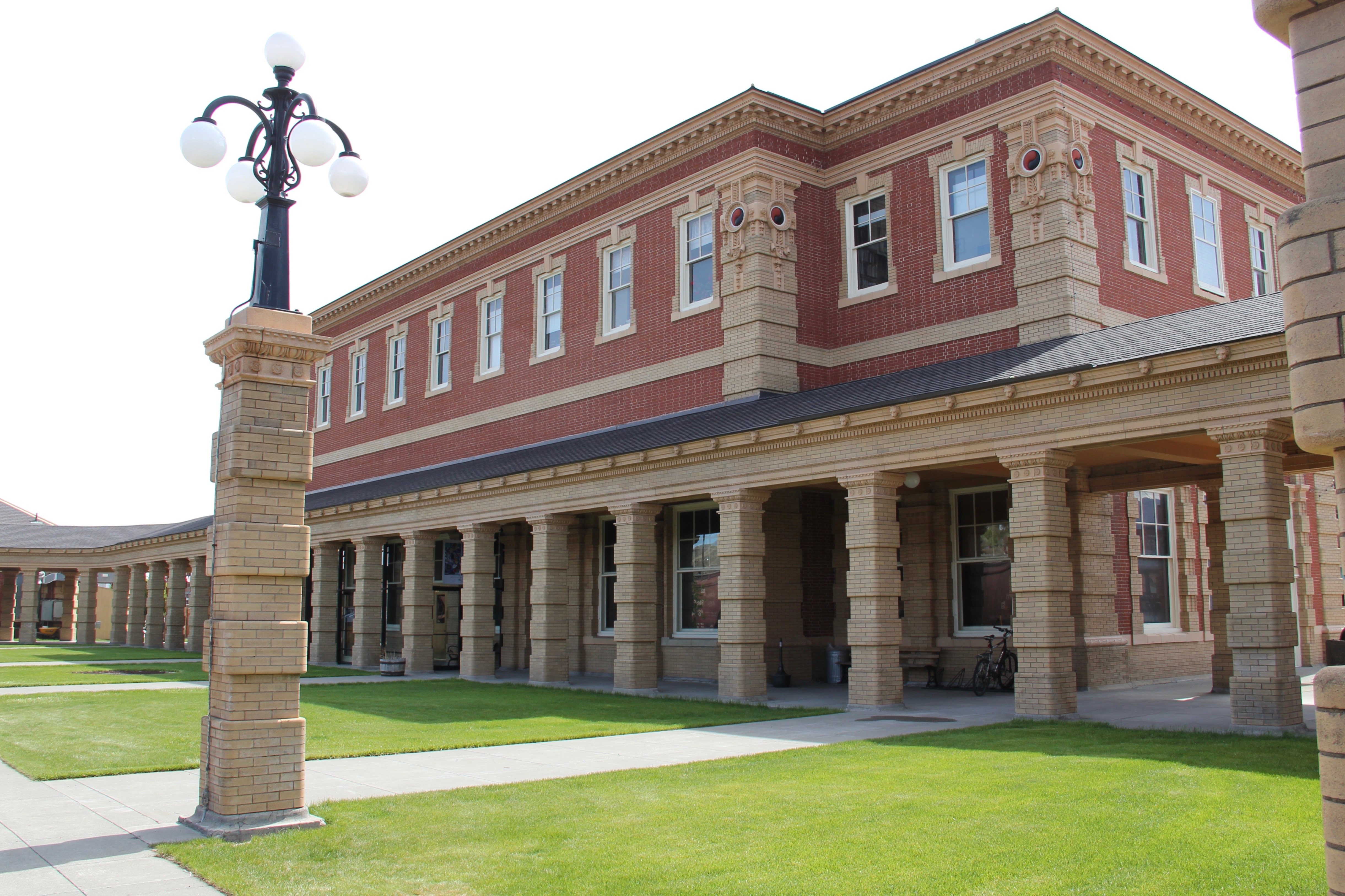
 Travelers were welcome to use the grand covered walkways to enter the depot proper, or to take a side visit to the railroad’s cafe, Martin’s as I
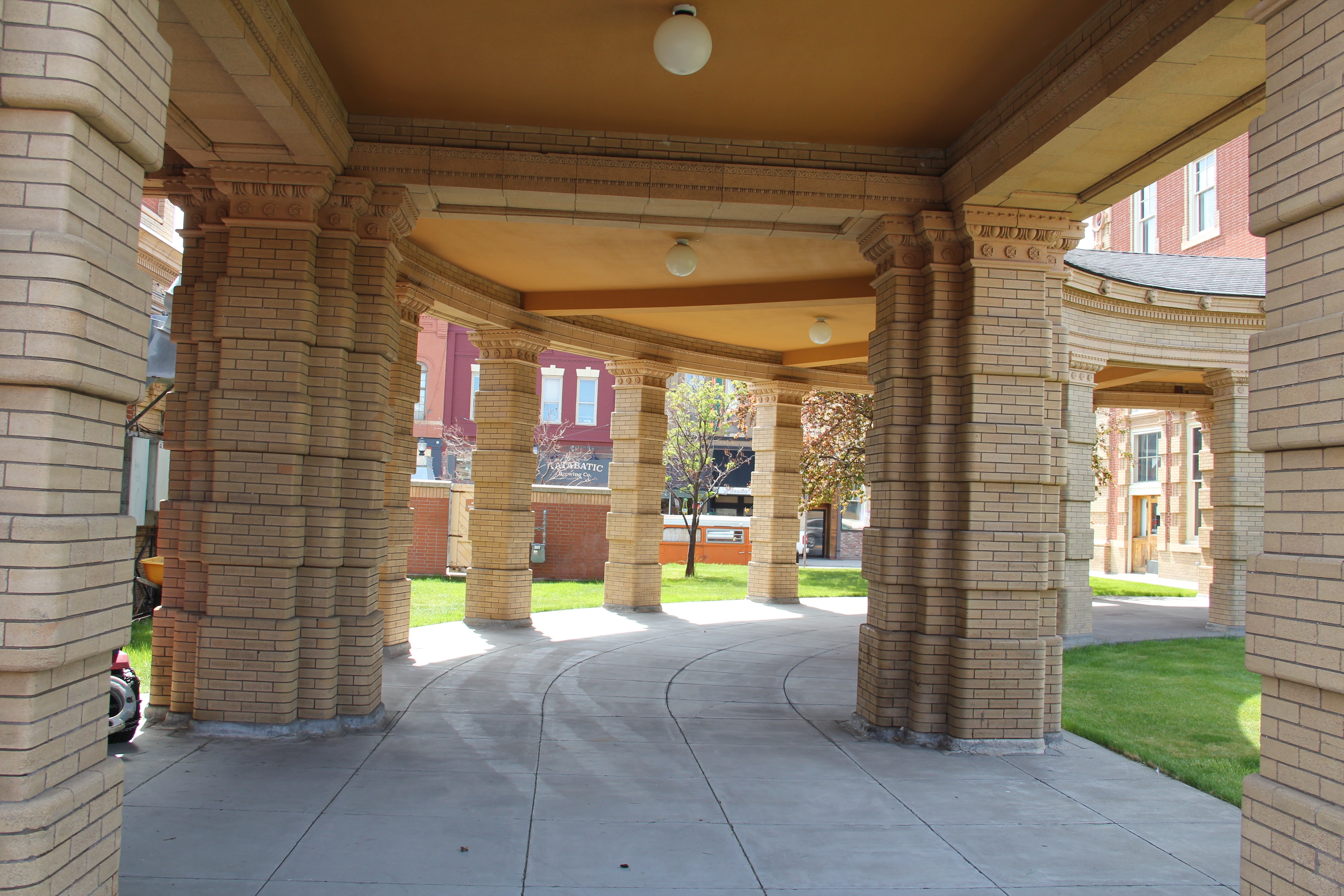 knew it back in the day, a place that rarely slept and always had good pie. The cafe changed its orientation from the railroad to the road as automobile travelers on U.S. 10 began to dominate the tourist market. Now it has been restored as a local brew pub.
The interior of the passenger station once held large public spaces for travelers and then more intimate spaces themed to either men or women.
Upstairs were spaces for offices, company lodging, and other company business. The station was the railroad’s urban outpost was what was then still the Montana frontier–its statement of taste and sophistication still reverberates today even as the depot no longer serves passengers (except for occasion excursion trains Amtrak doesn’t run here anymore) and serves as a railroad and Park County museum.
Thirty years ago, the overwhelming imprint of the Northern Pacific on the surrounding built environment was all I could see. At one corner was one of the first local historic preservation projects, an adaptive reuse effort to create the Livingston Bar and Grille (once popular with the valley’s Hollywood crowd).
 Directly facing the center of the passenger station was the mammoth Murray Hotel–a flea bag operation in the 1980s but now recently restored as a hipster place to be, especially its signature bar.
My throwback place back in the 1980s, however, was Gil’s. It was next to the Murray and the place to get the cheesy souvenirs you equate with western travel in the second half of the 20th century.
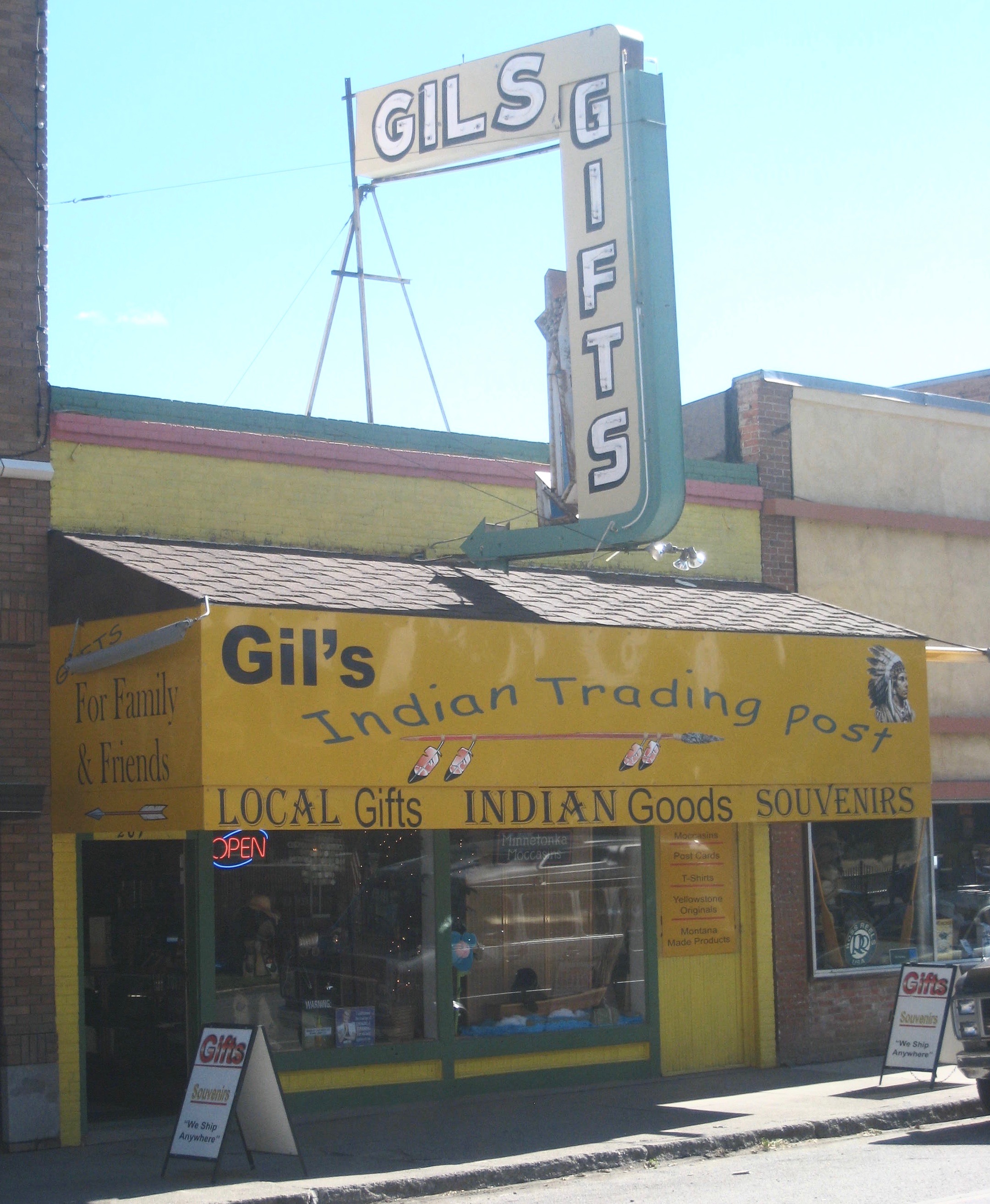 Imagine my pleasant surprise last year when I found that Gil’s still existed but now had been converted into a decidedly up-scale establishment, far removed from the 1980s.
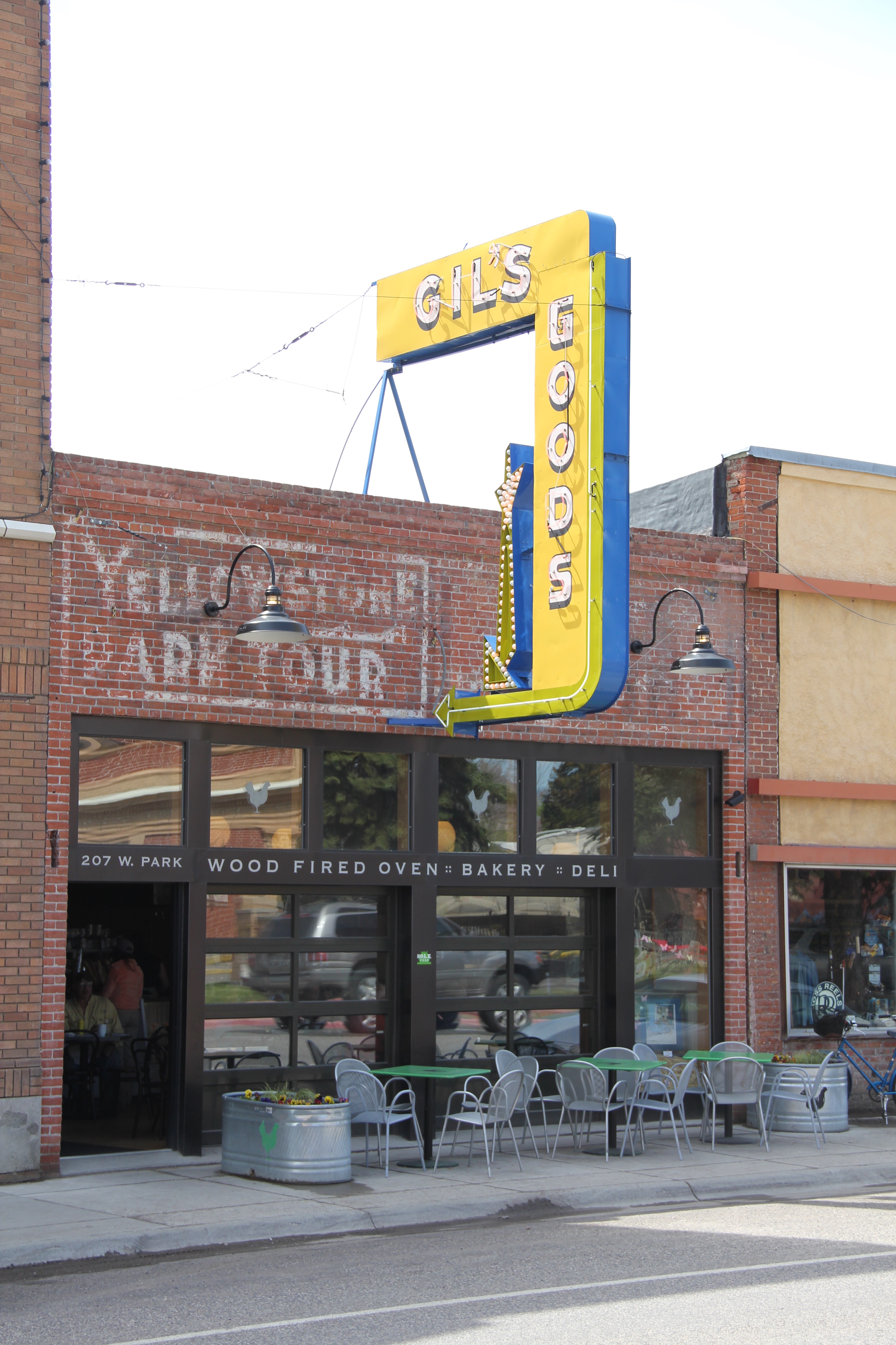 I don’t know if I have encountered a more fundamentally changed place–cheap trinkets gone, let the wood-fired pizzas come on.
 I was not so blinded in 1984 by the concept of the “metropolitan corridor” that I ignored the distinctive Victorian storefronts of Livingston–how could I since they all, in a way, fed into the tracks. But when I got to the end of that distinctive business district and watched the town, in my
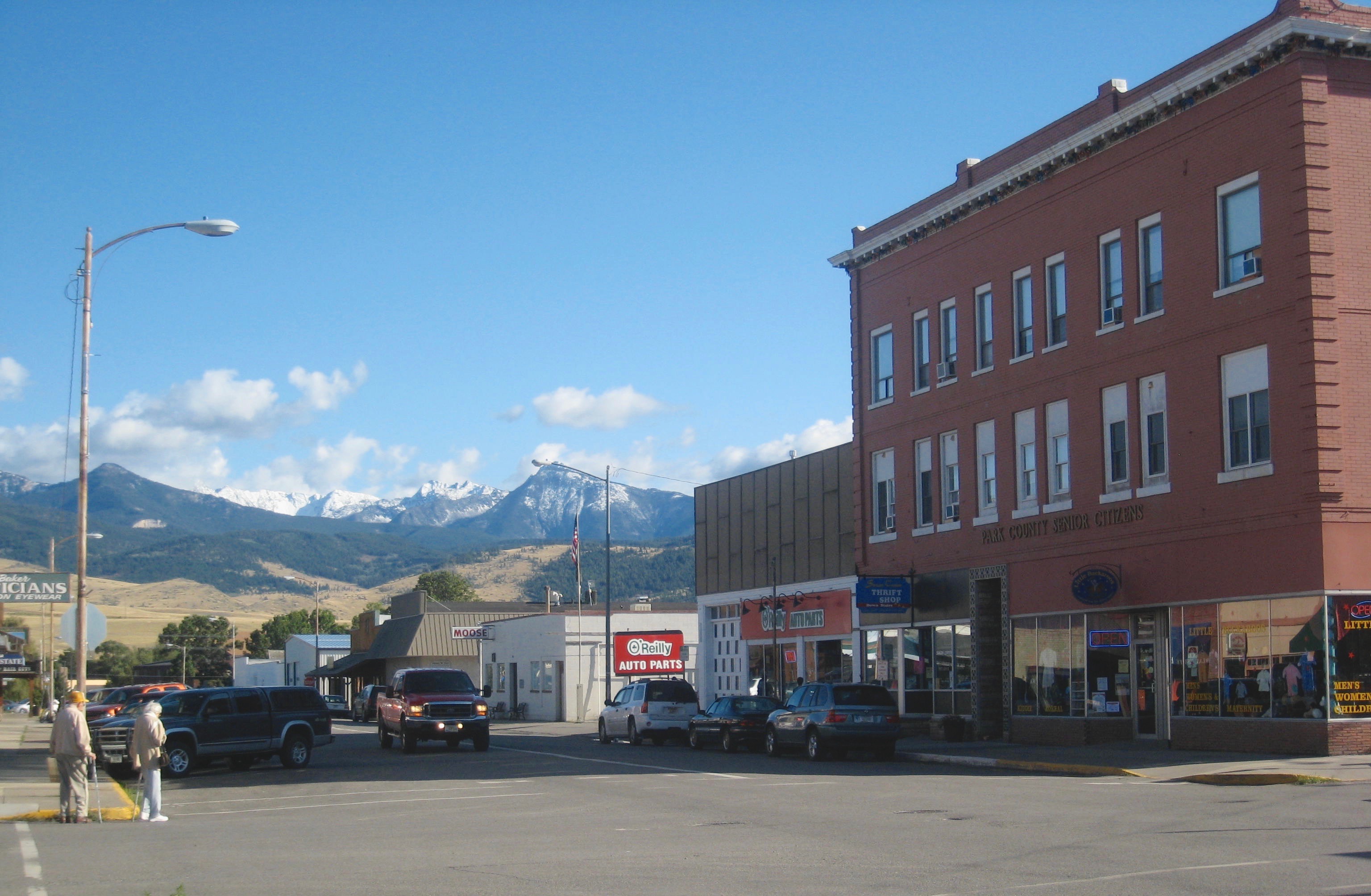 mind, fade into the Rockies, I had captured the obvious but had missed the bigger picture–that’s the next story.


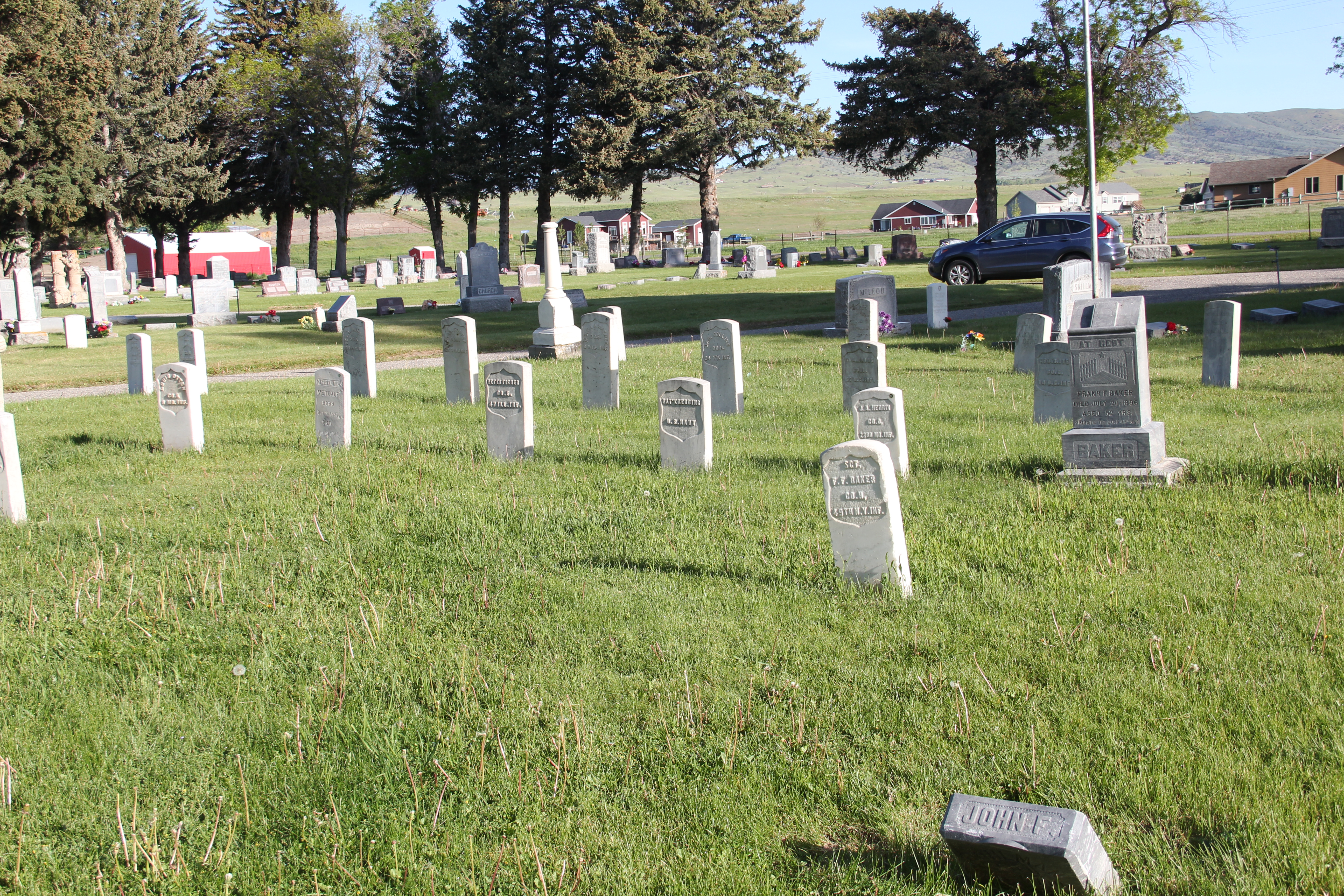
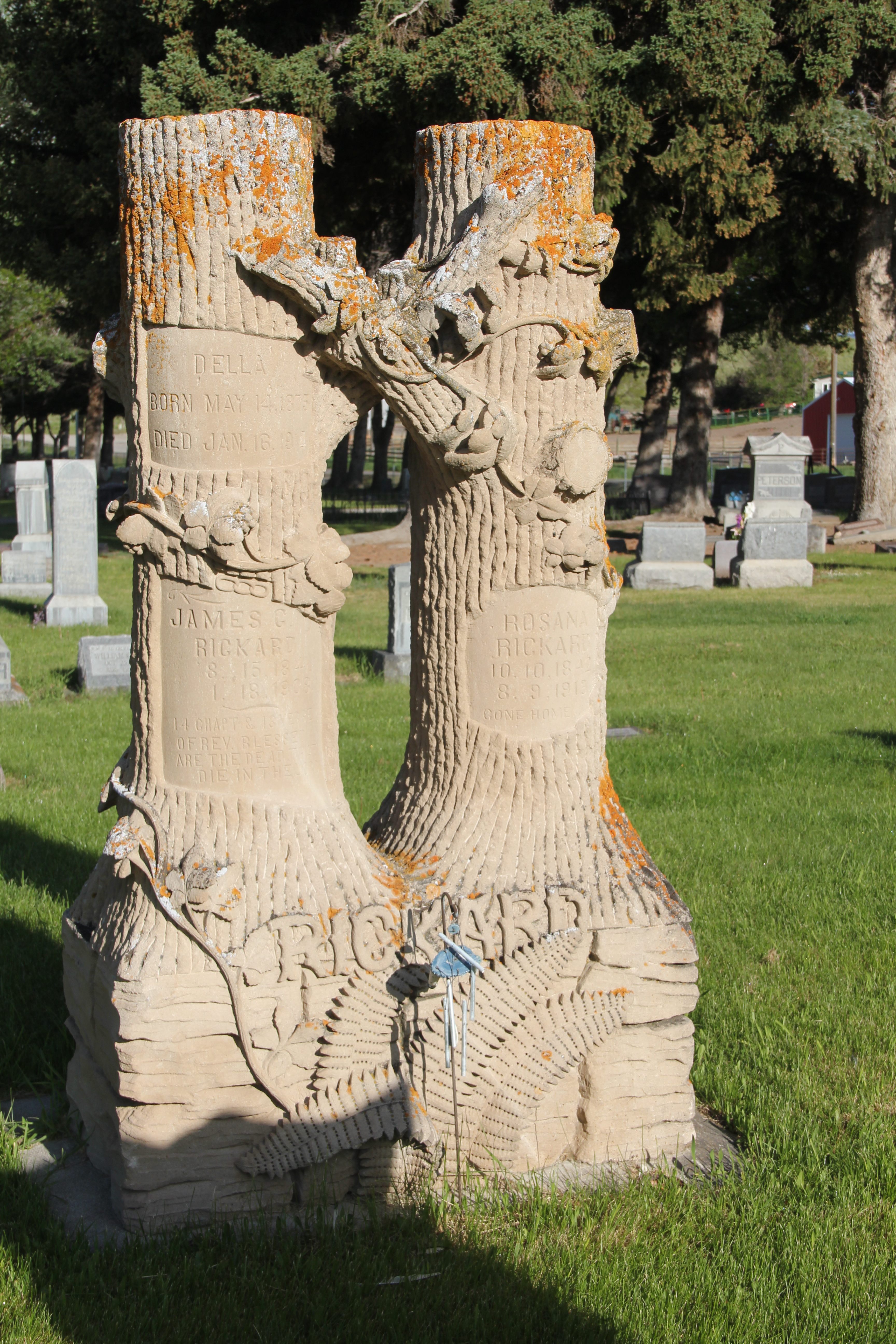
 On the northwestern outskirts of Livingston is Mountain View Cemetery, another of the historic properties that certainly existed when I carried out the 1984-1985 fieldwork for the Montana state historic preservation plan, but since it was a cemetery, we as a field gave it, or any cemetery for that matter, little consideration thirty years ago.


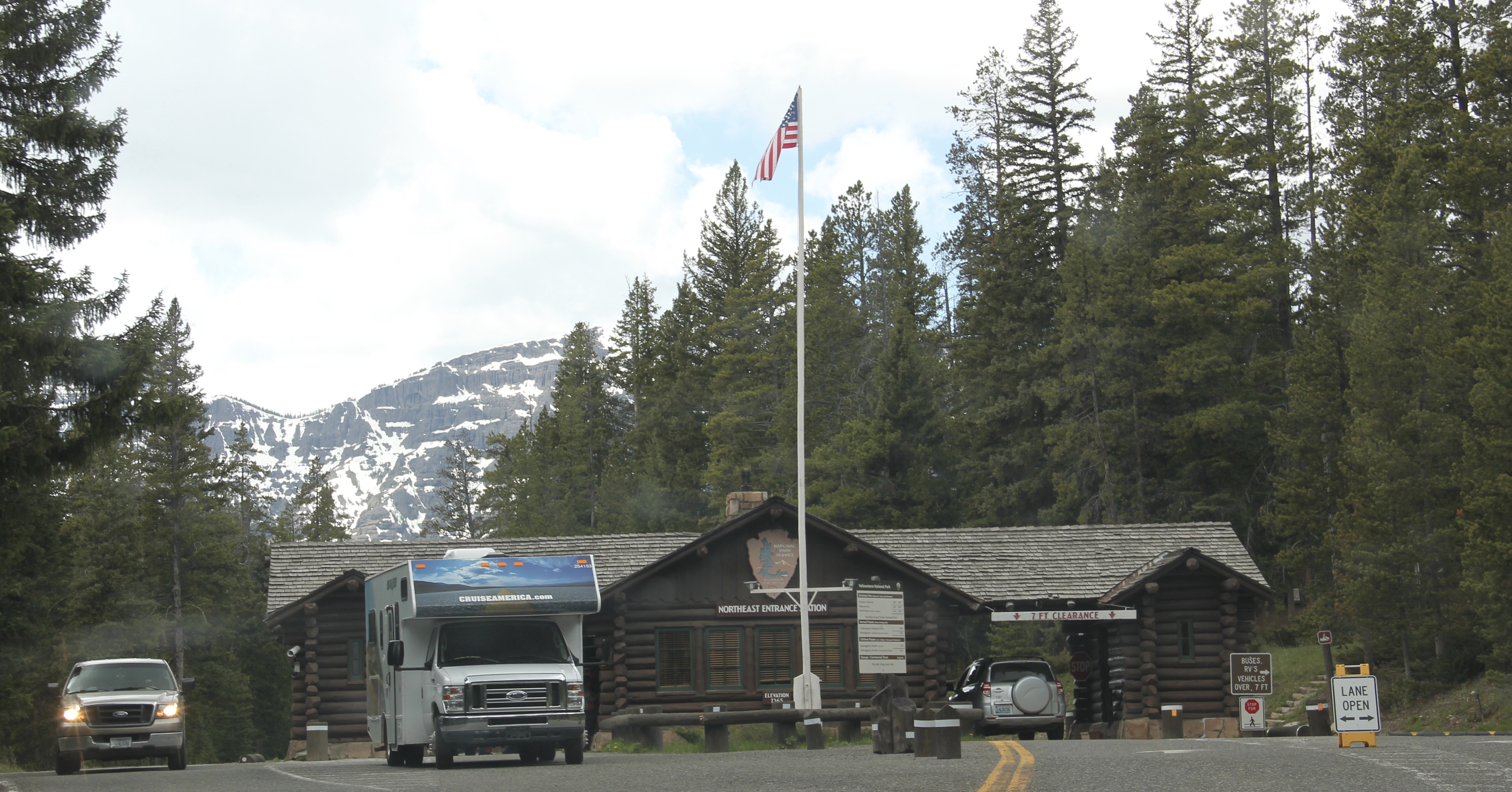
 The most popular Montana gateway into Yellowstone National Park is at Gardiner, in the southern tip of Park County. Here is where the Northern Pacific Railway stopped its trains, at a Rustic styled passenger station long ago demolished, and travelers passed through the gate above–designed by architect Robert Reamer–and started their journey into the park.
 By the mid-20th century, Gardiner had become a highway town, the place in-between the beautiful drive through the Paradise Valley on U.S. Highway 89 (now a local paved road)


 The plan to develop a new Gardiner library at the old Northern Pacific depot site at part of the Gardiner Gateway Project is particularly promising, giving the town a new community anchor but also reconnecting it to the railroad landscape it was once part of. Something indeed to look for when I next visit this Yellowstone Gateway.
 Montana’s gateways into Yellowstone National Park are known far and wide. The most popular are associated with the trains that delivered mostly easterners to the wonderland of the park–West Yellowstone for the Union Pacific line and Gardiner for the Northern Pacific Railway.
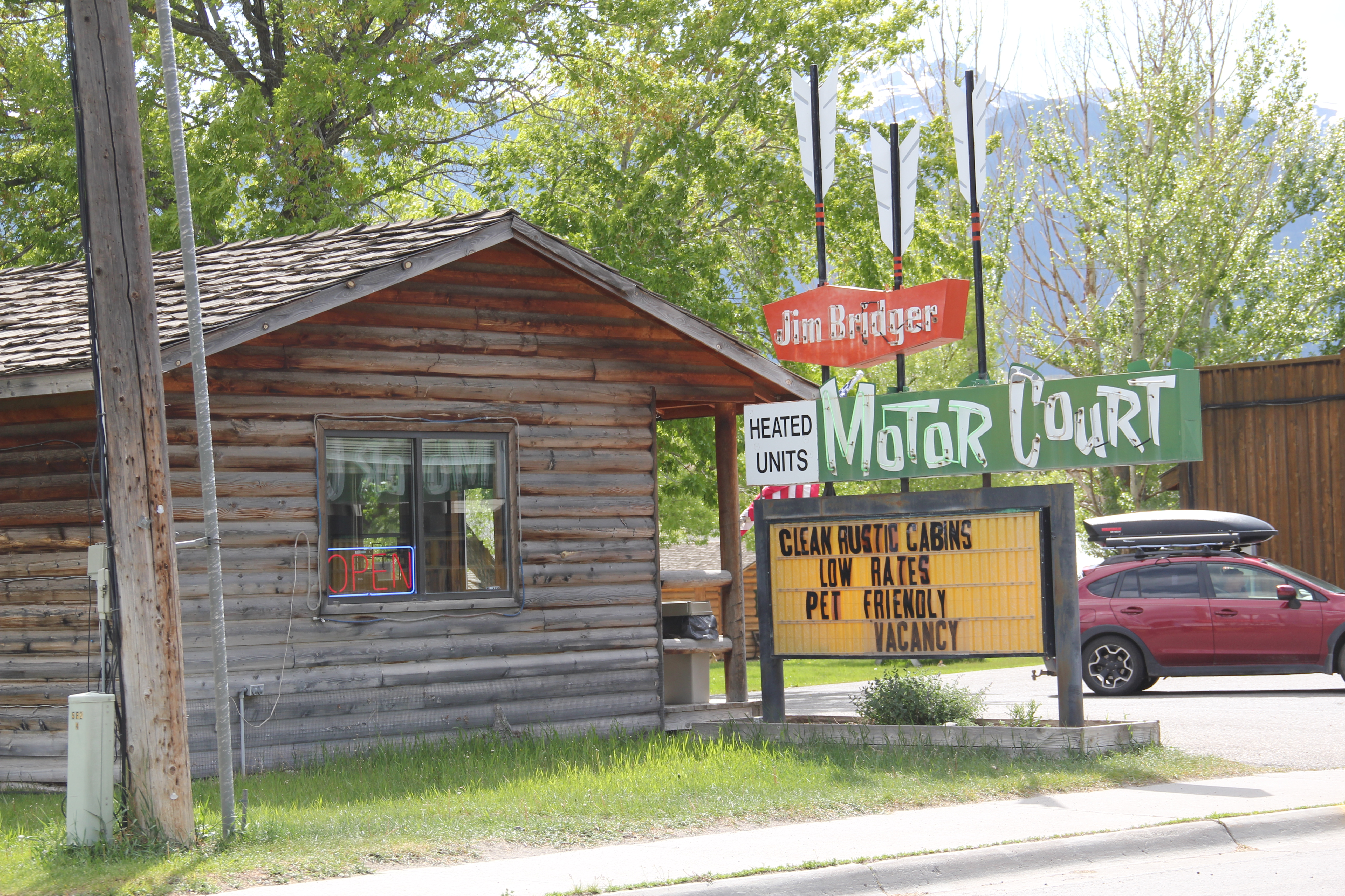
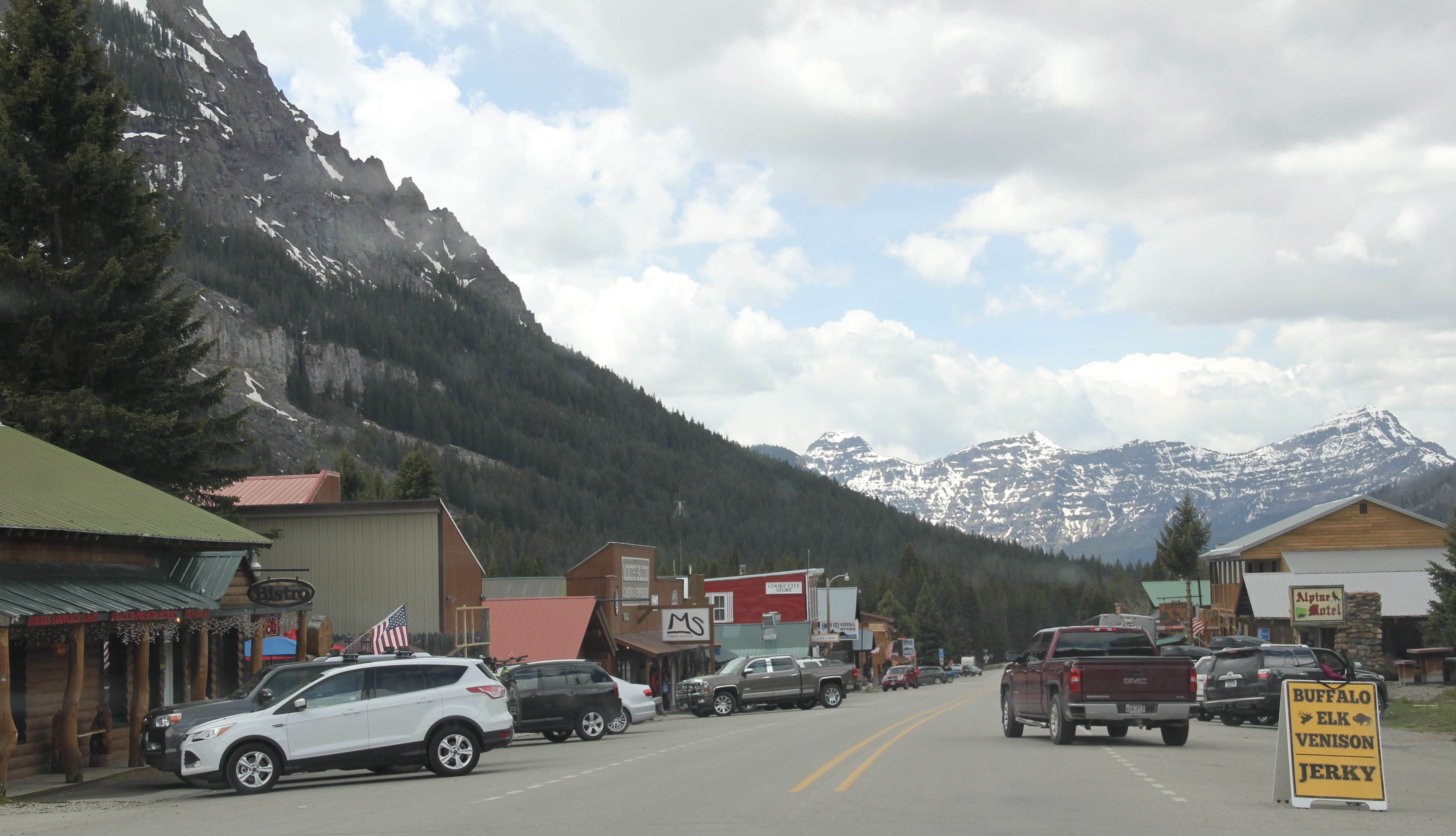 Cooke City, located in the corner of Park County, was never a railroad town but an overland connection that did not become popular until the development of the Beartooth Highway out of Red Lodge in the 1920s.
 It is all about the Beartooth Highway (U.S. 212) here–when it opens, Cooke City booms as a tourism oasis. When the highway closes for its long winter, business doesn’t end since the road to Mammoth Hot Springs far to the west is kept open as best as it can be, but the number of visitors drops remarkably. Snow mobile traffic in the winter has meant a lot to local business in the last 30 years.

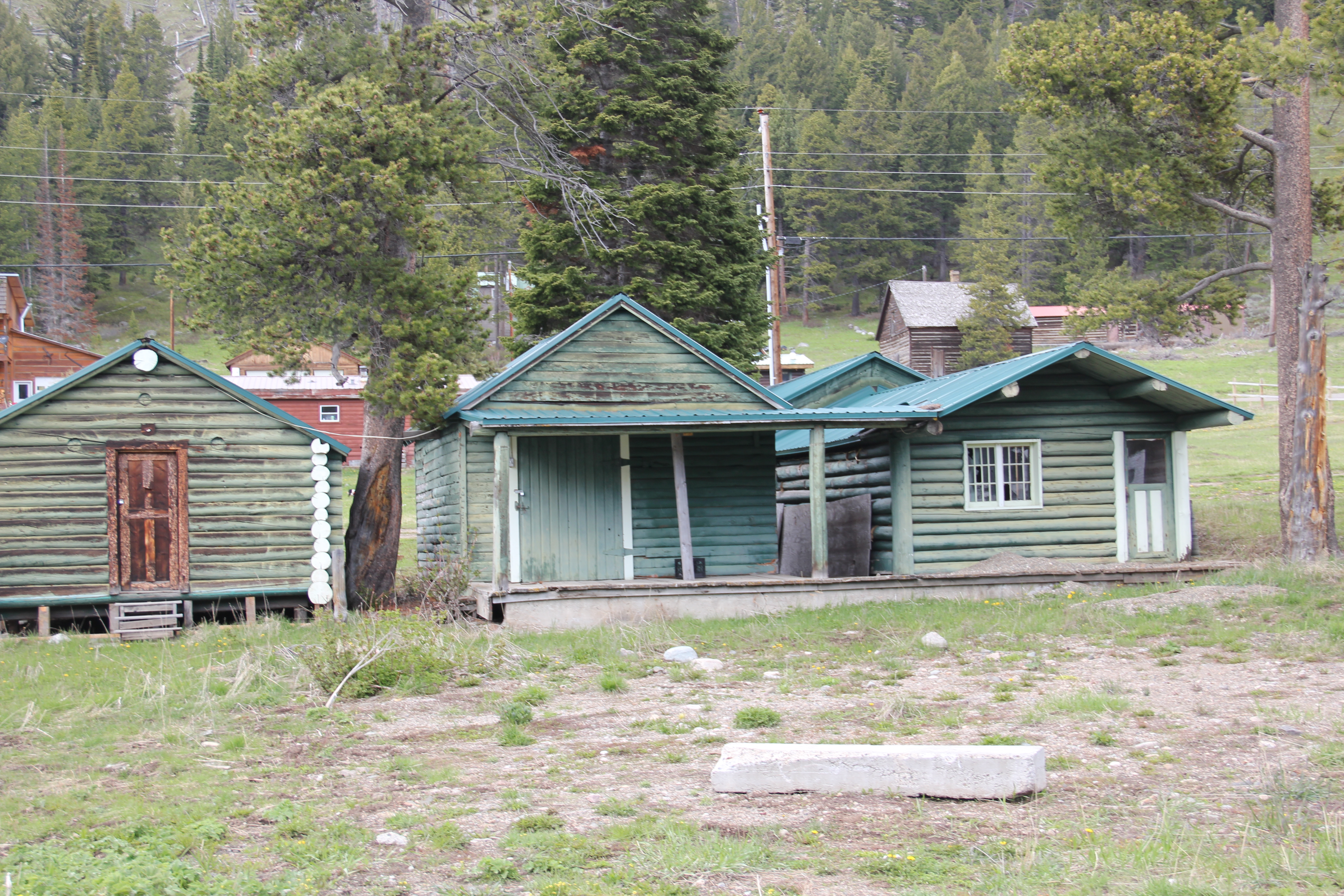 Cooke City uses its mining past to define its identity today, from moving log mining shacks and cabins into town, as shown above, for potential new lures for tourism, to the recently established visitor center and museum, which includes some of the local mining


 Perhaps the best example is the rustic yet modern styling of the Mt Republic Chapel of Peace between Silver Gate and Cooke City on U.S. 212. It is no match for the soaring mountains that surround it but its quiet dignity reflects well the people and environment of this part of Montana.

 The same can be said for Hoosier’s Bar–a favorite haunt here in Cooke City for several decades, easy to find with its neon sign, and then there is the throwback telephone booth–a good idea since many cell phones search for coverage in this area. Cooke City and Silver Gate are the smallest Montana gateways into Yellowstone National Park but they tell and preserve their story well.


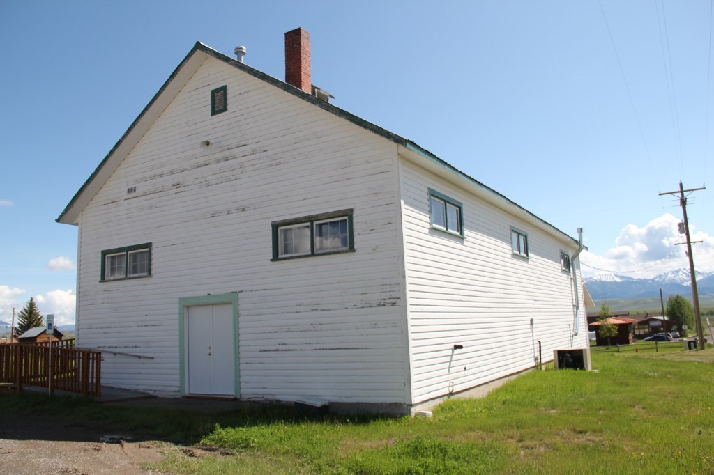
 Livingston’s town plan from 1882 was all about the railroad, with the adjacent Yellowstone River an afterthought, at best an impediment since it defined the south end of town. So far from the tracks to be of little worth to anyone, few paid it any attention. 100 years later when I am considering the town for the state historic preservation, I too was all about the railroad and the metropolitan corridor of which it was part. I paid no attention to the river. The town’s schools were on this end, but they were “modern” so did not capture my attention.
 Consequently I missed a bit part of the town’s story, the effort to reform the landscape and create public space during the New Deal era. The Works Progress Administration (WPA) transformed this part of town from 1935 to 1938 expanding an earlier public park into today’s Sacajawea Park.


 The major addition, however, was the large combination Civic Center and National Guard Armory, an Art Deco-styled building that cost an estimated $100,000 in 1938. It too survives and is in active use by the community.
 Tourists now come to this area more often than in the past due to additions made during the Lewis and Clark Bicentennial in the early 21st century. The park is part of the Lewis and Clark National Historic Trail.


 Livingston was one of the Northern Pacific Railroad’s most important division points. Not only did the massive and architecturally ornate passenger station, discussed in the previous blog, serve as a gateway to Yellowstone National Park, it contained various company offices, serving as a nerve center for the thousands of miles of railroad line. If you do the typical tourist thing in Livingston, you pay attention to the depot and the many late 19th and early 20th century buildings south of the tracks.
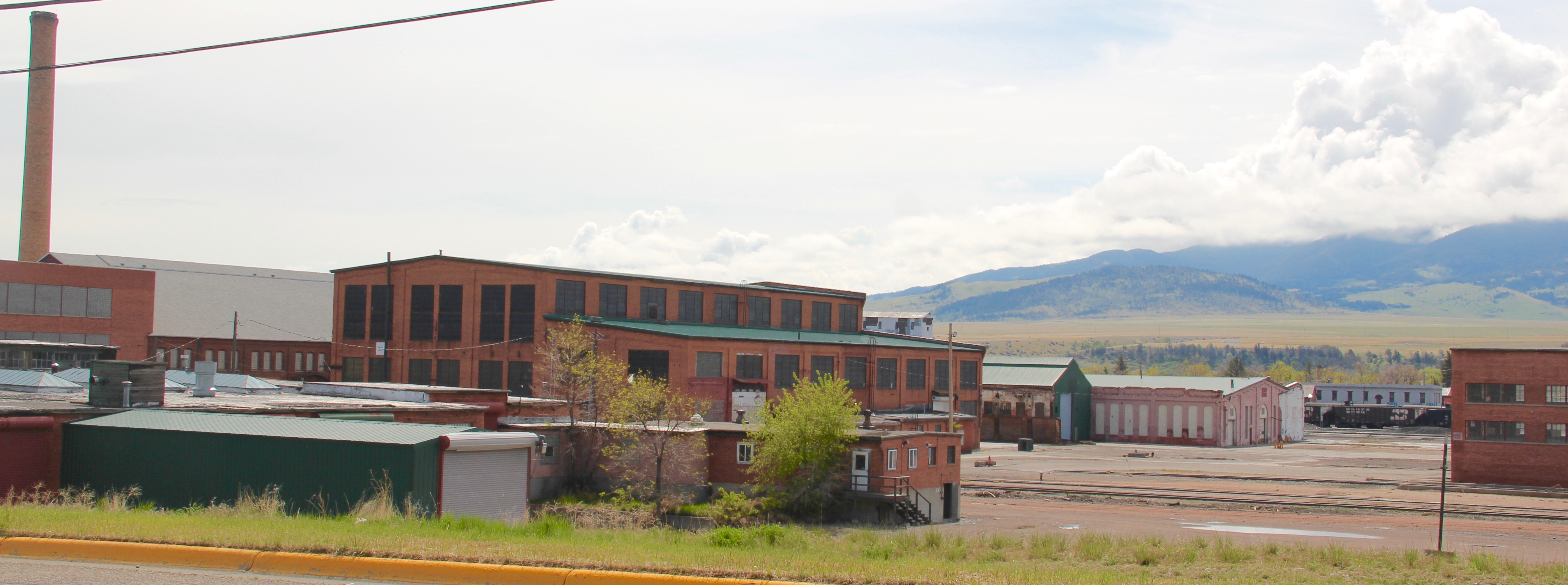 But to find where the real work of the railroad took place, you have to locate the underpass that takes you to the north side of the tracks, and the extensive Northern Pacific railroad shops. This area is not as busy as it once was, but enough buildings remain and enough activity takes place 24-7 that you quickly grasp that here is the heartbeat of the line. In the photo above, one early shop building, the lighter color brick building to the right center, still stands. Most others date to the line’s diesel conversion in the mid-20th century.
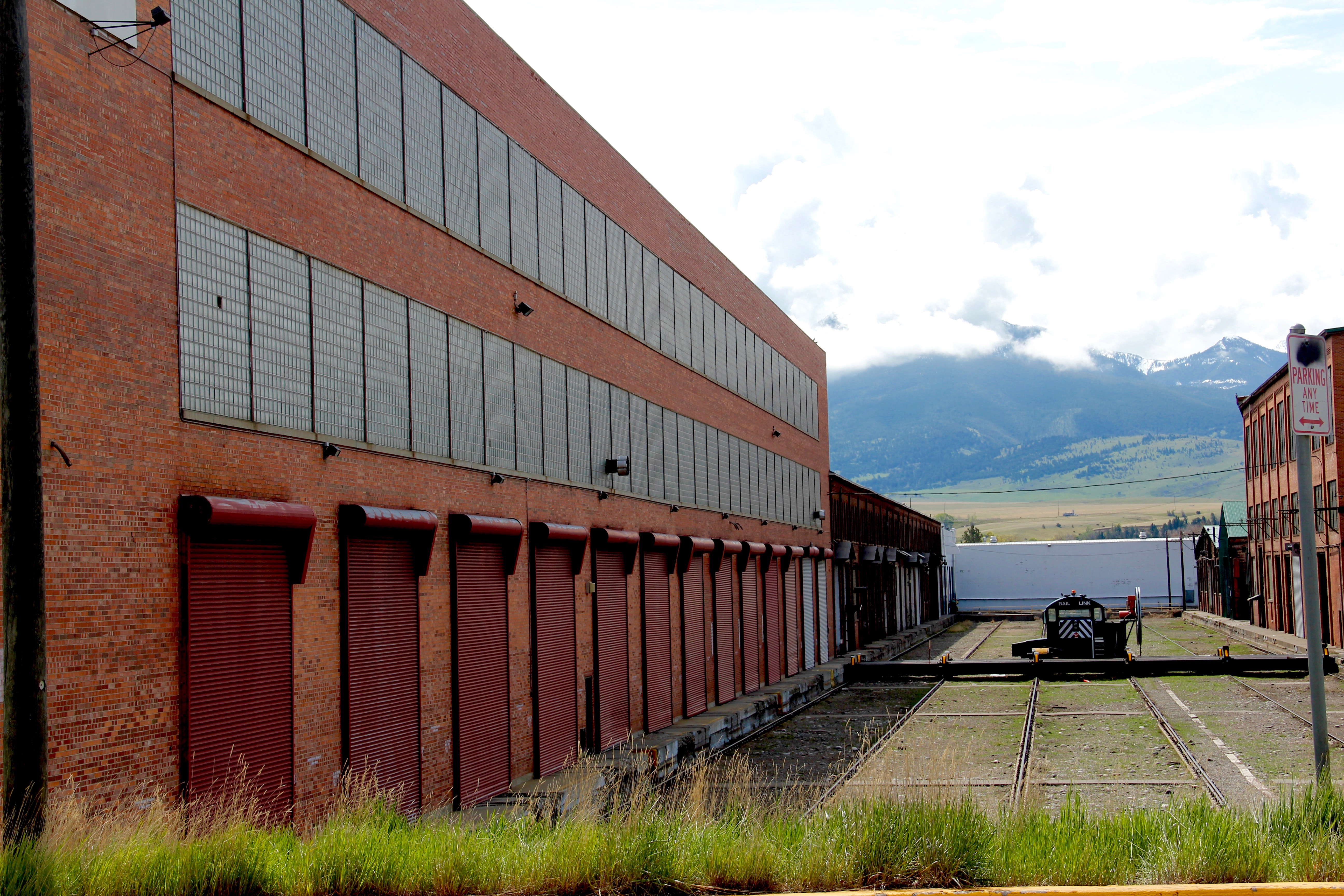 With the mountains to the south, and the outlines of the town visible as well, the shops are impressive statements of corporate power and determination, and how railroads gave an industrial cast to the landscape.
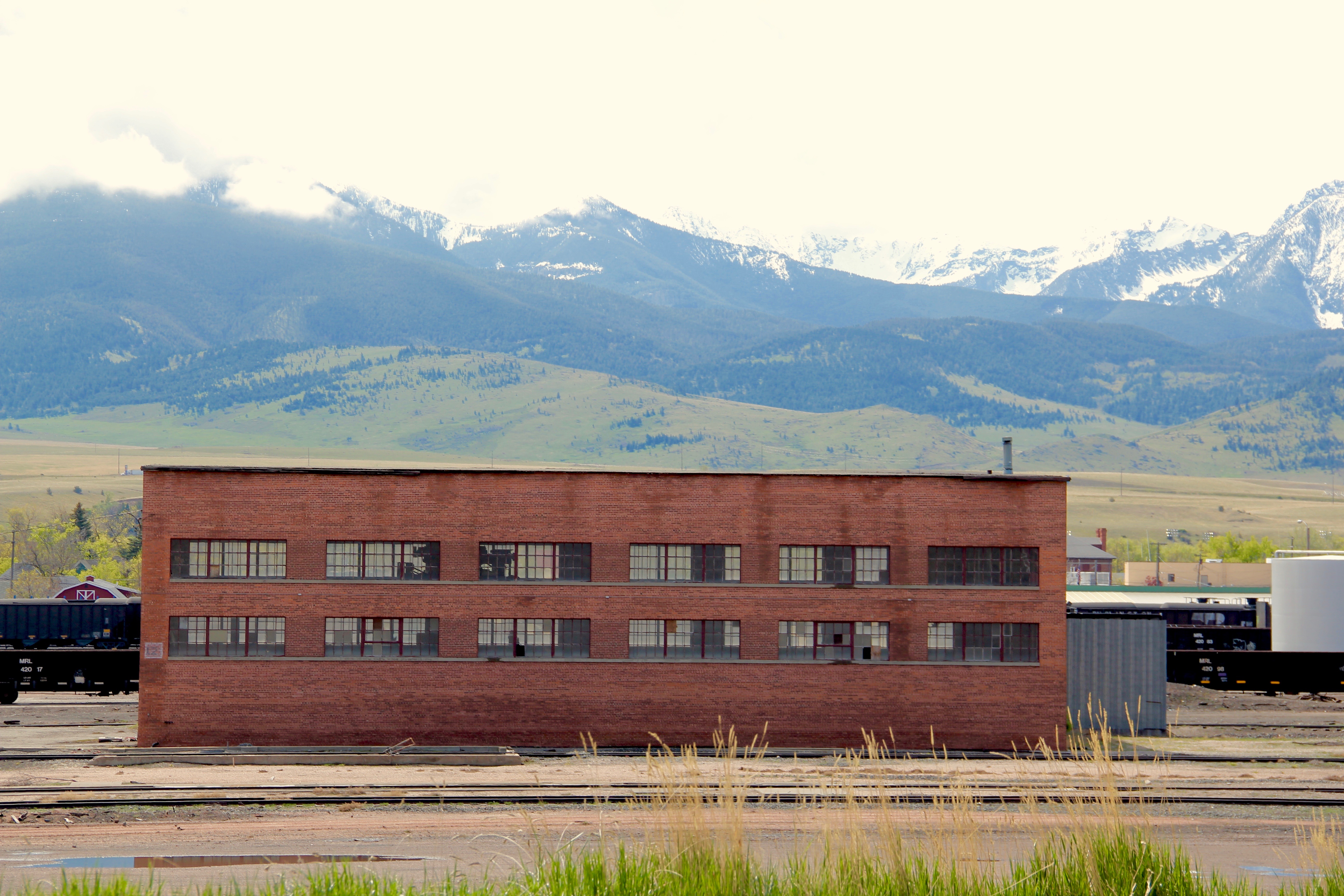 The north side, in many ways, was a separate world. Here the homes may date to the Victorian era too, but they are not the stylish period interpretations found in numbers on the south side. Rather they are vernacular styled cottages, or unadorned homes typical of America’s turn-of-the-century working class.

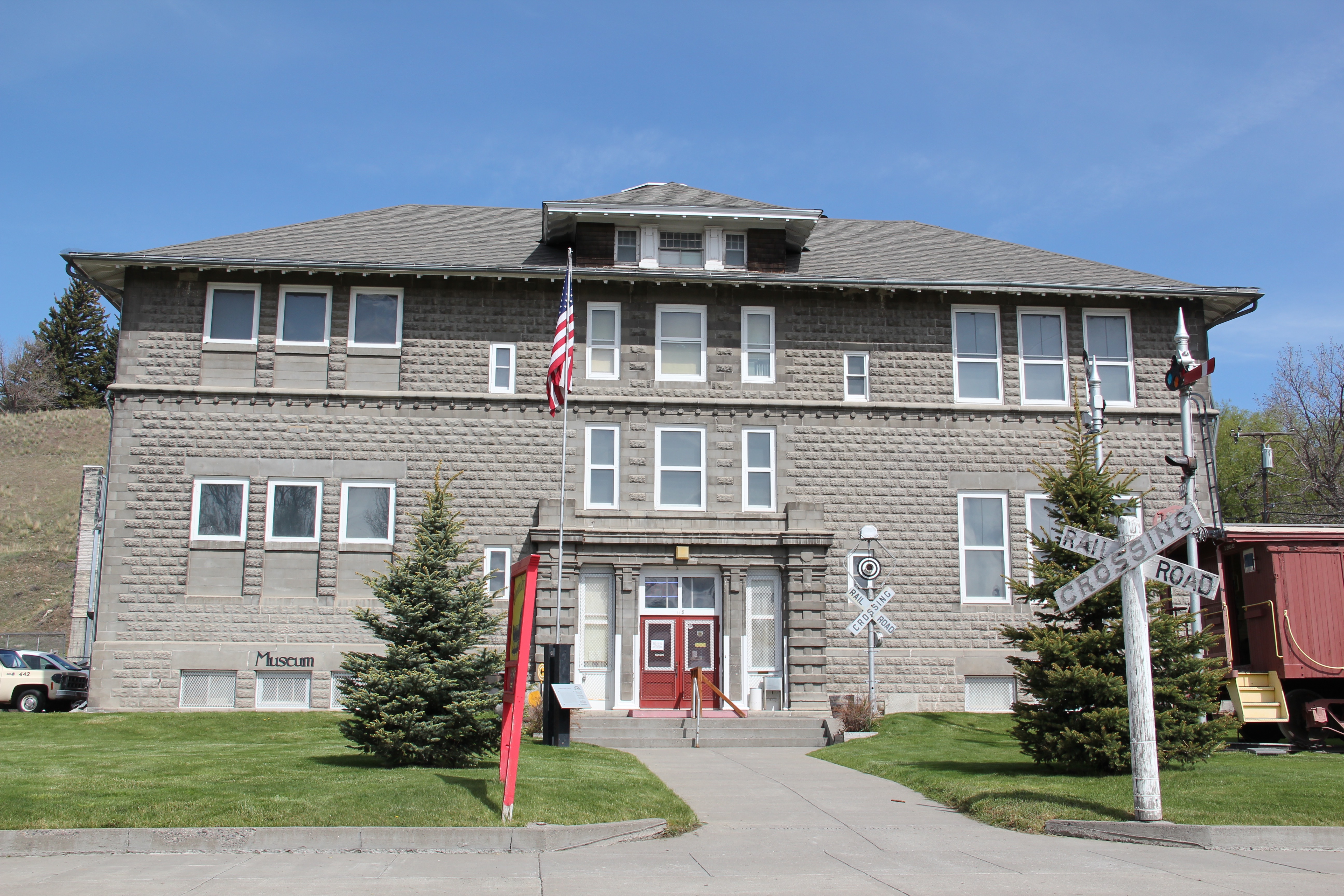 The school was converted into a community museum some 30 years ago, and if you visit the grand passenger station, you also need to stop at the school, to get a fuller picture of Livingston, the railroad town.

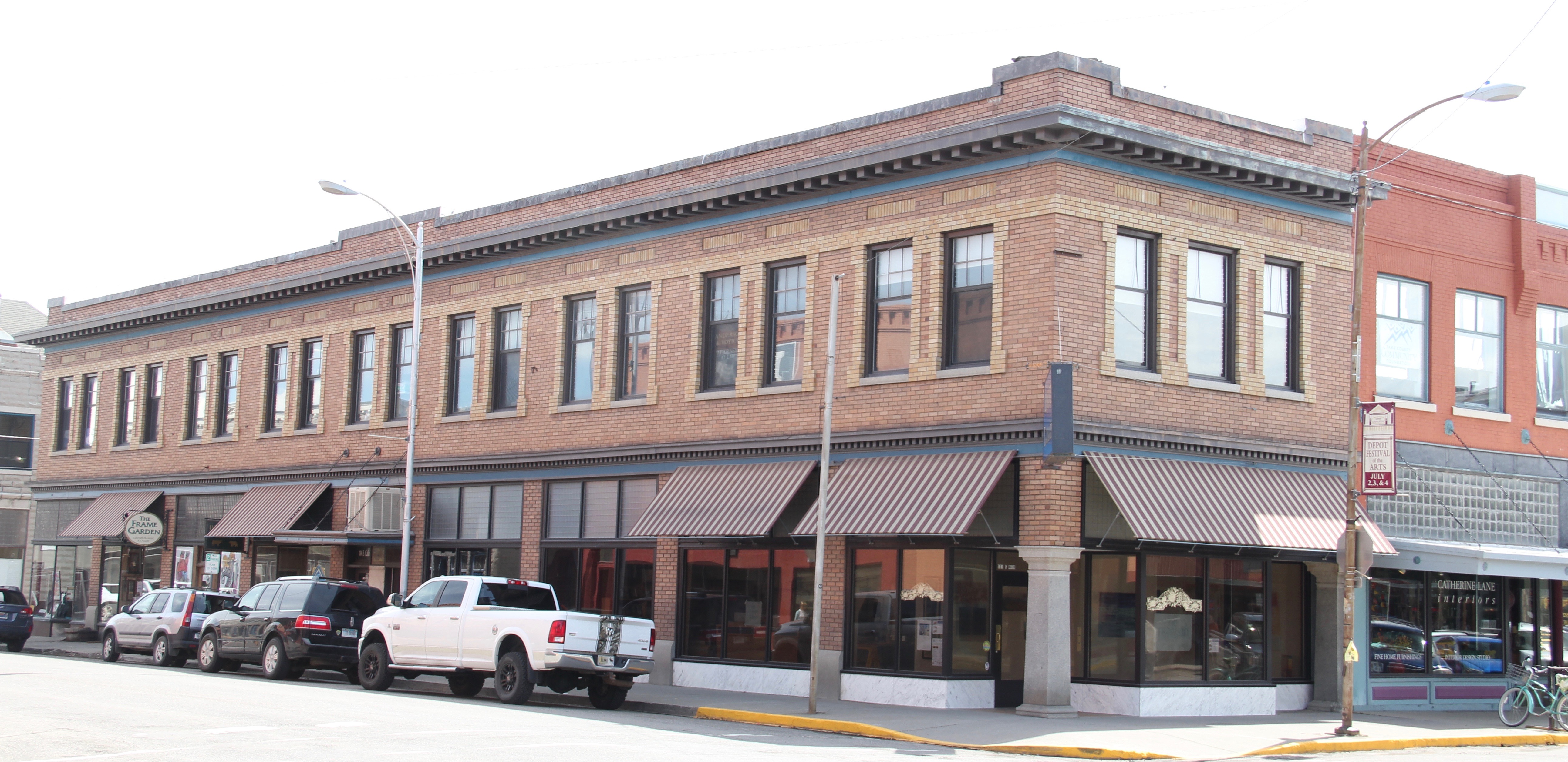 The above block of commercial businesses was once better known as the Montana Hotel while the block below, called the Hiatt Hotel in more recent years, was the Park Hotel, opened in 1904 to take advantage of increased tourist business due to the new Northern Pacific depot. Noted Montana architect C.S. Haire was the designer.
 These buildings served tourists in the summer months but throughout the years they relied on the “drummer” trade. Drummers were a word used to describe traveling businessmen, who rode the rails constantly, stopping at towns large and small, to drum up business for their companies. They too, like the machine shop workers on the south side, were a constant presence on the railroad lines of 100 years ago, and helped to make the lines hum with their travel and their stories.


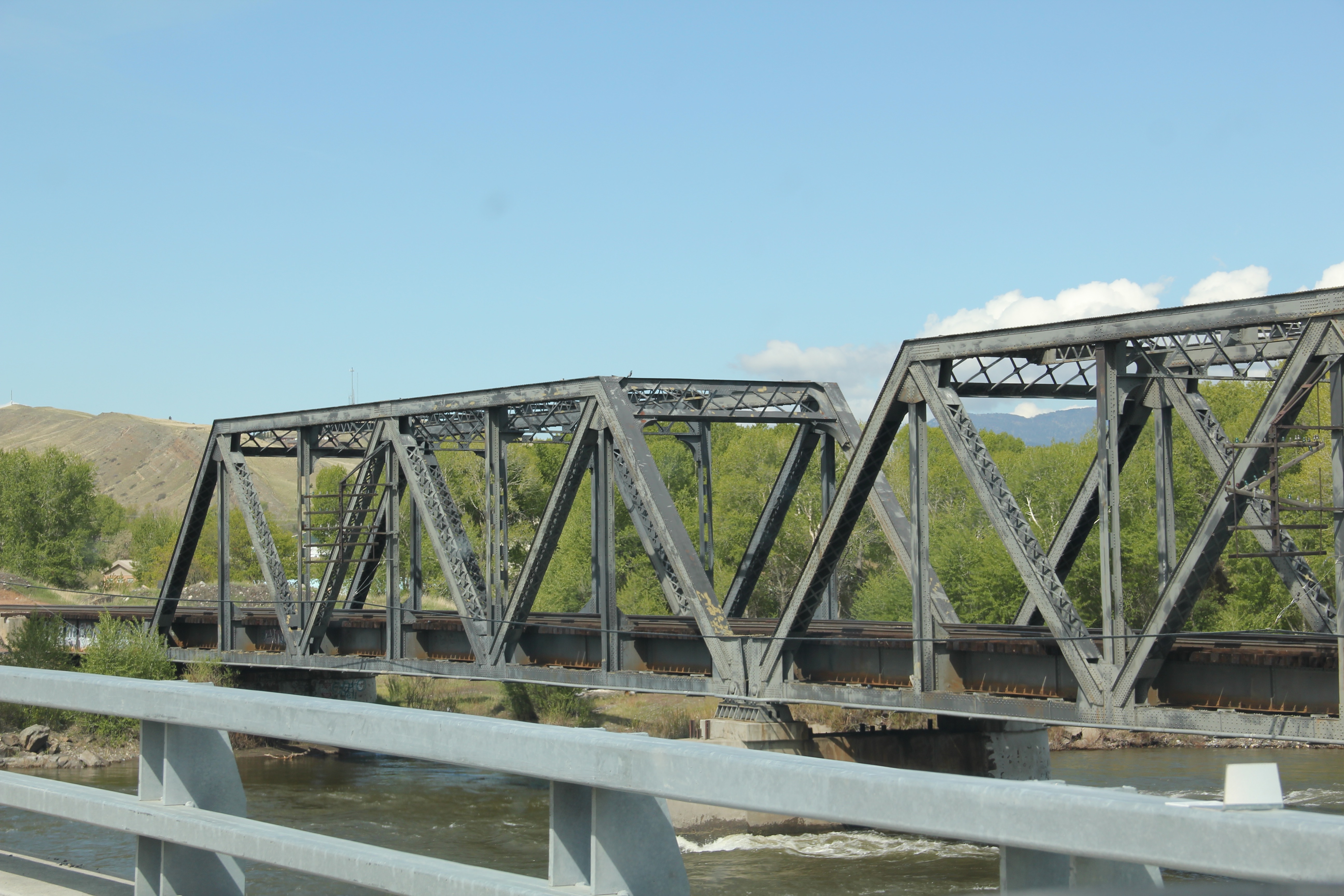
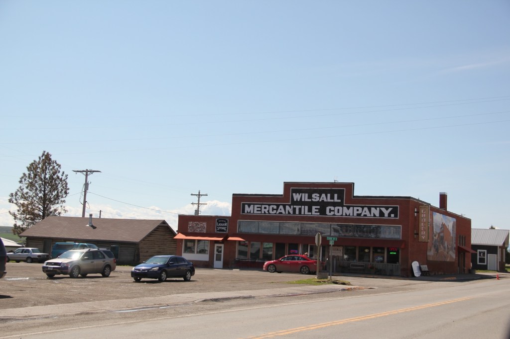
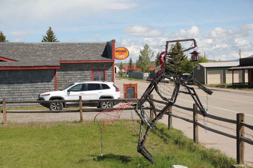
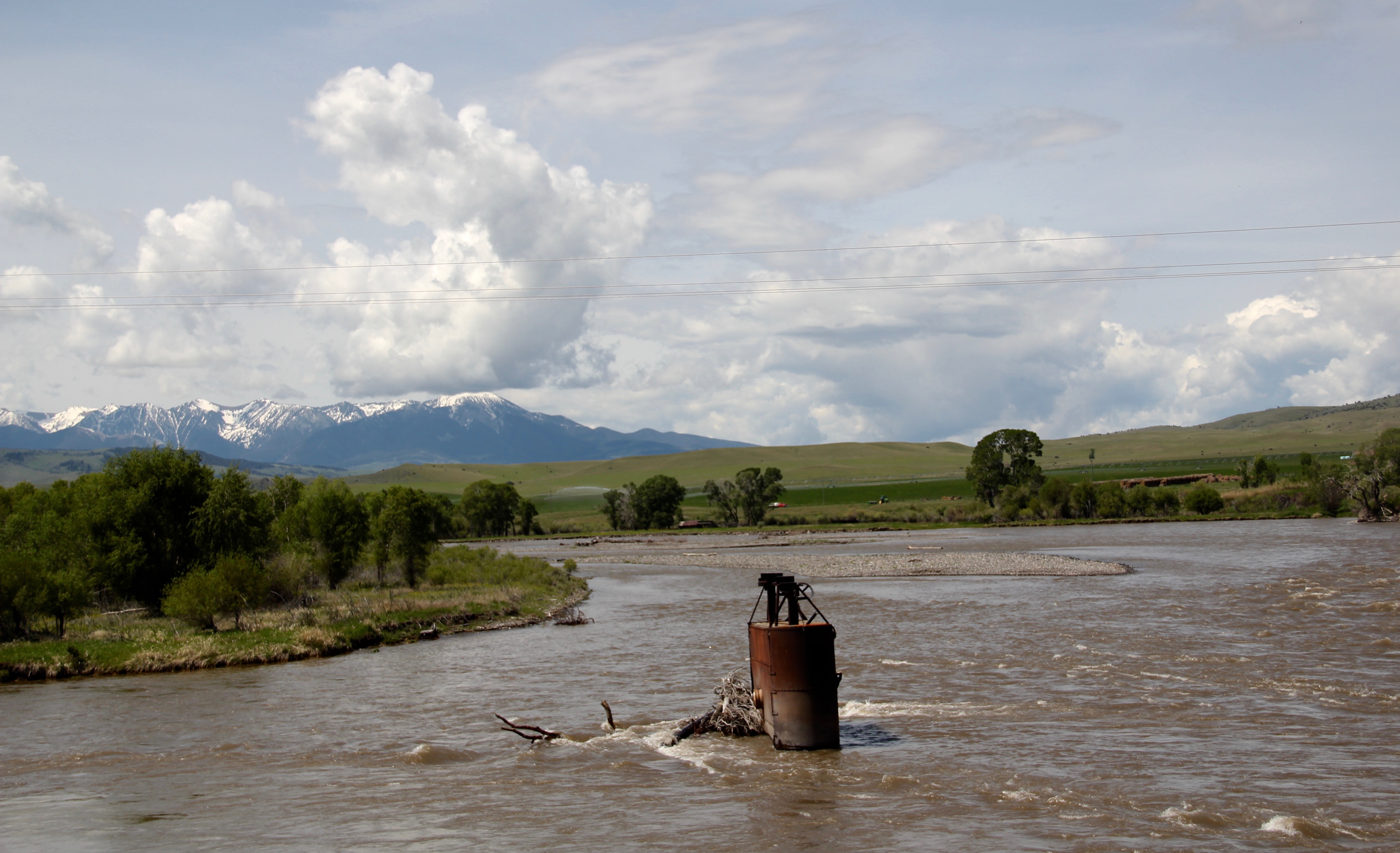
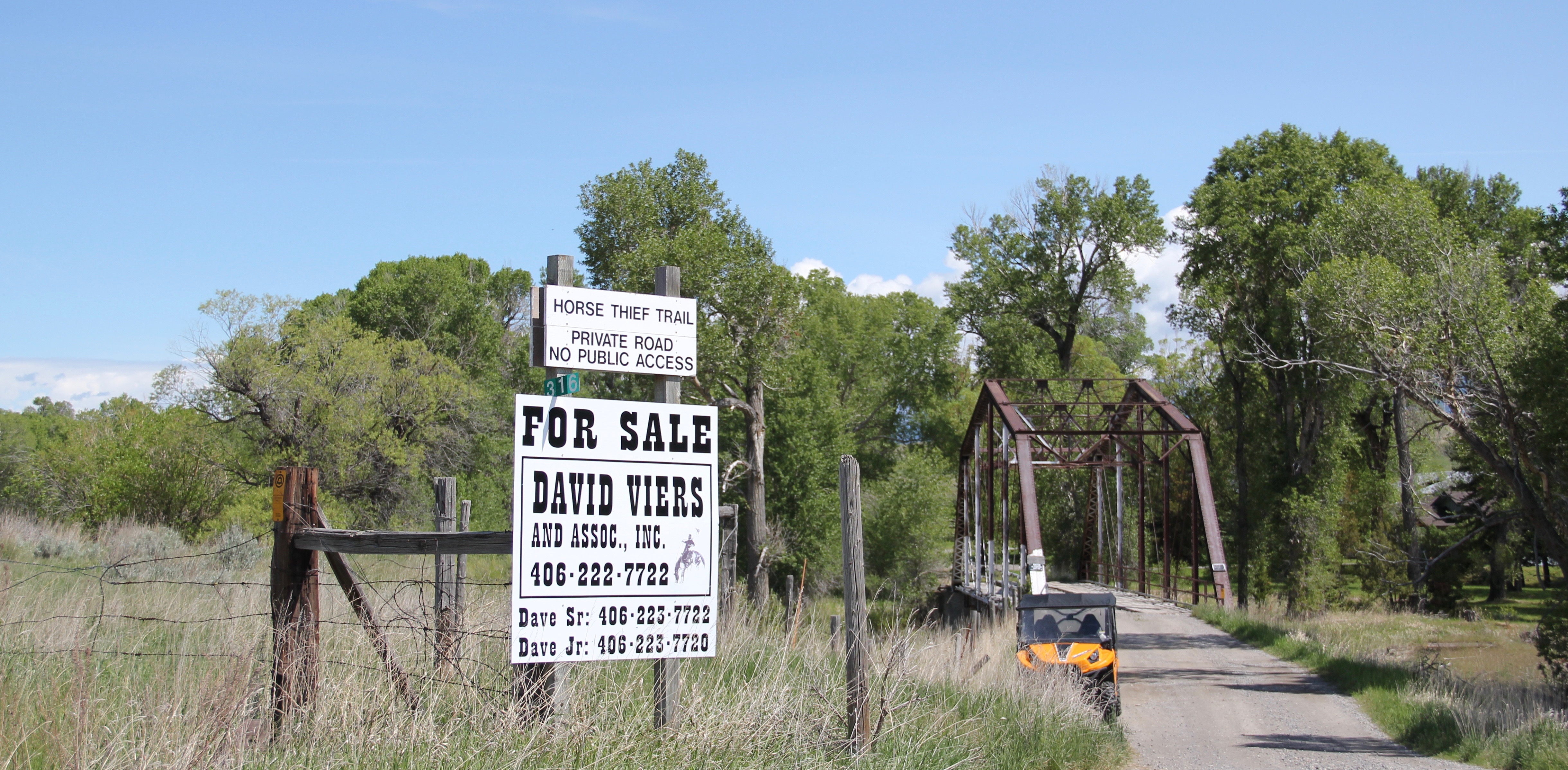 Traveling south of Clyde Park on U.S. 89, you pass by the turn-off for Horse Thief Trail, where a historic steel bridge still allows for one-lane traffic over the Shields River; this bridge and snippet of road is part of the original route of U.S 89. That means you are nearing the confluence of the Yellowstone and Shields rivers, and where U.S. Highway 89 crosses the Yellowstone River and takes you into the heart of Park County. Paralleling the modern concrete bridge is a c. 1897 steel Pratt through truss bridge, to serve the Northern Pacific Railroad spur that runs north to Clyde Park then Wilsall. The Northern Pacific called this the Third Crossing of the Yellowstone bridge; the Phoenix Bridge Company constructed it.
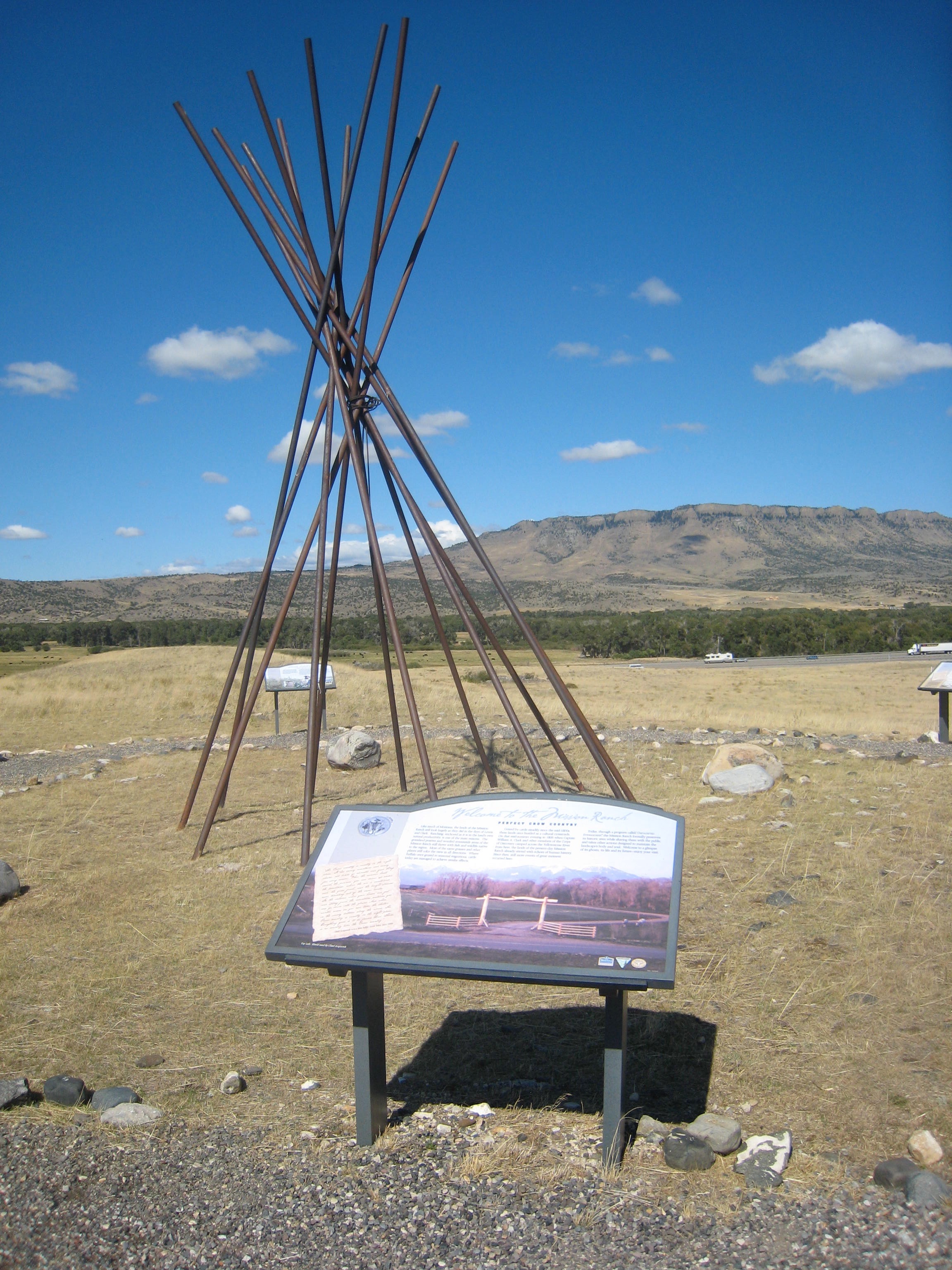
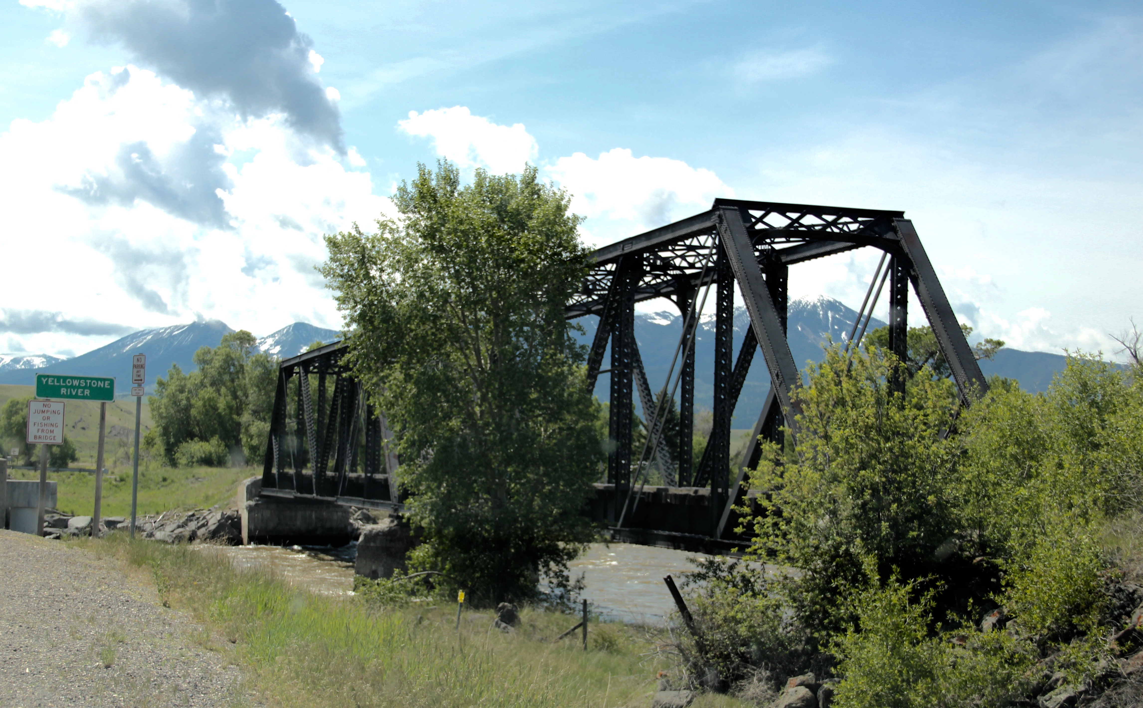 Before jogging slightly to the west to head to Livingston, the county seat, two places east of the Shields River confluence are worth a look. First is the site of Fort Parker, established as the first Crow Agency in 1869 or the first federal facility in the valley. It operated from this location until 1875.
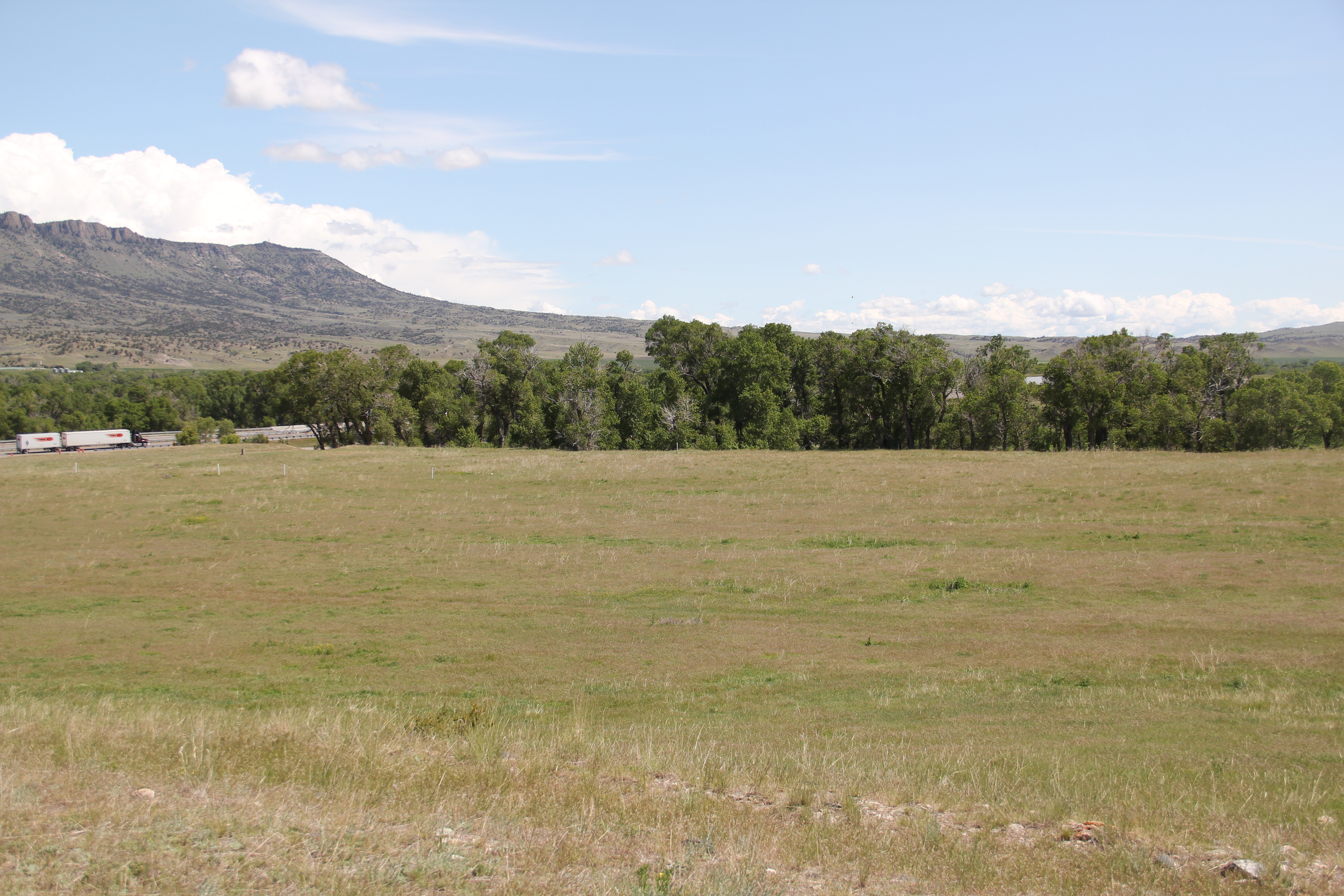
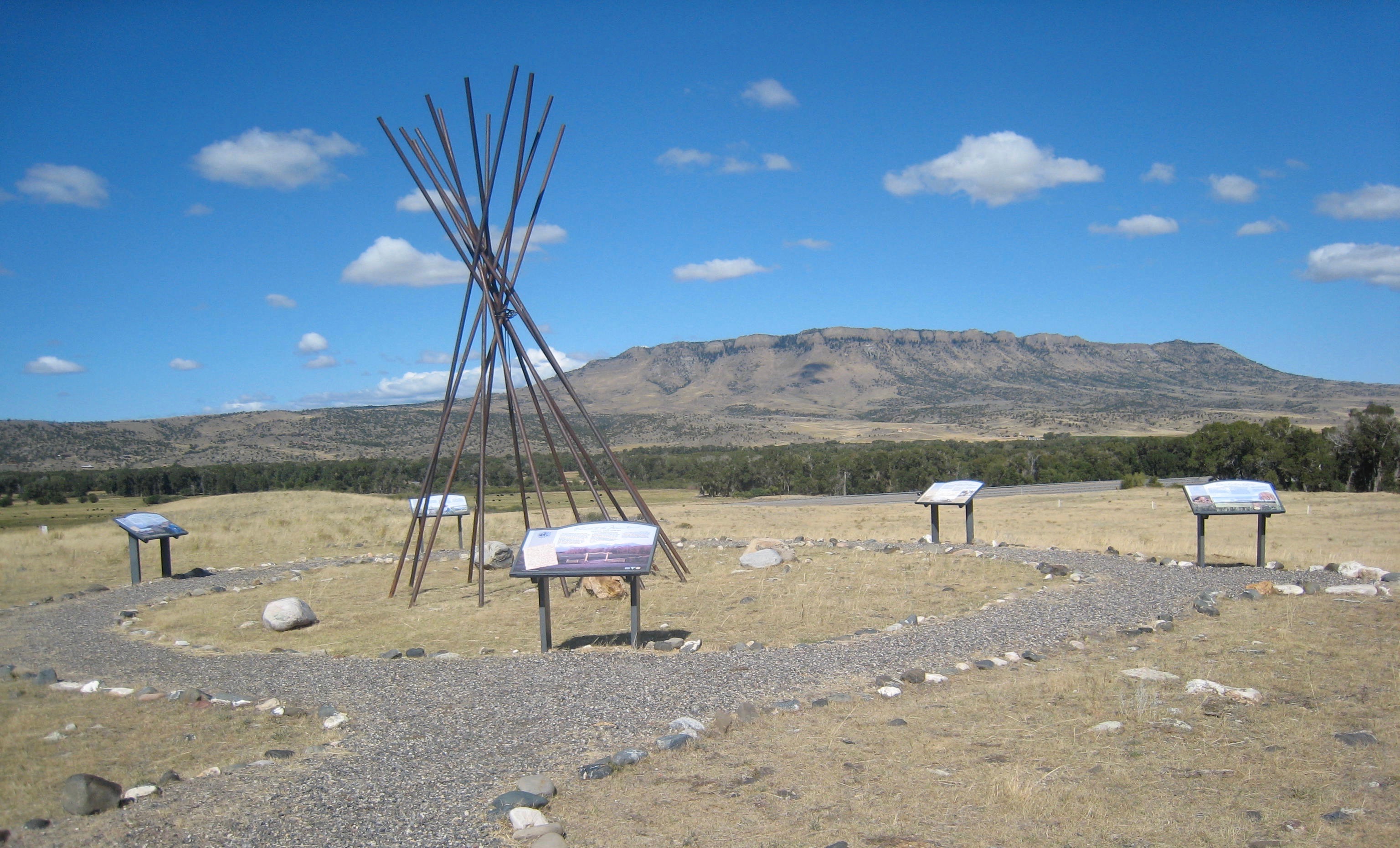 Gladly all of that changed in the 21st century. As a result of another innovative state partnership with land owners, there is an interpretive center for the Fort Parker story, easily accessible from the interstate, which also does not intrude into the potentially rich archaeological remains of the fort. The story told by the historical markers is accurate and comprehensive, from the agency’s beginnings to the land today.
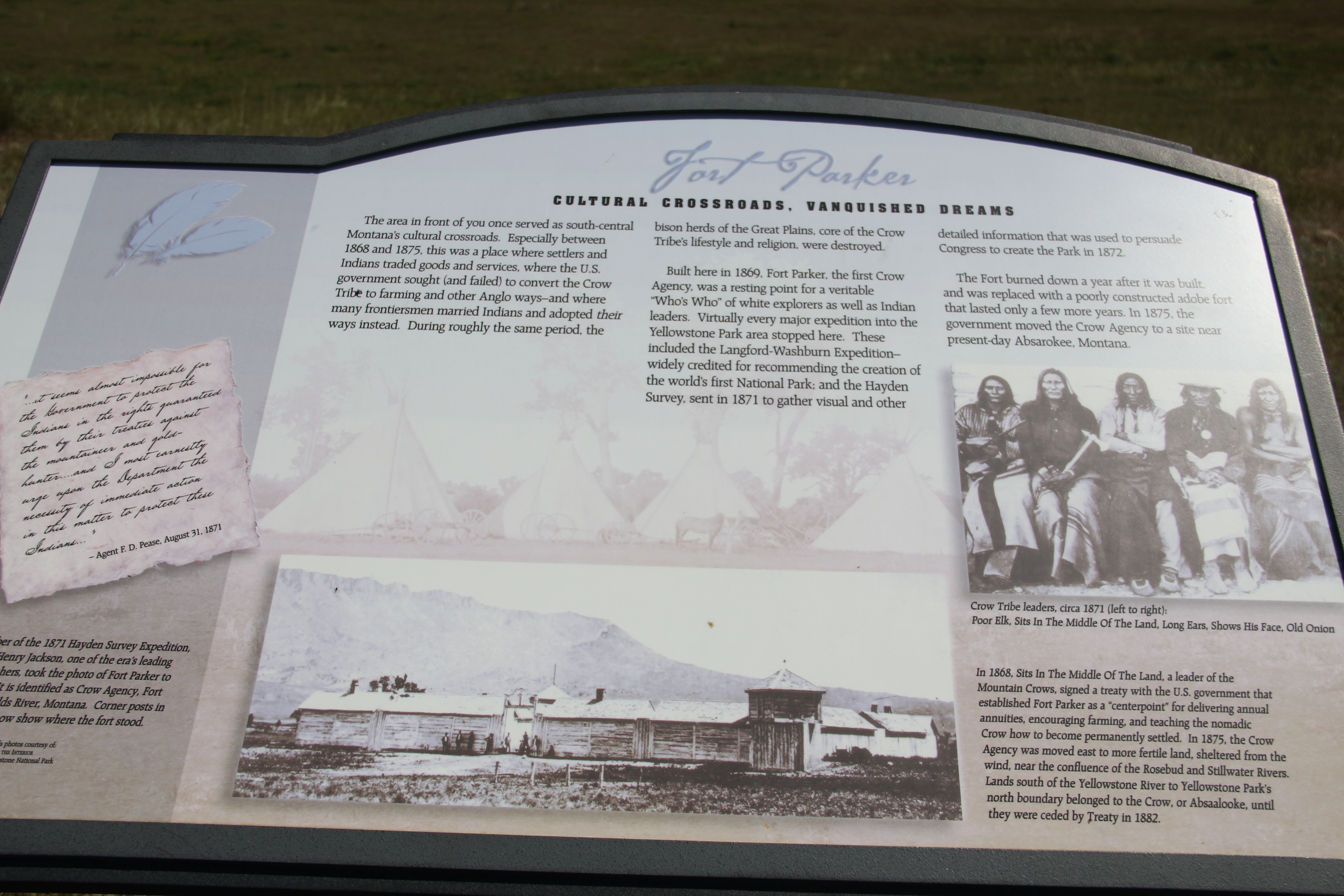
 Few remnants of that early white settlement remain today; you can find some just north of Springdale, at Park County’s eastern border, on the north side of the Yellowstone River. Hunter’s Hot Springs was the first attraction, established by Andrew Jackson Hunter in the 1870s, and receiving its last update in the early years of automobile tourism in the 1920s, as shown below in this postcard from my collection. Today, as the Google image below also shows, there are just scattered stones and fences from what had been a showplace for the valley.

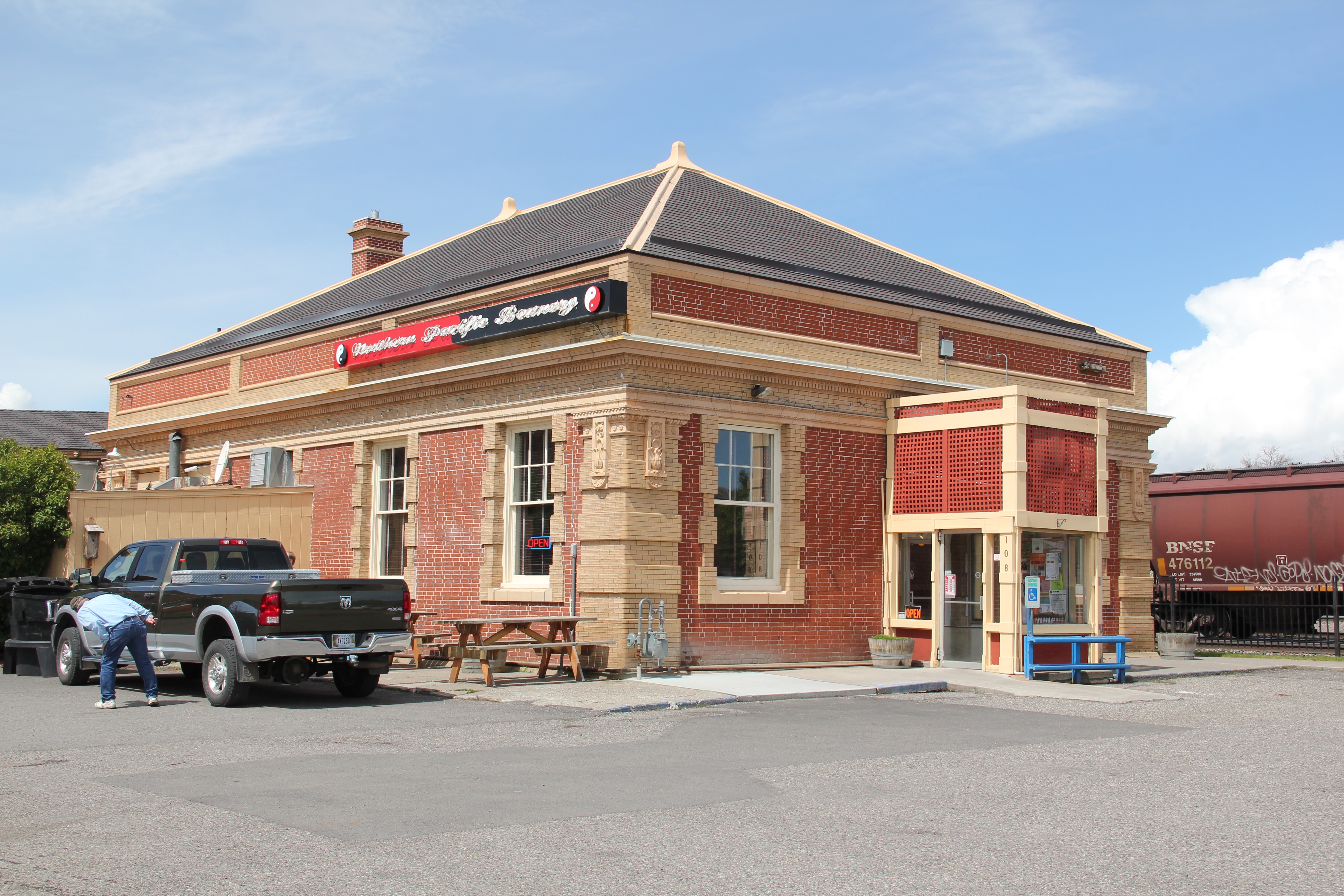
 Commercial businesses once lined the town side of the Northern Pacific tracks. Nothing is open today although trains rumbled down this historic main line every day. What does survive is impressive and worthy of


