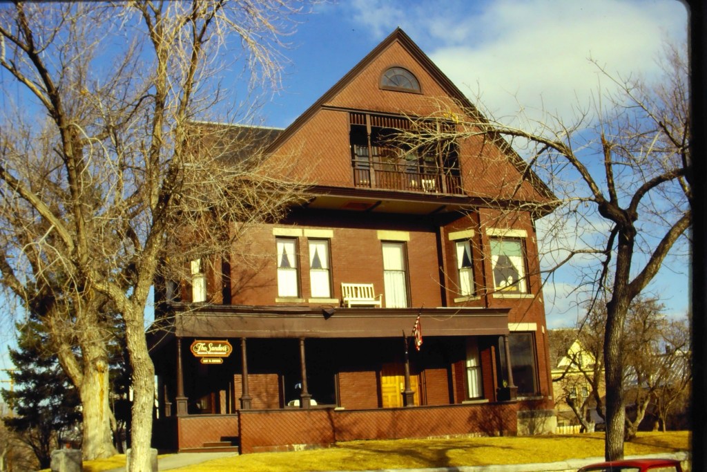
Bozeman is one of those Montana towns where historic preservation has played a positive economic and cultural role in local development for two generations.
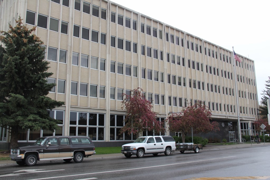
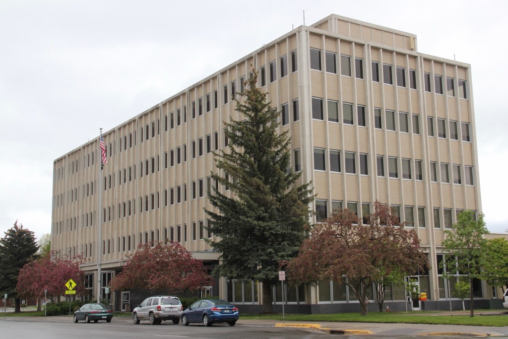
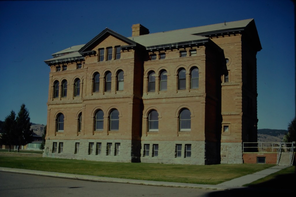
Federal building, Bozeman in 2014
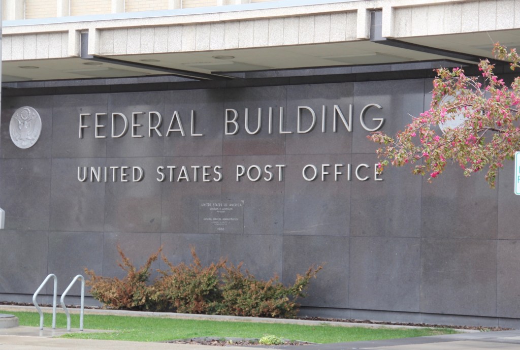
This it comes as a surprise when you hear that a public agency, in this case the federal General Services Administration, is considering letting the downtown landmark Federal Building pass from public hands.
The building dates to 1966, as is evident from its modern style, so 1960s. The firm of Hamill and Associates designed it in the New Formalist style made popular by architect E.D. Stone. It was built during a decade of growth, from a town of 13,000 in 1960 to a place of 18,000 by 1970. The new post office, and the agencies who were headquartered at the building, contributed significantly to the boom that occurred in Bozeman over the last third of the 20th century. In other words, important work took place here.
The city government has asked for the building to stay public, and be transferred to the city. It is listed in the National Register of Historic Places and the city has amply demonstrated the ability and the commitment necessary for the preservation and use of National Register properties. So let’s hope that transfer takes place. Bozeman cannot afford to lose another modernist landmark.
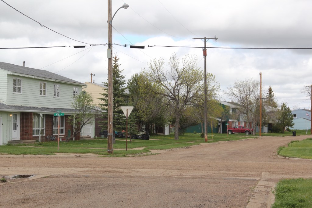
Montana Highway 246 is one of those “side” roads that few travel, unfortunately, because if you go that way from the west toward Glasgow it will take longer than US Highway 2. But the time is well worthwhile because once you cross the Milk River (by way of a modern concrete bridge) you step back to the turn of the 20th century.
Milk River crossing on Montana 246
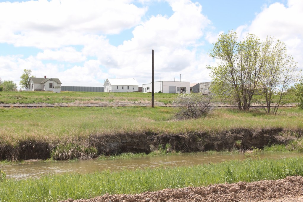
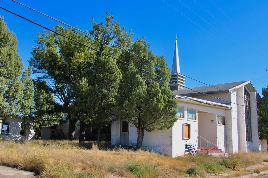
Vandalia has history as a late 19th century trading post at the crossing of the Milk River. Then it became one of the early milk River ranches. Once the Great Northern Railroad built its initial route westward the tracks came this way, following the river.
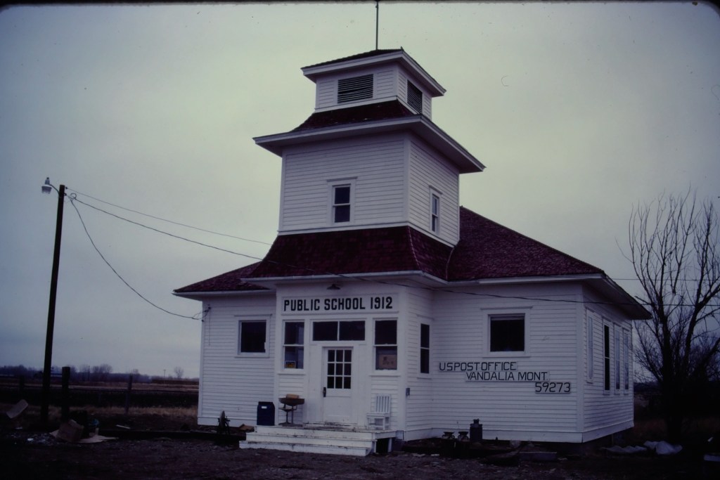
Vandalia school and post office in 1984
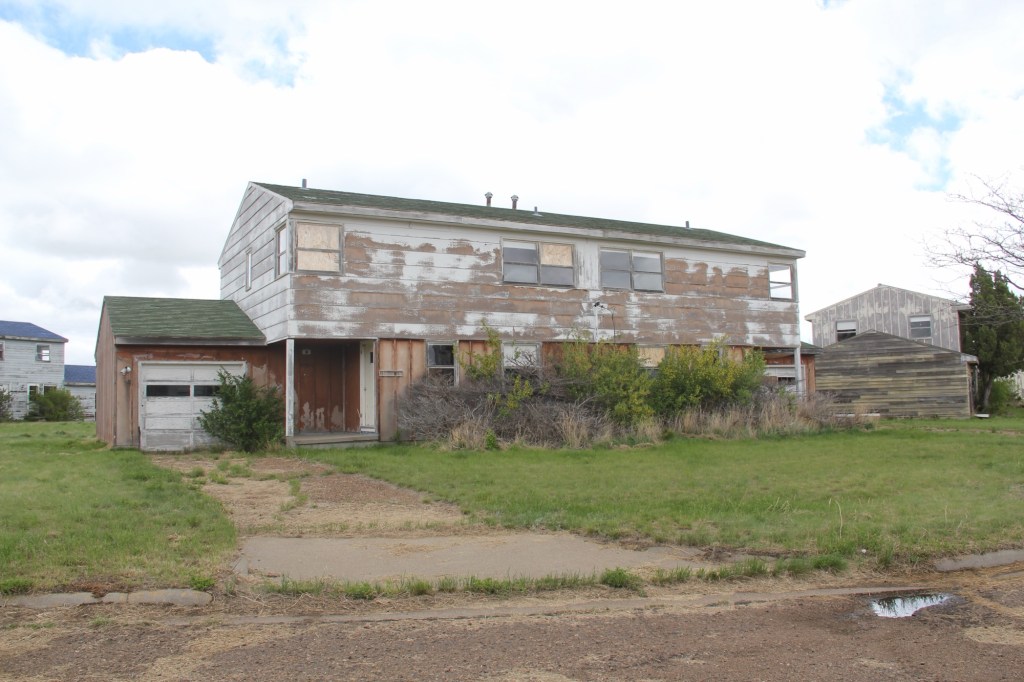
The tracks brought the first generation of homesteaders who built the white-painted frame school in 1912. The school later became the post office, and served that role when I first visited Vandalia in 1984.
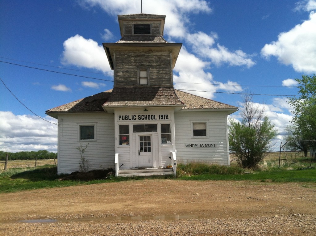
Vandalia school in 2013
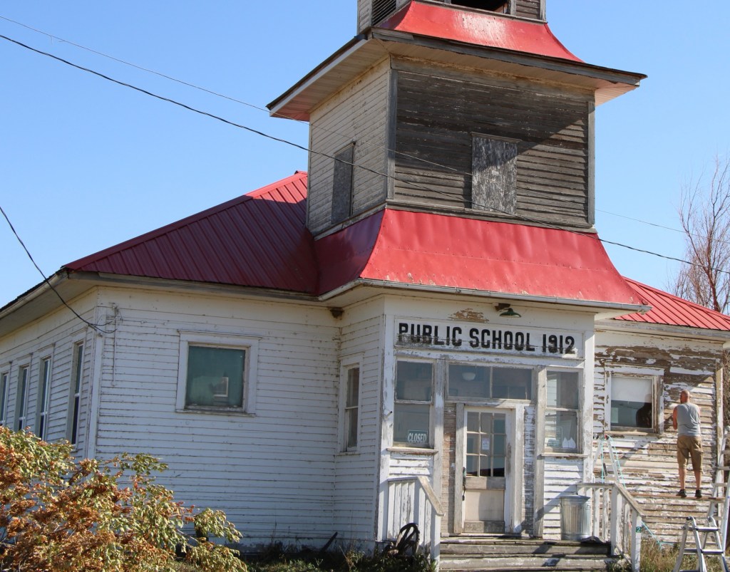
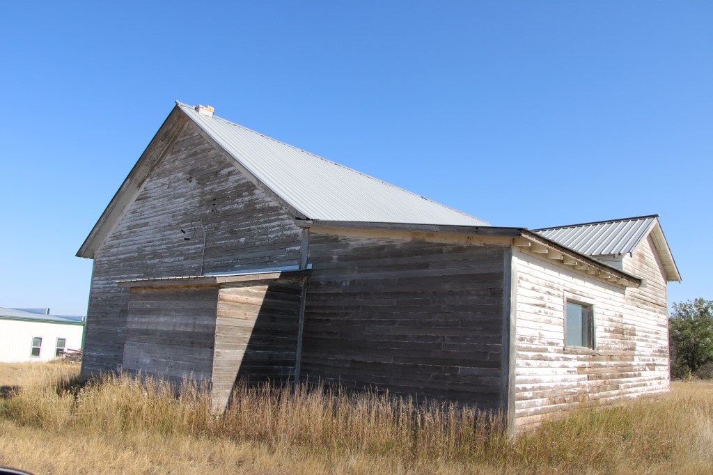
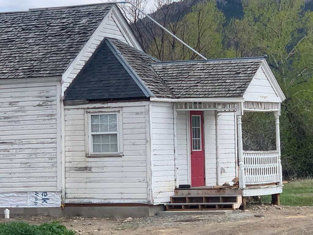
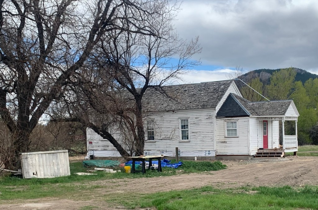
When I next visited almost 30 years later, the post office had closed and the school was in rough condition. Imagine my delight when I next stopped in the fall of 2025. The school was taking on new life. The roof had been prepared and replaced, and prep work was underway to give it a fresh coat of paint.
Vandalia school in 2025Vandalia in 2025
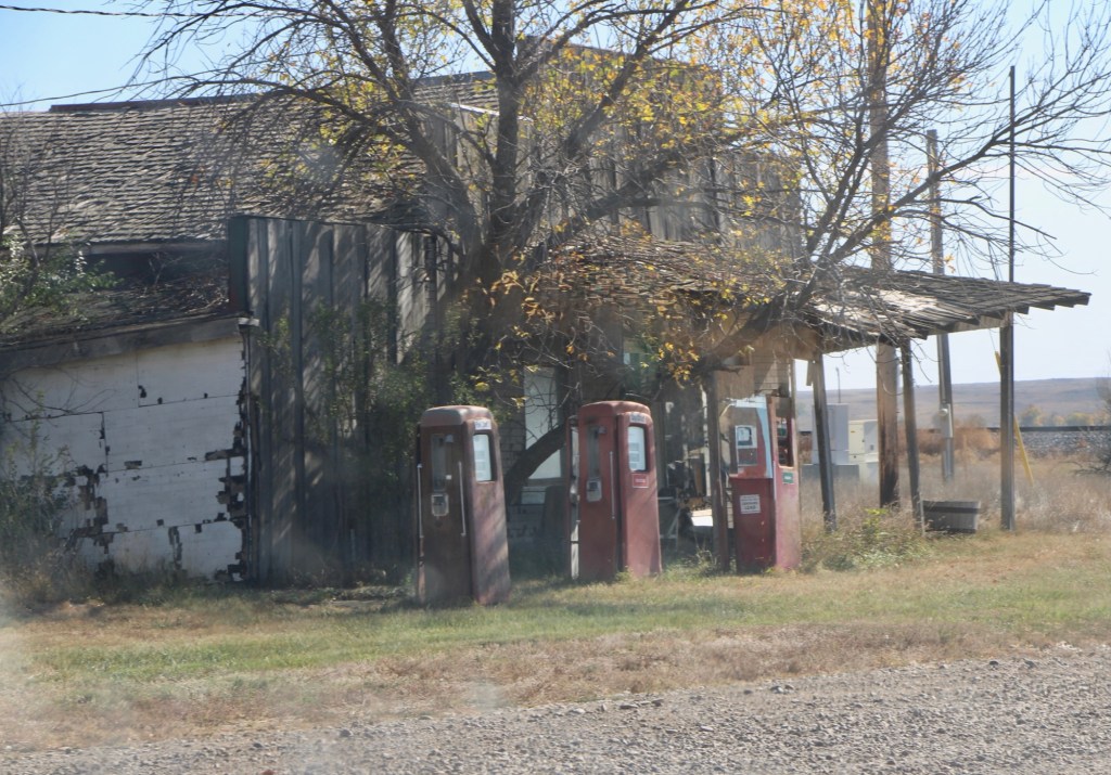
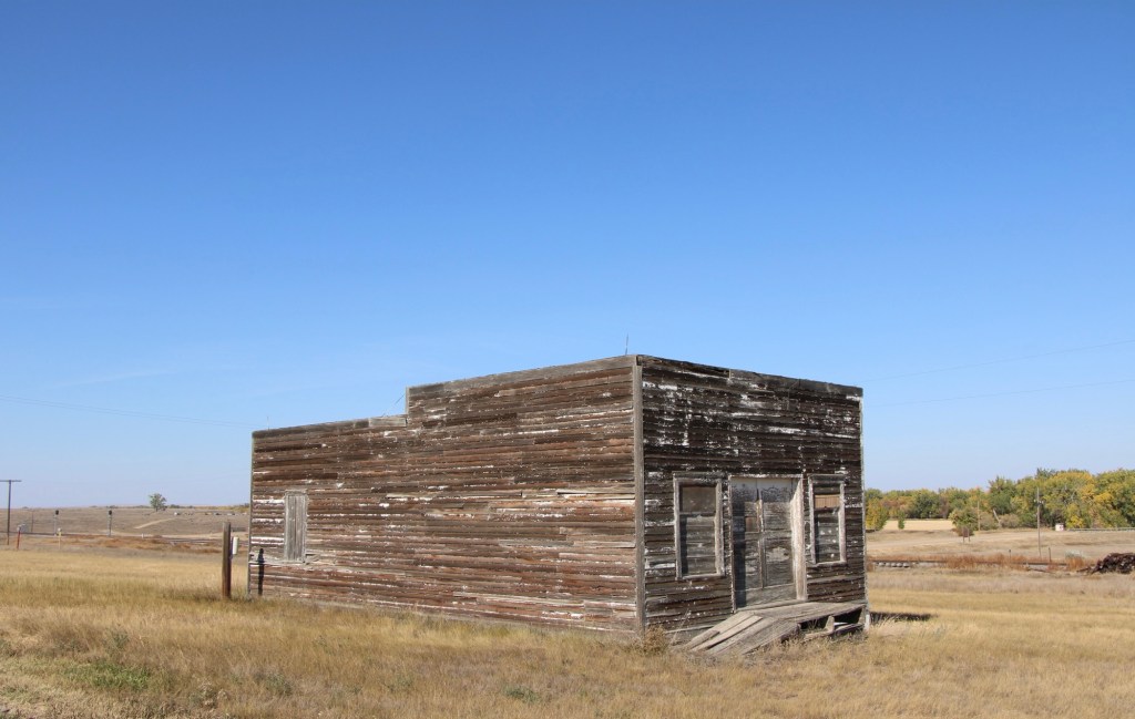
The story was not so bright for the old bar and store that was next door. The old gas pumps were still there but the porch roof was sagging and it looked forlorn.
Vandalia store in 2025Original route US Highway 2 heading east toward Tampico
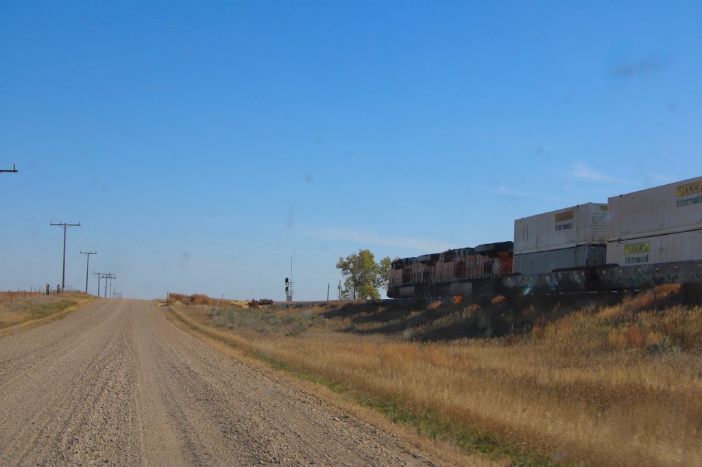
The drive remains fun, especially the graveled original route of US Highway 2 with the occasional Burlington Santa Fe freight train roaring by. Imagine driving cross country on this route when large sections of it remained unpaved.
Tampico in 2013
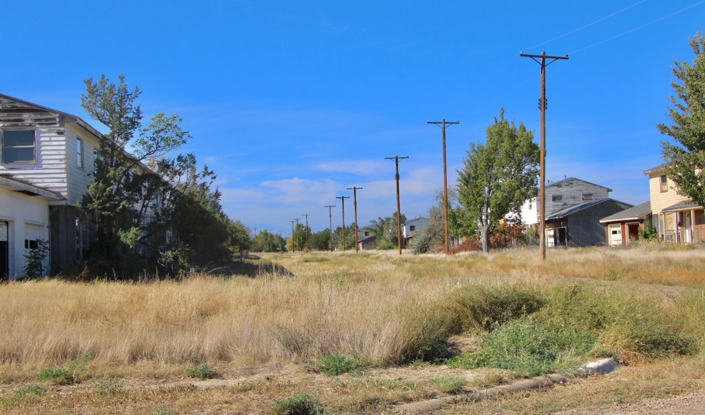
The next town to the east is Tampico, established around 1908. In 2013 the town was tiny but showed some life. Twelve years later, the abandonment was striking.
Tampico in 2025Tampico in 2025Leaning into oblivion, Tampico 2025
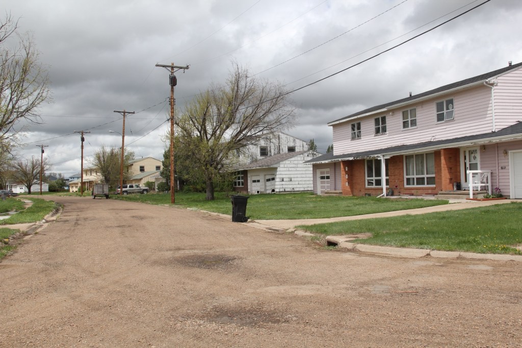
Most early 20th century railroad towns across the northern plains struggle one hundred years later but those off the major highways, like Vandalia and Tampico, could easily disappear.
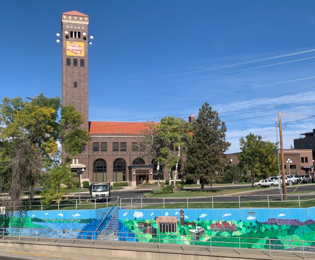
Montana newspapers this week featured a story about economic resurgence in Great Falls, where the population has remained basically level in the 21st century while other Montana cities have grown by leaps and bounds. Readers of this blog recognize that I am a big booster of what heritage and historic preservation has meant to the city, and certainly that pride in history and culture you find anytime you visit Great Falls as I found during a fall 2025 visit.
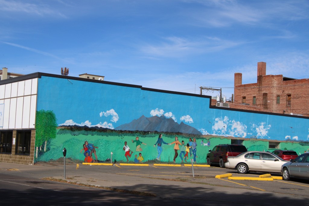
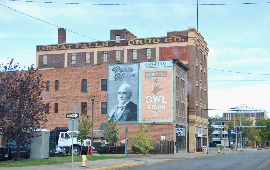
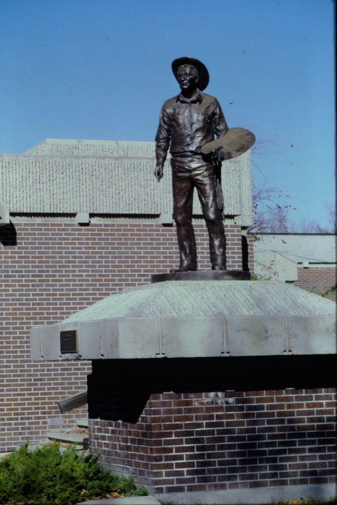
The proliferation of colorful, descriptive murals enliven downtown commercial buildings, including the highway underpass at the restored Milwaukee Road passenger station. the topic has been historic—witness the penetrating graze of town founder, Paris Gibson, below.
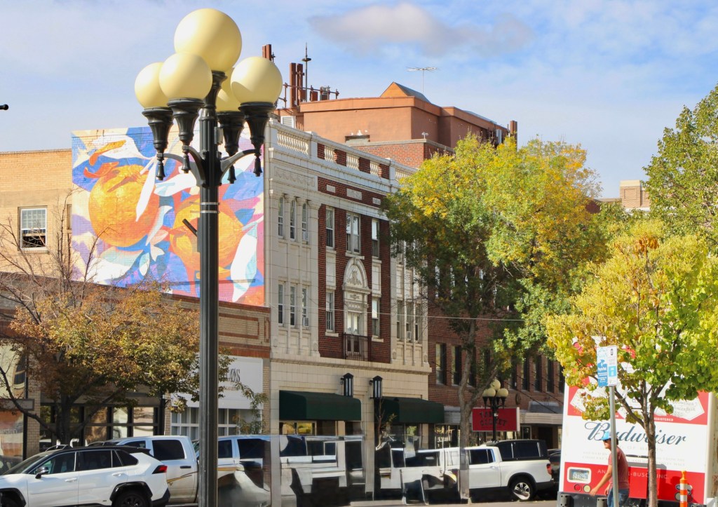
Or if it is a more abstract design in the city’s commercial heart ( the reproduction city street lights add charm too).
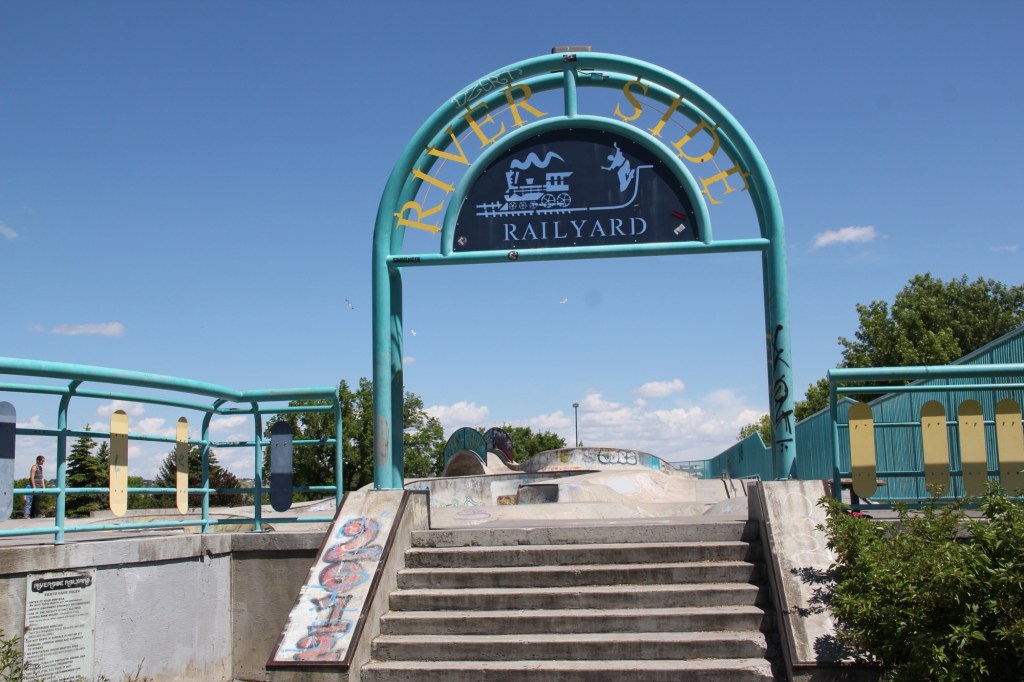
Downtown recreation is another positive change, as the river trail between the tracks of the Great Northern Railway and the Missouri River continues to expand and improve.
One of the state’s best skateparks also adds significantly to recreation, and community building in Great Falls.
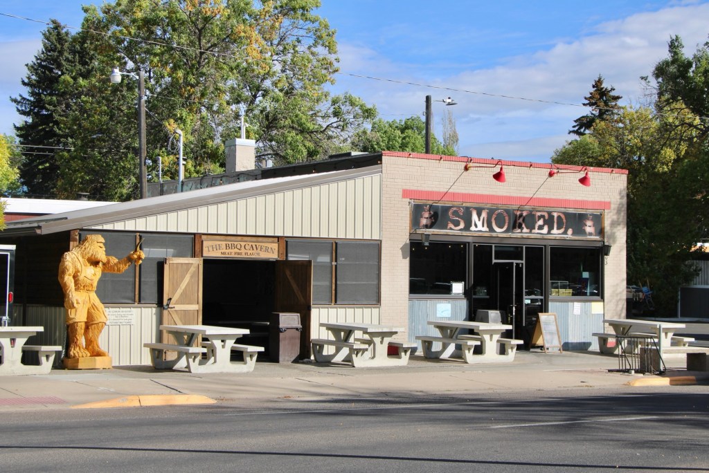
And speaking to community building the restoration and adaptive reuse of downtown buildings create nighttime gathering spots, giving residents plenty of reason to come downtown. The Celtic Cowboy, located in a circa 1890 livery building, has become a popular pub while the owe era of Smoked took a 1930s building and made it a must-stop place for Barbeque.
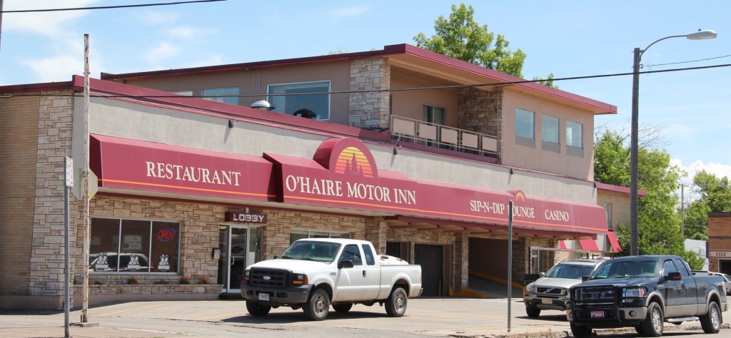
Even the iconic Sip-N-Dip lounge has announced a renovation and improvements to this mid-20th century landmark.
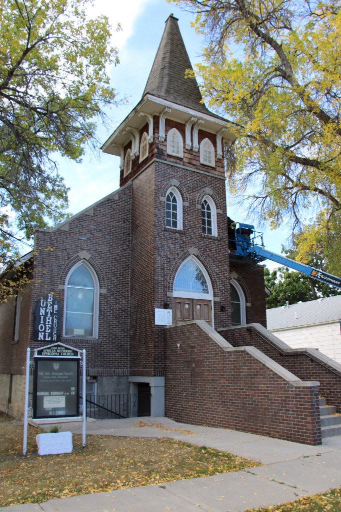
My stop in Great Falls last October centered around a check of the renovation of the National Register-listed Union Bethel AME Church. Like many others I supported its grant application and I was pleased to see work underway to ensure another 100 years for this landmark.
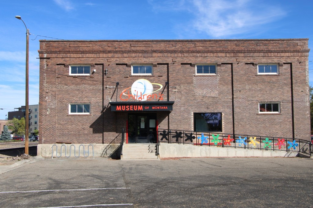
No doubt the protection of the city’s historic buildings and finding new community uses for them continues as an anchor for Great Falls, be it the Children’s Museum or the impressive History Museum and Archives. Both are located along the city’s historic railroad corridor.
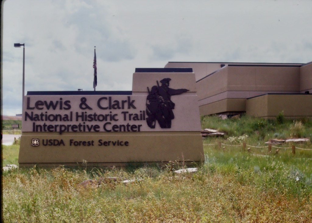
Preserving and telling local stories but Great Falls is further enhanced by two major national institutions—the Lewis and Clark National Historic Trail interpretive center and the Charles M. Russell Museum.
The Russell continues to expand, and amaze, as it evolves from a regional to truly national cultural center. The city too is trending in that direction, which means that next visit will certainly be sooner than later.
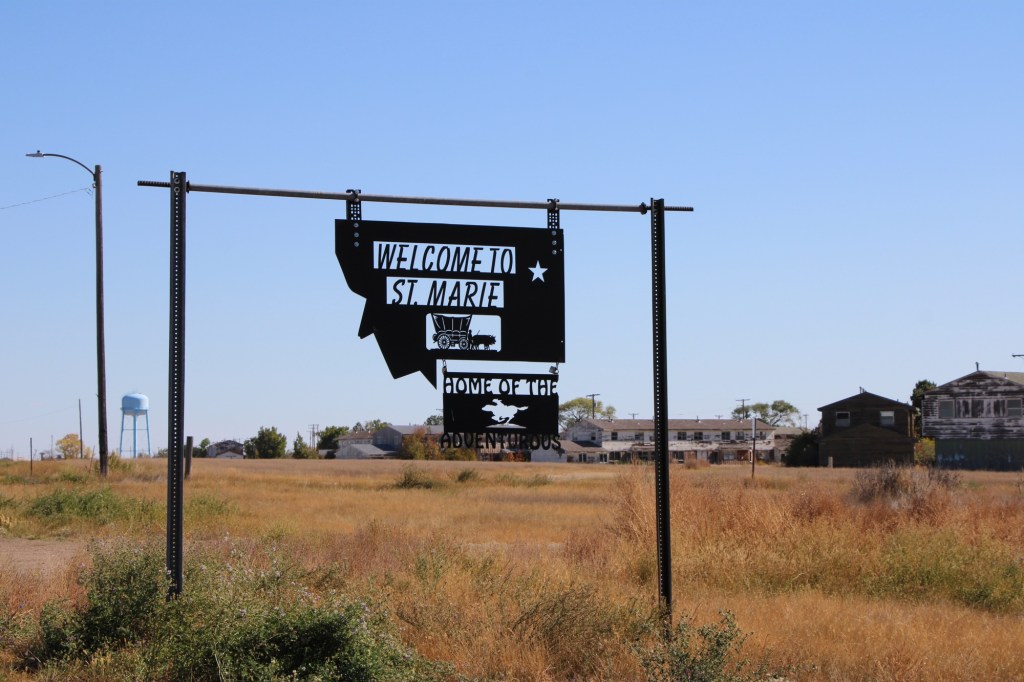
My first visit to what became known as St Marie came in 1984 when local Glasgow residents associated with the Valley county museum took me to the closed Glasgow Air Force Base, about 15 miles north of town. From the late 1950s to the 1970s, the base was an important cog in the Cold War military capabilities of the United States when huge B-52 bombers ruled the sky. Then suddenly it was not so important and the Air Force left.
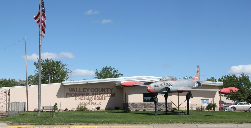
Valley County Museum, Glasgow
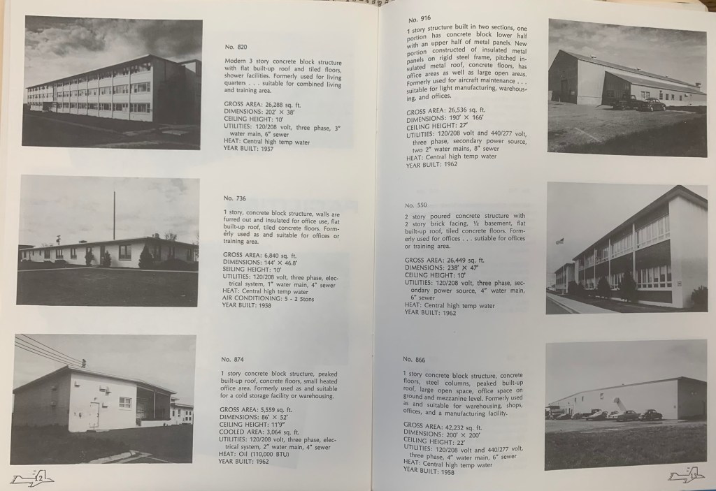
The locals in 1984 spoke of grand plans, of how the Air Force was in the process of selling the base, building by building. That part was true. They gave me a booklet that explained the past purpose of each building and the value of each building at that time.
In 1984 it seemed unlikely to me that a new use could be found because the base was so big—its population was once 50% of the entire county—and it was so isolated. If the Air Force didn’t have a use for it, who would?
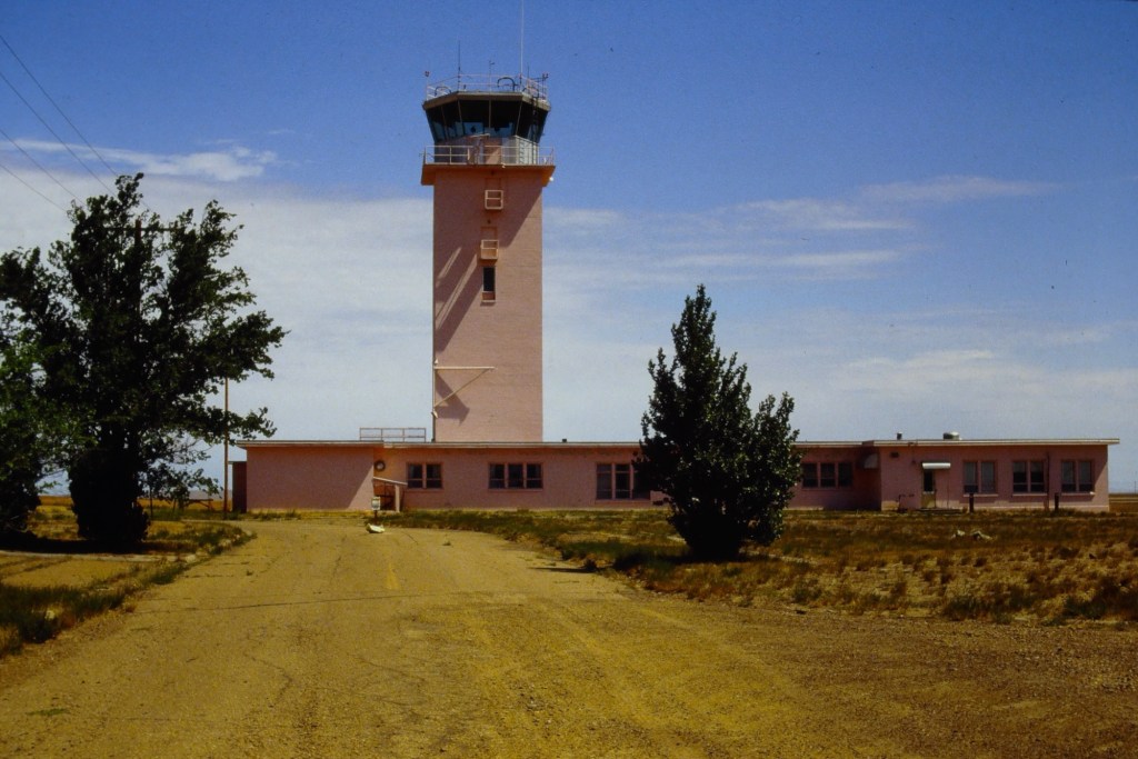
Control tower 1988
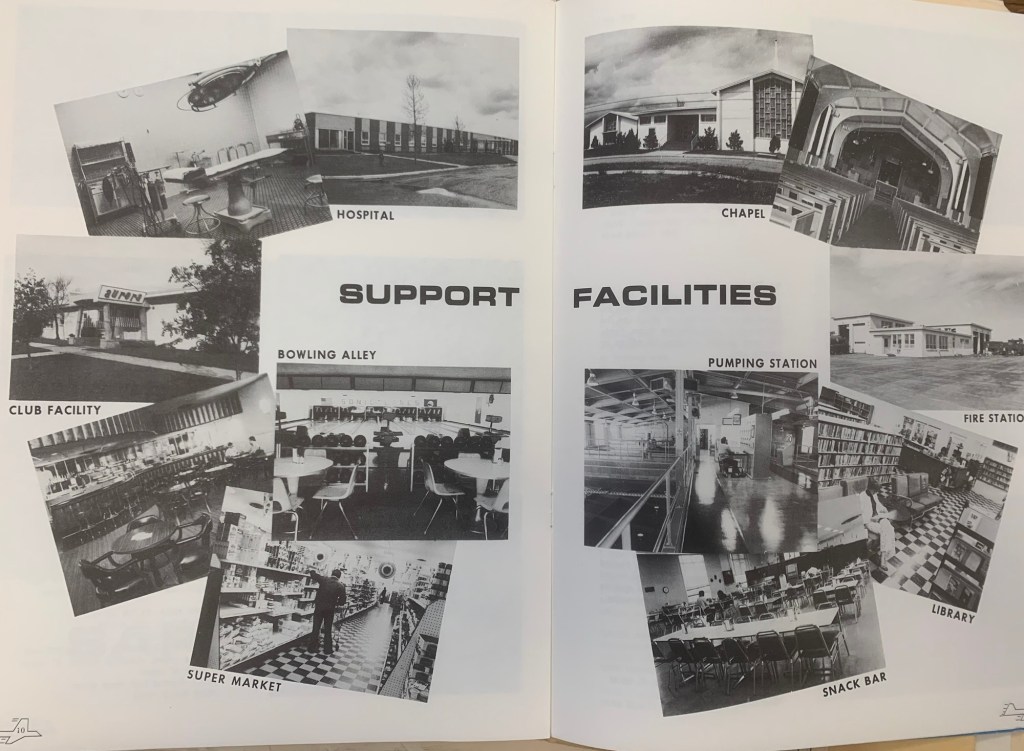
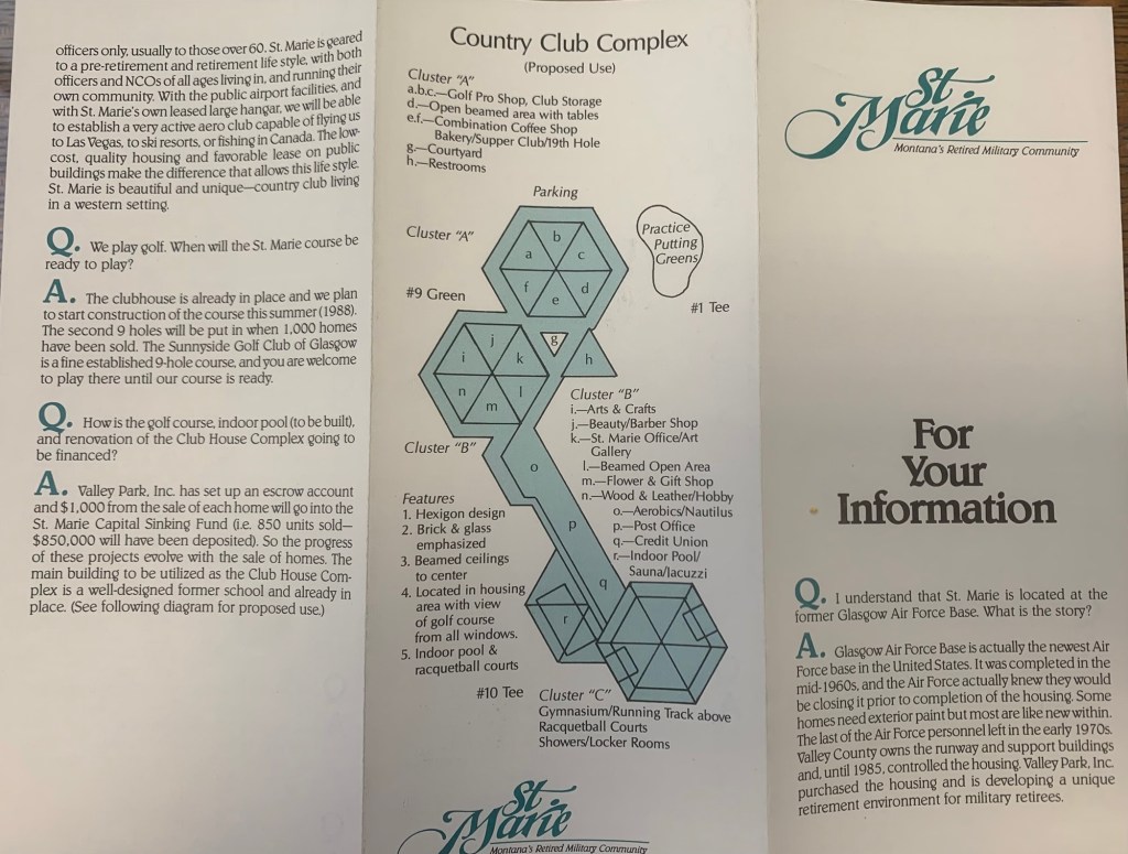
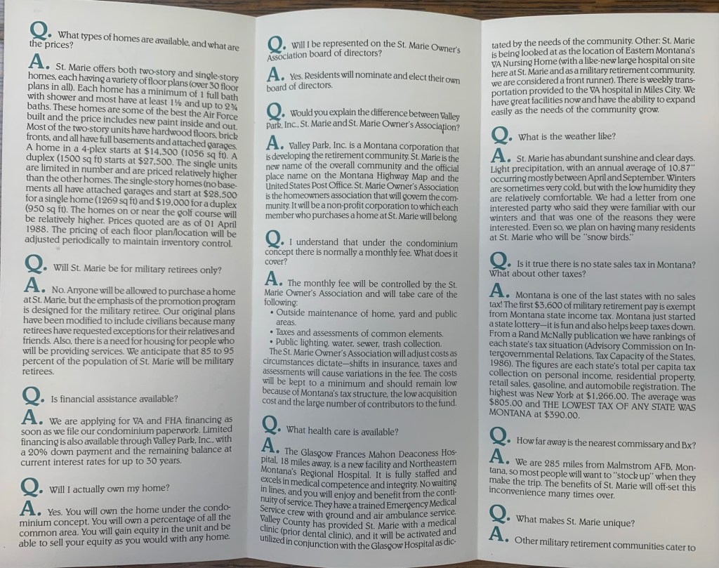
When I returned in 1988, the transformation of the base into civilian control was underway. Locals excitedly informed me of the new comprehensive plan to turn the base into a retirement community named St Marie, targeting veterans. The old support facilities would be humming once again and a golf course would be central to everything.
I was urged to invest now—get one of the officers homes, or half of a duplex for remarkably little—$27,500 for a 1,500 sq ft unit.
Obviously I passed on the opportunity, as did so many others who visited the community in the making over the next years. But enough said yes to give St Marie a fighting chance for a future. The promise didn’t last long, as several recent research articles detail. When I next visited Glasgow 25 years later in 2013, the folks at the museum didn’t urge me to buy—they told me to go and see what was left.
St Marie in 201320132013201320132013
Rot, decay, mold were everywhere—but just like so many Montana ghost towns there remained a core group of residents who kept their homes well and expressed pride in what had been accomplished.
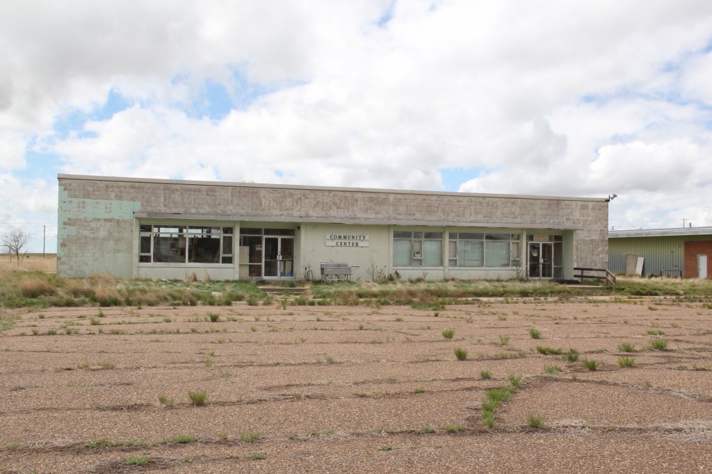
2013Community center 2013
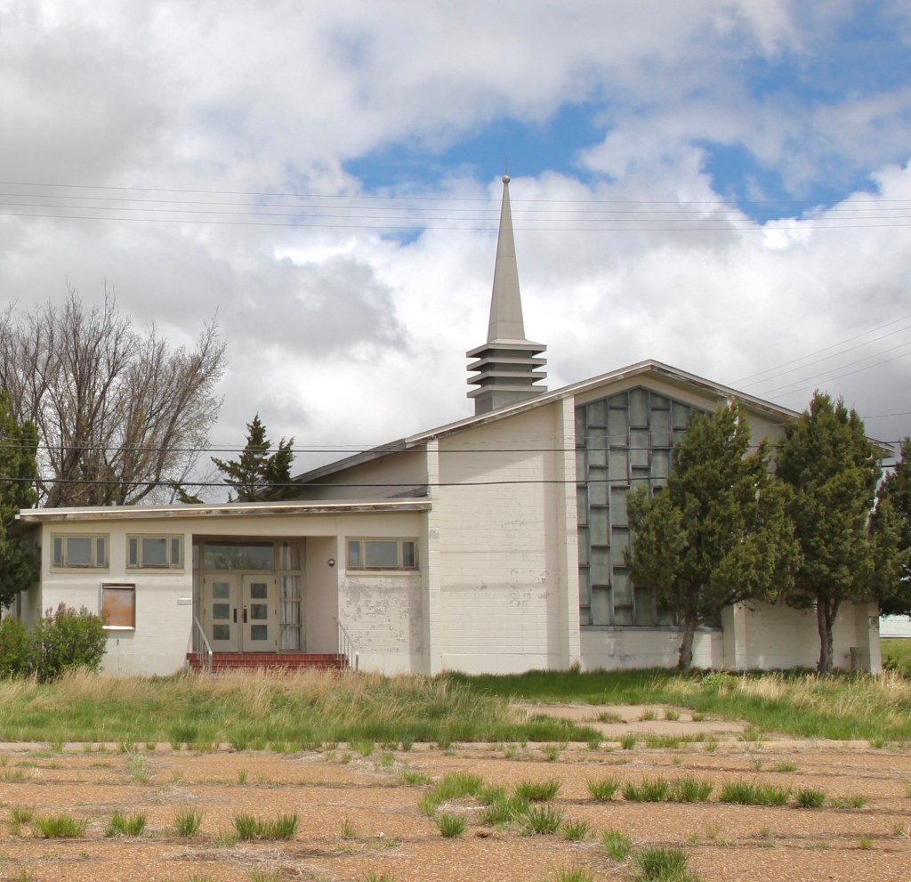
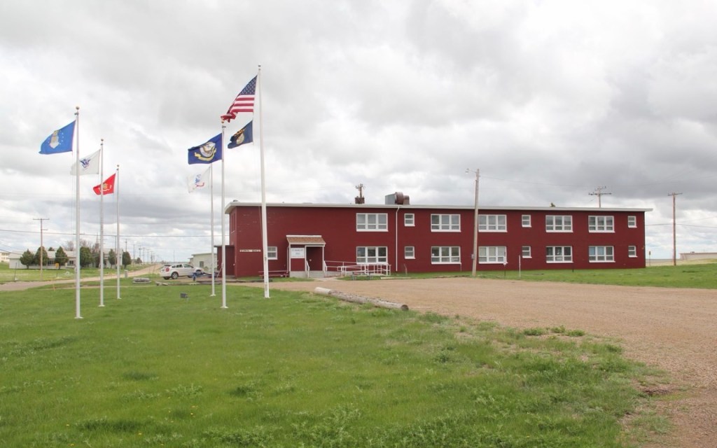
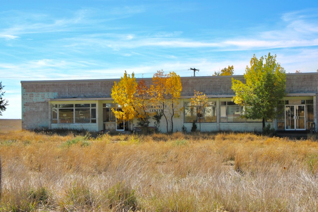
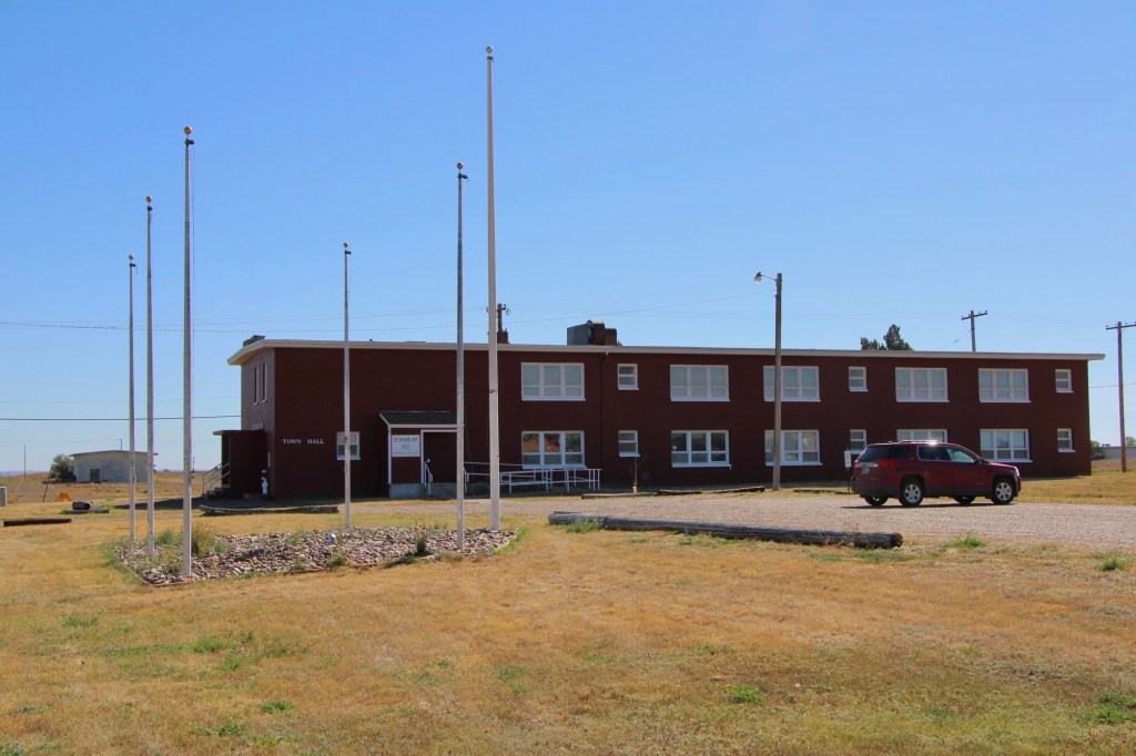
While key community buildings such as the chapel and post office/community center were closed, the flags were still flying proudly at the town hall. Officials spoke of a turnaround in the making.
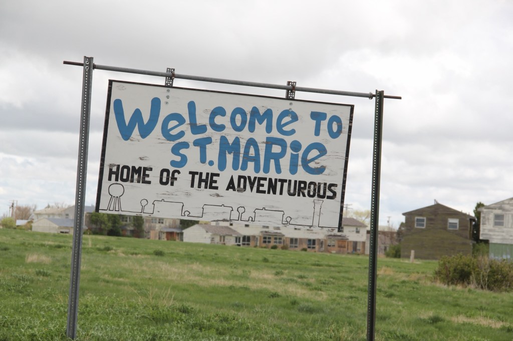
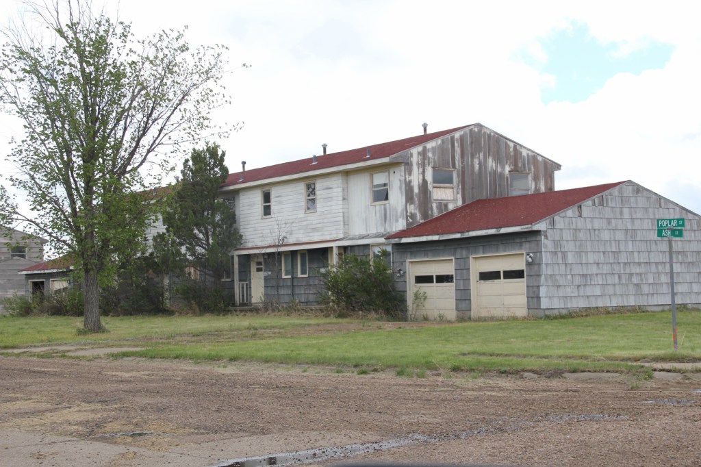
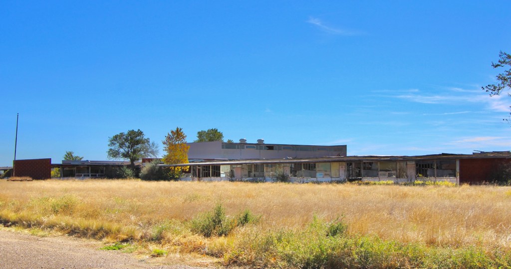
I returned in the fall of 2025–more than 40 years after my first visit—to find hopes mostly extinguished. The deterioration of the chapel, community center, and schools was shocking—little hope there.
October 2025October 2025October 2025October 2025
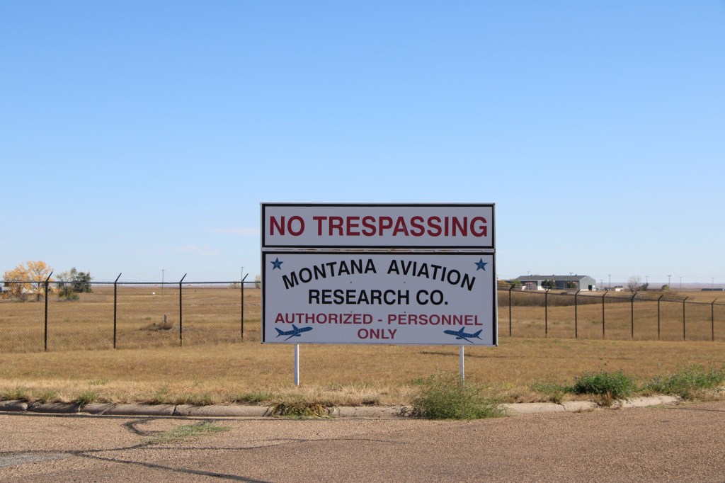
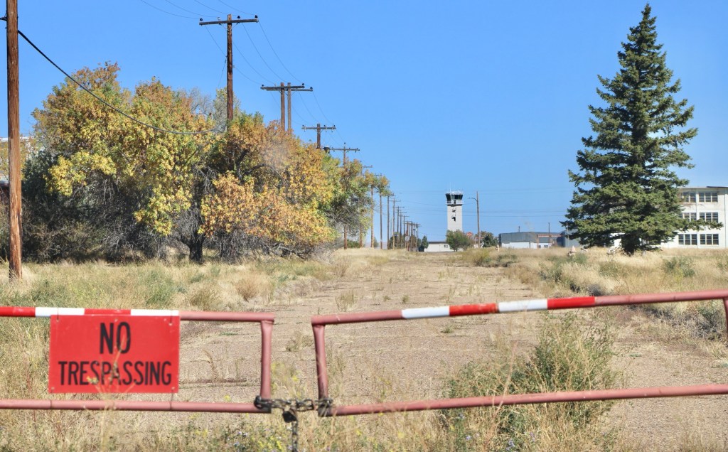
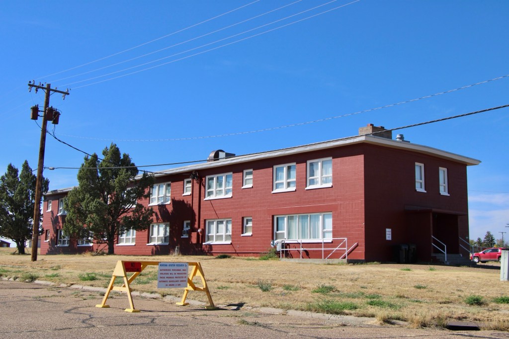
There were no flags flying at the town hall but everywhere it seemed there were new signs and barriers of the Montana Aviation Research Co. This private company was now using the runaways and had converted several buildings for employees’ use.
October 2025October 2025October 2025October 2025
The population had cratered since 2013 but of those approximately 300 people who still called St Marie home, you have to admire their commitment to the place. Numerous homes were well maintained even with the signs of abandonment everywhere.
October 2025October 2025October 2025October 2025October 2025
What will be left when I next visit this modern-day ghost town of the northern plains?
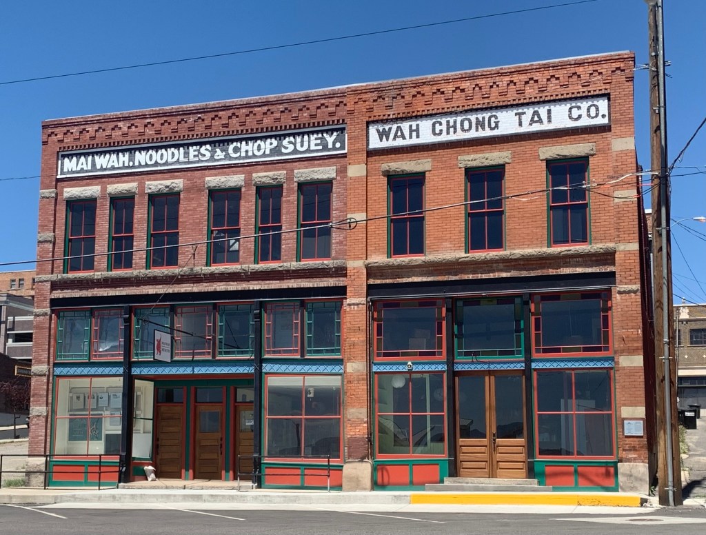
Today’s newspapers (April 24, 2026) bore the sad news that the Tam family has decided to close the iconic Pekin Noodle Parlor in Uptown Butte. For well over 100 years the family operated from this 2-story brick building at 117 South Main.
The building is nearby to another historic Chinese associated building on West Mercury, which is home to a museum about the Chinese in Butte and Montana.
The Montana Standard sees the restaurant’s closing as a developing story so perhaps we will soon know about the future of the historic building
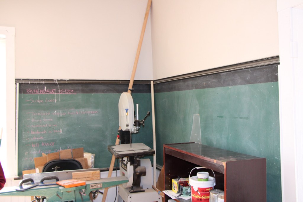
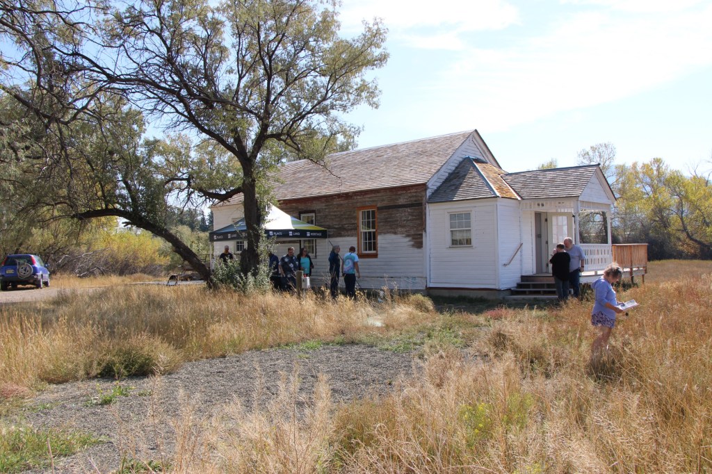
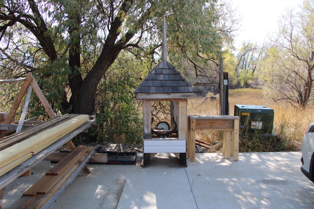
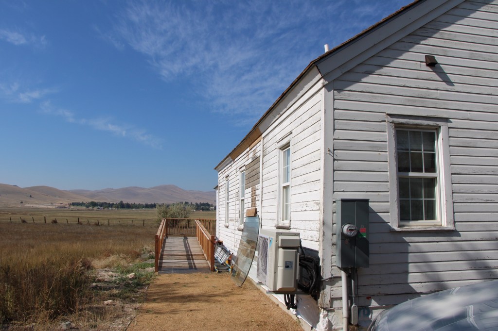
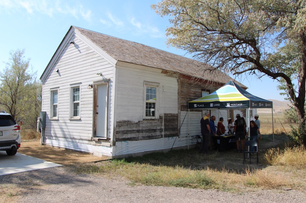
This year’s grants of the Foundation for Montana History are supporting many worthy projects across the state. One that I have been watching for some time, about 7 years, is the progress made in the restoration and reuse of the historic Baxendale School outside of Helena.
Built in the 1890s, it served as a one-room school in rural Lewis and Clark County until the mid-29th century. Luckily no one tore it down over the following decades. About 15 years ago Preserve Montana (then called the Montana Preservation Alliance) carried out a study of the state’s one room schools and convinced the National Trust for Historic Preservation to list Montana’s rural schools as one of the nation’s most threatened historic resources.
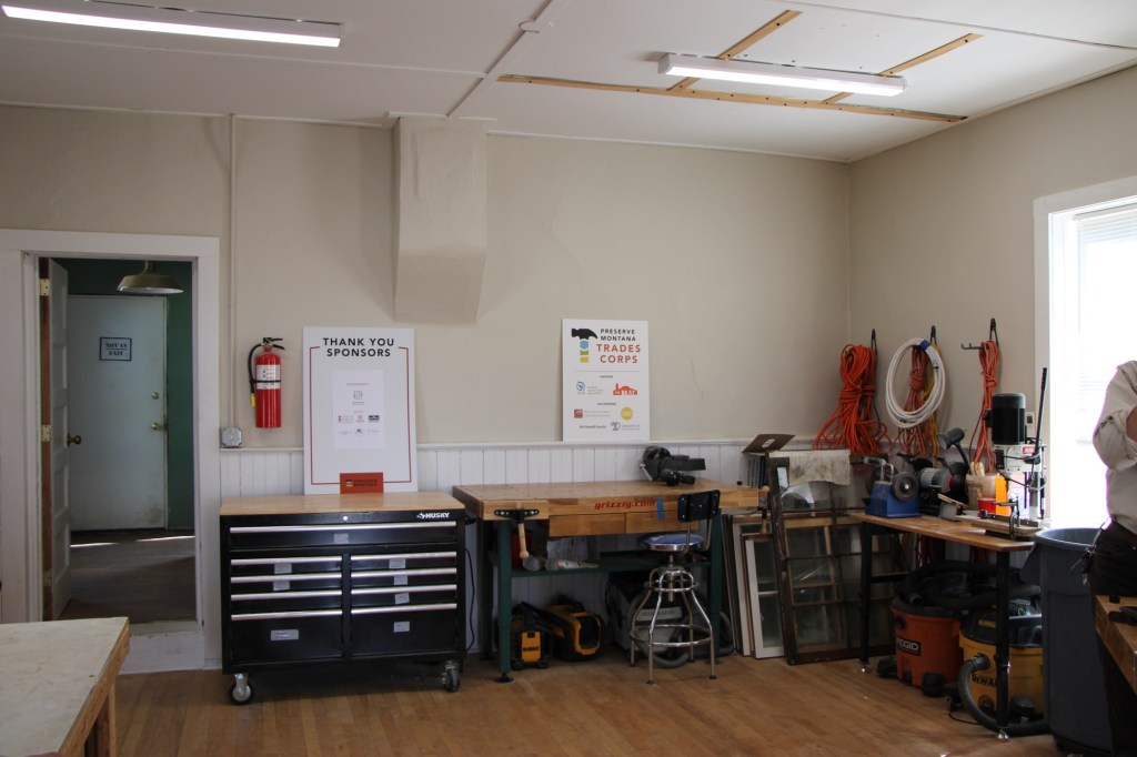
But Preserve Montana wanted to do more than advocate for preservation. I wanted to demonstrate how to give these buildings new lives. In 2019 it acquired the Baxendale School, moved it to the outskirts of Helena, and began to use it as a hands-on training center for the repair of older buildings.
School interior in 2025School in 2025
I was able to see the progress up close in the fall of 2025, and came away impressed with the progress and plans for next steps.
The support from the Foundation for Montana History will help complete the exterior restoration. What a productive partnership between the Foundation and Preserve Montana!
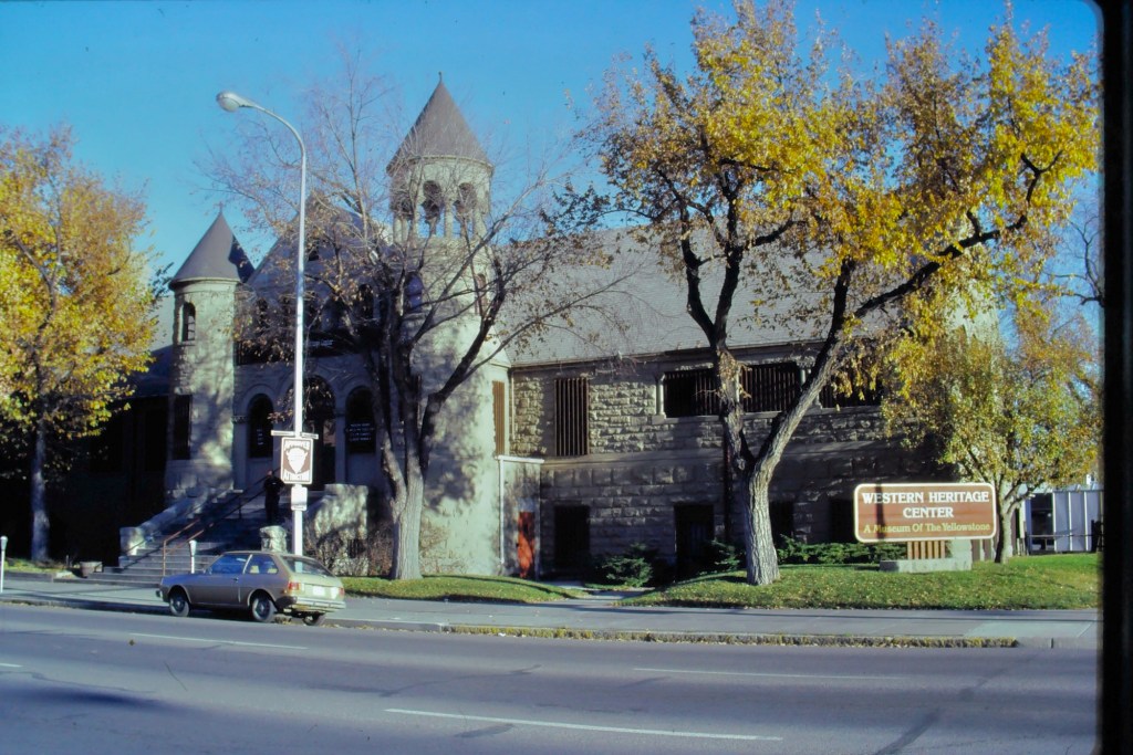
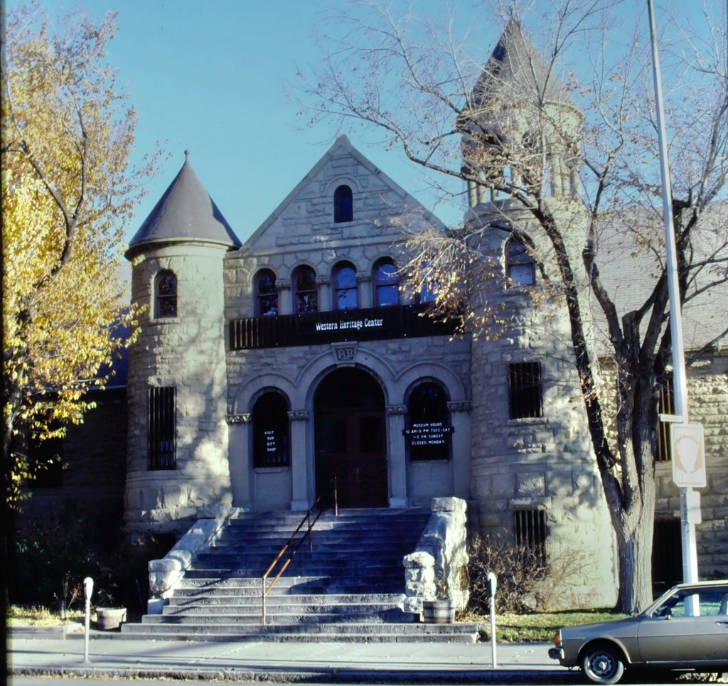
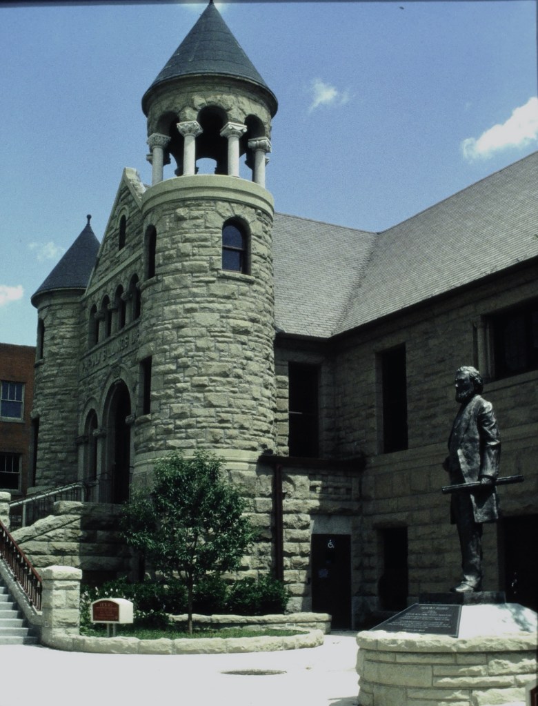
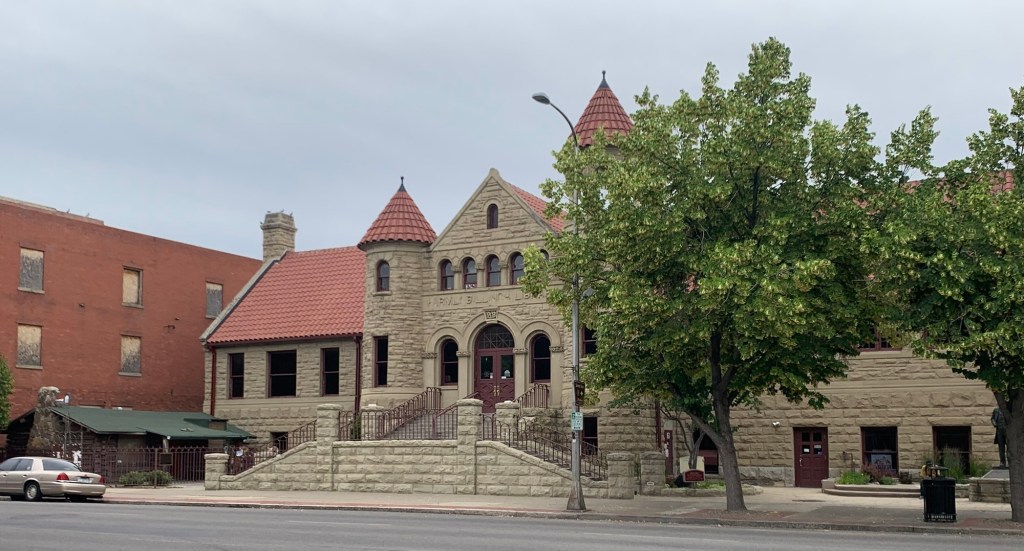
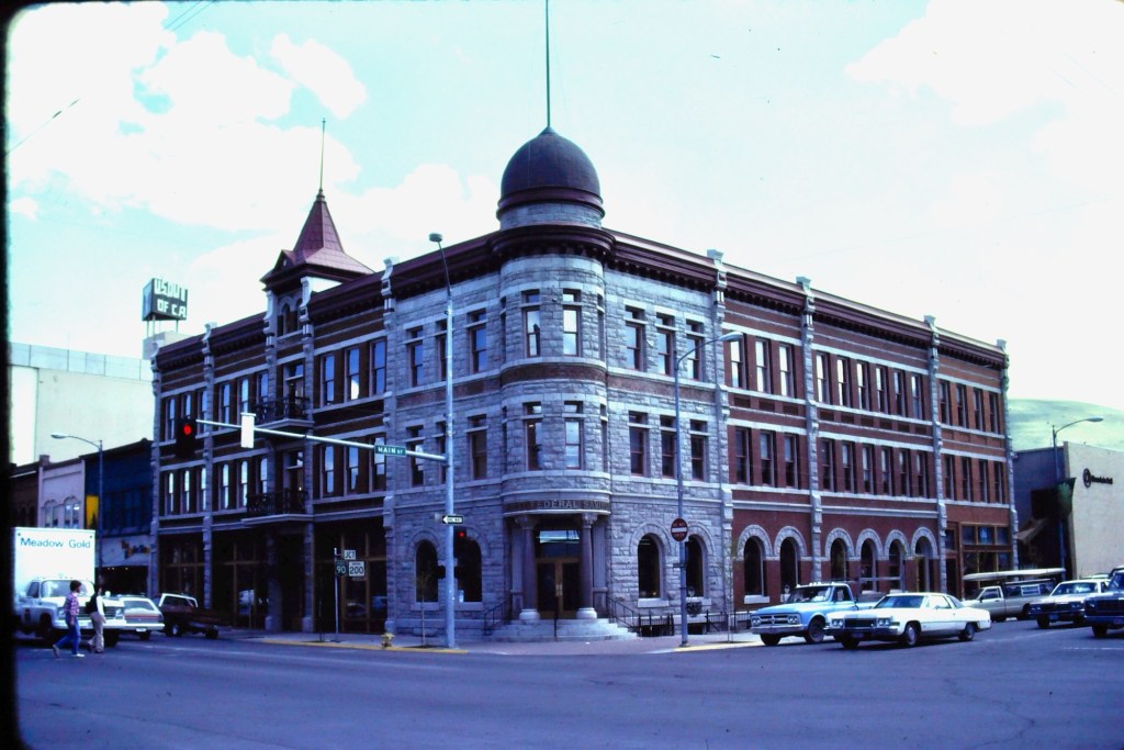
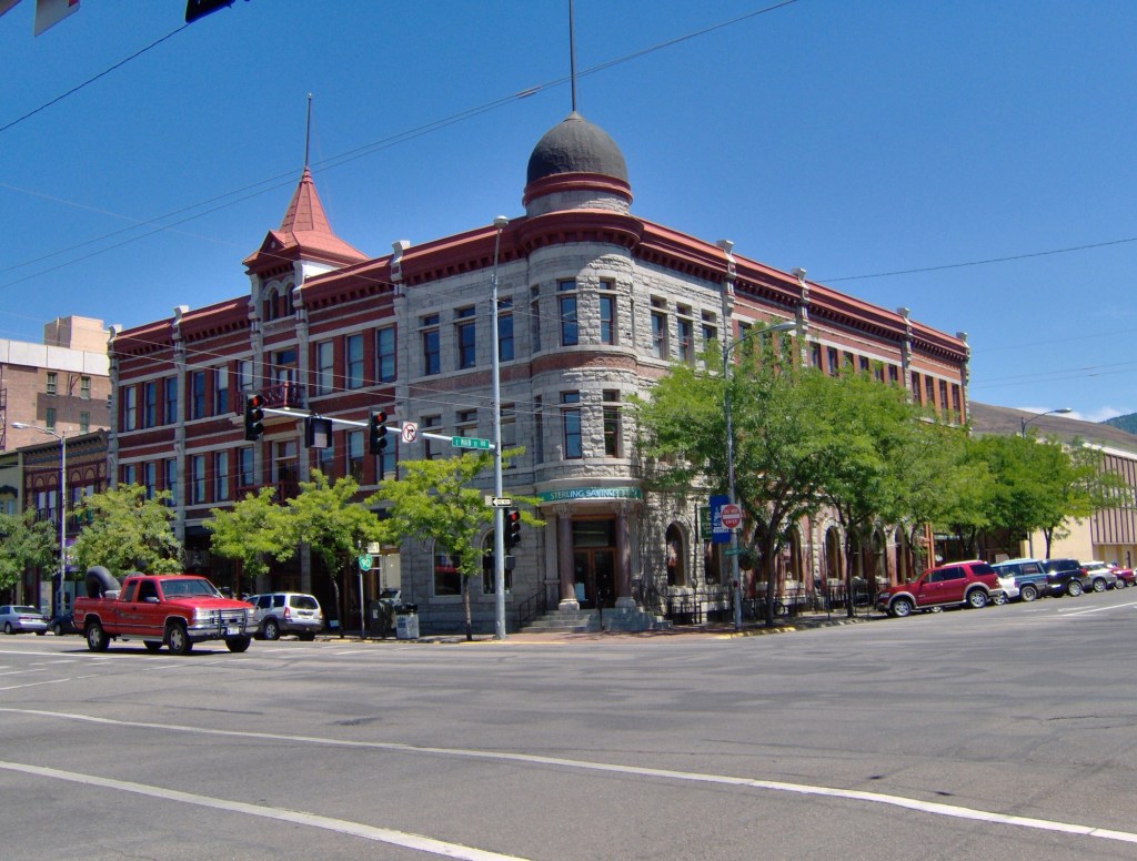
The Foundation for Montana History does many good things across the Treasure State. The Foundation announced its new round of grant awards and I was extremely happy to learn of the grant for a preservation study for the Westetn Heritage Center.
WHC in 1986
The WHC has been an outstanding regional museum for decades and my professional relationship with the museum is almost 45 years in duration.
WHC in 1986
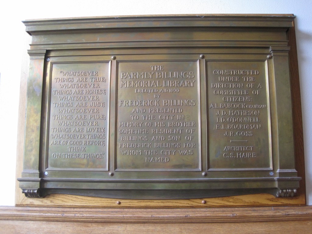
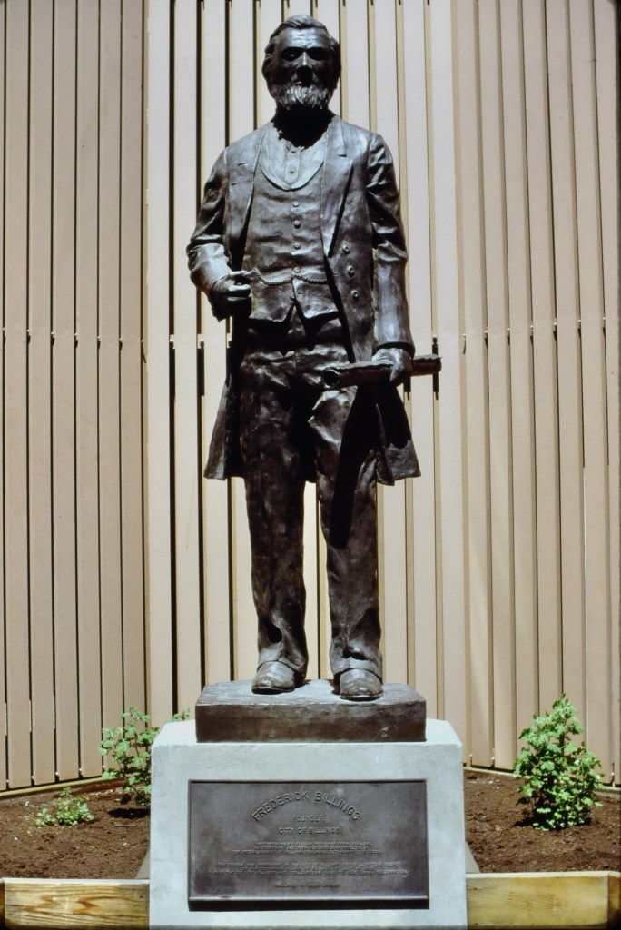
The building was constructed at the turn of the century in honor of Parmly Billings, a pivotal figure in the city’s early development. He was the son of Frederick Billings, the city’s founder and namesake. Parmly’s brother, Frederick, Jr., donated funds for the building to be the Parmly Billings Memorial Library. Montana architect Charles S. Haire designed the library in a Richardsonian Romanesque style. Supervising the project were several leaders of Billings including Albert Babcock and I.D. O’Donnell, who had been a good friend of Parmly.
In the early 1990s visionary WHC director Lynda Bourque Moss reconnected the museum with the Billings heirs and they helped to fund a renovation that restored the original entrance and name and also reorganized the landscape so that a statue of Frederick Billings, which had stood alone in front of a city parking garage, could stand in front of the building.
The Billings statue at the city parking garage 1988WHC in 1993WHC in late 1993 with Billings statueWHC in 1993
I was involved with the museum both for the research of my book Capitalism on the Frontier: The Transformation of Billings and the Yellowstone Valley (1993) and an award winning exhibit on the valley’s history that was created in 1990s.
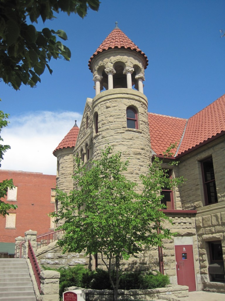
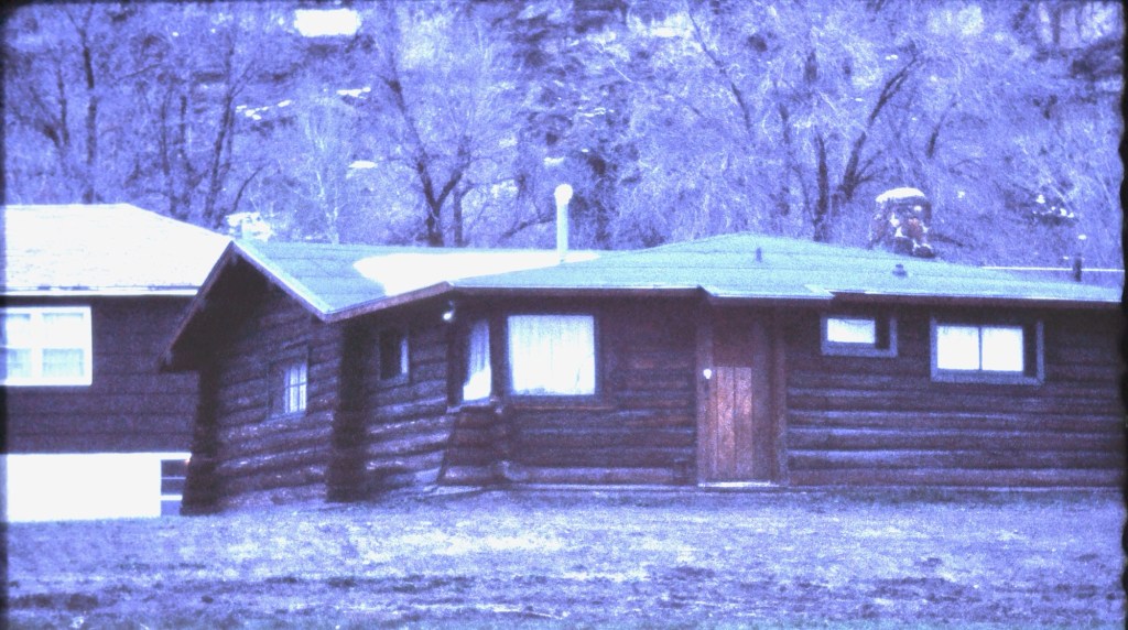
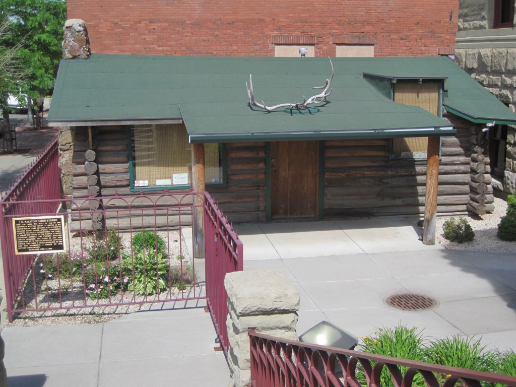
Since then I have of course visited the museum on numerous occasions. In the new century, the museum accepted the donation of the J.K. Ralston studio to the east corner of the property.
WHC in 2011Ralston cabin at Rocky Mountain College 1991Ralston cabin installed at WHC, 2011
it has been over 30 years since the mid-1990s renovations and so it’s time for a new preservation assessment of this very significant building. Congrats to the Foundation for Montana History for making it happen!
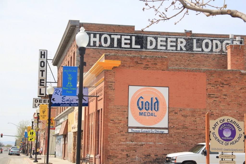
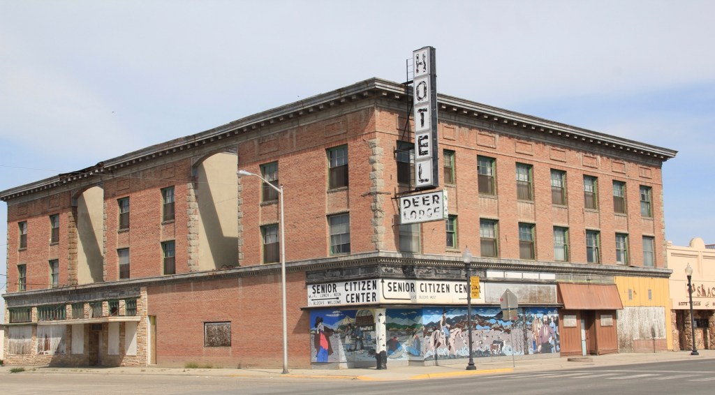
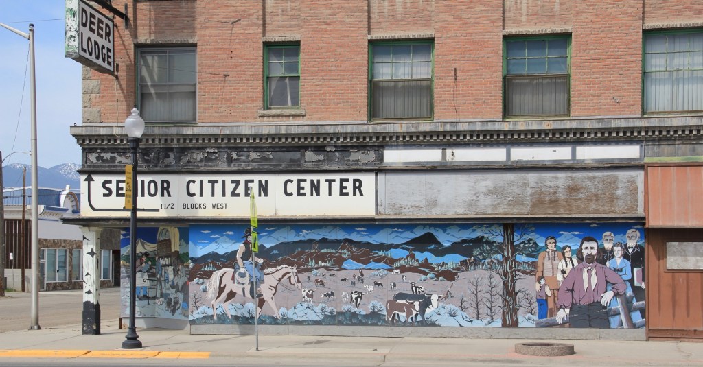
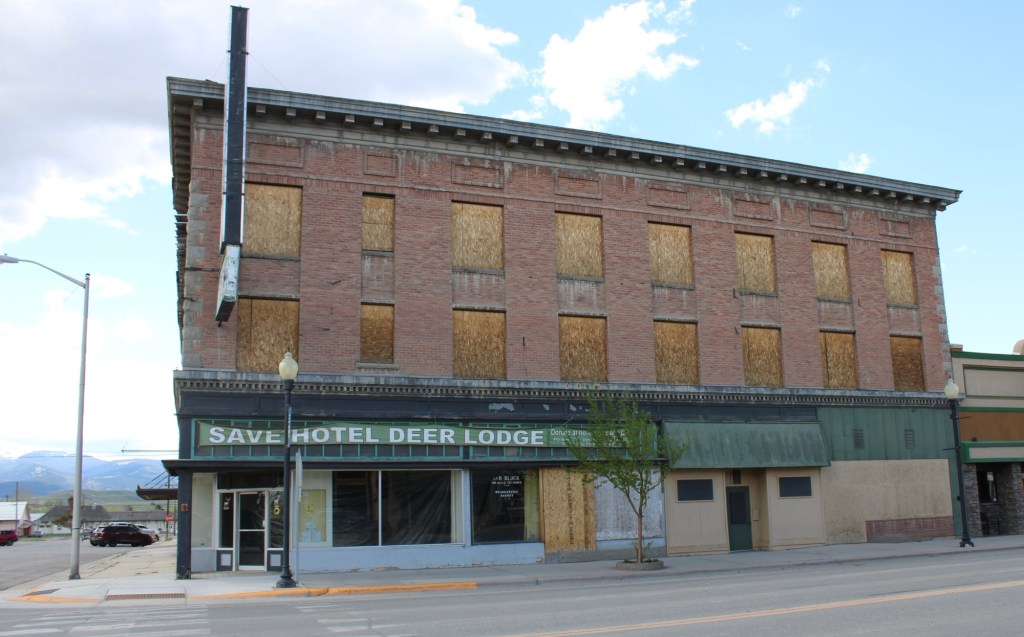
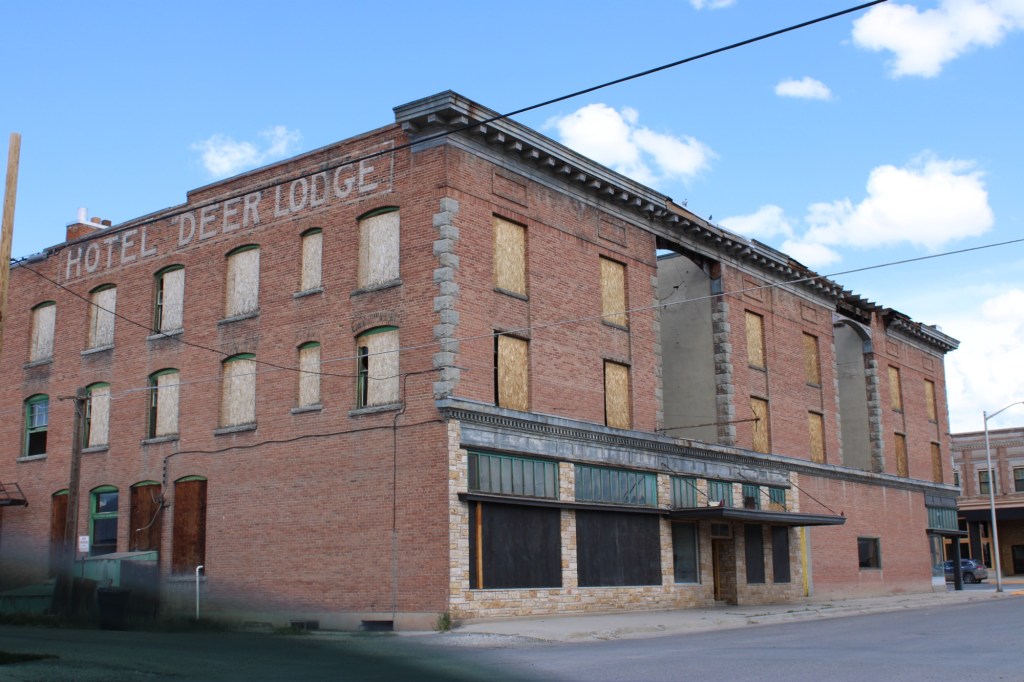
Encouraging news this week from Deer Lodge where a new effort is underway to potentially restore the historic Hotel Deer Lodge, according to a story in the Montana Standard.
The three-story brick hotel has been a landmark along the town’s Main Street for over 100 years, built in anticipation of decades of use in a town that both hosted the State Prison and the division yards of the Milwaukee Road. Unfortunately those days as an important Milwaukee division point disappeared by 1980, and the hotel struggled for business then closed.
Images from 2012
The three images above are from 2012 when an interpretive mural at the hotel entrance signaled that perhaps the place could be reopened.
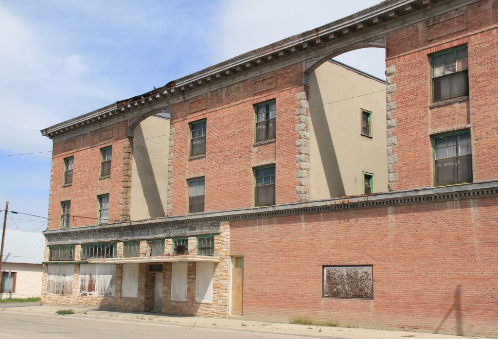
The next two images from 2023 show some restoration had been accomplished over the preceding ten years. But the building was far from been ready for any new use, especially in sections where the roof had failed.
2023 image2023 image
The newspaper story emphasized that any restoration would not be cheap. The place had deteriorated too much in the last three decades. One estimate called for $15 million. but having seen the town bring back its historic Main Street movie theater after a disastrous fire ten years ago, I have hopes the hotel will attract the necessary investment.
One of the most important late 19th century architects in Montana was German-born and -trained John C. Paulsen (1853-1897). He arrived in Helena in 1887 and soon joined with contractor Noah McConnell to establish the firm of Paulsen & McConnell, which existed until its dissolution in 1891.
One of the firm’s early commissions, the Jefferson County Courthouse in Boulder, enhanced its reputation for public architecture. its stately mix of brick and stone, dominated by a central tower with a commanding arch entry makes it one of the state’s most impressive Late Victorian era designs.
The firm had many significant commissions for private homes in Helena in the years 1887-1890. A select few that are listed in the National Register of Historic Places are shown below:
Sienna Hall, 1887 (1986 photo)Spalding-Gunn House, 1888-1889, which was part of Preserve Montana’s 2025 Hidden Helena tourA remodel of the Wilbur F. Sanders House, c 1887 (1988 photo)Neill House, c. 1888, remodeled significantly by Cass Gilbert, 1908 (1986 photo)Image of Neill House before Cass Gilbert remodeling, image courtesy of P.L. Dean, Helena
Perhaps most importantly there was Paulsen’s own home on the west side of town, which was built in 1889 and featured in the Hidden Helena 2025 tour. From the exterior the home doesn’t seem too splashy but the interior is one of the city’s best Arts and Crafts styled interior designs..
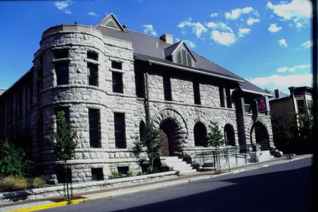
Another Helena landmark attributed to Paulsen is the Lewis and Clark County Jail, which was converted about 100 years later to the Myrna Loy Theatre.
Lewis and County Jail (1996 image)
One of Paulsen’s commercial buildings in Helena still stands, altered at an unknown date, on east Broadway.
Image taken in 2018
With John Lavalle as a partner, Paulsen also designed the downtown Montana Club but after a fire and major redesign by Cass Gilbert, nothing remains of Paulsen’s design outside of some of the stone, perhaps, reused on the first floor.
A much more intact example of Paulsen’s commercial designs is the landmark Higgins Block in downtown Missoula, another National Register building associated with Paulsen’s work.
Higgins Block, c 1986 imageHiggins Block, 2006 image
In 1895, Paulsen was appointed State Architect and several of Montana’s best known turn of the 20th century public buildings are from his designs.
First the Montana Deaf and Dumb Asylum in Boulder (images from 1986 to 2021):
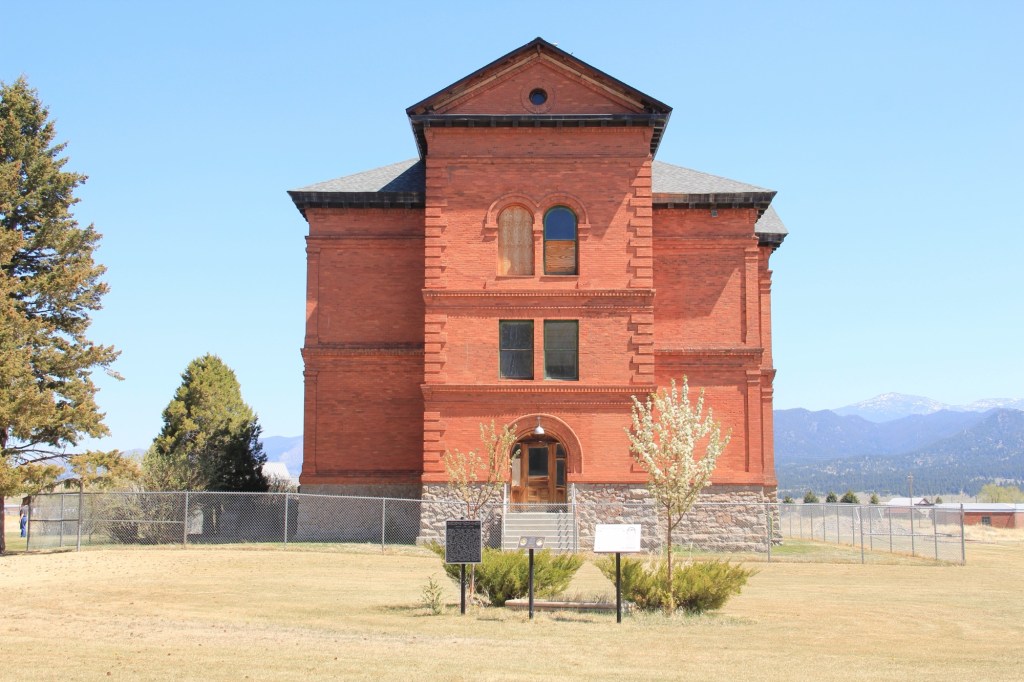
One of my favorites, the original building for Montana Western College (now Montana State University Western) in Dillon:
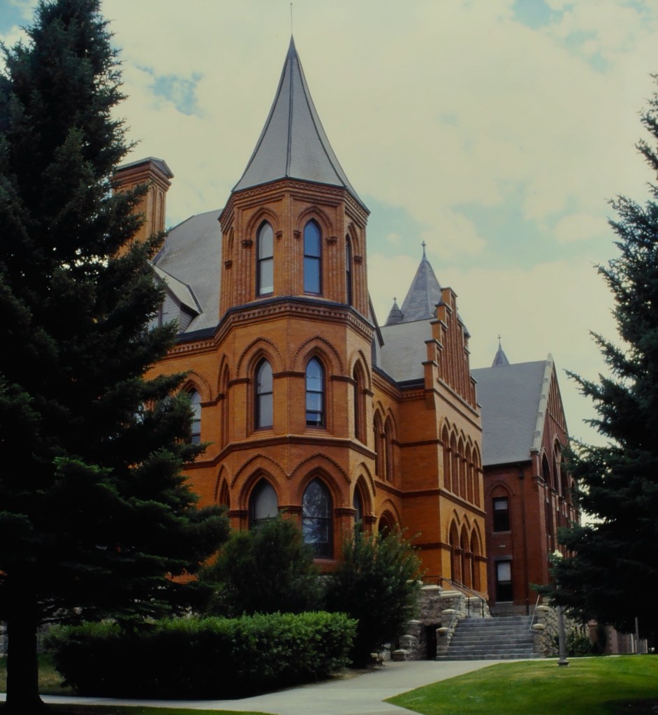
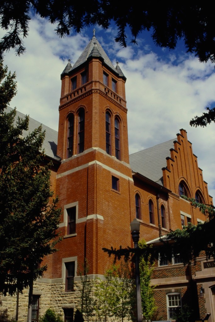
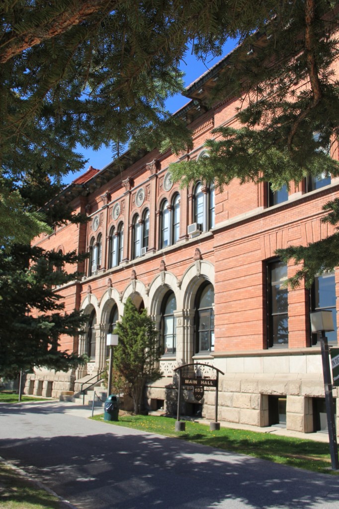
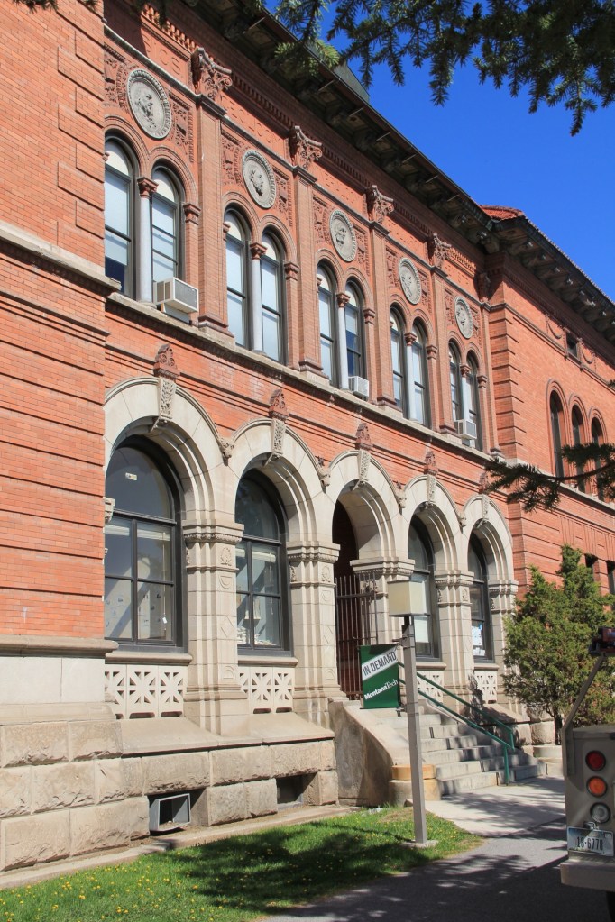
The Butte landmark Main Hall at Montana Tech University
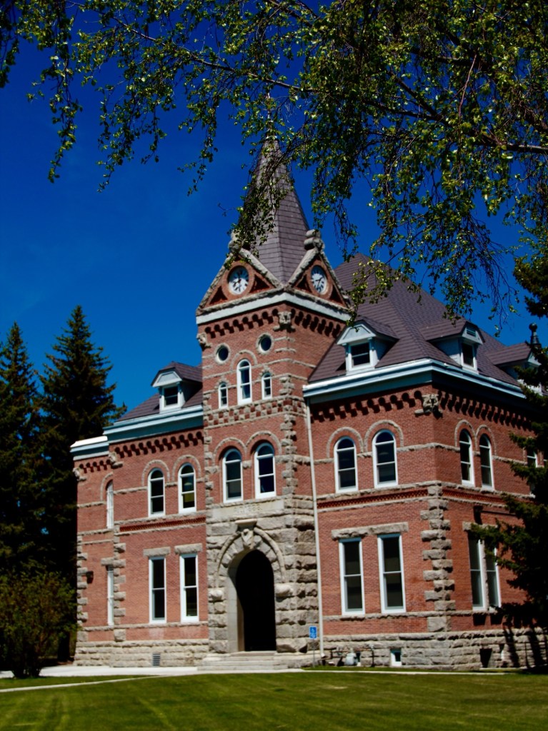
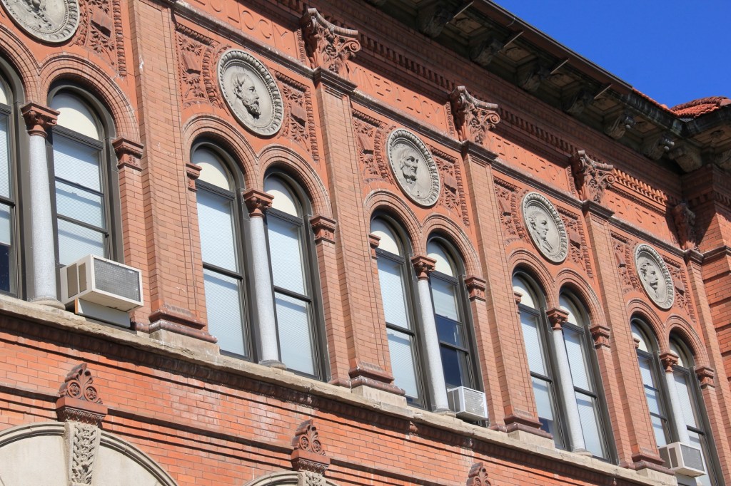
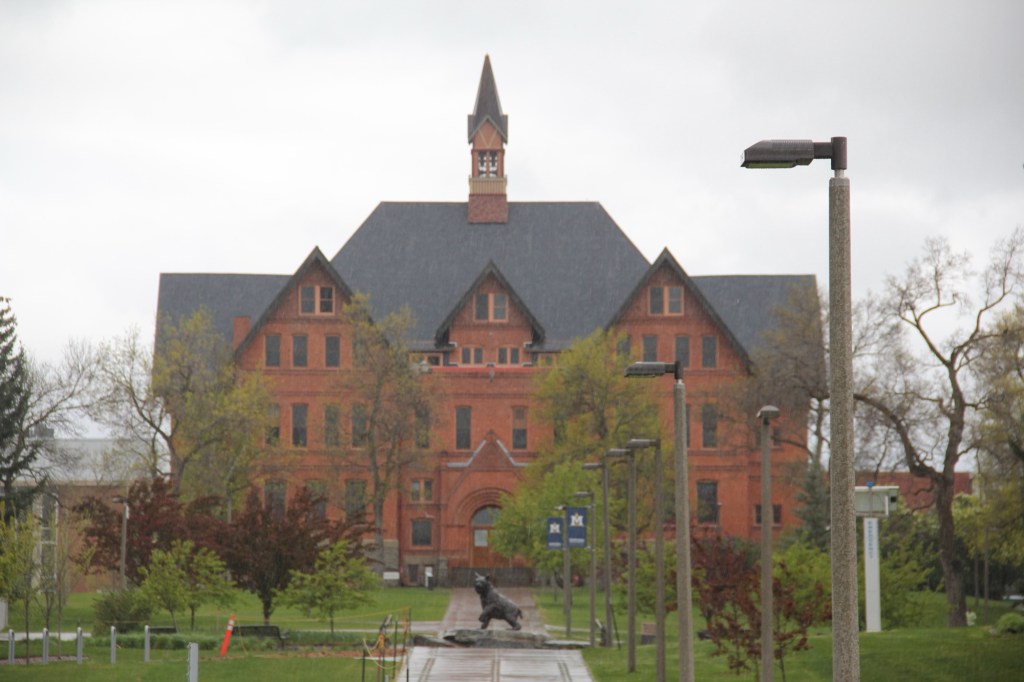
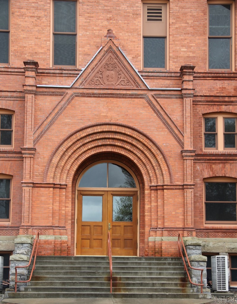
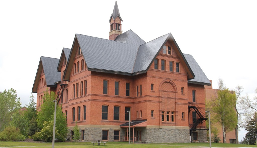
And Paulsen’s best known building, the iconic Main Hall of Montana State University in Bozeman.
Paulsen’s career became mired in controversy over the design of the new state Capitol building in Helena. After grand jury investigations in 1897 Paulsen allegedly had a nervous breakdown that led to heart complications and he died in Helena. Yet his late Victorian designs for many home and public buildings remain as a reminder of his imprint on the state’s built environment.
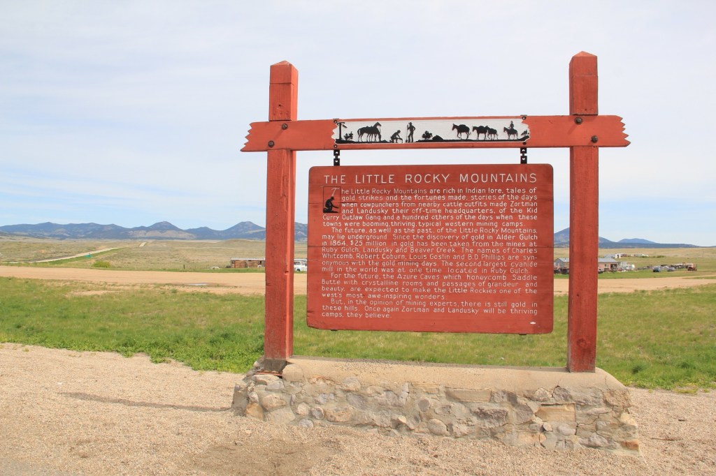
It would not be unfair to suggest that, perhaps, Montana has too many highway history markers. There are the classic ones of the mid-20th century by the state highway department with wonderful silhouettes from Helena artist Shorty Shope, as shown above.
Then there are hundreds of contemporary interpretive markers everywhere—markers that you just didn’t see back at the time of my historic preservation plan survey of 1984.
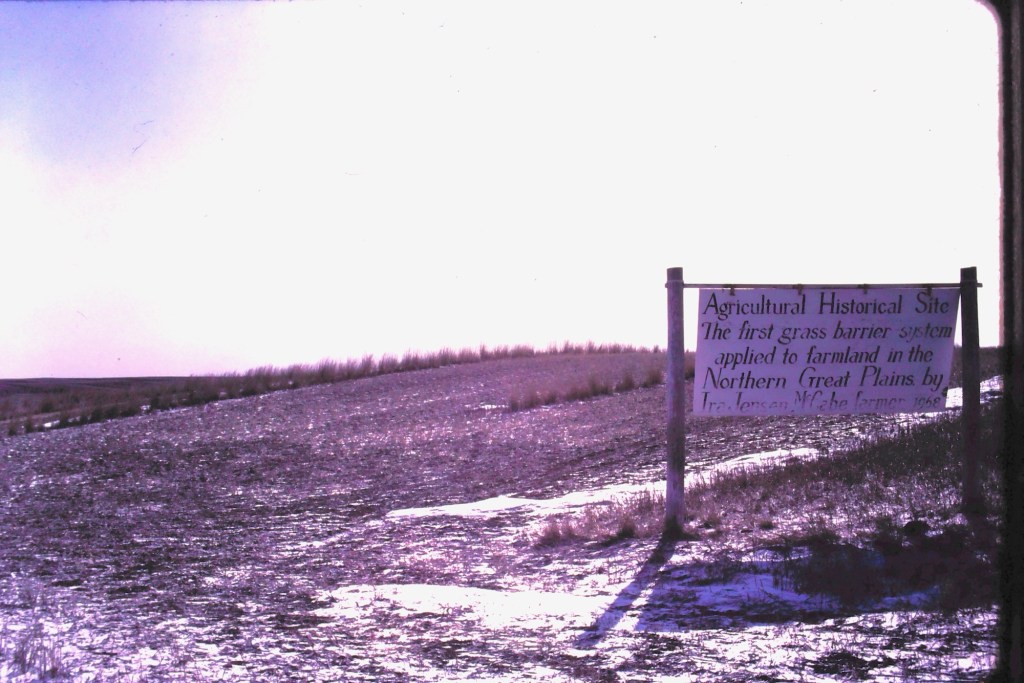
But early in that survey work in March 1984 I encountered along Highway 16 in Roosevelt County a sign that marked an “Agricultural History Site” crediting farmer Ira Jensen McCabe for the northern plains’ first “grass barrier applied to farmland.”
Ever since that encounter, I have been fascinated by Montana’s handmade history signs. Here are some of my favorites.
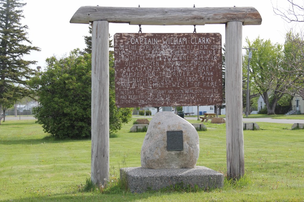
In Big Timber this marker (above) about Captain William Clark was on old U.S. Highway 10 until 1983 when it was moved to the city park of Big Timber. It was fresh and somewhat shiny then—40 years later it’s a bit worse for wear.
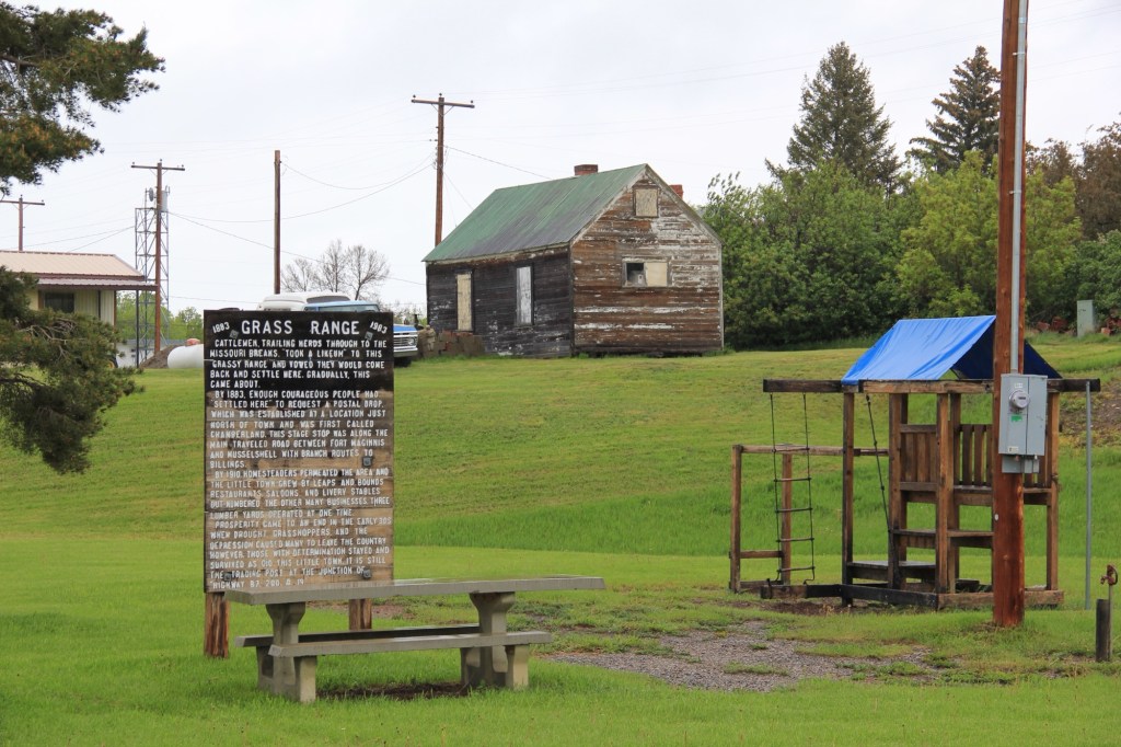
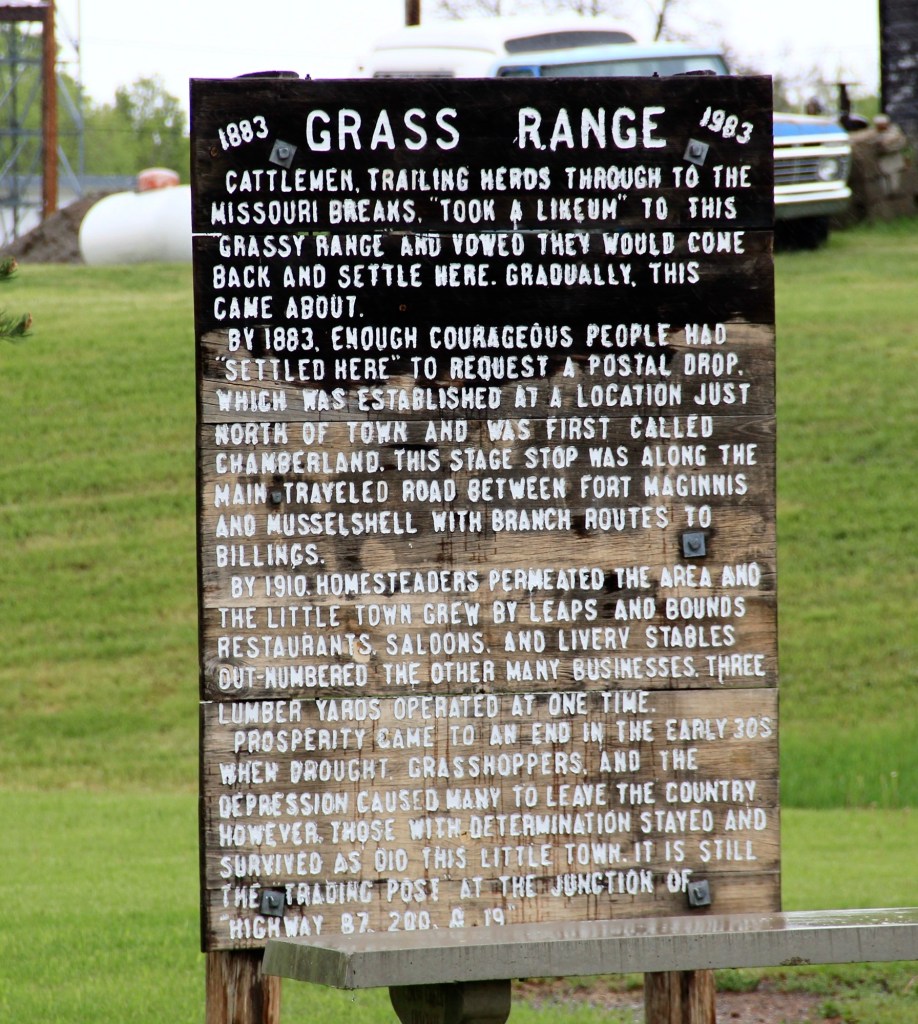
At the town park of Grass Range in Central Montana residents shared their history at some depth. This place is not on Highway 200 and it’s almost like the 1983 sign is there to remind residents of their past—then you find out that the park was where the community celebrated its 100th anniversary in 1983.
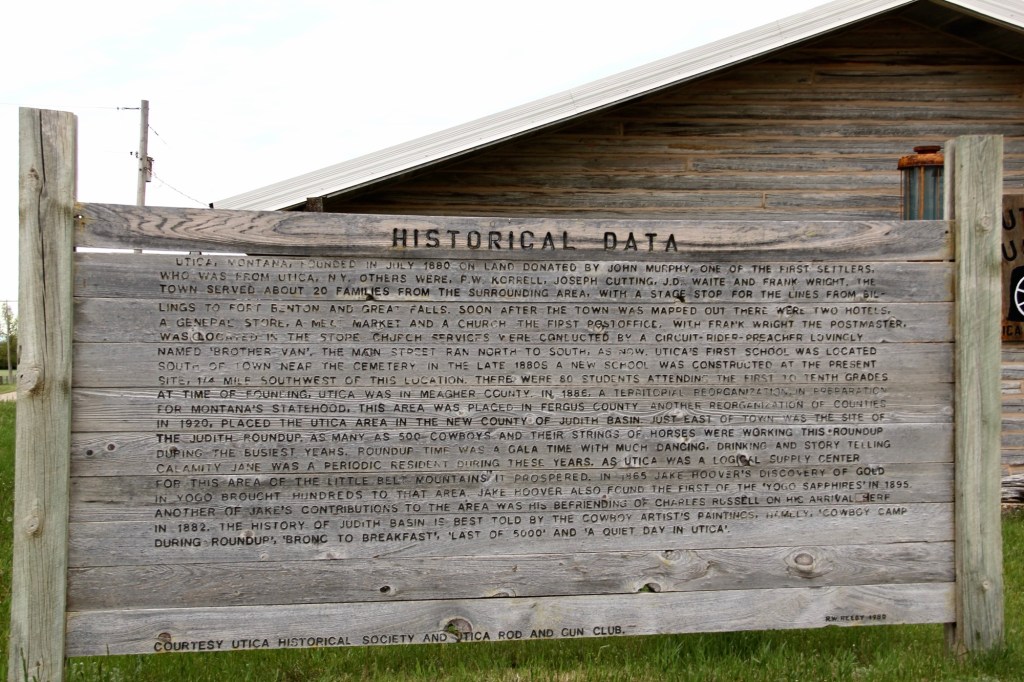
Grass Range seems concise and to the point compared to the Historical Data marker at Utica crafted by R.W. Reedy in 1980 for the Utica Historical Society and the Utica Rod and Gun Club.
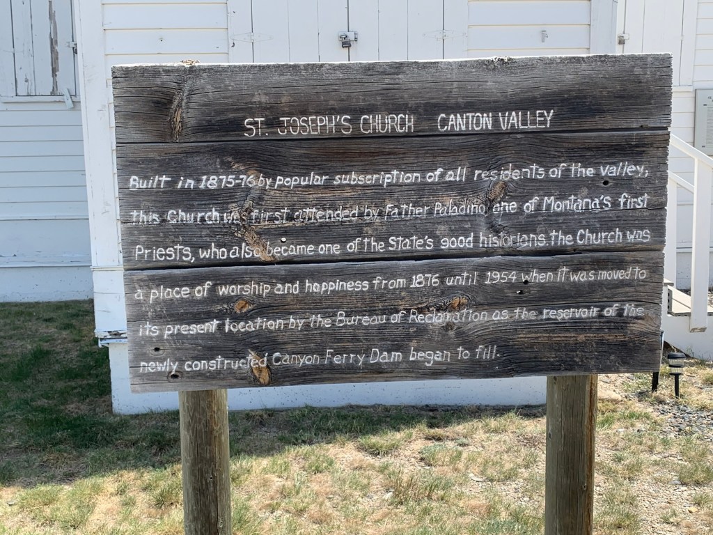
Sometime after 1954, residents of Broadwater County added the marker below about the history of St. Joseph’s Catholic Church.
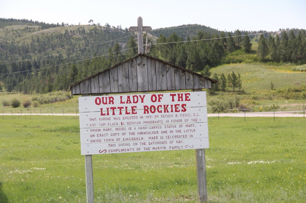
The Martin family explained the story of Our Lady of the Little Rockies” (below) outside of Hays in Blaine County.
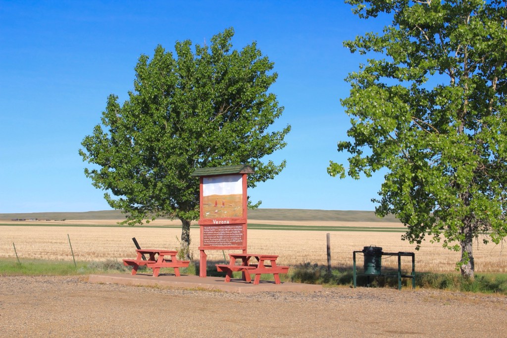
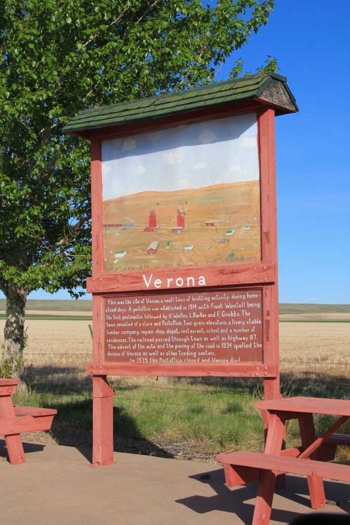
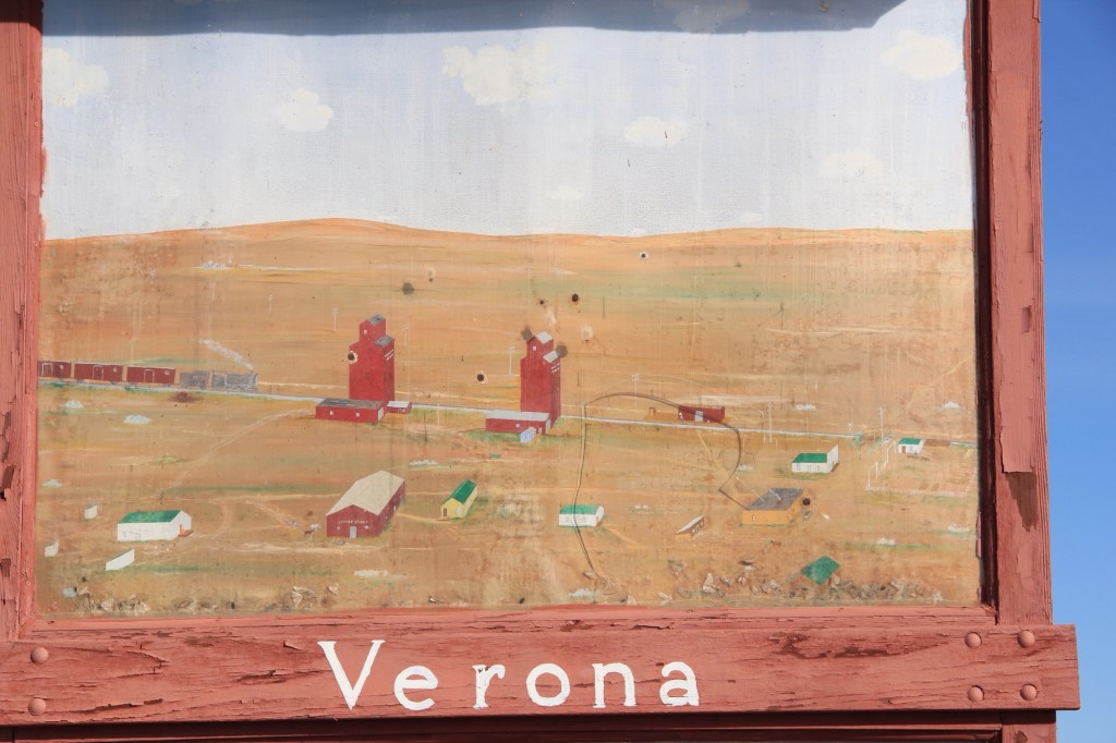
My favorite, however, is in Chouteau County along old Highway 87. It tells the story of Verona, one of the many homestead era towns that once covered Central Montana. The marker serves as a roadside stop but it’s not for tourists as it’s far from the present highway. It serves as a tribute to the past, complete with a painting of what Verona was like more than 100 years ago.
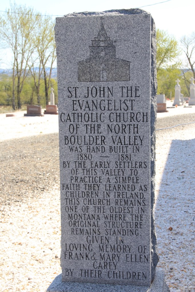
Handmade history hasn’t disappeared, but it does take different forms, such as a permanent stone marker for St John the Evangelist Catholic Church in the Boulder Valley (below) put up by the Carey family.
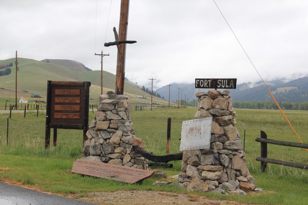
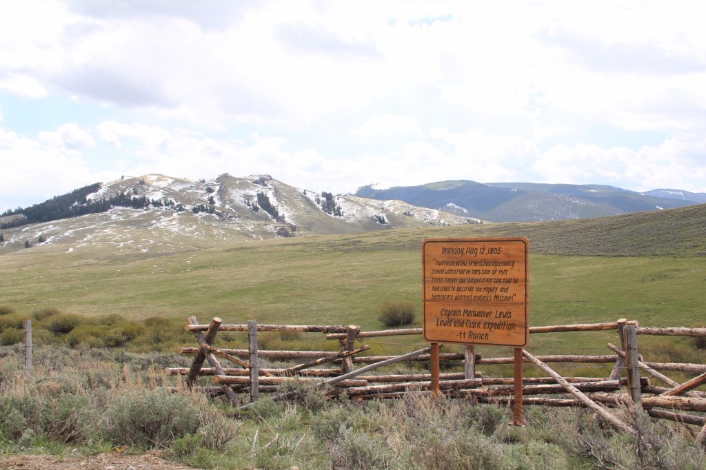
Or the interpretive marker for local history at Sula, in the state’s southwestern tip. Ranches have gotten into the act as well as seen by this wooden sign (below) about the location of Meriwether Lewis on August 12, 1805.
Montanans sharing stories about the places that matter to them—it doesn’t get more “public history” than this.