The Yellowstone and Missouri Confluence

IMG_6054
IMG_6053
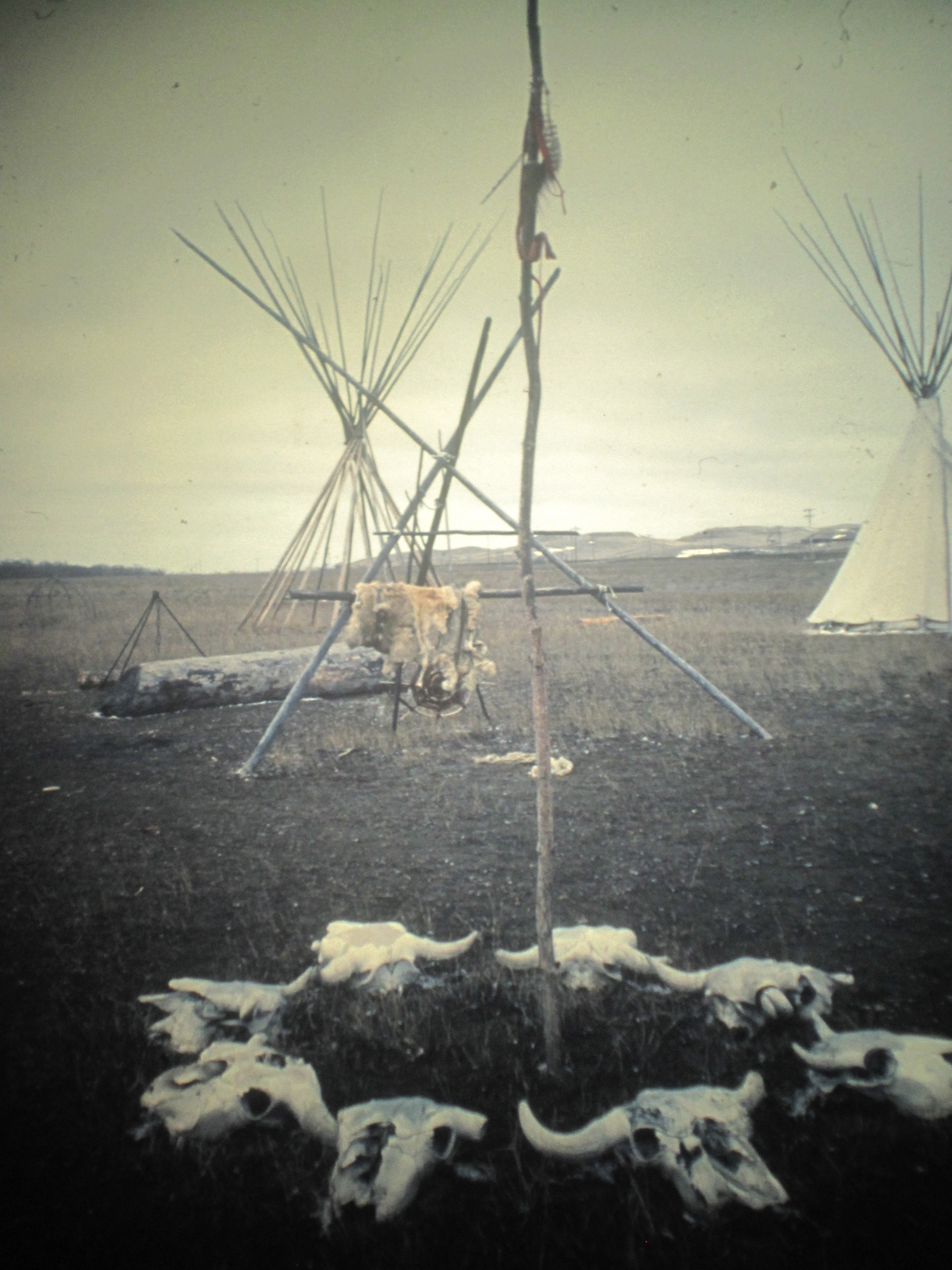
In the Montana survey work of 1984, there were few places I was more excited about visiting than the confluence of the Missouri and Yellowstone Rivers, on the border between North Dakota and Richland County, Montana. I had been working with the Western Heritage Center of Billings for a year on an exhibit, “Yellowstone: River of Life,” that would finally (to my mind) begin to refocus attention on the largely ignored history of the Yellowstone Valley. The story had many beginning points, but certainly where the Yellowstone emptied into the Missouri was one of the most important. This area had long been a Native American landmark. For the early Canadian and American traders, it was a crucial crossroads for the northern plains fur trade. The American Fur Company established Fort Union as its largest post in the region–and the site of the fort was still there, but little else, as the images above from 1984 indicate. Paul Hedren of the National Park Service promised me there was more to come–that the post would be rebuilt and its significant story told.
IMG_6056
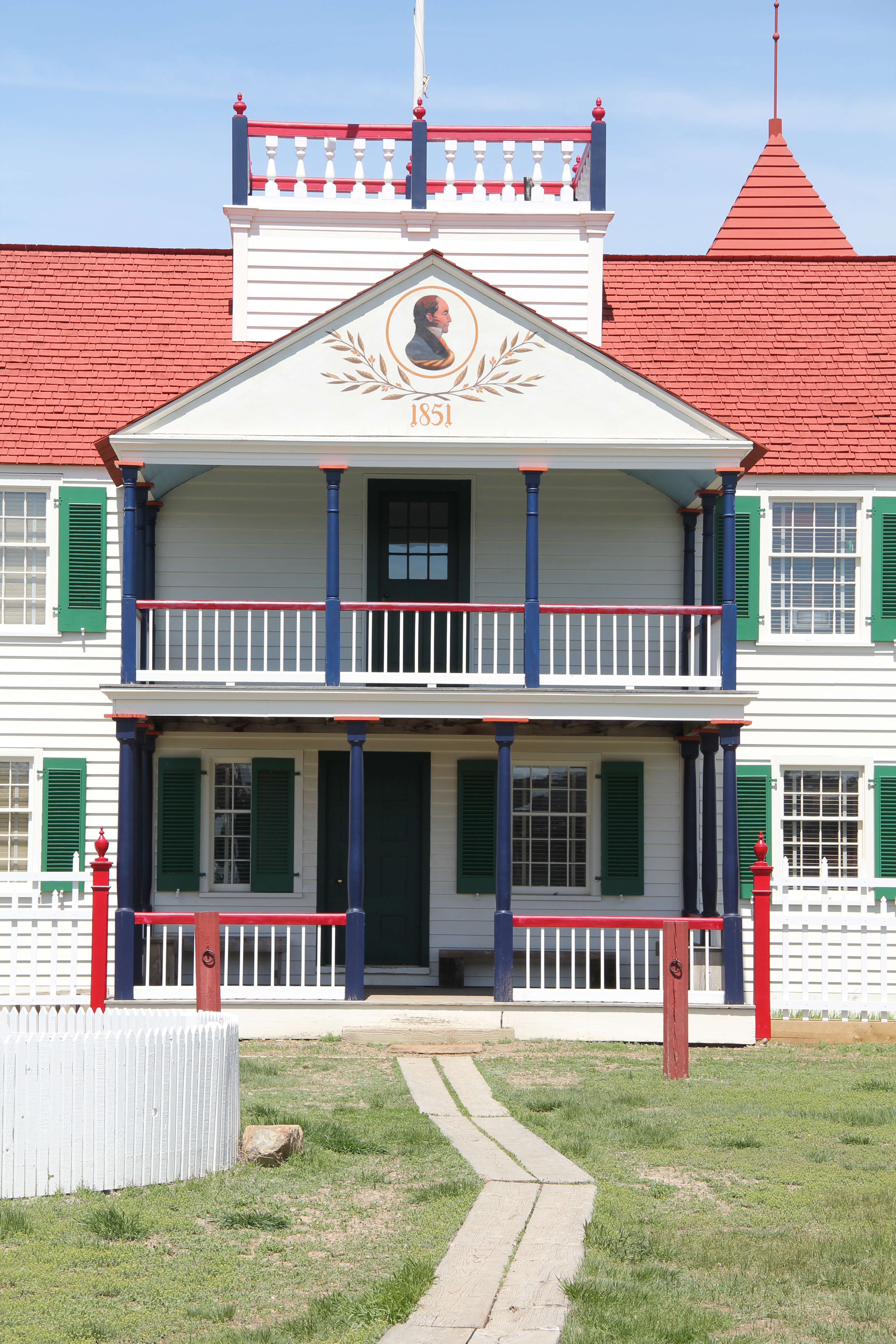
When I returned to this spot in 1988, I found that Paul’s promise had already met with success. The Bourgeoise House–the post headquarters and residence of the fort’s administrator (or Bourgeoise) had been rebuilt, finally suggesting the commanding size of the fort. The stockade and the rest of the site awaited a similar reconstruction.
IMG_7404
Twenty-five years later, I returned to Fort Union and explored a fully rebuilt site that finally was starting to receive the visitor count it always deserved: due to the Williston Basin oil boom. Williston, North Dakota, was gaining population as never before, and significant numbers of new residents were also reshaping Sidney, the seat of Richland County.
IMG_7391
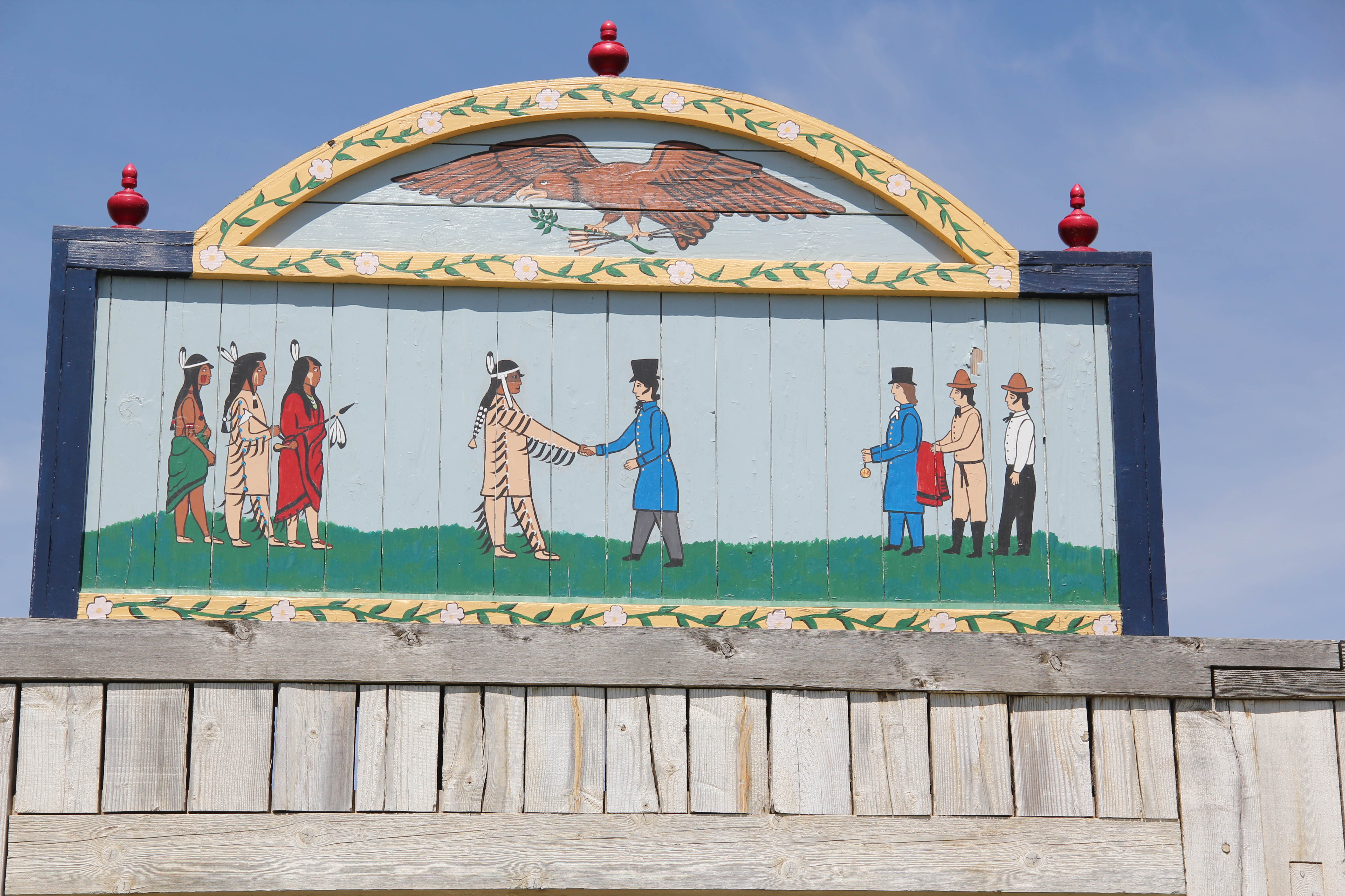
The reconstructed fort included a strong physical presence for the Native Americans who were the crucial economic actors for the post’s success. Without the reciprocity in relations and trade between the northern plains peoples and the American traders, the post would not have survived nor prospered.
IMG_7384
More could be done with the size and massing of this Palladian inspired classical styled dwelling–actually a rather late example of this architectural style but somehow a sensible design considering how the post was really on the far edge of the American empire. It would be decades later, after the arrival of the Northern Pacific Railroad in the early 1980s, that a dwelling with such architectural pretension would appear in the Yellowstone country.
IMG_7387
More could be said with additional reconstructed spaces and exhibits about the fur traders’ on Native Americans in the fur trade era from 1830 to 1868, but the fort as it exists in 2013 certainly conveys more to the public than the displays I found in 1984. Few places in the yellowstone Valley had changed more than Fort Union between 1984 and 2014.
IMG_7400
IMG_7389

Sheridan County: a forgotten railroad landscape

IMG_7450
In the past posts I revisited the two Daniels County towns at the “end of the line” of a spur line constructed by the Great Northern Railway in the early 1910s as a way of countering the push into northeastern Montana by the Soo Line at the same time. These attempts at railroad expansion and town building took root during the homesteading boom of that decade. Now with depots gone and residents drifting away, the old railroad corridor as it stretches from Opheim on the west end to its junction with the main line at Bainville, takes on the appearance of a ghost line, attested by the image above from Homestead and the one below from Reserve,both in Sheridan County.
IMG_7473
At the rough mid-point of this spur line lies Plentywood–rather forsaken spot I thought in 1984 but a town now actually facing too much growth, too fast as the need for residences and space for the thousands of Bakken oil field workers seeps into northeast Montana. In 2013, the impact on Plentywood and Medicine Lake to the south was apparent as this just opened man camp at Medicine Lake shows.
IMG_7458
Plentywood was of considerable interest to me because once the initial homestead boom turned to disaster in Sheridan County by the time of the Great Depression, there was a local movement to create a communist party. This story was known in 1984 but now we have full accounting due to the research of Sheridan County native Verlaine Stoner McDonald in her book The Red Corner (2010).
IMG_7492
IMG_7491
Plentywood has a classic T-plan town, with its depot and huge grain elevators defining what was the head of the town–and then a long “stem” of the T, where first came the commercial district, then a residential district, and finally at the “bottom” of the T: the county courthouse.

Plentywood's T-town plan, looking from the courthouse

Plentywood’s T-town plan, looking from the courthouse


This arrangement of space spoke to the railroad’s concern for safety and efficiency: T-plans moved traffic and pedestrians off of the tracks. But when the Works Progress Administration built the understated WPA Modern-styled courthouse in 1937, placing it at the end of the town, you also had a classic statement of where power lay in these plains country towns. The railroad stood at the head; at the end of the town was the seat for local politics.
IMG_7497
In 1984 another interesting arrangement of space I noted in Plentywood was how three different banks stood on three of the four corners of the town’s most prominent crossroads, where Montana Highway 16 crossed the main street. The banks are still there with the stone-work of the historic Adolph Riba bank (built by Henry and John Hill from the village of Raymond to the north), making it a prominent landmark.
IMG_7509
The impact of the regional oil boom on the public landscape is most evident in new schools and the new library, attached to the historic courthouse, changes I didn’t expect to find in a town that had lost 700 residents from the 2400 or so who lived there in 1984.
IMG_7500
I was especially pleased to see the town’s historic movie theater, the Orpheum, which stands adjacent to the “top” of the T, still doing well. It was rare to find a small town movie theater in 1984, even less common today. Plentywood today is more than the historic center point of a neglected railroad corridor; it lies in the center of the changes coming to the region out of the 21st century oil boom of the northern plains.
IMG_1680
IMG_7520