Lewistown: at the heart of Eastern Montana

IMG_9389
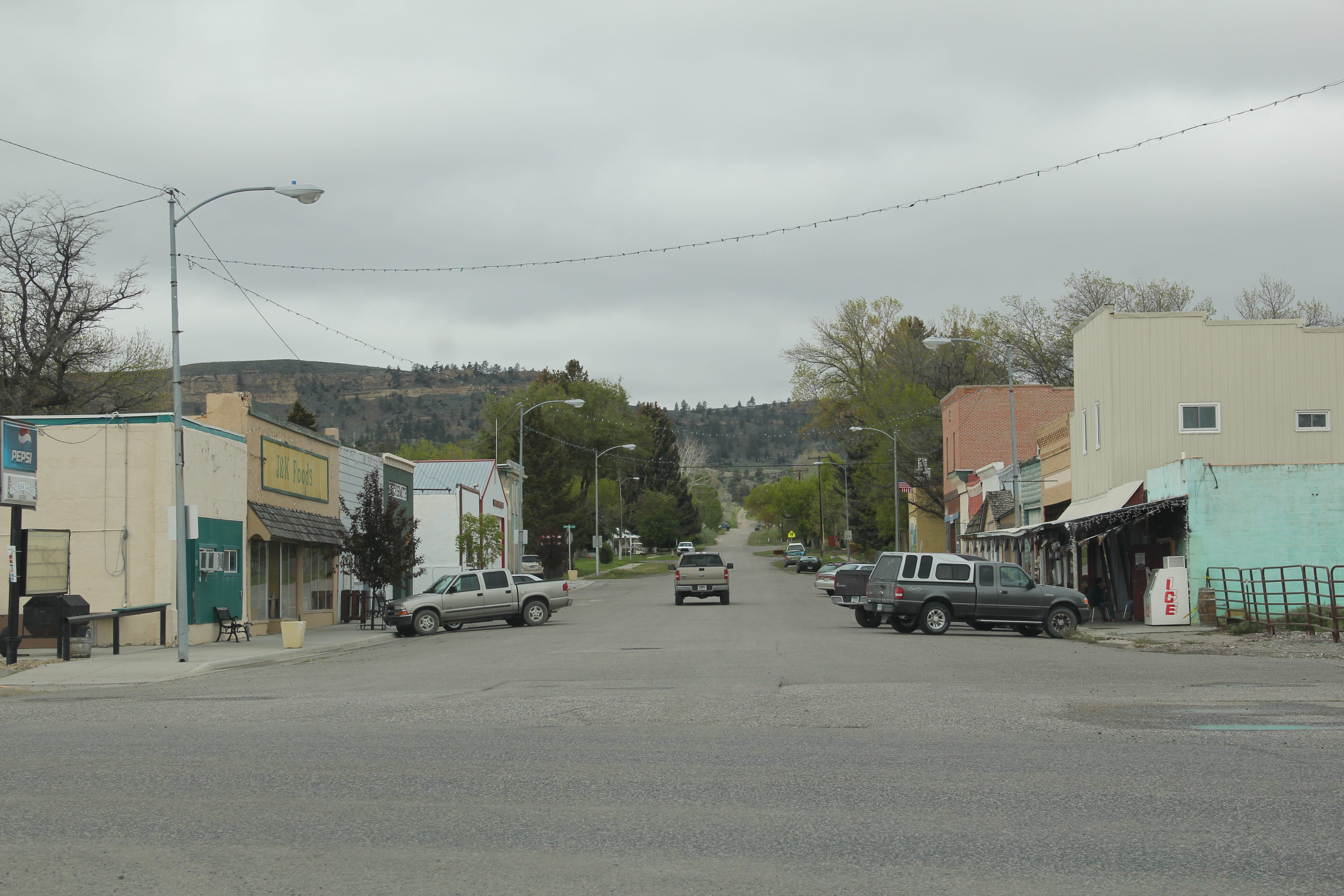
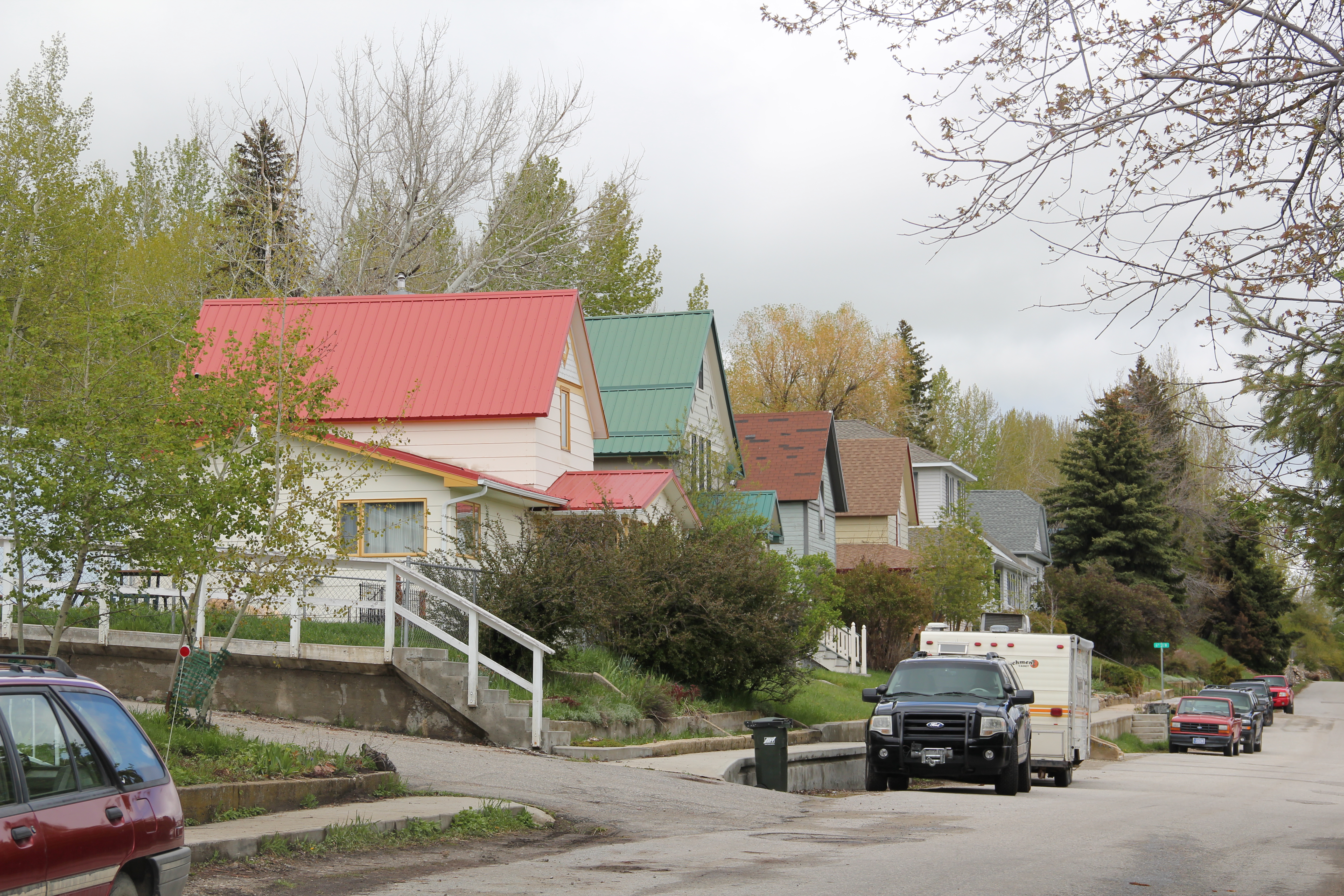
Lewistown, the seat of Fergus County, has been a hub for trade and government for eastern Montana since the 1880s.  Beginning as a trading post, the town next served as a crossroads for traffic going to short-lived precious metal mines at Kendall, Maiden, Giltedge, and other places.  Cattle ranches, such as the famous DHS Ranch and the N-Bar Ranch, also surrounded the place.  By the turn of the 20th century, the town had over 1,000 residents.  But by this time, railroad companies eyed the area for possible agricultural development, and within 20 years Lewistown had boomed–gaining six times its population–and a fascinating array of commercial and public buildings in the wake of the population growth.

IMG_9381
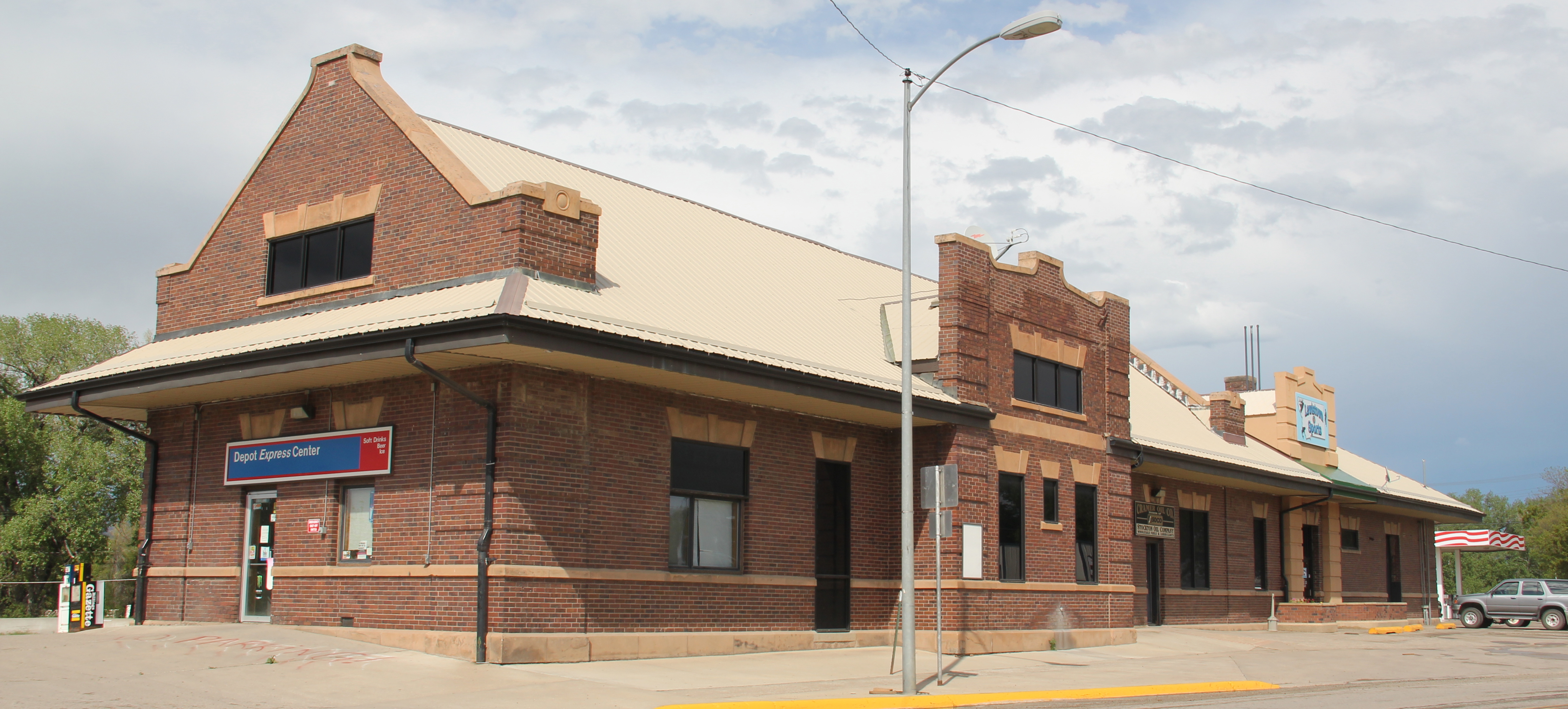
The Great Northern Railway not only an understated Classical Revival depot on one end of the town, it also expanded lines throughout Fergus County like tentacles desperate to grab as many wheat crops as possible.  The depot remains today, converted into a convenience mart and gas station (an adaptive reuse you do not commonly find for railroad depots).  On the other end of town stands the other major line–the Milwaukee Road–devoted to the homesteading rush in Fergus County.  It built an even grander

IMG_0004
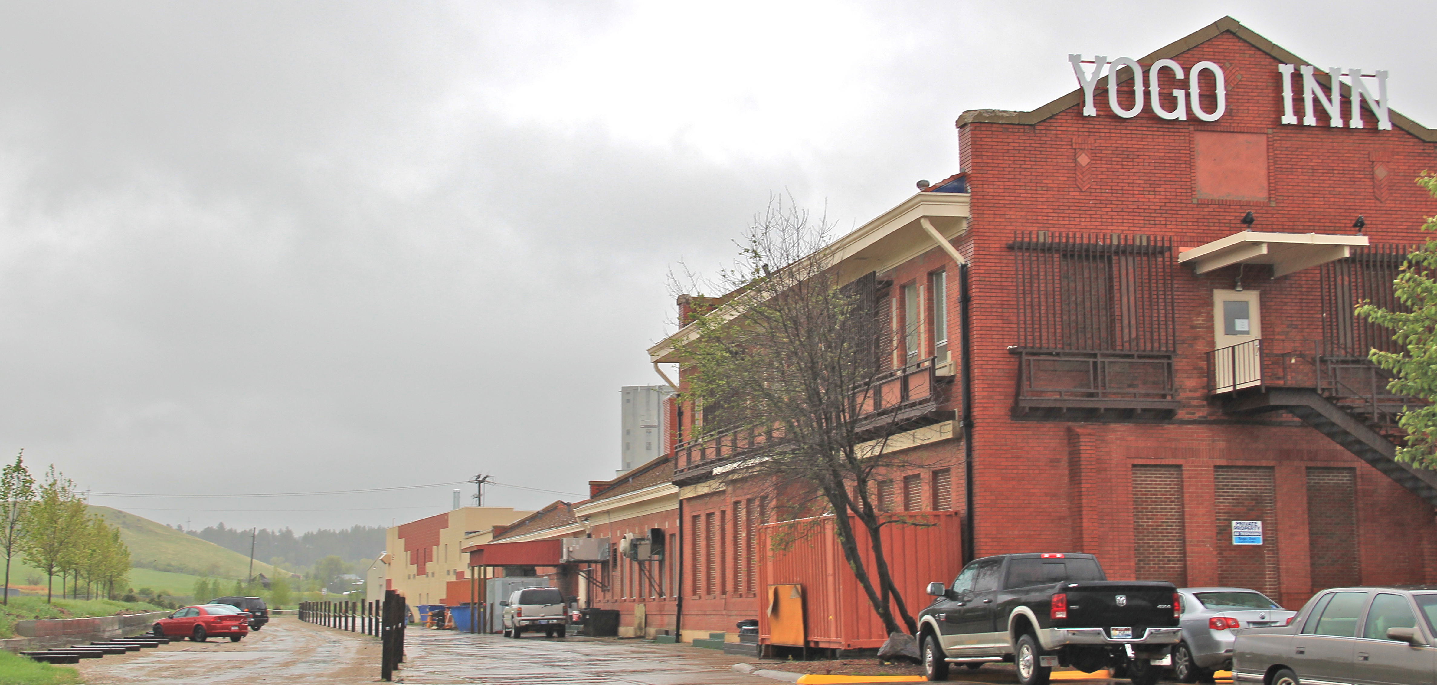
complex as a statement to its wishful dominance of the agricultural trade.  Shortly after the closure and bankruptcy of the line in the late 1970s and early 1980s, the depot became a large adaptive reuse project, turning the Milwaukee Road complex into the Yogo Inn and convention center, where, in 1984, I attended the Montana Historical Society statewide history conference.

IMG_9400The bloom grew stale over the decades and when I visited in 2013, the Yogo was clearly on life support; I was encouraged in May 2015 to find renovations underway–maybe there will be a third life for this Milwaukee Road landmark in Lewistown.

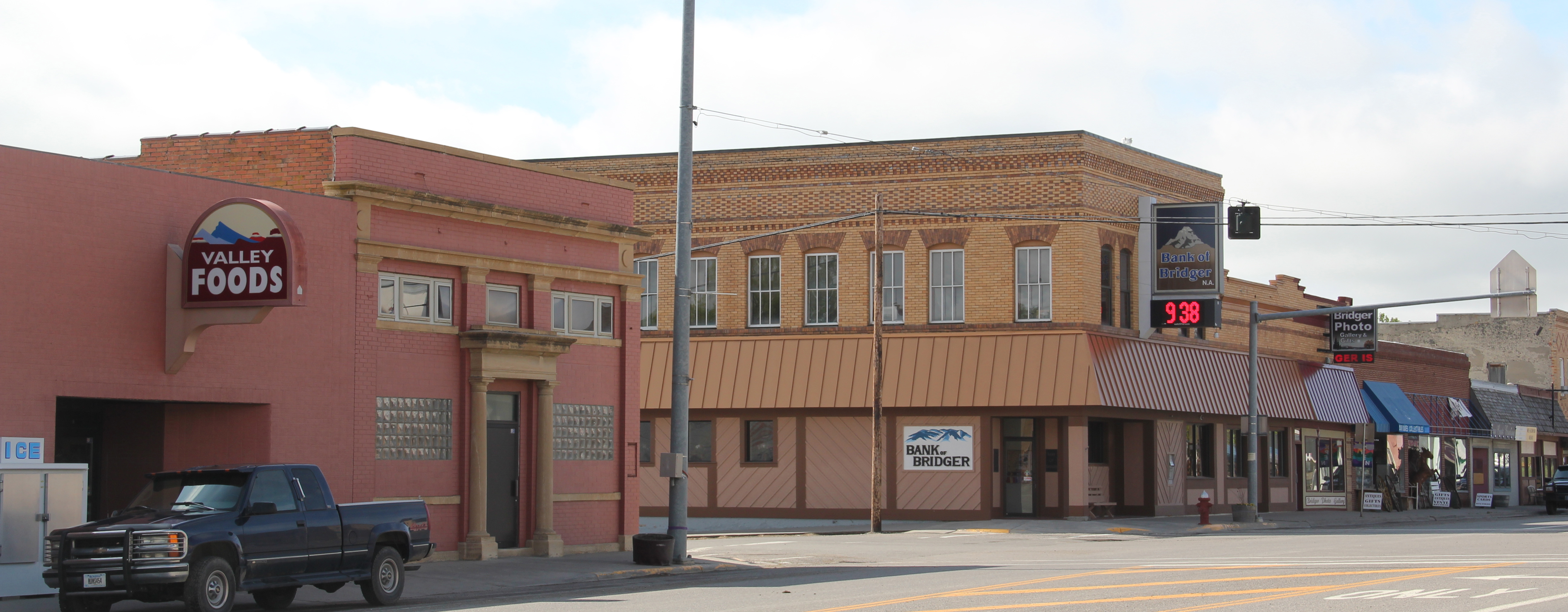
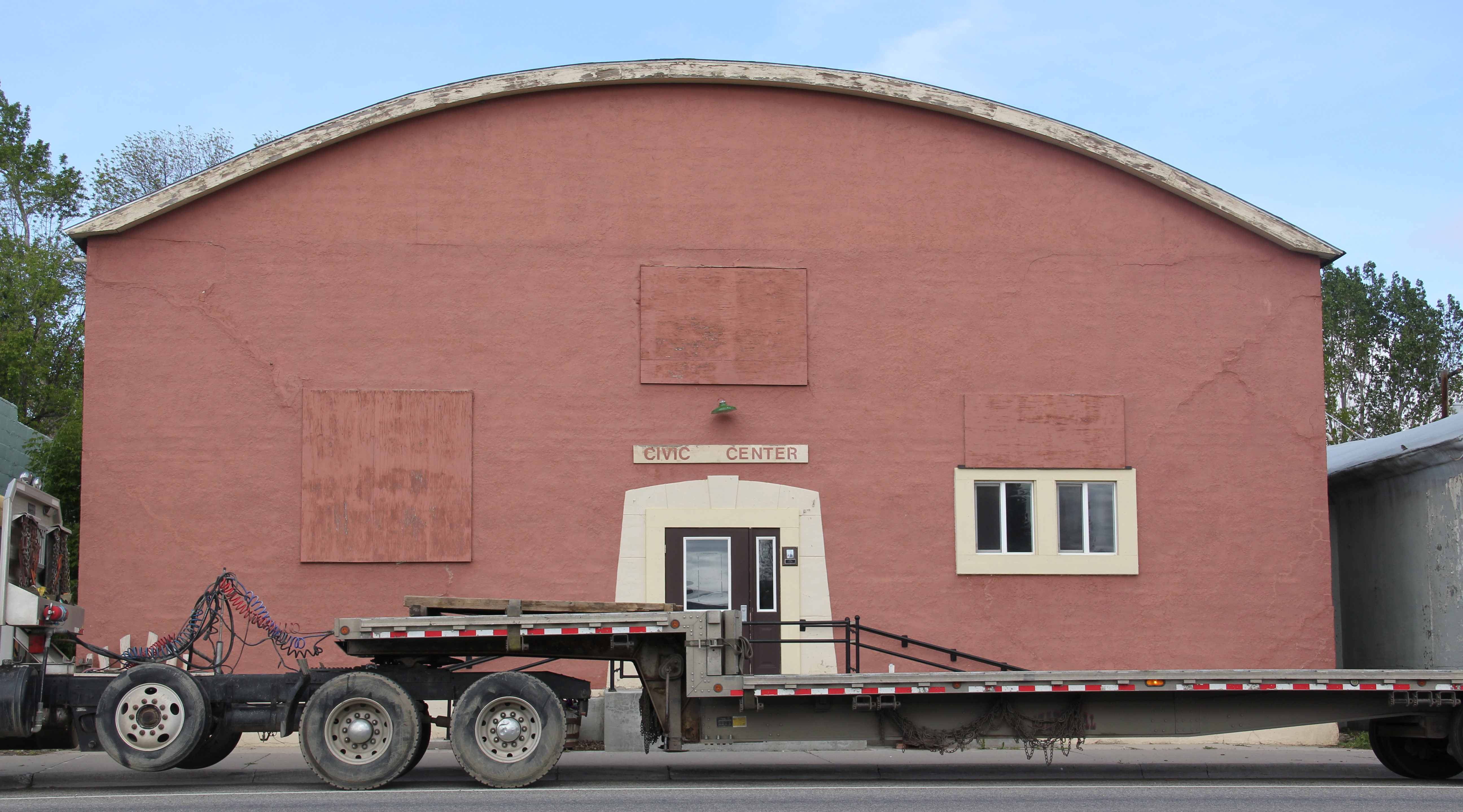
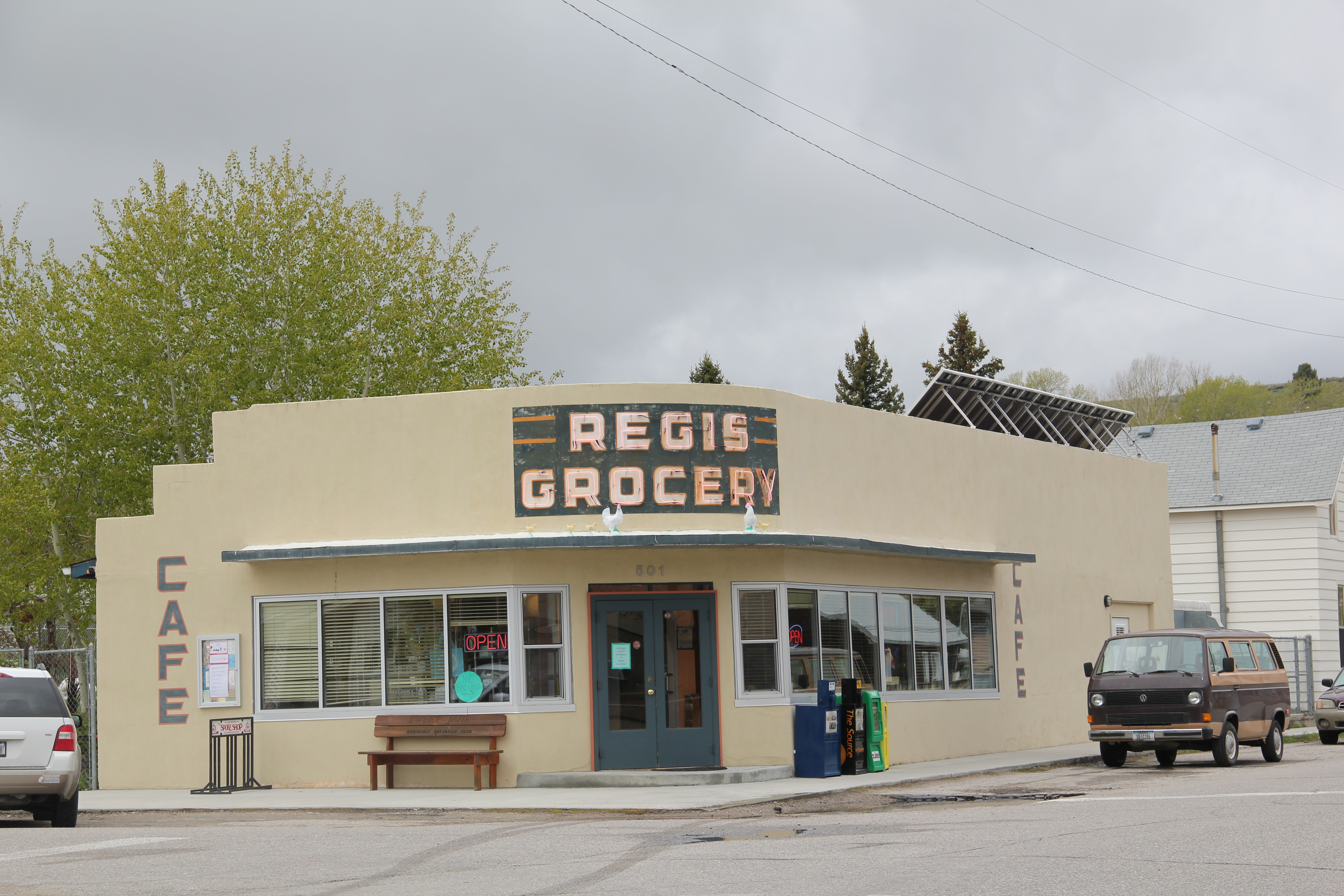
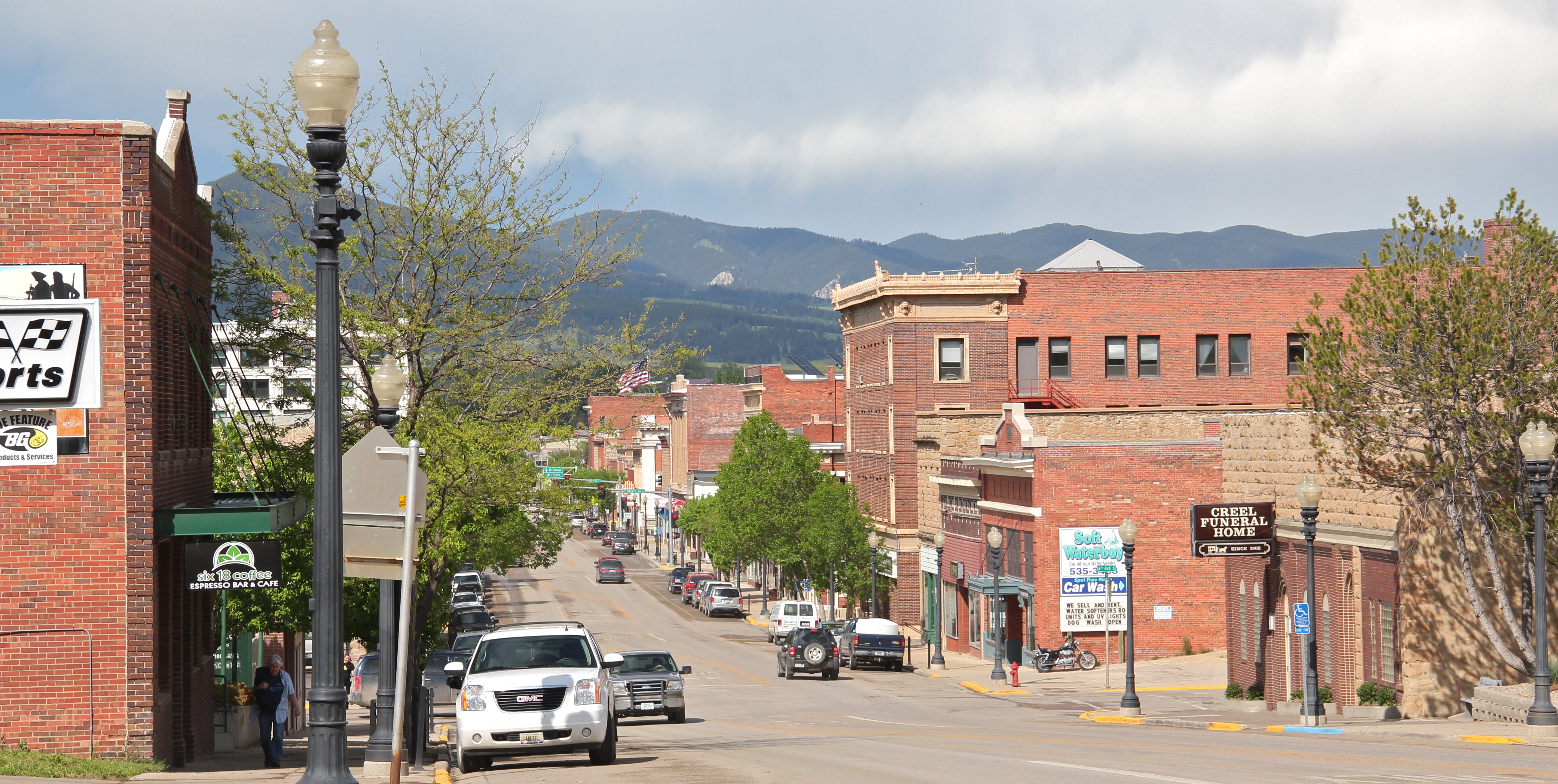
The Great Northern and the Milwaukee created the transportation network that brought homesteaders to central Montana by the thousands. Merchants, bankers, and craftsmen then rebuilt the downtown from 1904 to 1916, and much of that flurry of construction still serves residents today in the central business historic district, which is listed in the National Register of Historic Places.

IMG_9973
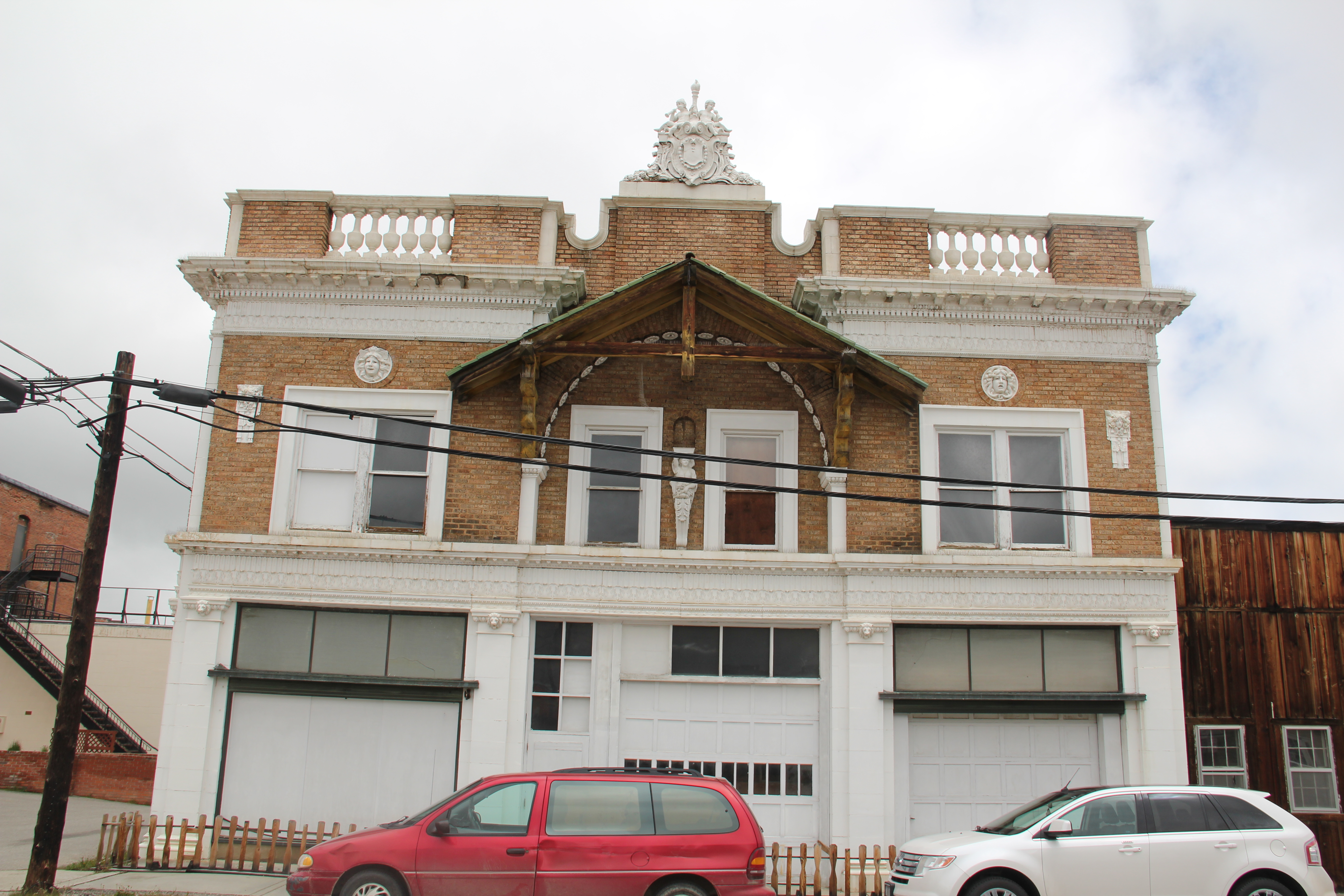
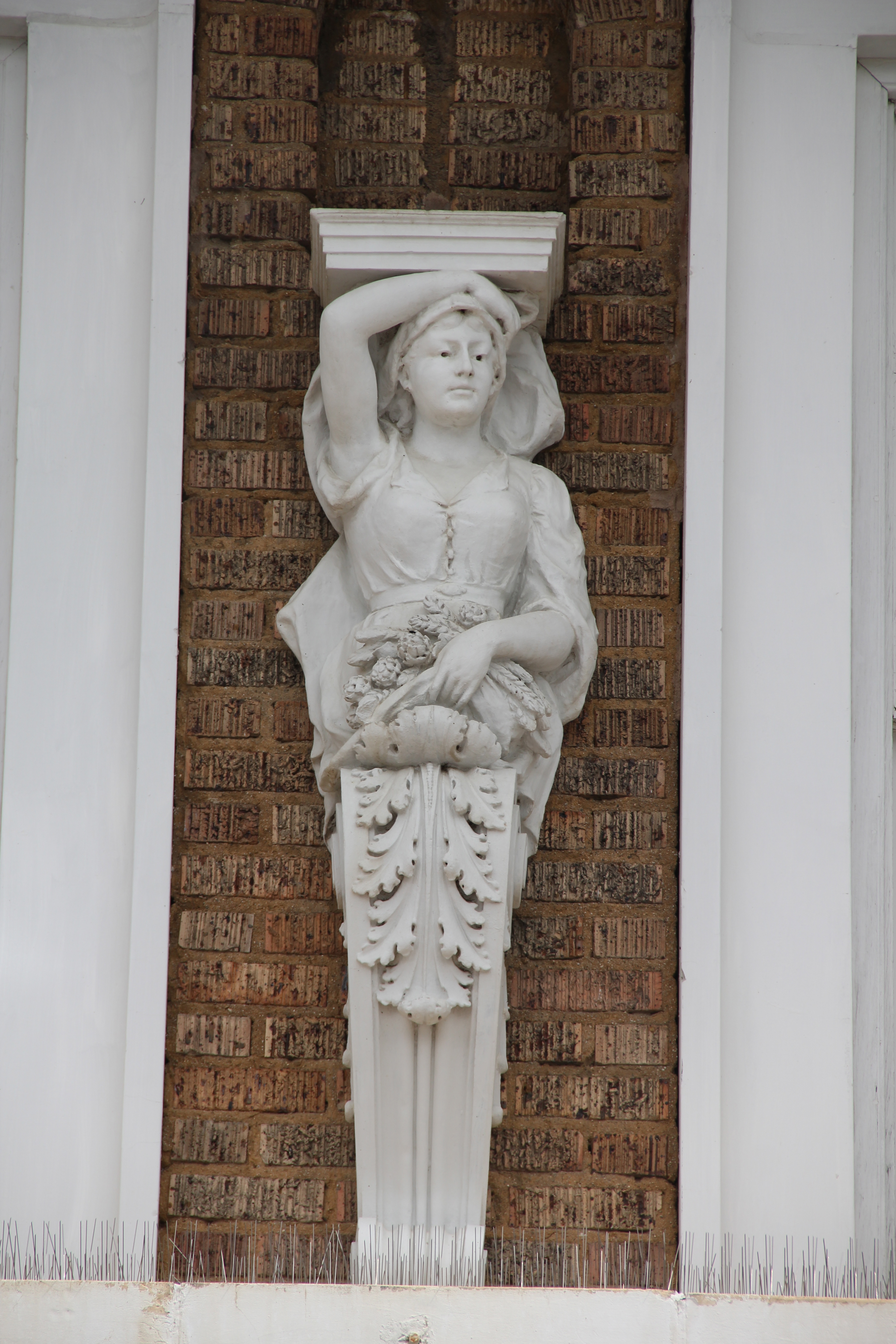
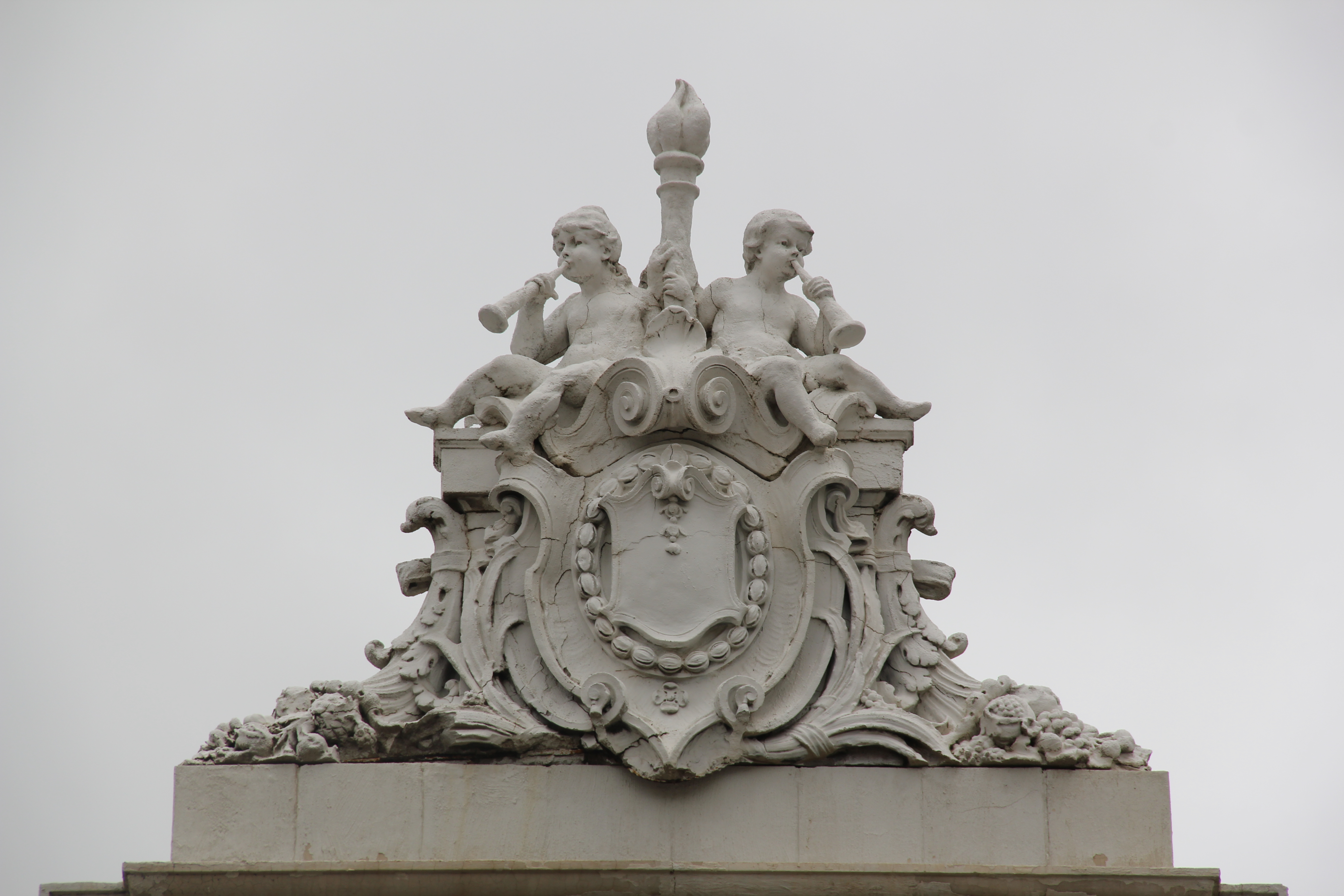
Classical Revival was the architectural statement of choice to this new Lewistown taking shape along Main Street.  The architects of the Montana State Capitol, Bell and Kent, designed a new Bank of Fergus County (above, on the right) in 1904.  It received another layer of classicism in the pilasters a decade later when owners wanted to match the flashy Judith Theater (1914), certainly one of the great examples of Beaux Arts design in a small Montana town movie palace.

Fergus Co Lewistown neoclassical bank  - Version 2

By 1916, however, bank officials were ready to support the town’s most complete interpretation of Classical Revival design in the new Montana Building, designed by the firm of Link and Haire.  The bank seemingly had few limits in front of it–homesteaders still arriving and agricultural prices were high.  But the boom went bust in the early 1920s and by 1924 the building had new owners, the First National Bank.  It has remained home to financial institutions ever since.

IMG_9967

IMG_9969

IMG_9951
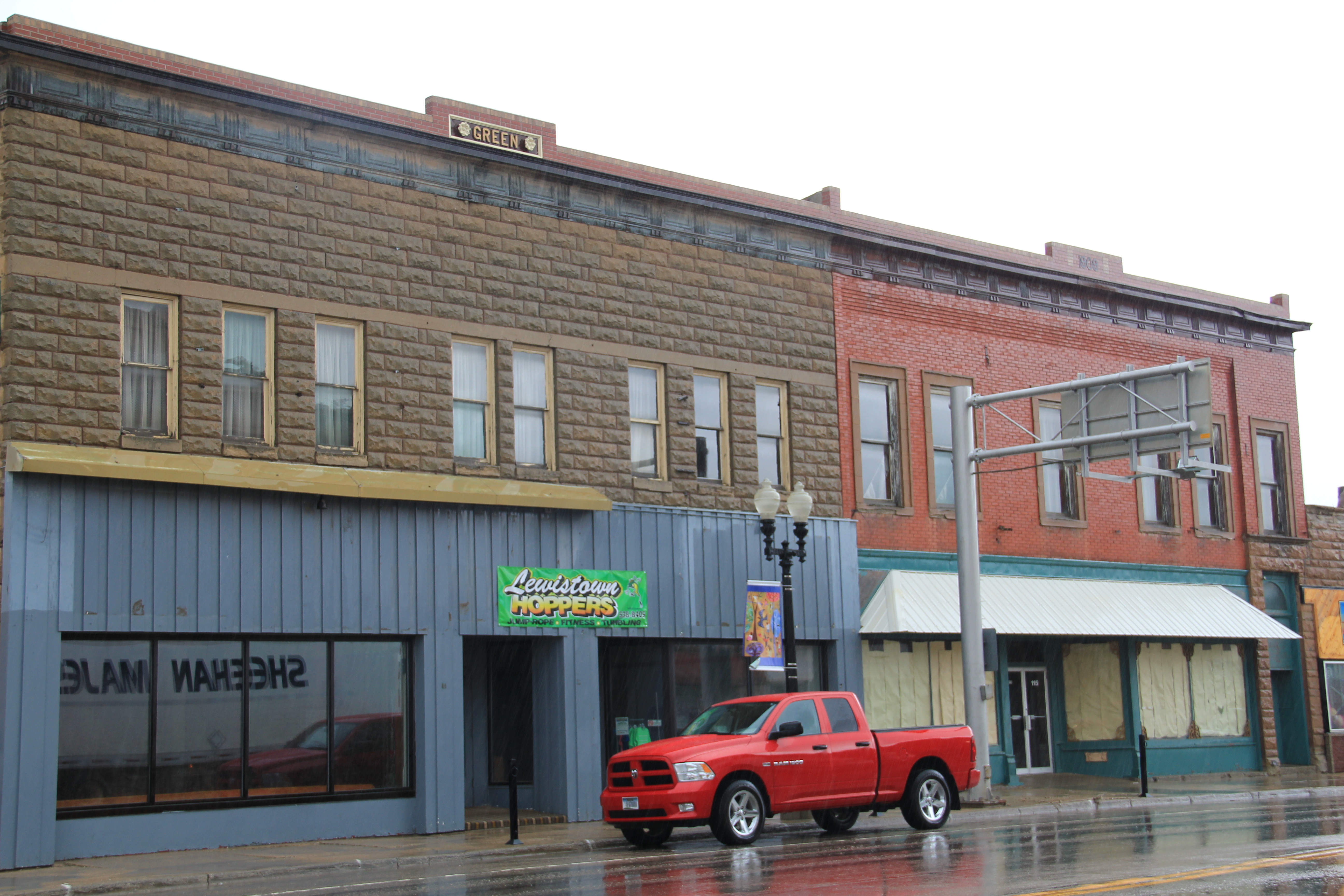
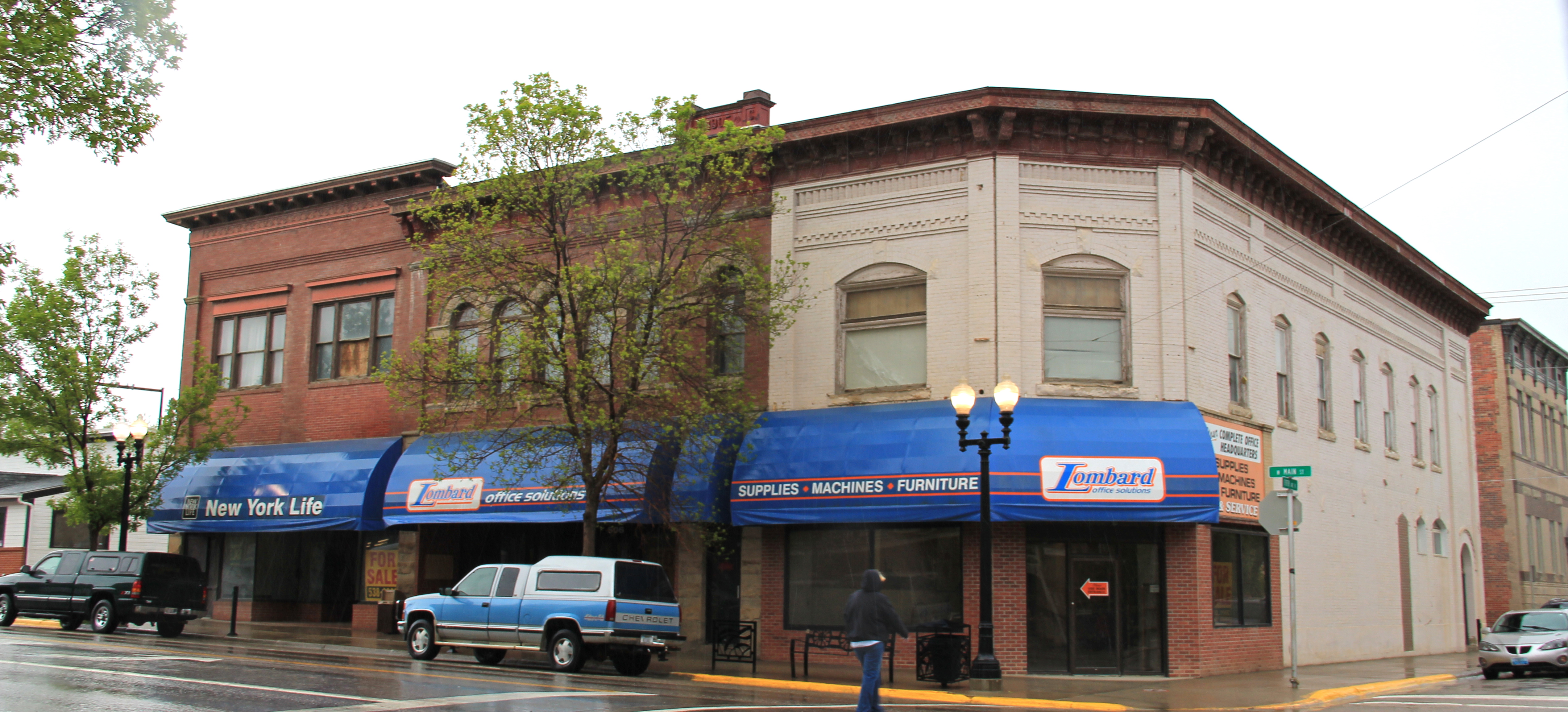
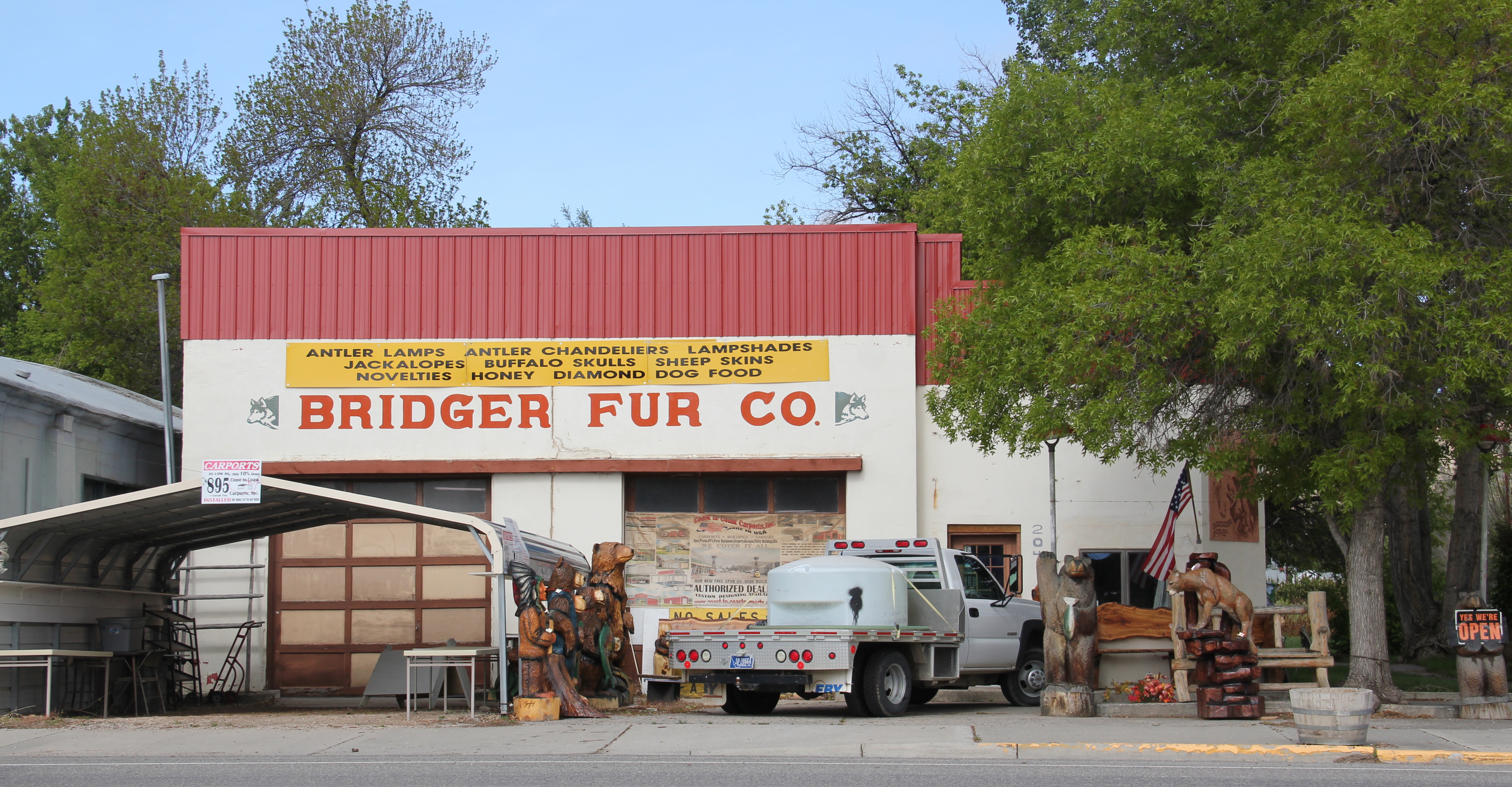
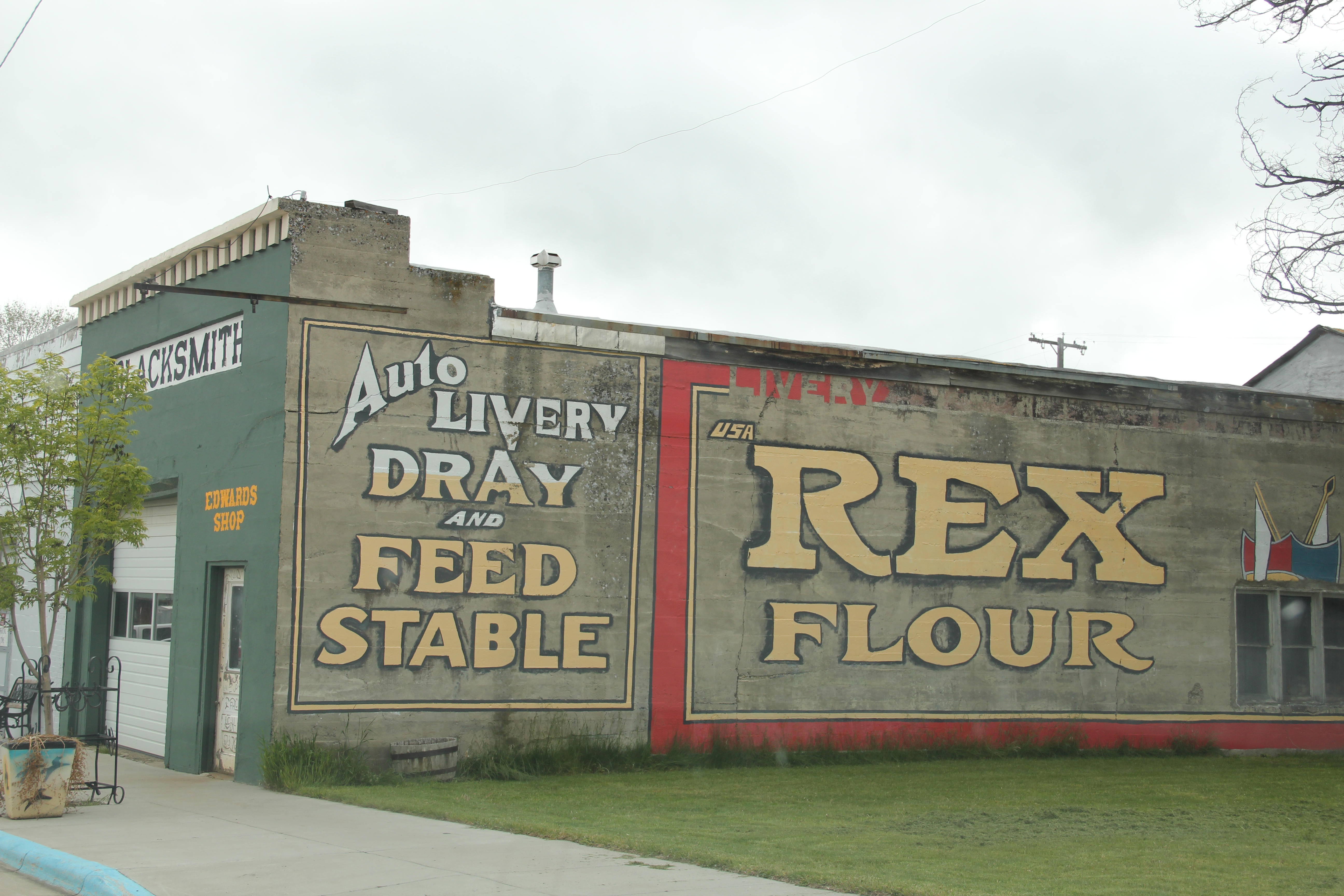
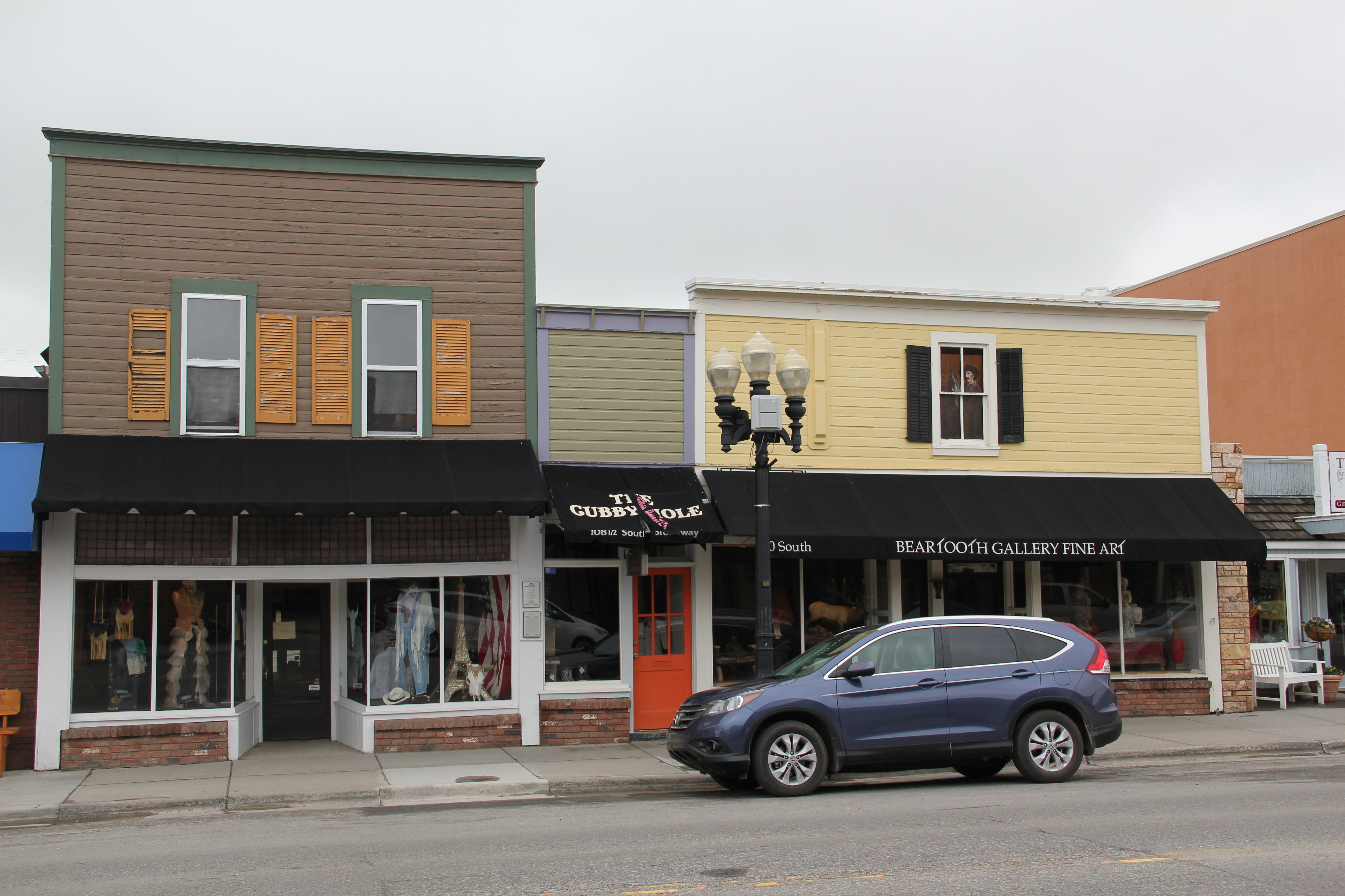
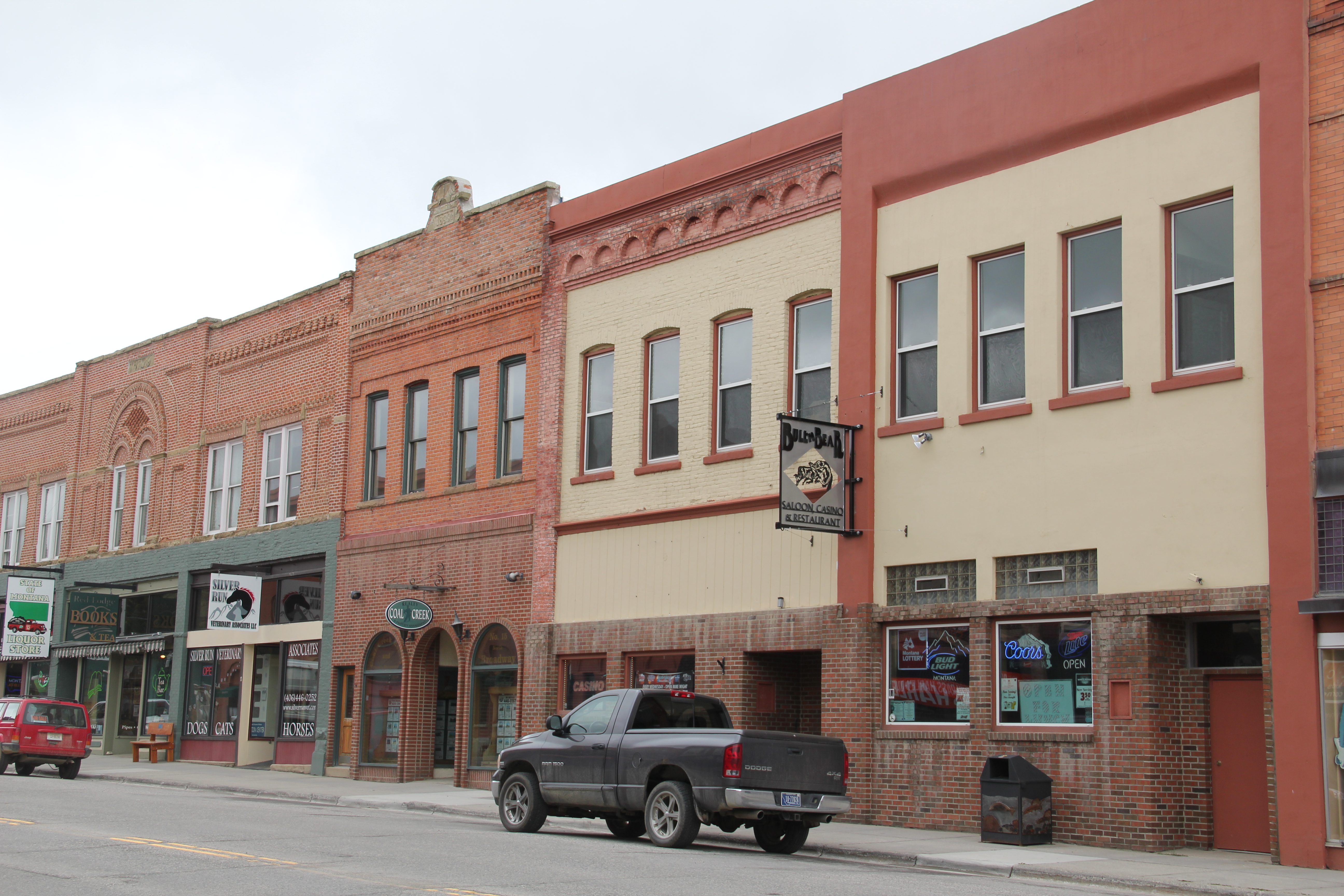
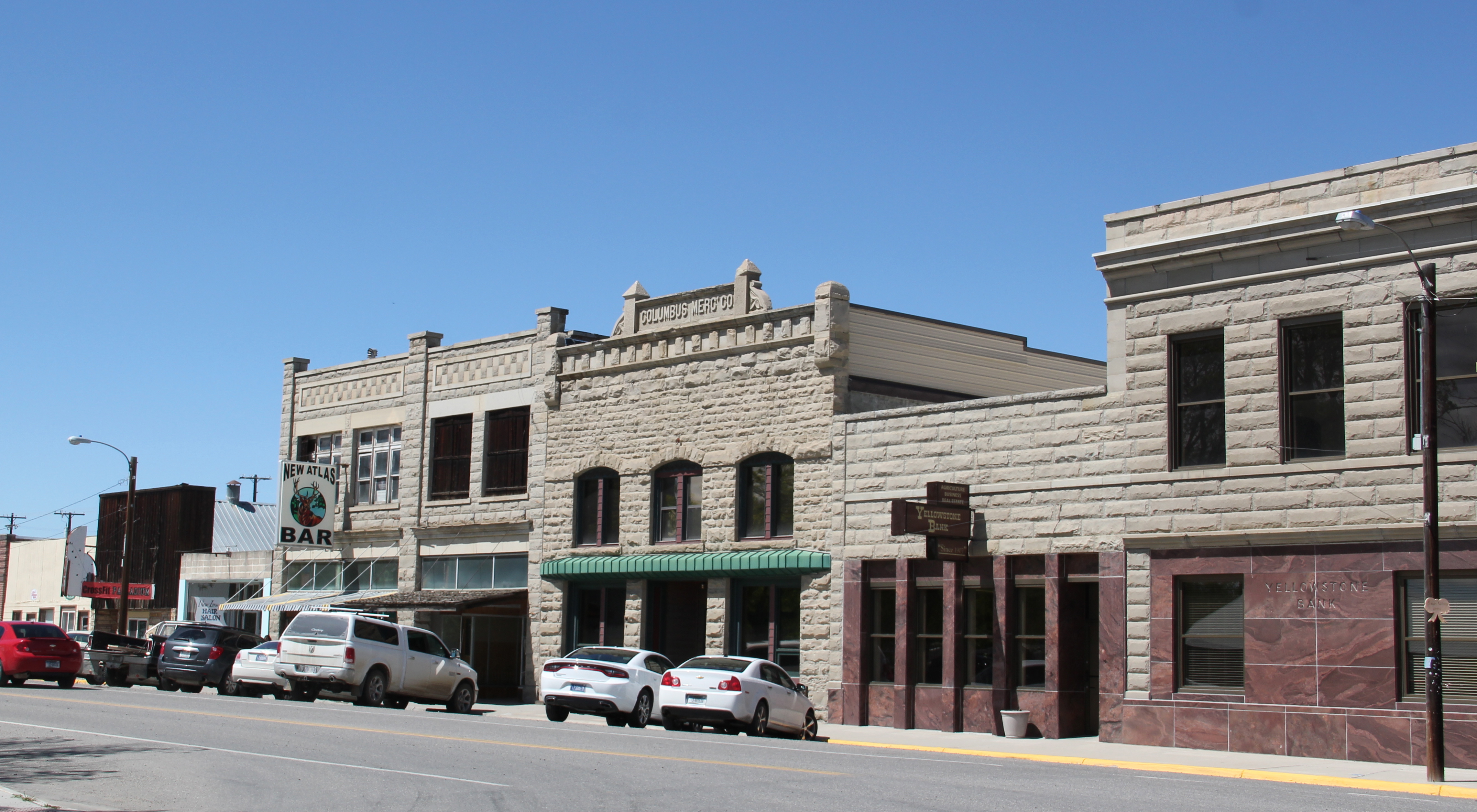
The splashy Beaux Arts classicism of the banks and theater catch your eye but much more common are two-story commercial blocks, often with a more understated classicism, where retail businesses used the first floor and professionals occupied the second.  The town had a several gifted craftsmen who left their mark in these buildings and others.

Detail Masonic Temple Lewistown Fergus Co IMG_9955
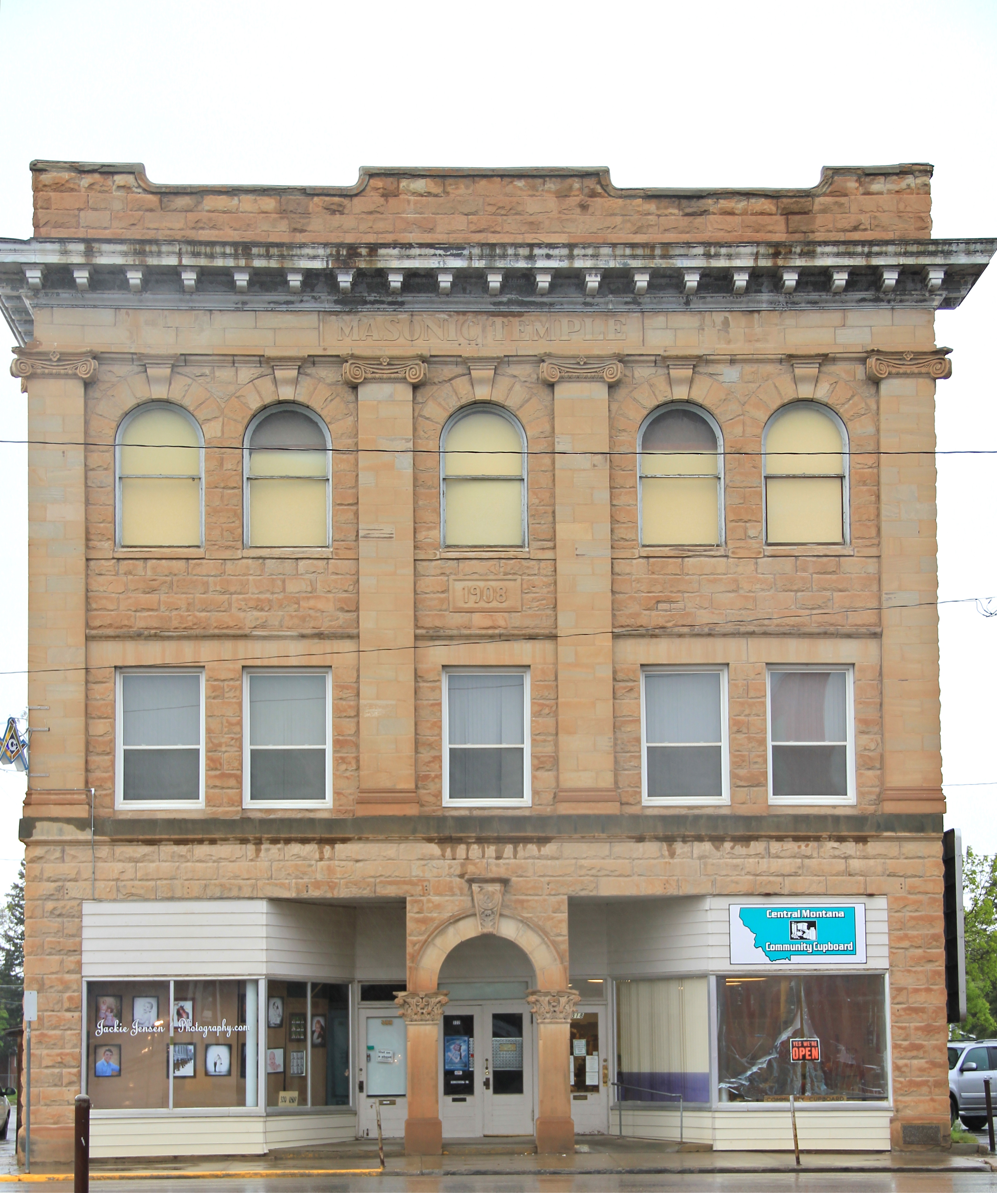
Croatian stonemasons left impressive stone Romanesque arches at the Masonic Lodge, a detail I photographed in 1984 (left) and 2013 (right).  The building itself is a dignified statement of both craftsmanship and purpose, combining both classical and Romanesque elements using locally available stone.  It’s one of my favorite buildings in town.

Fergus Co Lewistown masonic temple downtown commercial HD 13 - Version 2Not far away is the I.O.O.F. Hall, from 1914.  Here is an even later example of Romanesque arches highlighting a building that is both a fraternal lodge but also valuable retail space.

IMG_9966Be they multi-story or just one-story commercial businesses, this set of commercial designs convey so strongly the promise of early 1900s to thousands of Montanans.  Lewistown’s population had reached 6,000 by 1920–that generation would be shocked to know that remains the population today. Much more on Lewistown to come.

IMG_9984

Baker: The Milwaukee Road’s Eastern Gateway to Montana

Fallon Co Baker Milwaukee Road corridor  - Version 2The Milwaukee Road, the last transcontinental railroad to crisscross Montana, enters eastern Montana at the town of Baker, established in 1908, which served as an important rail center for the company with the full name of the Chicago, Milwaukee, St. Paul and Pacific.  When I visited Baker in 1984 i noted that many of its buildings dated from the homesteading era although there was a clear second layer of development died to the region’s oil boom of the late 1960s and 1970s.  In A Traveler’s Companion to Montana History (1986) I noted “Baker’s railroad corridor is still largely intact, and the spatial arrangement created by its Milwaukee depot and the neighboring Baker Hotel, an imposing brick building dating to 1916, symbolizes the railroad’s importance to the town.” Both buildings are gone now unfortunately but an indication of the prominence of the corridor is still conveyed by the brick building below which has served the community in many commercial and professional ways over the decades.

IMG_0390

Insurance was just one of the services provided by this neoclassical styled building.

Today the hotel, the tracks, and the huge grain elevators along the railroad corridor remain, and the elevators still visually dominate the surrounding mostly one-or two-story built environment.  But the depot is gone, leaving a hole in the town’s historic fabric.

IMG_0402Buildings and railroad tracks were not the only legacy of the Milwaukee in Baker–there was the large lake the company developed to provide water for its trains in a largely parched region.  The Baker Lake, 30 years ago, was undergoing another improvement project, part of the town’s generation-long effort to turn a forgotten corporate remnant into a community asset.  The company built the lake c. 1908 but soon found that the water was too salty–it corroded the equipment.  And so the lake sat, until the 1950s when the Baker’s Woman Club began an effort to convince the railroad to transfer the lake to local

IMG_0462government.  County leaders became convinced that yes, Baker needed a community recreation asset, and eventually the land was transferred into the public use, and Baker Lake by the end of the century was an unique asset in southeastern Montana, and a center for recreation and special events.

Fallon Co Baker library  - Version 2The lake is not the only contribution of the Woman’s Club.  it also was central in creating, staffing, and maintaining a public library, and the contemporary-designed library from 1970 remains but also has been enlarged since 1984.

IMG_0407

The Fallon County-City of Baker Administration Building, 1974-1975

Indeed, I noted the recent construction of the 1970s in Baker, like the new county courthouse/city administration building where I held a public meeting, but I didn’t really process the layer of modernism in the town, a reflection of its growth from 1950 to 1970, when the population grew from 1,772 to 2,584.  The new joint administration building, designed by the Billings firm of Johnson Graham Associates, remains an impressive piece of contemporary design.  Architects Willard Johnson and Orval Graham had established the firm in 1967.  The Baker project established a connection between the firm and county that continued into the present:  the new grandstand at the Fallon County Fairgrounds is also a JGA design, from 2011.

IMG_0417

IMG_0419

The tradition of county fairs dates to 1909 and today the Fallon County Fair is one of the region’s largest.

IMG_0465Historic schools are other important contributions to the town’s built environment.  Above is the Washington School, built in 1927.  It is a brick Classical Revival statement of the town’s insistence for permanence in the face of the homesteading bust. When I last visited in 2013, the school was undergoing rehabilitation to become an office building. On the other side of town stood a more modern design, the Longfellow School, built in 1968 during the height of the population boom in Baker.  Its low, rectangular mass was modern school design at its best, although since my 1984 visit the casement windows have been covered so central heat and air could be installed.

IMG_0410The second building in Baker listed in the National Register was the only one designated in 1984, and it was the pride and joy of the community:  the old county courthouse converted into the O’Fallon Museum.  Here was not only the historical exhibits typical of the area but also installations about the region’s prehistoric past and moved buildings to host special

IMG_0414collections but also to interpret the homesteading past.  I will always remember my public meeting in Baker, for the obvious pride residents had in the museum but also for the comment that they could not wait to show me “our really old stuff,” such as a 1916 homestead.  Coming from my training at Colonial Williamsburg, considering places from 1916 as really old was a notion that took some getting used to, but of course in the context of settlement and development of southeastern Montana, it made perfect sense.

IMG_0463Today I would even join into the call for the “really old stuff”–like the Lake Theatre of 1918.  It certainly deserves a place in the National Register as so few classic movie theaters remain in this part of the state.  The same could be said for this classic c. 1960 drive-in,

IMG_0404which is part of the town’s roadside architecture traditions along U.S. Highway 12, the federal road that parallels so much of the Milwaukee Road’s route through Montana.  For

IMG_0472good measure I would even dare say that it’s time to assess the significance of the oil wells and facilities along Montana Highway 7 as you enter or leave Baker.  The discovery of oil and its development in the 1960s and 1970s certainly was the major economic story of the town and county in the second half of the 20th century.

IMG_0468In 2015 Baker has retreated from that c. 1960-1970 boom.  Population peaked at 2584 in 1970.  It remained just a hundred or so under that in 1980, but changes in demand, technology and the bankruptcy of the Milwaukee meant that Baker in the last 30 years has lost residents, in 2010 down to 1741, about the same number as in 1950.  Yet I like that the lake had been restored, and it remained a vibrant part of the town, that new banks and new renovations were part of the town, and indeed, that an old car dealership and garage was now the very good Three Garages Bar.  Historic preservation can play a larger role in Baker’s future just as it did during Baker’s boom in the past.

IMG_0397

A last look at Carbon County, and a visit into the Crow Nation

In the northern reaches of Carbon County are two additional towns on U.S. 212 I would like to review before I turn into a far different landscape in neighboring Big Horn County.  I looked earlier at the Boyd store, and its changes over 30 years, briefly in passing on to other railroad towns in the Clark’s Fork Valley.

IMG_5916But Boyd is worth a second look if for nothing more than its rambling vernacular design post office since so many of those buildings have been replaced in the last 30 years by standardized USPS designs.  The same can be said of the Boyd School, a frame building now encased in vinyl that has layers of history in it as the community made additions as necessary over the decades.IMG_5917Continuing north on U.S. Highway 212 is the much larger, prosperous town of Joliet. Joliet is an anomaly–its population now is larger than it has ever been since census data has been recorded.  So many eastern Montana towns steadily lost population to where they are mere skeletons of themselves today.  Joliet has avoided that fate; in fact its population in 2010 was slightly more than when I first visited in 1984.

IMG_5928

The Joliet Community Center symbolizes the town’s stability and sense of itself.

The Rock Creek State Bank, now the Rebakah Lodge Building, anchors one of the town’s most prominent commercial corners.  It is one of several buildings in Joliet listed in the National Register of Historic Places, including a large historic residential district, in the last 30 years.  Joliet had nothing designated in the National Register when I visited in 1984.

IMG_5923While there is a bright new sheen to a good bit of Joliet, the downtown still has that classic mix of vernacular frame and brick one-story commercial buildings typical of the turn of the century railroad/homestead boom towns.  And like most, a tavern, in this case the Frontier Bar, is a permanent fixture in the town.

IMG_5920Outside of town is a wonderful array of roadside public sculpture, courtesy of long-time Joliet resident Charles Ringer.  Ringer moved to town, purchasing an old junk yard and part of a WPA granary, in 1971.  His works have become landmarks for travelers along U.S. Highway 212.  Ringer runs a studio shop out of an old ranch-style house.

IMG_5932Known to many winter travelers as “The Snow God” but named “The Creature” by its creator Charles Ringer, this huge metal sculpture is roadside art at its best in Montana.

IMG_5930

Ringer is also known for his various kinetic sculptures, and the entire property becomes a way for travelers to interact with, or just enjoy, the general wackiness of his creations.

IMG_5931

From Joliet you can strike out east on an improved gravel road, passing through the town of Edgar, and then climbing up out of the Clark’s Fork Valley and into the land of the Apsaalooke, or the Crow Indian Tribe.  Traveling west in the Crow reservation, you encounter two instant landmarks, one much more recent than the other but both are tightly intertwined.  A compelling metal sculpture of a warrior announces the entrance to the Plenty Coups High School, shrouded on the morning I went there in 2015 by an early morning fog.

BH Co Plenty Coups HS - Version 2

Across the road is the Plenty Coups State Park, a fascinating memorial to the former Crow chief Plenty Coups, who the Crow Indian Tribe has designated as its last traditional tribal

IMG_5544 IMG_5575

chief.  Plenty Coups had been among the first Crow Indians to take up a homestead, 320 acres along Pryor Creek, in 1884.  His succession of dwellings, using locally available

IMG_5564materials to build a log house, help to tell his story as well as how some Crows became ranchers.  The park has erected a modern tipi to show earlier Crow dwelling types; the rambling nature of the log house, is both typical and spectacular.  Typical in that

IMG_5549

IMG_5559

IMG_5551it is a three-bay house with a centered front door, but actually quite spectacular in its interior feel of open space, and that its very size would have spoken to the family’s prominence and achievements. The park also interprets a traditional sweat lodge, adding to the understanding of tradition and new ways that blended to create the homestead.

IMG_5561

IMG_5578When Plenty Coups died in 1932 he was 84.  He and his wife Strikes the Iron left 195 acres of their property to be a public park.  Later the National Park Service designated the site as a National Historic Landmark. Since my first visit in 1982 a new museum building had been added to the park, significantly enhancing the public interpretation of the site; you left with the feeling that this was just not a static installation and memorial (as it was in the 1980s) but a true museum and park which will continue to grow and adapt to the needs of the Crown Indian Tribe and the park’s visitors.

IMG_5572

To the east of Pryor, on Pryor Creek Road, was another historical place associated with the Apsaalooke–the Pryor Creek Battlefield.  Where in the low creek bluffs and the narrow

IMG_5533

valley created by the water, a major battle between the Apsaalooke and their enemies the Lakota, Cheyenne, and Arapaho took place c. 1861–just at the time the Civil War was beginning in the United States far to the east.

IMG_5536

The Crows had worked with federal officials to build a road turn-off and place interpretive markers about this key battle for the control of the Yellowstone Country c. 1861, just before the time that the first permanent white settlers entered what would become Montana Territory.  Thirty years ago, I knew from Crow historian Joe Medicine Crow that this famous battle, where the Apsaalooke secured control of the region in what Medicine Crow called a “glorious victory,” took place along Pryor Creek Road. But the markers now pinpoint the battlefield and interpret what happened plus the significance of the fight.

IMG_5538

Here was suddenly a place that I had truly never “seen” before–and an indication of how good interpretive markers can make a desolate place come alive with historical meaning.  Kudos to all for bringing forth this forgotten battlefield and a site of a famous Crow victory.

IMG_5539

Bridger: Northern Pacific Railroad Hub in the Clark’s Fork Valley

IMG_5650As you head north into Montana from Wyoming on U. S. 310, the first substantial place you encounter is Bridger, named for famed fur trader and early Yellowstone traveler Jim Bridger.  Like its neighbor to the north in Fromberg, Bridger is another turn of the 20th century Northern Pacific Railroad town in the Clark’s Fork River Valley that was much the same from my initial visit 31 years ago.  Its population had remained steady–a tad over 700, about the same as in 1984, and only 150 or so less than its height in 1950.

IMG_5659The town’s grain elevators speak to the formative impact of the railroad.  Here back in the late 1890s engineers followed a well worn and recognized Indian trail–a similar route to what Chief Joseph of the Nez Perce Indians chose a generation earlier as he tried to find safety for his people, traveling from Wyoming into the Clark’s Fork Valley.

IMG_5631The town’s commercial district retains much of its early 20th century look.  Old bank buildings dominate the town center, while substantial 2-story commercial buildings (including properties listed in the National Register) remain, showing how quickly merchants came to Bridger and launched businesses to attract the growing number of homesteaders in the Clark’s Fork River valley in the 1910s.

IMG_5658

IMG_5633

IMG_5655That first generation of settlers did their part to build lasting community institutions.  The Bridger United Methodist Church is an impressive example of vernacular Gothic design. It is listed in the National Register of Historic Places.  The town library is almost a picture perfect example of what this institution should look like in a small town setting.

IMG_5644

IMG_5636The irrigation ditch drifting through the town park is a reminder of how the engineered landscape of irrigated fields provided much of Bridger’s early wealth and development.  The park itself was a creation of the Works Progress Administration in the late 1930s.

IMG_5634

Within the park is a ceramic and brick arch, one of the town’s many examples of public art.  The mural on a side of a store seen earlier in this post is another example while creative metal statues of wild horses grazing or the imposing figure of Jim Bridger himself welcoming visitors at the southern end of the town underscores a local tradition of public art not often seen in Montana’s small towns.

IMG_5635

IMG_5661                     Carbon Co Bridger jim bridger mt 2 - Version 2

IMG_5630

Other historic statements of the town’s sense of community include the 1930s Civic Center, a bit worn today but a center for community gatherings and social events for decades.

IMG_5651Bridger’s schools from the 1960s introduce Montana modernism to the townscape, almost like spaceships landing within the middle of the Clark’s Fork River Valley.  Modernism 1960s style also characterize Sacred Heart Catholic Church, St. Paul’s Lutheran Church, and the Bridger Seventh Day Adventist Church, constructed in 1965.

IMG_5640

IMG_5646

St. Paul Lutheran ChurchIMG_5639                                            Sacred Heart Catholic Church

IMG_5649These community anchors date from 50 years ago, so obviously growth has been stagnant, or stable, pick your terms, since the boom introduced in the valley through expanded irrigation projects in the post-World War II era.  But all of the buildings are well maintained, and are part of the sense of overall sense of pride you get from a visit to Bridger.

IMG_5654Bridger has reminders, both in monuments and in businesses, of the deep past of the Clark’s Fork River Valley.  It is an interesting place of strong institutions, several National Register-listed historic homes, and local business, and a significant part of the often ignored history of the Clark’s Fork Valley.

Railroad Towns of the Clark’s Fork Valley

IMG_5595

The name Carbon County seemingly says it all–here is a Montana place that is mining country, and coal mining at all.  As earlier posts have discussed, coal mining is vitally important to the county’s history.  The county seat of Red Lodge was a major coal mining town. But even Red Lodge’s historic built environment speaks of another side of Carbon County’s history. Its tall shiny grain elevator along the railroad tracks remind us that Carbon County was also agricultural country, especially in the Clark’s Fork River Valley.Carbon Co Red Lodge elevator - Version 2

The next couple of posts will explore this part of Carbon County–the towns and places many tourists roar by as they seek out Red Lodge and the mountains beyond.  Some places were, and are, tiny but still changes over 30 years are apparent. Boyd, for instance.  In 1984 I caught this iconic view of past and present at the historic Boyd store. The building is still there but the facade is changed, to a rustic western style, one more to the liking of fast-moving tourists.

General Store- PO. Boyd Caron Co. MT  IMG_5919

Edgar is a place that admittedly I gave little attention to in 1984.  That was a mistake.  I missed a very interesting modernist-styled school, probably part of the county-wide WPA projects for schools in the late 1930s, along with another 1960s styled addition.  The school closed in 2009.

Carbon Co Edgar New Deal school 3 - Version 2

IMG_5594

Edgar still has its bar, located in a fine one-story brick building–but not much else from the decades when it mattered in the 20th century.

IMG_5589Fromberg is a different story.  Unlike so many country railroad towns in Montana, Fromberg has a strong sense of itself, both in the present and in the past.  Part of that has to be a reflection of its comparative stability.  Its population height came in 1940, with mover 500 residents.  Today the population remains over 400, just about a 100 person decrease over 70 years.  For Montana rural towns that is exceptional.  Indeed, from my first visit in 1984 to my last in 2015, the town had only lost a few families.

IMG_5598 IMG_5597Fromberg has its own museum; the centerpiece of which is its restored railroad depot, part of the old Northern Pacific spur line.  In true northern plains fashion, other historic buildings have been moved onto the museum grounds.  It’s not quite a building zoo but the buildings give the place enough presence to attract visitors speeding along the highway.

IMG_5600 IMG_5599

Fromberg is a t-plan town, and all of the patterns of that type of town planning are apparent.  From the depot, running west, is the primary commercial street, with brick and fame buildings on either side.

IMG_5601

IMG_5622

The historic Odd Fellows hall dominates the commercial district–its conversion into the town’s post office, rather than a historic building being lost so a modern standardized design post office could be put in its place, is an excellent example of historic preservation done right.  Indeed, Fromberg residents have embraced the possibilities of preservation and multiple buildings are listed in the National Register of Historic Places.

IMG_5623

IMG_5618The mural about overland travel on the front of the Clark’s Fork Bank adds a touch of public interpretation.  If you want first-person stories, a stop at the Little Cowboy Bar (and “museum”, located at where the commercial district intersects with the highway, will be worth it.  It is one of the region’s classic watering holes.

IMG_5626

Fromberg also has documented its historic domestic architecture, raining from vernacular styled early 20th century homes to more stylish bungalows and even a couple of good examples of Dutch Colonial Revival style.

IMG_5617

IMG_5614

The homes are clustered around two historic churches, the brick St. Joseph Catholic church and the frame Gothic-styled and National Register-listed Methodist Church, built in 1907-1908 by contractor Charles Darnell and the community.

Carbon Co Fromberg St. Joseph Catholic - Version 2   IMG_5615T

The historic Fromberg school, like its counterpart in Edgar, was part of the countywide program of building modern schools by the WPA during the New Deal.  Its still impressive facade conveys well the WPA’s sense of modernism, and it remains the town’s primary community center today.

IMG_5607

Carbon County’s Bearcreek and the Smith Mine Disaster

IMG_5696Red Lodge prospered as a railroad/coal town because rich seams of coal existed all around it, especially to the east along Bear Creek, now followed by Montana 308.  Active exploitation of these resources started at the beginning of the 20th century, and continued, on a significantly reduced scale, into the 1970s.

IMG_5688Bearcreek, the town that served these mines, was not much a place when I first visited in 1984, with the mines having been closed for a decade, many had left.  It had that abandoned look of other Montana mining towns where mining had ceased. Over 300 people lived there during World War II; in the 1980s about 60 residents could be counted.

IMG_5689Today, population has slightly ticked up–to almost 80 residents–but little remains of historic Bearcreek and its boom from 1905-c.1925, except for buildings made with stone from nearby sandstone quarries or flashier commercial buildings with pressed tin exteriors.

IMG_5683

IMG_5690Bearcreek is a sliver of what it had been due to the growth of the Colstrip mines and the railroad shift from coal to diesel power from 1925 to 1950.  But its fate, so closely intertwined with the mines, took a terrible turn for the worst in early 1943 when methane gas combined with lax safety procedures to led to the explosion of the Smith Mine.  With 74 miners dead, along with one first responder who died from injuries attempting to save the miners, the Smith Mine explosion is counted as Montana’s most deadly coal mining disaster. (Ironically due to the demand for coal during World War II, the mine stayed in production, in spite of the disaster, until the end of the war).

IMG_5702When I visited in 1984 the mine site was abandoned, deteriorating, but it did have public interpretation in the shape of a wooden highway historical marker, and the hulk of buildings did suggest a solemn memorial to those who had lost their lives.

IMG_5705

IMG_5710

Since that time, the deterioration of the site has continued, as it is open to the elements.  But the Montana State Historic Preservation Office has worked with property owners to create the Smith Mine Historic District in the National Register of Historic Places.  Plus, the preservation office and Montana Department of Transportation have added their own public interpretation markers to the highway historical marker, and these attract tourists on a regular basis to think about and remember those who died to fuel the nation’s war machine during World War II.

IMG_5701Frankly I think that is a good place for the Smith Mine site to be:  a decaying yet compelling industrial memorial to coal, miners, and the constant need for mine safety.

Red Lodge: Preservation Maybes and Maybe Nots

It’s no secret that I have long admired the towns of the Yellowstone Valley.  Thirty plus years ago, the attitude across much of Montana was dismissive of this region:  I even was told by someone who should have known better that “outside of Custer, there’s really isn’t much history there.”  Not only was their history in spades–chronologically deep, thematically rich–there was this tremendous built environment that I began to explore in 1982, and haven’t stopped since.

Snag Bar (1901) Red Lodge Carbon Co  IMG_5715

Admittedly I take an old school approach to the preservation of this landscape.  Red Lodge has many exemplary preservation achievements but in the 21st century success may be leading to the community losing that edge, admittedly rough edge, that once characterized this region of Montana.  Case in point:  the Snag Bar.  The image on the left is from the 1980s–on the right is an image from this summer.  I was happy that the Snag was still with us–always a cozy watering hole in the past.  But now its entrance spoke to a different audience, and the place had taken on the “Main Street Preservation” look that you can find across the country–and a bit of distinctiveness was gone.

IMG_5725

IMG_5716

Red Lodge was not tipped into that preservation fantasy land right out of Disney’s “Main Street U.S.A.” But new infill of modern false-fronts and even a heavy mountain-like Rustic feel doesn’t help, not to mention the northern California wine bar with its set-backs and sidewalk seating.  It is just worrisome.  As is the future of this once grand movie theater,

IMG_5799which has been hanging on, seemingly by a thread, for decades.  The theater has one of the great Classical Revival facades found in the state, full of whimsy and wonderful detail.

IMG_5782

IMG_5785   IMG_5783

Its conversion into a garage was kept it alive but a conversion into a new public use:  well it is a huge building, that needs work, and Red Lodge is already blessed with a brilliant historic movie theater, the Roman.  Multiple theaters in the early 20th century made sense: today not so much.

IMG_5797

Red Lodge also has gotten it right in its residential historic districts.  The “Hi-Bug” neighborhood–a designation 100 years ago that spoke to the merchant class that lived in the town’s most affluent neighborhood–has made a remarkable recovery in the last 30 years, and looks great as these few images attest.

IMG_5751

IMG_5812

IMG_5815

Throughout town there are similar preservation success stories, ranging from a historic service station (that has a nifty exhibit about Yellowstone tour buses and their preservation lurking inside) and one of my new favorites, the Regis Grocery, now a neighborhood (meaning off the tourists’ beaten path of US 212) cafe worth a stop.

IMG_5737

IMG_5804Red Lodge does have challenges–growth that can overwhelm historic character, too many tourism focused businesses–but the changes here over 30 years are impressive achievements, sure signs of how the 1966 National Historic Preservation Act has helped to change the face of Montana.

Red Lodge’s Commercial District: Turn of the 20th Century Masonry in the Yellowstone Valley

IMG_5789Red Lodge’s commercial district is listed in the National Register of Historic Places.  While the construction dates in the district span over 100 years, from the 1890s to more recent modern-era “in fill” buildings, the most notable pattern is the number of two-story stone or brick commercial buildings from the turn of the 20th century.

IMG_5728The landmark Pollard Hotel is a good example.  Opened in 1893 as the Spofford Hotel, the building was an instant business landmark, a hotel located halfway between the depot and the heart of the new city.  As the boom intensified at the turn of the century, Thomas Pollard bought the place and doubled its size in 1902. The Pollard served as that “booster” hotel, designed to show businessmen and investors that Red Lodge was an up and coming place.

IMG_5775

The Pollard was not alone in defining the city’s look.  Facing it were long blocks of two-part mostly brick commercial buildings, with retail and sales on the first floor and residences and offices for a growing professional class on the 2nd floors.

IMG_5776

IMG_5791

Carbon Co Red Lodge 26 - Version 2

The decorative cornices proudly proclaimed that the new buildings were part of the new century, and a promising era for all involved.  Of course commercial design in more settled areas to the east and west had already moved away from the heavy masonry typical of the 1880s–but Red Lodge was largely a Victorian commercial district for what would be a 20th century mining boom town.

IMG_5718

While two-story, two-part commercial blocks set one pattern in historic Red Lodge, another is created through the rhythm of the large commercial enterprises and the less ambitious one-story brick buildings of the district.

IMG_5720

Here is another building material found in abundance, rusticated concrete block meant to mimic stone masonry, and the stuccoed top half of the bakery building is another reminder that some owners used imitation materials to fit into Red Lodge’s streetscapes.

IMG_5730

While the commercial district retains much of what made it a special place when I first visited over 30 years ago, it has lost some of that small town Montana feel as owners increasingly cater to those tourists passing through.  The challenges of preservation in Red Lodge will be the next topic.

Th

Red Lodge: Coal Town of the Clark’s Fork Valley

Clark's Fork River, off U.S. 212, Carbon County, MT Clark’s Fork River, off U.S. 212, Carbon County, MT

When the Northern Pacific Railroad entered the Yellowstone Valley in the 1880s, officials and investors immediately began the search to find and acquire locally available deposits of coal.  First there came the Klein mines north of Billings and then by the end of the decade, the first move toward mines to the south, in the Clark’s Fork Valley, at what would become Carbon County with its major town of Red Lodge on Rock Creek. Development began slowly, with the Depression of 1893 intervening, but as the era’s financial and railroad magnates combined the Great Northern, the Burlington Route, and the Northern Pacific into one huge co-operative venture, they selected a new place in the Yellowstone Valley, a town called Laurel at the confluence of the Clark’s Fork and Yellowstone rivers, to connect the three railroads. In short order, a Northern Pacific Railroad spur line was built down the Clark’s Fork Valley to the place called Red Lodge–U.S. Highway 212 follows this route–and the boom was on.

IMG_5759Entering Red Lodge from the north via U.S. 212 you encounter immediately the town’s roots as a railroad town, as the historic Northern Pacific depot remains rooted at the head of the town.  Here is where my long-interest with the Red Lodge story began in 1984 when

IMG_5760I met with a small group of local historians, preservationists, and civic leaders determined to keep Red Lodge and its still intact historic environment together. The group’s vision for the depot was for it to be a visitor center, an arts center, but more than anything a community center, a visible sign of the turnaround that could happen.  Already, at the head of town artist Peter Toth had begun the new tradition with his mammoth wood sculpture, “In Honor of a Proud and Noble People,” installed in 1979, a theme of the region’s

IMG_5764Native American history and proximity to the Crow Indian Reservation that also was captured in a much more commercial way by the neon sign of the Red Lodge Cafe then, and still to my mind, the best place in town.  The neon, like Toth’s sculpture, was designed

IMG_5723

to attention of the one course of heritage tourism income that locals recognized:  that summer traffic coming out of Billings and off the interstate heading to Yellowstone National Park via U.S. 212 and the Beartooth Pass, one of the true highway wonders of the United States.  How to get people to stop, and how to restore pride and hope for the town itself: those motivated the group I met in 1984 moreso than any well meaning goal of merely preserving history and pretty buildings.

IMG_5758To say that the initial depot project was successful would be an understatement.  Thirty years later the depot is a public space that includes a gazebo, outdoor art, and a setting of history and culture rarely rivaled in the region.  As you move south from the depot, you also immediately encounter several of the dreams the groups discussed in 1984:  a National Register of Historic Places historic district (there are now more than one); restored and treasured public buildings such as the Carnegie Library and Carbon County Courthouse;

IMG_5746

IMG_5734

and their biggest goal of all in 1984, the acquisition, preservation, and transformation of iconic Labor Temple into a history museum and heritage center for the Carbon County Historical Society.

IMG_5740

The group understood the power of the Labor Temple:  they could tell a story not just of railroad magnates and economic development but could look at this history from those who came and labored in the mines, and built the town.  The building dated to the decade of Red Lodge’s height, 1910-1920, when the town’s population reached 5,000 but especially once the Northern Pacfic opened new mines at Colstrip to the east in the 1920s,  the town had been in a decades long period of population decline, where less than 2,000 people lived in 1980.  Many had given up, obviously, but those who stayed saw the bones of a possible community renaissance–and preservation was a big part of that.  That more recent story comes next.

Sandstone Masonry and Historic Landmarks in Columbus, Montana

IMG_5866Columbus, the seat of Stillwater County, has long served as an architectural and settlement landmark in the Yellowstone Valley.  Today when you drive down old U.S. highway 10 (Pike Street) next to the very active tracks of the Northern Pacific Railroad, two patterns stand out.  First, the town retains its historic depot and a well-defined railroad corridor–reminding everyone that here is one of the valley’s original railroad towns, from 1882-1883.  In a state where so many small town depots have been lost in the last 30 years, I always stop in Columbus just to see if its depot remains.

IMG_5910

This historic NP caboose is part of the displays at the Stillwater County Museum, which sits in a new building near the schools in the north end of town. This historic NP caboose is part of the displays at the Stillwater County Museum, which sits in a new building near the schools in the north end of town.

The second feature is the striking stone masonry, found not only along the primary commercial blocks of the town but also throughout the residential neighborhood.  This beautiful turn-of-the-20th-century work is largely attributed to Michael Jacobs, a native of Italy who anglicized her name from the original Jacobucci.  Jacobs was a principal in the Montana Sandstone Company, a firm that not only built Columbus’s historic buildings but also took on commissions in Billings and Butte and its most famous project, the Montana State Capitol in Helena.  Jacobs’ imprint on the town was part of its recovery from the

IMG_5912Depression of 1893, which had rocked towns all along the Northern Pacific line.  But Colubmus recovered and rebuilt frame buildings in stone from c. 1900 to 1920 as the homesteading boom spread through the region.  in Italy, the Montana Sandstone Company provided facing stone to numerous buildings in Butte, but it was the contract for the Montana State Capitol that put the company on the map and established Jacobs’ fame and fortune.

New Atlas Bar Columbus

My favorite Jacobs building is the New Atlas Bar, which I first visited in 1982 and then made it tradition to introduce this special place to anyone traveling through the valley with me on fieldwork.  Listed in the National Register of Historic Places, the bar dates to 1915-1916, and was designed by Curtis Oehme.  For almost all of the 20th century it was operated by the same family who opened it, the Mulvihill family.  Known in the 1980s as the “See ‘Em Dead Zoo,” the historic interior features dozens of stuffed trophies, of all sorts of animals from the region.

IMG_0858

IMG_0855

IMG_0854 IMG_0860

But its historic interior of back bars and ladies lounge is intact, and although the place doesn’t quite have the vibe of 20 years ago, it is still a community gathering spot along historic Pike Street.

IMG_5876Michael Jacobs’ stately Victorian residence is another example of the firm’s craftsmanship as are a series of remarkable tombstones in the town’s Mountain View Cemetery.  The carvings of these monuments is attributed to firm employee Pasqual Petosa.

IMG_5887 IMG_5889

The county courthouse, however, is not of sandstone, but still it is an impressive Classical Revival statement in its porticoed Ionic entrance and symmetrical facade.  Located in the north end of town, the courthouse, designed by Warren Dedrick, remains an anchor for the county’s history during the homesteading boom.  It first opened its doors in 1921.

IMG_1236

Unfortunately the courthouse faces an uncertain future.  This year proposals have come forth to replace the building, or to modify it significantly with additions, due largely to the county’s population growth and need for greater public space in the last 15 years.  The local preservation commission called for discussions and full consideration before the town, and county, loses such a heritage asset as this striking historic landmark.