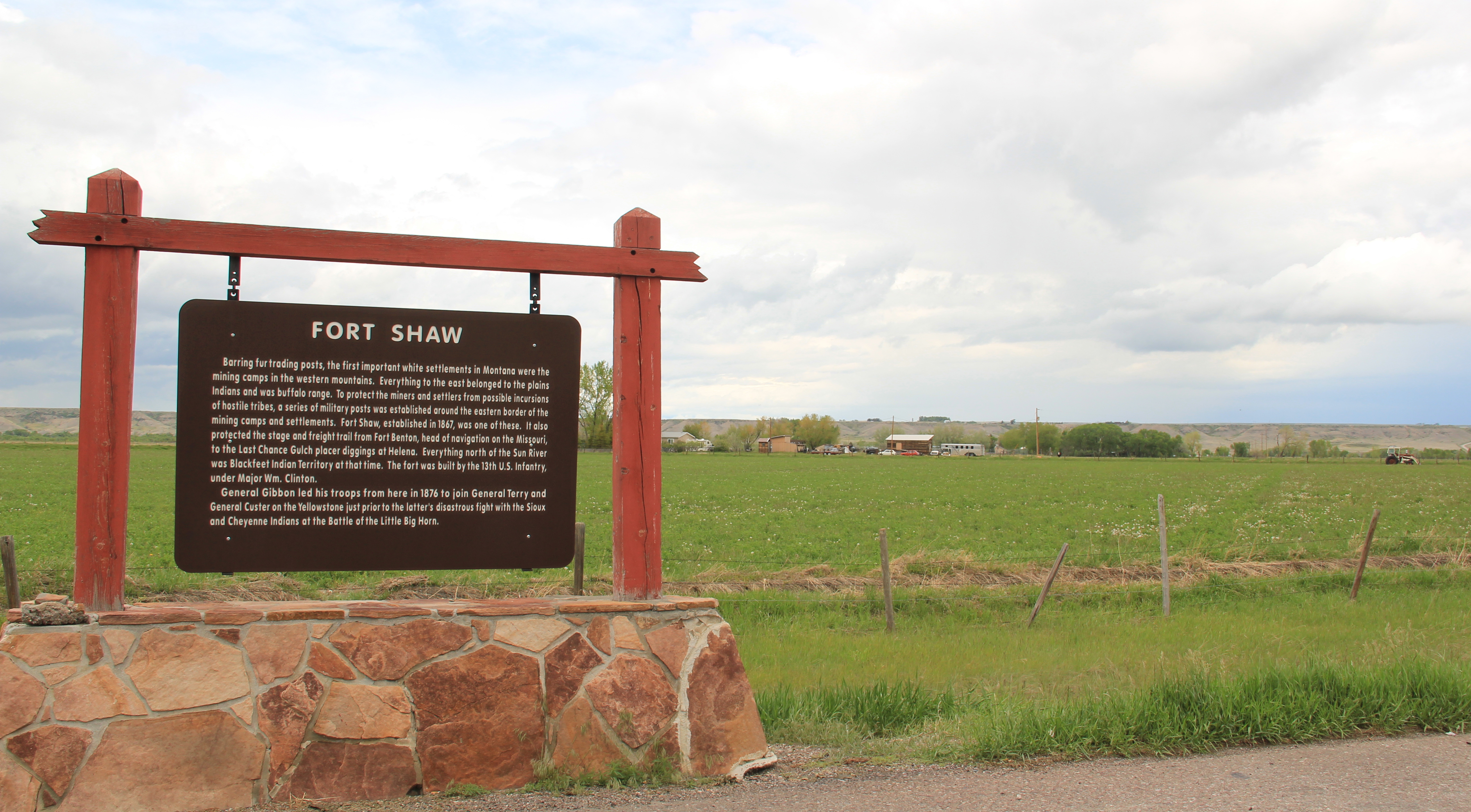
Another common features of heritage areas are properties associated with the nation’s military history and the process of nation building in the post Civil War United States of America. Cascade County has two major sites, one old and often forgotten, the other still at the heart of the nation’s defense. Let’s start with the oldest federal facility, Fort Shaw along the Sun River Valley in western Cascade County. As I was conducting the survey for the state historic preservation plan in 1984-1985, Fort Shaw was on everyone’s mind at the state historic preservation office. A proposal to list it in the National Register of Historic Places had been received, and the response was, generally, it is about time. This place had an important story to tell and was listed in 1985.

Commanders’ Quarters at Fort Shaw
As I noted in A Traveler’s Companion to Montana History, “Built in 1867 in what was then the heart of the country dominated by the Blackfoot Confederacy, Fort Shaw stood just a few miles west of where the Mullan Road [the important pre-Civil War federal military road through the region] crossed the Sun River. Colonel I.V.D. Reeves designed the fort, which was built with timber from nearby hills and sandstone and fieldstone found nearby. The soldiers also made adobe bricks that were used to construct the walls of many buildings at the fort. You can still see [in 1986 and 2015 as well] several of the original buildings, including two sandstone washhouses for the officers, the officers’ living quarters, and the commanding officer’s house.”
I emphasized in 1985 the property’s military significance in protecting the Mullan Road and the mining camps throughout western Montana. I also noted how it became a focal point for white settlement in the region. But I missed the bigger picture on what the site says and means.
Heritage Areas do a good job of looking at the “whole story” and how a landscape can have multiple meanings. Fort Shaw is an important military story: established two years after the end of the Civil War it represents an extension of federal military might into the West and how federal officials understood that occupation posts (Fort Shaw remained a post until 1891) represented federal power and authority, some 2000 miles away from Washington D.C. But certainly part of that process of nation building post 1865 was the federal policy to convert Native Americans. Here at this same place the Fort Shaw Government Industrial School was established, and here that federal officials and missionaries undertook that process of “civilizing” the Blackfeet. The idea behind industrial schools was that Native American children would be taken from their families, boarded at the school, and then taught skills that allowed them to contribute and compete in the modern white man’s world.
In the last decade, historical markers have been installed to help tell that story at Fort Shaw, highlighting the accomplishments of the 1904 girls’ basketball team, truly a remarkable story. Again, heritage areas like to talk about cultural history, and basketball and Indian nations across the northern plains are linked by this sport. The story of these girls and their successful run to a “World Championship” at the 1904 World’s Fair has been the subject of a PBS documentary (Playing for the World, 2009) and a recent book by Linda Peavy and Ursula Smith,
Full-Court Quest (2014). Their accomplishments are also marked by a monument at the old
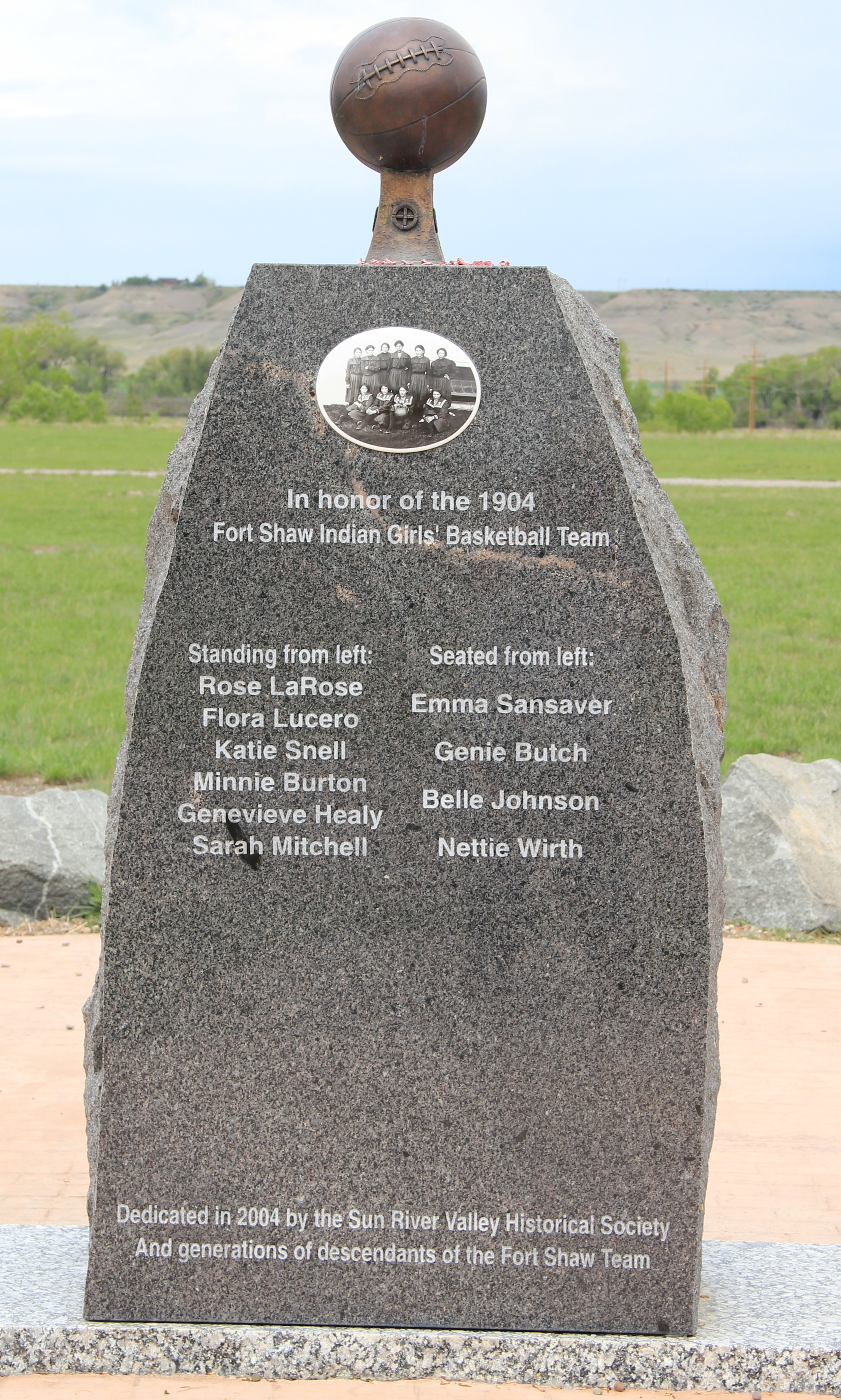
industrial school site, an interpretive site not there in 1984-1985 and another great example of how public interpretation of Montana’s landscape has broadened and improved in the last 30 years.
 Fort Shaw was not the region’s earliest mission site. That designation belongs to St. Peter’s Mission, located on the winding Mission Road to the south of Fort Shaw. An earlier blog discussed St. Peter’s but this special property is worth further discussion, as it is linked in time and purpose to what happened at Fort Shaw.
 The property has limited public accessibility as an active ranch surrounds it and uses some of the remaining historic buildings. But since my first visit in 1984, a small metal interpretive marker has been installed, which emphasizes its founding date of 1865-1866 by Catholic missionaries, many
whom are buried on a hill, along with some of their Blackfeet converts, overlooking the mission. The Jesuits established this outpost a year or so before the military post at Fort Shaw. In 1884 they too established a girls school for Blackfeet children at the site.
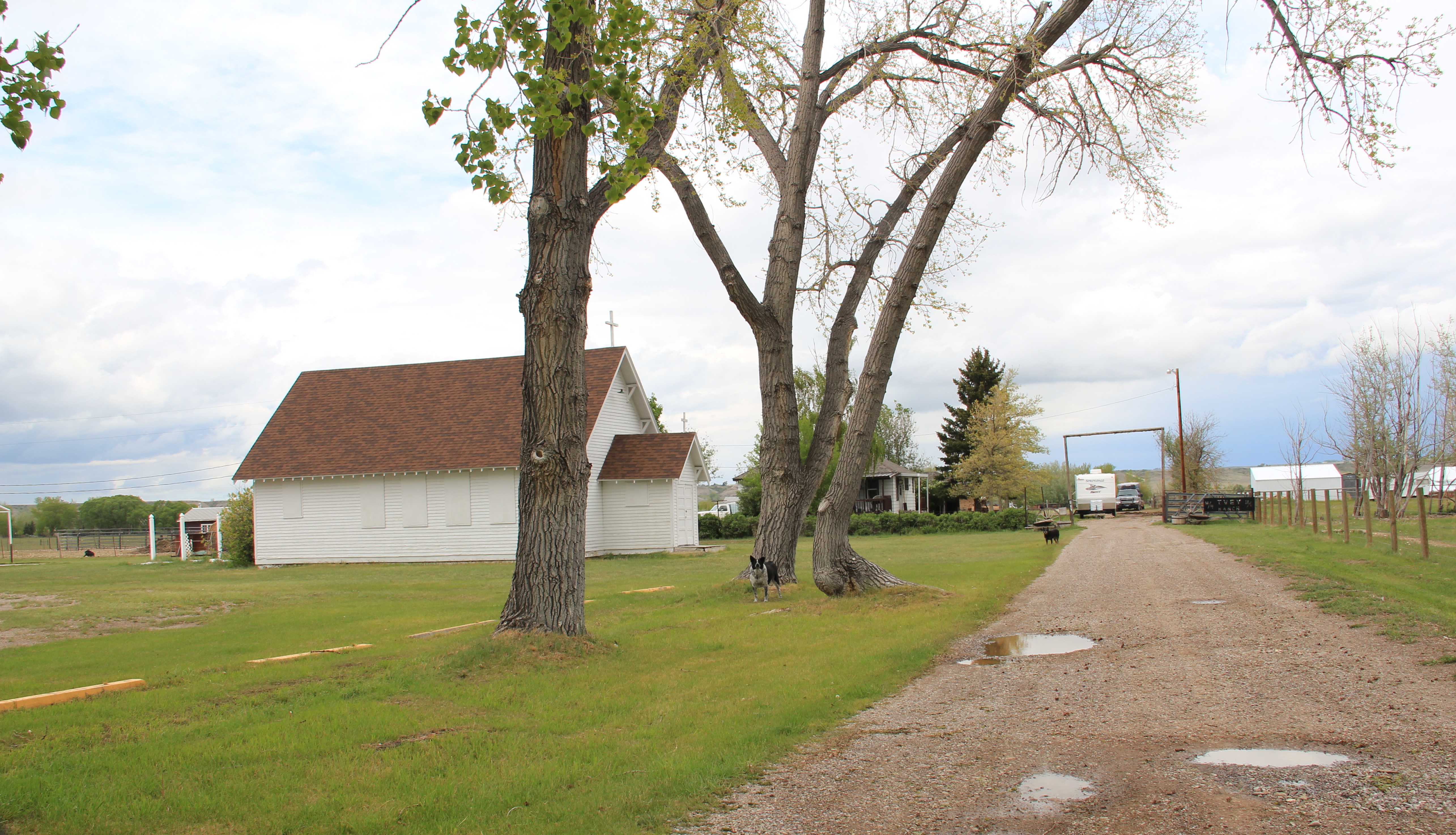 Often we forget these connections between religious missionaries and the nation-building process of government. Within a few hundred yards of Fort Shaw school, for instance, is the old road connecting the school to the historic St. Ann’s Catholic Church (seen above is the historic church building; the congregation has built a modern church in recent years).
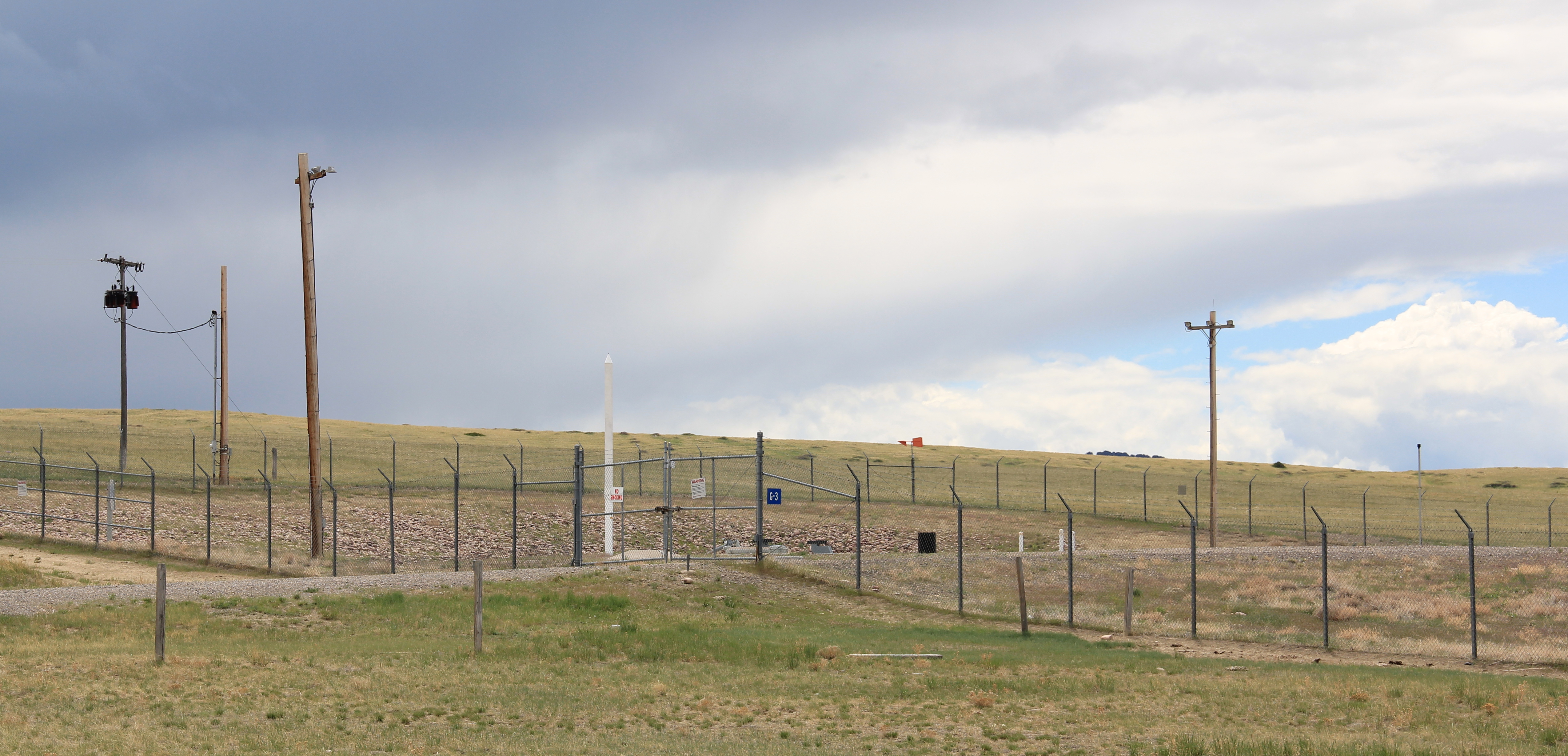 And we further forget, or choose to ignore, how the messy present lies side by side with these older, seemingly sacred places. Along the Mission Road and the Simms Road are nuclear missile bases, some active, some inactive, that are administered by the Malmstrom Air Force Base in Great Falls. Much like Fort Shaw from 100 years earlier, military commanders in the 1960s saw Cascade County as part of the edge of America’s national defense, the ideal location for nuclear bases that could protect, or retaliate, in case of a nuclear strike from the nation’s enemies.
 The Sun River Valley was transformed by homesteaders and irrigation during the great boom of the early 20th century; it shares that story of course with many towns in the Great Falls heritage area. Montana Highway 21 (shown above) connects with Montana Highway 200 to provide great opportunities to explore that landscape. The Sun River project of the U.S. Bureau of Reclamation especially left its mark.
While the old roadside stores at Fort Shaw, the project’s headquarters, suggested that the homesteader landscape was everyday vernacular, not designed to last, other properties, such as the wonderful Simms school complex, tells us that some built to last.
At Simms, reclamation engineers designed what they considered to be a model townsite plan, with the school at the center, and broad avenues radiating out from the school. Simms no doubt never reached the population that the planners envisioned, but here too in an unlikely place is the hand of the federal government, re-orienting the landscape in ways that can be seen, if you know where to look.

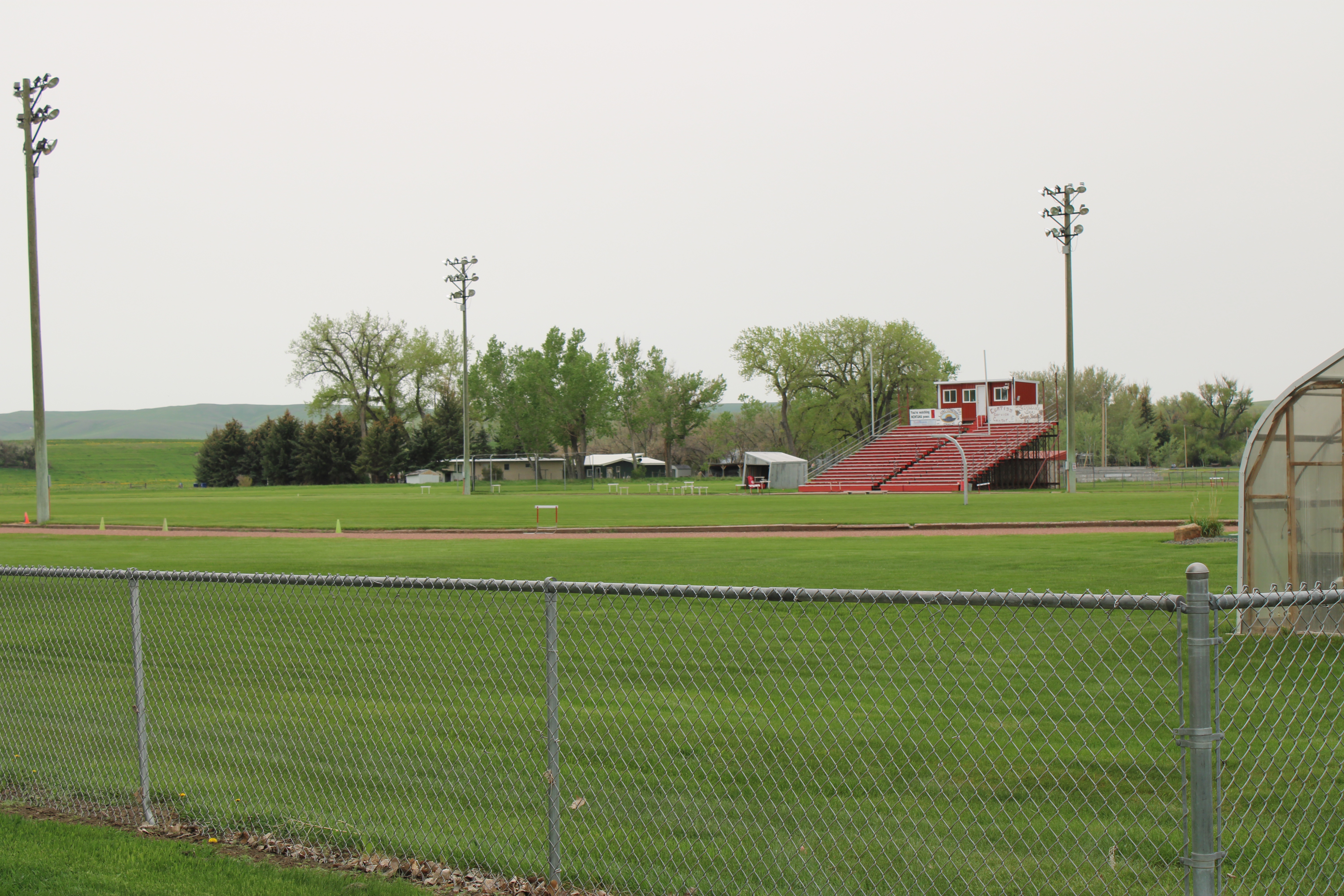
The school is very much the focus of the community–and the gymnasium at the rear has been the place for community events and sports for almost 100 years. The football and track field is in great shape too–a reminder of how sports bind the valley’s residents.

Not far from the school is another community building, the women’s club hall that dates to the Sun River project’s beginning years. I hope to see this building listed in the National Register in the future along with the other historic women’s club buildings scattered across the state.

West of Simms was property of note to my SHPO colleagues in 1984 was the J.C. Adams Stone Barn, which had received a grant for “brick and mortar” work as part of President Reagan’s efforts to jump start the economy in 1982-1983. This magnificent structure predated the federal agricultural programs, dating to the mid-1880s. It rather spoke to the promise of stock-raising and freighting–Adams did both–as the region began to develop in the last years of the Montana territorial period.
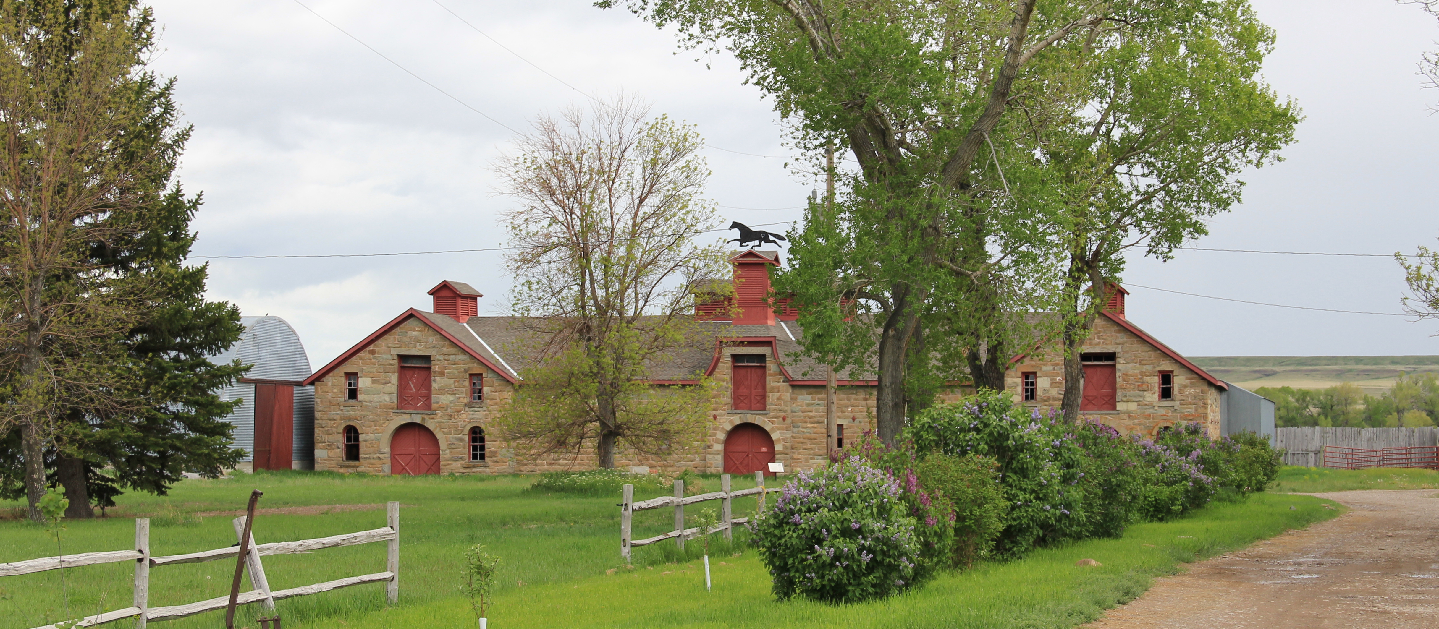 The barn is part of a still active ranch and is on private property. But the stone masonry can be viewed and appreciated from Montana Hwy 200.
 When one considers a Great Falls heritage area, the Missouri River of course will take center stage; as the next postings will show, it should be at the center of the story. But what happened along the Sun River, and what remains today, adds immeasurably to the national story and the overall significance of the region.


 One of my favorite weekend drives, when I lived in Helena over 30 years ago, was to head north, via the Flesher Pass (above) and Montana Highway 279, and hit the very different landscape of Montana Highway 200 (below) and eastern end of the Blackfoot Valley.
 The destination was breakfast, often at Lambkin’s, a family business that, to my delight, still operates when I visited in 2015. Lambkin’s is one of those classic small town Montana eateries, great for breakfast, and not bad for a burger and pie later in the day. The town is


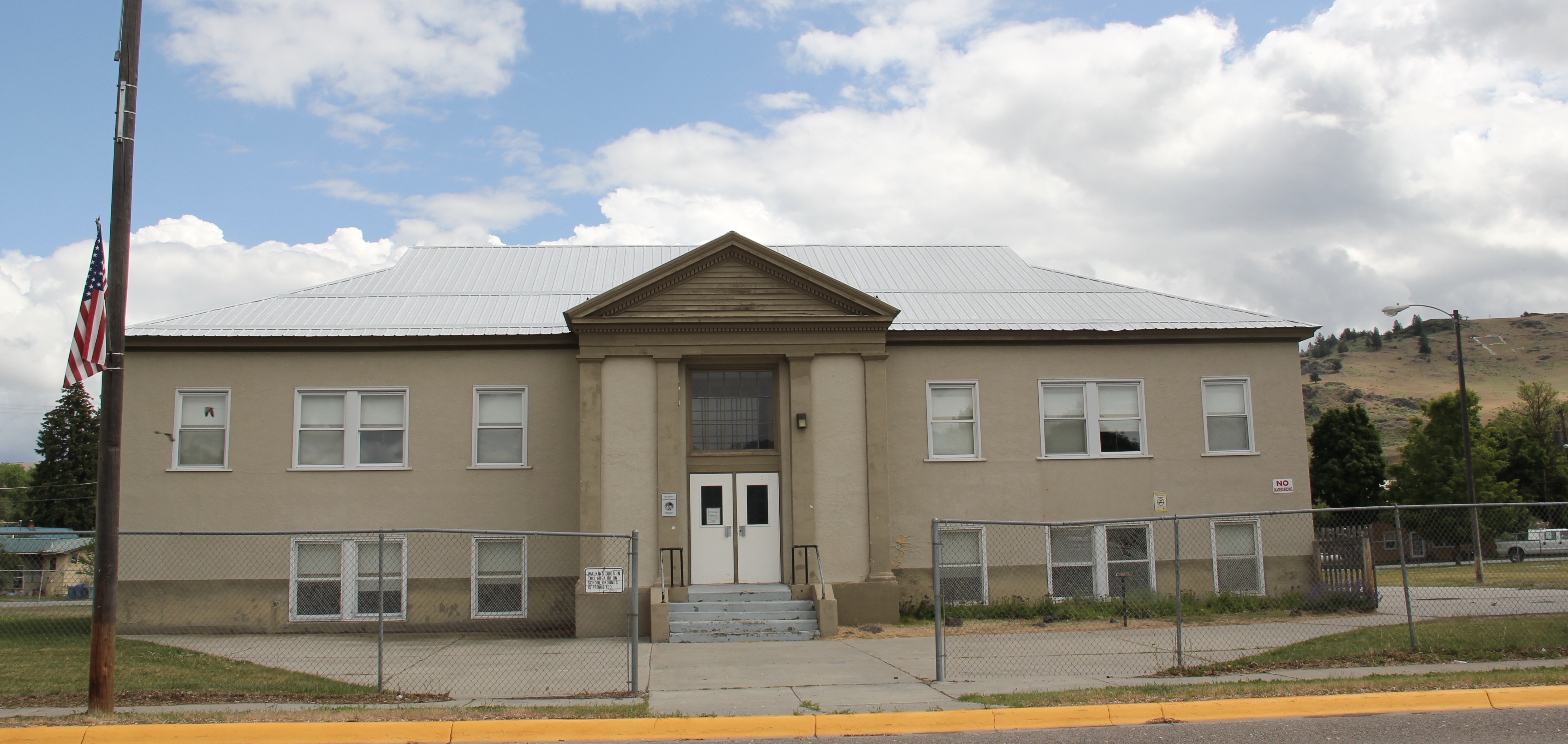 Plains is the second largest town in Sanders County, noted as the home of the county fairgrounds, the center of the local agricultural economy, and like Thompson Falls a significant place along the Clark’s Fork River and the Montana Highway 200 corridor.
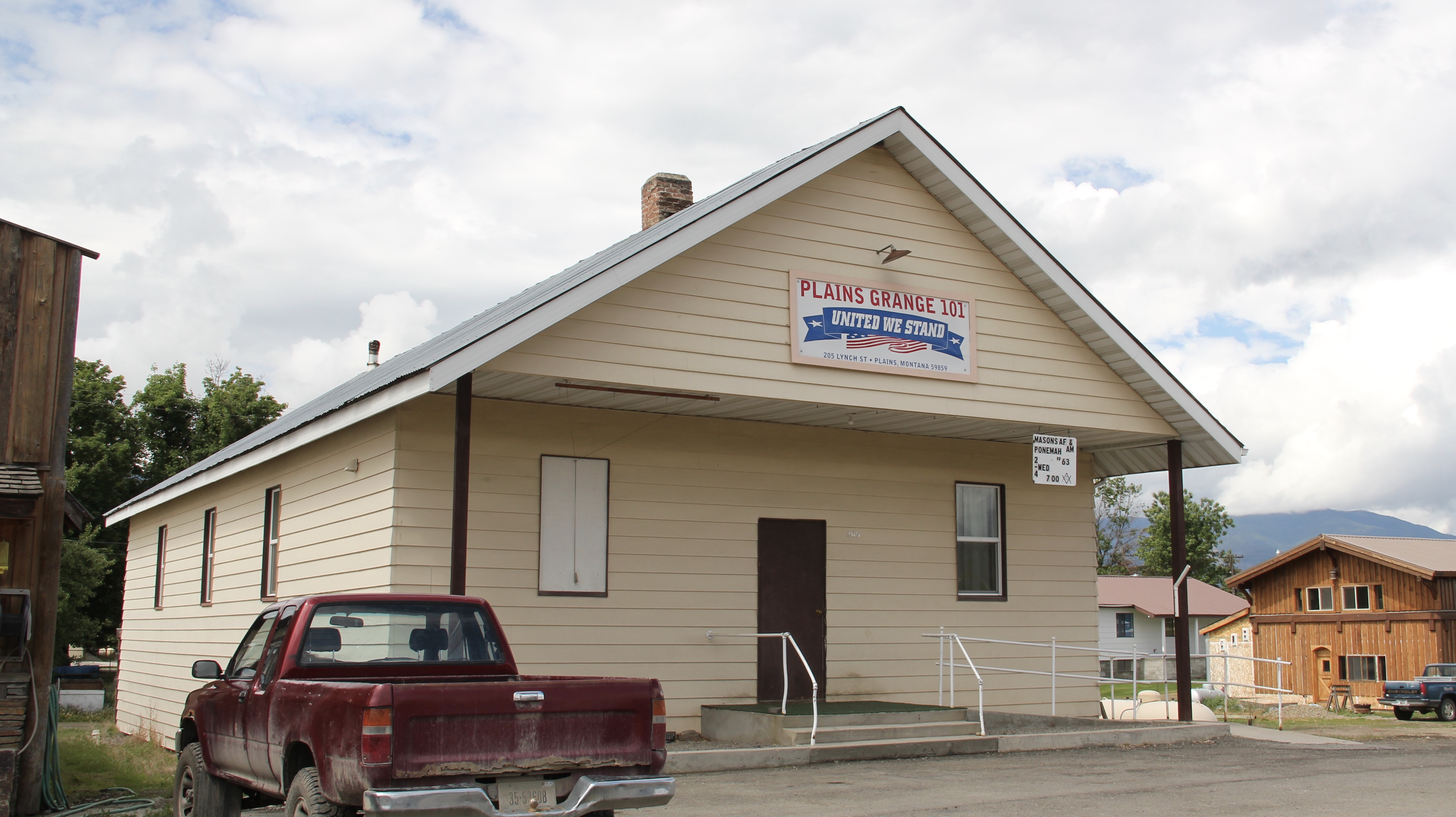 century feel, be it in institutions, such as the local Grange above, or the continuation of the local VFW hall and bowling alley, below.


 The Noxon Dam was finished in 1959. It is a mile in length, 260 feet in height and 700 feet wide at its base. Its generators can power approximately 365,000 homes, making it the second-largest capacity hydroelectric facility in Montana.
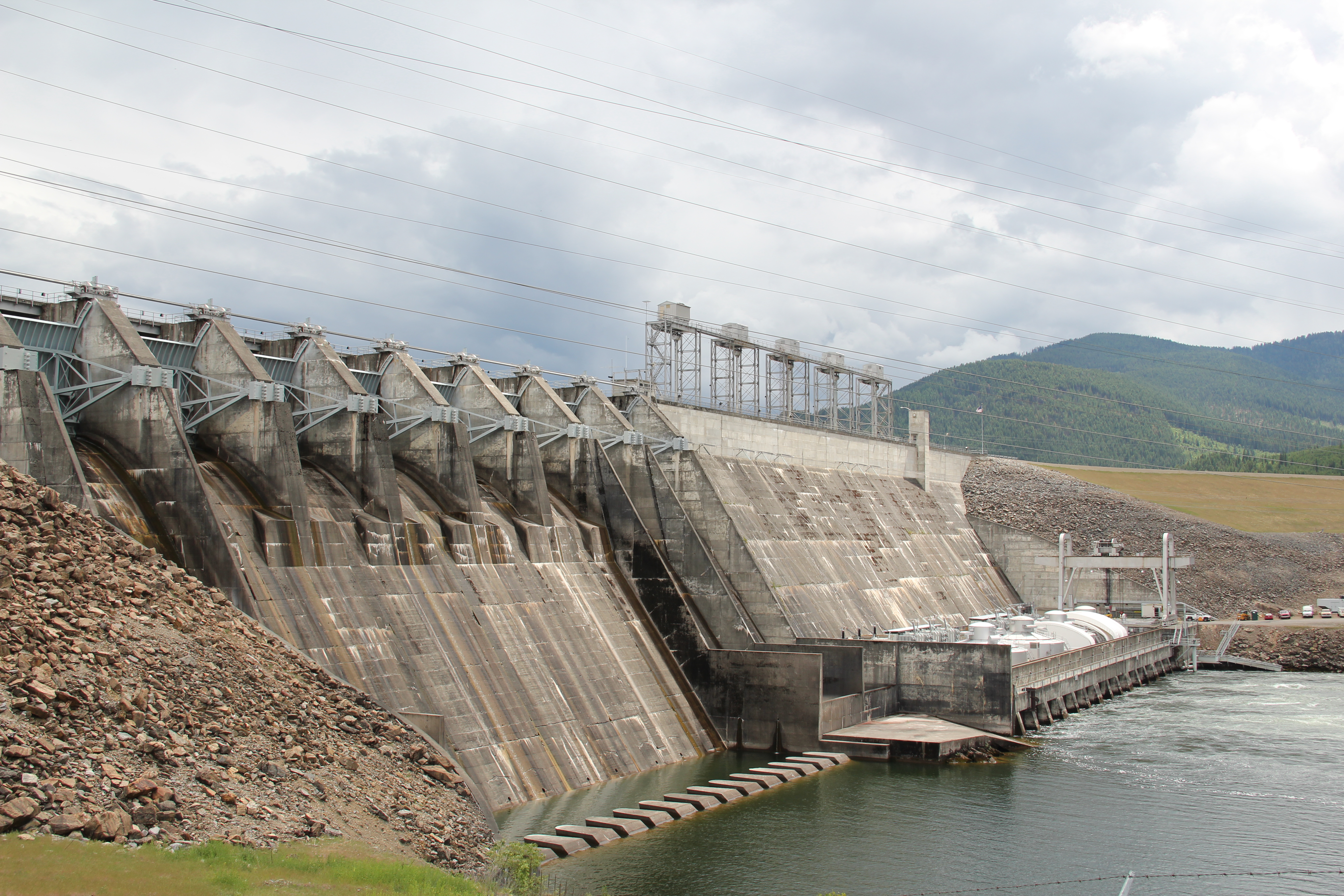 Today visitors can view the dam from various parking areas and short walking trails, one of which passes over the historic line of the Northern Pacific Railroad. The property has interpretive signs about the history of the project as well as about the engineering of hydroelectric power.
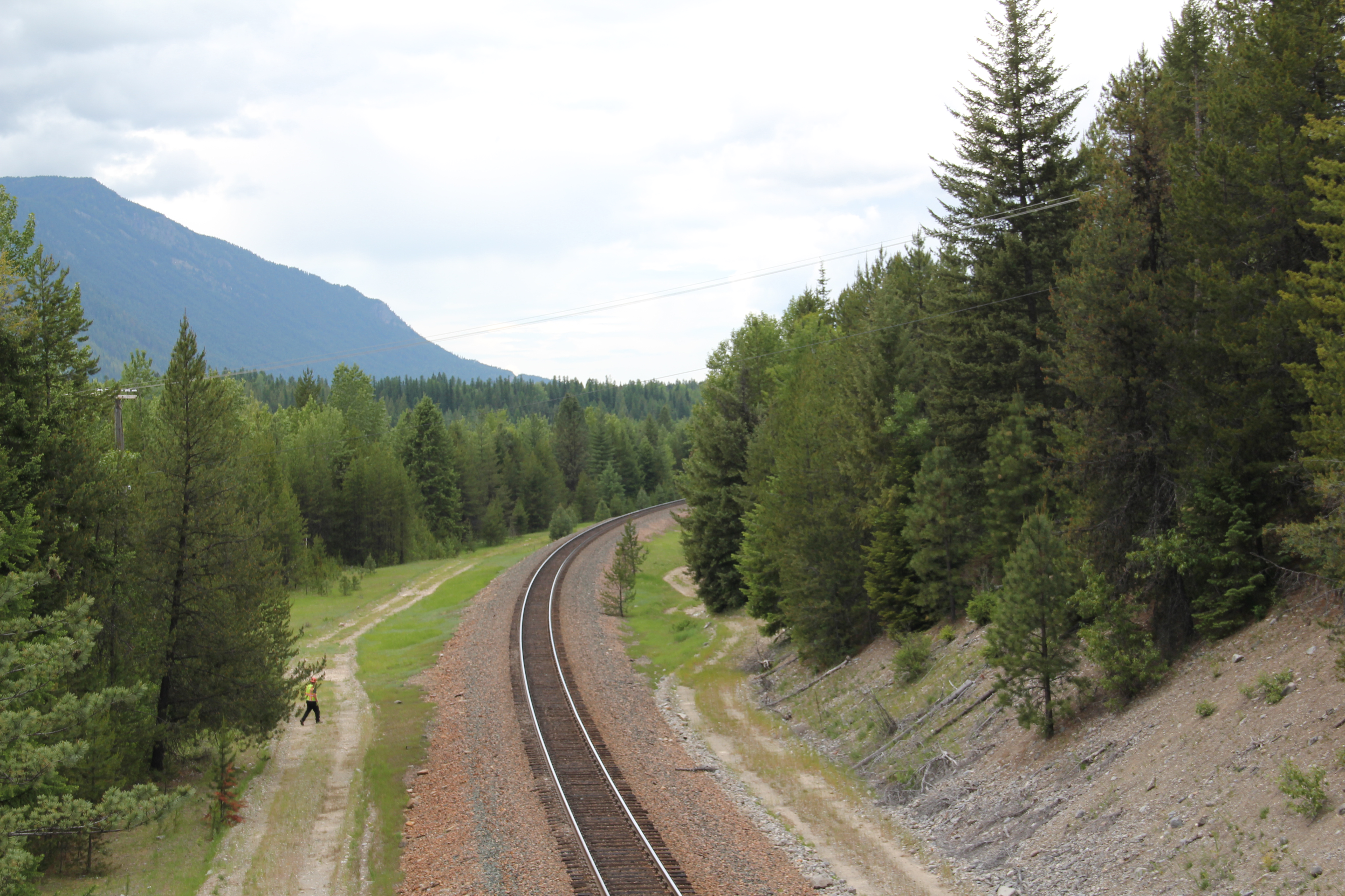 Along the banks of the river/reservoir, a much more recent public park has opened–with public sculpture reminding everyone of the Native Americans who once camped along the
 river at this place. By bringing the deep past of the region in view of the modern, this site is a new favorite place–wherever you are in Montana, and there are many modern engineering marvels–the Indians were always there first, using those same natural resources in far different ways.
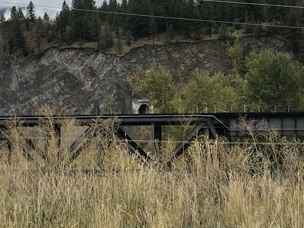
 On the outskirts of town, the 1920s monument to David Thompson was the centerpiece of the town’s heritage tourism attractions in 1984-1985, now it is more of an afterthought. David Thompson was a Welsh-Canadian who established the first trading post in this river valley, called Saleesh House, for the tribe with whom this veteran of both the Hudson Bay Company and North West Company had targeted for the fur trade. His last visit to Saleesh House came in the winter of 1812. Thompson, I thought in 1984, was a very important figure in Montana history but increasingly a neglected trader–in fact most of the early traders, like those of the American Fur Company on the Missouri and Yellowstone Rivers, are neglected, even though significant places associated with them remain intact on the state’s landscape.
 About one hundred years after David Thompson’s last winter at Saleesh House, an entirely different landscape emerged along the Clark’s Fork River, one that introduced the recent technology of electricity to the region. To support and encourage the development of hydroelectric facilities, the city of Thompson Falls combined with investors to build what became known as the “High Bridge,” a way for automobile traffic to cross this gorge in the Clark’s Fork and unite settlement on both sides of the river.
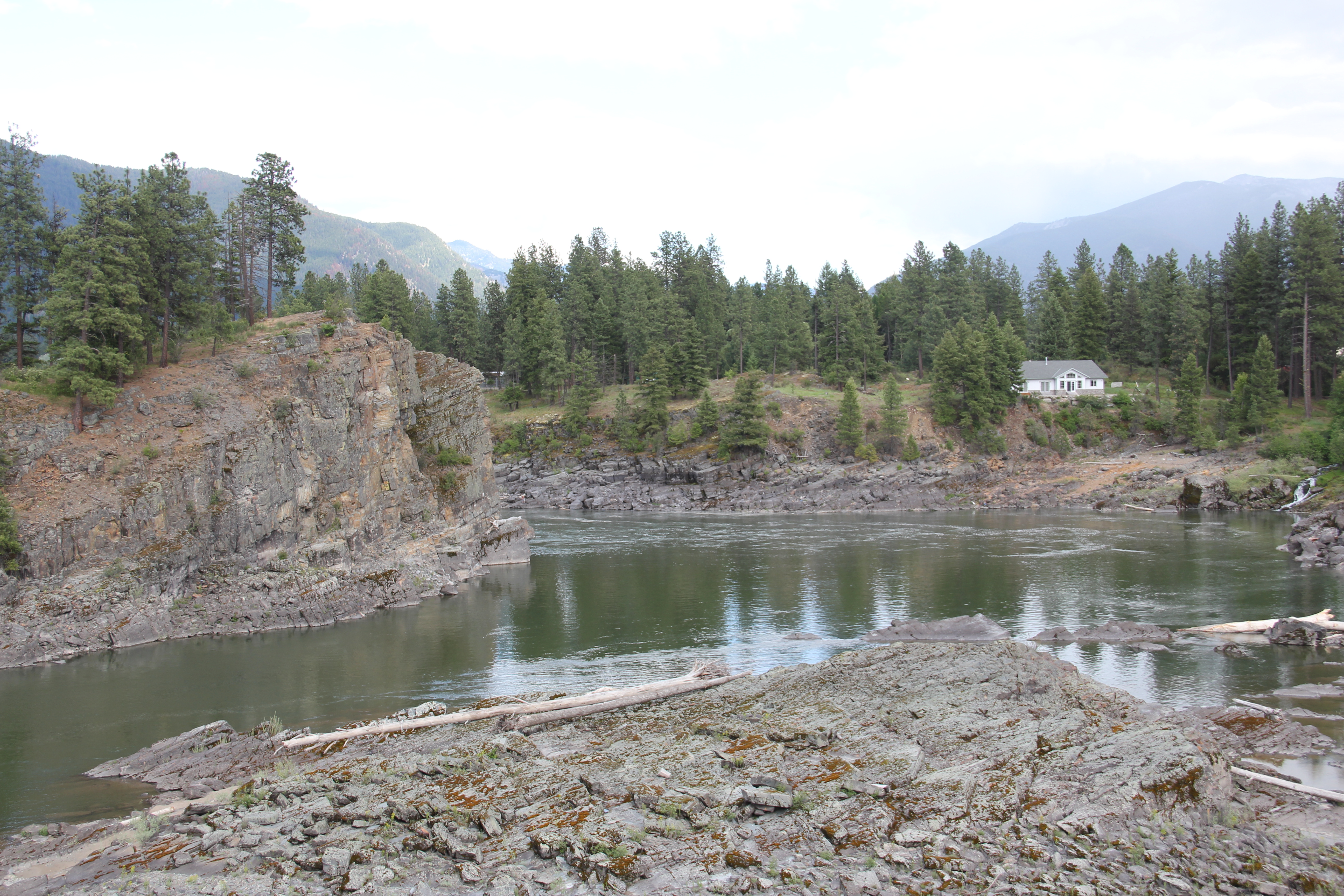 The High Bridge was an early 20th century Montana engineering marvel. It was 588 feet in length, designed for automobile traffic, with a 18-feet wide deck standing on a combination of Pratt and Parker trusses. It is the longest bridge of its kind in Montana.
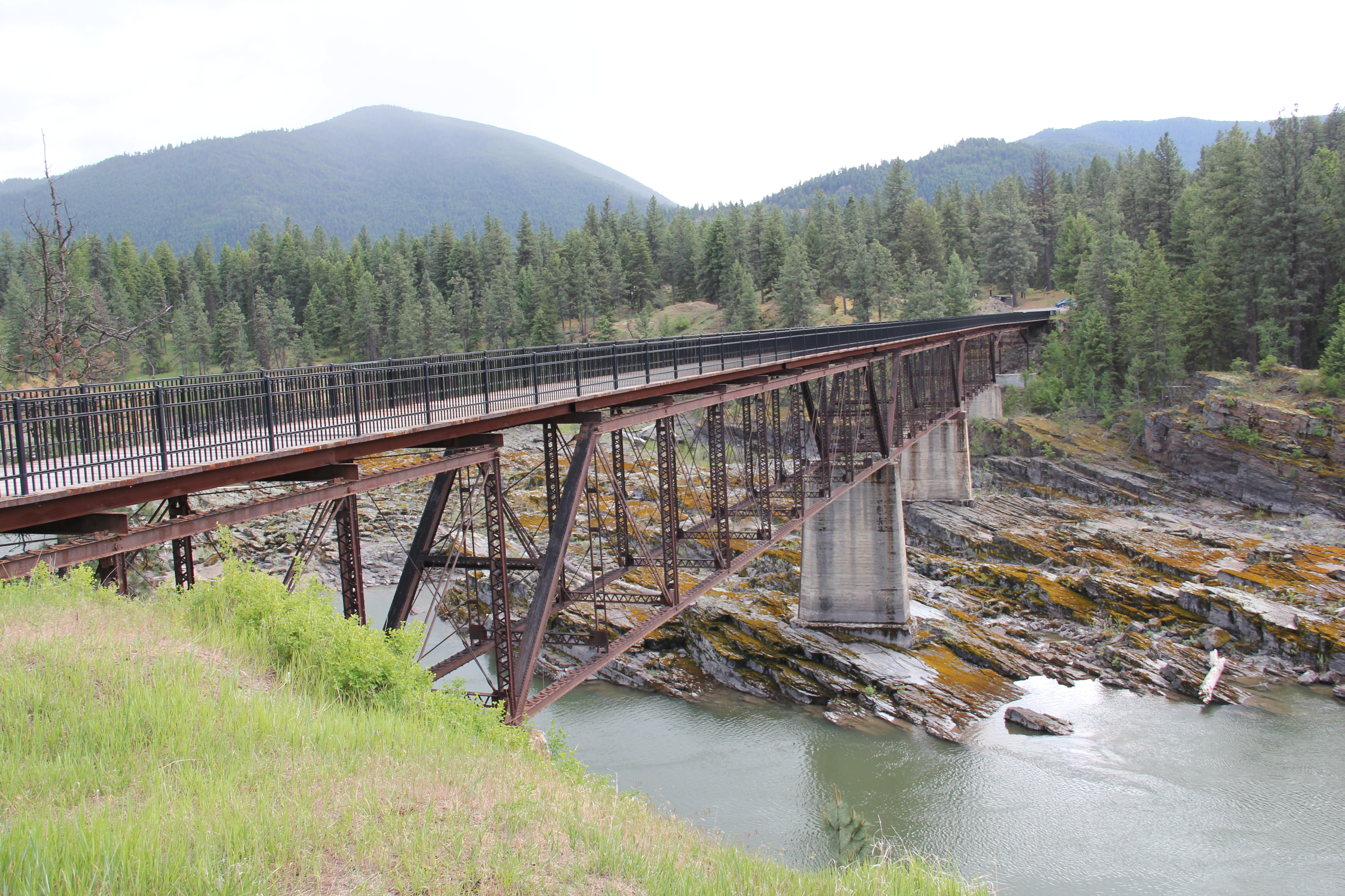


 But within two years, residents and officials combined together to place the bridges and hydroelectric facilities in the National Register of Historic Places as a historic district. They were preserved, but still not used, for a generation.
 In 2009-2010, residents worked with local, state, and federal government officials to restore the bridge, add a pedestrian deck, and to open the bridge and either side of the bridge as a public park. Funding in part came from the American Recovery and Reinvestment Act of 2009, one of the ways that short-lived federal building effort benefited historic preservation in Montana small towns.
 The High Bridge experience not only reconnected Thompson Falls to its river roots, it also creates an unique experience for heritage travelers. The site is not that far different from 100 years ago, giving you the chance to cross a river and peer below but also to realize just how “wild” automobile traffic was in the 1910s and 1920s.
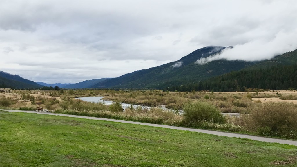
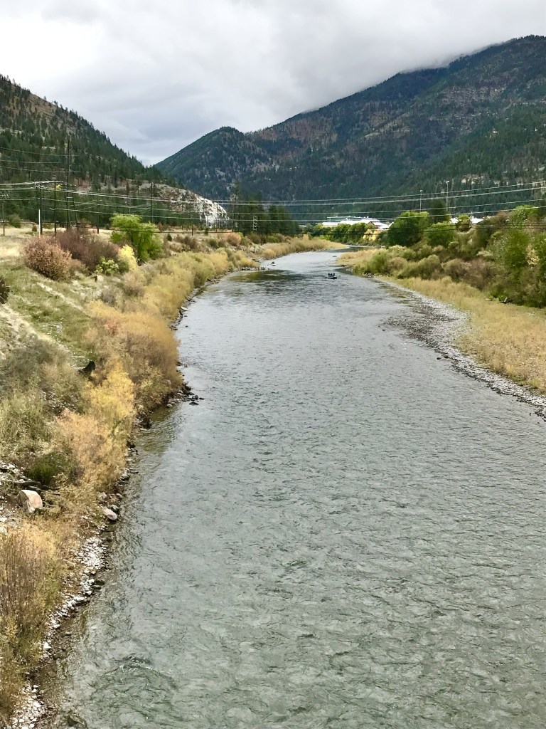
 Sanders County, like many of the places that are on the western side of the Rocky Mountains, has boomed in the last 25 years, from a population over 8,000 to the current estimated population of 11,300. It is close to Missoula, the eastern side is not far from Flathead Lake, Montana Highway 200 runs from Dixon to the end of the county at Heron. With wide valleys and narrow gorges created by both the Flathead and Clark’s Fork Rivers, which meet outside the town of Paradise, Sanders County is frankly a spectacular landscape, with dramatic mountain views framing open plains, such as the image above and the awesome gorge of Clark’s Fork River, below at Thompson Falls.
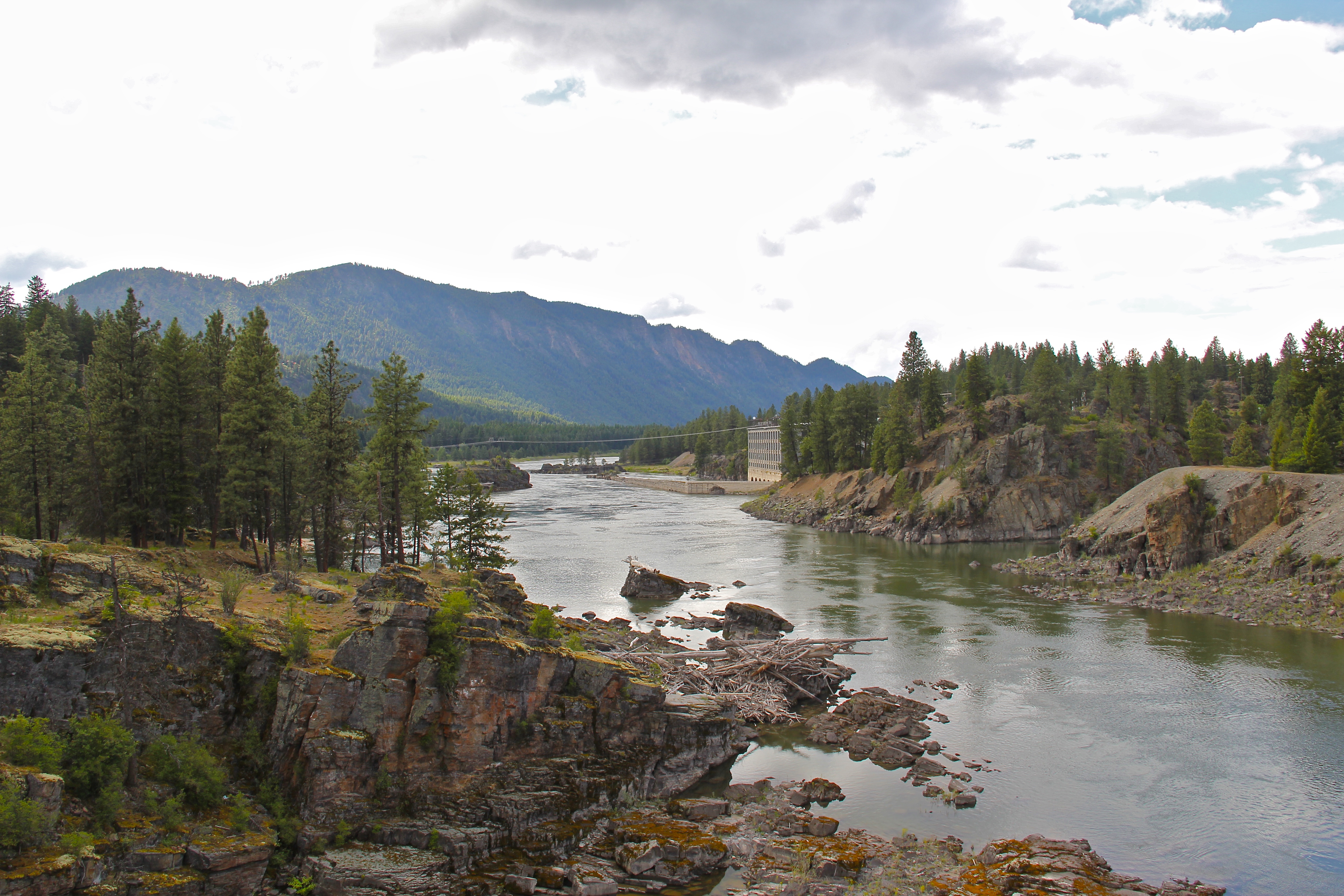 The eastern side of the county is just as dramatic just in a far different way. For centuries First Peoples hunted game and dug the camas root in the broad upland prairie that became known as Camas Prairie, crossed now by Montana Highway 28.
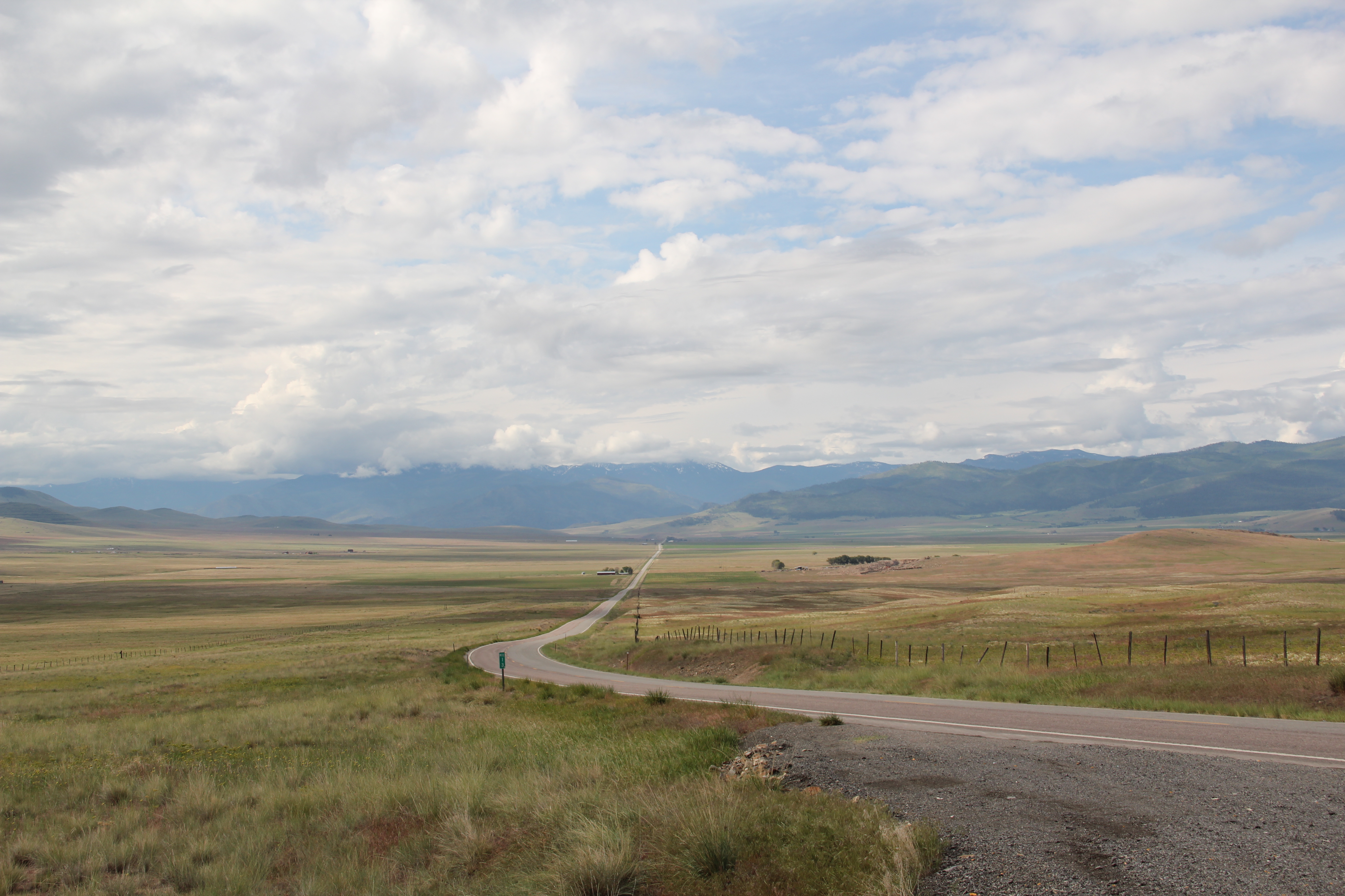 Then, leading from the county’s southeastern edge there is the beautiful Flathead River Valley, followed by Montana Highway 200, from Dixon to Paradise, and most importantly,
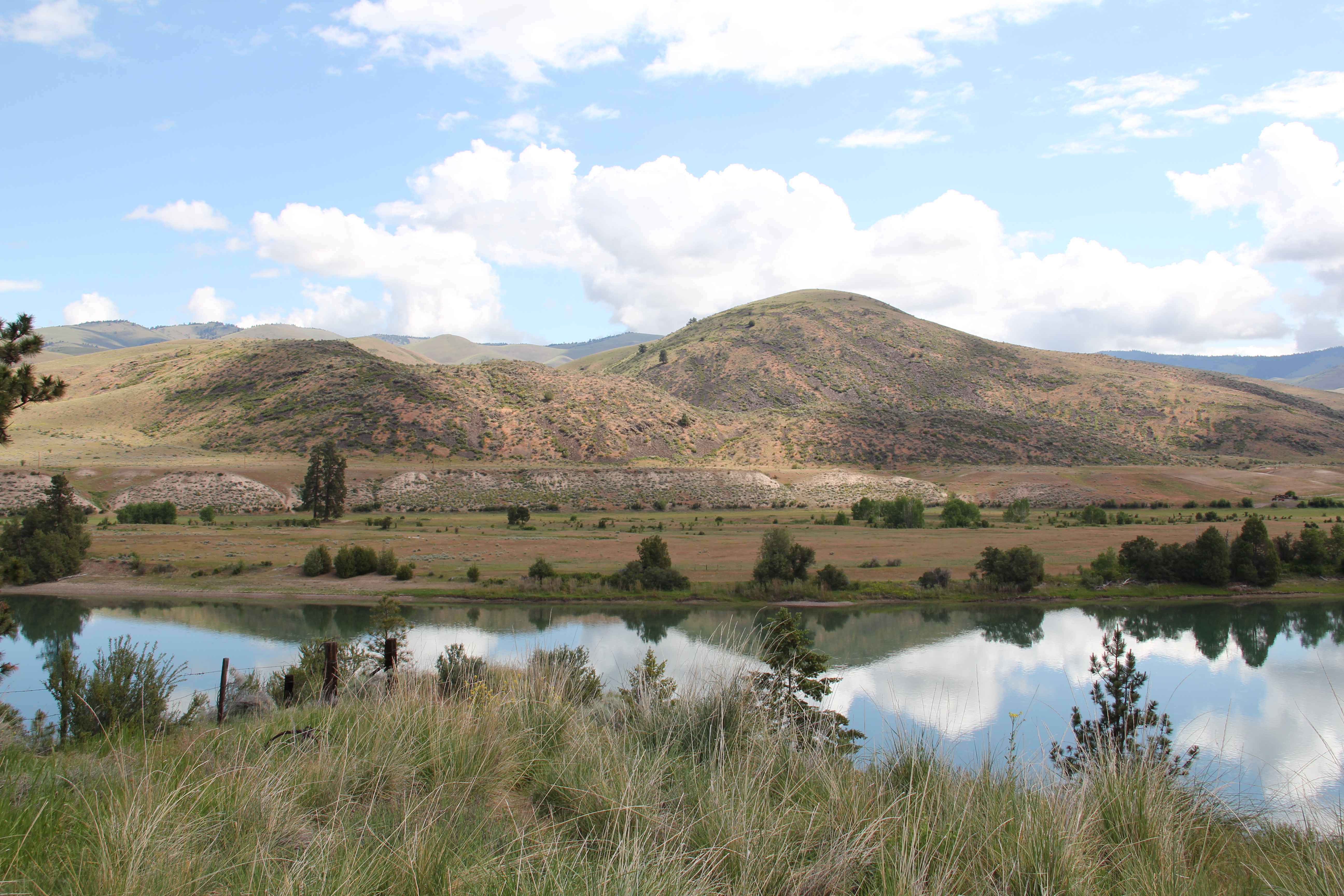 a transportation route initially carved as a trail by the First Peoples who became the nucleus of today’s Confederated Salish and Kootenai Tribe and much later engineered into a major corridor by the tracks of the Northern Pacific Railroad, as it stretched westward from Missoula to the west coast.
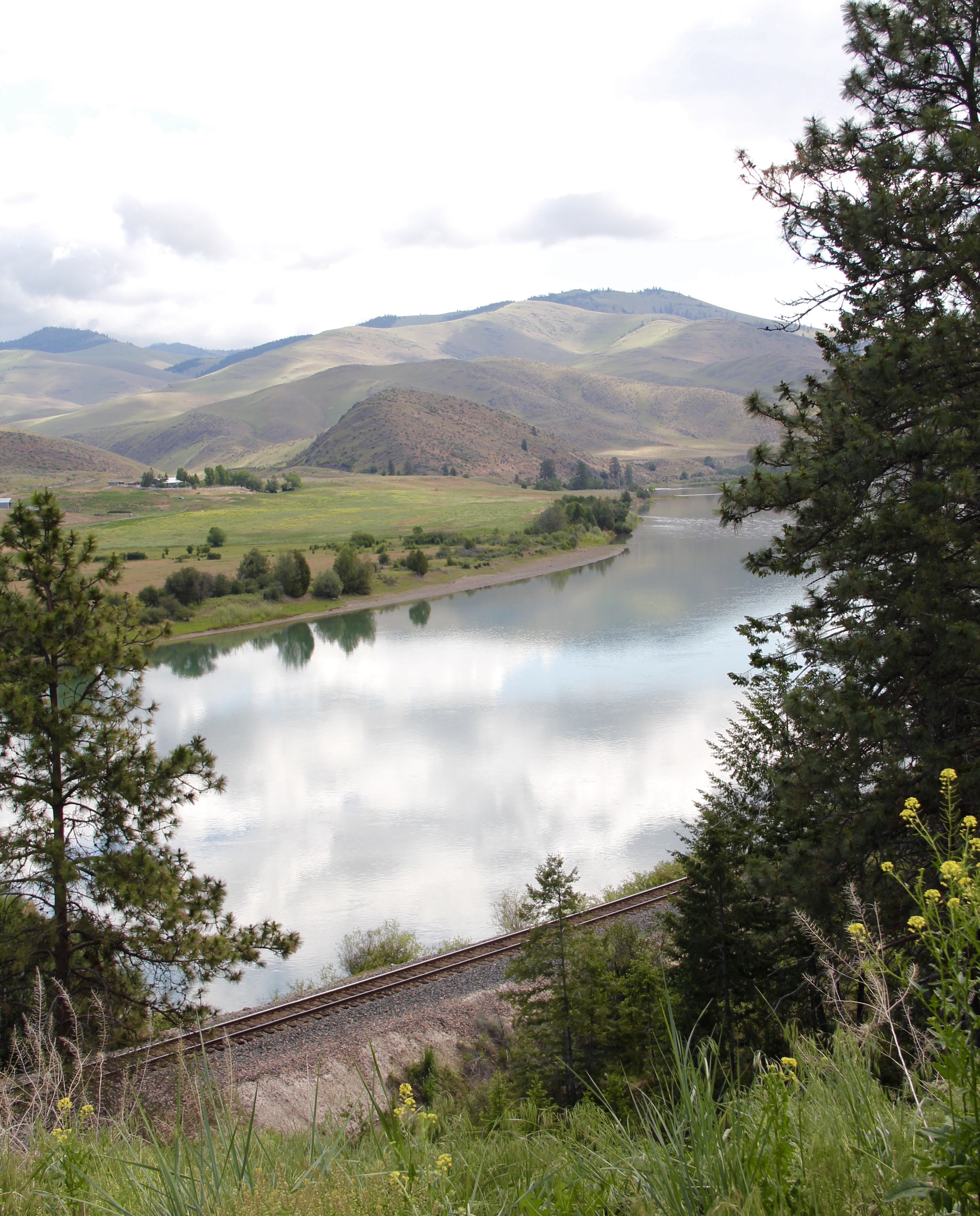 In its wake, the Northern Pacific created most of the county’s townsites by locating sidings along the track. Substantial settlement arrived once the federal government opened lands for the homesteading boom in the early 20th century.
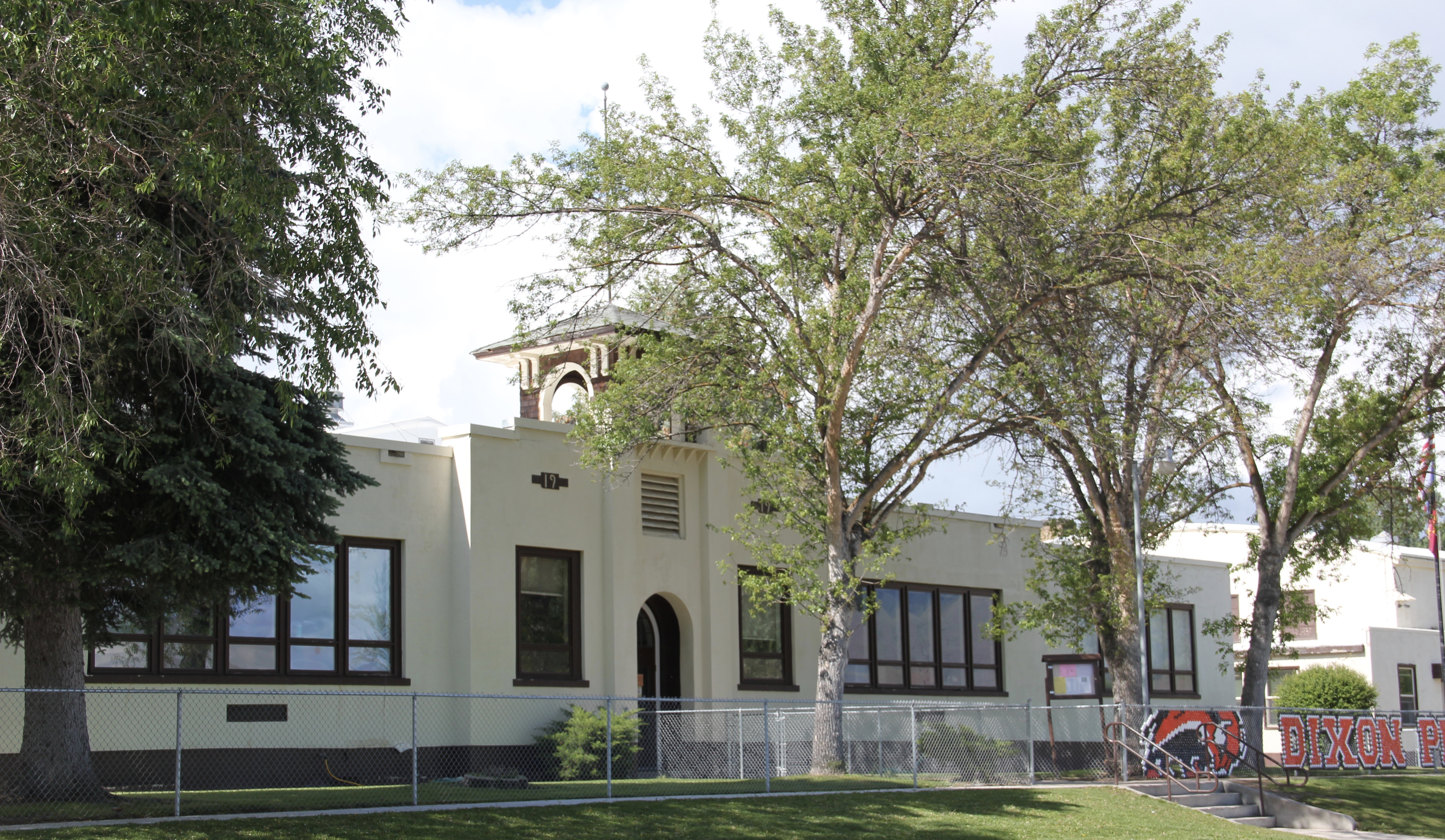
 Dixon, named for the former Montana governor Joseph Dixon, is one of the remaining railroad/homesteading towns along the Flathead River. The fate of the community bar, above, is symbolic of the recent history of the town, one of population decline.


 Local residents are being excellent stewards of this captivating property–certainly one of my favorite spots in the state combining landscape with architecture with history. The architect was the Missoula designer H. E. Kirkemo, and the school was completed in 1940, near the end of the New Deal school building programs.


 The school had just closed its doors for good when I lasted visited but the restoration planning has been underway ever since. I look forward to my next visit to Paradise to experience the final results. Near the school is another historic community property, the Paradise Cemetery, where tombstones mark the names of those who worked so long for the railroad and for the creation of this place within the Clark’s Fork River Valley.
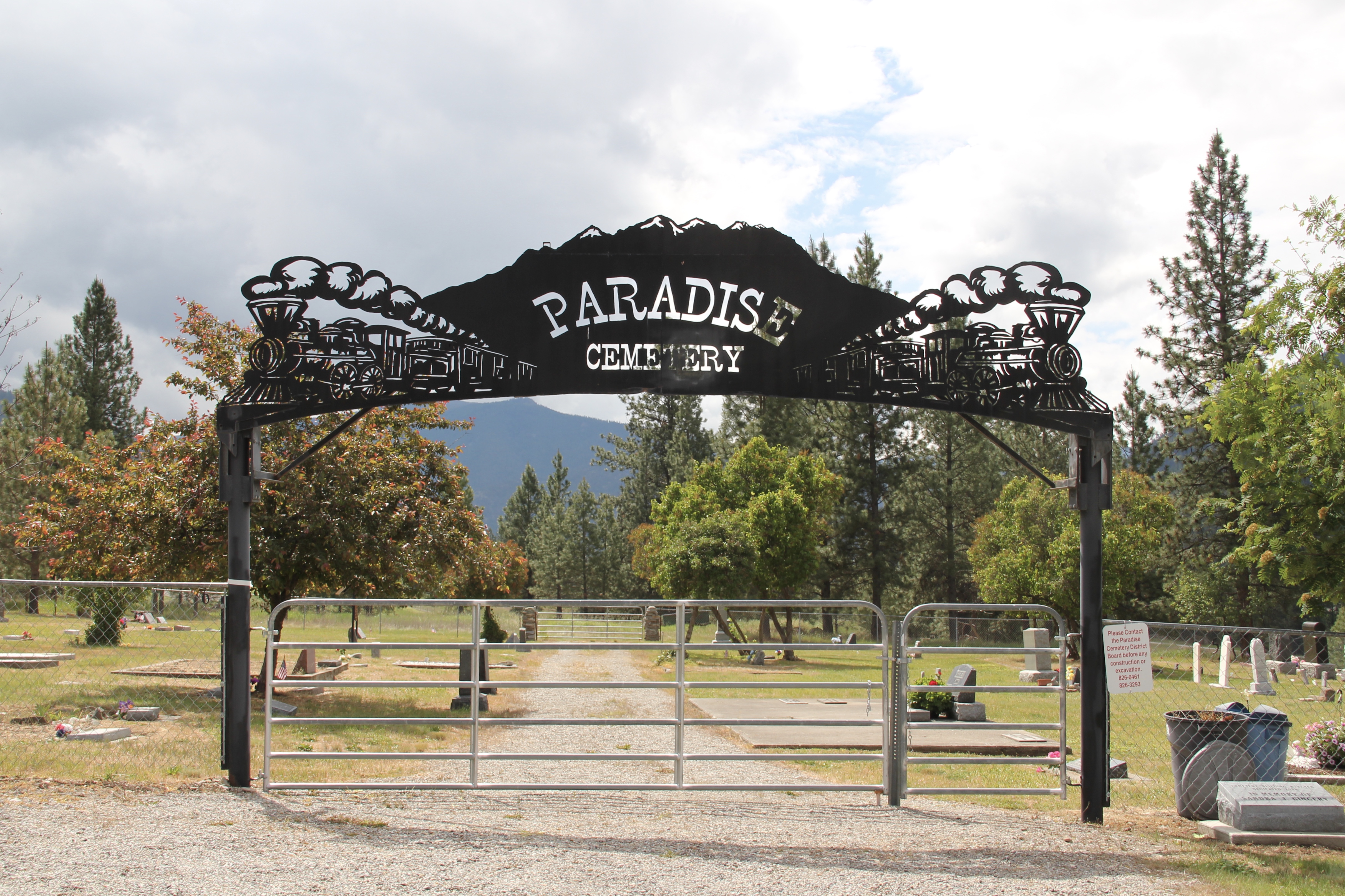
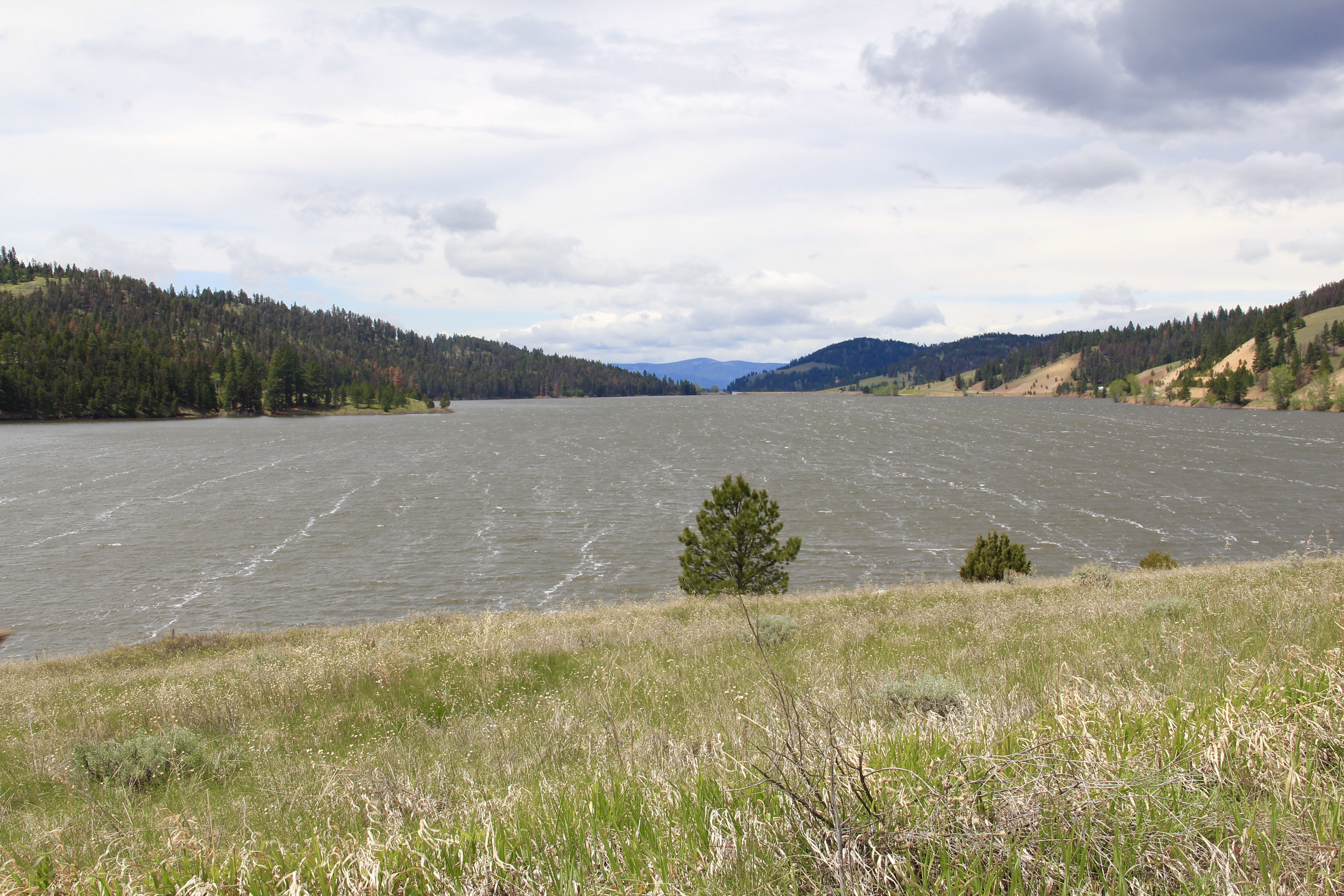
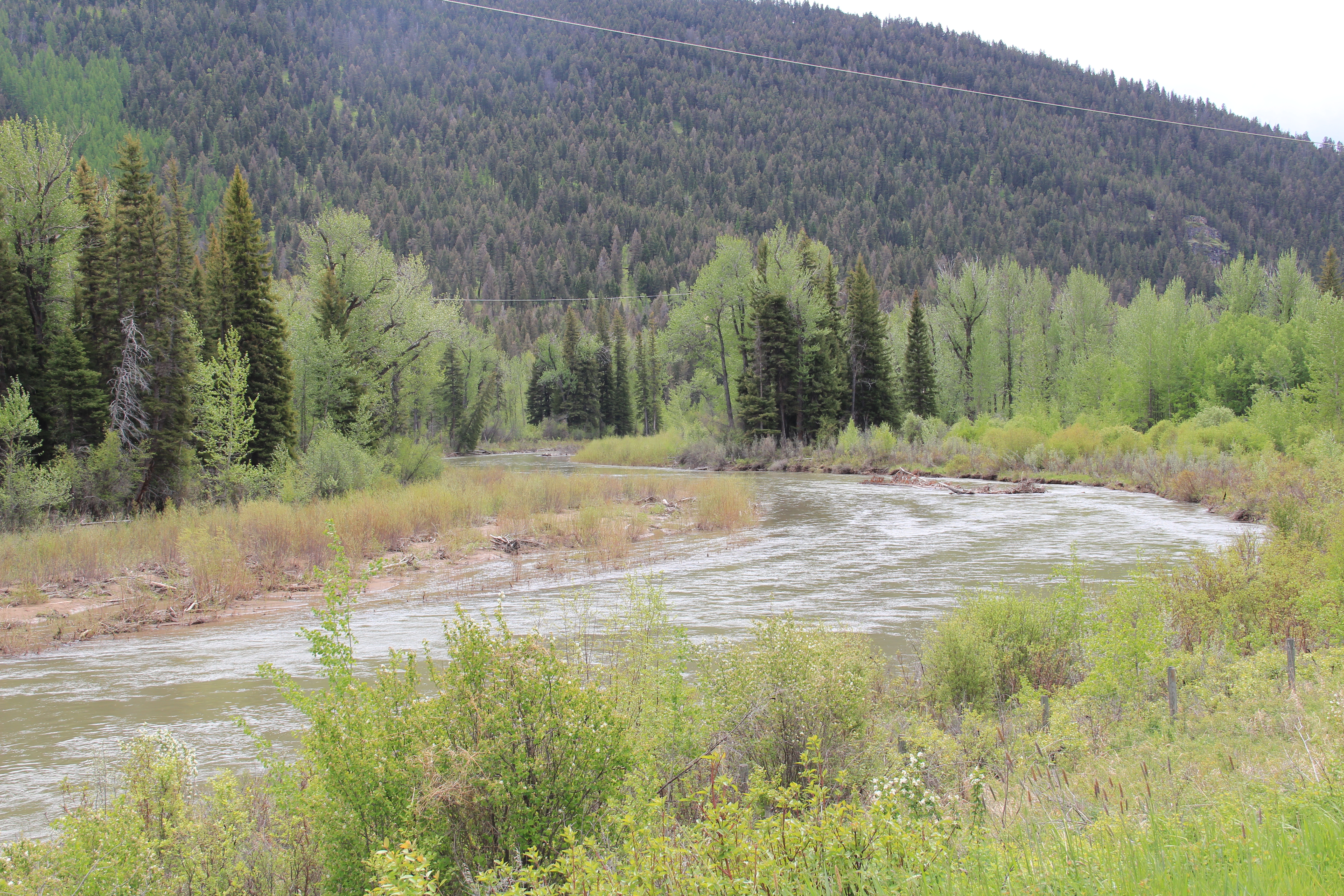
 Montana Highway 141 cuts north from Avon On U. S. Highway 12 to halfway between the towns of Ovando and Lincoln on Montana Highway 200. Its is high mountains prairie travel at its best, although the height of ranching along this route disappeared a while back. About 12-13 miles north of Avon you cross into the Nevada Creek drainage, which has long watered the land, enhanced after the New Deal added the Nevada Creek earthen dam that created Nevada Creek Reservoir in 1938.
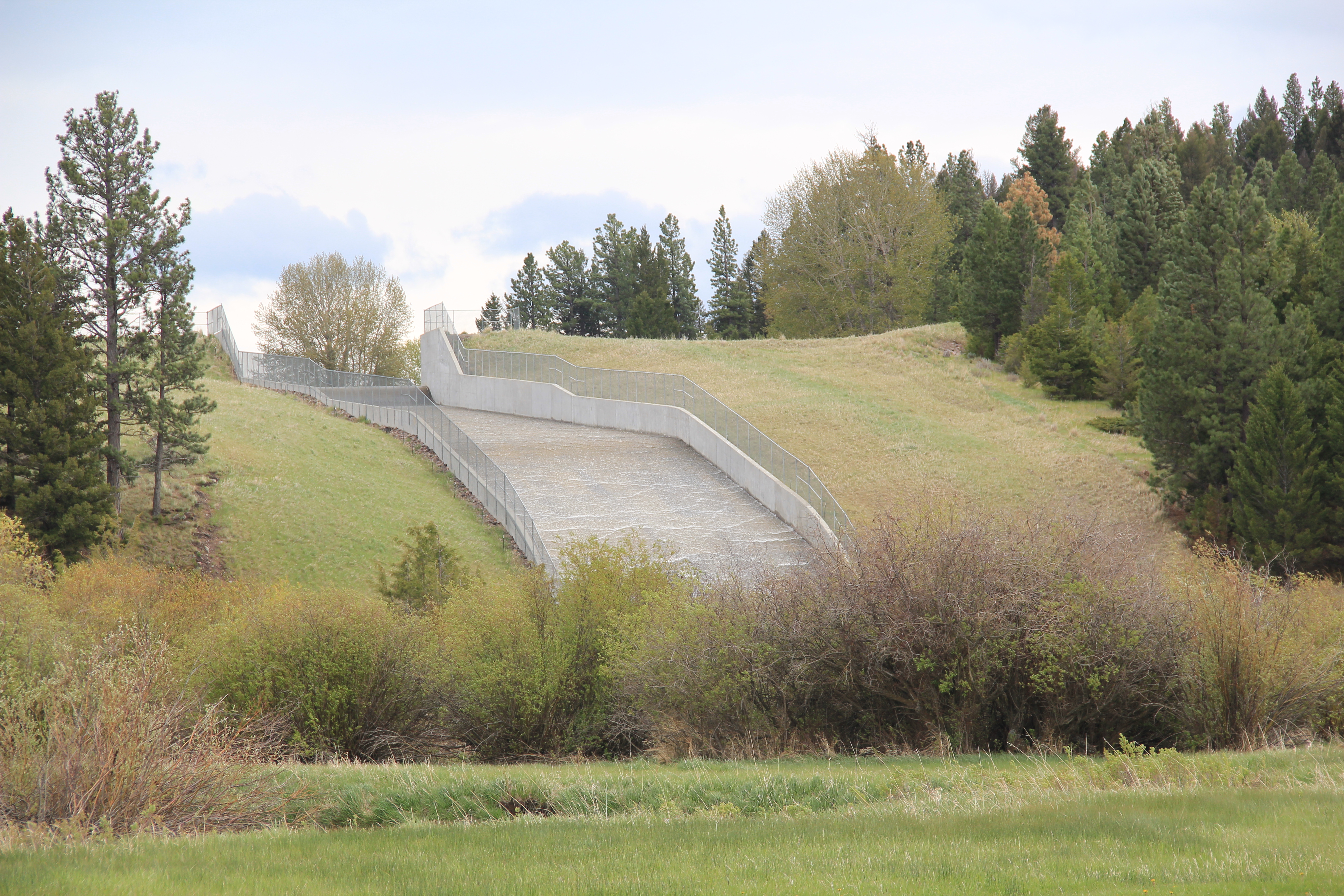
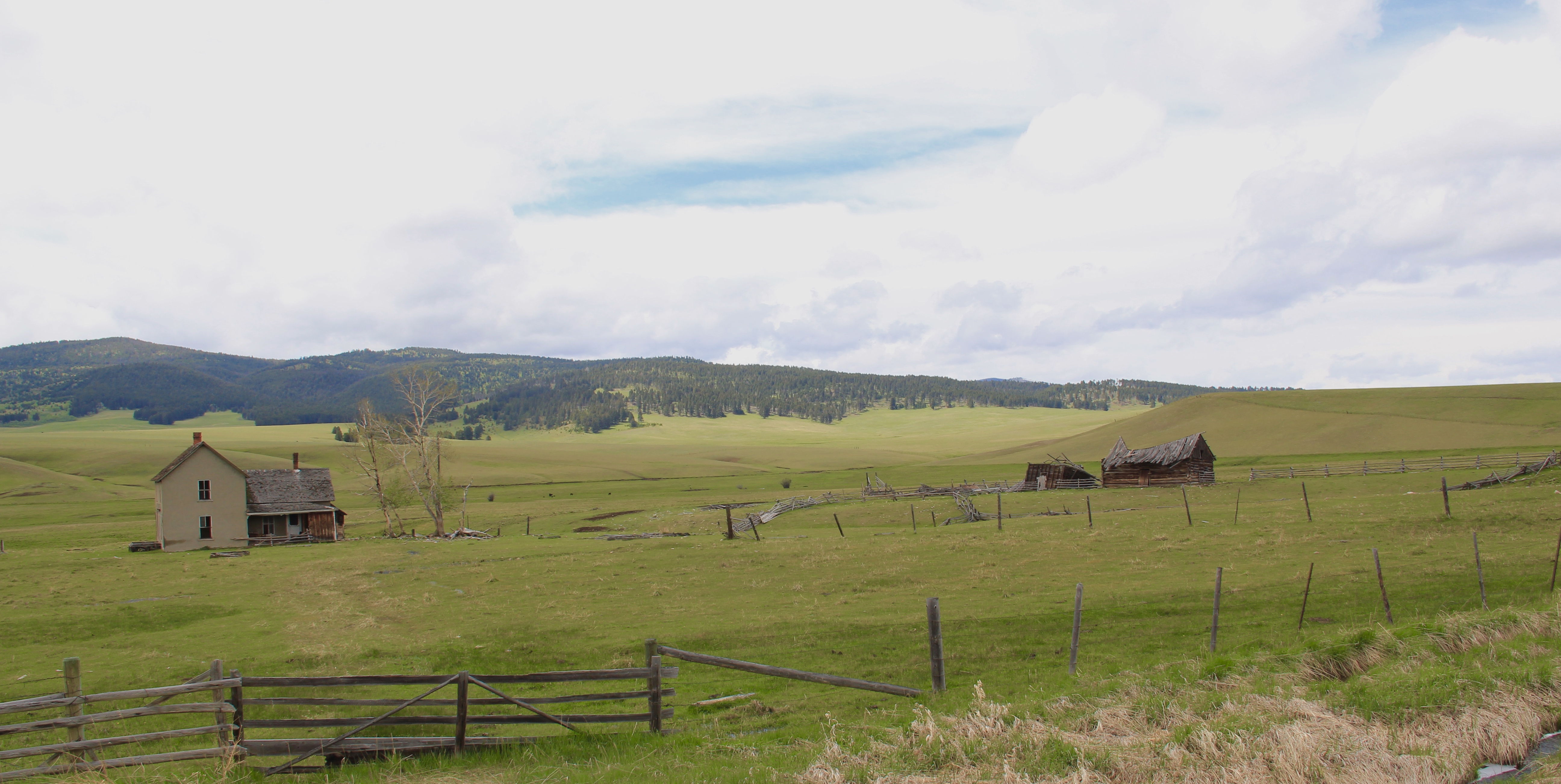
 Along the east banks of the lake are remnants of the Fitzpatrick Ranch, which is listed in the National Register of Historic Places. I highlighted the property in my book A Traveler’s Companion to Montana History (1986). Jimmy Isbel established the property in 1872,
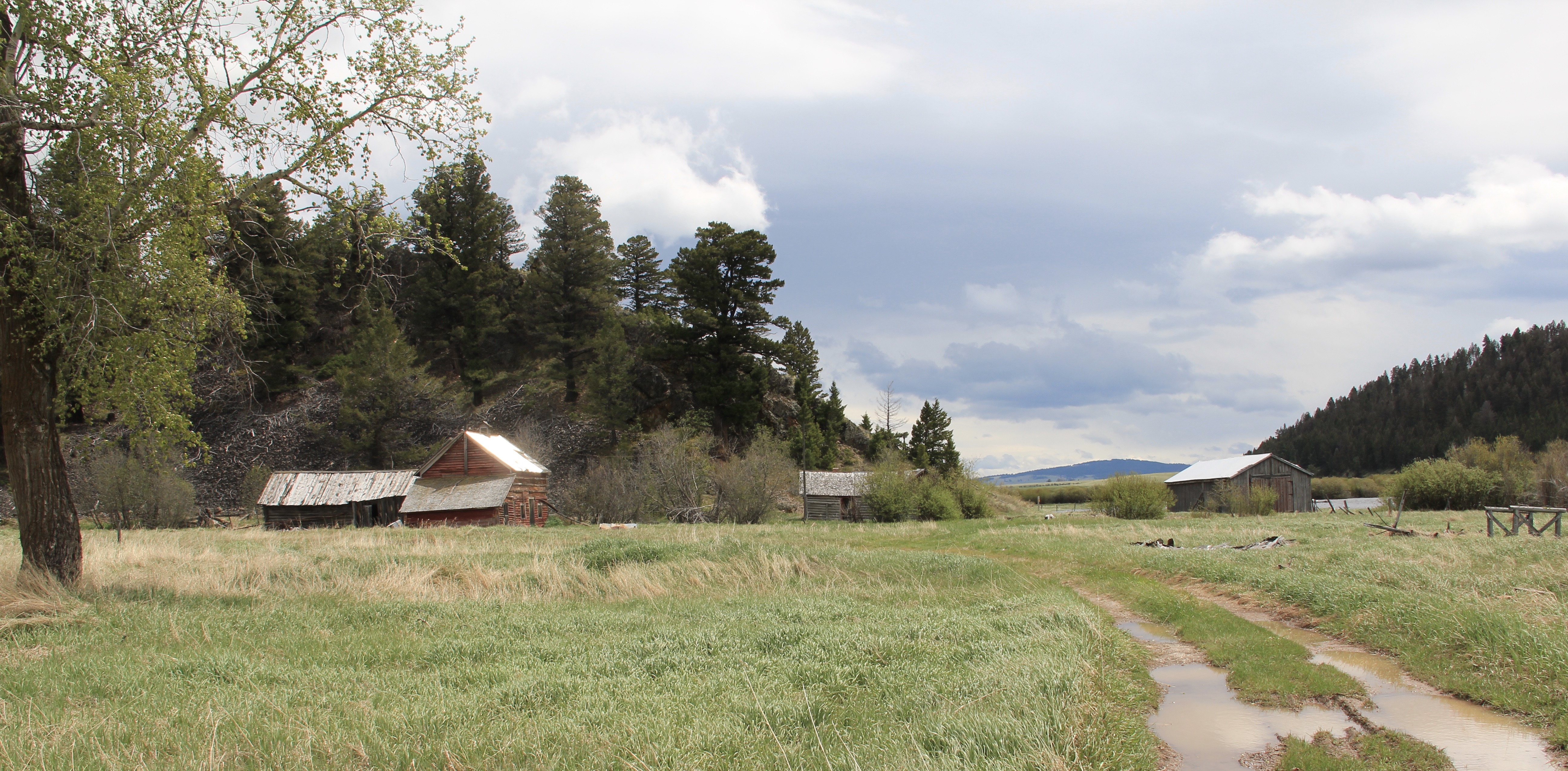 Thirty years ago, this significant collection of vernacular buildings was in good condition, but the years since have been hard on the property, and the complex now needs serious preservation attention. The loss of the roof on the log barn, and the general poor condition of the roofs of the outbuildings are major concerns.
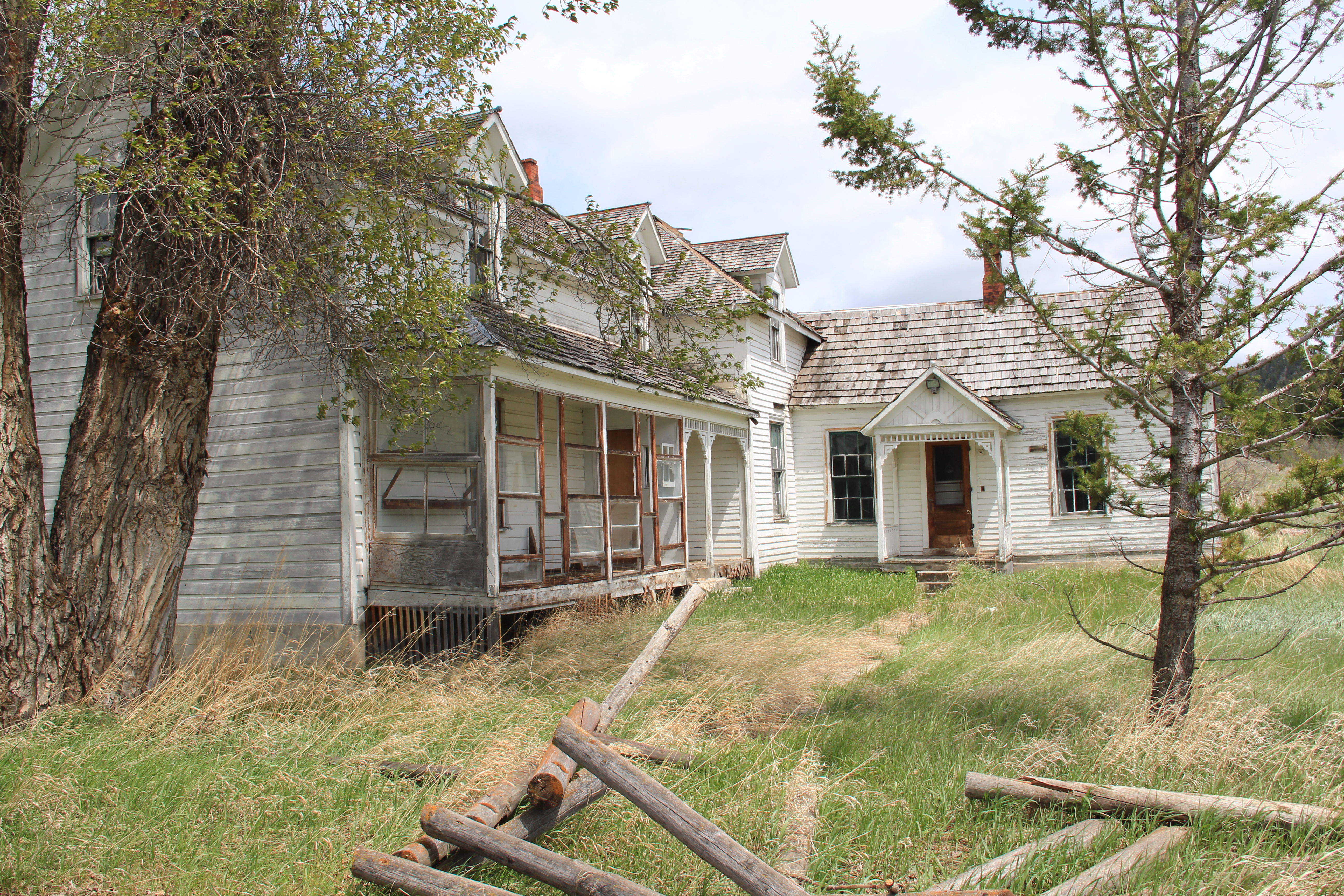

 Between the Fitzpatrick Ranch and Helmville is the Barger Ranch, also from the late 19th century judging from the more polished example of Queen Anne style in the ranch house. It is living proof that not all of the Nevada Creek ranches have passed away. The Nevada Creek Water Users Association at Helmville still operates to distribute the invaluable water from the reservoir.
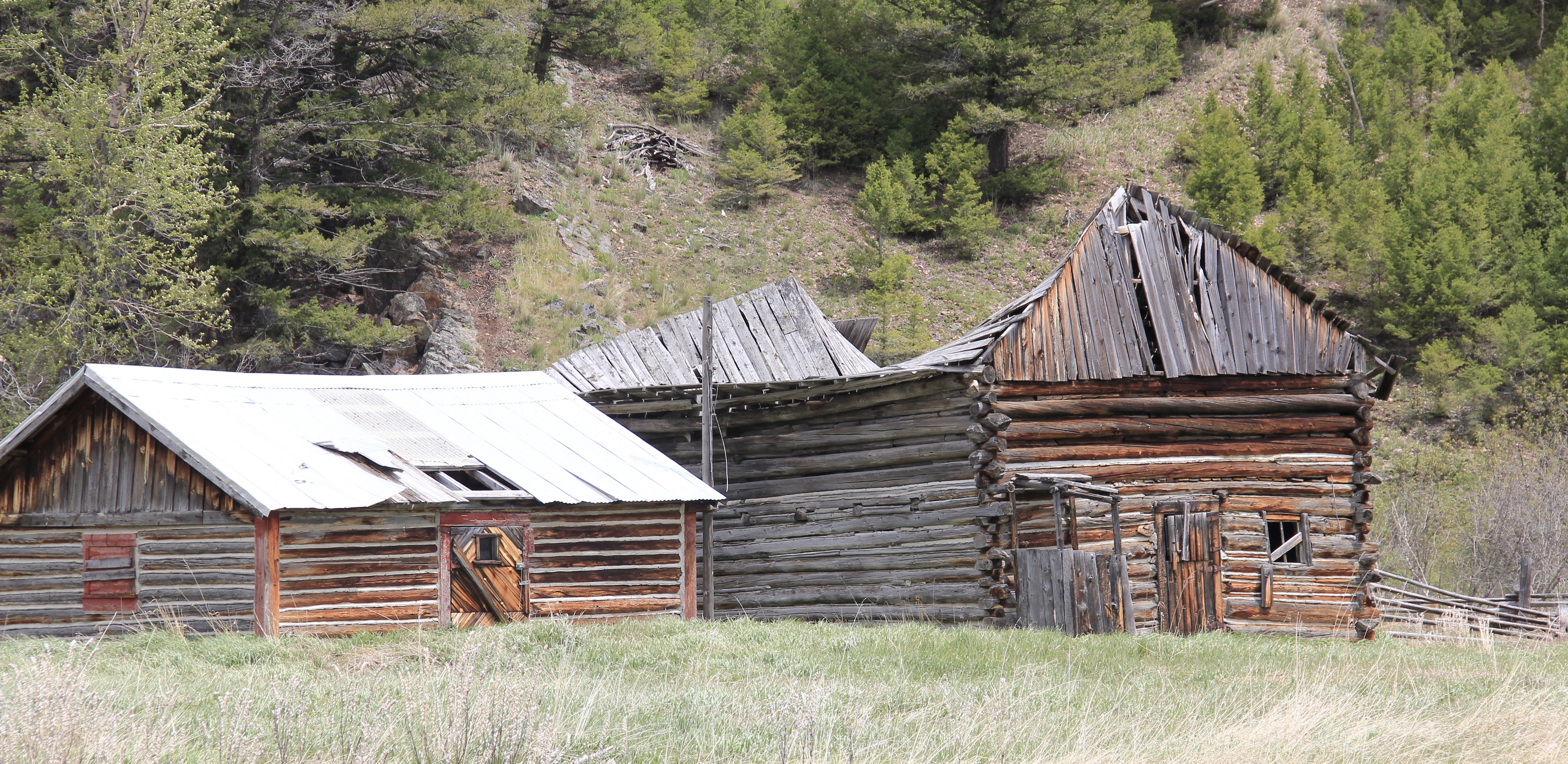
 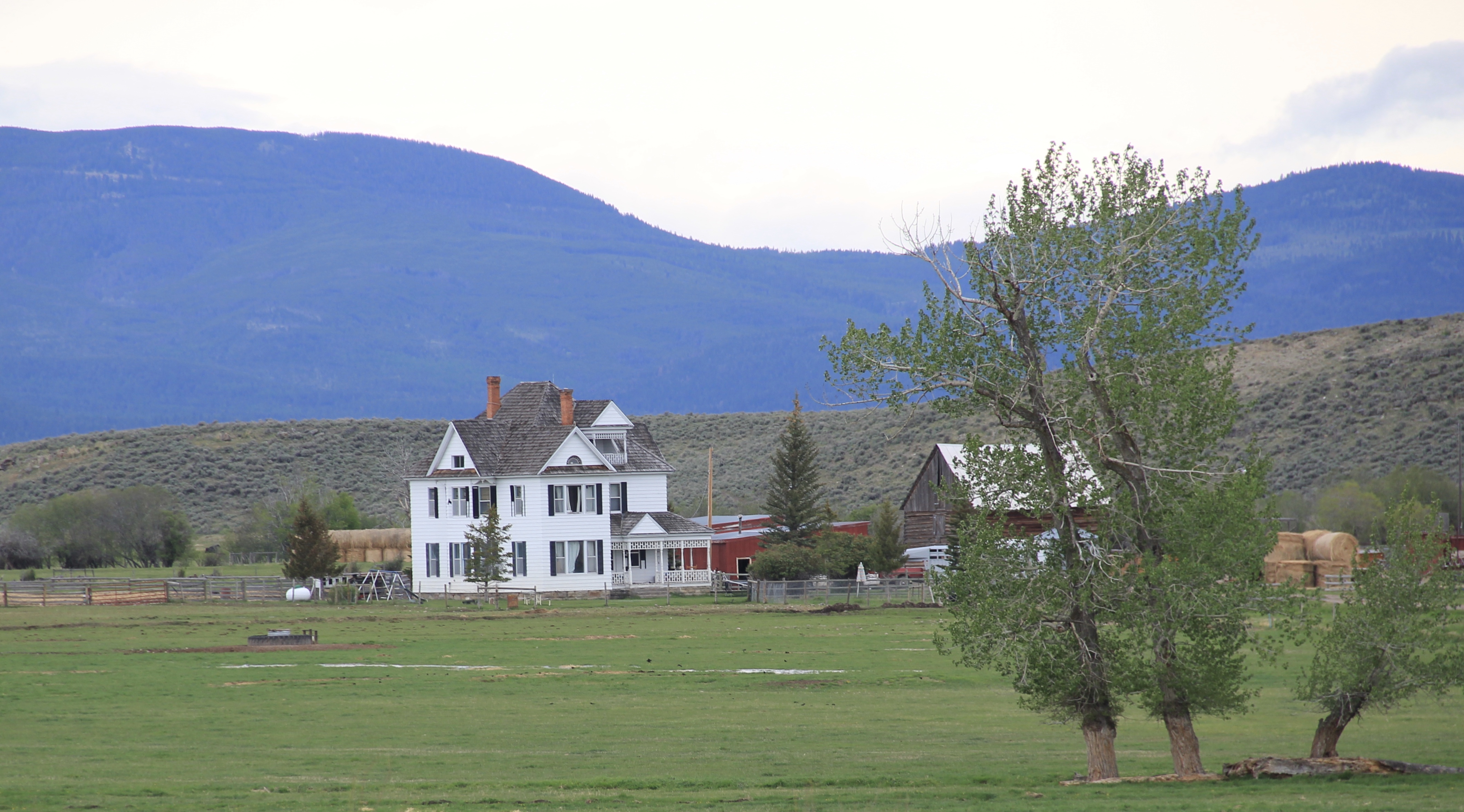 Helmville was another topic in my 1986 book. Throughout the Nevada Creek drainage, you could help but be impressed with the log construction, and the various types of notching used for the buildings. Helmville had a particular interesting grouping of wood frame and log buildings, which were highlighted by a 1984 photograph in the book. That exact view could not be replicated 30 years later but several of the old buildings still stood.
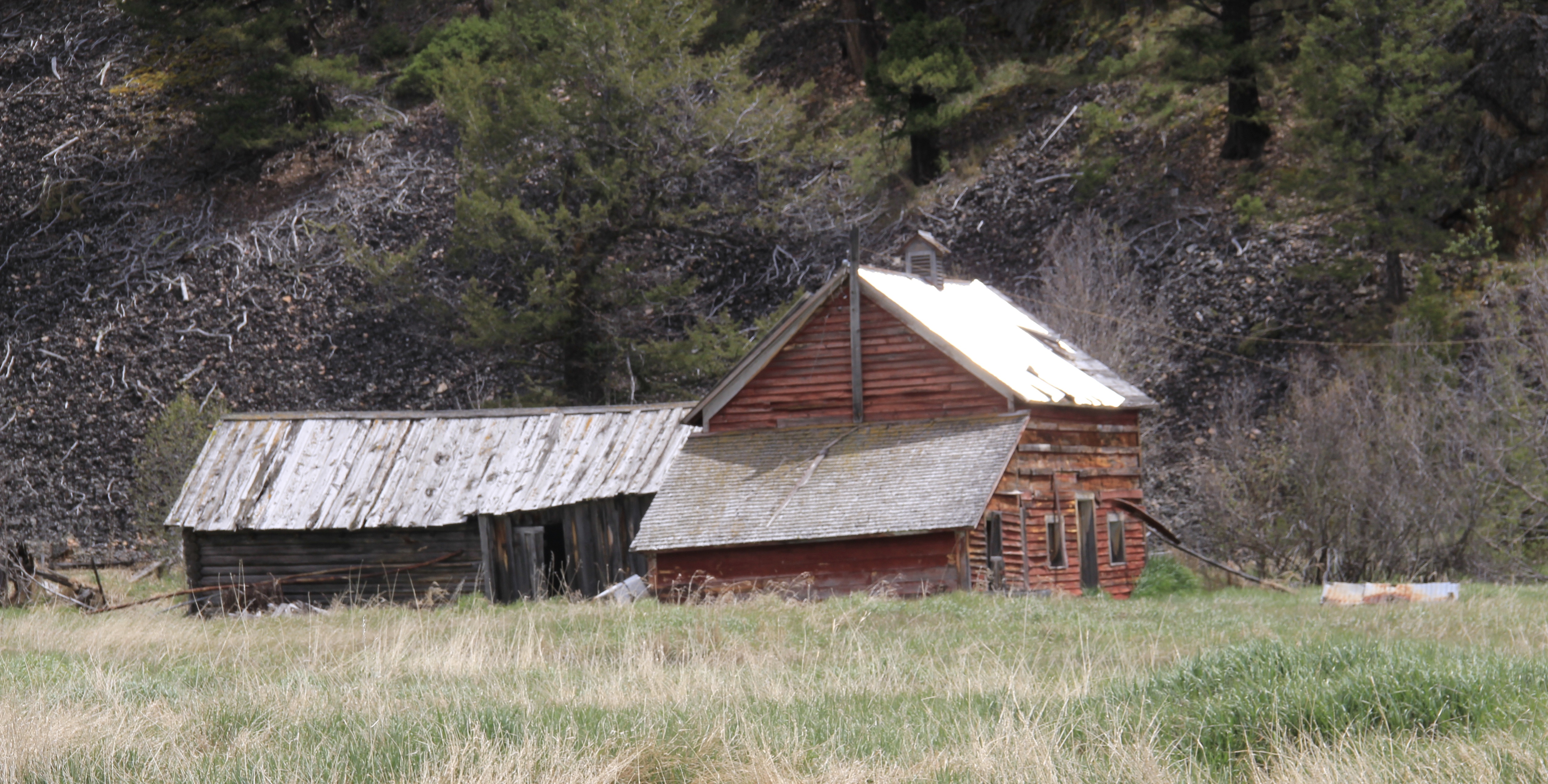
 Helmville has a good bit of continuity. Along with the row of buildings on Montana 271 there is a turn of the 20th century gable-front cottage and a two-story lodge building that has been turned into a garage.


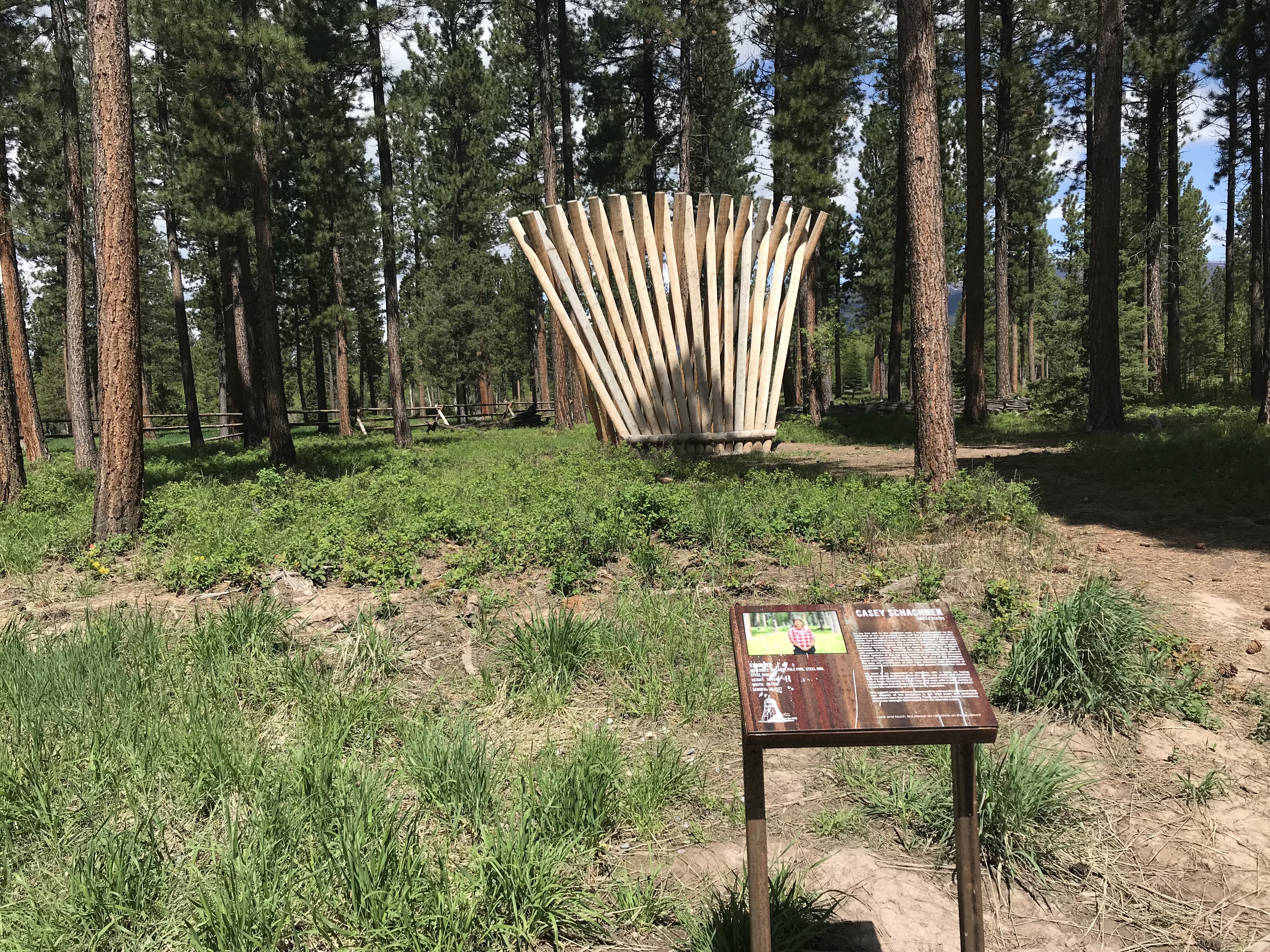
 Trixie’s was the same fun dive that I always recalled, but the village’s historic buildings had been restored, looking good. Business appeared to be brisk. A new community church has been opened, and a major interpretive place for the “Lewis Minus Clark” expedition had been installed. Kudos to both the U.S. Forest Service and the Lewis and Clark National Historic Trail for allowing a bit of humor in this marker.


 The school had also expanded from its New Deal core of the 1930s, courtesy of the Works Progress Administration. But the most noticeable change was the town’s street signs–first the fact that a small place had street signs but then the nostalgic backpacker theme of these cast iron marvels.
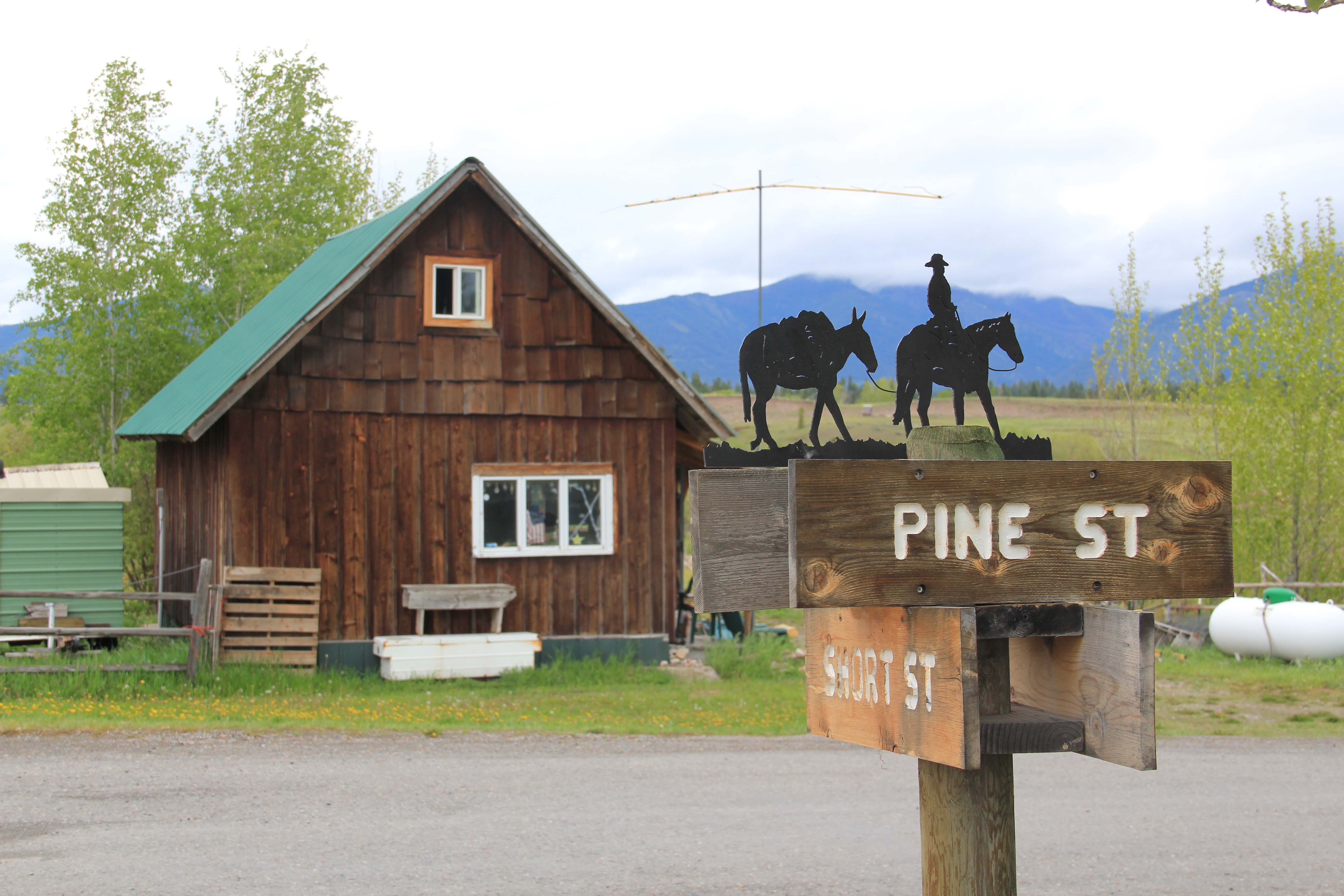 Ovando is a good location on the Blackfoot River for sportsmen, anglers, and hikers headed into the Bob Marshall Wilderness–its recent change demonstrates the influence on those groups on the 21st century Montana landscape.


