Fort Benton’s heritage development, part 2

Image

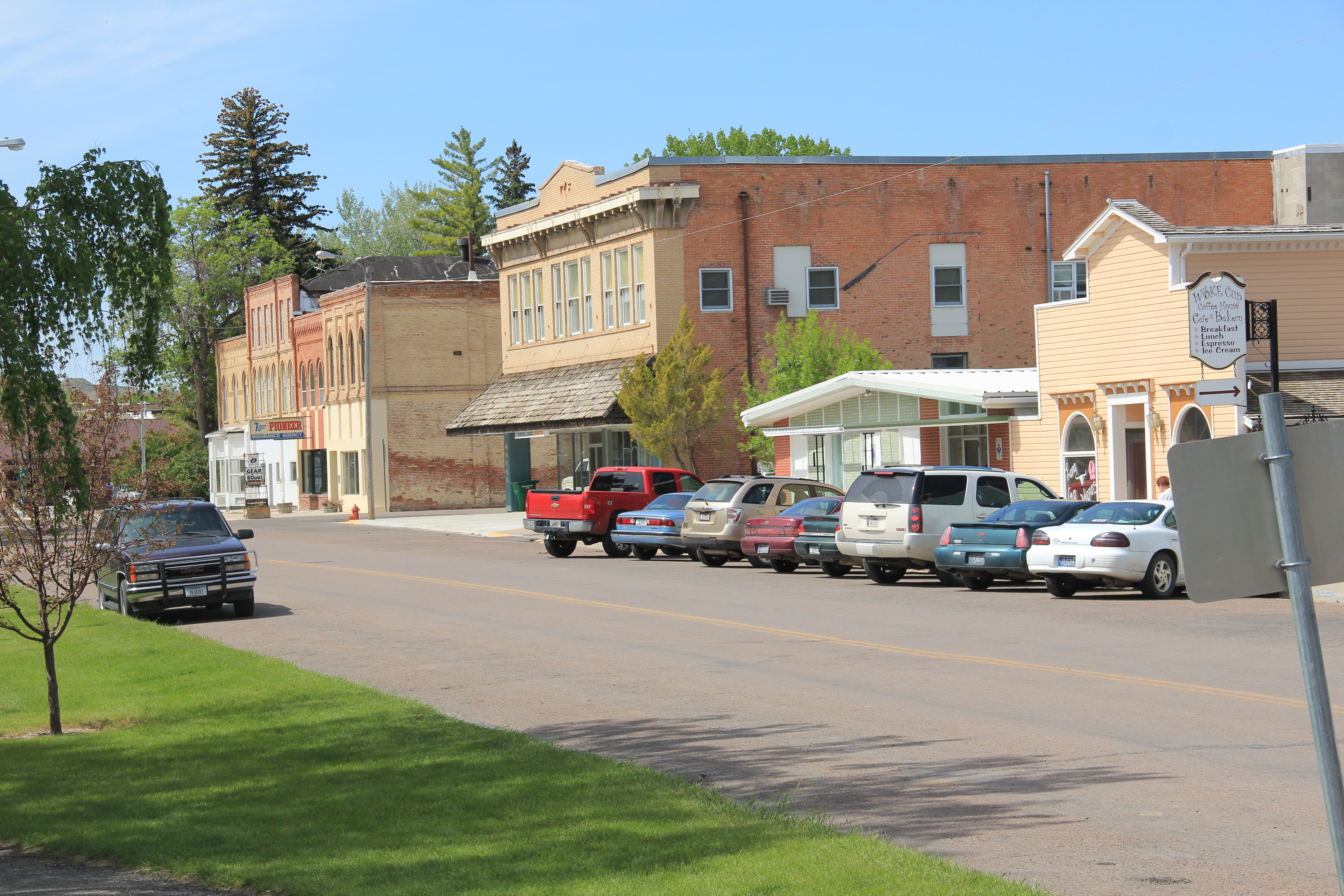
Lobby, Grand Union Hotel, 2013

In 1984, when John Lepley took me through Fort Benton and spoke of the community’s dreams for both preservation and heritage tourism, the vision was compelling but at the same time you had to wonder whether it was feasible.  One morning was spent at the Grand Union Hotel, a marvelous Victorian-era building, right on the river front.  It was then under restoration yet I had spent a night there and the future seemed bright.  But managing heritage assets is challenging and the hotel has passed through several approaches until its most recent owners seem got it right.  In the summer season and on weekend the hotel is a busy place.

IMG_8787

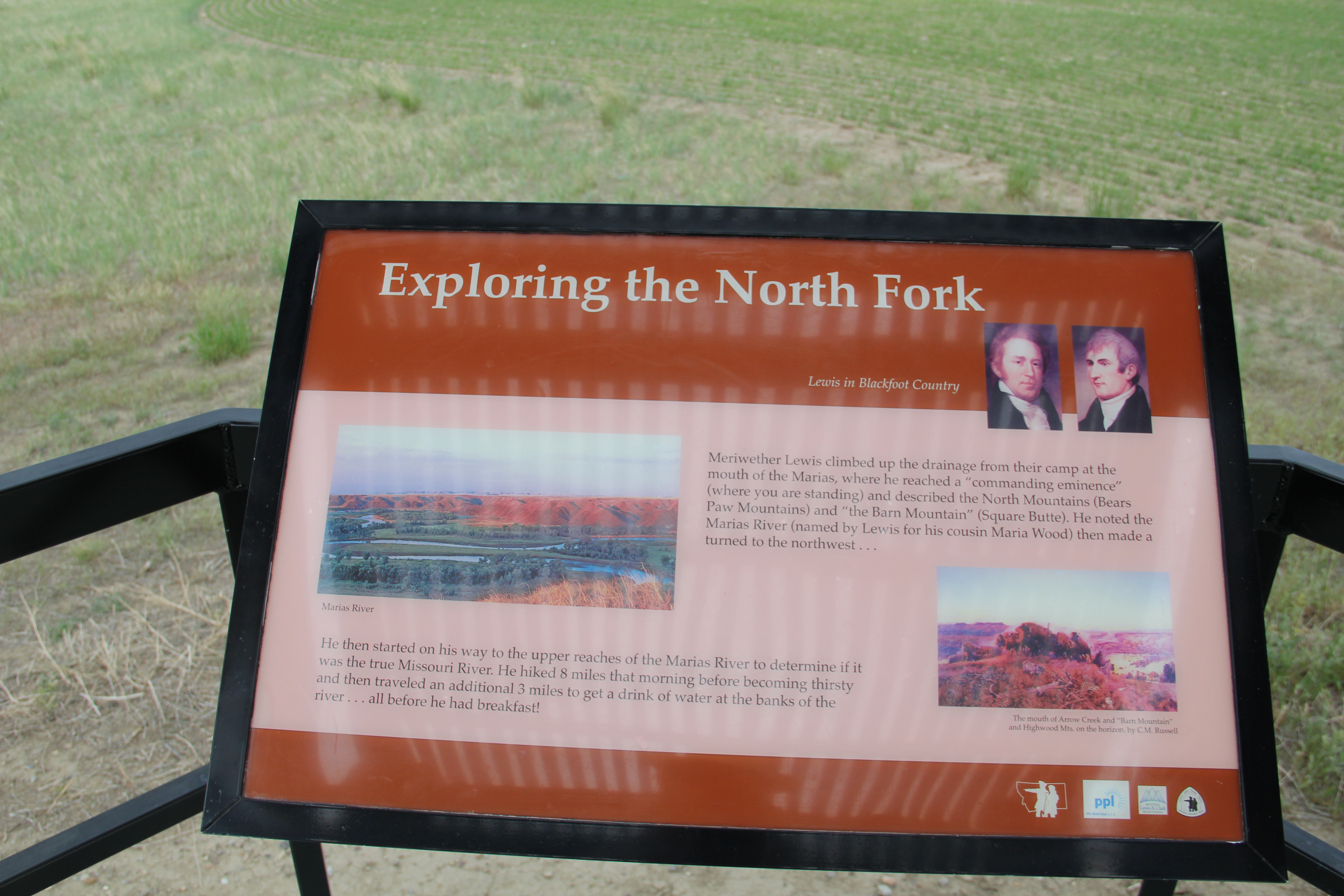
Next Lepley took me to the ruins of Fort Benton and spoke of the pending reconstruction of the fort.  The notion of reconstructing the nationally significant fur trade posts of the mid-19th century was an idea I had heard elsewhere, especially at Fort Union, at the confluence of the Yellowstone and Missouri rivers on the Montana-North Dakota border.

IMG_7404

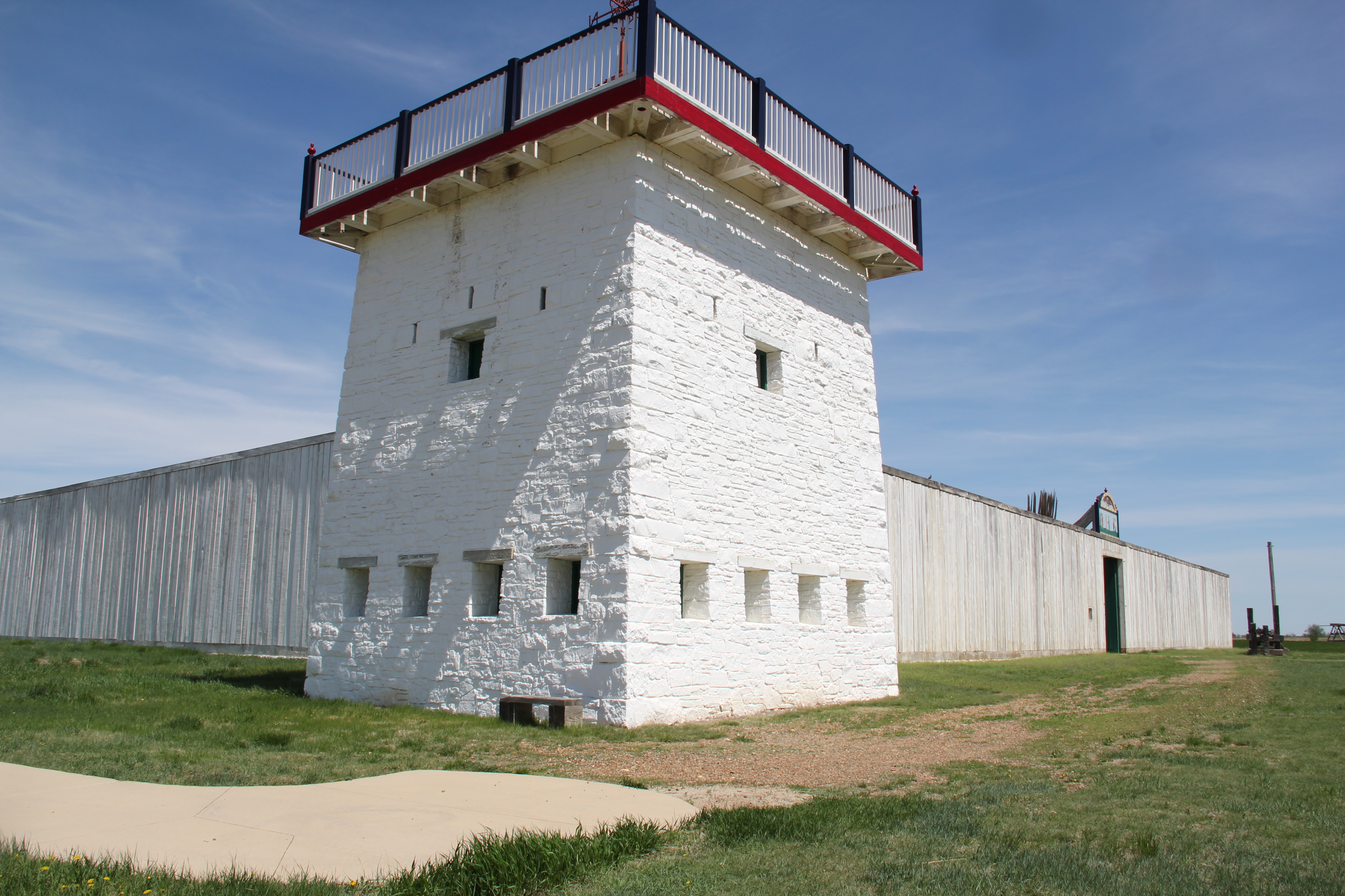
But Ft Union would be a National Park Service project, with all of that agency prestige and federal funding behind it.  Fort Benton too was nationally significant but the property was not owned by the federal government–a complete reconstruction struck me as ambitious if not fantasy in 1984.  Well, I was wrong:  Fort Benton, mid-19th century, has been reconstructed, and serves as a centerpiece of the town’s public interpretation.

IMG_8719

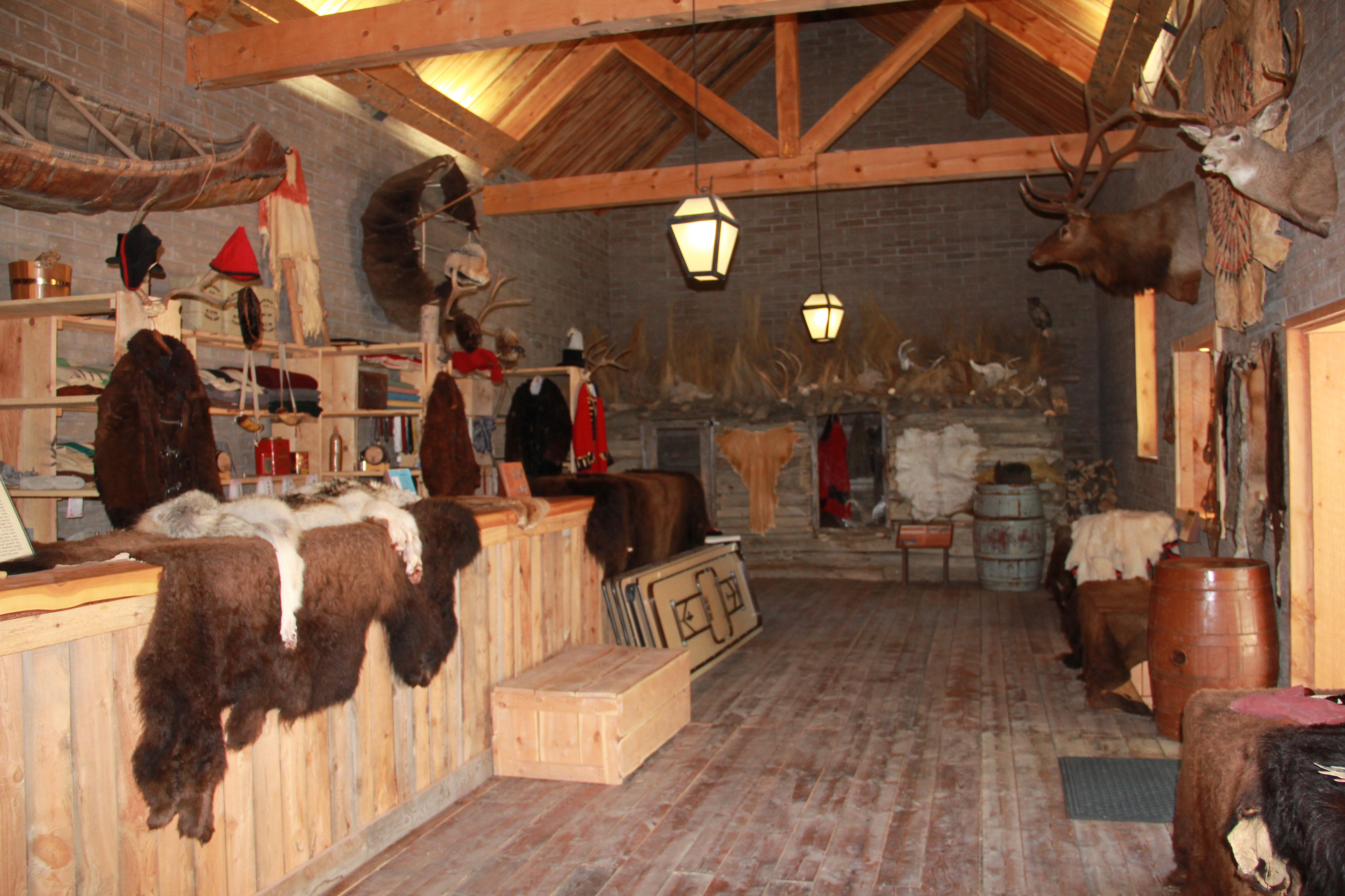
The fort is not only rebuilt in its exterior–a reconstruction that you can find elsewhere in the West–but it has a completed interior, divided into period rooms and modern exhibit spaces.  Finally there is a property in central Montana that conveys visually and physically what a mid-1800s trading post was like, and just how crucial this mix of private enterprise and Native American relations was to the region’s history.

IMG_8741

IMG_8721

The reconstruction also preserves and interprets the few bits of original fort wall that exist–and that were slowly ebbing away back in 1984.

IMG_8726


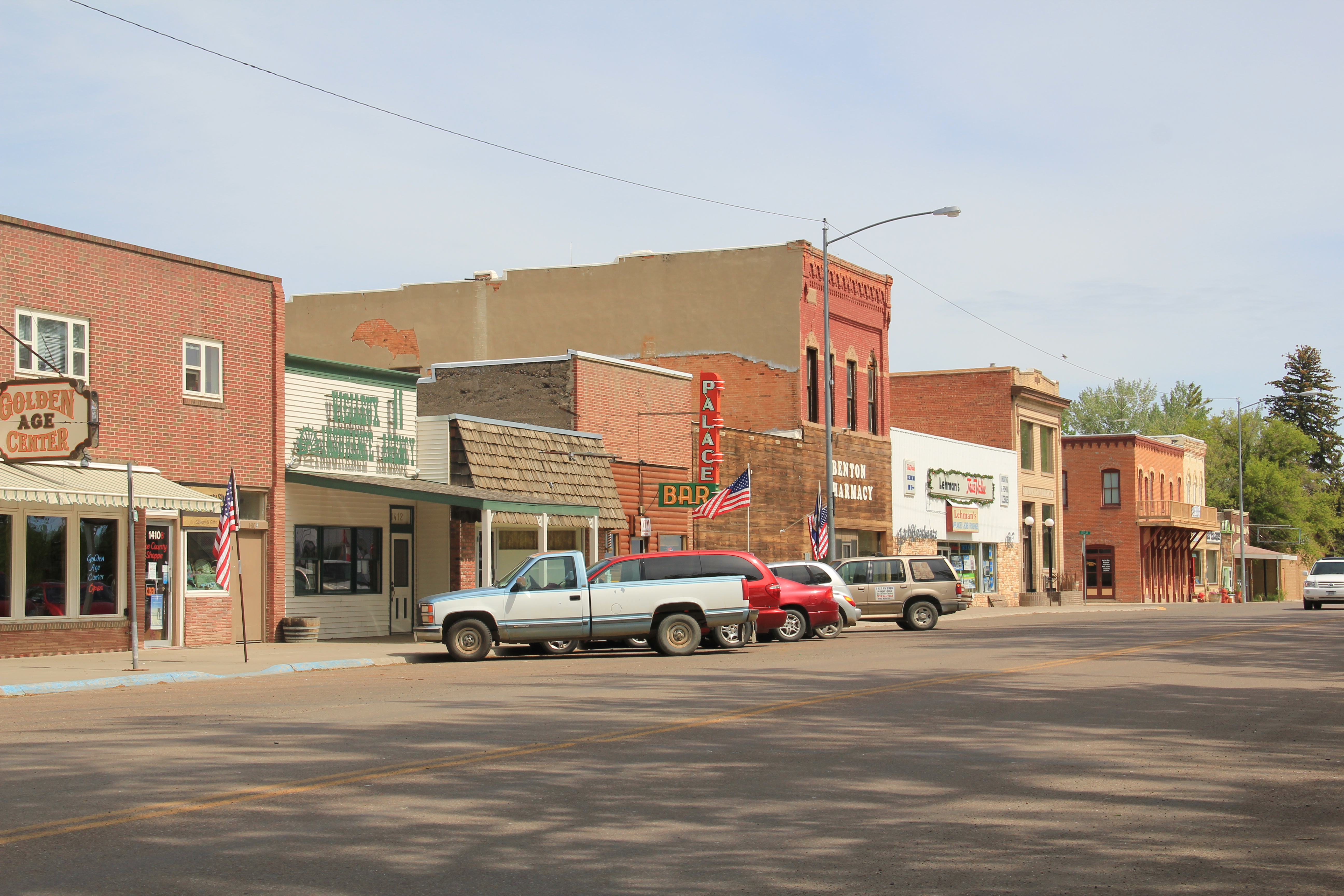
No doubt the reconstruction of Fort Benton, and the preservation of the remaining fort site, are major achievements for anyone, especially a town and county that are relatively isolated from large population areas like this one.  In 1984, John Lepley shared with me one last set of resources–the riverfront buildings.  There the story still needs to grow.  The recent success of the hotel should spur even more investment into the adaptive reuse of these buildings. Splendid properties they are, and still a potential backbone for the revitalization of the local economy.

IMG_8709

IMG_8687

The 1984 story ends here–and I must admit that the progress in heritage development is impressive.  But there is still the more recent history to digest, and that will be the next blog from Fort Benton.

Transformations in Fort Benton, part 1

Image


In the spring of 1984, there was no doubt that I would spend considerable time looking at the historic preservation issues at Fort Benton, a small county seat today but one of the most important places in all of the northern plains before the age of the railroad.  Here at this bend in the river, shown in a postcard I bought there in 1984, was basically the last stop for Missouri River boat traffic heading west.  The fort dated to the late fur trade era and as the rush for precious metals overtook Montana Territory in the 1860s and 1870s here developed a major trade and outfitting post, with roads running from Fort Benton in all directions.  But the place was a sleepy, almost forgotten town, as the railroads changed routes and the interstates bypassed it by miles and miles.  Landmarks too were there but the old fort had been slowly coming apart, only a recent determined effort by save what remained and then, ambitiously I thought 30 years ago, to rebuild the lost fort and tell fully the story of the fur trade and the significance of the Upper Missouri.

Image  Image


My guide was John Lepley, who was spearheading the local efforts and a member of the SHPO board.  Another key leader was Joel Overholser. And no doubt, there was some heritage tourism and historic interpretation infrastructure in place.  The Chouteau House, a classic river hotel, was still open, rough on the edges but the place where I stayed and took meals. (It was closed when I visited last in 2013).

Image


Nearby was the home of I. G. Baker, a pivotal figure in the region’s history.  It was open, and paneled interpretation in place but certainly a property that could “say” more.

Image


Various monuments and markers could be found throughout the riverfront:  the Mullan Road, the Whoop-Up Trail, and especially the recently installed (1976) State of Montana Lewis and Clark Memorial, a monument piece of public art, sculpted by Bob Scriver with the base by Shorty Shope, another well regarded Montana artist.  The memorial was an American bicentennial project led by the Fort Benton Improvement Association, which Lepley and Overholser served on as commissioners.  Indeed, the state also had donated one of the keelboats used in the film “Far Horizons,” a Hollywood take on the Lewis and Clark expedition.  The waterfront told a story, one dominated by Lewis and Clark.

Image  

Image

postcard of Far Horizons boat, c. 1984

Image


The amount and quality of the public art along the riverfront was impressive, but what struck me as speaking most strongly to the town’s future were two completed projects (the Museum of the Upper Missouri and the Missouri River Bridge) and the almost completed restoration of the Grand Hotel, a remarkable Victorian building that spoke to the town’s hopes in the late 19th century.

Image Image


Image


I left Fort Benton convinced of two things:  the town had clear preservation needs, not just the fort site but buildings from the Victorian era were decaying too.  But compared to other places that I would visit in 1984, I thought Fort Benton had the one key trait for success–vision, the realization that the steps of the 1970s were just first steps, and many more needed to be taken in the years to come.  Let’s next come back to Fort Benton 30 years later and see how far that vision has reached.

ImageWho

Finding the Lewis and Clark story at Coal Banks Landing

Image

Coal Banks Landing, on the Missouri River in Chouteau County, was another site already recognized as significant when the preservation planning survey got underway in the spring of 1984.  Here was yet another documented place associated with the Lewis and Clark expedition:  it took its name literally from the band of lignite easily observed in the banks along the Missouri.

Image


The landscape here not only speaks to the age of river transportation; to the west at Virgelle you can also find the original roadbed of James J. Hill’s Manitoba Road as it came down from Havre and connected with the Missouri River valley, its route to Great Falls.  Virgelle has National Register-listed properties in its historic pressed tin-sided general store and brick bank; across the road are a school and grain elevator.  These properties marked the forgotten town as a place once prominent along the Great Northern network.

Image Image

Image Image

Coal Banks Landing, in comparison, was a place on the river, with little to tell its story.  Today, however, Coal Banks Landing is a prominent spot, with a modern boat landing, a seasonal interpretive center, and then year-round interpretive markers for its multiple layers of history.

Image Image


The landing and its significant Lewis and Clark story are now preserved as part of the Upper Missouri River Breaks National Monument, one of the state’s most important conservation and heritage tourism developments in the 21st century.  This national monument preserves not only one of the most breathtaking sections of the Lewis and Clark National Historic Trail it also preserves open land little changed from the centuries of occupation by various Native American groups and scattered often log-built homesteads of the multi-ethnic groups that flooded into northern Montana in the first two decades of the 20th century.

Image Image


Little was here in 1984 to help residents and visitors understand the deep significance of the Missouri River.  Today Coal Banks Landing is a must stop for any heritage tourist of northern Montana.


Lewis and Clark and finding the “true Missouri” at Loma, Montana

Image

During the early weeks of fieldwork in northern Montana in 1984, I certainly had notes and reminders to document sites associated with the Lewis and Clark expedition.  Here was one part of the region’s history that had been given its due by generations of historians, and the brown Pathfinder-themed markers of the Lewis and Clark Trail made the historic route one of the state’s most recognizable heritage assets.  Yet as I left Hill County and moved into Chouteau County, heading toward Fort Benton, there was little to mark the story along the Marias River and the decision that the expedition made regarding the “true” path westward–the Missouri River or the Marias River (the latter they had not expected to encounter).  There was a state highway marker at Loma, but that seemed not enough, considering the importance of the events on the Marias and the high integrity of this historic landscape.

Image


Opportunities not gained during the Lewis and Clark sesquicentennial in the 1950s were not missed during the bicentennial of the past decade.  As you approach the highlands above Loma, a major new interpretive kiosk not only presents a compelling view of the Marias landscape, it also interprets the significance of the location.

Image

Image Image


Here is an example of the partnerships now driving the interpretation of the Lewis and Clark Trail:  the Lewis and Clark National Historic Trail of the National Park Service being the most important, bringing a consistency of design and message to the interpretation.

Image 

With these partnerships, working with property owners, in place, visitors can experience such key sites as Decision Point, at the confluence of the Missouri and Marias rivers, where the expedition made the correct choice and followed the “true Missouri” westward.  Loma, rather than being a neglected place in the Lewis and Clark story, now has become a centerpiece of the region’s interpretation, thanks to new visions and new installations in the 21st century.

Image