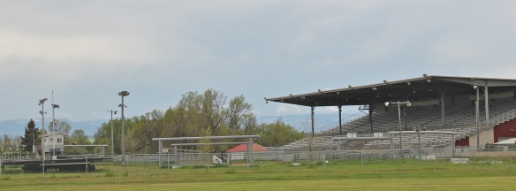
Bozeman, the county seat of Gallatin County, was one of my favorite Montana towns during the 1984-1985 survey. In some ways, it was still a cowtown, a commercial center for the hundreds of surrounding ranches in Gallatin County. Yet it was also a college town–bars, music, cheap eats–as home to Montana State University. In 1980 its population was over 21,000–thirty years later by 2010 it had boomed to over 37,000. By the time I explored the town in 2015 for this new survey there were an estimated 42,000 residents, double of that of the 1980s town I had so enjoyed.


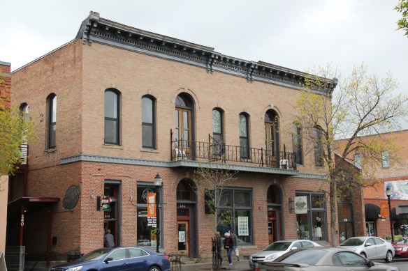
In 2007 then State Senator Lynda Bourque Moss stopped with me in Bozeman as we traveled from Billings to Helena where I was to speak to the governor’s task force on historic preservation, a meeting where the idea that I would recreate the survey of 1984-1985 first took root. We stopped because she wanted to show me changes. The four photos above showed me that yes, change had come, and in a big way to Bozeman. The old Hallmark Store, which had moved into an earlier Stockman Bar, had become an upscale wine bar–a bit of California in the old cowtown of Bozeman–and when I next returned “Plonk” had added sidewalk seating. We could have been in Aspen, at least Breckinridge, Colorado.

Plonk and the sporting goods store, 2007
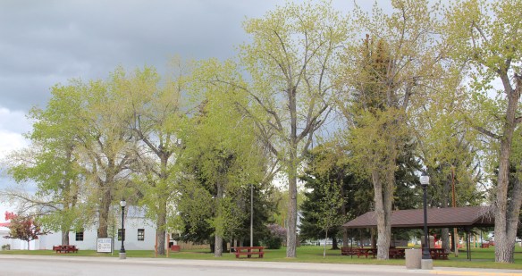
Bozeman had eagerly embraced the idea of historic districts in 1984-1985 as a way of revitalizing its downtown–so much had moved, or was going to move, out to the interstate exits. John DeHaas at Montana State University had done so much to promote historic preservation in the 1970s and early 1980s. A tradition and commitment were in place. That much was clear when I surveyed the town and talked with residents and decision makers in 1984-85. The next several posts will explore the impact of those historic districts in the last 30 years, and offer observations on where next steps may go.
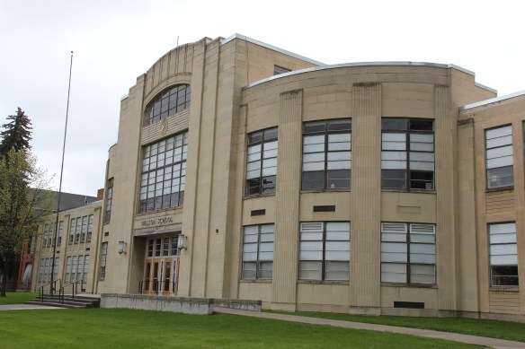


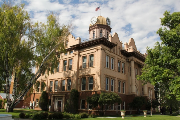
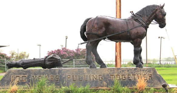
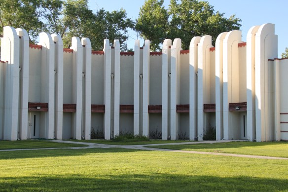
Let’s start with what I saw as the public landmarks, and anchors, for downtown Bozeman in 1984-1985. None was more important than the New Deal era Gallatin County High School, a striking Art Moderne design by Bozeman architect Fred Willson. At that time, the “new” high school–which stood right by an earlier 20th century brick high school building–was not “old enough” to be considered for the National Register. This building, like many of the state’s New Deal era legacy, has since been listed in the National Register. And its grounds have been re-energized for all who walk by through the installation of a statue in honor of Malcolm Story, designed by Belgrade, Montana, artist Jim Dolan and placed in front of the earlier high school in 1995.

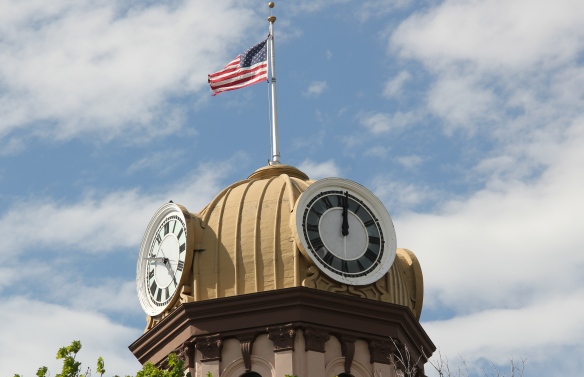
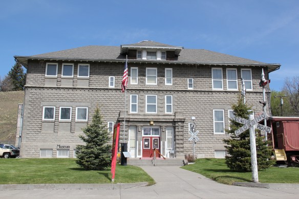
Across Main Street is another public anchor, also funded by the New Deal in the late 1930s and also designed by Fred Willson: the Art Deco classicism of the Gallatin County Courthouse. Next door is the historic county jail, in a distinctive castellated Gothic style, which already had been converted into headquarters for the local historical society and county museum when I visited in 1984. The facility still serves that purpose today.


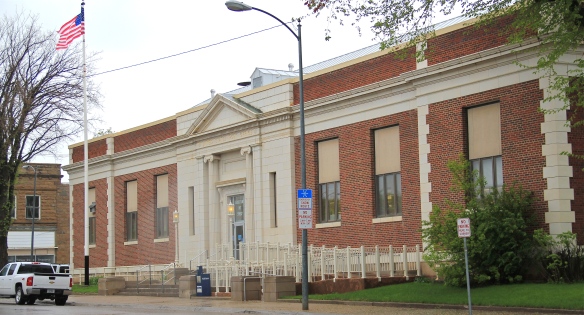
A couple of blocks away from this public landscape core of Bozeman were additional public buildings, on side streets to Main Street. Tracy and Babcock Streets had the town’s first two federal buildings/post office. The 1915 neoclassical styled post office operated until 1964 and filled several community roles, including a turn in the 1990s hit movie A River Runs Through It until it became home to the non-profit HRDC after a complete renovation at the turn of the 21st century. The building also has been enlivened by the addition of Jim Dolan’s statue in honor of Jeanette Ranklin, the first woman U.S. Congress representative, elected in 2010 from Montana.


Nearby is the mid-1960s Federal Building, a grand though boxy five-story building that symbolized the growth of the federal government and its impact on Gallatin County in the Cold War era while also adding a modernist design landmark to the city’s mix of Victorian and Classical architectural styles. The earlier post office was given attention in my 1984-85; due to its date of construction and style, I paid no attention to the new Federal Building. I didn’t repeat that mistake in 2015–the Federal Building of 1964-66 is one of the region’s most impressive statements of Montana modernism. and a much more recent Federal Building, which I ignored, for reasons of chronology that no longer apply in 2015.


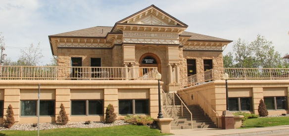
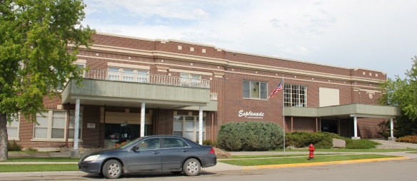
The final public anchor was the Carnegie Library of 1902-1903, one of the better architectural expressions of Classical Revival style in the state, designed by architect Charles S. Haire, who shaped so much of state’s architecture in the early 20th century.
 Then Senator Moss took me for a quick tour of its late 1990s renovation in 2007–its conversion into law offices respected both its original spaces and interior design.


That brings me to the four commercial anchors you encountered on Main Street in 1984-1985. Two were massive buildings on either end of Main Street that defined the entire district–the Renaissance Revival style of Hotel Baxter, individually listed in the National Register in 1984, and the massiveness of the Victorian Romanesque style of The Bozeman Block, reminding everyone of the town’s railroad era.


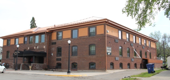
In the middle of the district were two other key National Register properties–the Ellen Theatre, a wonderful Beaux Arts design scaled for the small town that it served in the 1920s. Everyone thought that keeping a movie house/ theater downtown would help keep it alive at night. The second building, the Union Hall, was both historically important but also could serve as a symbol of what downtown revitalization meant–a building need not
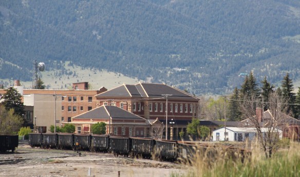
be spectacular to serve an important role in the historic district. The c. 1880s building belonged to the town’s boom during after the Northern Pacific Railroad arrived, and originally served as a brewery. Here was where the Bozeman historic preservation office was located when I conducted the state historic preservation plan survey in 1984-85. Next let’s consider the town’s railroad resources, a focal point of mine 30 years ago.


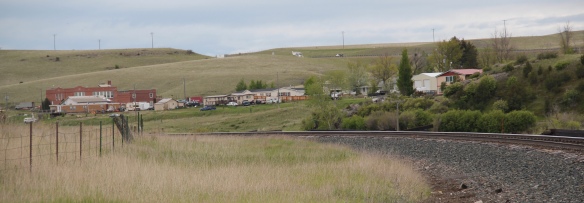
 Located between the Gallatin River and Interstate I-90, Logan is a forgotten yet still historically significant railroad junction on the Northern Pacific Railroad. Established c.


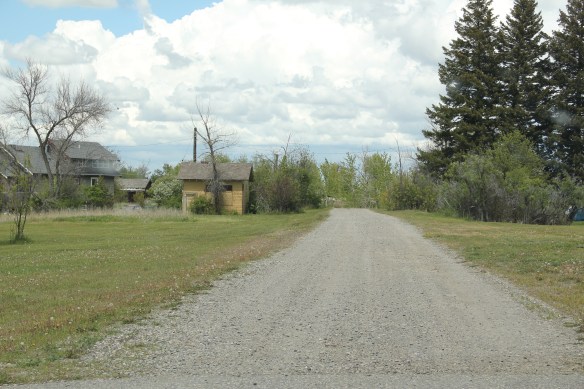
 Manhattan was not originally Manhattan, but named Moreland, as discussed in an earlier blog about the effort to build a barley empire in this part of Gallatin County at the turn of the century by the Manhattan Malting Company and its industrial works here and in Bozeman. But the existing railroad corridor, along with the surviving one- and two-


 The historic auto garage from c. 1920 above is one of the most significant landmarks left upon old U.S. 10, and I am glad it is still used for its original function in the 21st century.


 But it has many positives in place to keep its character yet change with the times. Many residents are using historic buildings for their businesses and trades. Others are clearly committed to the historic residential area–you can’t help but be impressed by the town’s well-kept historic homes and well-maintained yards and public areas.


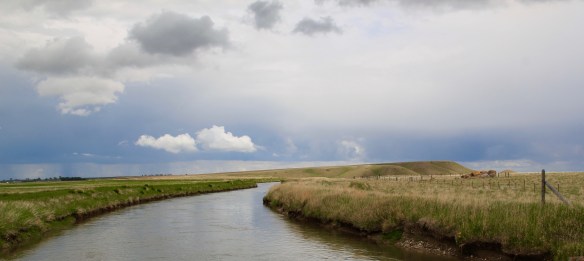 We just finished an exploration of U.S. Highway south from Great Falls to Livingston, the gateway to Yellowstone National Park. Now let’s head in the opposite direction, north of Great Falls to Glacier National Park. In the first half of this trek, one great man-made landscape dominates either side of the road–the Sun River Irrigation Project, established by the U.S. Bureau of Reclamation in 1906 but not completed until the late 1920s.

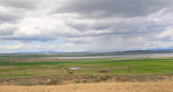
 Feeding in and out of Fairfield are multiple canals and ditches, with the great bulk of land devoted to the production of malting barley, under

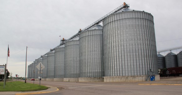 Fairfield itself is a classic T-plan railroad town. The barley granaries dominate the trackside, where also is located the headquarters for the Greenfields Irrigation District, so designated in 1926.
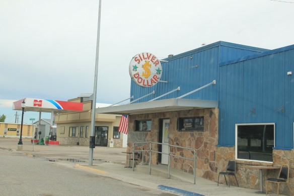
 Along the stem of the “T” plan are all of the primary commercial buildings of the town, from an unassuming log visitor center to various one-story commercial buildings, and, naturally, a classic bar, the Silver Dollar.


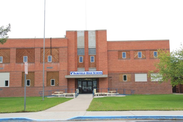
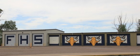
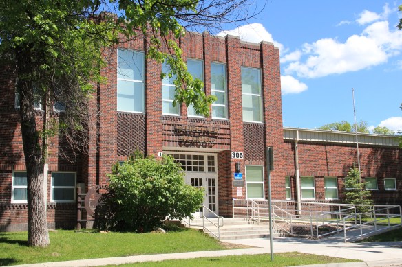
 Public spaces and institutions are located at the bottom of the “T,” including a community park and swimming pool, a c. 1960 community hall, and an Art-Deco styled Fairfield High School. The park, pool, and high school were all part of the second period of federal improvement at Fairfield during the New Deal era.

 Livingston’s town plan from 1882 was all about the railroad, with the adjacent Yellowstone River an afterthought, at best an impediment since it defined the south end of town. So far from the tracks to be of little worth to anyone, few paid it any attention. 100 years later when I am considering the town for the state historic preservation, I too was all about the railroad and the metropolitan corridor of which it was part. I paid no attention to the river. The town’s schools were on this end, but they were “modern” so did not capture my attention.
 Consequently I missed a bit part of the town’s story, the effort to reform the landscape and create public space during the New Deal era. The Works Progress Administration (WPA) transformed this part of town from 1935 to 1938 expanding an earlier public park into today’s Sacajawea Park.


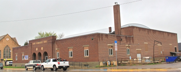
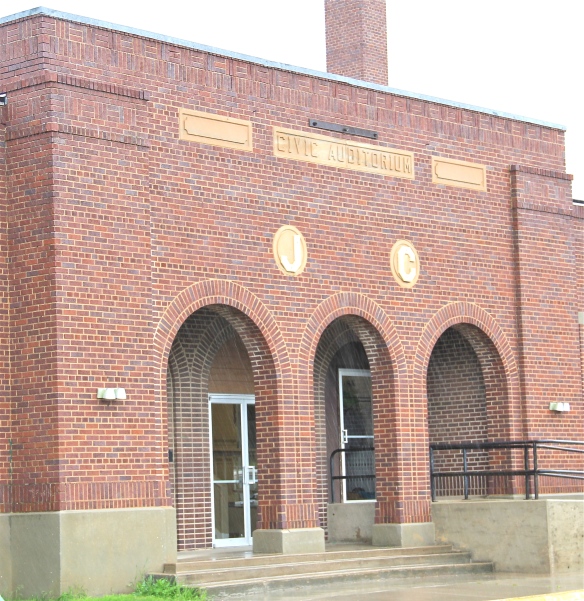
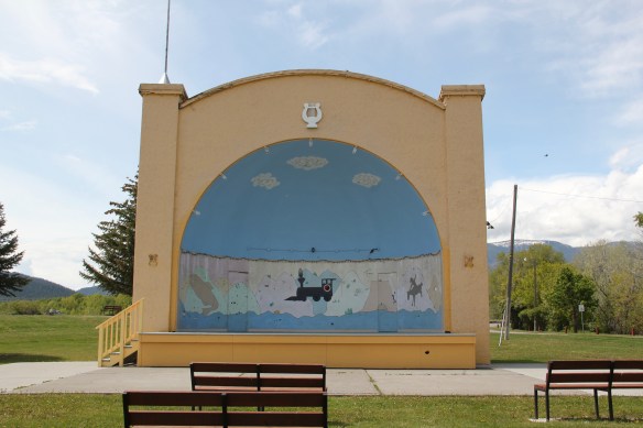 The major addition, however, was the large combination Civic Center and National Guard Armory, an Art Deco-styled building that cost an estimated $100,000 in 1938. It too survives and is in active use by the community.
 Tourists now come to this area more often than in the past due to additions made during the Lewis and Clark Bicentennial in the early 21st century. The park is part of the Lewis and Clark National Historic Trail.
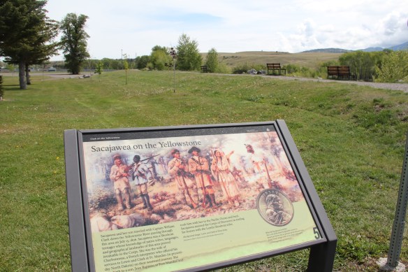


 Livingston was one of the Northern Pacific Railroad’s most important division points. Not only did the massive and architecturally ornate passenger station, discussed in the previous blog, serve as a gateway to Yellowstone National Park, it contained various company offices, serving as a nerve center for the thousands of miles of railroad line. If you do the typical tourist thing in Livingston, you pay attention to the depot and the many late 19th and early 20th century buildings south of the tracks.
 But to find where the real work of the railroad took place, you have to locate the underpass that takes you to the north side of the tracks, and the extensive Northern Pacific railroad shops. This area is not as busy as it once was, but enough buildings remain and enough activity takes place 24-7 that you quickly grasp that here is the heartbeat of the line. In the photo above, one early shop building, the lighter color brick building to the right center, still stands. Most others date to the line’s diesel conversion in the mid-20th century.
 With the mountains to the south, and the outlines of the town visible as well, the shops are impressive statements of corporate power and determination, and how railroads gave an industrial cast to the landscape.
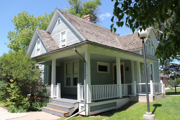
 The north side, in many ways, was a separate world. Here the homes may date to the Victorian era too, but they are not the stylish period interpretations found in numbers on the south side. Rather they are vernacular styled cottages, or unadorned homes typical of America’s turn-of-the-century working class.

 The school was converted into a community museum some 30 years ago, and if you visit the grand passenger station, you also need to stop at the school, to get a fuller picture of Livingston, the railroad town.

 The above block of commercial businesses was once better known as the Montana Hotel while the block below, called the Hiatt Hotel in more recent years, was the Park Hotel, opened in 1904 to take advantage of increased tourist business due to the new Northern Pacific depot. Noted Montana architect C.S. Haire was the designer.
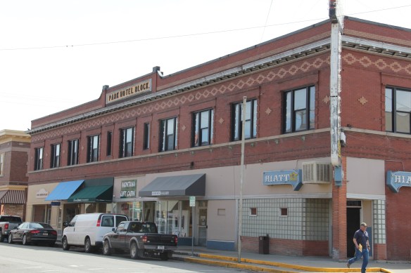 These buildings served tourists in the summer months but throughout the years they relied on the “drummer” trade. Drummers were a word used to describe traveling businessmen, who rode the rails constantly, stopping at towns large and small, to drum up business for their companies. They too, like the machine shop workers on the south side, were a constant presence on the railroad lines of 100 years ago, and helped to make the lines hum with their travel and their stories.


 project, and the Art Moderne landmark Intermountain bus station–once so proudly featured in the Clint Eastwood and Jeff Bridges movie, “Thunderbolt and Lightfoot,” part of that decade from the mid-1970s to mid-1980s when Montana was suddenly in the lens of Hollywood.
 All of these buildings and places help to give Great Falls its unique sense of self, and its sense of achievement and promise. And that is not to even mention the fun, funky stuff, such as the Polar Bears and having the
 supper club experience of 50 years ago at Borrie’s in Black Eagle. Stepping back into time, or looking into a future where heritage stands next to the
 atomic age, Great Falls and its environs–from Fort Benton to the northeast to Fort Shaw to the southwest–can give you that memorable heritage area experience.
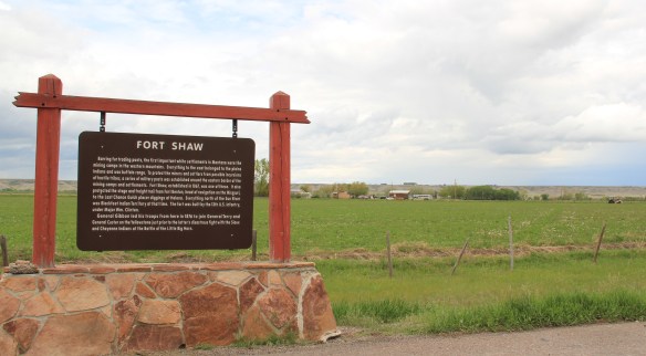


 Fort Shaw was not the region’s earliest mission site. That designation belongs to St. Peter’s Mission, located on the winding Mission Road to the south of Fort Shaw. An earlier blog discussed St. Peter’s but this special property is worth further discussion, as it is linked in time and purpose to what happened at Fort Shaw.
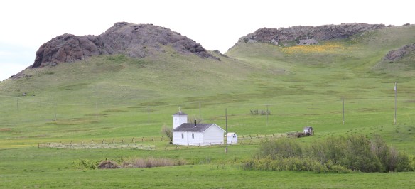 The property has limited public accessibility as an active ranch surrounds it and uses some of the remaining historic buildings. But since my first visit in 1984, a small metal interpretive marker has been installed, which emphasizes its founding date of 1865-1866 by Catholic missionaries, many

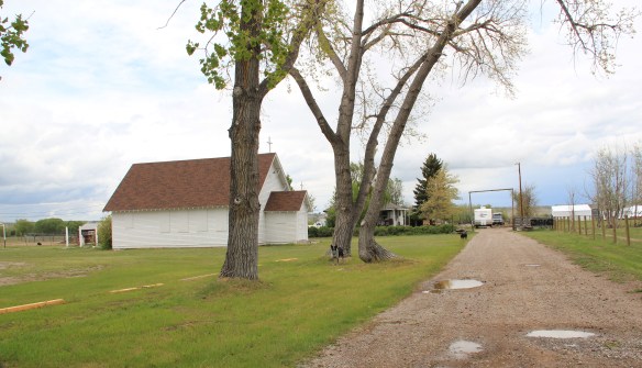 Often we forget these connections between religious missionaries and the nation-building process of government. Within a few hundred yards of Fort Shaw school, for instance, is the old road connecting the school to the historic St. Ann’s Catholic Church (seen above is the historic church building; the congregation has built a modern church in recent years).
 And we further forget, or choose to ignore, how the messy present lies side by side with these older, seemingly sacred places. Along the Mission Road and the Simms Road are nuclear missile bases, some active, some inactive, that are administered by the Malmstrom Air Force Base in Great Falls. Much like Fort Shaw from 100 years earlier, military commanders in the 1960s saw Cascade County as part of the edge of America’s national defense, the ideal location for nuclear bases that could protect, or retaliate, in case of a nuclear strike from the nation’s enemies.
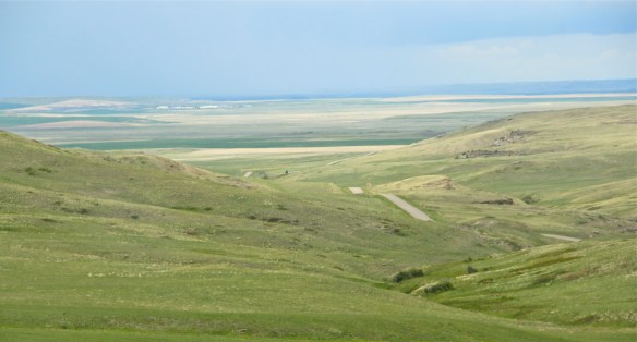
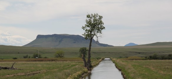 The Sun River Valley was transformed by homesteaders and irrigation during the great boom of the early 20th century; it shares that story of course with many towns in the Great Falls heritage area. Montana Highway 21 (shown above) connects with Montana Highway 200 to provide great opportunities to explore that landscape. The Sun River project of the U.S. Bureau of Reclamation especially left its mark.


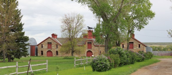 The barn is part of a still active ranch and is on private property. But the stone masonry can be viewed and appreciated from Montana Hwy 200.
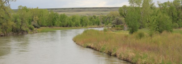 When one considers a Great Falls heritage area, the Missouri River of course will take center stage; as the next postings will show, it should be at the center of the story. But what happened along the Sun River, and what remains today, adds immeasurably to the national story and the overall significance of the region.