Monida, at the Idaho-Montana border, on Interstate I-15.
Country towns of Beaverhead County–wait, you cry out: isn’t every town in Beaverhead County a country town? Well yes, since Dillon, the county seat, has a single stop light, you can say that. But Dillon is very much an urban oasis compared to the county’s tiny villages and towns scattered all about Beaverhead’s 5,572 square miles, making it the largest county in Montana.
 Let’s start this theme with the railroad/ federal highway towns. Monida, at the state border with Idaho, is a good place to start, first established as a place on the Utah and Northern Railroad line as it moved north toward the mines at Butte in 1881. Monica had a second life as a highway stop on the old U.S. Highway 91 that paralleled the tracks, as evident in the old garages left behind.
The next town north on the corridor created by the railroad/highway/interstate is Lima,  which possesses a Montana welcome center and rest stop. That’s important because at this stop you also can find one of the state’s mid-20th century examples of a tourist welcome center, which has been moved to this stop and then interpreted as part of the state’s evolving roadside architecture.
Lima is a classic symmetrical-plan railroad town, the plan favored by the engineers of the Utah and Northern as the railroad moved into Montana. The west side of the tracks, where the two-lane U.S. Highway 91 passed, was the primary commercial district, with several brick and frame two-story buildings ranging from the 1880s to the 1910s.
The east side, opposite old U.S. Highway 91, was a secondary area; the Lima Historical Society is trying to keep an old 1880s building intact for the 21st century.
The town’s comparative vitality is shown by its metal Butler Building-like municipal building, and historic churches, ranging from a early 20th century shingle style to a 1960s contemporary style Gothic church of the Latter Day Saints.
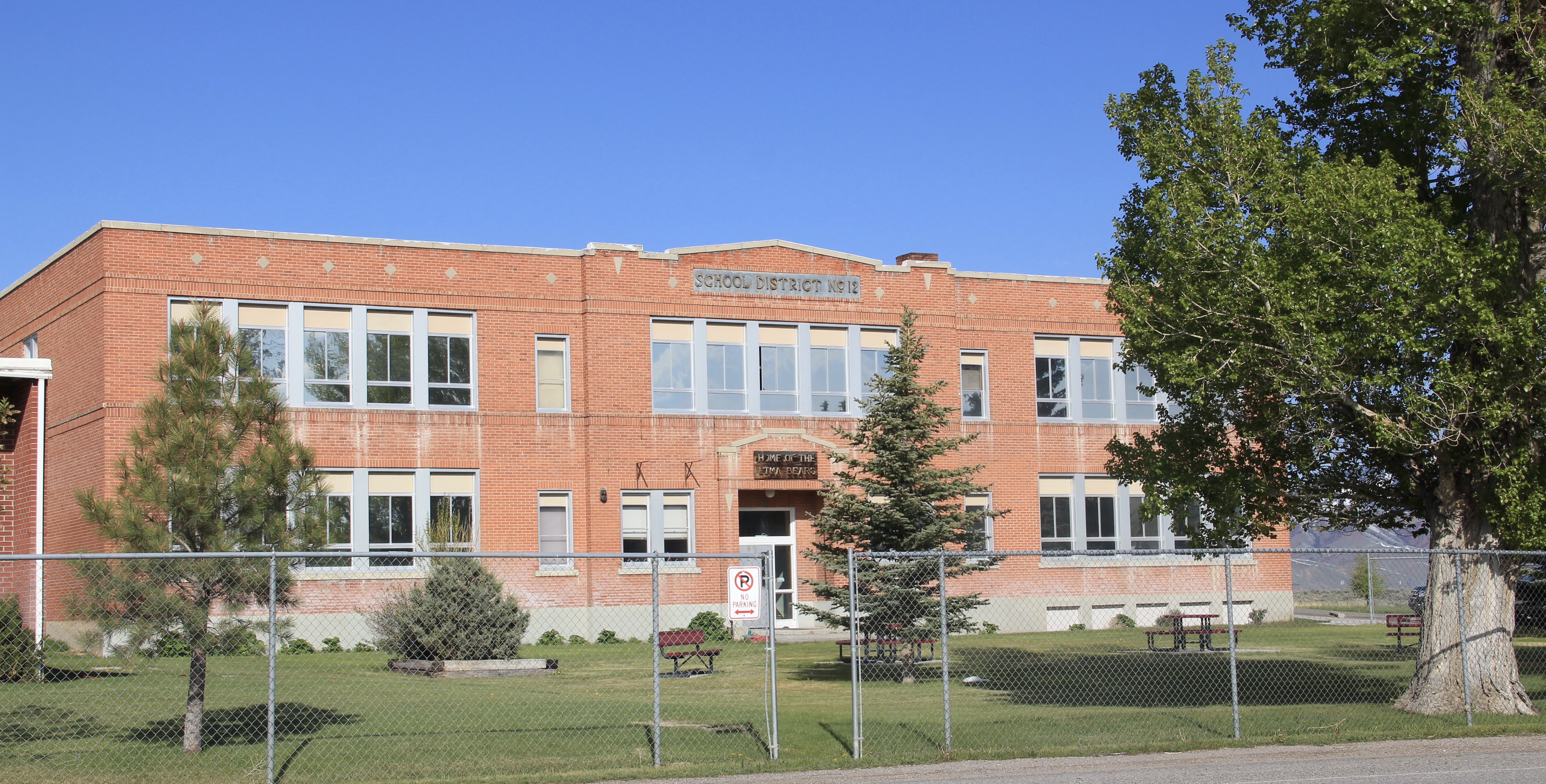
The town’s pride naturally is its school, which developed from the early 20th century two-story brick schoolhouse to become the town’s center of community.
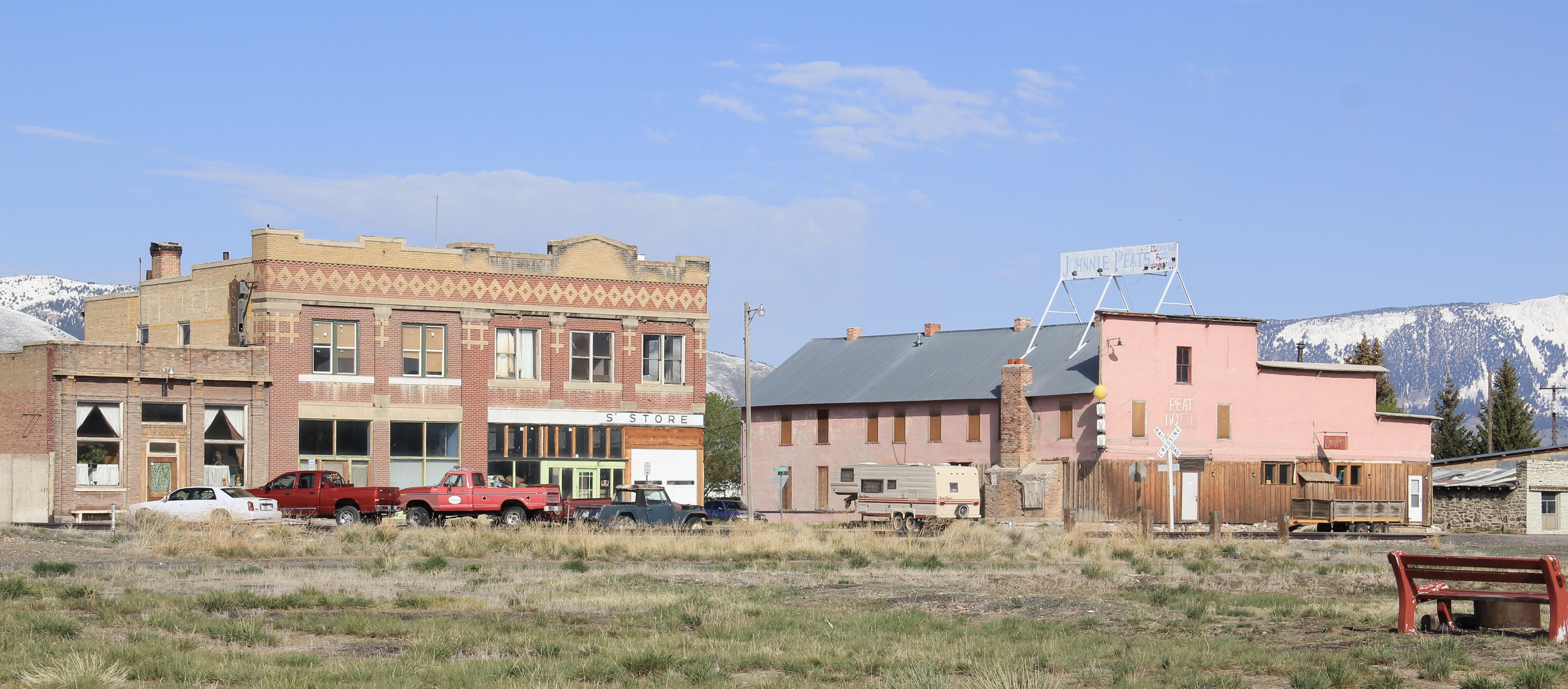
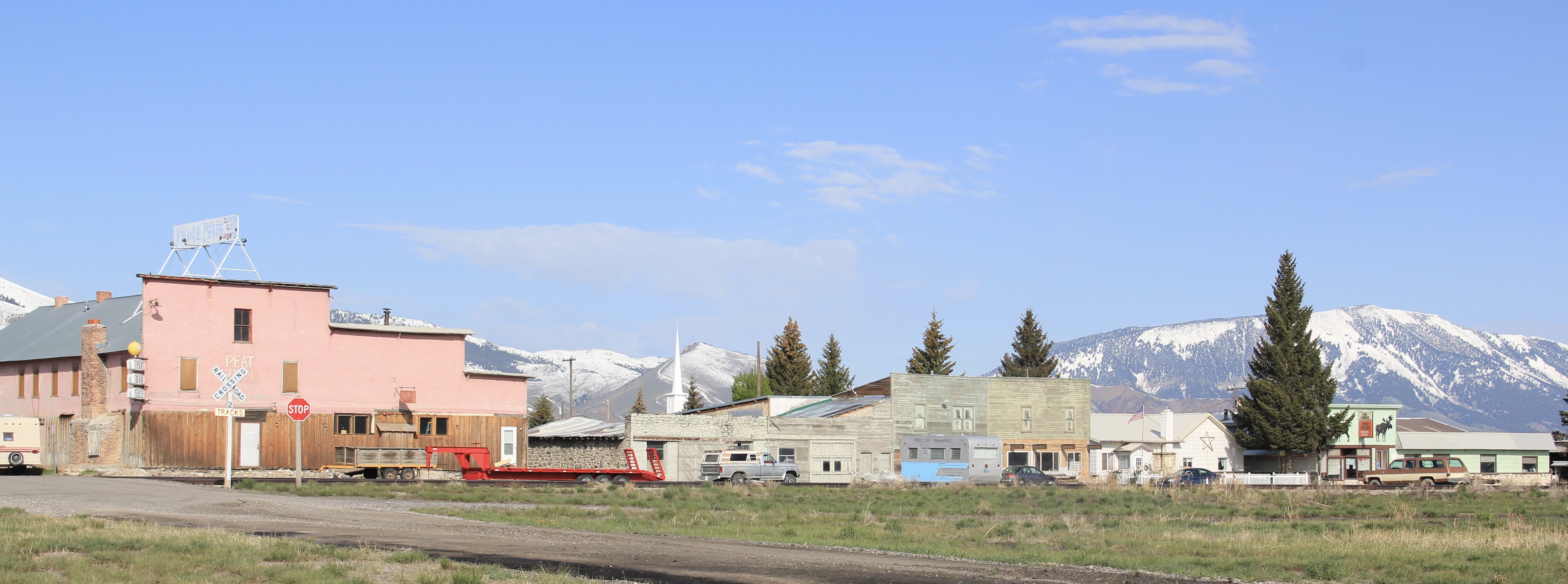
Eight miles to the north is a very different historic schoolhouse, the one-story brick Dell school (1903), which had been converted into a wonderful cafe when I stopped in 1984. It is still a great place–if you don’t stop here for pie or a caramel roll (or both), you goofed.

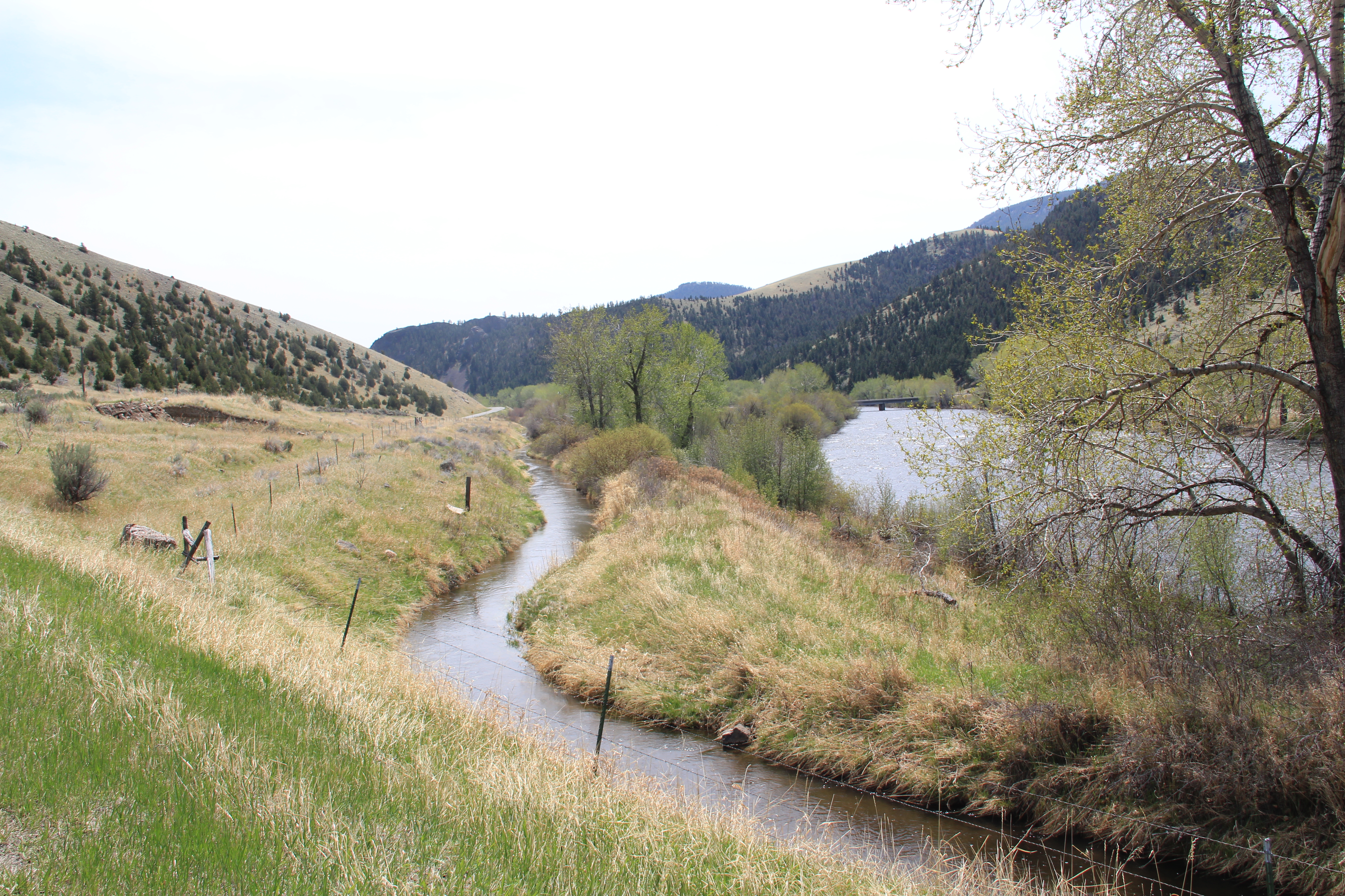
The Calf-A is not the only place worth a look at Dell, a tiny railroad town along the historic Utah and Northern line, with the Tendroy Mountains in the background. Dell still has its 
post office, within its one store, its community hall, and a good steakhouse dive, the false-front Stockyard Inn. But most importantly, for an understanding of the impact of World
War II on Montana, Dell has an air-strip, which still contains its 1940s B-17 Radar base, complete with storehouse–marked by the orange band around the building–and radar tower. Kate Hampton of the Montana State Historic Preservation Office in 2012 told me to be of the lookout for these properties. Once found throughout Montana, and part of the guidance system sending planes northward, many have disappeared over the years. Let’s hope the installation at Dell remains for sometime to come.

There are no more towns between Dell and Dillon but about halfway there is the Clark Canyon Reservoir, part of the reshaping of the northwest landscape by the U.S. Bureau of Reclamation in the 1960s. The bureau in 1961-1964 built the earthen dam and created the
reservoir, which inundated the small railroad town of Armstead, and led to the re-routing of U.S. Highway 91 (now incorporated into the interstate at this point).
 The reclamation project, which stored water for irrigation, also covered the site of Camp Fortunate, a very important place within the larger narrative of the Lewis and Clark Expedition and its relationships and negotiations with the Shoshone Indians. An early
effort to mark and interpret the site came from the Daughters of the American Revolution, who not surprisingly focused on the Sacajawea story. Reclamation officials added other markers after the construction of the dam and reservoir.
In this century the Lewis and Clark National Historic Trail has added yet another layer of public interpretation in its attempt to tell the whole story of the expedition and its complicated relations with the Native Americans of the region.
North of Dillon along the old route of U.S. Highway 91 and overlooking the corridor of the Utah and Northern Railroad is another significant Lewis and Clark site, known as Clark’s Lookout, which was opened to the public during the Lewis and Clark Bicentennial of the early 21st century.
The lookout is one of the exciting historic sites that have been established in Montana in the 30 years since my initial survey for the state historic preservation plan. Not only does the property interpret an important moment in the expedition’s history–from this vantage point William Clark tried to understand the countryside before him and the best direction to take–it also allows visitors to literally walk in his footsteps and imagine the same perspective.
Of course what Clark viewed, and what you might see, are vastly different–the tracks of the Utah and Northern, then route of old U.S. 91 are right up front, while the town of Dillon creeps northward toward the lookout.
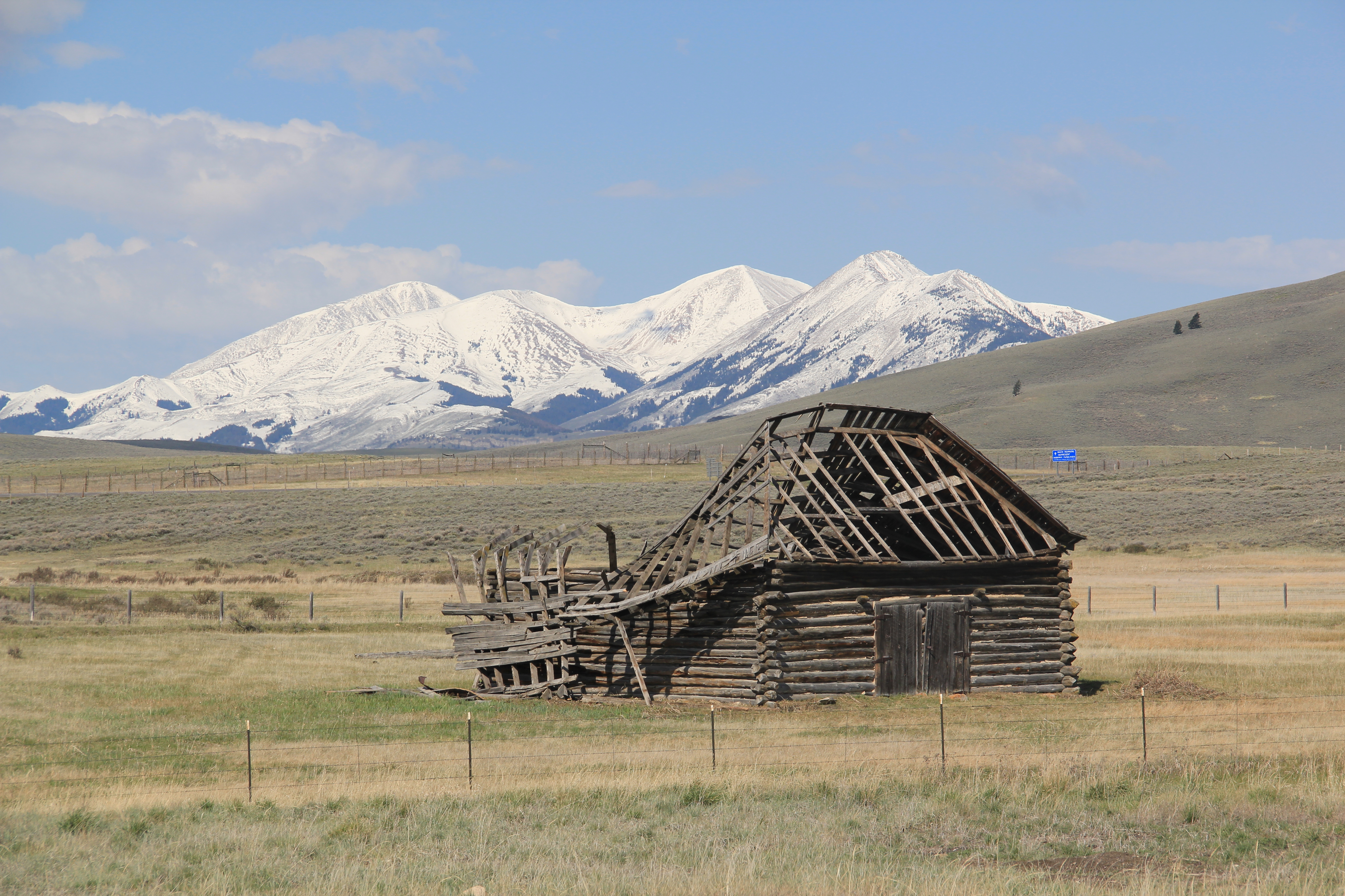
Our last stop for part one of Beaverhead’s country towns is Glen, a village best accessed by old U. S. Highway 91. A tiny post office marks the old town. Not far away are two historic 
North of Glen you cross the river along old U.S. Highway 91 and encounter a great steel tress bridge, a reminder of the nature of travel along the federal highways of the mid-20th century.


 A good bit of the historic machine shops (above) still operated in 1988. The depot and railroad offices still dominated the Merrill Avenue business district (below).
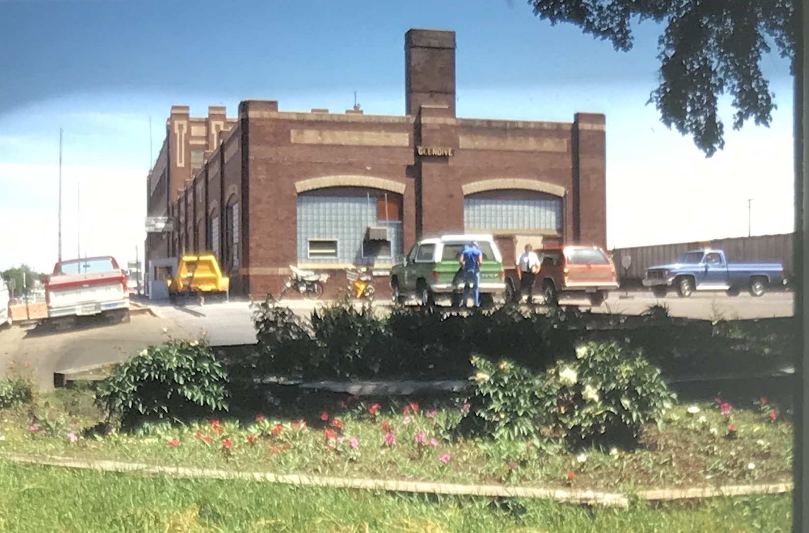


 My favorite Merrill Avenue business was the wonderful Art Moderne style of the Luhaven Bar (below). You gots love the black carrera glass and glass block entrance.

 But my favorite modernist building was the First National Bank, which was later converted to the town’s public library.
 Next posting will include homes from the town’s residential district from the early 20th century to the mid-century as I continue a look back to the Yellowstone River and its towns in 1988.
 In the early posts of this exploration of Montana’s historic landscape I spoke of the transformation that I encountered when I revisited Glendive, the seat of Dawson County, for the first time in about 25 years, of how local preservation efforts had kept most of the town’s railroad era landscapes alive while leading to the revitalization of its amazing number of historic residences from 1900 to 1950.
 Let’s now turn our attention to public landmarks, old and more recent, that also deserve notice, starting with the magnificent Classical Revival-styled City Hall, one of the anchors of the Merrill Avenue historic district, which is listed in the National Register of Historic Places. Built in 1914, this all-in-one municipal building is an impressive architectural
 statement by the second generation of Glendale’s leaders that the town would grow and prosper during the homesteading boom of the first two decades of the 20th century. The architect was Brynjulf Rivenes of Miles City. His firm had so many commissions coming from eastern Montana and Yellowstone Valley patrons that by this time Rivenes operated offices in both Glendive and Miles City.
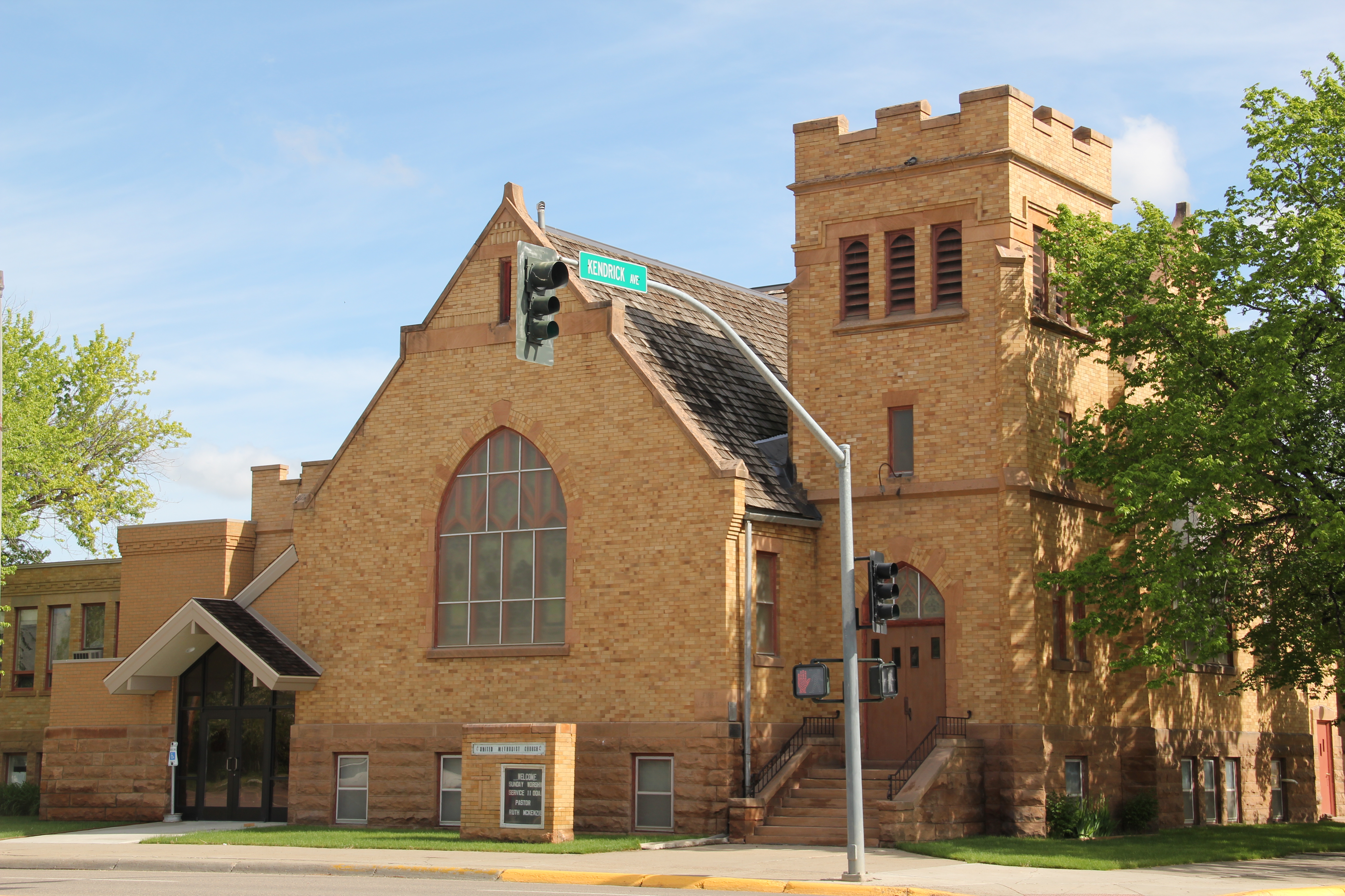 Rivenes had earlier marked Glendive’s new emerging townscape with his Gothic design for the First Methodist Church, in 1909. Fifteen years later, he added another landmark church design with the Romanesque styled Sacred Heart Catholic Church (1924-1925).

 With recovery and the arrival of more and more automobile traffic from the late 1930s to the 1950s, many of the older buildings received mid-century updates. The remodels could
 The 1950s and 1960s brought many changes to Glendive. Post World War Ii growth both in the town and the many surrounding ranches led to expansion and remodeling at the historic Glendive Milling Company in 1955. When the historic districts for Glendive were designated in the late 1980s, preservationists questioned the inclusion of this important industrial/agricultural complex due to the changes of the 1950s. Viewed today, however, the mill complex is clearly a very significant historic site.
 More contemporary styled church buildings were also dedicated in the mid-century, such as the classic “contemporary” styling of the Assembly of God building, with classrooms at
 at the front rather than the rear, or the modified A-frame style of the First Congregational Church, which I shared in an earlier post on Glendive.
 Glendive is very much a blending of different 20th century architectural styles, reaching back into the region’s deep, deep past, as at Makoshika State Park, where the visitor
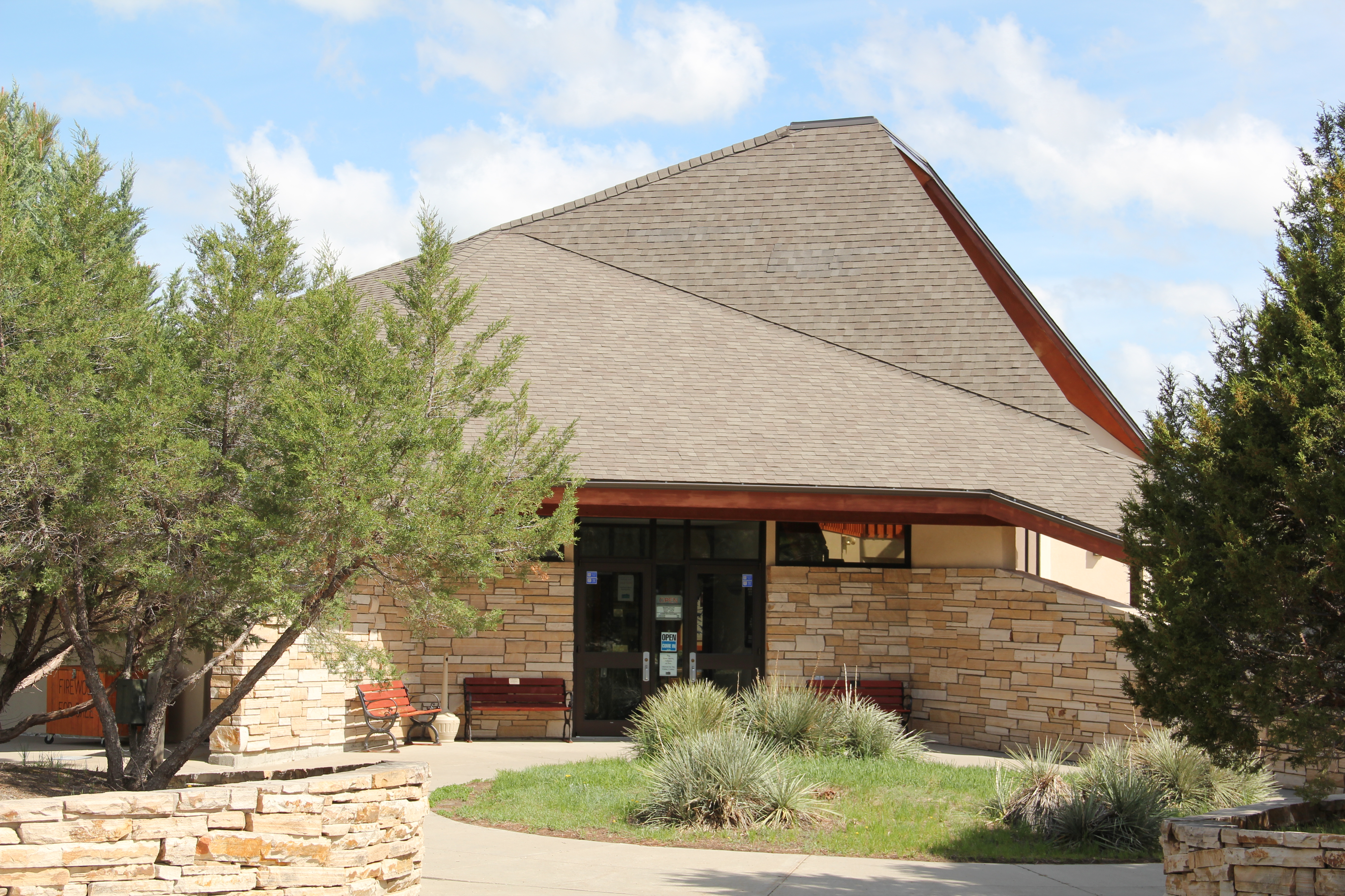 center/museum is an excellent example of late 20th century modern style–clearly a building of the present but one that complements, not overwhelms, the beauty of the park itself.


 Imagine my pleasure to be there for the theatre’s grand opening May 19, 2012. Not only had the community raised the funds to repair and reopen the business, they also took great pains to restore it to its earlier architectural glory. Such an achievement for a town of just over 3,000 residents–when you consider that the next city south on Interstate I-90 is Anaconda with its monument Washoe Theatre, I immediately began to think of future “movie palace” trips. What a treat, both for the experience and architecture.


 In that same trip to Deer Lodge, I noted how the community had recently enhanced the National Register-listed W. K. Kohrs Memorial Library (1902), one of the region’s great Classical Revival buildings by the Butte architectural firm of Link and Carter (J.G. Link would soon become one of the state’s most renowned classicists), by expanding the library
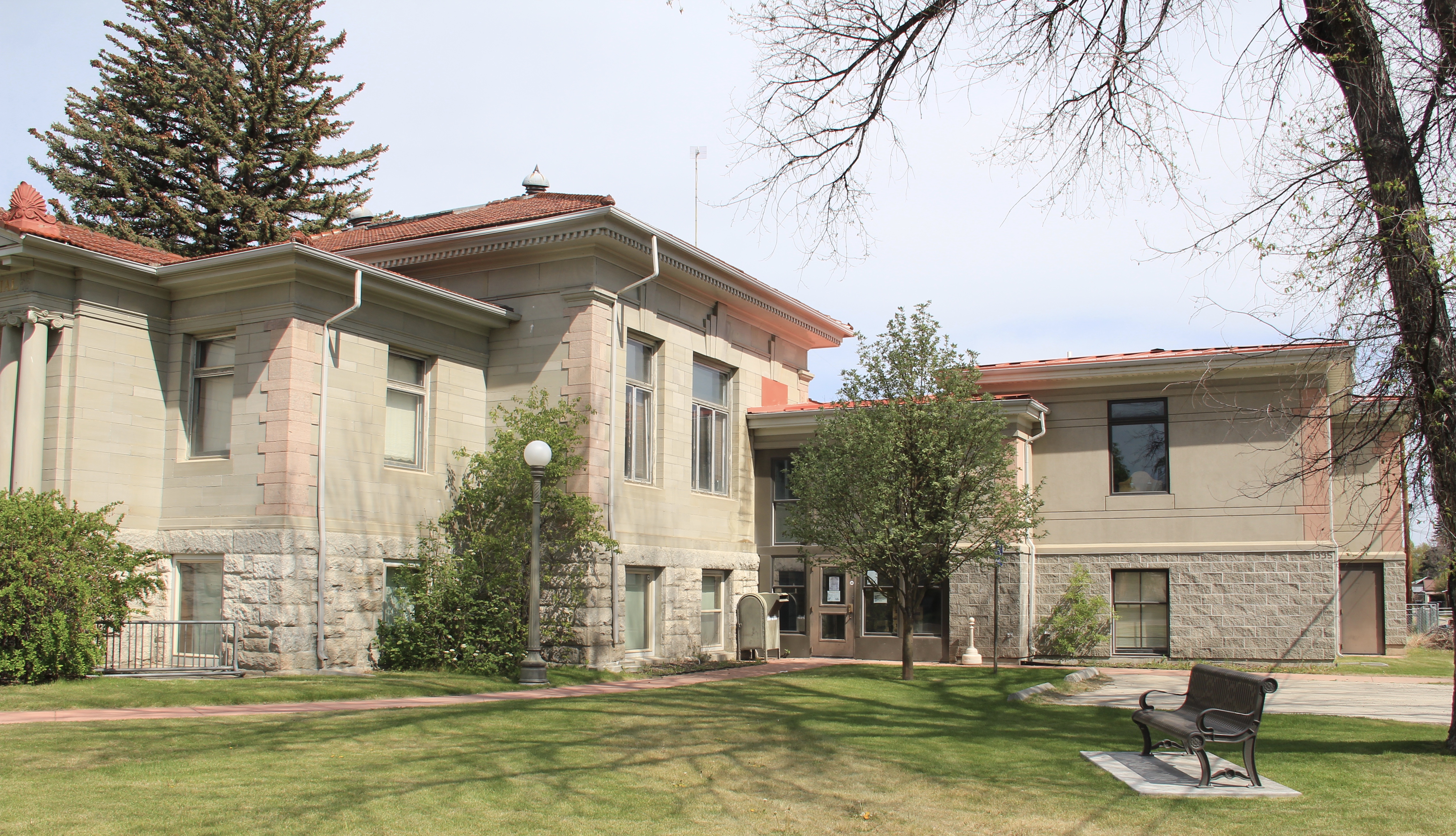 with an addition to the side and behind the commanding entrance portico. Although it has proven to be difficult for such a small town to keep the library professionally staffed, the care they have shown the exterior and interior indicate they understand the value of this monument from the past.

 Then add in the impressive examples of turn of the 20th century church architecture, represented by the Cotswold Gothic stone work of St. James Episcopal Church, the more former Tudor Revival of the 1st Presbyterian Church, and the more vernacular yet
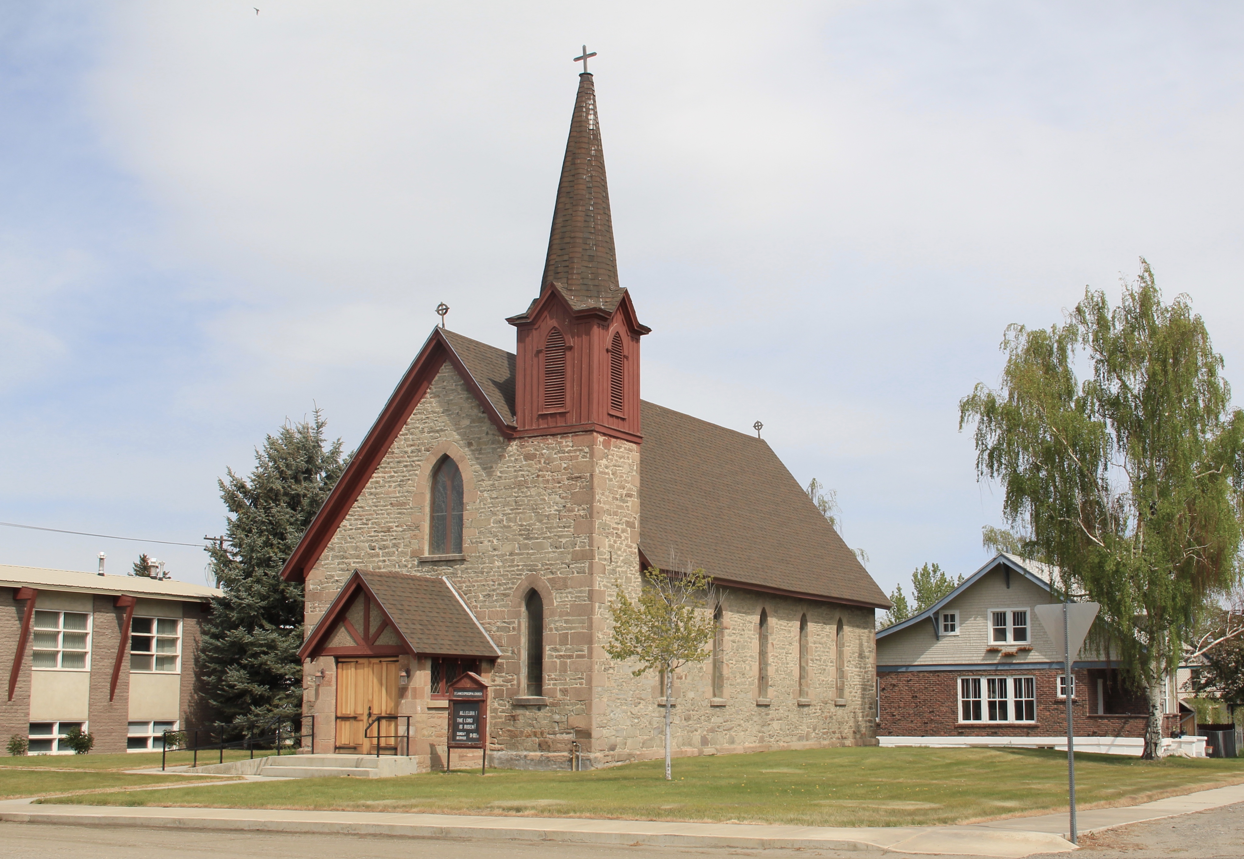


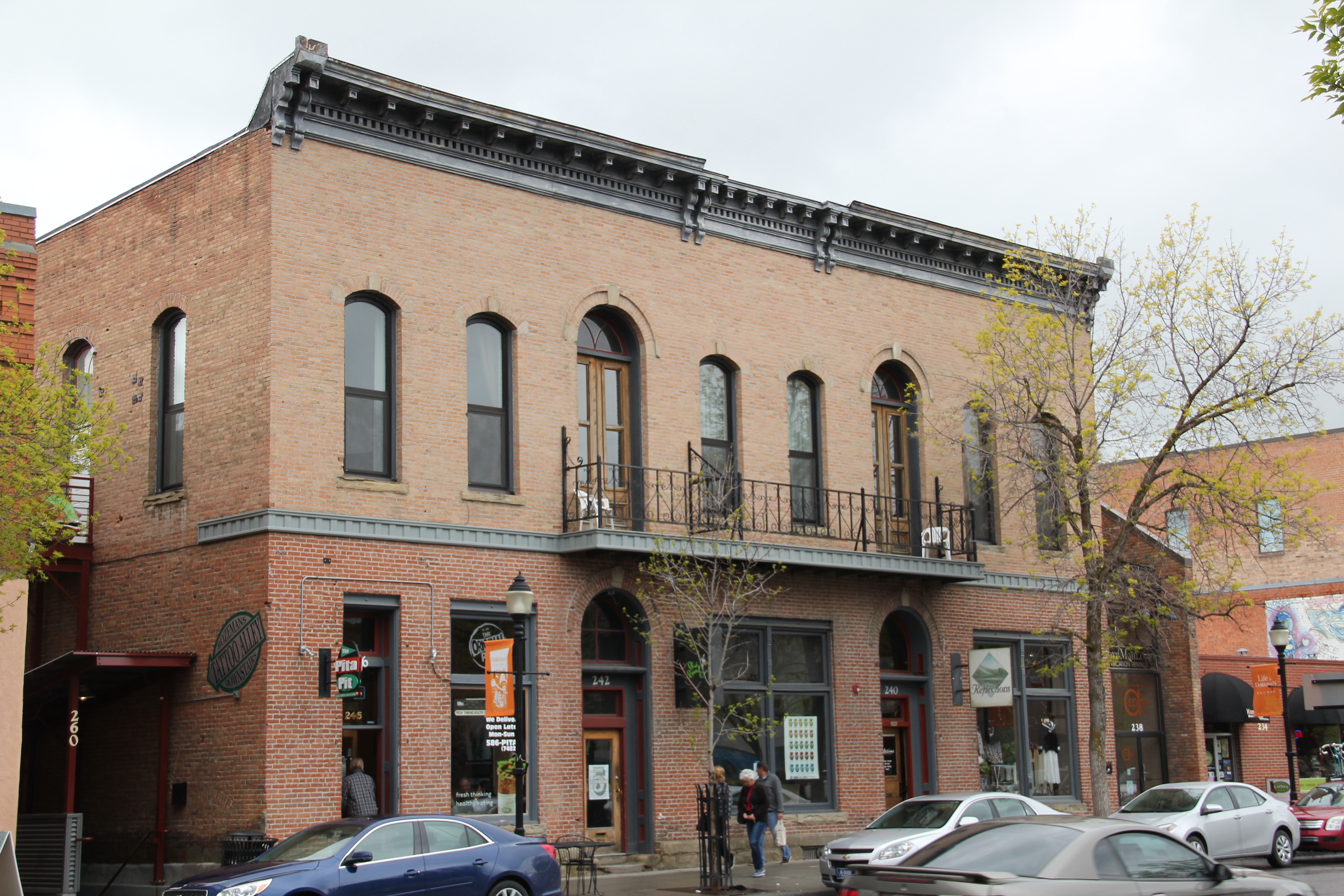
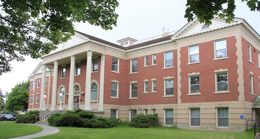
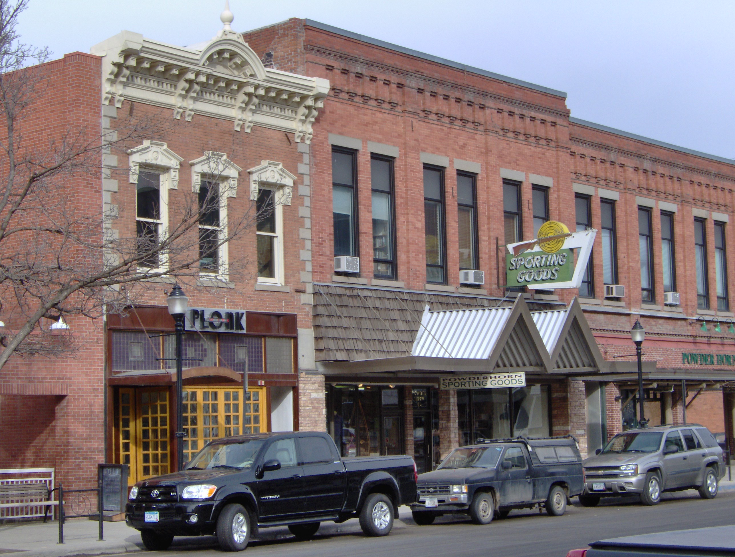
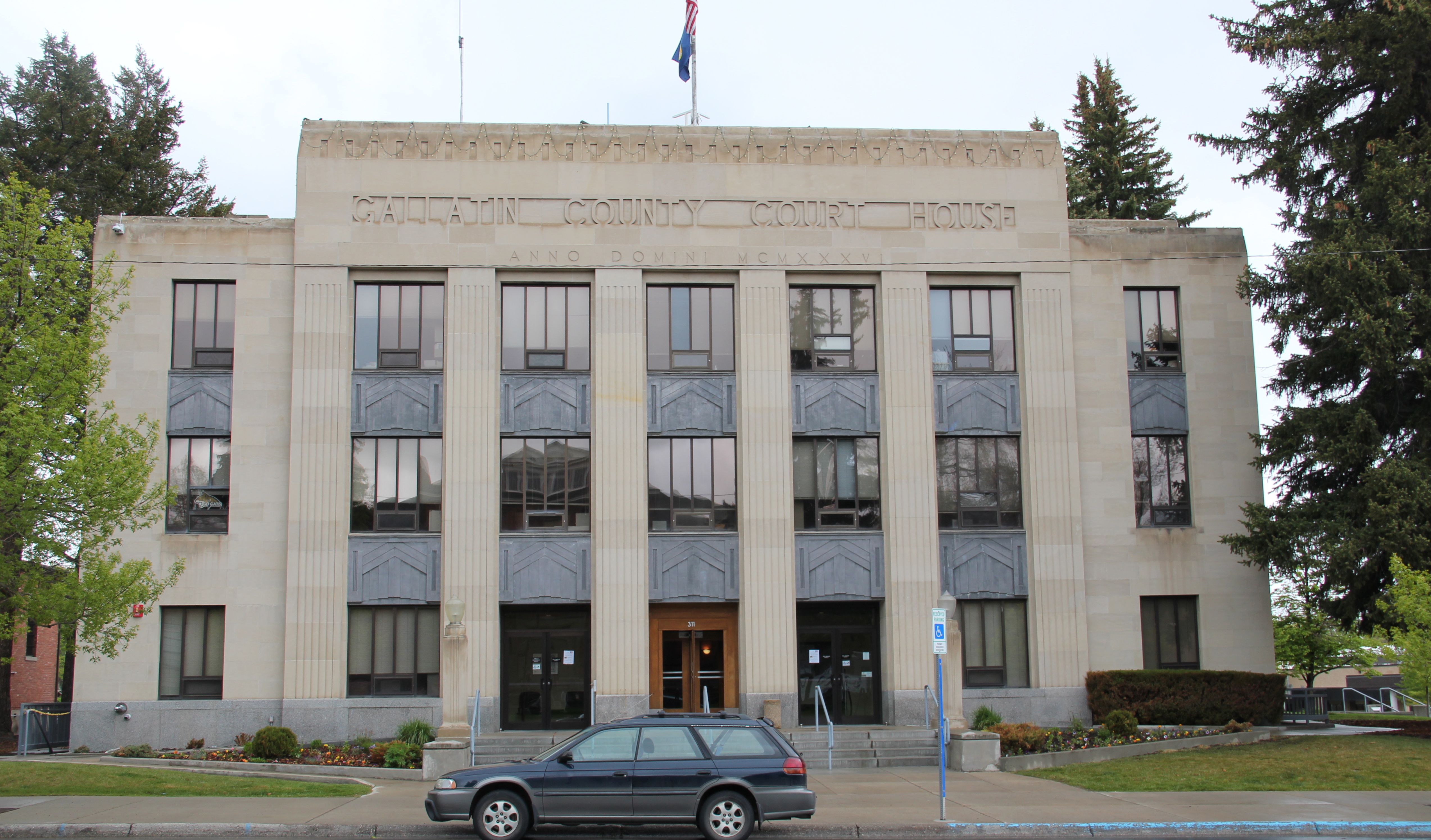
 Dillon is not a large county seat but here you find public buildings from the first third of the 20th century that document the town’s past aspirations to grow into a large, prosperous western city. It is a pattern found in several Montana towns–impressive public buildings designed to prove to outsiders, and perhaps mostly to themselves, that a new town out in the wilds of Montana could evolve into a prosperous, settled place like those county seats of government back east.


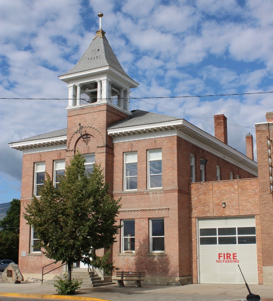
 The Dillon City Hall also belongs to those turn-of-the-20th century public landmarks but it is a bit more of a blending of Victorian and Classical styling for a multi-purpose building that was city hall, police headquarters, and the fire station all rolled into one.
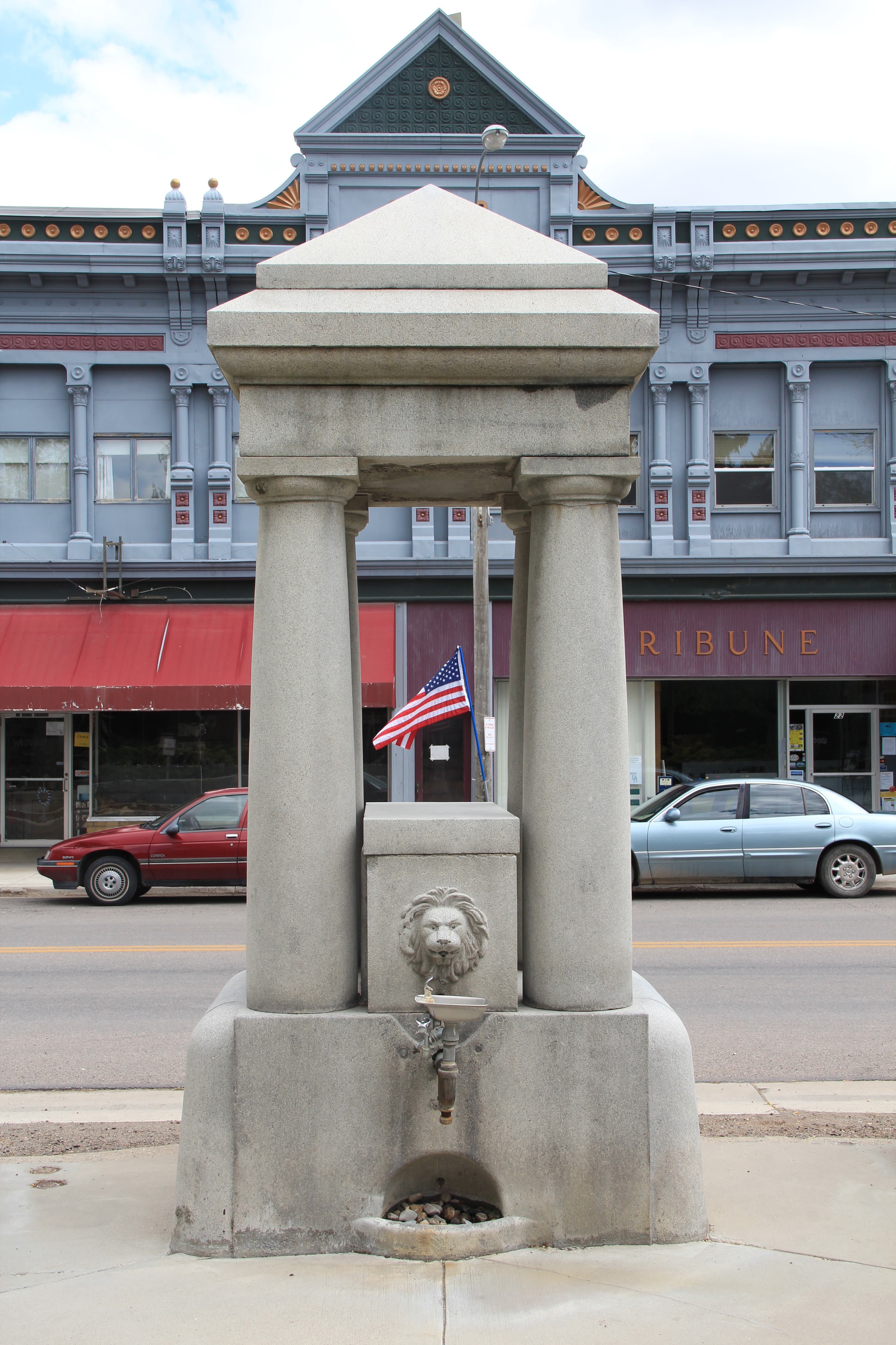
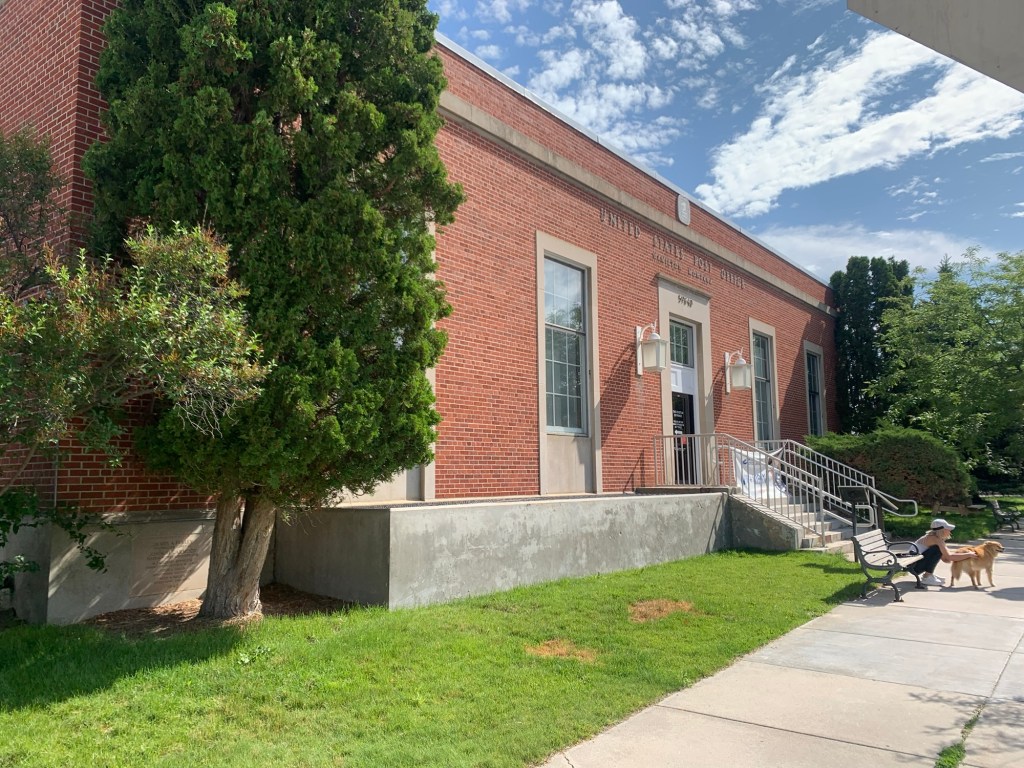
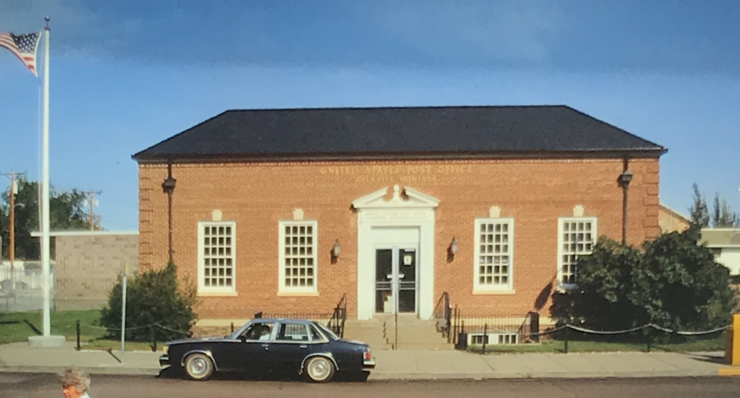
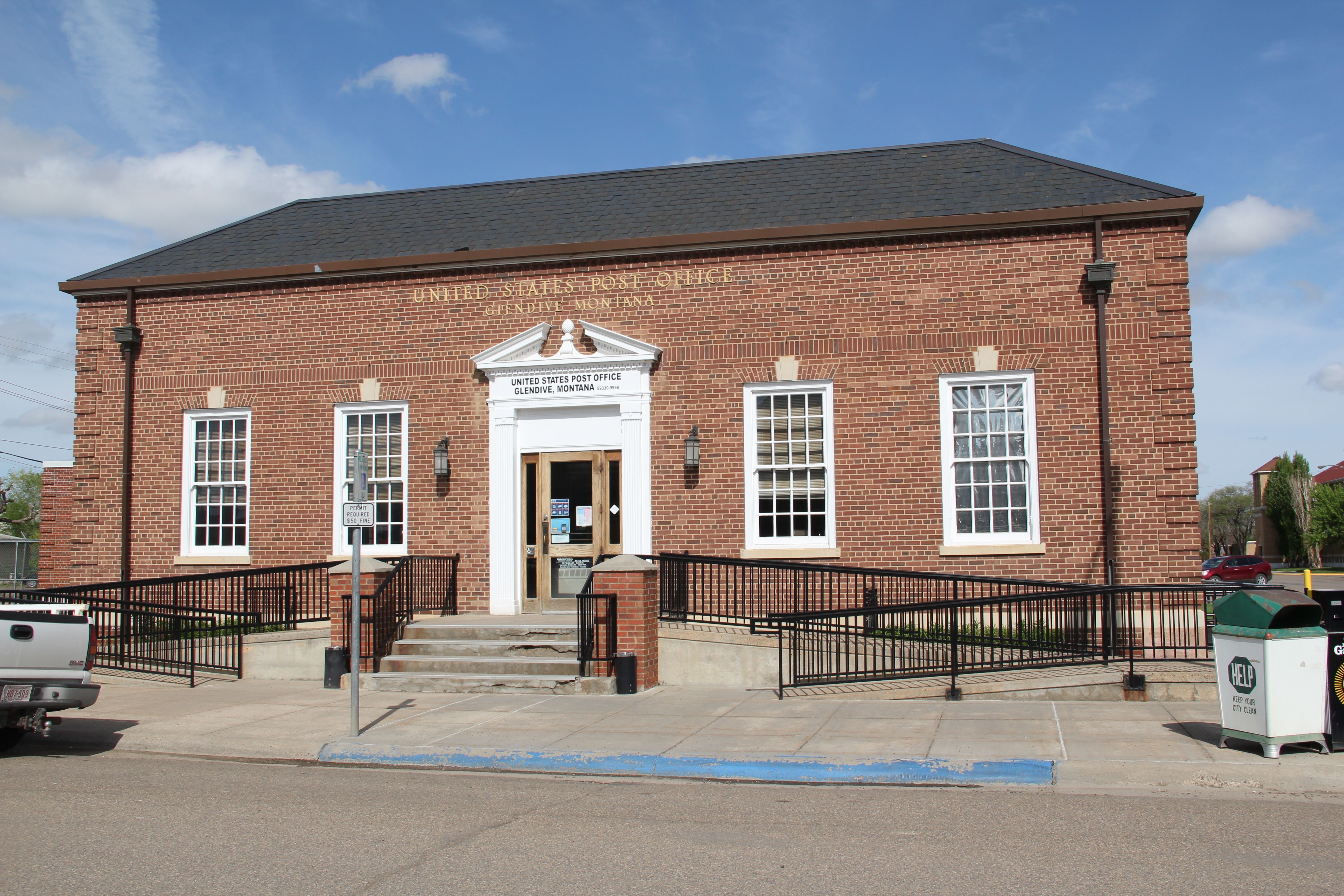
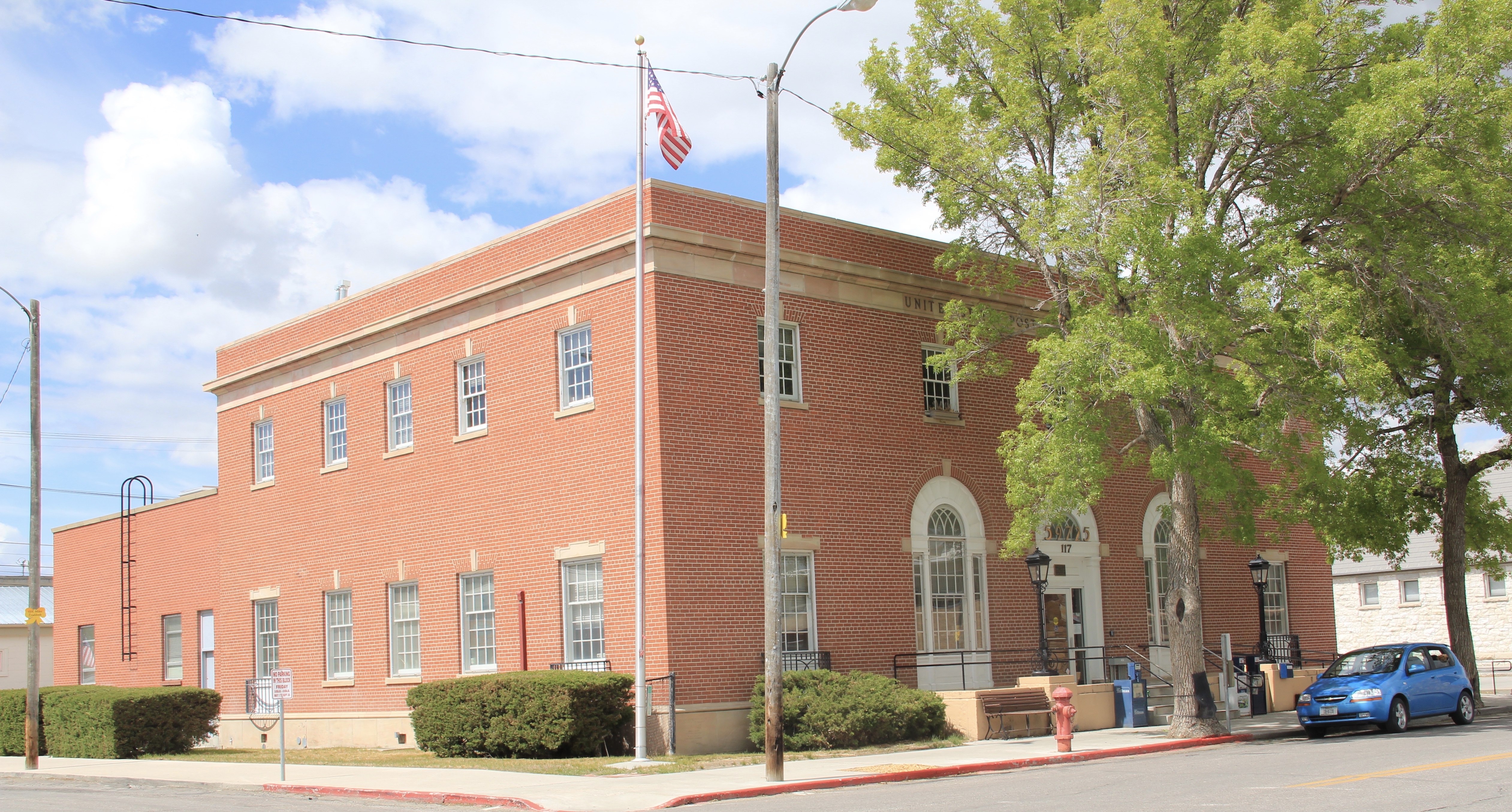 A New Deal era post office introduced a restrained version of Colonial Revival style to Dillon’s downtown. The central entrance gave no hint to the marvel inside, one of the
 state’s six post office murals, commissioned and executed between 1937 and 1942. The Dillon work is titled “News from the States” painted by Elizabeth Lochrie in 1938. It is a rarity among the murals executed across the country in those years because it directly addressed the mail and communication in early Beaverhead County. Ironically, few of the post office murals actually took the mail as a central theme.
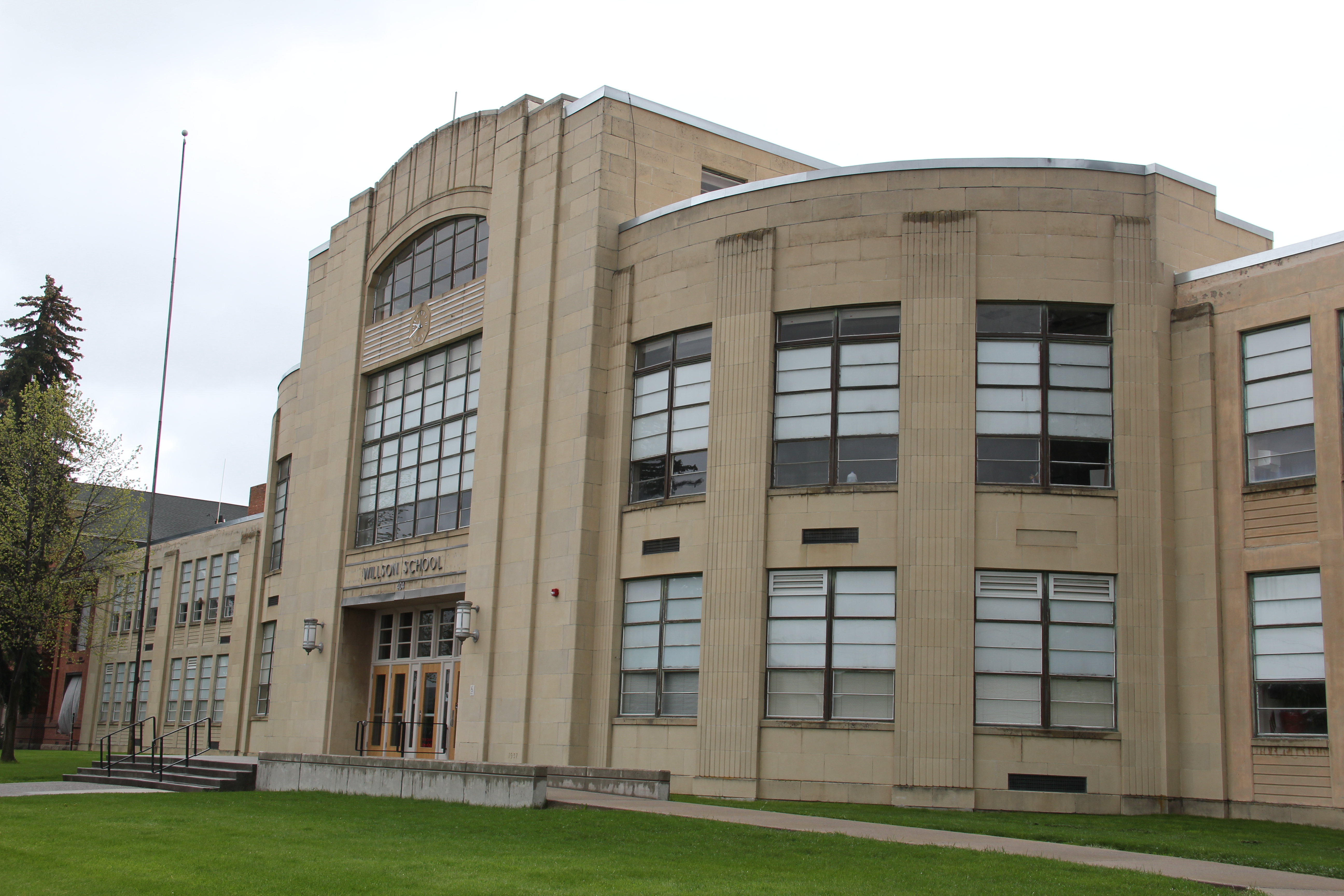
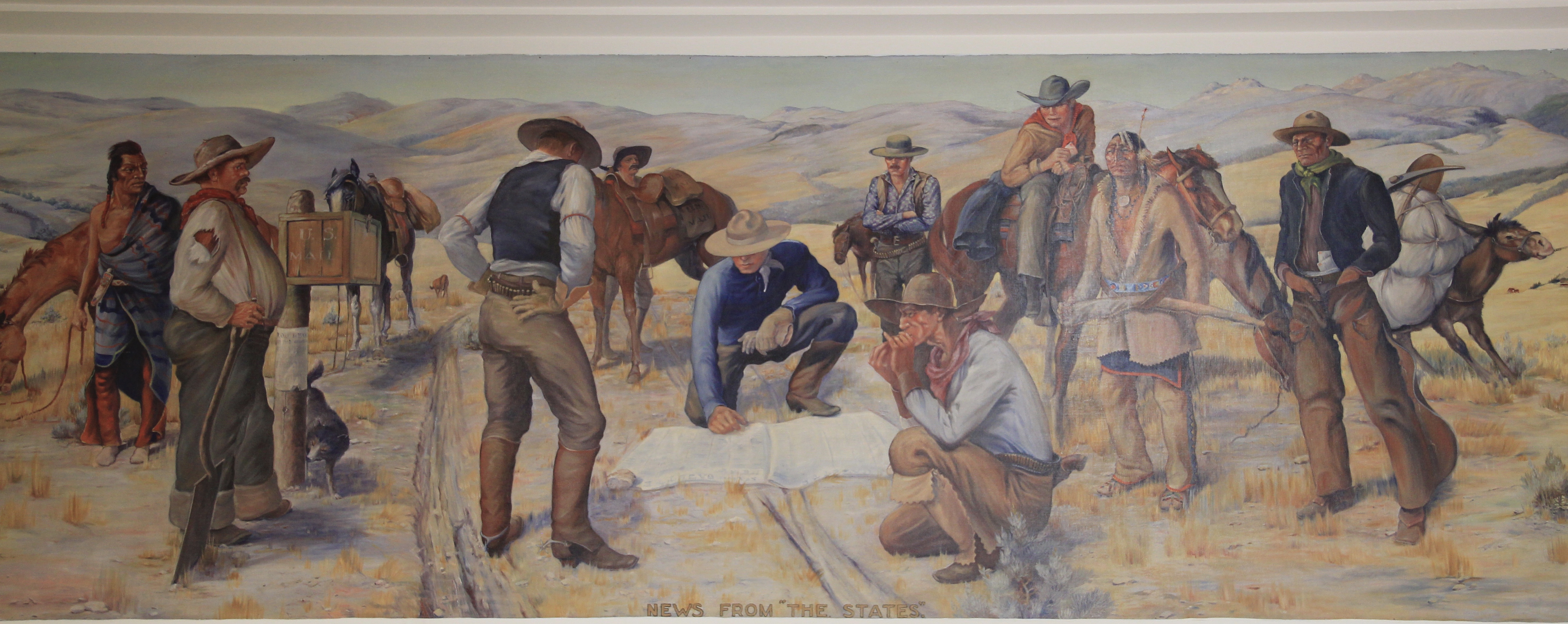 The New Deal also introduced a public modernism to Dillon through the Art Deco styling of the Beaverhead County High School, a building still in use today as the county high school.
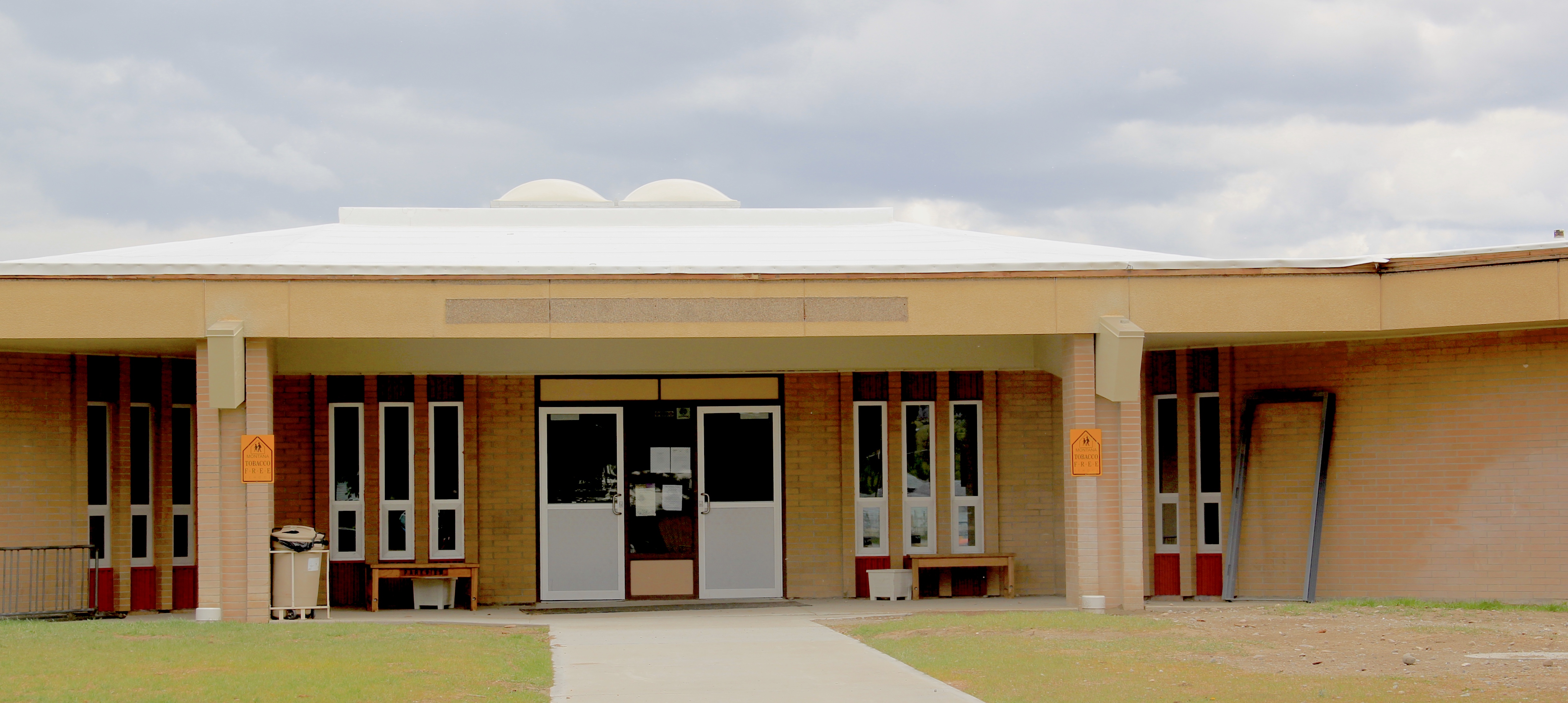
 A generation later, modernism again was the theme for the Dillon Middle School and Elementary school–with the low one-story profile suggestive of the contemporary style then the rage for both public and commercial buildings in the 1950s-60s, into the 1970s.
 The contemporary style also made its mark on other public buildings, from the mid-century county office building to the much more recent neo-Rustic style of the Beaverhead National Forest headquarters.


 When travelers, and most Montana residents even, speak of Silver Bow County, they think of Butte. Outside of the Copper City, however, are small towns and a very different way of life. To the west we have already discussed Ramsay and its beginnings as a munitions factory town during World War I. Let’s shift attention now to the southern tip of the county and two places along the historic Union Pacific spur line, the Utah Northern Railroad, into Butte.
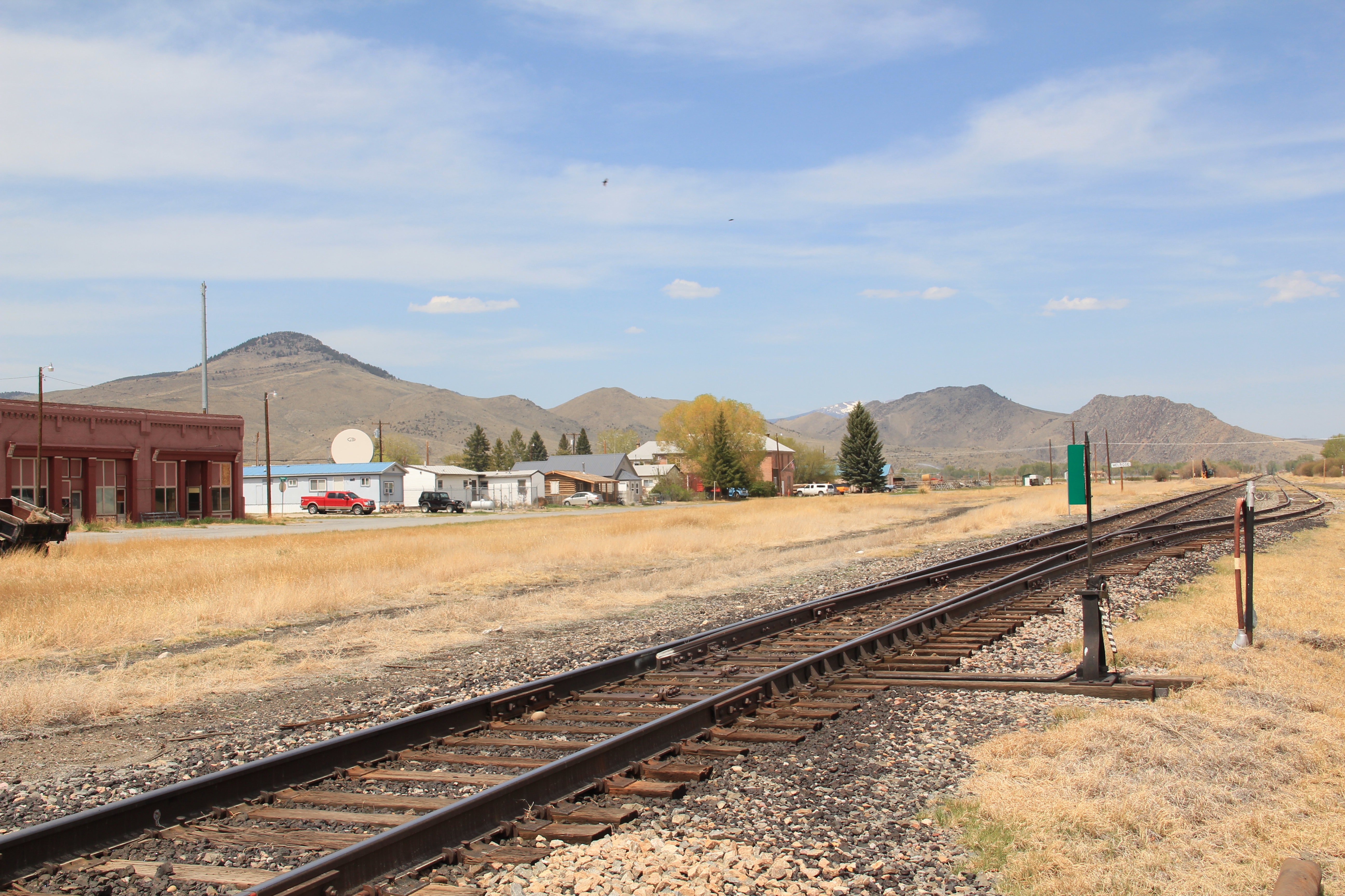


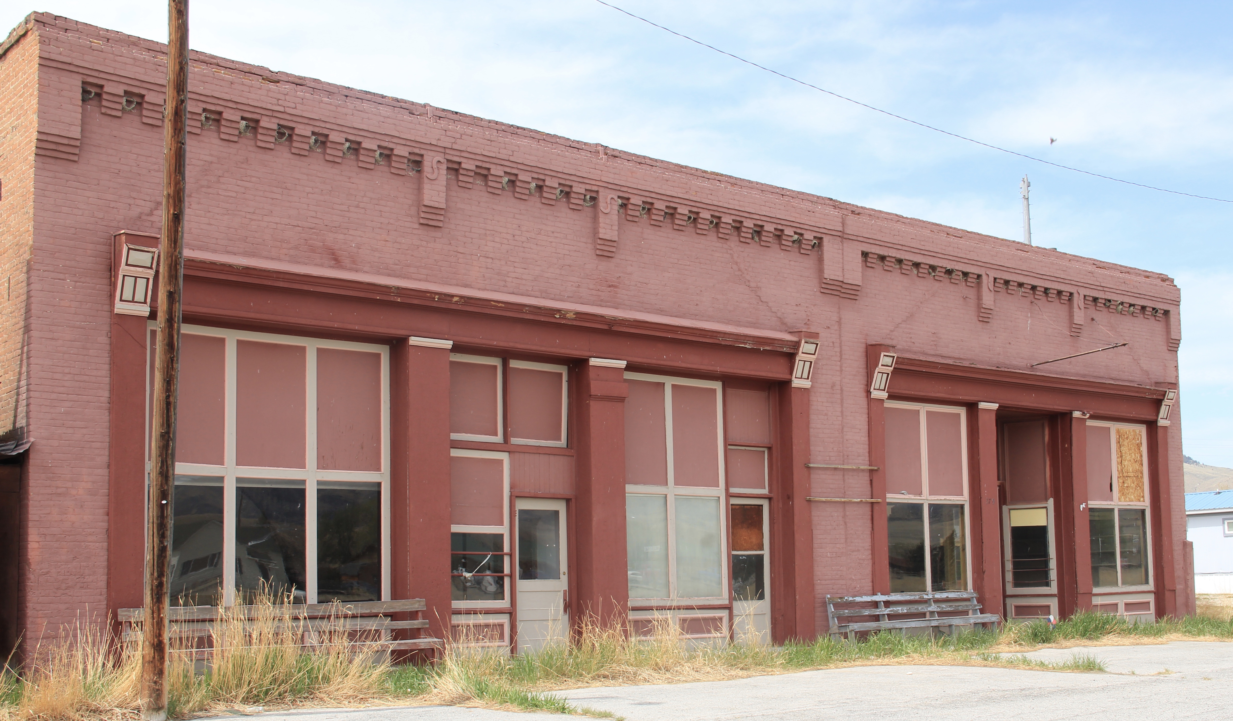
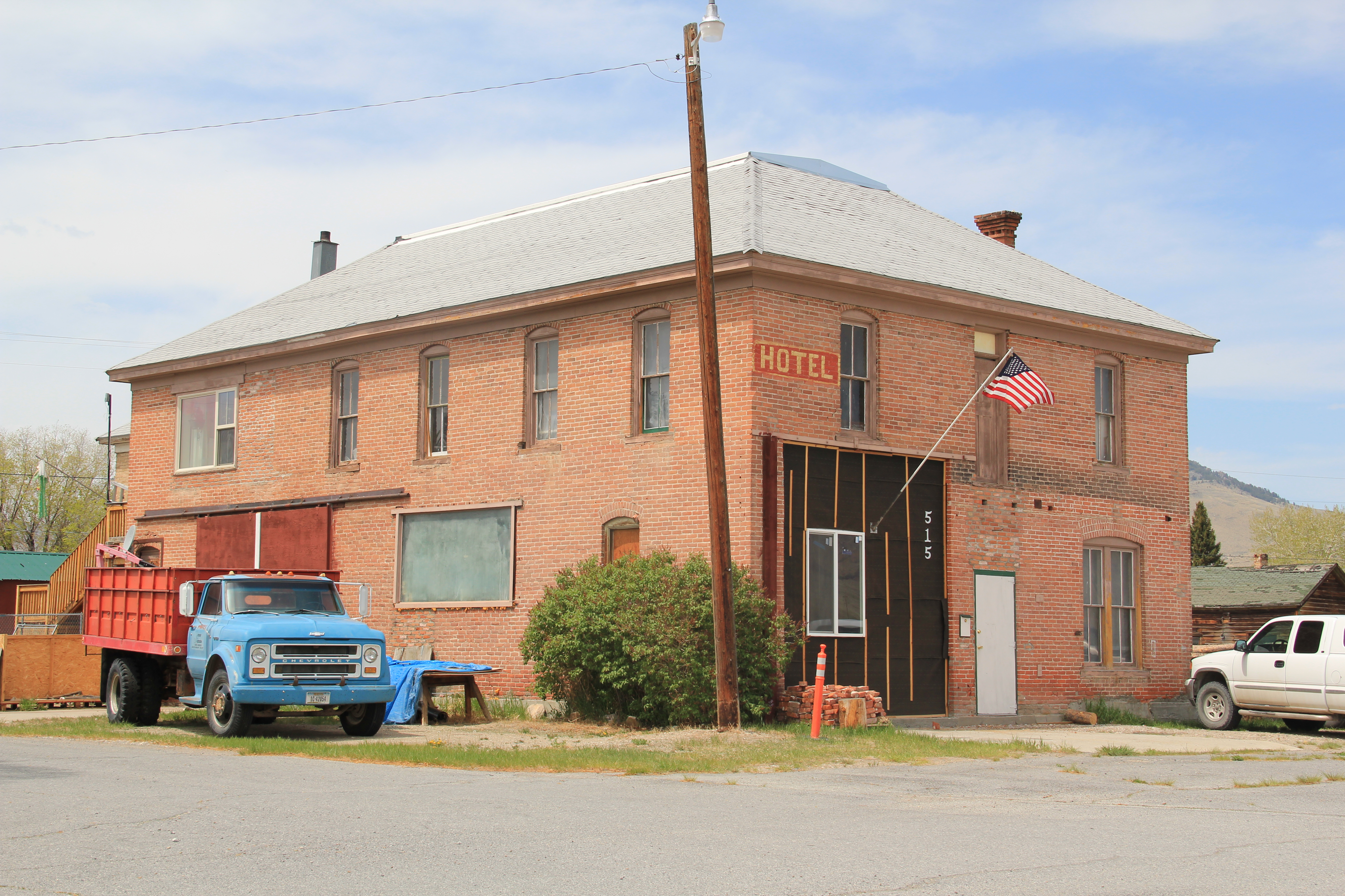 when Melrose was a substantial, busy place. This 1870s-1880s history is largely forgotten today as the town has evolved into a sportsmen’s stop off Interstate I-15 due to its great access to the Big Hole River and surrounding national forests as well as the quite marvy Melrose Bar and Cafe, a classic western watering hole.
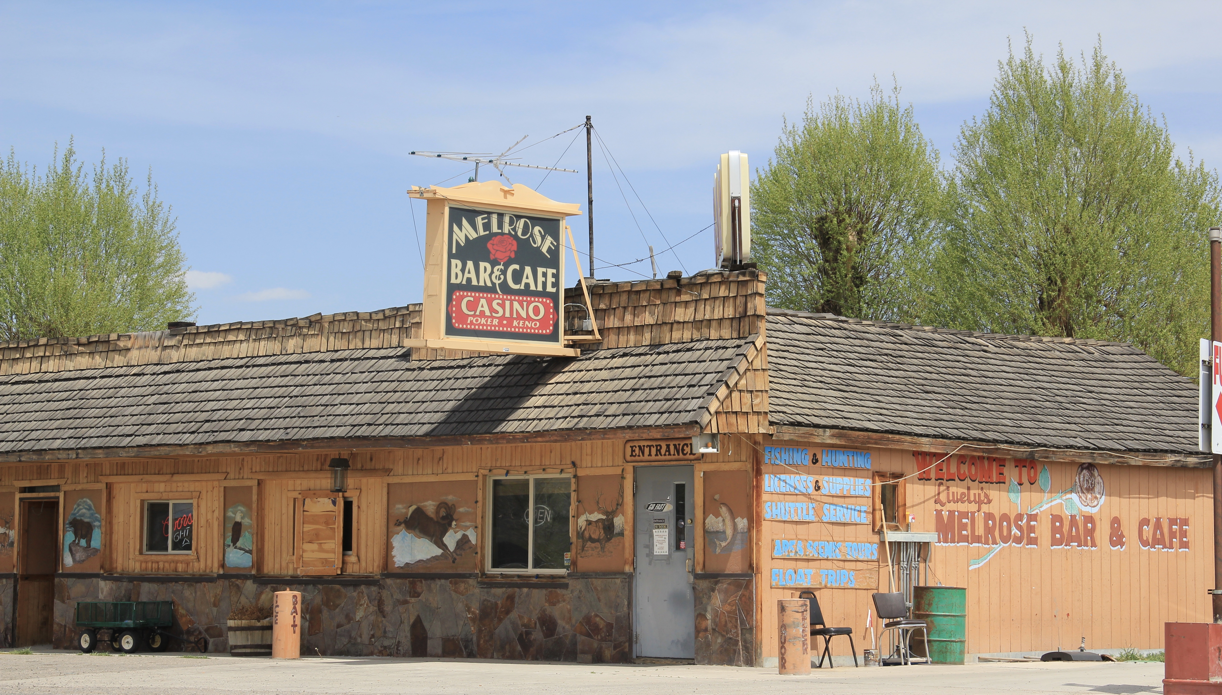 Community institutions help to keep Melrose’s sense of itself alive in the 21st century. Its school, local firehall, the historic stone St John the Apostle Catholic Mission and the modernist styled Community Presbyterian Church are statements of stability and purpose.


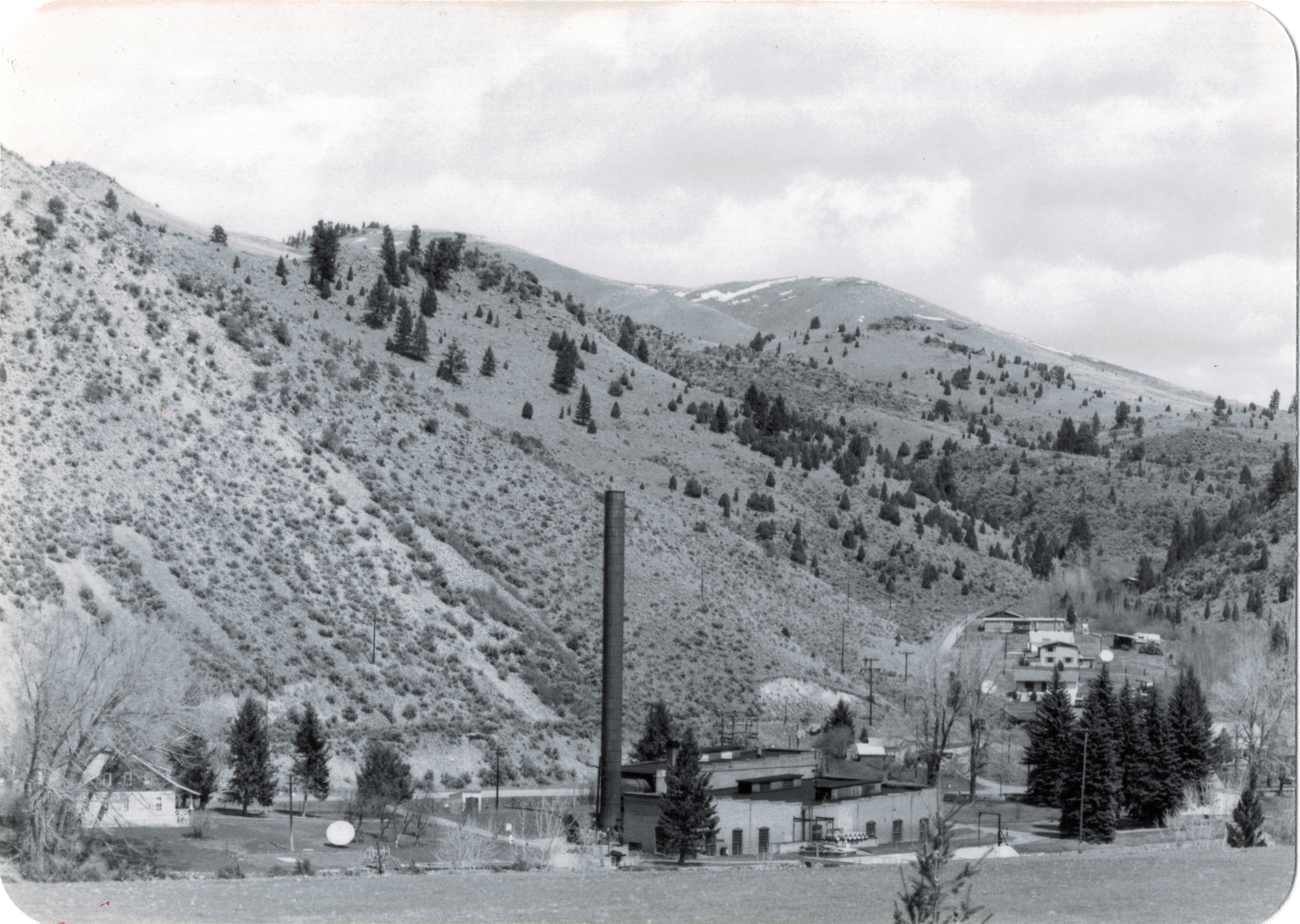 The photo above was published in A Traveler’s Companion to Montana History, in part because of the preservation excitement over this landmark but also because it documented how the boom in Butte helped to transform the historic landscape on the “other side of the divide.” The pump station took water from the Big Hole River and pumped it over the mountains to the Butte Water Company–without the pump station, expansion of the mines and the city would have been difficult perhaps impossible in the early 20th century.
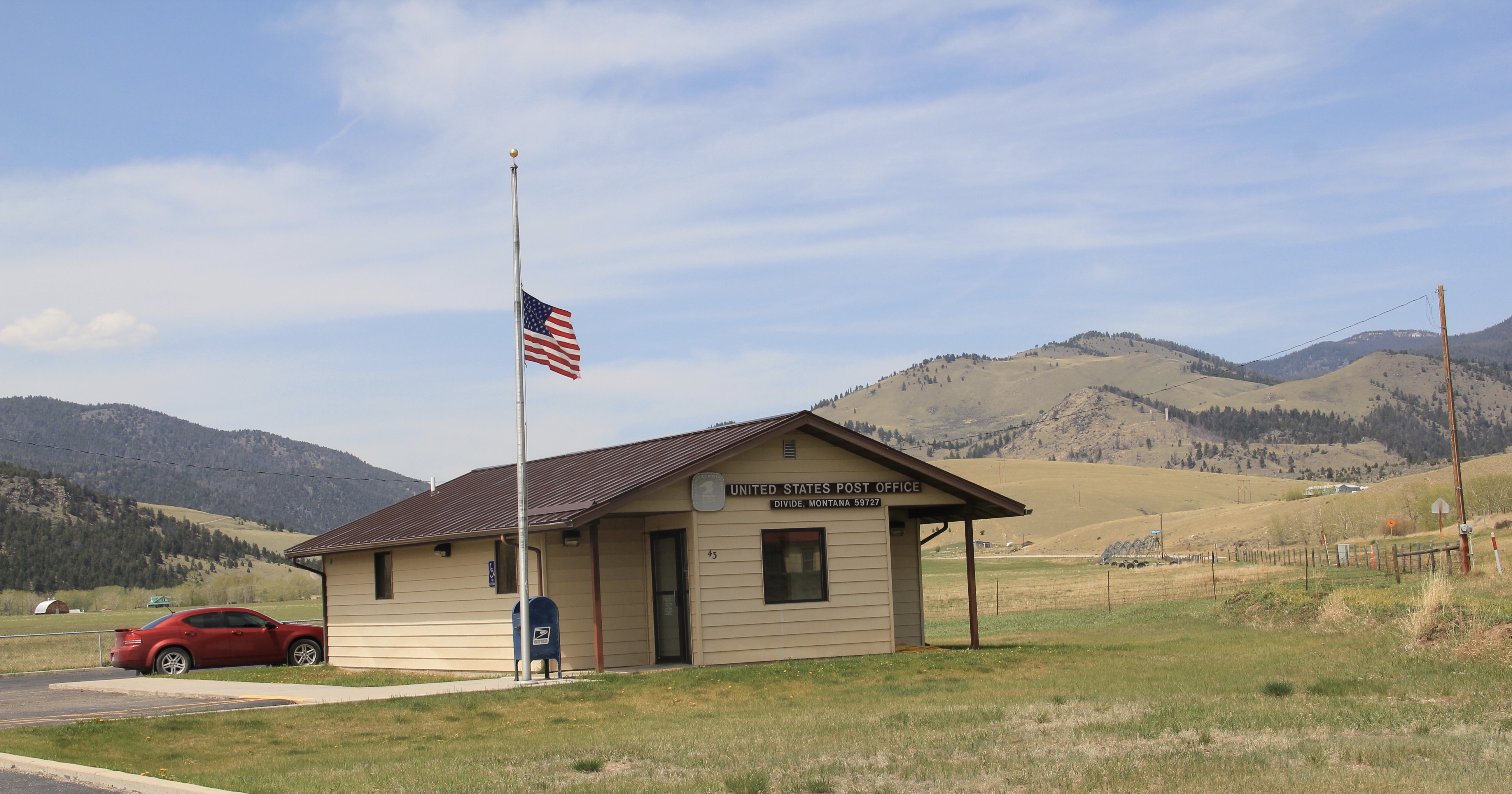 In 2014, in reaction to the listing of Montana rural schools as a threatened national treasure by the National Trust of Historic Preservation, CBS Sunday Morning visited Divide School for a feature story. Teacher Judy Boyle told the Montana Standard of May 16, 2014: “The town of Divide is pretty proud of its school and they want to keep it running. We have a Post Office, the Grange and the school — and if you close the school, you basically close the town.”
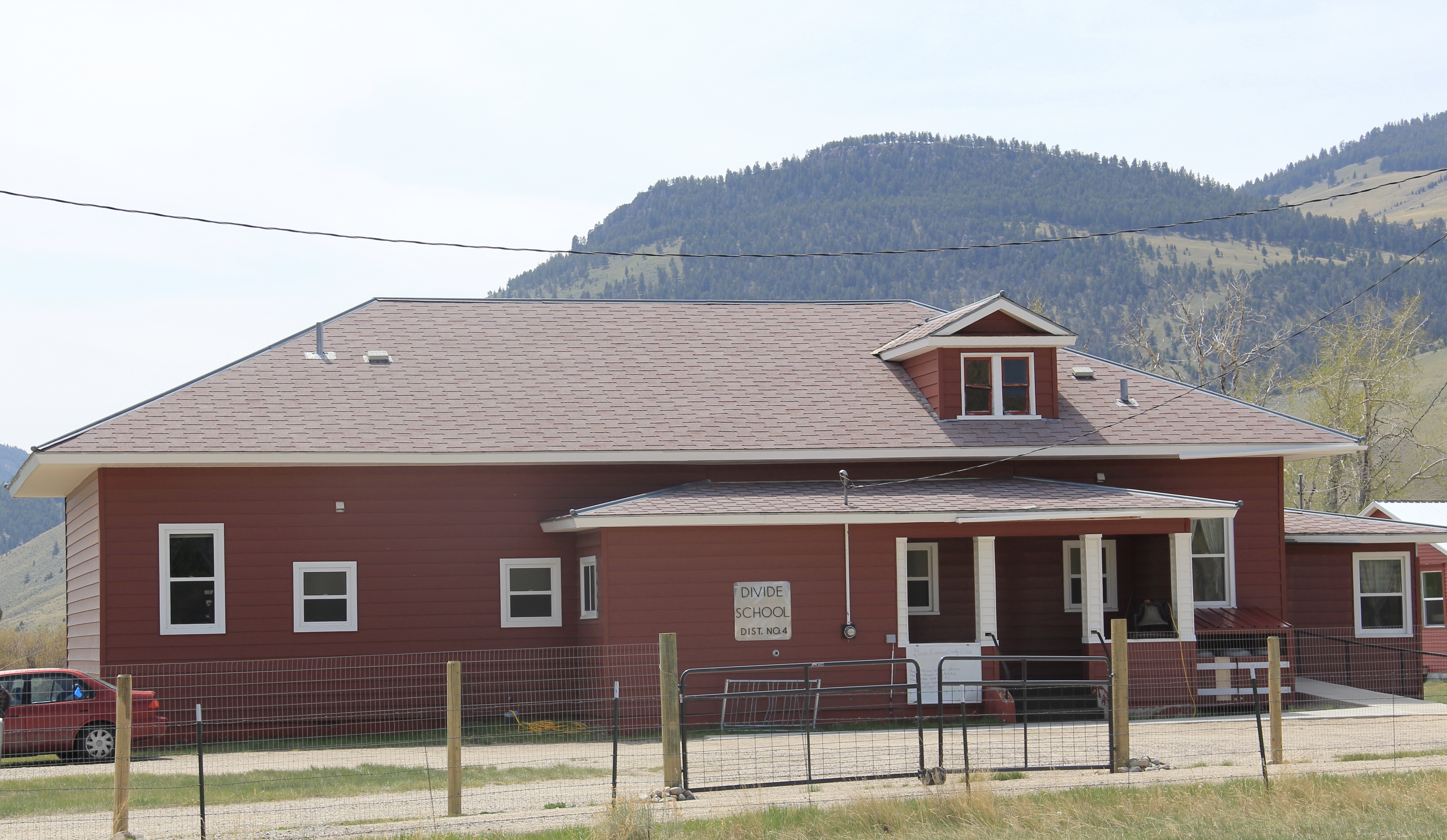 Divide is one of many Montana towns where residents consider their schools to the foundation for their future–helping to explain why Montanans are so passionate about their local schools.


 Then Senator Moss took me for a quick tour of its late 1990s renovation in 2007–its conversion into law offices respected both its original spaces and interior design.