Lost Landmark: Gladstone Hotel in Circle

In 2013 I wrote about the poor condition of the Gladstone Hotel, a landmark from the homesteading era in Circle that had been listed in the National Register over 40 years ago.

This one didn’t make it. A reader of the blog told me that on September 21, 2023 it burned to the ground.

Image from the Circle Banner newspaper.

That’s two important historic Eastern Montana hotels, both from the homesteading era, lost in the last couple of years, first the Graves in Harlowton and now the Gladstone in Circle.

During the 1984 historic preservation survey of Montana, I had spent the night at both. Those days are now gone up in smoke.

A winter day in Tennessee, fond thoughts of Montana

665FD124-6386-4018-AC4D-22477FE6D8D1

There’s been a bit of winter in Tennessee in early January 2018 and my university has been closed for two days due to three inches of snow (that’s no misprint). Days like this one lead me to reflection of my jaunt across Big Sky Country in the cold of February to the warmth of mid-May 1984. I had spent 2 months at my cubbyhole in the basement of the Montana Historical Society, shown below, and I was ready I

thought to hit the road. Wonders of all sorts I would find and here are just a few of the special (admittedly perhaps not spectacular to outsiders) places I encountered.

Just up the tracks from the opening image at the southern tip of Beaverhead County was the Hotel Metlen in Dillon. A grad student recently asked me about it, having come across it while trolling the internet. It sounds like a fleabag the student remarked–I probably didn’t help when I recalled staying there for 10 bucks in 1984. But what a great Second Empire-styled railroad hotel!

It had upgraded during my last visit in 2012–still classy in a dumpy way, if that makes any sense.

On the opposite end of the state, at Thompson Falls, was another favorite lodging spot, a classic 1950s motor lodge, the Falls Motel. Spiffy now but still Mom and Pop and so far away from the chain experience of today.

But as regulars of this blog know, I didn’t care where I stayed as long as beef, booze, and pie were nearby. Real rules for the road. The beef could range from the juicy roadside burgers from Polson (the b/w image) to the great huge steaks at Willow Creek (the yellow tinted roadhouse).

And speaking of roadhouses Wise River Club from 1984 above is still going strong and as friendly as ever. While the owners keep changing at Big Timber–the sign still

chops away and the beer is still cold. That is what you need on the road.

Wait! Pie matters too, represented by the Wagon Wheel in Drummond, above. Southerners do brag about pie, and I believed in that regional myth, until I traveled Montana. I swear that there are most great pie places in a single Montana County (say, Cascade) than all of Tennessee. On cold days I still think of a Montana cup of coffee (always strong) and a piece of grit pie. In 1984 I just needed that one afternoon stop to push on for a few more hours of driving and documenting the captivating landscape of the Big Sky Country.

Bozeman’s historic districts after 30 years

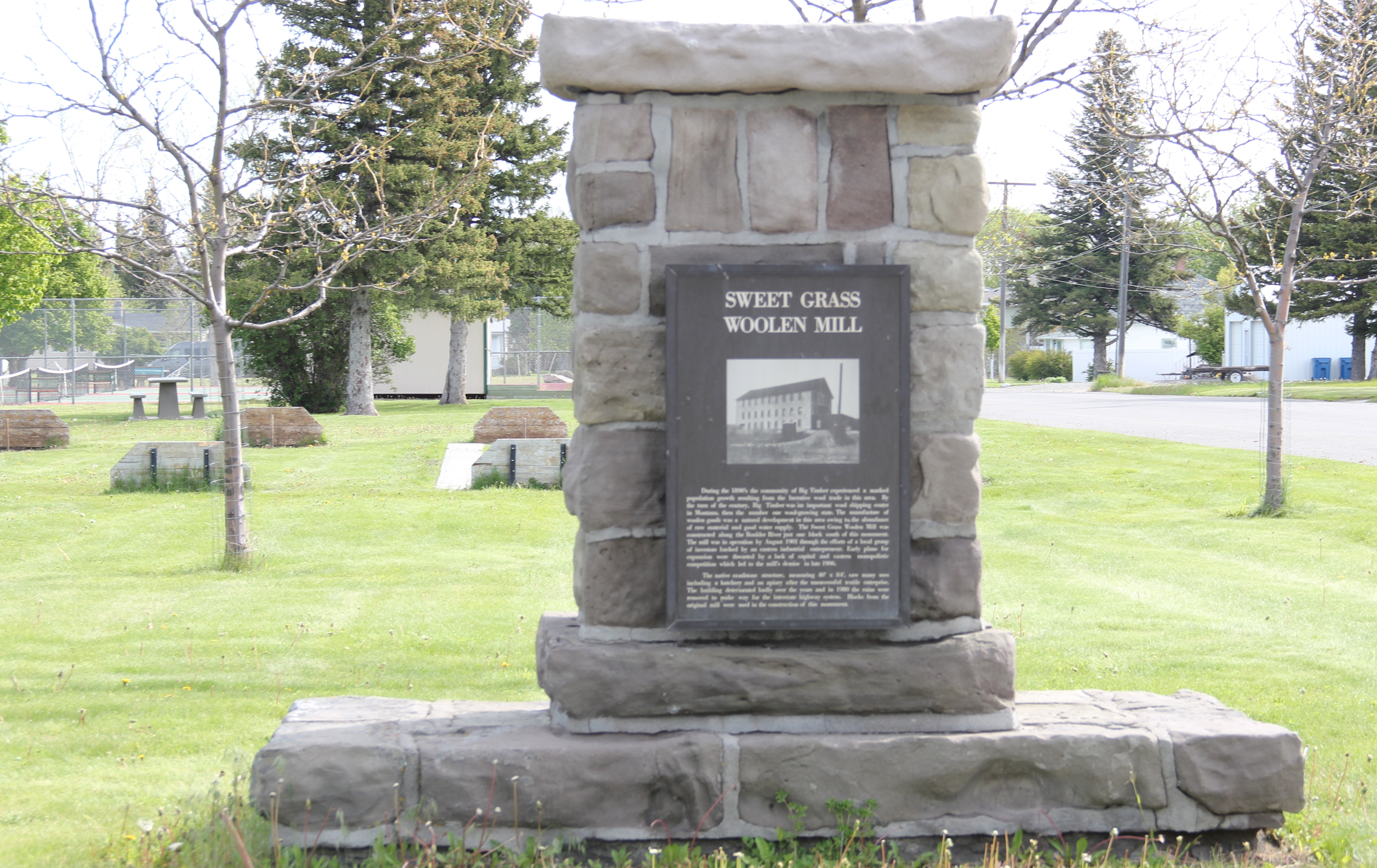
Bozeman, the county seat of Gallatin County, was one of my favorite Montana towns during the 1984-1985 survey.  In some ways, it was still a cowtown, a commercial center for the hundreds of surrounding ranches in Gallatin County.  Yet it was also a college town–bars, music, cheap eats–as home to Montana State University.  In 1980 its population was over 21,000–thirty years later by 2010 it had boomed to over 37,000.  By the time I explored the town in 2015 for this new survey there were an estimated 42,000 residents, double of that of the 1980s town I had so enjoyed.

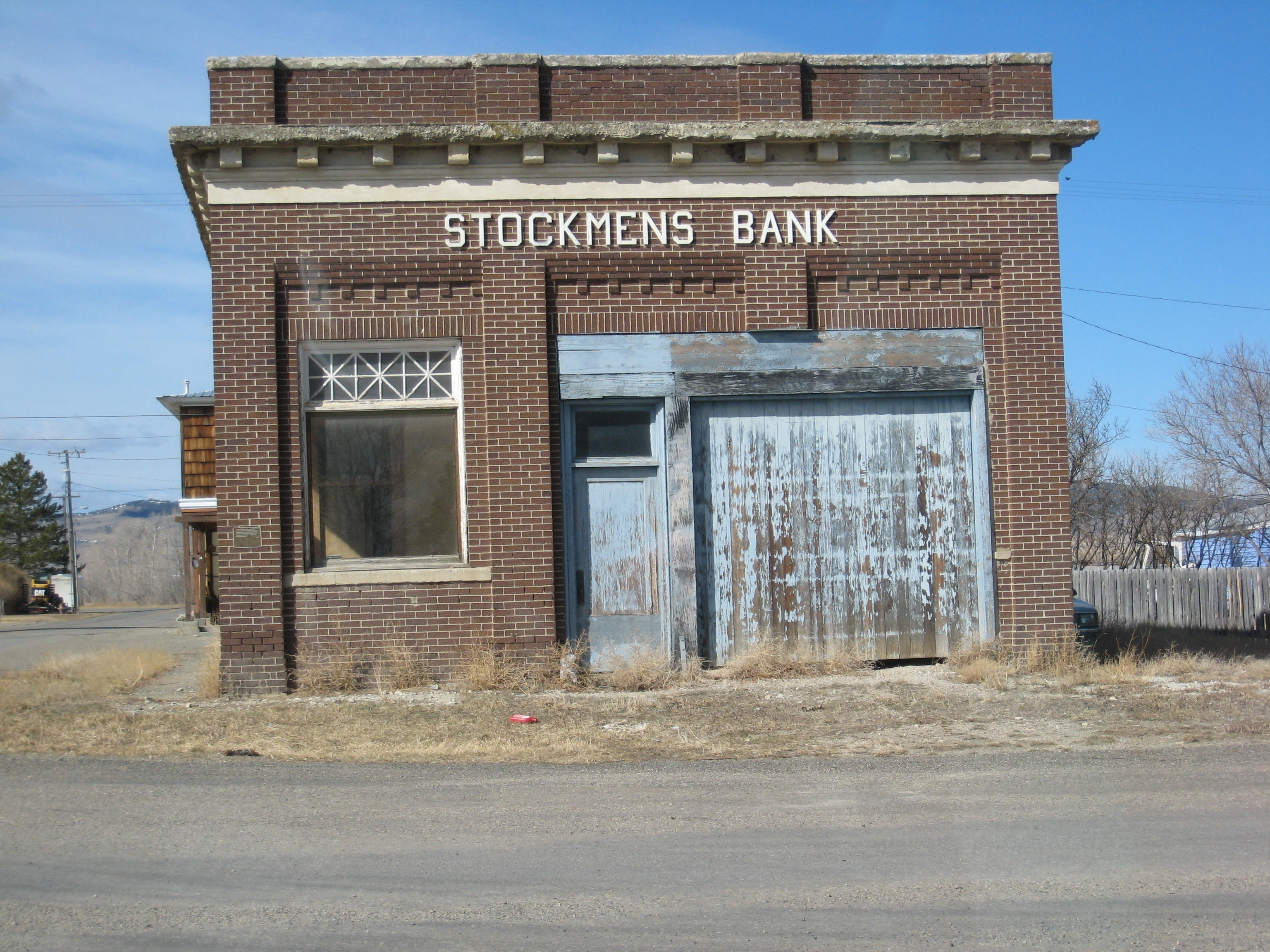
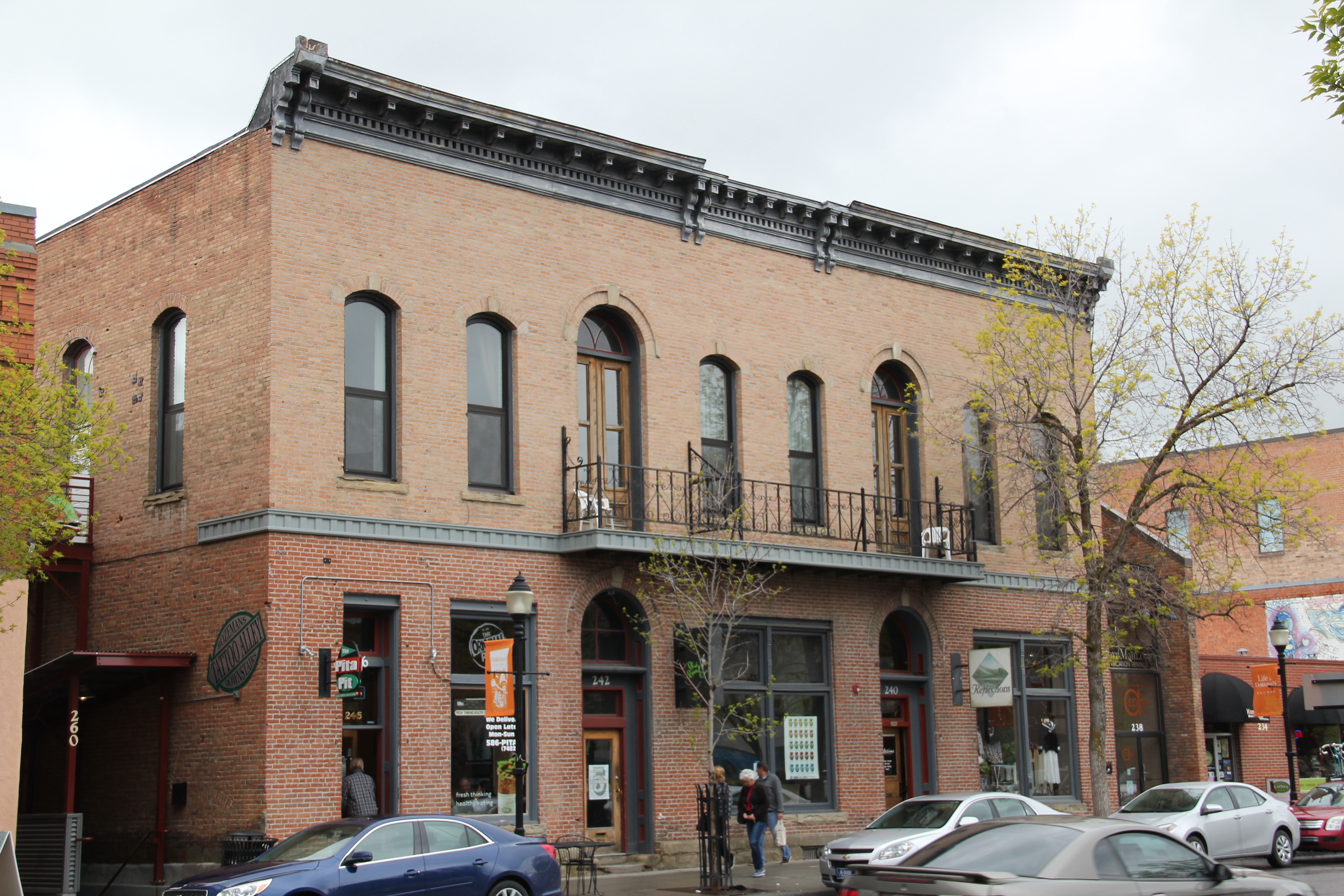
In 2007 then State Senator Lynda Bourque Moss stopped with me in Bozeman as we traveled from Billings to Helena where I was to speak to the governor’s task force on historic preservation, a meeting where the idea that I would recreate the survey of 1984-1985 first took root.  We stopped because she wanted to show me changes.  The four photos above showed me that yes, change had come, and in a big way to Bozeman.  The old Hallmark Store, which had moved into an earlier Stockman Bar, had become an upscale wine bar–a bit of California in the old cowtown of Bozeman–and when I next returned “Plonk” had added sidewalk seating.  We could have been in Aspen, at least Breckinridge, Colorado.

HPIM0207.JPG

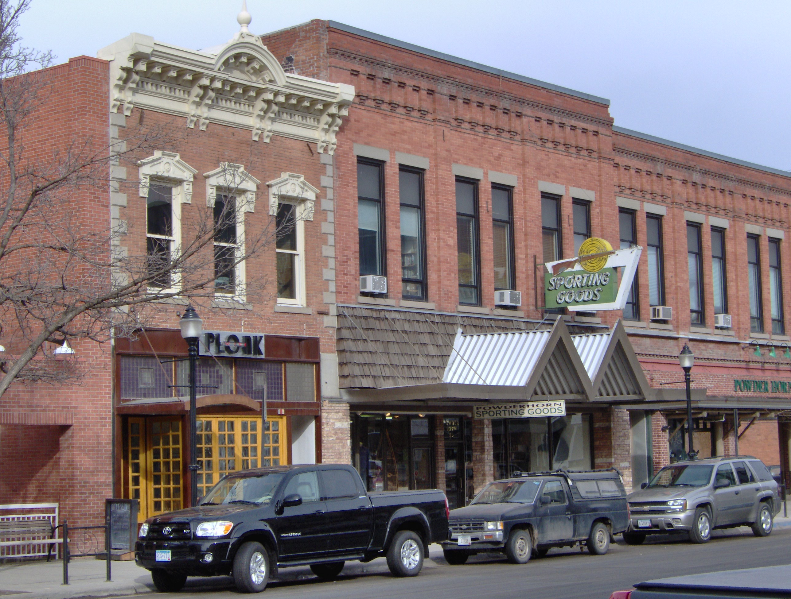
Plonk and the sporting goods store, 2007

Bozeman had eagerly embraced the idea of historic districts in 1984-1985 as a way of revitalizing its downtown–so much had moved, or was going to move, out to the interstate exits.  John DeHaas at Montana State University had done so much to promote historic preservation in the 1970s and early 1980s.  A tradition and commitment were in place.  That much was clear when I surveyed the town and talked with residents and decision makers in 1984-85. The next several posts will explore the impact of those historic districts in the last 30 years, and offer observations on where next steps may go.

IMG_6838


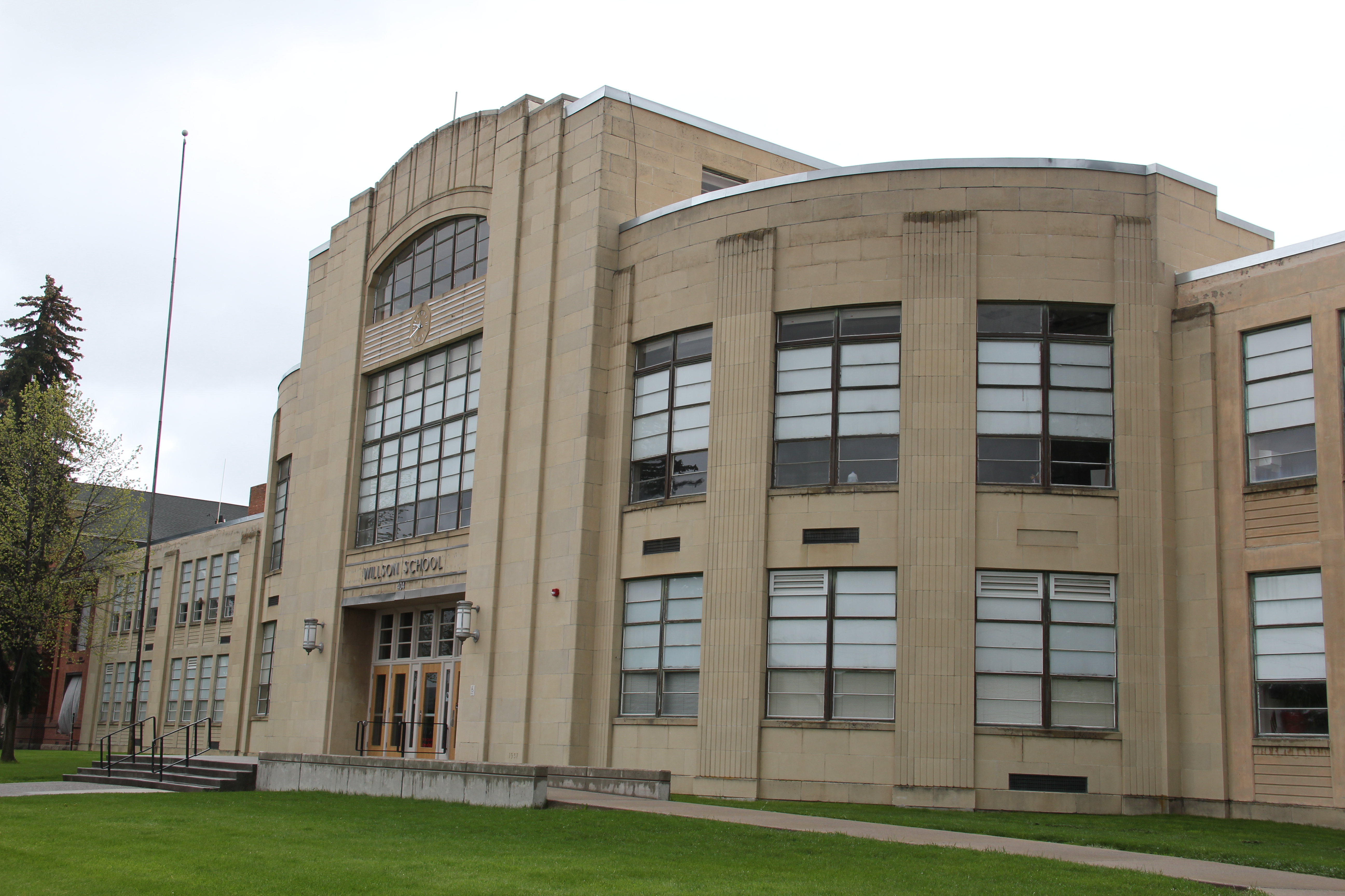
Let’s start with what I saw as the public landmarks, and anchors, for downtown Bozeman in 1984-1985.  None was more important than the New Deal era Gallatin County High School, a striking Art Moderne design by Bozeman architect Fred Willson.  At that time, the “new” high school–which stood right by an earlier 20th century brick high school building–was not “old enough” to be considered for the National Register.  This building, like many of the state’s New Deal era legacy, has since been listed in the National Register.  And its grounds have been re-energized for all who walk by through the installation of a statue in honor of Malcolm Story, designed by Belgrade, Montana, artist Jim Dolan and placed in front of the earlier high school in 1995.

IMG_6833

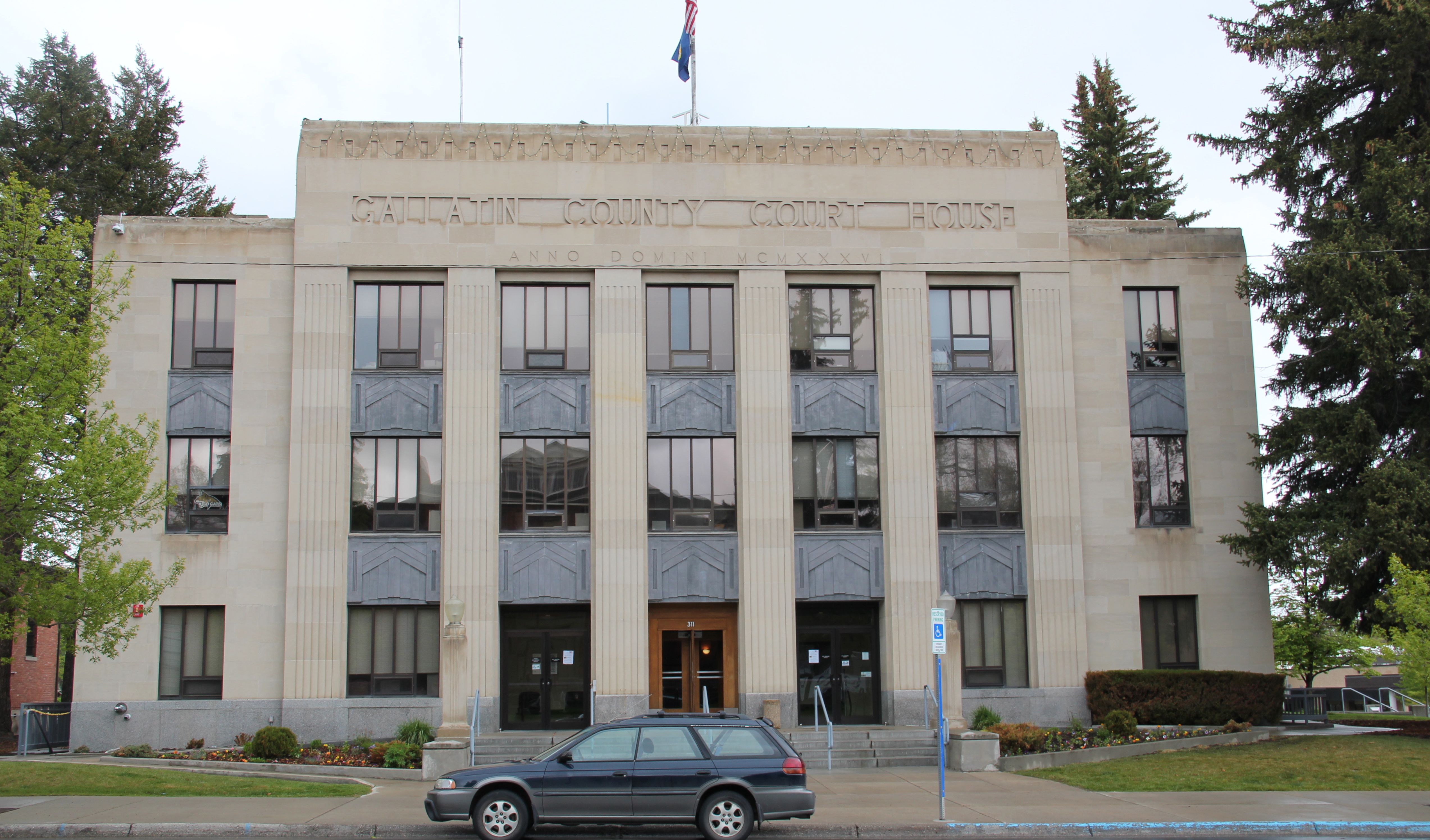
Across Main Street is another public anchor, also funded by the New Deal in the late 1930s and also designed by Fred Willson:  the Art Deco classicism of the Gallatin County Courthouse.  Next door is the historic county jail, in a distinctive castellated Gothic style, which already had been converted into headquarters for the local historical society and county museum when I visited in 1984.  The facility still serves that purpose today.

A couple of blocks away from this public landscape core of Bozeman were additional public buildings, on side streets to Main Street.  Tracy and Babcock Streets had the town’s first two federal buildings/post office.  The 1915 neoclassical styled post office operated until 1964 and filled several community roles, including a turn in the 1990s hit movie A River Runs Through It until it became home to the non-profit HRDC after a complete renovation at the turn of the 21st century.  The building also has been enlivened by the addition of Jim Dolan’s statue in honor of Jeanette Ranklin, the first woman U.S. Congress representative, elected in 2010 from Montana.

Nearby is the mid-1960s Federal Building, a grand though boxy five-story building that symbolized the growth of the federal government and its impact on Gallatin County in the Cold War era while also adding a modernist design landmark to the city’s mix of Victorian and Classical architectural styles.  The earlier post office was given attention in my 1984-85; due to its date of construction and style, I paid no attention to the new Federal Building.  I didn’t repeat that mistake in 2015–the Federal Building of 1964-66 is one of the region’s most impressive statements of Montana modernism. and a much more recent Federal Building, which I ignored, for reasons of chronology that no longer apply in 2015.

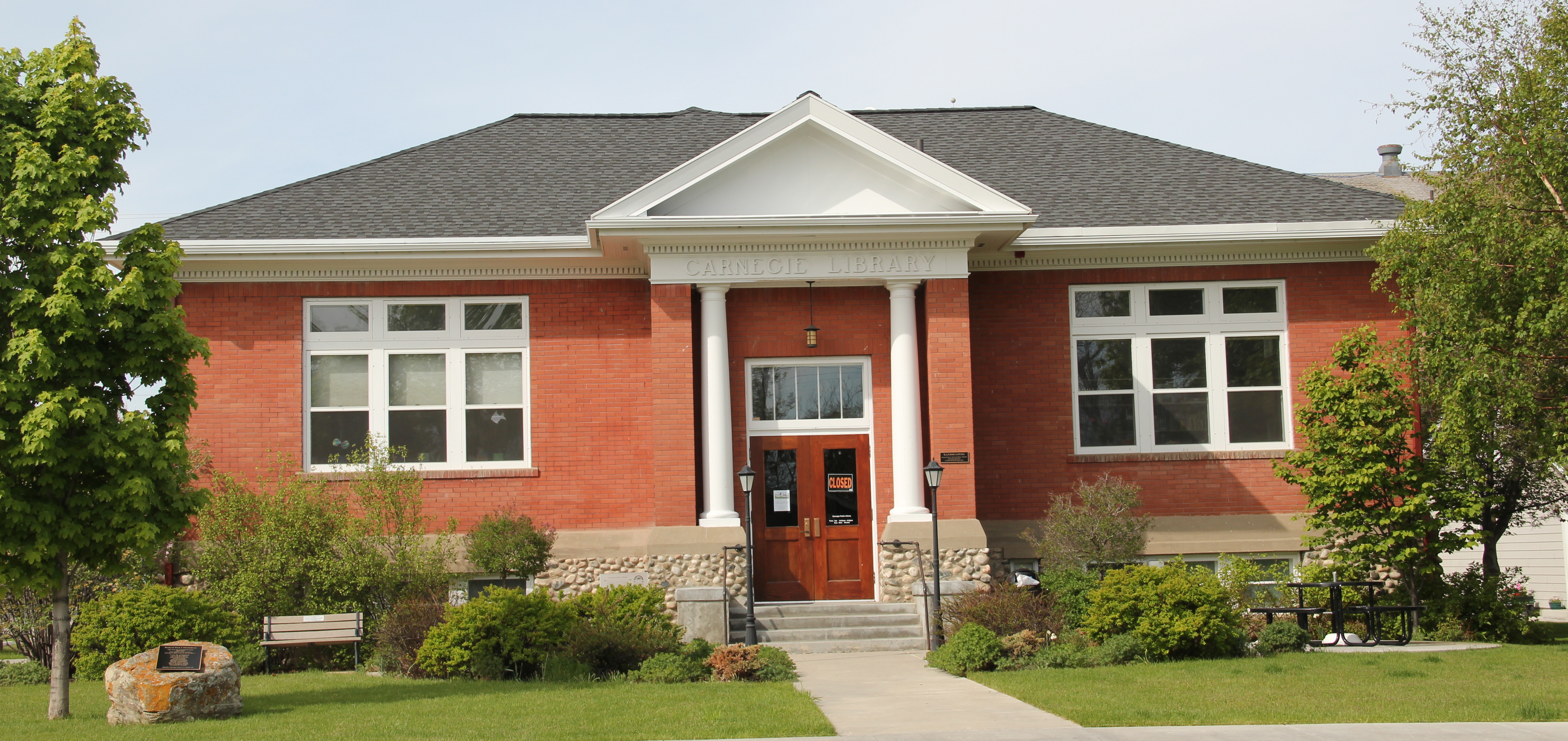
The final public anchor was the Carnegie Library of 1902-1903, one of the better architectural expressions of Classical Revival style in the state, designed by architect Charles S. Haire, who shaped so much of state’s architecture in the early 20th century.

IMG_6895Then Senator Moss took me for a quick tour of its late 1990s renovation in 2007–its conversion into law offices respected both its original spaces and interior design.


That brings me to the four commercial anchors you encountered on Main Street in 1984-1985.  Two were massive buildings on either end of Main Street that defined the entire district–the Renaissance Revival style of Hotel Baxter, individually listed in the National Register in 1984, and the massiveness of the Victorian Romanesque style of The Bozeman Block, reminding everyone of the town’s railroad era.

In the middle of the district were two other key National Register properties–the Ellen Theatre, a wonderful Beaux Arts design scaled for the small town that it served in the 1920s.  Everyone thought that keeping a movie house/ theater downtown would help keep it alive at night.  The second building, the Union Hall, was both historically important but also could serve as a symbol of what downtown revitalization meant–a building need not

IMG_6885

be spectacular to serve an important role in the historic district.  The c. 1880s building belonged to the town’s boom during after the Northern Pacific Railroad arrived, and originally served as a brewery.  Here was where the Bozeman historic preservation office was located when I conducted the state historic preservation plan survey in 1984-85. Next let’s consider the town’s railroad resources, a focal point of mine 30 years ago.
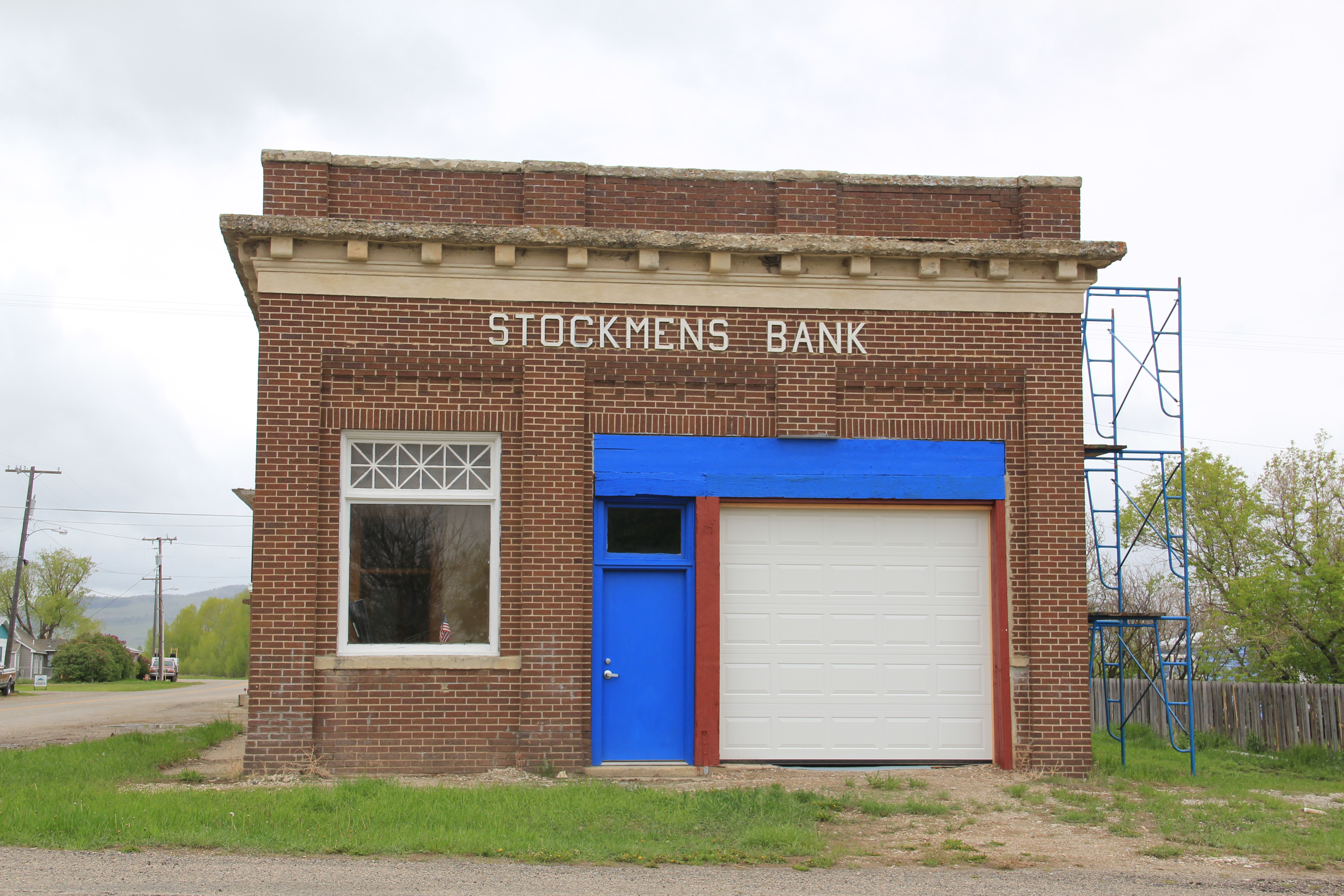


The Sweet Grass of the Yellowstone Valley

IMG_6258

Sweet Grass County has one of the most spectacular landscapes of the entire state of Montana.  Located in the middle of the Yellowstone Valley, the county has long been a significant crossroads, from the prehistoric era to today.  At the county seat of Big Timber, Interstate Highway 90 (along with the historic route of old U.S. Highway 10) parallels the Yellowstone River.  The town is also the southern point of origin for U.S. Highway 191,

2011 MT Sweetgrass county 014

The Lazy J, near the intersection of U.S. 191 and old U.S. 10, is a classic bit of mid-20th century roadside architecture.

which strikes northward cutting across Central Montana and continuing until the highway ends at the Canadian border, north of Malta.

IMG_6331Established by the Northern Pacific Railroad in 1882-1883, Big Timber has the classic T-Plan town plat found on so many Northern Pacific towns.  But one reason I have long liked this place is the quirkiness of its town plan.  The depot and the elevators are where they

IMG_6329should be, forming the top of the “T,” but the beautiful early 20th century stone masonry Sweet Grass County Courthouse is neither on McLeod Street (the stem of the T) nor at the end of the T, dividing the town’s commercial area from its residential neighborhood.  No, it IMG_6333is a block west of the intersection of McLeod Street and old U.S. Highway 10–an uncommon arrangement of public space in northern plains railroad towns.  A public park

IMG_6314

effectively marks the end of the historic town.  When I first surveyed the town in 1984, I found that an old 1946 highway marker for the Lewis and Clark Expedition had been moved to the park a year prior to my visit, and the interpretive sign told me that the town had a sense of its place in history.  In the decades since, residents have added a monument to the town’s early wool industry along with a bronze sculpture, titled “Free Spirit” by Dave Hodges, linking the place to the open spaces and cowboy culture of the valley.  Coming soon will be the new headquarters for the Montana Cowboy Hall of Fame, an institution that searched high and long for a home until finding Big Timber.

IMG_6316

IMG_6313

IMG_6271Public interpretation through art is another change I encountered in Big Timber.  The most striking dates to the Lewis and Clark Bicentennial at the start of this century.  On the walls of the local grocery store are three panels telling the story of the expedition in Sweet Grass County as the men encountered the confluence of the Boulder and Yellowstone rivers.  IMG_6296On another commercial building near the intersection of U.S. 191 and old U.S. 10 was an unexpected surprise:  a mural recreating–or is it reinterpreting–the famed Milwaukee Road promotional poster from the turn of the 20th century that encouraged homesteaders

IMG_6267to head to Montana. Oddly the reproduction mural gives the Northern Pacific corporate emblem but the route shown is the Milwaukee’s route, admittedly also showing where the two lines ran side by side in parts of the Yellowstone Valley.

IMG_6290

Public interpretation has not extended into an intensive involvement with the National Register of Historic Places.  In 1984, only one property–a segment of the Bozeman Trail where it crossed the Yellowstone–in the county was listed, and that stood on Sweet Grass’s far western border to Park County.  Then, right after I had finished the project, the iconic western hotel, The Grand, was listed in the National Register.  In the 30 years, a handful of Big Timber landmarks also have been designated on the National Register:  the Classical Revival-styled Carnegie Library, St. Mark’s Episcopal Church, and the Big

IMG_6324

Sweetgrass Co Big Timber 6 - Version 2 IMG_6306Timber City Hall.  Little doubt these landmarks are cherished–when more library space was necessary this century the expansion of the historic building was done appropriately, keeping this landmark in service for decades.

IMG_6308But when you consider just how intact the town’s historic environment from the 1880s to the 1950s is today, you think a National Register historic district nomination in order, or at least one for the historic commercial district, which has a wonderful array of building types, designs, and, luckily for Big Timber, open businesses, including one of my favorite bars in all of the state–at least favorite bar signs–the Timber Bar.

IMG_6273

IMG_6274

IMG_6275IMG_6284The next post will look deeper in the historic buildings of Big Timber, and then stretch north to a real jewel, the Melville Lutheran Church.

The Disappearing Act of the Milwaukee Road

2011 MT Meagher County 052

Montana State 294 is one of my favorite highways.  For Montana it is a short route, just around 30 miles between Martinsdale and where the road junctions with US 89 and meets up with Ringling.  But these 30 miles are packed–well in a Montana sense–with resources of the original mainline of the Chicago, Milwaukee, St. Paul, and Pacific Railroad (the Milwaukee Road) as an electric line, such as the roadbed that parallels the state highway above at Lennep–it now serves as a secondary dirt road for residents.

MR station

The Milwaukee maintained transformer stations about every 30 miles of its electrified tracks so AC power could be converted into DC current for its trains.  I apologize for the poor quality of my 1984 image of the station along Montana 294 but then it was still generating power for local use.  Thirty years later that had ended–the power lines were gone, taking away context from the building itself and leaving those who don’t know any better wondering why a big two story brick building was out here by itself.

2011 MT Meagher County 054

The station is about five miles west of Lennep, which I described in 1986 as “a tiny village where residents have preserved an old store and where the schoolhouse is still in use.”

2011 MT Meagher County 046

The school is now a residence and the store is still there, though not in business.

2011 MT Meagher County 045

The true landmark of the entire road is the Trinity Lutheran Church, built in 1910.  Its soaring Gothic bell tower, gleaming bright in the sun, is a beacon for anyone traveling along the road. It is one of my absolute favorite rural Montana churches and clearly eligible for listing in the National Register–as would be the entire remaining hamlet of Lennep.

2011 MT Meagher County 049

To the east of Lennep is Martinsdale, a tiny place that somehow has already managed two different blog posts about it.  Maybe that tells you that it too is a favorite place.  In 1984, its intact combination depot, what the Milwaukee called a “Standard Class A Passenger Station.”  This standardized design building, standing at the head of the town, spoke

IMG_9678

volumes of how the Milwaukee reshaped this landscape in the first decade of the twentieth century. But since this image from 2013 I have learned that the depot is gone–part of the roof decking was missing then so I am not surprised at the lost.  Just disappointed in the lack of vision of keeping this heritage asset together for the future.

IMG_1618

The news is not all bad from Martinsdale.  In 2013 the Stockmen’s Bank was listed in the National Register of Historic Places, only the sixth such place in Meagher County.  Yeah I know the photo above from 2007 shows it missing one entire bay from when it was converted from a bank into a garage.  But its brick construction and classical style made it

Renovations at the Stockman's Bank, 2013

Renovations at the Stockman’s Bank, 2013

a landmark in Martinsdale.  Can’t way to see its condition in 2015 because the town has several key buildings, and I just don’t mean the Mint Bar.

IMG_9679

I really mean the Martinsdale Community Center.  Rural reformers in the early 20th century pushed western communities to establish centers–where people could gather in a secular public space, vital for not only individual sanity but community togetherness in the dispersed population of the northern plains.  The center at Martinsdale has always been well maintained, and now that the depot is gone, it is the community landmark.

IMG_9675

Business, however, is not booming in Martinsdale.  The Crazy Mountain Inn serves as the local restaurant and lodging option, the older classic false-front Martinsdale Hotel is now shuttered.

IMG_9681

IMG_9676

Even classic roadside institutions like the town’s two historic service stations/garages have closed–their mid-20th century designs are reminders of the days when automobiles came this way in numbers.

IMG_9683

IMG_9680

Now let’s shift attention to the “eastern end” of this route, the town of Ringling, a place once of high hopes founded by the circus master John Ringling.  Like Lennep, the Ringling townscape is dominated by two elements:  the Milwaukee Road standardized depot–in

2011 MT Meagher County 056

better shape in 2011 than the Martinsdale station–and the sacred landmark that dominates the view from U.S. Highway 89 for miles:  St. John’s Catholic Church.  The church dates c. 1910 and is a wonderful example of Arts and Crafts style in an otherwise basic gable-front rural church building.  Although used much more sparingly today, it has been restored and maintained well.  It too is eligible I would think for the National Register.

2011 MT Meagher County 057

Montana 294, like the Milwaukee Road itself, is no longer a major artery–it wasn’t really in 1984 and it is even moreso in 2015.  But what remains is a reminder of how the Milwaukee Road shaped the state’s landscape for 100 years, leaving in its wake landmarks of transportation, engineering, architecture, settlement, and faith.