Monida, at the Idaho-Montana border, on Interstate I-15.
Country towns of Beaverhead County–wait, you cry out: isn’t every town in Beaverhead County a country town? Well yes, since Dillon, the county seat, has a single stop light, you can say that. But Dillon is very much an urban oasis compared to the county’s tiny villages and towns scattered all about Beaverhead’s 5,572 square miles, making it the largest county in Montana.
 Let’s start this theme with the railroad/ federal highway towns. Monida, at the state border with Idaho, is a good place to start, first established as a place on the Utah and Northern Railroad line as it moved north toward the mines at Butte in 1881. Monica had a second life as a highway stop on the old U.S. Highway 91 that paralleled the tracks, as evident in the old garages left behind.
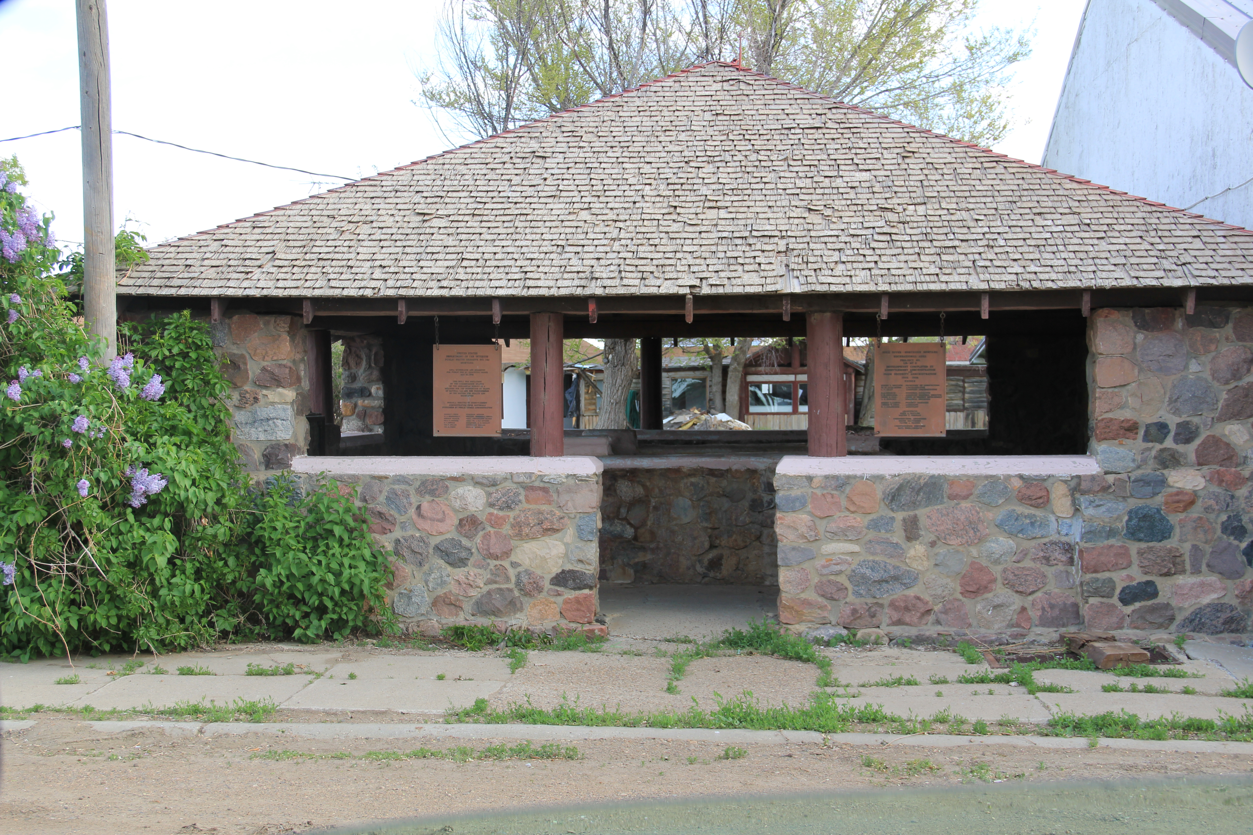
The next town north on the corridor created by the railroad/highway/interstate is Lima,  which possesses a Montana welcome center and rest stop. That’s important because at this stop you also can find one of the state’s mid-20th century examples of a tourist welcome center, which has been moved to this stop and then interpreted as part of the state’s evolving roadside architecture.
Lima is a classic symmetrical-plan railroad town, the plan favored by the engineers of the Utah and Northern as the railroad moved into Montana. The west side of the tracks, where the two-lane U.S. Highway 91 passed, was the primary commercial district, with several brick and frame two-story buildings ranging from the 1880s to the 1910s.
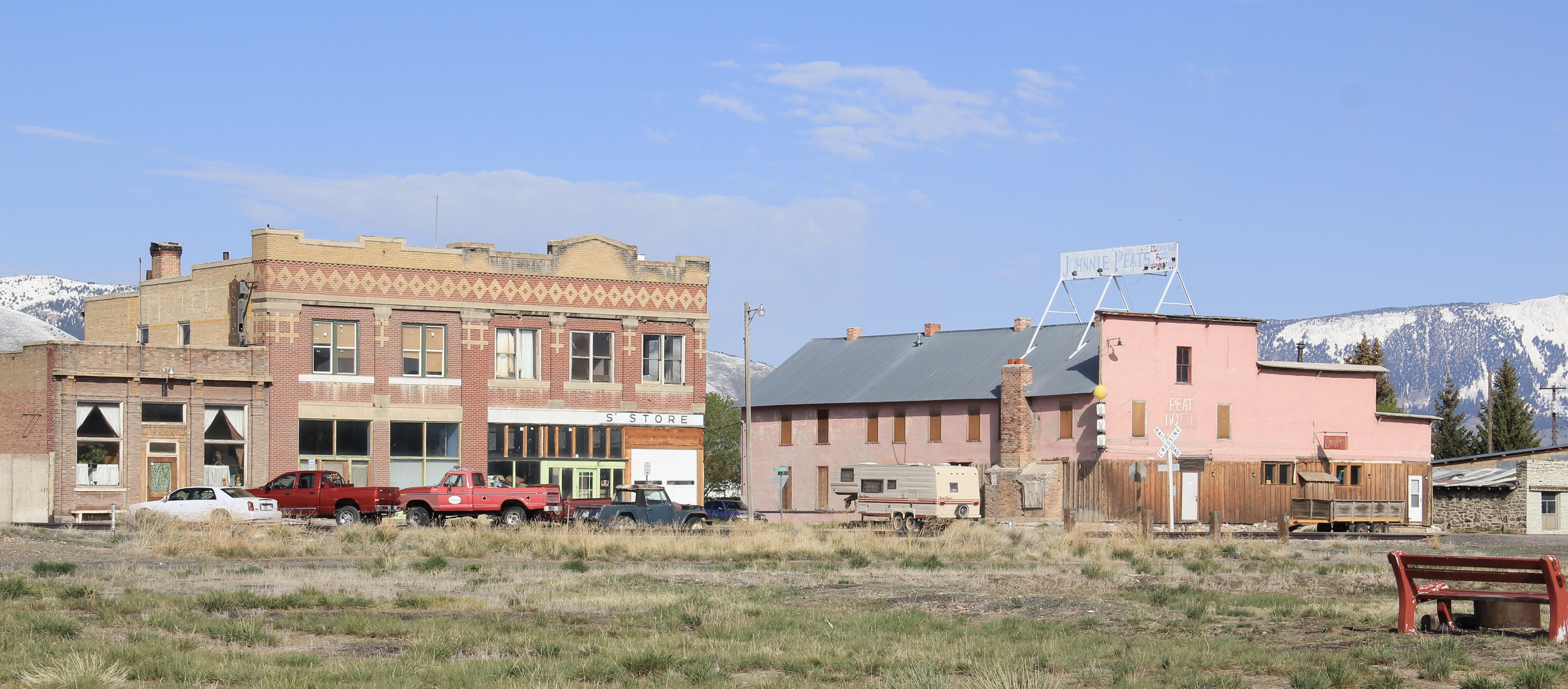
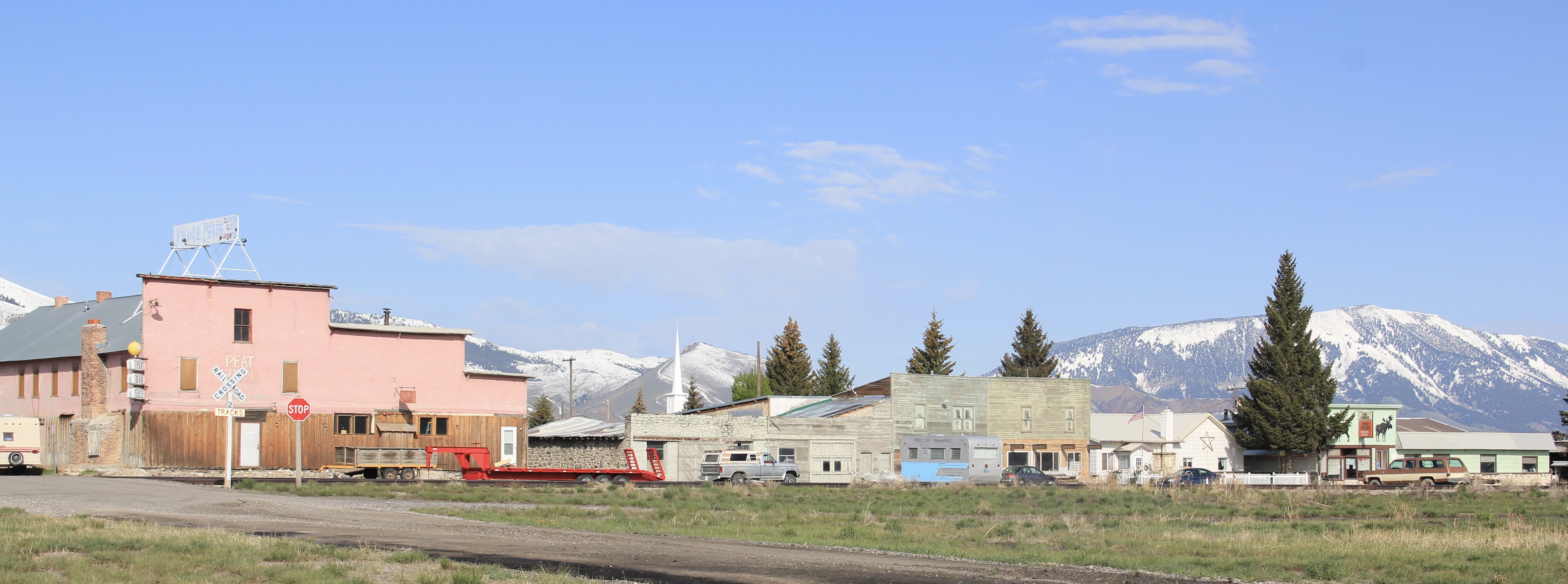
The east side, opposite old U.S. Highway 91, was a secondary area; the Lima Historical Society is trying to keep an old 1880s building intact for the 21st century.
The town’s comparative vitality is shown by its metal Butler Building-like municipal building, and historic churches, ranging from a early 20th century shingle style to a 1960s contemporary style Gothic church of the Latter Day Saints.
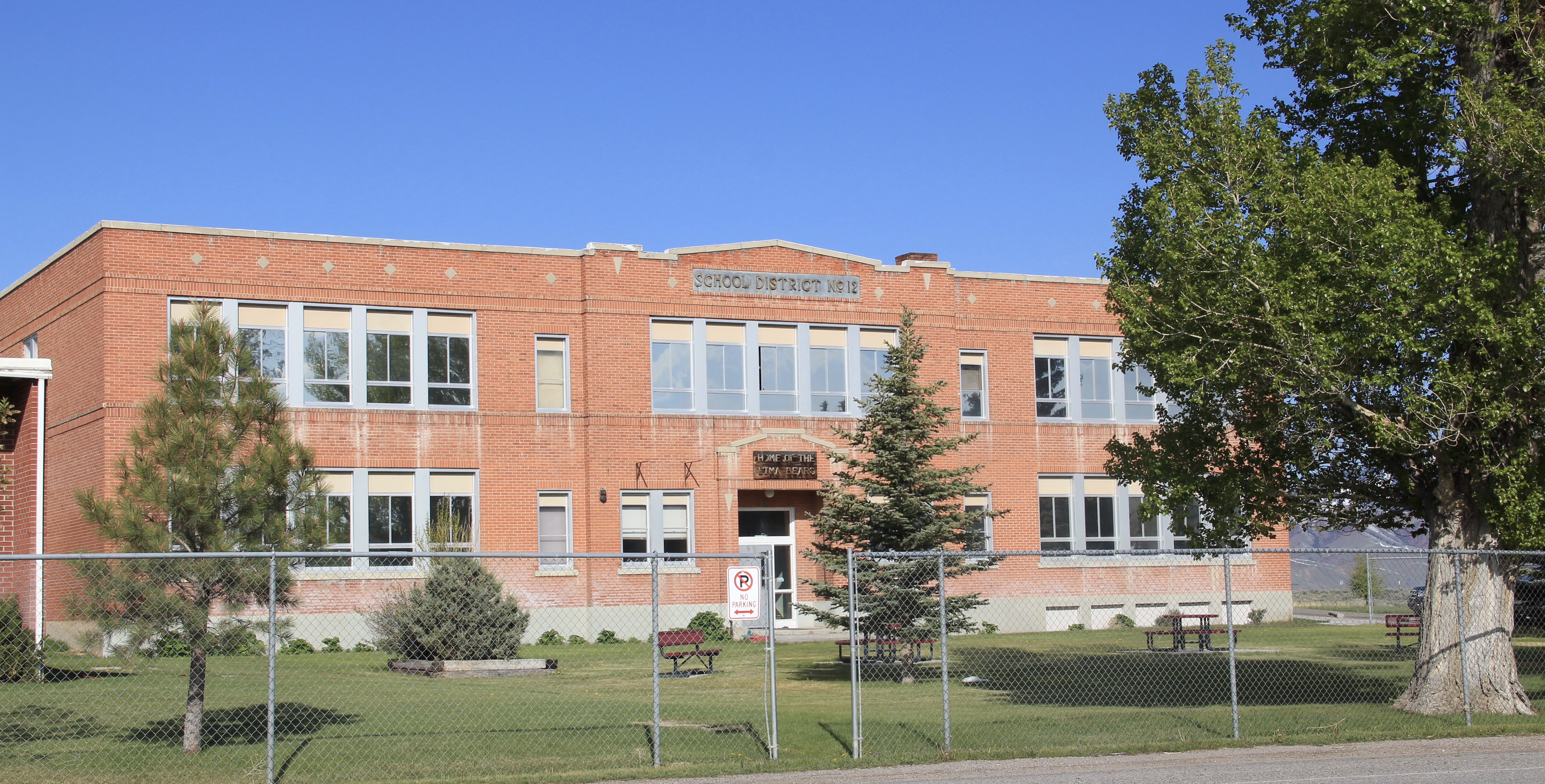
The town’s pride naturally is its school, which developed from the early 20th century two-story brick schoolhouse to become the town’s center of community.
Eight miles to the north is a very different historic schoolhouse, the one-story brick Dell school (1903), which had been converted into a wonderful cafe when I stopped in 1984. It is still a great place–if you don’t stop here for pie or a caramel roll (or both), you goofed.

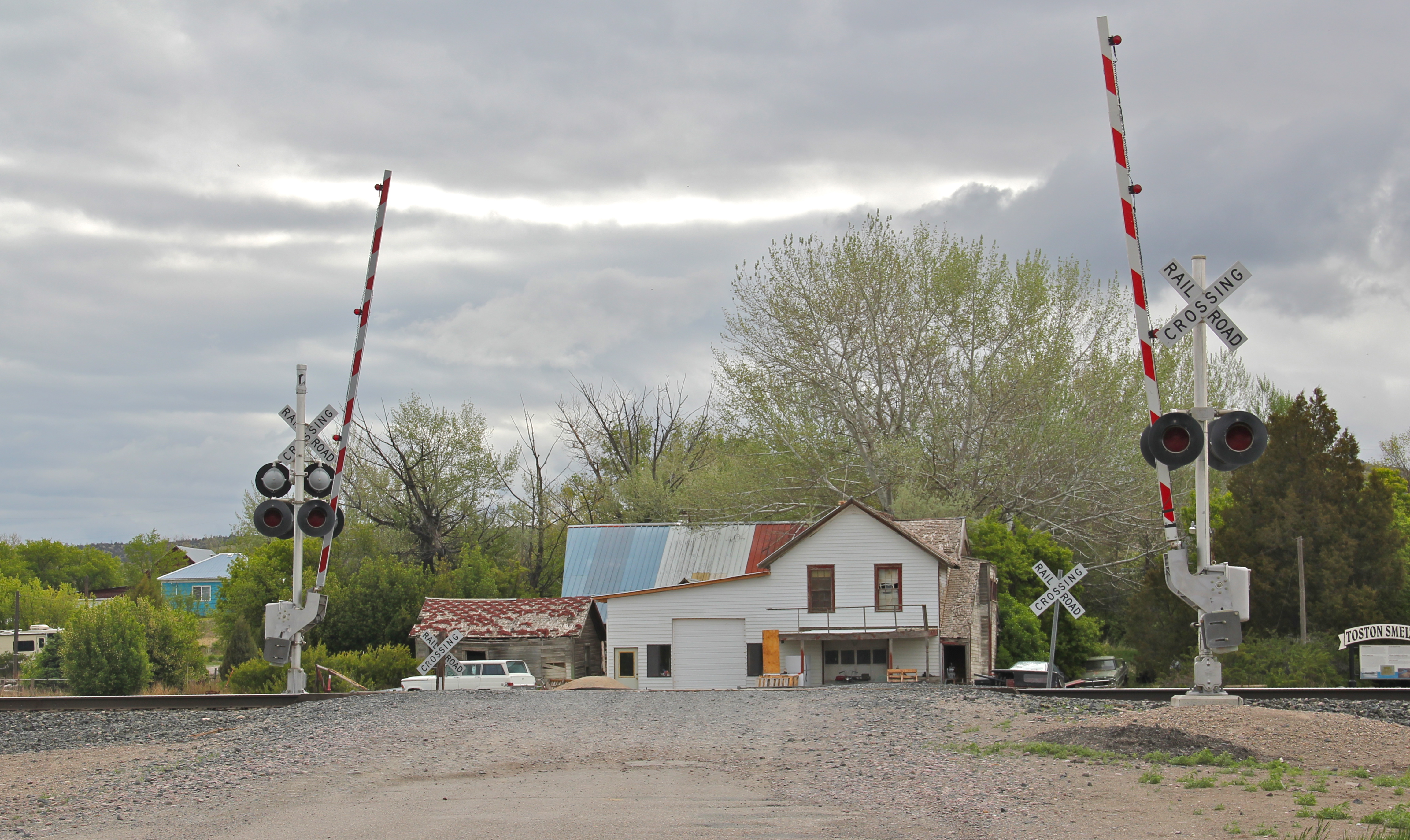
The Calf-A is not the only place worth a look at Dell, a tiny railroad town along the historic Utah and Northern line, with the Tendroy Mountains in the background. Dell still has its 
post office, within its one store, its community hall, and a good steakhouse dive, the false-front Stockyard Inn. But most importantly, for an understanding of the impact of World
War II on Montana, Dell has an air-strip, which still contains its 1940s B-17 Radar base, complete with storehouse–marked by the orange band around the building–and radar tower. Kate Hampton of the Montana State Historic Preservation Office in 2012 told me to be of the lookout for these properties. Once found throughout Montana, and part of the guidance system sending planes northward, many have disappeared over the years. Let’s hope the installation at Dell remains for sometime to come.

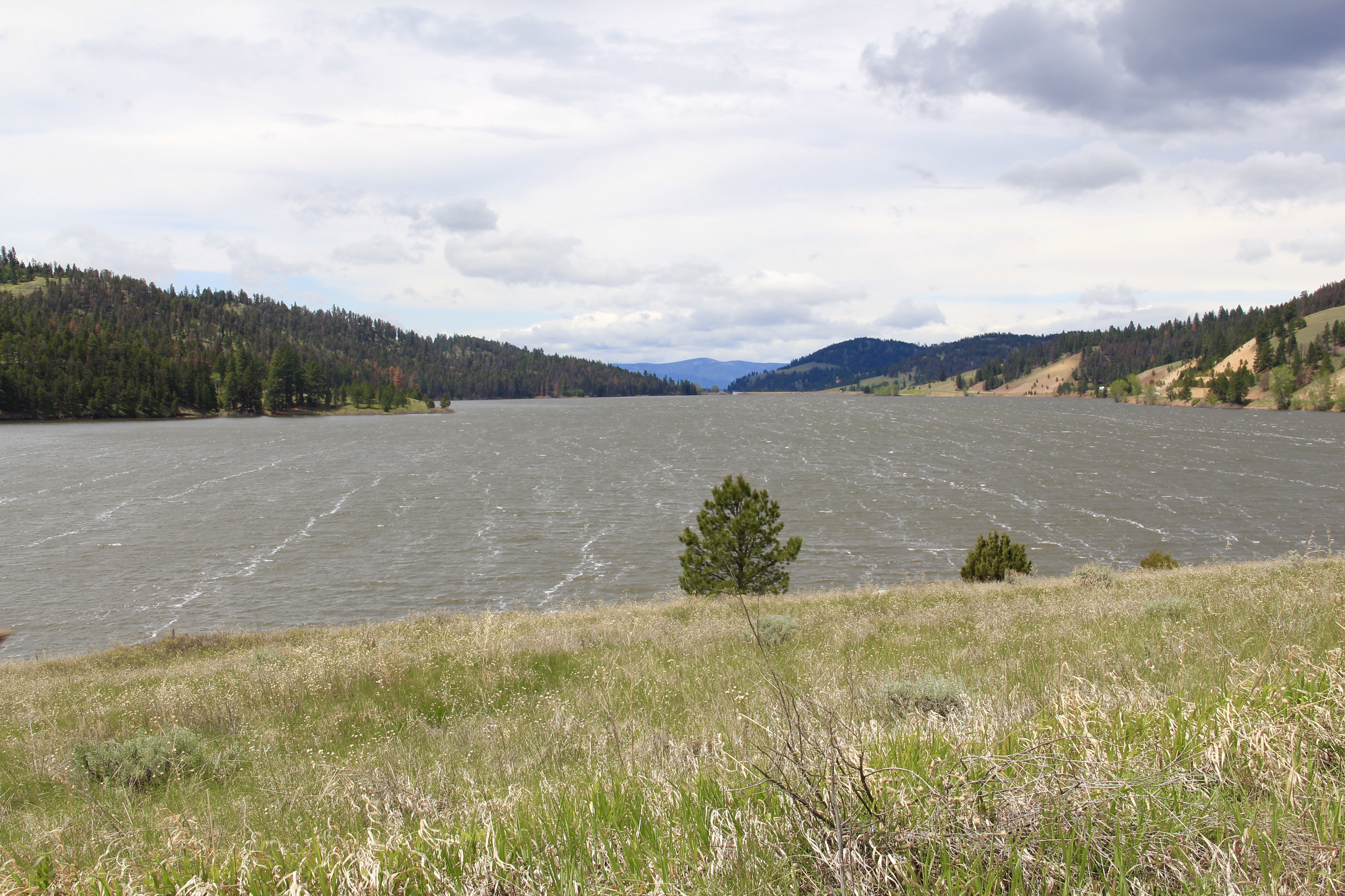
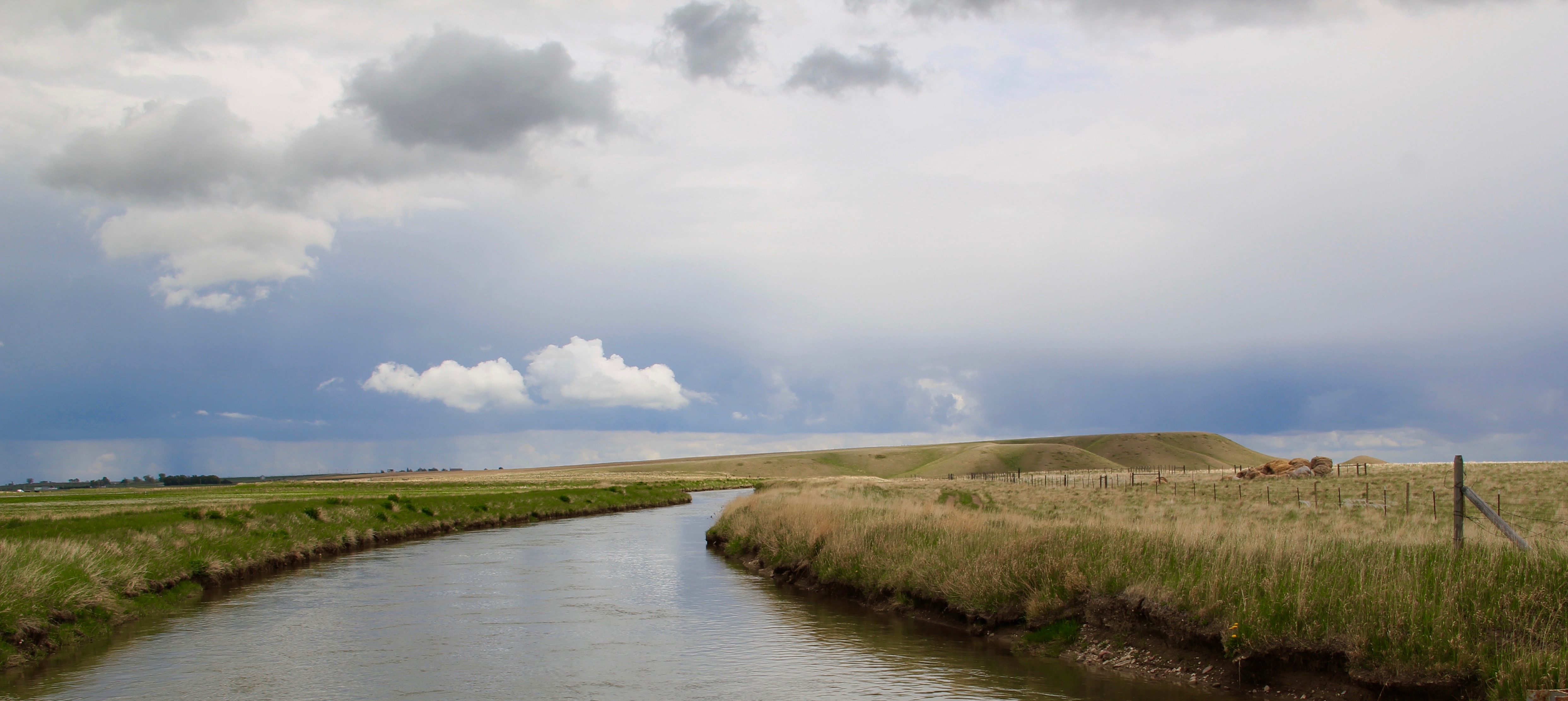
There are no more towns between Dell and Dillon but about halfway there is the Clark Canyon Reservoir, part of the reshaping of the northwest landscape by the U.S. Bureau of Reclamation in the 1960s. The bureau in 1961-1964 built the earthen dam and created the
reservoir, which inundated the small railroad town of Armstead, and led to the re-routing of U.S. Highway 91 (now incorporated into the interstate at this point).
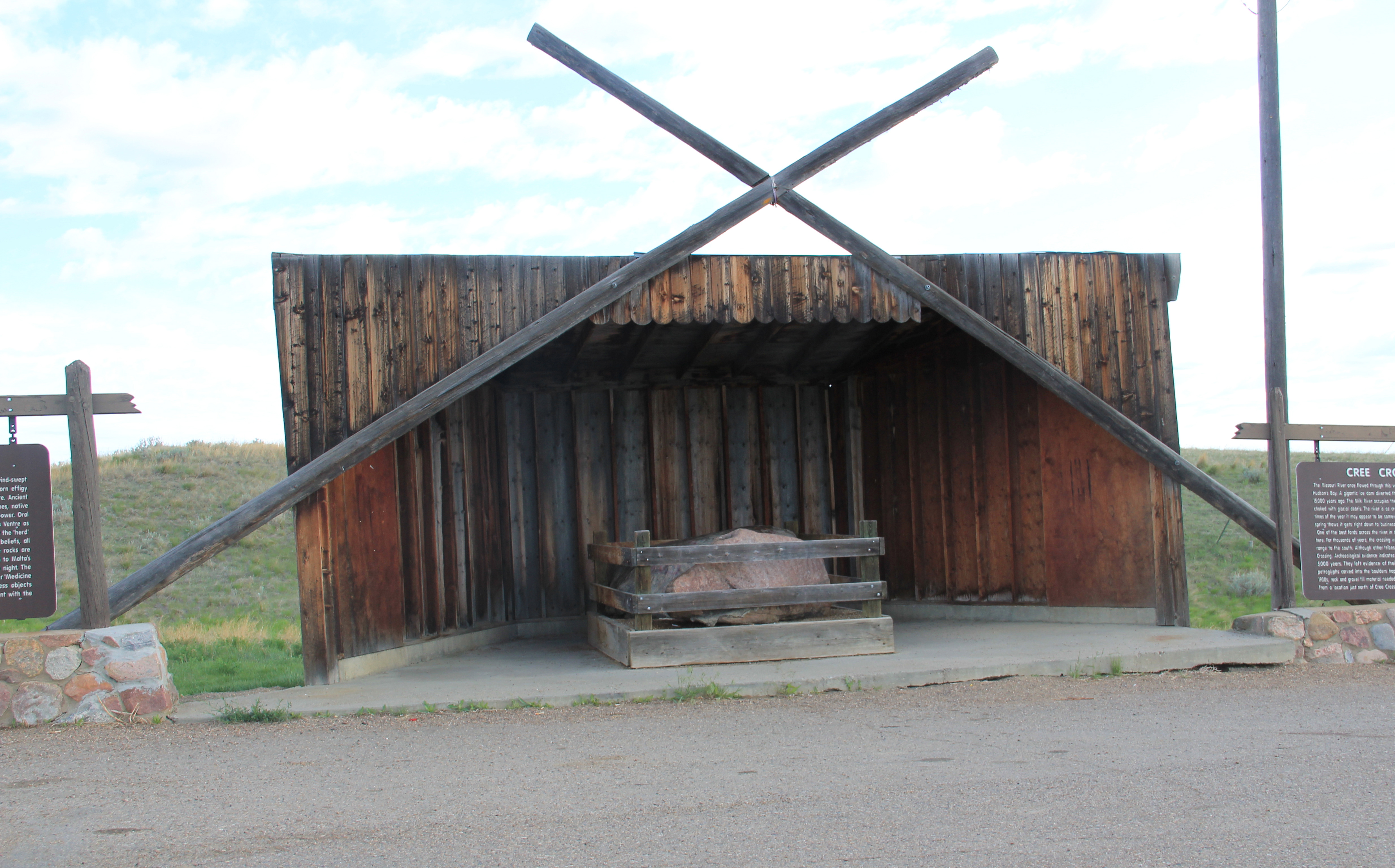
 The reclamation project, which stored water for irrigation, also covered the site of Camp Fortunate, a very important place within the larger narrative of the Lewis and Clark Expedition and its relationships and negotiations with the Shoshone Indians. An early
effort to mark and interpret the site came from the Daughters of the American Revolution, who not surprisingly focused on the Sacajawea story. Reclamation officials added other markers after the construction of the dam and reservoir.
In this century the Lewis and Clark National Historic Trail has added yet another layer of public interpretation in its attempt to tell the whole story of the expedition and its complicated relations with the Native Americans of the region.
North of Dillon along the old route of U.S. Highway 91 and overlooking the corridor of the Utah and Northern Railroad is another significant Lewis and Clark site, known as Clark’s Lookout, which was opened to the public during the Lewis and Clark Bicentennial of the early 21st century.
The lookout is one of the exciting historic sites that have been established in Montana in the 30 years since my initial survey for the state historic preservation plan. Not only does the property interpret an important moment in the expedition’s history–from this vantage point William Clark tried to understand the countryside before him and the best direction to take–it also allows visitors to literally walk in his footsteps and imagine the same perspective.
Of course what Clark viewed, and what you might see, are vastly different–the tracks of the Utah and Northern, then route of old U.S. 91 are right up front, while the town of Dillon creeps northward toward the lookout.
Our last stop for part one of Beaverhead’s country towns is Glen, a village best accessed by old U. S. Highway 91. A tiny post office marks the old town. Not far away are two historic 
North of Glen you cross the river along old U.S. Highway 91 and encounter a great steel tress bridge, a reminder of the nature of travel along the federal highways of the mid-20th century.


 City as one large tourism funnel. After spending a good part of 2006-2007 working with local residents and the Great Smoky Mountains National Park about the heritage and preservation of Gatlinburg, Tennessee–one of the most notorious gateways into any national park–I learned to look deeper than the highway landscape and find some real jewels in each of these Glacier National Park gateway communities.


 At Hungry Horse, however, I did leave the highway and explored the marvelous landscape created by the Hungry Horse Dam and Reservoir, a mid-20th century project by the U.S. Bureau of Reclamation. The agency justified the dam as a hydroelectric power project for a growing Flathead County and as a boost to local irrigation. The irrigation side of the project–the real reason the agency exists–never happened and Hungry Horse today is an electric power and recreational project.
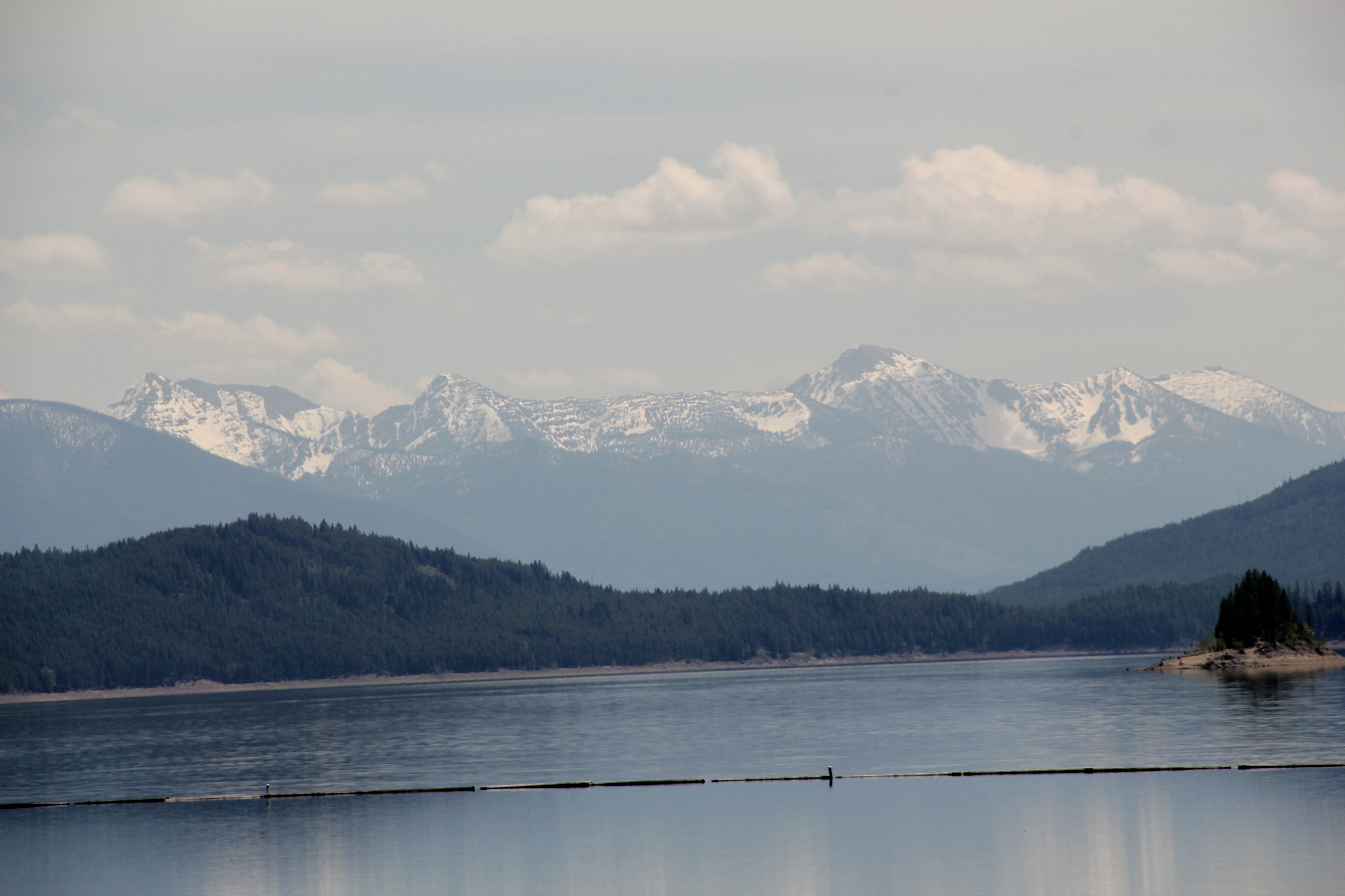 I appreciated the vastness of the concrete arch dam–the 11th largest concrete dam in the United States–as well as the beauty of Hungry Horse Reservoir, an under-appreciated tourism asset as anyone in Flathead County will tell you. But again, I let just the size and impact of the dam distract me from some of the details of its construction that, today, are so striking.


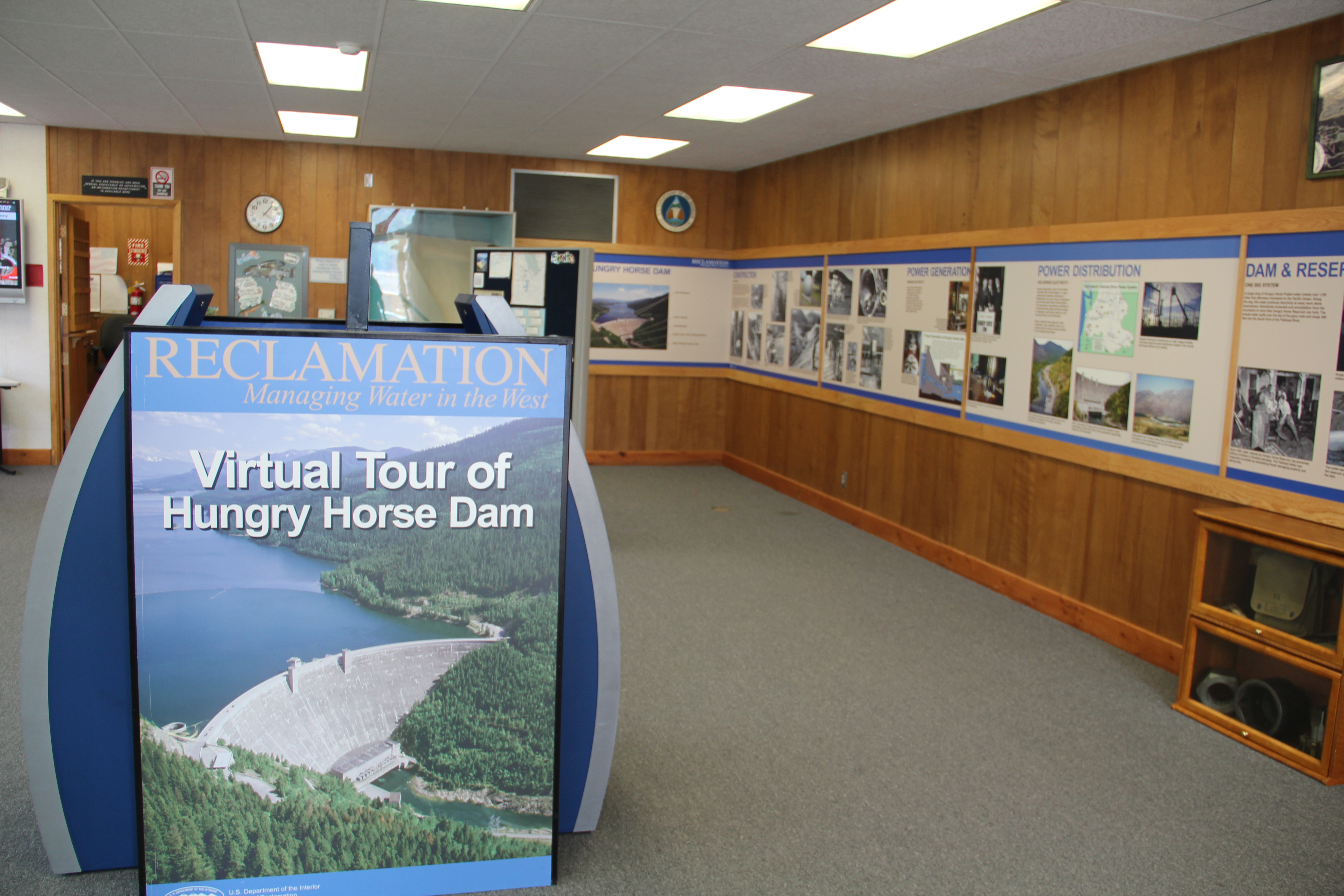 I am concerned, however, about news in September 2015 that Reclamation has contracted for updates and renovation at the Visitor Center–let’s hope that the classic 1950s look of the property is not sacrificed.


 Architect Kirtland Cutter of Spokane was the architect and the chalet design was actually just a smaller scale and less adorned version of the Idaho State Exhibition Building that he had designed for the 1893 World’s Fair in Chicago. Cutter is one of the major figures of the Arts and Crafts Movement in the American Northwest and we will look at another of his buildings for the railroad and Glacier in the next post about Lake McDonald Lodge.


 Montana Highway 141 cuts north from Avon On U. S. Highway 12 to halfway between the towns of Ovando and Lincoln on Montana Highway 200. Its is high mountains prairie travel at its best, although the height of ranching along this route disappeared a while back. About 12-13 miles north of Avon you cross into the Nevada Creek drainage, which has long watered the land, enhanced after the New Deal added the Nevada Creek earthen dam that created Nevada Creek Reservoir in 1938.
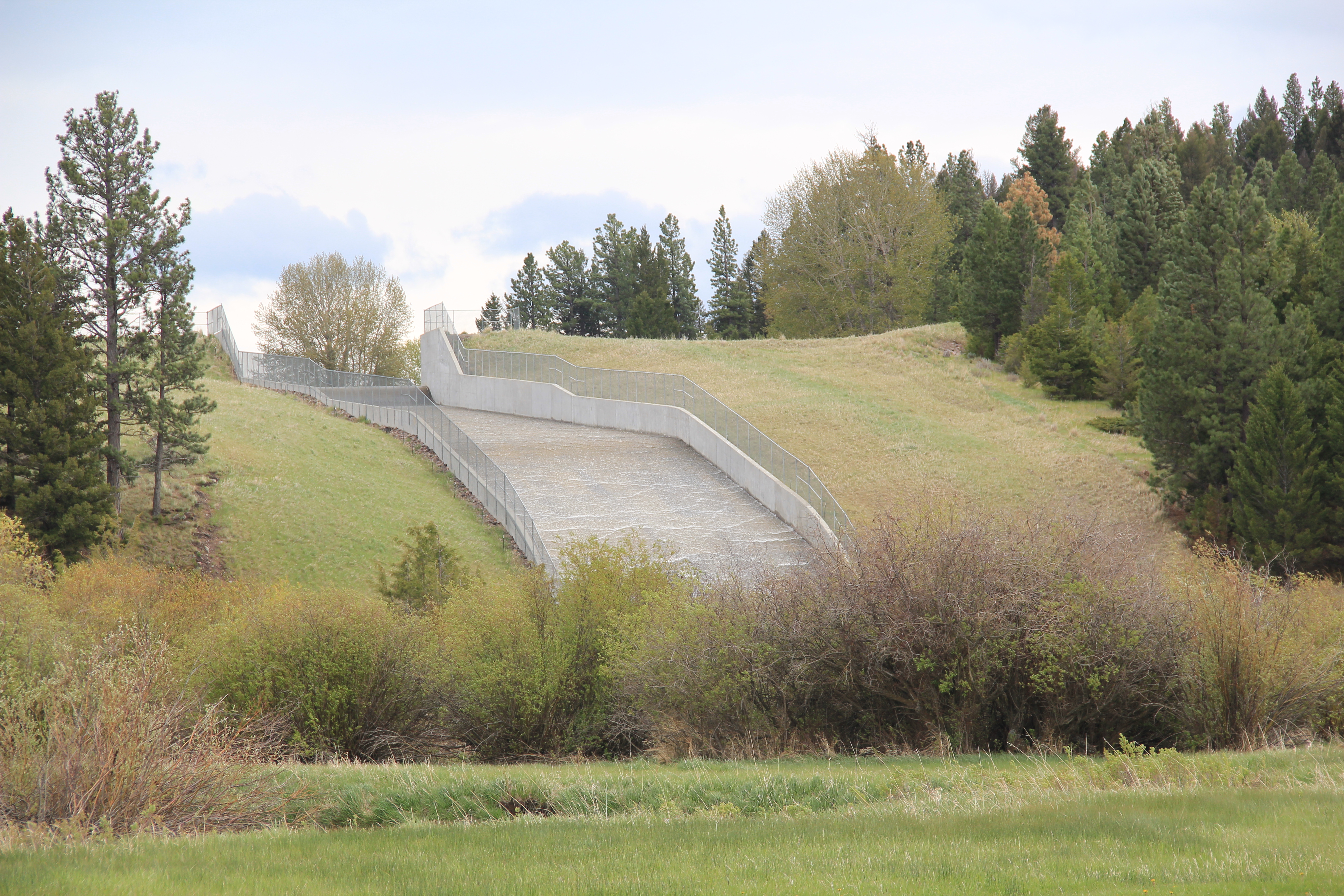
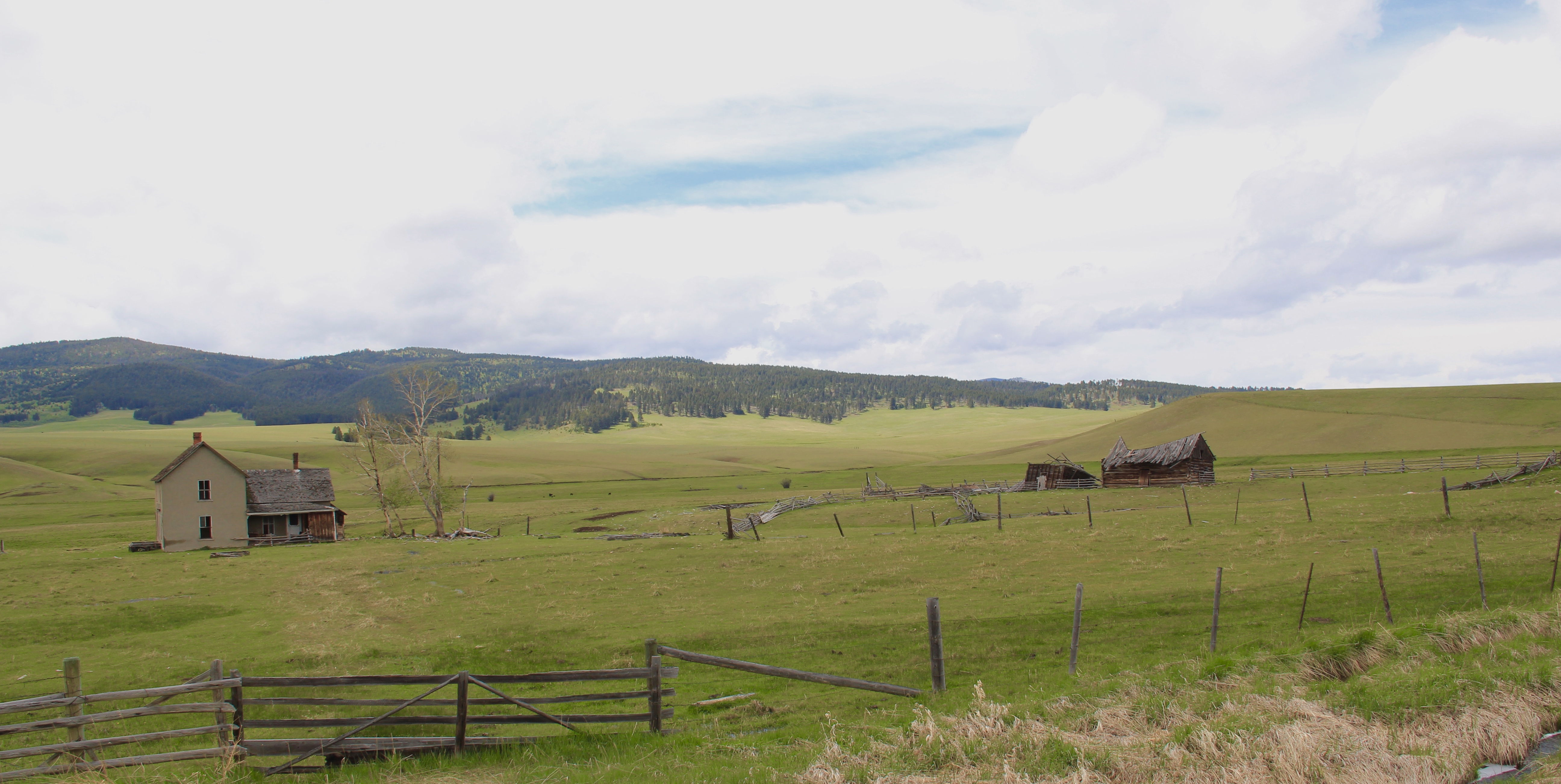
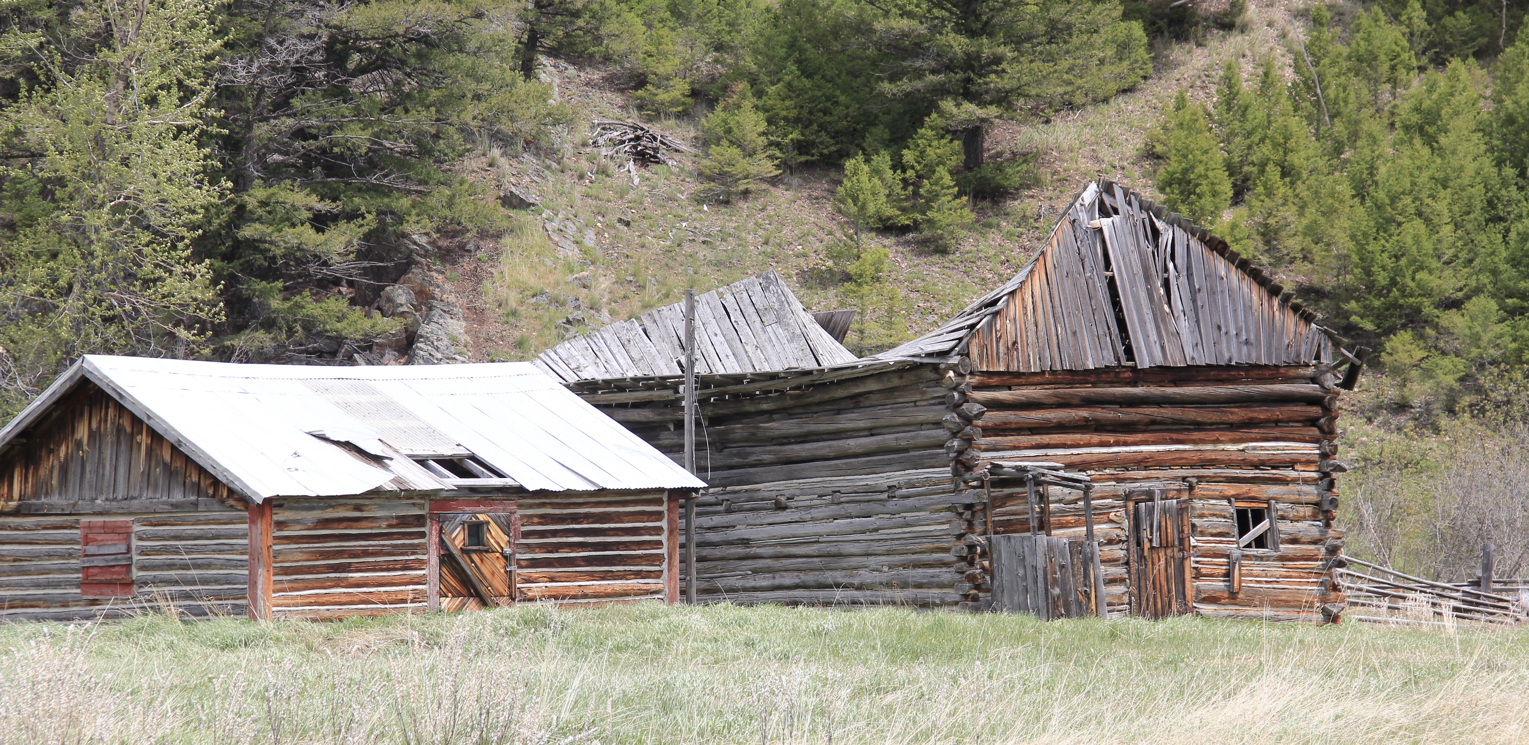
 Along the east banks of the lake are remnants of the Fitzpatrick Ranch, which is listed in the National Register of Historic Places. I highlighted the property in my book A Traveler’s Companion to Montana History (1986). Jimmy Isbel established the property in 1872,
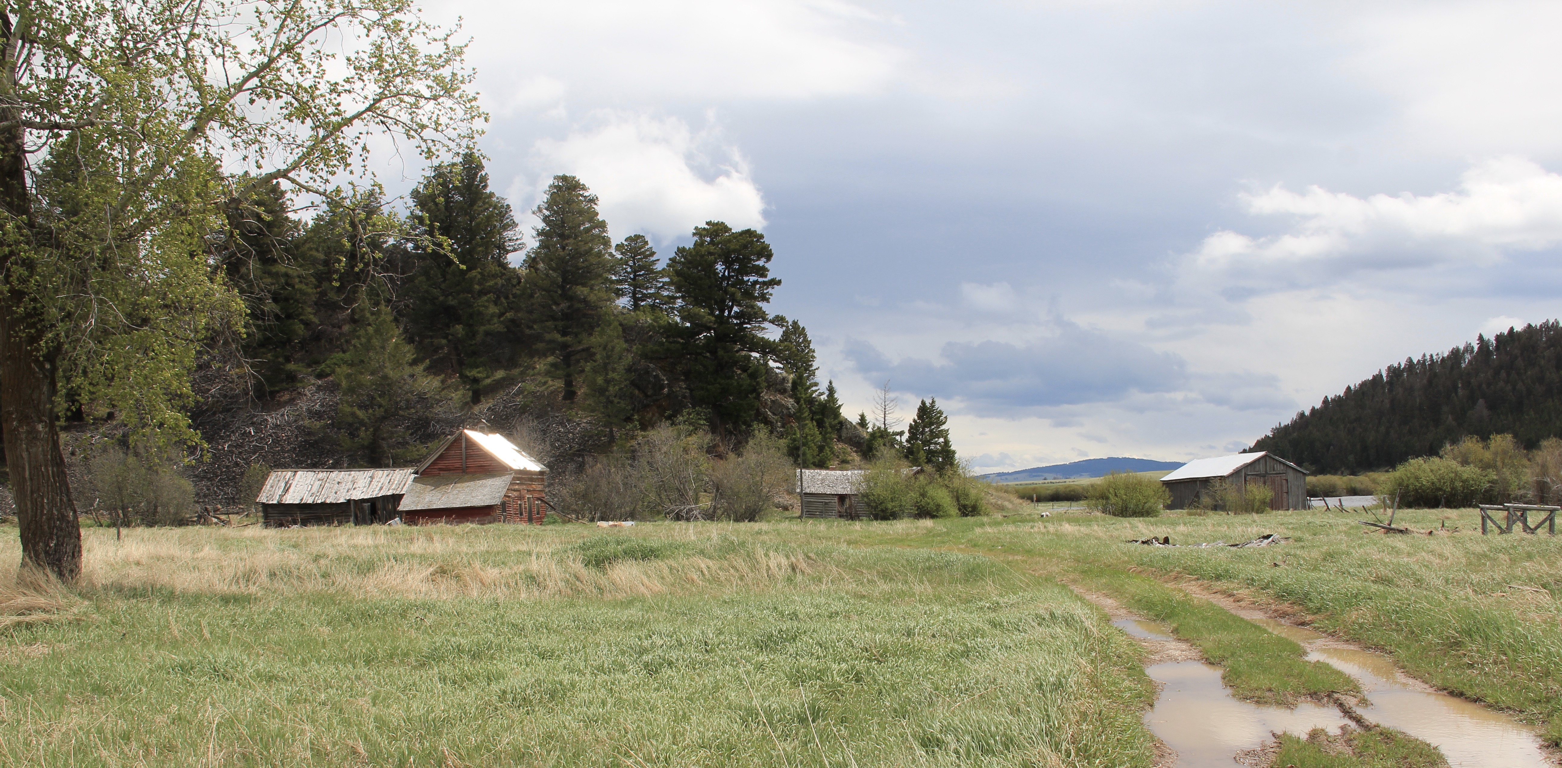 Thirty years ago, this significant collection of vernacular buildings was in good condition, but the years since have been hard on the property, and the complex now needs serious preservation attention. The loss of the roof on the log barn, and the general poor condition of the roofs of the outbuildings are major concerns.
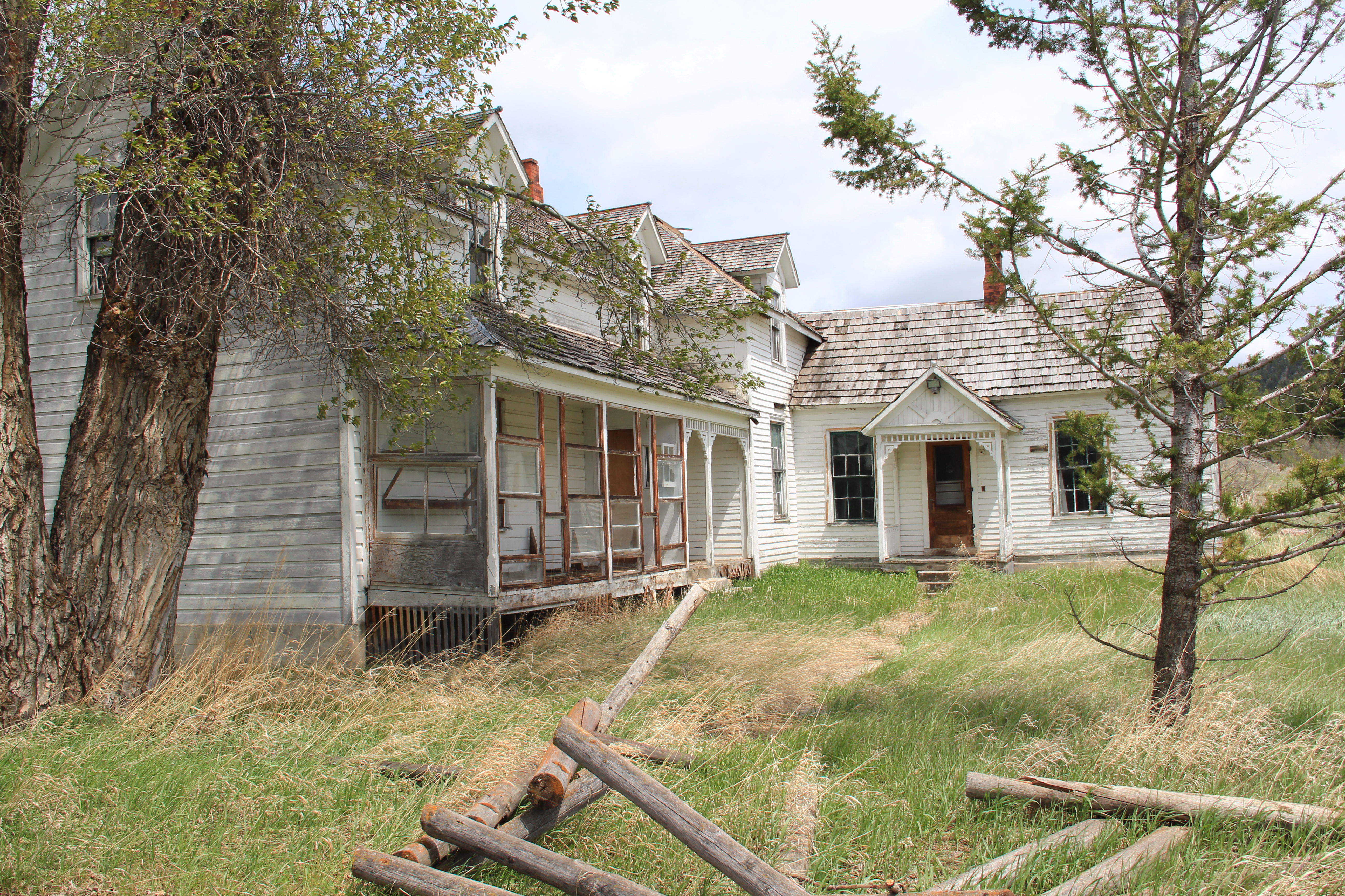

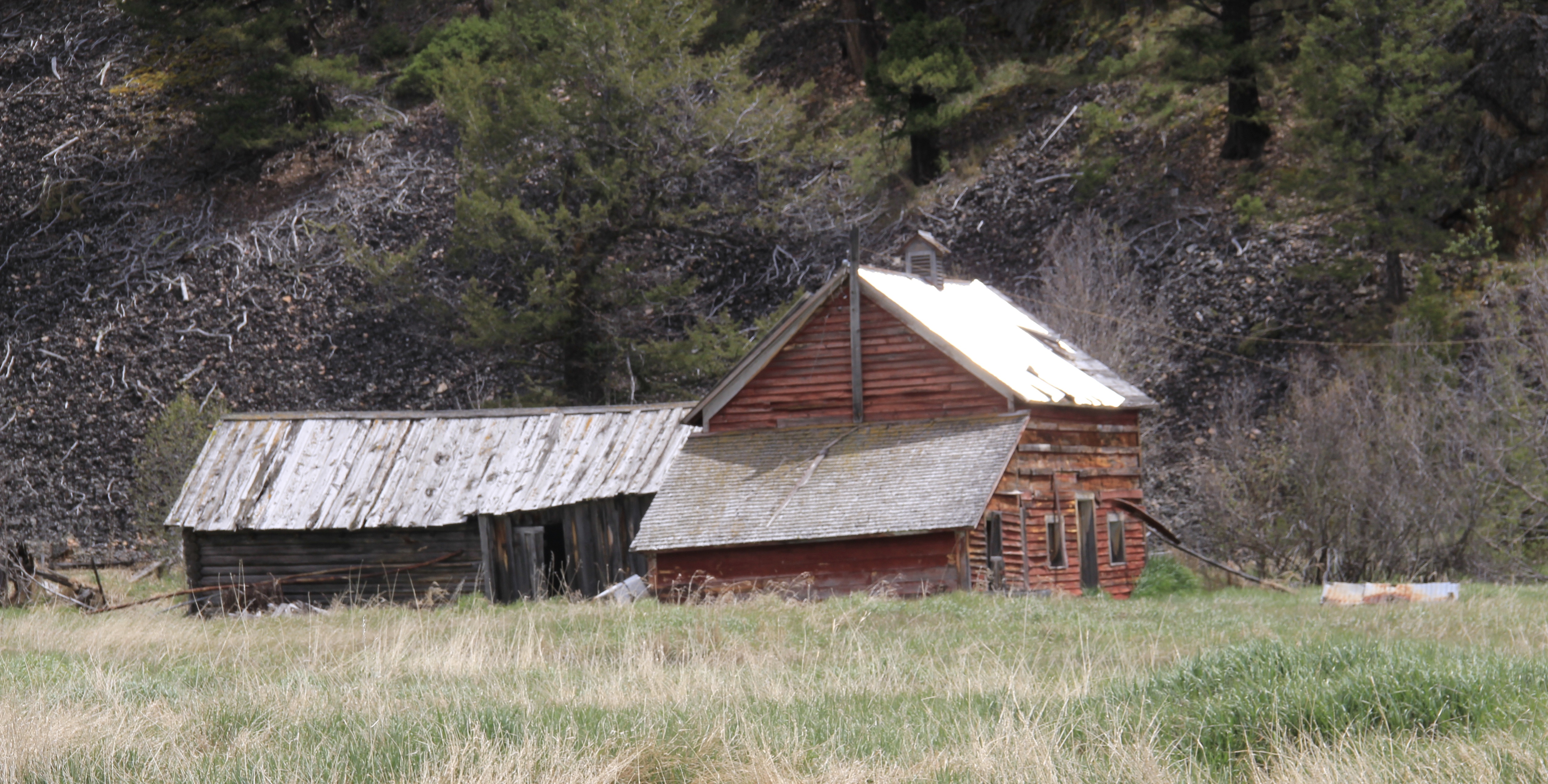 Between the Fitzpatrick Ranch and Helmville is the Barger Ranch, also from the late 19th century judging from the more polished example of Queen Anne style in the ranch house. It is living proof that not all of the Nevada Creek ranches have passed away. The Nevada Creek Water Users Association at Helmville still operates to distribute the invaluable water from the reservoir.
 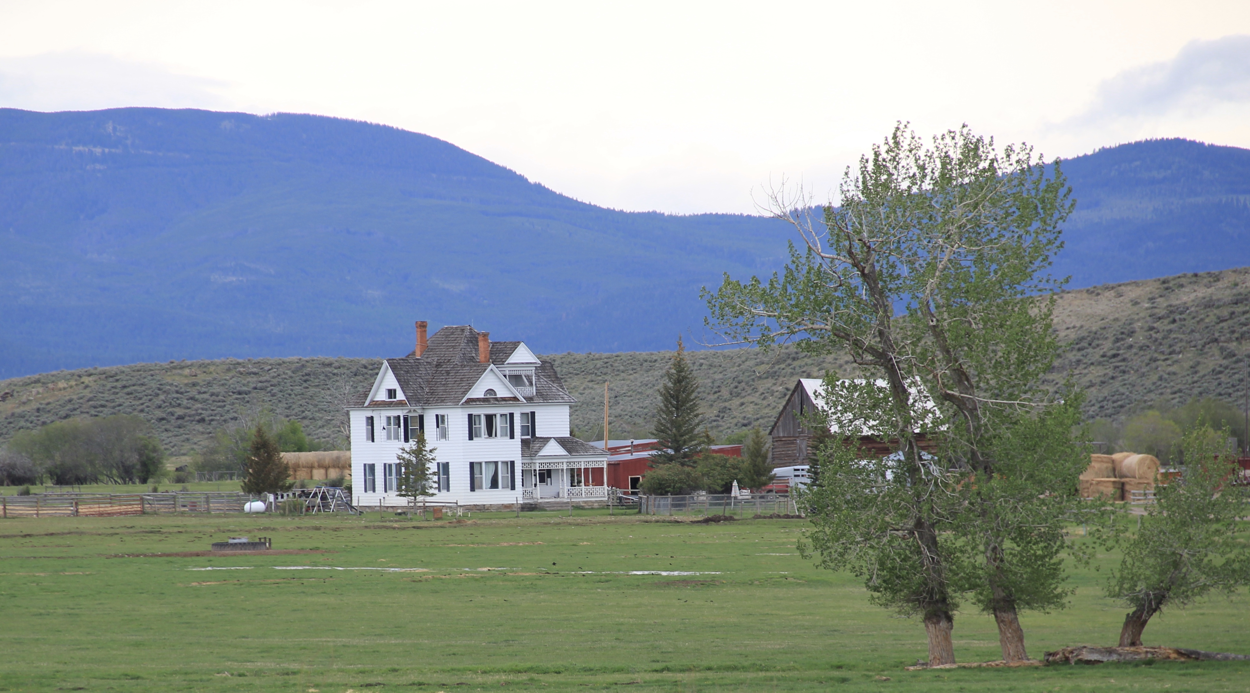 Helmville was another topic in my 1986 book. Throughout the Nevada Creek drainage, you could help but be impressed with the log construction, and the various types of notching used for the buildings. Helmville had a particular interesting grouping of wood frame and log buildings, which were highlighted by a 1984 photograph in the book. That exact view could not be replicated 30 years later but several of the old buildings still stood.
 Helmville has a good bit of continuity. Along with the row of buildings on Montana 271 there is a turn of the 20th century gable-front cottage and a two-story lodge building that has been turned into a garage.


 Trixie’s was the same fun dive that I always recalled, but the village’s historic buildings had been restored, looking good. Business appeared to be brisk. A new community church has been opened, and a major interpretive place for the “Lewis Minus Clark” expedition had been installed. Kudos to both the U.S. Forest Service and the Lewis and Clark National Historic Trail for allowing a bit of humor in this marker.


 The school had also expanded from its New Deal core of the 1930s, courtesy of the Works Progress Administration. But the most noticeable change was the town’s street signs–first the fact that a small place had street signs but then the nostalgic backpacker theme of these cast iron marvels.
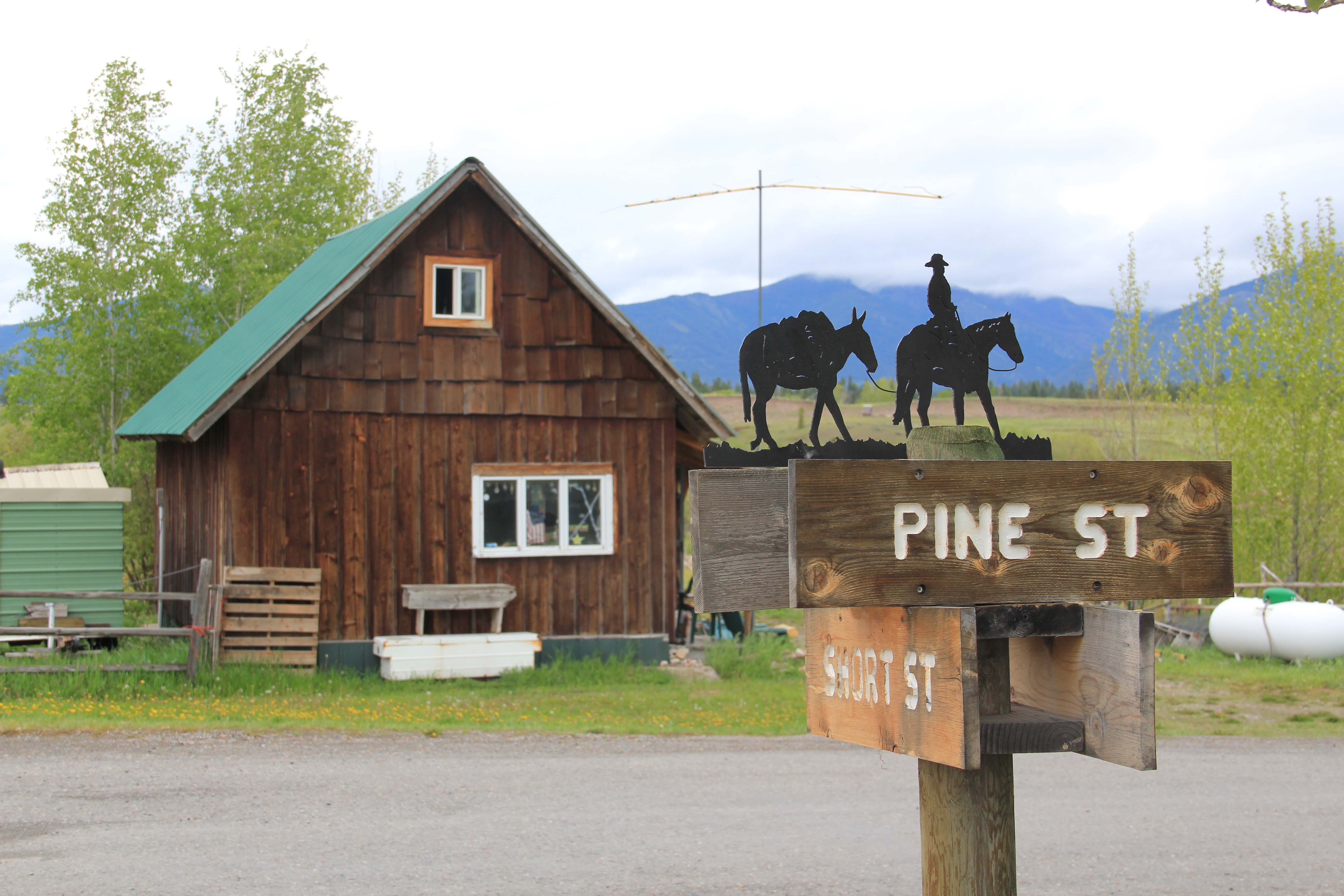 Ovando is a good location on the Blackfoot River for sportsmen, anglers, and hikers headed into the Bob Marshall Wilderness–its recent change demonstrates the influence on those groups on the 21st century Montana landscape.


 For travelers along Montana Highway 287 the villages of Laurin and Alder are a mere diversion as you motor along from Sheridan to Virginia City. From those towns the Ruby River winds into the mountains, and they were the “end of the line” for the railroad spur that tied the southern part of Madison County to the state’s rail system. About two miles south of Sheridan is a former late 19th century Queen-Anne style ranch house that now houses the Ruby Valley Inn, a bed and breakfast establishment.
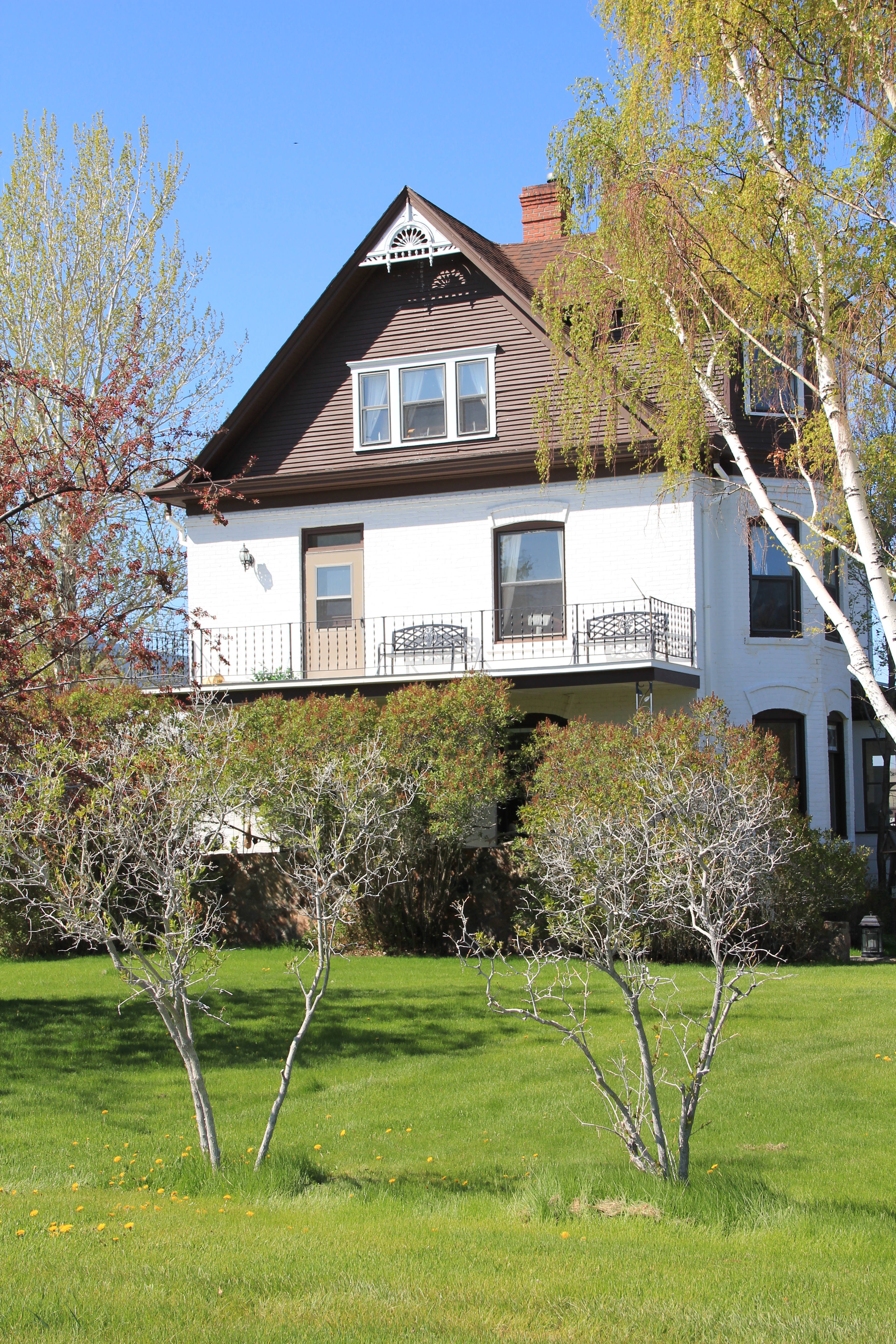
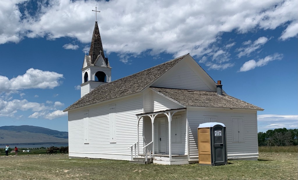
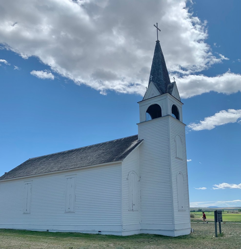
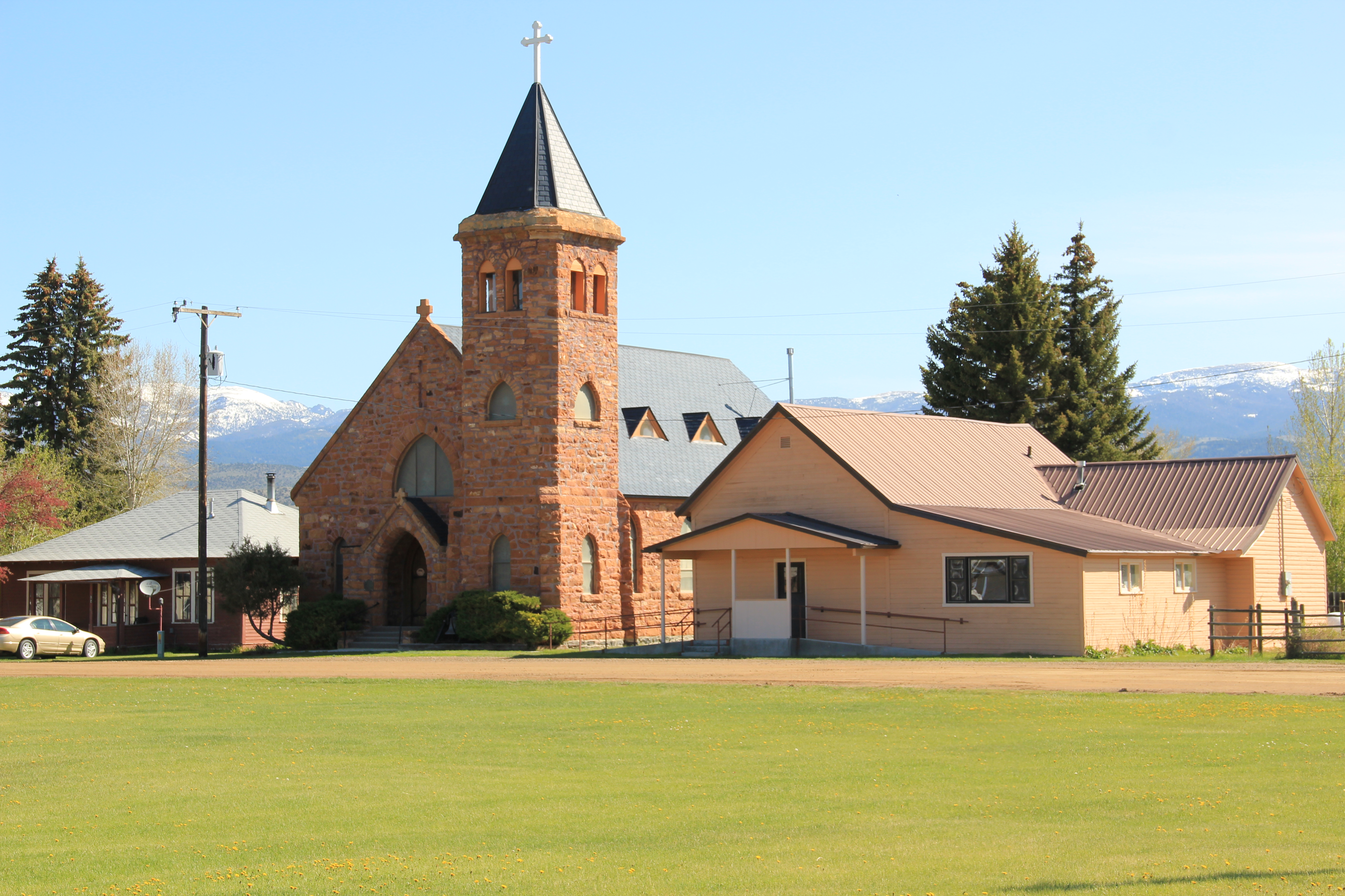 At Laurin, St. Mary of the Assumption Catholic Church is a major Ruby River Valley landmark. It roots the settlement history of this place deep in the valley; John Batiste Laurin, for whom the village is named, established the place in July 1863. The church is listed in the National Register of Historic Places. Laurin was never large and a few repurposed commercial buildings indicate that. The historic Laurin School is now a private home, an excellent example of adaptive reuse of a historic rural school.
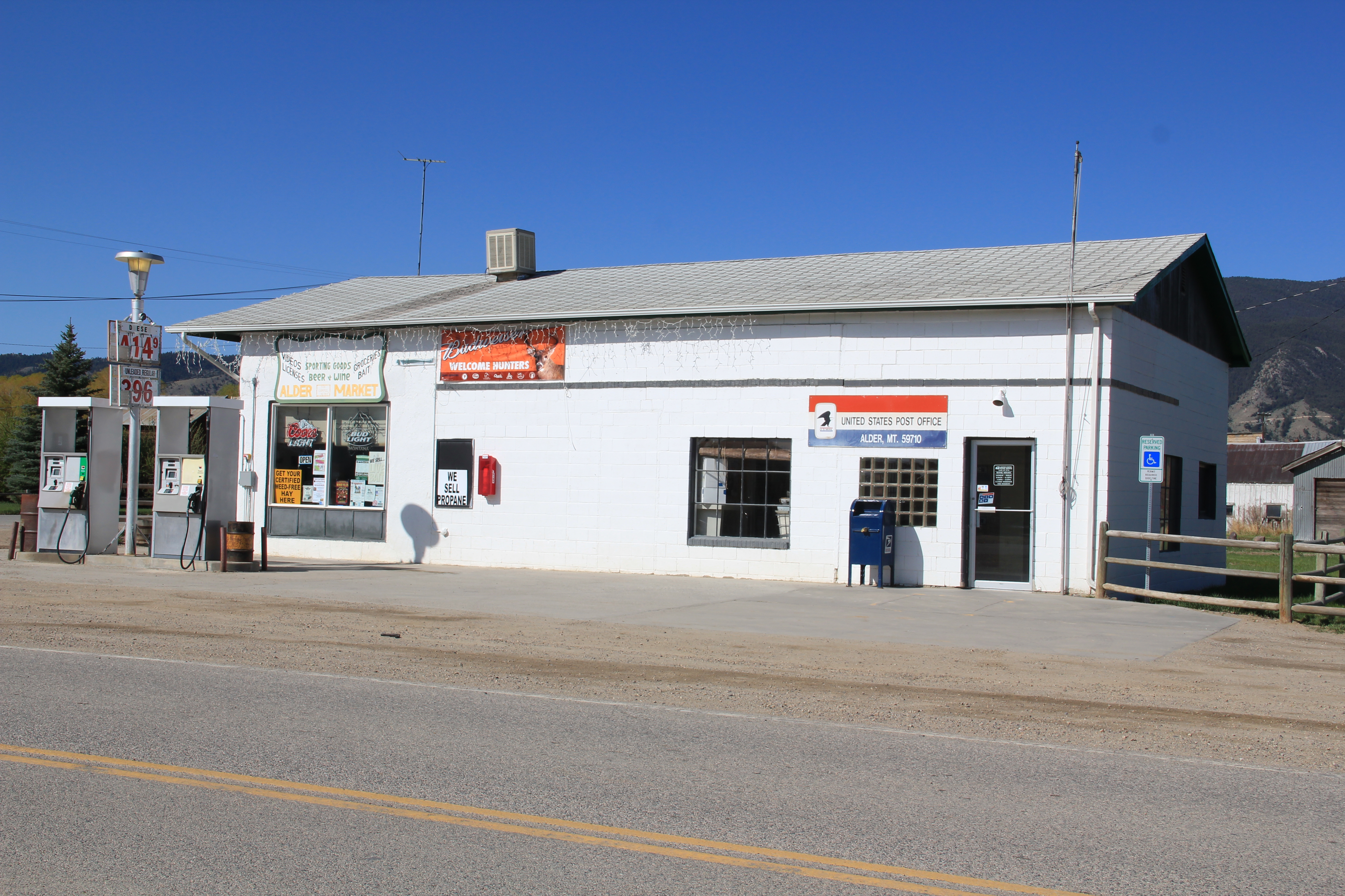
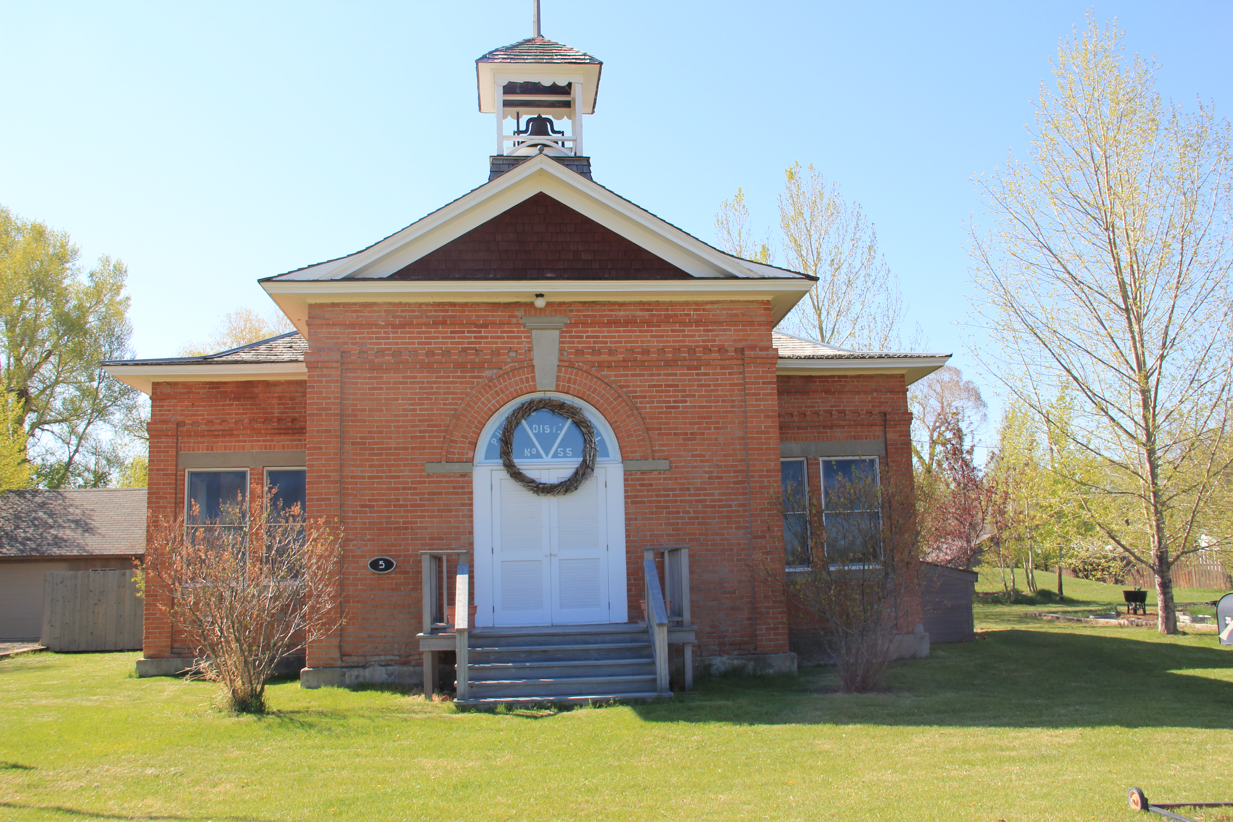 While Laurin has a reserved, calm feel to it, Alder feels like the highway road-stop it has been for decades. Its historic brick school is not as architecturally elaborate as Laurin but in 2012 it was still open and serving local students.
 Other commercial buildings from the early 20th century were now abandoned, including the eye-popping, yellow-painted false front bar and steakhouse, which I understand has moved its business elsewhere since 2012.

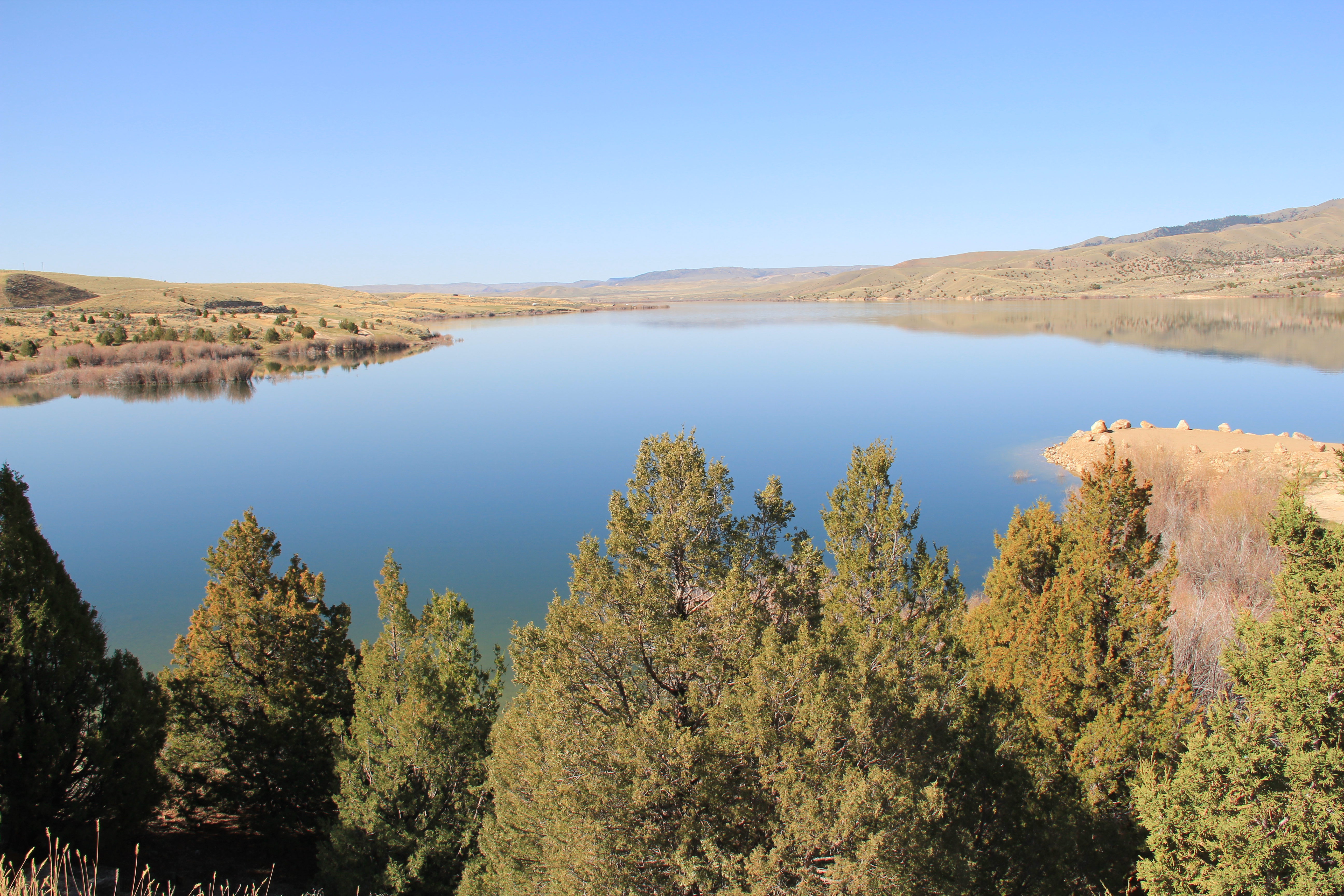
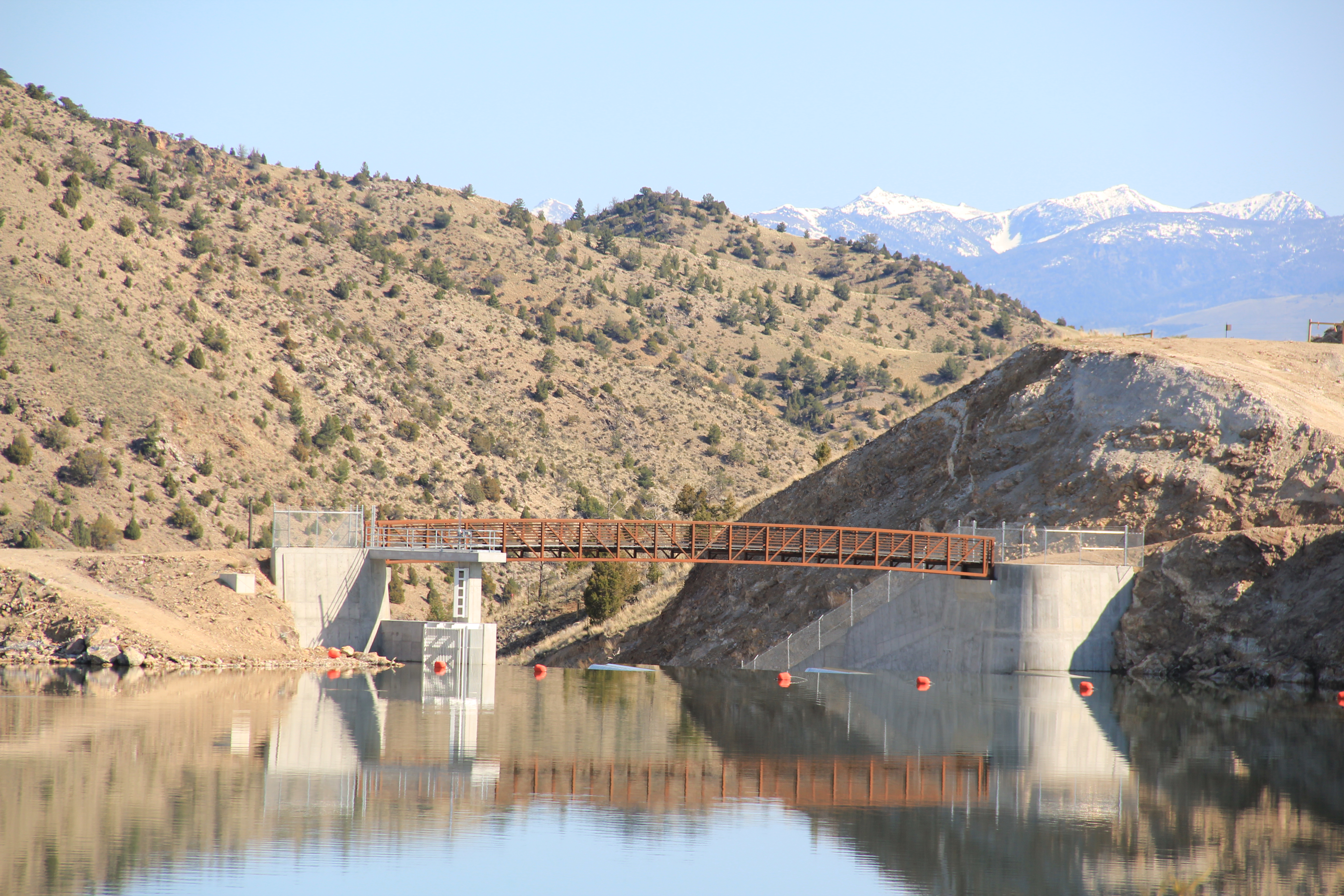
 At Alder you can go south on Montana Highway 357 and follow a good, paved road to the Ruby Dam and Reservoir. Part of the New Deal’s contributions to reshaping rural Montana through new or expanded irrigation projects, the Ruby Dam is not an awe-inspiring engineering feat on par with Fort Peck Dam. But the views are striking and here is another engineered landscape created by mid-20th century irrigation projects from the Bureau of Reclamation.
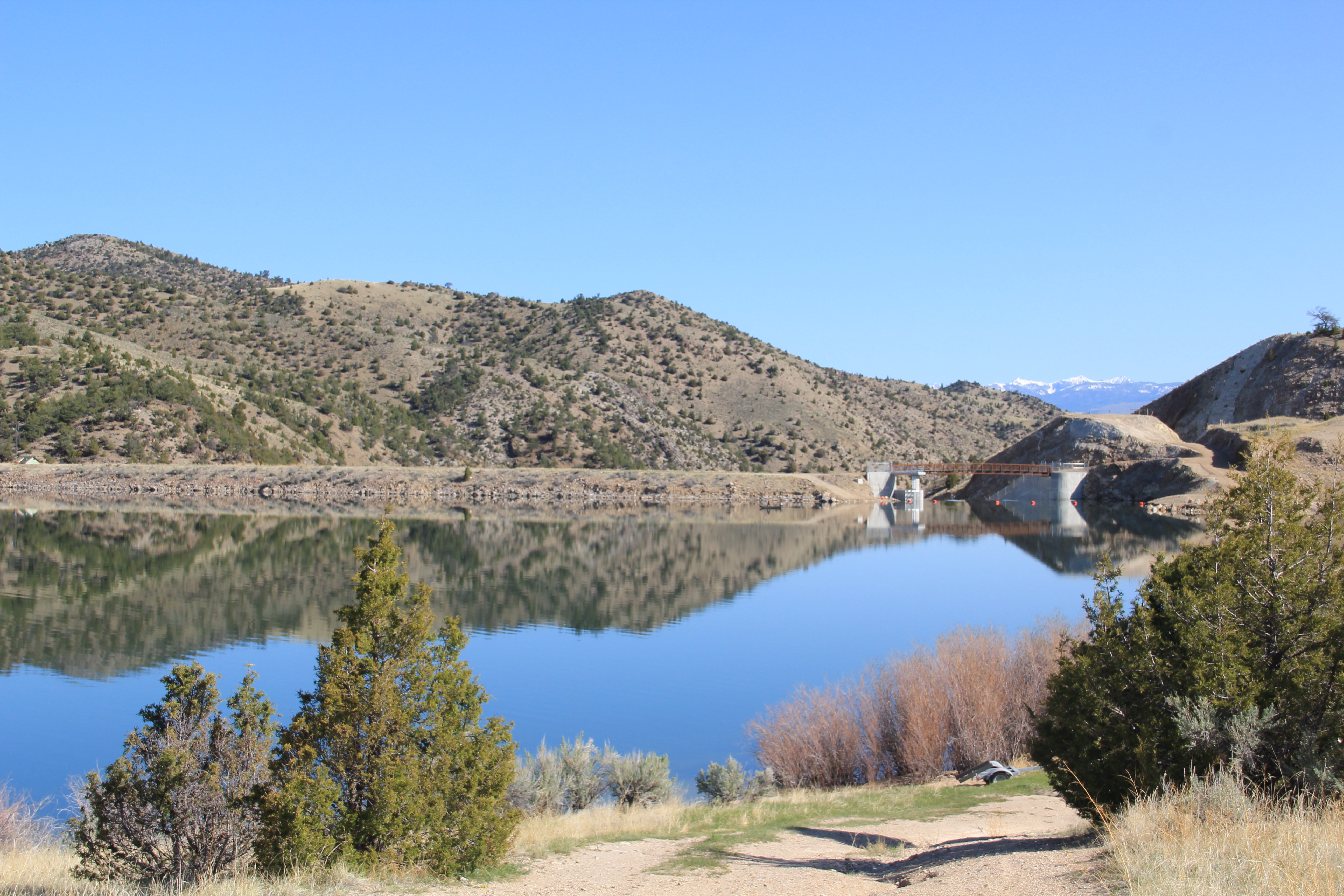
 Back on Montana 287 is one of the first log buildings that I visited in Montana, known as Robber’s Roost. Listed in the National Register, this two-story log building dates to 1863, constructed by Pete Daly as a road house for travelers to the Virginia City mines. Tradition has it that it also became a hang-out for road agents who stole from travelers, thus the name. It is an important part of the vernacular log construction tradition of the territorial era in Montana history.
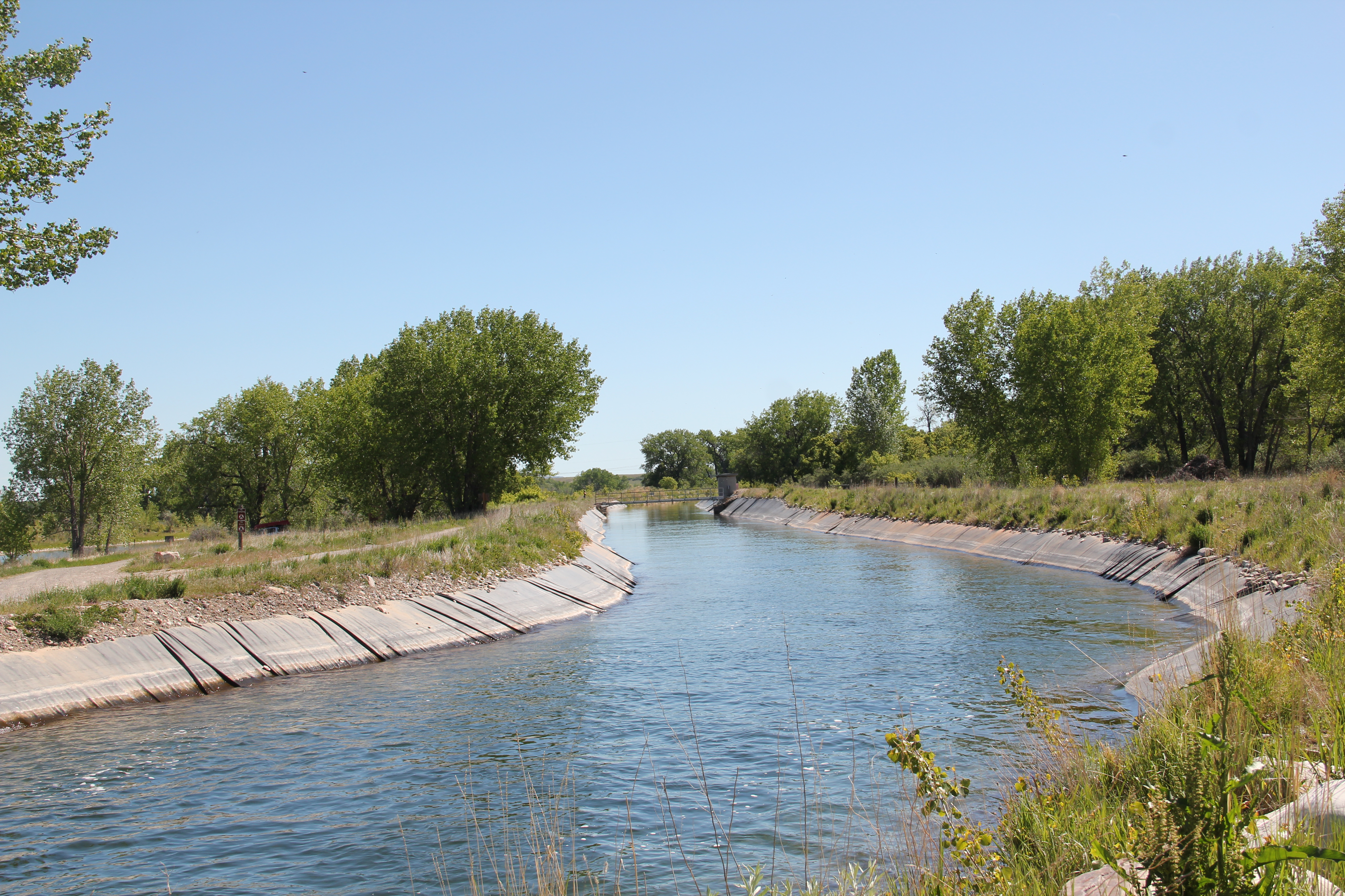
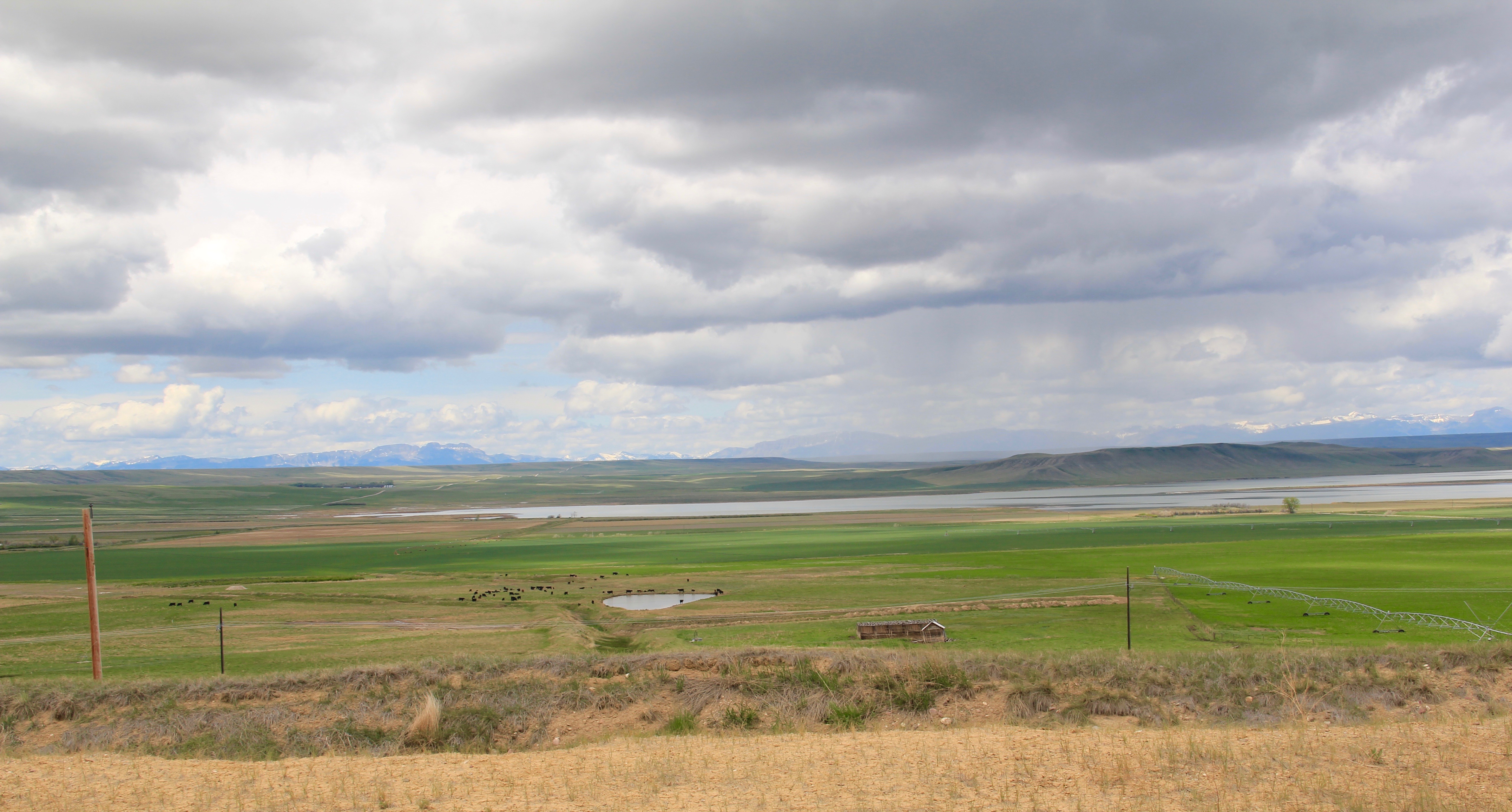
 We just finished an exploration of U.S. Highway south from Great Falls to Livingston, the gateway to Yellowstone National Park. Now let’s head in the opposite direction, north of Great Falls to Glacier National Park. In the first half of this trek, one great man-made landscape dominates either side of the road–the Sun River Irrigation Project, established by the U.S. Bureau of Reclamation in 1906 but not completed until the late 1920s.

 Feeding in and out of Fairfield are multiple canals and ditches, with the great bulk of land devoted to the production of malting barley, under

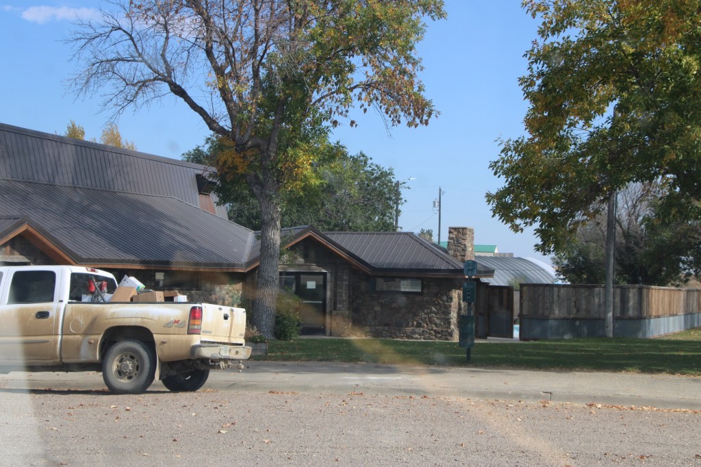
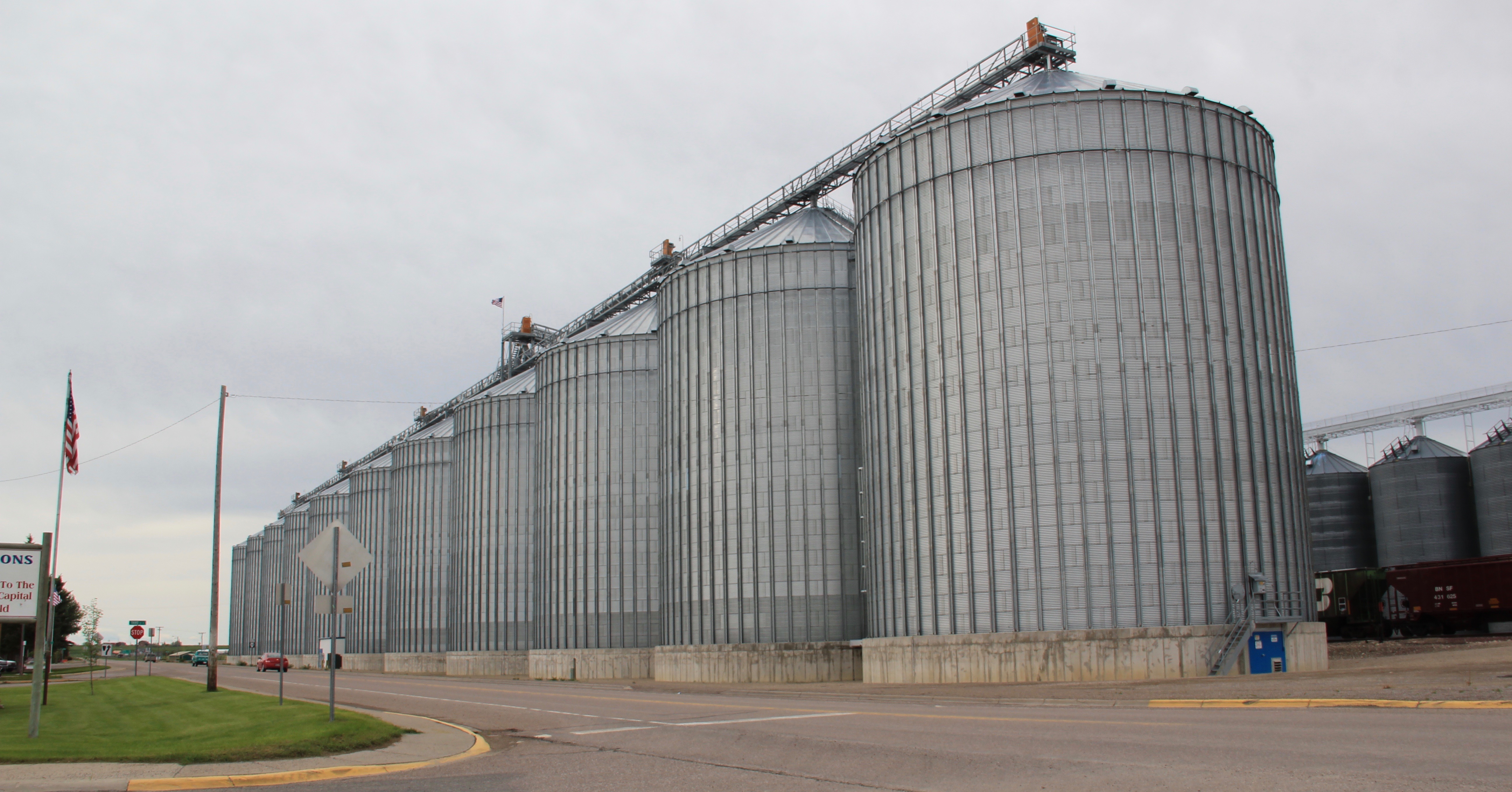 Fairfield itself is a classic T-plan railroad town. The barley granaries dominate the trackside, where also is located the headquarters for the Greenfields Irrigation District, so designated in 1926.
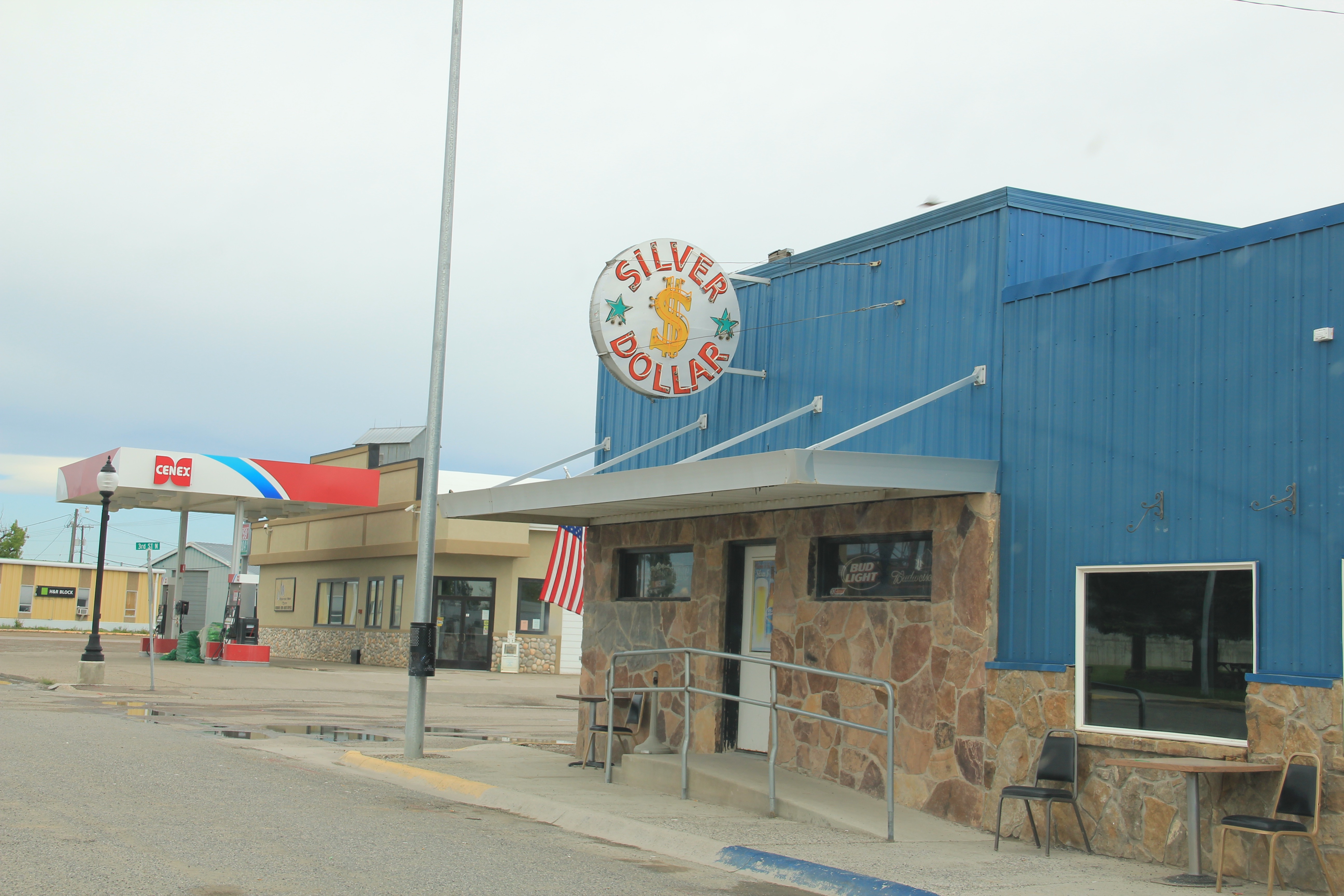
 Along the stem of the “T” plan are all of the primary commercial buildings of the town, from an unassuming log visitor center to various one-story commercial buildings, and, naturally, a classic bar, the Silver Dollar.


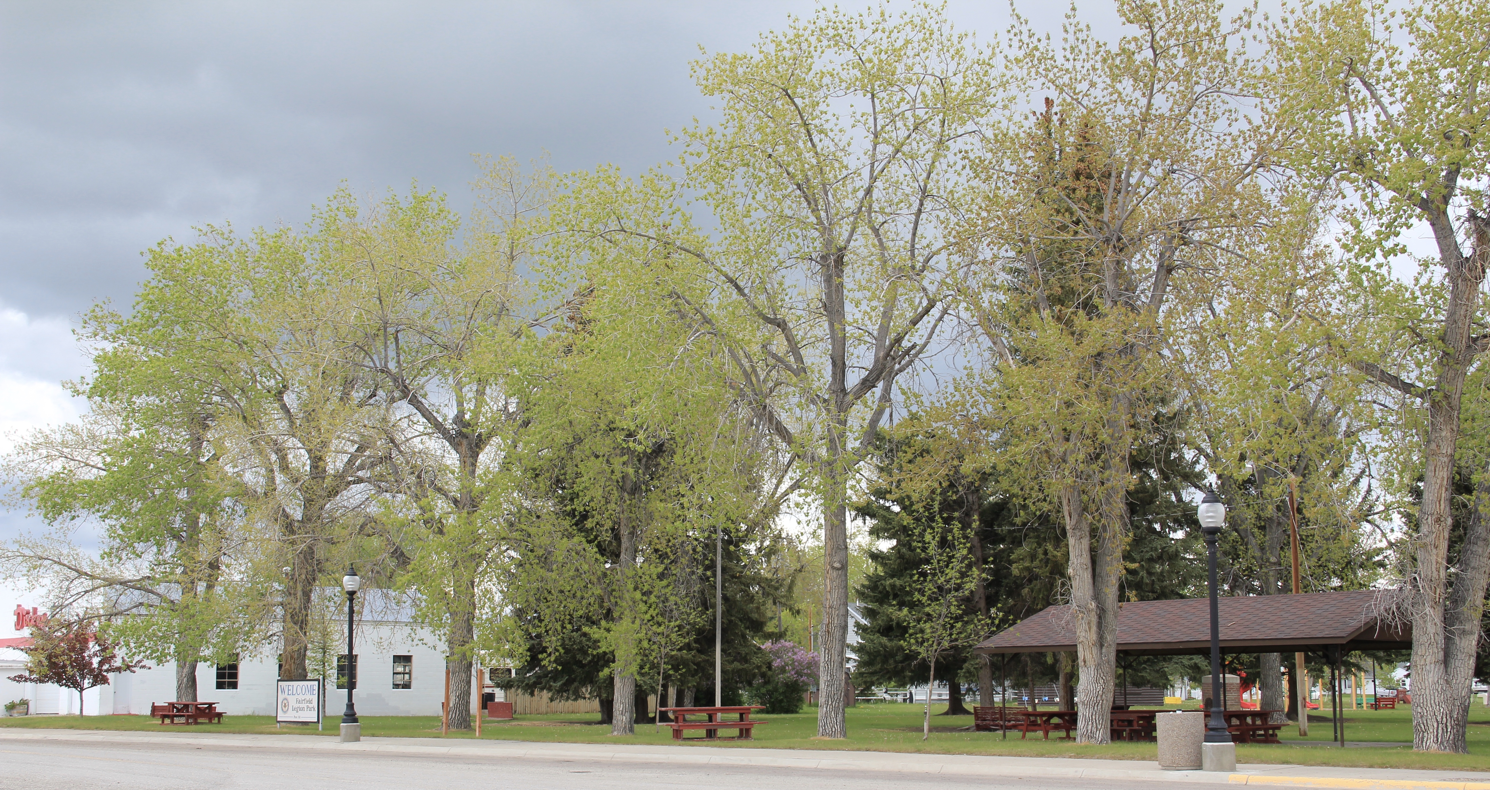
 Public spaces and institutions are located at the bottom of the “T,” including a community park and swimming pool, a c. 1960 community hall, and an Art-Deco styled Fairfield High School. The park, pool, and high school were all part of the second period of federal improvement at Fairfield during the New Deal era.