The Sweet Grass of the Yellowstone Valley

IMG_6258

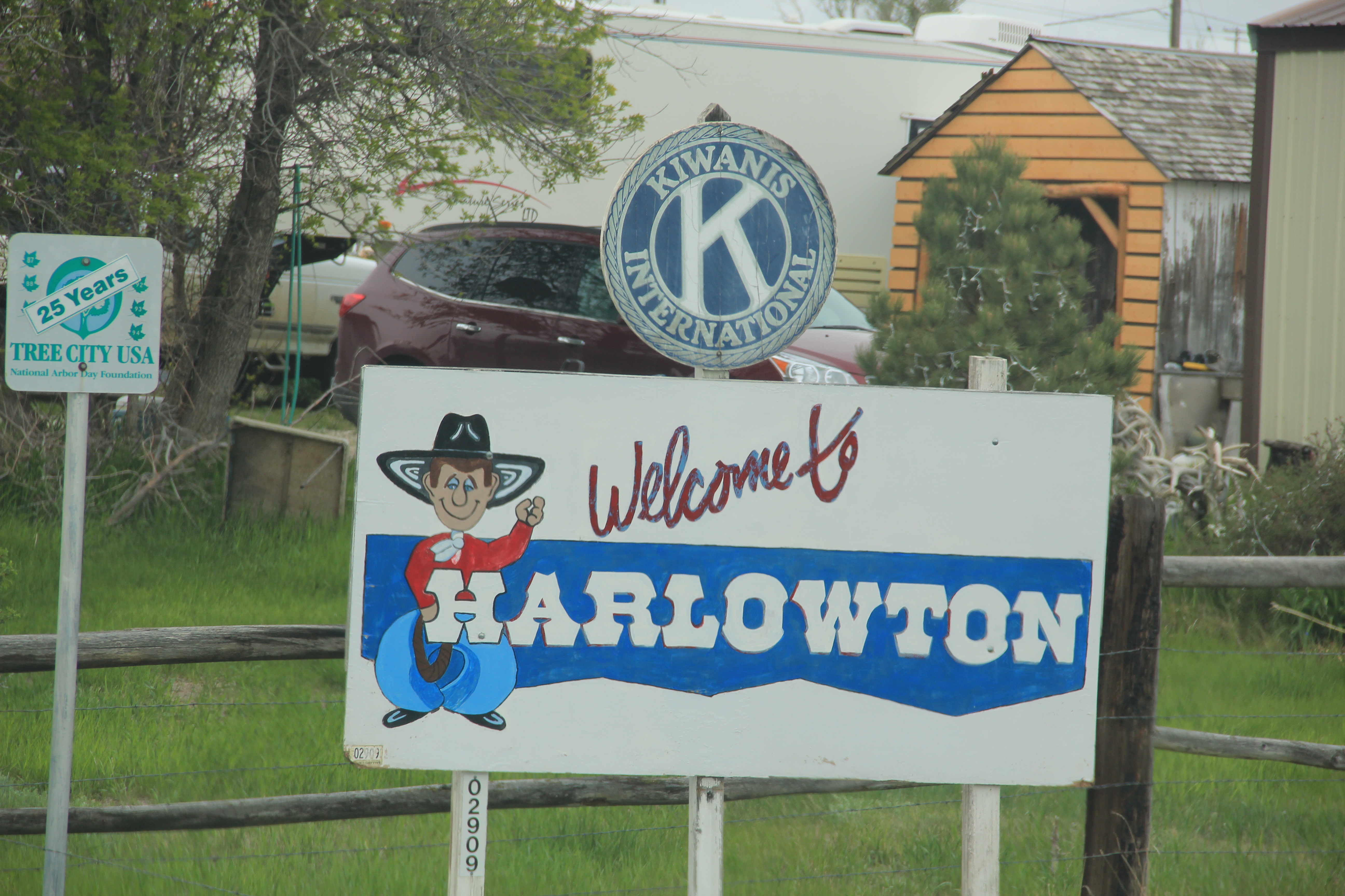
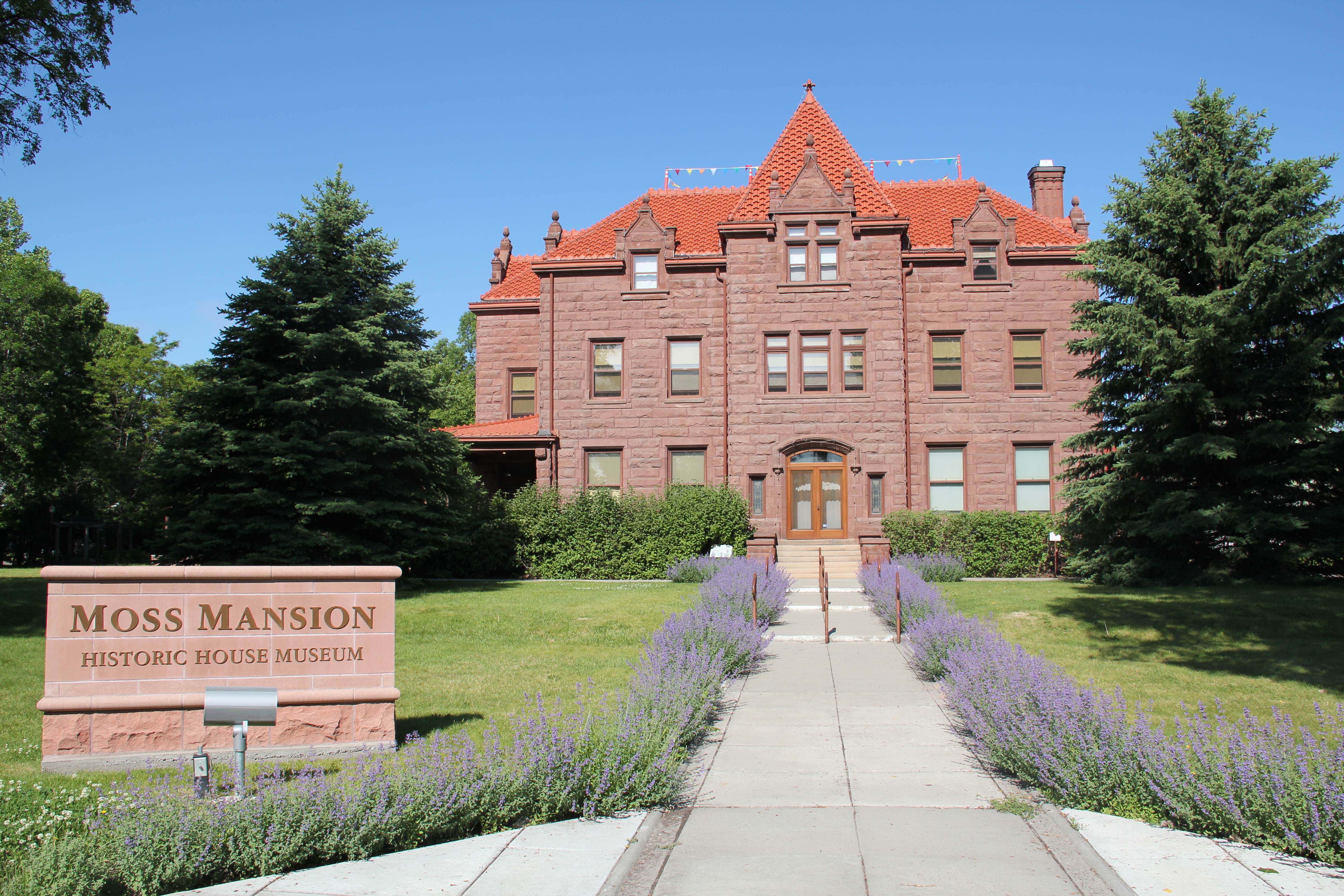
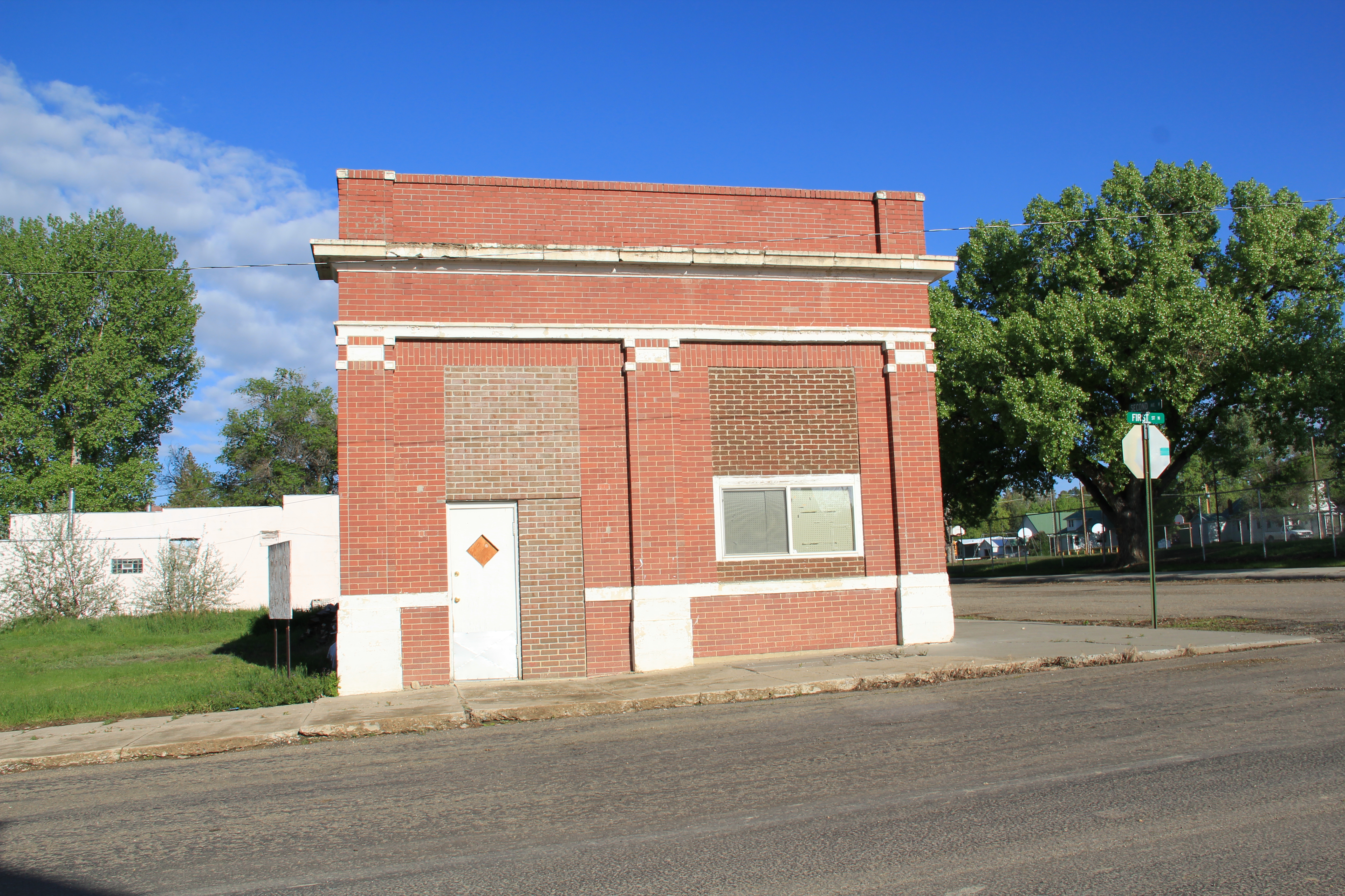
Sweet Grass County has one of the most spectacular landscapes of the entire state of Montana.  Located in the middle of the Yellowstone Valley, the county has long been a significant crossroads, from the prehistoric era to today.  At the county seat of Big Timber, Interstate Highway 90 (along with the historic route of old U.S. Highway 10) parallels the Yellowstone River.  The town is also the southern point of origin for U.S. Highway 191,

2011 MT Sweetgrass county 014

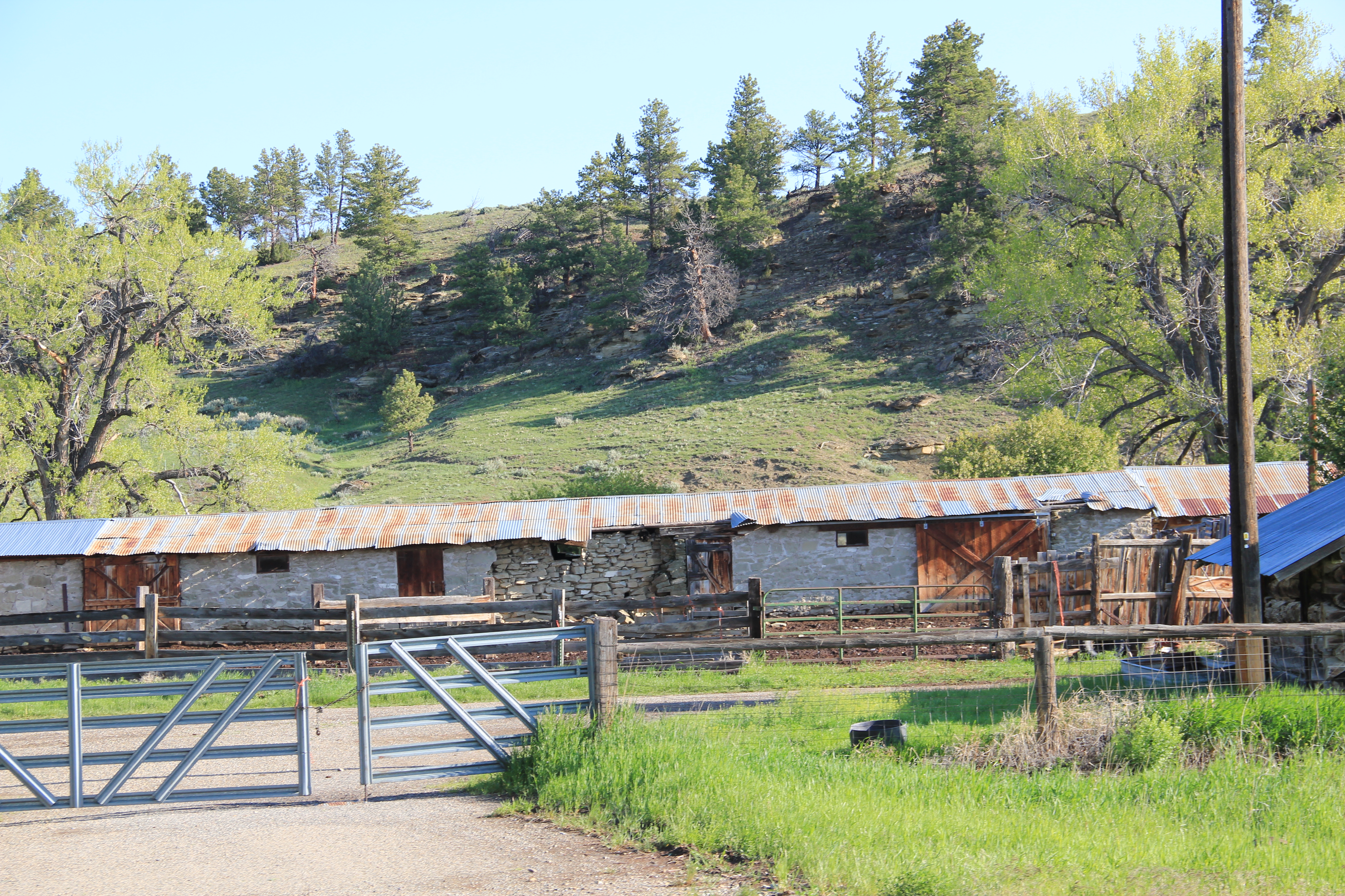
The Lazy J, near the intersection of U.S. 191 and old U.S. 10, is a classic bit of mid-20th century roadside architecture.

which strikes northward cutting across Central Montana and continuing until the highway ends at the Canadian border, north of Malta.

IMG_6331
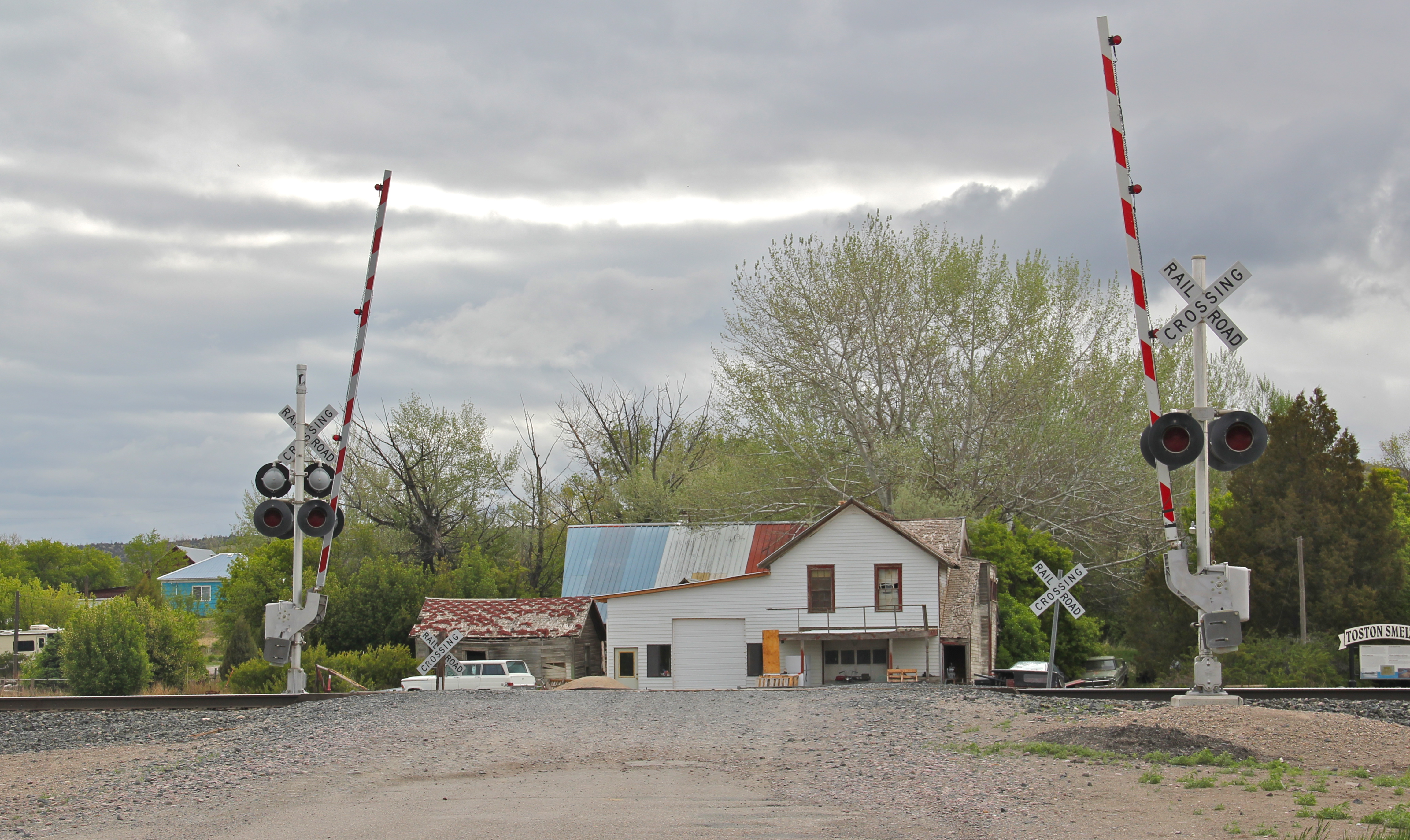
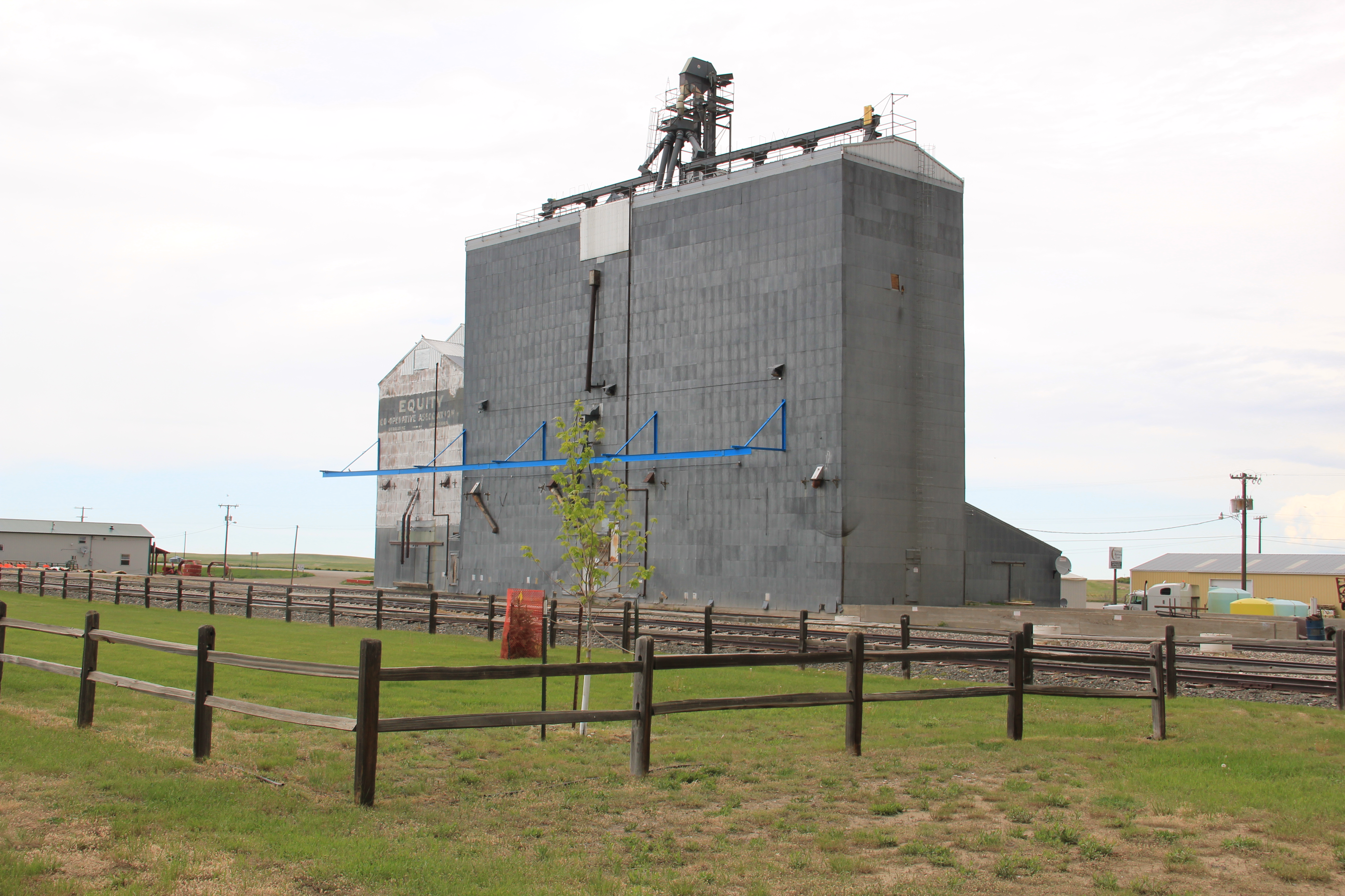
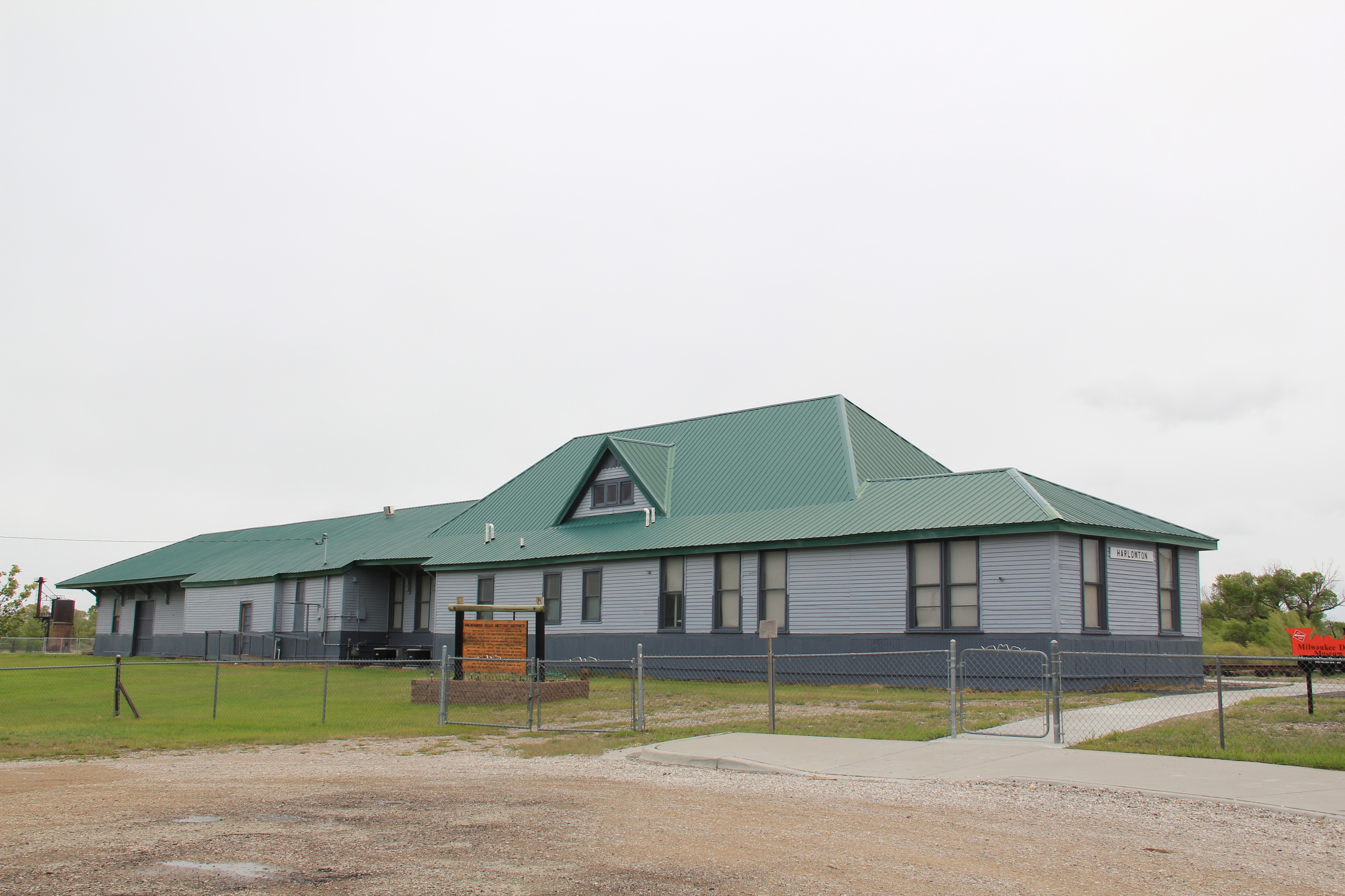
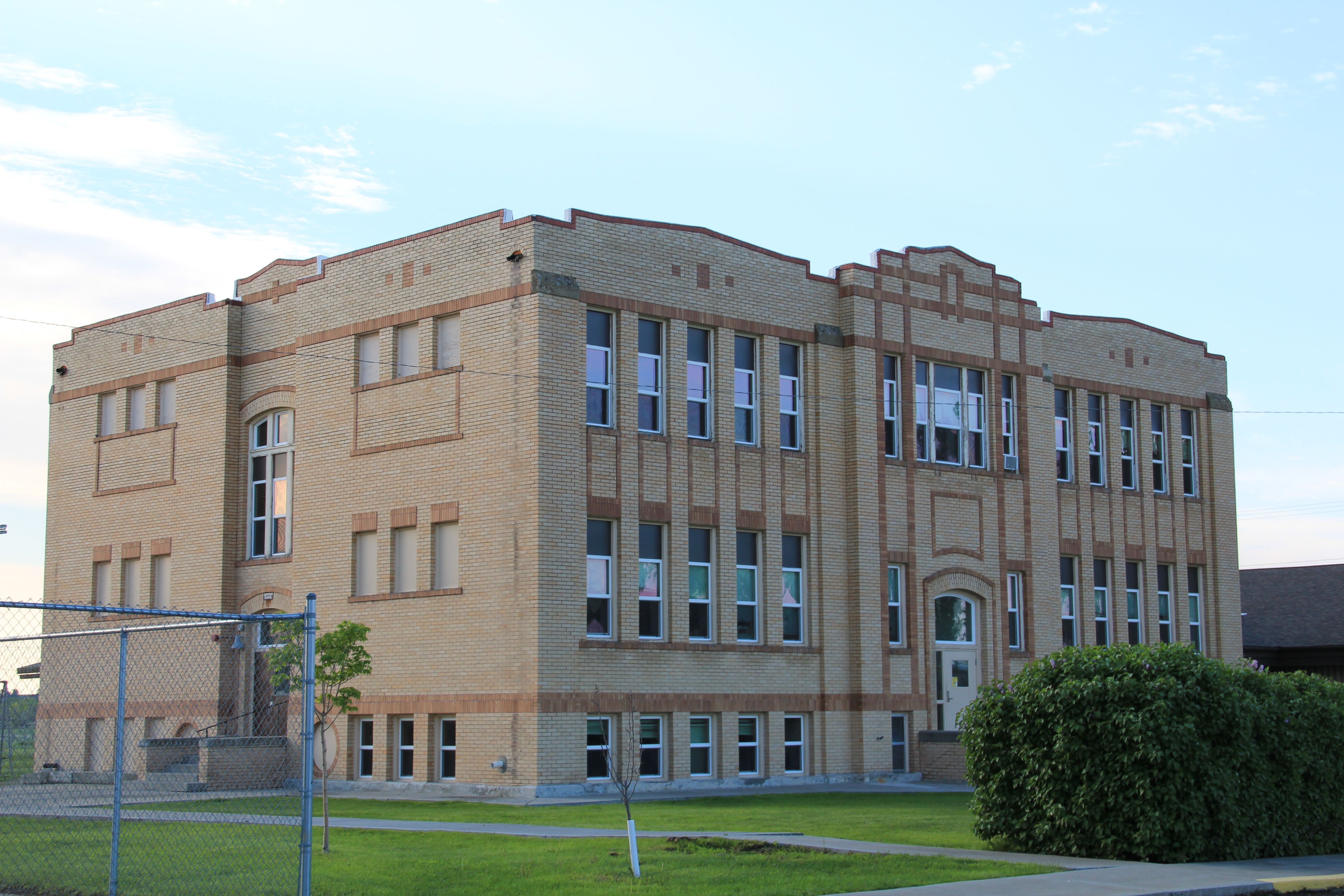
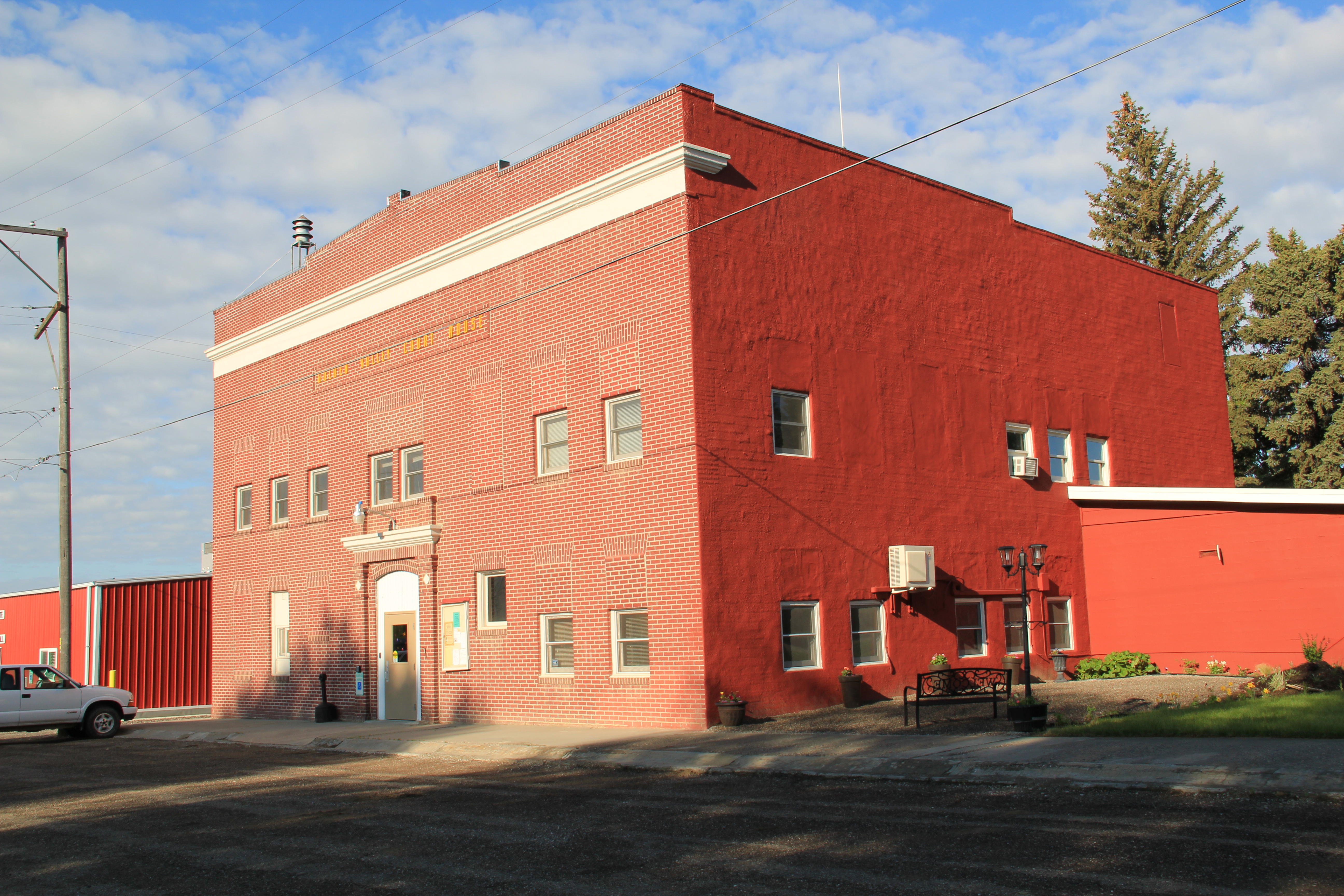
Established by the Northern Pacific Railroad in 1882-1883, Big Timber has the classic T-Plan town plat found on so many Northern Pacific towns.  But one reason I have long liked this place is the quirkiness of its town plan.  The depot and the elevators are where they

IMG_6329
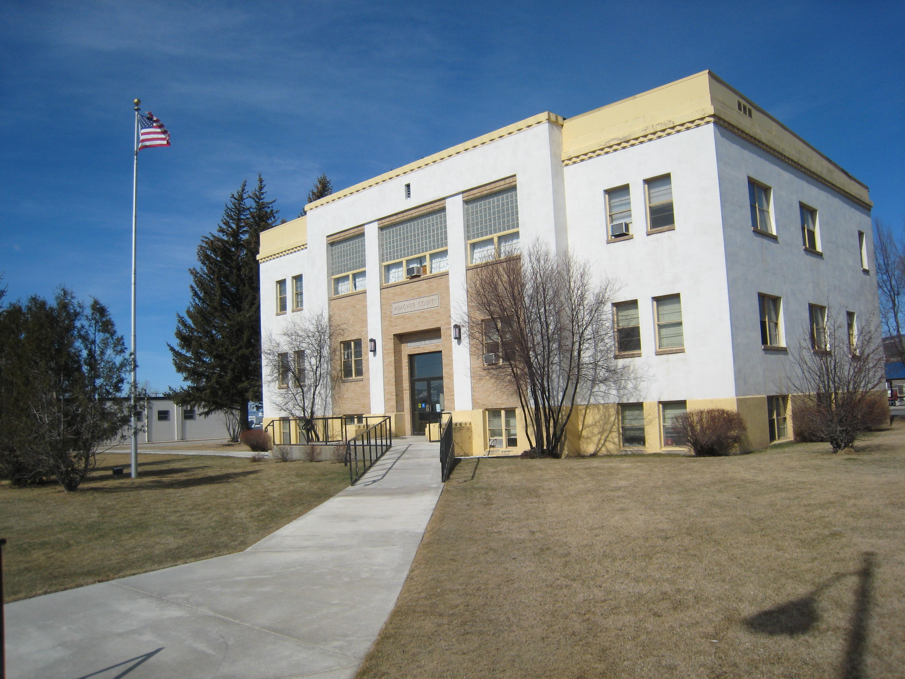
should be, forming the top of the “T,” but the beautiful early 20th century stone masonry Sweet Grass County Courthouse is neither on McLeod Street (the stem of the T) nor at the end of the T, dividing the town’s commercial area from its residential neighborhood.  No, it IMG_6333is a block west of the intersection of McLeod Street and old U.S. Highway 10–an uncommon arrangement of public space in northern plains railroad towns.  A public park

IMG_6314

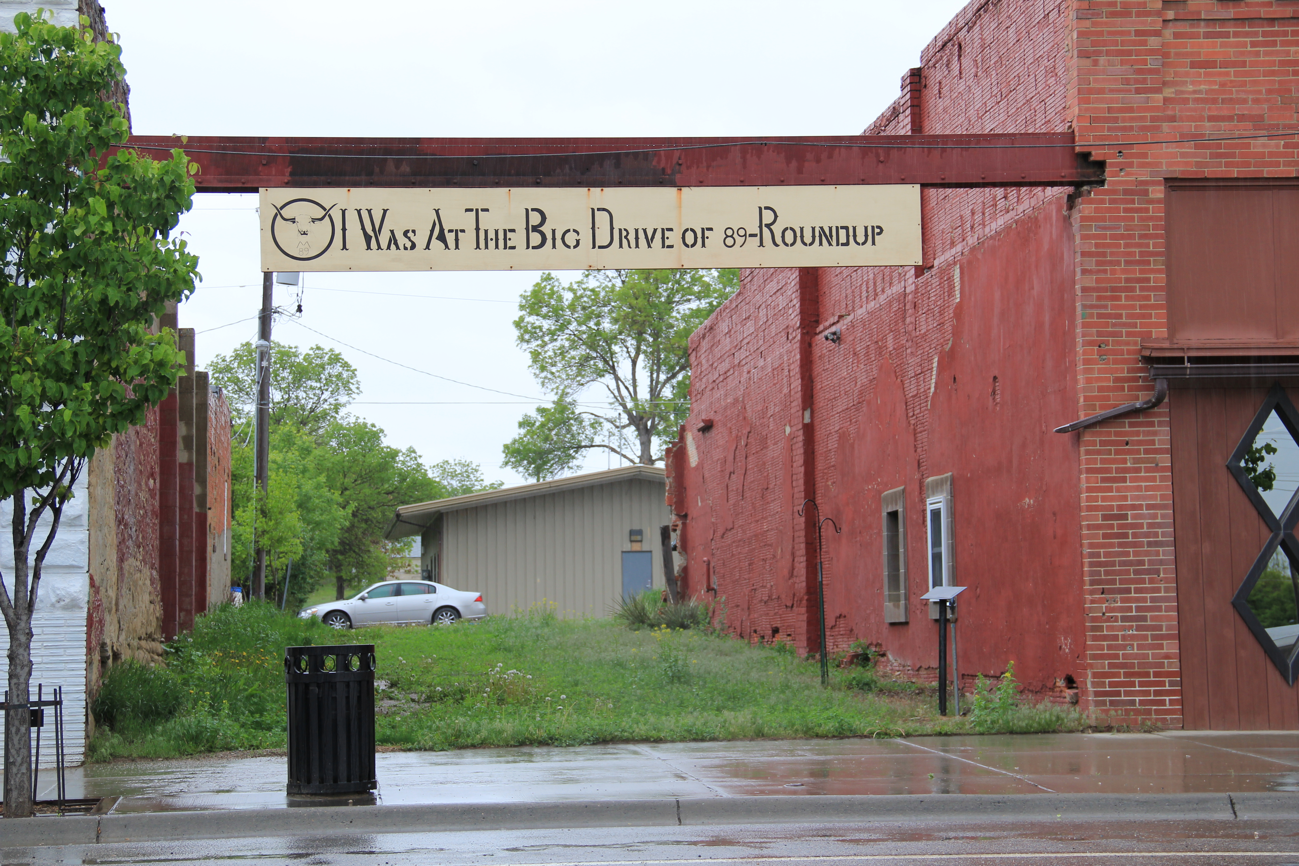
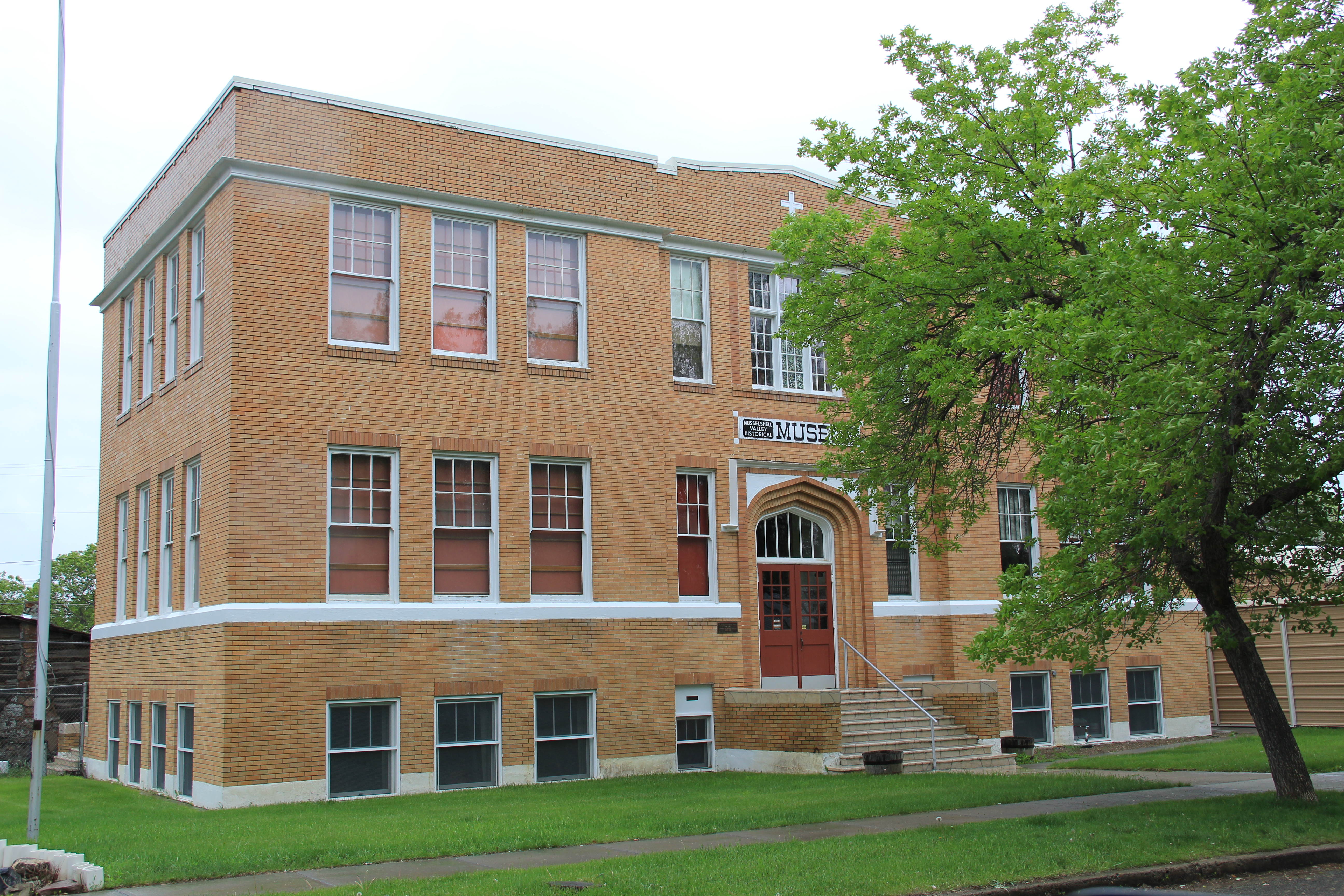
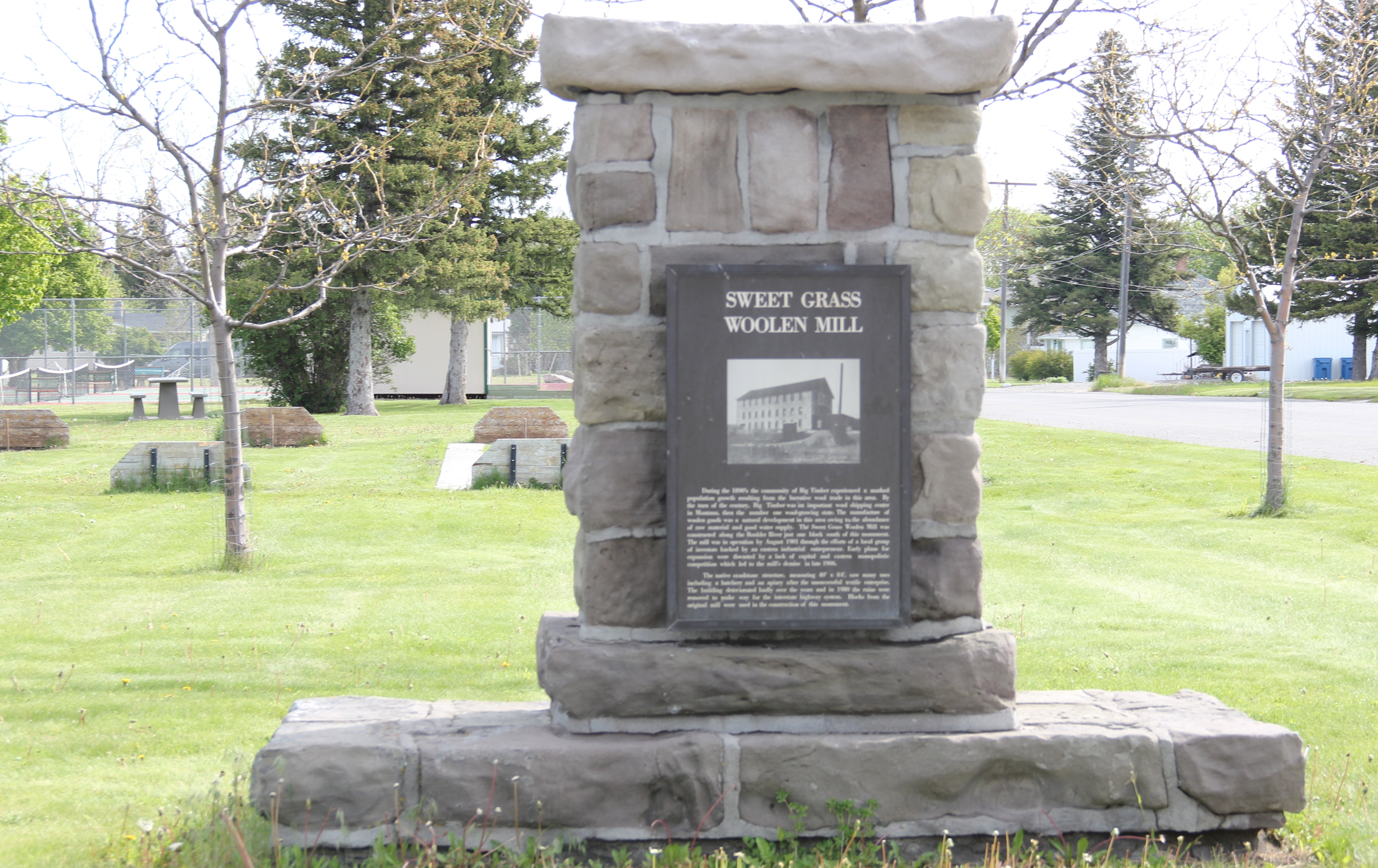
effectively marks the end of the historic town.  When I first surveyed the town in 1984, I found that an old 1946 highway marker for the Lewis and Clark Expedition had been moved to the park a year prior to my visit, and the interpretive sign told me that the town had a sense of its place in history.  In the decades since, residents have added a monument to the town’s early wool industry along with a bronze sculpture, titled “Free Spirit” by Dave Hodges, linking the place to the open spaces and cowboy culture of the valley.  Coming soon will be the new headquarters for the Montana Cowboy Hall of Fame, an institution that searched high and long for a home until finding Big Timber.

IMG_6316

IMG_6313

IMG_6271Public interpretation through art is another change I encountered in Big Timber.  The most striking dates to the Lewis and Clark Bicentennial at the start of this century.  On the walls of the local grocery store are three panels telling the story of the expedition in Sweet Grass County as the men encountered the confluence of the Boulder and Yellowstone rivers.  IMG_6296On another commercial building near the intersection of U.S. 191 and old U.S. 10 was an unexpected surprise:  a mural recreating–or is it reinterpreting–the famed Milwaukee Road promotional poster from the turn of the 20th century that encouraged homesteaders

IMG_6267to head to Montana. Oddly the reproduction mural gives the Northern Pacific corporate emblem but the route shown is the Milwaukee’s route, admittedly also showing where the two lines ran side by side in parts of the Yellowstone Valley.

IMG_6290

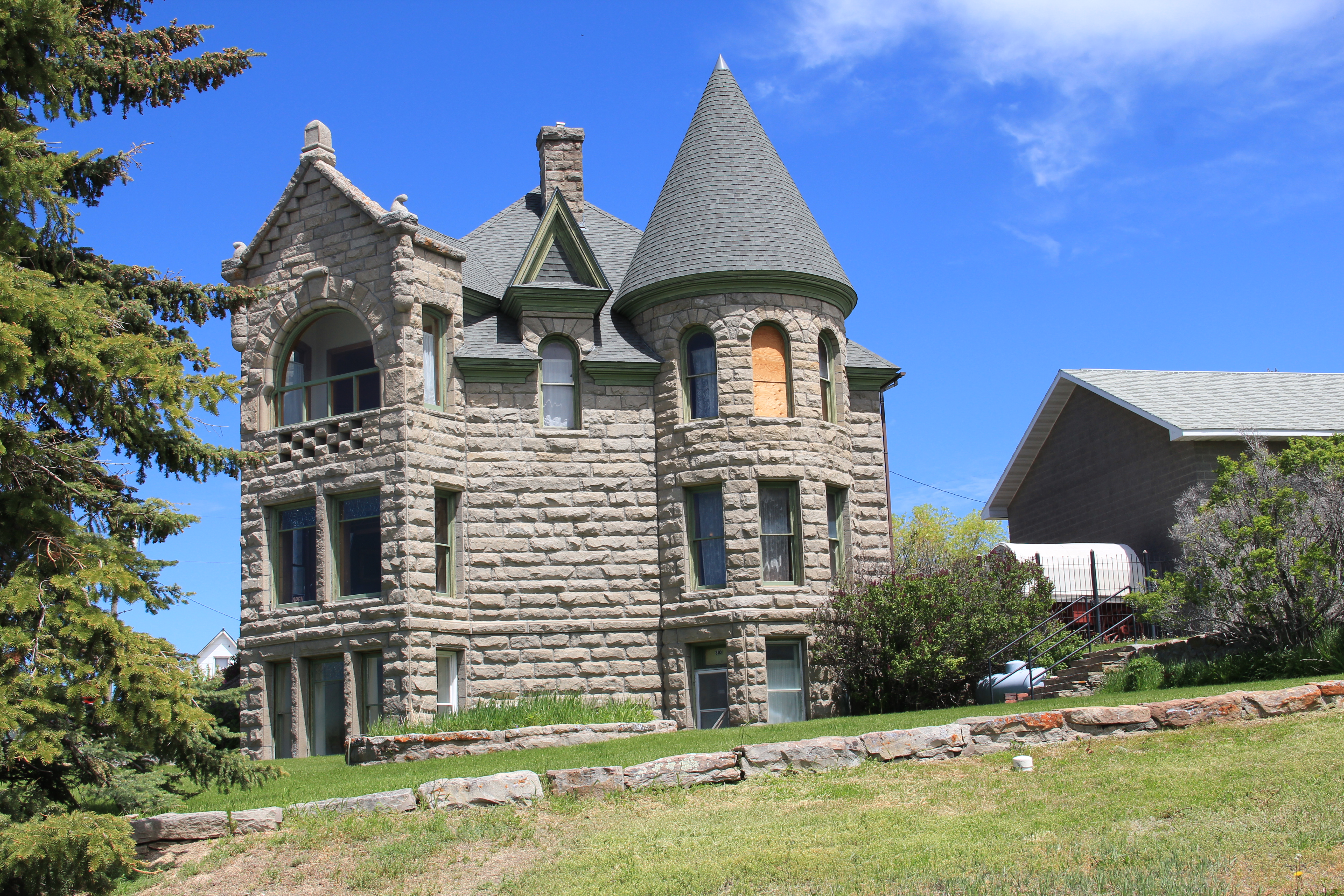
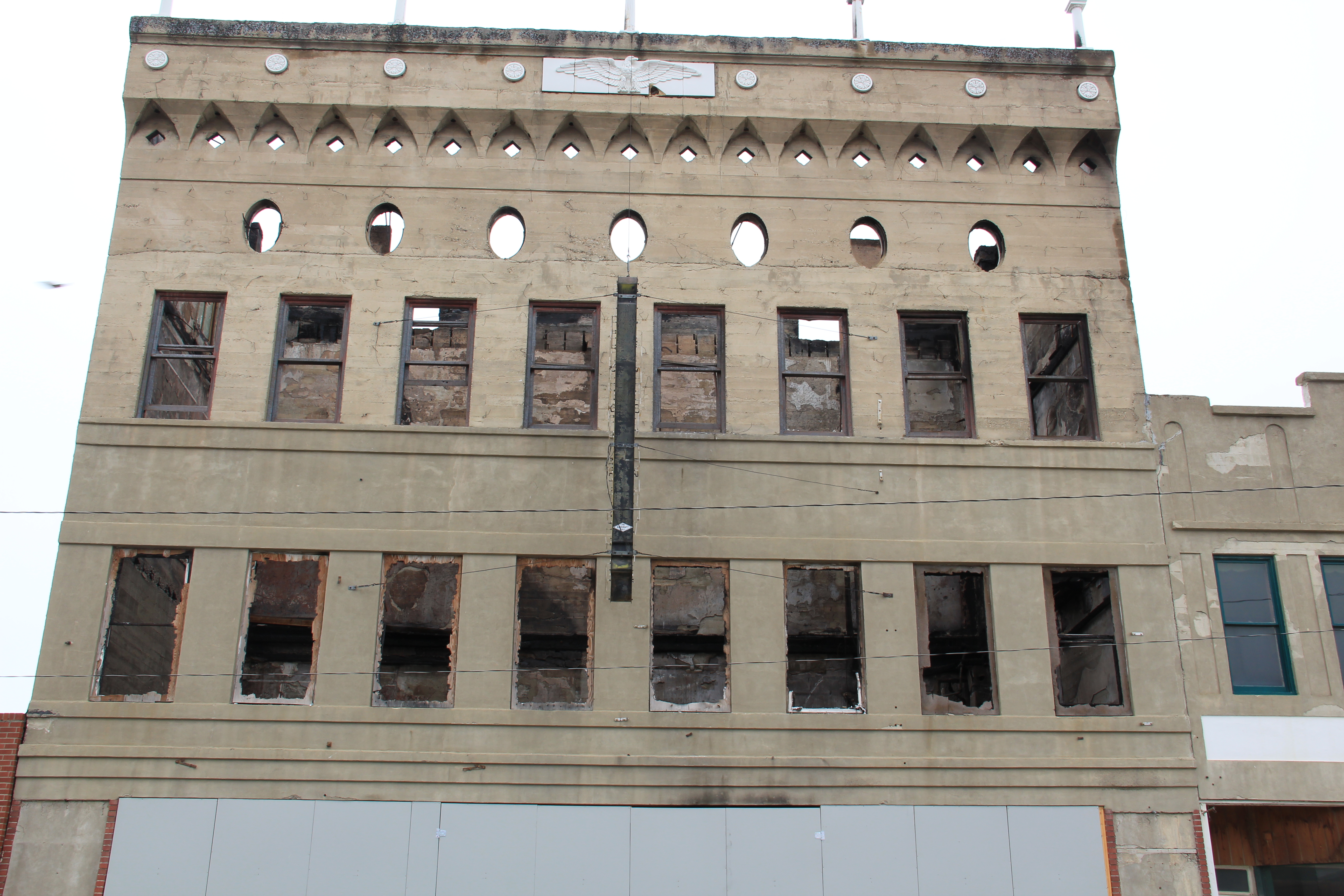
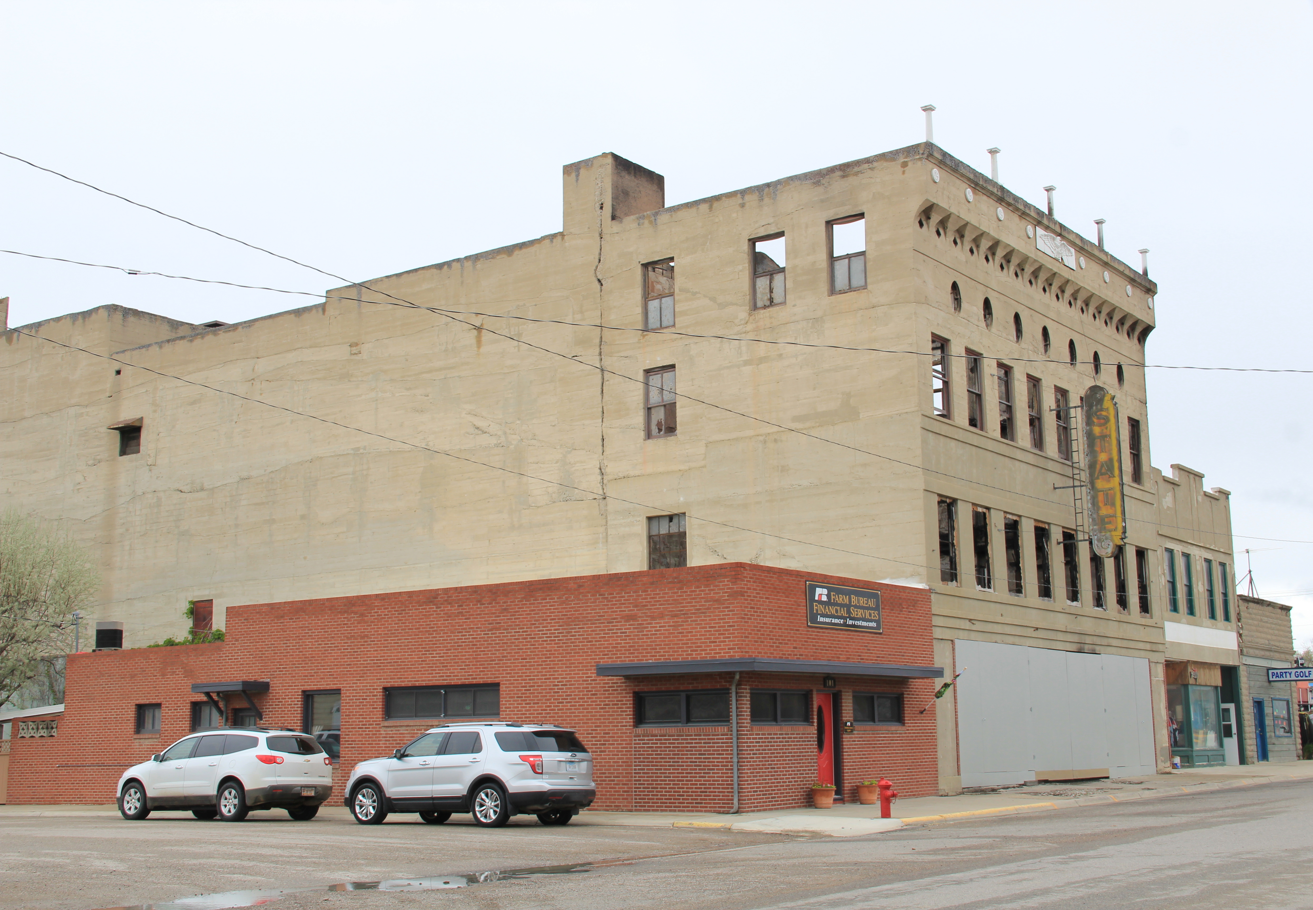
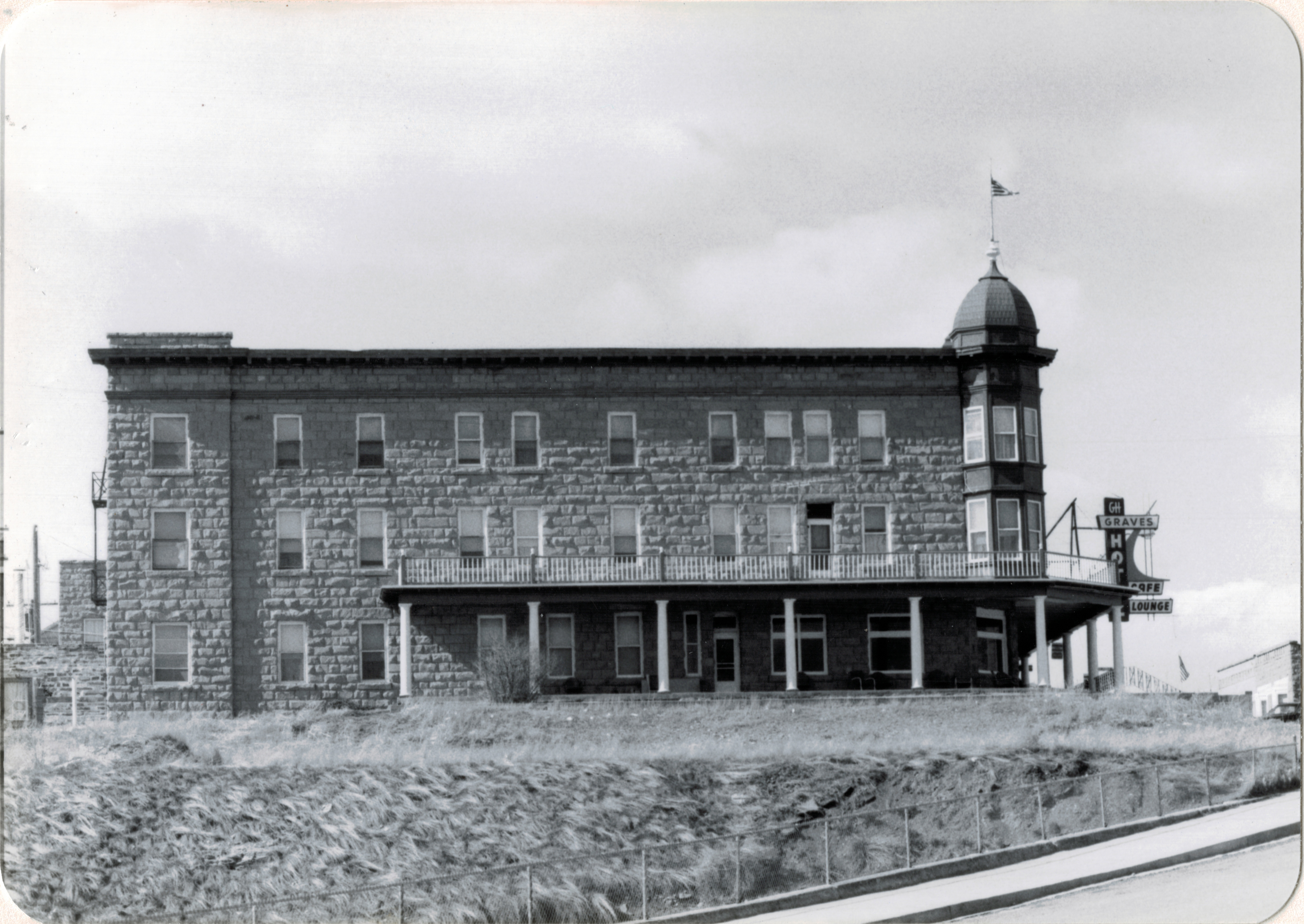
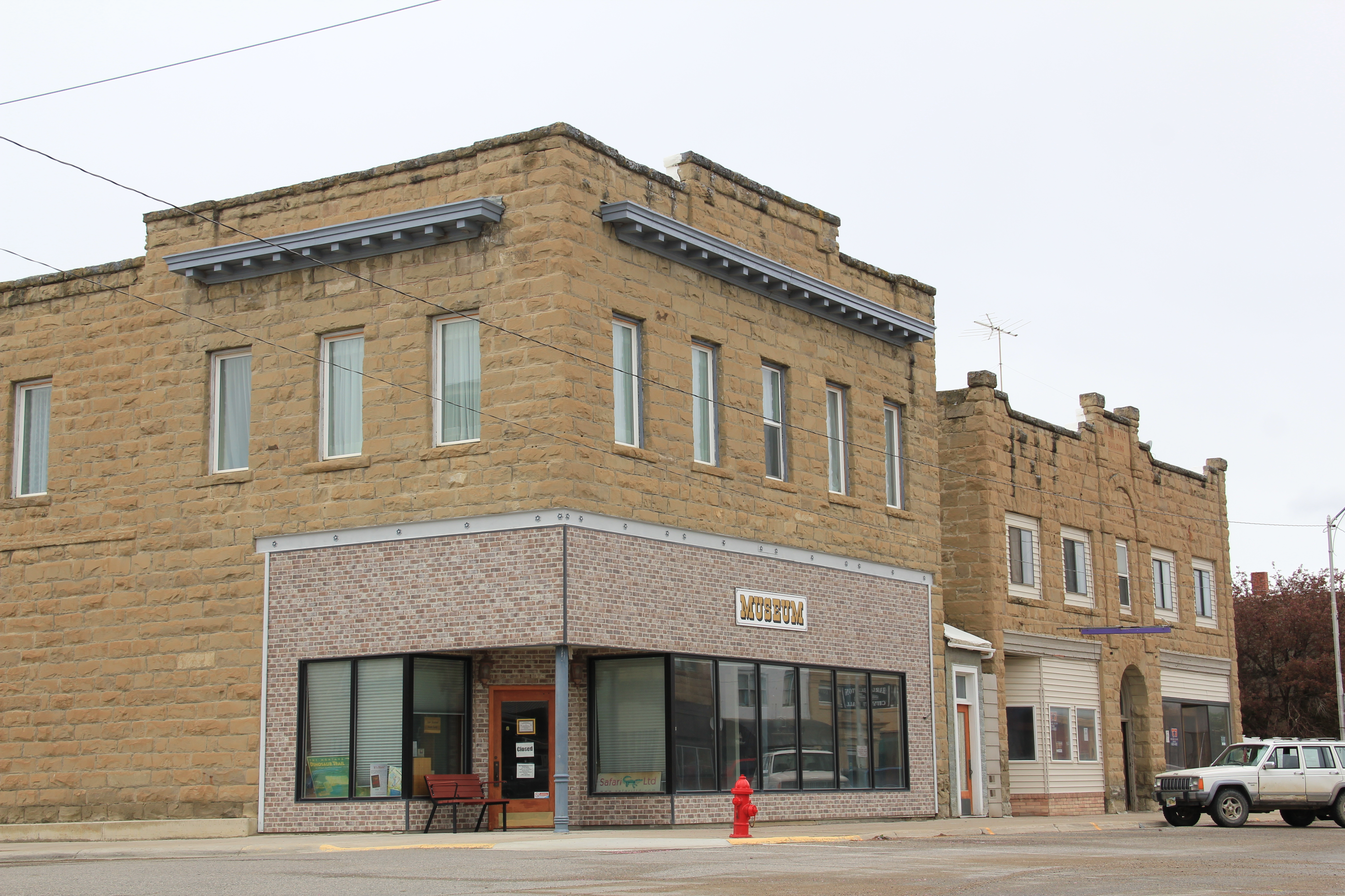
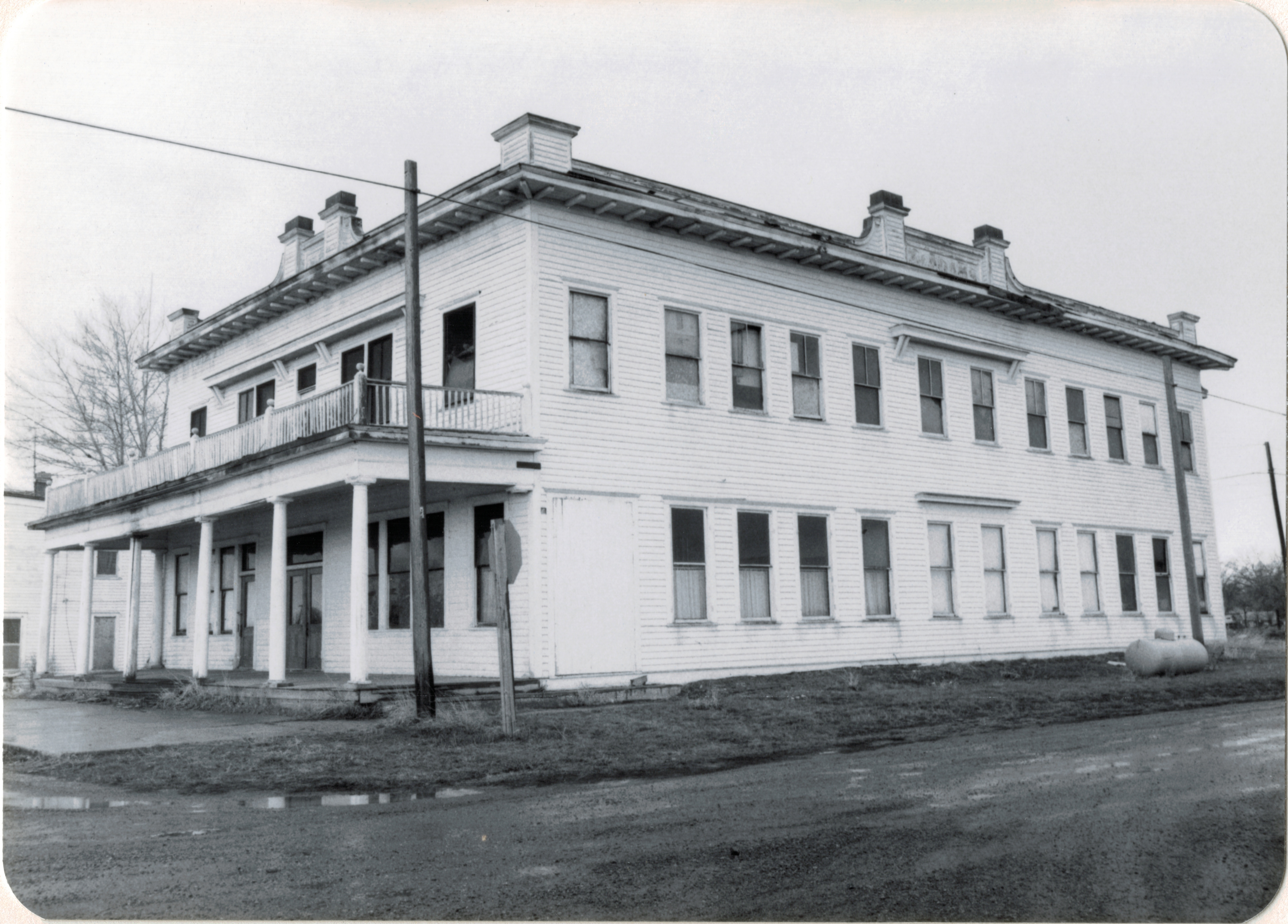
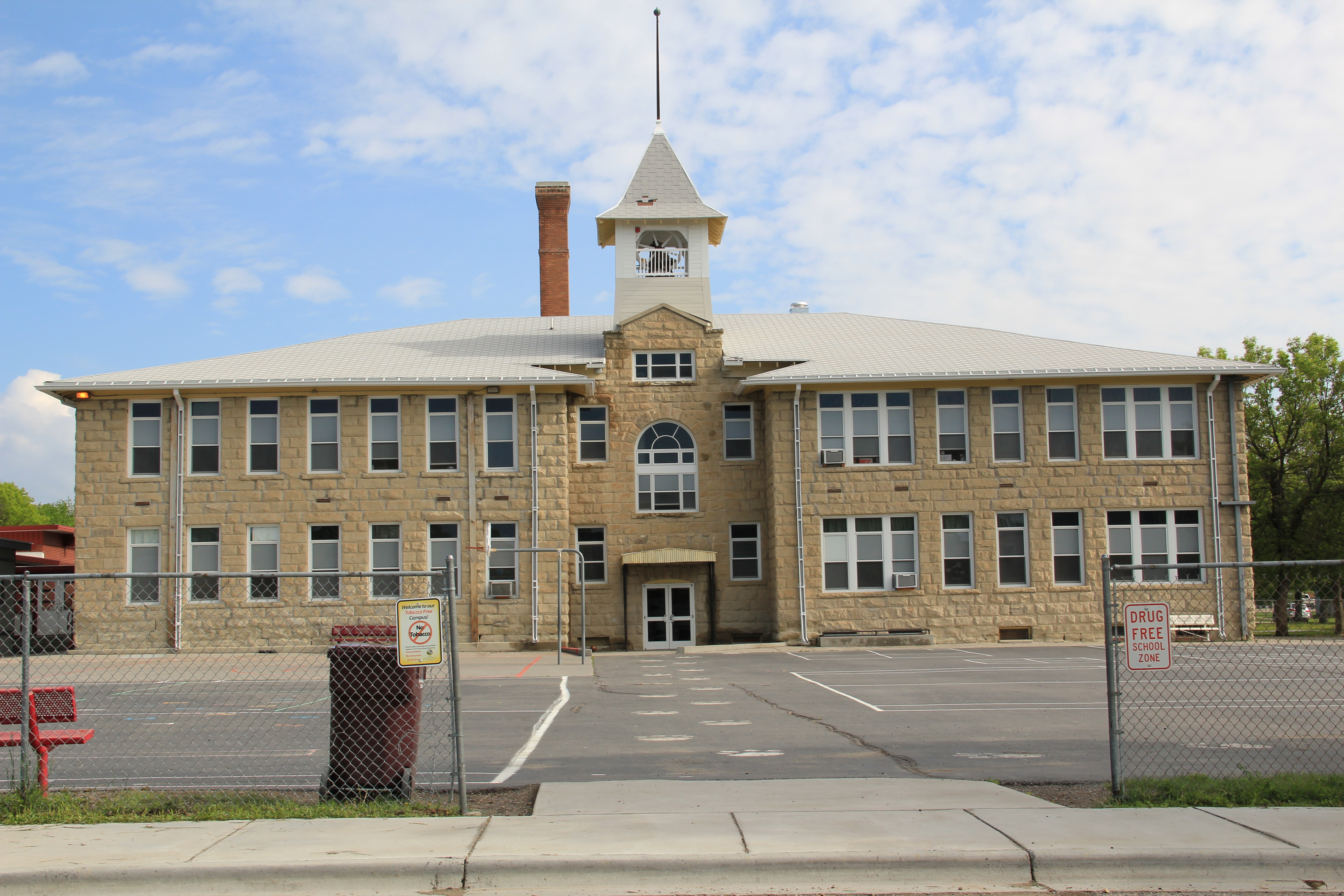
Public interpretation has not extended into an intensive involvement with the National Register of Historic Places.  In 1984, only one property–a segment of the Bozeman Trail where it crossed the Yellowstone–in the county was listed, and that stood on Sweet Grass’s far western border to Park County.  Then, right after I had finished the project, the iconic western hotel, The Grand, was listed in the National Register.  In the 30 years, a handful of Big Timber landmarks also have been designated on the National Register:  the Classical Revival-styled Carnegie Library, St. Mark’s Episcopal Church, and the Big

IMG_6324

Sweetgrass Co Big Timber 6 - Version 2 IMG_6306
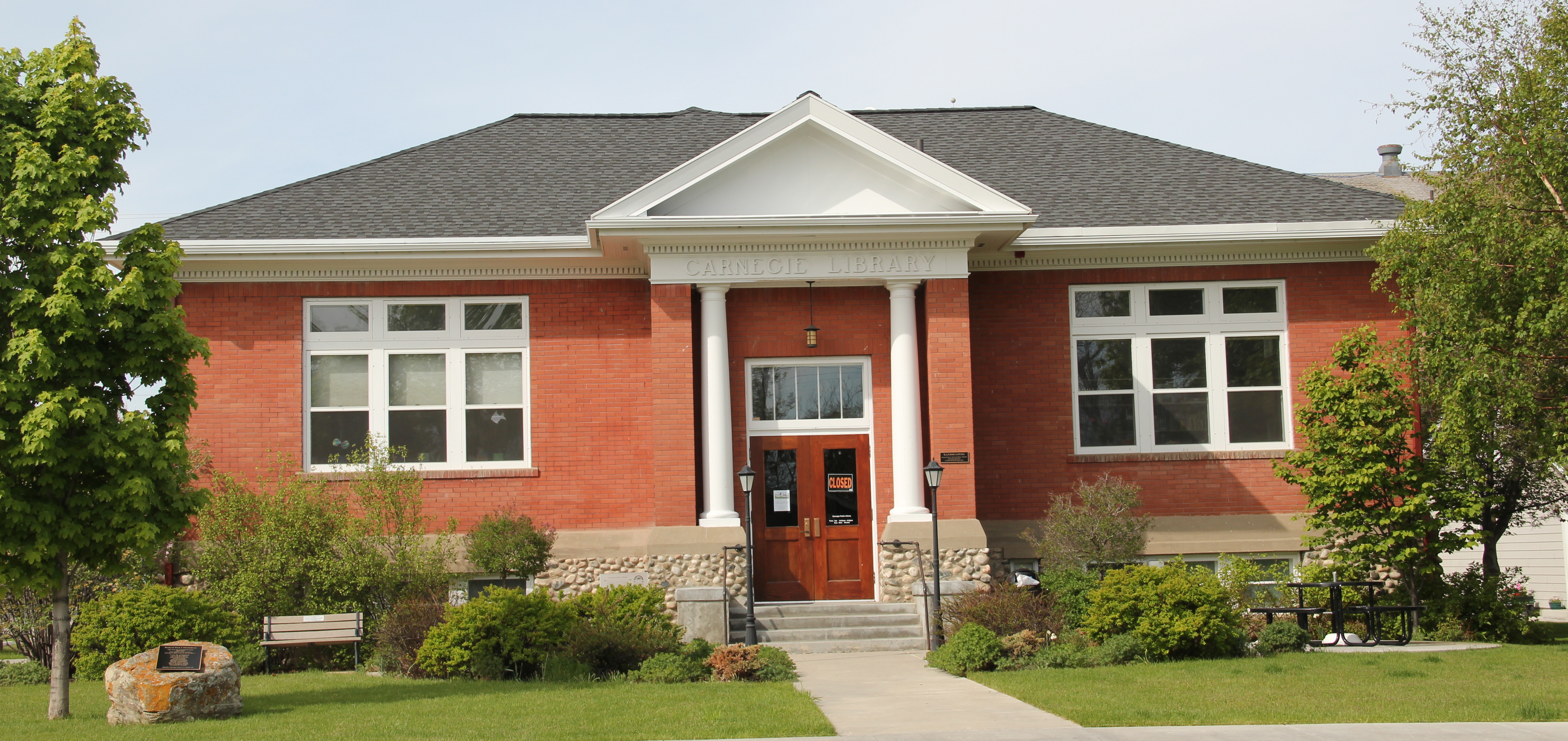
Timber City Hall.  Little doubt these landmarks are cherished–when more library space was necessary this century the expansion of the historic building was done appropriately, keeping this landmark in service for decades.

IMG_6308
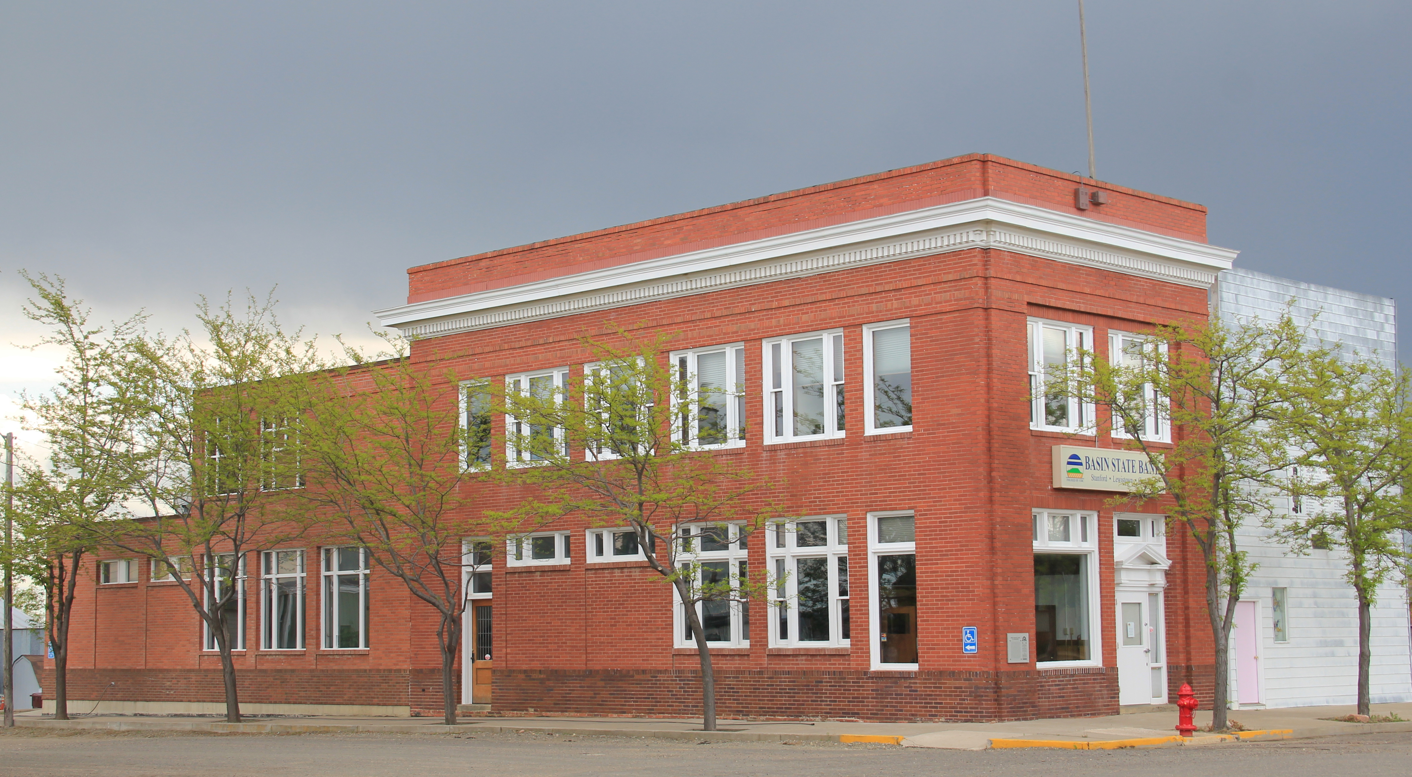
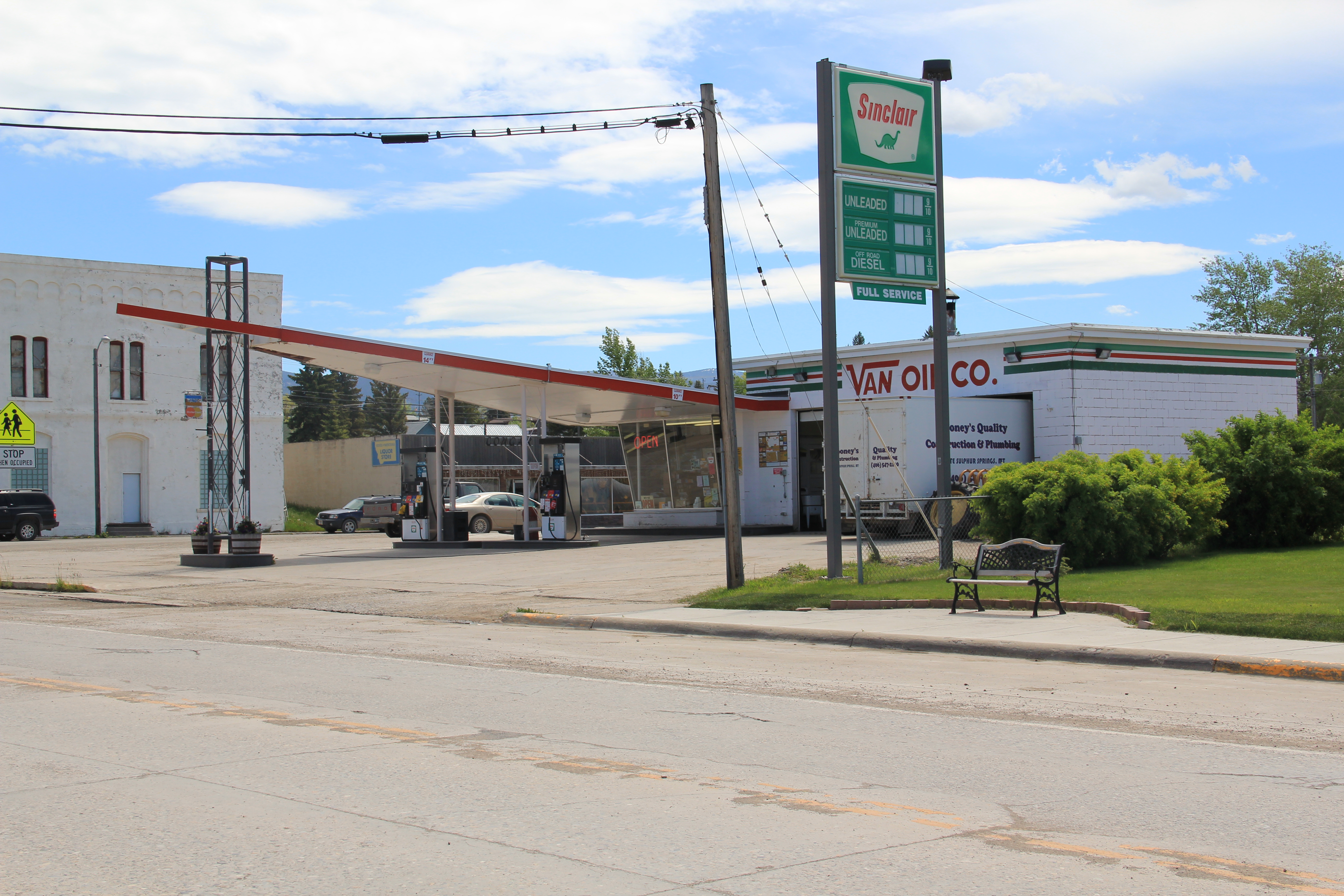
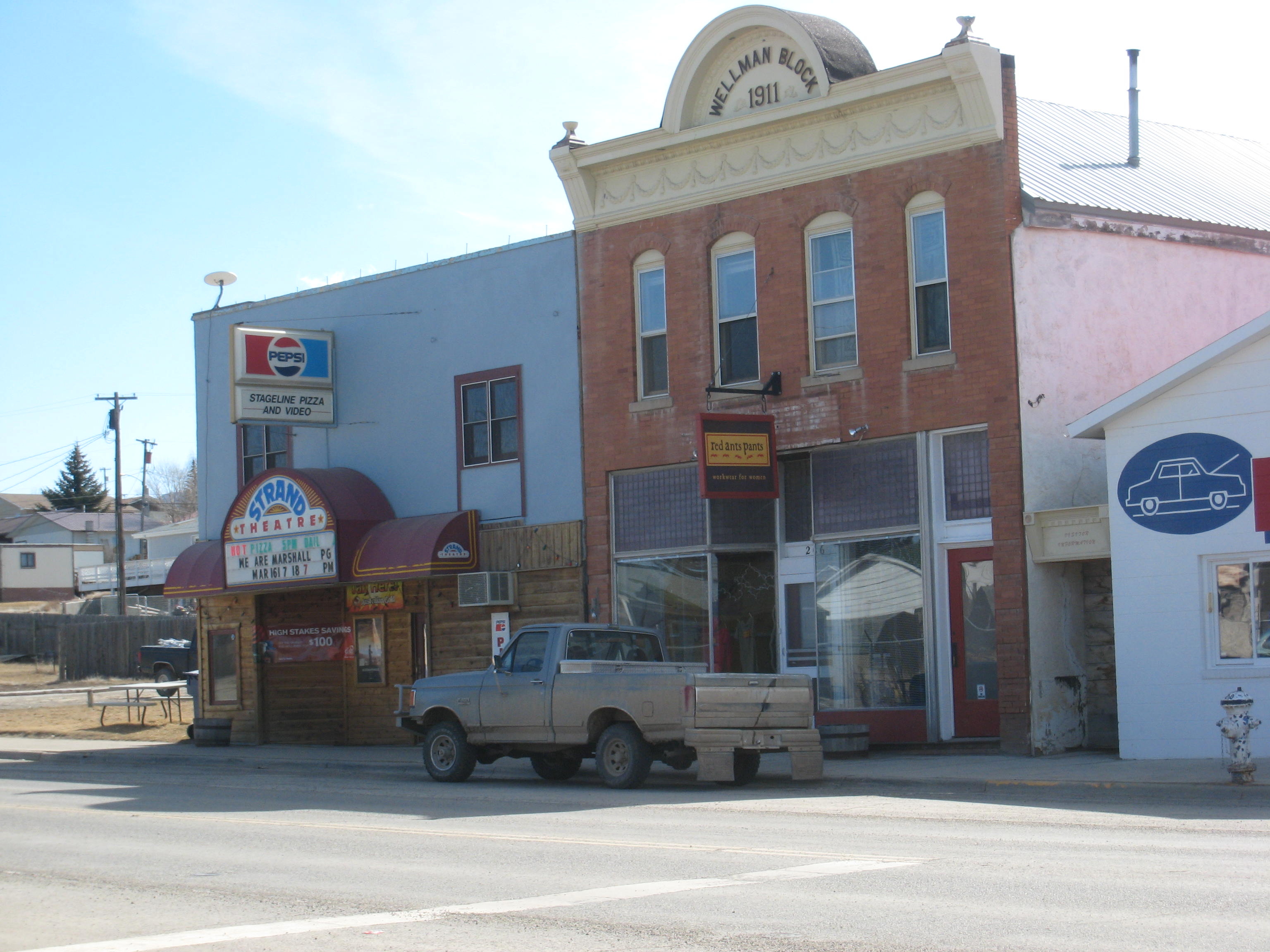
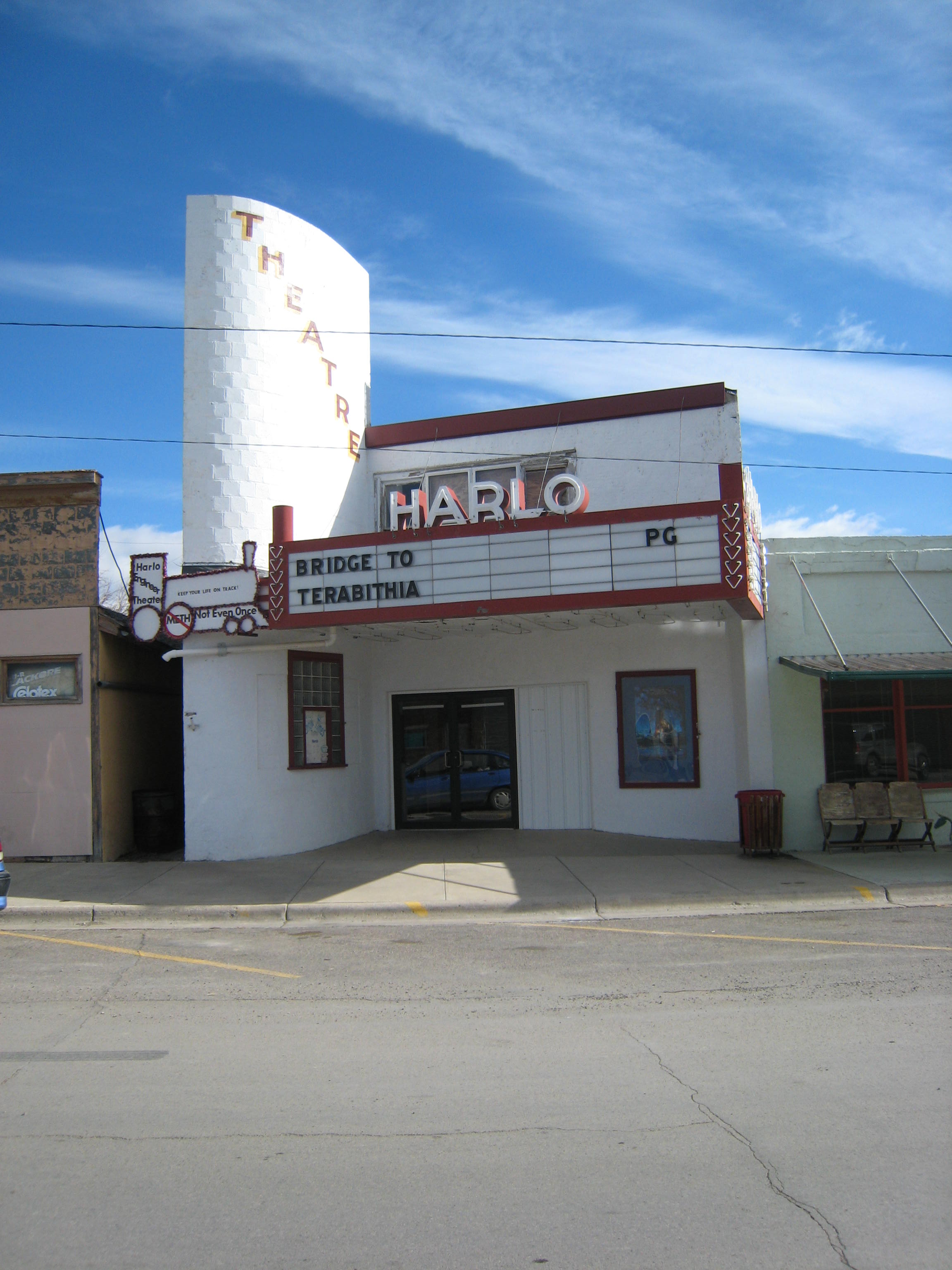
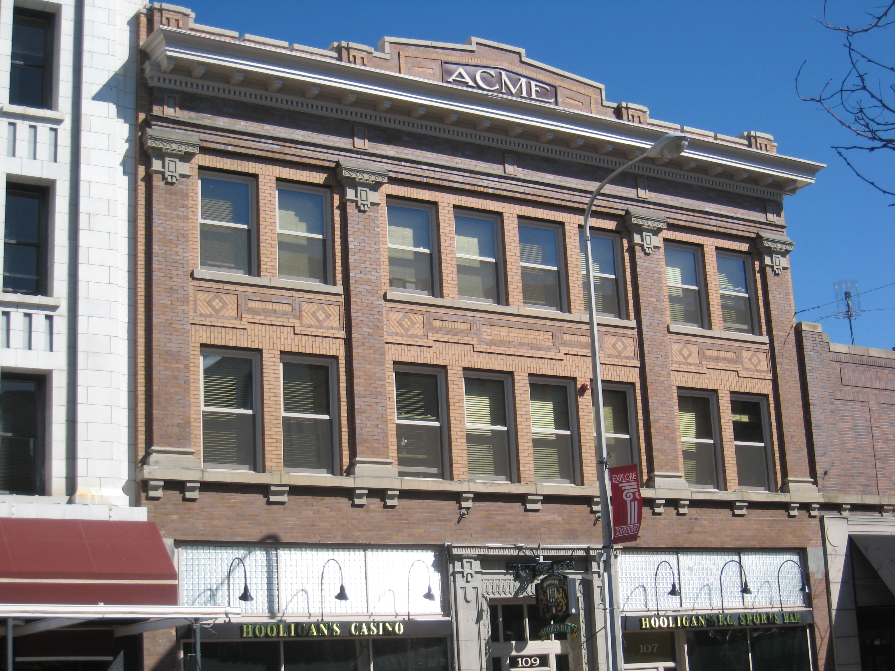
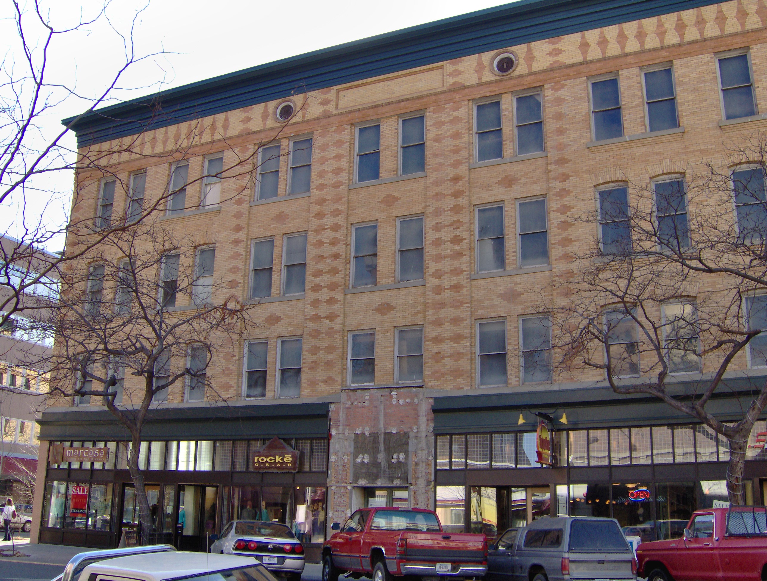
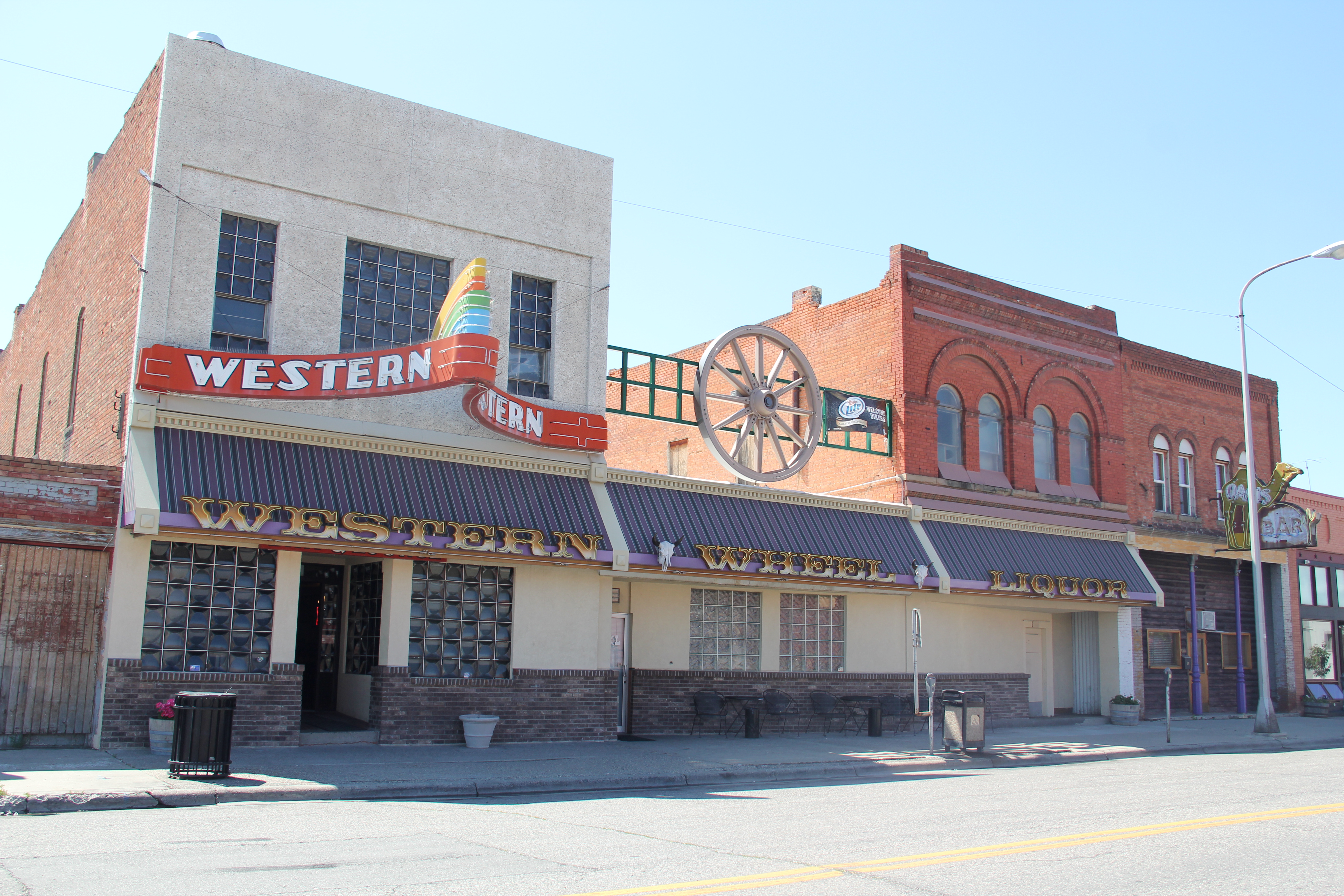
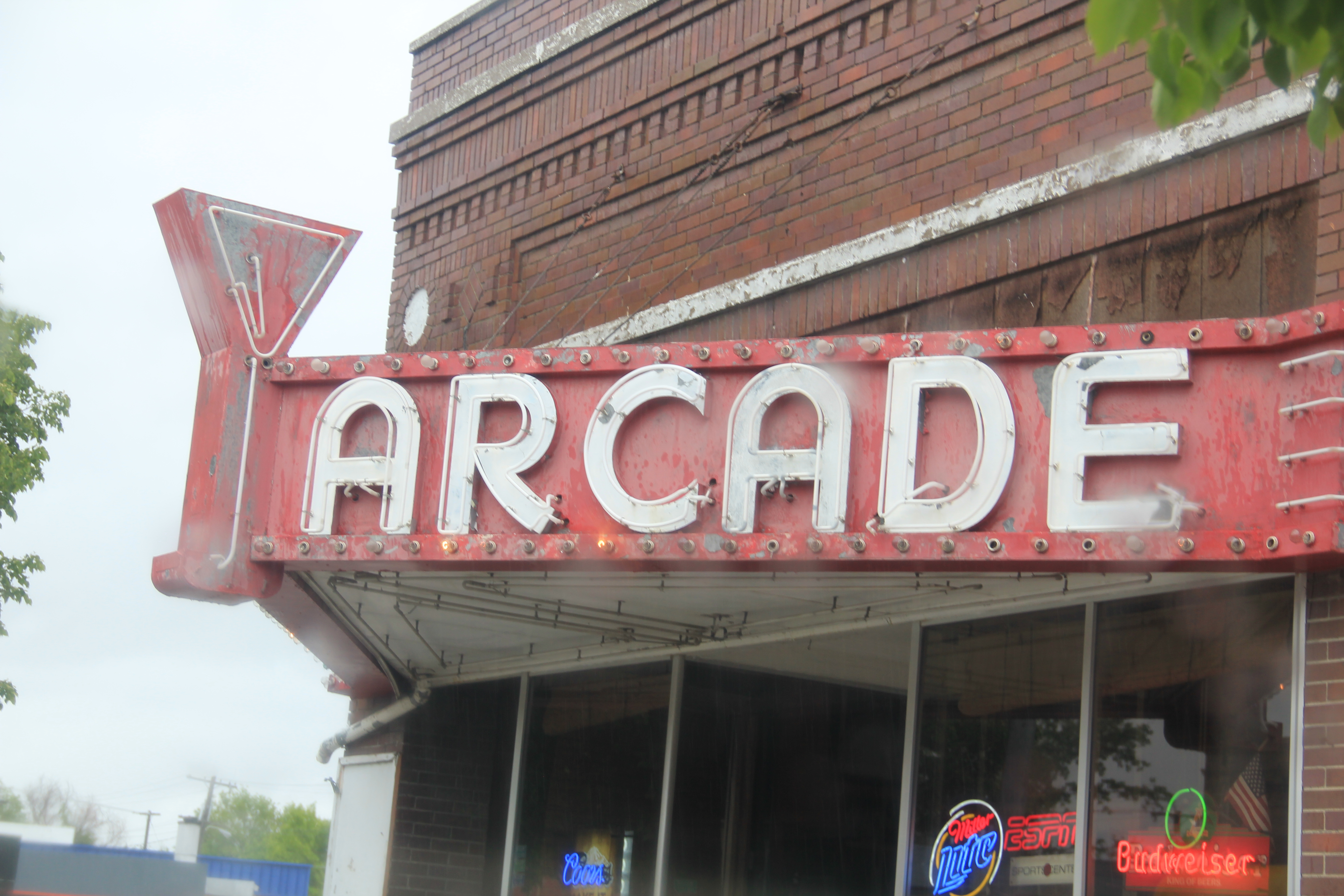
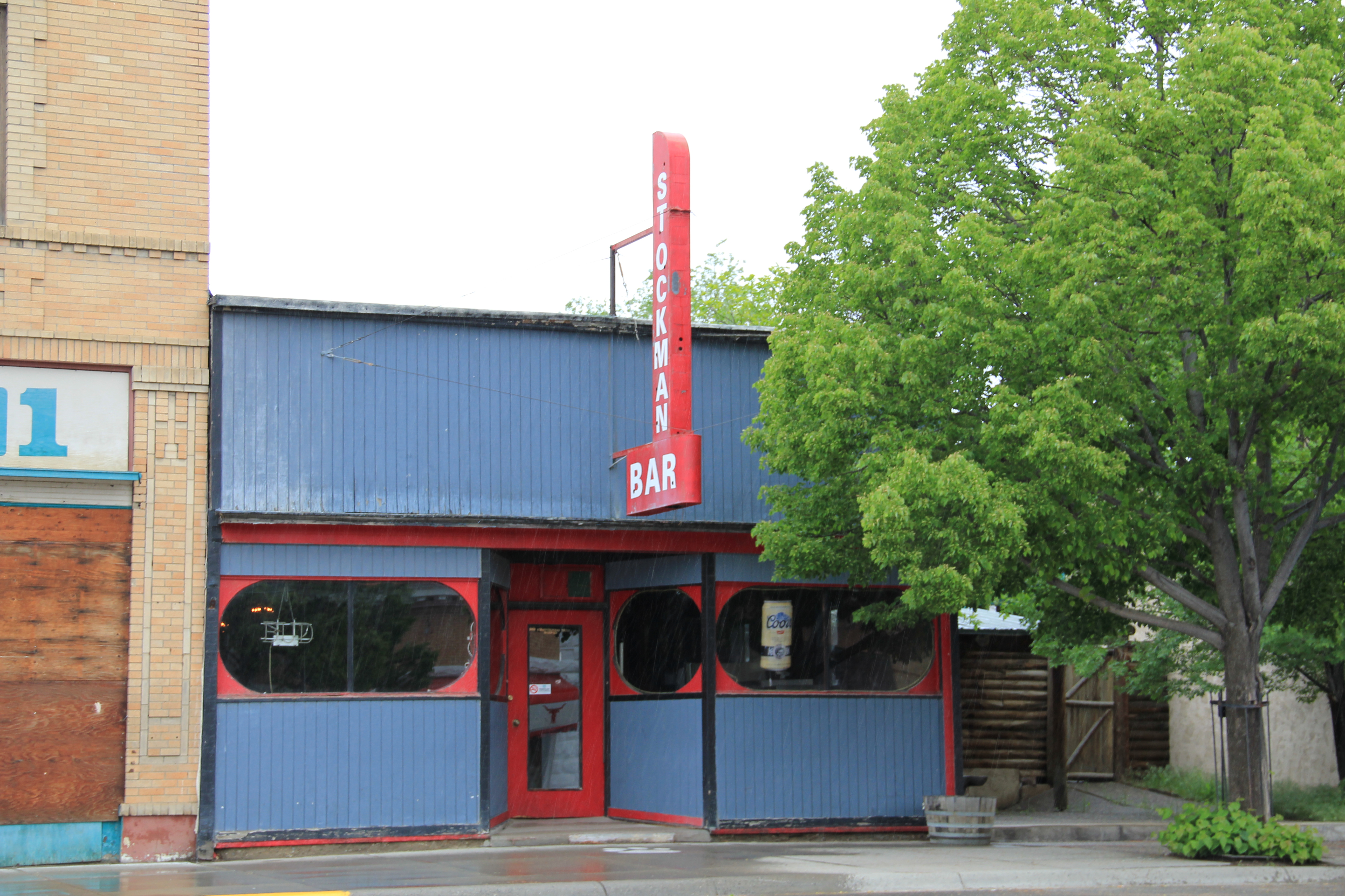
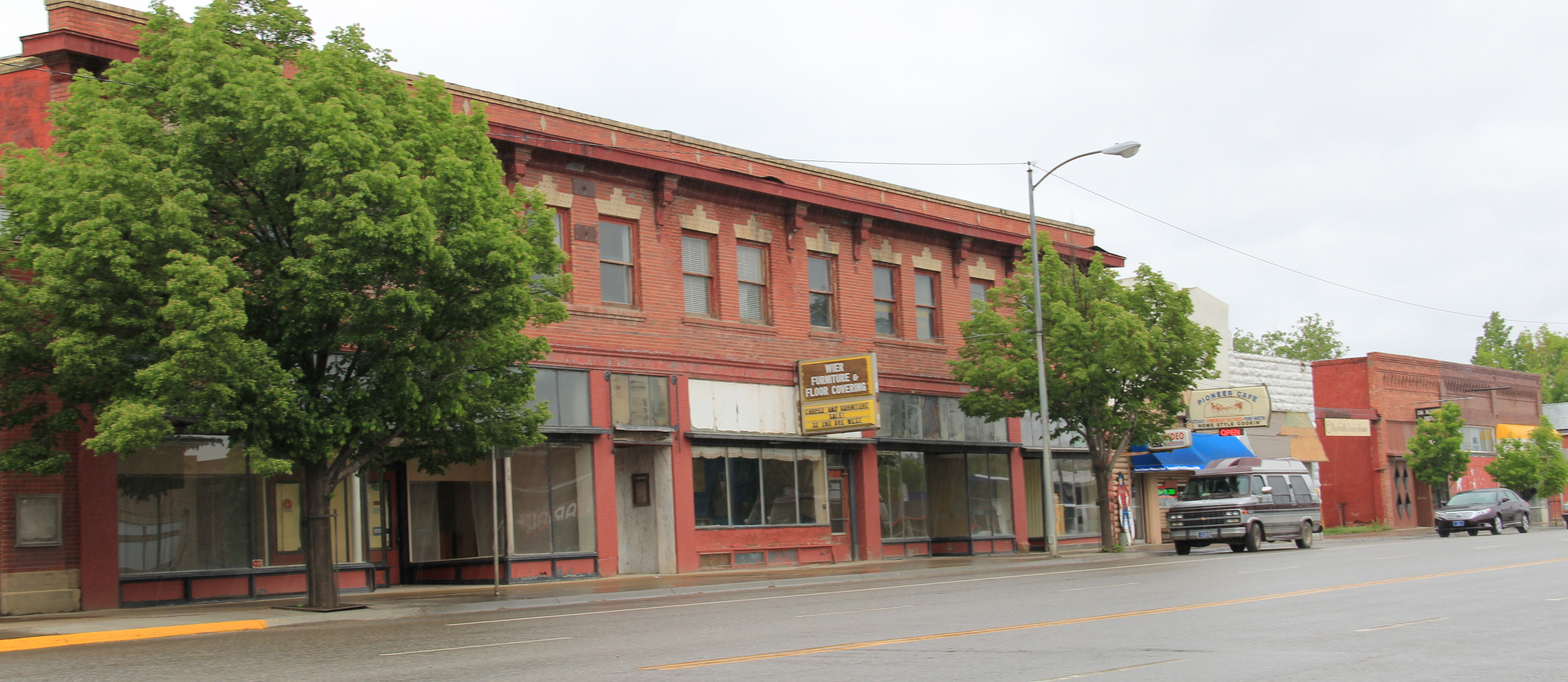
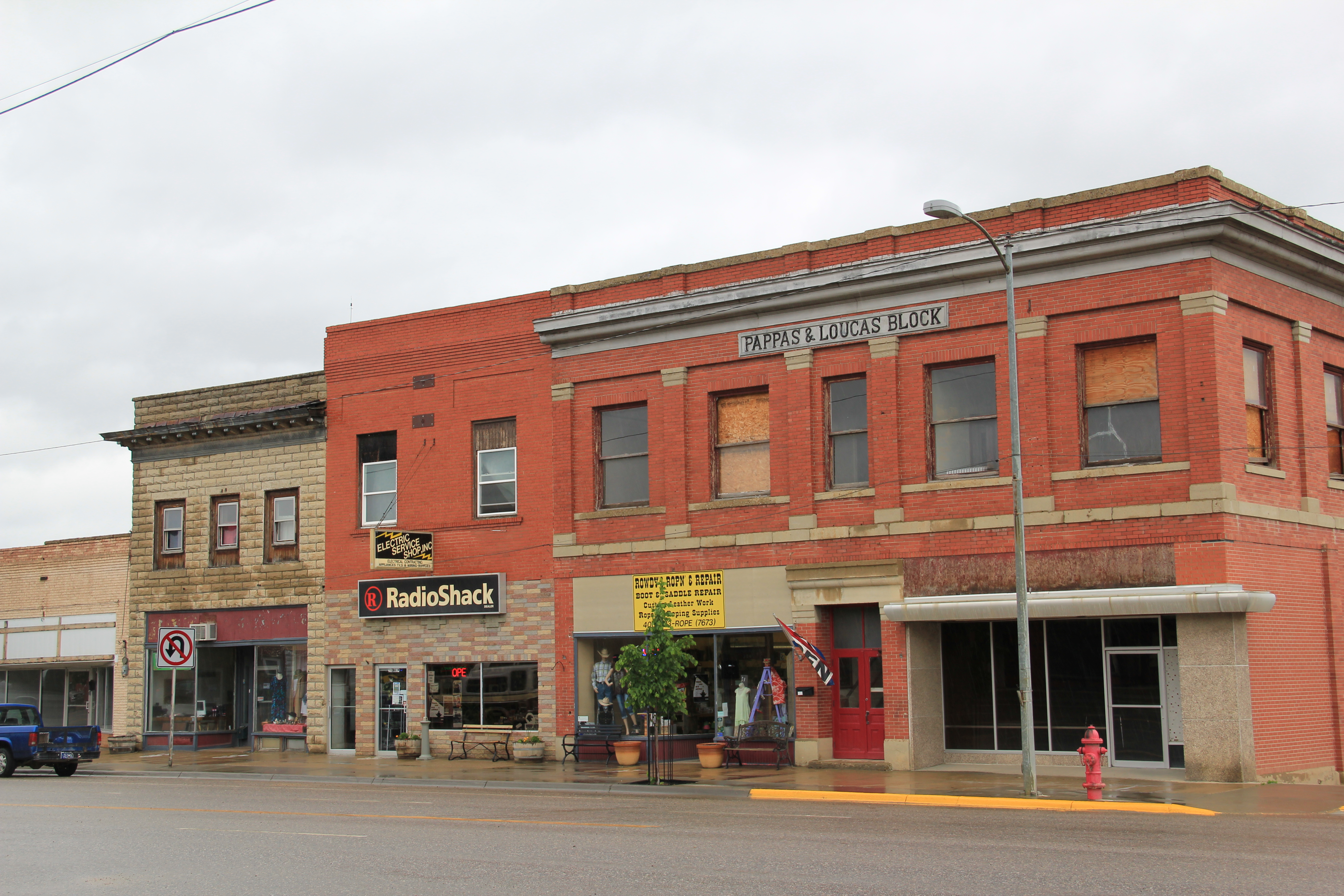
But when you consider just how intact the town’s historic environment from the 1880s to the 1950s is today, you think a National Register historic district nomination in order, or at least one for the historic commercial district, which has a wonderful array of building types, designs, and, luckily for Big Timber, open businesses, including one of my favorite bars in all of the state–at least favorite bar signs–the Timber Bar.

IMG_6273

IMG_6274

IMG_6275IMG_6284The next post will look deeper in the historic buildings of Big Timber, and then stretch north to a real jewel, the Melville Lutheran Church.

Toston: Another Northern Pacific Town in Broadwater County

IMG_7073

Toston has become a forgotten town of the Northern Pacific Railroad line as it stretched from Logan, in Gallatin County, through the headwaters of the Missouri River and into the broad Missouri River valley of Broadwater County. Today Toston is best known to travelers of U.S. 287 as a scenic stop on the Missouri River, and the access to Toston Dam reservoir, a project of the U.S. Bureau of Reclamation.

IMG_7069

The town’s heyday came early, especially with the discovery of pyrite goal ore at Radersburg to the west in the Elkhorn Mountains and the establishment of a smelter at Toston in the late 1880s.  In the 21st century the old smelter site has received a superfund clean-up and a large interpretive marker explains the smelter and its impact on both Toston and Radersburg, another good example of the much better public interpretation you can encounter on the Montana landscape.

IMG_7074

At the Missouri River fishing access, Montana Wildlife and Park erected another interpretive marker, a huge boulder marking the location of the Lorentz homestead.  William B. Lorentz was the Northern Pacific’s agent in Toston and he filed for a homestead along the Missouri south of the tracks in 1887.

IMG_7070

Toston had a second economic boom during the homesteading era when state officials decided to build a new steel truss bridge over the Missouri River.  The Toston Bridge was listed in the National Register of Historic Places in 2005.  Its interpretive marker records that state engineer Charles A. Kyle designed “a riveted steel Warren through truss design”

IMG_7072

for the bridge in 1918, with Security Bridge Company of Billings as the contractor.  The Billings company used 11 local residents, including William Lorentz, the former Northern Pacific station master. and the bridge was opened in the summer of 1920. Soon thereafter, the Bureau of Reclamation announced its intention to create a new irrigation project, initially called the Townsend Bench project. Reclamation officials designed a project for what they called 15,000 “excellent acres,” irrigated by a gravity system with the diversion dam located east of Toston on the Missouri River, identified today as the Crow Creek Pump Unit.  Consequently, Toston has several buildings remaining from the first two decades of the 20th century, including concrete block commercial buildings and the town’s most impressive building, a two-story frame school, which is now a private residence.

IMG_7079

IMG_7078

With the irrigation project came a set of large grain elevators, which in 1984 dominated the highway view of Toston along U.S. Highway 287. These have been demolished.  One historic church building, I believe it is a Methodist Church, remains but does not hold services.

IMG_7076

The Toston Bridge kept the town vibrant since its location meant that all traffic between Helena and Bozeman on U.S. Highway 287 passed over the bridge, over the tracks, and through the middle of town.  In 1955, however, a new bypass bridge was constructed and Toston began a decline that has slowly drained away most of its population.  At the 2010 census, it had 108 residents.

IMG_7080

Geraldine: A Milwaukee Road Town that made it

IMG_8825

My last post looked at the disappearing towns of the Milwaukee Road in central Montana’s Meagher County.  Those themes of a railroad, town creation, and abandonment were constant in several posts as I traced the imprint  of the Milwaukee on Montana’s landscape in the 20th century.  However, not all central Montana plains towns tied to the Milwaukee Road have disappeared–Geraldine in Chouteau County is one of those exceptions.

Geraldine MR Depot Choteau Co

Milwaukee Road depot at Geraldine, c. 1998

Geraldine was established c. 1913 along a major spur line of the Milwaukee Road that connected its division point at Harlowtown to the much larger railroad transportation center of Great Falls to the north.  Due to the richness of the high plains agriculture of southern Chouteau County–the land south of the Missouri River–and the commitment of its citizens, Geraldine has remained generally solid through the decades.  According to census records, the town has never topped 400 residents, 375 being the largest number of residents, and now, according to the 2010 count, there are only about 100 less, a little over 260 residents.  Losing what amounts to 25-30% of the population over the 100 years sounds like a disappearing town, true, but in an eastern Montana perspective, it is not.  As this blog has documented at many places, too many plains country towns have lost 50% or more of their population in just the last 30 years.

IMG_8822

In the 1984-85 historic preservation survey, Geraldine impressed me for several reasons.  First was the dominating presence of the grain elevators, as seen above and with the first photo in this blog.  I had grown accustomed to Milwaukee Road towns where the corporate standardized design for the combination depot–a building that joined both freight and passenger operations–dominated the railroad corridor.  Here the elevators punctuate the skyline and loom over the town itself–the railroad created the need for them, certainly, but by the end of the 20th century the elevators were still viable businesses while the depot had become a local museum and community center.

IMG_8808

Then there was the town plan.  Milwaukee Road country towns were “T-plan” towns where the tracks, depot, and elevators defined the top of the T while the town’s business district formed the stem of the T.  Geraldine was a bit different, a tilted T-plan town, where the top

IMG_8818of the T, due to the railroad’s approach was slanted, giving Geraldine, compared to other Milwaukee towns, an off-kilter look.  Geraldine also still had business, although the number of independent places had diminished since 1984-1985.  Two key institutions today are

IMG_8817

the local state bank, a Classical Revival-styled two-story building from c. 1914 that is listed in the National Register of Historic Places as the First National Bank of Geraldine.  Unlike scores of other local institutions in the 1920s and 1930s, the Geraldine bank did not close its doors and continues to serve ranchers and town residents today.  It is a rock from Geraldine’s past that surely helps to define its future.  The same can be said for the

IMG_8823

Geraldine school–home of the Tigers.  This local school has several different building periods, as this image of its facade indicates, but maintaining a school district is vital to the town–plains country towns that lose their schools soon become abandoned places.

IMG_8815

Geraldine touches upon many key theme of eastern Montana history–in subtle yet significant ways.  It even lightly touches on another theme of this blog–Montana Modernism.  No one was much looking at the contemporary styled buildings of the late 1950s and 1960s in 1984-1985.  I was no exception.  But in the 21st century, we want to document those buildings and appreciate how the new architecture expressed the hopes of the post World War II generation.  Geraldine’s contribution is its United Methodist

IMG_8816

Church, with its particularly notable tall concrete bell tower, mixing a bit of tradition with the new look of the postwar generation.

IMG_8820

Geraldine of course has a classic western watering hole–Rusty’s Bar and Grill, completed with its front glass block windows.  It is highly recommended–not much on the outside admittedly but a full community experience on the inside.  Historic depot and bank, modern-styled church, unique town plan, and great bar:  more than enough reasons to come to Geraldine, not once but whenever travels take you between Great Falls and the Musselshell River Valley.

Meagher County: Crossroads between East and West Montana

IMG_1629

Meagher County Courthouse, White Sulphur Springs, 2007. One of the best New Deal era courthouses in the state.

Meagher County has been a place that I drive through rather constantly.  If you take U.S. Highway 12 east/west or U.S. Highway 89 north/south–both are important historic roads–you pass through this county where the central plains meet the mountains of the west.  The county seat of White Sulphur Springs is near the crossroads of the two federal highways, and home to one of the great roadside cafes of the state, what we always called the Eat Cafe, since the only marker it had was a large sign saying “Eat.”

IMG_0081

And the old historic bar, the Bucka-Roo Bar , was not a bad place either to grab a beer on a hot, dry day.  It is not the only commercial building of note.  The town has both the

IMG_1626

classic Victorian era commercial block but also the 1960s modernist 1960s gas station.

2011 MT Meagher County 005

2011 MT Meagher County 009

The Wellman Block, now home to Red Ants Pants, was built in 1911 and is listed in the National Register of Historic Places.  Red Ants Pants is the sponsor of an annual Americana music festival outside of the town that ranks as the highlight of the summer in this part of the state.  Next door to the Wellman Block is the historic Strand Theatre.

IMG_1625

The reason I came to White Sulphur Springs in 1984 was none of these places–it was to visit the local historic house museum, a granite stone Romanesque styled house known as The Castle.  It was rather amazing to everyone in preservation back then that a tiny town

2011 MT Meagher County 010

had tackled the tough task of preserving a historic house as a local museum–especially one so far away from the interstate visitor.  Byron Sherman had the house constructed in 1892, with rock taken from the nearby Castle Mountains.  This stockman wanted to show that livestock could pay, and pay well out in the wilds of central Montana.  It has been a tough go for The Castle over the last 30 years.  The local historical society built a new storage building adjacent to the house but the house itself doesn’t get enough visitors.  The town’s major landmark in 1984, it seems almost an afterthought today.

IMG_1622

IMG_1624

That neglect is really no fault of the house, its story, or its keepers.  It is the reality after a nearby ranch house–famous in 1984 but closed to visitors, even someone as intrepid as me, back then.  Of course I am speaking of the Bair Ranch, east of White Sulphur Springs in Martinsdale.  Its story comes in the next post.

IMG_1606

An Easter Greeting from St. Peter’s Catholic Mission

IMG_9510

In all of the justified and well-meaning excitement for a Great Falls of Missouri heritage area–an effort I fully support as an administrator of a statewide heritage area in Tennessee–let’s always remember the western end of Cascade County where so much started.  The First Nations Buffalo Jump State Park at Ulm is the reminder of the centuries old Native American shaping of the landscape.  Here, on a graveled road within a working ranch, stands another key National Register site where Catholic missionaries attempted to build a new world with Blackfeet Indian–St. Peter’s Catholic Mission.

IMG_9528

Just getting there is awe-inspiring as the road winds its way around Crown Butte and through dazzling landscape of where the plains meet the mountains in Montana.  St. Peter’s did not become a major settlement, despite its early founding–it seems in the middle of nowhere today, which it is, but in the mid-19th century it was right where it needed to be, at the intersection of Native American and white missionary culture.

IMG_9518

IMG_9525

The church itself is an unassuming log building, c. 1878, with a frame bell tower later later. But it was an outpost in that missionary effort among the Blackfeet 150 years ago.  I wrote about this place and the later Holy Family Mission on the Blackfeet Reservation in en essay “Acculturation by Design” years ago so I won’t belabor the success and failure of those efforts here.  You can see for yourself. Other remnants of the old mission school survive,

IMG_9522

some barely hanging on, as they are still part of a working ranch.  The cemetery high above the church, and every other part of the old mission, is probably the most compelling site.  And a perfect place today, or any day for that matter, for contemplation of the story of men, culture, faith, and history on the northern plains.

IMG_9520

Harlowton: Lost Landmarks in a Milwaukee Road Town he

IMG_9748Harlowton is my favorite of Montana’s Milwaukee Road towns.  Its roots lay with the vision of Richard Harlow to build an independent central Montana railroad.  When the Milwaukee Road assumed control of Harlow’s mini-empire, it turned Harlowton into one of the line’s key division points, the place where steam engines switched to electric power for the journey up and over the Rocky Mountains.

IMG_1591 copy

Fischer Park with Milwaukee Road electric engine, Harlowton, 2006

When I surveyed the town in 1984, I did so with the blessing and insight of Lon Johnson, then the historic architect of the Montana State Historic Preservation Office.  Harlowton was a special case for Lon, especially the dream of restoring and reopening the magnificent State Theatre (1917), a hallmark of its days when Milwaukee passenger traffic promised so much for this small plains town.

IMG_9739

IMG_9738

Before the restoration could take place, however, the theatre caught fire in 1997 and plans were set aside until 2011 when a new effort to restore the building occurred, but a second fire in 2012 again stopped progress.  The photos above from 2013 show that the hulk of the 1917 theatre remain but with the declining local population, renewal of the theatre will be difficult.

Milwaukee Road depot and offices, Harlowton, 2006

Milwaukee Road depot and offices, Harlowton, 2006

My great interest in Harlowton centered on the Milwaukee Road and its works.  In 1984, the company’s bankruptcy was only a few years old.  Down at the tracks, there was still the railroad line, the depot, the roundhouse, and other buildings.  I considered these remnants, especially in the local context, as extremely significant.  Afterwards, locals and the SHPO agreed and the Milwaukee Road depot historic district was created.  Over the next 25 years, I would stop by Harlowton periodically to monitor the district, and noted with approval how the depot had been repaired.  The roundhouse, unfortunately, was lost.

Harlowton depot and offices in 2013

Harlowton depot and offices in 2013

Looking north from the depot, on the bluffs of the Musselshell River overlooking the railroad tracks, stood a third key landmark, the Graves Hotel.  My colleague Lon Johnson also had

IMG_1594

Harlowton, from the railroad depot, 2006

been a big fan of this Queen Anne-styled stone railroad hotel, with the stone carved from the nearby bluffs.  I too fell in love with the Graves, staying here periodically in the 1980s.

Graves Hotel, Harlowton, MT, 1984

Graves Hotel, Harlowton, MT, 1984

When I visited in 2006, however, the Graves looked good–from a recent repainting of its late Victorian detailing–but it was closed, and so it has remained ever since.  I do not

Graves Hotel harlowton

pretend to have the answers on how do you maintain a large three-story National Register hotel that is miles from an interstate and located instead on a little-used-by-tourists route

Graves Hotel in 2013

Graves Hotel in 2013

(U.S. Highway 12), but even if the hotel can come partially back to life, it would be a real tourism boost to Harlowton.

It’s not like the local residents aren’t in the game and trying.  The county museum, the Upper Musselshell Valley Museum, continues to grow its profile along Central Avenue.  The buildings made of locally quarried stone, with late Victorian cornices, harken to the turn of the 20th century when Harlowton held such promise with the Milwaukee Road’s arrival.

IMG_9719

IMG_9731

The Harlo Theatre remains in business too, and is a throwback to small town theaters, and a rare survivor in today’s home entertainment world.  Plus it is a cool building.

IMG_1592 copyDespite missing out on the interstate, losing a railroad, and dropping a lot of population, there is still something to Harlowton that makes me return, trip after trip.  More on that something in the next blog.

Billings: a few more words, for now

HPIM0190.JPGI always have more to say about Billings, the centerpiece of the Yellowstone valley and Montana’s largest city.  I have been thinking about it, and exploring its history, since 1982, a time when hardly anyone in the history field (except for Dr. Lawrence Small at Rocky Mountain College) was paying attention. But for now–until I get back in May for new fieldwork–I want to place Billings aside, but offer some words about how historic preservation and adaptive reuse–at least what I have witnessed since 1982–have impacted the city.

Dedication plaque at Parmly Billings Library (now Western Heritage Center), Billings

Dedication plaque at Parmly Billings Library (now Western Heritage Center), Billings

When I began my first project at the Western Heritage Center, that historic library building and the old county jail, turned into the Yellowstone Art Center, was about it, for historic preservation, in Billings.  There also was the county museum, which was early resident Paul McCormick’s “town” cabin since moved to the airport and used as the county museum, and The Castle, Austin North’s downtown residence turned into a store. Many thought that was plenty–few thought that even the Classical Revival landmark of the

HPIM0177.JPG

Northern Pacific Railway depot deserved much attention.  Luckily, three women that I met in those days, Senia Hart, Ruth Towe, and Lynda Moss, thought otherwise.

Former Hart-Alpin department store, Billings

Former Hart-Alpin department store, Billings

Hart, whose husband had built the Hart-Albin store into a regional brand name, was distressed by the apparent death of downtown Billings.  Everyone, and many businesses, wanted to relocate to either the Heights or at Rimrock Mall.  Traffic shifted away from downtown into the suburbs and interstate.  Hart saw a robust still viable building stock, and thought otherwise.  I heartily agreed.  Everyone back then liked to show off the Rex Hotel as a sign of the future.  The old flea bag railroad hotel had been transformed in downtown’s best restaurant by the early 1980s.

IMG_1566

HPIM0187.JPG

Hart was not the only business woman or man devoted to downtown–it took many to keep it alive, such as Alberta Bair.  Her donation for the conversion of a historic Art Deco theater into a modern performing arts center interjected new life into downtown.

HPIM0191.JPG

In the 1990s the first historic district was created along Montana Avenue, with the Rex Hotel as a real anchor to encourage other new investment.  To say that Montana Avenue has worked in the decades since would be a major understatement.

HPIM0178.JPG

Success didn’t come immediately–for a long time, the Rex stood alone, but the depot got new life, most buildings were repaired, or restored, and by the 21st century a new wave of adaptive reuse gave new opportunities to once forgotten industrial buildings around the district.  Montana Avenue, and downtown Billings, once again became a destination.

HPIM0183.JPG

Montana Avenue in 2006

CTA Architects building, 2006

CTA Architects building, 2006

Encouraging CTA and others to see downtown in new ways back then was State Senator Lynda Moss (who served 2005-2013)–she got introduced to the potential of downtown as the director of the Western Heritage Center, in some ways bringing the story full circle.  Moss though pushed investors and residents to think about the south side of the tracks downtown, and the potential of Minnesota Avenue.

Previously neglected building south of tracks in Billings

Previously neglected building south of tracks in Billings

Minnesota Avenue, Billings

Minnesota Avenue, Billings

And then came the news that the once lap of luxury hotel–but closed for some years– in downtown Billings was also receiving a new life.  The 2011-2012 restoration of the Northern Hotel–I haven’t had a chance to visit the final result yet–marked the close of a decade of real, sustainable change in downtown Billings.

Northern Hotel, Billings, 2011

Northern Hotel, Billings, 2011

Yet, at the same time, it took us back to the city’s roots.  Banker Preston W. Moss had championed the need for a luxury hotel, to attract business and further investment.  More than anyone, Ruth Towe, made the preservation of Moss’s story, and his mansion, to be a life task.  I had the chance to listen to many of the Moss Mansion group’s plans and

IMG_1242

dreams back in the 1980s.  Their legacy today is not just the city’s primary historic house museum, but also a renewed interest in the historic downtown residential neighborhoods.  Billings has a rich collection of domestic architecture, and the good condition of those places today, like the ongoing renovation and expansion of the McKinley School, tells anyone that downtown Billings is alive and well.  Individuals like Ruth Towe willing to work with others can make a difference in historic preservation.  I have seen it in my professional career in Billings.  There will be much more to be said about this place in future postings.

IMG_1240

The Art Deco style of the Babcock Theatre is yet another downtown historic preservation anchor.

Billings: heart of the Midland Empire

IMG_1310

The irrigation ditch at Hesper Ranch, where the irrigated empire of eastern Montana began in the late 19th century.

Billings, due to a young energetic staff at the city’s major history museum, the Western Heritage Center, gave me my first opportunities to learn and embrace the amazing landscape of Montana.  In 1982 the museum was finding its way; it was not the community institution that it has become some 30 plus years later.  Board members in 1982 were

IMG_1582

Western Heritage Center (the historic Parmly Billings Library), Billings, in 2006

interested in possibly recreating the old river village of Coulson, of which not a trace was left.  I explored the issue, recommended no, and then suggested that actually the founding and development of the town was a fascinating story–with a cast of characters.  Well, only a few people (Lynda Moss the education director then and David Carroll the exhibit curator) were fascinated with what I found, but I was a convert, and ever since I have been exploring the Midland Empire of Billings and Yellowstone County.

IMG_1351

The Big Ditch, at Eastern Montana College (now MSU Billings)

Irrigation, those man-made slivers of life that slice through eastern Montana, was one important key to the story.  When Frederick Billings, the president of the Northern Pacific Railroad, helped to established the “town on paper” called Billings in 1882, he soon discovered that while there was coal in the Bull Mountains to the north there was little land worth his salt for agricultural development, and Billings was nothing if not an energetic, progressive farmer back at his home in Vermont.

IMG_1579

The city’s centennial statue of Frederick Billings, which stood by a parking garage when I began my Billings history work in the 1980s. Due to the good efforts of Lynda Moss and others, it was appropriately moved to the grounds of the historic Parmly Billings Library (Western Heritage Center) over a decade later.

He counted on Benjamin Shuart, the local Congregational minister (who was supported by his wife Julia Billings) to be his man on the ground, checking into the agricultural potential.  Everyone understood that only water would make the ground bloom, so the construction of the Big Ditch began.  It ran through Shuart’s property he managed for the Billings family,

Early dwelling at Hesper Farm, 2011

Early dwelling at Hesper Farm, 2011

known as Hesper Farm.  When Billings lost faith in Shuart, and his own son Parmly unexpectedly passed away, Billings turned to one of his son’s workers, and friends, I. D. O’Donnell, to make his land valuable and to give life to the town that was named for him.  O’Donnell, self taught in the value of land, irrigation engineering, and the possible miracle crop of sugar beets, became the Oracle of Irrigation for not only the Yellowstone Valley but for all of the northern plains.

IMG_1571

O’Donnell expanded the ranch at Hesper Farm and turned into a private demonstration farm for the entire region, a place of beautiful cottonwood trees and modern barns.

IMG_1318

His enthusiasm and connections attracted other investors, and soon caught the attention of the new U.S. Reclamation Service, which made the Huntley Project its second one across the West.  Amazingly the very simple farm-vernacular building that housed the project’s office at Ballatine still stands, a little building that really conveys a huge story of a federal program that transformed a region.

IMG_1296

IMG_1295O’Donnell’s empire depended on others for capital, none no more so dependable that Preston Moss.  Moss also looked to the Midland Empire, and built his grand mansion in pursuit of that dream.  The Moss Mansion became a house museum in 1983.

IMG_1241

Not far away I. D. O’Donnell also had his town house, on a more modest scale but grand as far as many homes in the “new” Billings.  This Queen Anne house, like the Moss Mansion, were listed in the National Register in the 1980s, and the Moss-O’Donnell story

IMG_1245

became better known.  And the legacies extend to places not often thought historic.  That place would be the Billings Sugar Factory, a huge sprawling complex of where town meets farm, ironically located about halfway between downtown Billings and the old Yellowstone River townsite of Coulson.  Sugar beets made the valley bloom, and the landscape still shows those marks today.

IMG_0189

Montana’s Golden Valley–County, that is

MR line in Musselshell Valley (p84 25-30)

Abandoned Milwaukee Road corridor along U.S. Highway 12, Golden Valley County, MT, 1984

Golden Valley County, Montana, established with much local fanfare and excitement in 1920, was one of the last counties created in Montana.  Today, with just over 1100 residents, it remains one of the county’s smallest in population.  Yet, like other places along U.S. Highway 12, it has been a favorite jaunt of mine since 1982.  The highway connects with Montana 3, which roughly parallels an old stagecoach route, and Highway 3 going south takes you directly to downtown Billings.  Thus, beginning with my many projects with the Western Heritage Center in Billings in 1982, I quickly found out that taking U.S. 12 between Helena and Billings not only cut off miles from the journey but was always more scenic and more interesting due to the remnants of roadside architecture and bits of the Milwaukee Road corridor that followed the Musselshell River in this county.

Golden Valley Co, near Cushman (p84 27-9)

U.S. 12 and Milwaukee Road routes along Musselshell River, Cushman, MT, 1984

As you leave Billings and head north of Montana 3, this state road intersects with U.S. 12 at Lavina, one of the county’s two incorporated towns, and a place that has held steady in population since 1980 (probably due to its location and proximity to Billings).  The Adams Hotel, built in 1908 with a year of the railroad’s arrival, struck me immediately–a huge two-story Colonial Revival style building–in 1984 in the middle of nowhere.  But the Adams,

Adams Hotel, Lavina, Golden Valley Co (26-26)

listed in the National Register of Historic Places, spoke to the town founders’ hopes for the future–and the need for a large hotel for all of the traveling businessmen, and homesteaders, the Milwaukee planned to attract to the area.  As the image above shows, in 1984 the Adams needed a friend–someone who would take on a huge frame building and find a new life for it.  In the next decade that friend came and the Adams came back to life, as the 2006 digital image below shows.

Lavina

The next decade has not been so kind.  Owners have placed a clock in the cornice, eliminating the original dating of the building, plus brass lanterns have appeared on the second floor and it needs painting and repairs.  But the building is still open, and in use, and those are huge steps toward compared to 30 years ago.

IMG_0203

The town’s general store, Slayton Mercantile, which is also on the National Register, is doing better, and has become one of my frequent stops in the region.  This two-story brick commercial building also spoke to town’s hope for a bright future in the second decade of the 20th century.  Travelers along the road, and the town’s steady population, keep it in business today.

Slayton Mercantile, Lavina, MT, 2007

Slayton Mercantile, Lavina, MT, 2007

Slayton Mercantile, Lavina, MT, 2013

Slayton Mercantile, Lavina, MT, 2013

The historic two-story with full basement yellow brick Lavina Public School is not on the National Register but this early 20th century building is another key landmark.  Its exterior architectural features speak to the restrained styles of public architecture often found in the region. Another community landmark is the joint United Methodist and Lutheran church of Lavina–the two congregations share this Gothic-styled early 20th century building to sustain it and themselves as viable congregations.

IMG_0196

IMG_0195

The fate of beautiful rural churches is not a happy story throughout the northern plains, but Golden Valley County has done better than many.  Another of its early 20th century churches, the Lutheran Church at Barber, needed help in the early 1980s when I first surveyed it.  Local residents in the last 30 years restored the building, opening it for services, and listed it in the National Register.  The original open bell tower has been covered and a handicap ramp for attendees have been added–steps that have helped to keep the building part of the county’s otherwise disappearing historic landscape.

Grace Lutheran Church, Barber NR (p84 27-29)

Barber Community Church, Golden Valley County, MT, 1984

Ryegate is the county seat and an important crossroads for ranchers and travelers.  Its population too has remained relatively steady since the end of the Milwaukee Road in 1980–273 then and 245 in 2010.  It was never a big place, with the largest population coming in 1920 when the county began, 405 residents.  The historic grain elevators

IMG_0211

speak to the importance of the railroad, and highway, while the landmark Ryegate Bar has served thirsty locals and travelers for decades.  Today it is most famous for its annual testicle festival–a new tradition launched since the survey of 1984-1985.

IMG_0212

Two buildings from the county’s beginnings are a one-story brick Classical style bank building, which like so many in the region closed its doors during the homesteader bust and the Great Depression, and the Golden Valley County Courthouse, appropriately the town’s most imposing building.

IMG_0214

IMG_0222

Ryegate also has its acknowledged historic sites:  a town project in 1976 marked the area’s association with Chief Joseph’s 1877 trek across eastern Montana while on the

IMG_0208

town’s eastern border the Sims-Garfield Ranch, a rambling assortment of vernacular-styled log and stone outbuildings and two vernacular style residences is the only town property listed in the National Register. Nestled between U.S. Highway 12 and the rocky bluffs of the Musselshell River, it is evocative of the county’s roots as a ranching landscape, a place of work and pride that survives today.

IMG_0229

IMG_0228

IMG_0227

IMG_0226

Roundup, Montana: 19th Century Trail Crossroads and 20th Century Railroad Town

IMG_0080

Roundup, the seat of Musselshell County, has long been one of my favorite Montana county seats.  The old 19th century cattle trails are one important defining feature of the eastern Montana landscape; another are the railroad lines that crossed the region.  Here at Roundup, a north-south cattle trail crosses the east-west railroad line,  creating a town environment rich in history.

IMG_0078

Locals gathered at the town’s several good historic bars–the Arcade being my favorite–are rich in tales of the chaos and fun of early September 1989 when cowboys and pretend cowboys gathered in mass to recreate the “Great Montana Cattle Drive.”  A monument to that crazy day stands next to Roundup’s outstanding New Deal-era courthouse.  Another sign to that time is much more lonely, on Main Street, the old historic route of the trail (now part of U.S. Highway 87). Are you supposed to stand there for a selfie if you rode in ’89?

IMG_0077

IMG_0076

Arcade Bar, Roundup, a real Montana classic

IMG_0057

There are so many Stockman Bars in Montana. The one is Roundup has these two great Art Deco-like windows.

The coming of the Milwaukee Road in 1906-1907 created a new look to Roundup.  Like many Milwaukee towns in Montana, it has a T-plan, with the route of the tracks (the rails

IMG_0050

I was glad to see this light industrial adaptive reuse of the Milwaukee depot–it was abandoned in 1985 and could have been demolished.

have been removed since c. 1985) and the location of the depot forming the top part of the T while the stem of the T is the route of U. S. 87 as it stretches to the north.

IMG_0048

U.S. 87 N (Main Street), Roundup

Earlier posts have discussed the town’s contribution to Montana modernism, St. Benedict’s Catholic Church, and the superb Musselshell County Fairgrounds, one of my favorite in the state (and a public property eligible for the National Register IMHO). Roundup has two National Register properties–its two historic schools.  The St. Benedict Catholic School (c. 1920), designed by Roundup’s own John Grant, is now the Musselshell Valley Museum.

IMG_0036

The town’s historic public school, but in two major sections in 1911 and 1913, was designed by the Billings architectural firm of Link and Haire.   It is an impressive landmark, built from stone taken from the bluffs of the Musselshell River Valley, and one maintained with pride by the community.

IMG_0235

Many historic buildings from the early 20th century line Main Street–naturally many one-story buildings but also commercial blocks of style and substance.  There is also a lot of homes that would contribute to a residential historic district.  Roundup has lost population like almost all eastern Montana towns since 1980 but not by such a severe amount–just over 200 in the last 30 years.  Thus, the town’s historic buildings remain in use and in fairly good condition.

IMG_0063

IMG_0046

IMG_0039

The historic schools in Roundup have been a great start for heritage efforts in Roundup but this quick overview shows that more can be done, to document and preserve this pivotal place in the Musselshell Valley.