Sheridan County In 1988

After my comprehensive work in Montana from 1984-85 I returned in 1988 to revisit and add new places to my visual understanding of the state. Here are most of the color slides I took in Sheridan County on my second trip to Plentywood and environs.

I particularly looked at the railroad corridors–big surprise I know. Above is the Great Northern depot at Medicine Lake and below is a similar combination of Great Northern depot and elevators at Antelope.

The other railroad corridor I wanted to look at was the Soo Line, which operated a short spur line into the county in the early 20th century. I’m glad I did since hardly any buildings exist along this route today. Below is the T-town plan of Outlook.

Outlook in 1988 still had its classic Soo Line combination depot, with both passenger services, baggage warehouse and station office wrapped in one building. Below is the Outlook railroad corridor.

The station was in fair condition then (it is gone now) and I took a couple of images along with a close-up of the two-seat privy.

Other “towns” on the Soo Line had nothing left but deteriorating elevators. Here in 1988 was what was left in Raymond.

In Plentywood, the county seat, I took images of the great fairgrounds sign and the New Deal-era Sheridan County Courthouse.

I also was so happy to see the Orpheum movie theater still in operation.

Finally I always have found it fascinating that at Plentywood’s main intersection stood 3 bank buildings at the three corners–and at Montana’s best known socialist county in the early 20th century.

And in 1988 I also took care to document the town’s Northern Pacific depot. Railroads and banks dominated the county at its founding.

Last scenes: the Flandrem community monument on Highway 16 and a bit of badlands scenery along Highway 5 (the image is from my original trip in 1985, this the bit of snow, taken February 1985).

The Transformation of Polson

Lake Co Polson courthouse 1935 New deal 1

Polson is the county seat of Lake County, a town that when I visited as part of the state historic preservation plan survey in 1984 had experienced a bit of recent growth, inching closer to 2800 residents after a 20 year period of being in the mid-2000s.  In all, a typical small town Montana county seat, complete with the New Deal era courthouse, c. 1935,

designed in an understated Art Deco style by architect Fred Brinkman. The solid condition and conservation of this landmark was good to see in 2015, as well as the continuation of one of the state’s great roadside architecture landmarks, Burgerville, on U.S. Highway 93 south of the commercial core.

Lake Co Polson BurgervilleBut in the last 30 years, Polson has boomed as a lakeside resort town, with a population of 4700 today compared to the 2800 of the 1980s.  Key landmarks remain but nothing has been listed in the National Register of Historic Places since my 1984 visit, even the great New Deal modern courthouse above.

As the collage above shows, the town has historic buildings still serving the community after 100 years of history, with historic businesses, homes, the town gymnasium, and churches among those landmarks.  The Flathead-Poison Historical Museum has operated since the 1960s.  The gymnasium has been a community center for recreation and sports since the mid-20th century.

Lake Co Polson gym


Certainly I have my favorites such as the flashy Art Deco style of the Beacon Tire and Garage on the old highway 93 route and especially the historic grandstand of the Lake County Fairgrounds on the outskirts of Polson.

Lake Co Polson fairgrounds 2

img_8685These landmarks need to be treasured because a new Polson is emerging all around town–and could crowd out the places that frame the community’s identity.  Right now there is a balance between old and new, but a tipping point is around the corner.

Those who crowd the farmers market in downtown during the warm weeks of the year need to realize how fragile that small town feel and landscape can be today.

Lake Co Polson farmers market


Baker: The Milwaukee Road’s Eastern Gateway to Montana

Fallon Co Baker Milwaukee Road corridor  - Version 2
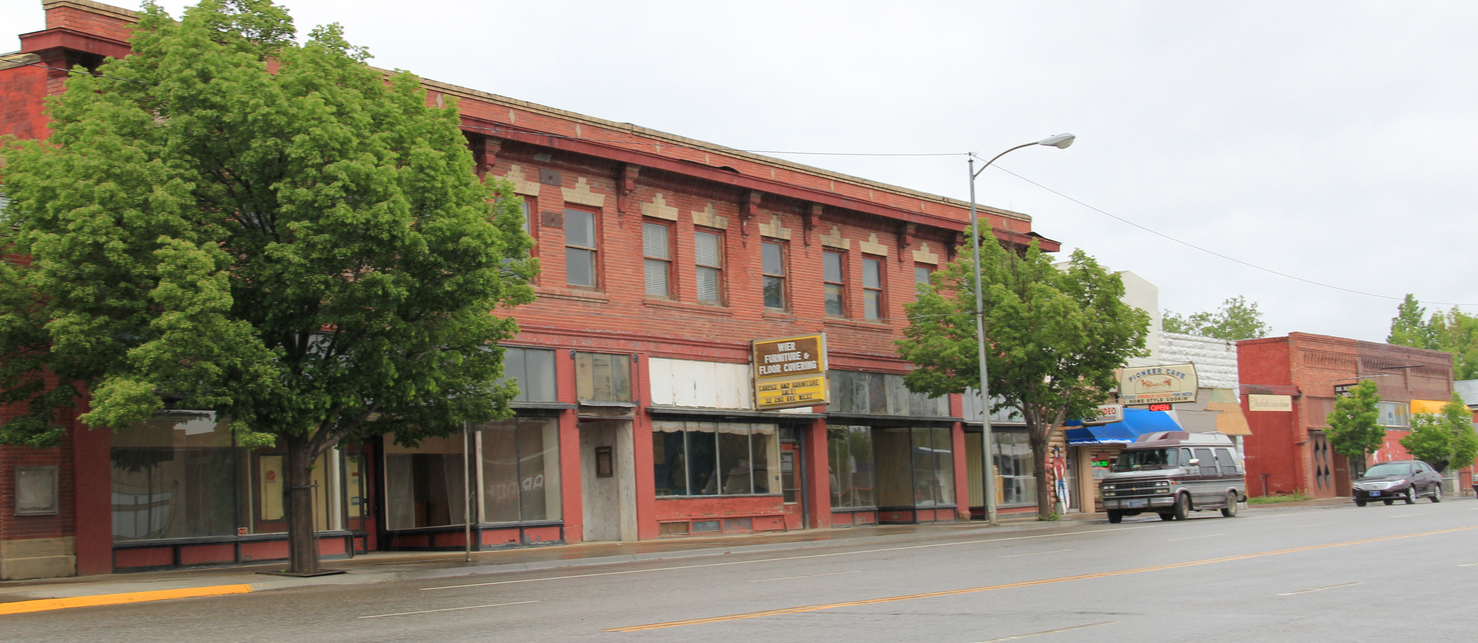
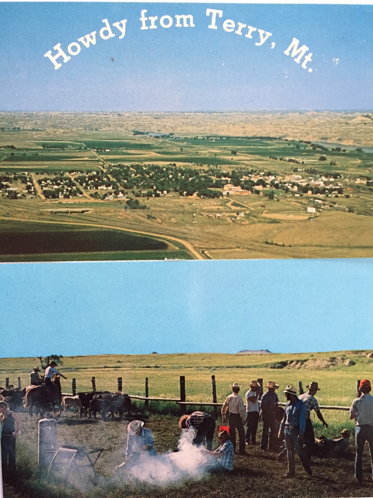
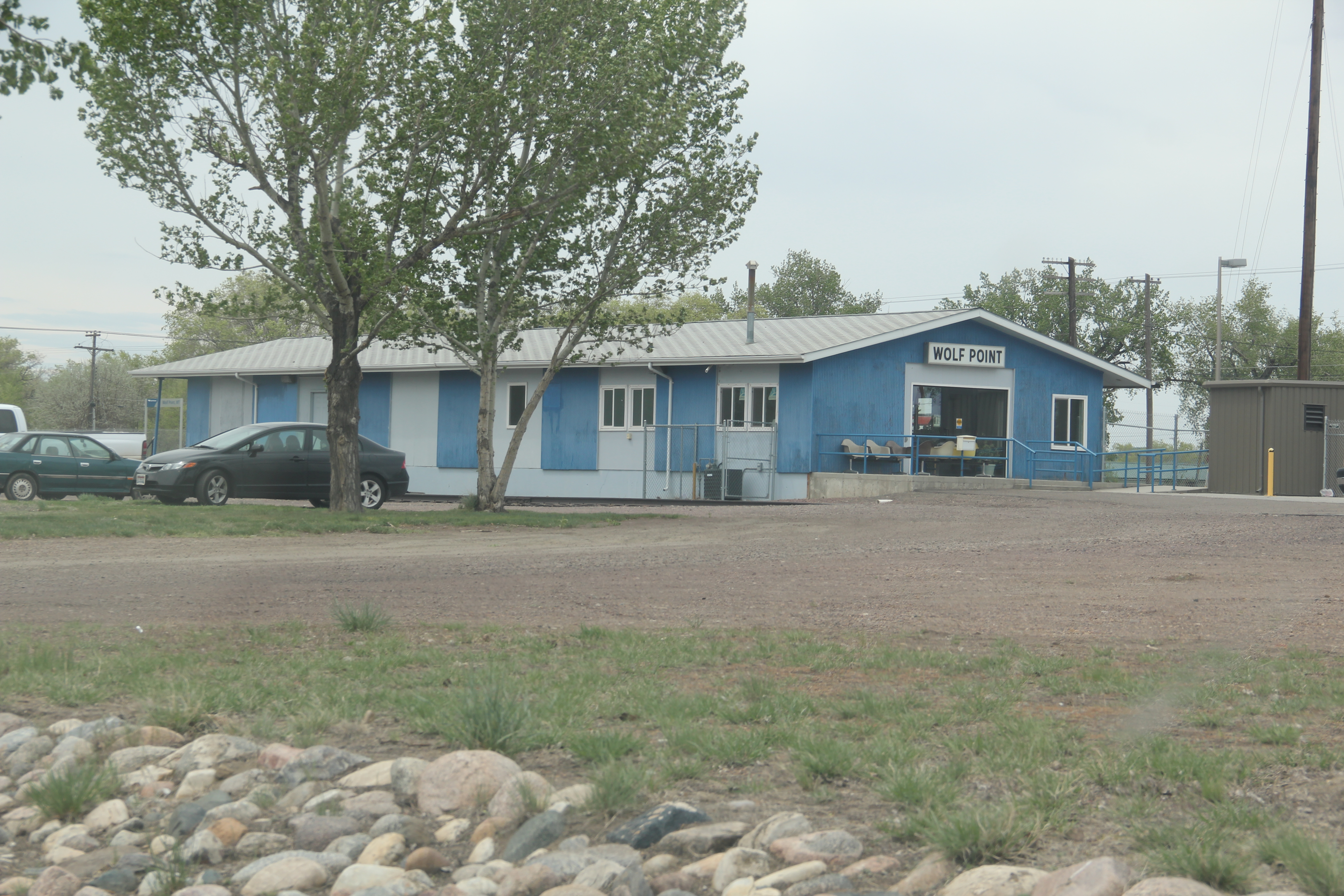
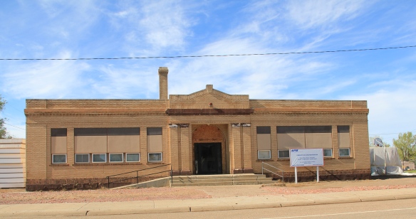
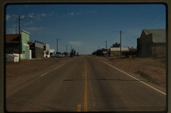
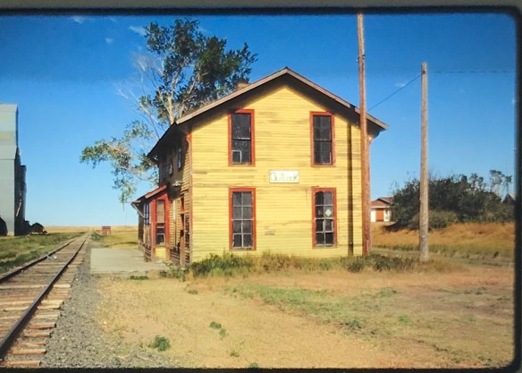
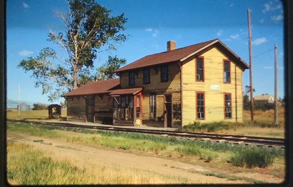
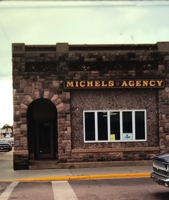
The Milwaukee Road, the last transcontinental railroad to crisscross Montana, enters eastern Montana at the town of Baker, established in 1908, which served as an important rail center for the company with the full name of the Chicago, Milwaukee, St. Paul and Pacific.  When I visited Baker in 1984 i noted that many of its buildings dated from the homesteading era although there was a clear second layer of development died to the region’s oil boom of the late 1960s and 1970s.  In A Traveler’s Companion to Montana History (1986) I noted “Baker’s railroad corridor is still largely intact, and the spatial arrangement created by its Milwaukee depot and the neighboring Baker Hotel, an imposing brick building dating to 1916, symbolizes the railroad’s importance to the town.” Both buildings are gone now unfortunately but an indication of the prominence of the corridor is still conveyed by the brick building below which has served the community in many commercial and professional ways over the decades.

IMG_0390

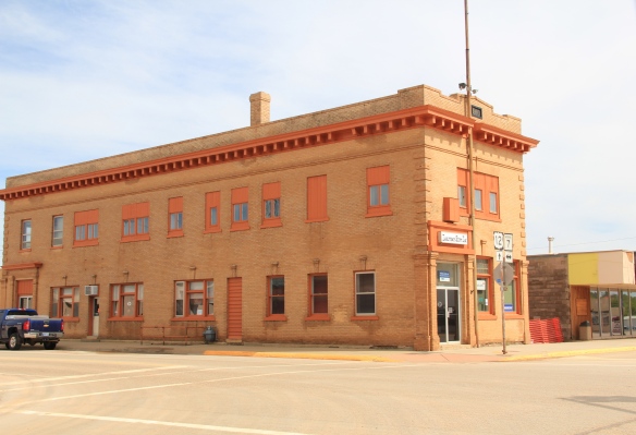
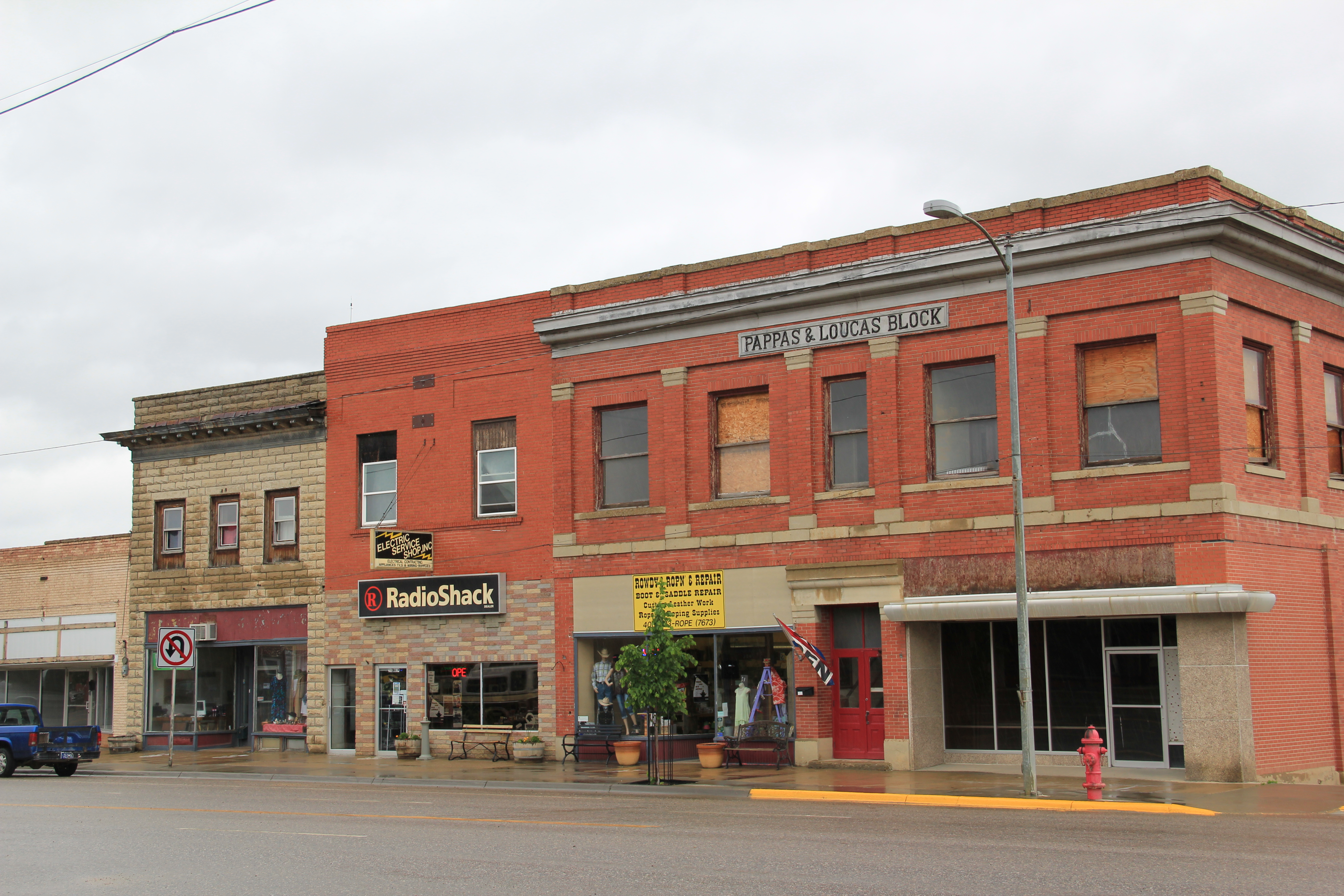
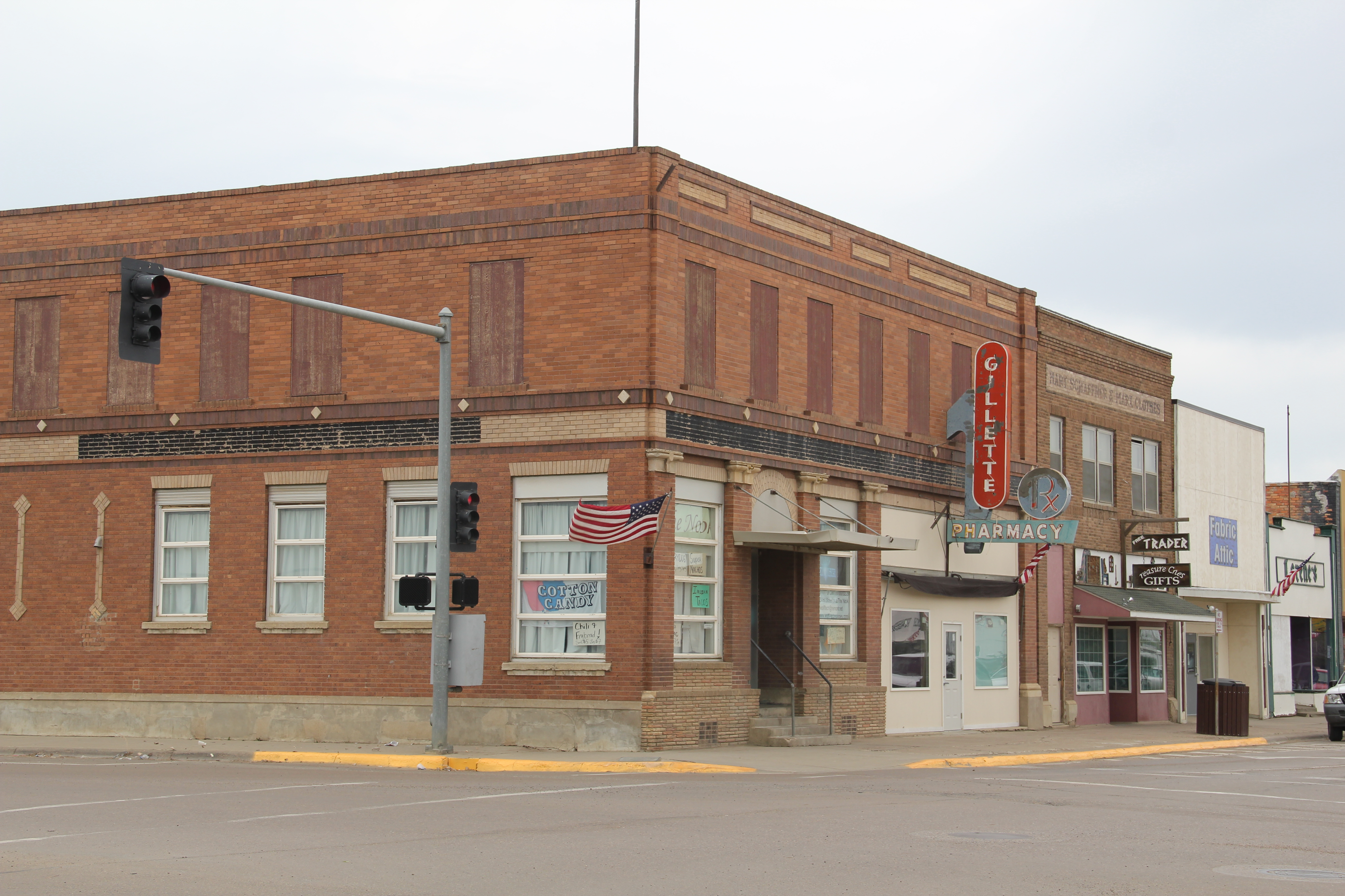
Insurance was just one of the services provided by this neoclassical styled building.

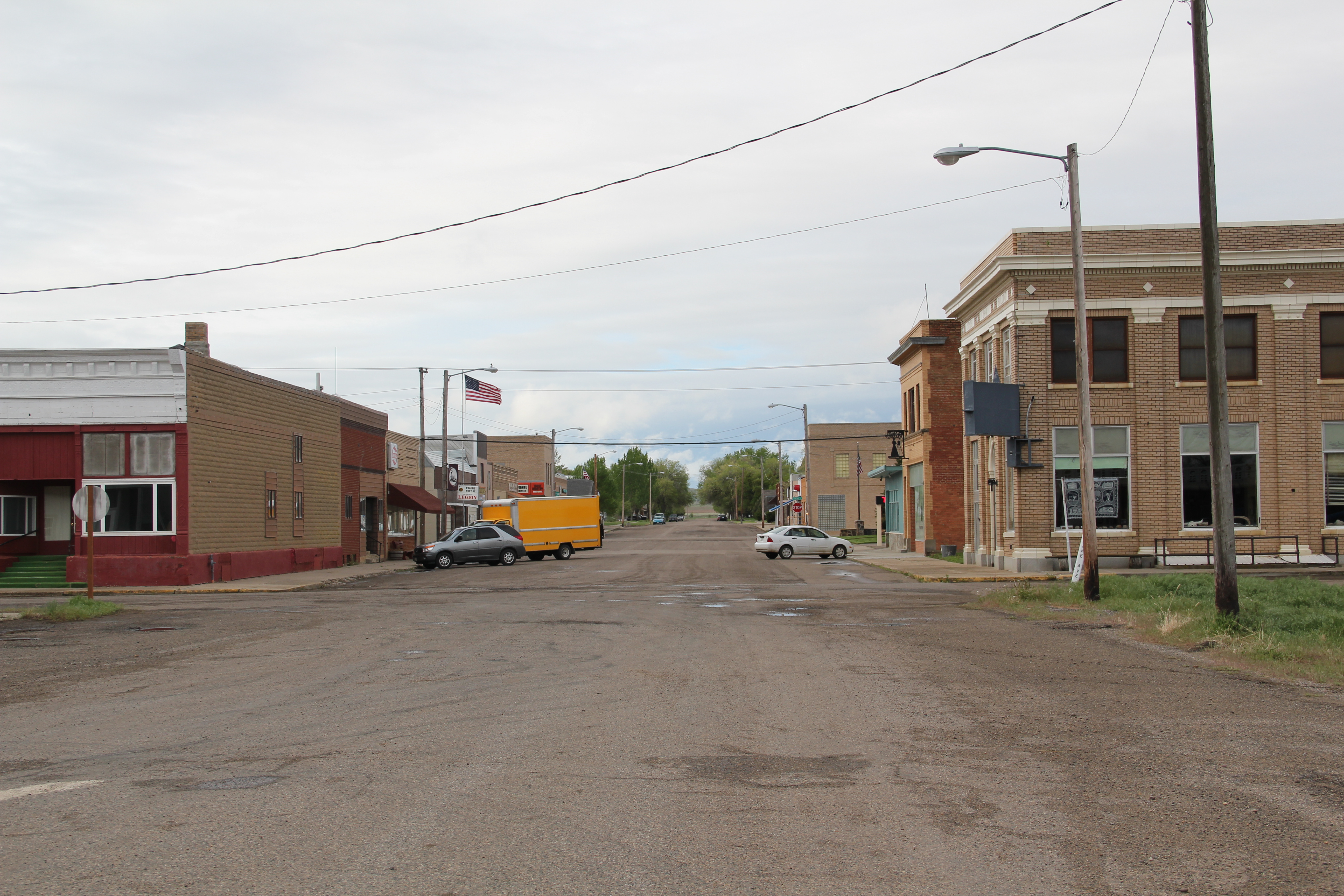
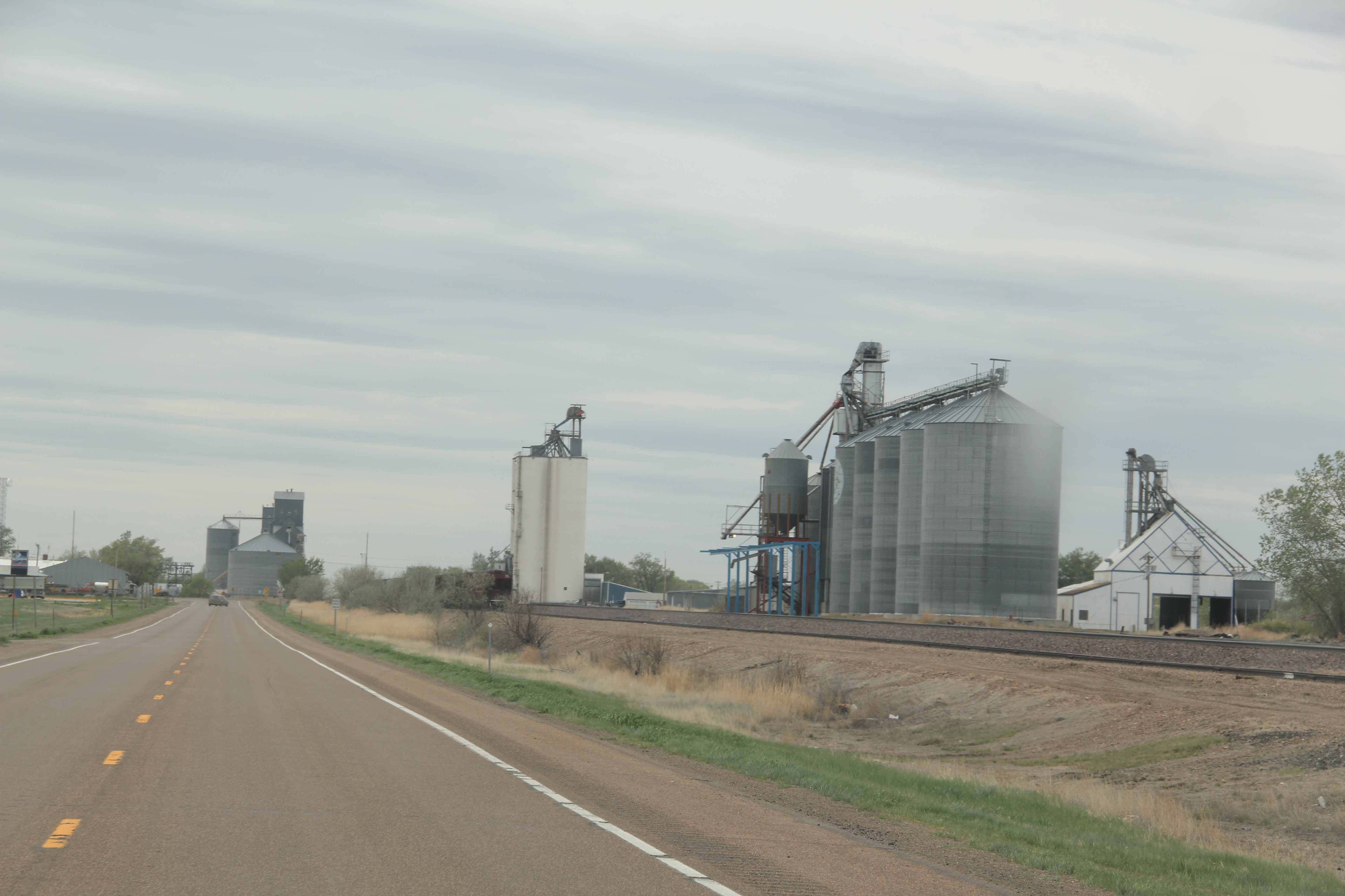
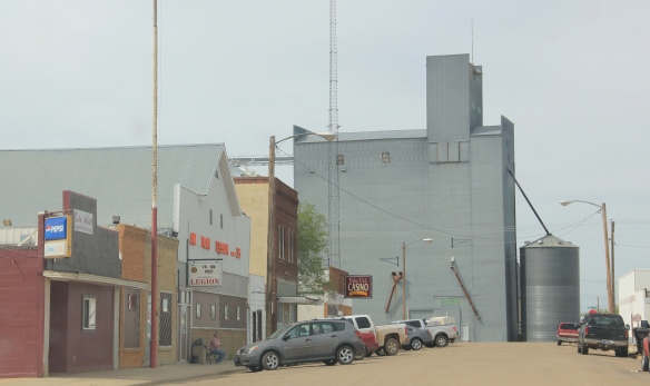
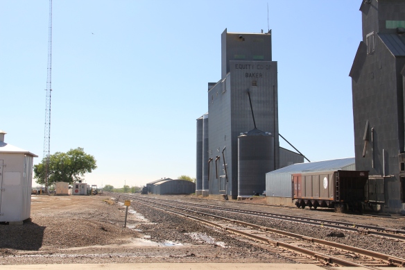
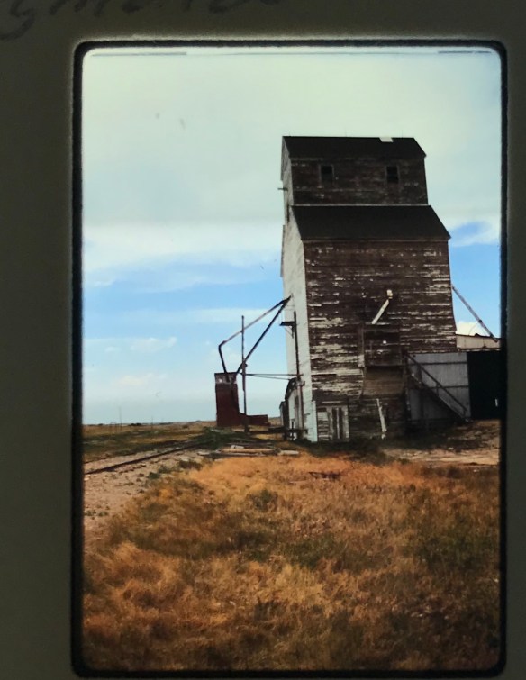
Today the hotel, the tracks, and the huge grain elevators along the railroad corridor remain, and the elevators still visually dominate the surrounding mostly one-or two-story built environment.  But the depot is gone, leaving a hole in the town’s historic fabric.

IMG_0402Buildings and railroad tracks were not the only legacy of the Milwaukee in Baker–there was the large lake the company developed to provide water for its trains in a largely parched region.  The Baker Lake, 30 years ago, was undergoing another improvement project, part of the town’s generation-long effort to turn a forgotten corporate remnant into a community asset.  The company built the lake c. 1908 but soon found that the water was too salty–it corroded the equipment.  And so the lake sat, until the 1950s when the Baker’s Woman Club began an effort to convince the railroad to transfer the lake to local

IMG_0462
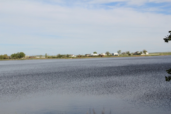
government.  County leaders became convinced that yes, Baker needed a community recreation asset, and eventually the land was transferred into the public use, and Baker Lake by the end of the century was an unique asset in southeastern Montana, and a center for recreation and special events.

Fallon Co Baker library  - Version 2
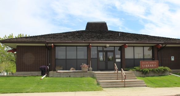
The lake is not the only contribution of the Woman’s Club.  it also was central in creating, staffing, and maintaining a public library, and the contemporary-designed library from 1970 remains but also has been enlarged since 1984.

IMG_0407

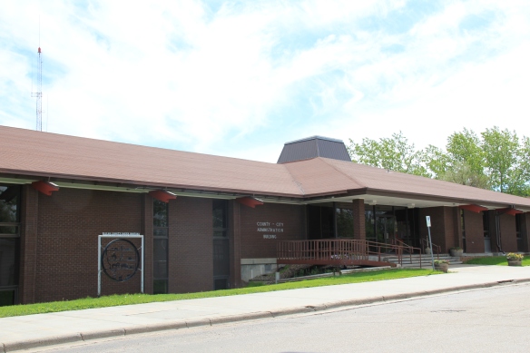
The Fallon County-City of Baker Administration Building, 1974-1975

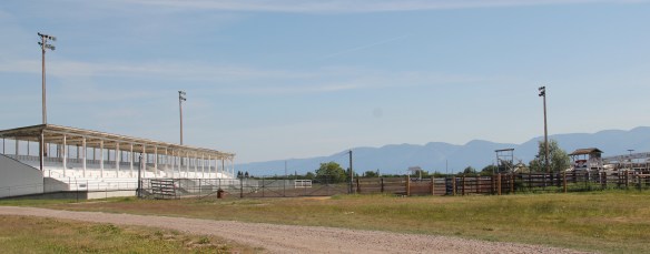
Indeed, I noted the recent construction of the 1970s in Baker, like the new county courthouse/city administration building where I held a public meeting, but I didn’t really process the layer of modernism in the town, a reflection of its growth from 1950 to 1970, when the population grew from 1,772 to 2,584.  The new joint administration building, designed by the Billings firm of Johnson Graham Associates, remains an impressive piece of contemporary design.  Architects Willard Johnson and Orval Graham had established the firm in 1967.  The Baker project established a connection between the firm and county that continued into the present:  the new grandstand at the Fallon County Fairgrounds is also a JGA design, from 2011.

IMG_0417

IMG_0419

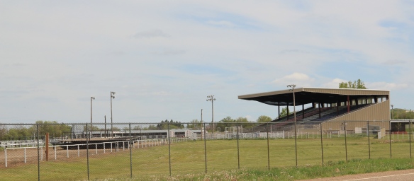
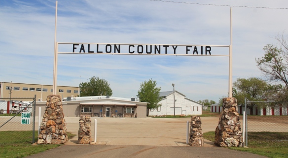
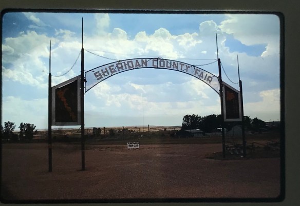
The tradition of county fairs dates to 1909 and today the Fallon County Fair is one of the region’s largest.

IMG_0465
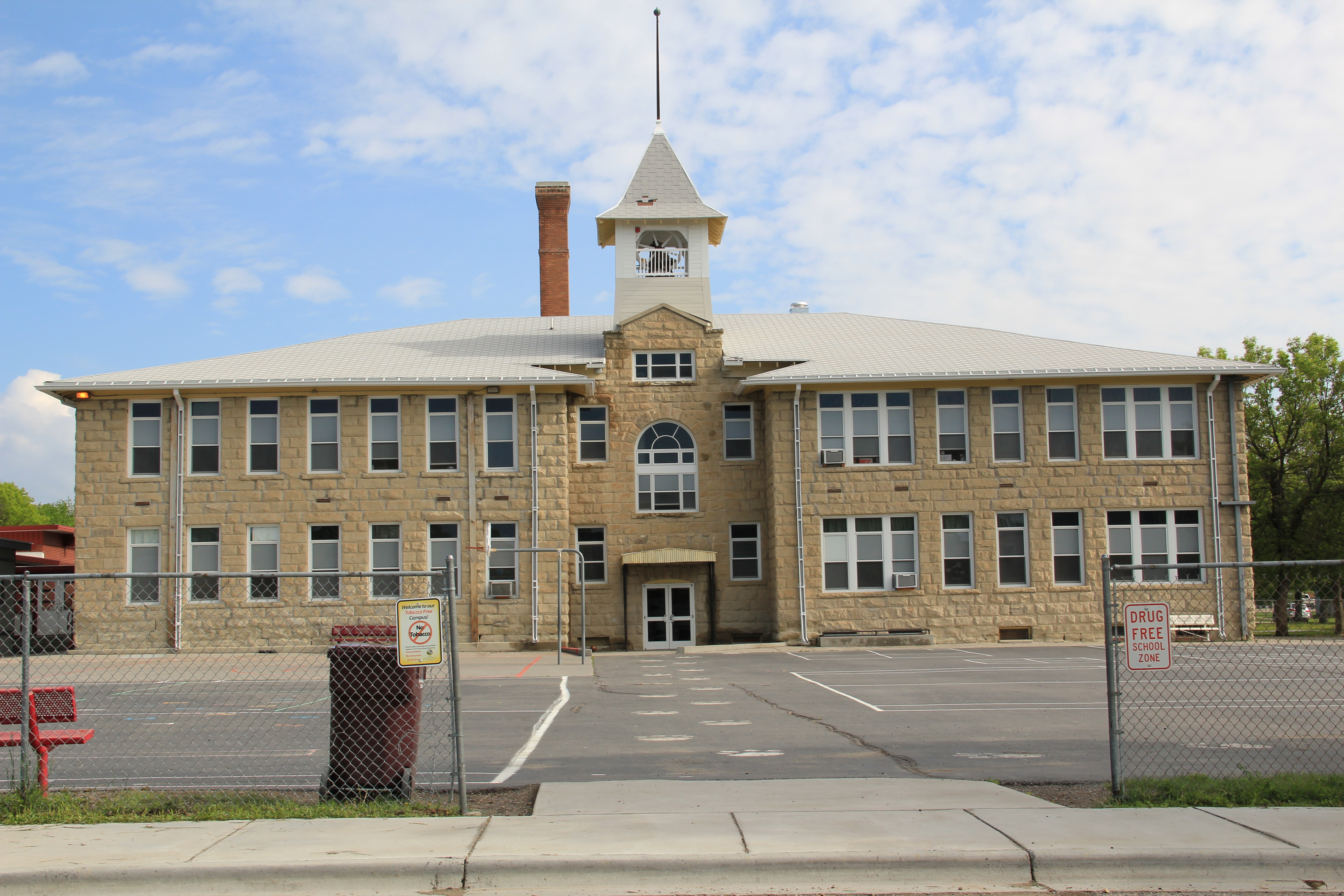
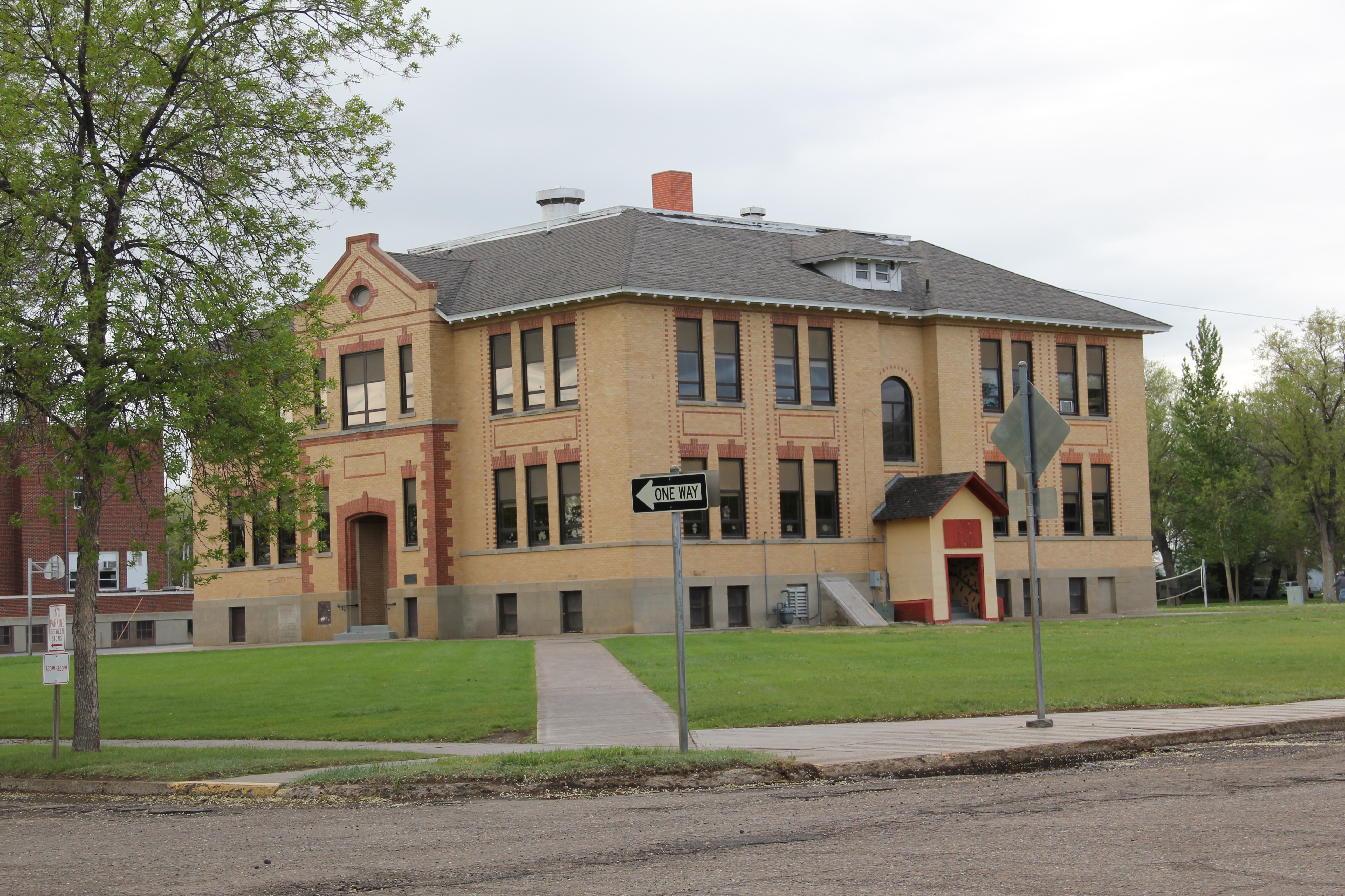
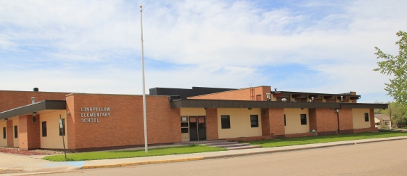
Historic schools are other important contributions to the town’s built environment.  Above is the Washington School, built in 1927.  It is a brick Classical Revival statement of the town’s insistence for permanence in the face of the homesteading bust. When I last visited in 2013, the school was undergoing rehabilitation to become an office building. On the other side of town stood a more modern design, the Longfellow School, built in 1968 during the height of the population boom in Baker.  Its low, rectangular mass was modern school design at its best, although since my 1984 visit the casement windows have been covered so central heat and air could be installed.

IMG_0410
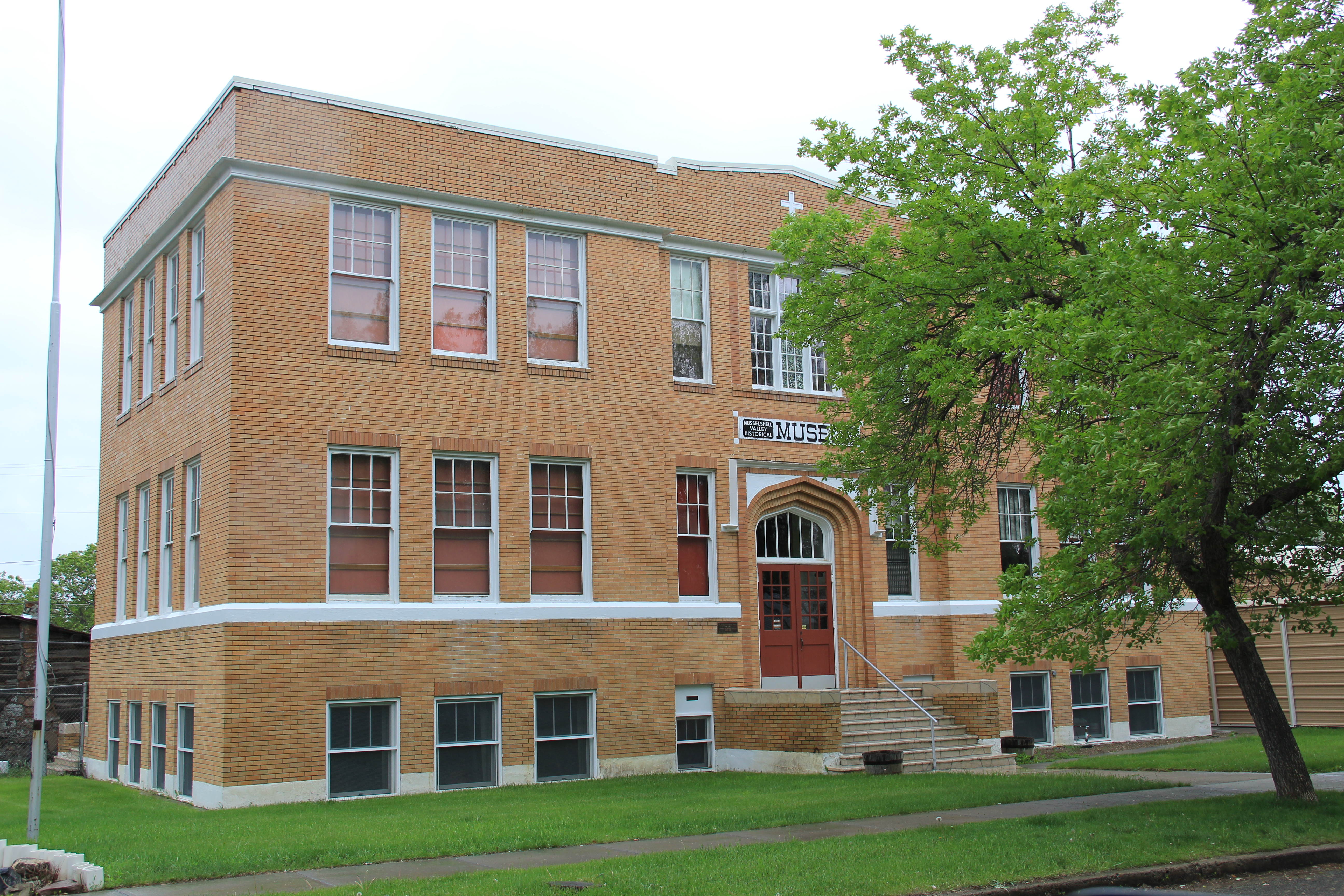
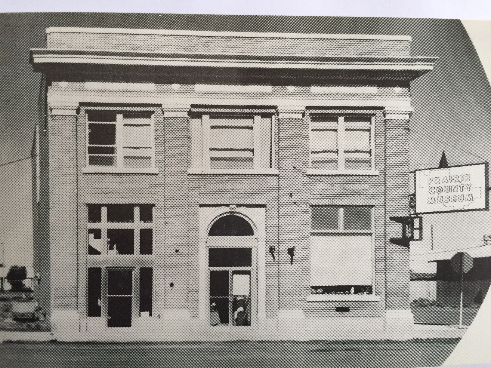
The second building in Baker listed in the National Register was the only one designated in 1984, and it was the pride and joy of the community:  the old county courthouse converted into the O’Fallon Museum.  Here was not only the historical exhibits typical of the area but also installations about the region’s prehistoric past and moved buildings to host special

IMG_0414
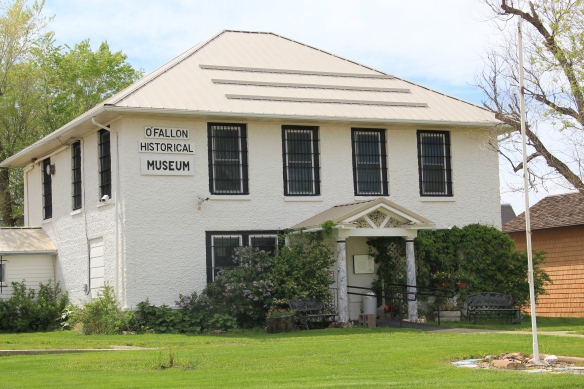
collections but also to interpret the homesteading past.  I will always remember my public meeting in Baker, for the obvious pride residents had in the museum but also for the comment that they could not wait to show me “our really old stuff,” such as a 1916 homestead.  Coming from my training at Colonial Williamsburg, considering places from 1916 as really old was a notion that took some getting used to, but of course in the context of settlement and development of southeastern Montana, it made perfect sense.

IMG_0463
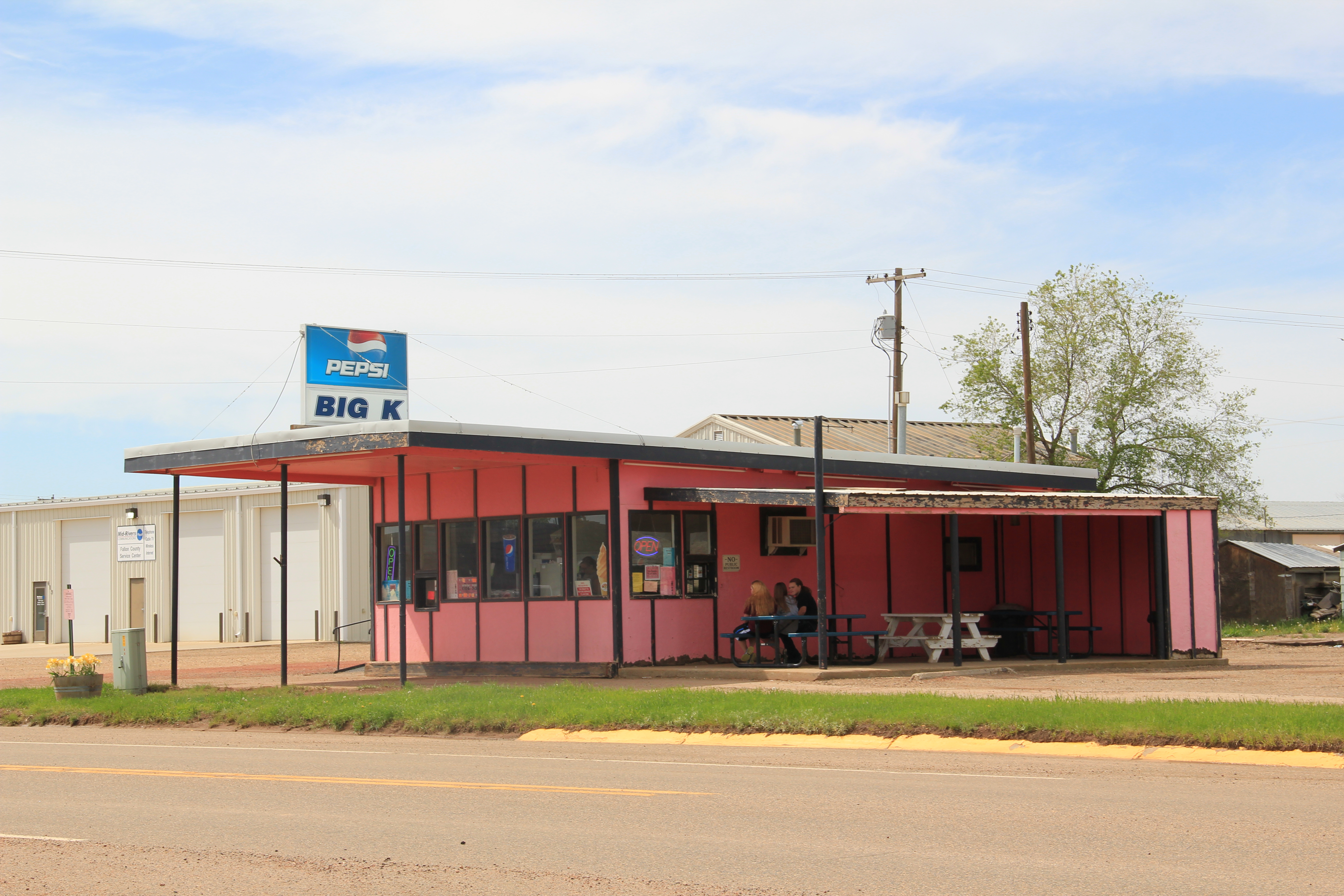
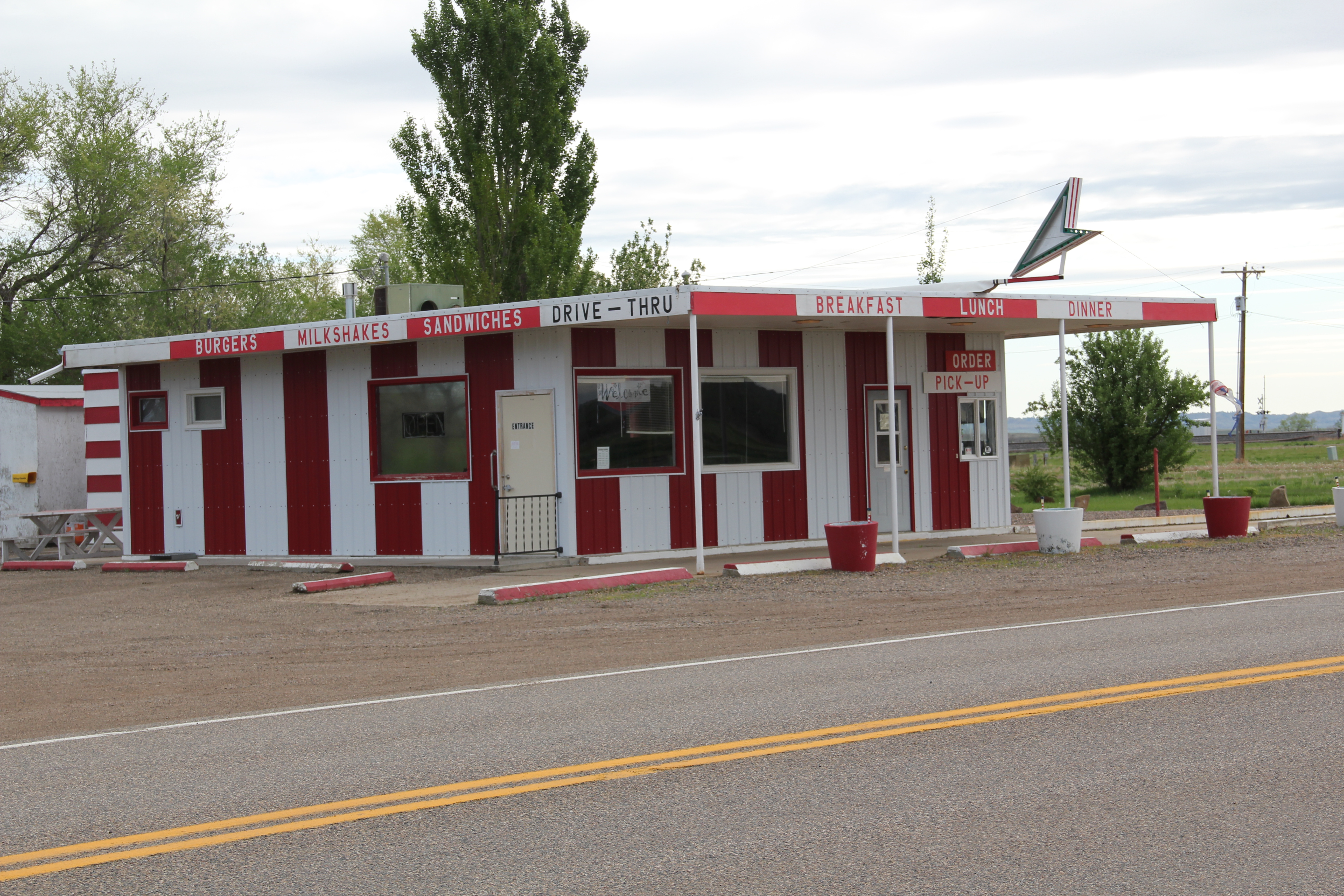
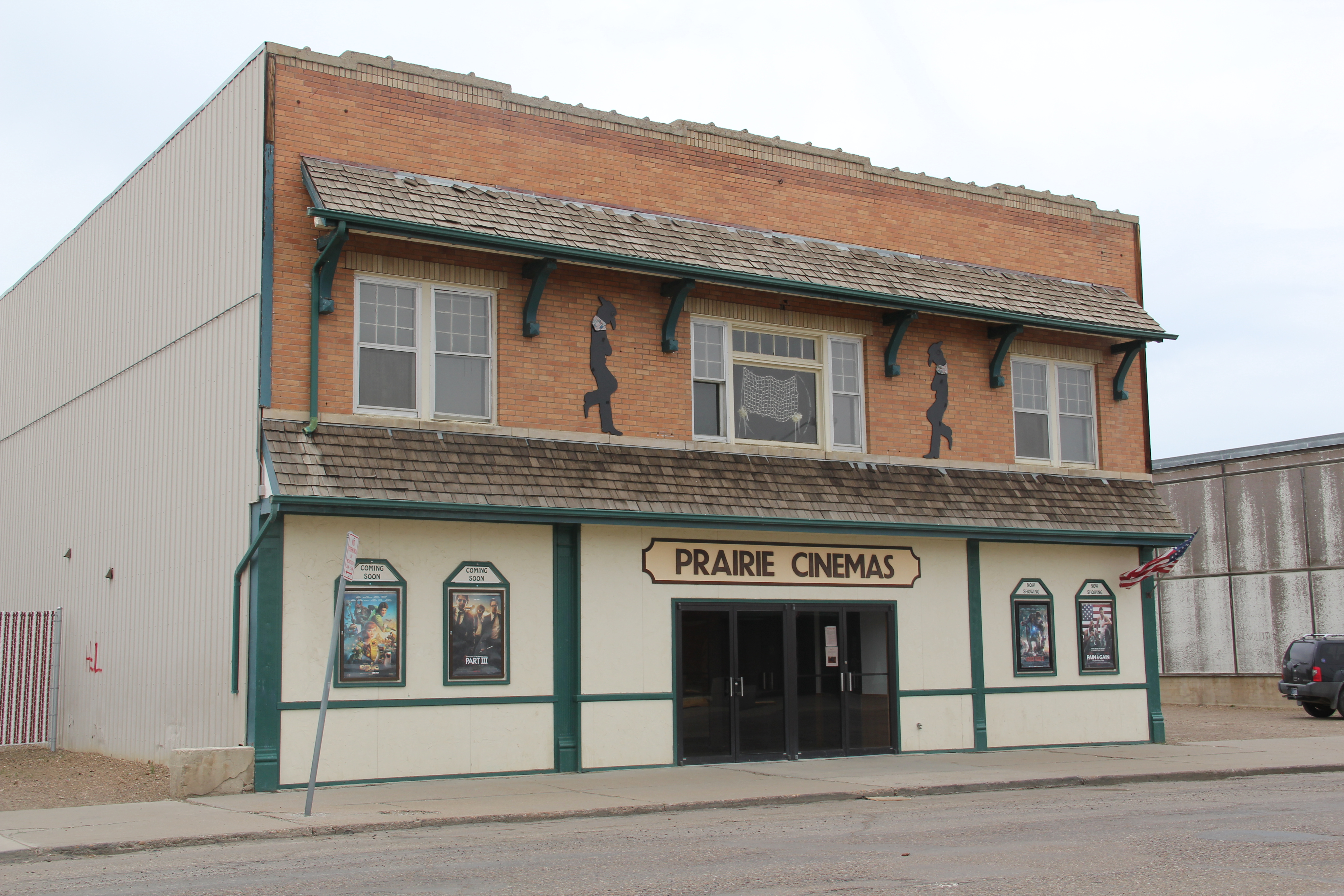
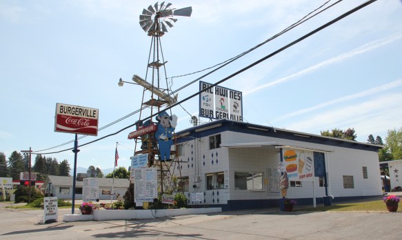
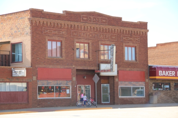
Today I would even join into the call for the “really old stuff”–like the Lake Theatre of 1918.  It certainly deserves a place in the National Register as so few classic movie theaters remain in this part of the state.  The same could be said for this classic c. 1960 drive-in,

IMG_0404which is part of the town’s roadside architecture traditions along U.S. Highway 12, the federal road that parallels so much of the Milwaukee Road’s route through Montana.  For

IMG_0472
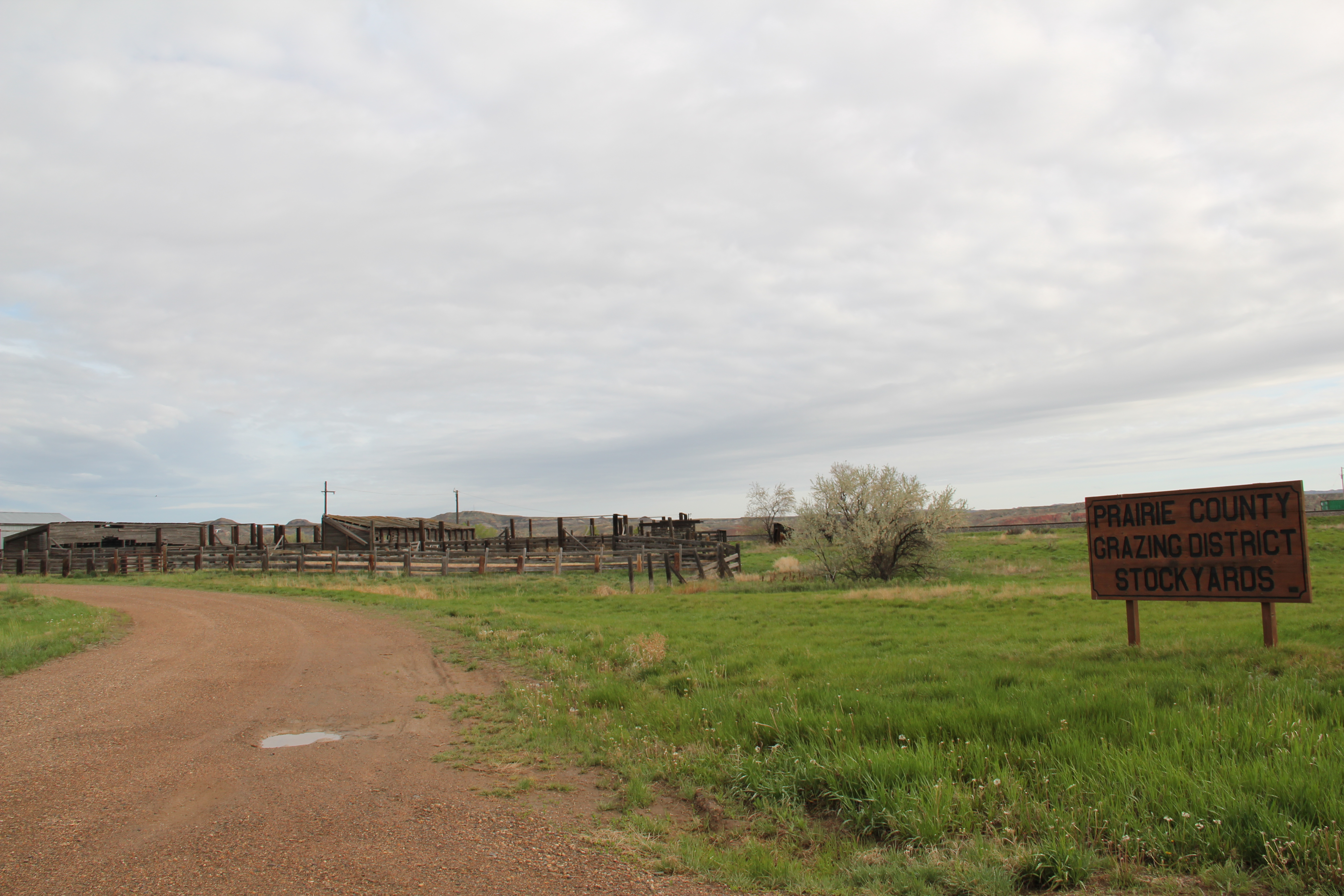
good measure I would even dare say that it’s time to assess the significance of the oil wells and facilities along Montana Highway 7 as you enter or leave Baker.  The discovery of oil and its development in the 1960s and 1970s certainly was the major economic story of the town and county in the second half of the 20th century.

IMG_0468
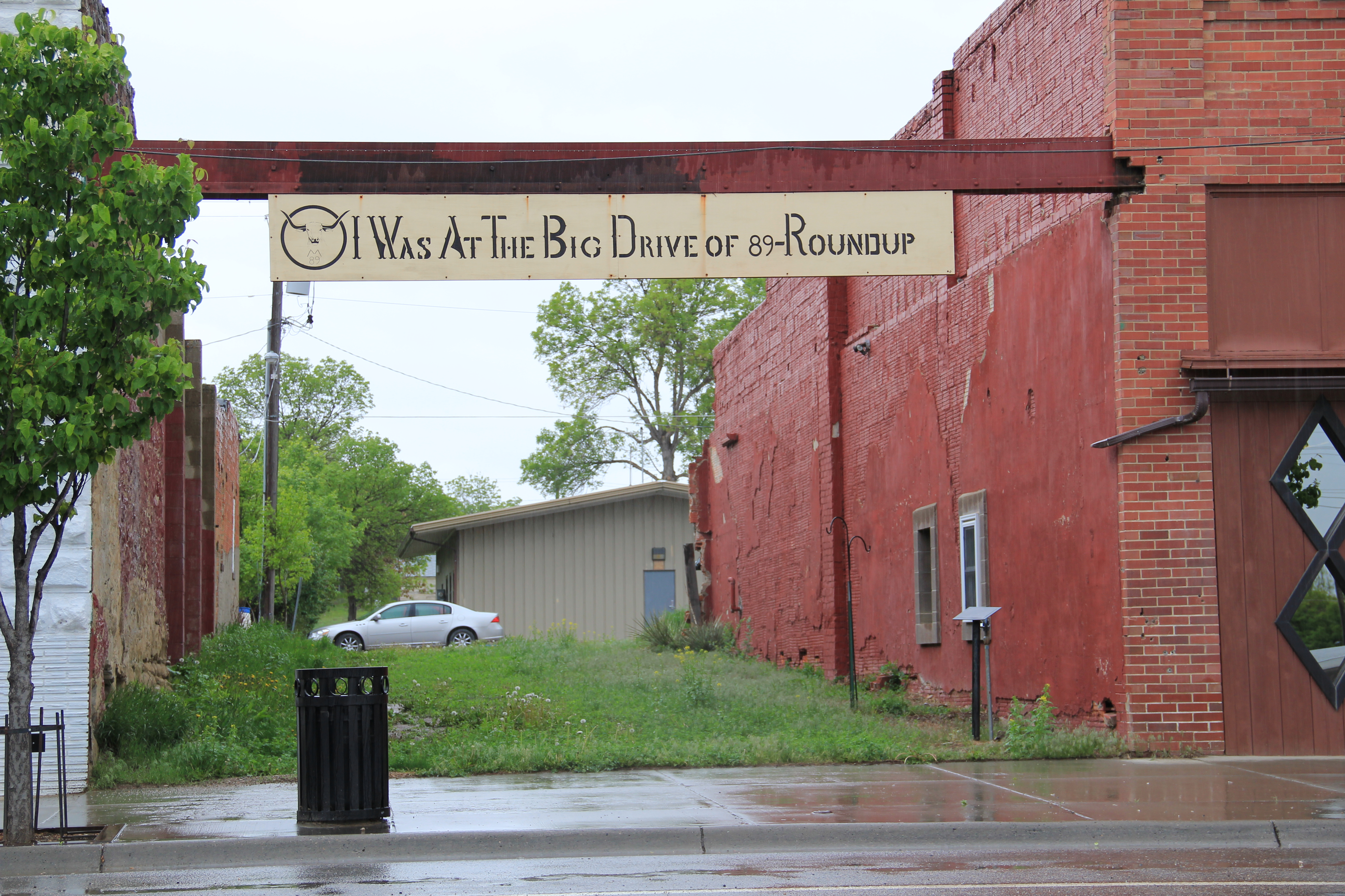
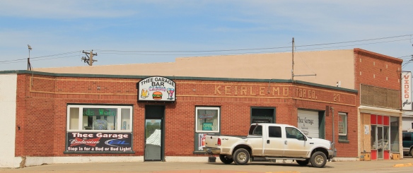
In 2015 Baker has retreated from that c. 1960-1970 boom.  Population peaked at 2584 in 1970.  It remained just a hundred or so under that in 1980, but changes in demand, technology and the bankruptcy of the Milwaukee meant that Baker in the last 30 years has lost residents, in 2010 down to 1741, about the same number as in 1950.  Yet I like that the lake had been restored, and it remained a vibrant part of the town, that new banks and new renovations were part of the town, and indeed, that an old car dealership and garage was now the very good Three Garages Bar.  Historic preservation can play a larger role in Baker’s future just as it did during Baker’s boom in the past.
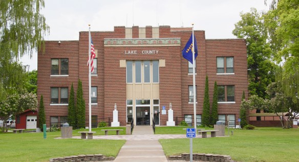
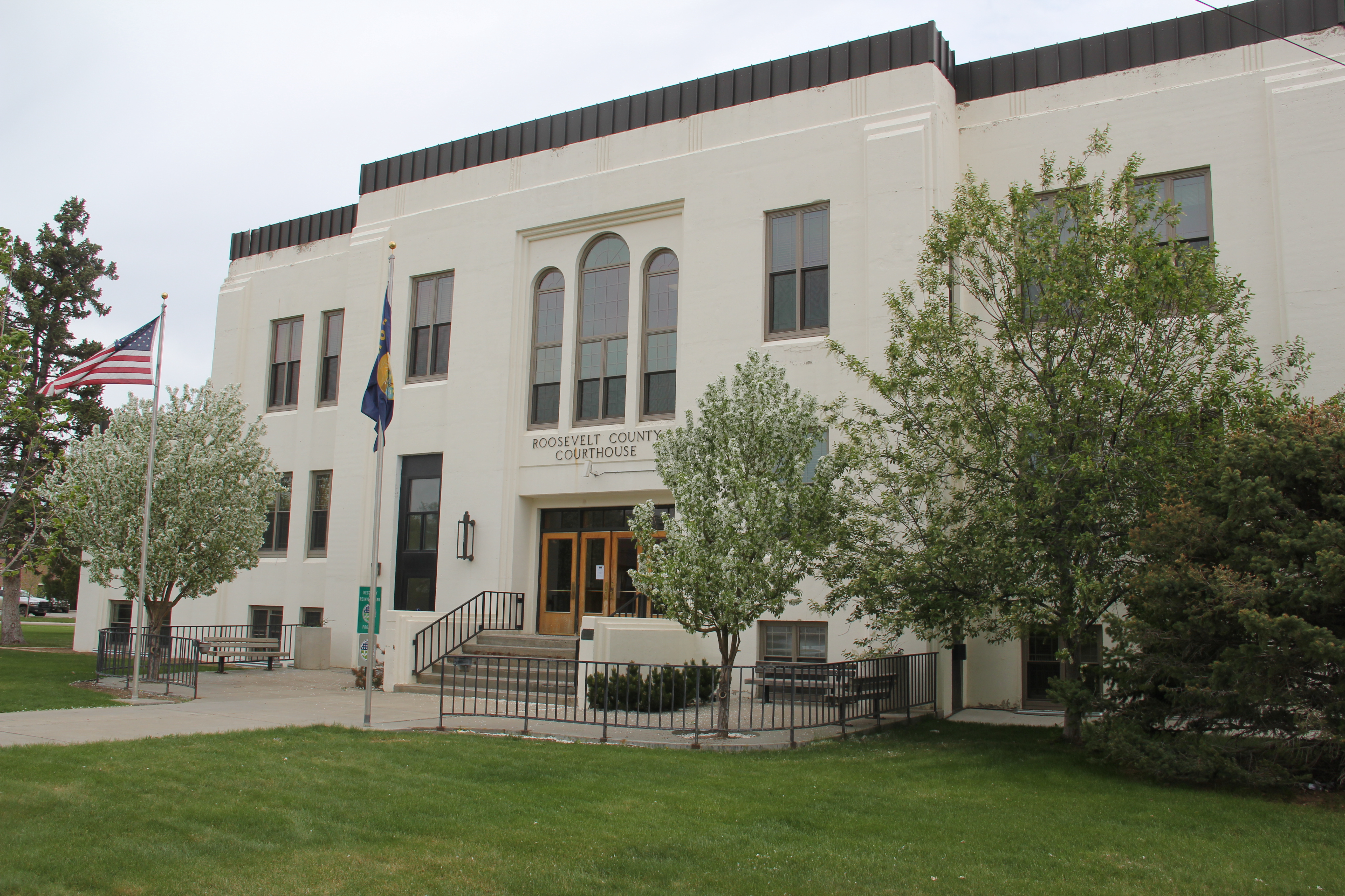
IMG_0397

Roundup, Montana: 19th Century Trail Crossroads and 20th Century Railroad Town

IMG_0080

Roundup, the seat of Musselshell County, has long been one of my favorite Montana county seats.  The old 19th century cattle trails are one important defining feature of the eastern Montana landscape; another are the railroad lines that crossed the region.  Here at Roundup, a north-south cattle trail crosses the east-west railroad line,  creating a town environment rich in history.

IMG_0078

Locals gathered at the town’s several good historic bars–the Arcade being my favorite–are rich in tales of the chaos and fun of early September 1989 when cowboys and pretend cowboys gathered in mass to recreate the “Great Montana Cattle Drive.”  A monument to that crazy day stands next to Roundup’s outstanding New Deal-era courthouse.  Another sign to that time is much more lonely, on Main Street, the old historic route of the trail (now part of U.S. Highway 87). Are you supposed to stand there for a selfie if you rode in ’89?

IMG_0077

IMG_0076

Arcade Bar, Roundup, a real Montana classic

IMG_0057

There are so many Stockman Bars in Montana. The one is Roundup has these two great Art Deco-like windows.

The coming of the Milwaukee Road in 1906-1907 created a new look to Roundup.  Like many Milwaukee towns in Montana, it has a T-plan, with the route of the tracks (the rails

IMG_0050

I was glad to see this light industrial adaptive reuse of the Milwaukee depot–it was abandoned in 1985 and could have been demolished.

have been removed since c. 1985) and the location of the depot forming the top part of the T while the stem of the T is the route of U. S. 87 as it stretches to the north.

IMG_0048

U.S. 87 N (Main Street), Roundup

Earlier posts have discussed the town’s contribution to Montana modernism, St. Benedict’s Catholic Church, and the superb Musselshell County Fairgrounds, one of my favorite in the state (and a public property eligible for the National Register IMHO). Roundup has two National Register properties–its two historic schools.  The St. Benedict Catholic School (c. 1920), designed by Roundup’s own John Grant, is now the Musselshell Valley Museum.

IMG_0036

The town’s historic public school, but in two major sections in 1911 and 1913, was designed by the Billings architectural firm of Link and Haire.   It is an impressive landmark, built from stone taken from the bluffs of the Musselshell River Valley, and one maintained with pride by the community.

IMG_0235

Many historic buildings from the early 20th century line Main Street–naturally many one-story buildings but also commercial blocks of style and substance.  There is also a lot of homes that would contribute to a residential historic district.  Roundup has lost population like almost all eastern Montana towns since 1980 but not by such a severe amount–just over 200 in the last 30 years.  Thus, the town’s historic buildings remain in use and in fairly good condition.

IMG_0063

IMG_0046

IMG_0039

The historic schools in Roundup have been a great start for heritage efforts in Roundup but this quick overview shows that more can be done, to document and preserve this pivotal place in the Musselshell Valley.

Down the Powder River to Broadus

IMG_0149

When I was able to carve some extra fieldwork in my limited time in Montana in 2013, there were two places in particular I was eager to revisit, both in the state’s far southeast corner. Broadus, the seat of Powder River County, and Ekalaka, the seat of Carter County, were tiny places in 1984.  Yet both made me very more than welcome in my work for the state historic preservation plan.

IMG_0146

My 1984 public meeting on the historic preservation plan took place at what was then the new Powder River County Courthouse, a real point of pride, obviously, for all of the residents.  Built in 1978 from designs by Harrison G. Fagg and Associates, the building is 1970s modernism at its best: low profile, earth-tone brick, at one with its setting but also with a functional modern interior where all of the work of county government could take place.  That night, the residents’ passion and interest in the past were intense.  They couldn’t wait, they said, to show me the oldest homestead house in the county, from 1916. I have recounted that story many times since:  it all depends on the context when you think of how “old” a property may be.  In the Powder River County context, it made sense: the county itself wasn’t formed until 1919.

Cross Ranch, Powder River Co

Another property I visited in 1984 following the public meeting was the Cross Ranch, and took the photo above of its overall setting.  At that time the county had no properties listed in the National Register:  the Cross Ranch Headquarters, with its distinctive hipped roof, would be the first, in 1996.

IMG_0147

Broadus itself has several properties that are also National Register worthy.  Although the population decline has been steep, from 712 in 1980 to merely 468 in 2010, I found its distinctive town square plan intact.  Town squares are common in the south and midwest but not so much in Montana since so many county seats are either mining towns, that grew quickly and haphazardly, or railroad towns with their familiar symmetrical plan or T-plan design.  My favorite landmark is the historic Montana Bar and Cafe, which is now the Montana Casino and Bar–the wild game collection is still there but like most historic bars across the state the pings of gambling machines now dominate the interiors as bar owners do what they can for income as rural populations continue to decrease.

IMG_0161

For a place under 500 people, in a county of just over 1100 residents, Broadus provides a range of outlets for recreation and entertainment besides the public school, from the county museum for visitors, the local library, a bowling alley, and a small movie theater.

IMG_0148

IMG_0156

IMG_0155

IMG_0154

The most important, and historic, community institution–again in addition to the public schools–is Cottonwood Park, where the annual Powder River County Rodeo takes place.

IMG_0178

IMG_0176

IMG_0175

The Let ‘Er Buck Rodeo is one of the region’s best, and makes the town come alive every summer.  Fairgrounds are so important in the rural west:  community gatherings matter to those who are scattered across this vast landscape.

IMG_0179North of Broadus on Montana Highway 59 is another landmark of community, but one quite rare to find in today’s west.  The Coalwood Ladies Aid Society was established in 1915; it still meets in the historic Coalwood School, c. 1945.  Women’s organizations like the Coalwood Ladies Aid served not only as a support group but also community builders for rural places across the region.

IMG_0183

Broadus was, and is, a place where the past matters and residents still embrace their way of life and special place in the Montana landscape.

Howdy from Terry!

Terry overview
Terry, the seat of Prairie County, has long been one of my favorite places in the Yellowstone Valley. Stuck between the much larger, and more famed, Yellowstone towns of Miles City (to the west) and Glendive (to the east), Terry has somehow developed and kept its own identity as a western place, and landscape, that still speaks strongly to the patterns that transformed the region over the last 150 years: railroads, homesteading, cattle, and town building.
IMG_4047
In 1984 I focused on the railroad imprint on the town, which began in the early 1880s as Northern Pacific officials understood the need for a railroad stop at place near the confluence between the Yellowstone and Powder rivers.
IMG_7154
In 2013, however, the depot was gone from the tracks but not the town. It had been moved to become part of the solid Prairie County Museum, a local institution that was still quite new when I first visited in 1984. Located in the town’s most prominent neoclassical bank building from the 1910s, the museum was a place where I held a public meeting about the preservation plan process and found a community totally engaged with its past.
Terry bank
IMG_7141
The museum highlights agriculture and ranching, and includes the Evelyn Cameron Gallery, which displays and celebrates the life and contributions of this important western photographer. One change I noted last year was the creation of the Evelyn Cameron Heritage Center, on Laudre Avenue just a few yards away from the museum, which is at the crossroads of Laudre and Logan Avenues.
IMG_7182
That crossroads was another pattern in Terry’s landscape that caught my eye. Most Northern Pacific towns, originally, were symmetrical plans, with a long line of commercial buildings flanking one side of the tracks and grain elevators and warehouses on the other side. Terry, however, had a classic T-town plan, with the tracks creating the top of the T and then a main commercial artery, in this case Logan Avenue, serving as the stem of the “T.”
IMG_7147
Why was Terry different? It is the impact of the Milwaukee Road as it built through the valley in 1906-1907. In 1984 there was still a second set of tracks, and a few scattered commercial buildings, to the north of the Northern Pacific mainline. Today two buildings remain along with the roadbed that marks this second period of Terry’s growth.
IMG_7144
IMG_7143
IMG_7133
Just west of the “downtown” you can find the one still thriving institution associated with the Milwaukee Road impact on Terry: the Prairie County Fairgrounds, which once faced the Milwaukee’s main line. (I have discussed the fairgrounds in an earlier post.)
IMG_7138
Another wave of change came to Terry in the 1920s as U.S. Highway 10 gave the town another transportation pattern. The highway’s crossroads with the original T-plan commercial artery is marked by a still extant somewhat Art Deco-styled brick gas station/ auto dealership.
IMG_7178
The most recognized roadside landmark is the Kempton Hotel, a true rarity now for this section of the Yellowstone Valley as those rambling montage of buildings that once constituted places of rest and relaxation along the nation’s highways have largely disappeared from the landscape.
Then, just yards away, is another rambling montage of historic buildings, the schools of Prairie County, ranging from the large stately multi-story brick buildings of the early 20th century to more restrained modern buildings of the second half of the century.
IMG_7168
At the edge of town are three different properties, all related to the need for highway transportation. The Dizzy Diner is a classic 1950s drive-in while the crumbling Terry drive-in also speaks to past patterns in popular culture. Then the Prairie County Grazing District Stockyards connects the present to the past traditions of stock raising in this region.
IMG_7187
IMG_7191
IMG_7189
Certainly the biggest change is Terry from 1984 and 2013 was the transformation of the county courthouse. In 1984 I was shocked that there was only an unadorned concrete block building for the courthouse, and I have shared images of that building across the country. Well the concrete block building on Logan Avenue is gone, replaced by a much larger, still unadorned building for local government.
IMG_7174
IMG_7175
Terry’s population has dropped by a third since my first encounter with the town in the early 1980s. But new public investment, and a still commercially relevant “downtown” speaks volumes to the residents’ commitment and faith in this small yet significant Yellowstone valley town.

Wolf Point on the Hi-Line

Great Northern corridor along U.S. in Roosevelt County

Great Northern Railway corridor along U.S. 2 in Roosevelt County

When I encountered the northern prairie of Roosevelt County in 1984, it was difficult to tear your eyes from the omnipresent tracks of the Great Northern Railway.  The trains roared past regularly, and the tracks defined space and town location throughout this stretch of U.S. Highway 2.  So when I arrived in Wolf Point, the seat of Roosevelt County, I immediately looked for the depot, and came away disappointed.  Here, for northeast Montana, was a large town: certainly I would

Wolf Point depot, Roosevelt  County

Wolf Point depot, Roosevelt County

find more than the standard-issue Great Northern design.  It was different but nothing as I expected.  No grand architectural statement–rather a modernist building with little ornament or aesthetics to it, except here was what the railroad had become in the second half of the 20th century–a functional transportation system not the town builder and landmark of the turn of the century.

IMG_7737 But as I explored the town in 1984, and visited it again in 2013, I found several places worth considering in this small county seat of 2621 in 2010.  First was the impact of the New Deal.  Roosevelt County–named for TR not FDR–received one of the most striking modernist courthouses in the state, courtesy of the Work Projects Administration.

IMG_7743


Encountering such a gleaming landmark of the federal imprint on the region startled me, but also started me looking much more carefully at the impact of federal projects on the region, a research interest that culminated in an essay titled “The New Deal Landscape of the Northern Plains” for the Great Plains Quarterly.

Wolf Point, like almost every Hi-Line town, had suffered from population decline.  The town’s heyday came in 1960 with a population of 3585, which had dropped by 500 by 1980, and another 400 since then.  Yet Main Street was alive, not dead, but dilapidated with later day “improvements” marring historic commercial facades.

IMG_7764

IMG_7752

Yet the town retained its historic movie theater, and had recently expanded a local history museum that has a remarkable array of objects.  Wolf Point in the 2010 census was about 1/2 Native American in population; the most impressive building added to the town since 1984 was the Fort Peck Community College.

IMG_7761

IMG_7751

Wolf Point also had hoped to become the final landing spot for the Montana Cowboy Hall of Fame.  It was a worthy contender not just for its open plains, but the Wolf Point Rodeo is among the state’s oldest, and the historic fairgrounds continue to host the “Wild Horse Stampede” every summer.

IMG_7755

Smack in the middle of U.S. 2 is another monument to the Montana Cowboy, and a symbol of the hopes that the Hall of Fame would land in Wolf Point.  This bronze statue titled Homage was executed by Floyd DeWitt and given to the town by the Fort Peck Assiniboine and Sioux tribes.

IMG_7753

To travelers along U.S. 2 Wolf Point may be considered as one or two blinks and that it is, but the history here is deeper, and strongly felt.  Yes it has the rails and the elevators to define the horizontal and the vertical but its landmarks continue to say:  we’re here and we matter.

IMG_7756

IMG_7756

IMG_7757