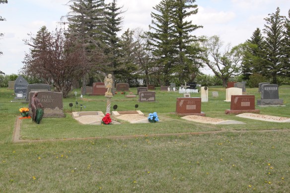
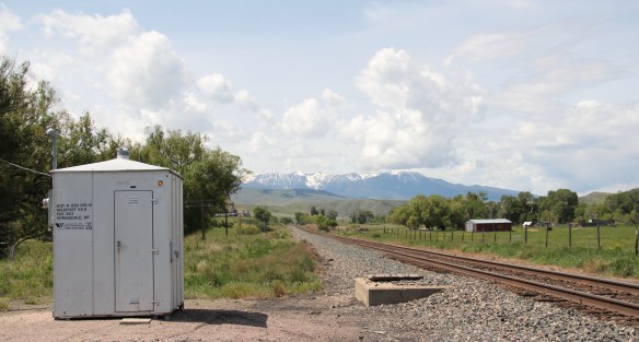
Milwaukee Road Corridor, Moore, 1984.
In my work with the State Historic Preservation Office in 1984-1985, my colleagues put up with many of my own peculiar interests and views of the Montana historic landscape, especially the focus on public buildings and the state’s railroad corridors. My interests, however, in the country towns of the Judith Basin was probably always a puzzler; staff always wished I would press on to Lewistown, where some of the best preservation work in the state was taking place in the mid-1980s (much more on Lewistown a bit later). But I must admit that the maze of small towns–never numbering more than 200 or so souls in any given place–created by the railroads as they fought for market dominance in the rich agricultural region of the Judith Basin some 100 years ago was just fascinating.

Grain elevators at Moore, 1984
And they remain so today. The geographer John Hudson had provided basic insights on the creation, distribution, and purpose of the country towns in the larger development of the northern plains–he coined the phrase “plains country towns.” The constant elements that they all shared–oriented to the tracks, the dominance of grain elevators, the prominence of depots–underscore the railroad era origins. But the towns all had their own individual places and statements, be it a woman’s club, a library, the school, and the bars and taverns. Thirty years later, much was missing from what I experienced in 1984–every place lost population between 1980-2010–but much still remained, and residents seemed determined to keep it that way.


Moore still has its grain elevators but the Milwaukee depot is long gone, creating an empty space along the corridor. Moore has the look of so many Milwaukee Road towns with a T-plan design apparent today even as the town decline from its height of 575 residents in 1920 to the 193 of today.
 But the town, which compared to many I visited in 1984 had declined to a lesser degree (229 residents in 1980 to 193 in 2010), still has its public institutions. The Moore Woman’s Club is celebrating its centennial in 2015 while the town’s public library is another key community center while the continued operation of the unassuming Moore public school

 is undoubtedly the major reason that the town is still here today.

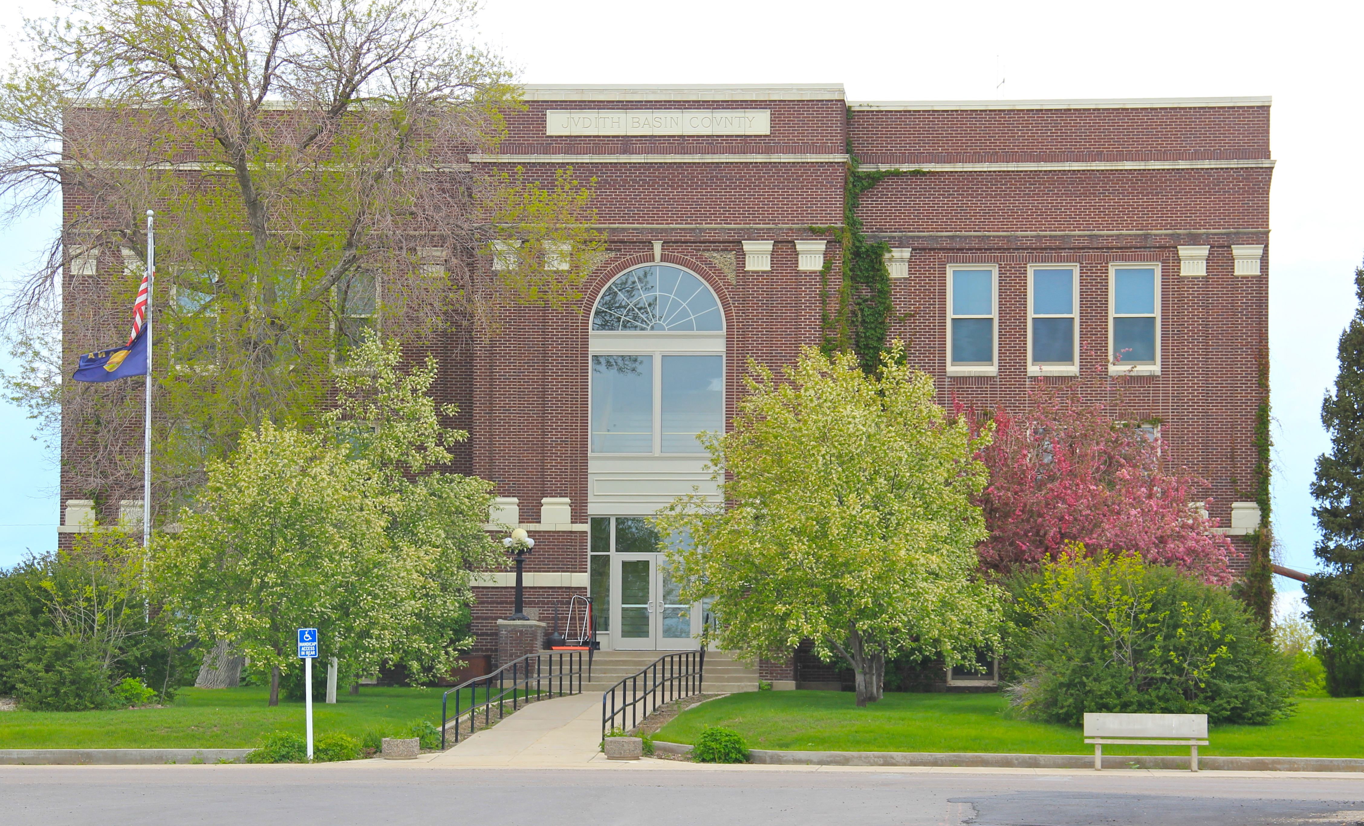
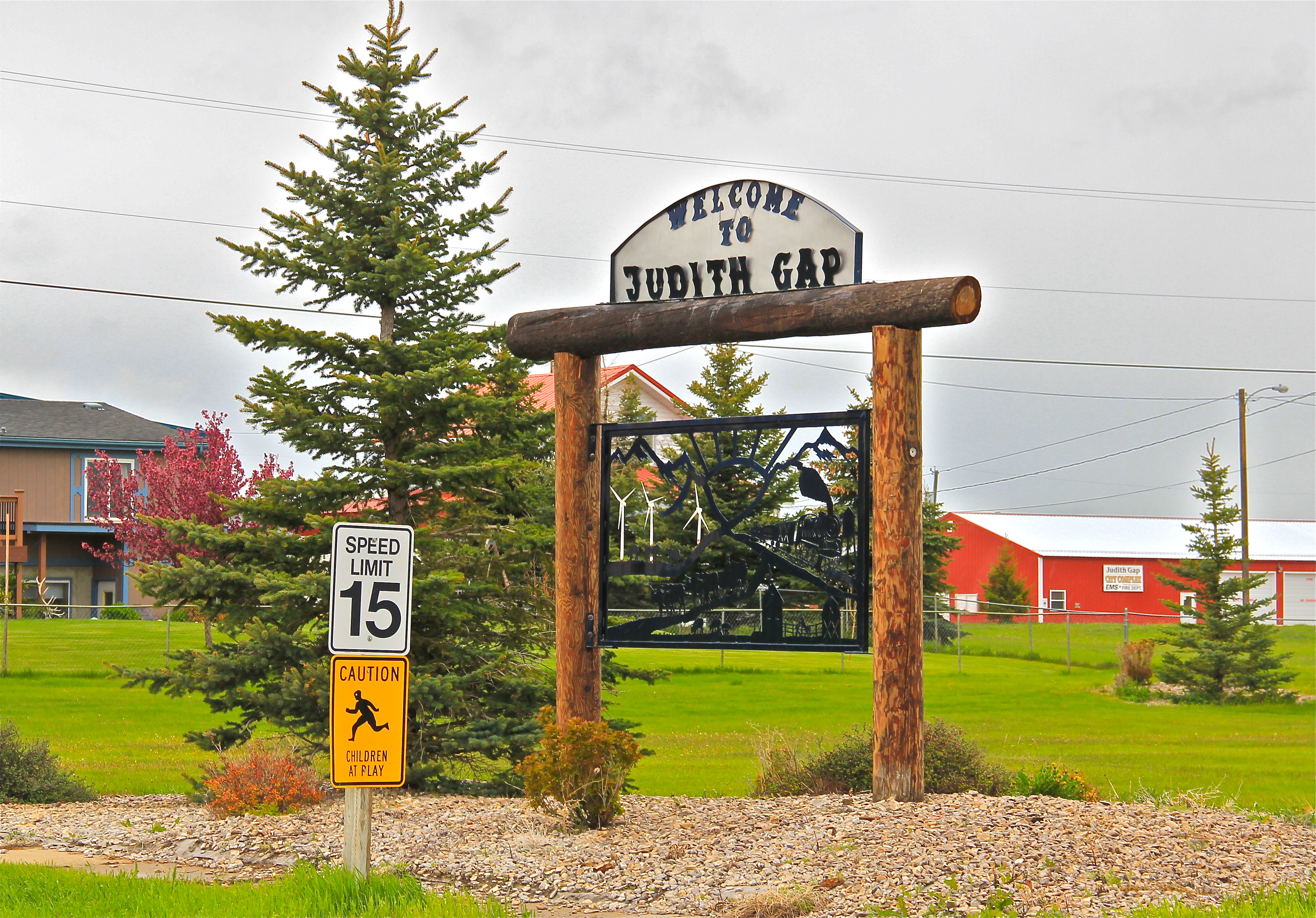
The Great Northern Railway spur line that snaked north from the Yellowstone Valley at Laurel through the Judith Gap then the basin was always a corridor of great interest to me, although the towns created along the way were small, seemingly inconsequential compared to the linking of Great Falls and Billings.
 Traveling north out of the Yellowstone then Musselshell valleys, the Great Northern line entered the basin at Judith Gap, and the homesteaders who followed built a grand two-story brick school that spoke of their ambitions.

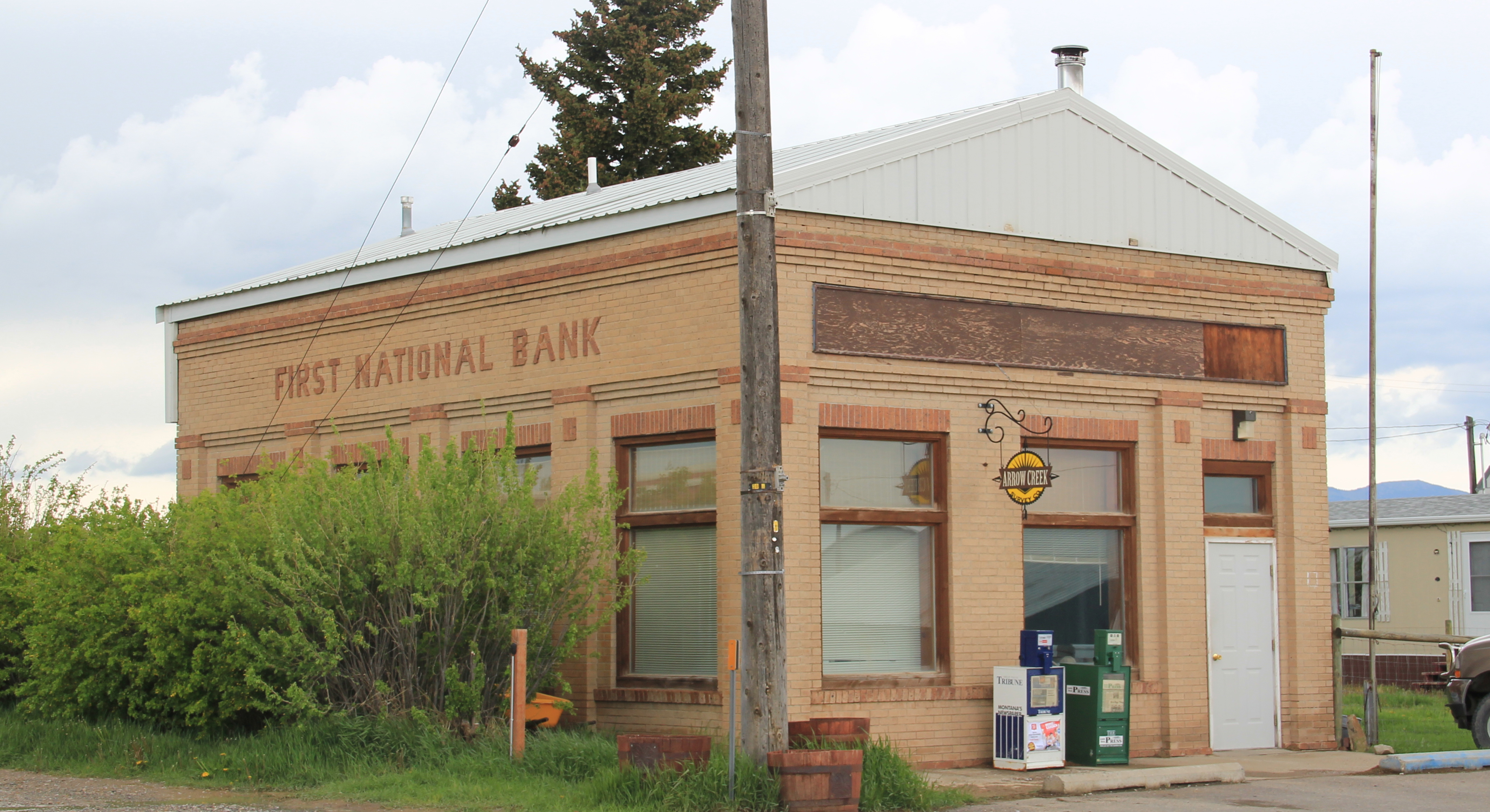
The corridor then left in its wake places forgotten today. Travelers along U.S. 191 may notice the old brick state bank building and elevators at Garneill, but they may not.

The highway veers away from the railroad line at Garneill, meaning that the old state bank at Buffalo was a forgotten place in 1984–and the town remains so today.

First State Bank, Buffalo, 1984.
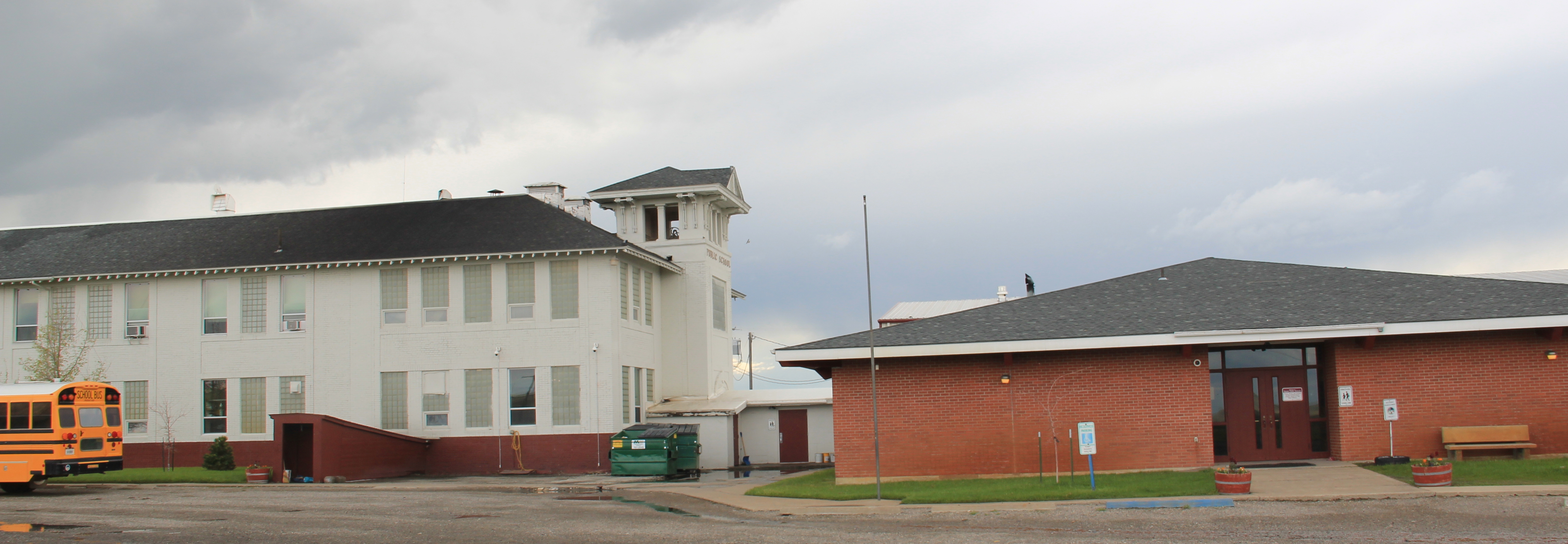
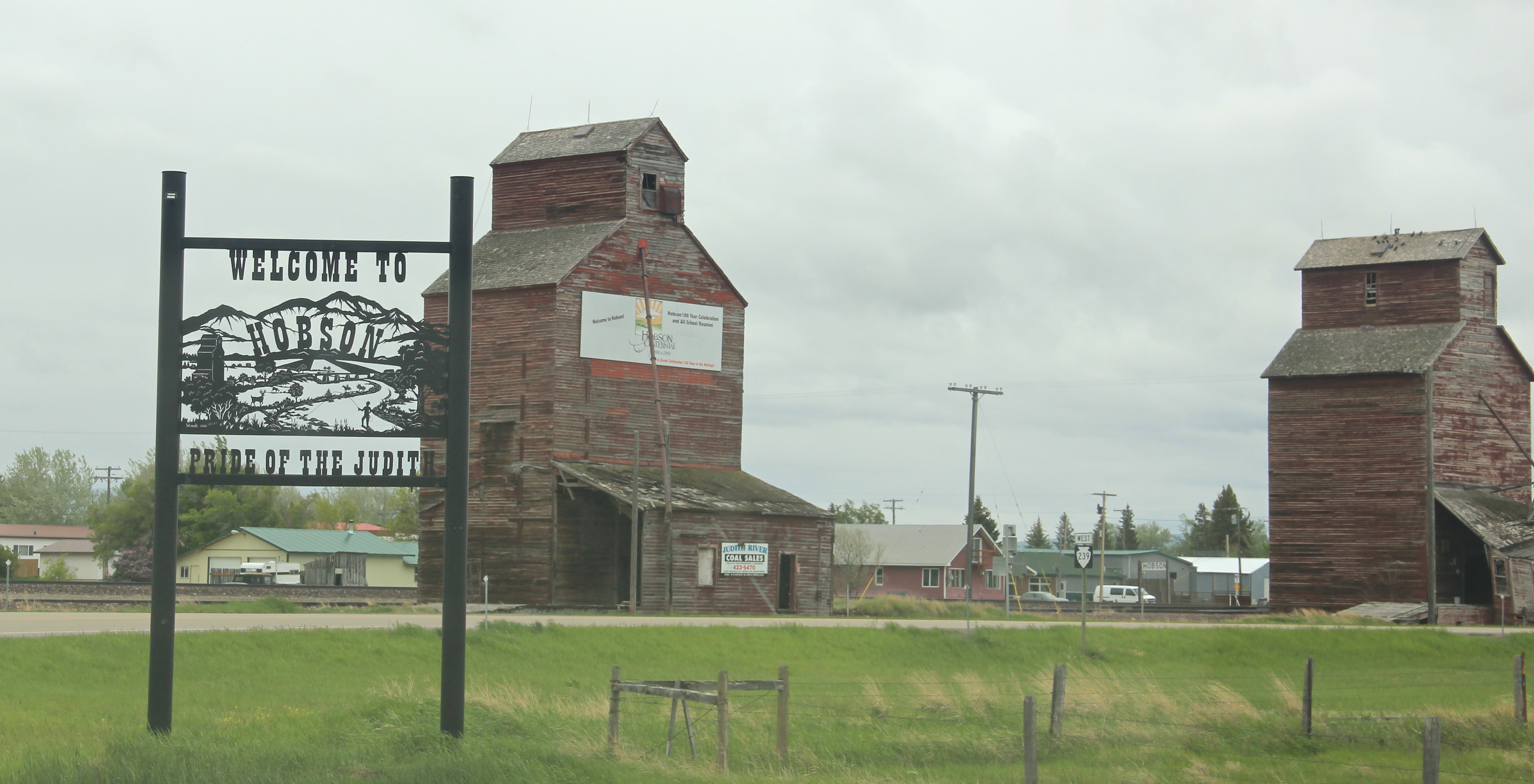
Hobson, on U.S. 87/Montana 200, has experienced a much brighter history. Its brick bank building houses a local bar. While no depot remains, the town’s railroad line remains a 
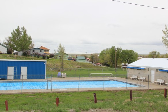
 point of focus, although most traffic, commercial and otherwise, relies on the highway. Hobson’s population when I visited in 1984 was at its height, 261 people in 1980, and it still tops over 200 today. Another defining characteristic is Hobson’s rather unique (for a plains country town) boulevard plan.
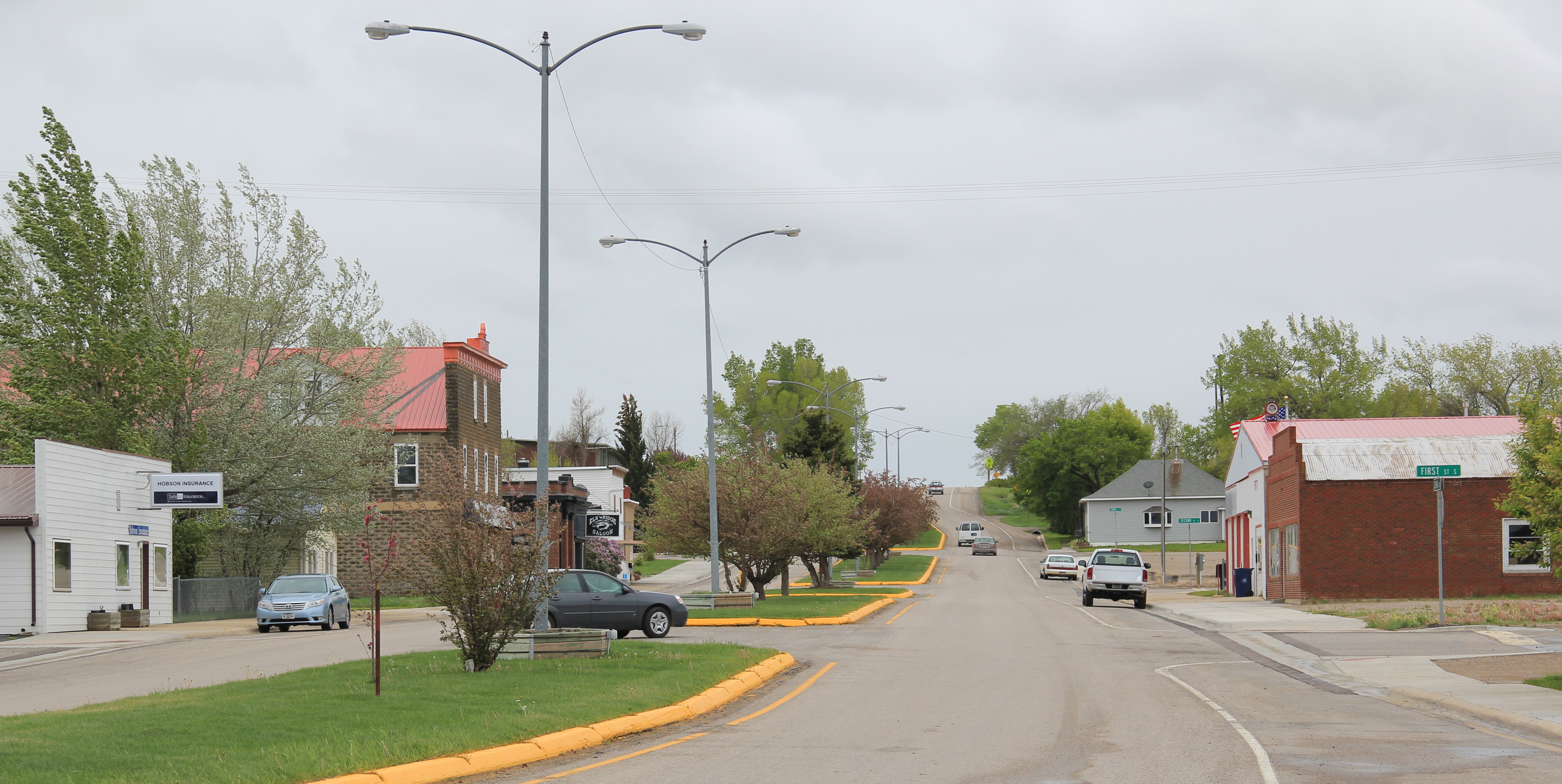
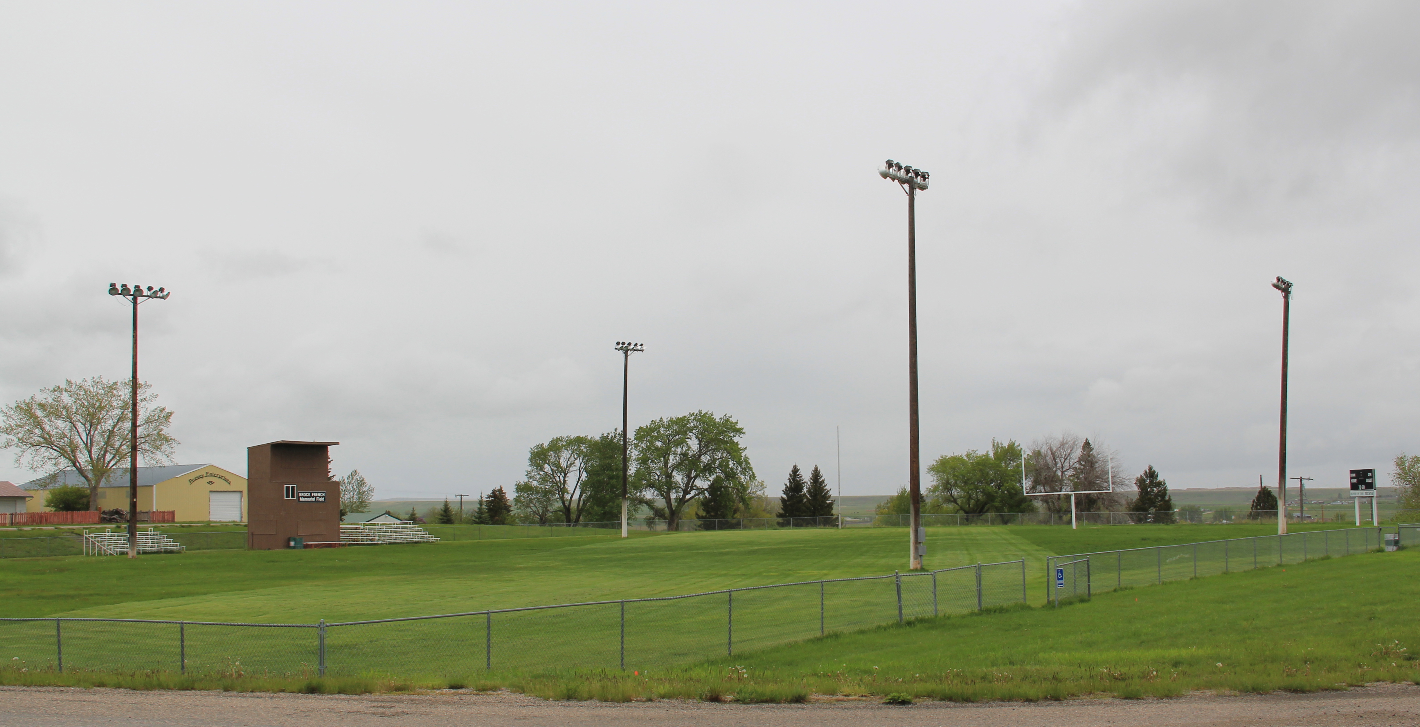
 On either side lie business and public buildings and the street ends at the high school, where the six-man football field is a central element of the community’s public landscape.
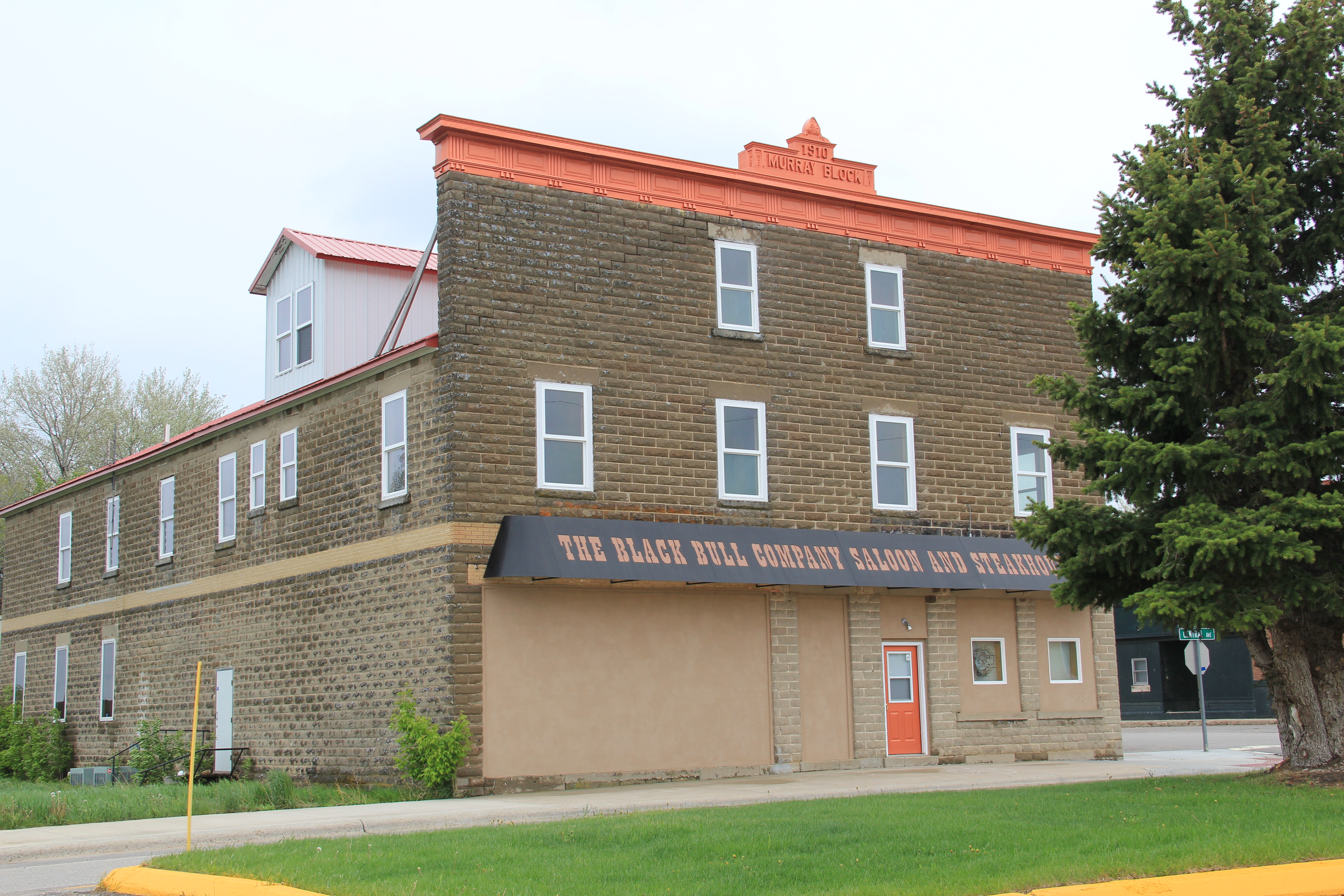
 The Murray Block, 1910, dominates the business district today as it much have done one hundred years ago–it is rare to see a false-front concrete block building. The Masonic
 Lodge probably helps to identify some of the builders of Hobson’s historic structures located on the boulevard. But whoever the builders were, here is a very interesting place


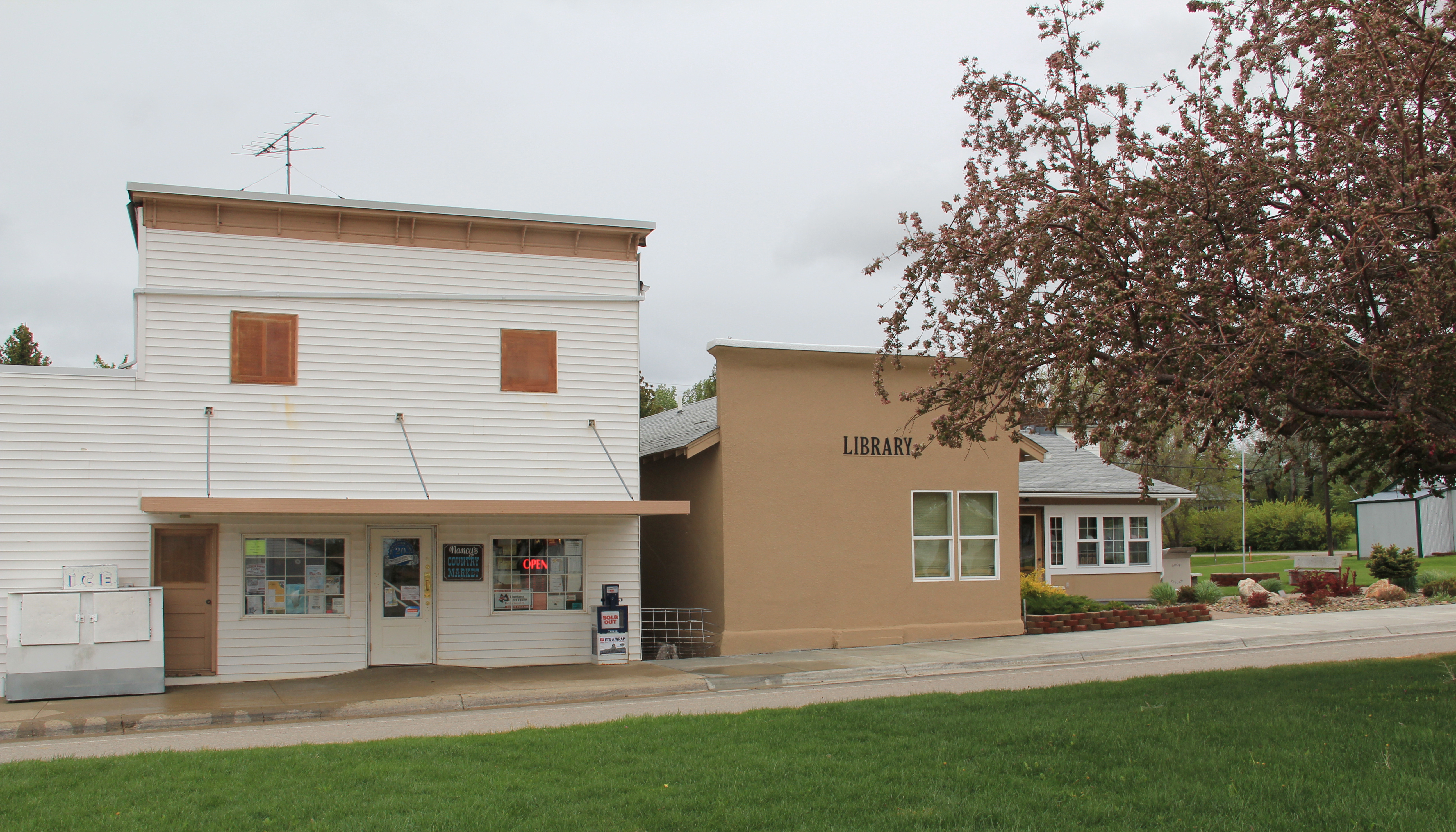
 and just as importantly the properties are in use, be they a cafe, a store, or a library. A long two-lane road, Montana 239, stretches east from Hobson along the Judith River and headed into Little Belt Mountains. The paved road ends at the earlier settlement of the
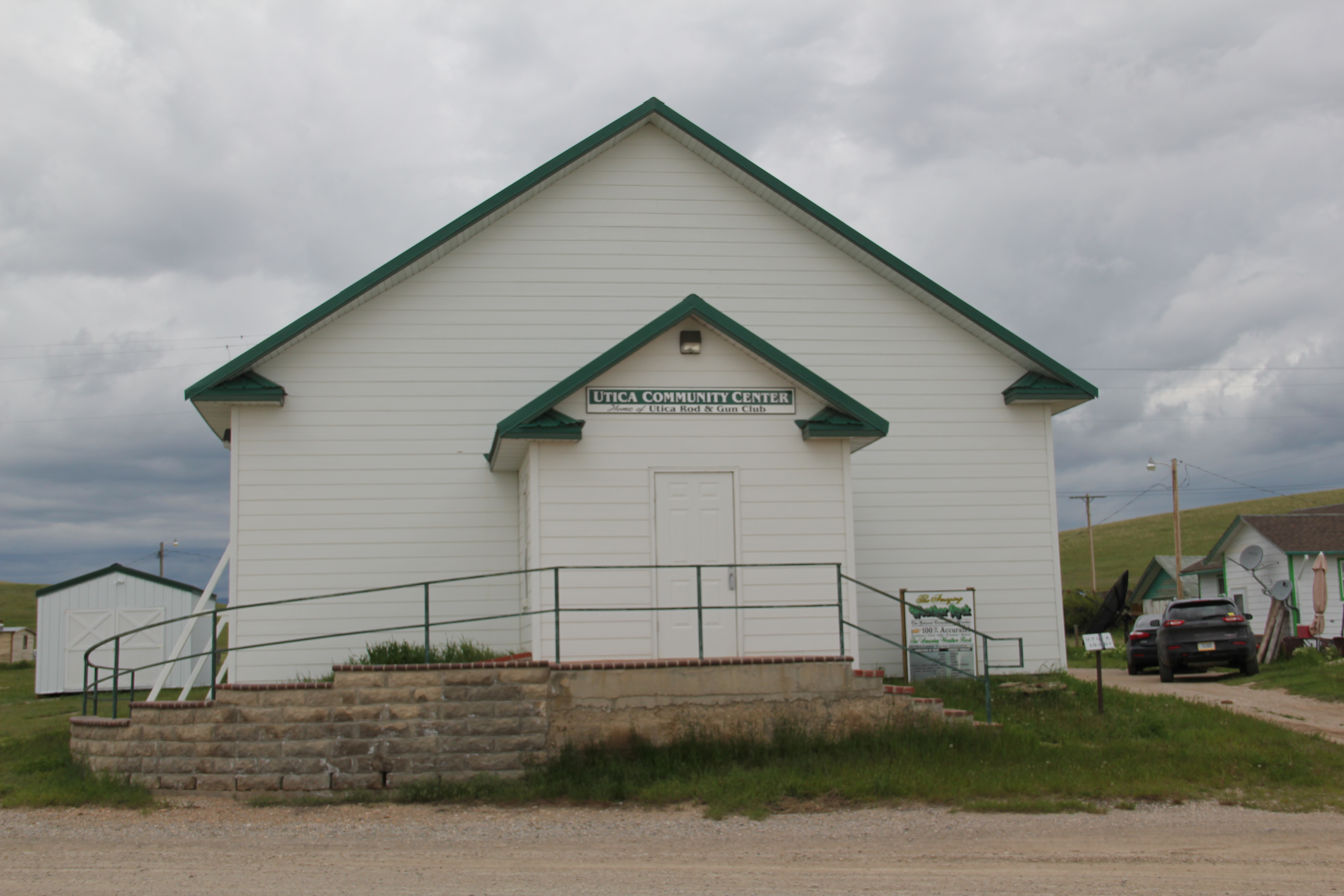
 basin, the cowboy town of Utica, made famous by the paintings and writings of Charles M. Russell, the state’s most famous artist. Utica has a strong sense of itself, although it is justa tiny place today. A large part of that sense of the past is maintained and enhanced by the work of the Utica museum, the local historical society, and the town rod and gun club. Utica has a level of public interpretation that was certainly not in place in 1984 and that today is rarely matched in a small Montana town.


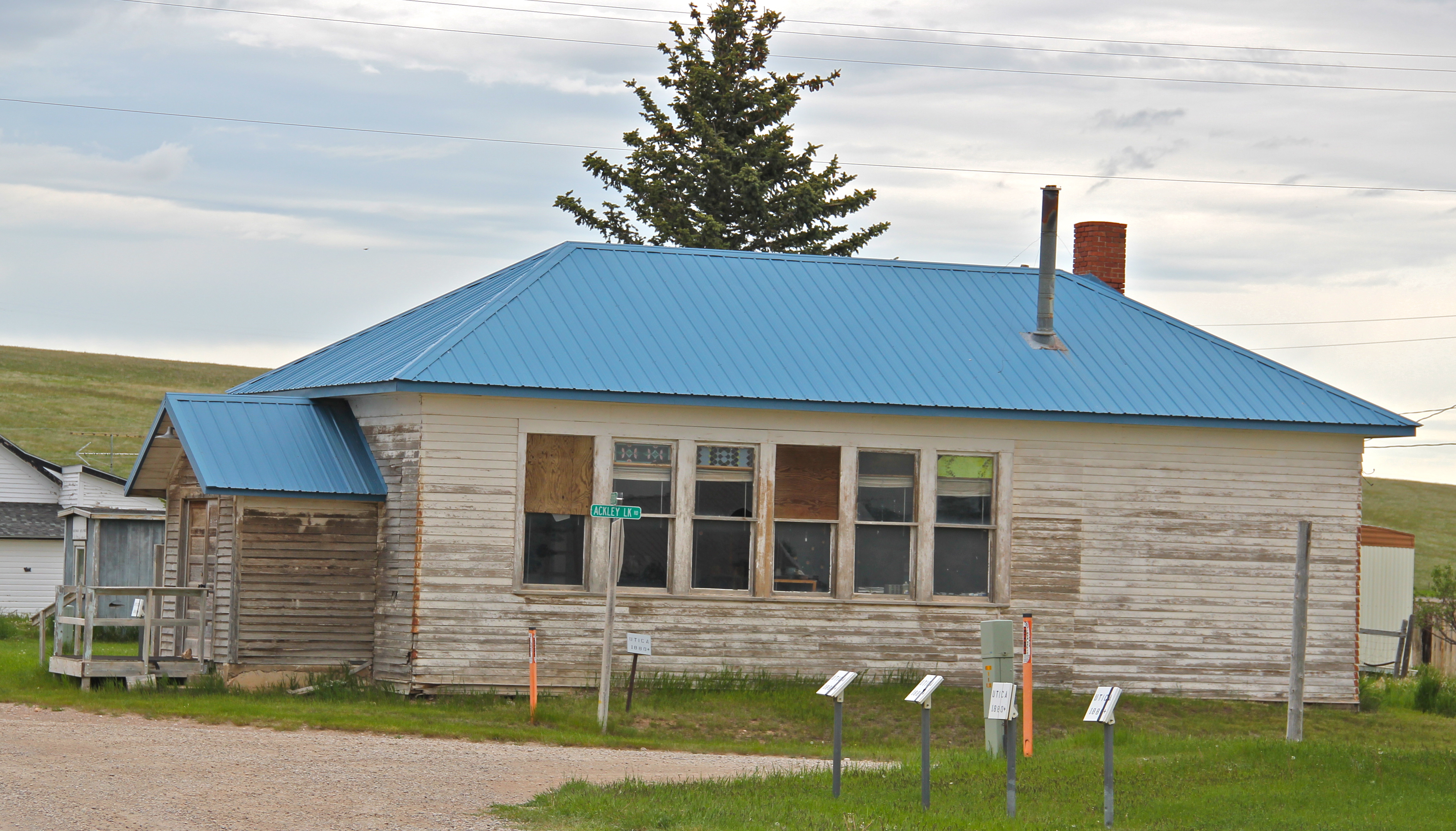
 Utica also has done a commendable job of maintaining and preserving key community buildings, such as the early 20th century school and community hall, both properties associated with the homesteading boom of that time. The town’s historic store is a little

 worse for the wear of 100 years of use, but it is still here, and the stone construction speaks strongly to the vernacular quality of the area’s built environment.
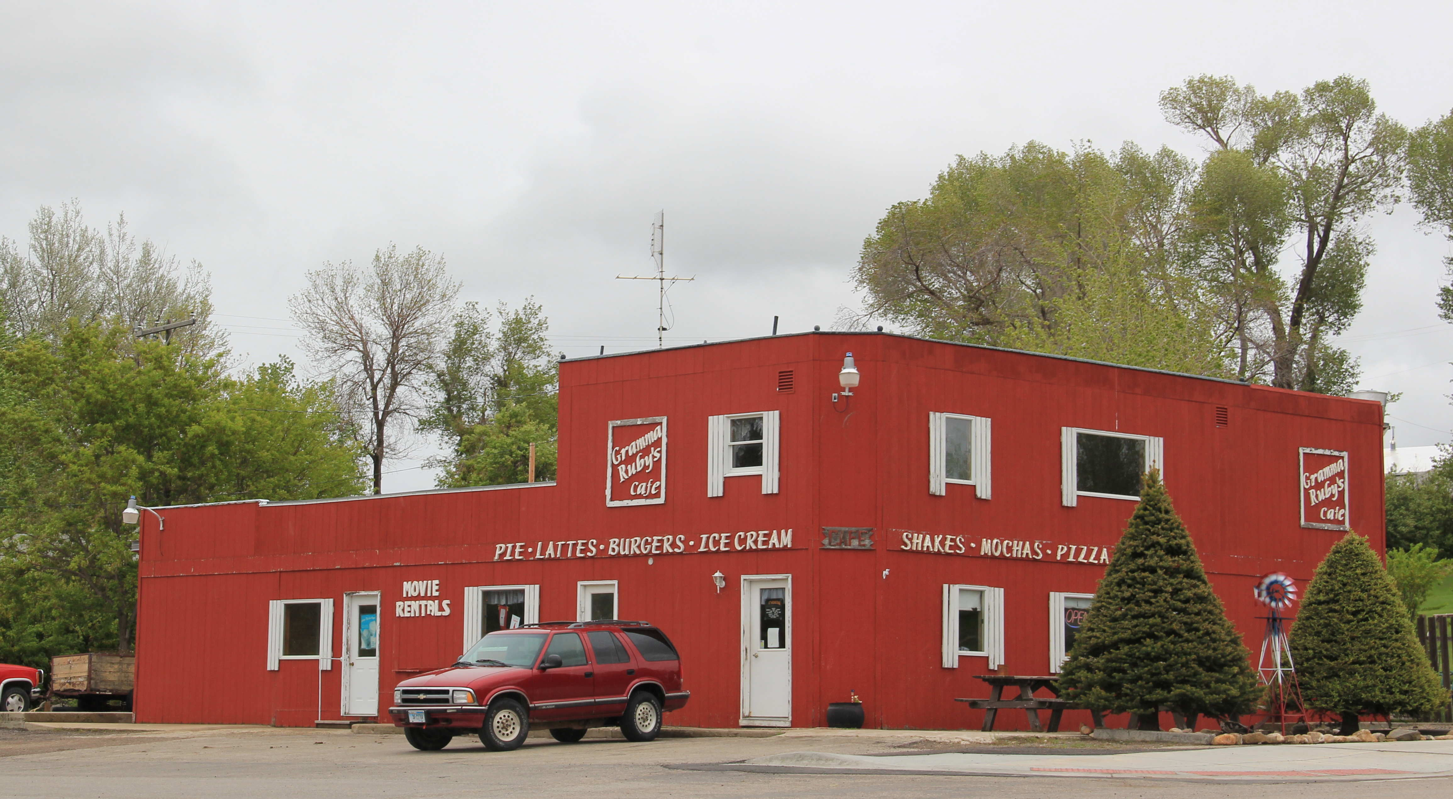
 History and preservation are not the only reasons for Utica’s survival. In true Montana fashion, most people who take the long drive here come for the food, drink, and good
 times at the Oxen Yoke Inn–why else would you locate the town’s primary interpretive sign next to the bar’s parking lot.
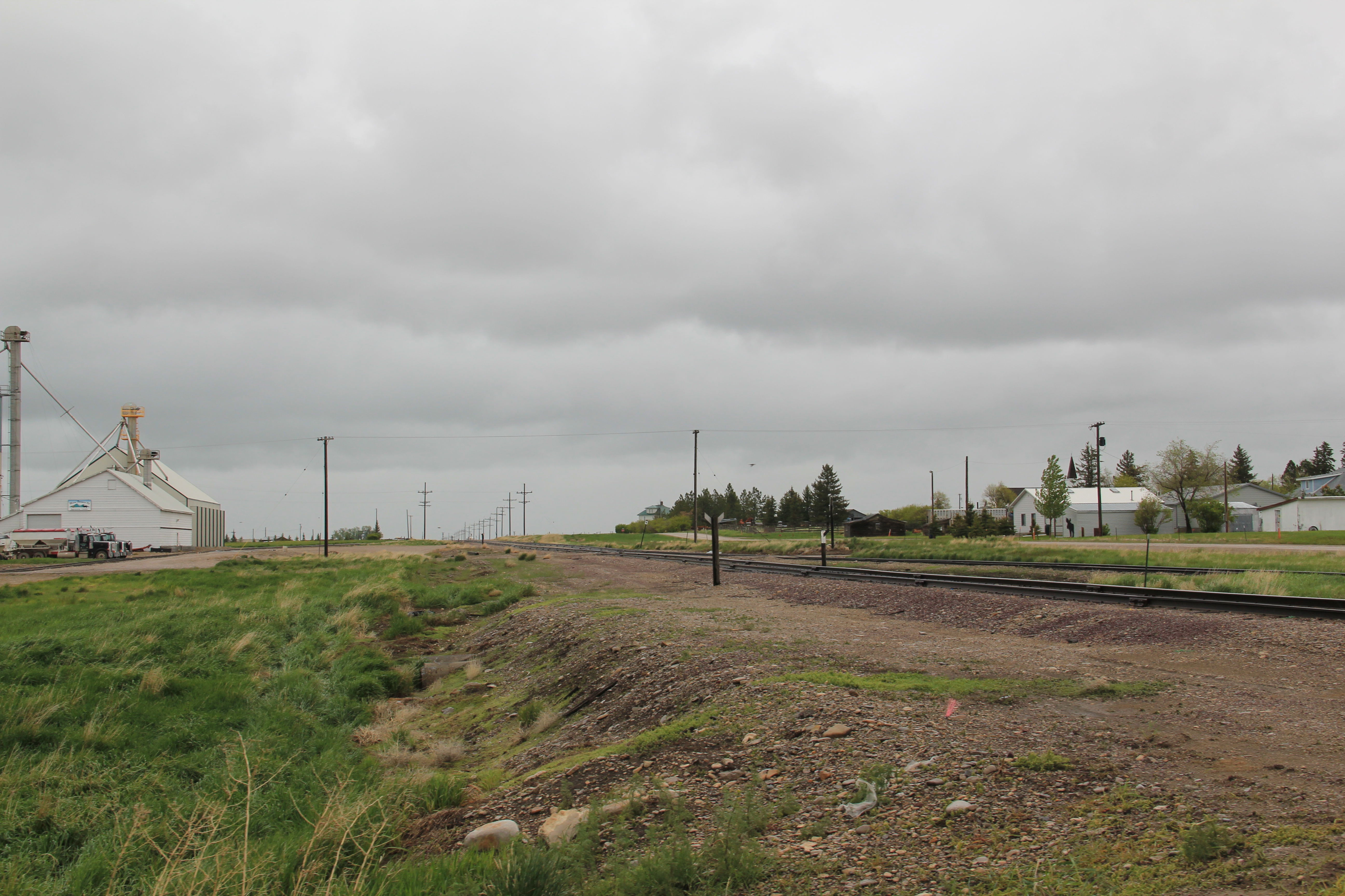
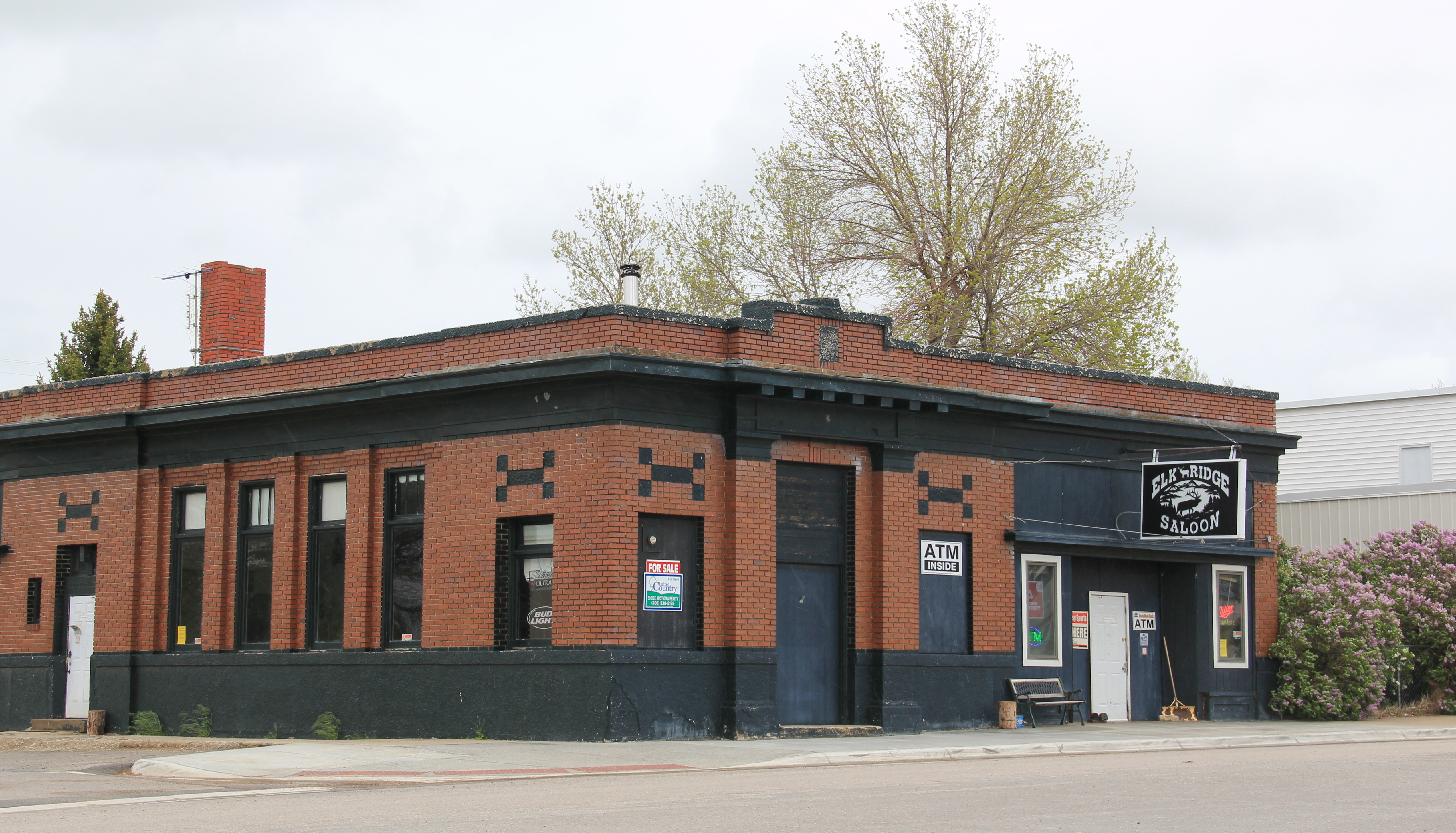
 For most travelers the highway from Hobson at the eastern end of Judith Basin County to Stanford, the county seat, in the center of the county, is just open road. But between those two towns three Great Northern hamlets still have significant remnants of their past. Moccasin was such a favorite in 1984 that the resulting book from the survey work, A Traveler’s Companion to Montana History, had two images from the place–the New Deal school, with its totally out of place but flashy Art Deco design, and the two-story Classical Revival styled bank building.
 Those landmarks remain in Moccasin, but much worse for the wear. The school is clearly among those threatened landmarks highlighted by the National Trust for Historic Preservation in 2012. The bank is hanging on, barely.

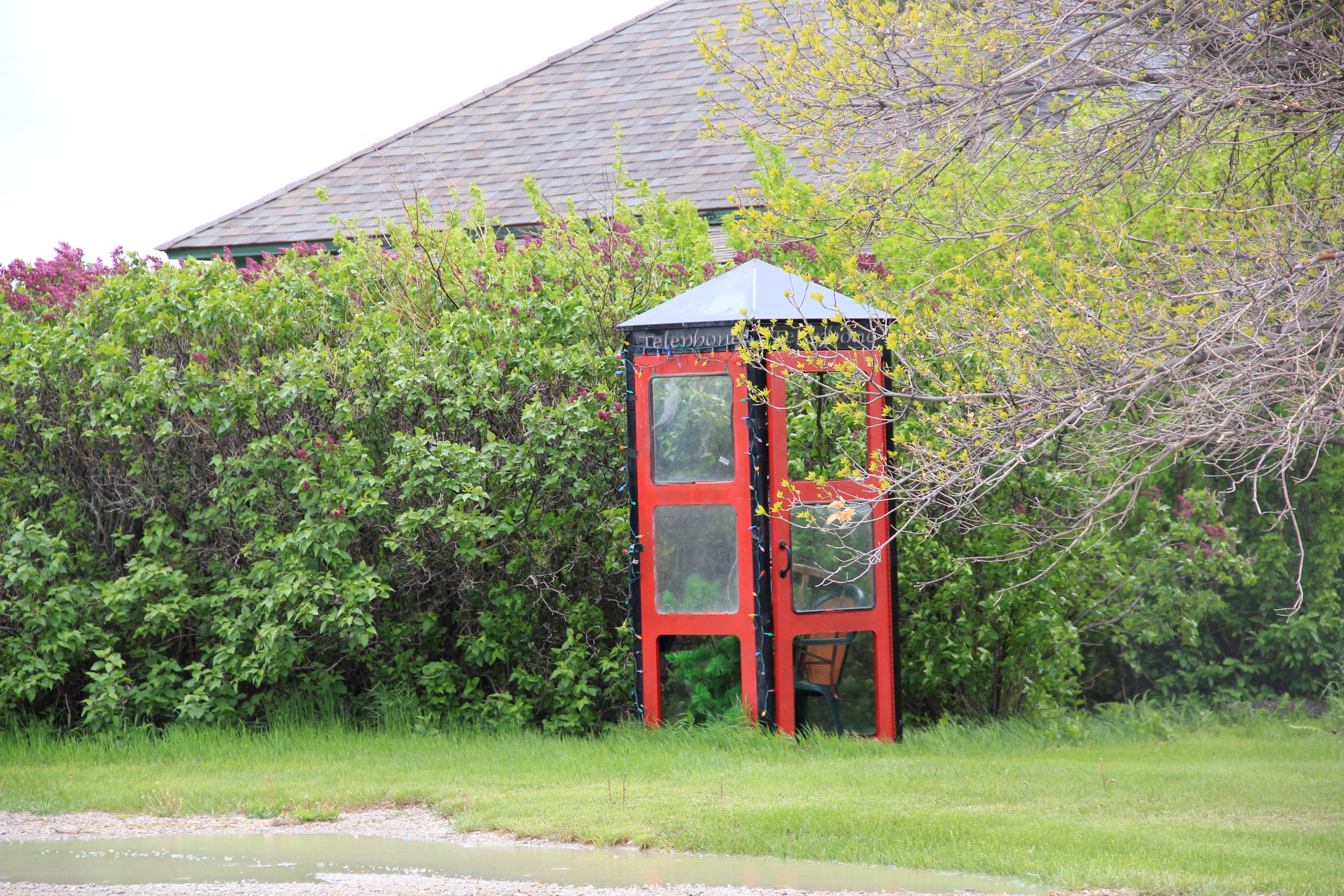
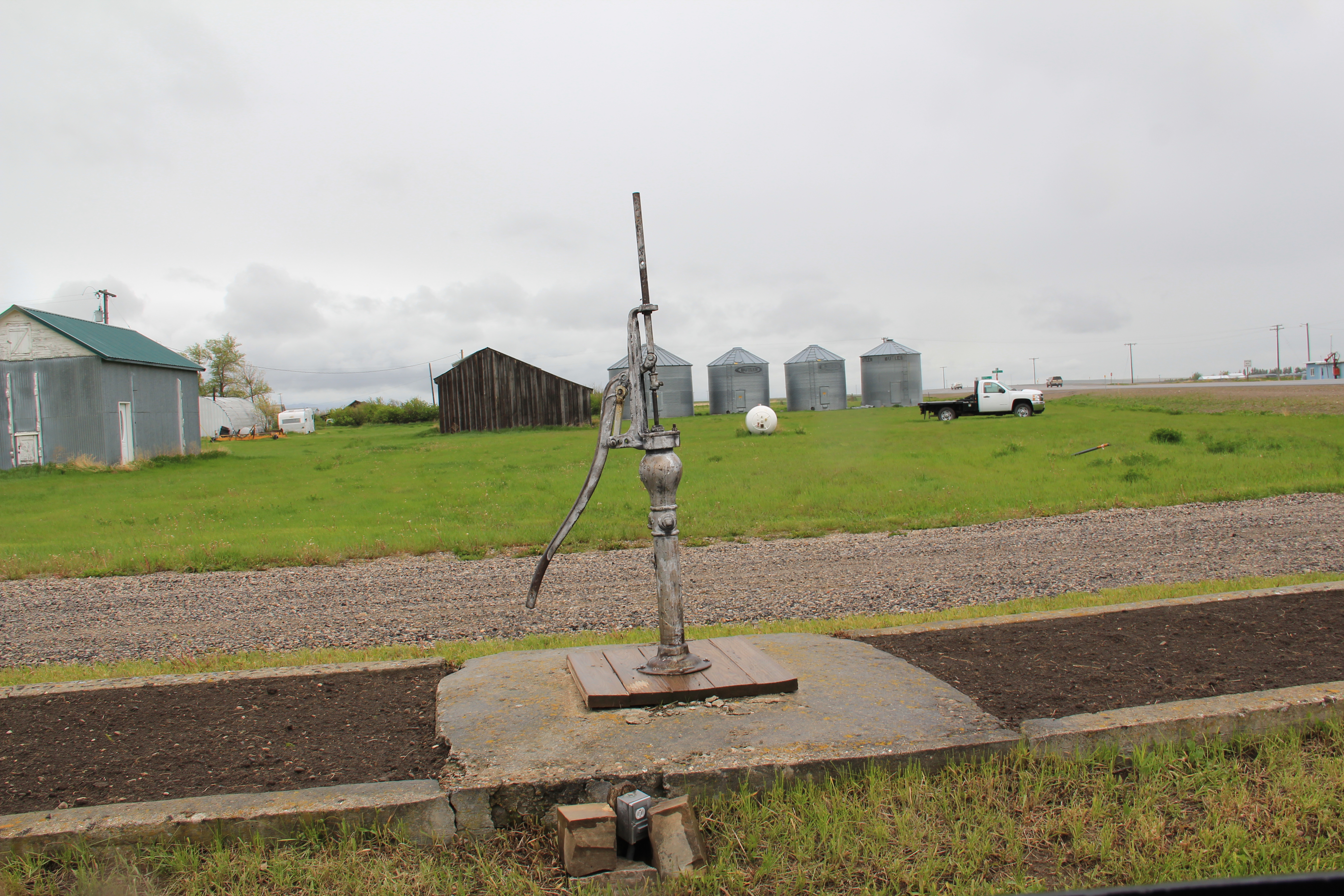
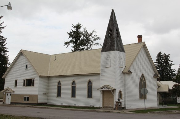
 Moccasin still has other historic buildings worthy of note, such as a church, its town pump, even a telephone booth (a real disappearing part of the landscape from 1984 to 2014).


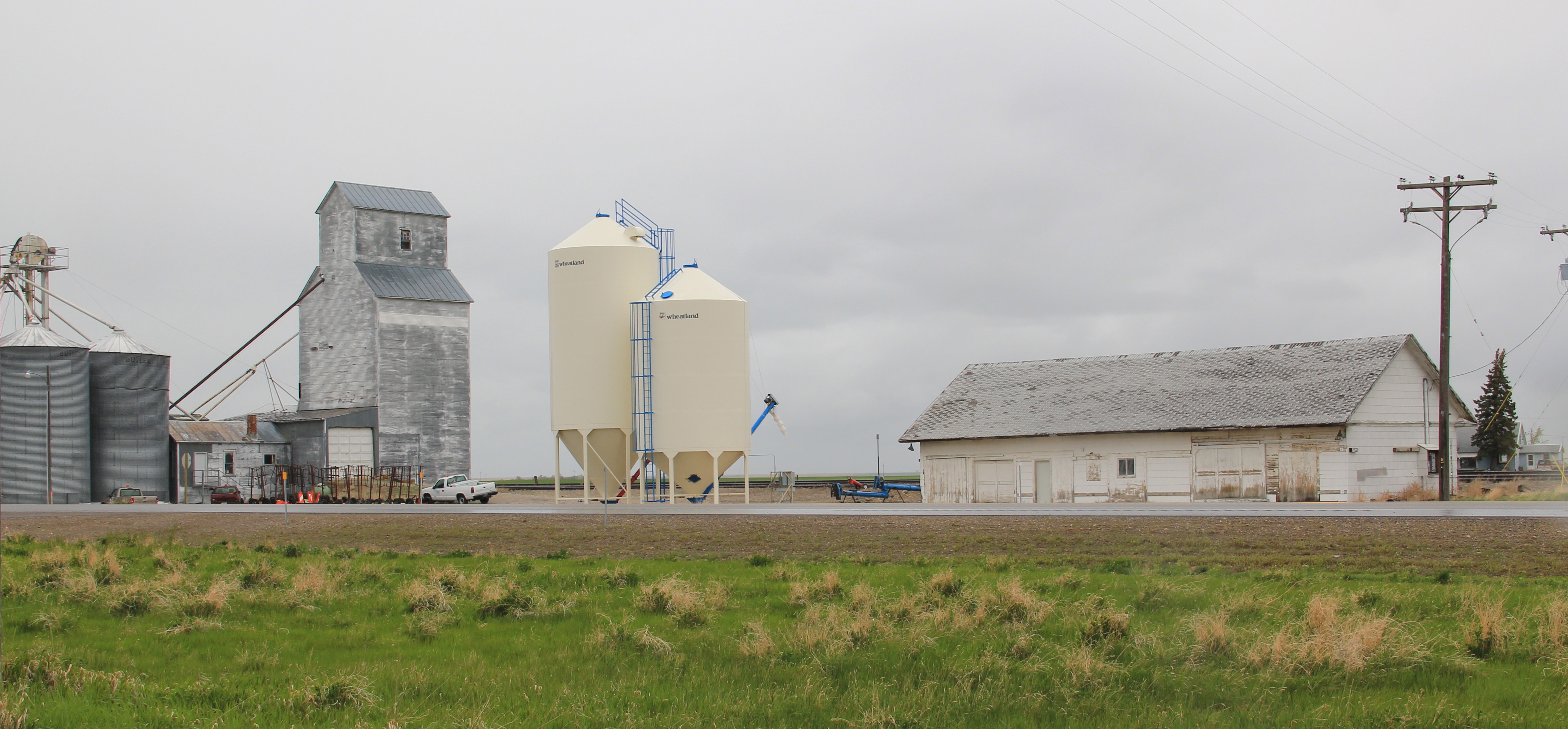
 More importantly, its historic Great Northern combination depot, although battered, still is along the tracks nearby the elevators, reminding anyone looking closely enough of the railroad roots of the place.
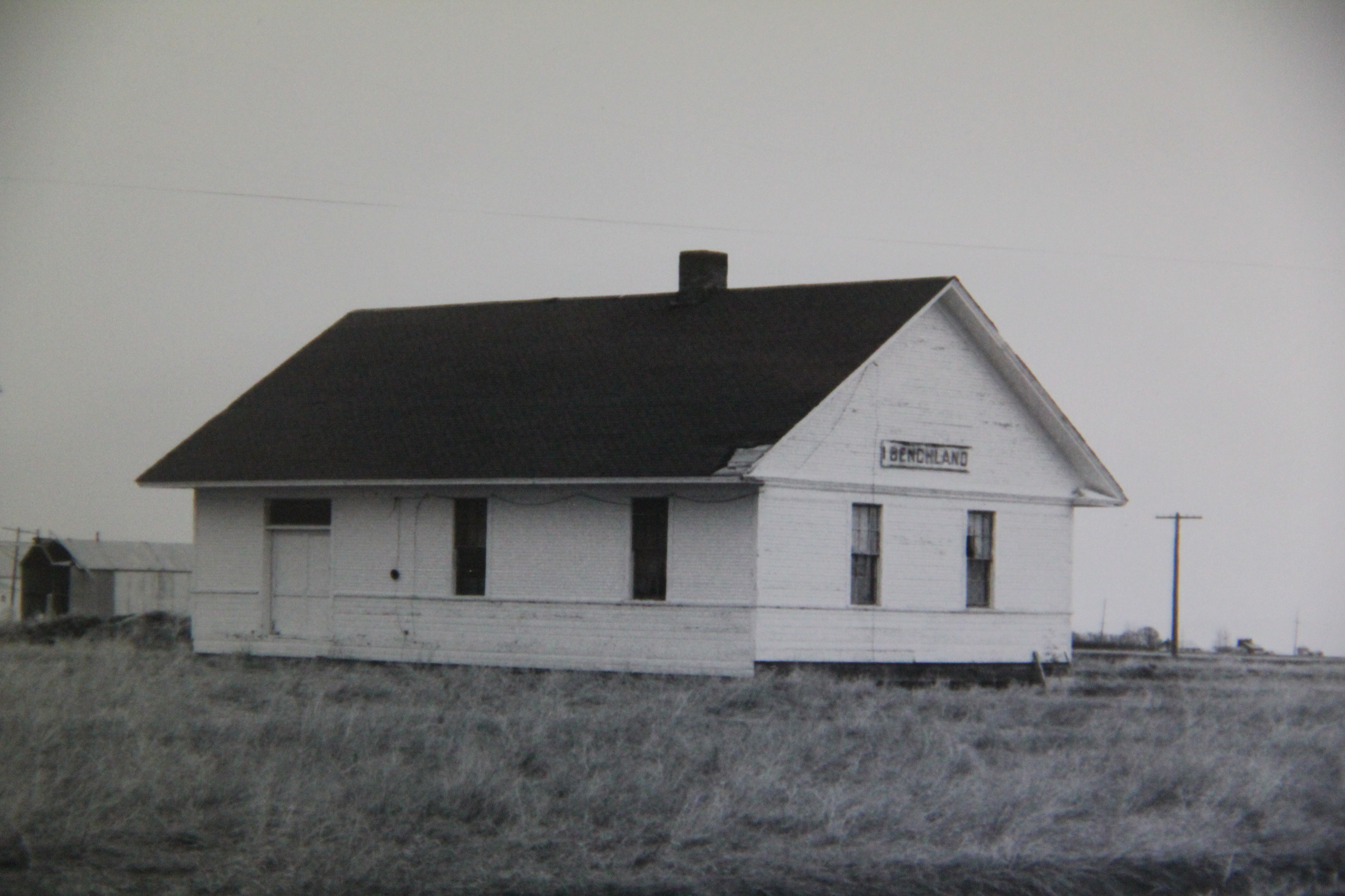
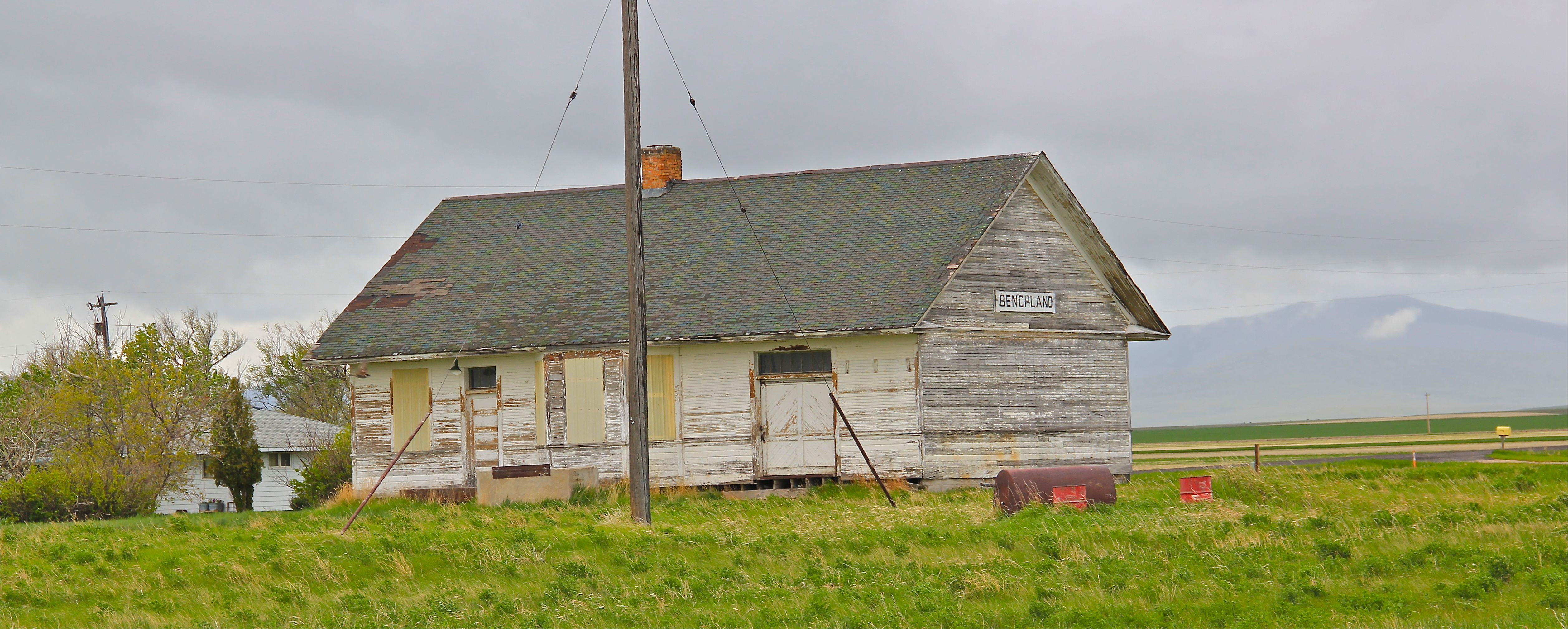
 The next two towns of Benchland and Windham also retain their historic depots. The Benchland station has deteriorated in the last generation as documented in a comparison of a 1984 image with one from 2014.

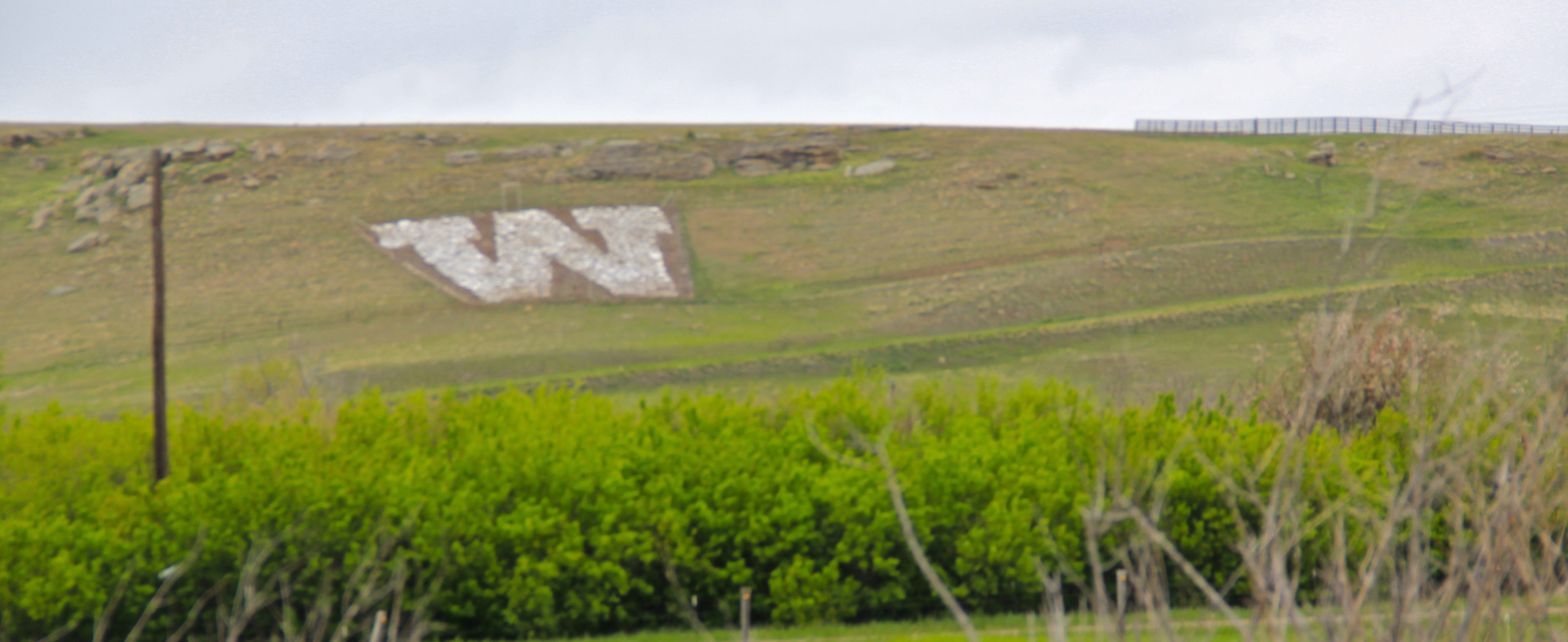
 The Windham depot has been moved slightly off the tracks–but still within a stone’s throw of the rails. The station, along with the historic commercial strip of the T-town plan, and historic elevators, still give meaning to the “W” of the town sign.


 The curve of the tracks headed to Stanford is a good place to rest with this post–more on the plains country towns of the Judith Basin in the next post.


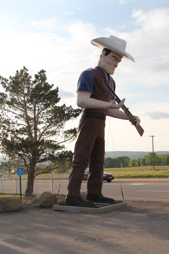 metal like Thunder jack in the Shields Valley on U.S. 89 north of Livingston. There’s always a wave and friendly greeting!
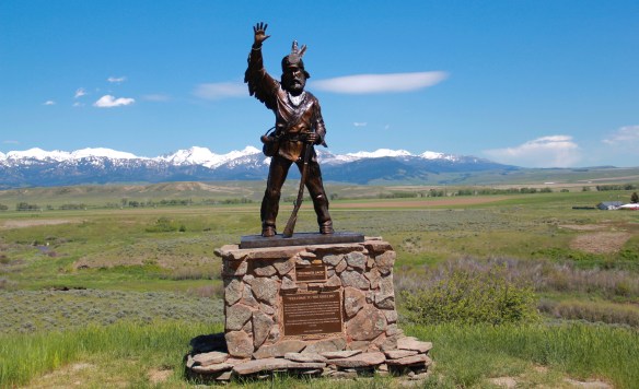


 and consider those who have passed before with the many historical markers.
 The vastness and diversity of the Big Sky Country is amazing, with so many bridges to


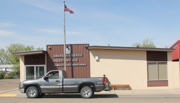
 The county library, above, is small but busy, a reminder of how important these public buildings can be. About 5 years ago, the time of my last visit, Scobey still had its own medical center, below, as well as a distinctive post office, different from many in the region due to its modernist style.


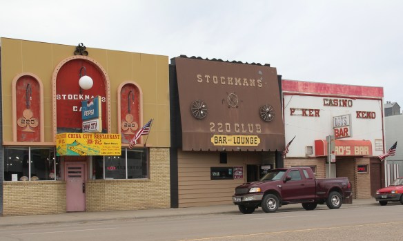
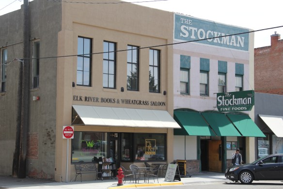
 entertained generations of Grizzly students and fans–note the window mural. But it is just one of several favorite Stockman’s Bars I have encountered in my Montana fieldwork. My top choice is actually on the other end of the state–almost in North Dakota in fact–the Stockman’s Bar in Wibaux.


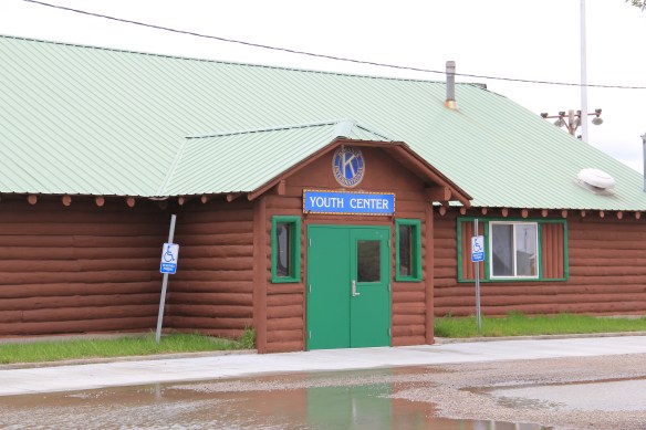 The woman’s club began c. 1921 and had already made a major contribution to the town’s well-being in establishing its first library. After World War II, however, club members felt they should once again help build the community, by building a youth center and veterans memorial garden. Mrs. Norman Good proposed the project in 1946 and Mrs. G. D. Martin provided the first substantial donation. The club then held fundraisers of all sorts. By 1950, construction was underway, with contractor Clyde Wilson building the center with logs from Colby and Sons in Kila, Montana.
 As the youth center was under construction, the woman’s club also reached an agreement with the school board to use land for the construction of a new football field, named McQuitty Field. Located behind the youth center, the field opened in 1950.
 Thus, on U.S. Highway 12 lies the public recreation heart of Harlowton–a postwar gift of residents and service clubs to the community. In 1956, the woman’s club deeded the Youth Center to the Kiwanis Club, which still manages it today.


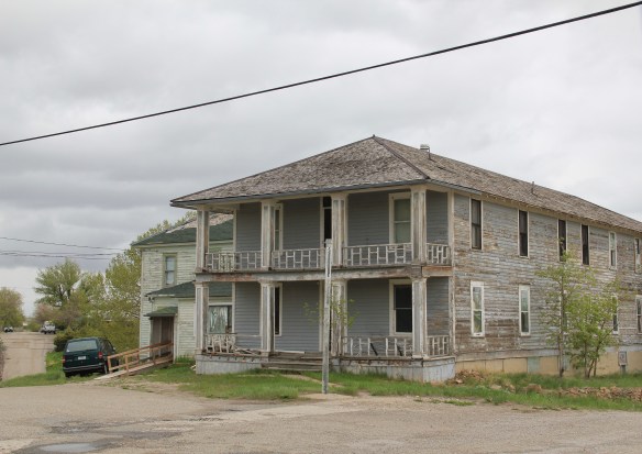 Road, it once also had several hotels and more short-term housing for workers and travelers–a good bit of that has disappeared, or is disappearing.
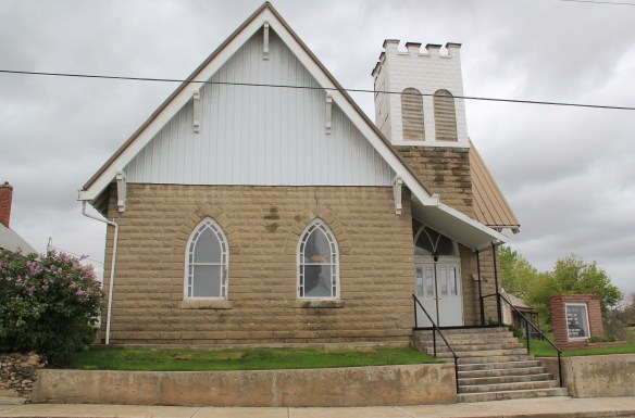
 It is difficult to visit Harlowton and not notice the mammoth Montana Flour Mills set of concrete grain silos–today’s silent sentinels of what ranchers once produced in abundance in these lands.
 The mill, made from locally quarried stone, came within months of the completion of the railroad to Harlowton–the concrete silos reflected the hopes of investors and local ranchers, as grain production soared in the 1910s–reaching some 1.2 million bushels in 1918. It wasn’t called Wheatland County for nothing. I still wish the big electric sign that once adorned the silos was still there.


 Moiese is best known, by far, as the entrance to the National Bison Range, where a general store stands nearby the refuge gate. Created by Congress in 1908, the refuge took
 additional land–almost 19,000 acres- from the tribes, without their consent, to create a safe haven for the remaining bison in the region. A few hundred bison live within its boundaries today. In 2016 the National Park Service began discussions with the Consolidated Kootenai and Salish Tribe to transfer management of the refuge to the tribe.
 Eight miles north of Moiese along the railroad line is the town of Charlo, named in honor of Chief Charlo of the Bitterroot Salish, who was forced from the Bitterroot Valley to move to the reservation in 1891. Charlo served as head chief of the Bitterroot Salish from 1870-
 1910. As a railroad town, Charlo is like many along the Northern Pacific, with a brief strip of businesses facing the railroad tracks, marked by the town’s sole grain elevator. It has a classic rural bar, Tiny’s Tavern, with its brightly painted exterior of concrete block, with brick accents. Built in 1946 by Tiny Browne, it was both a motel and a tavern, and a local museum of items that Tiny thought were interesting. Browne died in 1977 and his sister, Celeste Fagan, next owned the tavern, managed by Edna Easterly who recalled in a story in the Missoulian of April 20, 2007 that Tiny “was known as the bank of Charlo. Tiny always carried a lot of money in his pocket and if you needed to cash a check, you went to Tiny.”
 Most important for its architecture, however, is the town’s public school, a wonderful example of Art Deco style from the New Deal decade of the 1930s.
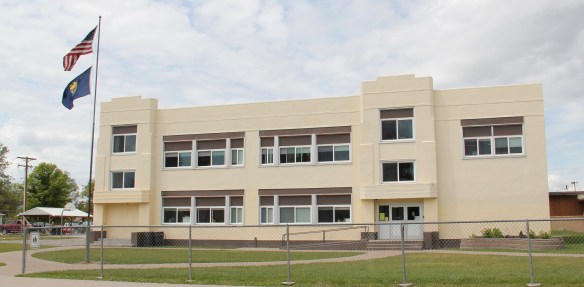 Ronan is a third town along the railroad corridor, named for a former white superintendent of the reservation. The town’s demographics today are mostly white, with a little more than a quarter Native American population. Ronan proudly proclaims its existence not only with a gate sign, connecting the business district to the sprawl along U.S. Highway 93 but also a log visitor center and interpretive park on the highway.


 The facade expresses a confident future, which is needed in today’s uncertain economic climate for rural hospitals across the state. But my favorite building in Ronan speaks to my love for adaptive reuse and mid-20th century modern design. The town library is an
 exquisite example of mid-century modern, and was once a local bank before being converted into the library.
 Few places in Montana, or for the nation for that matter, have benefited more from historic preservation and heritage development than Bozeman. To see a grain elevator complex find new uses and life in a century where grain elevators are typically a relic of a bygone era, tall hulking figures on the northern plains landscape, you discover that so much of our historic built environment can be re-imagined and put back into use.


 The town’s historic churches are other important anchors. Listed in the National Register of Historic Places, St. James Episcopal Church is a distinguished statement of Gothic Revival executed in locally quarried sandstone designed by architect George Hancock of Fargo, North Dakota and built by local contractor James Campbell in 1890.
 Preservation efforts 30 years ago were focused on Main Street landmarks, with much success. But the combination of preservation and adaptive reuse has moved into the town’s railroad corridor with similar positive results, and the number of historic neighborhoods have multiplied.


 Continuing west you soon encounter post-World War II service stations and motels, some updated, some much like they were, on the outskirts of town and then, boom, you are in the heart of Livingston, facing the commanding presence of the Northern Pacific depot complex with warehouses–some now converted to new uses–coming first and then
 massive passenger station itself. Opened in 1902, the passenger station was an architectural marvel for the new state, designed by Reed and Stem, who would continue on to great fame as the architects of Grand Central Station in New York City. The station, interestingly, is not Classical Revival in style–certainly the choice of most architects for their grand gateways along the nation’s rail line–but a more restrained interpretation of Renaissance Revival style, completed in red brick.
 The building is not particularly inviting for locals coming from the business district to the depot–that was not its primary audience. Rather the grand entrance is track side, where passengers headed to Yellowstone National Park could depart for food, fun, frivolity, whatever they needed before the journey into the wildness of Yellowstone.
 Travelers were welcome to use the grand covered walkways to enter the depot proper, or to take a side visit to the railroad’s cafe, Martin’s as I
 knew it back in the day, a place that rarely slept and always had good pie. The cafe changed its orientation from the railroad to the road as automobile travelers on U.S. 10 began to dominate the tourist market. Now it has been restored as a local brew pub.
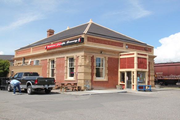


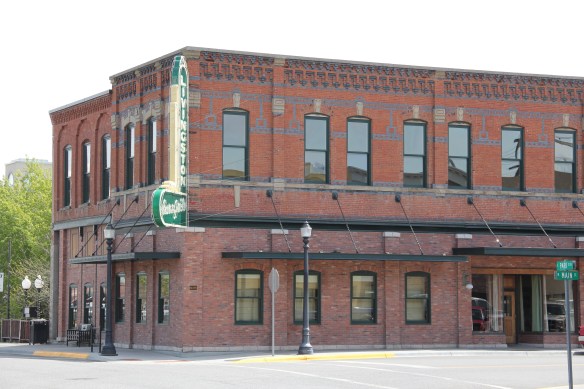 Directly facing the center of the passenger station was the mammoth Murray Hotel–a flea bag operation in the 1980s but now recently restored as a hipster place to be, especially its signature bar.

 Imagine my pleasant surprise last year when I found that Gil’s still existed but now had been converted into a decidedly up-scale establishment, far removed from the 1980s.
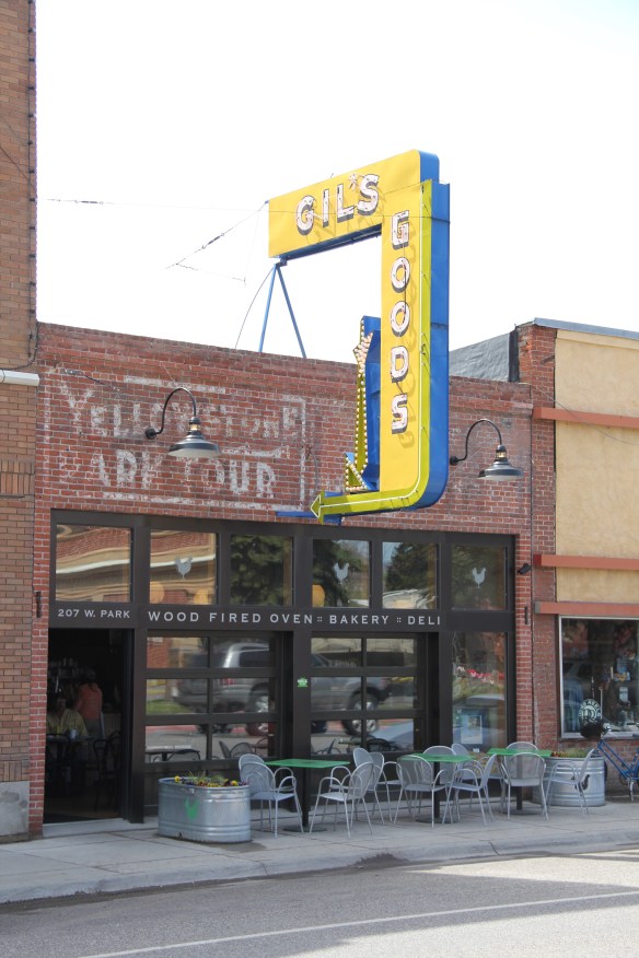 I don’t know if I have encountered a more fundamentally changed place–cheap trinkets gone, let the wood-fired pizzas come on.
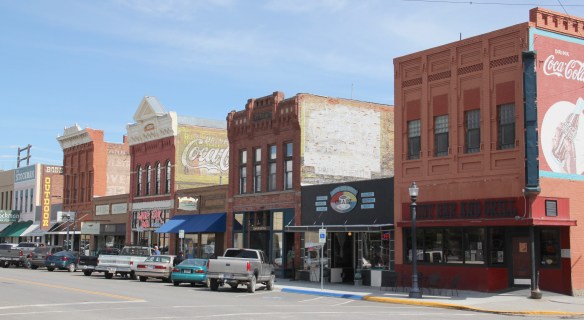 I was not so blinded in 1984 by the concept of the “metropolitan corridor” that I ignored the distinctive Victorian storefronts of Livingston–how could I since they all, in a way, fed into the tracks. But when I got to the end of that distinctive business district and watched the town, in my
 mind, fade into the Rockies, I had captured the obvious but had missed the bigger picture–that’s the next story.