Billings: a few more words, for now

HPIM0190.JPGI always have more to say about Billings, the centerpiece of the Yellowstone valley and Montana’s largest city.  I have been thinking about it, and exploring its history, since 1982, a time when hardly anyone in the history field (except for Dr. Lawrence Small at Rocky Mountain College) was paying attention. But for now–until I get back in May for new fieldwork–I want to place Billings aside, but offer some words about how historic preservation and adaptive reuse–at least what I have witnessed since 1982–have impacted the city.

Dedication plaque at Parmly Billings Library (now Western Heritage Center), Billings

Dedication plaque at Parmly Billings Library (now Western Heritage Center), Billings

When I began my first project at the Western Heritage Center, that historic library building and the old county jail, turned into the Yellowstone Art Center, was about it, for historic preservation, in Billings.  There also was the county museum, which was early resident Paul McCormick’s “town” cabin since moved to the airport and used as the county museum, and The Castle, Austin North’s downtown residence turned into a store. Many thought that was plenty–few thought that even the Classical Revival landmark of the

HPIM0177.JPG

Northern Pacific Railway depot deserved much attention.  Luckily, three women that I met in those days, Senia Hart, Ruth Towe, and Lynda Moss, thought otherwise.

Former Hart-Alpin department store, Billings

Former Hart-Alpin department store, Billings

Hart, whose husband had built the Hart-Albin store into a regional brand name, was distressed by the apparent death of downtown Billings.  Everyone, and many businesses, wanted to relocate to either the Heights or at Rimrock Mall.  Traffic shifted away from downtown into the suburbs and interstate.  Hart saw a robust still viable building stock, and thought otherwise.  I heartily agreed.  Everyone back then liked to show off the Rex Hotel as a sign of the future.  The old flea bag railroad hotel had been transformed in downtown’s best restaurant by the early 1980s.

IMG_1566

HPIM0187.JPG

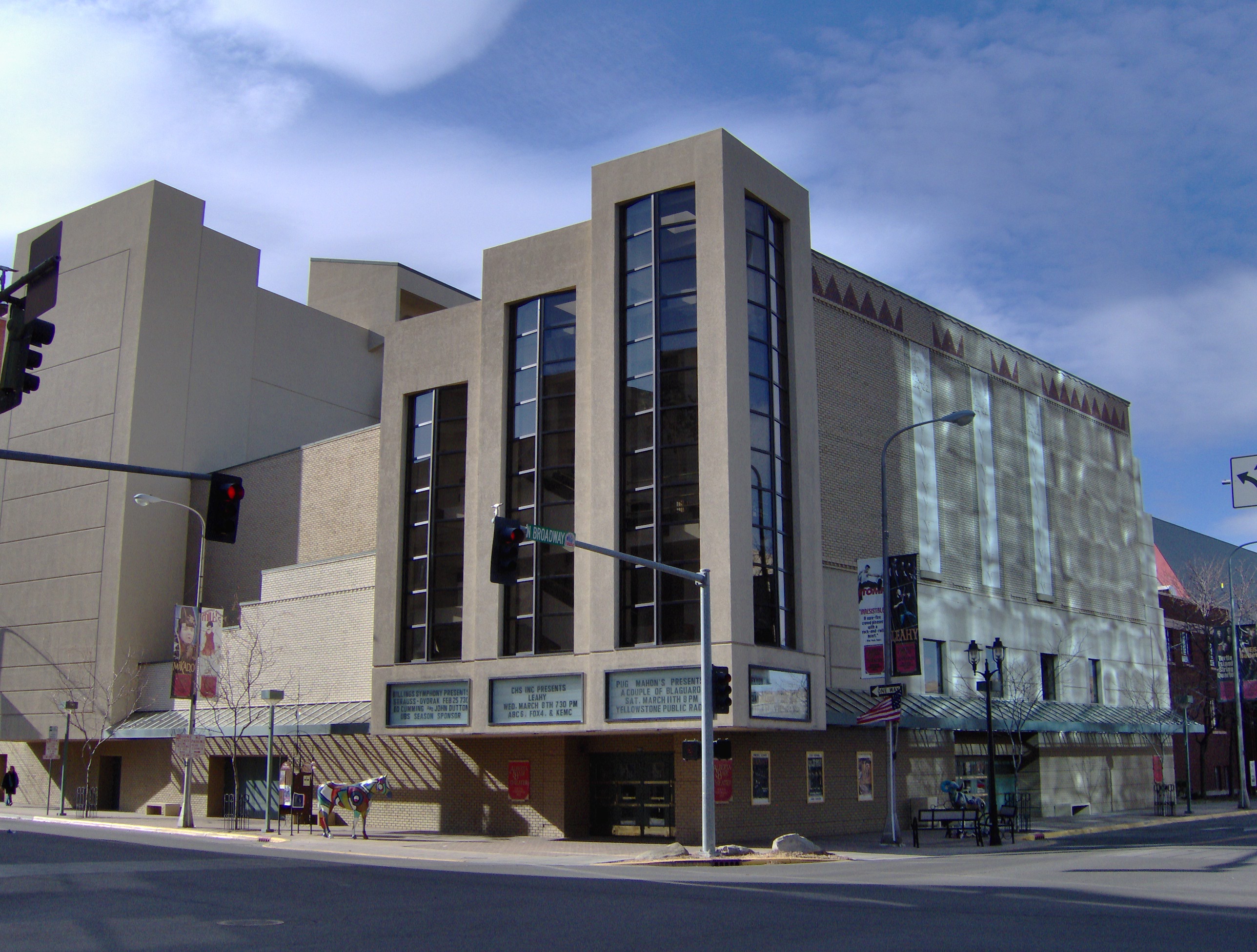
Hart was not the only business woman or man devoted to downtown–it took many to keep it alive, such as Alberta Bair.  Her donation for the conversion of a historic Art Deco theater into a modern performing arts center interjected new life into downtown.

HPIM0191.JPG

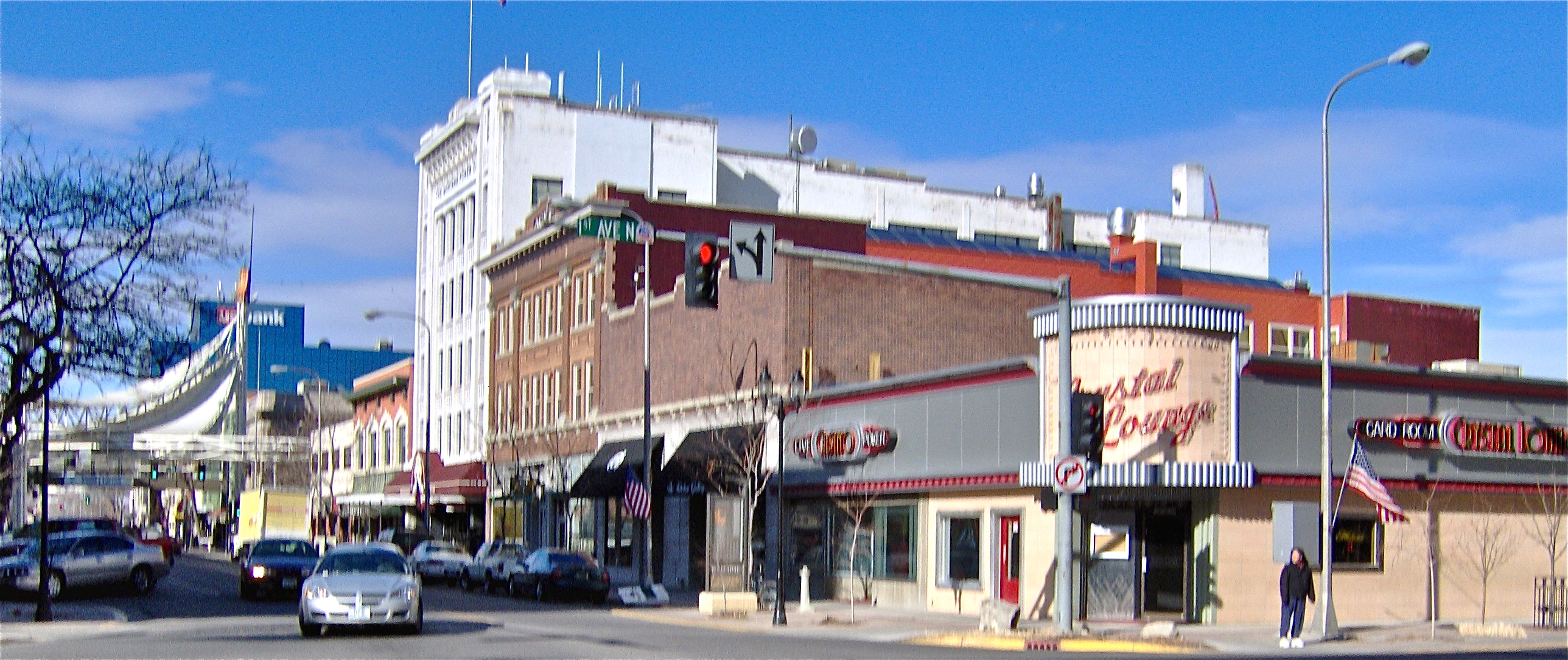
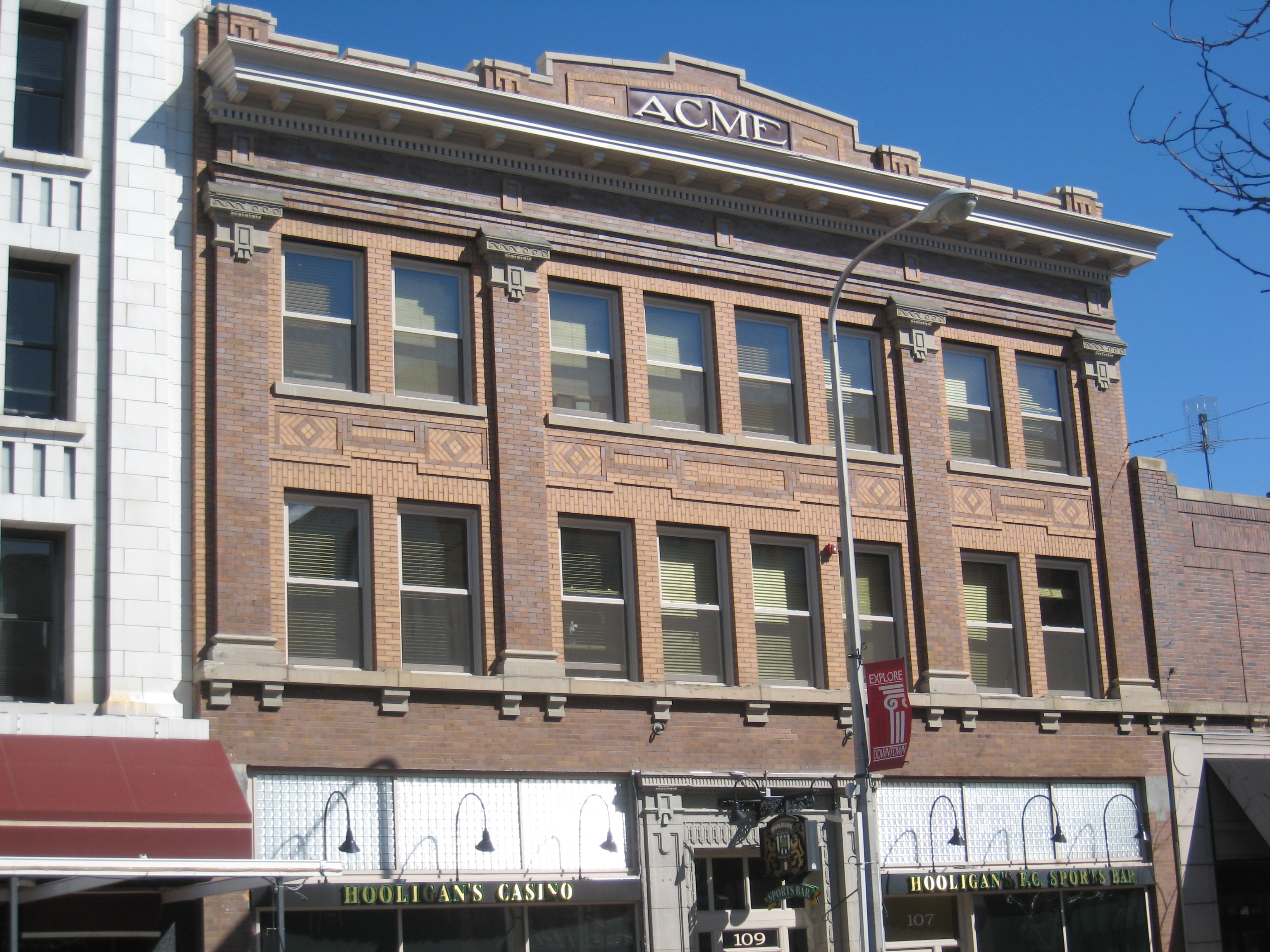
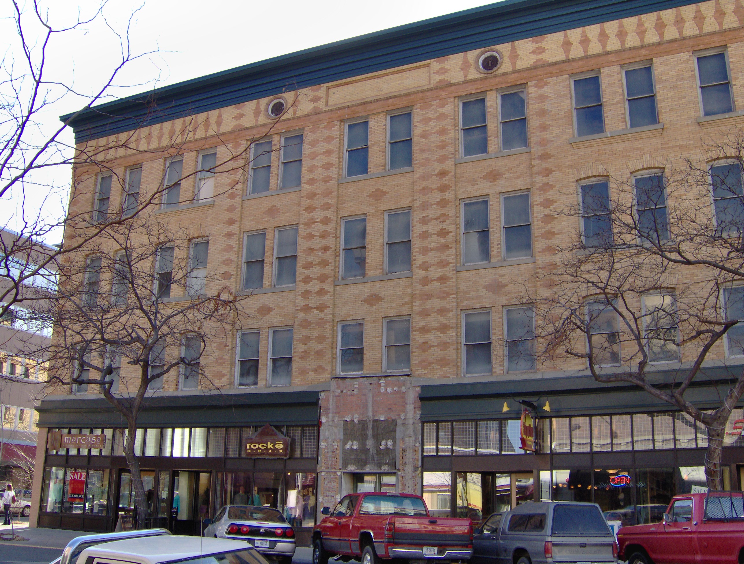
In the 1990s the first historic district was created along Montana Avenue, with the Rex Hotel as a real anchor to encourage other new investment.  To say that Montana Avenue has worked in the decades since would be a major understatement.

HPIM0178.JPG

Success didn’t come immediately–for a long time, the Rex stood alone, but the depot got new life, most buildings were repaired, or restored, and by the 21st century a new wave of adaptive reuse gave new opportunities to once forgotten industrial buildings around the district.  Montana Avenue, and downtown Billings, once again became a destination.

HPIM0183.JPG

Montana Avenue in 2006

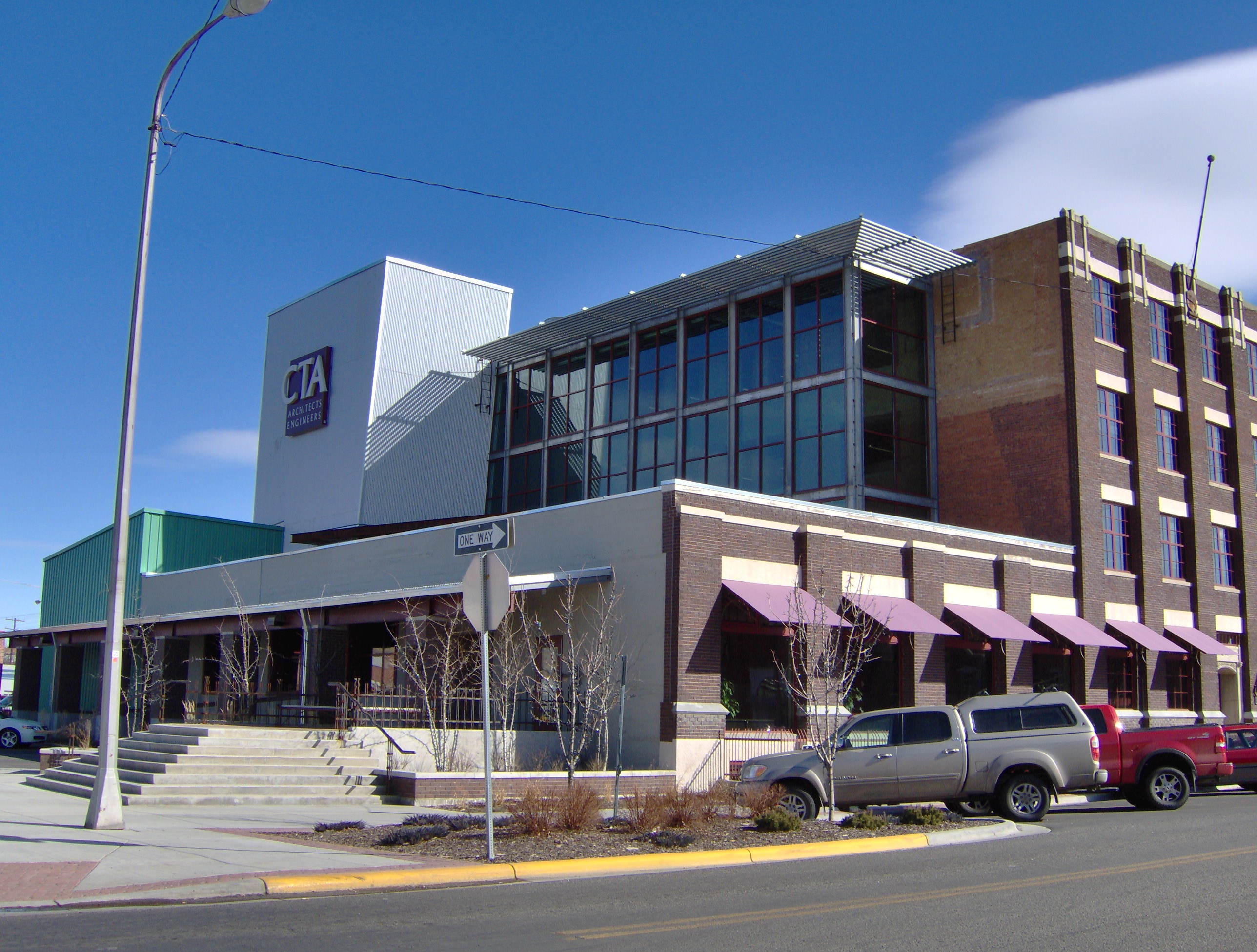
CTA Architects building, 2006

CTA Architects building, 2006

Encouraging CTA and others to see downtown in new ways back then was State Senator Lynda Moss (who served 2005-2013)–she got introduced to the potential of downtown as the director of the Western Heritage Center, in some ways bringing the story full circle.  Moss though pushed investors and residents to think about the south side of the tracks downtown, and the potential of Minnesota Avenue.

Previously neglected building south of tracks in Billings

Previously neglected building south of tracks in Billings

Minnesota Avenue, Billings

Minnesota Avenue, Billings

And then came the news that the once lap of luxury hotel–but closed for some years– in downtown Billings was also receiving a new life.  The 2011-2012 restoration of the Northern Hotel–I haven’t had a chance to visit the final result yet–marked the close of a decade of real, sustainable change in downtown Billings.

Northern Hotel, Billings, 2011

Northern Hotel, Billings, 2011

Yet, at the same time, it took us back to the city’s roots.  Banker Preston W. Moss had championed the need for a luxury hotel, to attract business and further investment.  More than anyone, Ruth Towe, made the preservation of Moss’s story, and his mansion, to be a life task.  I had the chance to listen to many of the Moss Mansion group’s plans and

IMG_1242

dreams back in the 1980s.  Their legacy today is not just the city’s primary historic house museum, but also a renewed interest in the historic downtown residential neighborhoods.  Billings has a rich collection of domestic architecture, and the good condition of those places today, like the ongoing renovation and expansion of the McKinley School, tells anyone that downtown Billings is alive and well.  Individuals like Ruth Towe willing to work with others can make a difference in historic preservation.  I have seen it in my professional career in Billings.  There will be much more to be said about this place in future postings.

IMG_1240

The Art Deco style of the Babcock Theatre is yet another downtown historic preservation anchor.

Billings: heart of the Midland Empire

IMG_1310

The irrigation ditch at Hesper Ranch, where the irrigated empire of eastern Montana began in the late 19th century.

Billings, due to a young energetic staff at the city’s major history museum, the Western Heritage Center, gave me my first opportunities to learn and embrace the amazing landscape of Montana.  In 1982 the museum was finding its way; it was not the community institution that it has become some 30 plus years later.  Board members in 1982 were

IMG_1582

Western Heritage Center (the historic Parmly Billings Library), Billings, in 2006

interested in possibly recreating the old river village of Coulson, of which not a trace was left.  I explored the issue, recommended no, and then suggested that actually the founding and development of the town was a fascinating story–with a cast of characters.  Well, only a few people (Lynda Moss the education director then and David Carroll the exhibit curator) were fascinated with what I found, but I was a convert, and ever since I have been exploring the Midland Empire of Billings and Yellowstone County.

IMG_1351

The Big Ditch, at Eastern Montana College (now MSU Billings)

Irrigation, those man-made slivers of life that slice through eastern Montana, was one important key to the story.  When Frederick Billings, the president of the Northern Pacific Railroad, helped to established the “town on paper” called Billings in 1882, he soon discovered that while there was coal in the Bull Mountains to the north there was little land worth his salt for agricultural development, and Billings was nothing if not an energetic, progressive farmer back at his home in Vermont.

IMG_1579

The city’s centennial statue of Frederick Billings, which stood by a parking garage when I began my Billings history work in the 1980s. Due to the good efforts of Lynda Moss and others, it was appropriately moved to the grounds of the historic Parmly Billings Library (Western Heritage Center) over a decade later.

He counted on Benjamin Shuart, the local Congregational minister (who was supported by his wife Julia Billings) to be his man on the ground, checking into the agricultural potential.  Everyone understood that only water would make the ground bloom, so the construction of the Big Ditch began.  It ran through Shuart’s property he managed for the Billings family,

Early dwelling at Hesper Farm, 2011

Early dwelling at Hesper Farm, 2011

known as Hesper Farm.  When Billings lost faith in Shuart, and his own son Parmly unexpectedly passed away, Billings turned to one of his son’s workers, and friends, I. D. O’Donnell, to make his land valuable and to give life to the town that was named for him.  O’Donnell, self taught in the value of land, irrigation engineering, and the possible miracle crop of sugar beets, became the Oracle of Irrigation for not only the Yellowstone Valley but for all of the northern plains.

IMG_1571

O’Donnell expanded the ranch at Hesper Farm and turned into a private demonstration farm for the entire region, a place of beautiful cottonwood trees and modern barns.

IMG_1318

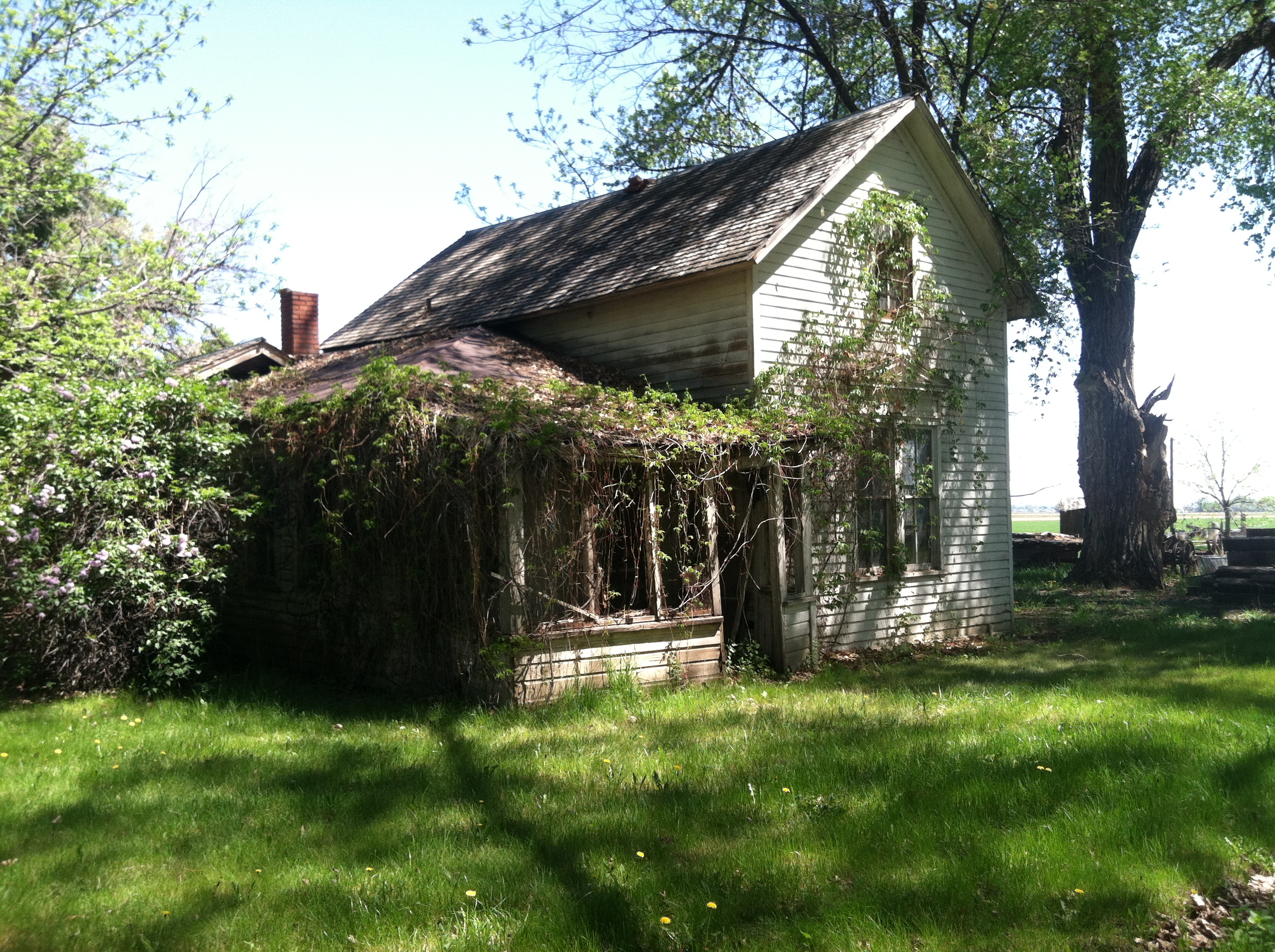
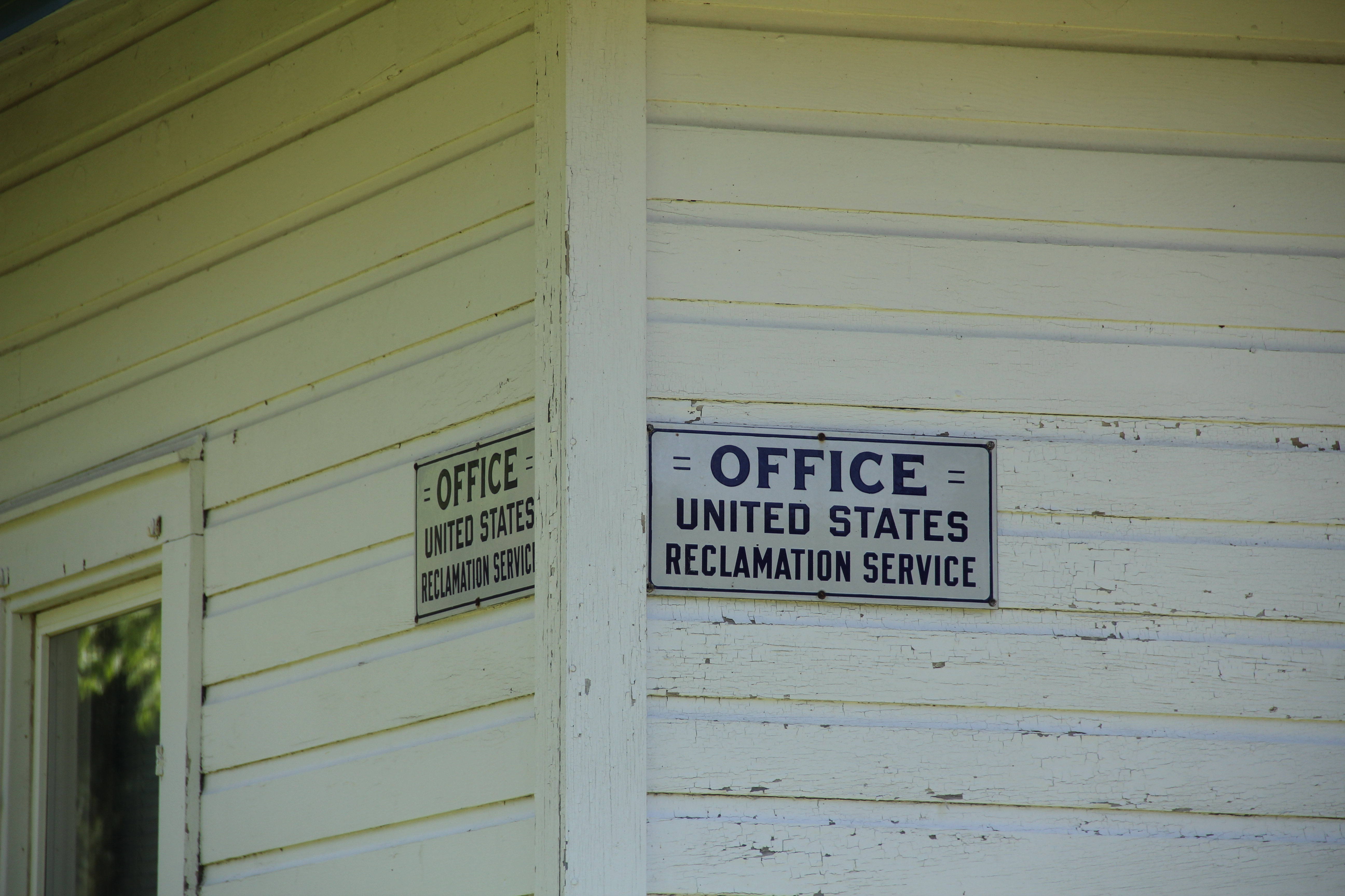
His enthusiasm and connections attracted other investors, and soon caught the attention of the new U.S. Reclamation Service, which made the Huntley Project its second one across the West.  Amazingly the very simple farm-vernacular building that housed the project’s office at Ballatine still stands, a little building that really conveys a huge story of a federal program that transformed a region.

IMG_1296

IMG_1295O’Donnell’s empire depended on others for capital, none no more so dependable that Preston Moss.  Moss also looked to the Midland Empire, and built his grand mansion in pursuit of that dream.  The Moss Mansion became a house museum in 1983.

IMG_1241

Not far away I. D. O’Donnell also had his town house, on a more modest scale but grand as far as many homes in the “new” Billings.  This Queen Anne house, like the Moss Mansion, were listed in the National Register in the 1980s, and the Moss-O’Donnell story

IMG_1245

became better known.  And the legacies extend to places not often thought historic.  That place would be the Billings Sugar Factory, a huge sprawling complex of where town meets farm, ironically located about halfway between downtown Billings and the old Yellowstone River townsite of Coulson.  Sugar beets made the valley bloom, and the landscape still shows those marks today.

IMG_0189

Montana’s Golden Valley–County, that is

MR line in Musselshell Valley (p84 25-30)

Abandoned Milwaukee Road corridor along U.S. Highway 12, Golden Valley County, MT, 1984

Golden Valley County, Montana, established with much local fanfare and excitement in 1920, was one of the last counties created in Montana.  Today, with just over 1100 residents, it remains one of the county’s smallest in population.  Yet, like other places along U.S. Highway 12, it has been a favorite jaunt of mine since 1982.  The highway connects with Montana 3, which roughly parallels an old stagecoach route, and Highway 3 going south takes you directly to downtown Billings.  Thus, beginning with my many projects with the Western Heritage Center in Billings in 1982, I quickly found out that taking U.S. 12 between Helena and Billings not only cut off miles from the journey but was always more scenic and more interesting due to the remnants of roadside architecture and bits of the Milwaukee Road corridor that followed the Musselshell River in this county.
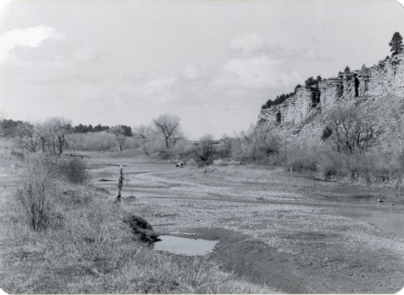
Golden Valley Co, near Cushman (p84 27-9)

U.S. 12 and Milwaukee Road routes along Musselshell River, Cushman, MT, 1984

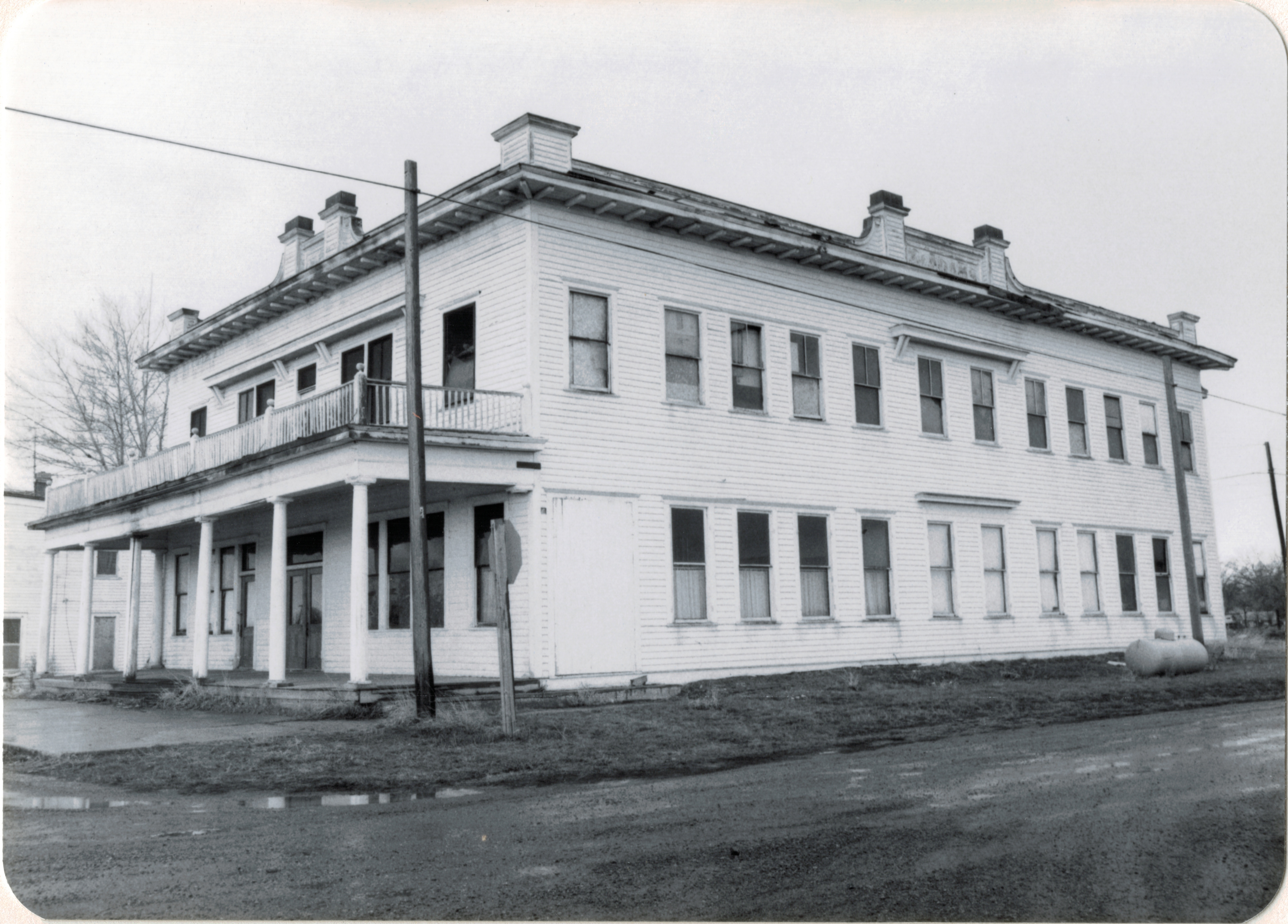
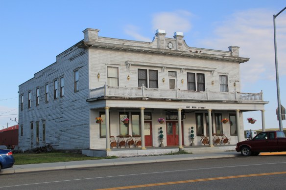
As you leave Billings and head north of Montana 3, this state road intersects with U.S. 12 at Lavina, one of the county’s two incorporated towns, and a place that has held steady in population since 1980 (probably due to its location and proximity to Billings).  The Adams Hotel, built in 1908 with a year of the railroad’s arrival, struck me immediately–a huge two-story Colonial Revival style building–in 1984 in the middle of nowhere.  But the Adams,

Adams Hotel, Lavina, Golden Valley Co (26-26)

listed in the National Register of Historic Places, spoke to the town founders’ hopes for the future–and the need for a large hotel for all of the traveling businessmen, and homesteaders, the Milwaukee planned to attract to the area.  As the image above shows, in 1984 the Adams needed a friend–someone who would take on a huge frame building and find a new life for it.  In the next decade that friend came and the Adams came back to life, as the 2006 digital image below shows.

Lavina

The next decade has not been so kind.  Owners have placed a clock in the cornice, eliminating the original dating of the building, plus brass lanterns have appeared on the second floor and it needs painting and repairs.  But the building is still open, and in use, and those are huge steps toward compared to 30 years ago.
IMG_0203

The town’s general store, Slayton Mercantile, which is also on the National Register, is doing better, and has become one of my frequent stops in the region.  This two-story brick commercial building also spoke to town’s hope for a bright future in the second decade of the 20th century.  Travelers along the road, and the town’s steady population, keep it in business today.

Slayton Mercantile, Lavina, MT, 2007

Slayton Mercantile, Lavina, MT, 2007

Slayton Mercantile, Lavina, MT, 2013

Slayton Mercantile, Lavina, MT, 2013

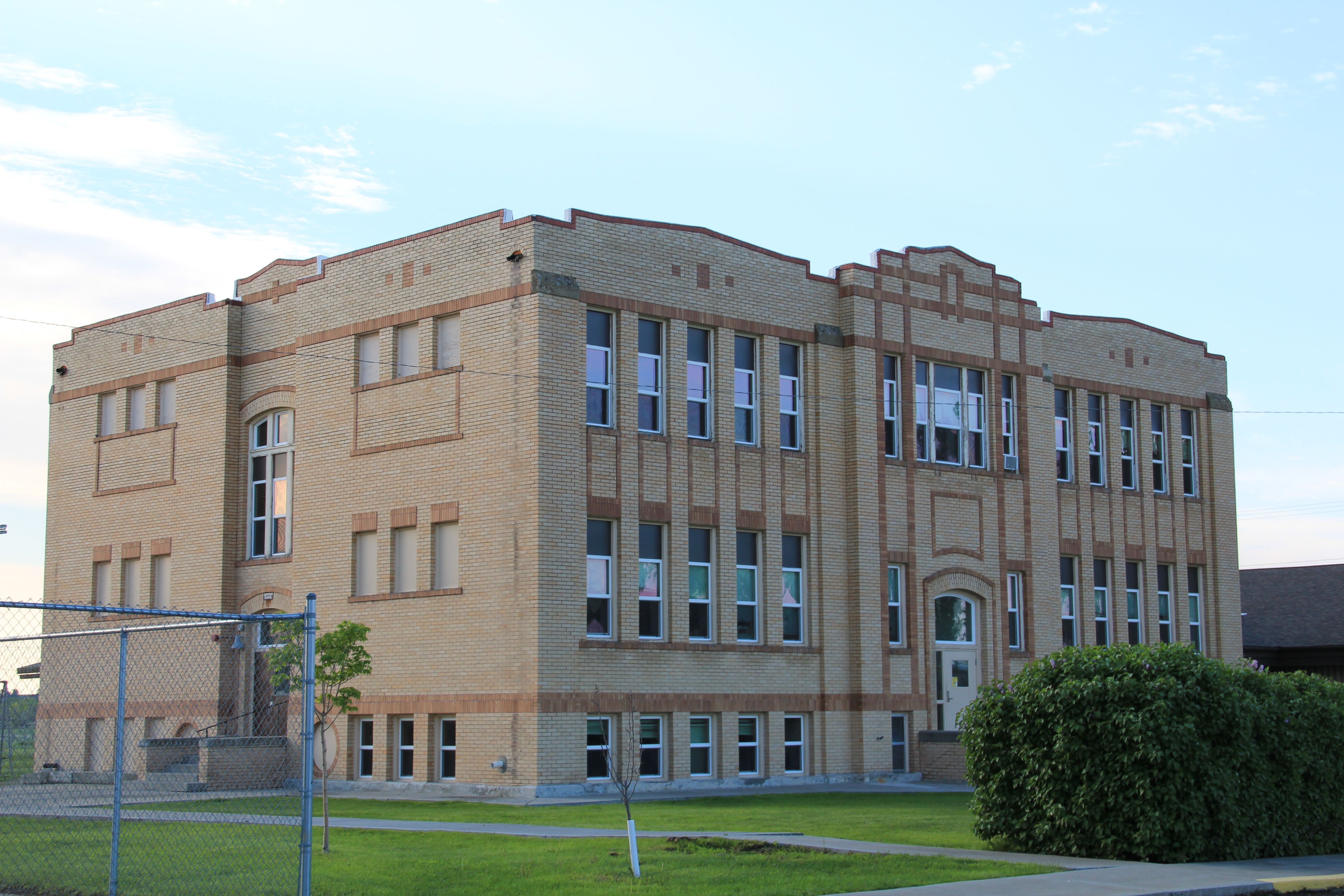
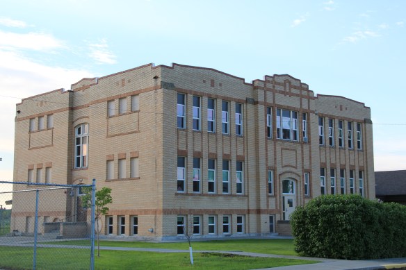
The historic two-story with full basement yellow brick Lavina Public School is not on the National Register but this early 20th century building is another key landmark.  Its exterior architectural features speak to the restrained styles of public architecture often found in the region. Another community landmark is the joint United Methodist and Lutheran church of Lavina–the two congregations share this Gothic-styled early 20th century building to sustain it and themselves as viable congregations.
IMG_0196

IMG_0195

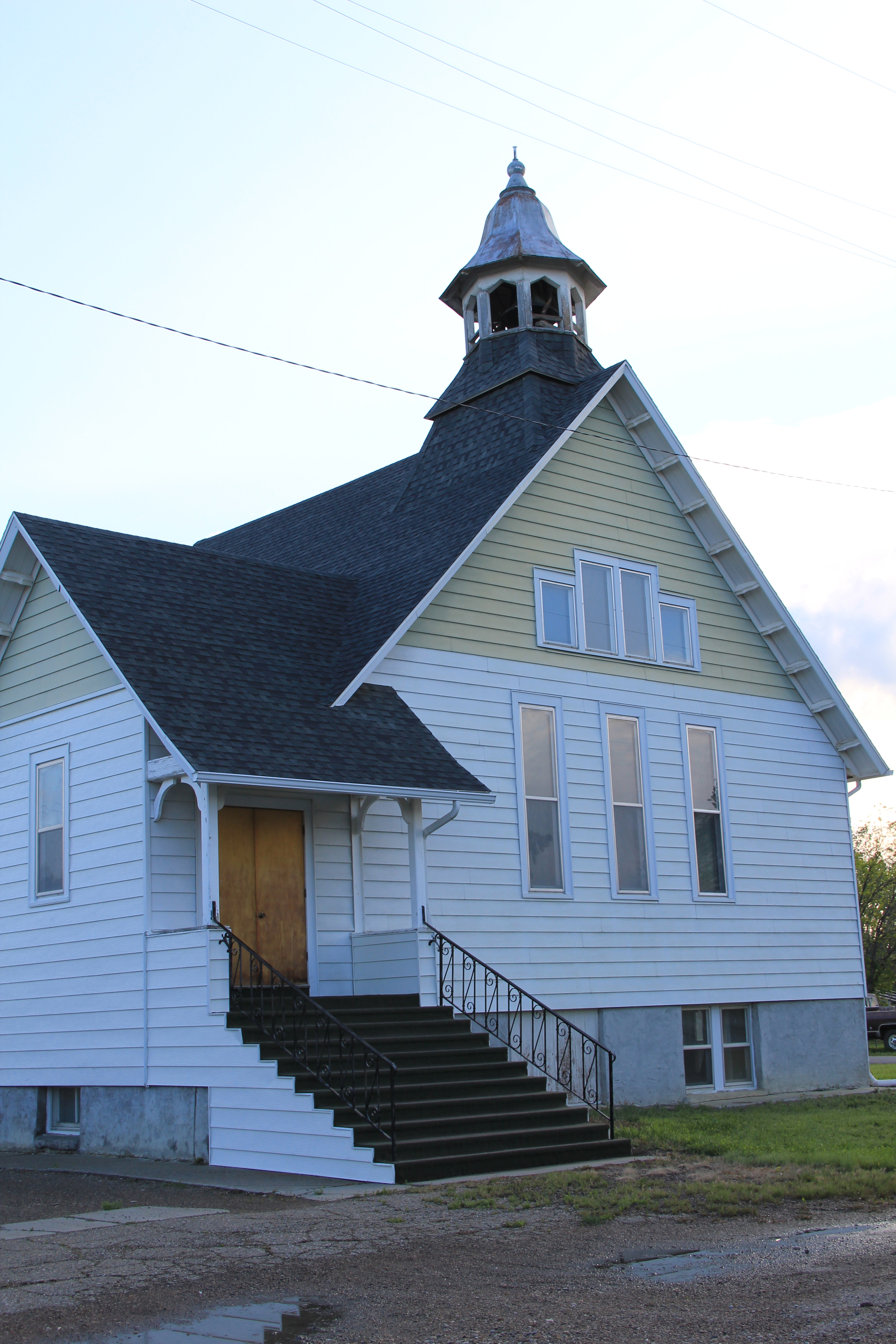
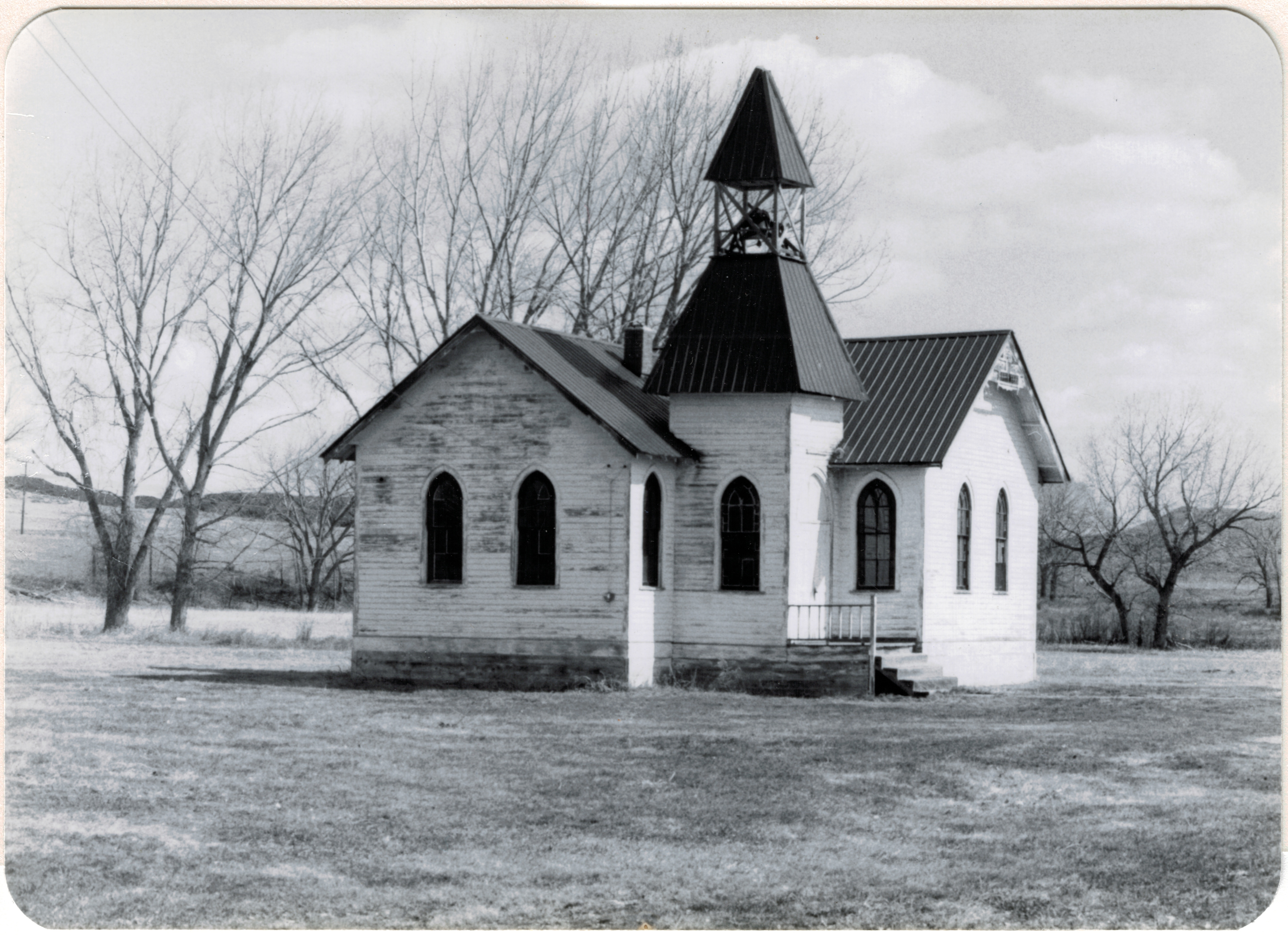
The fate of beautiful rural churches is not a happy story throughout the northern plains, but Golden Valley County has done better than many.  Another of its early 20th century churches, the Lutheran Church at Barber, needed help in the early 1980s when I first surveyed it.  Local residents in the last 30 years restored the building, opening it for services, and listed it in the National Register.  The original open bell tower has been covered and a handicap ramp for attendees have been added–steps that have helped to keep the building part of the county’s otherwise disappearing historic landscape.
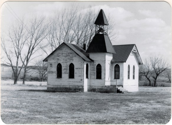
Grace Lutheran Church, Barber NR (p84 27-29)

Barber Community Church, Golden Valley County, MT, 1984

Ryegate is the county seat and an important crossroads for ranchers and travelers.  Its population too has remained relatively steady since the end of the Milwaukee Road in 1980–273 then and 245 in 2010.  It was never a big place, with the largest population coming in 1920 when the county began, 405 residents.  The historic grain elevators

IMG_0211

speak to the importance of the railroad, and highway, while the landmark Ryegate Bar has served thirsty locals and travelers for decades.  Today it is most famous for its annual testicle festival–a new tradition launched since the survey of 1984-1985.

IMG_0212

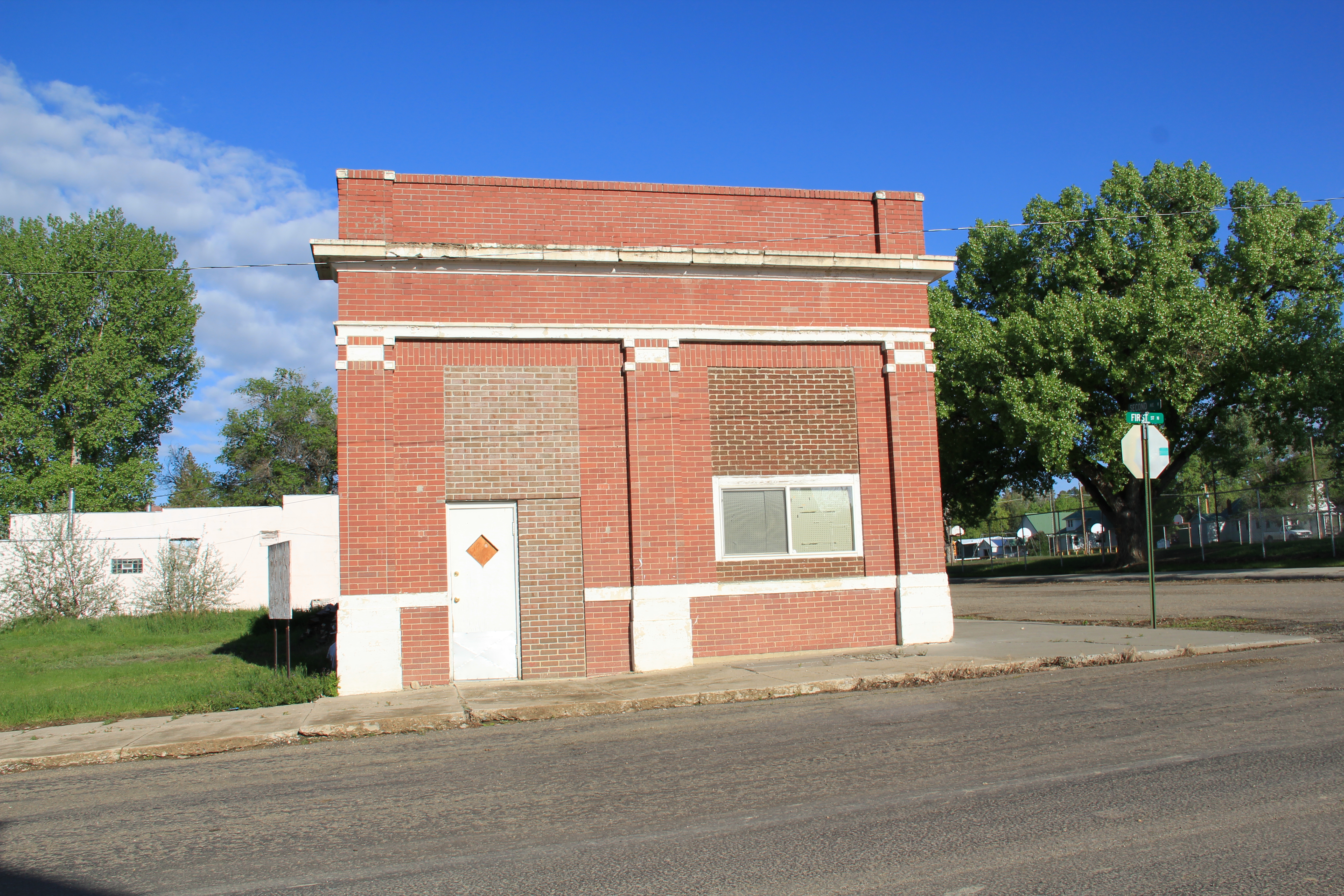
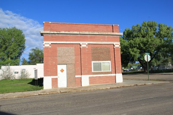
Two buildings from the county’s beginnings are a one-story brick Classical style bank building, which like so many in the region closed its doors during the homesteader bust and the Great Depression, and the Golden Valley County Courthouse, appropriately the town’s most imposing building.
IMG_0214

IMG_0222

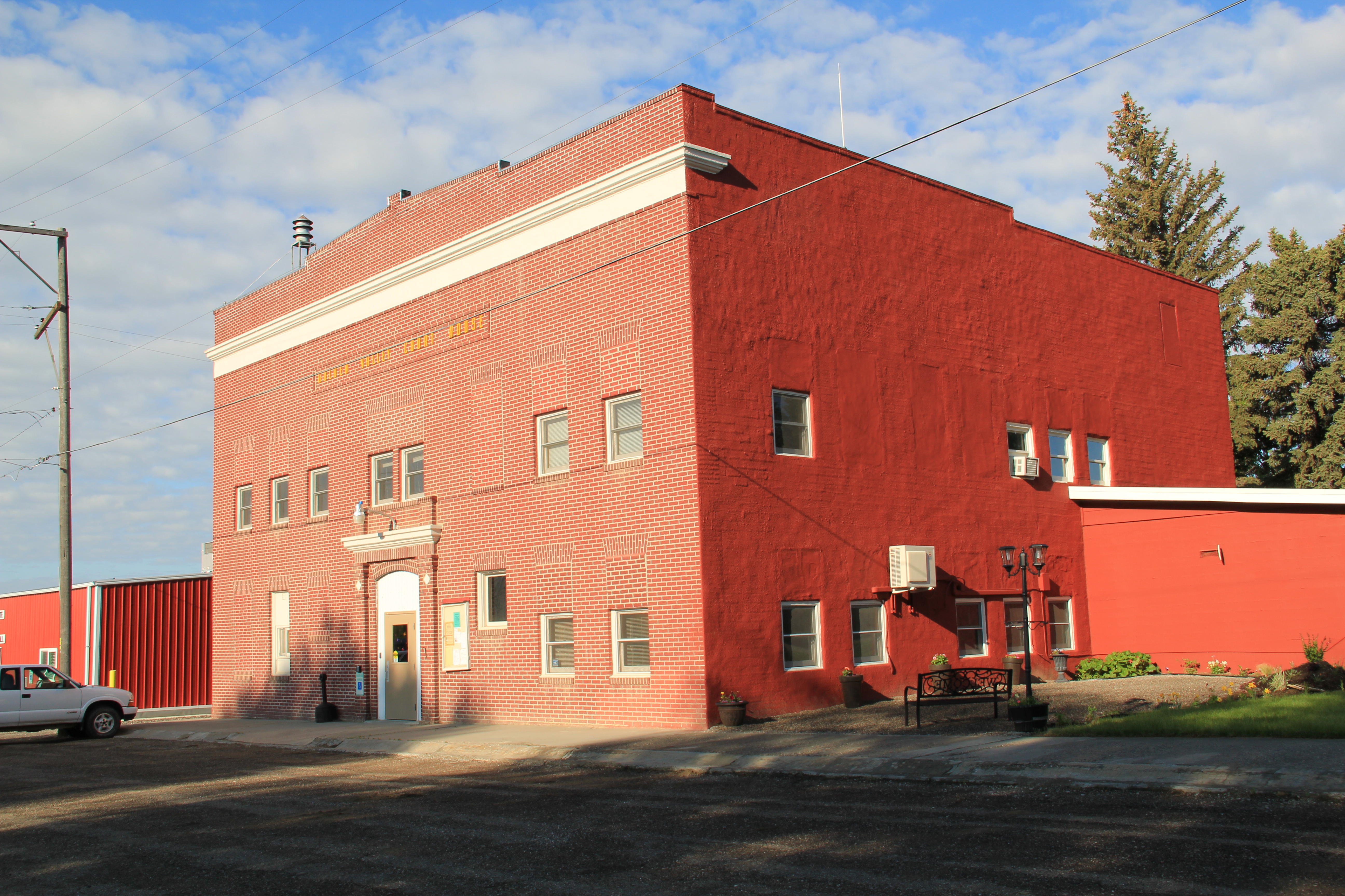
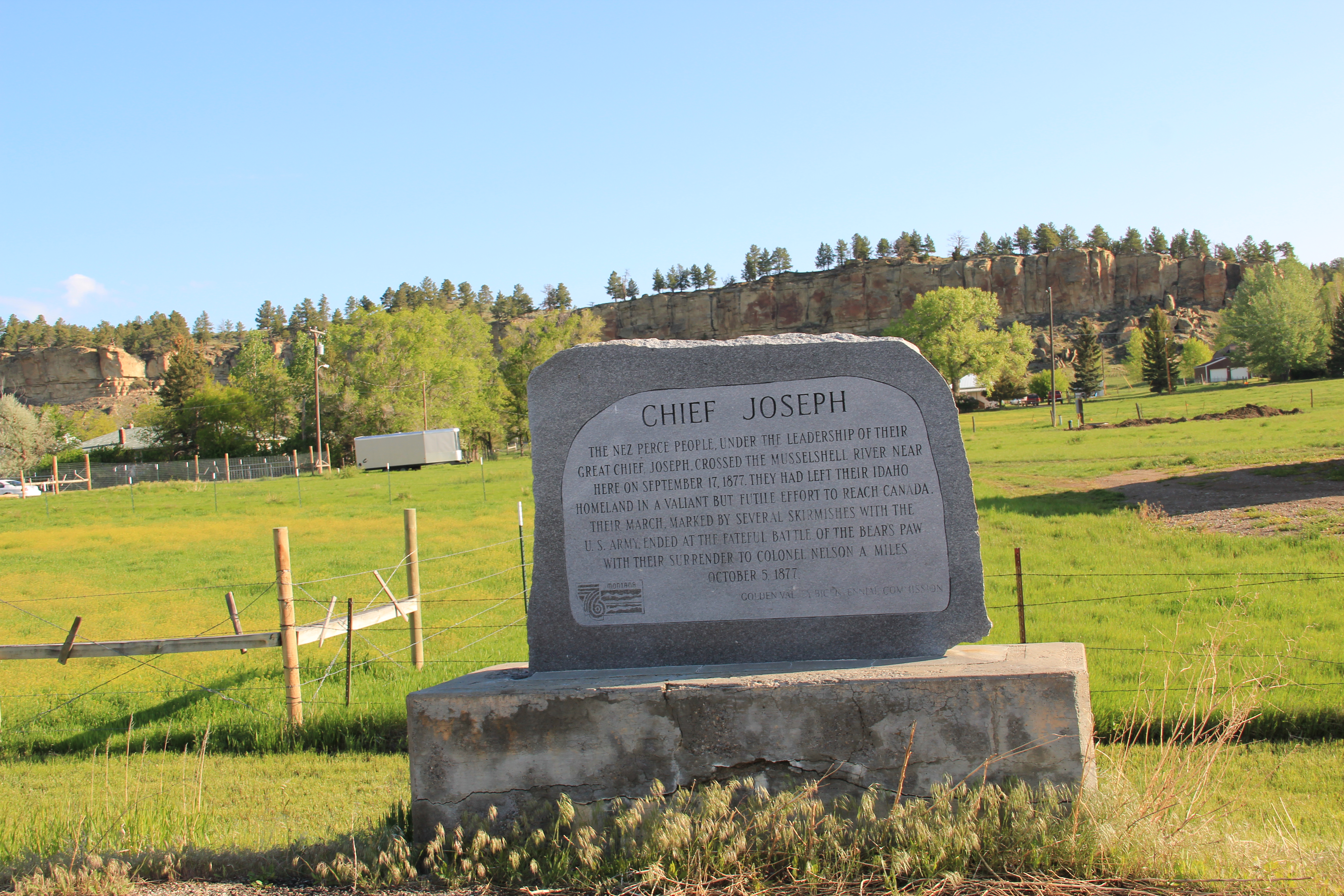
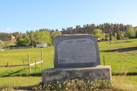
Ryegate also has its acknowledged historic sites:  a town project in 1976 marked the area’s association with Chief Joseph’s 1877 trek across eastern Montana while on the
IMG_0208

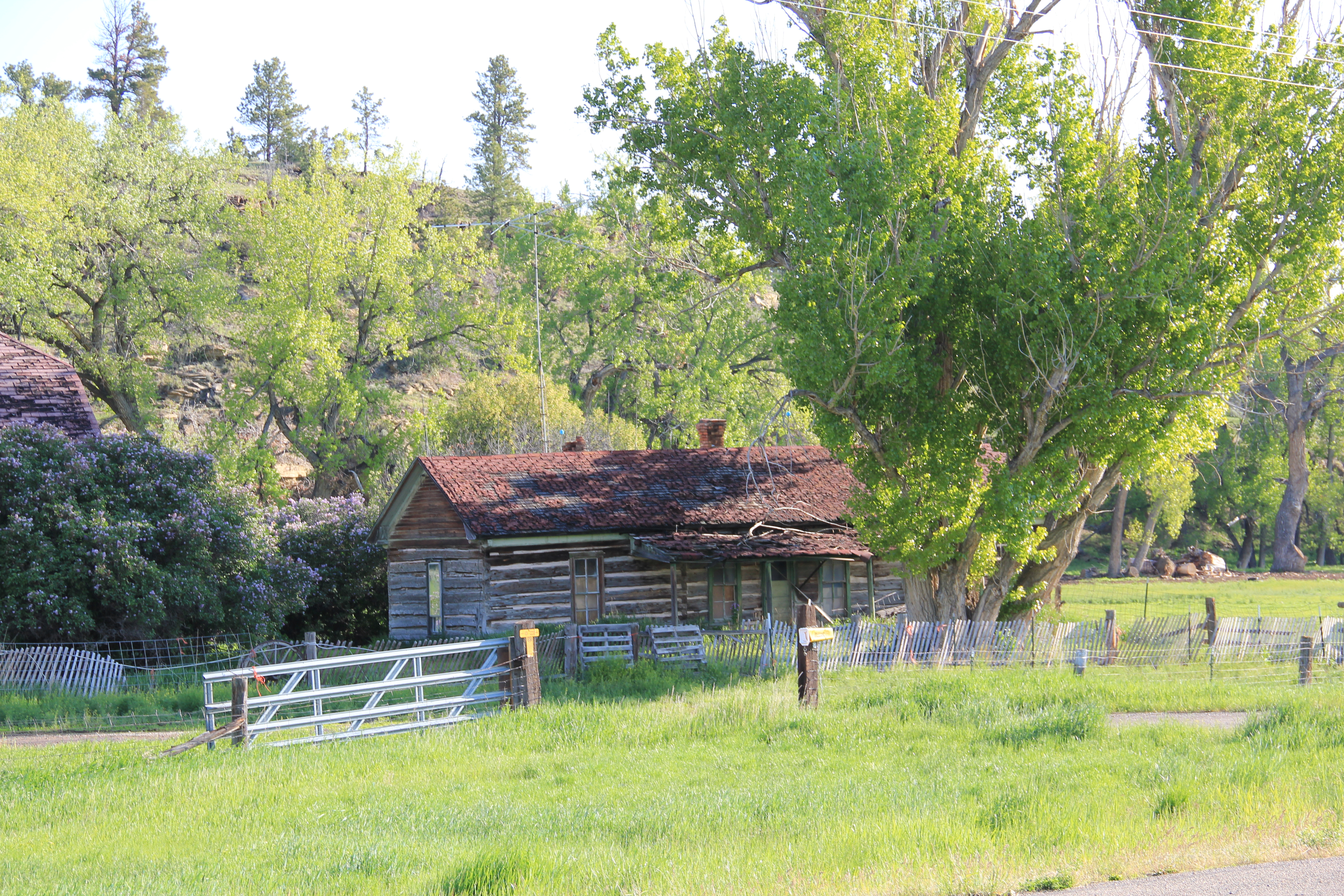
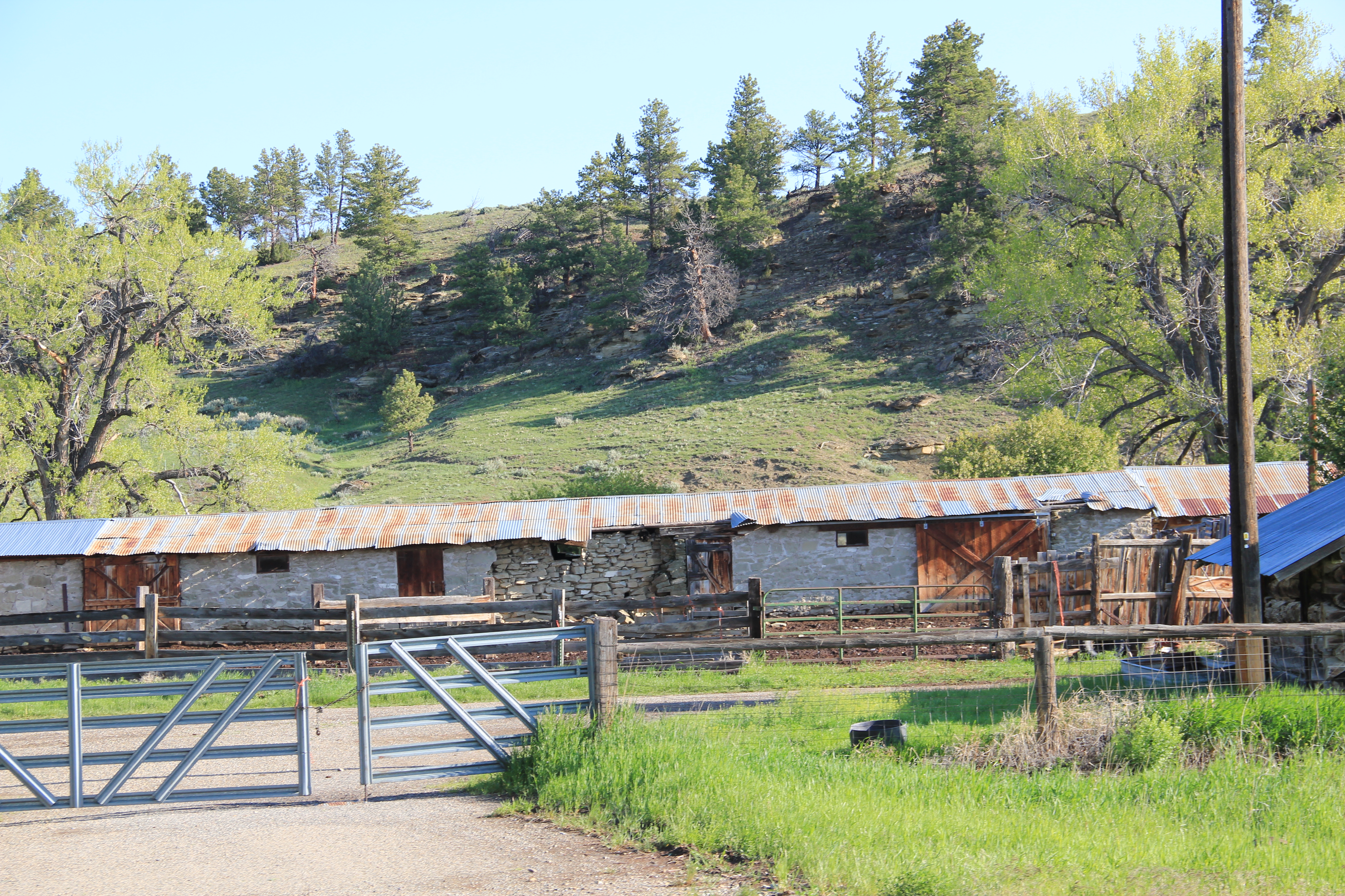
town’s eastern border the Sims-Garfield Ranch, a rambling assortment of vernacular-styled log and stone outbuildings and two vernacular style residences is the only town property listed in the National Register. Nestled between U.S. Highway 12 and the rocky bluffs of the Musselshell River, it is evocative of the county’s roots as a ranching landscape, a place of work and pride that survives today.

IMG_0229

IMG_0228

IMG_0227

IMG_0226

Roundup, Montana: 19th Century Trail Crossroads and 20th Century Railroad Town

IMG_0080

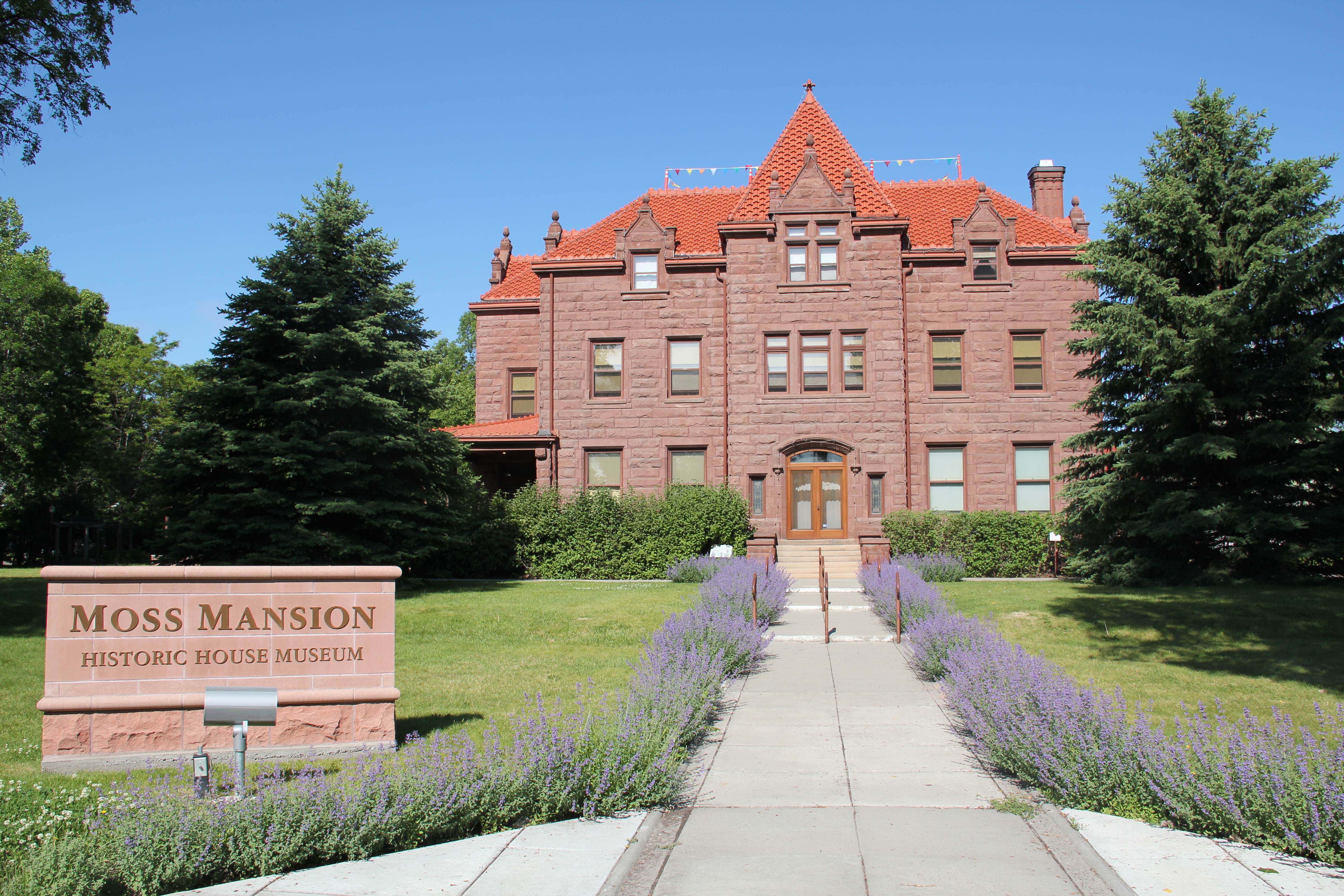
Roundup, the seat of Musselshell County, has long been one of my favorite Montana county seats.  The old 19th century cattle trails are one important defining feature of the eastern Montana landscape; another are the railroad lines that crossed the region.  Here at Roundup, a north-south cattle trail crosses the east-west railroad line,  creating a town environment rich in history.
IMG_0078

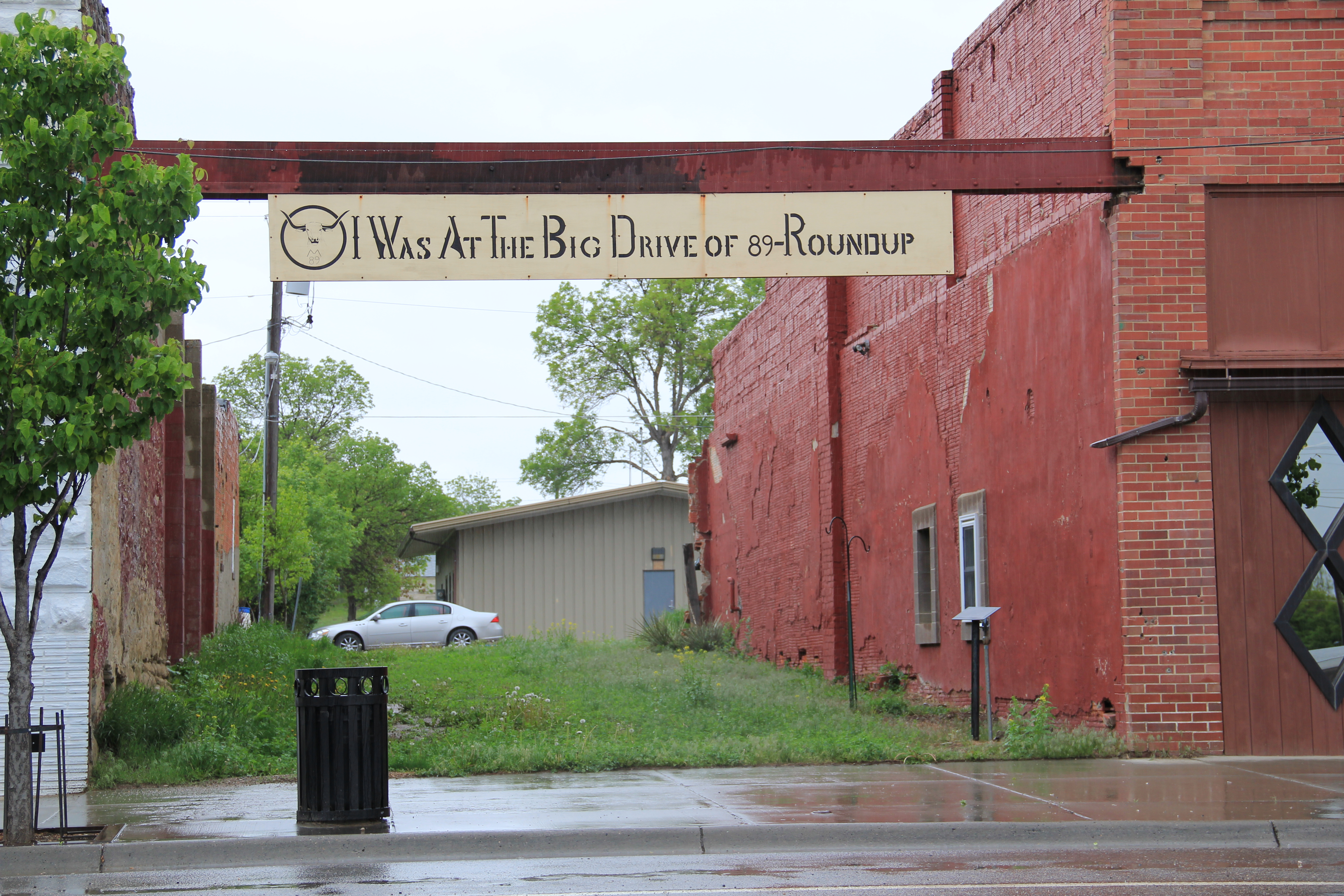
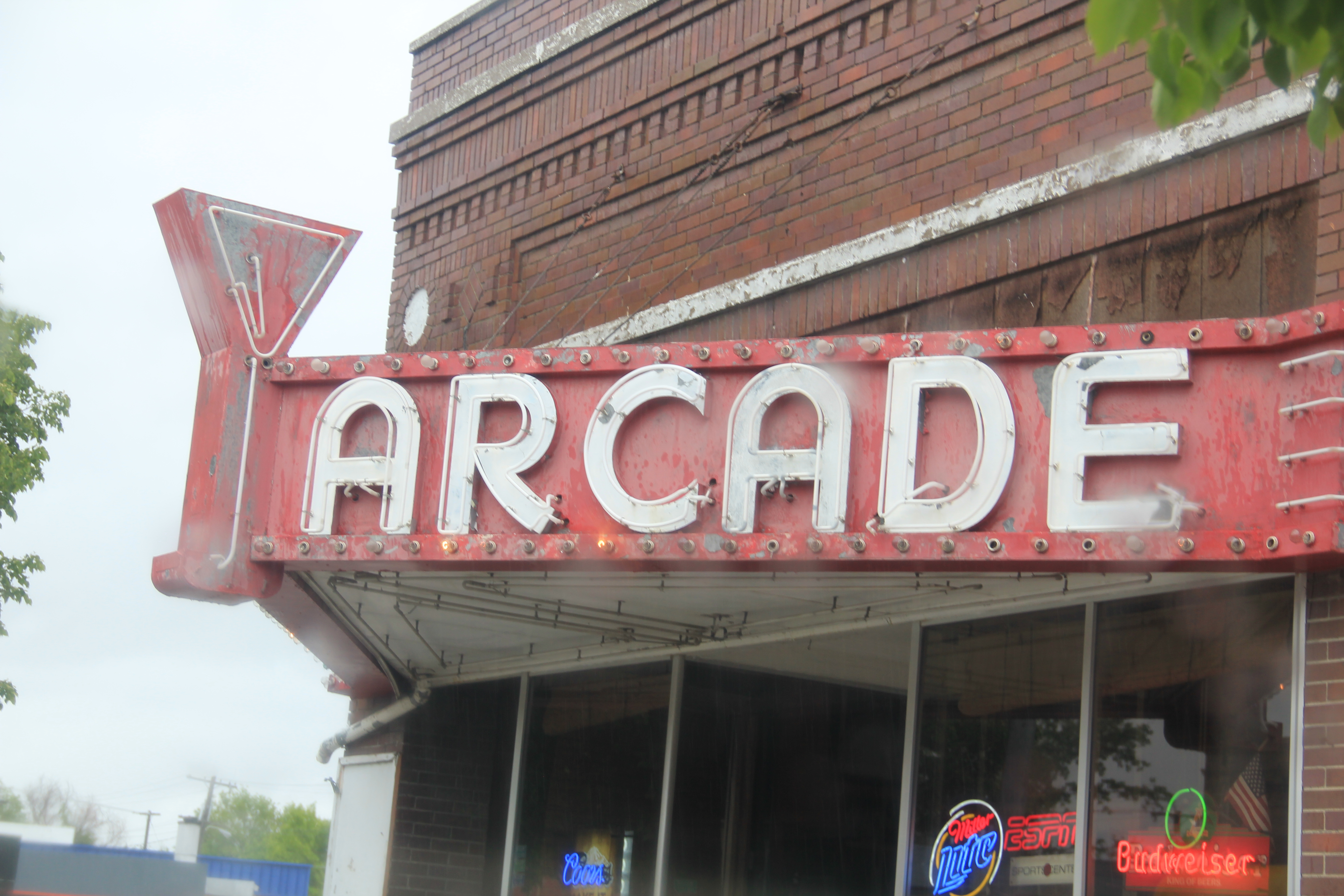
Locals gathered at the town’s several good historic bars–the Arcade being my favorite–are rich in tales of the chaos and fun of early September 1989 when cowboys and pretend cowboys gathered in mass to recreate the “Great Montana Cattle Drive.”  A monument to that crazy day stands next to Roundup’s outstanding New Deal-era courthouse.  Another sign to that time is much more lonely, on Main Street, the old historic route of the trail (now part of U.S. Highway 87). Are you supposed to stand there for a selfie if you rode in ’89?

IMG_0077

IMG_0076

Arcade Bar, Roundup, a real Montana classic

IMG_0057

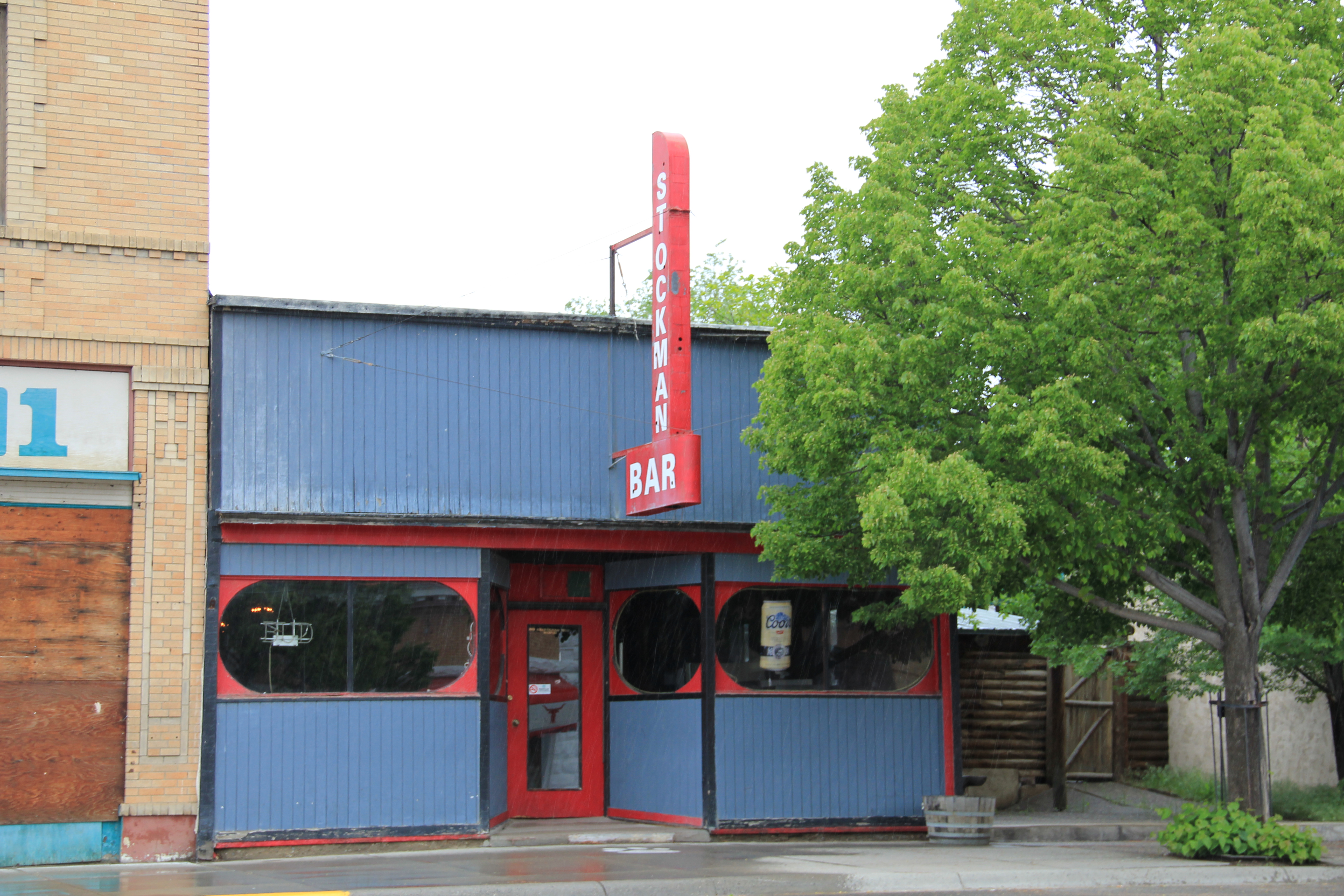
There are so many Stockman Bars in Montana. The one is Roundup has these two great Art Deco-like windows.

The coming of the Milwaukee Road in 1906-1907 created a new look to Roundup.  Like many Milwaukee towns in Montana, it has a T-plan, with the route of the tracks (the rails

IMG_0050

I was glad to see this light industrial adaptive reuse of the Milwaukee depot–it was abandoned in 1985 and could have been demolished.

have been removed since c. 1985) and the location of the depot forming the top part of the T while the stem of the T is the route of U. S. 87 as it stretches to the north.

IMG_0048

U.S. 87 N (Main Street), Roundup

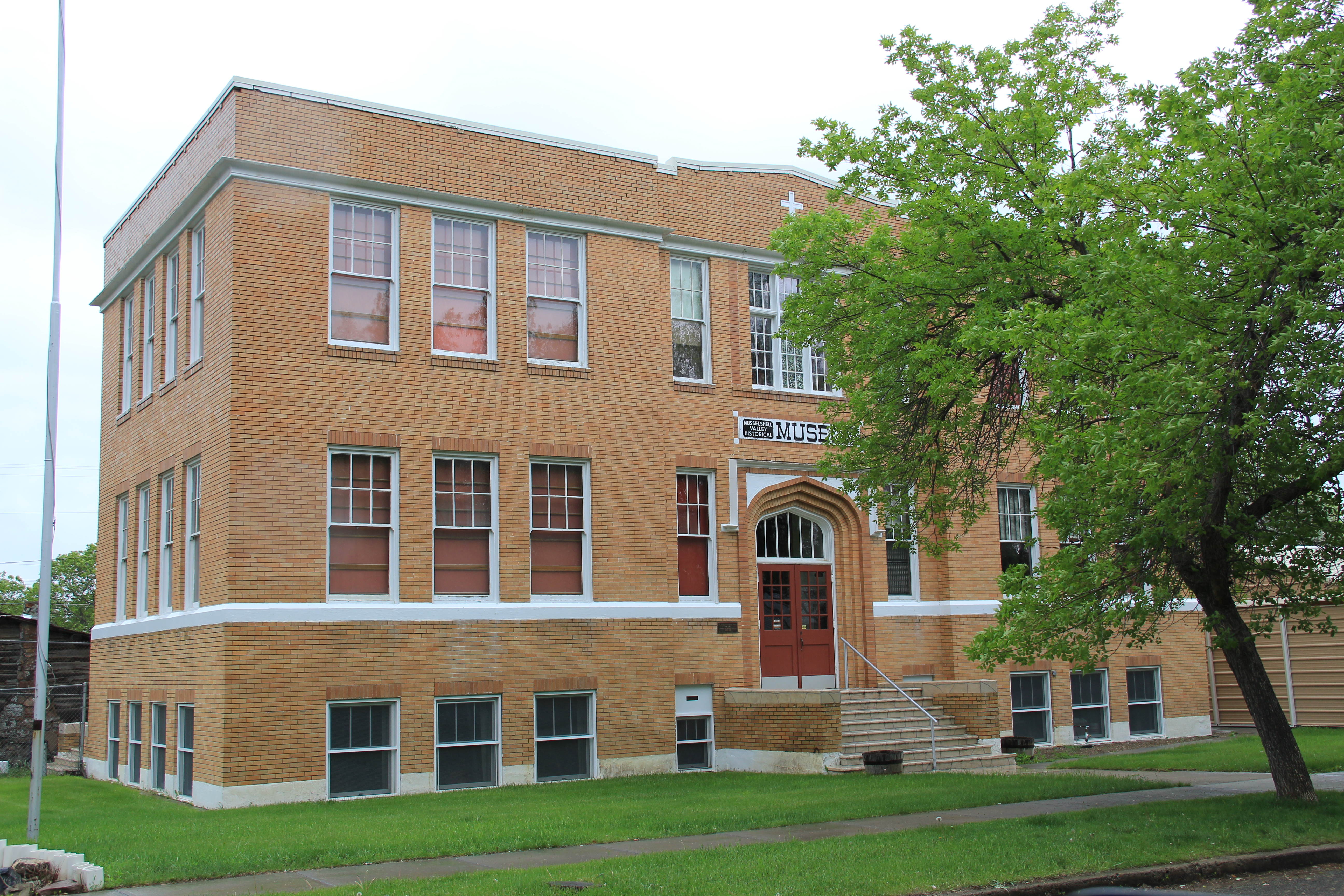
Earlier posts have discussed the town’s contribution to Montana modernism, St. Benedict’s Catholic Church, and the superb Musselshell County Fairgrounds, one of my favorite in the state (and a public property eligible for the National Register IMHO). Roundup has two National Register properties–its two historic schools.  The St. Benedict Catholic School (c. 1920), designed by Roundup’s own John Grant, is now the Musselshell Valley Museum.

IMG_0036

The town’s historic public school, but in two major sections in 1911 and 1913, was designed by the Billings architectural firm of Link and Haire.   It is an impressive landmark, built from stone taken from the bluffs of the Musselshell River Valley, and one maintained with pride by the community.

IMG_0235

Many historic buildings from the early 20th century line Main Street–naturally many one-story buildings but also commercial blocks of style and substance.  There is also a lot of homes that would contribute to a residential historic district.  Roundup has lost population like almost all eastern Montana towns since 1980 but not by such a severe amount–just over 200 in the last 30 years.  Thus, the town’s historic buildings remain in use and in fairly good condition.

IMG_0063

IMG_0046

IMG_0039

The historic schools in Roundup have been a great start for heritage efforts in Roundup but this quick overview shows that more can be done, to document and preserve this pivotal place in the Musselshell Valley.

The Milwaukee Road Heads into the Musselshell Valley

As the Milwaukee Road left the Yellowstone Valley at Forsyth and struck northwest toward the Musselshell River valley, it created one of Montana’s most classic prairie railroad towns, Ingomar, established in 1908.  The hamlet, with 25 or so residents today, compared to perhaps the 100 who lived around there in 1980 has several historic buildings that document its quick twentieth century rise, and just as quick fall in the 1920s and 1930s depression years.

IMG_6844

Jersey Lily Bar, Ingomar, 1984

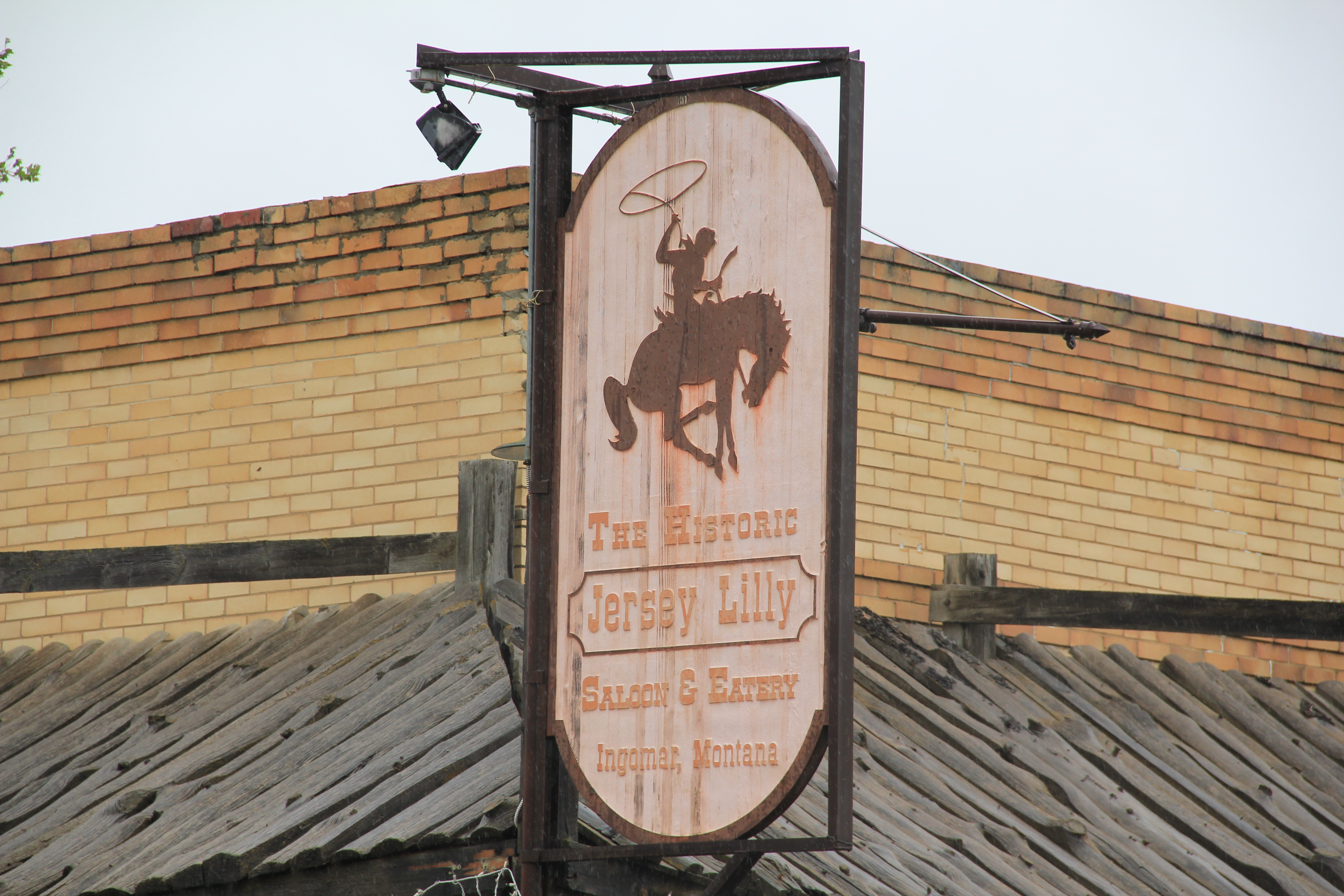
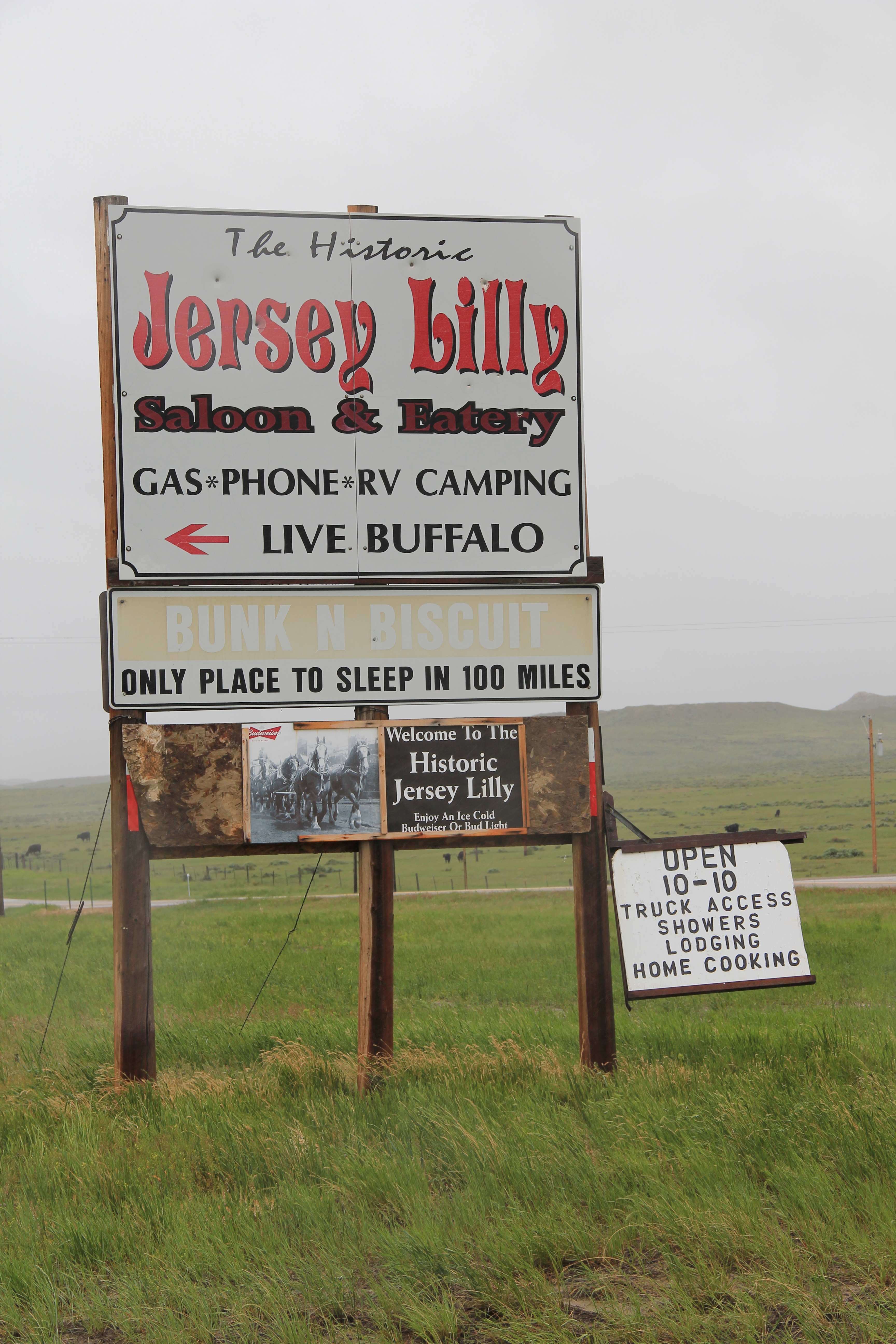
In the 1984 survey of Montana, Ingomar really just had one reason to stop:  the Jersey Lilly Bar, owned and managed by Bill Seward, who had done so since 1984.  That spring Seward and I became good friends.  Few people stopped there in February and March and since I was in the region, I found ways to stop in. do coffee (strong, hot, always ready) and have whatever Bill was thinking of cooking.  He was proud of his beans, and liked sliced red potatoes when he had them.  Seward added the faux western wood porch to a 1914 bank building:  he said that the tourists liked it, that it made the otherwise Classical Revival bank look “Old West.”  Until Seward’s death in 1995, I found reasons to visit Ingomar three other times, in a way just to make sure that both Seward and the bar was still going on.  Since the construction of the interstate highway to the south had so killed traffic along U.S. Highway 12, you wondered when the bar would close.

IMG_0115

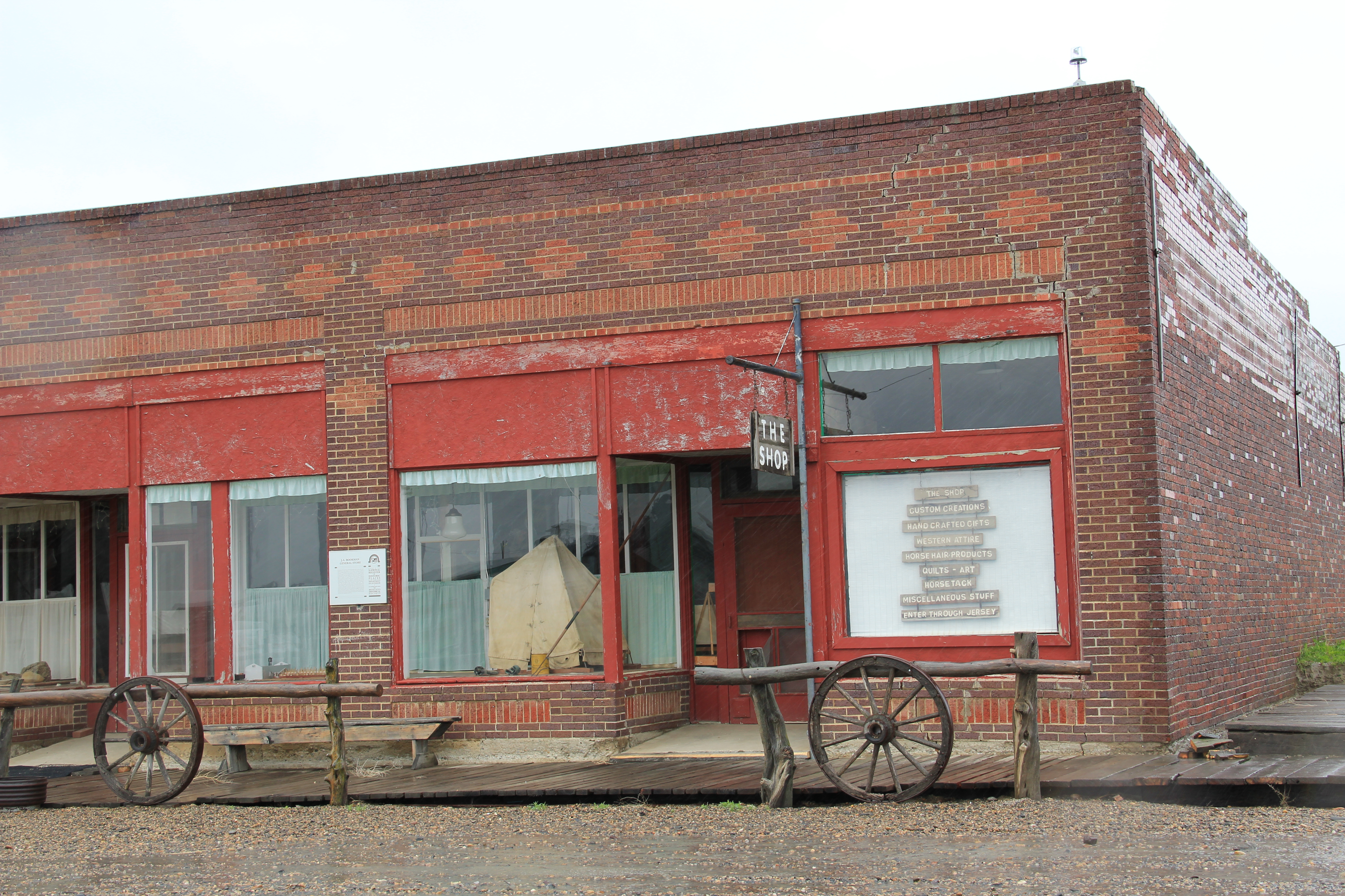
This former homestead-era bank building, the Wiley, Clark, and Greening Bank, opened in 1914 and closed as a bank seven years later.  In 1933, the height of the Depression, it re-opened as the Oasis Bar (it certainly was that along U.S. 12) and it became the Jersey Lilly Bar in 1948.  Almost seven decades later, it is a well-known landmark on the highway, and was listed in the National Register of Historic Places in 1995.

IMG_0116

IMG_0126

Adjoining the bar, and accessible only through the bar, is another National Register building, the Bookman General Store, constructed as really an act of faith in 1921, replacing an earlier store that had burned.  The prospects for Ingomar was not so rosy by that time but the Bookman family stayed the course–lost the store for two years from 1933-1935–but reacquired it and kept it open to 1943.

IMG_0122

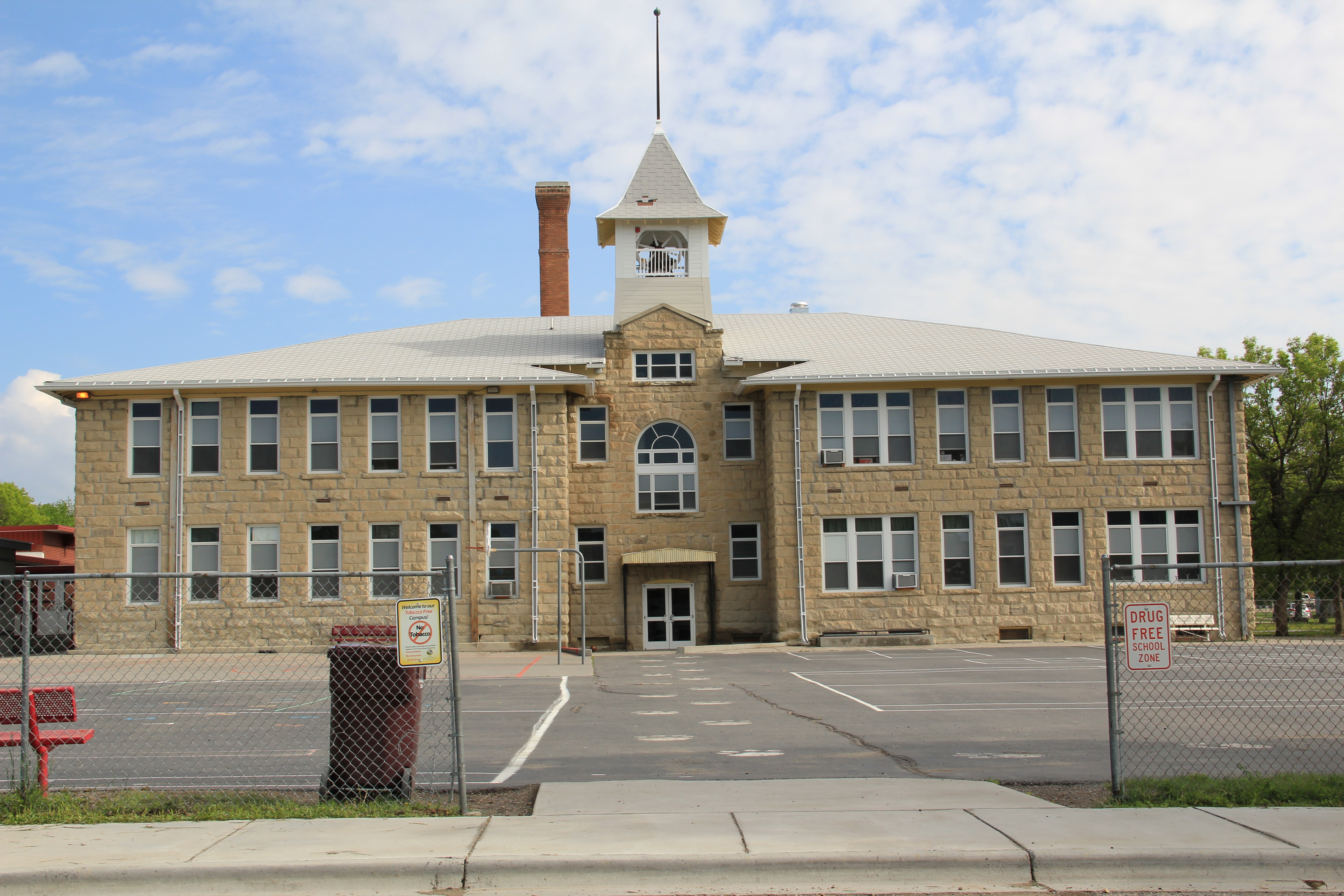
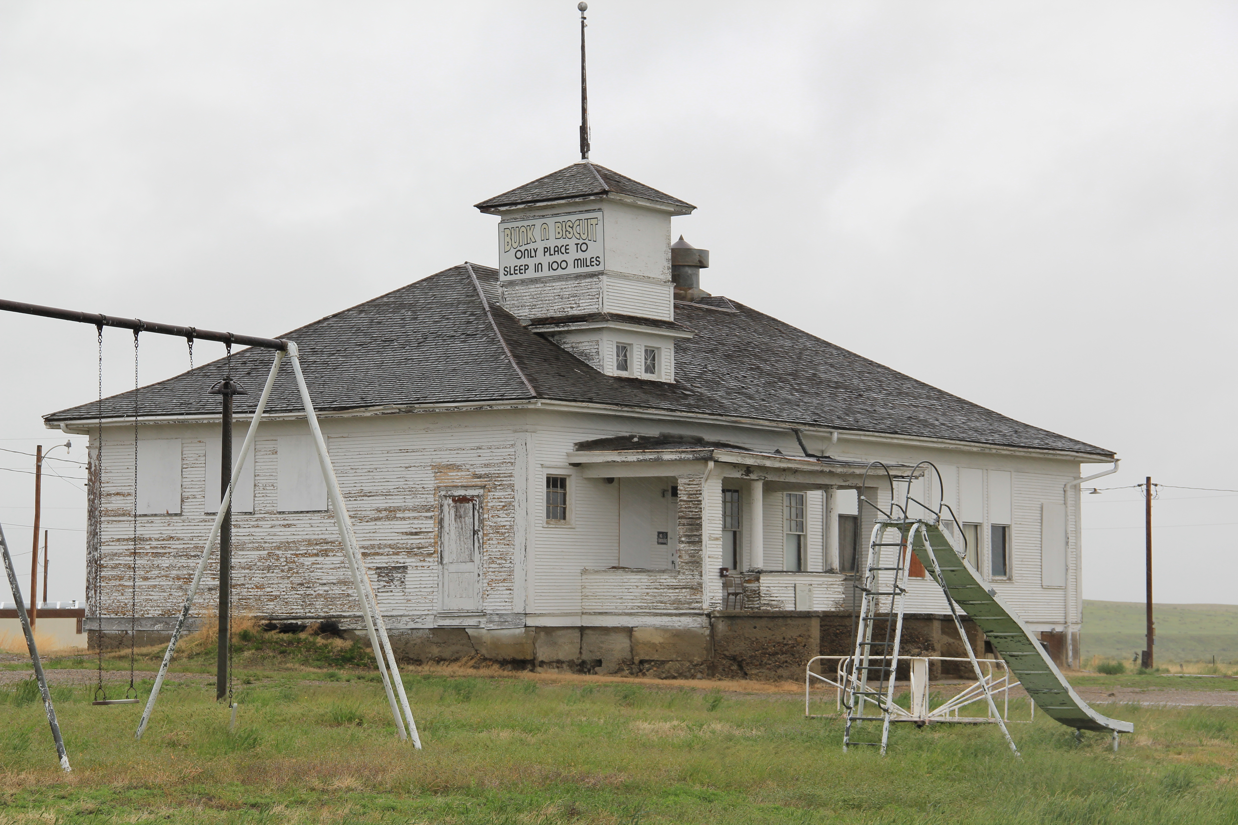
A third Ingomar landmark on the National Register is the public school, which evolved from  a one-room in 1913 to the rambling building you see today, constructed by Neils Hanson of Melstone in 1915.  When I surveyed Ingomar in 1984, the school still operated but closed for good in 1992.  It was converted into a “biscuit and bunk” later that decade.

IMG_0111

Another important historic building is the Milwaukee Road “combination-style” depot, where the passenger and freight service was combined into one building.  Many of these have disappeared along the line since its closure, and too many have disappeared or have been moved since my survey work of 1984-1985.  Ingomar has its depot, converted into a private residence along the now-gone tracks in the 1990s.

IMG_0123

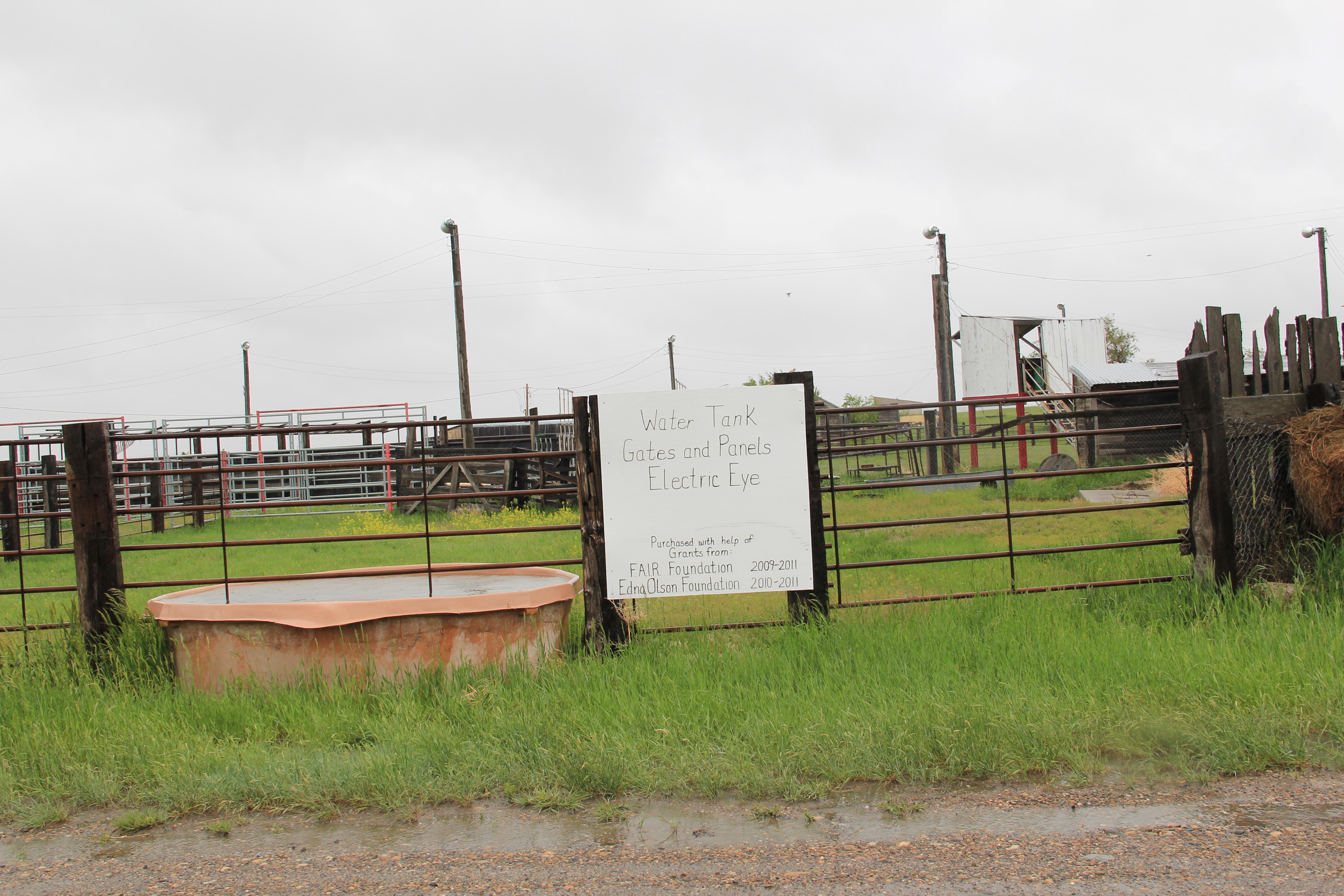
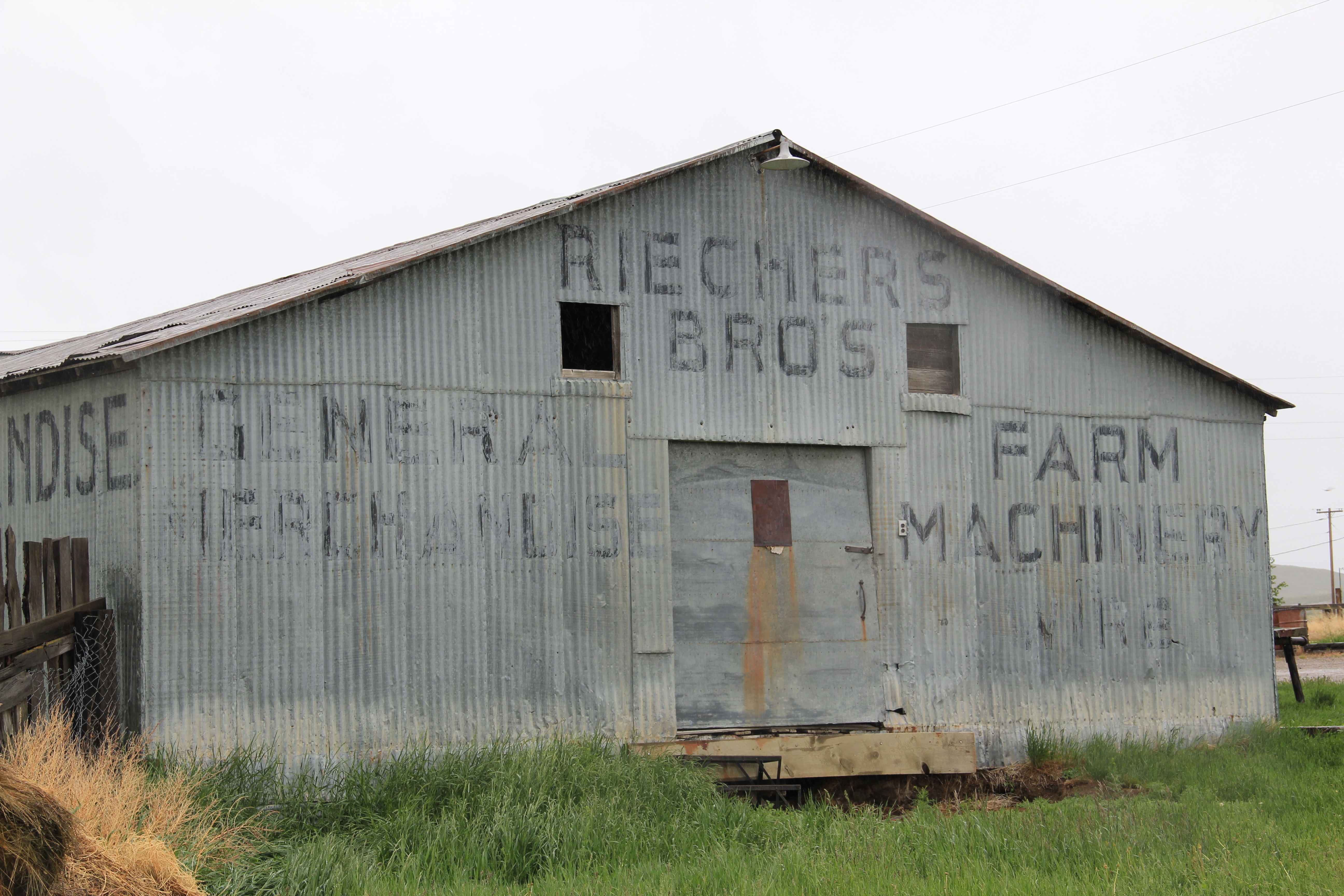
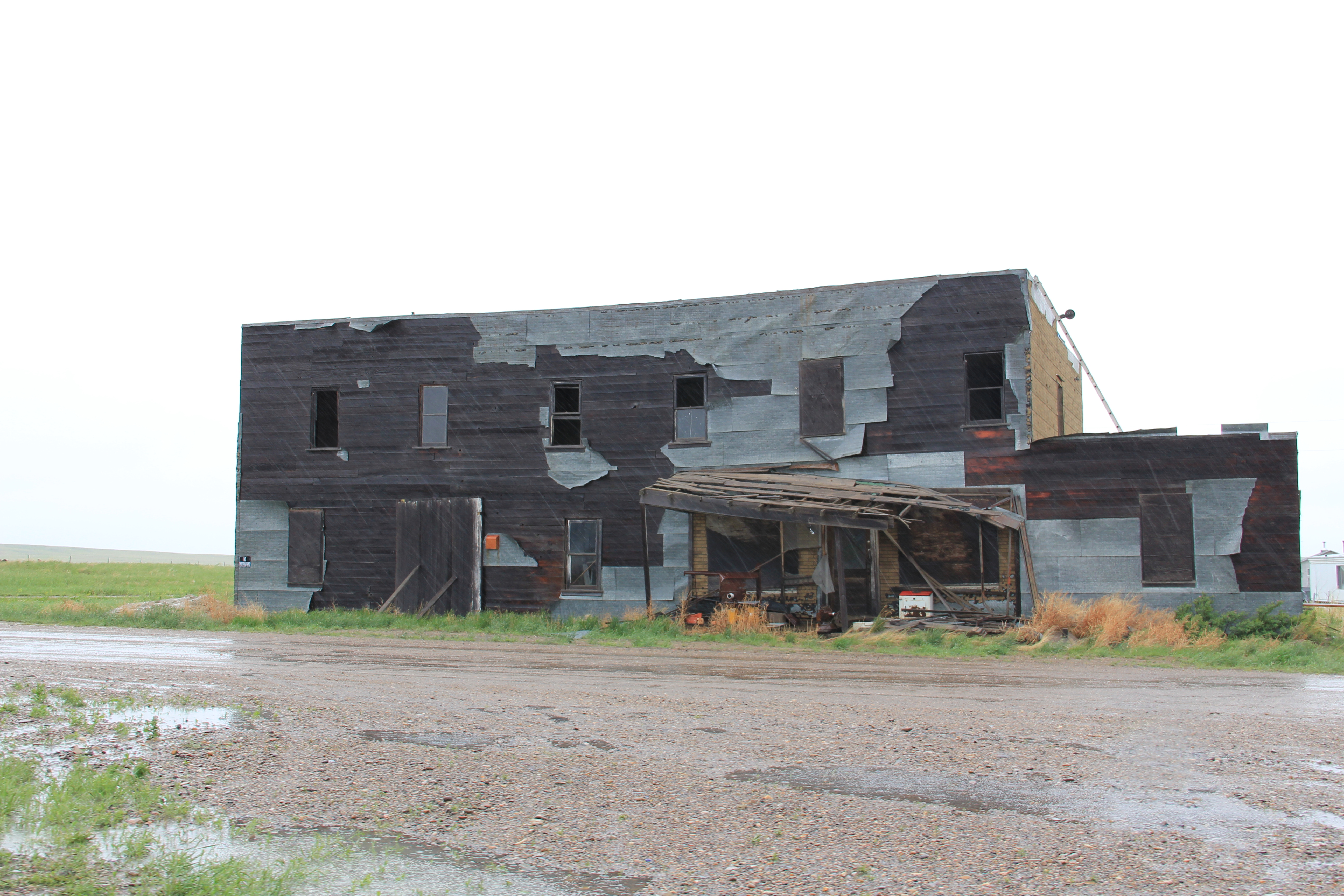
Other historic properties exist, perhaps waiting new futures.  The rodeo grounds stay in use while the Riechers Brothers general merchandise and machinery store building remains standing.  Other structures are barely hanging on.

IMG_0113

IMG_0114

IMG_0109

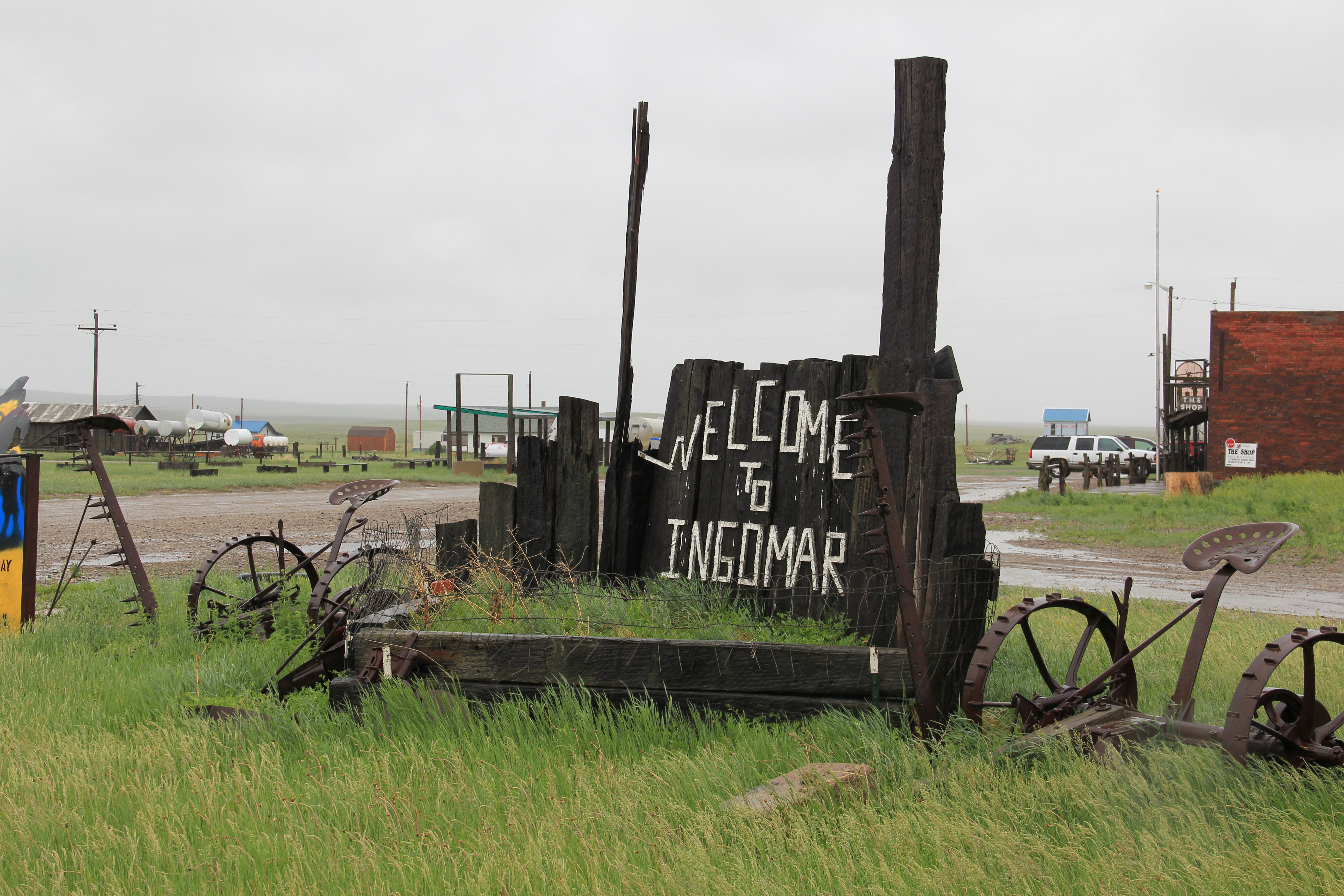
As travel dwindles and population disappears, you worry about the future of Ingomar.  Their signs and their heritage assets beckon visitors daily but will enough even come by to make a difference?

IMG_0108

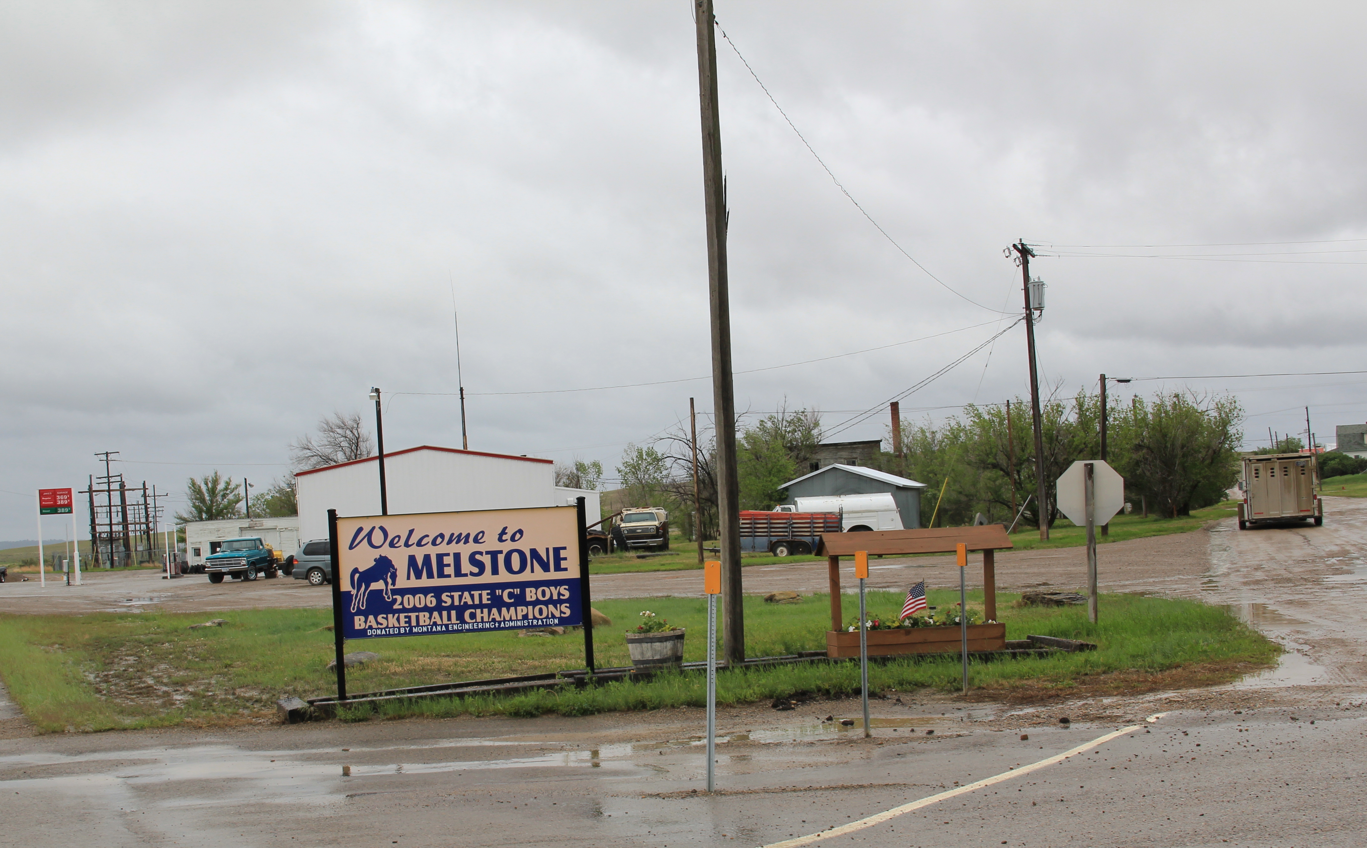
Melstone, just west of where the Milwaukee Road crossed the Musselshell River and entered its valley, is another worrisome case.  Its population has dropped to under 100–almost 150 lost since my visit in 1984.  But it still has its school, which is very much the town’s central institution and point of pride.

IMG_0103

Melstone has lost its signature building, the 1912 Antlers Hotel, located on the town’s most prominent corner between its main street, that leads to the school, and the intersection with U.S. Highway 12.

IMG_4071

Antlers Hotel, Melstone, 1984

The location of the Antlers Hotel is now a grassy spot.

The location of the Antlers Hotel is now a grassy spot.

Melstone has a hardware/general store along with Jakes Garage on the highway and the Melstone Bar and Cafe, another classic roadside stop along u.S. 12.

IMG_0104

IMG_0099

Ingomar and Melstone–I understand to most eyes they are dumps, not worth a look–but in my fieldwork they are interesting and valuable, physical signs of the 20th century determination to make rural settlements work, and despite their losses, they are still here some 100 years later.

Hardin and Montana’s Modernist Traditions

The National Register-listed Burlington Route depot  is now the chamber of commerce office.

The National Register-listed Burlington Route depot is now the chamber of commerce office.

Hardin is different than so much of eastern Montana It was created along the Burlington Route–a railroad line that entered the state in the early 20th century and headed north to Billings–and not the three dominant lines of the region:  the Great Northern, the Northern Pacific, and the Milwaukee Road.  Its town plan is different: streets radiate out from the depot, the centerpiece of the design, although tradition soon overruled design:  businesses soon adapted the plan into the standard T-town look that you find throughout the region.

From the depot, looking northwest, the Hotel Becker, also in the National Register, is the town's most recognized landmark from its first decade of development.

From the depot, looking northwest, the Hotel Becker, also in the National Register, is the town’s most recognized landmark from its first decade of development.

IMG_6839

To the northeast of the depot, the street soon took on the look of an alley as owners adapted the plan to the preferred T-town look of a proper “Main Street.”

Hardin is also different because like its huge neighbor to the north, Billings, Hardin’s demographic story is not one of a boom in the early twentieth century followed by decades of declining population.  When I first visited in the early 1980s, the town’s population had grown by one thousand since the 1950s, and it has even grown a couple of hundred more since then, rather than the story so often documented in this blog of rather steep declines in eastern Montana towns from 1980 to 2010.  Hardin even weathered the closing, and now slow demolition, of its industrial mainstay, the Holly Sugar Refinery, which dominated the skyline and local industry from its opening in 1937 to its closing in the early 1970s.

The refinery, shown here in 2013, is  just east of the town proper and has served as a major landmark for travelers on I-94.

The refinery, shown here in 2013, is just east of the town proper and has served as a major landmark for travelers on I-94.

The opening of the refinery in the Depression decade also coincided with yet another trend that makes Hardin different:  its impressive collection of modernist designs, which started with the magnificent Big Horn County Courthouse.

IMG_6872

The courthouse was constructed between 1937 and 1938 as a Works Progress Administration (WPA) effort; J. G. Link of Billings was the architect, as the firm was for so many New Deal projects in the region.  The courthouse is the state’s most successful blending of regional materials with standard WPA Modern design.  South of Hardin is the Big Horn Canyon, a beautiful deep gorge that frames the river.  The striking stonework of the courthouse came from a quarry near Fort Smith and linked the modern courthouse to the local landscape.

Over the next two generations, and into the present, the town has continued to grace its built environment with interesting examples of modern design.  Some naturally reflect the Art Deco styling of the courthouse.  The entrance to the Community Bowling Alley is very mid-century Deco, and other commercial buildings have a hint here and there of Deco styling, especially in the use of a band of glass block windows on the historic Gay Block.

IMG_6877

IMG_6852

What really is really impressive in Hardin are several buildings from Montana’s contemporary era of the 1950s and 1960s, first in commercial buildings and storefronts, especially the metal-clad and International style-influenced Zelka Machine Shop.

IMG_6858

IMG_6849

IMG_6861

Two congregations also caught the modernist favor.  The Methodist built a rectangular brick International styled-influenced sanctuary while the Congregationalists added an almost Saarinen-esque design to the townscape.

IMG_6871

IMG_6876

Nor did residents ignore domestic architecture styles, either in the past, as attested by this Prairie-style dwelling, or in the present, as in the recent Neo-Prairie style addition to the formerly classical-styled town library.

IMG_6868

IMG_6865

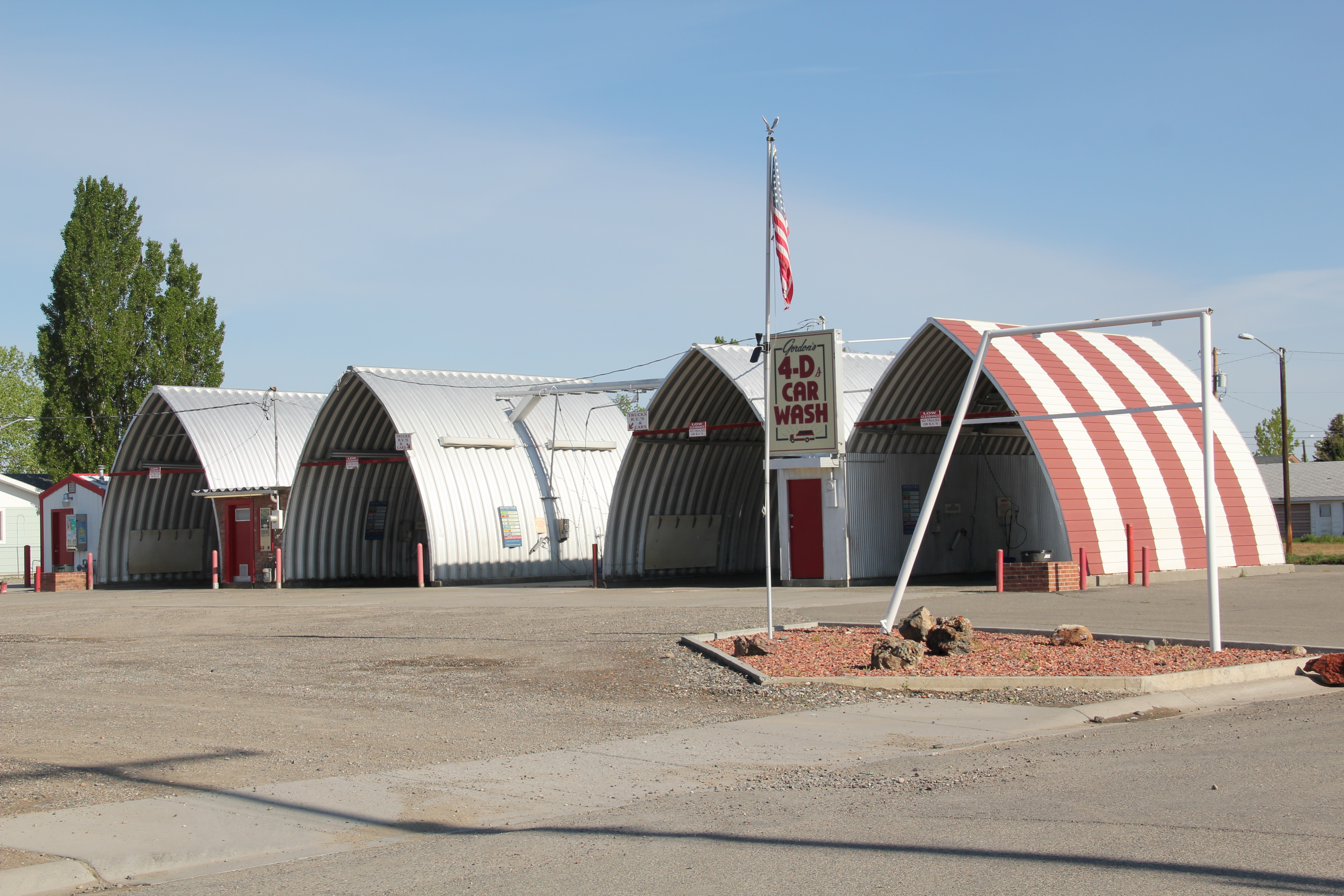
Perhaps the best comes last in the dramatic lines and stone aesthetic of the First Interstate Bank Drive-In Bank, located between the town’s commercial artery and its residential district, or the slashed up quonset-hut vernacular of a car wash located on the outskirts of town.  Whatever look you like of Montana modernism, Hardin has something that touches on that design aesthetic.

IMG_6879

IMG_6880

IMG_6881

Forsyth’s historic districts

Forsyth, the seat of Rosebud County, has used historic preservation effectively as one of many community assets to guide its economic sustainability over the last 30 years.  When I first visited there in 1984, the community had already started to grapple with the impact of the coal mining far south at Decker.  The passing of coal trains defined much of rhythms of traffic and life back then.  But even 30 years ago, residents were determined to keep their identity and to celebrate their heritage, despite being drawn into a different world.  That was impressive–and from 1986 to 1990, they put their commitment into physical terms by listing many properties in the National Register of Historic Places.

IMG_6943

You really haven’t been to Forsyth unless you take in a movie at the Roxy Theater (1930) and an after-movie libation at the Lariat Bar

Earlier posts talked about such key heritage institutions as the Rosebud County Courthouse, the adjacent Rosebud County Museum, the Howdy (Commercial) Hotel, and then the adaptive reuse of the Vananda State Bank as new landmark business.  Forsyth also has a downtown commercial historic district, which includes both the hotel, bank, the Roxy Theater shown above, but additional classic Montana two-story commercial buildings, with their understated Victorian or classical cornices.

IMG_6944

The Masonic Temple, designed by Miles City architect Byrnjulf Rivenes in 1911, served the community in many ways during its formative years, including the town library.  The Blue Front rooming house came in 1912 and served as home for Northern Pacific railroad employees for many years–today it is a remarkably intact example of that type of single-man housing from 100 years ago.

IMG_6945

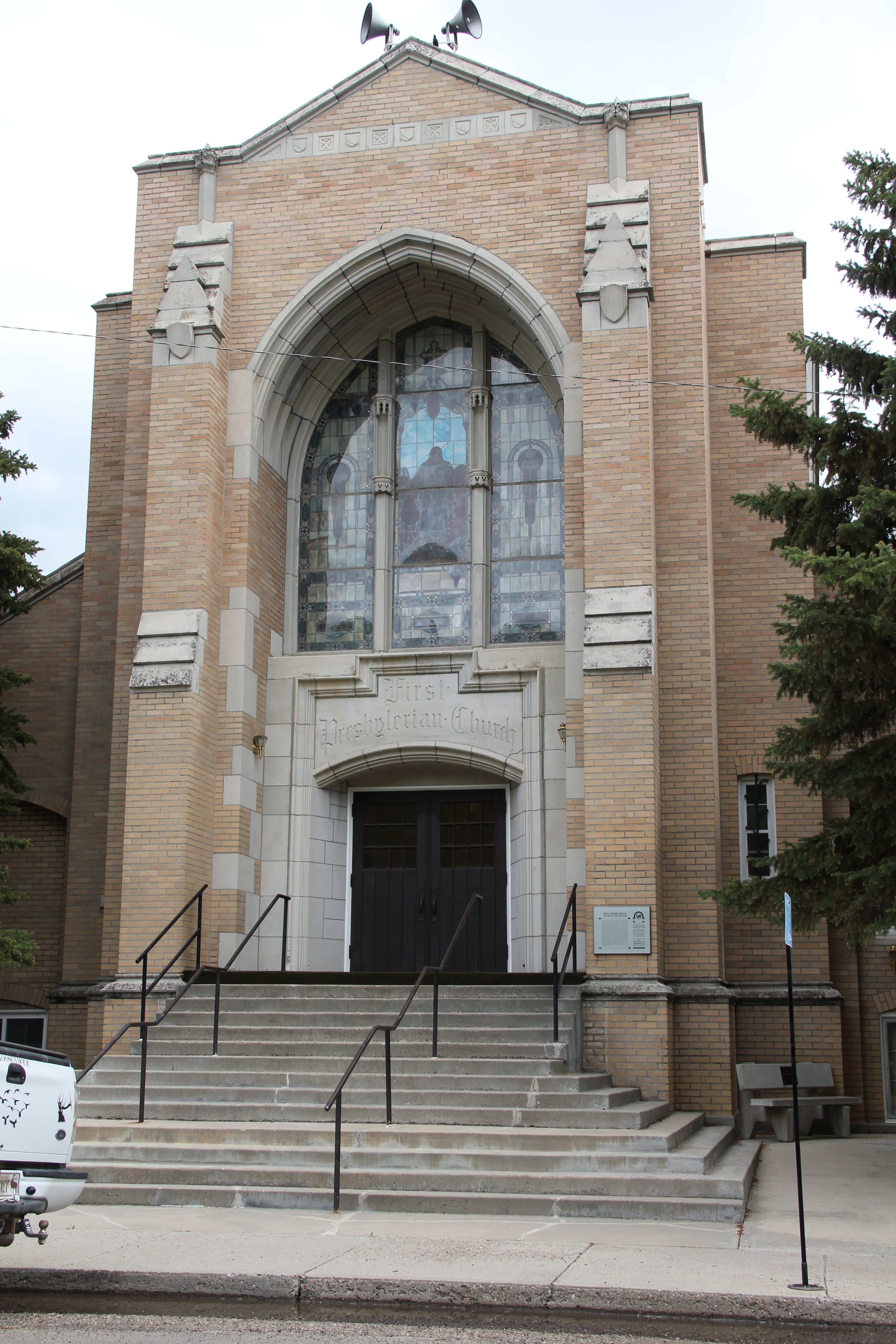
Residents also have designated a historic district of their homes and churches that developed in the early 20th century.  It is an impressive array of buildings, from the c. 1920 First Presbyterian Church, a Gothic Revival design by Howard Van Doren Shaw of Chicago in partnership with McIver and Cohagen of Billings, to the brilliant Craftsman-style of the McQuistion House (1914) built by Louis Wahl of Forsyth for ranchers Joshua and Grace McQuistion as their “town” home.  Then there is the 1897 Queen Anne-style house moved to its Forsyth lot by ranchers Robert and Dora Lane in 1909.  The Lanes moved on but the house has stayed, becoming over 100 years a real cornerstone to the historic neighborhood.

IMG_6967

IMG_6963

IMG_6966

Indeed, that is a theme found throughout town. Despite the coal industry that rumbles in the southern end of the county, Forsyth still holds on, and shows pride in, its ranching past.  No better emblem can be found than the modern front to the Forsyth high school.

IMG_6974

Like the vast majority of eastern Montana towns I visited in 2013, Forsyth has lost population from 1980.  Then over 2500 lived there; in 2010 the census takers counted over 1700 residents.  But unlike many, Forsyth is not beat up, abandoned, forgotten, depressing.  The murals by Bob Watts, discussed in an earlier post, are part of the

IMG_6975

answer.  Local stubbornness is another.  But pride in community as expressed through the town’s many historic preservation projects is another.  Forsyth has figured out how to gain a future through an appreciation of the past.  Let’s hope others follow their lead.

IMG_6985

Moving and Saving Historic Buildings in the Montana Plains

Created with GIMP

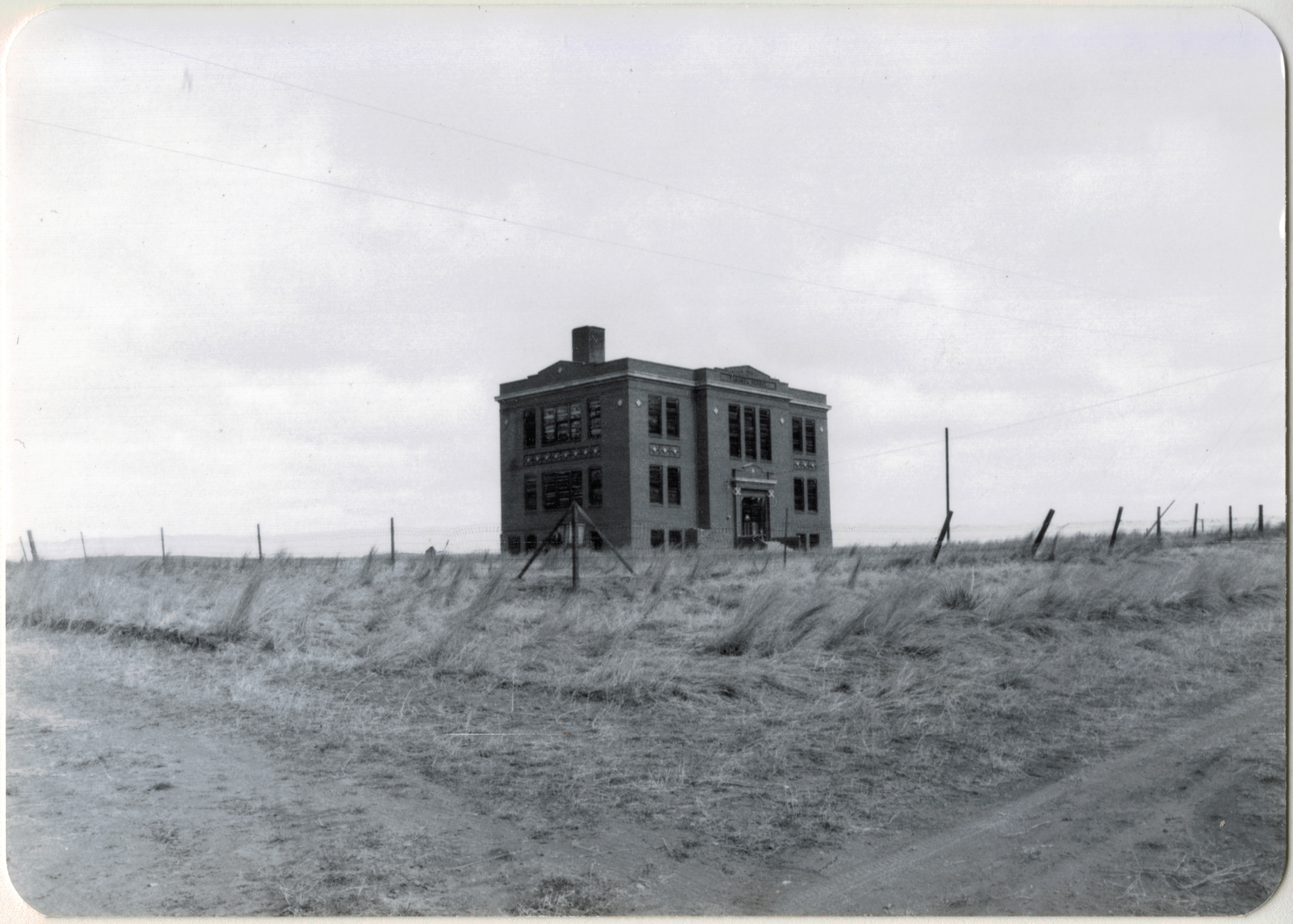
Vananda School, northern Rosebud County. I took this image during the preservation work of 1984.

When I met with residents in Rosebud County in 1984, few places in the county captivated me more than Vananda, one of the county’s Milwaukee Road towns along U.S. Highway 12.  Vananda in 1984 had a few scattered buildings and structures, but two landmarks, a small one-story Classical Revival bank, and the three-story Vananda school. The school in particular spoke to the hopes of the settlers who flooded into the region after the Milwaukee came through in 1907-1908.  In 1917, when Louis Wahl, a Forsyth contractor, built the bank, Vananda like many other homestead towns thought a bright future awaited.  But when the bust came in the 1920s, followed by the Great Depression in the 1930s, people disappeared from here even quicker than they had arrived.

In the years since, I have stopped at Vananda several times, seeing if the buildings still stood as silent sentinels to the homesteading past. The school and the bank survived

Vananda Bank-School Rosebud Co. MT

My favorite image of Vananda, taken in 1998.

the 1990s.  In fact, the Montana State Historic Preservation Office had listed the Vananda historic district in the National Register of Historic Places in 1990, part of a countywide effort to designate local landmarks at that time.

IMG_0130

Vananda historic district, 2013

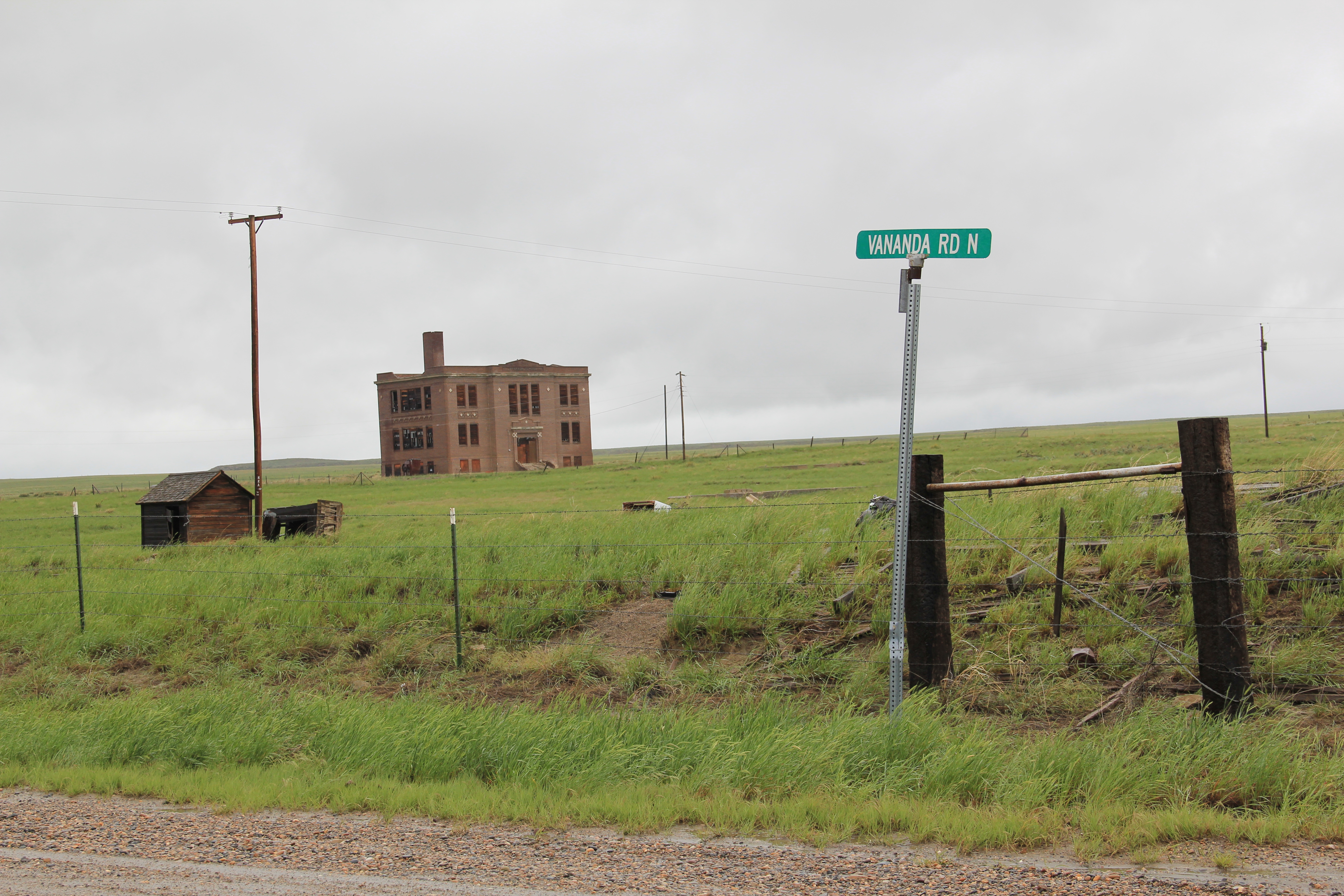
When I next visited Vananda in 2013, fifteen years had passed.  Imagine my disappointment in finding only the school, and it was looking even more worse for the wear.  This was the same year that the National Trust for Historic Preservation listed Montana’s rural schools as one of its most threatened properties in the nation.  One can hope that that designation will eventually bring help and preservation to the school.

IMG_0128

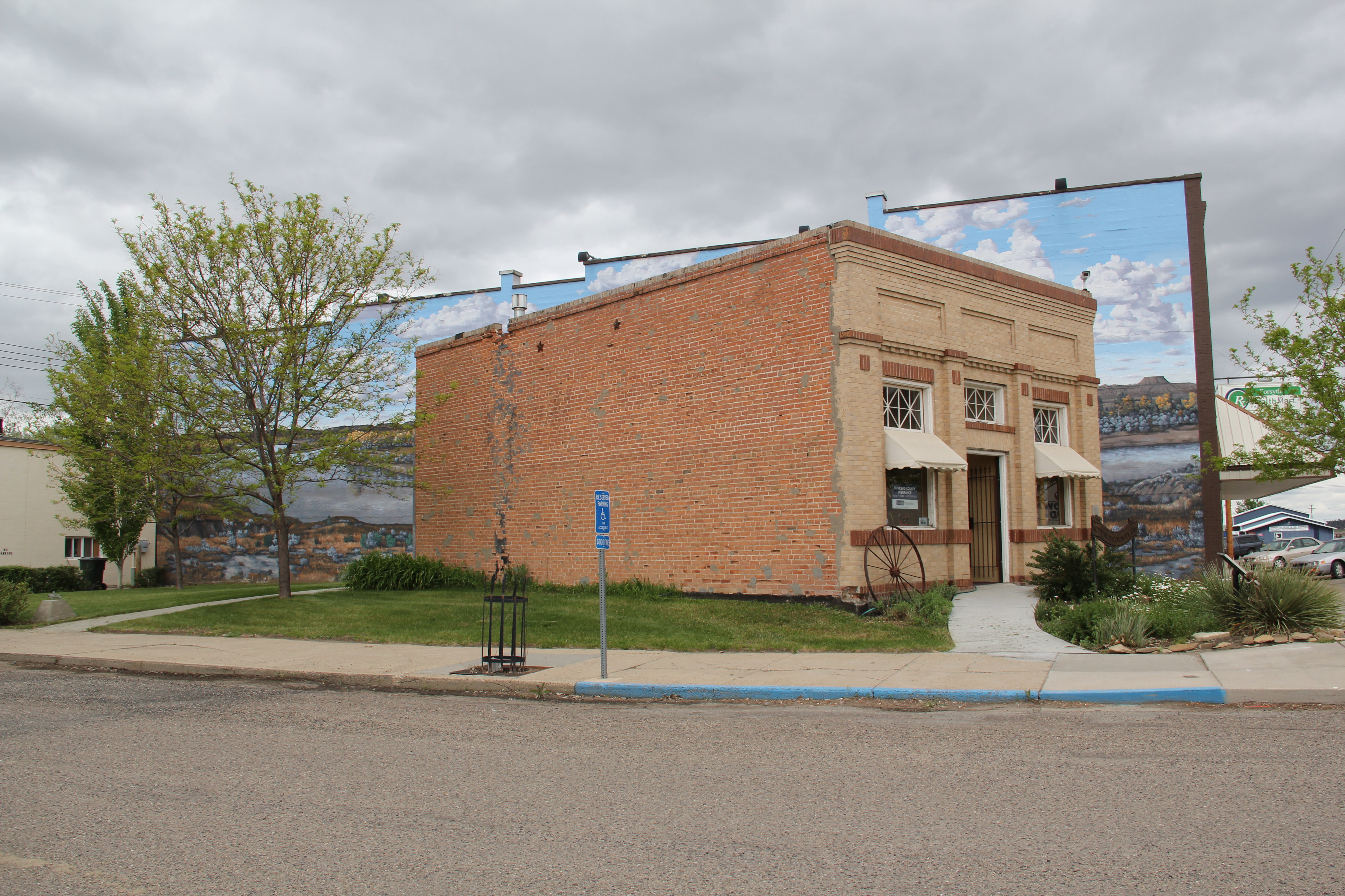
What had happened to the bank?  I found out about 17 miles later when I came into Forsyth, and stopped at something new, at the town’s most prominent crossroads, at Main and 10th Avenue.  It was the Vananda State Bank, moved to that location in 2002-2003.

IMG_6984

The abandoned building was now an insurance building, and an important contributor to town’s historic environment, especially since its corner lot was further enlivened by a mural of the Yellowstone River, “Autumn on the Yellowstone,” by local artist Bob Watts, who has several different murals located throughout town. No. moving the bank to Forsyth and restoring it there, rather than Vananda, is not historic preservation in its purest form.  But it is preservation nonetheless in my opinion.  The historic marker in front of the building tells its story, and there is an active heritage tourism infrastructure in Forsyth, with multiple historic districts, a recently expanded county museum, and a Historic Forsyth walking/driving tour you can download from the Internet.  The bank and the story of Vananda remain active contributors to Rosebud County, fulfilling some of that promise first proclaimed in 1917.

Miles City’s Boom, 1907-1925

The Renaissance Revival-styled U.S. Post Office, designed by Oscar Wenderoth, opened in 1916 during the height of the region's homesteading boom.

The Renaissance Revival-styled U.S. Post Office, designed by Oscar Wenderoth, opened in 1916 during the height of the region’s homesteading boom.

Following the construction of the Milwaukee Road and its various shops, roundhouse, and offices, Miles City entered a boom period unlike any other in the town’s history.  The boom lasted for just under 20 years, ending soon after the Northern Pacific Railroad constructed its new passenger depot in 1924.  In between the arrival of the Milwaukee, and the opening of the new Northern Pacific depot, an array of new middle-class homes, churches, new public elementary and high schools, and businesses gave the city its early twentieth century “look” still prized today and protected by three historic districts.

IMG_7063

Washington School, Miles City

Census records tell us a mere 1,938 people lived in Miles City in 1900, but by 1910 that number had jumped to 4,697 and ten years later, 1920, almost 8,000 people lived there.  Hemmed in by the Yellowstone River and the mainline of the Northern Pacific, the town spread to the east, along Main Street, and then north into the new neighborhoods associated with the Milwaukee Road developments.

The East Main Historic District has a number of architecturally distinctive buildings from the 1910.  The Horton House (1911) is an excellent example of the “American Four-Square” house designed by Miles City architect Brynjulf Rivenes.  The two-story house is now a bed and breakfast business.  You don’t typically equate eastern Montana towns with the latest in domestic architecture styles, but the Love House (1916) is an excellent Montana example of the Prairie style, first created by famed architect Frank Lloyd Wright and here executed in a design from George Wageley. Another example of the Prairie style from that same decade is the Pope House, built by Thomas Horton.

Horton House Bed and Breakfast, Miles City

Horton House Bed and Breakfast, Miles City

Love House, Miles City

Love House, Miles City

Pope House, Miles City

Pope House, Miles City

Just off of East Main Street is the Wibaux Park neighborhood, centered around a public space donated by cattleman Pierre Wibaux in 1915.  Here the dwellings included bungalows, Colonial Revival cottages, and an impressive example of Tudor Revival style.

Wibaux Park, Miles City

Wibaux Park, Miles City

Tudor Revival style house facing Wibaux Park, Miles City.

Tudor Revival style house facing Wibaux Park, Miles City.

Congregations also built large, architecturally distinctive church buildings to serve their growing congregations.  The Methodists added a Gothic Revival style building, designed by Woodruff and McGulpin, in 1912.  The Presbyterians added their own Gothic edifice two years later, a mammoth building designed by Brynjulf Rivenes that stood between the downtown commercial district and the new residential areas.  The Catholics added a new Sacred Heart church in 1924, adding to the contributions started by the Ursulines at the first of the century.

Methodist Church, Miles City

Methodist Church, Miles City

First Presbyterian, entrance, Miles City

First Presbyterian, entrance, Miles City

Sacred Heart Catholic Church, Miles City

Sacred Heart Catholic Church, Miles City

New public schools–with the buildings still in use today–completed the process of urban growth between 1907 and 1925.  The Custer County High School, finished in 1922, became a centerpiece not only of Miles City but the the county as a whole.  Here was a modern facility that gave local students opportunities their parents never had. The boom had been magnificent but as drought and homesteading failures multiplified across eastern Montana by the mid-1920s, residents were learning that the bust would be transformative too.  We will look at the era of bust and recovery next.

Custer County High School, 1922

Custer County High School, 1922

Glendive and early 20th century domestic architecture

IMG_7280
Glendive’s growth into one of the Yellowstone’s major towns in the first decades of the 20th century is well documented in its intact historic homes along Meade and Kendrick Avenues, which are located between the Yellowstone River to the west and the commercial corridor represented by Merrill Avenue to the east. Earlier posts have identified the two key economic events–the Lower Yellowstone Project of 1904/5 and the expansion of the Northern Pacific Railway shops in the 1920s–that shaped the neighborhood. Here I want to share the neighborhood’s stylistic diversity, along with the obvious pride that owners have in their homes and town. Let’s begin with an amazing set of bungalows, one of the region’s best concentrations of this early 20th century architectural style. There is a mix of what are often characterized as Craftsman Bungalows, with its thatch-like shingle roofs, exposed stick work and prominent bracketed porches. Others are more restrained in their ornament, taking on the look of a transitional design between Victorian era details and the one- and one-half story bungalow form.
IMG_7278
IMG_7276
IMG_7275
IMG_7274
IMG_7273
Next comes variations from another popular early 20th century form, the “foursquare,” a two-story, squarish dwelling, typically with a hipped roof and a less prominent porch than a bungalow, but as this example from Kendrick Avenue indicates, the Foursquare can come off looking much like a bungalow on steroids.
IMG_7271
The neighborhood also has earlier Victorian styles, such as this rambling Queen Anne-style house on Meade Avenue, while just a bit farther away on North Douglas is the Krug House, an outstanding Montana example of Classical Revival-infused Foursquare design that was completed in 1907.
IMG_7279
IMG_7216
This National Register-listed property, designed by St. Louis architect Herbert G. Chivers, was the home of Charles Krug and family and definitely represents a statement house for its time. Krug wanted to prove that good money could be made from sheep–a rancher need not be only a cattleman.
A statement of modernity comes from Gresham Street, near the high school, where this Art Deco dwelling stands out among the more traditional designs of the town. Another different statement was made by this Contemporary-style home on Kendrick Avenue, which dates to the city’s last boom in the early 1960s. More at home in a modern suburban setting than the more formal early 20th neighborhood of Meade and Kendrick Avenues, this house, with its prominent A-frame center section and project front entrance garage states 1960s values well.
IMG_7286
IMG_7272
Glendive’s historic homes are complemented by its early 20th century historic churches. I will close with two: the Castellated Gothic United Methodist Church and the Romanesque-styled Sacred Heart Catholic Church.
IMG_7268
IMG_7300
Glendive in the 1980s struck me as a town in decline but one that retained a faith in its historic buildings and houses. Thirty years later than faith seemed renewed–as the historic fabric of the town has changed, certainly, but also had been maintained even enhanced by local stewardship.