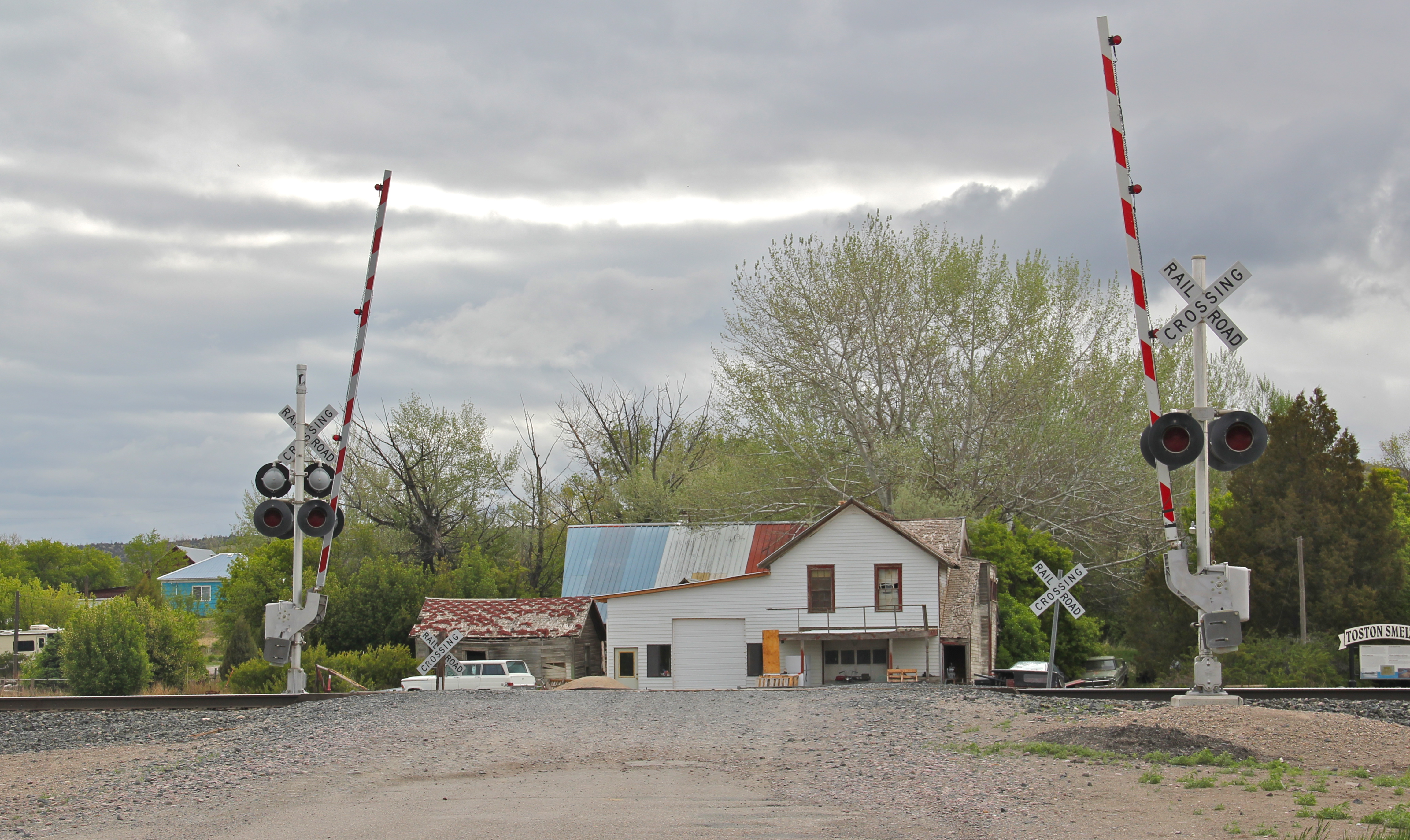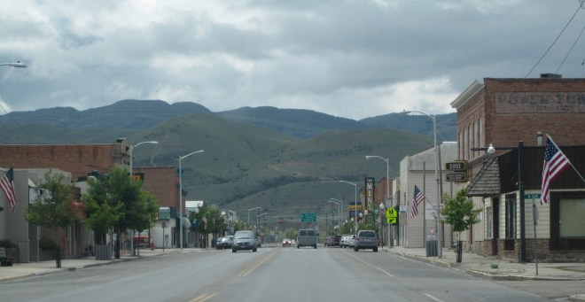
Townsend is a classic Montana crossroads town, with its historic heart, and primary commercial district, centered on the intersection of U.S. Highways 12 and 287. But a closer look reminds you of the town’s origins as a railroad town, part of the Northern Pacific route, as it moved westward from Bozeman to Helena, Montana, along the valley of the Missouri River. The town’s layout is a good example of a T-town plan, with Front Street (now U.S. 287) forming the top of the “T” while Broadway (U.S. 12) forming the stem, as shown above.

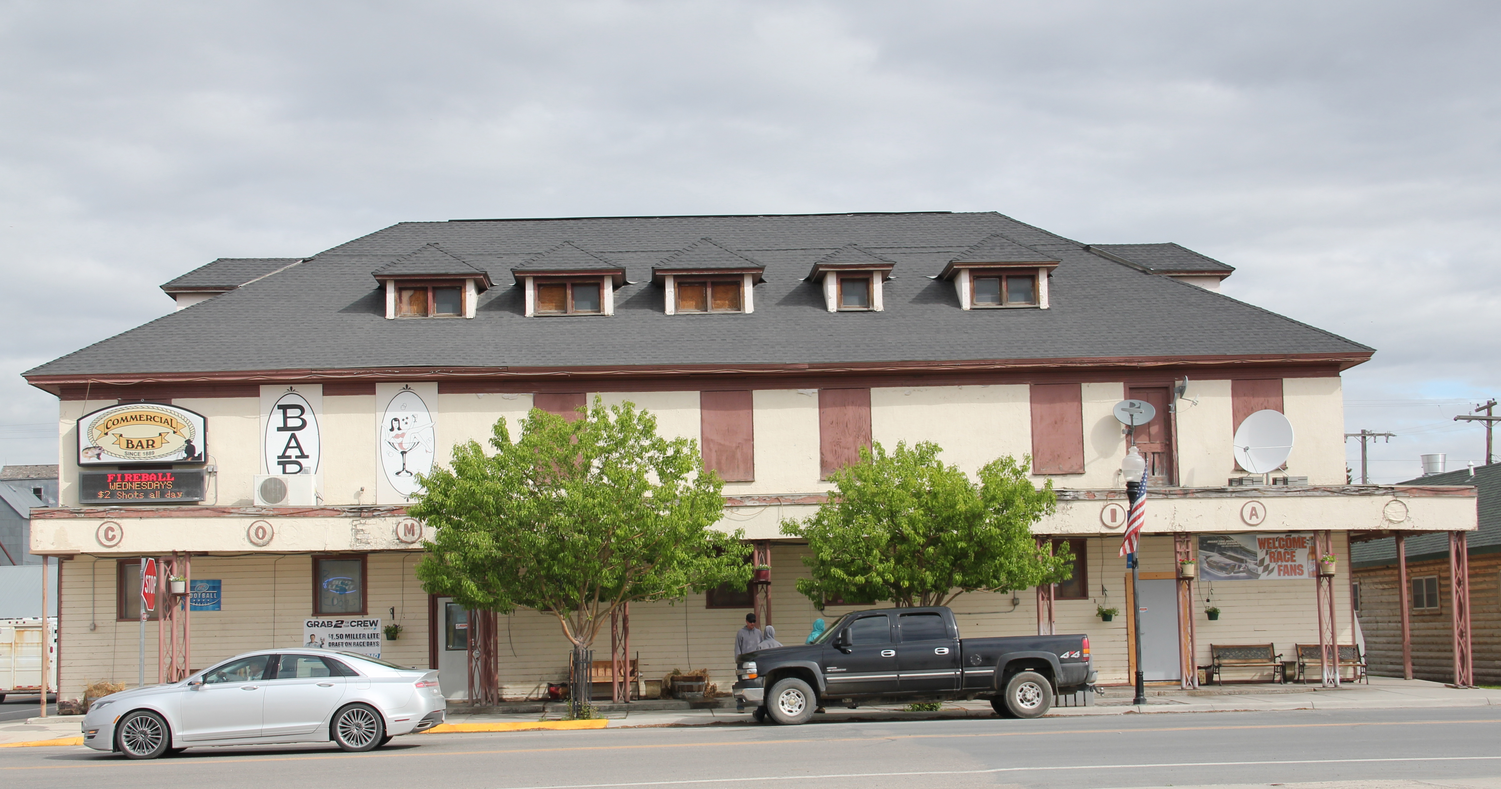
Grain elevators and other light industrial and transportation-related buildings the lots between the railroad tracks and Front Street. At the corner of the highway junction is one of the town’s oldest buildings, the Commercial Hotel of 1889, which still operates today as

a bar and restaurant. Historically this large two-story frame building, with hipped roof dormers creating even additional rental space under the roof, would have been an attraction for travelers and business people looking for a place just off the tracks, or later the highway. It is among a handful of late 19th century railroad hotels left in Montana.

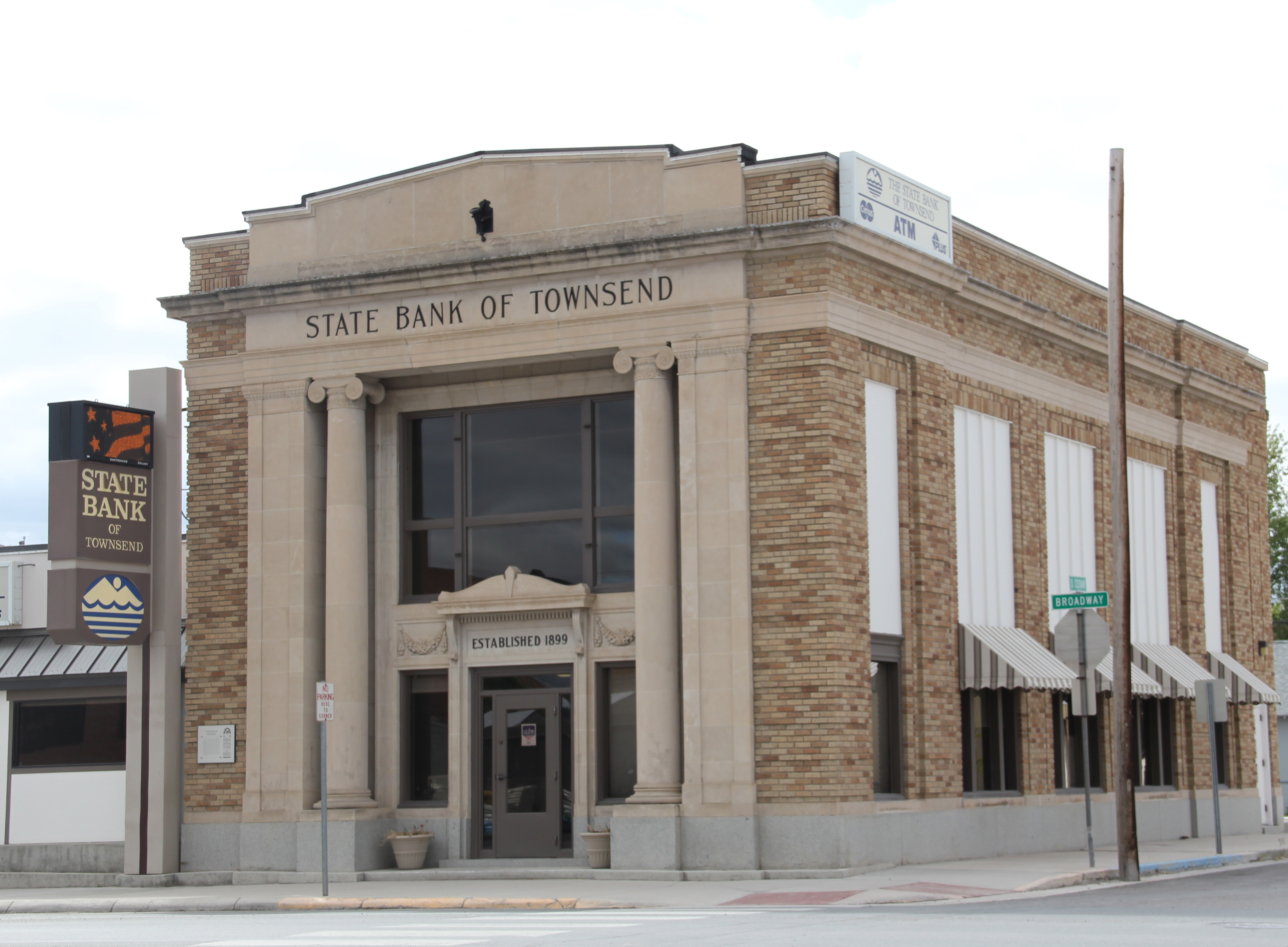
Broadway also had its historic landmarks, especially the neoclassical-styled State Bank of Townsend, which is listed in the National Register of Historic Places. Dating to 1918, the building’s architect was the Albert Mooreman and Company firm from St. Paul, MN. The flanking two-story classical columns root the yellow brick building to its prominent corner lot–the bank’s survival into the twenty-first century is also a rarity in rural Montana.

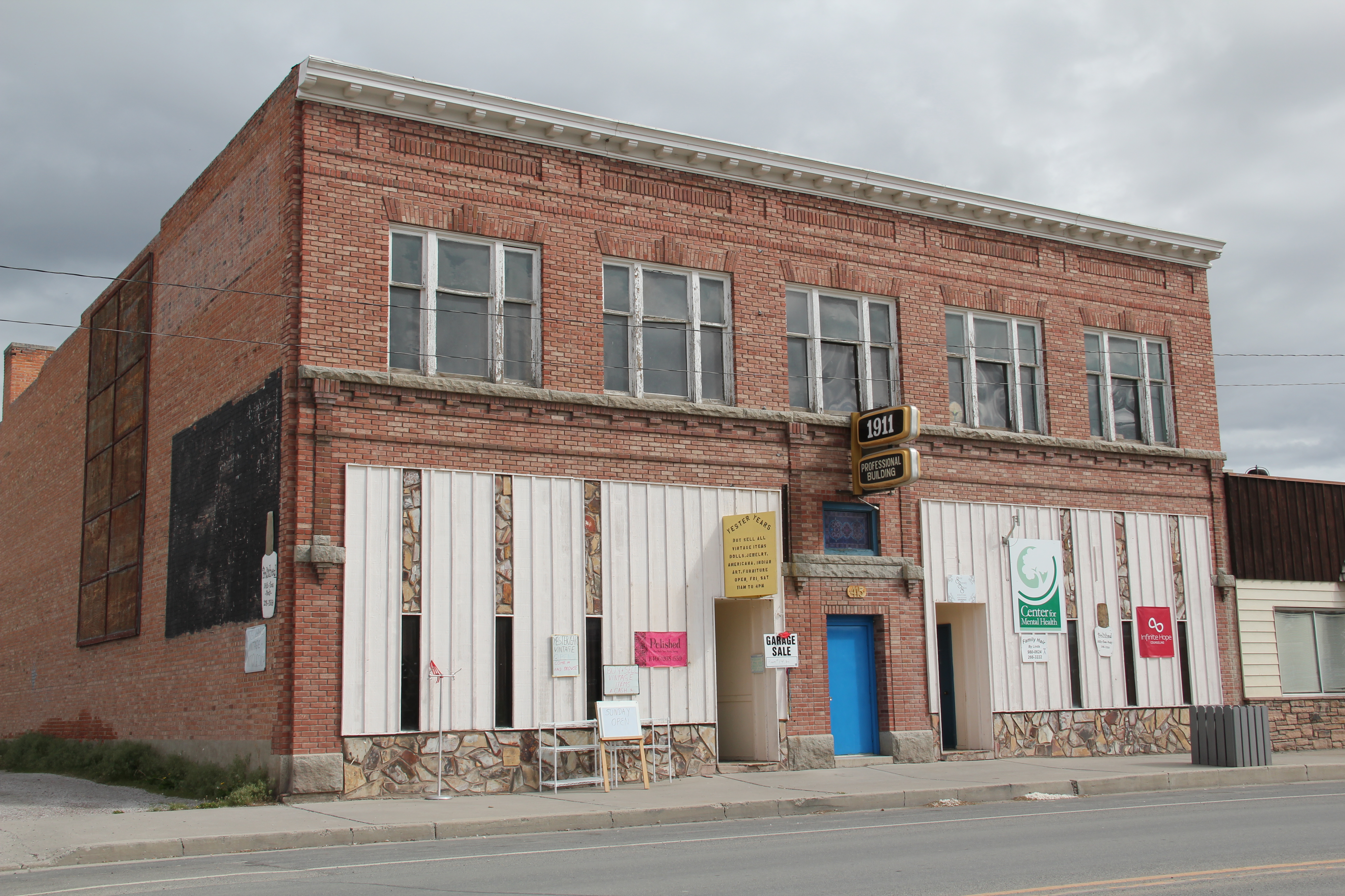
Broadway also has its mix of one- and two-story business buildings, from the American Legion and another Montana Mint Bar to the Professional Building of 1911. Despite its proximity to both Helena and Bozeman, the town has retained its commercial vitality.


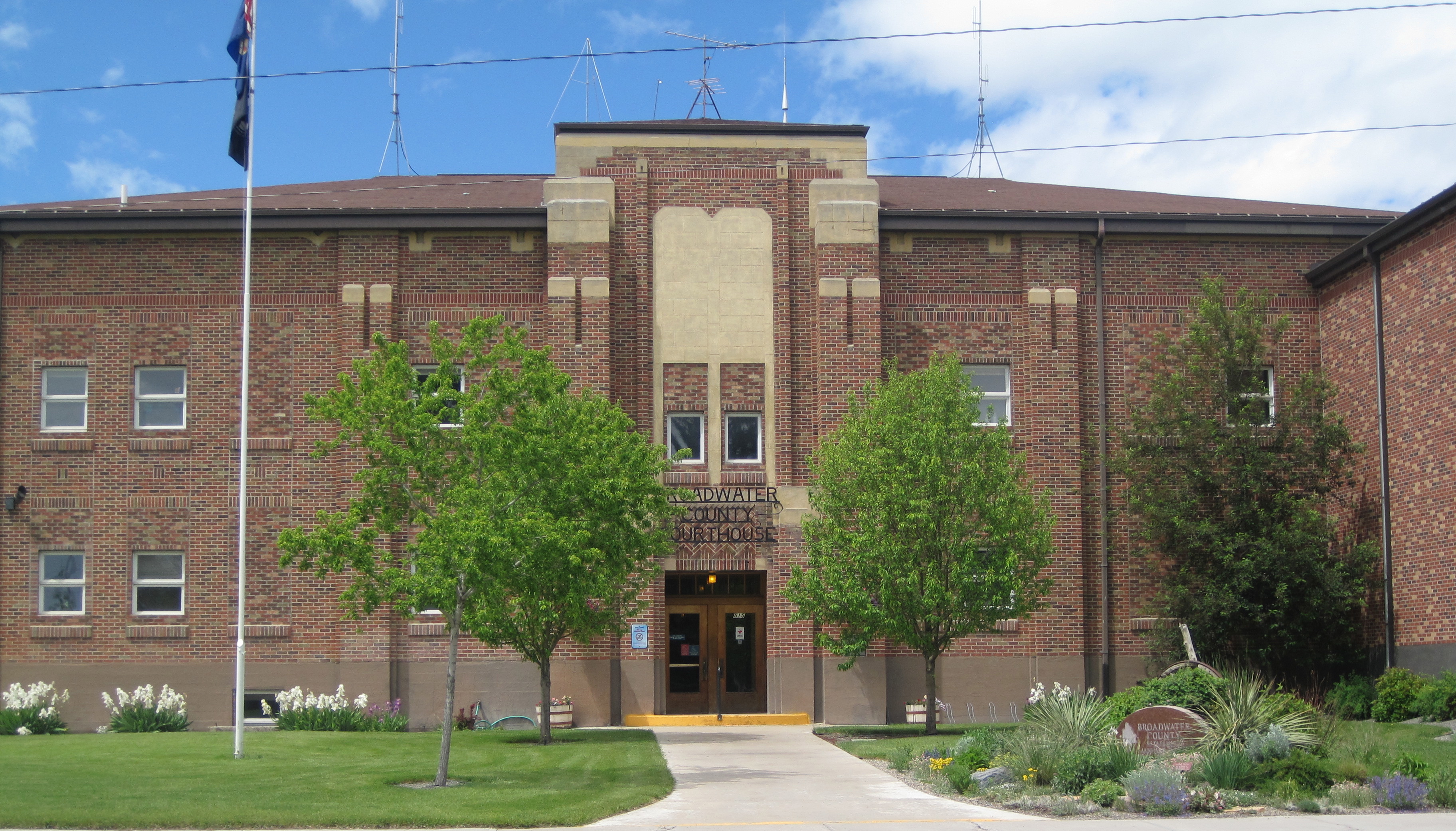
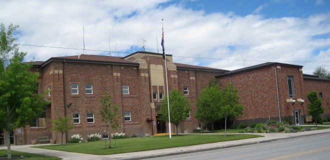
At the end of the commercial district is the Broadwater County Courthouse, a mid-1930s New Deal project that has expanded significantly in the three decades since I carried out the original historic preservation plan survey in 1984-1985. Its understated Art-Deco styling fits well its highway location. And as to be expected in a “T-town” plan, its location at the end of Broadway, meaning the end of the stem of the “T” reflected well the comparative power between local government and the corporate power of the railroad.

Being a resident of Helena from 1981 to 1985, I passed through Townsend many times on my way east since US 12 was a favorite trek. I noticed these major landmarks and the patterns of railroad town plans but I must admit that I never strayed off of either Front Street or Broadway, and that was a mistake.

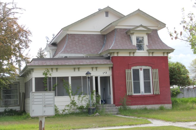

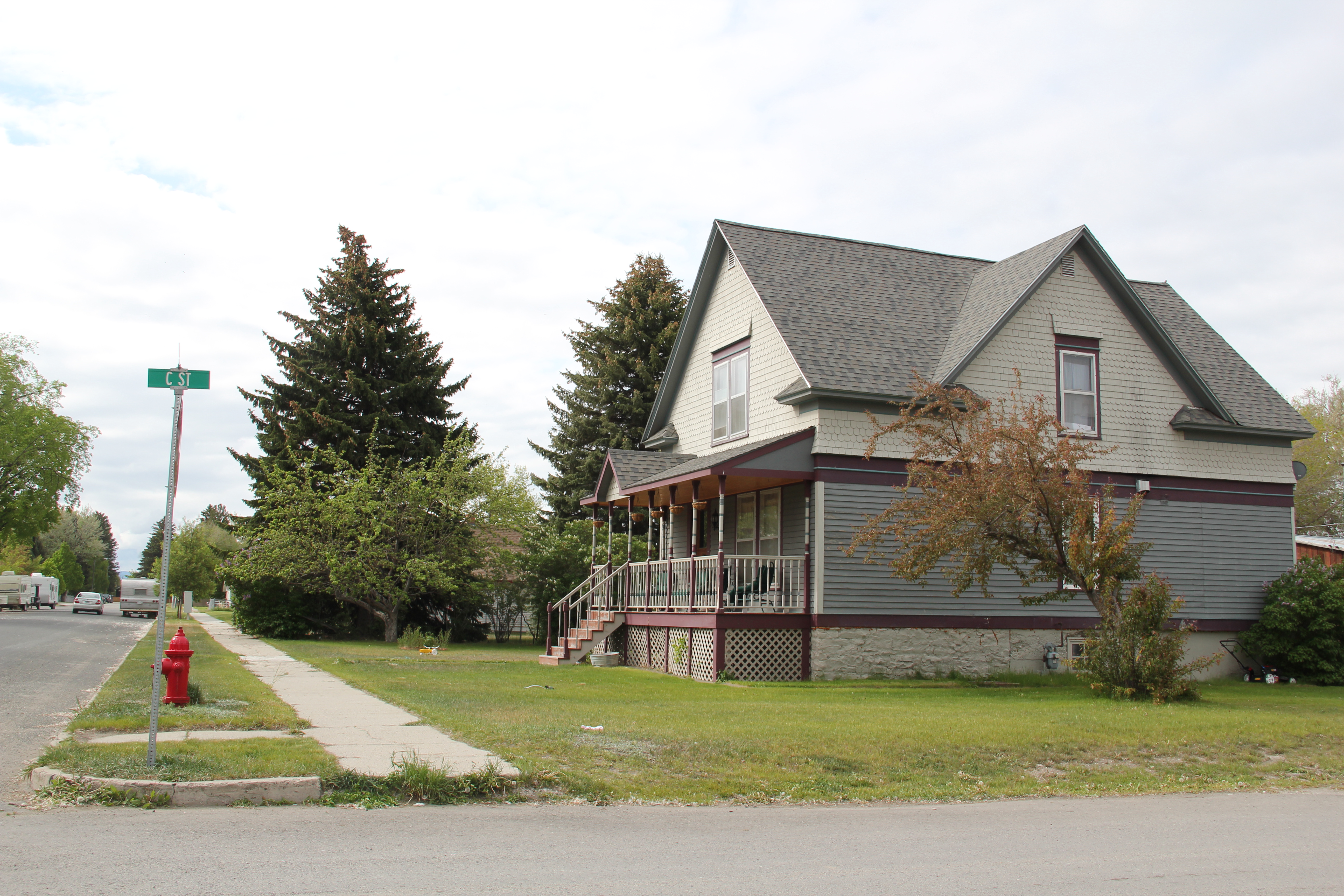
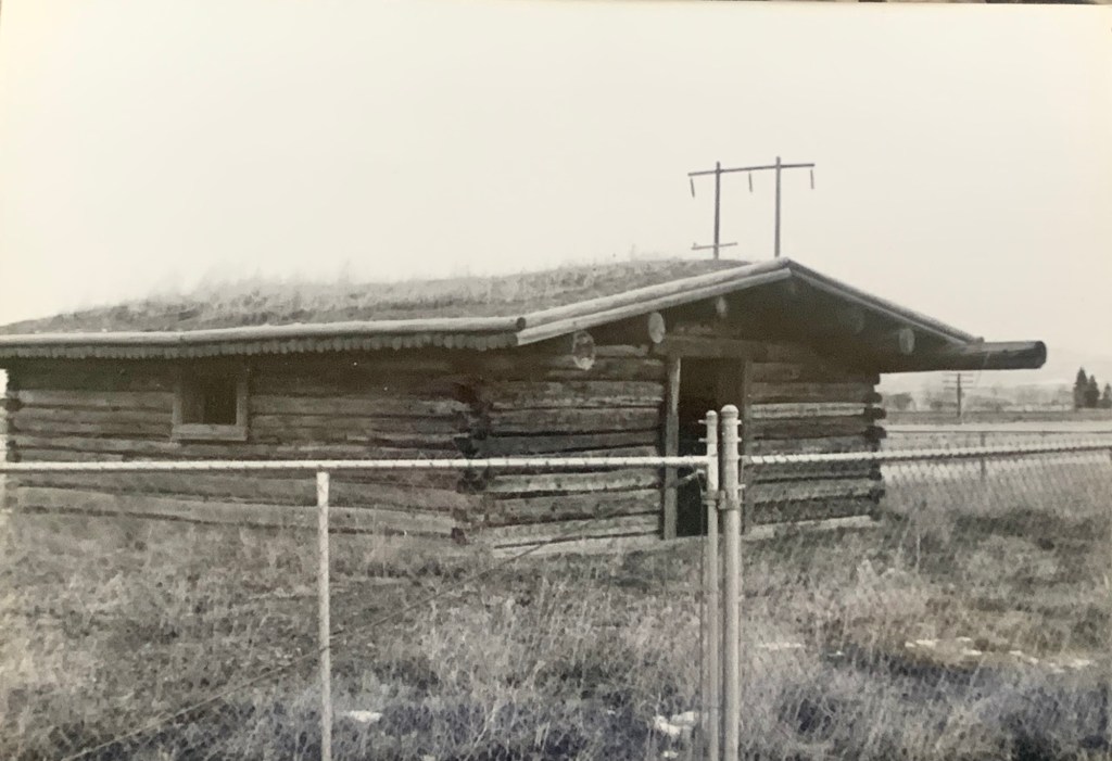
South of Broadway are several valuable late-19th or turn of the century Victorian-styled residences, some of which have found their champions and have been restored while others need that champion to see the potential jewel underneath decades of change. One historic neighborhood school building–now a Masonic lodge–also remains, along with many different churches, most of which date to the second half of the twentieth century.

North of Broadway is a notable exception, the Victorian Gothic styled Townsend United Methodist Church, again an important survivor from the town’s opening generation of history.

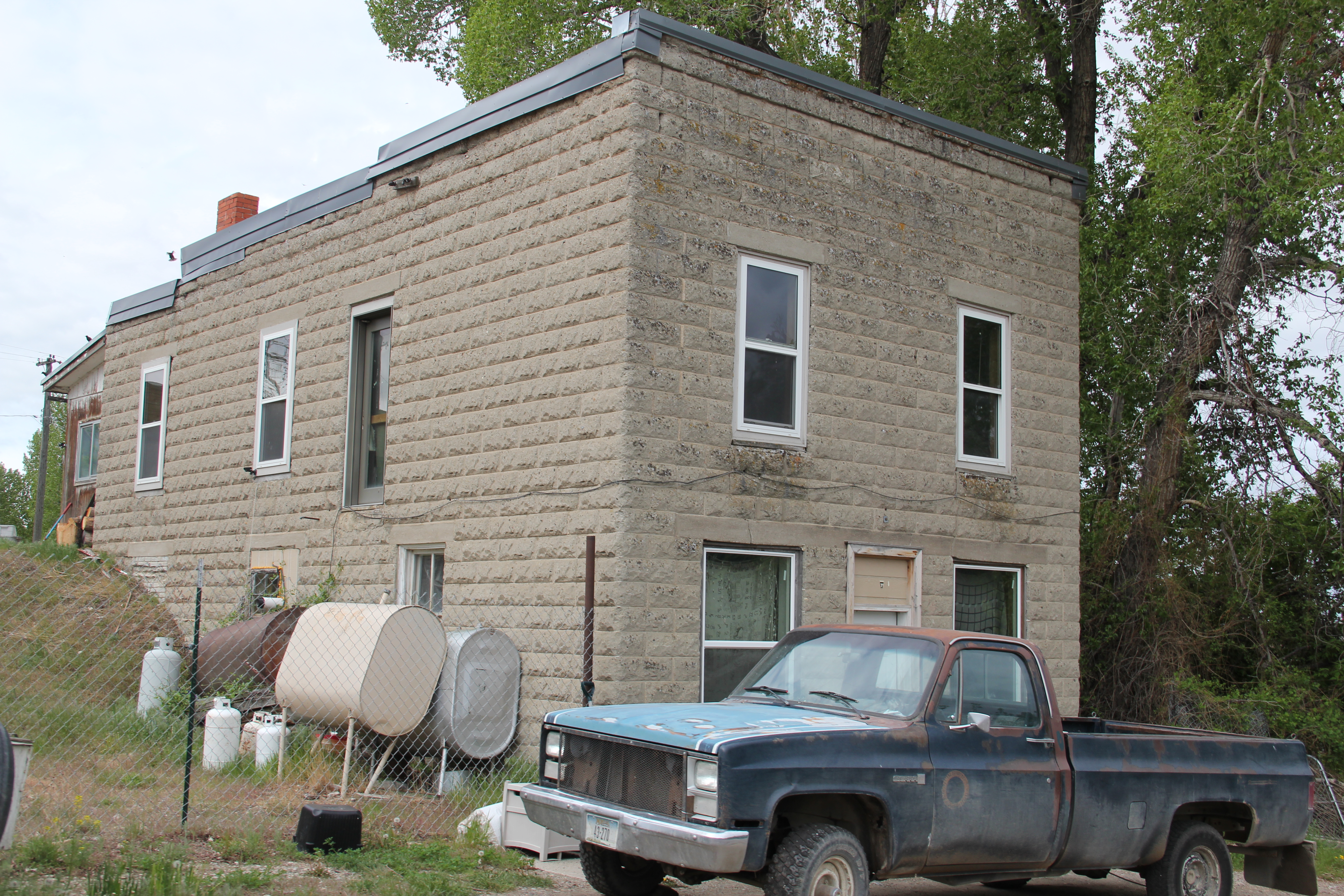
Townsend also had a set of interesting bungalows from c. 1920 on U.S. 12 as it moves east of the courthouse. These are made of concrete block, shaped to mimic stone masonry. It was a popular technique to give a house a solid, permanent look, and you tend to find it more in the west than in the east. Of course, Townsend was not far from the major concrete works at Trident–a topic for a later posting.


Last but not least Townsend, and Broadwater County, has an active historical society and local museum, established during the American Bicentennial in 1976–and expanding ever since at its location behind the county courthouse.


 My friends in the environs of Helena have been surprised that after 300 something posts I had yet to say anything about Augusta, a crossroads town in northern Lewis and Clark County along U.S. Highway 287, during my revisit of the 1984-1985 state historic preservation plan. They knew that I loved the open range drive to Augusta, whether approaching from U.S. 287 or U.S. Highway 89.
 Then, the various businesses and bars along Main Street represented not just a favorite place in rural Lewis and Clark County, but also document a classic western town with great roadside architecture such as the Wagon Wheel Motel.


 Augusta began as a crossroads town for neighboring ranches; the later extension of a railroad spur to nearby Gilman spurred competition between the two towns. But Augusta
  won that battle–today not much outside of the Montana Highway Historical marker, a steel bridge, and a disappearing railroad corridor remains of Gilman.

 But I like the football field almost as much as the historic school–could a more neighborhood setting even be imagined?
 Then there are historic commercial buildings from the early 20th century–several with National Register qualities, especially the F. M. Mack General Merchandise store–a frame building with paired bracketed cornice.


 Over 300 people call Augusta home today, a slight increase since my work 30 years ago. The community not only has kept the historic buildings noted above, residents also have opened the Augusta Area Museum–heritage is clearly part of the town’s future.
 Nestled where Montana Highway 287 encounters U.S. Highway 287 in the southern end of Madison County, Ennis has changed in significant ways in the last 30 years. Its earlier dependence on automobile tourism to Yellowstone National Park has shifted into the favor of population growth and development in this portion of the county.
 The iconic Ennis Cafe, always a favorite place back in the day of the statewide work, remains, with a new false front emphasizing the wildlife and open spaces of this area. That place, along with several classic watering holes, served not only locals but the


 of a section of the highway where you will encounter magnificent views of the Madison River Valley and open ranch lands.