Jefferson County, nestled as it is between the much larger population centers of Helena (Lewis and Clark County) and Butte (Silver Bow County), has often been neglected in any overview or study of Montana. But within the county’s historical landscape are places and stories that convey so much about Montana history and the historic properties that reflect its culture and identity.
 Let’s begin with the place so often in the news lately, the Montana Development Center, the location of the historic Montana Deaf and Dumb Asylum (1897-1898), a stately red brick Renaissance Revival-style building listed in the National Register of Historic Places in 1985. Since the building was being considered for listing, it was a top priority for the state historic preservation plan work in 1984. It remains in need of a new future 30-plus

A photo of the asylum from 2007
years later. The architect was John C. Paulsen, who then served as the State Architect. The building represents an early effort by the state to provide for its citizens, and the presence of the institution in Boulder shaped that town’s history for the next 120 years.
Boulder is a place of impressive public buildings. The Jefferson County Courthouse (1888-89) is another piece of Victorian architecture, in the Dichardsonian Romanesque style, again by John K. Paulsen. It was listed in the National Register in 1980.
 Another public institution once found in numbers across Montana but now found only in a few places is the high school dormitory, for students who spent the week in town rather than attempting to travel the distances between home and the high school on a daily basis. Boulder still has its high school dormitory from the 1920s, converted long ago into apartments.

Indeed the importance of schools to not only the state’s history of education but the mere survival of communities has been pinpointed by various state preservation groups and the National Trust for Historic Preservation. Jefferson County still has many significant surviving school buildings from the early 20th century, none of which have been listed yet in the National Register.

Carter School, 1916, Montana City
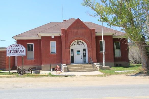
Clancy School, now the Jefferson County Museum
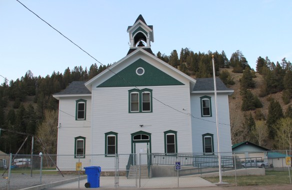
Basin school, still in use

Caldwell school, one of the few buildings left in this old railroad town
Whitehall still has its impressive Gothic style gymnasium from the 1920s while the school itself shows how this part of the county has gained in population since 1985.
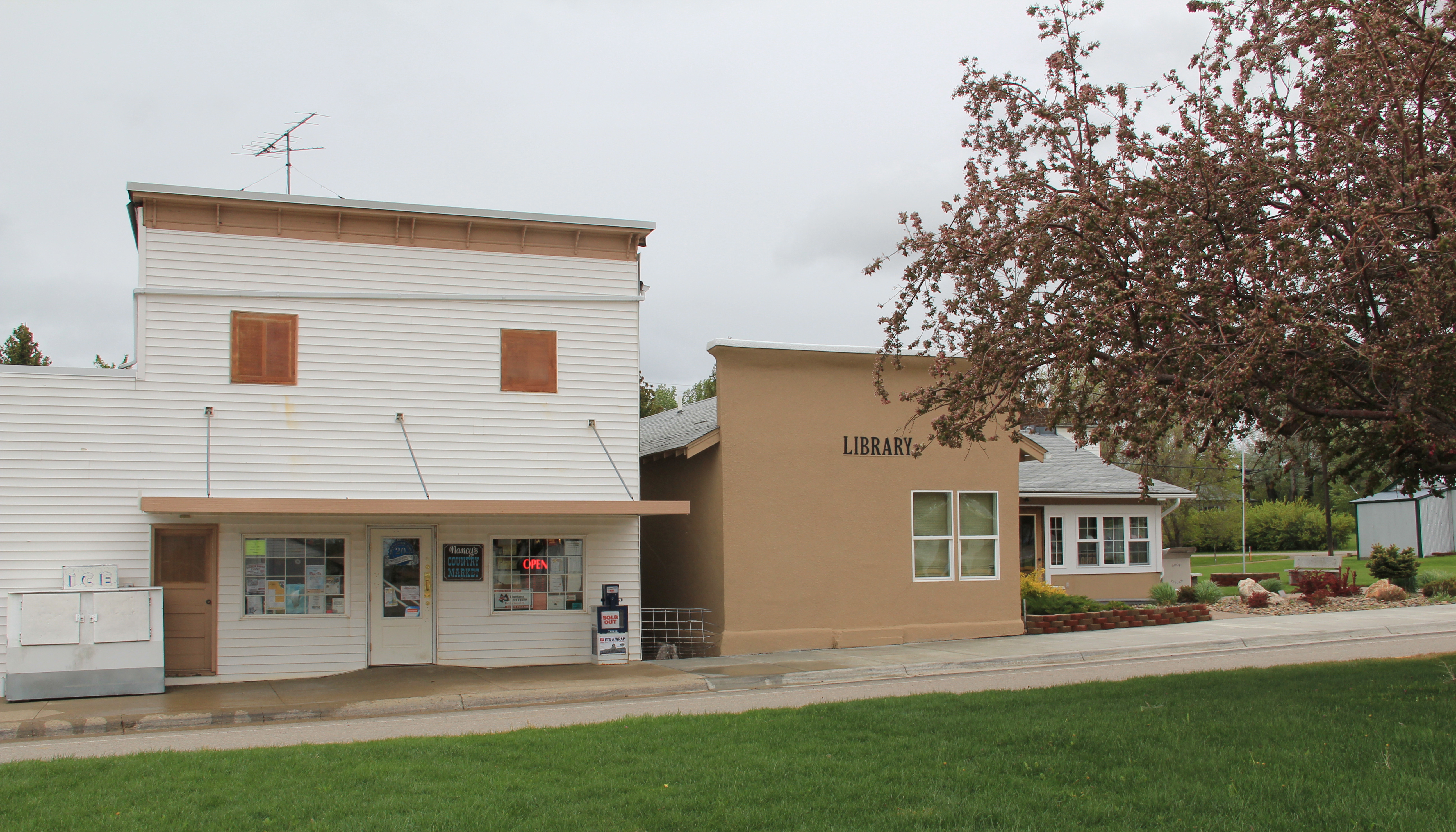
 Community halls represent another theme found in the Montana landscape; Jefferson County has an excellent example in its 1911 community hall in Clancy, which now serves as the local library. Likewise, fraternal lodges played a major role as community centers in early Montana history–the stone masonry of the two-story Boulder Basin Masonic Lodge makes an impressive Main Street statement.
Irrigation and sugar beet cultivation are key 20th century agricultural themes, typically associated with eastern and central Montana. Jefferson County tells that story too, in a different way, at Whitehall. The irrigation ditches are everywhere and the tall concrete stack of the sugar refinery plant still looms over the town.
In 1917 Amalgamated Sugar Company, based in Utah, formed the Jefferson Valley Sugar Company and began to construct but did not finish a refinery at Whitehall. The venture did not begin well, and the works were later sold to the Utah-Idaho Sugar Company in 1920, which never finished the plant but left the stack standing. Nearby is Sugar Beet

Row, where hipped roof duplex residences typical of c. 1920 company towns are still lined up, and in use, although their exteriors have changed over the decades.

Through many posts in this blog, I have identified those informal yet very important community centers found in urban neighborhoods and rural outposts across the state–bars and taverns. Jefferson County has plenty of famous classic watering holes, such as Ting’s Bar in Jefferson City, the Windsor Bar in Boulder, or the Two Bit Bar in Whitehall, not forgetting Roper Lanes and Lounge in Whitehall.

Speaking of recreation, Jefferson County also has one of my favorite hot springs in all of the west, the Boulder Hot Springs along Montana Highway 69. Here is a classic oasis of the early 20th century, complete in Spanish Revival style, and listed in the National Register of Historic Places. Its rough worn exterior only hints at the marvel of its pool and experience of this place.

Mining always has been part of Jefferson County’s livelihood with still active mines near Whitehall and at Wickes. The county also has significant early remnants of the state’s

The coke ovens above are from Wickes (L) and Alhambra (R) while the image directly above is of 21st century mining continuing at Wickes.
mining era, with still extant (but still threatened as well) charcoal kilns at Wickes (1881) and at Alhambra. Naturally with the mining came railroads early to Jefferson County. As you travel Interstate I-15 between Butte and Helena, you are generally following the route of the Montana Central, which connected the mines in Butte to the smelter in Great Falls, and a part of the abandoned roadbed can still be followed.
 Another good example of the early railroad development is at Corbin, where a major ore concentrator operated by the Helena Mining and Reduction Company was located in the 1880s. The concentrator handled 125 tons of ore every day. The concentrator is long gone but the foundations, while crumbling steadily, remain to convey its size and location. The tall steel train trestle overlooks the town, a powerful reminder of the connection between the rails and mines. It is part of the historic Montana Central line, first built as a wood trestle in 1888 and then replaced with the steel structure found today in 1902.

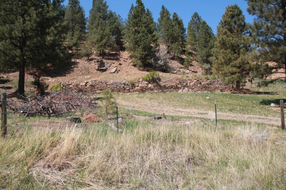
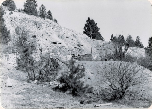
Corbin concentrator site, 1984

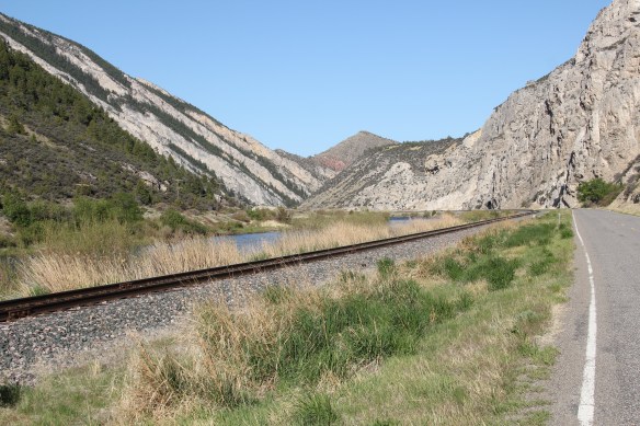
The Northern Pacific Railroad and the Milwaukee Road were both active in the southern end of the county. Along one stretch of the Jefferson River, which is followed by Montana Highway 2 (old U.S. Highway 10), you are actually traversing an ancient transportation route, created by the river, the railroads, and the federal highway. The Northern Pacific tracks are immediately next to the highway between the road and the Jefferson River; the Milwaukee corridor is on the opposite side of the river.
The most famous remnant of Montana’s mining era is the ghost town at Elkhorn. Of course the phrase ghost town is a brand name, not reality. People still live in Elkhorn–indeed more now than when I last visited 25 years ago. Another change is that the two primary landmarks of the town, Fraternity Hall and Gilliam Hall, have become a pocket state park, and are in better preservation shape than in the past.
 Fraternity Hall was famous at the time of the state historic preservation plan survey as one of the best architectural examples of false front, Italianate style-influenced commercial buildings in the northern Rockies. The two photos below, one from 1985 and the other from 2013, show how its preservation has been enhanced under state guardianship. Its projecting bay and balcony are outstanding examples of the craftsmanship found in the vernacular architecture of the boom towns.
The adjacent Gillian Hall is also an important building, not as architecturally ornate as Fraternity Hall, but typical of mining town entertainment houses with bars and food on the first floor, and a dance hall on the second floor.

While the state park properties dominate what remains at Elkhorn, it is the general unplanned, ramshackle appearance and arrangement of the town that conveys a bit of what these bustling places were like over 130 years ago–residences and businesses alike thrown up quickly because everyone wanted to make their pile and then move on.
Elkhorn is not the only place of compelling vernacular architecture. Visible along Interstate I-15 is a remarkable set of log ranch buildings near Elk Park, once a major dairy center serving Butte during the 1st half of the twentieth century. John and Rudy Parini constructed the gambrel-roof log barn, to expand production available from an earlier log barn by their father, in c. 1929. The Parini ranch ever since has been a landmark for travelers between Butte and Helena.
Nearby is another frame dairy barn from the 1920s, constructed and operated by brothers George and William Francine. The barns are powerful artifacts of the interplay between urban development and agricultural innovation in Jefferson County in the 20th century.
 The historic barn at the Jefferson Valley Museum is the Brooke Barn from 1914, another example of the dairy production then taking place in this part of Montana as the same time that the mines were booming in nearby Butte.
 The adjacent rodeo grounds at Whitehall host in late July the Whitehall Bucking Horse Futurity competition and fair.
 The bucking horse competition is not the only major summer event in the county. Along the old federal highway and the Jefferson River at Cardwell, music promoters took a historic highway truss bridge, converted it into a stage, and have been hosting the Headwaters Country Jam, the state’s biggest country music festival–a bit of Nashville every June in Montana: I have to love it.
 Here is adaptive reuse at perhaps its ingenious best, and successful adaptive reuse projects are another constant theme found across Montana. Whitehall itself has a second example in the conversion of a 1920s Craftsman-style building on Legion Avenue (old U.S. Highway 10). Indeed, although travelers do not use the older federal highway much since the construction of the interstate, Whitehall has several good examples of roadside architecture–yes, another blog theme–along Legion Avenue, such as a Art Moderne-styled automobile dealership and a classic 1950s motel, complete with flashing neon sign.
West of Whitehall is another 20th century roadside attraction, Lewis and Clark Caverns, a property with one of the most interesting conservation histories in the nation. It began as a privately developed site and then between 1908 and 1911 it became the Lewis and Clark Cavern National Monument during the administration of President William Howard Taft. Federal authorities believed that the caverns had a direct connection to the Lewis and Clark Expedition. The Corps of Discovery camped nearby on July 31, 1805, but had no direct association with the caverns. A portion of their route is within the park’s boundaries.
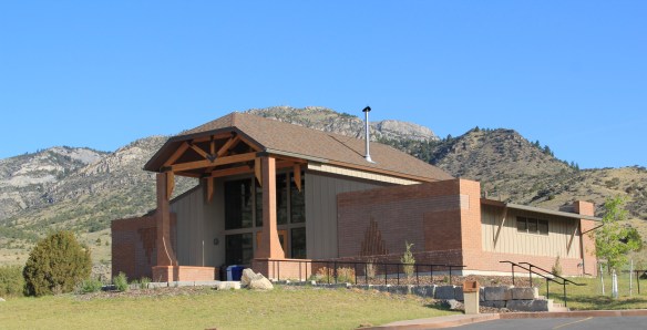 During the mid-1930s the Civilian Conservation Corps developed the park with new trails in the caverns; state and local authorities wanted more site development since the park stood along U.S. Highway 10, with potential tourism growth. In 1937-38, the federal government transferred the national monument to state control and in 1938 state officials launched Lewis and Clark Caverns as Montana’s first state park. Since my work 30 years ago, the state has re-energized the park with a new visitor center and interpretive exhibits that better convey the caverns’ significance, especially to Native Americans who had used the place centuries before Lewis and Clark passed nearby.
Faith, and the persistence of early churches across rural Montana, is perhaps the most appropriate last theme to explore in Jefferson County. St. John the Evangelist (1880-1881) dominates the landscape of the Boulder Valley, along Montana Highway 69, like few other buildings. This straightforward statement of faith in a frame Gothic styled building, complete with a historic cemetery at the back, is a reminder of the early Catholic settlers of the valley, and how diversity is yet another reality of the Montana experience.

 When travelers, and most Montana residents even, speak of Silver Bow County, they think of Butte. Outside of the Copper City, however, are small towns and a very different way of life. To the west we have already discussed Ramsay and its beginnings as a munitions factory town during World War I. Let’s shift attention now to the southern tip of the county and two places along the historic Union Pacific spur line, the Utah Northern Railroad, into Butte.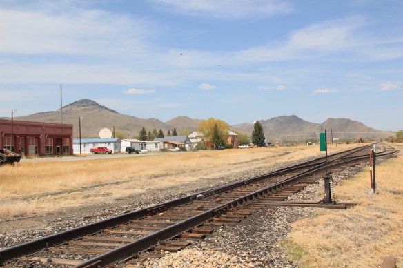


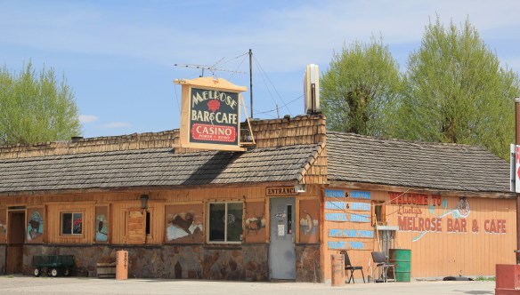
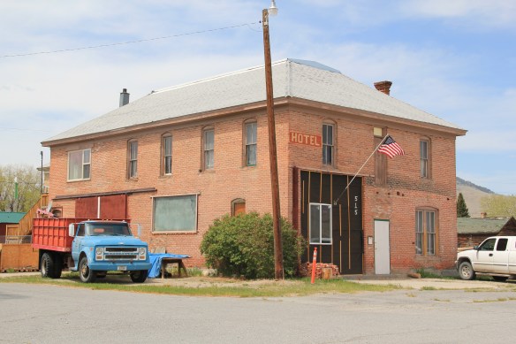 when Melrose was a substantial, busy place. This 1870s-1880s history is largely forgotten today as the town has evolved into a sportsmen’s stop off Interstate I-15 due to its great access to the Big Hole River and surrounding national forests as well as the quite marvy Melrose Bar and Cafe, a classic western watering hole.
 Community institutions help to keep Melrose’s sense of itself alive in the 21st century. Its school, local firehall, the historic stone St John the Apostle Catholic Mission and the modernist styled Community Presbyterian Church are statements of stability and purpose.


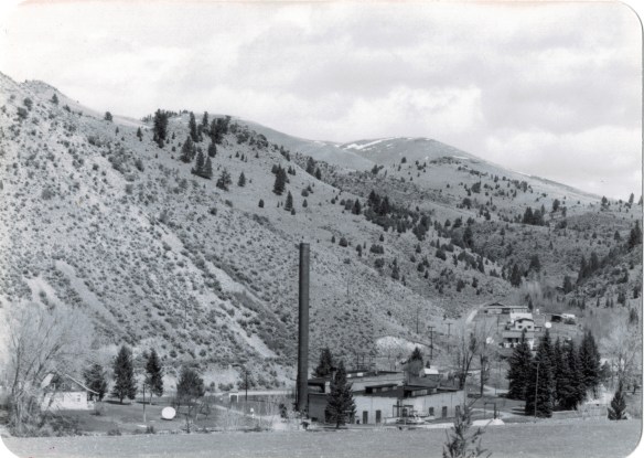 The photo above was published in A Traveler’s Companion to Montana History, in part because of the preservation excitement over this landmark but also because it documented how the boom in Butte helped to transform the historic landscape on the “other side of the divide.” The pump station took water from the Big Hole River and pumped it over the mountains to the Butte Water Company–without the pump station, expansion of the mines and the city would have been difficult perhaps impossible in the early 20th century.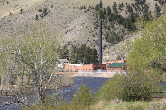
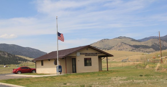 In 2014, in reaction to the listing of Montana rural schools as a threatened national treasure by the National Trust of Historic Preservation, CBS Sunday Morning visited Divide School for a feature story. Teacher Judy Boyle told the Montana Standard of May 16, 2014: “The town of Divide is pretty proud of its school and they want to keep it running. We have a Post Office, the Grange and the school — and if you close the school, you basically close the town.”
 Divide is one of many Montana towns where residents consider their schools to the foundation for their future–helping to explain why Montanans are so passionate about their local schools.


 Willow Creek was the end of the line for both the Northern Pacific and Milwaukee Road railroads as they vied for dominance in turn of the 20th century western Gallatin County. The Northern Pacific came first with its spur line to Butte in the late 1880s then the Milwaukee arrived c. 1908. Both used the same corridor, along what is now called the Old Yellowstone Trail on some maps; the Willow Creek Road (MT 287) on others. It was a route that dated to 1864–the town cemetery, according to lore, dates to that year and Willow Creek has had a post office since 1867.


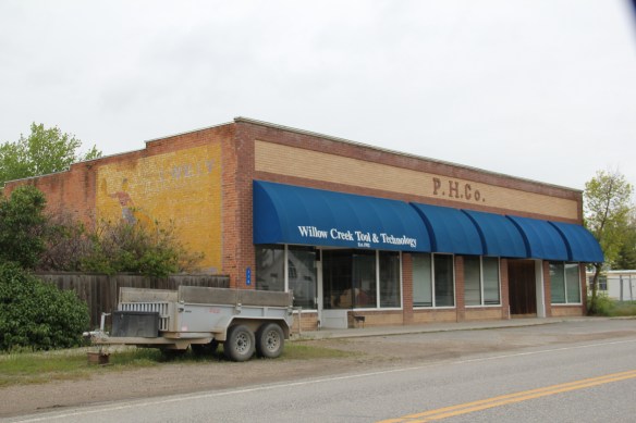
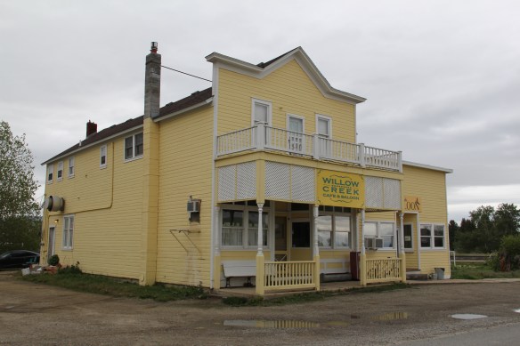 Across the street is the “employment center,” the Willow Creek Tool and Technology which sells its wares across the west out of its brick building from the 1910s. (Note the faded advertising sign that once greeted travelers on the Yellowstone Trail highway.)
 The cultural side of Willow Creek is represented by several places: homes and galleries of different artists, a monthly arts festival in the summer, and two special buildings from the 1910s. The Stateler Memorial Methodist Church, c. 1915, is listed in the National Register of Historic Places. Built from rusticated concrete blocks (from the cement factory at Three Forks) designed to resemble stone masonry, the church building is home to one of the oldest congregations (1864) in the Methodist Church in Montana. The Gothic Revival-styled sanctuary is named in honor of its founding minister Learner B. Stateler.
 Nearby is another crucial landmark for any rural Montana community–the local school. The Willow Creek School is an excellent example of the standardized, somewhat Craftsman-styled designs used for rural Montana schools in the 1910s. Two stories of classrooms, sitting on a full basement, was a large school for its time, another reflection of the hopes of the homesteading era.
 Additions in form of a gym and added rooms had come to the north and the school and its lot is the town’s community center. Although so close to Three Forks, the school kept its


 Located between the Gallatin River and Interstate I-90, Logan is a forgotten yet still historically significant railroad junction on the Northern Pacific Railroad. Established c.


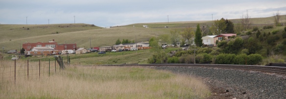


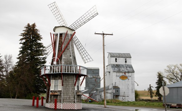 Montana history has many episodes that involve rich eastern and foreign capitalists who rolled the dice on Montana’s resources. Typically everyone thinks of the mining and railroad corporations of the late 19th century. But in several places across the Big Sky Country, investors looked to the land itself and dreamed of agricultural bonanzas.
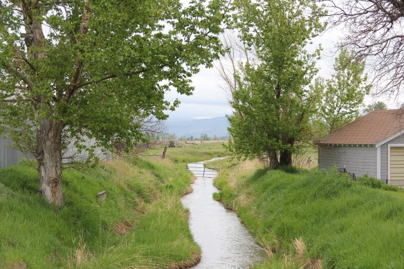 Such is the case of Amsterdam and Church Hill (now Churchill), two rural communities in today’s rapidly suburbanizing Gallatin County. The Manhattan Malting Company was mostly a New York City venture which in the early 1890s, before the terrible depression of 1893-1896, established an industrial base on the Northern Pacific Railroad, changing the name of the town from Moreland to Manhattan. The company purchased 13,000 acres,and acquired the best in agricultural technology, the Jacob Price Field Locomotive steam plow, to till the soil. They also convinced hundred of Dutch farmers to come to Gallatin County and work the land. Even with the hard times, or perhaps because of them, people still wanted good beer, and the company prospered. By 1905 the company decided to shed itself of the land and focus on malting barley.
 The new land company focused on getting farmers on its land, and to secure a railroad spur line. The railroad came in 1911, and the community name of Amsterdam reflected the ethnic origins of the surrounding farmers and ranchers. Even when the Malting Company failed during Prohibition, the farmers kept going, developing some of the still most productive farmland in the state.
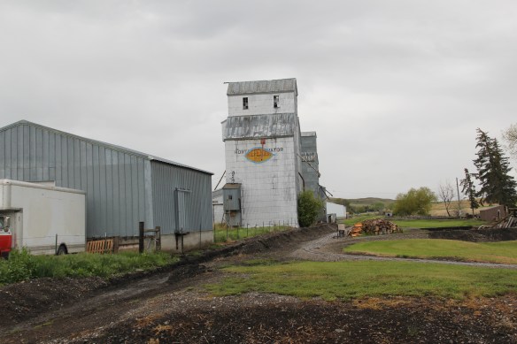 When I visited Amsterdam in 1984 the railroad line still operated but the spur closed the next year, leaving today only a faint corridor to mark its route. Look close and you can still see the outline of the T-plan town that was once “downtown Amsterdam” by the remaining historic commercial buildings, with the Danhof automobile dealership still in business today, with a newer showroom just east of the old railroad tracks.


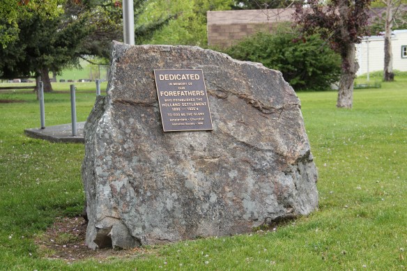
 U.S. Highway 89 enters the Blackfeet Indian Reservation on its southern border, heading for its junction with U.S. Highway 2 and the reservation center of Browning. Before the junction, you cross the historic Two Medicine River, a historic corridor for the Blackfeet. To the west of the river crossing is a highway historical marker for Coldfeet School, a one-
 room school (not extant) built for Blackfeet children in 1933 during the New Deal. To the east of the highway river crossing, however, was one of the earliest schools (1889) on the reservation, the Holy Family Catholic


 This panorama of the mission site today shows that neither of the dormitories remain, although the historic frame barn and mill still stand (to the left) while the chapel is still a dominating element, and has been incorporated into present-day Blackfeet culture. It is in excellent shape.
 Another change is that the Blackfeet provide public interpretation of the site, through their own historical markers, which is extended into the adjacent historic cemetery, one of the most somber places in the region. The old mission is now part of the reservation’s heritage tourism effort.
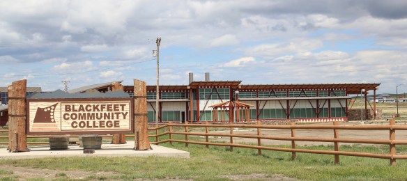
 Returning to U.S. 89 and heading northwest, you head to the junction of U.S. Highway 2 and the town of Browning. The town is a center for reservation education, as shown by the new campus for the Blackfeet Community College.
 Here too is another historic Catholic Church, the Little Flower Catholic Church, built in 1931, from locally available stone in a Gothic Revival style. The congregation supports a small Catholic school next door.
 The Browning fairgrounds is an important Blackfeet recreation and cultural center, with this recent installation again providing public interpretation of Blackfeet culture.
 and U.S. 89, heading north. It created an appropriate, respectful way for the increasing number of auto tourists headed to Glacier National Park to learn about the Blackfeet in particular and Plains Indian culture in general. The famous mid-20th century anthropologist, John Ewers, had worked tribes to create the museum’s initial exhibits and collections. In the 21st century, the Blackfeet have developed additional institutions to take advantage of tourism through the nearby Glacier Peaks casino and hotel, a complex that has developed from 2011 to 2015.
 These new buildings are part of a long-term continuum of tourism in Browning, starting with this old concrete tipi, built originally as a gas station in 1934 and now converted into a coffee shop. And the Blackfeet
 Trading Post is a business found in all sorts of national park gateways–the classic place to get cheap souvenirs and t-shirts of all types, not to mention moccasins and all of the stereotypical material culture of Native American tourism in our country.
 the primary voice on what the park means, and how visitors can think about it today. The Native American presence on U.S. Highway 89 today is much more evident, with much more public interpretation, than in my travels 30 years ago.
 The two lanes of U.S. Highway 89 as it winds northwest from Choteau to the southern boundary of the Blackfeet Indian Reservation, cross a stark yet compelling landscape, a jaunt that has never ceased to amaze me. To those only with the mountains of Glacier National Park in their minds will see merely open land, irrigated fields, scattered ranches.
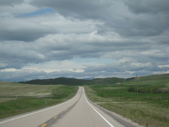 But there’s a deeper landscape here, some embodied in the tiny towns along the way, others in places just ignored, certainly not recognized. In the first post of 2016, and the 200th of this series of explorations of the Montana landscape, let’s once again look a bit harder.
 For one, this is a landscape shaped by Cold War America. Nuclear missile silos were installed throughout the region with some easily accessible from the roadway. You wonder how many tourists realize that.
 The federal imprint has lingered on this land for almost 150 years. Today north of Choteau this highway historical marker, and a lonely boulder set square in the adjacent field, mark the first federal intrusion, the creation of the Teton River Agency, where in 1868-69 the federal government established its reservation headquarters for the Blackfeet Indians. The agency was only here for about 7 years but this spot was where the first white-administered schools for Blackfeet children began, in 1872.
 Irrigation systems would be a third federal imprint on the landscape and it came early to this region–through the Reclamation Service’s Valier Irrigation Project–but to find that place you need to venture a bit east of U.S. 89 to the town of Valier, on the banks of Lake Frances, which was created as a reservoir for the irrigation project.
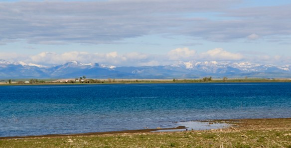 Valier has never been a very big place, but its investors in 1908, including William S. Cargill of the powerful Cargill family of Wisconsin (today’s Cargill Industries), had high hopes that the engineered landscape could create a ranching and farming wonderland.

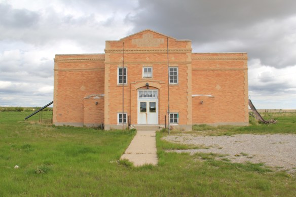
 Listed in the National Register of Historic Places, the school remains in use today, as a bed and breakfast establishment. Even though Valier never reached the dreams of the Cargills and other outside investors, it has been a stable agricultural community for 100 years–the population today is only 100 less than what the census takers marked in 1920. Valier has that




 Heritage tourism also remains alive along U.S. Highway 89, and for those travelers who slow just a bit there is now the Two Medicine Dinosaur Center at Bynum.
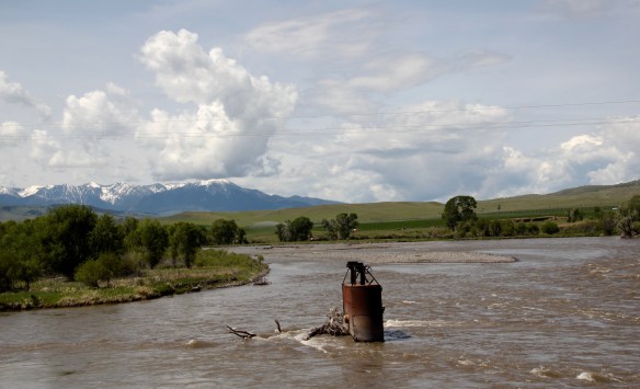
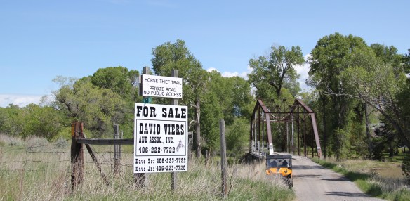 Traveling south of Clyde Park on U.S. 89, you pass by the turn-off for Horse Thief Trail, where a historic steel bridge still allows for one-lane traffic over the Shields River; this bridge and snippet of road is part of the original route of U.S 89. That means you are nearing the confluence of the Yellowstone and Shields rivers, and where U.S. Highway 89 crosses the Yellowstone River and takes you into the heart of Park County. Paralleling the modern concrete bridge is a c. 1897 steel Pratt through truss bridge, to serve the Northern Pacific Railroad spur that runs north to Clyde Park then Wilsall. The Northern Pacific called this the Third Crossing of the Yellowstone bridge; the Phoenix Bridge Company constructed it.
 Before jogging slightly to the west to head to Livingston, the county seat, two places east of the Shields River confluence are worth a look. First is the site of Fort Parker, established as the first Crow Agency in 1869 or the first federal facility in the valley. It operated from this location until 1875.
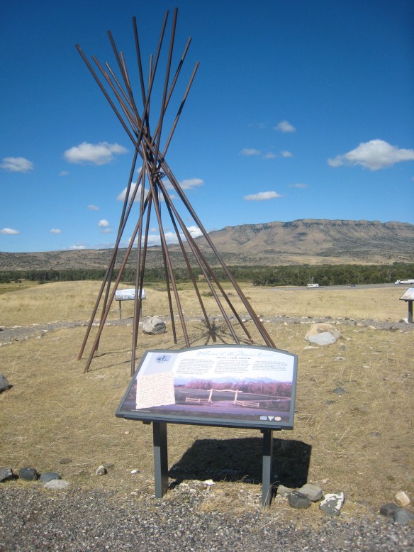
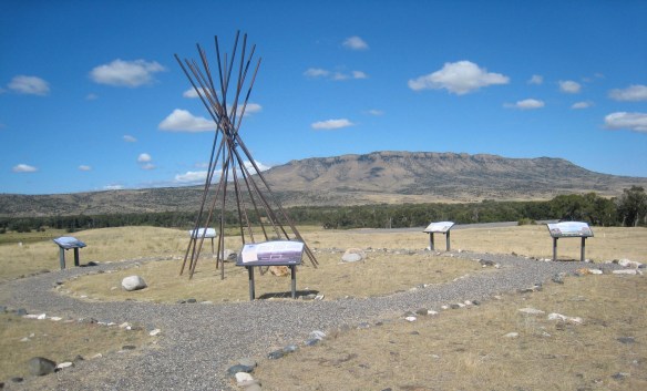 Gladly all of that changed in the 21st century. As a result of another innovative state partnership with land owners, there is an interpretive center for the Fort Parker story, easily accessible from the interstate, which also does not intrude into the potentially rich archaeological remains of the fort. The story told by the historical markers is accurate and comprehensive, from the agency’s beginnings to the land today.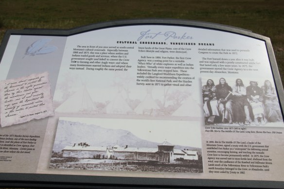
 Few remnants of that early white settlement remain today; you can find some just north of Springdale, at Park County’s eastern border, on the north side of the Yellowstone River. Hunter’s Hot Springs was the first attraction, established by Andrew Jackson Hunter in the 1870s, and receiving its last update in the early years of automobile tourism in the 1920s, as shown below in this postcard from my collection. Today, as the Google image below also shows, there are just scattered stones and fences from what had been a showplace for the valley.

 Commercial businesses once lined the town side of the Northern Pacific tracks. Nothing is open today although trains rumbled down this historic main line every day. What does survive is impressive and worthy of


 As the highway leaves the central plains east of Great Falls, it heads east through coal country (see the earlier post on Belt) and south into the Little Belt Mountains and the old mining towns of Monarch and Neihart (above). Both Cascade County towns are proud of their heritage, a story embodied in the Monarch-Neihart School, a wonderful bit of log craftsmanship from the New Deal era, a WPA project finished in 1940 that is listed in the National Register of Historic Places.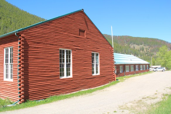


 When I last visited there in 2015 the combined route of U.S. 89 and 12, which passes in front of the courthouse and the center of town, was being rebuilt, giving the historic business district the look of a ghost town.

 U.S. Highway 89 continues south, crossing the historic corridor of the Milwaukee Road at Ringling, another Meagher County town discussed in an earlier post, marked by the landmark St. John’s Catholic Church.
 Travelers continuing south soon find themselves in Park County, entering the Shields River Valley just north of Wilsall, where highway markers and monuments, like that for “Thunder Jack” (2006) by sculptor Gary Kerby, convey the significance of the place.
 Wilsall was not much a place 30 years ago, a small trade town on the edge of a Northern Pacific Railroad spur line, a past still recalled by the tall elevator and old railroad corridor.
 But the growing popularity of the Shields River Valley has led to a new boom in Walsall, with old banks converted into bars and old general stores

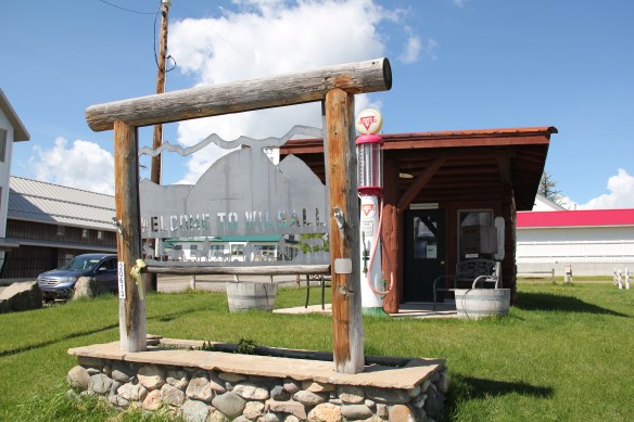

 Clyde Park Tavern is still the place to go for an adult beverage, or two. Historic grain elevators still serve local ranchers, marking the railroad line that defined the town’s landscape until the impact of the highway in the early 20th century.