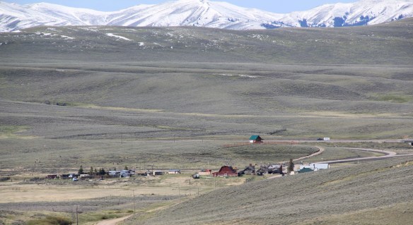
Monida, at the Idaho-Montana border, on Interstate I-15.
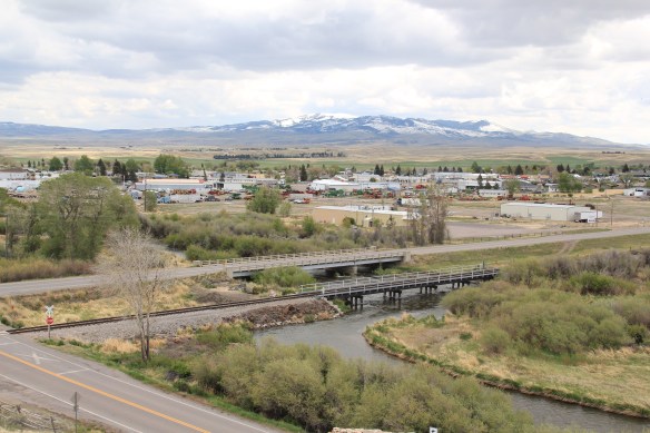
Country towns of Beaverhead County–wait, you cry out: isn’t every town in Beaverhead County a country town? Well yes, since Dillon, the county seat, has a single stop light, you can say that. But Dillon is very much an urban oasis compared to the county’s tiny villages and towns scattered all about Beaverhead’s 5,572 square miles, making it the largest county in Montana.
 Let’s start this theme with the railroad/ federal highway towns. Monida, at the state border with Idaho, is a good place to start, first established as a place on the Utah and Northern Railroad line as it moved north toward the mines at Butte in 1881. Monica had a second life as a highway stop on the old U.S. Highway 91 that paralleled the tracks, as evident in the old garages left behind.
The next town north on the corridor created by the railroad/highway/interstate is Lima, 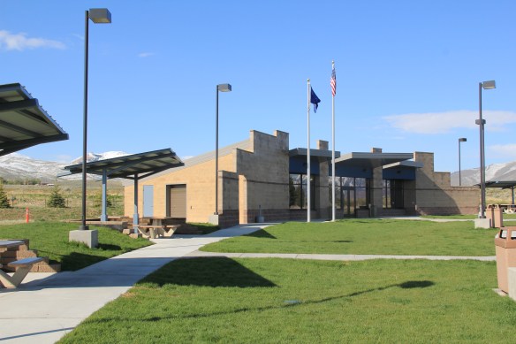 which possesses a Montana welcome center and rest stop. That’s important because at this stop you also can find one of the state’s mid-20th century examples of a tourist welcome center, which has been moved to this stop and then interpreted as part of the state’s evolving roadside architecture.
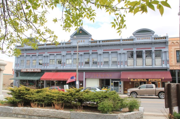
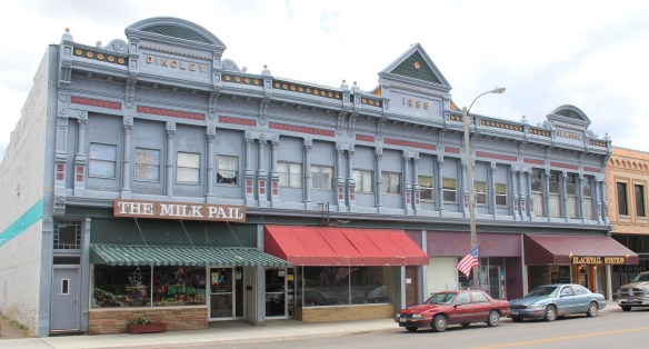
Lima is a classic symmetrical-plan railroad town, the plan favored by the engineers of the Utah and Northern as the railroad moved into Montana. The west side of the tracks, where the two-lane U.S. Highway 91 passed, was the primary commercial district, with several brick and frame two-story buildings ranging from the 1880s to the 1910s.


The east side, opposite old U.S. Highway 91, was a secondary area; the Lima Historical Society is trying to keep an old 1880s building intact for the 21st century.
The town’s comparative vitality is shown by its metal Butler Building-like municipal building, and historic churches, ranging from a early 20th century shingle style to a 1960s contemporary style Gothic church of the Latter Day Saints.
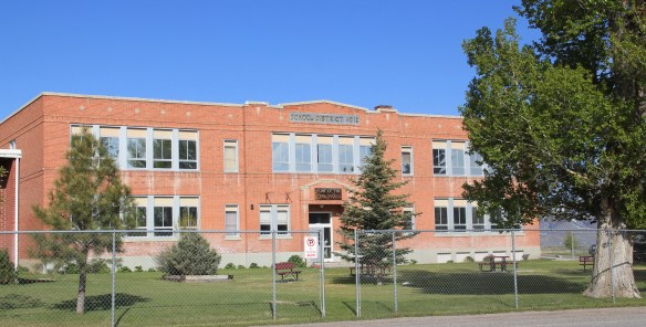
The town’s pride naturally is its school, which developed from the early 20th century two-story brick schoolhouse to become the town’s center of community.
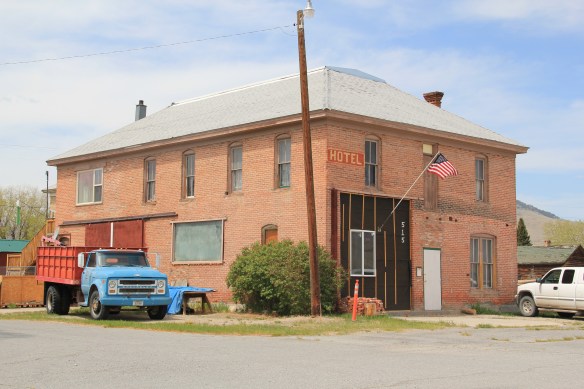
Eight miles to the north is a very different historic schoolhouse, the one-story brick Dell school (1903), which had been converted into a wonderful cafe when I stopped in 1984. It is still a great place–if you don’t stop here for pie or a caramel roll (or both), you goofed.

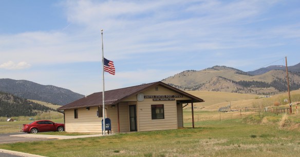
The Calf-A is not the only place worth a look at Dell, a tiny railroad town along the historic Utah and Northern line, with the Tendroy Mountains in the background. Dell still has its 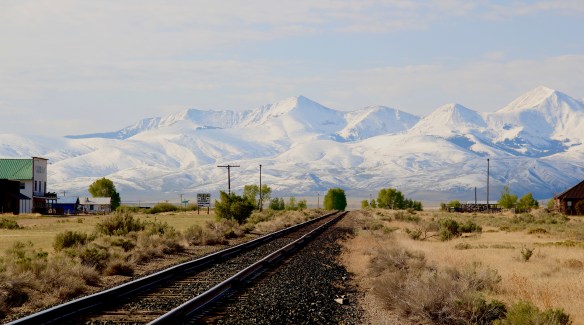
post office, within its one store, its community hall, and a good steakhouse dive, the false-front Stockyard Inn. But most importantly, for an understanding of the impact of World
War II on Montana, Dell has an air-strip, which still contains its 1940s B-17 Radar base, complete with storehouse–marked by the orange band around the building–and radar tower. Kate Hampton of the Montana State Historic Preservation Office in 2012 told me to be of the lookout for these properties. Once found throughout Montana, and part of the guidance system sending planes northward, many have disappeared over the years. Let’s hope the installation at Dell remains for sometime to come.

There are no more towns between Dell and Dillon but about halfway there is the Clark Canyon Reservoir, part of the reshaping of the northwest landscape by the U.S. Bureau of Reclamation in the 1960s. The bureau in 1961-1964 built the earthen dam and created the
reservoir, which inundated the small railroad town of Armstead, and led to the re-routing of U.S. Highway 91 (now incorporated into the interstate at this point).
 The reclamation project, which stored water for irrigation, also covered the site of Camp Fortunate, a very important place within the larger narrative of the Lewis and Clark Expedition and its relationships and negotiations with the Shoshone Indians. An early
effort to mark and interpret the site came from the Daughters of the American Revolution, who not surprisingly focused on the Sacajawea story. Reclamation officials added other markers after the construction of the dam and reservoir.
In this century the Lewis and Clark National Historic Trail has added yet another layer of public interpretation in its attempt to tell the whole story of the expedition and its complicated relations with the Native Americans of the region.
North of Dillon along the old route of U.S. Highway 91 and overlooking the corridor of the Utah and Northern Railroad is another significant Lewis and Clark site, known as Clark’s Lookout, which was opened to the public during the Lewis and Clark Bicentennial of the early 21st century.
The lookout is one of the exciting historic sites that have been established in Montana in the 30 years since my initial survey for the state historic preservation plan. Not only does the property interpret an important moment in the expedition’s history–from this vantage point William Clark tried to understand the countryside before him and the best direction to take–it also allows visitors to literally walk in his footsteps and imagine the same perspective.
Of course what Clark viewed, and what you might see, are vastly different–the tracks of the Utah and Northern, then route of old U.S. 91 are right up front, while the town of Dillon creeps northward toward the lookout.
Our last stop for part one of Beaverhead’s country towns is Glen, a village best accessed by old U. S. Highway 91. A tiny post office marks the old town. Not far away are two historic 
North of Glen you cross the river along old U.S. Highway 91 and encounter a great steel tress bridge, a reminder of the nature of travel along the federal highways of the mid-20th century.


 This birds-eye view of the town is at the Beaverhead County Museum at the railroad depot. It shows the symmetrical plan well, with two-story commercial blocks facing the tracks and depot, which was then just a frame building. To the opposite side of the tracks with more laborer cottages and one outstanding landmark, the Second Empire-style Hotel Metlen. The Metlen, listed in the National Register of Historic Places, remains today, one
 of the state’s best examples of a railroad hotel. I recognized the building as such in the 1984 state historic preservation plan and my book, A Traveler’s Companion to Montana History, included the image below of the hotel.
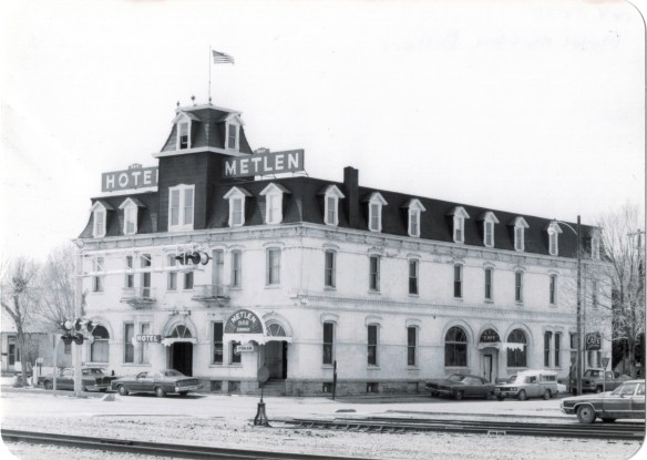 This three-story hotel served not only tourists but especially traveling businessmen–called drummers because they were out “drumming up” business for their companies. The interior has received some restoration work in the last 30 years but little has changed in the facade, as they two images, one from 1990 and the other from 2012, indicate.


 built environment has many stories to tell.


 When travelers, and most Montana residents even, speak of Silver Bow County, they think of Butte. Outside of the Copper City, however, are small towns and a very different way of life. To the west we have already discussed Ramsay and its beginnings as a munitions factory town during World War I. Let’s shift attention now to the southern tip of the county and two places along the historic Union Pacific spur line, the Utah Northern Railroad, into Butte.
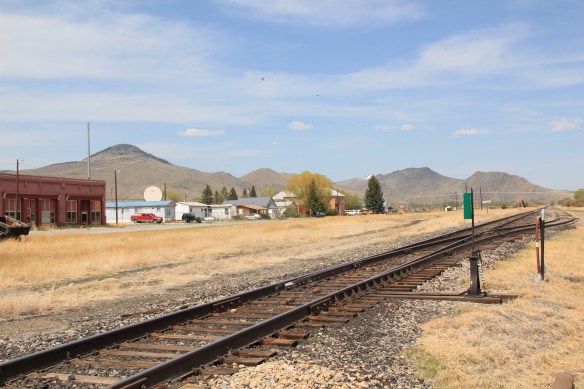


 when Melrose was a substantial, busy place. This 1870s-1880s history is largely forgotten today as the town has evolved into a sportsmen’s stop off Interstate I-15 due to its great access to the Big Hole River and surrounding national forests as well as the quite marvy Melrose Bar and Cafe, a classic western watering hole.
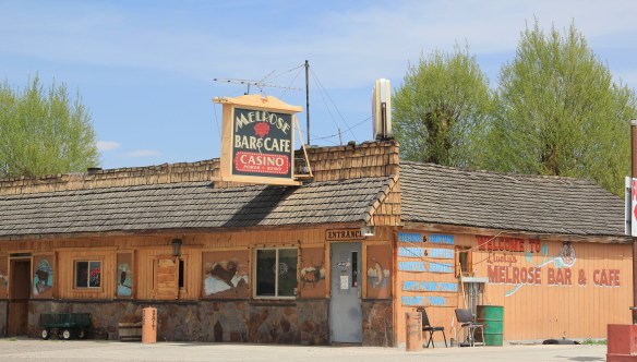 Community institutions help to keep Melrose’s sense of itself alive in the 21st century. Its school, local firehall, the historic stone St John the Apostle Catholic Mission and the modernist styled Community Presbyterian Church are statements of stability and purpose.


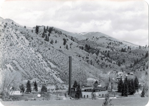 The photo above was published in A Traveler’s Companion to Montana History, in part because of the preservation excitement over this landmark but also because it documented how the boom in Butte helped to transform the historic landscape on the “other side of the divide.” The pump station took water from the Big Hole River and pumped it over the mountains to the Butte Water Company–without the pump station, expansion of the mines and the city would have been difficult perhaps impossible in the early 20th century.
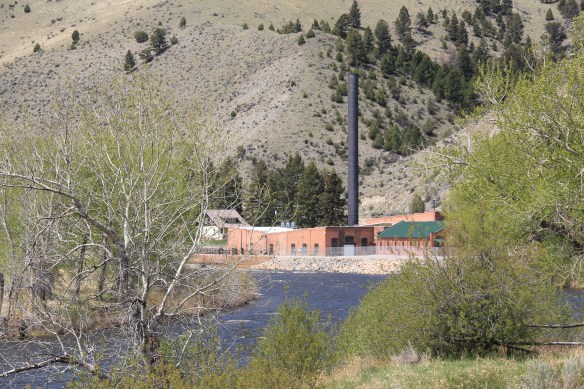
 In 2014, in reaction to the listing of Montana rural schools as a threatened national treasure by the National Trust of Historic Preservation, CBS Sunday Morning visited Divide School for a feature story. Teacher Judy Boyle told the Montana Standard of May 16, 2014: “The town of Divide is pretty proud of its school and they want to keep it running. We have a Post Office, the Grange and the school — and if you close the school, you basically close the town.”
 Divide is one of many Montana towns where residents consider their schools to the foundation for their future–helping to explain why Montanans are so passionate about their local schools.


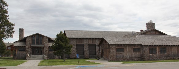
 The district’s architectural jewel, the Dining Room, dates almost a generation later to 1926. Architect Gilbert S. Underwood designed one of the late marvels of the Rustic style as defined in the northern Rockies. With its rugged stone exterior rising as it was a natural formation in the land, the dining room immediately told arriving visitors that an adventure awaited them, especially once they stepped inside and experienced the vast log interior spaces.


 Other former Union Pacific buildings have been given adaptive reuse treatment by the town, with a baggage building becoming police headquarters and the former men’s dormitory has been converted into a local health clinic.

 Thus, West Yellowstone is among Montana’s best examples of roadside architecture as distinctive 19502-1960w motels and a wide assortment of commercial types line both U.S. 191 but also the side arteries to the highway.


