 Jefferson County, nestled as it is between the much larger population centers of Helena (Lewis and Clark County) and Butte (Silver Bow County), has often been neglected in any overview or study of Montana. But within the county’s historical landscape are places and stories that convey so much about Montana history and the historic properties that reflect its culture and identity.
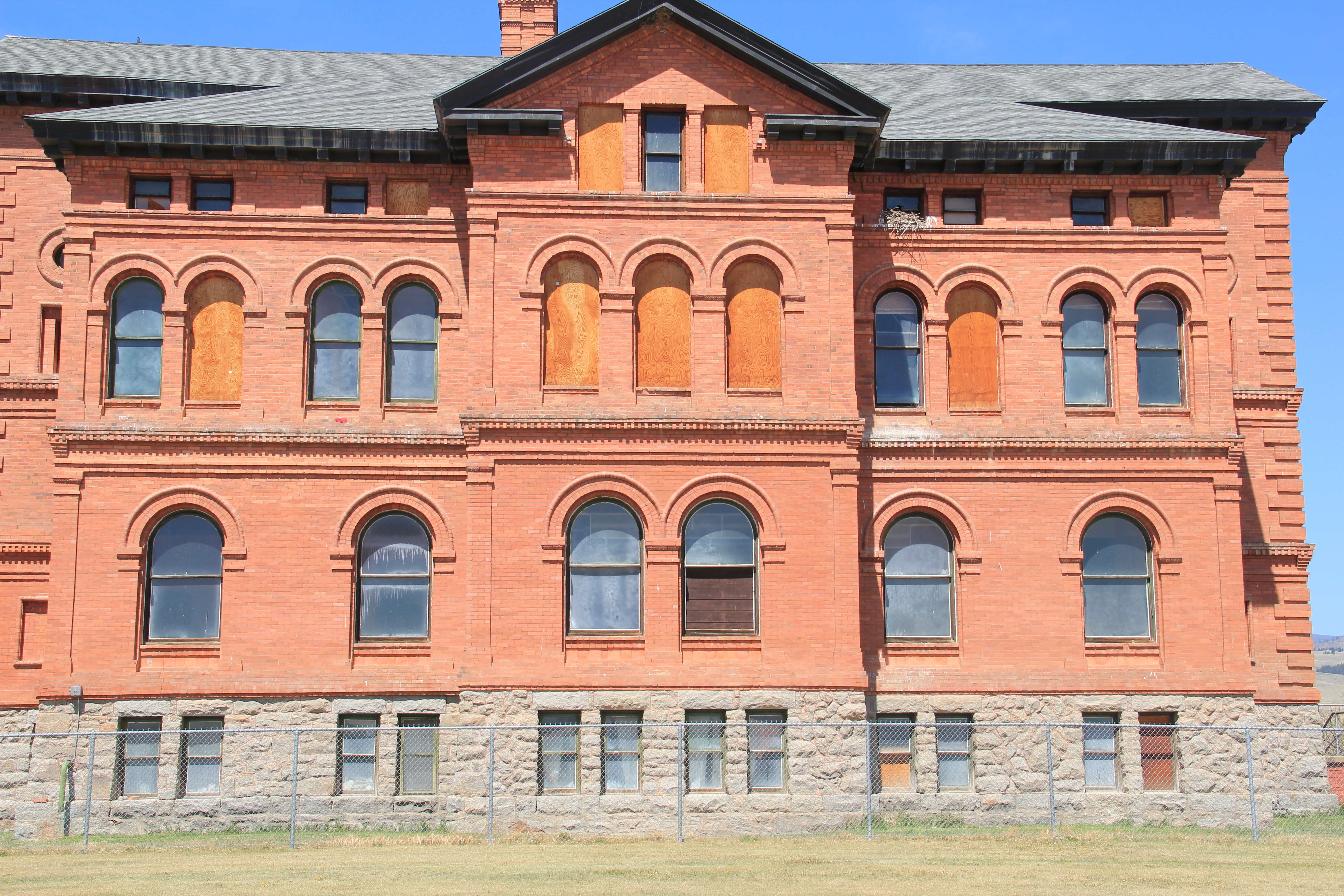 Let’s begin with the place so often in the news lately, the Montana Development Center, the location of the historic Montana Deaf and Dumb Asylum (1897-1898), a stately red brick Renaissance Revival-style building listed in the National Register of Historic Places in 1985. Since the building was being considered for listing, it was a top priority for the state historic preservation plan work in 1984. It remains in need of a new future 30-plus
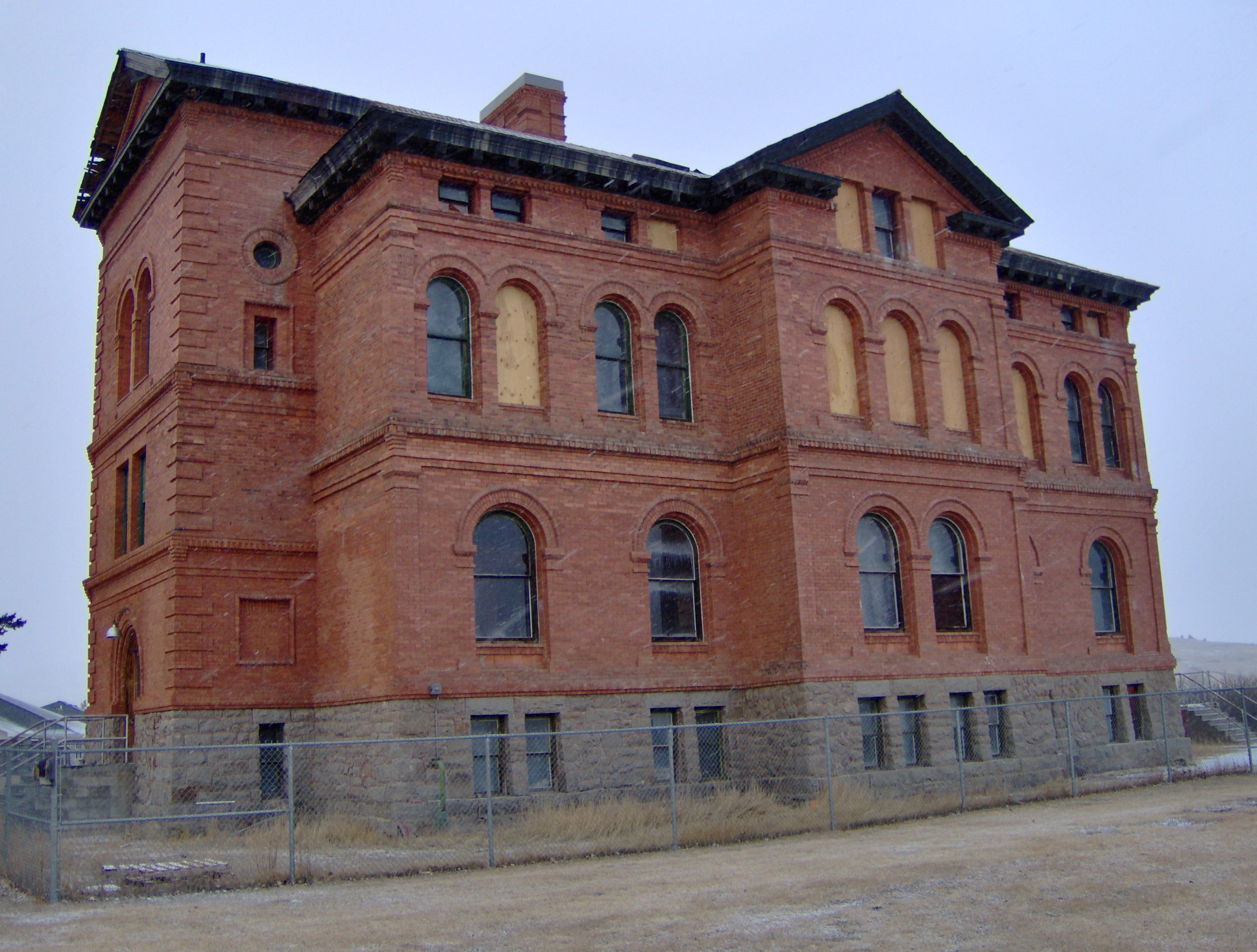
A photo of the asylum from 2007
years later. The architect was John C. Paulsen, who then served as the State Architect. The building represents an early effort by the state to provide for its citizens, and the presence of the institution in Boulder shaped that town’s history for the next 120 years.
Boulder is a place of impressive public buildings. The Jefferson County Courthouse (1888-89) is another piece of Victorian architecture, in the Dichardsonian Romanesque style, again by John K. Paulsen. It was listed in the National Register in 1980.
 Another public institution once found in numbers across Montana but now found only in a few places is the high school dormitory, for students who spent the week in town rather than attempting to travel the distances between home and the high school on a daily basis. Boulder still has its high school dormitory from the 1920s, converted long ago into apartments.

Indeed the importance of schools to not only the state’s history of education but the mere survival of communities has been pinpointed by various state preservation groups and the National Trust for Historic Preservation. Jefferson County still has many significant surviving school buildings from the early 20th century, none of which have been listed yet in the National Register.

Carter School, 1916, Montana City

Clancy School, now the Jefferson County Museum

Basin school, still in use

Caldwell school, one of the few buildings left in this old railroad town
Whitehall still has its impressive Gothic style gymnasium from the 1920s while the school itself shows how this part of the county has gained in population since 1985.
 Community halls represent another theme found in the Montana landscape; Jefferson County has an excellent example in its 1911 community hall in Clancy, which now serves as the local library. Likewise, fraternal lodges played a major role as community centers in early Montana history–the stone masonry of the two-story Boulder Basin Masonic Lodge makes an impressive Main Street statement.
Irrigation and sugar beet cultivation are key 20th century agricultural themes, typically associated with eastern and central Montana. Jefferson County tells that story too, in a different way, at Whitehall. The irrigation ditches are everywhere and the tall concrete stack of the sugar refinery plant still looms over the town.
In 1917 Amalgamated Sugar Company, based in Utah, formed the Jefferson Valley Sugar Company and began to construct but did not finish a refinery at Whitehall. The venture did not begin well, and the works were later sold to the Utah-Idaho Sugar Company in 1920, which never finished the plant but left the stack standing. Nearby is Sugar Beet
Row, where hipped roof duplex residences typical of c. 1920 company towns are still lined up, and in use, although their exteriors have changed over the decades.
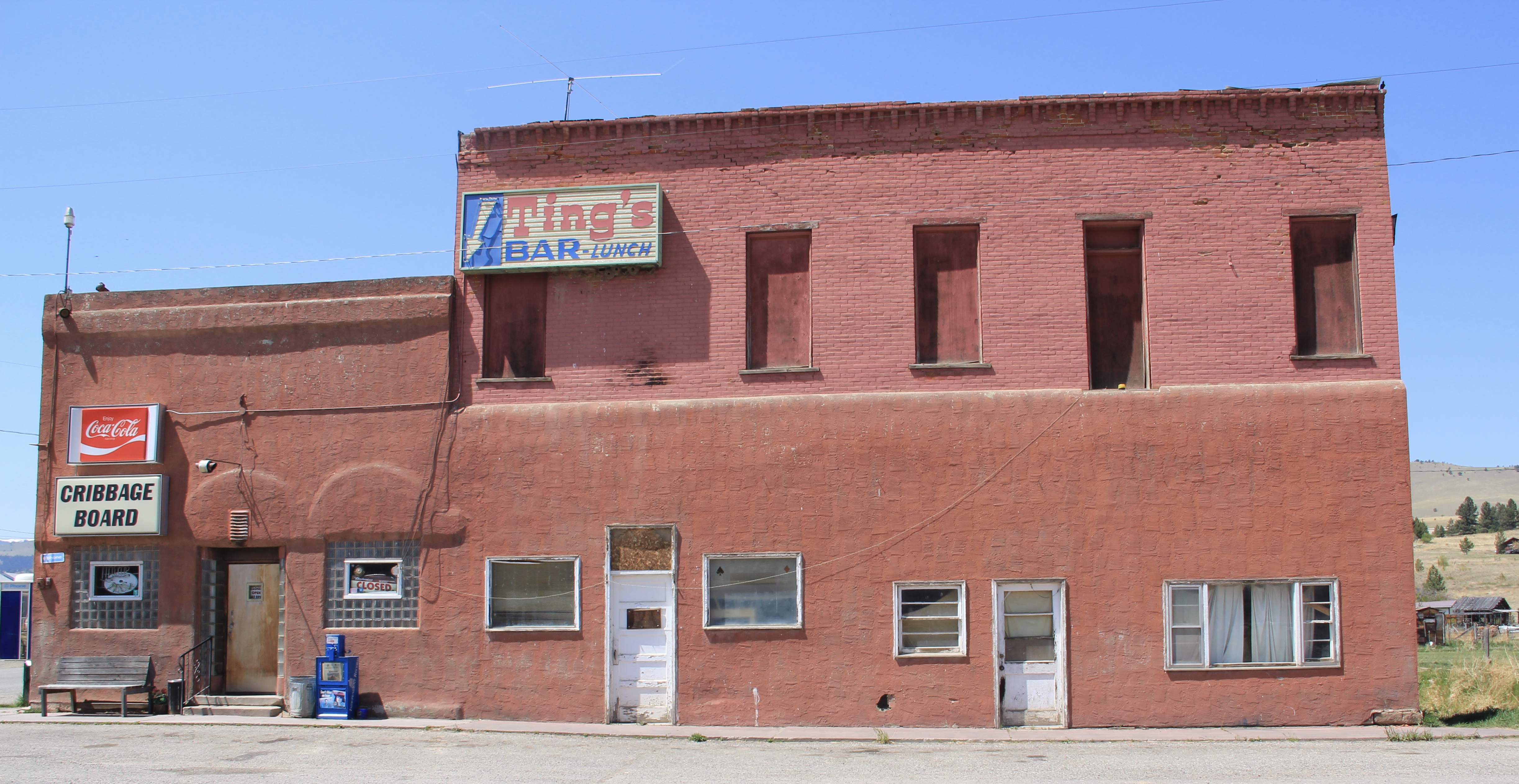
Through many posts in this blog, I have identified those informal yet very important community centers found in urban neighborhoods and rural outposts across the state–bars and taverns. Jefferson County has plenty of famous classic watering holes, such as Ting’s Bar in Jefferson City, the Windsor Bar in Boulder, or the Two Bit Bar in Whitehall, not forgetting Roper Lanes and Lounge in Whitehall.

Speaking of recreation, Jefferson County also has one of my favorite hot springs in all of the west, the Boulder Hot Springs along Montana Highway 69. Here is a classic oasis of the early 20th century, complete in Spanish Revival style, and listed in the National Register of Historic Places. Its rough worn exterior only hints at the marvel of its pool and experience of this place.

Mining always has been part of Jefferson County’s livelihood with still active mines near Whitehall and at Wickes. The county also has significant early remnants of the state’s

The coke ovens above are from Wickes (L) and Alhambra (R) while the image directly above is of 21st century mining continuing at Wickes.
mining era, with still extant (but still threatened as well) charcoal kilns at Wickes (1881) and at Alhambra. Naturally with the mining came railroads early to Jefferson County. As you travel Interstate I-15 between Butte and Helena, you are generally following the route of the Montana Central, which connected the mines in Butte to the smelter in Great Falls, and a part of the abandoned roadbed can still be followed.
 Another good example of the early railroad development is at Corbin, where a major ore concentrator operated by the Helena Mining and Reduction Company was located in the 1880s. The concentrator handled 125 tons of ore every day. The concentrator is long gone but the foundations, while crumbling steadily, remain to convey its size and location. The tall steel train trestle overlooks the town, a powerful reminder of the connection between the rails and mines. It is part of the historic Montana Central line, first built as a wood trestle in 1888 and then replaced with the steel structure found today in 1902.


Corbin concentrator site, 1984

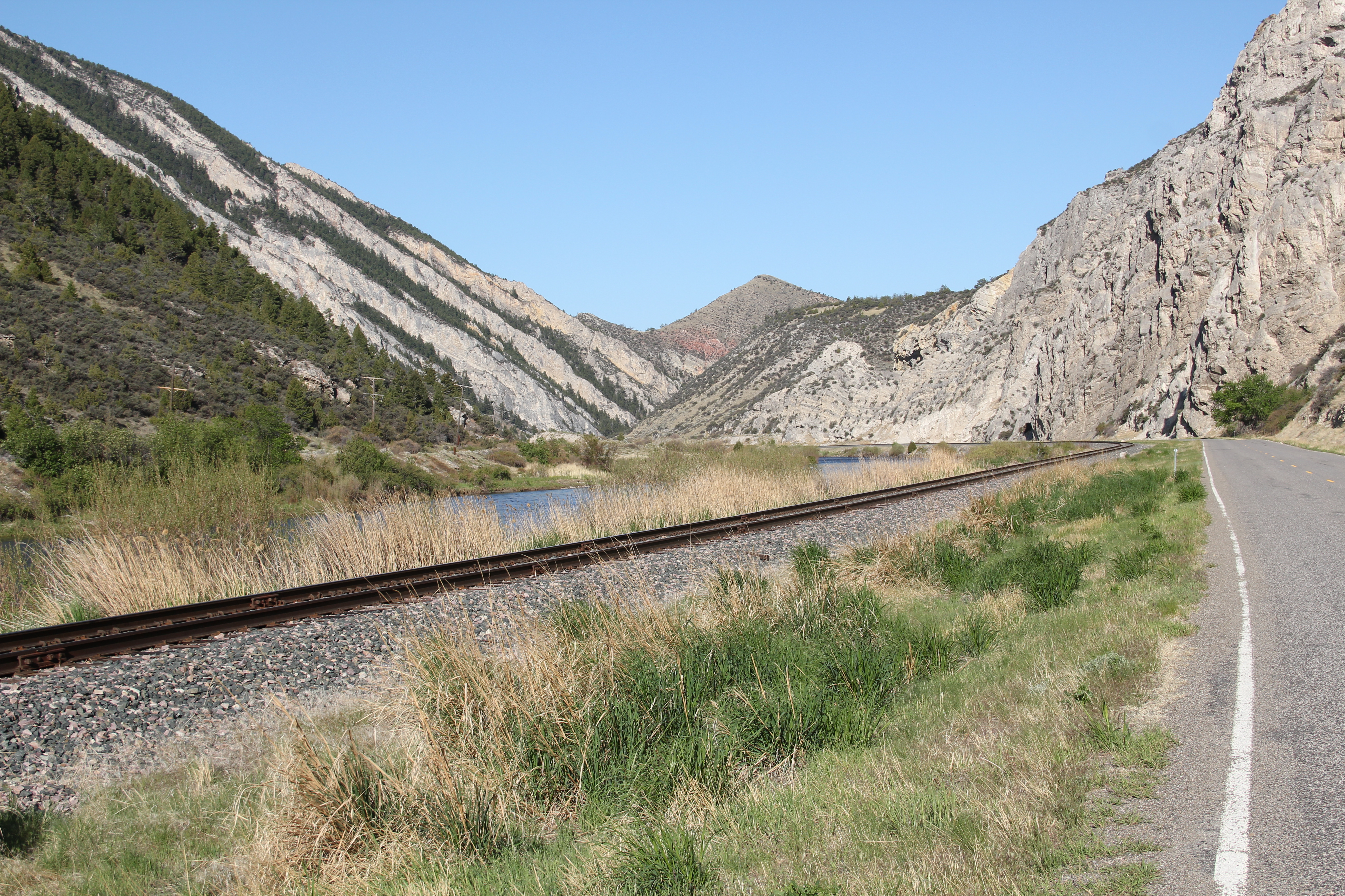
The Northern Pacific Railroad and the Milwaukee Road were both active in the southern end of the county. Along one stretch of the Jefferson River, which is followed by Montana Highway 2 (old U.S. Highway 10), you are actually traversing an ancient transportation route, created by the river, the railroads, and the federal highway. The Northern Pacific tracks are immediately next to the highway between the road and the Jefferson River; the Milwaukee corridor is on the opposite side of the river.
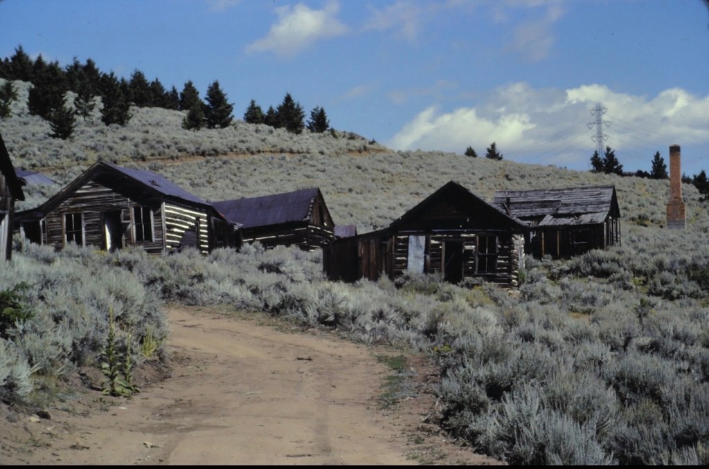
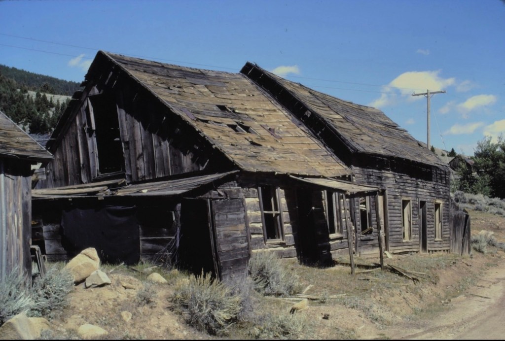
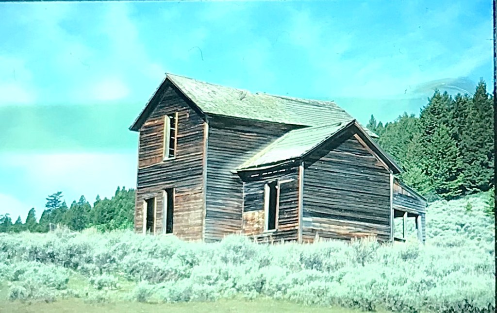
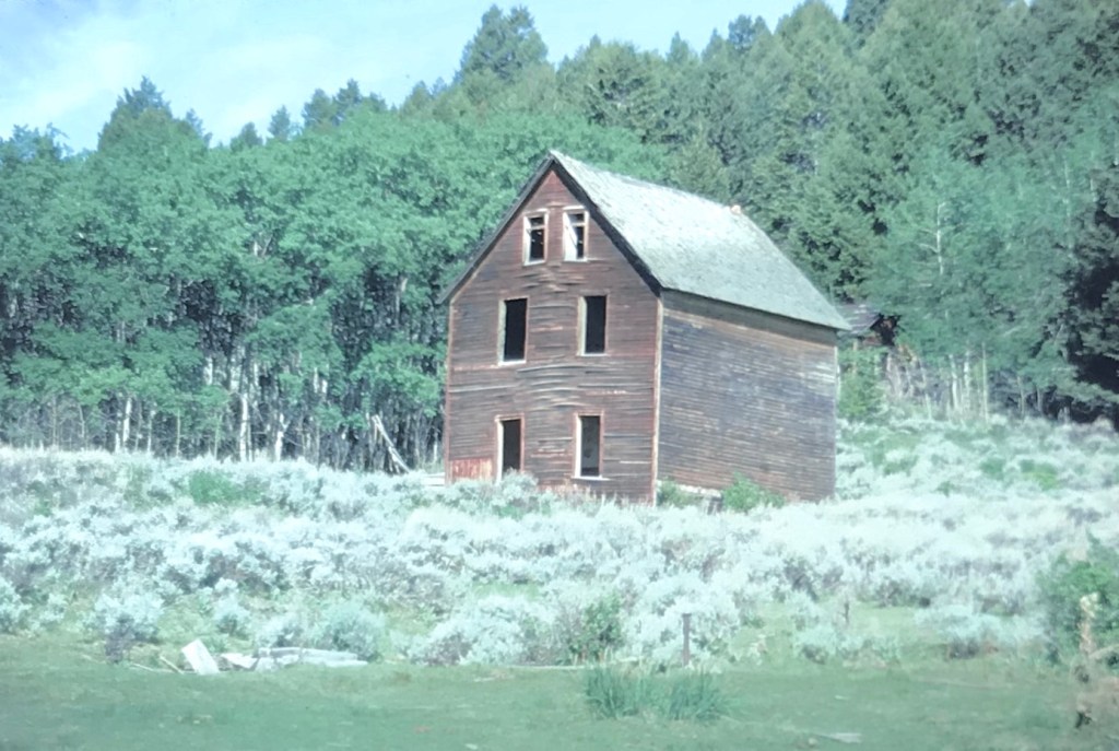
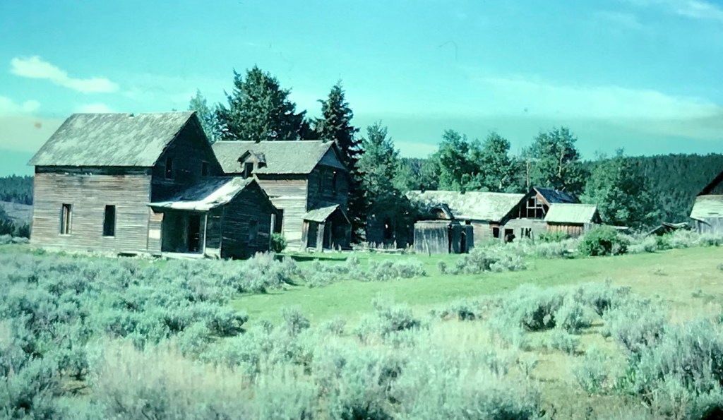
The most famous remnant of Montana’s mining era is the ghost town at Elkhorn. Of course the phrase ghost town is a brand name, not reality. People still live in Elkhorn–indeed more now than when I last visited 25 years ago. Another change is that the two primary landmarks of the town, Fraternity Hall and Gilliam Hall, have become a pocket state park, and are in better preservation shape than in the past.
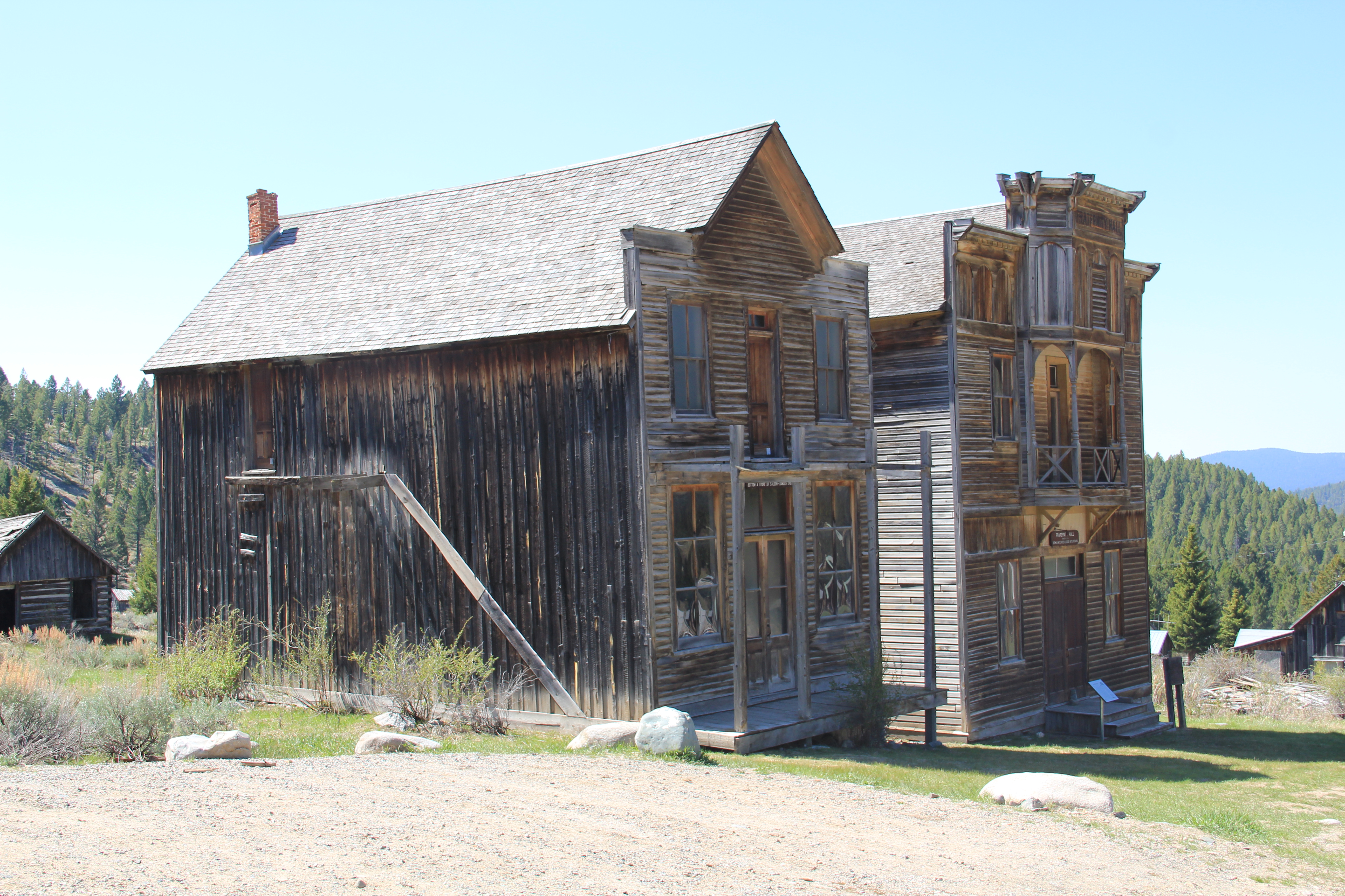 Fraternity Hall was famous at the time of the state historic preservation plan survey as one of the best architectural examples of false front, Italianate style-influenced commercial buildings in the northern Rockies. The two photos below, one from 1985 and the other from 2013, show how its preservation has been enhanced under state guardianship. Its projecting bay and balcony are outstanding examples of the craftsmanship found in the vernacular architecture of the boom towns.
The adjacent Gillian Hall is also an important building, not as architecturally ornate as Fraternity Hall, but typical of mining town entertainment houses with bars and food on the first floor, and a dance hall on the second floor.

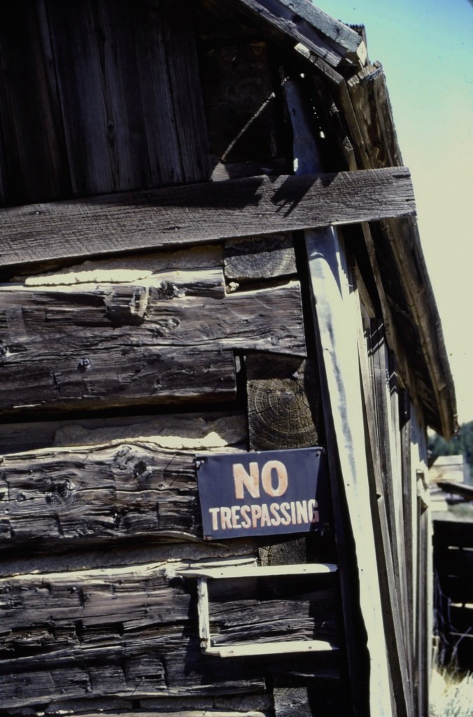
While the state park properties dominate what remains at Elkhorn, it is the general unplanned, ramshackle appearance and arrangement of the town that conveys a bit of what these bustling places were like over 130 years ago–residences and businesses alike thrown up quickly because everyone wanted to make their pile and then move on.
Elkhorn is not the only place of compelling vernacular architecture. Visible along Interstate I-15 is a remarkable set of log ranch buildings near Elk Park, once a major dairy center serving Butte during the 1st half of the twentieth century. John and Rudy Parini constructed the gambrel-roof log barn, to expand production available from an earlier log barn by their father, in c. 1929. The Parini ranch ever since has been a landmark for travelers between Butte and Helena.
Nearby is another frame dairy barn from the 1920s, constructed and operated by brothers George and William Francine. The barns are powerful artifacts of the interplay between urban development and agricultural innovation in Jefferson County in the 20th century.
 The historic barn at the Jefferson Valley Museum is the Brooke Barn from 1914, another example of the dairy production then taking place in this part of Montana as the same time that the mines were booming in nearby Butte.
 The adjacent rodeo grounds at Whitehall host in late July the Whitehall Bucking Horse Futurity competition and fair.
 The bucking horse competition is not the only major summer event in the county. Along the old federal highway and the Jefferson River at Cardwell, music promoters took a historic highway truss bridge, converted it into a stage, and have been hosting the Headwaters Country Jam, the state’s biggest country music festival–a bit of Nashville every June in Montana: I have to love it.
 Here is adaptive reuse at perhaps its ingenious best, and successful adaptive reuse projects are another constant theme found across Montana. Whitehall itself has a second example in the conversion of a 1920s Craftsman-style building on Legion Avenue (old U.S. Highway 10). Indeed, although travelers do not use the older federal highway much since the construction of the interstate, Whitehall has several good examples of roadside architecture–yes, another blog theme–along Legion Avenue, such as a Art Moderne-styled automobile dealership and a classic 1950s motel, complete with flashing neon sign.
West of Whitehall is another 20th century roadside attraction, Lewis and Clark Caverns, a property with one of the most interesting conservation histories in the nation. It began as a privately developed site and then between 1908 and 1911 it became the Lewis and Clark Cavern National Monument during the administration of President William Howard Taft. Federal authorities believed that the caverns had a direct connection to the Lewis and Clark Expedition. The Corps of Discovery camped nearby on July 31, 1805, but had no direct association with the caverns. A portion of their route is within the park’s boundaries.
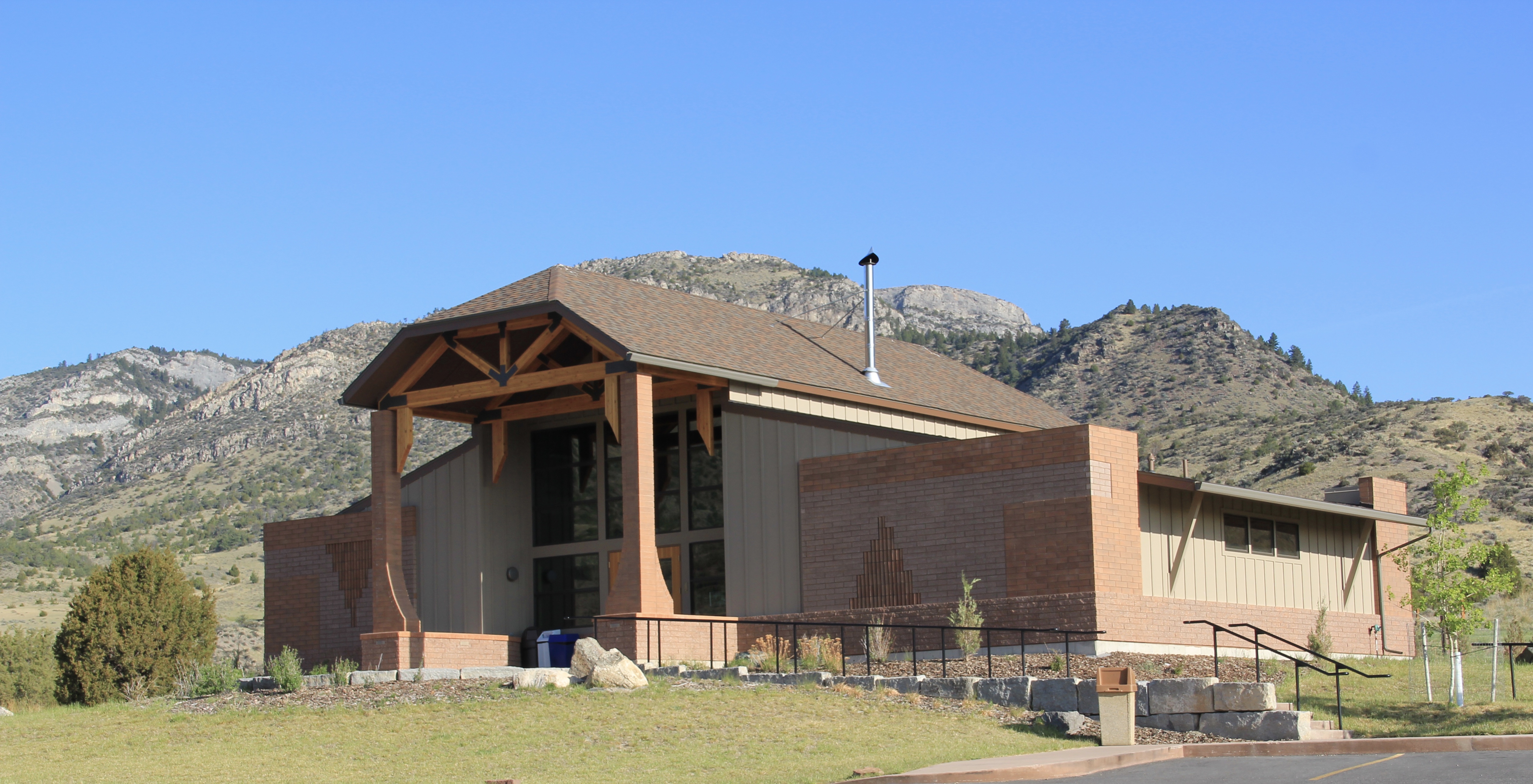 During the mid-1930s the Civilian Conservation Corps developed the park with new trails in the caverns; state and local authorities wanted more site development since the park stood along U.S. Highway 10, with potential tourism growth. In 1937-38, the federal government transferred the national monument to state control and in 1938 state officials launched Lewis and Clark Caverns as Montana’s first state park. Since my work 30 years ago, the state has re-energized the park with a new visitor center and interpretive exhibits that better convey the caverns’ significance, especially to Native Americans who had used the place centuries before Lewis and Clark passed nearby.
Faith, and the persistence of early churches across rural Montana, is perhaps the most appropriate last theme to explore in Jefferson County. St. John the Evangelist (1880-1881) dominates the landscape of the Boulder Valley, along Montana Highway 69, like few other buildings. This straightforward statement of faith in a frame Gothic styled building, complete with a historic cemetery at the back, is a reminder of the early Catholic settlers of the valley, and how diversity is yet another reality of the Montana experience.


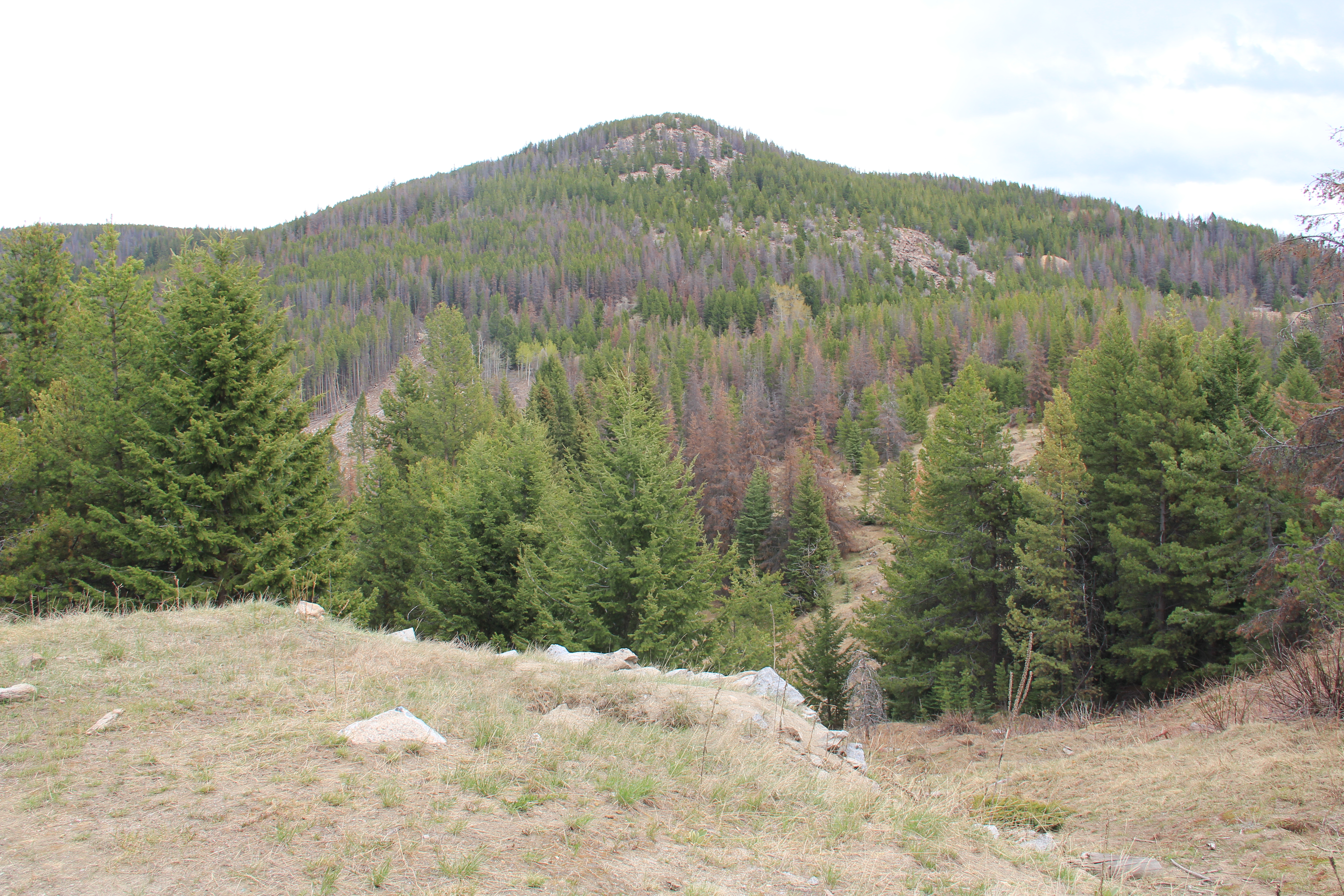
 The late 19th century discovery and development of silver mines high in the Granite Mountains changed the course of this part of the Pintler route. The Granite Mountain mines yielded one of the biggest silver strikes in all of Montana, creating both the mountain mining town of Granite and a bit farther down on the mountain’s edge the town of Philipsburg, which by 1893 served as the seat for the new county of Granite.
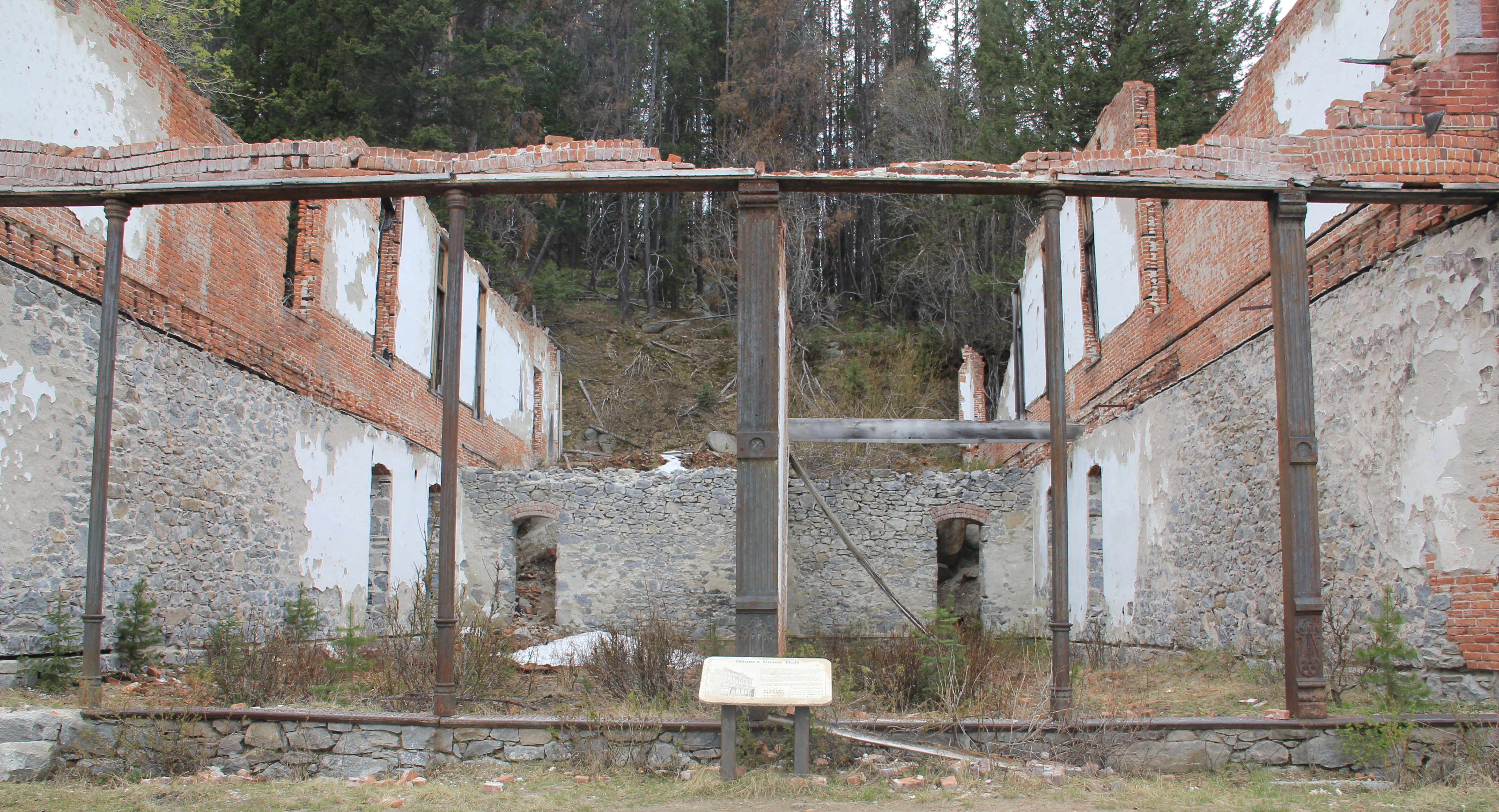
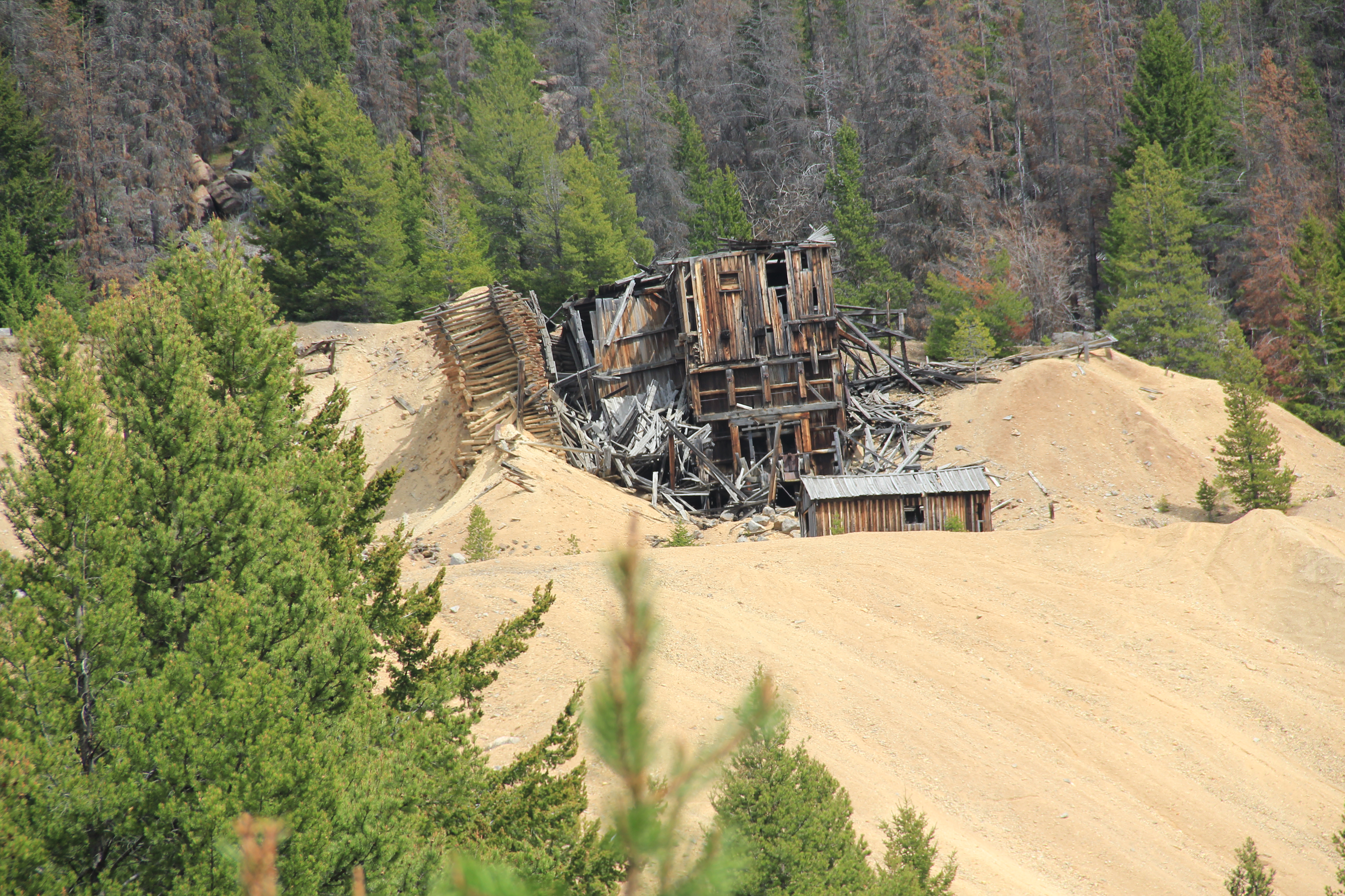
 The U.S. Forest Service’s rather weathered and beat-up sign marks the historic entrance to the mining town of Granite, located at over 7,000 feet in elevation above the town of Philipsburg. During the 1984-85 state historic preservation plan work Granite was the focal point. The office knew of the latest collapse of Miners Union Hall (1890) turning what had been an impressive Victorian landmark into a place with three walls and lots of rubble–it remains that way today.


 Connecting the Granite road to the town of Philipsburg, today as in the past, is the site of the Bi-Metallic Mill, which is still in limited use today compared to the mining hey-day.
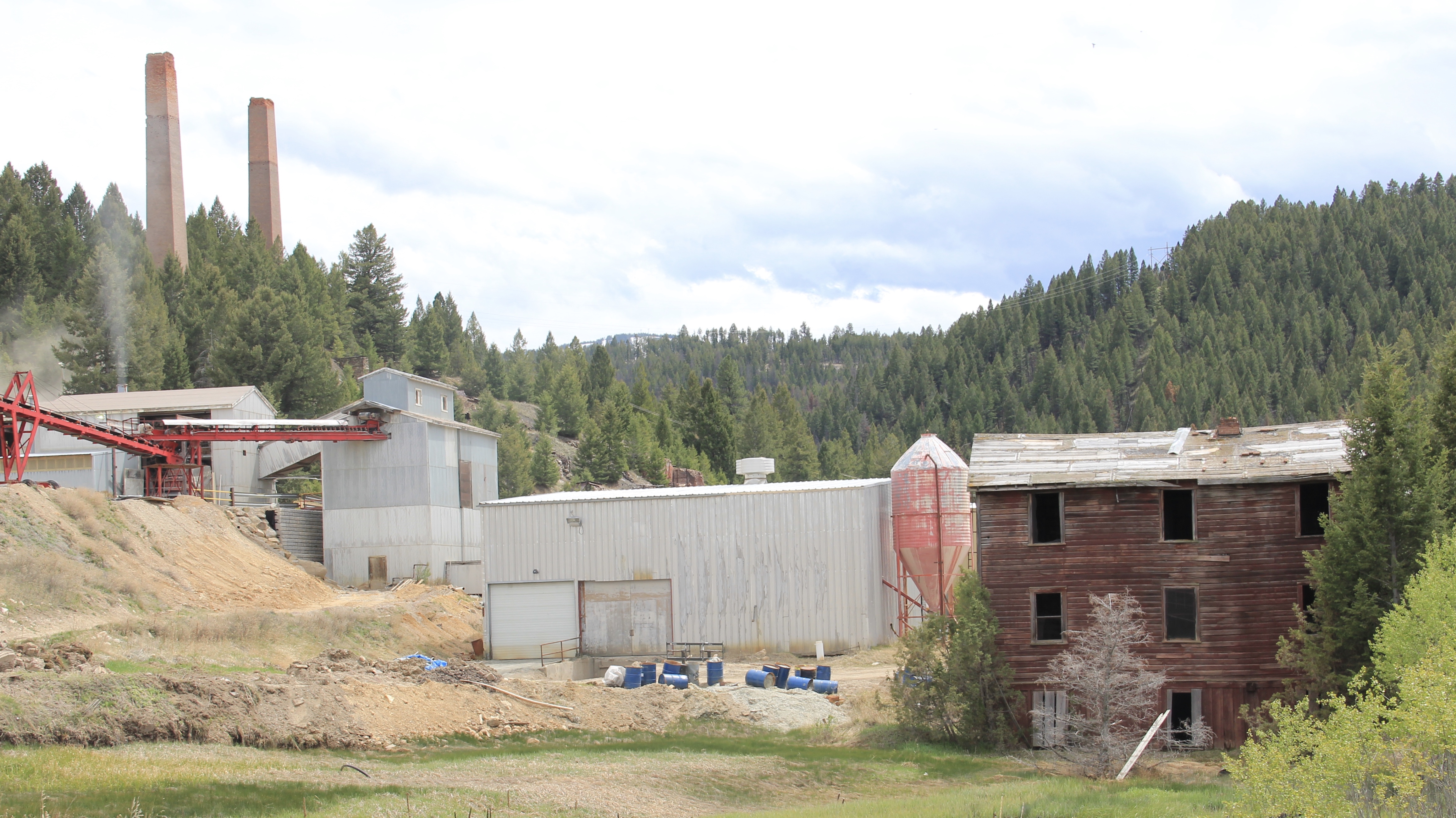


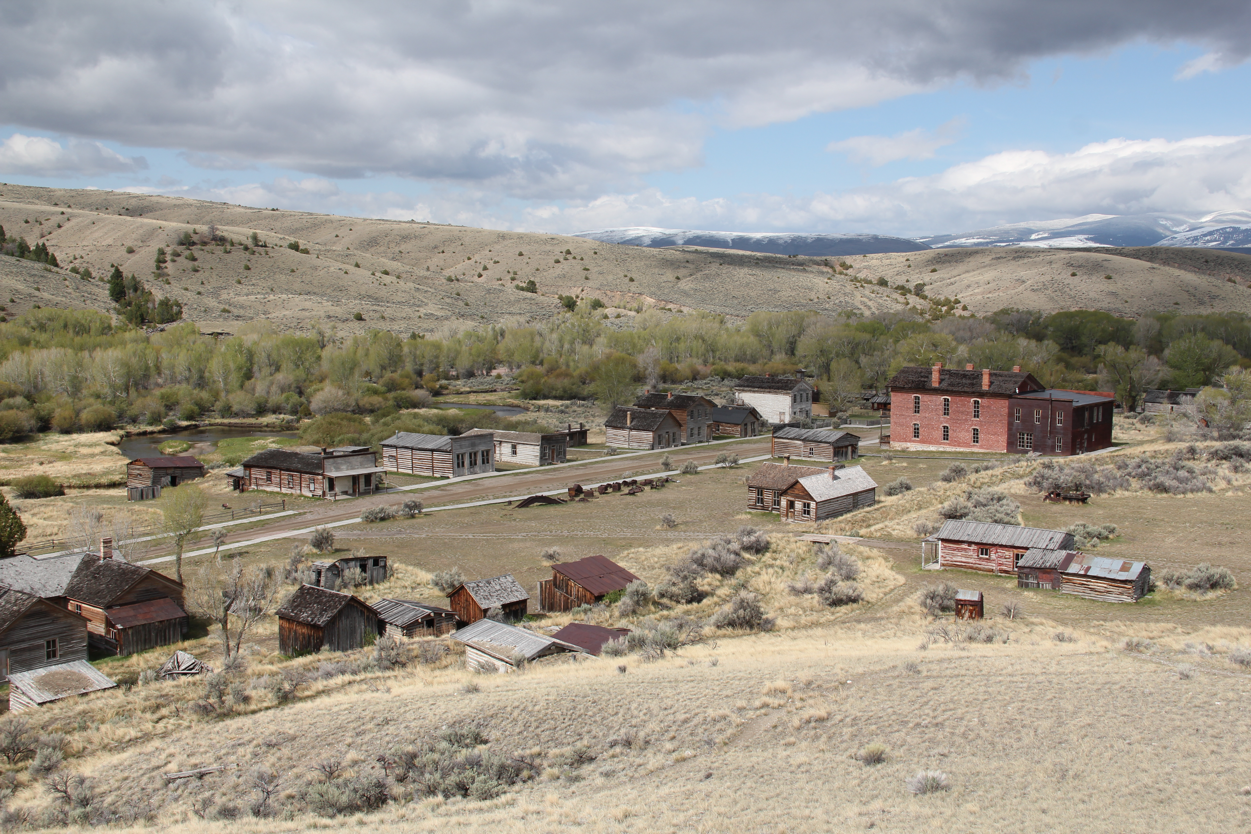 My first trip to Beaverhead County in 1981 had two primary goals–and the first was to explore Bannack, the roots of Montana Territory, and one of its best connections to Civil War America. As this simple wooden sign below remarks, here in 1862 the first gold strike in what became Montana Territory occurred.
 a path because the glistening bits of metal loose in the sands of the creek had never interested the Native Americans but news of the find was enough to drive easterners, many of them southerners, away from the landscape of war and into a wholly different place, crested by beautiful mountains.
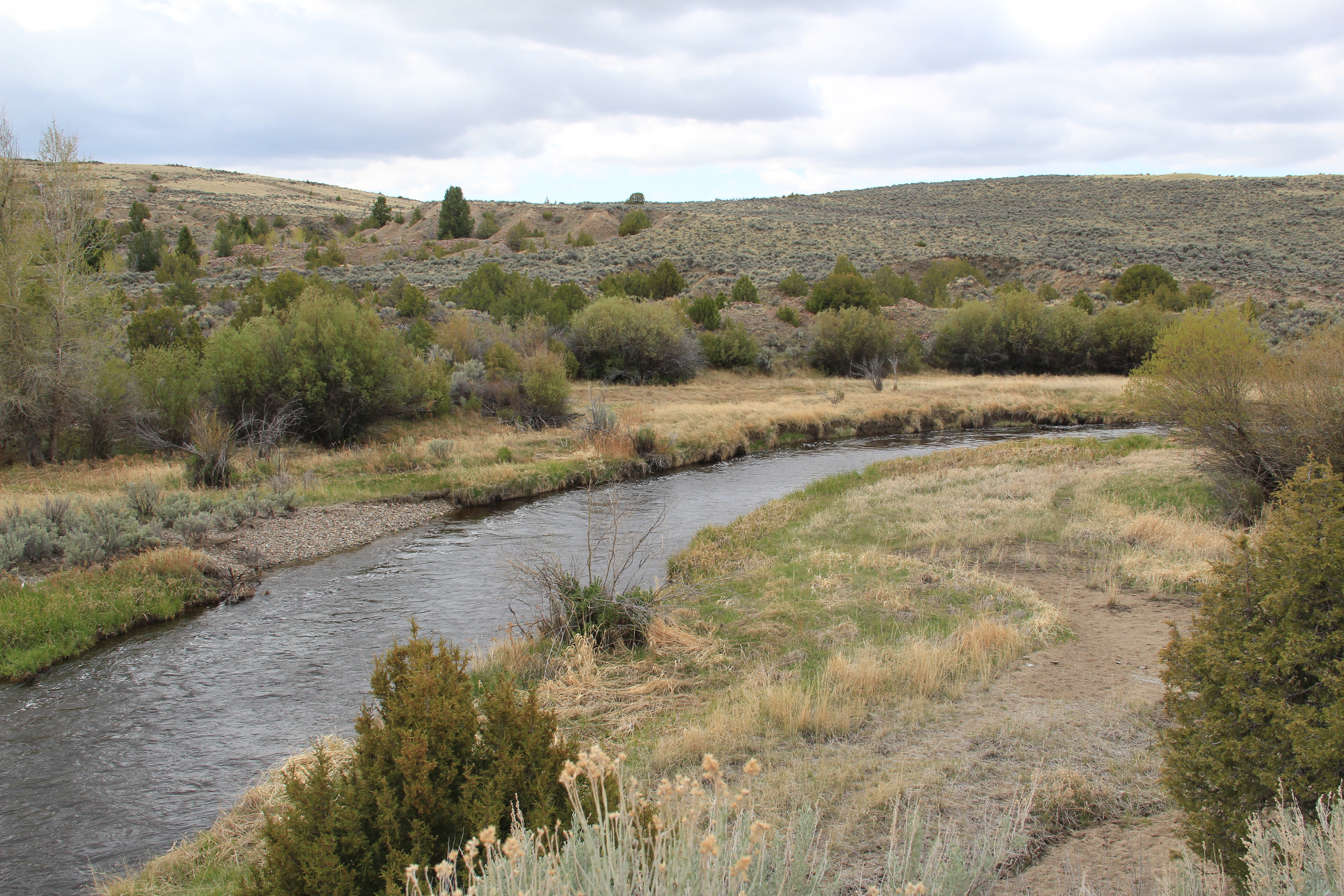 Grasshopper Creek was not much of place then, and even now, but this stream of water became the source of a boom that eventually reshaped the boundaries of the northern Rockies and nearby its banks grew the town of Bannack, a name taken in part from the Bannock Indians who had used this landscape in far different ways for many years.
 The story of the preservation of Bannock begins with local land owners, who protected the site, and kept most of the buildings from being scattered across the region. There was little official interest in the place at first. The state Daughters of American Revolution
 marked it in 1925, otherwise the buildings remained, some in use as residences or for public purposes, others melting away in the demanding climate. The Boveys moved the Goodrich Hotel to their preservation project at Virginia City and transformed it into the Fairweather Inn, which is still in use as lodging.
 In 1954, the Beaverhead County Historical Society transferred about 1/3 of the present property to the state for protection and development as a state park. Not until 1961 did the National Park Service recognize the town as a National Historic Landmark.


 Gritty, dusty, forlorn: yes, Bannack is the real deal for anyone wanting to explore ground zero of the gold rush era in Montana, and to think about how in the midst of the great Civil War, federal officials found time to support adventurous citizens to launch a new territory in forgotten expanses of the northern Rockies.
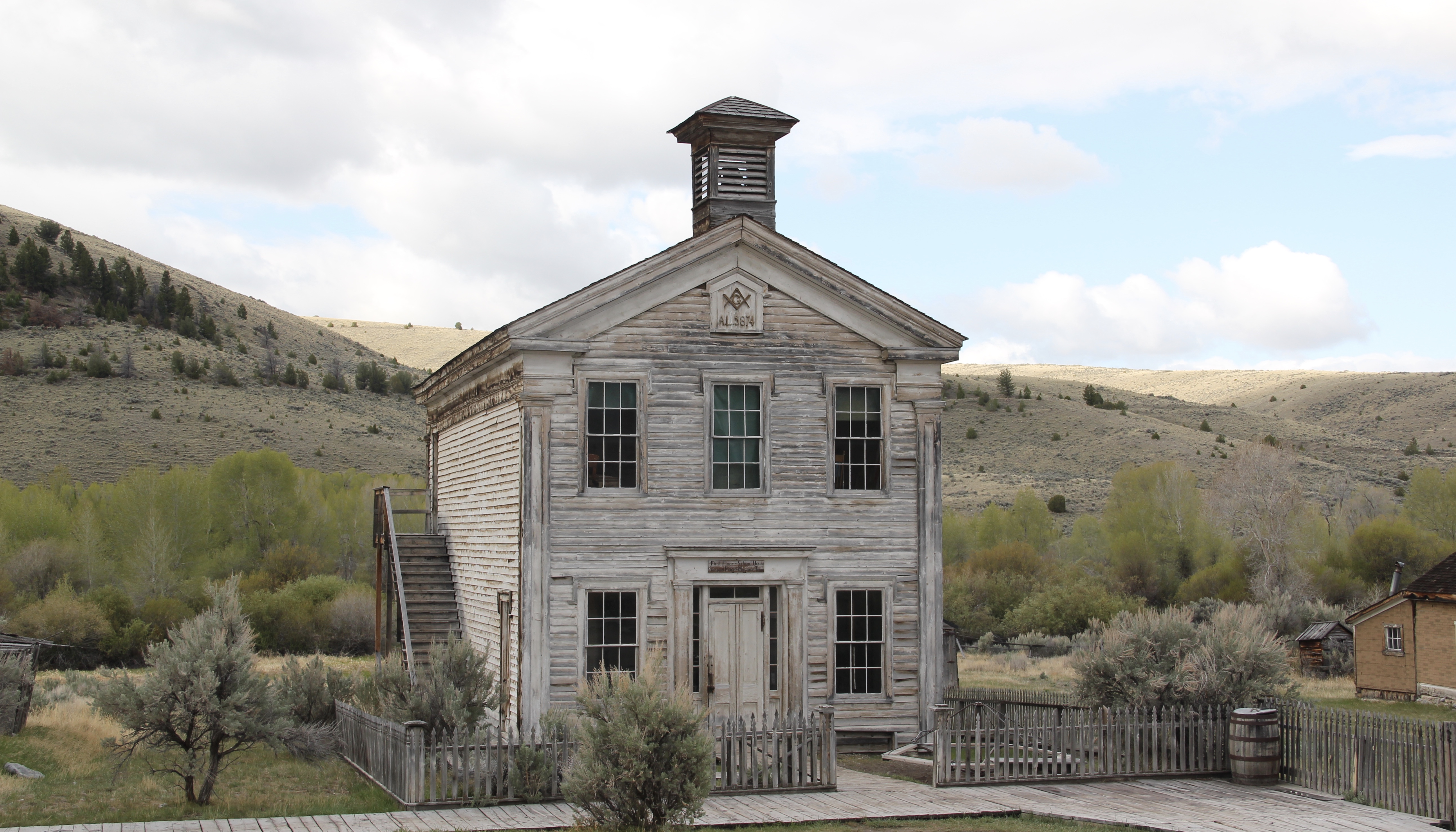 I thought that 30 years ago I “got” Bannack–there wasn’t much that I missed here. I was wrong. Probably like thousands of other visitors who fly into the town, and leave just as quickly, I missed what is still called the “new” town cemetery. Almost hidden in the sagebrush along Bannack Road, the “new” cemetery is not Boot Hill–where is Plummer
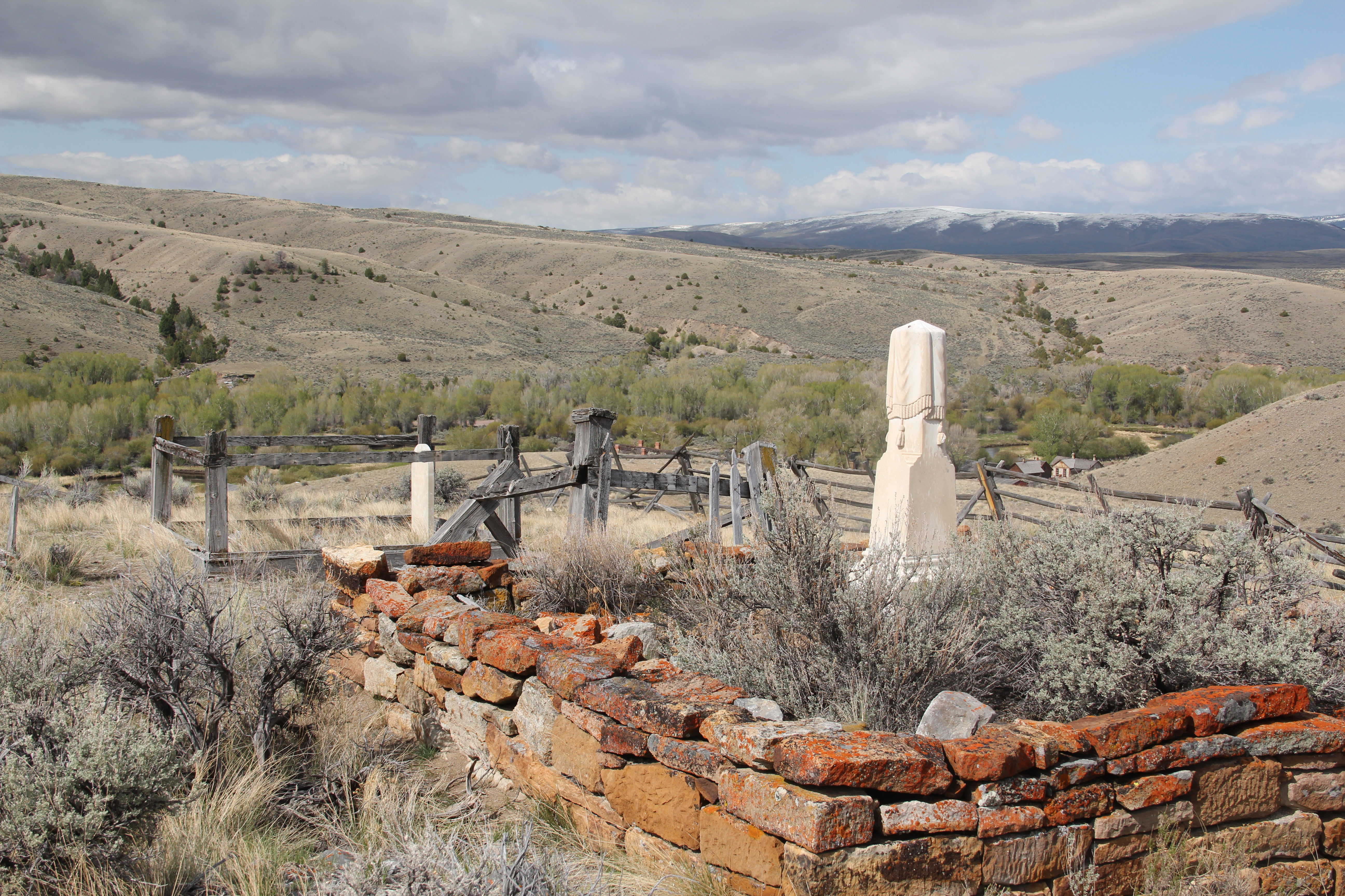 buried people still want to know–but it is a remarkable place of hand-carved tombstones, others rich with Victorian imagery, and a few that are poignant reminders of the Civil War veterans who came here and stayed.
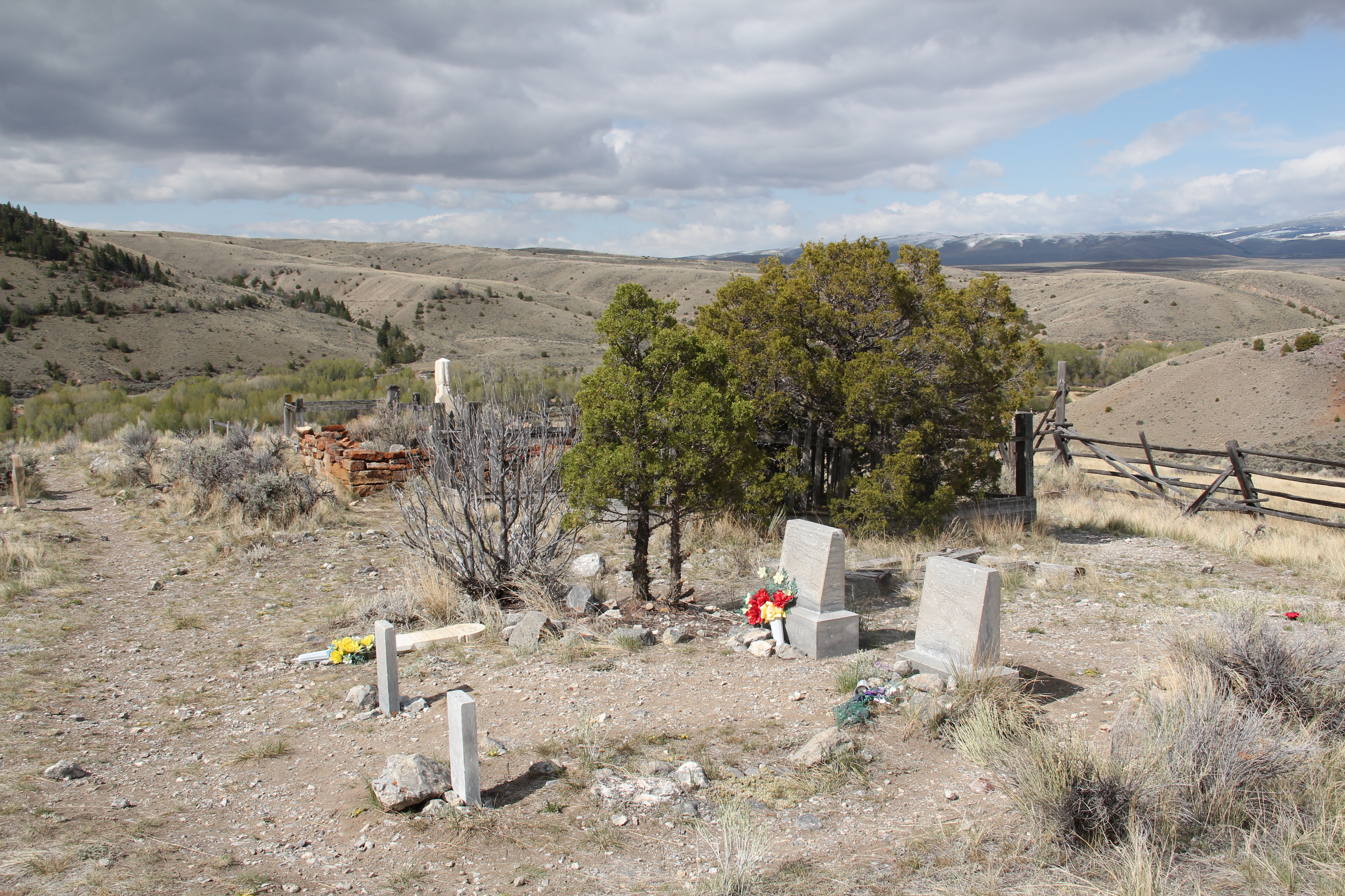


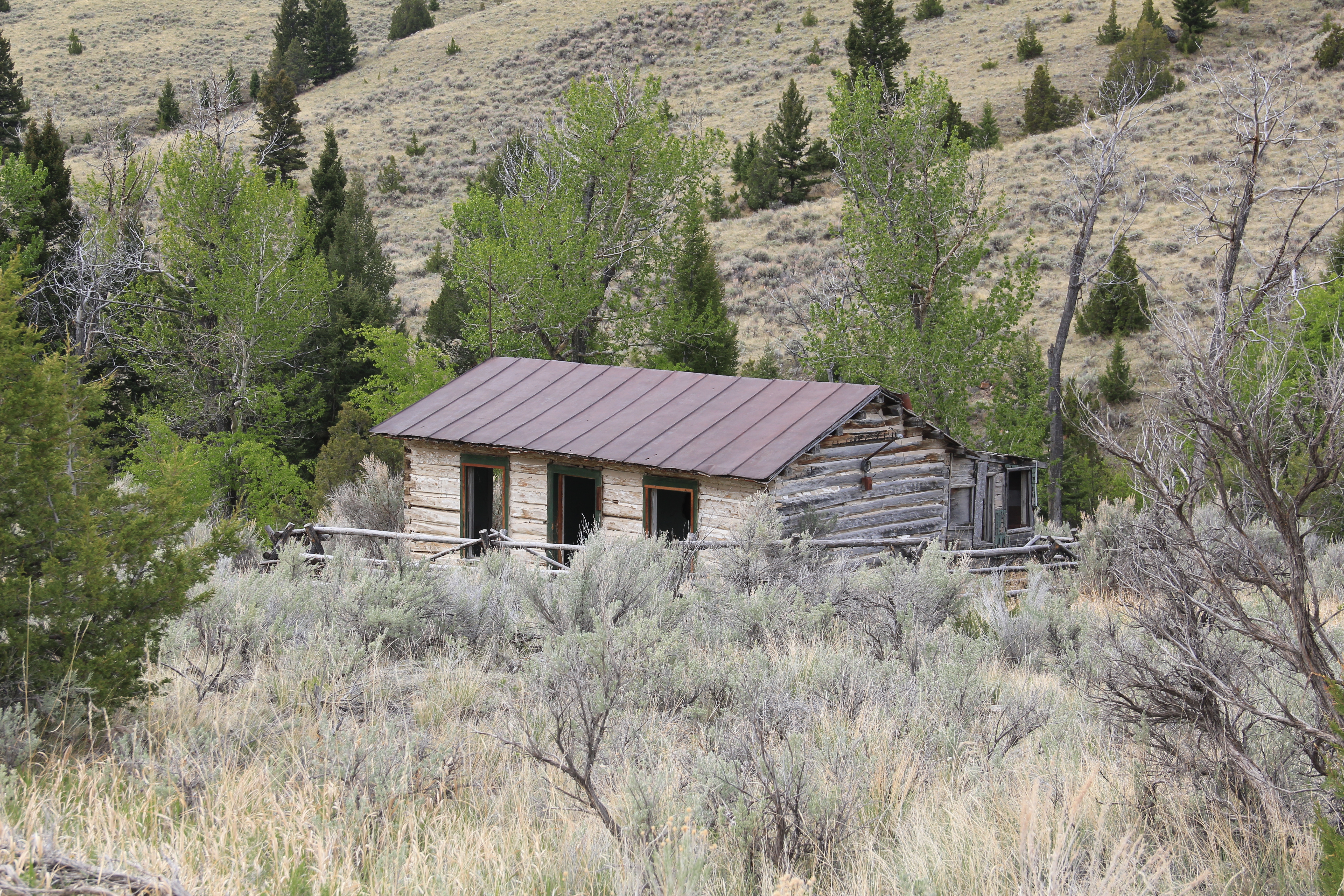
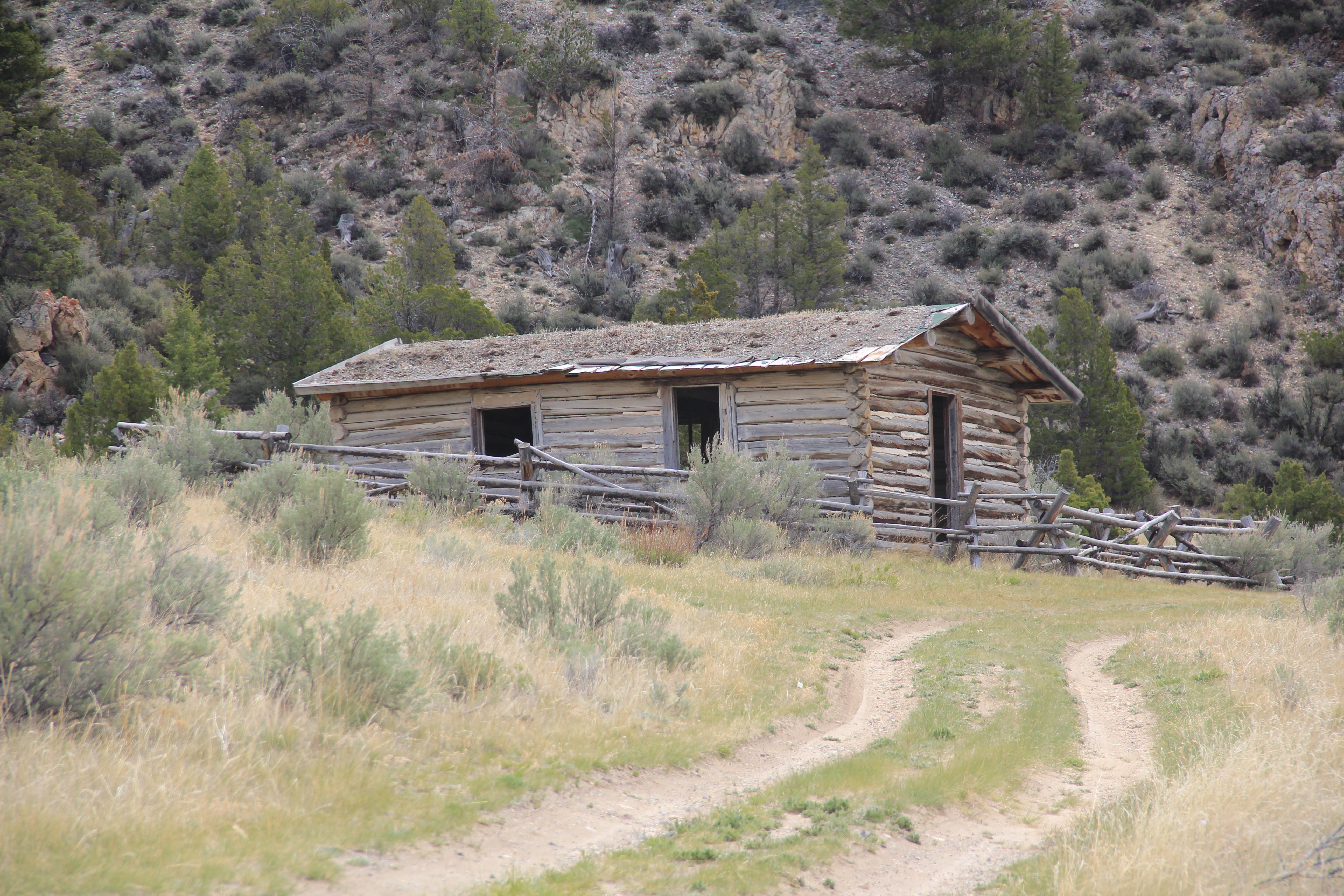

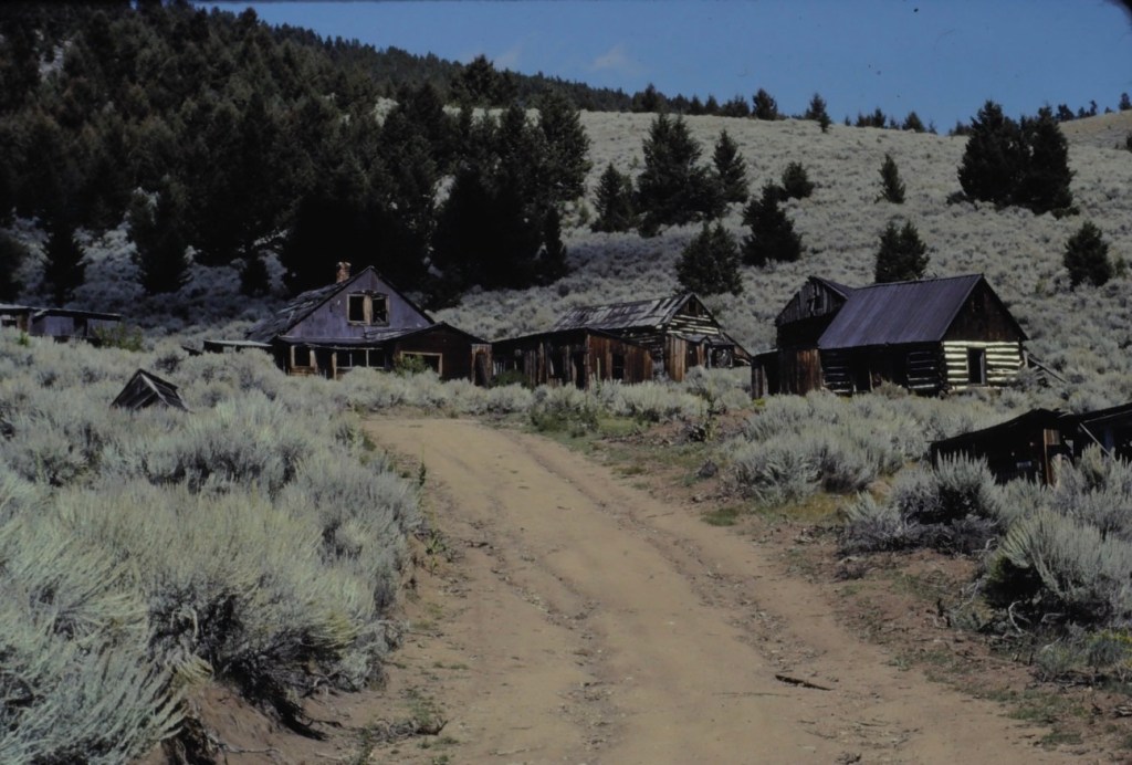
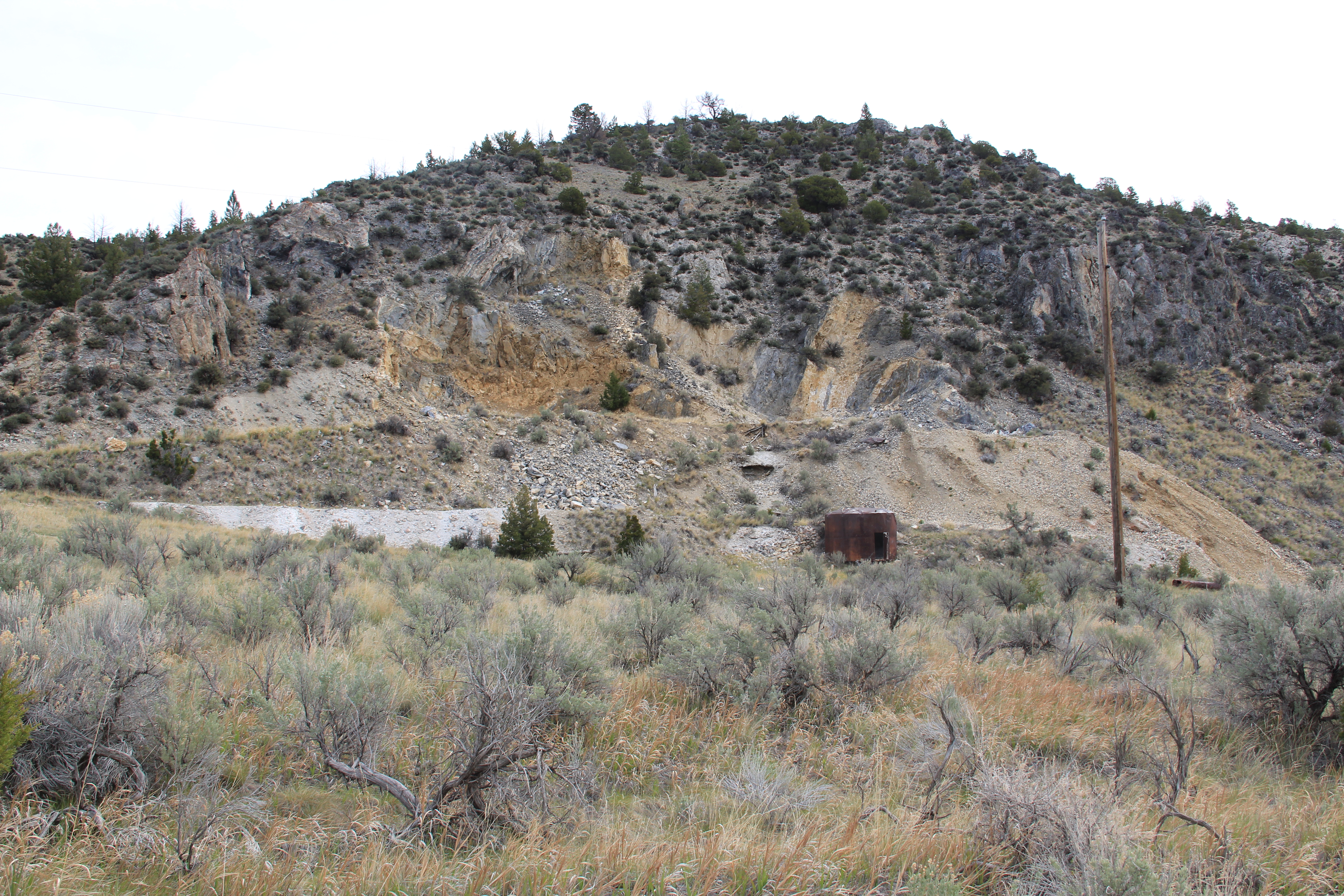 At Farlin, the scars of mining are everywhere, surrounded by sage grass, brush, and scattered trees, trying to recover in what was once a denuded landscape. Operations had ended by the time of the Great Depression. While never a huge place–population estimates top out at 500–Farlin is representative of the smaller mining operations that reshaped the rural western Montana landscape. Not every place became a Butte, or a Virginia City. Properties like Farlin help to tell us of the often lonely and exceedingly difficult search for opportunity in the Treasure State over 100 years ago.


