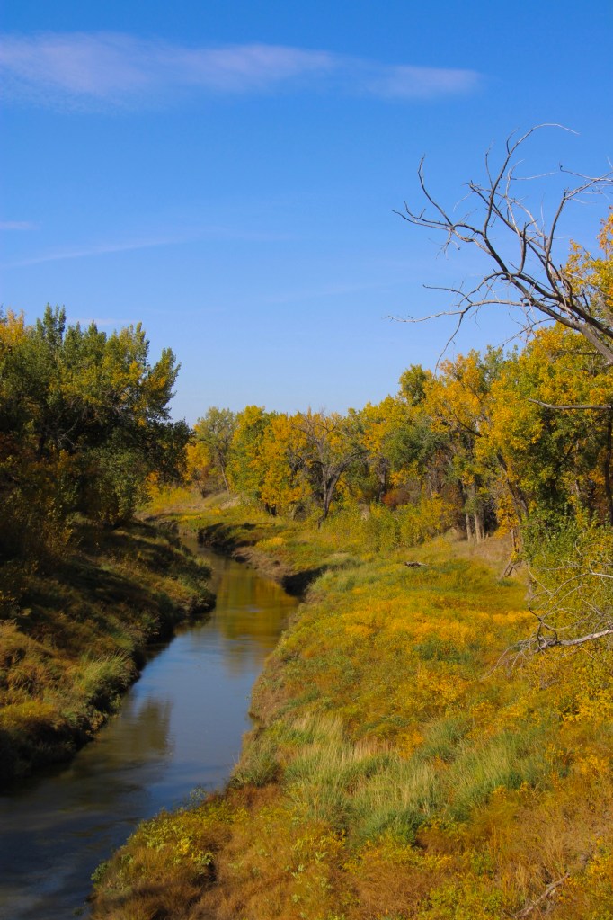
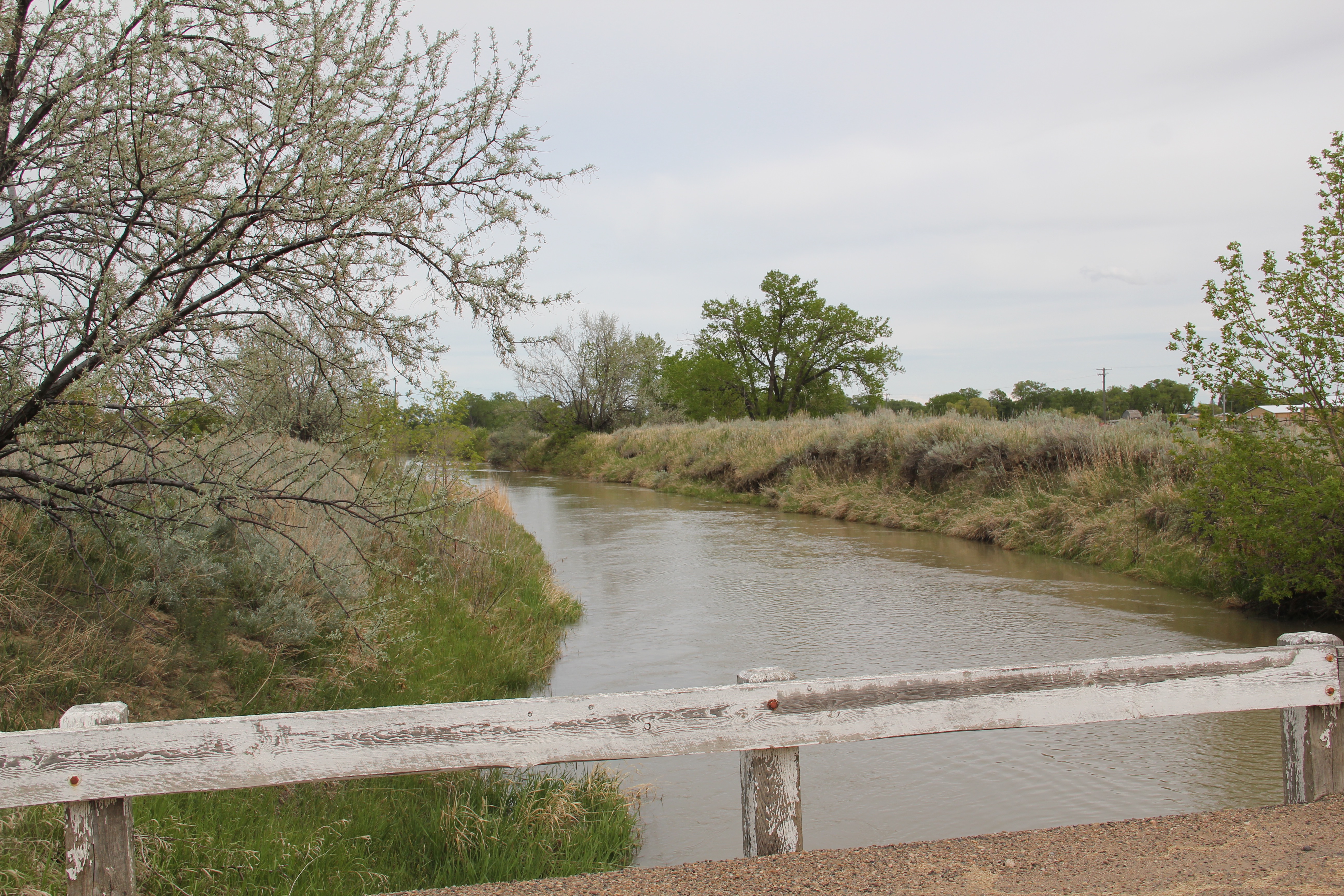
Montana Highway 246 is one of those “side” roads that few travel, unfortunately, because if you go that way from the west toward Glasgow it will take longer than US Highway 2. But the time is well worthwhile because once you cross the Milk River (by way of a modern concrete bridge) you step back to the turn of the 20th century.
Milk River crossing on Montana 246
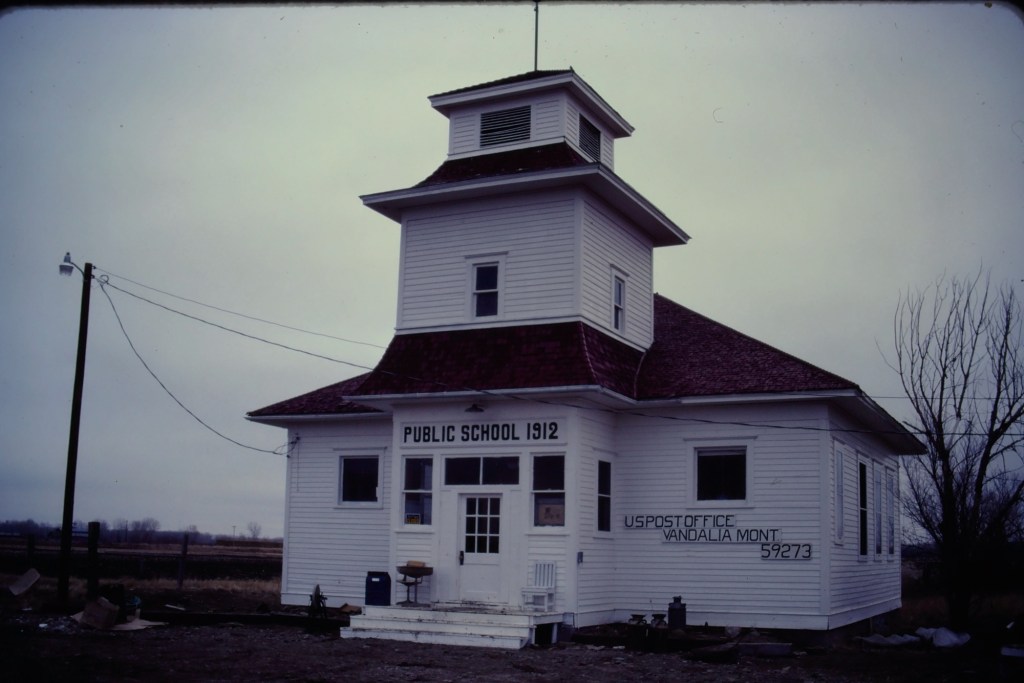
Vandalia has history as a late 19th century trading post at the crossing of the Milk River. Then it became one of the early milk River ranches. Once the Great Northern Railroad built its initial route westward the tracks came this way, following the river.
Vandalia school and post office in 1984
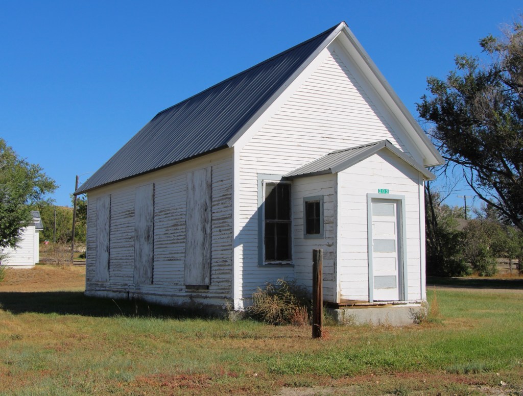
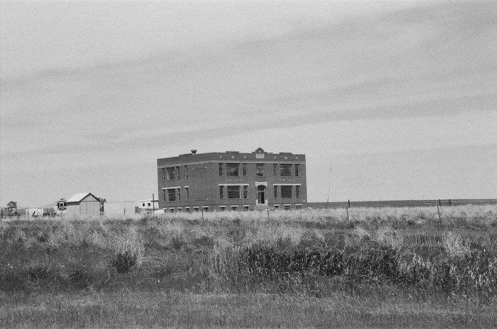
The tracks brought the first generation of homesteaders who built the white-painted frame school in 1912. The school later became the post office, and served that role when I first visited Vandalia in 1984.
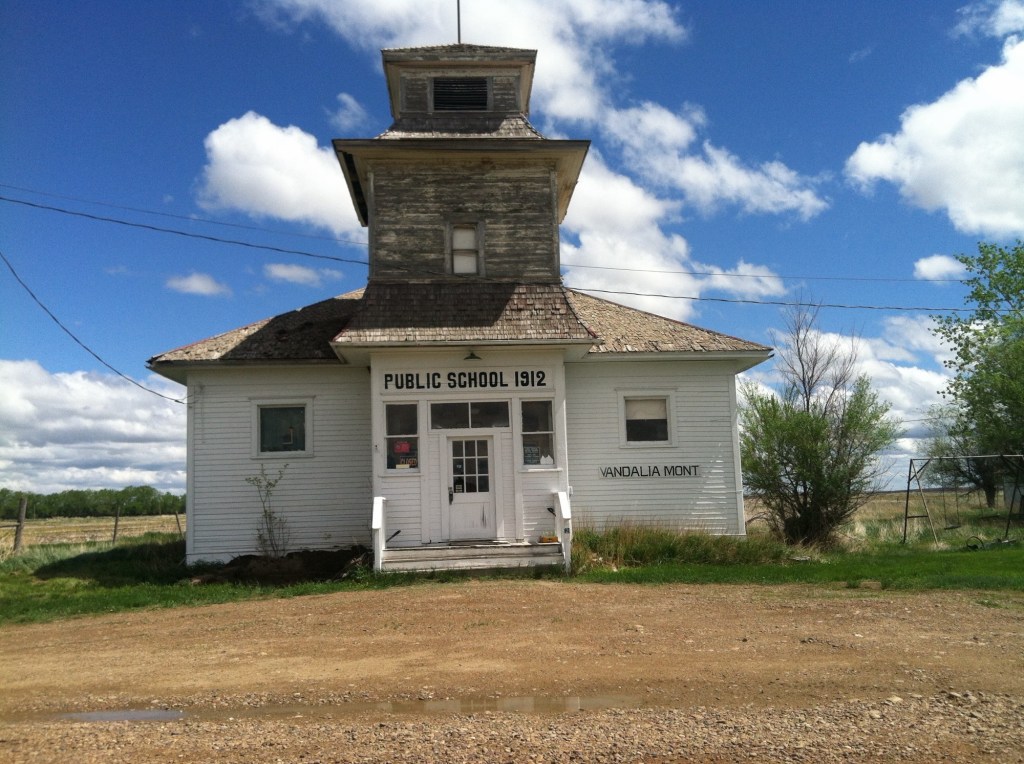
Vandalia school in 2013
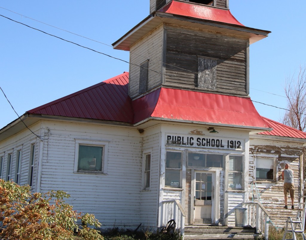
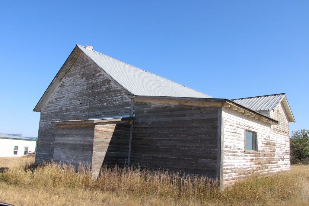
When I next visited almost 30 years later, the post office had closed and the school was in rough condition. Imagine my delight when I next stopped in the fall of 2025. The school was taking on new life. The roof had been prepared and replaced, and prep work was underway to give it a fresh coat of paint.
Vandalia school in 2025Vandalia in 2025
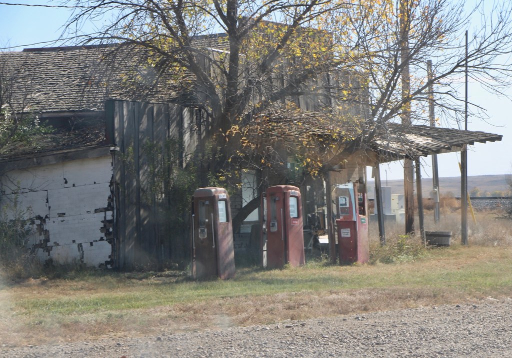
The story was not so bright for the old bar and store that was next door. The old gas pumps were still there but the porch roof was sagging and it looked forlorn.
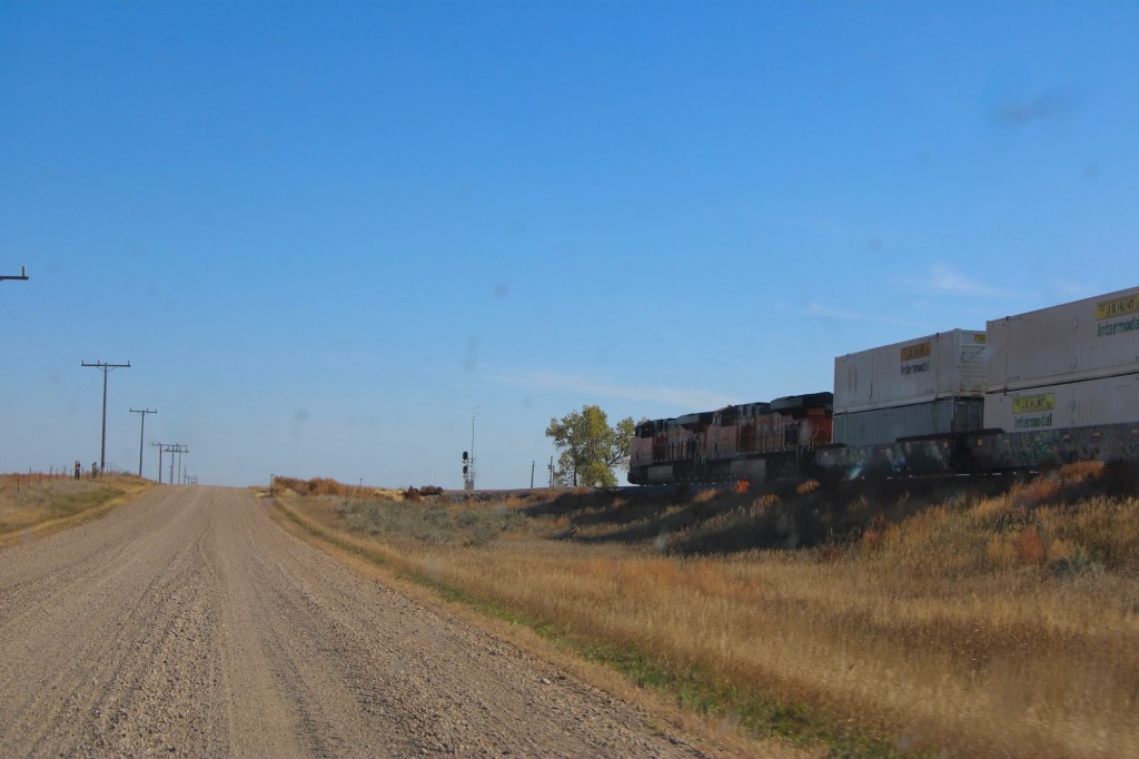
Vandalia store in 2025Original route US Highway 2 heading east toward Tampico
The drive remains fun, especially the graveled original route of US Highway 2 with the occasional Burlington Santa Fe freight train roaring by. Imagine driving cross country on this route when large sections of it remained unpaved.
Tampico in 2013
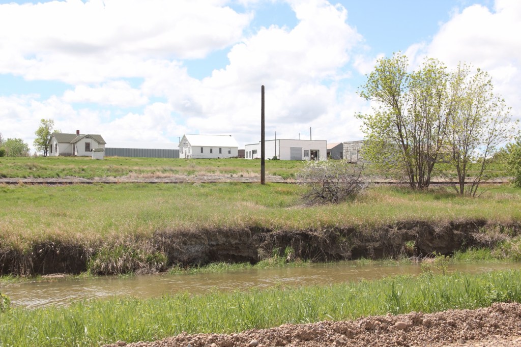
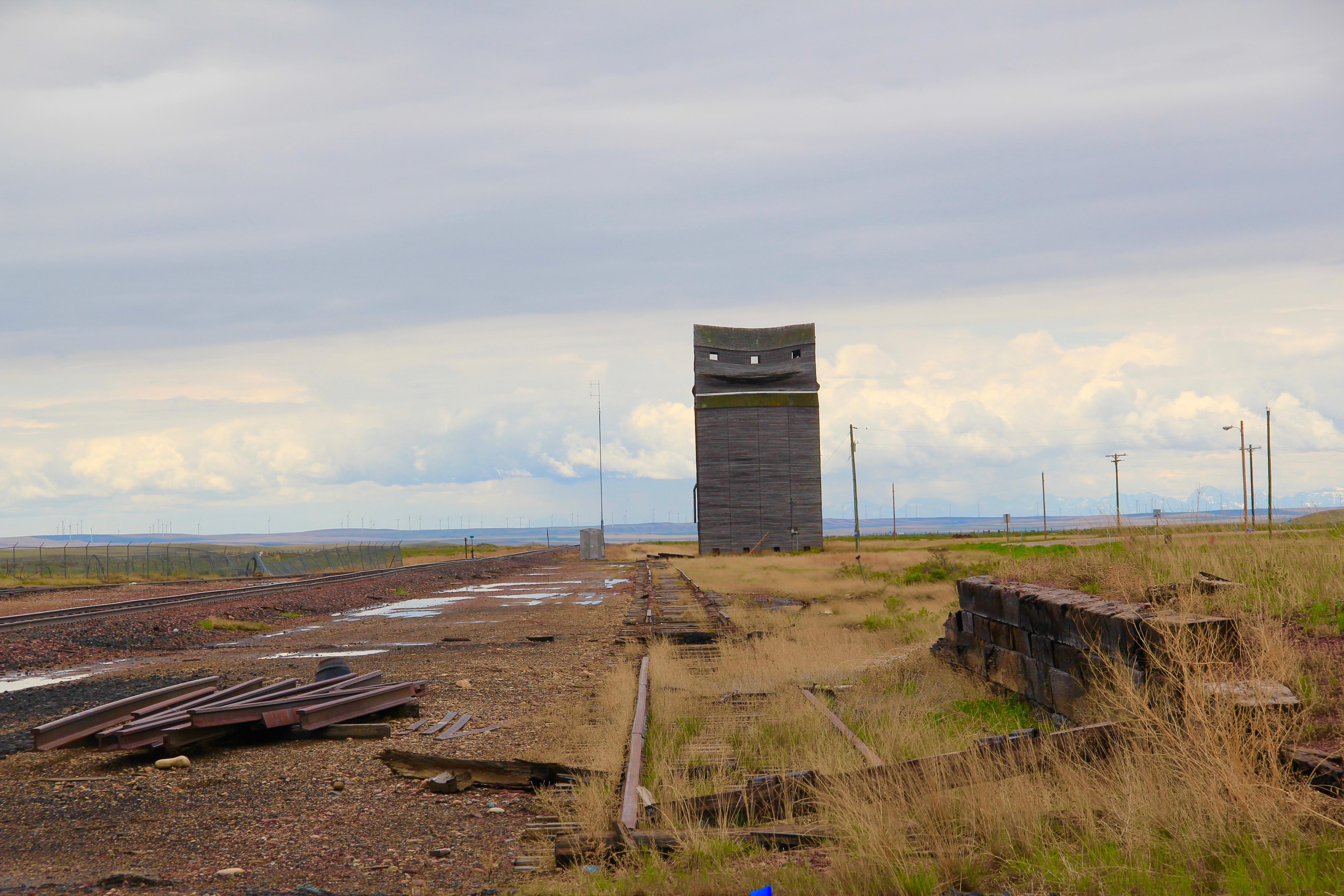
The next town to the east is Tampico, established around 1908. In 2013 the town was tiny but showed some life. Twelve years later, the abandonment was striking.
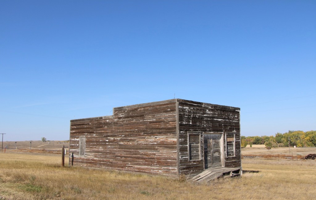
Tampico in 2025Tampico in 2025Leaning into oblivion, Tampico 2025
Most early 20th century railroad towns across the northern plains struggle one hundred years later but those off the major highways, like Vandalia and Tampico, could easily disappear.
It had been over a decade since I last stopped in late September 2025 at the tiny railroad town of Nashua in Valley County. Recently in the state and regional press, there have been stories about the uptick in tourism in northern Montana. It’s about time, especially for intrepid heritage tourists. As my posts from over ten years ago emphasized, an amazing array of stories and places await those who venture beyond Havre on U.S. Highway 2.
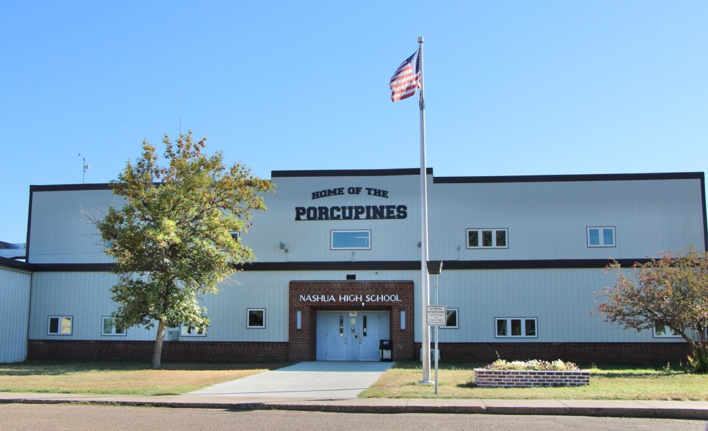
Even tiny Nashua (probably less than 300 residents today) reflects virtues worth exploring—community pride especially as reflected at the recently renovated Nashua High School, above. Since the town had lost population since my last visit, I had wondered if the school was still there as an anchor. Indeed it was, and looked almost modern as its 1935 core from the New Deal had been layered over with a new facade.
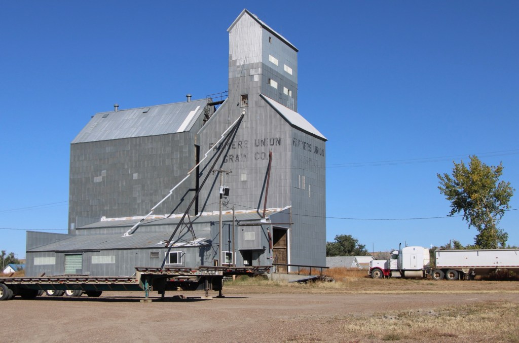
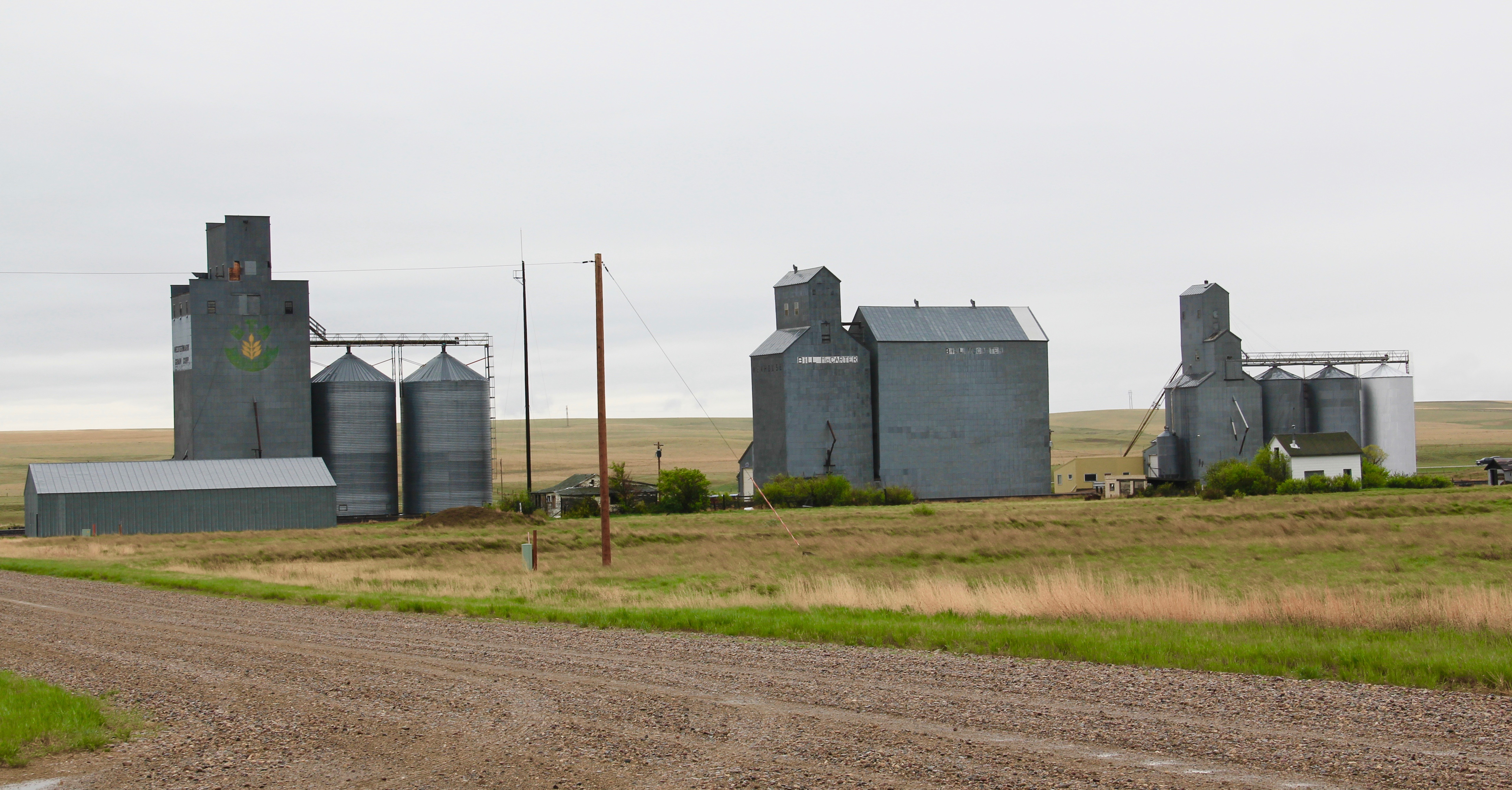
The railroad was the dominant influence in the town’s history—save for the 1930s boom during the construction of nearby Fort Peck Dam—and the town’s rail corridor is still defined by its grain elevators.
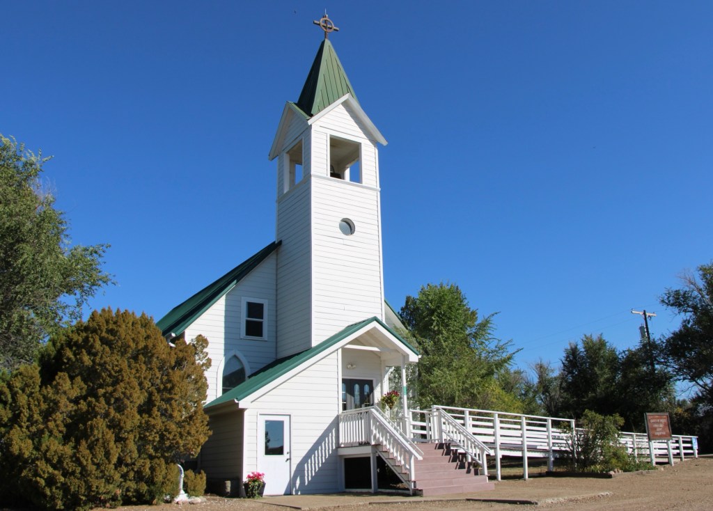
Queen of Angels Catholic Church
Competing for the Big Sky line of Nashua is the tall Gothic style bell tower of the Catholic Church. Established in 1917, Queen of Angeles Catholic Church began as a mission church. The Sisters of Charity worked with the diocese to establish an adjacent one-room school, below, as a way of growing and maintaining the congregation after the end of the Fort Peck Dam boom.
Then in 1953 Rev A. J. Schuh wrote an appeal to The Catholic Worker, a major newspaper, asking for the support for the construction of a rectory so that a more permanent foundation for the church’s work in Nashua could be laid. I had no idea if the appeal worked or not—but something happened. Queen of Angels Catholic Church was in great condition, and a major town landmark.
Front Street, Nashua
Along the old highway route was another landmark, of a quite different purpose: Vic’s Bar and Bowling Alley. Here is the private social center for the town. Great rural Montana towns always have at least one traditional watering hole. Vic’s is that place in Nashua.
Victor Dostert (1886-1961) homesteaded south of the town along the Milk River during the boom of the 1910s but when the bust came in the 1920s Dostert, his wife Anna, and their three sons stayed, making their mark with construction projects (from a theater to the Catholic Church) and taking advantage of the thousands of construction workers passing through by building and operating Vick’s Bar in 1935. He added the bowling alley in the 1950s—a decade when the bowling craze as a community institution reached its peak across the nation.
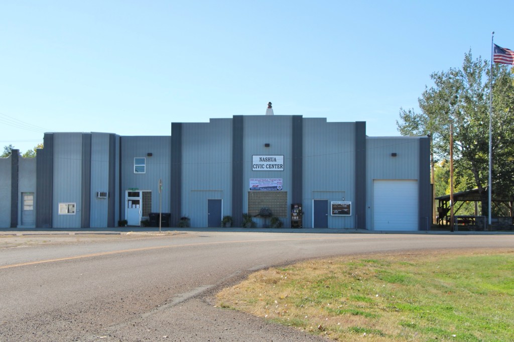
Dostert as Nashua’s town official had already been instrumental a few years earlier in the creation of the Nashua Civic Center, the public community center for this part of Valley County still today.
These places and brief stories hint at the richness of heritage experiences in Valley County. I’m glad I stopped at Nashua again (just too bad that it was early in the morning and Vic’s Bar was not yet opened). But give the residents much credit—they hung through another tough decade through commitment, community spirit, determination and faith.
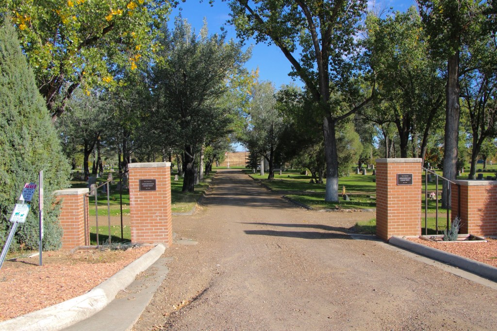
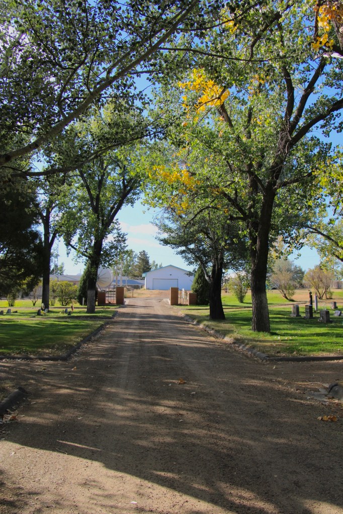
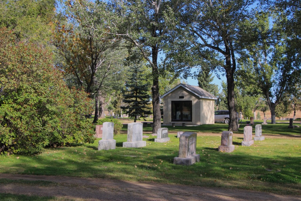
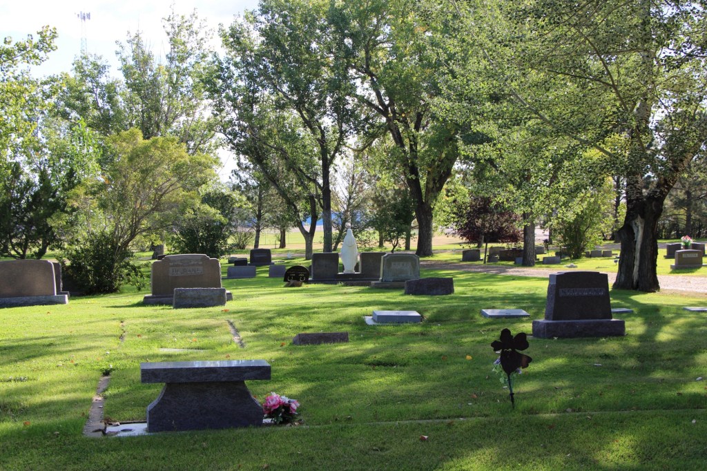
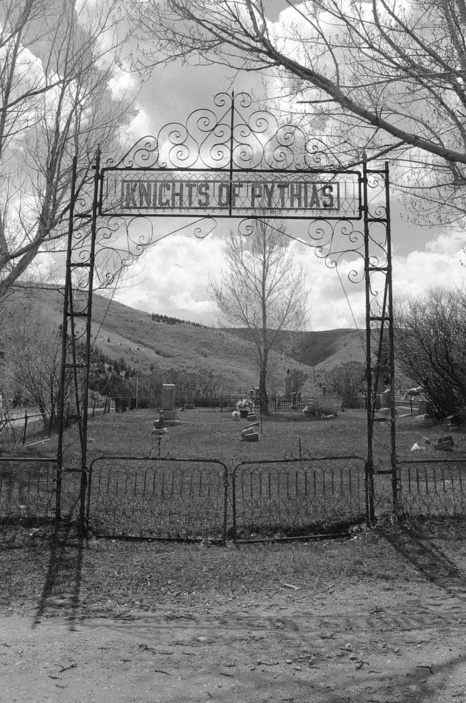
Municipal cemeteries are key public spaces in the Hi-Line towns of Montana. As they mostly date from the 1890s to 1910s, the cemeteries are part of the region’s progressive-era history. New settlers sought to replicate their prior homes—building permanent schools, new churches, town blocks, and homes while also establishing cemeteries.
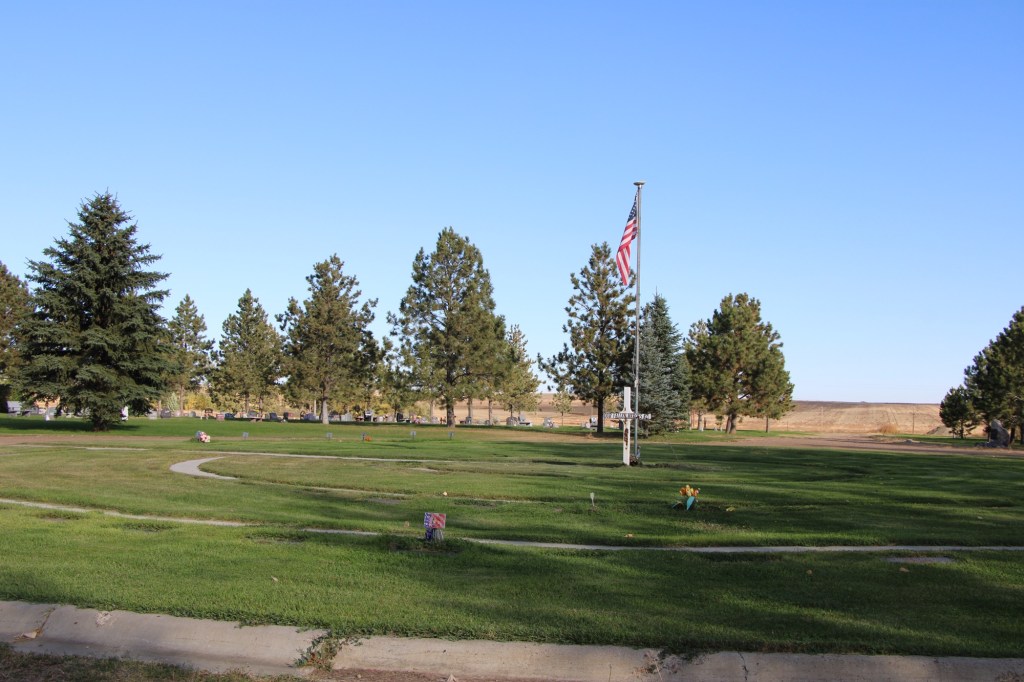
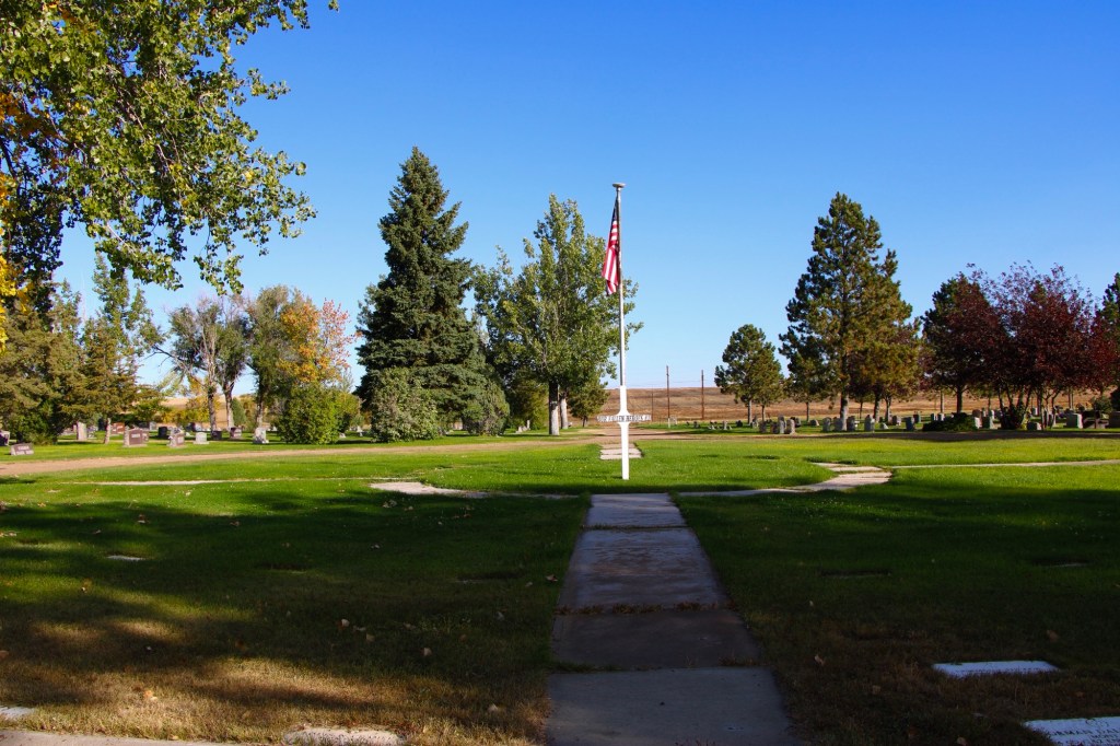
In 1915 settlers formally incorporated Wolf Point as a municipality. A year later, mortician L.M. Clayton opened a funeral business, which would operate until 2005. On a hill several blocks north of the town’s railroad tracks, Clayton established Greenwood Cemetery by 1917. The name came from his wife, Nora May Greenwood. The Greenwood Cemetery Association was organized to administer the property, and its beautification was ensured by the town’s Woman’s Club when it worked with Wolf Point leaders and the cemetery association to extend water to the place. It became a green oasis of rest and tranquility within the often brown, water starved landscape. It remains an impressive landmark of civic pride today.
There are two ceremonial areas that immediately capture your attention. Two veterans circles have been installed to honor the many from Roosevelt County who have served the nation from World War I forward.
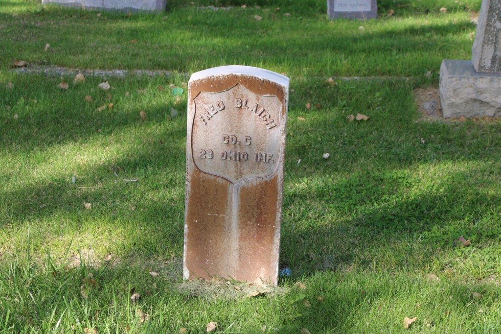
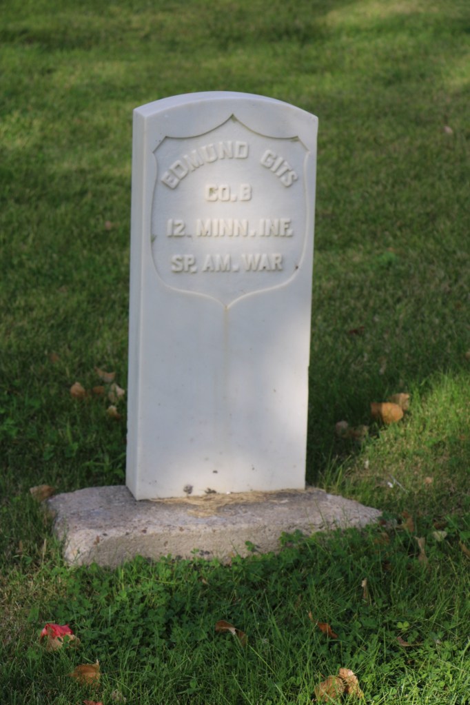
Scattered through the cemetery are other veteran burials, including ones from the Civil War and the Spanish-American War.
Civil War veteranSpanish-American war veteran
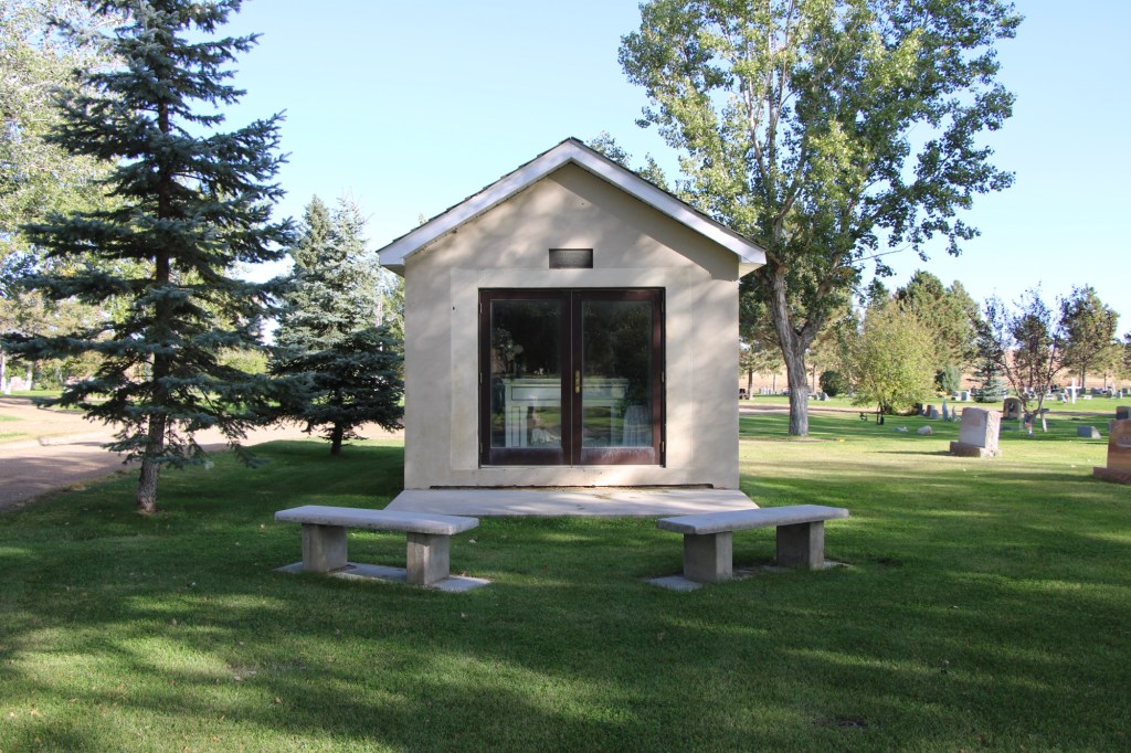
The second ceremonial area is more subtle in appearance but unique in its own way.
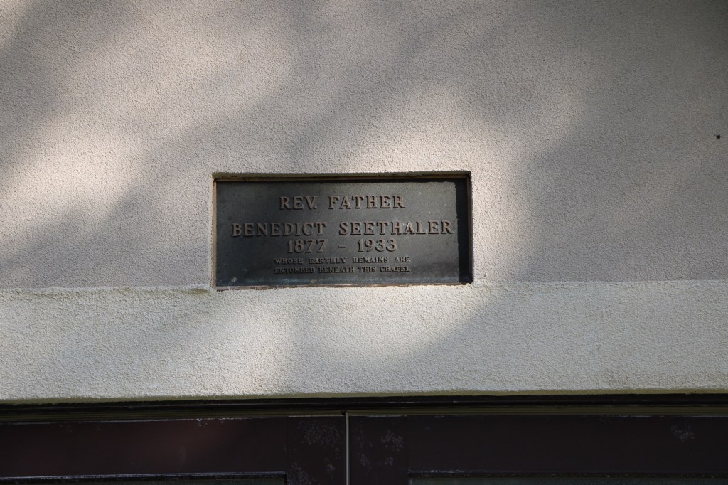
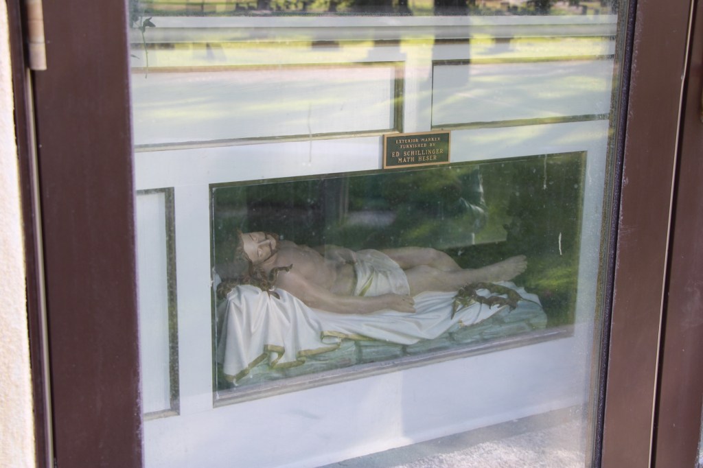
Seehaler Chapel
Father Benedict Seehaler established and led Wolf Point’s Immaculate Conception Catholic Church from 1917 to 1931. After his death, parishioners built a tiny memorial chapel in his memory. It was built over his grave.
The chapel has an altar and a carved depiction of Christ. The church on Memorial Day holds a memorial mass is held (weather permitting) at the Father Benedict Seehaler Memorial Chapel in Greenwood Cemetery.
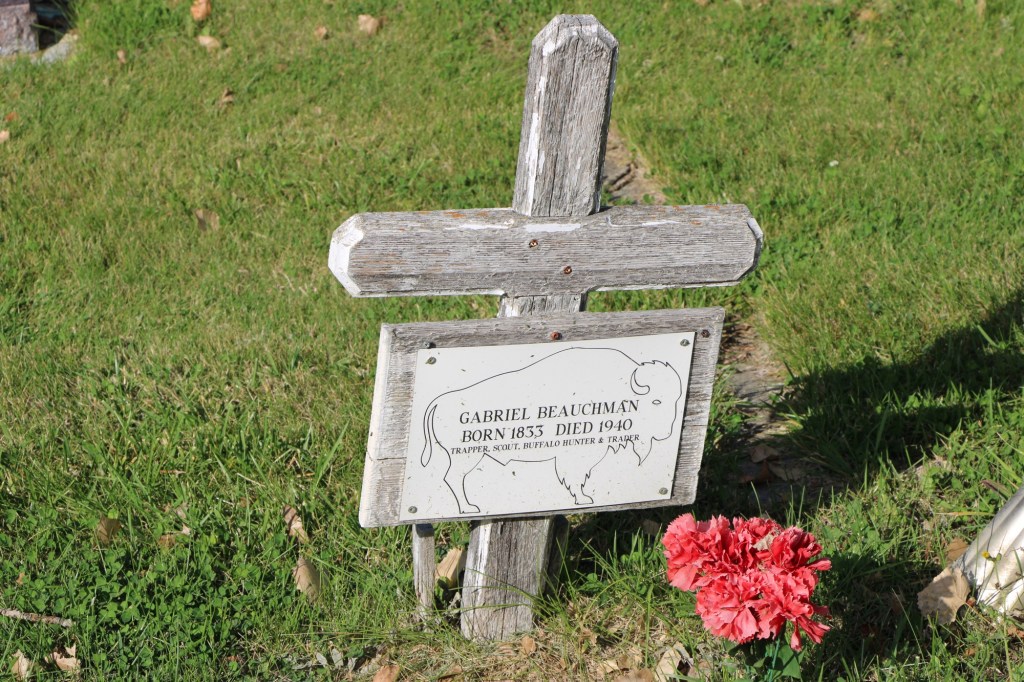
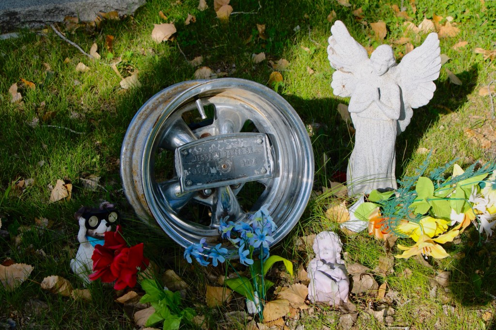
There are many impressive grave markers at the cemetery, whether they are unadorned crosses of early settlers to ones that through the materials used help to tell a story.
Gabriel Beauchman (d. 1940)Jesse W. Baker, Sr (d. 1994)
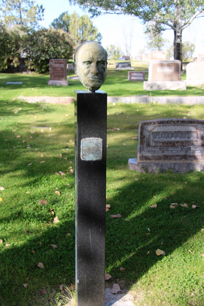
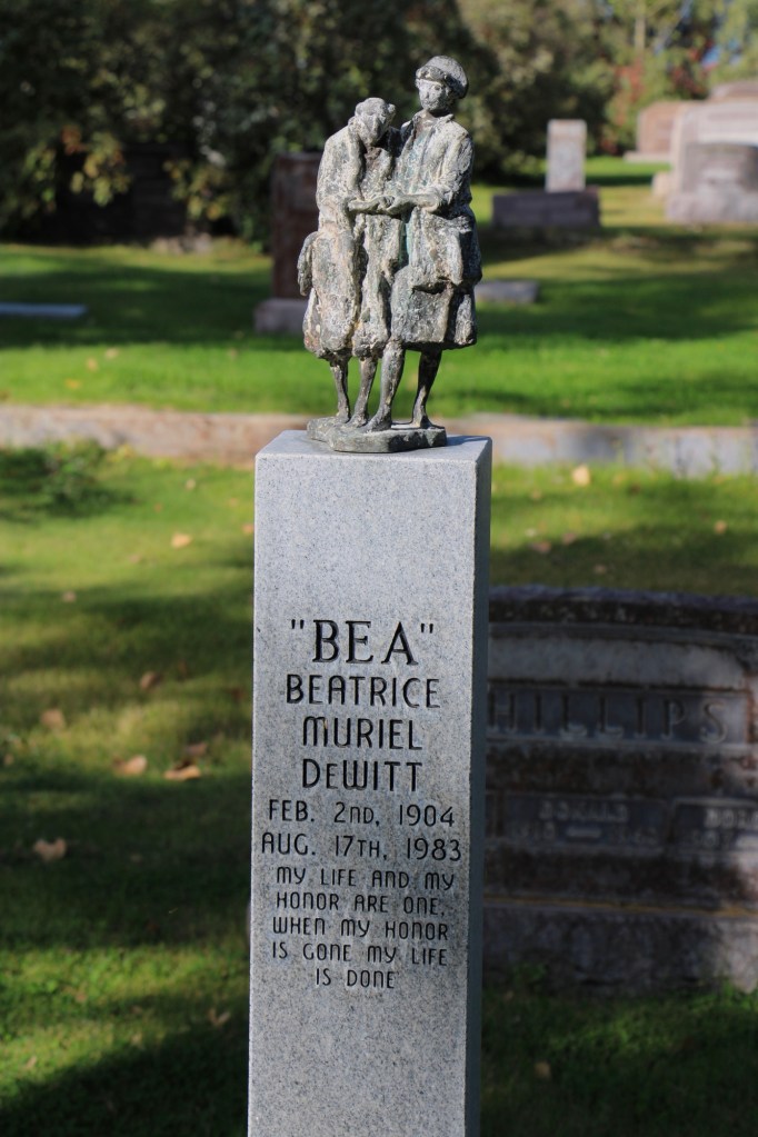
Two of the most unique, however, are pedestal sculptures in memory of a husband and wife, Floyd and Bea Dewitt. Floyd passed away in 1980, Bea followed three years later. Floyd’s sculpture is a likeness while Bea’s pedestal sculpture is more symbolic, with the interpretation left to the visitor, until you learn she was a beloved nurse.
Historian Patty Dean found the DeWitt’s obituaries published in the Billings Gazette, see below, and graciously shared them:
There are many more observations you can make about Greenwood Cemetery but this is enough for the posting (I reserve the right to revisit this place in the future. It is simply one of the most significant municipal cemeteries of northern Montana.
In doing the photography for the 1984-85 survey for the State Historic Preservation Office, everything was in Black and White, both for the stability of black and white negatives but also for the cost—color slides were expensive. Thirty plus years later, it’s totally different. Everything is digital and only a few places will even process black and white film.
But I have continued to take a few rolls of black and white film on my recent work in Montana. Here are a few images to share.
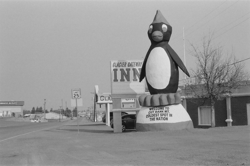
The older US 2 route into Cut Bank features this wonderful piece of roadside sculpture. And back in 1984 the Glacier Gateway Inn was the place to stay.Frank Little Grave in Butte. The starkness and shadows of black and white film is perfect for cemetery work, as this famous grave at Mountain View Cemetery shows.The same is true for Anaconda’s historic cemetery. As I have said in earlier posts, this place is one of the state’s most compelling places. I can explore there all day long. Love the decorative iron work on the gate and entrance to the Knights section at AnacondaGhost towns from either the mining or homestead eras always leave buildings that just seem to say more in black and white. Here we are at Barber on US Highway 12 in central Montana.Abandoned schools that become lonely landmarks of hopes crushed: Buffalo, Montana
In 2024 I began to see media accounts, both regionally and nationally, of how Glasgow, the seat of Valley County, was the most isolated place you can imagine, truly in the Middle of nowhere.
Historic Great Northern Railroad corridor in Glasgow
I’m not one to argue with geographers and economists. I’m sure from their perspective, they got it right. But I never thought of Glasgow as isolated: it is on the Great Northern mainline, and part of the famed Empire Builder Amtrak route, and on U.S. Highway 2.
Great Northern depot, Glasgow
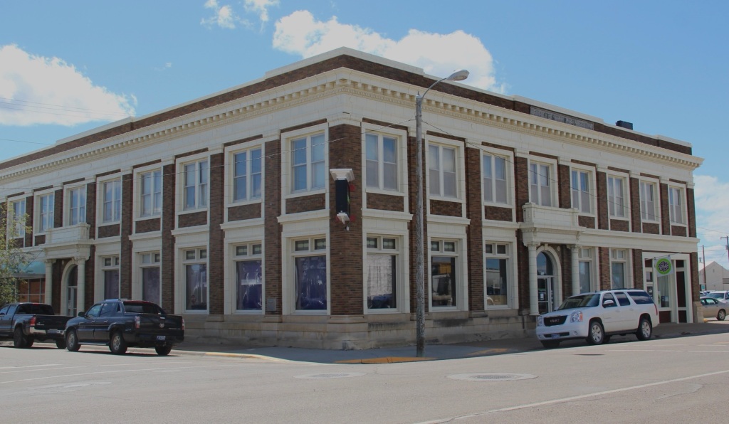
Then the town has always shown a great deal of pride and ambition, conveyed so effectively by its many historic buildings, starting with the First National Bank, built c. 1884 and listed in the National Register of Historic Places.
1st National Bank building, Glasgow
When you enter the town from the underpass of the railroad, the bank is the first landmark to catch your eye, appropriate too for the impact of local banks on a town’s economic prospects during the homesteading boom and bust of the 1910s and 1920s, respectively.
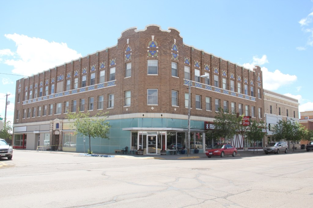
Rundle Hotel, during renovation in 2013
Another landmark from the homesteading era is the Rundle Building, once the Glasgow Hotel and restored in the last ten years as an upscale hotel in the heart of downtown. Built c. 1916 and designed by the important Billings firm of Link and Haire, the Rundle is a captivating statement of an Arts and Crafts-infused Mediterranean Revival style. I have been trying to get back to Glasgow to stay here for the last four years—maybe I will make it in 2025.
The 1930s transformed Valley County through the construction of the mammoth Fort Peck Dam on the Missouri River. Glasgow too has a major New Deal landmark in its U.S. post office and courthouse, built c. 1939 and designed by federal architect Louis A. Simon.
Post office/federal courthouse, Glasgow
Its understated New Deal Deco exterior obscures a jewel of an interior, highlighted by its New Deal-funded 1942 mural depicting local history and the changes brought about by the Fort Peck Dam by artist Forest Hill. This building too is listed in the National Register.
Glasgow post office mural
Another important New Deal supported building was all about the community, and providing new opportunities: the Glasgow Civic Center. It too has a New Deal Deco style, and its large public space has been used for almost every type of event or gathering you can imagine.
Glasgow Civic Center
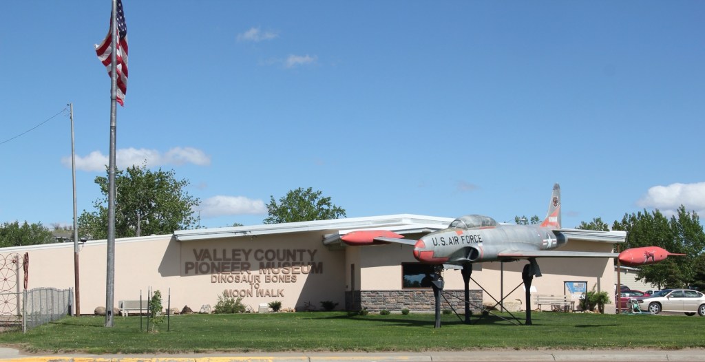
Glasgow’s sense of itself today still respects it past, brilliantly conveyed by its large and expansive museum. When I first visited Glasgow 40 years
Valley County Museum
ago, I held a public meeting on the state historic preservation plan here, and the next morning residents gave me a detailed tour of the recently established museum. I was impressed with its collection then, now it sprawls through the building to the adjoining grounds.
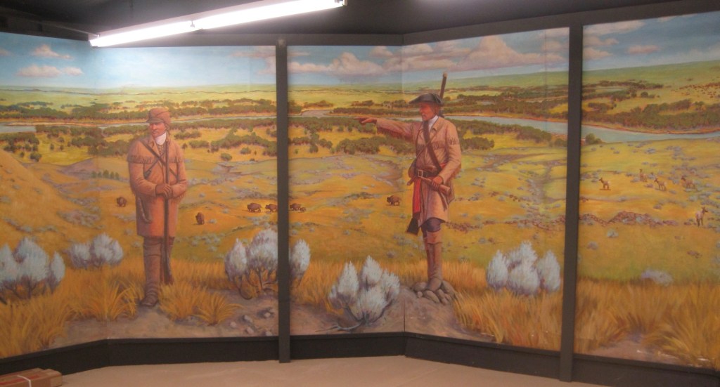
Veterans section of the museumThe high school band sectionLewis and Clark mural, 2095, by Jessie Henderson, a Chippewa/Cree artistThe back bar at saloon exhibit
Indeed, the saloon exhibit underscores another fun part of Glasgow—across from the depot in the original route of Highway 2 is an amazing collection of bars, stores, and eateries, right out of the early 1900s.
Glasgow bars at depot
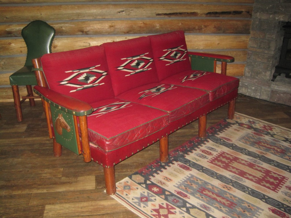
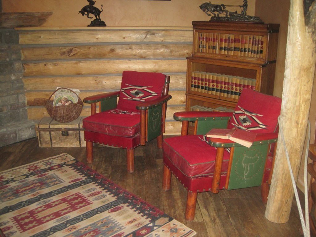
But back to the museum, and its important Montana decorative arts collection of the work of modern craftsman Thomas Molesworth, once in the town’s Carnegie library.
The newer exterior exhibits led the museum to move entire building to the property, including examples of the homestead shacks of the early 1900s that were followed by permanent homes such as this white painted bungalow.
Representative ranch house from homesteading boom
Pride of place, pride of the past. Glasgow might be in the middle but it is far from being nowhere as this small sampling of properties demonstrates.
Grain elevators not only record the industrialization of plains agriculture; they also show you places–where the railroad left a siding and some sort of town, mostly gone now, took root over 100 years ago. Kevin is in northern Toole County, maybe 20 minutes south of the Canadian border. This lone elevator documents its homesteading era, that with the bust of the 1920s gave way to a boom in oil production in the middle decades of the 20th century. several oil tanks still remain from that era.
Kevin, Toole County, Montana
Kevin is the outlier–the rural grain elevators of Toole County record places that were once large agricultural communities, and have not been in population decline for decades. But elevators, both from the early days and from more modern times, remain as the sentinels of Toole County.
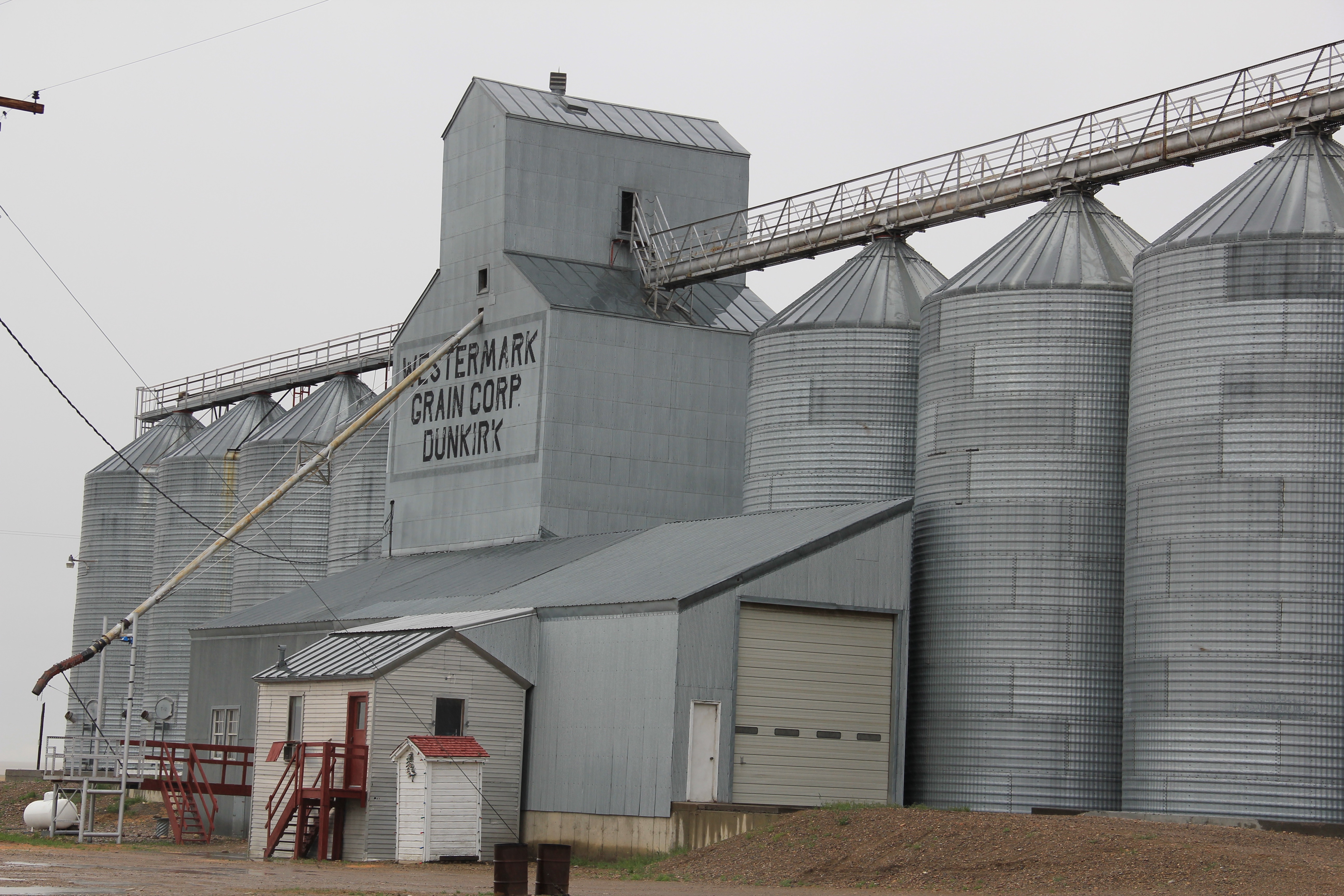
At Devon, Toole County, the elevators face U.S. Highway 2 and the tracks of the Great Northern Railway, now the Burlington Northern Santa Fe railroad. I wonder if you can see them from the Sweet Grass Hills. some 30 miles to the north.More recent metal grain silos surround the older grain elevator at Dunkirk, a land-locked place surrounded by grain fields for as far as the eyes can see. Galata, on the eastern end of Toole County, captures the fundamental nature of the Hi-Line landscape–bands of steel on raised roadbeds, dotted here and there by tall grain elevators and the spare building or two.
Milk River Irrigation Project Ditch at Dodson, Phillips County
In today’s New York Times (June 15, 2020), Montana Jim Robbins reported on the looming disaster facing Montana’s northern states if the St. Mary’s canal, which recently collapsed, is not repaired. The informative, insightful story focuses on the beginnings of the U.S. Bureau of Reclamation’s Milk River Irrigation Project, its pathway through southern Alberta, and its emergence in central Montana’s Hill County. It included several wonderful images of Havre, the seat of Hill County, and discussed the wide-ranging disaster faced by ranchers and small towns along the Hi-Line if the ditch did not get its long overdue repairs–to the tune of $200 million.
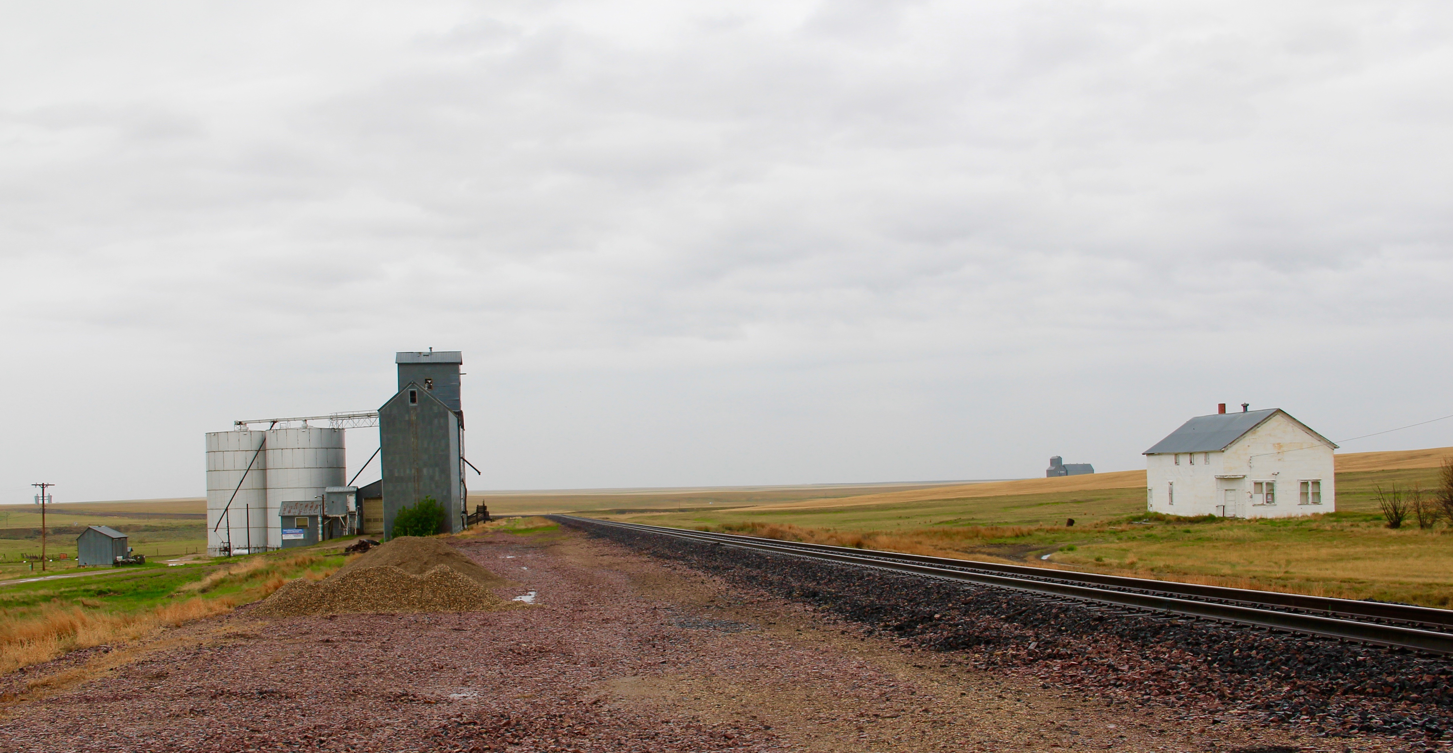
The Great Northern, the Milk River Project, and original U.S. 2 at Tampico
Robbins’ story immediately took my mind back to my travels throughout the Milk River Valley, from Hill County to Valley County, in 2013. The story of how modern transportation and engineering combined to transform the northern plains is so fundamental to the region’s history, yet it remains a story seldom told (another reason Robbins’ New York Times story matters). The image above represents the forces that led to the settlement and development of the Milk River Valley. Taken outside of the village of Tampico in Valley County, it centers the ditch between the two transportation systems–the Great Northern Railway on the left and the original route of U.S. Highway 2 on the right– that served the settlers drawn by the water. The image below shows the village of Tampico from the perspective of the ditch–the place would not exist without the ditch.
One of the very few historical markers in Montana that touches on the state’s irrigation history focuses about a historic bridge that once stood nearby at Tampico.
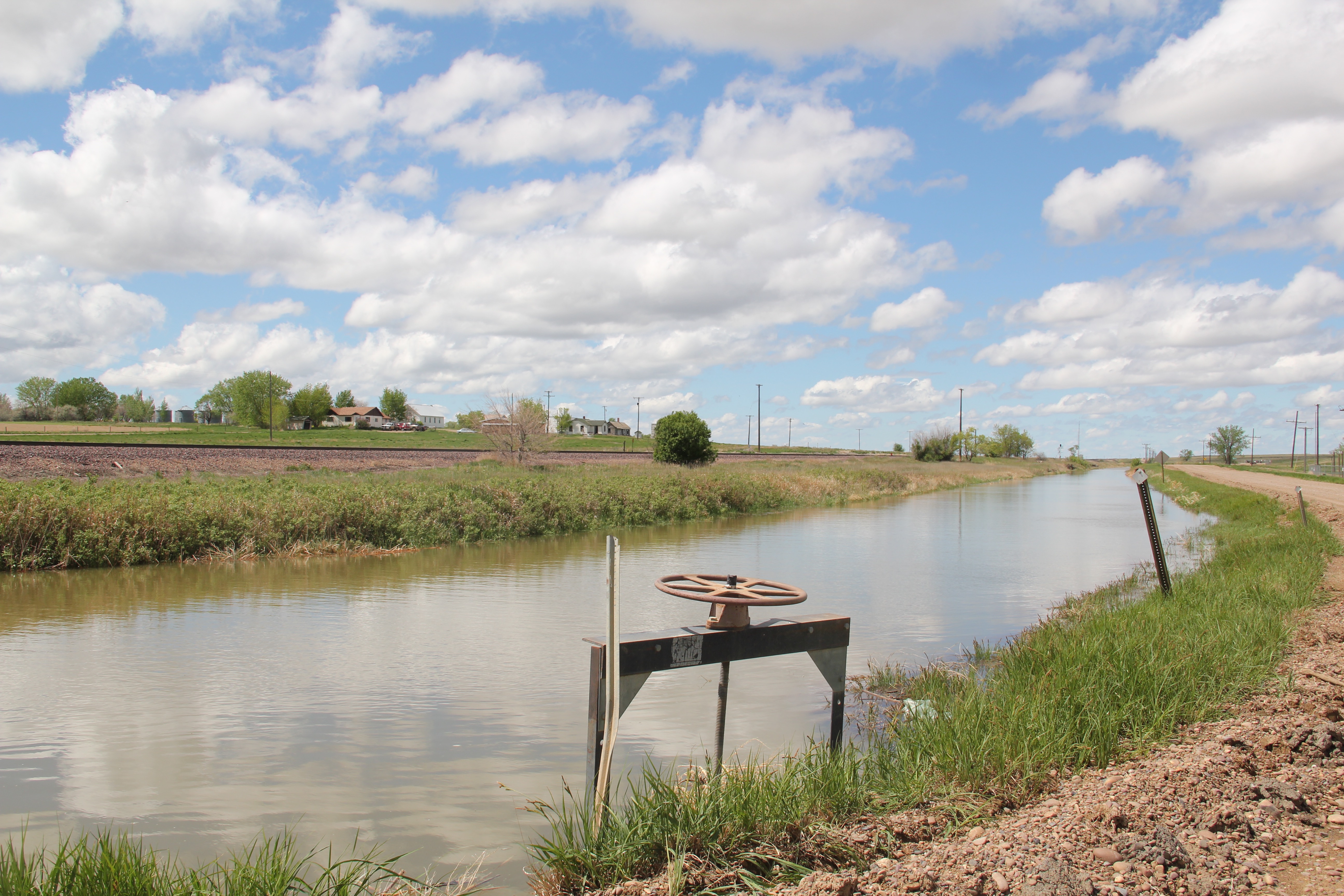
Large man-made lakes capture water to reserve it for use throughout the growing season. The images above are of Fresno Reservoir, on a rainy morning, in Hill County. While the two images below are of Nelson Reservoir, on a typically bright sunny day, many miles downstream in Phillips County.
The Milk River Project shapes so much of the Hi-Line, it has become just part of the scenery. I wonder how many travelers along U.S. Highway 2 in Phillips County even notice or consider the constant presence of the ditch along their route.
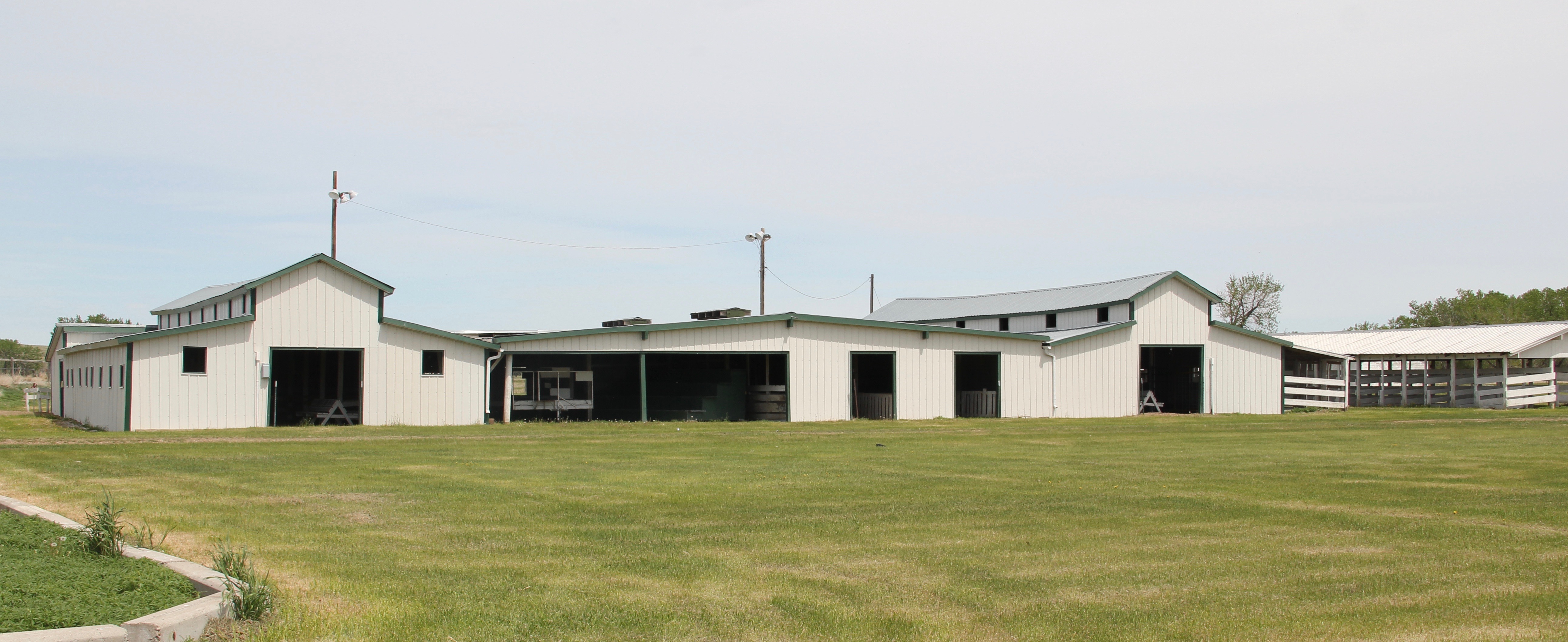
Not only are their scattered small towns along the Milk River Project, early agricultural institutions are often centered on the project. A great example is the Phillips County Fairgrounds, outside of Dodson, and the question may be well posed–why there? Dodson
is a tiny place, almost 20 miles from the county seat of Malta. But at the time of the Milk River Project, Dodson was vital; the ditch neatly divided the town into two halves, and a major diversion dam was just west of town. Here was a perfect place, at the turn of the century, for a fairgrounds. And it is a gorgeous historic fairgrounds.
My first encounter with the Milk River Project and the beautiful valley it serves came in February 1984 when Eleanor Clack took me on a tour of the bison kill historic site just west of downtown Havre. It remains an excellent place to see how the waters of the Milk have nurtured countless generations of peoples who called this place home.
Just last week I posted about two other Milk River Project towns–Lohman and Zurich–in Blaine County. My next post will continue this second look at the Milk River Project as I revisit Chinook, the Blaine County seat, where the ditch once again is almost everywhere, but rarely given a second thought.
Zurich, Montana, taken north of town looking south, 1984.
I have always enjoyed exploring Blaine County, Montana. In earlier posts I have discussed such famous places as the Fort Belknap Reservation, and Harlem, its north gateway town, as well as Hays near the south end of the reservation and Cleveland, one of my favorite places in the region. Chinook, the county seat, has been featured in a couple of posts, and I might add another one yet. then the Chief Joseph Battleground of the Bear’s Paw has gotten a considerable deal of attention, due to the national significance of the place, and the recent improvements to the battlefield from the National Park Service. Why so much on Blaine County places? Regular readers of this blog know of my interest in the irrigation systems of the U.S. Bureau of Reclamation in
the early twentieth century. The Milk River system was an important project, and the towns along U.S. Highway 2 and the Great Northern Railway mainline prospered, temporarily, because of the growth of the system. Plus the Milk River, in my opinion, doesn’t get the attention of many–and it is a spectacular river valley in many places.
Lehman, west of Chinook adjacent to both the Milk River and U.S. Highway 2, has almost totally disappeared as a place along the tracks. What is left of the town–this deteriorating commercial building in 2013–might even be gone today.
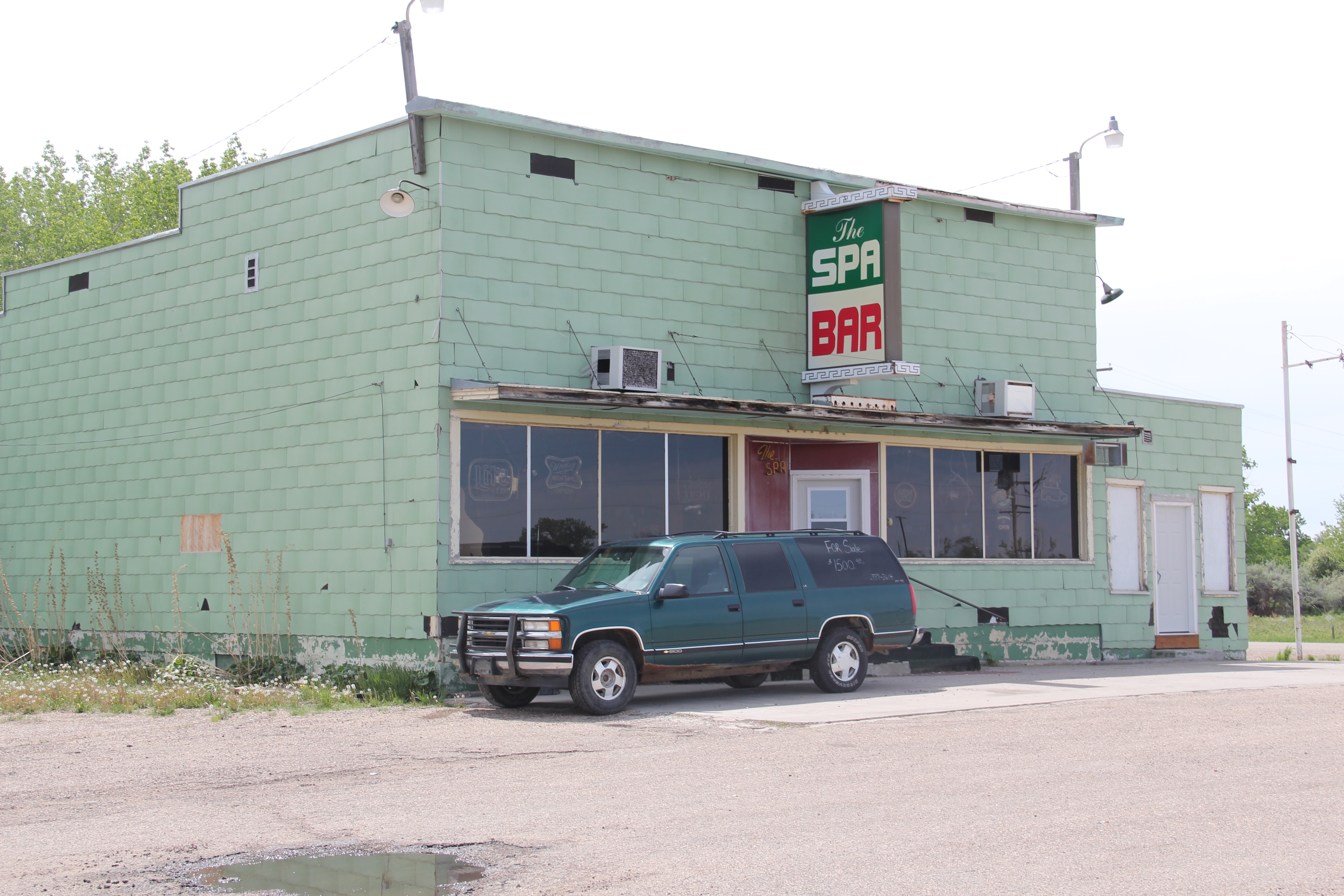
Zurich, west of Chinook and also abutting the river and the highway, has fared somewhat better. I have earlier commented on the existing street names–Park Avenue highlighted here–and the hopes for the future of the very names chosen at the turn of the century. Compared to my visit in 1984, the town has lost business and population over the last 30 years.
The Spa Bar still operated sporadically when I visited last in 2014. I wonder if it still opens its doors today. I love the name–a sly reference to Zurich, Switzerland, which is internationally known for its many spas.
What appears to be an old rural church–or was it a school, or both?–still stood, its gable front slowly coming apart.
But across the street was the modern Zurich Elementary School–an attractive touch of modern school design in such a small place. According to the public schools website,
Zurich had 23 students in 2020–while another internet source said the school was permanently closed. I hope that has not happened–if the school goes Zurich will be yet another Hi-Line ghost town quickly.
The Hi-Line is Montana’s major northern transportation corridor–first carved by the St. Paul, Minneapolis and Manitoba Railway in the 1880s and then extended by the Great Northern Railway a decade late. Today most travelers use U.S. Highway 2, which largely parallels the railroad, to traverse the Hi-Line. The first place you encounter of more than 500 people is Culbertson, established in the 1880s and named for Alexander Culbertson, who was once the factor (the manager) of the Fort Union fur trading post at the confluence of the Missouri and Yellowstone rivers.
The Great Northern depot at Culbertson
Earlier in this documentary blog on the Montana landscape, I discussed Culbertson as part of the landscape of oil and fracking then taking place in the region. Today I want to share images of community institutions that link the town’s more than 130 year history to the present. Historic churches are a good place to start.
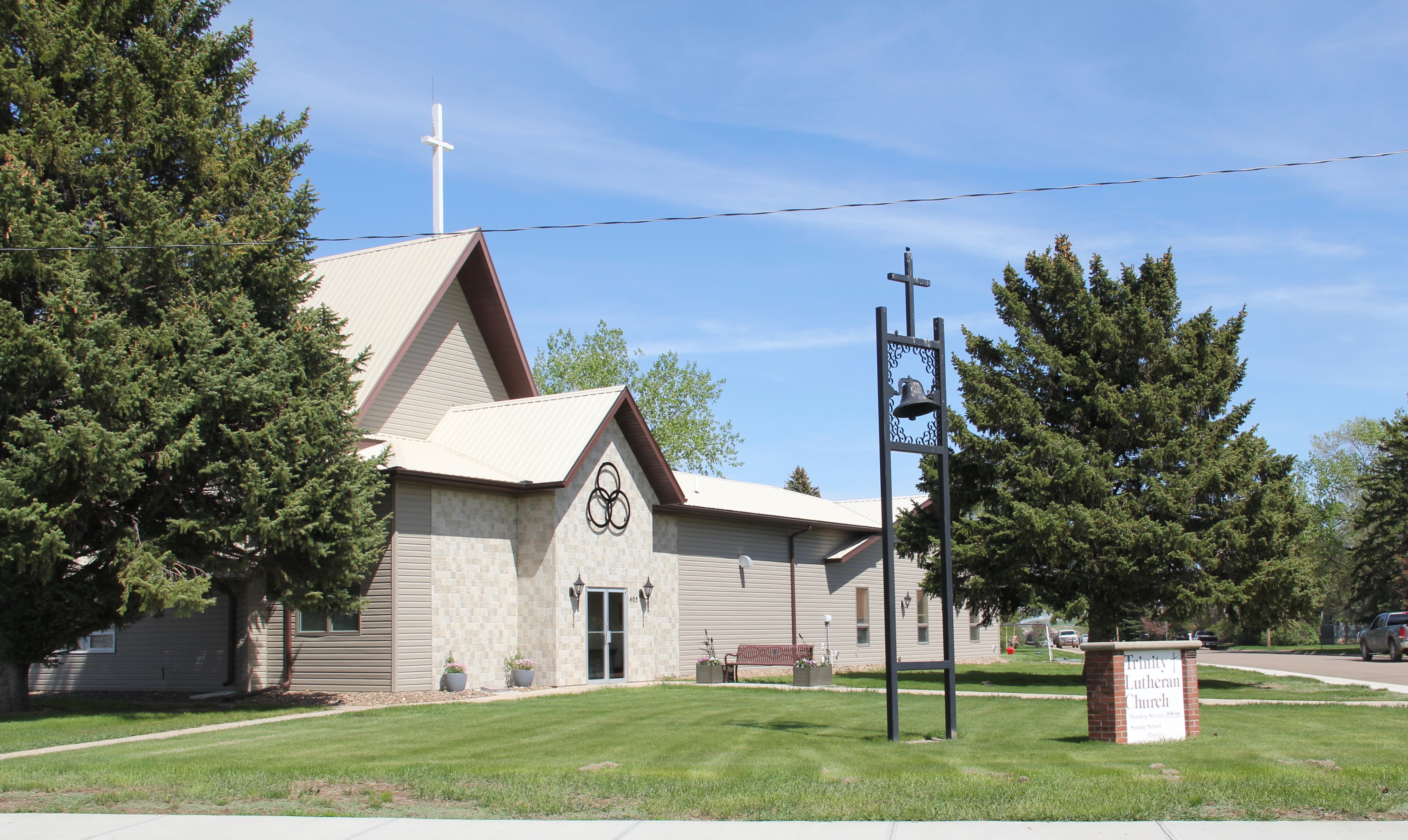
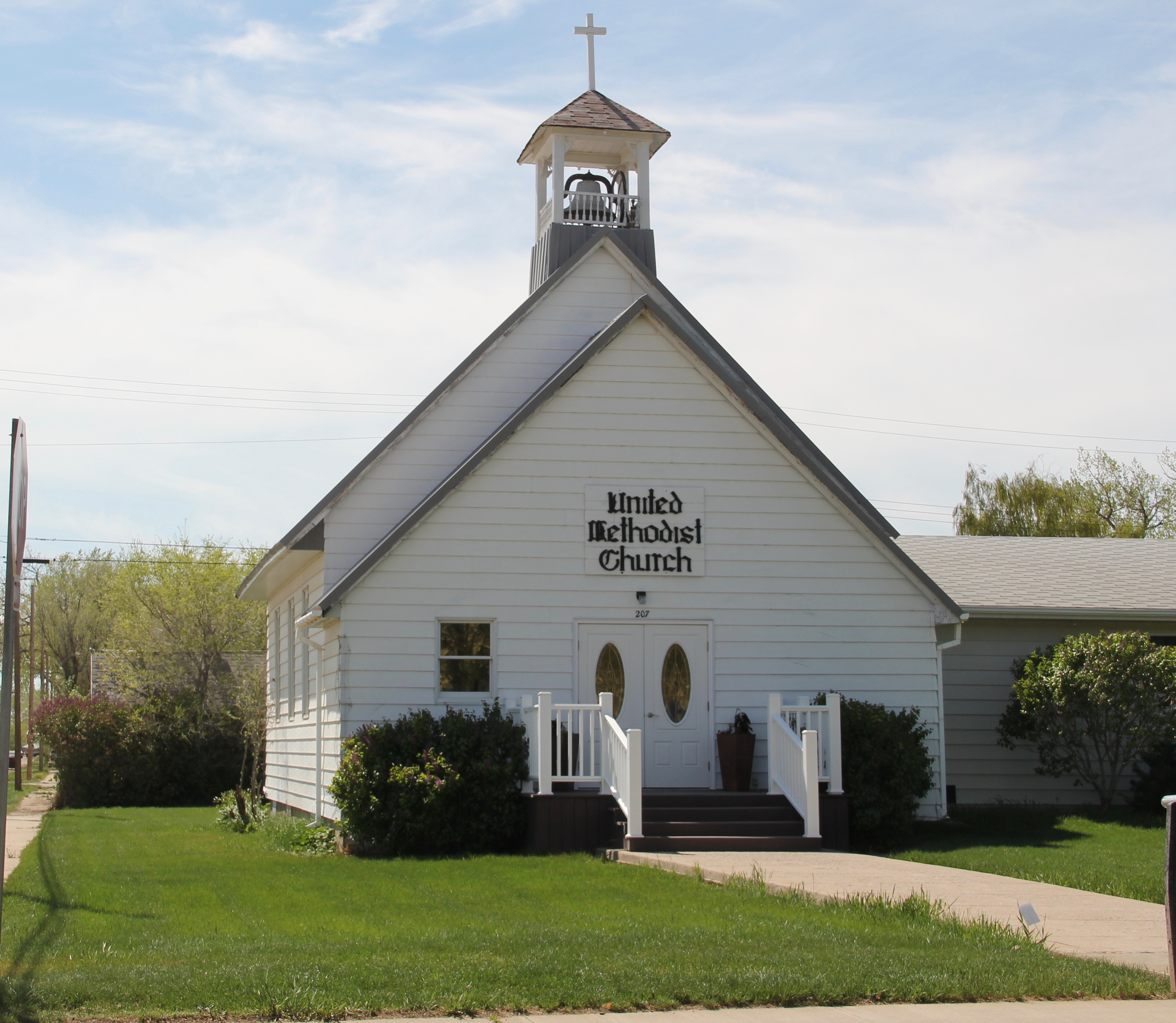
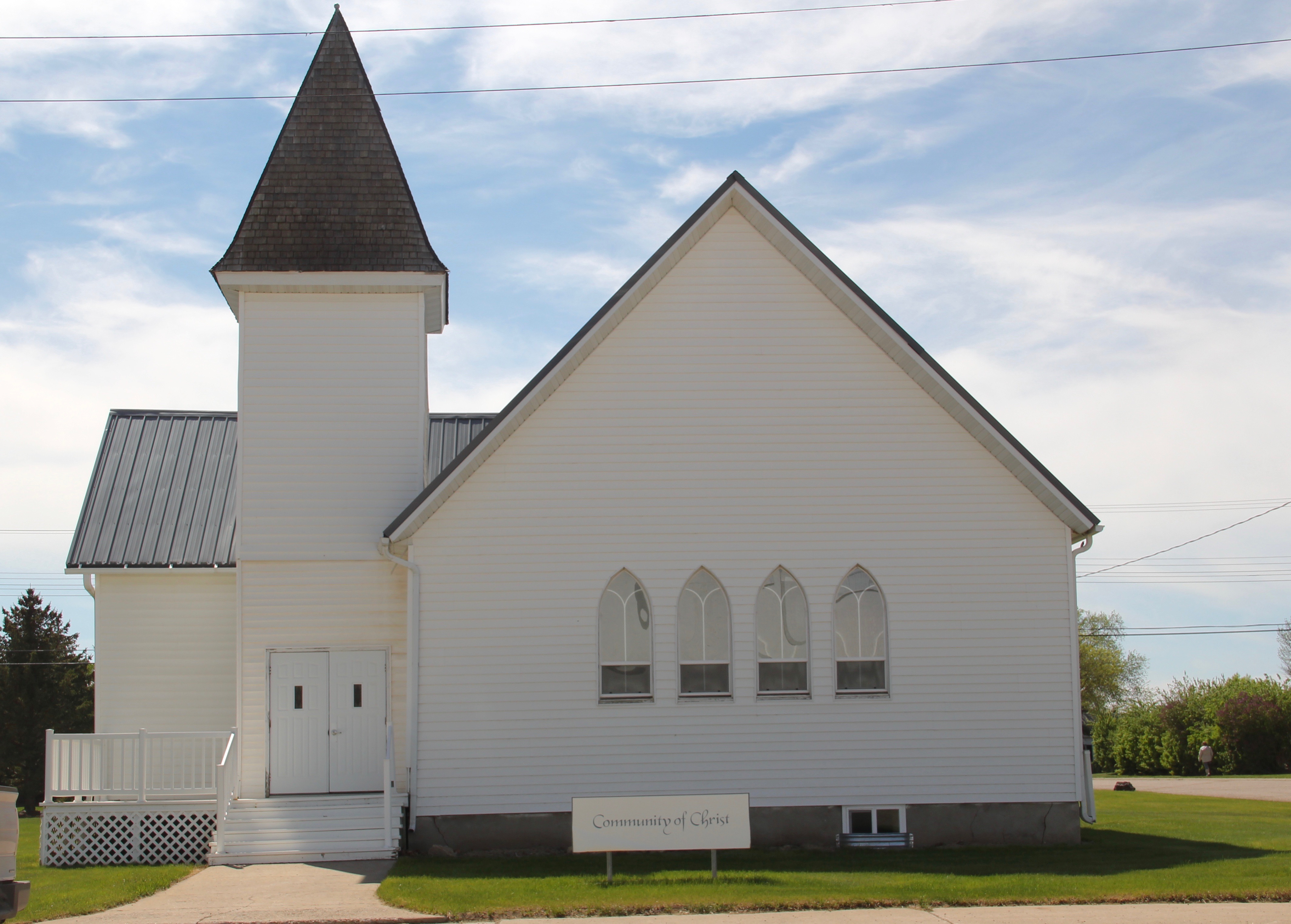
The United Methodist Church reflecting a vernacular Gothic type that can be found all across the northern plains in the late 19th and early 20th century. The Community of
God Church shares that similar vernacular Gothic style and retains its bell tower. Mid-20th century modern style can be found in St. Anthony Catholic Church. As regular readers of the blog may recall, I have explored the diocese’s choice of mid-century modern style for many Catholic churches in eastern Montana. The Culbertson church is a good example of that pattern. Another church that belongs to the modern design era of the 20th century is Trinity Lutheran Church, especially as this distinguished building expanded over the decades to meet its congregation’s needs.
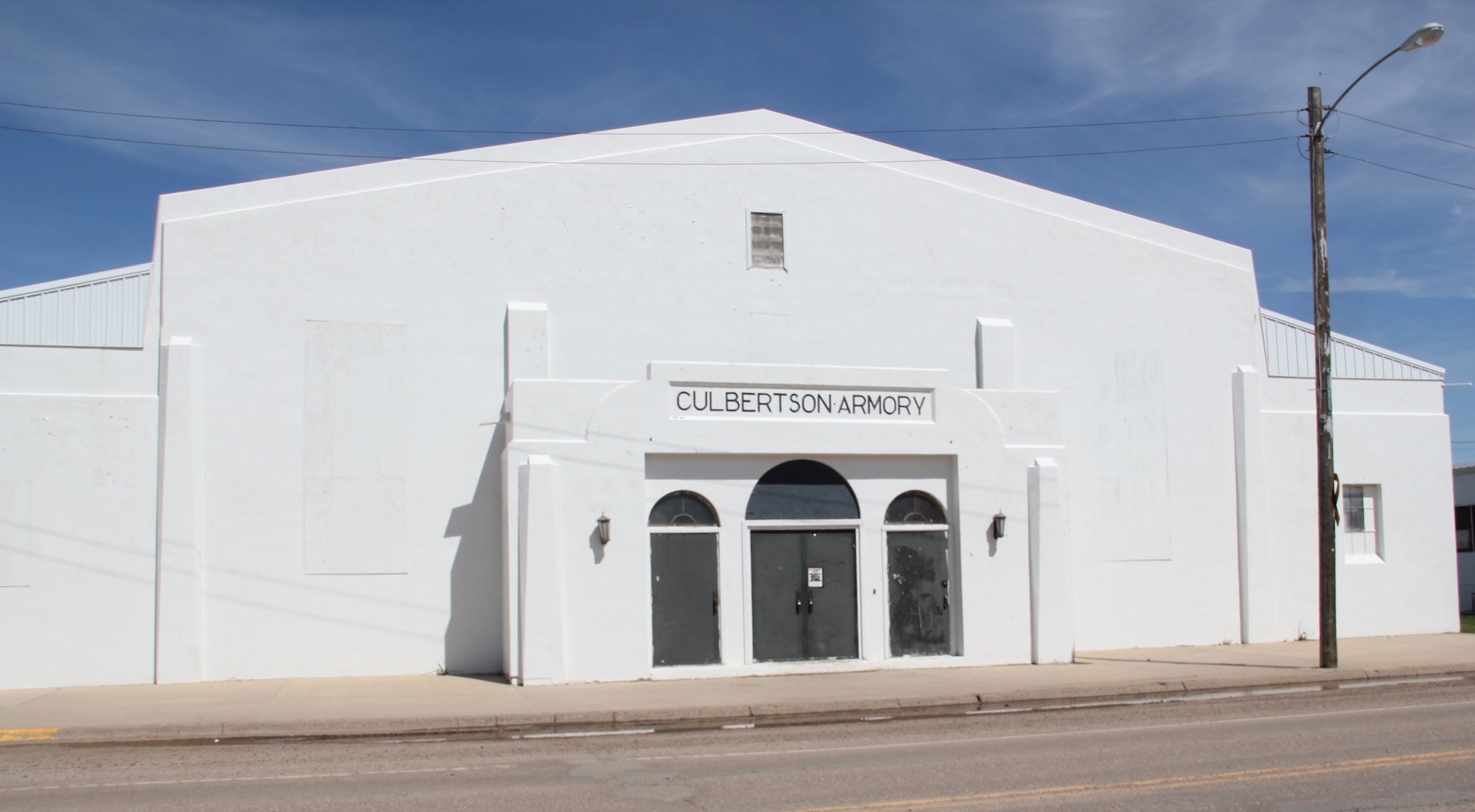
One of the most interesting buildings in Culbertson is the Armory, part of the significant impact that New Deal agencies had on the built environment of Roosevelt County in the 1930s. Justified as part of the nation’s war preparedness efforts in the late 1930s, so many armories across the country have found second life as public buildings, serving local government and community events.
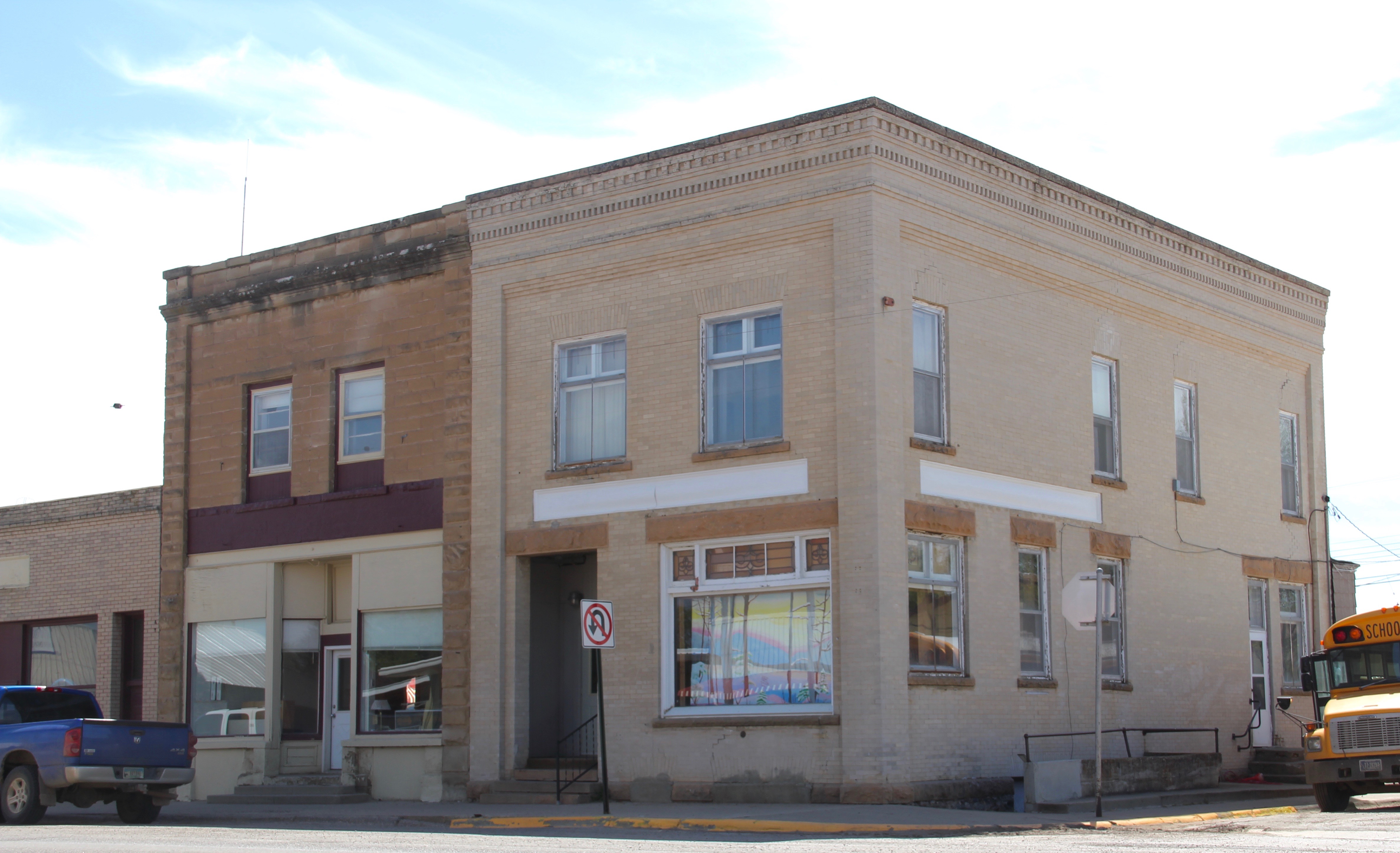
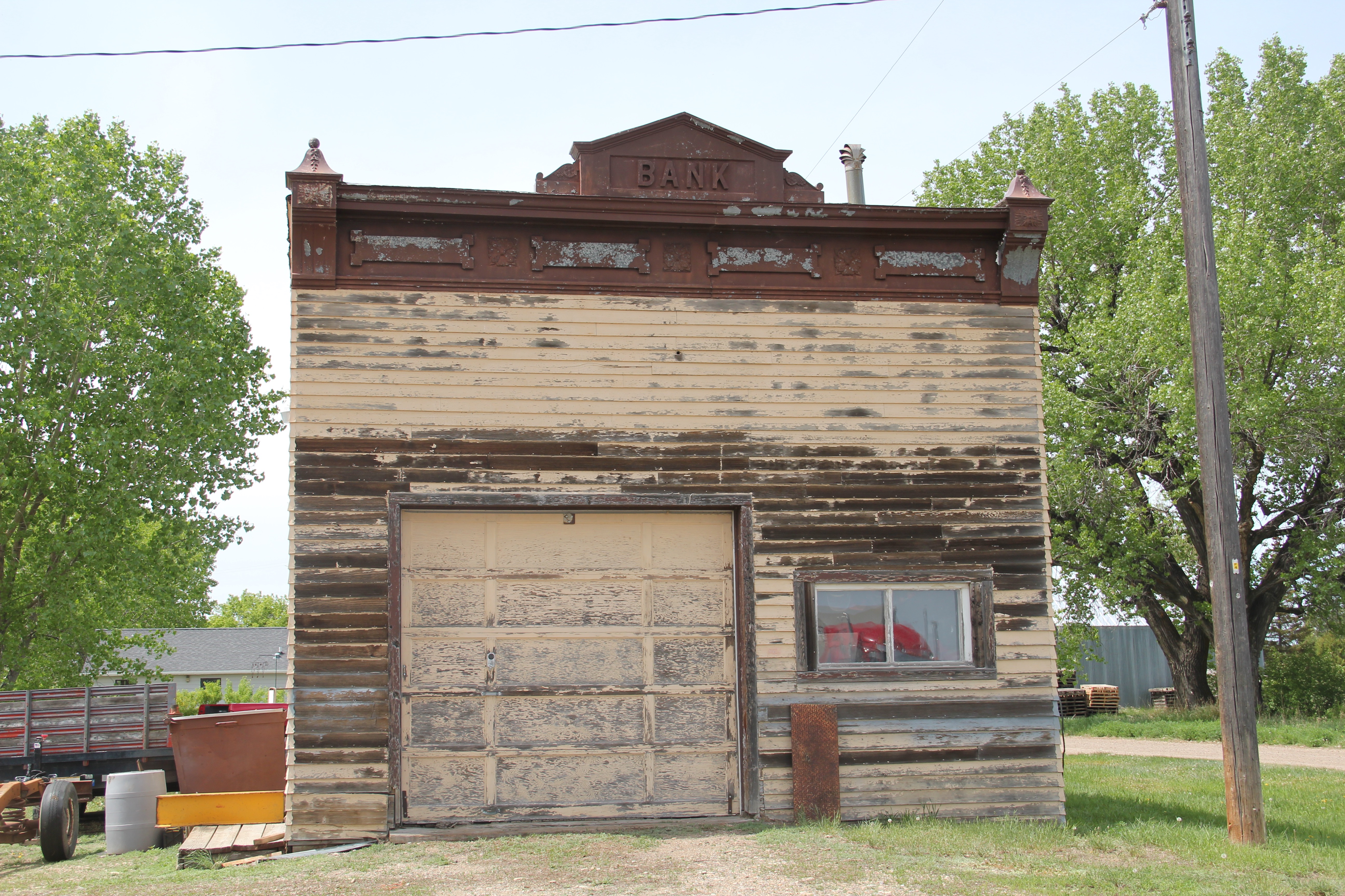
In my earlier post about Culbertson I should have focused more on surviving commercial buildings from the early 20th century–the time of the homesteading boom. The beautiful cast-iron cornice on the Moen Building (1908) is impressive, one of the best examples of that Victorian commercial style still extant on the Hi-Line.
Some of the extant two-story commercial buildings from the homesteading boom show some architectural styling, like the two below, but then a former town bank is impressive in its detail and masonry as any in the region. Culbertson had high hopes in the 1910s.
On either side of the town center are two additional important institutions. The Culbertson Museum serves as a community heritage center but also as a visitor center for travelers entering Montana. Its outdoor sculpture of the Lewis and Clark Expedition is a reminder to all travelers that traces of the Corps of Discovery can be found along so much of the Hi-Line.
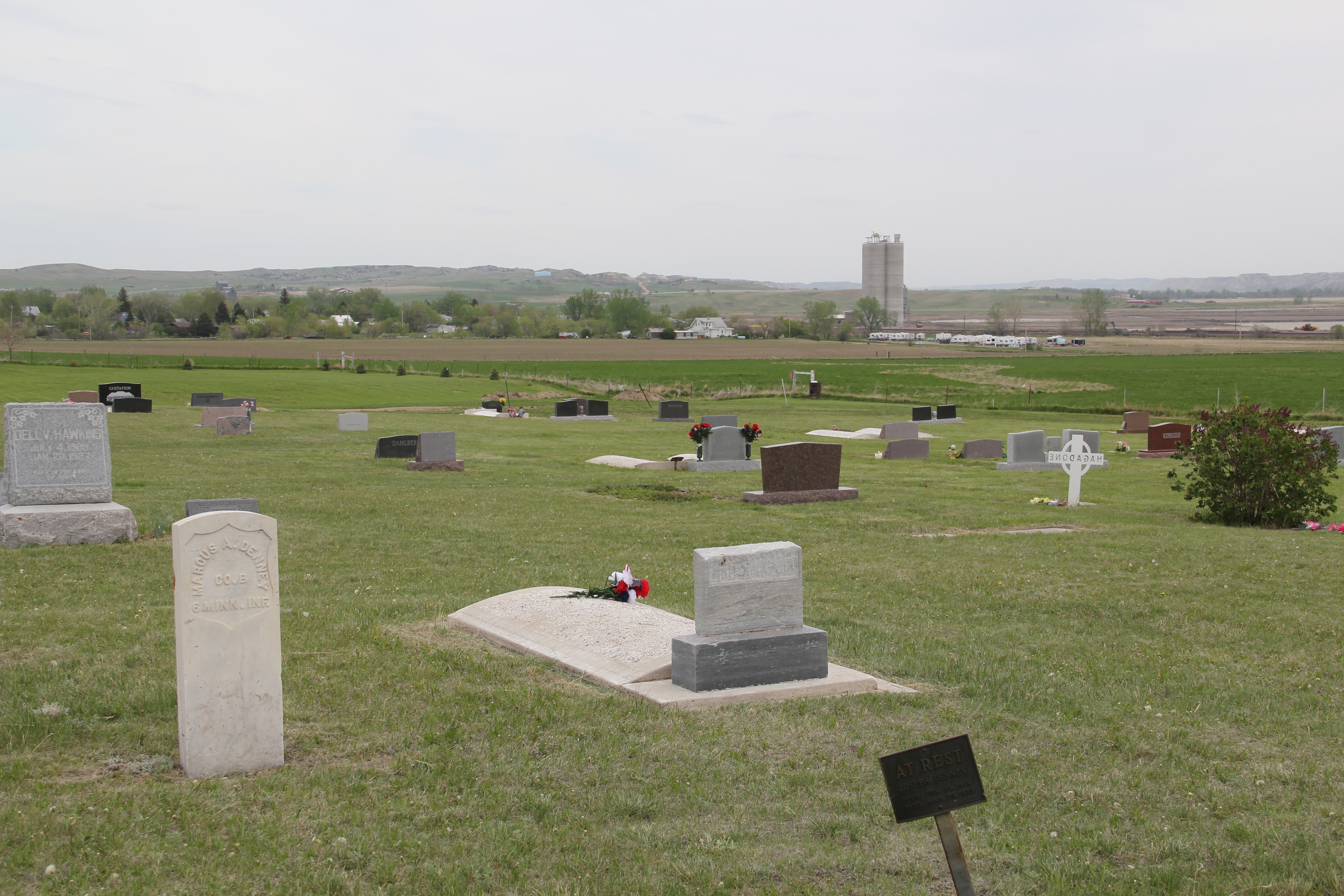
On the west side of town is its historic cemetery, the Hillside Cemetery. At first glance, it seems unimposing, more quaint that important. But the cemetery is the oldest historic
resource in Culbertson, and in fact is the the burial place of two former Union soldiers, one from Illinois and one from Minnesota, who fought in the Civil War. The markers are a reminder that the mid-19th century roots of Montana are never far away, even at the small town of Culbertson.
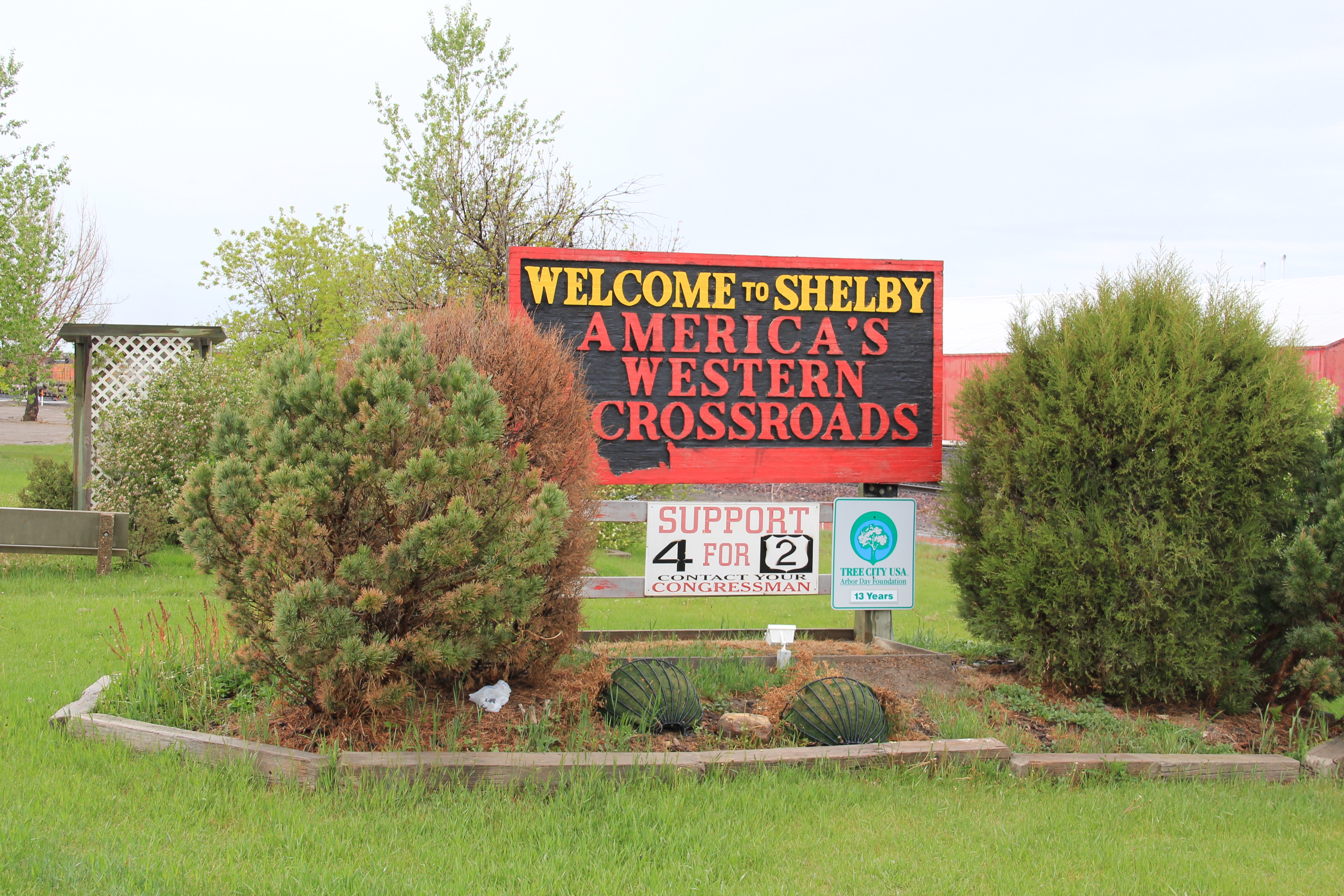
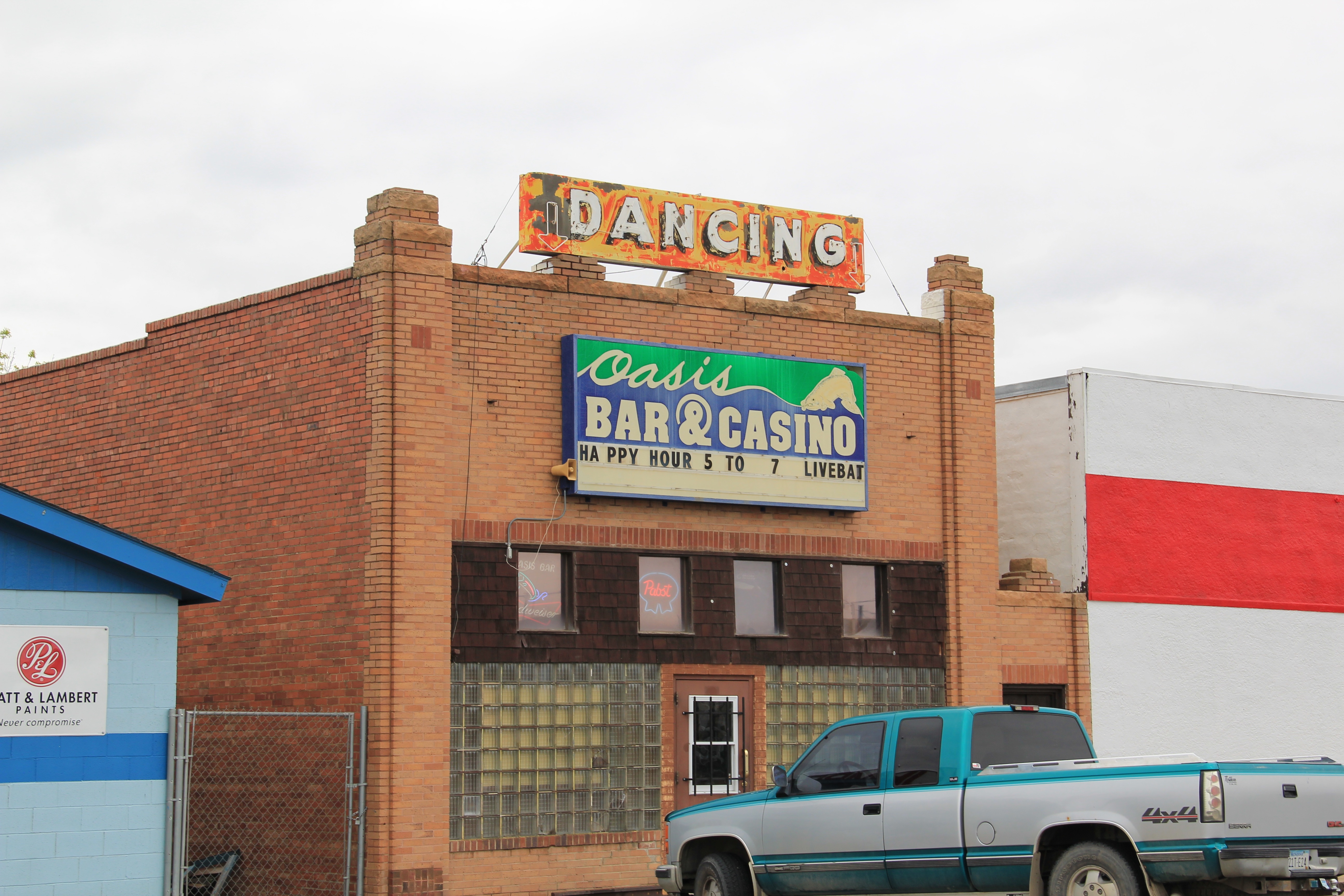
As we all have read the newspapers over the last six weeks, it has been doubly sad to learn of the devastation COVID-19 has brought to the people of Toole County, where the town of Shelby is the county seat. The virus has ravaged most of the United States but the level of its impact on such rural places as Shelby and Toole County has been especially devastating since in places like these everyone does know everyone. The impact is so direct and personal.
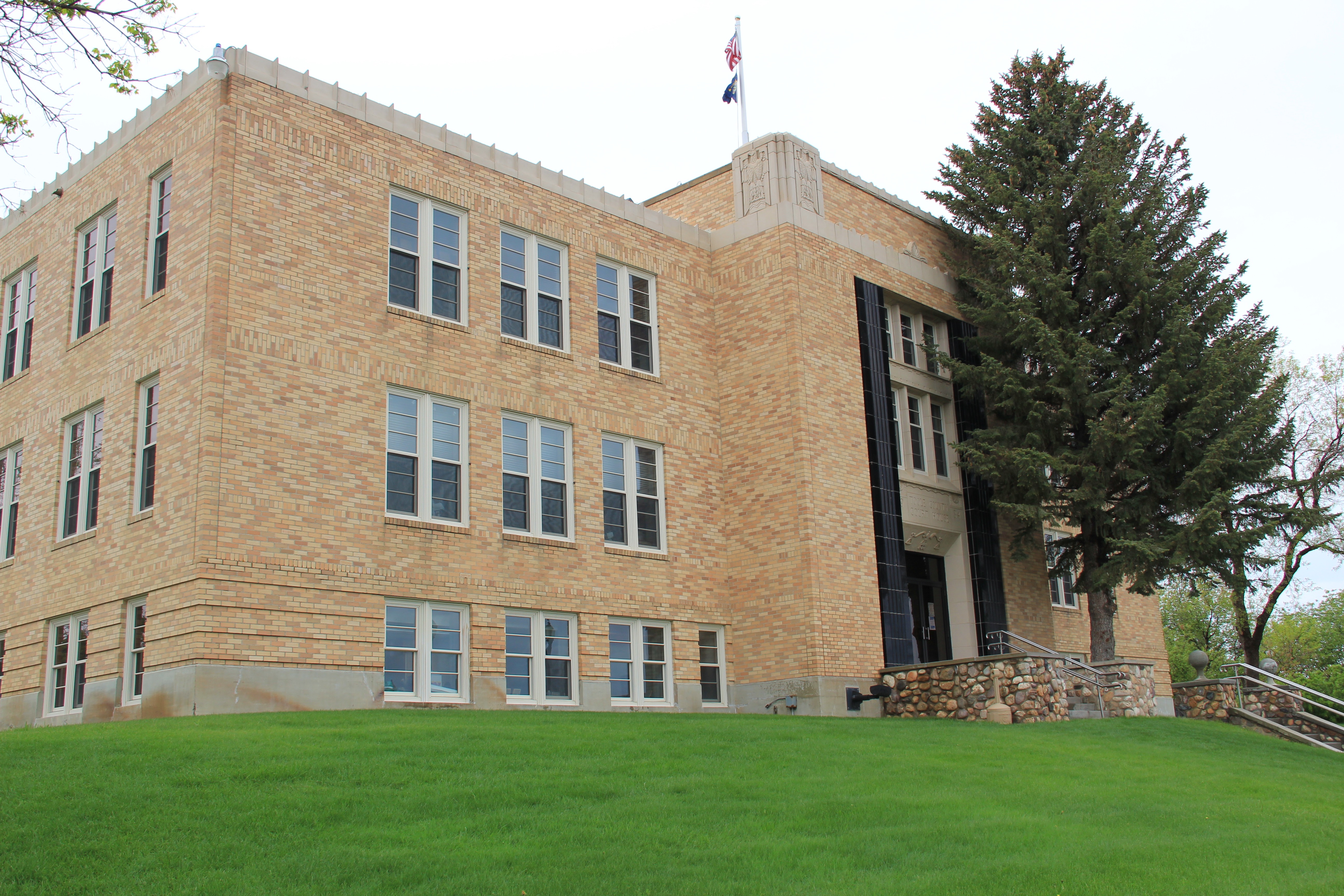
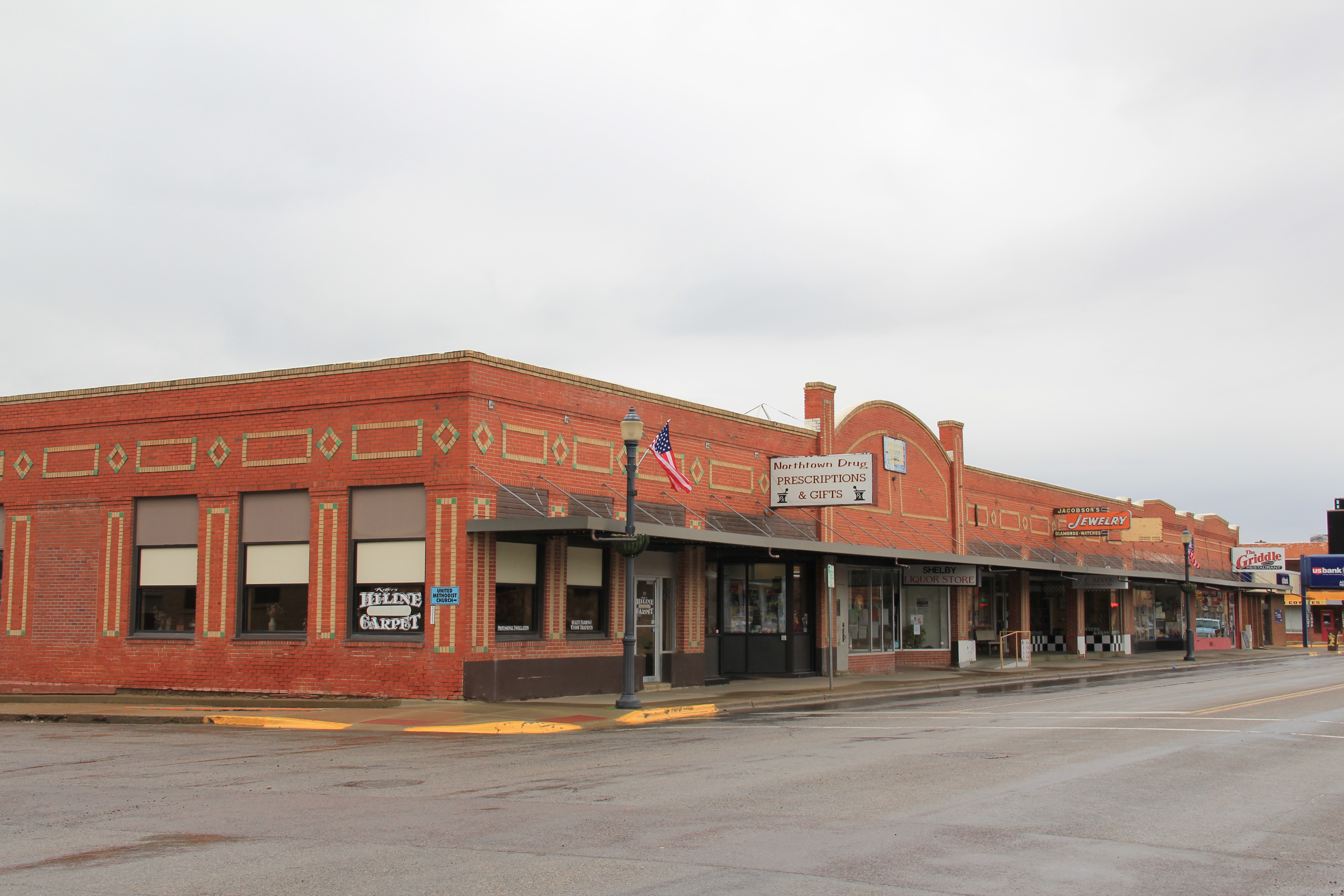
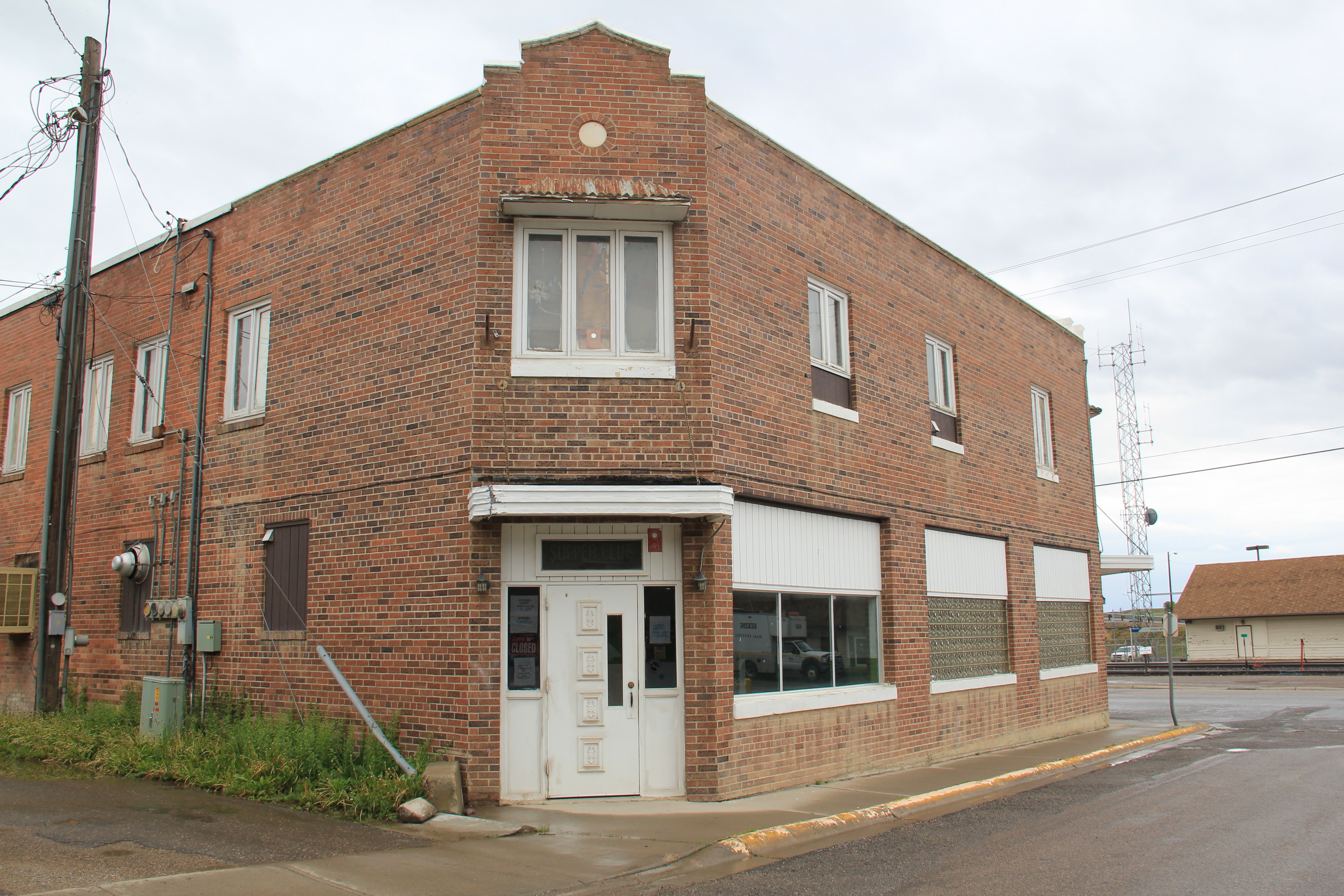
In this weekend’s papers, reporters stressed how residents are moving forward the best they could, despite the sadness, and fear. I would expect no less. I last visited Shelby seven years ago; indeed I made two stops between 2011 and 2013. Of course people were friendly, helpful, just as they had been when I started my initial Montana survey in 1984 with an overnight program in Shelby at the courthouse. Imagine my delight to learn in those same news stories that the town had met virtually of course to discuss a pending proposal to place the downtown in the National Register of Historic Places. I fully agree: the range of buildings along Main Street (historic U.S. Highway 2) has always ranked among my favorite Main Streets in the state.
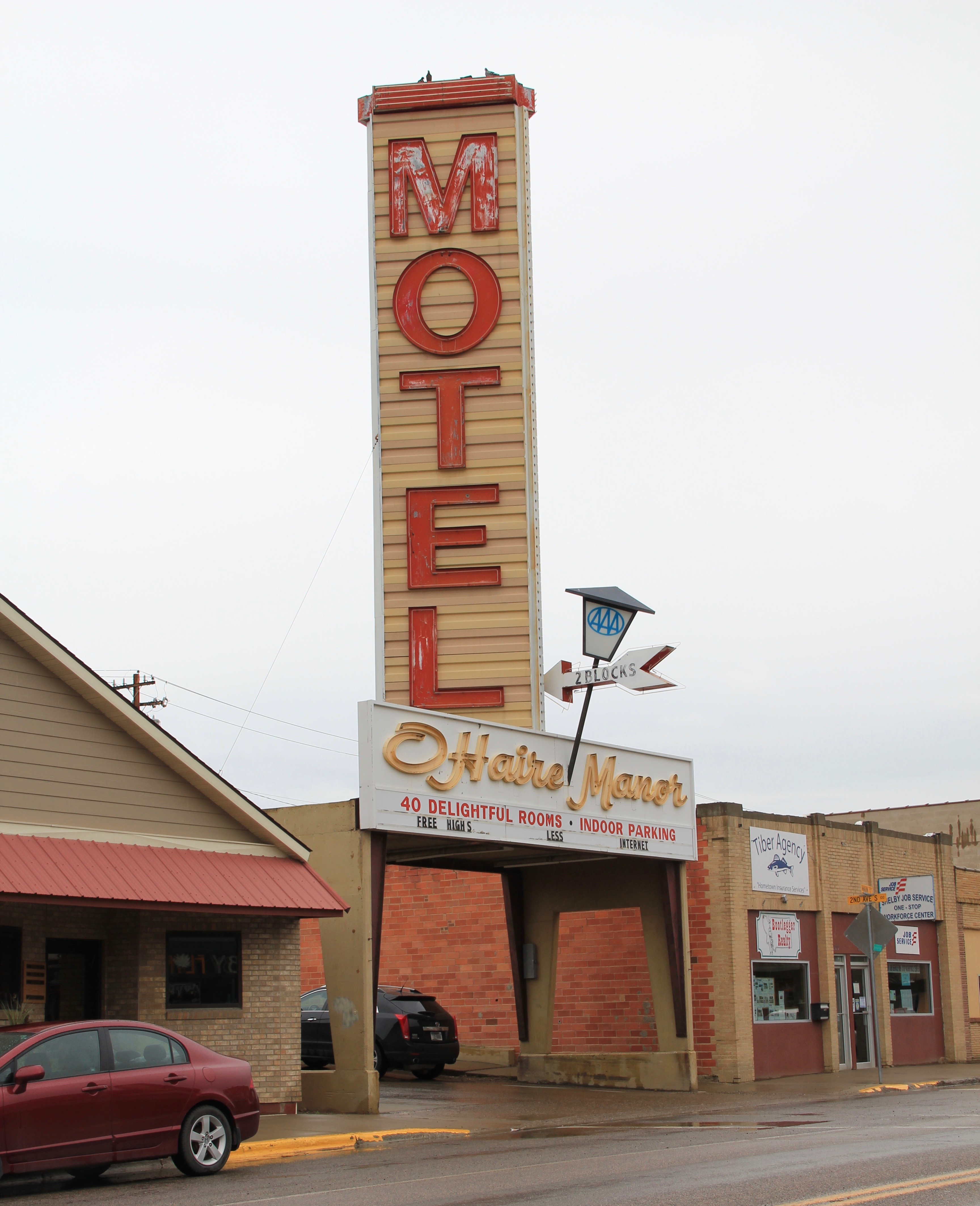
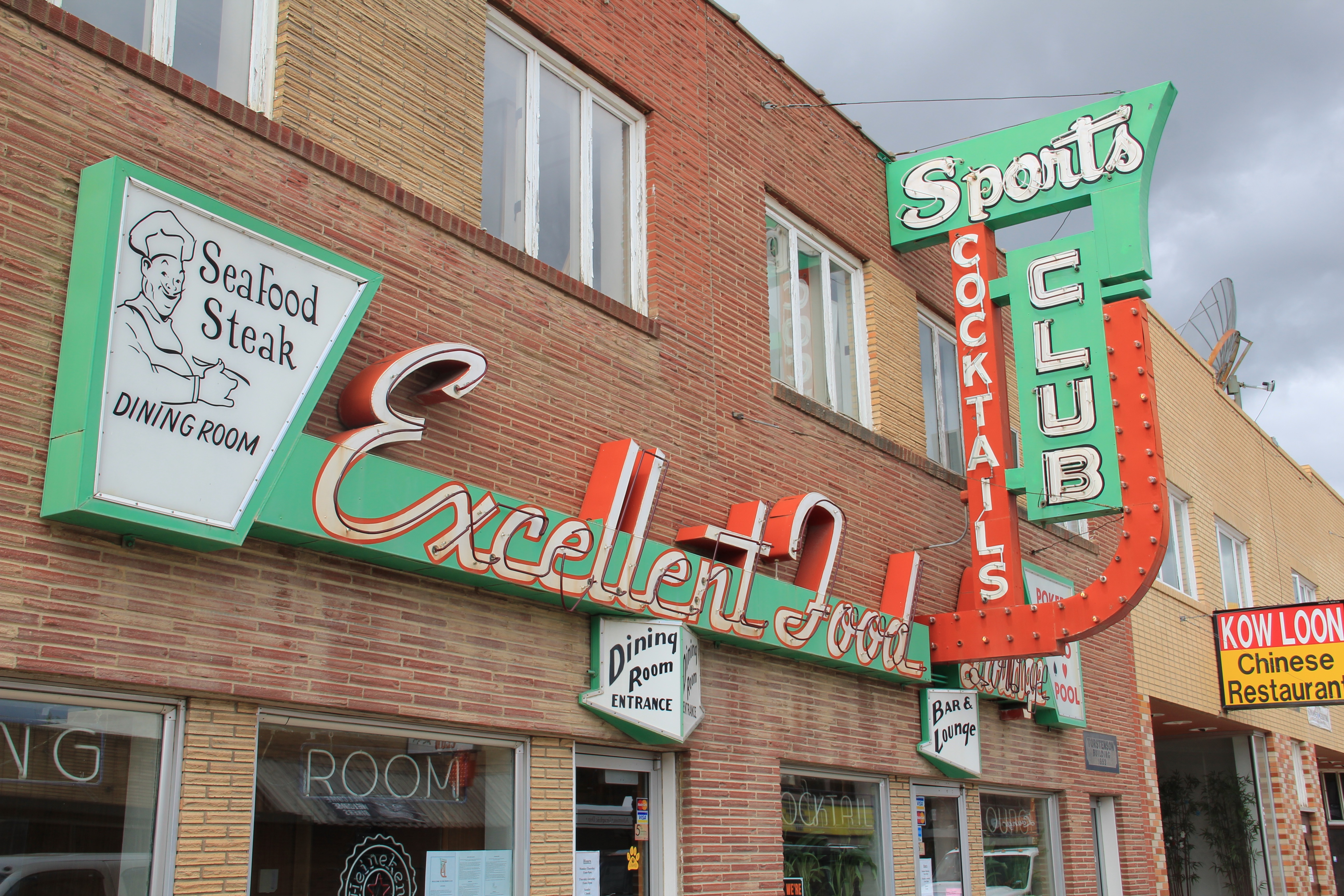
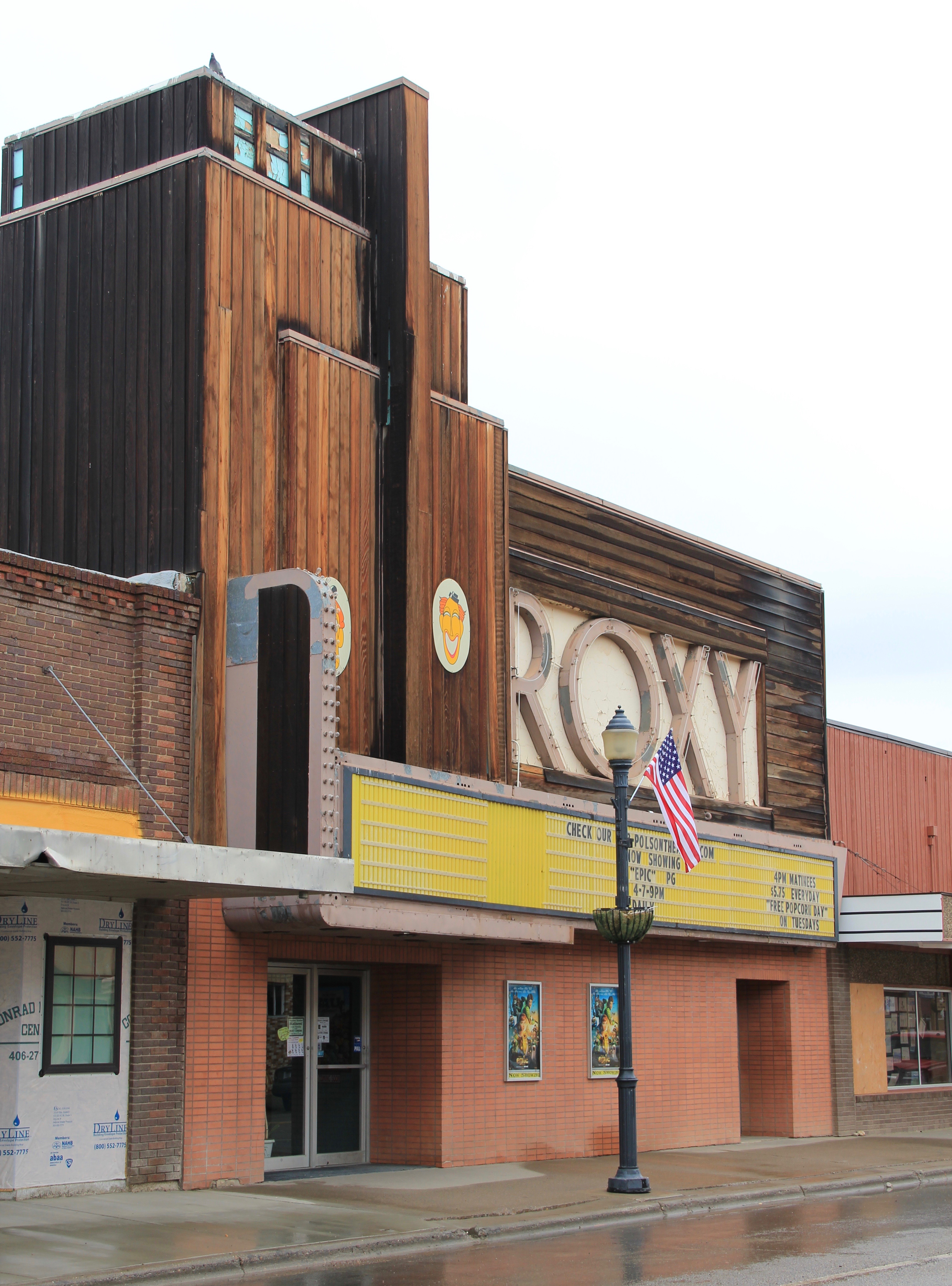
Let’s me share today views of the downtown commercial buildings that I took in 2011 and 2013. They reflect the impact of the 1920s oil boom on the town and county–so many date to those decades–but as a group they also show how Shelby grew in the early to mid-twentieth century on both sides of the Great Northern Railway that passed through the heart of town, with its historic depot still serving passengers on the Empire Builder today.
The range of roadside architecture in the tavern, restaurant, and motel signs is particularly significant–in so many other places these touchstones of mid-century commercial design have been lost. But I also like the unpretentiousness of the buildings, and the commercial district they create. The architecture in that way reflects the residents themselves: flashy if you want it, but also solid, grounded, and ready to face what comes their way.
The downtown district would add much to the National Register of Historic Places. Shelby was already represented by a historic garage and the original City Hall, recently a visitor center, that was built for the famous Fourth of July 1923 heavyweight
bout between Jack Dempsey-and Tommy Gibbons. But these additions tell its full story of commercial growth in the age of the highway. I hope the project moves smoothly forward–Shelby and Toole County deserves that break, along with many, many others as they fight back against the scourge of our time.


 One of the very few historical markers in Montana that touches on the state’s irrigation history focuses about a historic bridge that once stood nearby at Tampico.
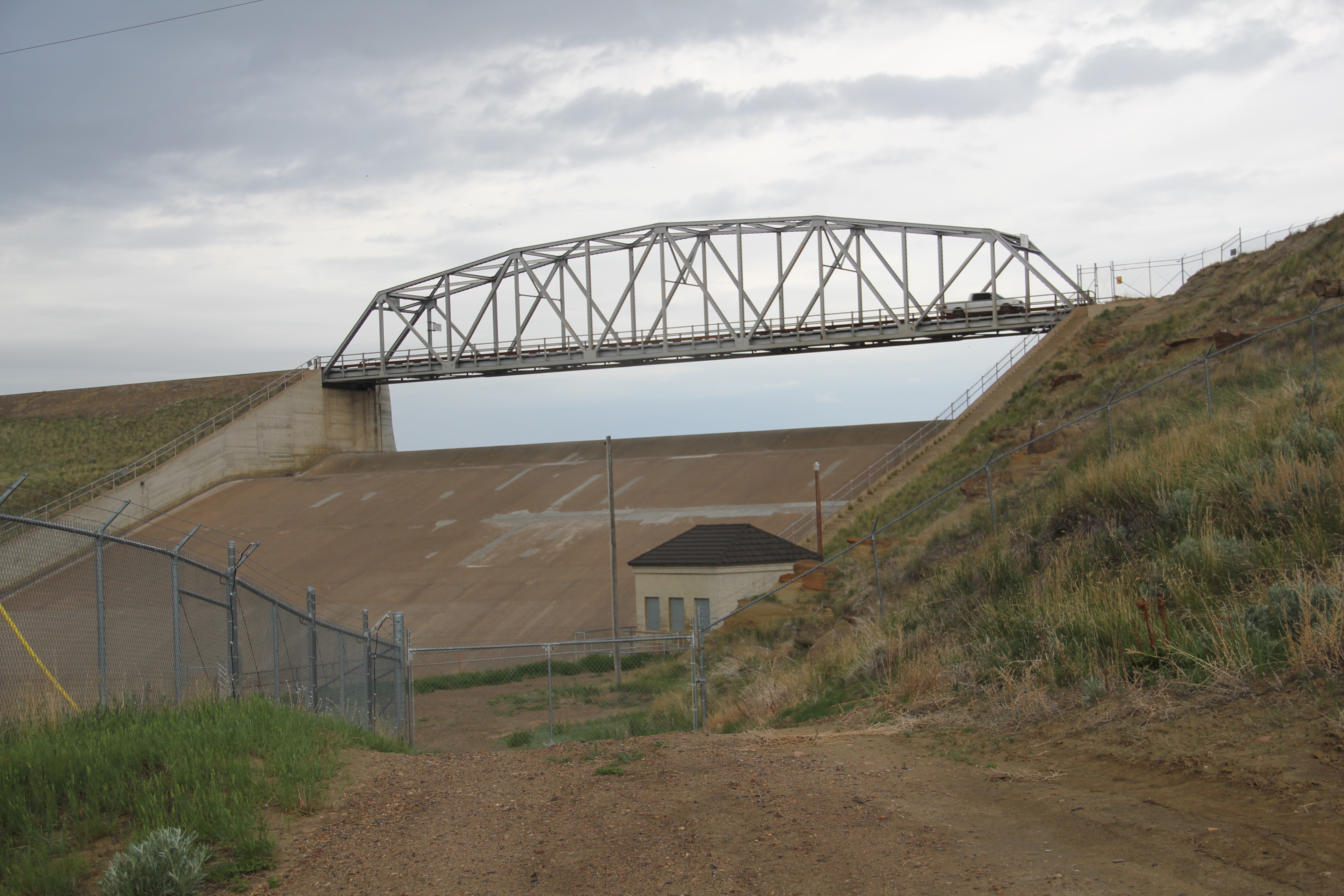
 Large man-made lakes capture water to reserve it for use throughout the growing season. The images above are of Fresno Reservoir, on a rainy morning, in Hill County. While the two images below are of Nelson Reservoir, on a typically bright sunny day, many miles downstream in Phillips County.
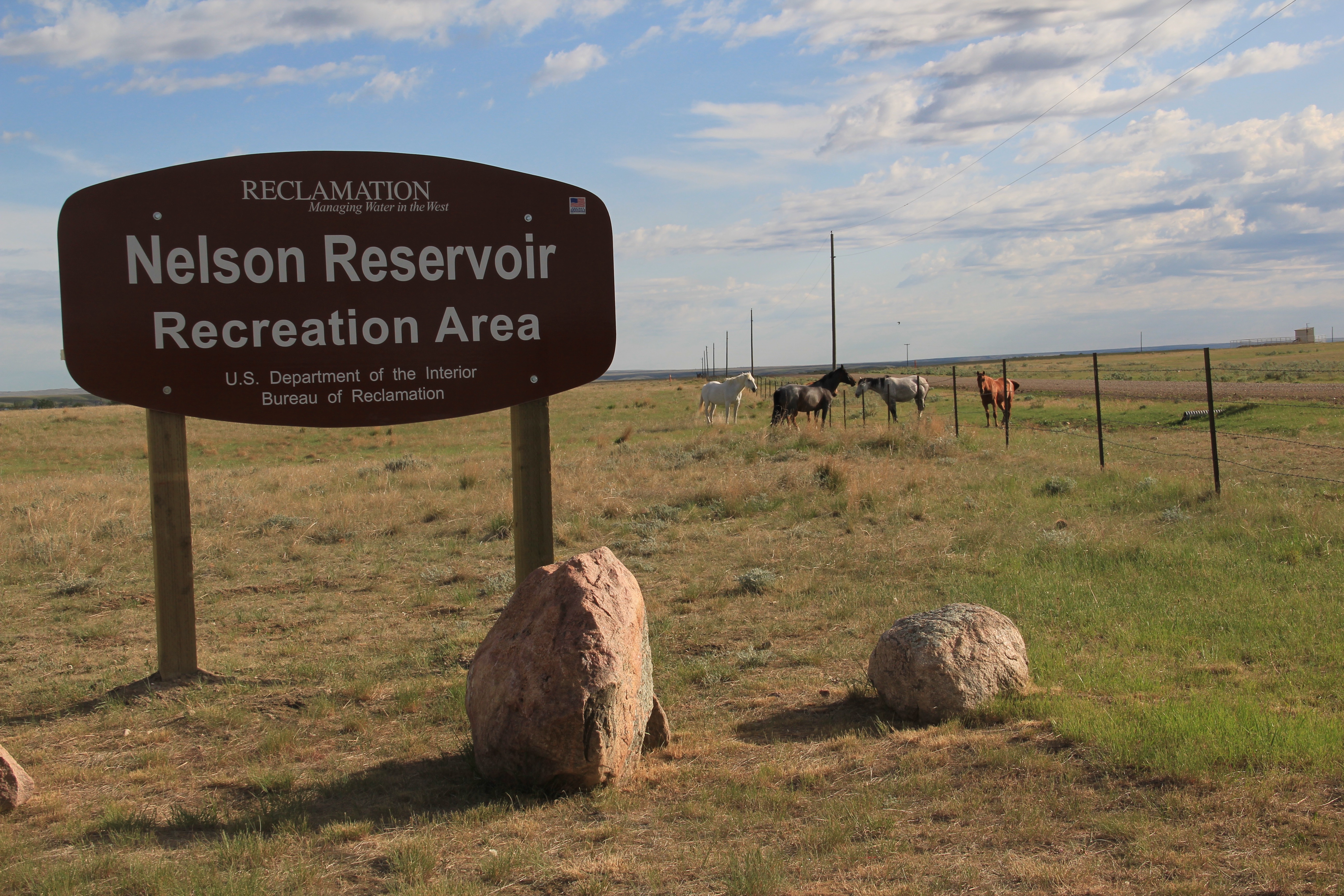
 The Milk River Project shapes so much of the Hi-Line, it has become just part of the scenery. I wonder how many travelers along U.S. Highway 2 in Phillips County even notice or consider the constant presence of the ditch along their route.

 is a tiny place, almost 20 miles from the county seat of Malta. But at the time of the Milk River Project, Dodson was vital; the ditch neatly divided the town into two halves, and a major diversion dam was just west of town. Here was a perfect place, at the turn of the century, for a fairgrounds. And it is a gorgeous historic fairgrounds.


 Lehman, west of Chinook adjacent to both the Milk River and U.S. Highway 2, has almost totally disappeared as a place along the tracks. What is left of the town–this deteriorating commercial building in 2013–might even be gone today.


 modern style for many Catholic churches in eastern Montana. The Culbertson church is a good example of that pattern. Another church that belongs to the modern design era of the 20th century is Trinity Lutheran Church, especially as this distinguished building expanded over the decades to meet its congregation’s needs.