Milwaukee Road Corridor, Moore, 1984.
In my work with the State Historic Preservation Office in 1984-1985, my colleagues put up with many of my own peculiar interests and views of the Montana historic landscape, especially the focus on public buildings and the state’s railroad corridors. My interests, however, in the country towns of the Judith Basin was probably always a puzzler; staff always wished I would press on to Lewistown, where some of the best preservation work in the state was taking place in the mid-1980s (much more on Lewistown a bit later). But I must admit that the maze of small towns–never numbering more than 200 or so souls in any given place–created by the railroads as they fought for market dominance in the rich agricultural region of the Judith Basin some 100 years ago was just fascinating.

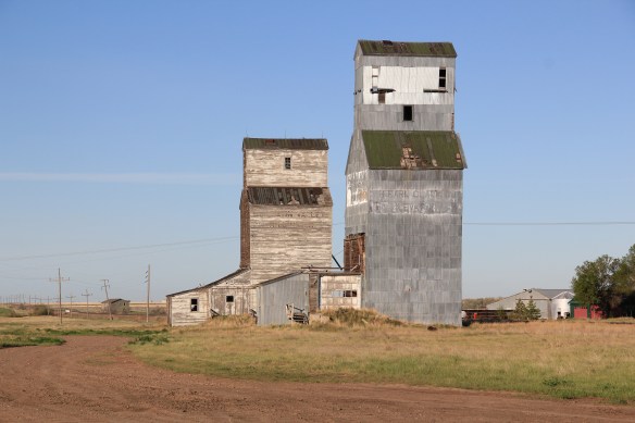
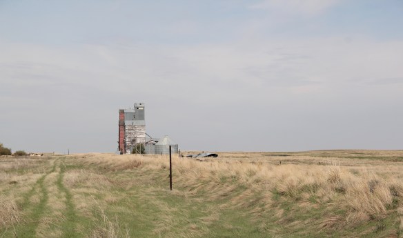
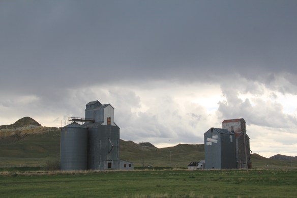
Grain elevators at Moore, 1984
And they remain so today. The geographer John Hudson had provided basic insights on the creation, distribution, and purpose of the country towns in the larger development of the northern plains–he coined the phrase “plains country towns.” The constant elements that they all shared–oriented to the tracks, the dominance of grain elevators, the prominence of depots–underscore the railroad era origins. But the towns all had their own individual places and statements, be it a woman’s club, a library, the school, and the bars and taverns. Thirty years later, much was missing from what I experienced in 1984–every place lost population between 1980-2010–but much still remained, and residents seemed determined to keep it that way.


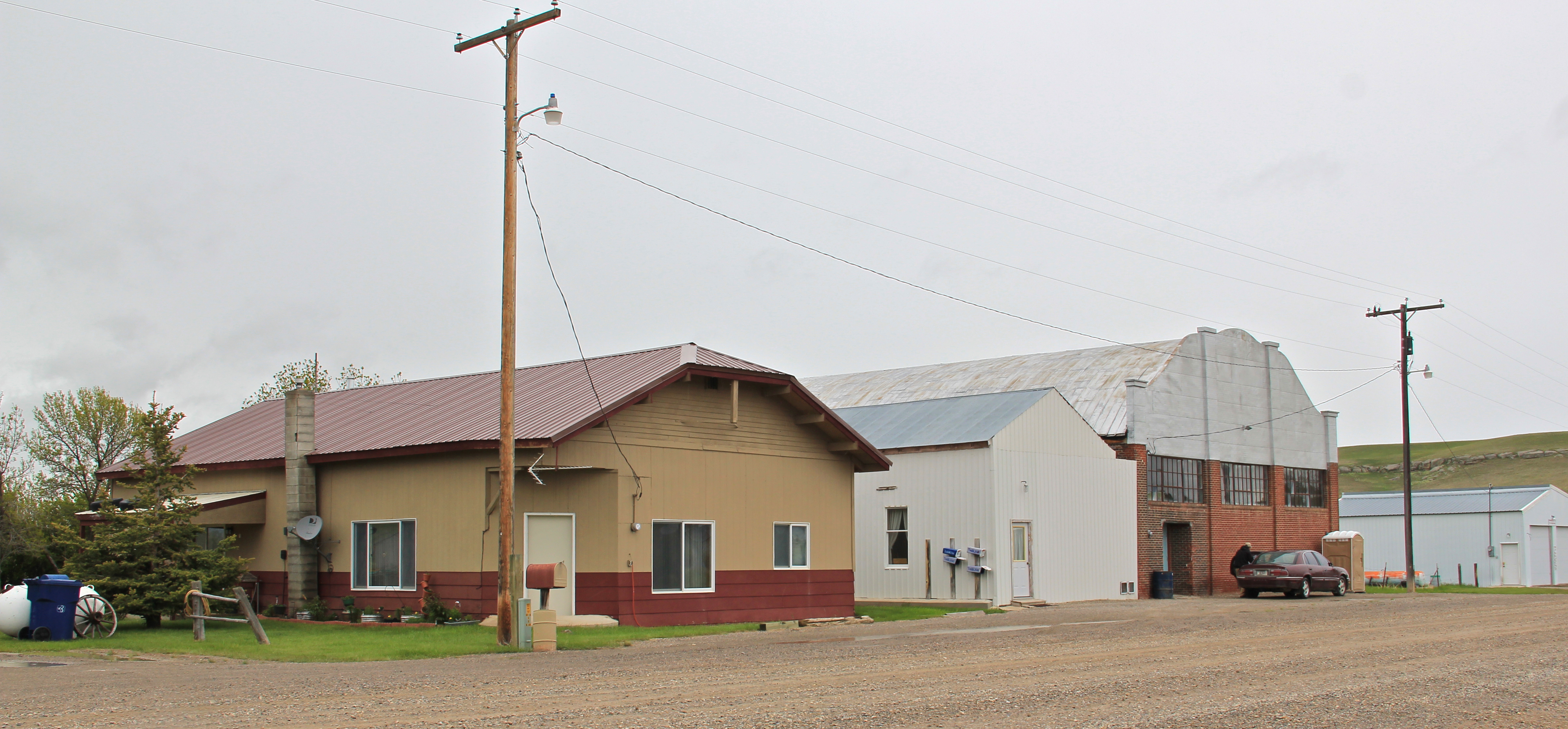
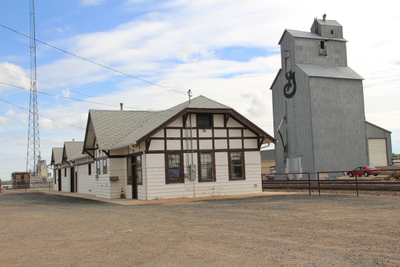
Moore still has its grain elevators but the Milwaukee depot is long gone, creating an empty space along the corridor. Moore has the look of so many Milwaukee Road towns with a T-plan design apparent today even as the town decline from its height of 575 residents in 1920 to the 193 of today.
 But the town, which compared to many I visited in 1984 had declined to a lesser degree (229 residents in 1980 to 193 in 2010), still has its public institutions. The Moore Woman’s Club is celebrating its centennial in 2015 while the town’s public library is another key community center while the continued operation of the unassuming Moore public school

 is undoubtedly the major reason that the town is still here today.

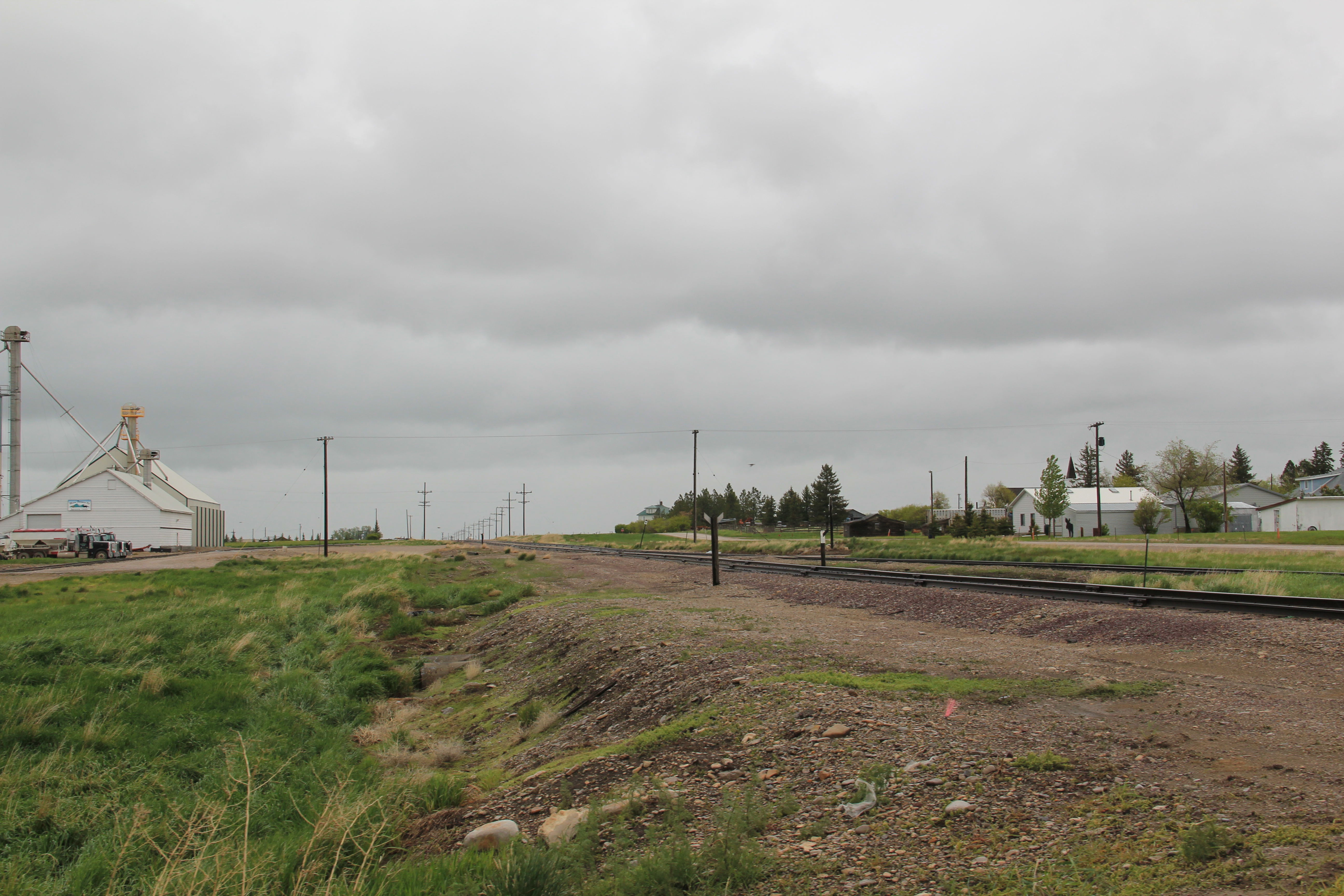
The Great Northern Railway spur line that snaked north from the Yellowstone Valley at Laurel through the Judith Gap then the basin was always a corridor of great interest to me, although the towns created along the way were small, seemingly inconsequential compared to the linking of Great Falls and Billings.
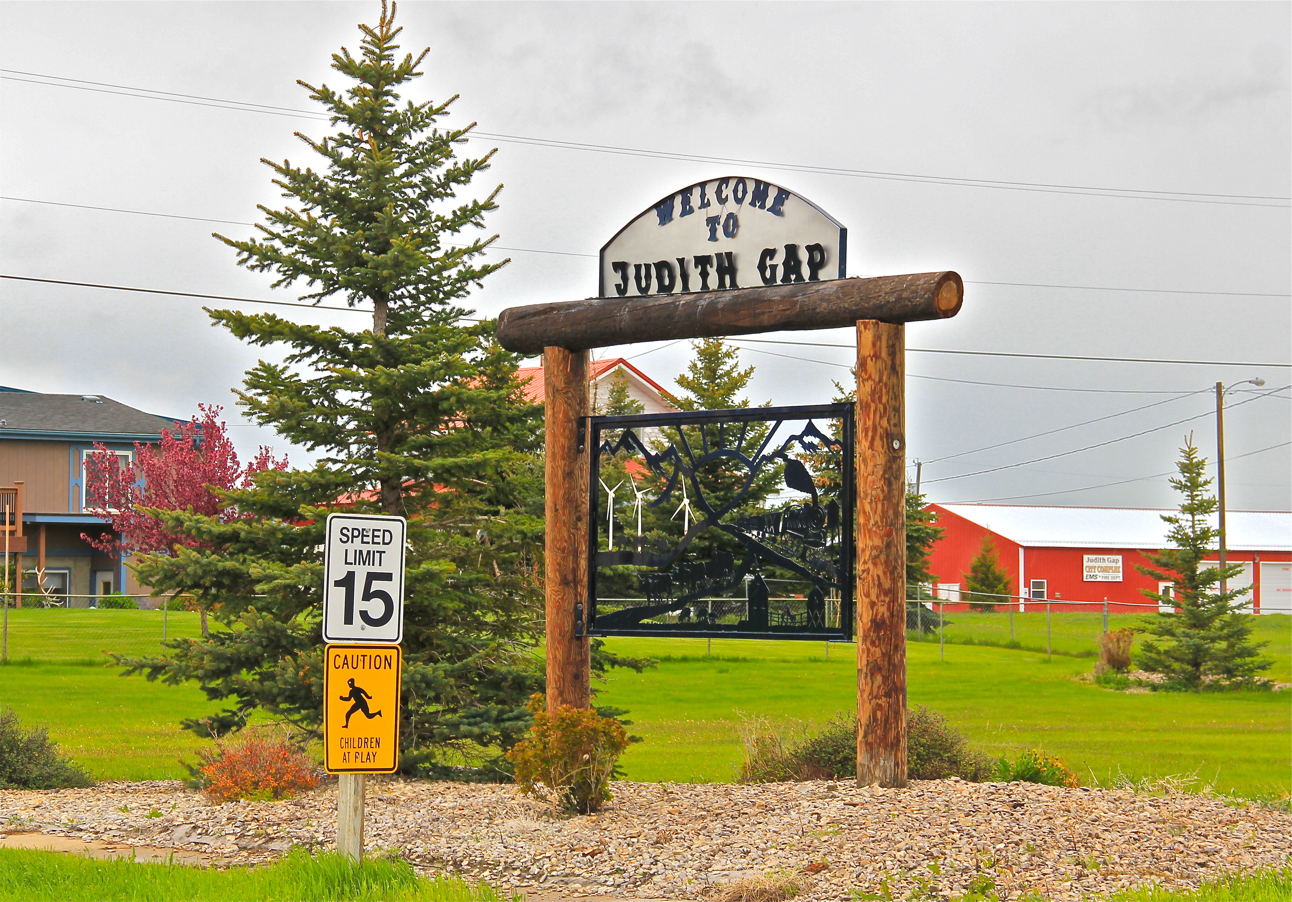
 Traveling north out of the Yellowstone then Musselshell valleys, the Great Northern line entered the basin at Judith Gap, and the homesteaders who followed built a grand two-story brick school that spoke of their ambitions.

The corridor then left in its wake places forgotten today. Travelers along U.S. 191 may notice the old brick state bank building and elevators at Garneill, but they may not.

The highway veers away from the railroad line at Garneill, meaning that the old state bank at Buffalo was a forgotten place in 1984–and the town remains so today.

First State Bank, Buffalo, 1984.
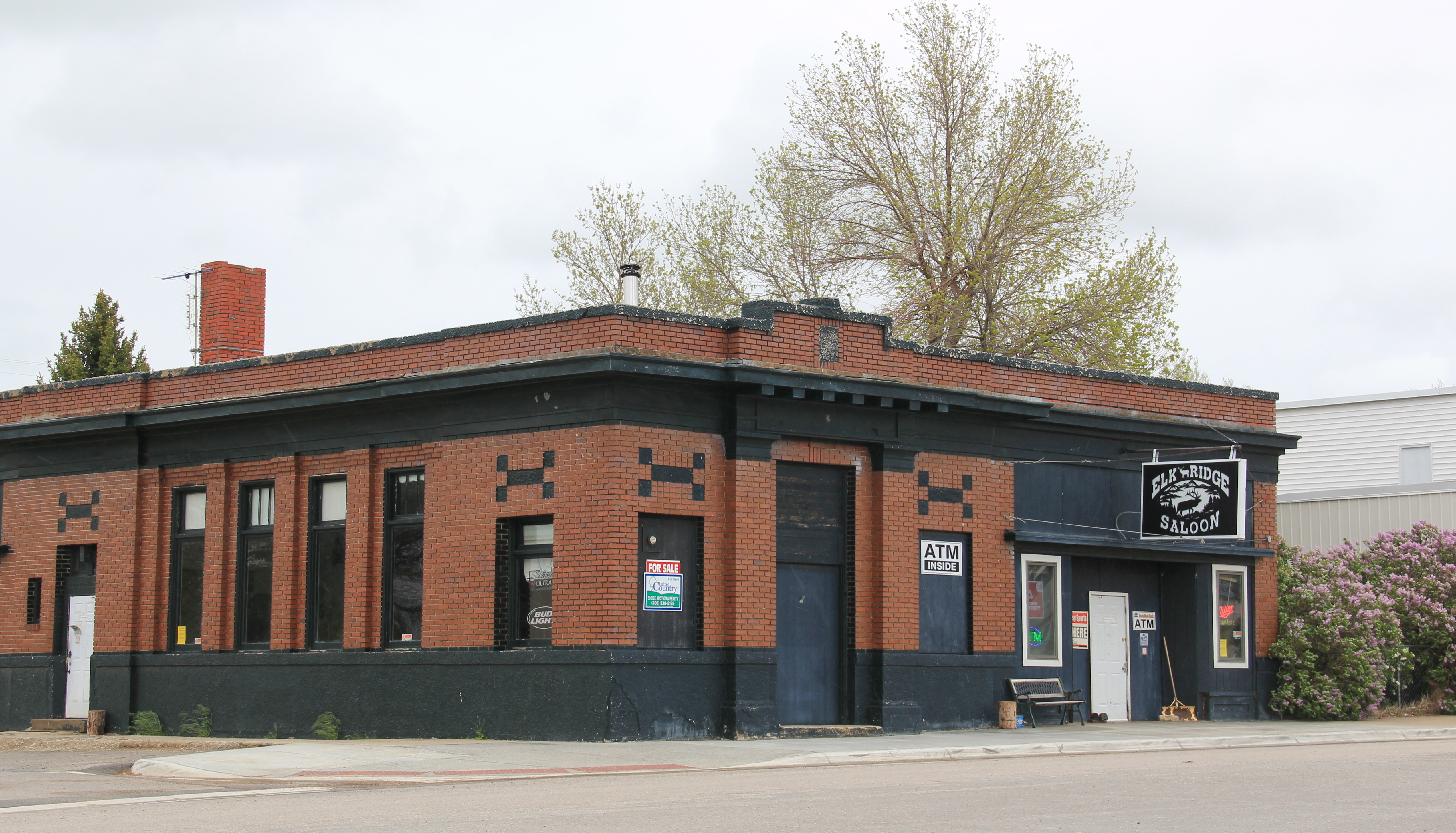
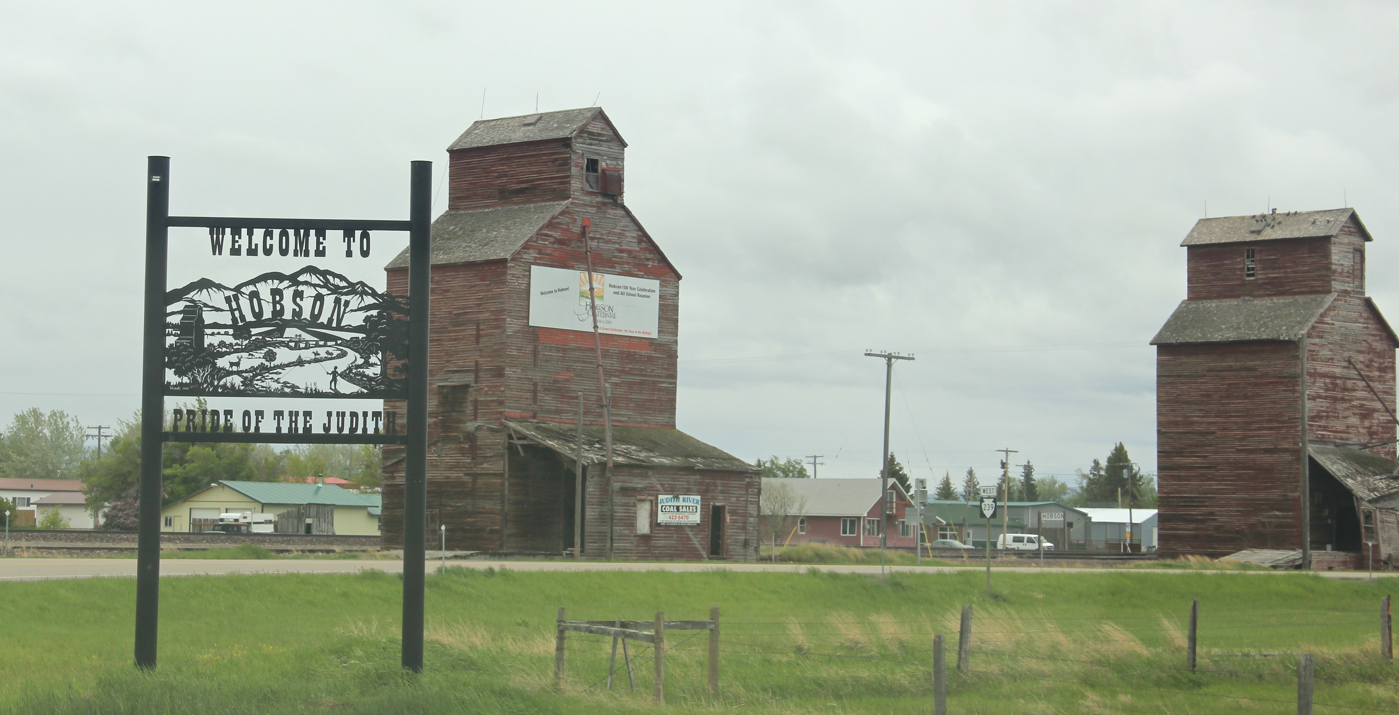
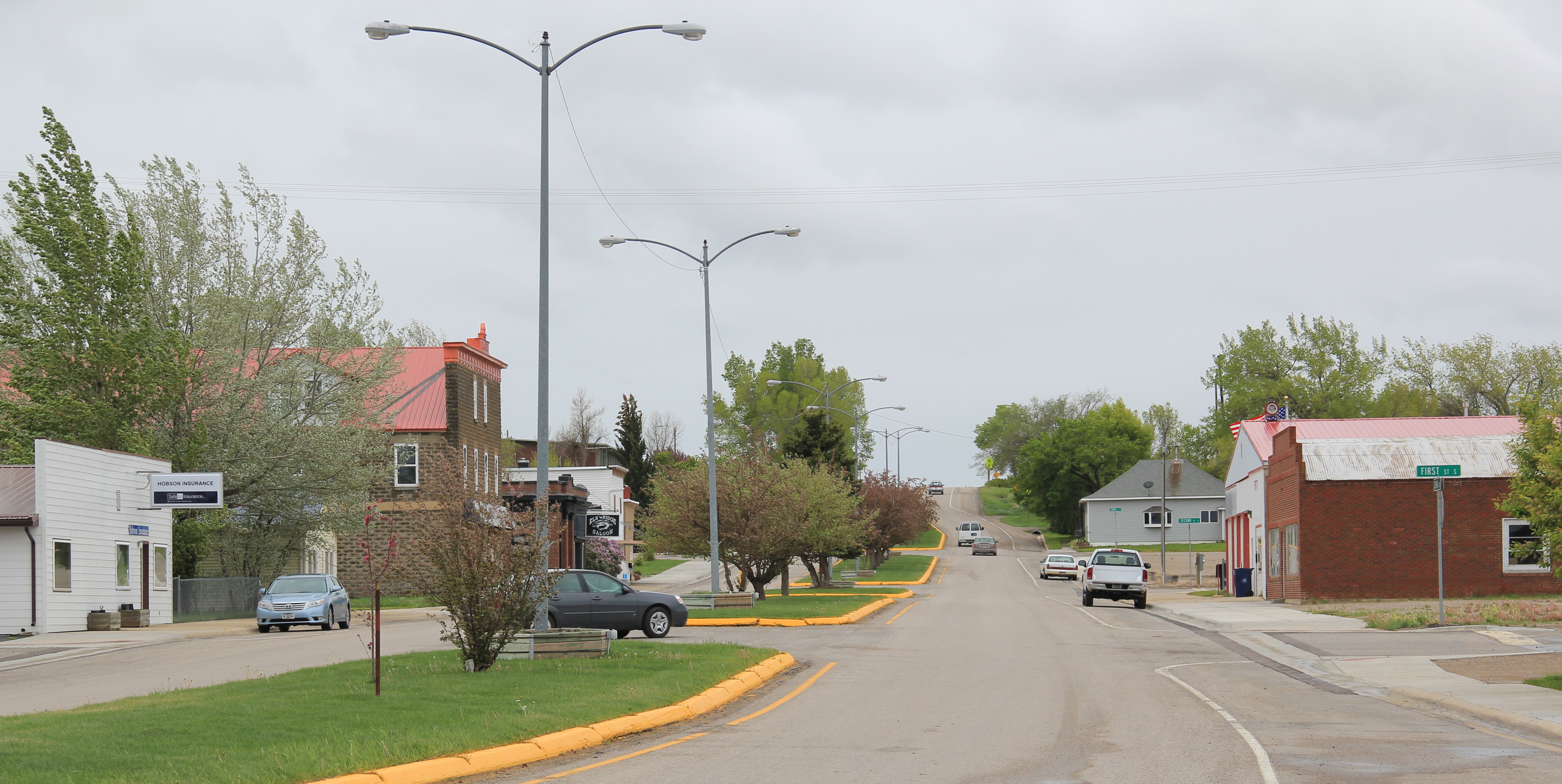
Hobson, on U.S. 87/Montana 200, has experienced a much brighter history. Its brick bank building houses a local bar. While no depot remains, the town’s railroad line remains a 
 point of focus, although most traffic, commercial and otherwise, relies on the highway. Hobson’s population when I visited in 1984 was at its height, 261 people in 1980, and it still tops over 200 today. Another defining characteristic is Hobson’s rather unique (for a plains country town) boulevard plan.
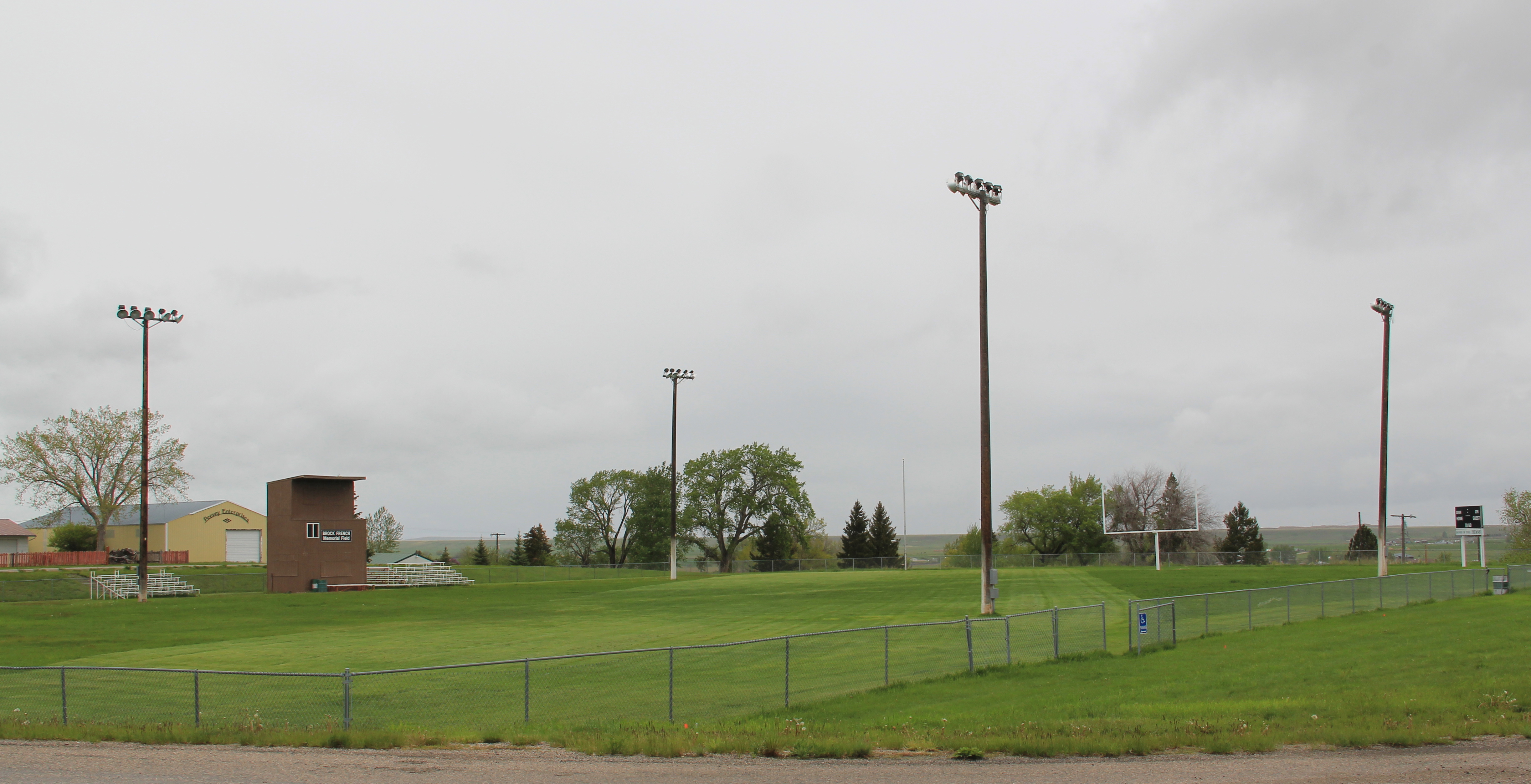
 On either side lie business and public buildings and the street ends at the high school, where the six-man football field is a central element of the community’s public landscape.
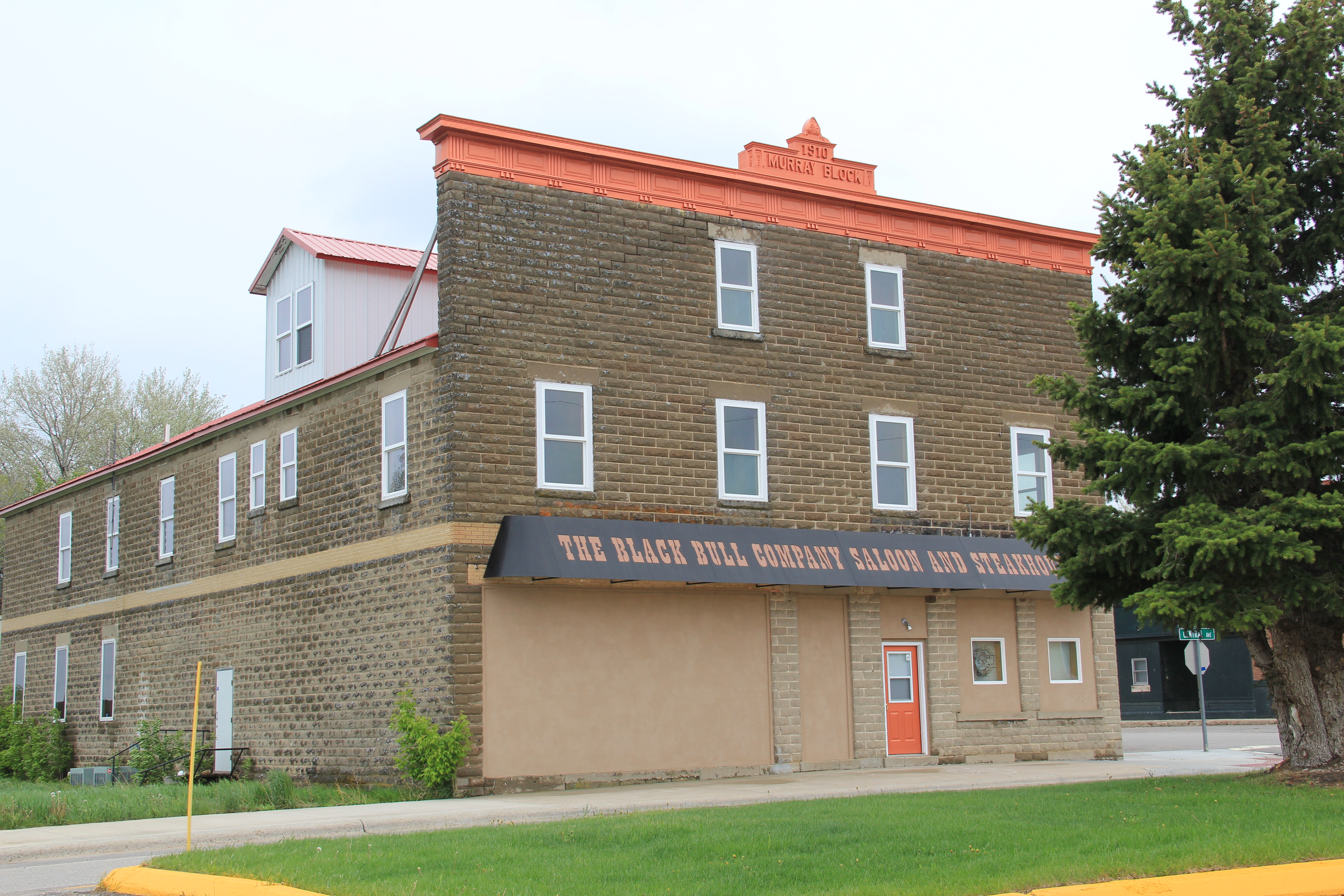
 The Murray Block, 1910, dominates the business district today as it much have done one hundred years ago–it is rare to see a false-front concrete block building. The Masonic
 Lodge probably helps to identify some of the builders of Hobson’s historic structures located on the boulevard. But whoever the builders were, here is a very interesting place


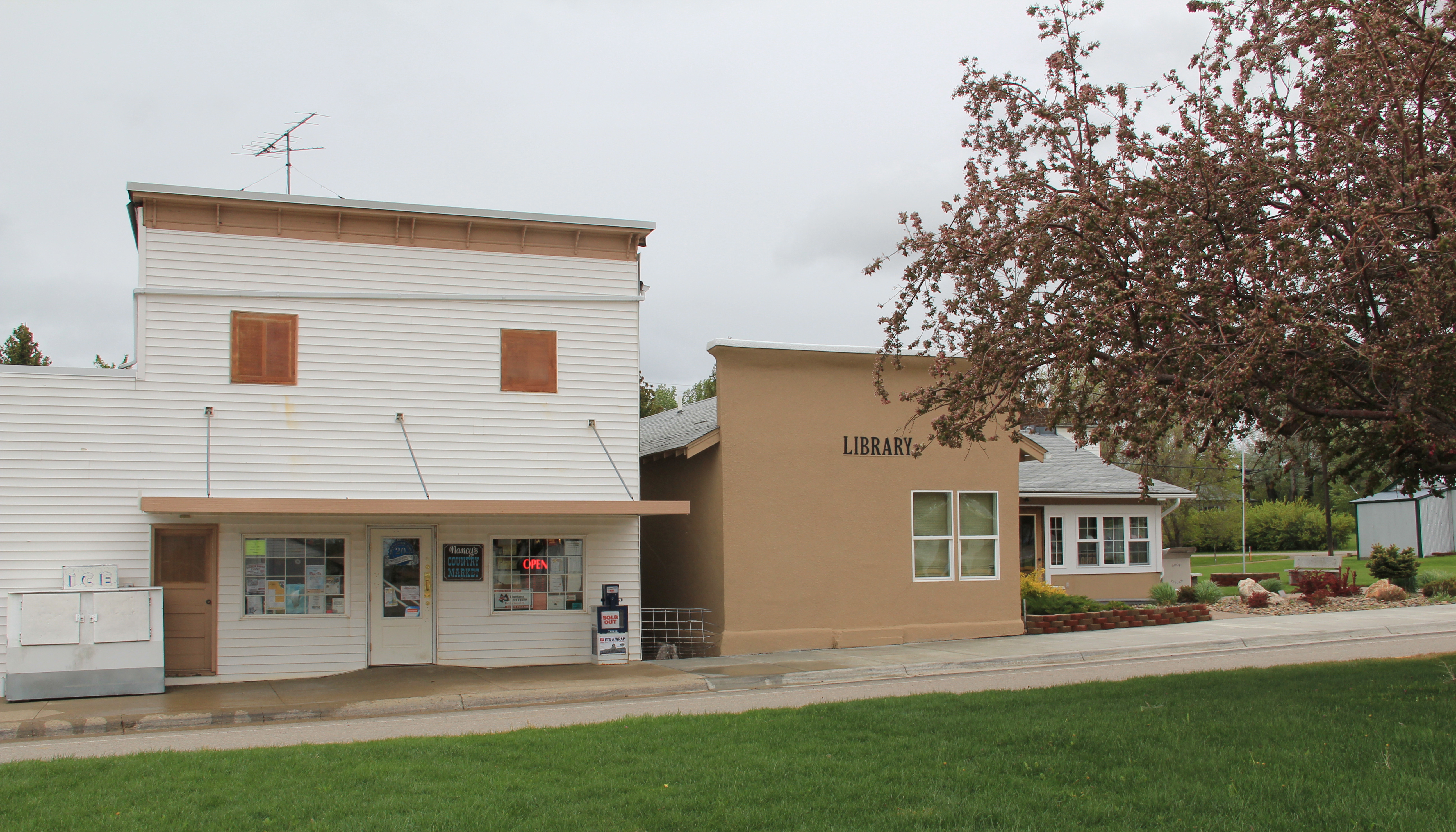
 and just as importantly the properties are in use, be they a cafe, a store, or a library. A long two-lane road, Montana 239, stretches east from Hobson along the Judith River and headed into Little Belt Mountains. The paved road ends at the earlier settlement of the
 basin, the cowboy town of Utica, made famous by the paintings and writings of Charles M. Russell, the state’s most famous artist. Utica has a strong sense of itself, although it is justa tiny place today. A large part of that sense of the past is maintained and enhanced by the work of the Utica museum, the local historical society, and the town rod and gun club. Utica has a level of public interpretation that was certainly not in place in 1984 and that today is rarely matched in a small Montana town.


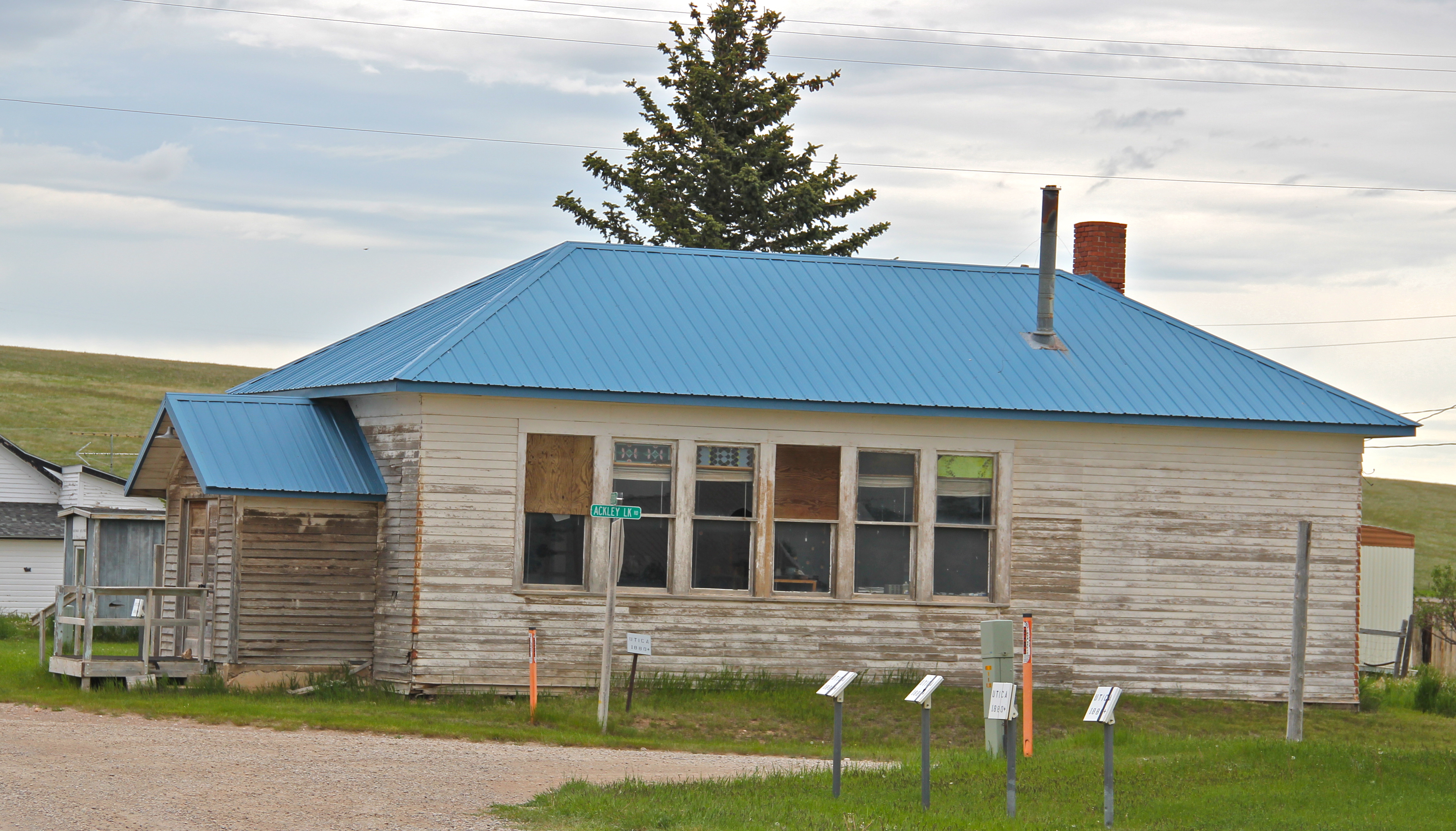
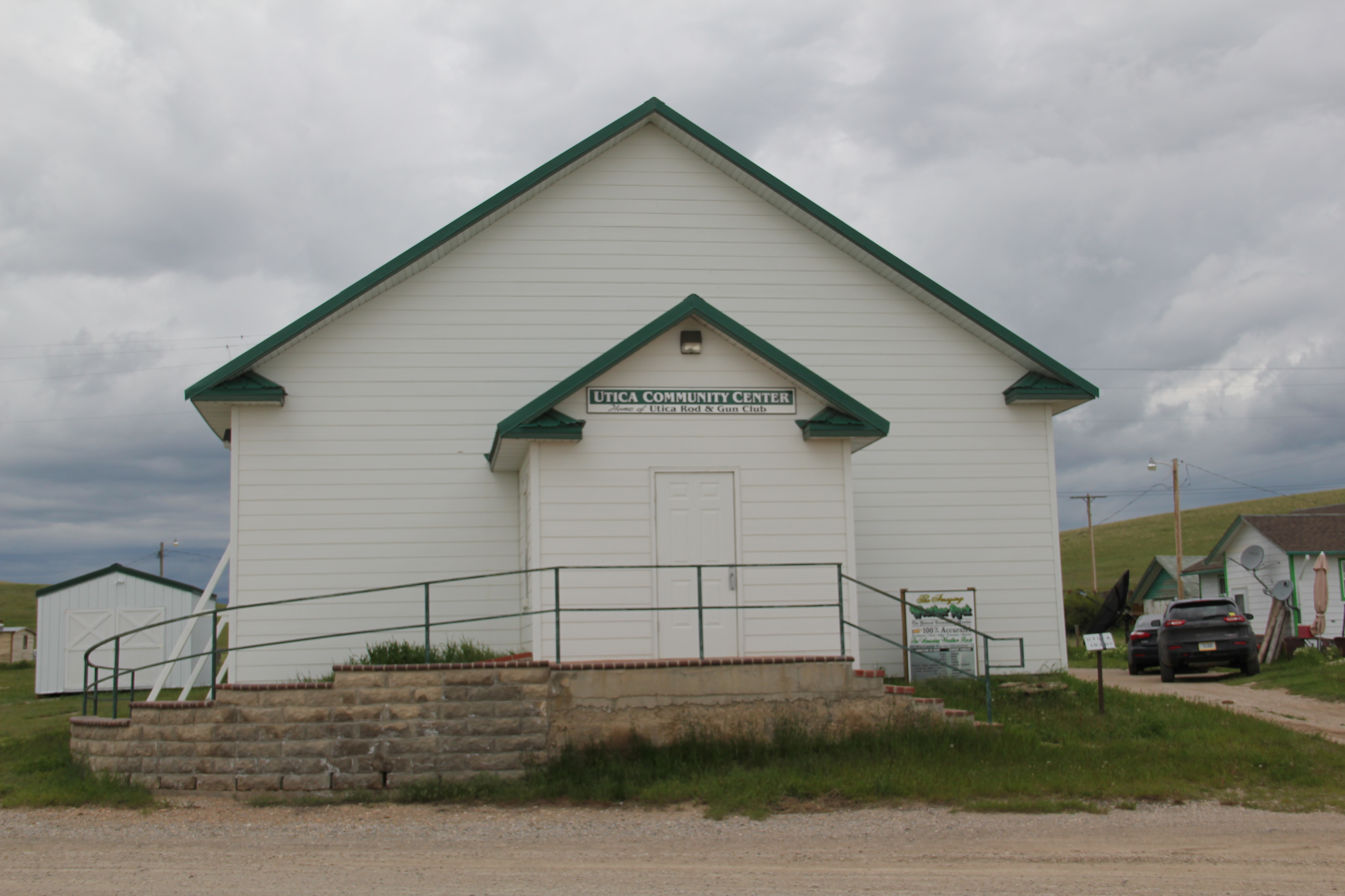
 Utica also has done a commendable job of maintaining and preserving key community buildings, such as the early 20th century school and community hall, both properties associated with the homesteading boom of that time. The town’s historic store is a little

 worse for the wear of 100 years of use, but it is still here, and the stone construction speaks strongly to the vernacular quality of the area’s built environment.
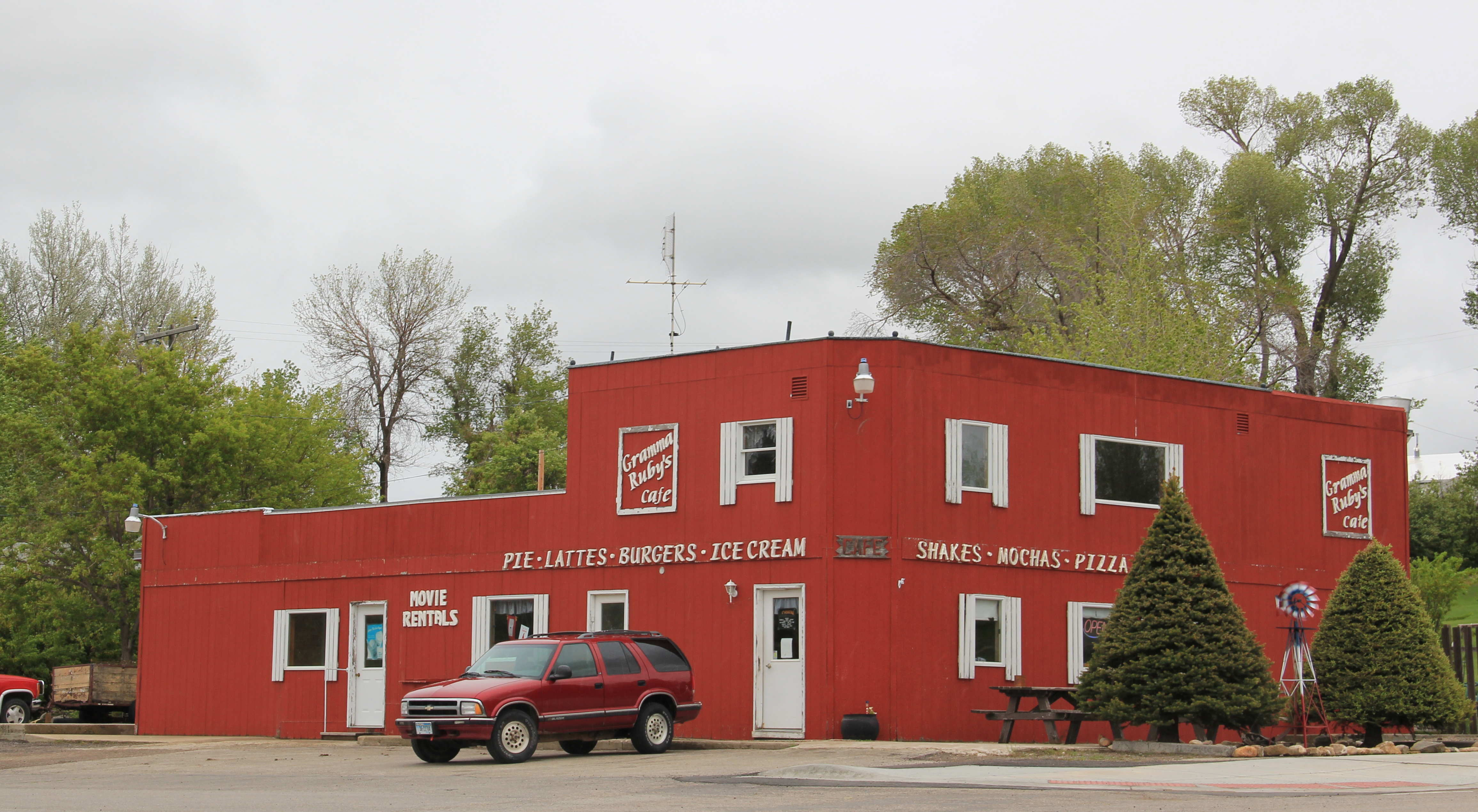
 History and preservation are not the only reasons for Utica’s survival. In true Montana fashion, most people who take the long drive here come for the food, drink, and good
 times at the Oxen Yoke Inn–why else would you locate the town’s primary interpretive sign next to the bar’s parking lot.
 For most travelers the highway from Hobson at the eastern end of Judith Basin County to Stanford, the county seat, in the center of the county, is just open road. But between those two towns three Great Northern hamlets still have significant remnants of their past. Moccasin was such a favorite in 1984 that the resulting book from the survey work, A Traveler’s Companion to Montana History, had two images from the place–the New Deal school, with its totally out of place but flashy Art Deco design, and the two-story Classical Revival styled bank building.
 Those landmarks remain in Moccasin, but much worse for the wear. The school is clearly among those threatened landmarks highlighted by the National Trust for Historic Preservation in 2012. The bank is hanging on, barely.

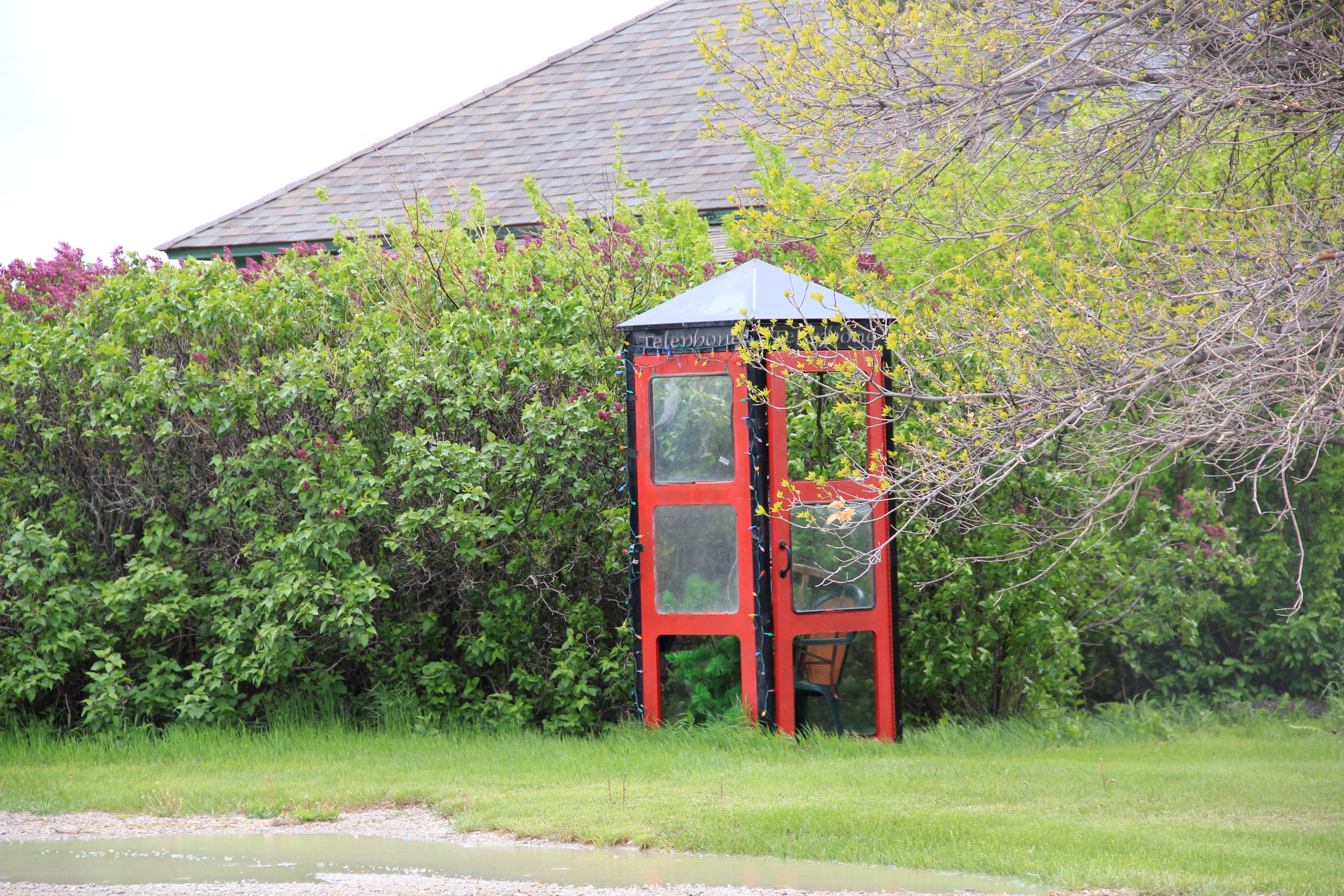
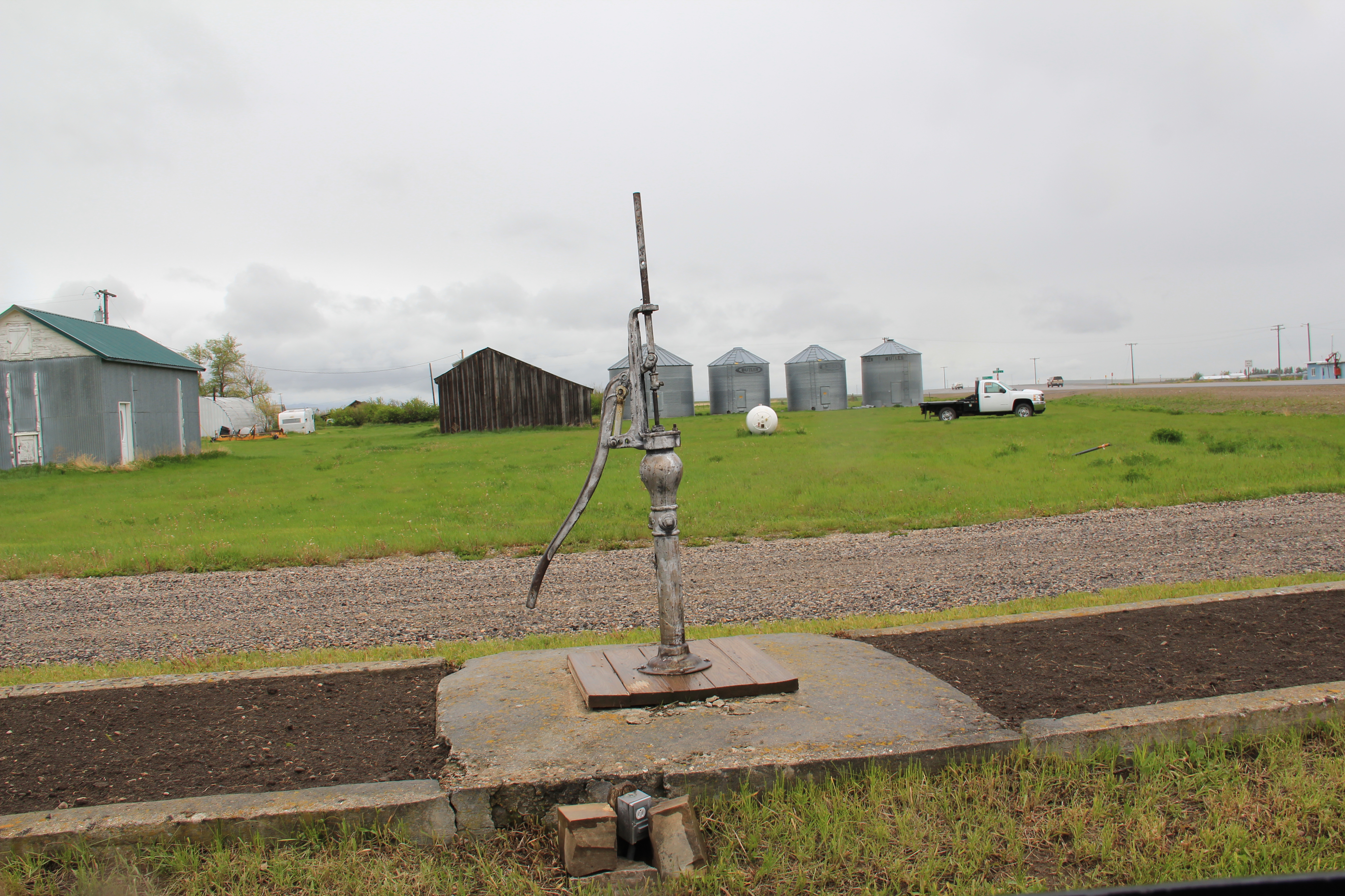
 Moccasin still has other historic buildings worthy of note, such as a church, its town pump, even a telephone booth (a real disappearing part of the landscape from 1984 to 2014).


 More importantly, its historic Great Northern combination depot, although battered, still is along the tracks nearby the elevators, reminding anyone looking closely enough of the railroad roots of the place.
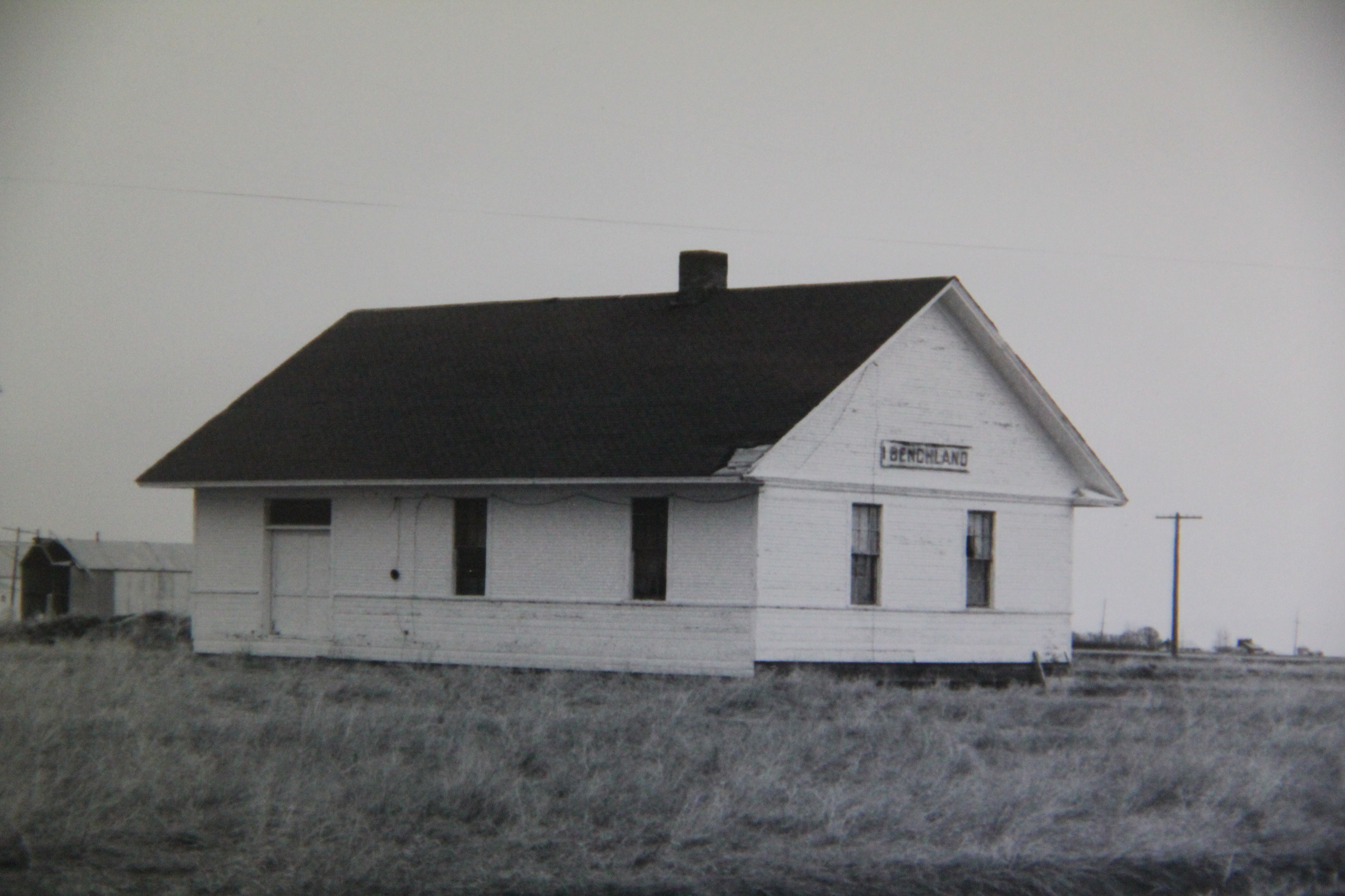
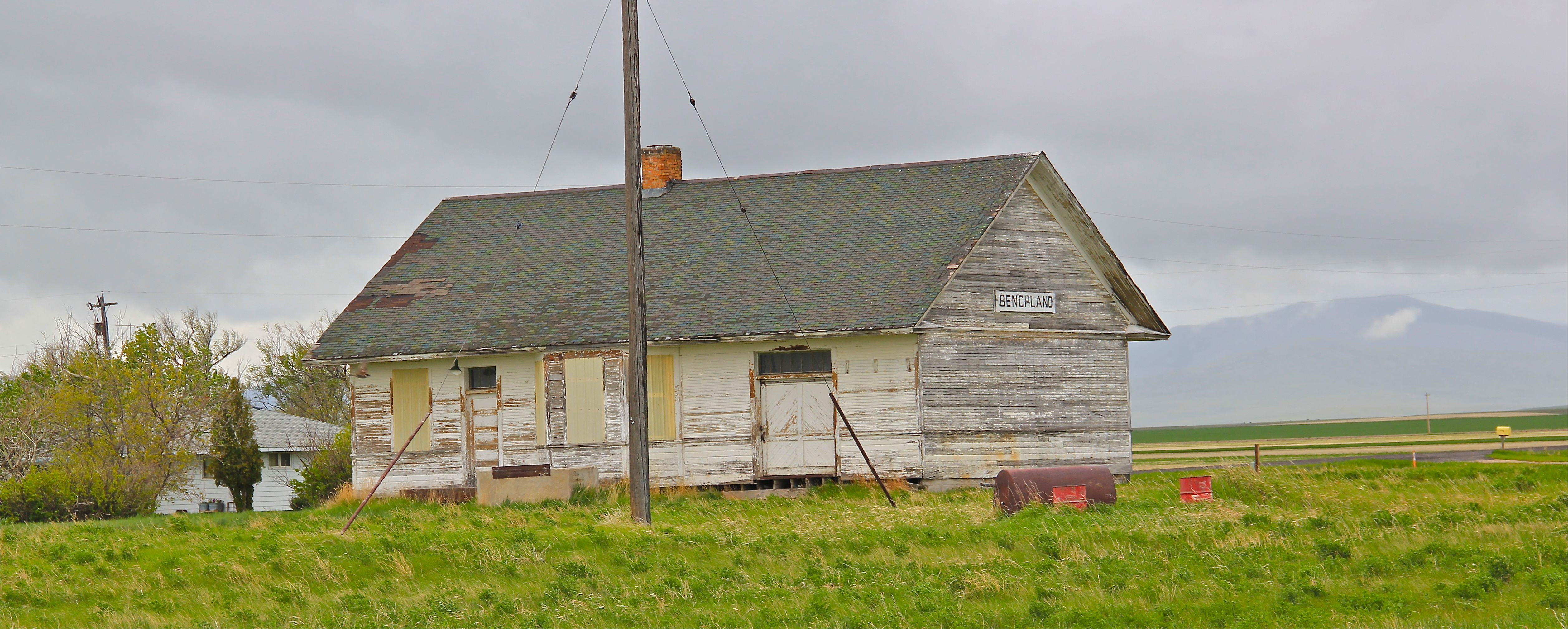
 The next two towns of Benchland and Windham also retain their historic depots. The Benchland station has deteriorated in the last generation as documented in a comparison of a 1984 image with one from 2014.

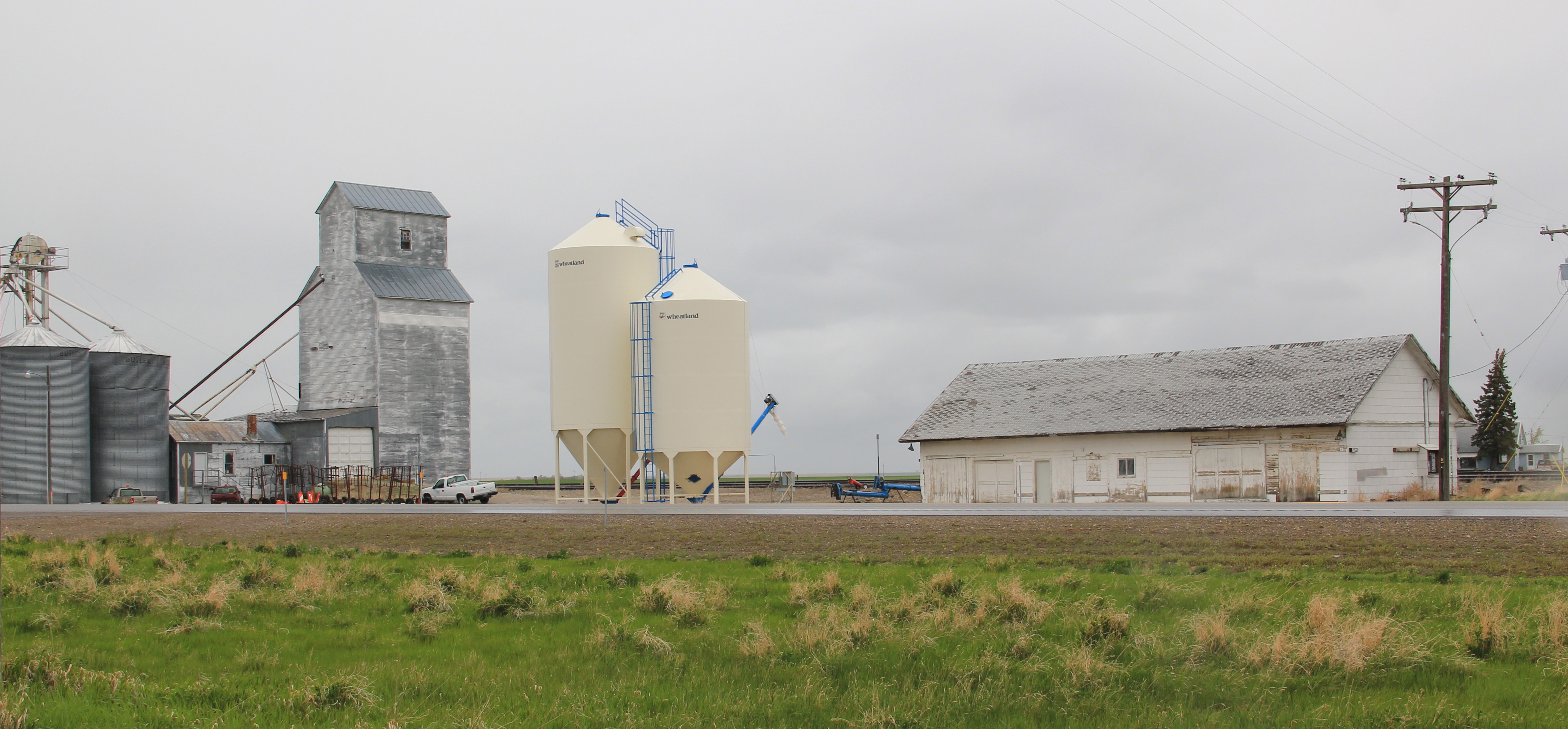
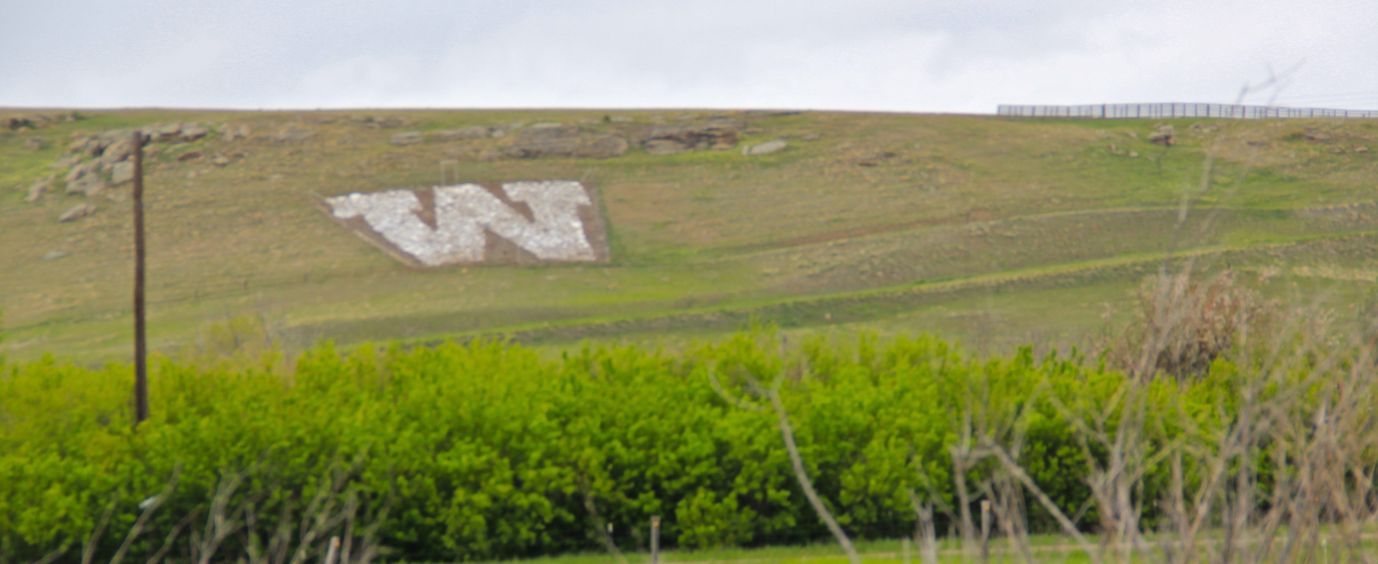
 The Windham depot has been moved slightly off the tracks–but still within a stone’s throw of the rails. The station, along with the historic commercial strip of the T-town plan, and historic elevators, still give meaning to the “W” of the town sign.


 The curve of the tracks headed to Stanford is a good place to rest with this post–more on the plains country towns of the Judith Basin in the next post.


 In the early posts of this exploration of Montana’s historic landscape I spoke of the transformation that I encountered when I revisited Glendive, the seat of Dawson County, for the first time in about 25 years, of how local preservation efforts had kept most of the town’s railroad era landscapes alive while leading to the revitalization of its amazing number of historic residences from 1900 to 1950.
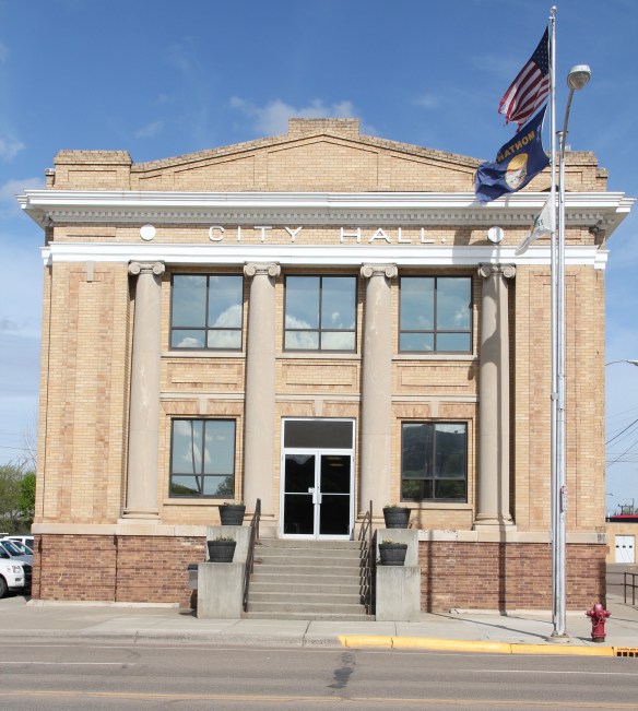 Let’s now turn our attention to public landmarks, old and more recent, that also deserve notice, starting with the magnificent Classical Revival-styled City Hall, one of the anchors of the Merrill Avenue historic district, which is listed in the National Register of Historic Places. Built in 1914, this all-in-one municipal building is an impressive architectural
 statement by the second generation of Glendale’s leaders that the town would grow and prosper during the homesteading boom of the first two decades of the 20th century. The architect was Brynjulf Rivenes of Miles City. His firm had so many commissions coming from eastern Montana and Yellowstone Valley patrons that by this time Rivenes operated offices in both Glendive and Miles City.
 Rivenes had earlier marked Glendive’s new emerging townscape with his Gothic design for the First Methodist Church, in 1909. Fifteen years later, he added another landmark church design with the Romanesque styled Sacred Heart Catholic Church (1924-1925).

 With recovery and the arrival of more and more automobile traffic from the late 1930s to the 1950s, many of the older buildings received mid-century updates. The remodels could
 The 1950s and 1960s brought many changes to Glendive. Post World War Ii growth both in the town and the many surrounding ranches led to expansion and remodeling at the historic Glendive Milling Company in 1955. When the historic districts for Glendive were designated in the late 1980s, preservationists questioned the inclusion of this important industrial/agricultural complex due to the changes of the 1950s. Viewed today, however, the mill complex is clearly a very significant historic site.
 More contemporary styled church buildings were also dedicated in the mid-century, such as the classic “contemporary” styling of the Assembly of God building, with classrooms at
 at the front rather than the rear, or the modified A-frame style of the First Congregational Church, which I shared in an earlier post on Glendive.
 Glendive is very much a blending of different 20th century architectural styles, reaching back into the region’s deep, deep past, as at Makoshika State Park, where the visitor
 center/museum is an excellent example of late 20th century modern style–clearly a building of the present but one that complements, not overwhelms, the beauty of the park itself.
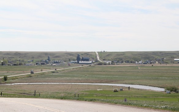
 The town’s grain elevators really are its landmark–the town is along the railroad spur and sits off Montana Highway 16–without the elevators you might not even notice it.
 Agriculture defines the use of the largest buildings of the town, and while it is a tiny place Reserve serves a much larger region of ranches located between Plentywood, the county seat, to the north and Medicine Lake, to the south.
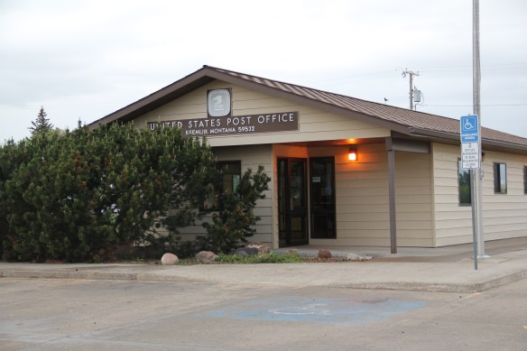
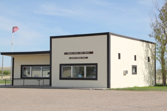 This larger audience for services in Reserve helps to explain the survival of the Reserve Post Office–so many tiny Montana towns have lost the one federal institution that had been there since the town’s beginning.
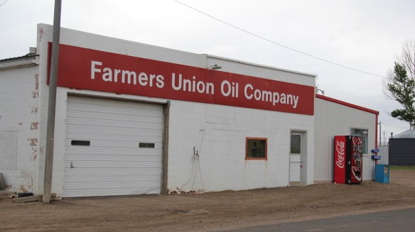
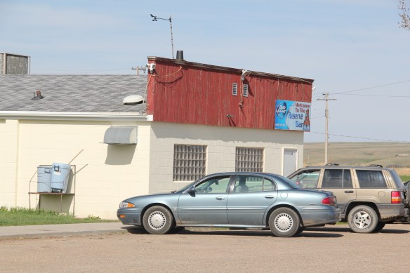 But naturally I will urge you to make a stop, however brief, at the Reserve Bar. This concrete block building, with its period glass block windows, is a friendly place, and a great way to talk with both residents and surrounding farmers.
 Kremlin never grew to be much, perhaps 300 residents at its height (around 100 today), not because it never participated in the region’s agricultural boom–the decaying elevators speak to prosperity but a tornado and then drought doomed the town to being a minor player along the Great Northern main line.


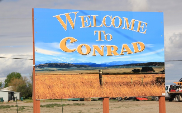 Conrad, the seat of Pondera County, is a railroad town, although the town’s close proximity to Interstate I-15 means that so many have forgotten the importance of this Great Northern Railway spur line that stretches from Shelby on the main line south to Great Falls.
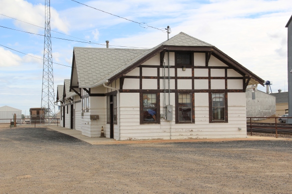
 The town’s 1920s Arts and Crafts/ Chalet style Great Northern passenger station, along with grain elevators, serve as a reminder of the railroad’s importance to transporting the grains from neighboring ranches.
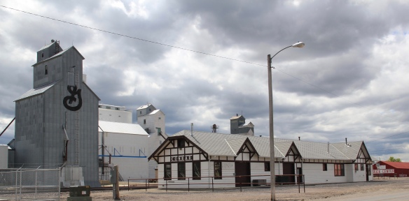 Facing the depot is a combination symmetrical town, with one story brick buildings, several of them classic western bars, and then a block long T-plan that connects to the historic federal highway U.S. 87.
 Montana Highway 1, the Pintler Scenic Route as I knew it during the 1984-85 state historic preservation plan survey, provides travelers with two distinct experiences. The southern half is a mining landscape, centered on the urban places of Anaconda and Philipsburg. The northern half is very agricultural, a place where cowboys and cowgirls still roam. It is one of my favorite parts of the state. Fret not, I won’t explore every nook and cranny but I will talk about three favorite places.
 First up is the village of Hall, which is north of Phillipsburg. The Northern Pacific Railroad ran its spur line from Drummond to Philipsburg through the middle of the valley, leaving Hall as the halfway stop between the larger towns. Just as in 1984, the old town bank still served as the post office. Hogan’s Store still stood near the railroad tracks and a lone grain elevator stood along the old railroad corridor.
 So too was the historic school at Hall still standing–in fact this c. 1920 brick building continues to serve local children as it has for decades. The same was true for the Stockman
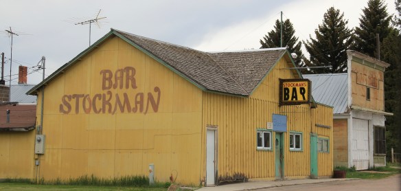 Bar–maybe not as old as the school building but not far behind and still in business despite the proximity to Drummond and Philipsburg. Then there is a wonderful piece of yard art in Hall–leaving no doubt about the primary agricultural product here.
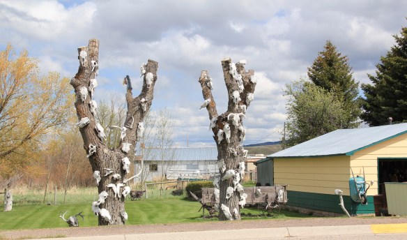
 As you travel north on Montana Highway 1 you next, unexpectedly, cross the historic Mullan Road, one of the oldest roads in the northwest. Parts of the road are graveled and graded, others are paved, but whatever the condition the road takes you to 19th century log
 buildings, even a dog-trot type log dwelling as well as the spectacular Valley Cemetery. I call it spectacular not for its cemetery art–although there is more than you would expect–but for its setting in the Flint Valley.

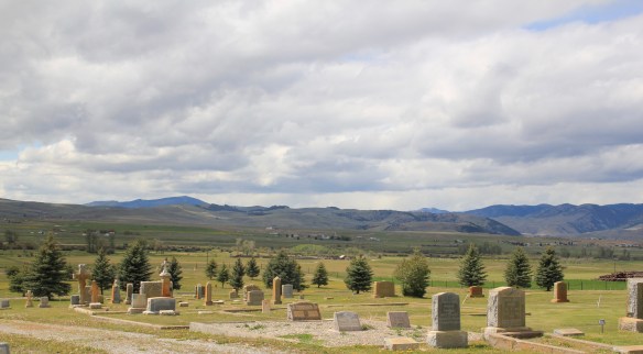 Wherever you look the vista is jaw dropping and can’t be that different than what Capt. Mullan and crew experienced in the late 1850s as they trekked this way. The Annie Milroy grave marker and statue (1912) speaks to the sadness that many homesteaders experienced as they tried to make a go of it in this demanding land.


 The nearby elaborate carving of the Bergman family marker is just another indication that this cemetery deserves additional, full research. (Not far away from Hall is the lone obelisk marker for the historic Emmitsburg Cemetery, another early settlement site.) My next post will finish the Pintler Scenic Route with a deep look at Drummond.
 Willow Creek was the end of the line for both the Northern Pacific and Milwaukee Road railroads as they vied for dominance in turn of the 20th century western Gallatin County. The Northern Pacific came first with its spur line to Butte in the late 1880s then the Milwaukee arrived c. 1908. Both used the same corridor, along what is now called the Old Yellowstone Trail on some maps; the Willow Creek Road (MT 287) on others. It was a route that dated to 1864–the town cemetery, according to lore, dates to that year and Willow Creek has had a post office since 1867.


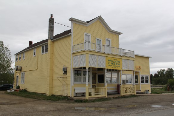 Across the street is the “employment center,” the Willow Creek Tool and Technology which sells its wares across the west out of its brick building from the 1910s. (Note the faded advertising sign that once greeted travelers on the Yellowstone Trail highway.)
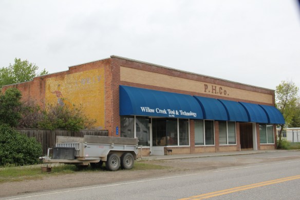 The cultural side of Willow Creek is represented by several places: homes and galleries of different artists, a monthly arts festival in the summer, and two special buildings from the 1910s. The Stateler Memorial Methodist Church, c. 1915, is listed in the National Register of Historic Places. Built from rusticated concrete blocks (from the cement factory at Three Forks) designed to resemble stone masonry, the church building is home to one of the oldest congregations (1864) in the Methodist Church in Montana. The Gothic Revival-styled sanctuary is named in honor of its founding minister Learner B. Stateler.
 Nearby is another crucial landmark for any rural Montana community–the local school. The Willow Creek School is an excellent example of the standardized, somewhat Craftsman-styled designs used for rural Montana schools in the 1910s. Two stories of classrooms, sitting on a full basement, was a large school for its time, another reflection of the hopes of the homesteading era.
 Additions in form of a gym and added rooms had come to the north and the school and its lot is the town’s community center. Although so close to Three Forks, the school kept its


 Montana history has many episodes that involve rich eastern and foreign capitalists who rolled the dice on Montana’s resources. Typically everyone thinks of the mining and railroad corporations of the late 19th century. But in several places across the Big Sky Country, investors looked to the land itself and dreamed of agricultural bonanzas.
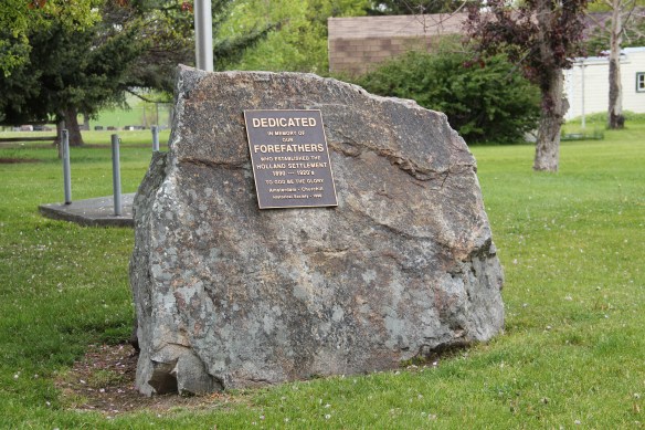
 Such is the case of Amsterdam and Church Hill (now Churchill), two rural communities in today’s rapidly suburbanizing Gallatin County. The Manhattan Malting Company was mostly a New York City venture which in the early 1890s, before the terrible depression of 1893-1896, established an industrial base on the Northern Pacific Railroad, changing the name of the town from Moreland to Manhattan. The company purchased 13,000 acres,and acquired the best in agricultural technology, the Jacob Price Field Locomotive steam plow, to till the soil. They also convinced hundred of Dutch farmers to come to Gallatin County and work the land. Even with the hard times, or perhaps because of them, people still wanted good beer, and the company prospered. By 1905 the company decided to shed itself of the land and focus on malting barley.
 The new land company focused on getting farmers on its land, and to secure a railroad spur line. The railroad came in 1911, and the community name of Amsterdam reflected the ethnic origins of the surrounding farmers and ranchers. Even when the Malting Company failed during Prohibition, the farmers kept going, developing some of the still most productive farmland in the state.
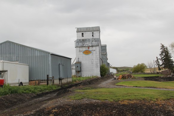 When I visited Amsterdam in 1984 the railroad line still operated but the spur closed the next year, leaving today only a faint corridor to mark its route. Look close and you can still see the outline of the T-plan town that was once “downtown Amsterdam” by the remaining historic commercial buildings, with the Danhof automobile dealership still in business today, with a newer showroom just east of the old railroad tracks.


 As the highway leaves the central plains east of Great Falls, it heads east through coal country (see the earlier post on Belt) and south into the Little Belt Mountains and the old mining towns of Monarch and Neihart (above). Both Cascade County towns are proud of their heritage, a story embodied in the Monarch-Neihart School, a wonderful bit of log craftsmanship from the New Deal era, a WPA project finished in 1940 that is listed in the National Register of Historic Places.
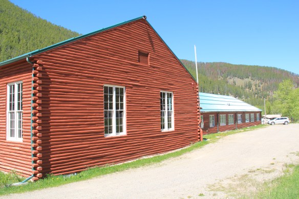


 When I last visited there in 2015 the combined route of U.S. 89 and 12, which passes in front of the courthouse and the center of town, was being rebuilt, giving the historic business district the look of a ghost town.

 U.S. Highway 89 continues south, crossing the historic corridor of the Milwaukee Road at Ringling, another Meagher County town discussed in an earlier post, marked by the landmark St. John’s Catholic Church.
 Travelers continuing south soon find themselves in Park County, entering the Shields River Valley just north of Wilsall, where highway markers and monuments, like that for “Thunder Jack” (2006) by sculptor Gary Kerby, convey the significance of the place.
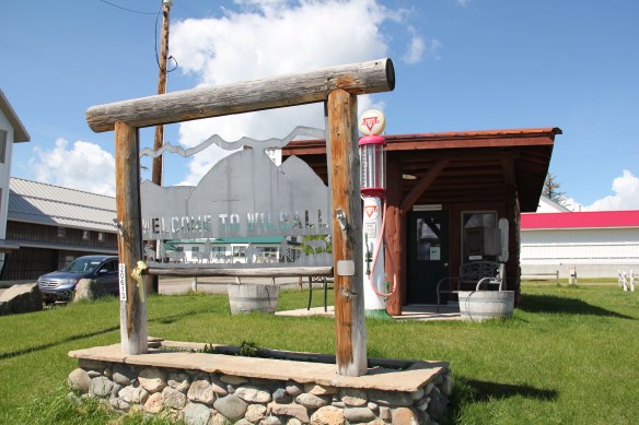
 Wilsall was not much a place 30 years ago, a small trade town on the edge of a Northern Pacific Railroad spur line, a past still recalled by the tall elevator and old railroad corridor.
 But the growing popularity of the Shields River Valley has led to a new boom in Walsall, with old banks converted into bars and old general stores


 Clyde Park Tavern is still the place to go for an adult beverage, or two. Historic grain elevators still serve local ranchers, marking the railroad line that defined the town’s landscape until the impact of the highway in the early 20th century.