 Miners first began to gather at what is now Philipsburg in the late 1860s; the town was later named for Philip Deidesheimer, who operated the Bi-Metallic Mine works. As the Bi-Metallic Mine and Mill expanded operations in the 1880s, a rapid boom in building
occurred, creating one and two-story brick buildings with dazzling Eastlake-styled cast-iron facades. The town was incorporated in 1890.

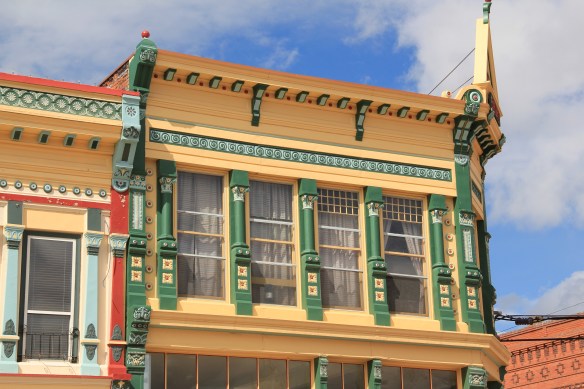 The quality of the Victorian commercial architecture still extant in Phillipsburg, such as the 1888 Sayrs Block above, astounded me during the 1984-85 preservation work. So much was intact but so much needed help. Residents, local officials, and the state preservation office understood that and by 1986 the Philipsburg Commercial historic district had been added to the National Register of Historic Places.
 What is exciting is that in this decade, entrepreneurs are building upon early successful renovations and adaptive reuse project to launch new businesses and create new jobs. The town’s population is growing, after 30 years of decline.
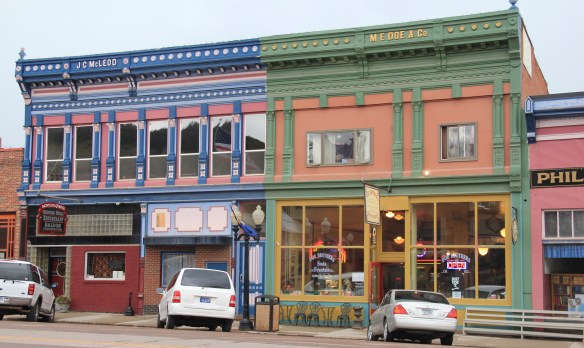
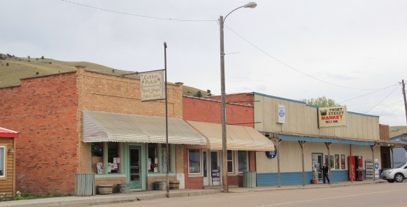
No business has been more central to this transformation than the Sweet Palace, shown above, which is next door to the two-story brick Masonic Lodge.
Another key to recent success has the resurrection of local hotels and bed and breakfast establishments, along with the staging of various summer productions at the town’s Opera House Theatre, built in 1896, making it the longest continuous operating theater in the state. These properties give visitors a reason to stay longer, and not just stop at the Candy Store, grab a brew at one of the town’s historic bars, and then move along.
The town has recently added an amphitheater, located behind the historic school building, that also serves summer events that drive ever-increasing numbers of people to visit this mountain mining town and to spend more time and money there. This is modern-day heritage development at work.
 The new developments in Philipsburg are interesting and invaluable changes since 1984-1985. At the same time, I am happy that residents have still embraced their historic public buildings in a similar fashion. The photograph I used in my book about the town in 1985
 was the Philipsburg School, with its soaring tower symbolizing the hopes that residents had for Philipsburg’s future in the 1890s. The historic school, which is listed in the National Register, remains although the community built a new building adjacent to the historic one in 1987. (you can see a corner of the new building at the lower left).
 When I first visited in 1984 the only building in Philipsburg listed in the National Register was the Queen Anne-styled Granite County Jail of 1902. It also remains in use.
 But now the Classical Revival-styled Granite County Courthouse (1913) is also listed in the National Register. Designed by the important Montana architectural firm of Link and Haire, this small town county courthouse also speaks to the county’s early 20th century ambitions, with its stately classical columned portico and its central classical cupola.

 By climbing the hill above the courthouse you also gain a great overview look of the town, reminding you that these rather imposing public buildings are within what is truly a modest urban setting that is connected to the wider world by Montana Highway 1.

A couple of final thoughts on Philipsburg. Its range of domestic architecture from c. 1875 to 1925 is limited in numbers but impressive in the variety of forms, from brick cottages to brick Queen Anne homes to textbook examples of bungalows and American Four Squares.
Listed in the National Register of Historic Places, the M.E. Dow House is a frame Queen Anne home, modest considering the flamboyant Eastlake-styled cast-iron front to his downtown business block.
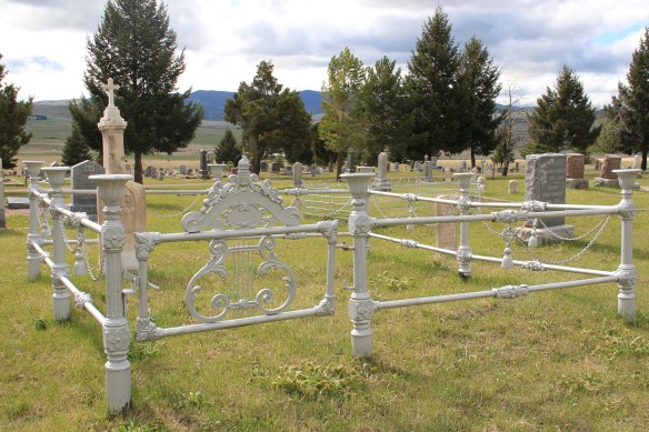
 The Philipsburg Cemetery, which like so many that I ignored in 1984-1985, was a revelation, reflecting the quality of Victorian period architecture found in the town.
 The beauty and serenity of its setting were impressive enough, but then some of the family plots and individual markers reflected Victorian era mortuary art at its best.
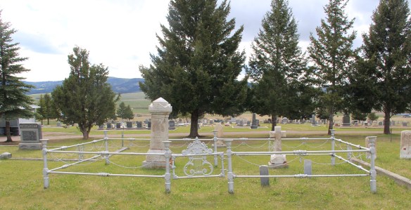 This cast-iron gate, completed with urns on each post and the music lyre gate, is among the most impressive I have encountered in any small town across America. And this cemetery has two separate ones.
 Many grave markers came from local or nearby masons but others, like these for the Schuh and Jennings families, were cast in metal, imitating stone, and shipped by railroad to Philipsburg.
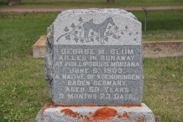
Other markers are not architecturally impressive but they tell stories, such as the one below, for Mr. George M. Blum, a native of Germany, who was “killed in runaway at Phillipsburg” in 1903. I look forward to a future visit to this cemetery for further research.


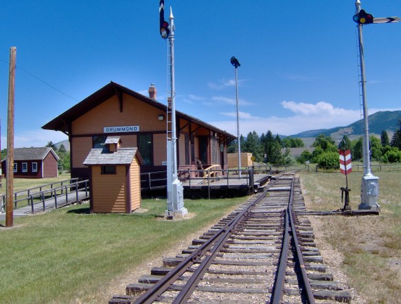
 Drummond is the north entrance of the Pintler Scenic Route. The first ranchers settled here in the 1870s but a proper town, designed in symmetrical fashion facing the railroad tracks, was not established until 1883-1884 as the Northern Pacific Railroad built through here following the Clark’s Fork River to Missoula.


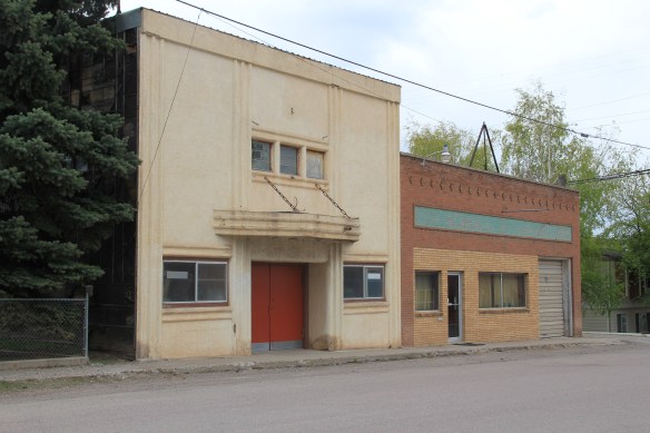
 There is a faintly classically influenced two-story brick commercial block, a Masonic Lodge made of concrete block, various bars and cafes, a railroad water tank, and a slightly Art Deco movie theater, which was open in the 1980s but is now closed.


 Due to the federal highway and the later Interstate I-90 exit built at Drummond, the town even has a good bit of motel roadside architecture from c. 1970 to 1990.
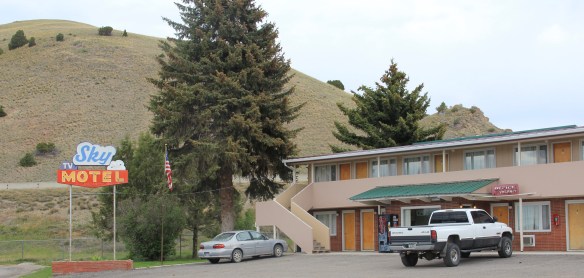
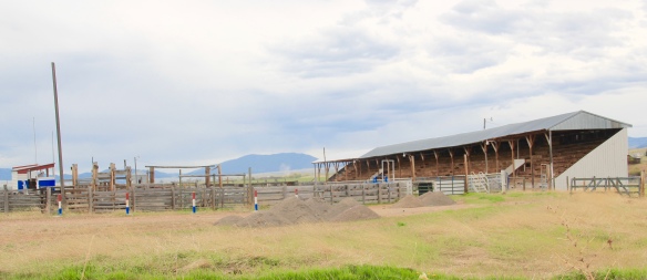
 Between the Northern Pacific corridor and old U.S. 10 is the town’s most famous contemporary business, its “Used Cow” corrals, and now far away, on the other side of the
 tracks are rodeo grounds named in honor of Frank G. Ramberg and James A. Morse, maintained by the local American Legion chapter.
 The rodeo grounds are not the only cultural properties in Drummond. The Mullan Road monument along the old highway is the oldest landmark. The local heritage museum is at the New Chicago School (1874), an frame one-story school moved from the Flint River Valley to its location near the interstate and turned into a museum.

 Another local museum emphasizes contemporary sculpture and painting by Bill Ohrmann. A latter day “cowboy artist” Ohrmann grew up in the Flint River Valley but by the 12960s he was producing sculpture and painting on a regular basis. The museum is also a gallery and his works are for sale, although the huge sculptures might not be going anywhere.


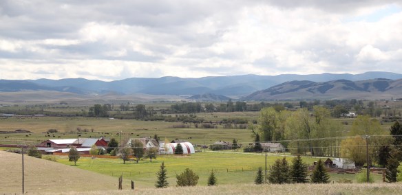 Montana Highway 1, the Pintler Scenic Route as I knew it during the 1984-85 state historic preservation plan survey, provides travelers with two distinct experiences. The southern half is a mining landscape, centered on the urban places of Anaconda and Philipsburg. The northern half is very agricultural, a place where cowboys and cowgirls still roam. It is one of my favorite parts of the state. Fret not, I won’t explore every nook and cranny but I will talk about three favorite places.
 First up is the village of Hall, which is north of Phillipsburg. The Northern Pacific Railroad ran its spur line from Drummond to Philipsburg through the middle of the valley, leaving Hall as the halfway stop between the larger towns. Just as in 1984, the old town bank still served as the post office. Hogan’s Store still stood near the railroad tracks and a lone grain elevator stood along the old railroad corridor.
 So too was the historic school at Hall still standing–in fact this c. 1920 brick building continues to serve local children as it has for decades. The same was true for the Stockman
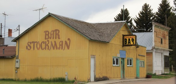 Bar–maybe not as old as the school building but not far behind and still in business despite the proximity to Drummond and Philipsburg. Then there is a wonderful piece of yard art in Hall–leaving no doubt about the primary agricultural product here.
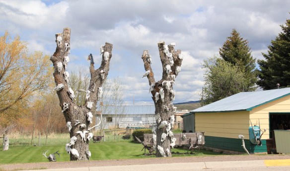
 As you travel north on Montana Highway 1 you next, unexpectedly, cross the historic Mullan Road, one of the oldest roads in the northwest. Parts of the road are graveled and graded, others are paved, but whatever the condition the road takes you to 19th century log
 buildings, even a dog-trot type log dwelling as well as the spectacular Valley Cemetery. I call it spectacular not for its cemetery art–although there is more than you would expect–but for its setting in the Flint Valley.

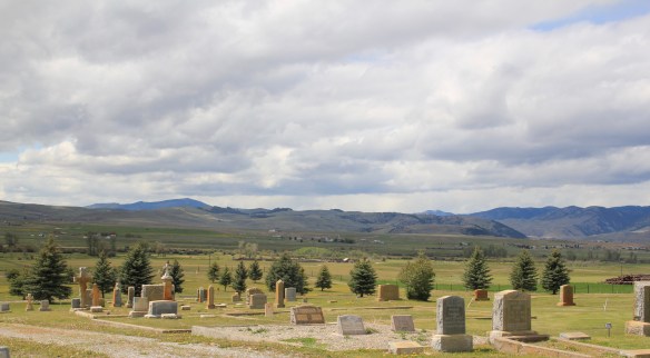 Wherever you look the vista is jaw dropping and can’t be that different than what Capt. Mullan and crew experienced in the late 1850s as they trekked this way. The Annie Milroy grave marker and statue (1912) speaks to the sadness that many homesteaders experienced as they tried to make a go of it in this demanding land.


 The nearby elaborate carving of the Bergman family marker is just another indication that this cemetery deserves additional, full research. (Not far away from Hall is the lone obelisk marker for the historic Emmitsburg Cemetery, another early settlement site.) My next post will finish the Pintler Scenic Route with a deep look at Drummond.


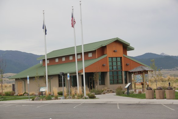
 Montana Highway 1, designated the Pintler Scenic Route, has long been one of my favorite roads. It was the first Montana road to be paved in its entirety. During the state historic preservation plan work of 1984-1985, I documented the route as U.S. 10A, but once government officials decided to decommission the U.S. 10 designation in 1986, the name U.S. 10A also went away. t. In its early decades the route had passed through Opportunity to Anonconda onto Phillipsburg and then Drummond, but for all of my time in Montana, the highway has gone from Interstate I-90, Anaconda/Opportunity exit to the west and then north to the Drummond exit on the same interstate. There is a new 21st century rest stop center at the Anaconda I-90 exit that has a Montana Department of Transportation marker about the mountain ranges and the Pintler route.
 The town of Opportunity was not a priority for my travels in 1984-1985 but recent scholarship on how local residents have fought back against the decades of pollution from Anaconda’s Washoe Stack led me to give this small town of 500 a new look. The book is Brad Tyer’s Opportunity, Montana: Big Copper, Bad Water, and the Burial of an American Landscape (2014). Tyler details how the success of Anaconda also meant the sacrifice of thousands of surrounding acres to the pollution belching daily from the Washoe Stack until it closed in 1981. He then reviews in detail how in the 21st century, EPA heaped a new disaster on the town by moving Milltown wastes from the Clark’s Fork River near Missoula to Opportunity, telling locals that the Milltown soil would be new top soil for Opportunity. The environmental solution didn’t work, leaving the town in worse shape than before.
 Opportunity residents got a small fraction of SuperFund monies for the environmental cleanup in the form of Beaver Creek park. But the centerpiece of the park, the Opportunity School built for residents in 1914 by the Anaconda Company, has been mothballed for now. It operated from 1914 until the smelter ceased operations in 1981 and
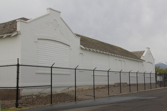 served as the community’s focal point. Restoration of the school is problematic due to the prior use of asbestos, meaning the federally funded park is only partially finished since the SuperFund support is now gone.


 Sitting at 6,425 feet in elevation Georgetown Lake covers over 3700 acres. Today it is very much a recreational landscape but when it was created in 1885 its job was to generate electrical power for the nearby mines since it stood roughly equal distance between


 As the state highway historical marker above documents, this high country area was another mining region. With an vantage point above the lake, Southern Cross is a significant remnant of the mining activities from the early 20th century. The mines here
 began operation in the mid-1860s and production continued for until World War II. The settlement was largely Finnish and Swedish in the early 20th century when most of the remaining buildings were constructed.


