
 The Clark’s Fork River and transportation through the valleys and over the Rocky Mountains lie at the core of Missoula’s early history. Captain John Mullan blazed his road through here immediately before the Civil War, and a Mullan Road marker is downtown.
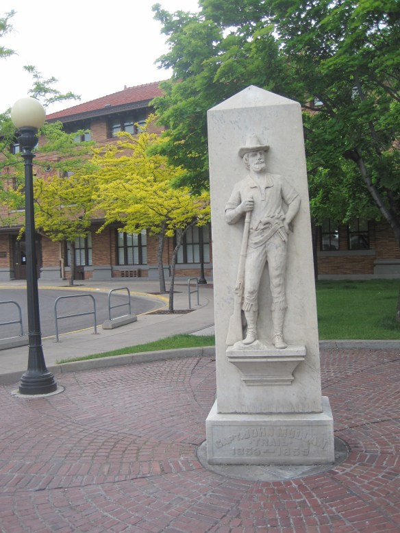 White settlement first arrived in the initial territorial years and a sawmill was the first major business. As a river crossroads town, Missoula grew, and then became a permanent dot on the federal map with the arrival of Fort Missoula, established in 1877. The fort, largely neglected when I conducted my work for the state historic preservation plan in 1984, is now a regional heritage center.

Quartermaster building, Fort Missoula, built 1911.

Fort Missoula overview, taken in 2007.
But so much of that you see and experience today in downtown Missoula is shaped by the arrival of two railroads, the Northern Pacific Railroad in 1883 and then the Milwaukee Road in 1908. In those 25 years, much of historic environment of present-day Missoula was built, creating a north side, south side look to the city that reflects not only the central thread of the Clark’s Fork River but also the impact of the two sets of railroad tracks.
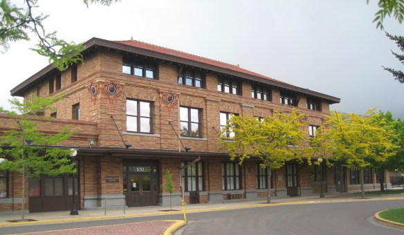 Built in 1901, the Northern Pacific passenger station is an impressive example of Renaissance Revival style, designed by the architectural firm of Reed and Stem, and symbolized the turn of the century dominance of the railroad over the region’s transportation and the importance of Missoula to the railroad as a major train yard. The station, listed in the National Register of Historic Places in 1985, stands at the historic “top” of downtown Missoula, which at its bare bones has the classic T-plan of a railroad hub of the late 19th century. The Northern Pacific tracks and related railroad warehouses are the top of the “T” stretching in both directions with Interstate I-90 crossing the river bluffs to the northeast. Two reminders of the historic railroad traffic are adjacent to the station–a steam Northern Pacific engine and a diesel Burlington Northern engine.


From the passenger station stretching into the town itself is Higgins Street,which runs in a straight line to the river. The most important early commercial building, near the Higgins Street bridge is of course the threatened Missoula Mercantile building (discussed

in an earlier blog), which has sections dating to the 1880s. Higgins Street bridge crosses the Clark’s Fork, which on the south side became the street’s connection with the later Milwaukee Road.
 The Milwaukee was not to be out-done by the Northern Pacific when it arrived in Missoula in 1908. Railroad architect J. J. Lindstrand gave the line a fashionable Misson-style passenger station and offices, which opened in 1910. It too is listed in the National Register. Like the company’s stations in Great Falls and Butte, built approximately at the same time, the station has a tall tower that commanded the city’s early 20th century skyline, and made the depot easy to find. Located dramatically along the Clark’s Fork River, the arrival of the railroad and the construction of the depot led to a new frenzy of building on South Higgins Street, and a good many of those one-story and two-story buildings remain in use today.
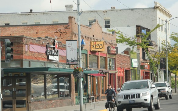
That is enough for now–the railroads of Missoula have been introduced. Next I will explore landmarks between the two depots of Missoula.
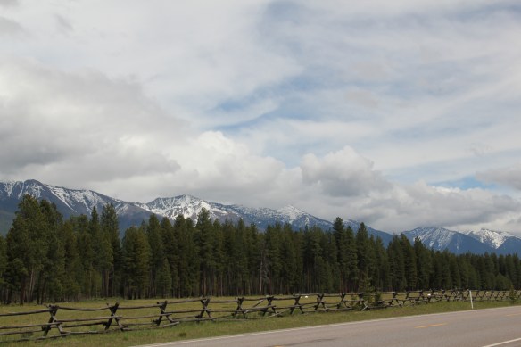 Missoula County has grown, a lot, since my state historic preservation plan work in 1984-1985, especially in the county seat of Missoula and surrounding suburbs. Yet Missoula County still has several spectacular rural drives, like Montana Highway 83 above at Condon, along with distinctive country towns. This post will share some of my favorites.


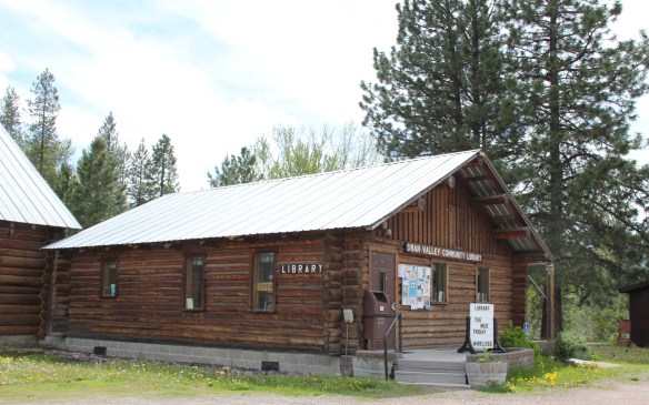 The Condon Community Center and adjacent Swan Valley Community Library serve as additional hubs for those living along the lakes and mountains of northeast Missoula County. Both buildings are excellent examples of mid-20th century Rustic style–a look that, in different variations, dominates the Highway 35 corridor.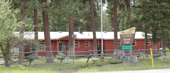
 Condon is also the base for the Condon Work Center, home to the Great Northern Fire Crew, of the Flathead National Forest. Here you can take a mile-long Swan Ecosystem Trail and learn of the diversity of life in this national forest region.
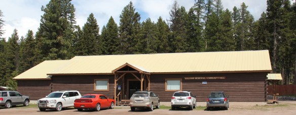
 South of Condon on Montana Highway 83 is Seeley Lake–a place that certainly has boomed in the last 30 years–witness the improved highway, new businesses, and population that has increased over 60 percent since my last visit in 1992. Yet it still had places rooted in the community’s earlier history such as the Sullivan Memorial Community Hall–a good example of mid-20th century Rustic style.
 And it had added one of my favorite bits of roadside architecture in this part of Montana: the Chicken Coop Restaurant as well as opening a new Seeley Lake Historical Museum and Chamber of Commerce office at a spectacular highway location just outside of town.


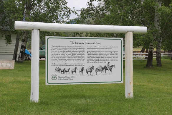
 I don’t recall even thinking about the forest service facility, but here was an entire complex devoted to the forest service’s use of mules and horses before the days of the ATV that was built by the Civilian Conservation Corps. The remount depot is an interesting


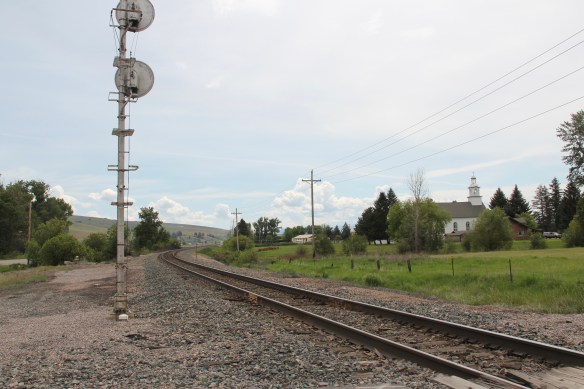
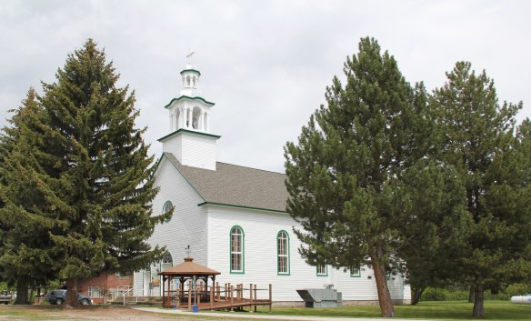
 The name Frenchtown dates to 1868 and is a reference to a number of French Canadians who moved here in the early settlement period. A National Register-listed church, the St. John the Baptist Catholic Church (1884) marks that first generation of settlers. Its classical-tinged cupola has long been the town’s most famous landmark.
 The Milwaukee Road built through here in 1907-1908 and there remains a handful of historic business buildings from the time of the Milwaukee boom. There is one landmark
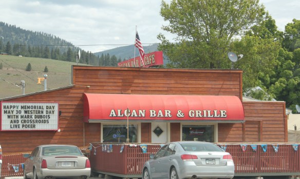
 another roadside landmark–the Bucksnort Bar, just further evidence to add to the Chicken Coop and the Alcan that you won’t go hungry if you explore the small towns of Missoula County.

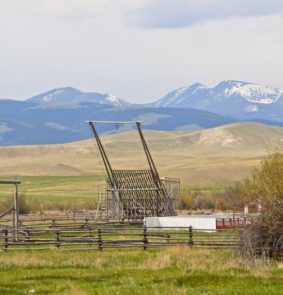 Powell County’s Deer Lodge Valley is another favorite western Montana landscape. I visited there often during the 1980s, and in the years since I found myself often back in places like Deer Lodge, the county seat, if for nothing else to stop at the R&B Drive-In.
 Let’s start with the town of Deer Lodge, a place that has changed much in the last 30 years, a process that was underway in the early 1980s after the Milwaukee Road closed its division point and declared the entire line bankrupt. Besides Miles City, it is difficult to find a town more impacted by the Milwaukee’s failure than Deer Lodge.


 Yet, Deer Lodge was not a typical small town base for the Milwaukee Road; railroads typically wanted to create their own place. But Deer Lodge was one of the oldest places in the state, where ranchers in the 1850s first arrived–the early site is now interpreted at the Grant-Kohrs National Historic Site of the National Park Service–soon followed by Capt. John Mullan as he and his soldiers built the Mullan Road through this valley.

 The Northern Pacific passenger depot exists across the tracks from the Milwaukee Road station. It too has a new use: the Northern Pacific depot is now the senior citizens center.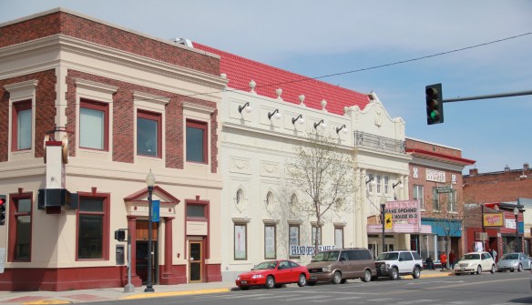

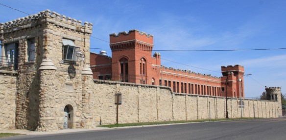 Before Deer Lodge was a railroad town, it was a prison town, the location for the Territorial Prison, and later the state prison. Most of the buildings you can visit today are from the state prison era. It operated here until 1980 when it moved to a facility outside of town.

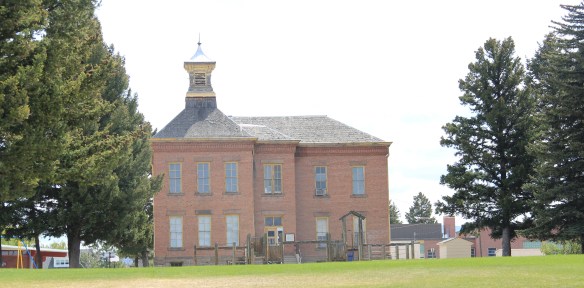 Deer Lodge also was an early center for education, represented by Trask Hall (1870s), which, like the territorial prison, is listed in the National Register. So with the themes of settlement, ranching, railroads, education, prisons, and the beauty of the valley why has Deer Lodge struggled to be recognized as one of Montana’s premier heritage designations? As the next post will discuss, citizens are taking steps to remedy the situation.
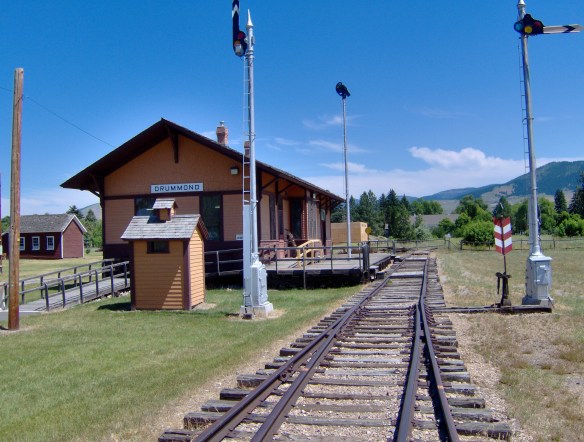
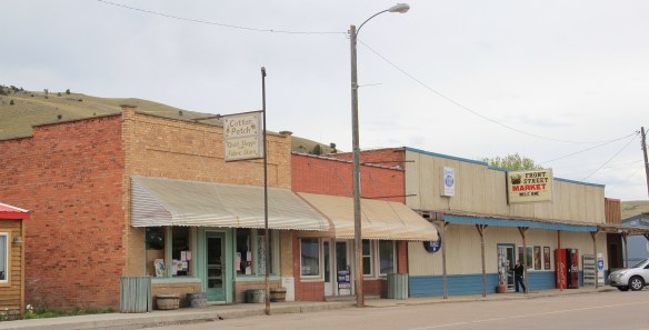 Drummond is the north entrance of the Pintler Scenic Route. The first ranchers settled here in the 1870s but a proper town, designed in symmetrical fashion facing the railroad tracks, was not established until 1883-1884 as the Northern Pacific Railroad built through here following the Clark’s Fork River to Missoula.


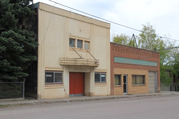
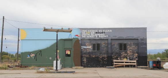 There is a faintly classically influenced two-story brick commercial block, a Masonic Lodge made of concrete block, various bars and cafes, a railroad water tank, and a slightly Art Deco movie theater, which was open in the 1980s but is now closed.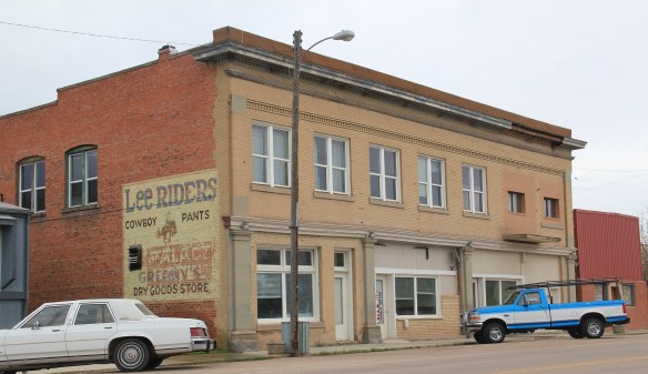


 Due to the federal highway and the later Interstate I-90 exit built at Drummond, the town even has a good bit of motel roadside architecture from c. 1970 to 1990.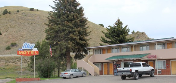
 Between the Northern Pacific corridor and old U.S. 10 is the town’s most famous contemporary business, its “Used Cow” corrals, and now far away, on the other side of the
 tracks are rodeo grounds named in honor of Frank G. Ramberg and James A. Morse, maintained by the local American Legion chapter.
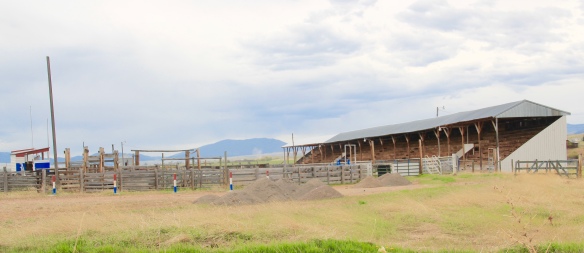 The rodeo grounds are not the only cultural properties in Drummond. The Mullan Road monument along the old highway is the oldest landmark. The local heritage museum is at the New Chicago School (1874), an frame one-story school moved from the Flint River Valley to its location near the interstate and turned into a museum.

 Another local museum emphasizes contemporary sculpture and painting by Bill Ohrmann. A latter day “cowboy artist” Ohrmann grew up in the Flint River Valley but by the 12960s he was producing sculpture and painting on a regular basis. The museum is also a gallery and his works are for sale, although the huge sculptures might not be going anywhere.




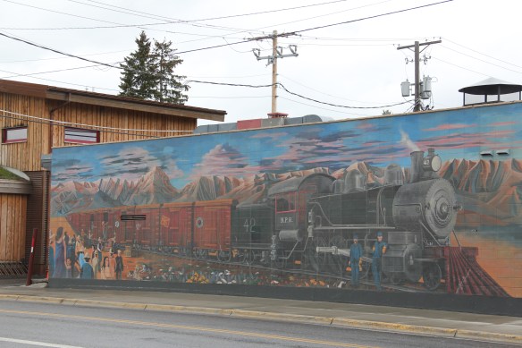 On Bozeman’s Main Street today there is a huge mural celebrating the arrival of the Northern Pacific Railroad in 1882. The impact of the railroad on the town was certainly a topic of interest in the 1984-85 survey, and one image included the existing Northern Pacific Railroad and adjoining grain elevators and other businesses reliant on the corridor.
 Today that same place has been transformed, through adaptive reuse, into a micro-brewery and restaurant–pretty good place too, and a great place in 2015 for me to get out of a persistent rain. The Northern Pacific reached a deal with rancher Nelson Story in 1882 to build through his property but also provide a spur line to his existing mill operations. From the beginning both the railroad and local entrepreneurs saw an agricultural future for Bozeman and Gallatin County.

 The depot and adjoining buildings have been designated as a historic district, with a pocket city park providing some new life to the area. But this impressive building’s next life remains uncertain even as the city encourages creative solutions for the area.
 The c. 1922 depot is adequately moth-balled–the new roof has lots of life left–and as the city maintains it is structurally sound with key interior features intact. Yet graffiti now mars one end of the building, and any building that is empty, especially in such a booming local economy, is cause for concern.

 The same fate did not befell the Milwaukee Road’s other significant building in Bozeman, its concrete block warehouse, shown above in an 1985 image. The open space, solid construction, and excellent location helped to ensure a much longer life for the building, which is now a building supplies store, with a repainted company sign adorning the elevations of the building.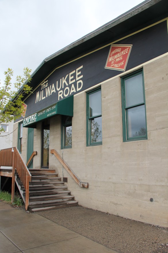
 It is encouraging that the city recognizes the significance, and the possibilities, for the historic buildings along Bozeman’s railroad corridor. Let’s hope that a permanent solution soon emerges for the empty Northern Pacific depot.

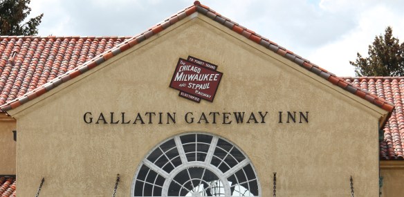


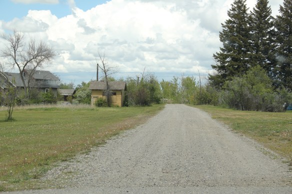


 Willow Creek was the end of the line for both the Northern Pacific and Milwaukee Road railroads as they vied for dominance in turn of the 20th century western Gallatin County. The Northern Pacific came first with its spur line to Butte in the late 1880s then the Milwaukee arrived c. 1908. Both used the same corridor, along what is now called the Old Yellowstone Trail on some maps; the Willow Creek Road (MT 287) on others. It was a route that dated to 1864–the town cemetery, according to lore, dates to that year and Willow Creek has had a post office since 1867.


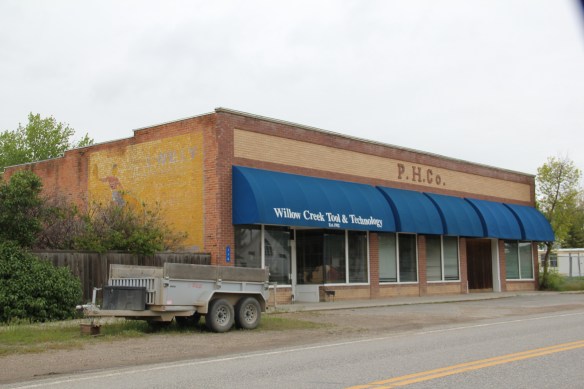
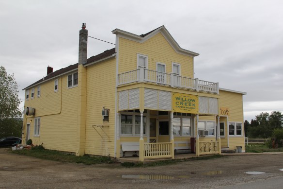 Across the street is the “employment center,” the Willow Creek Tool and Technology which sells its wares across the west out of its brick building from the 1910s. (Note the faded advertising sign that once greeted travelers on the Yellowstone Trail highway.)
 The cultural side of Willow Creek is represented by several places: homes and galleries of different artists, a monthly arts festival in the summer, and two special buildings from the 1910s. The Stateler Memorial Methodist Church, c. 1915, is listed in the National Register of Historic Places. Built from rusticated concrete blocks (from the cement factory at Three Forks) designed to resemble stone masonry, the church building is home to one of the oldest congregations (1864) in the Methodist Church in Montana. The Gothic Revival-styled sanctuary is named in honor of its founding minister Learner B. Stateler.
 Nearby is another crucial landmark for any rural Montana community–the local school. The Willow Creek School is an excellent example of the standardized, somewhat Craftsman-styled designs used for rural Montana schools in the 1910s. Two stories of classrooms, sitting on a full basement, was a large school for its time, another reflection of the hopes of the homesteading era.
 Additions in form of a gym and added rooms had come to the north and the school and its lot is the town’s community center. Although so close to Three Forks, the school kept its


 Three Forks, Montana, is unique in how competing railroads shaped this one small town between the 2008 and 2010. The last post discussed how the Milwaukee Road came first, and its landmark Sacajawea Inn stands at the north end of the town’s main street. On the east side–see the Google Map below–became the domain of the Northern Pacific Railroad and its spur line to the copper kingdom of Butte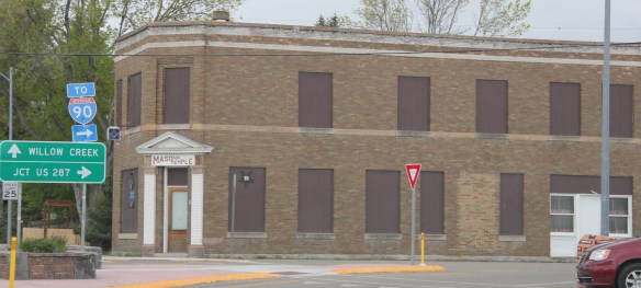


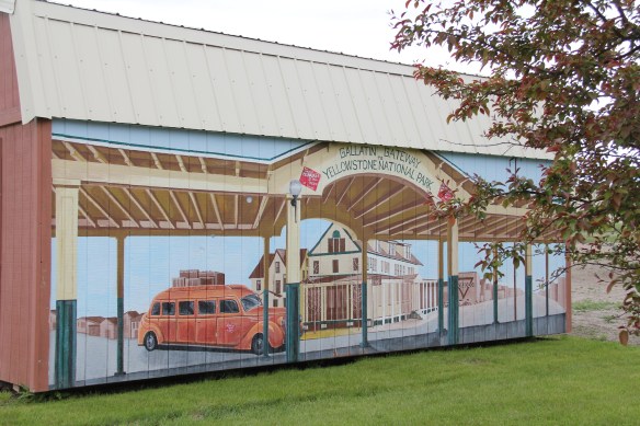
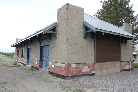 Company. In 1914 Charles Botcher bought the plant, renamed it the Ideal Cement Company and kept it in business under that name until the 1980s.


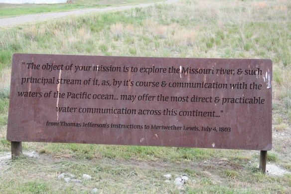


 As you leave the Missouri Headwaters State Park access road (Montana 286) and return south to old U.S. Highway 10, you encounter a plaintive sign hoping to attract the thousands of heritage tourists who come to the state park–go a bit farther south and west and find the town of Three Forks.
 The story of Three Forks, on the western edge of Gallatin County, is not of rivers but of railroads, of how both the Northern Pacific and the Milwaukee Road corridors shaped this part of the state at the end of the first decade of the 20th century.


