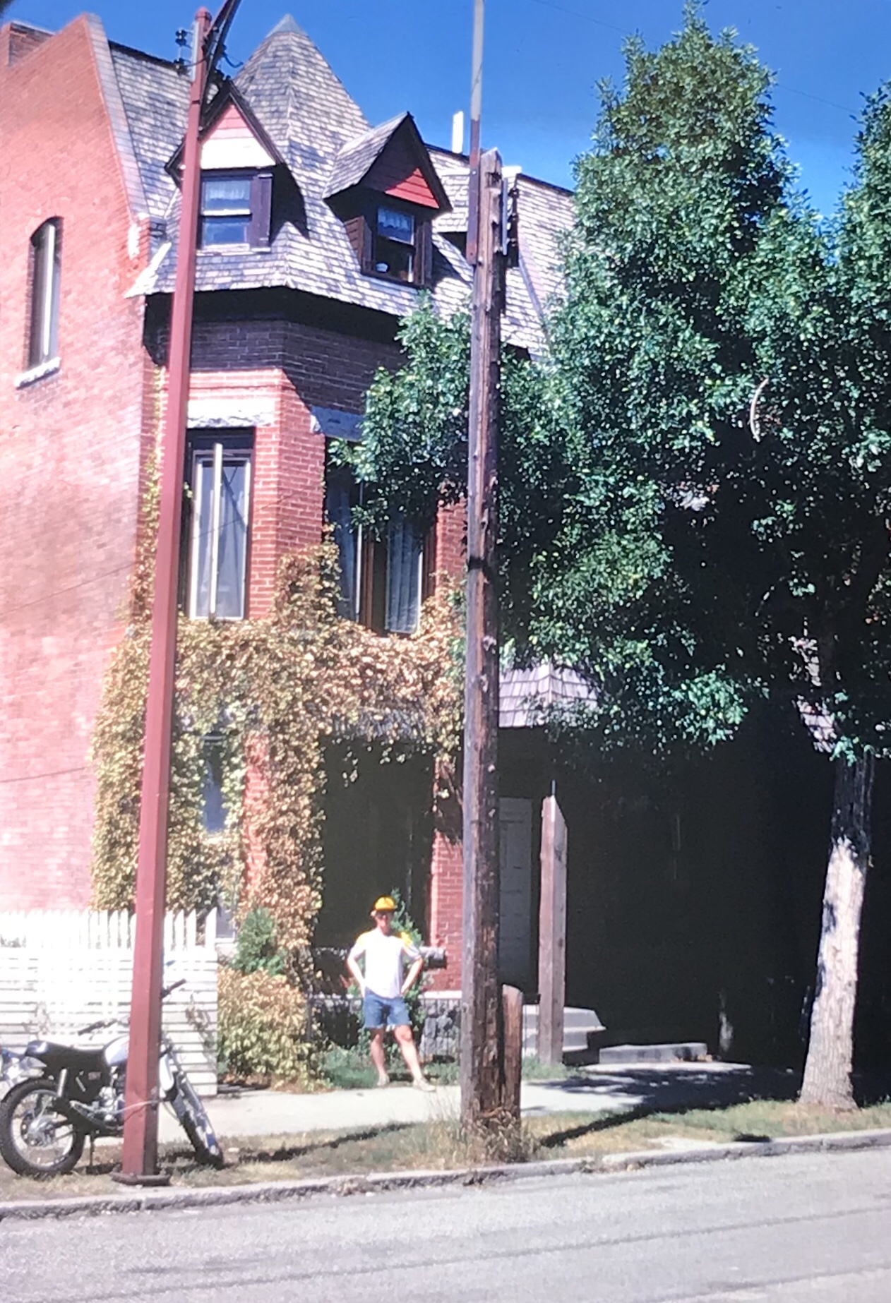
 When I first arrived in Montana in 1981 the first place that I stopped at was Little Bighorn Battlefield, then known as Custer Battlefield National Monument. As a southerner new to the west, here was a place that “everyone” knew about, an iconic western battlefield where Gen. George A. Custer and the 7th Calvary suffered a devastating defeat from a combined Sioux-Cheyenne force. Everything then was focused on “Last Stand Hill” where
Little Big Horn Battlefield, 1984
Custer and his troops had stood for almost 100 years. As a veteran visitor to southern Civil War battlefields, it struck me how what you saw and experienced was all about the federal side–similar to what you found back then at southern Civil War memorial parks, where valiant Confederates fought what seemed to be a foe with no name outside of enemy.
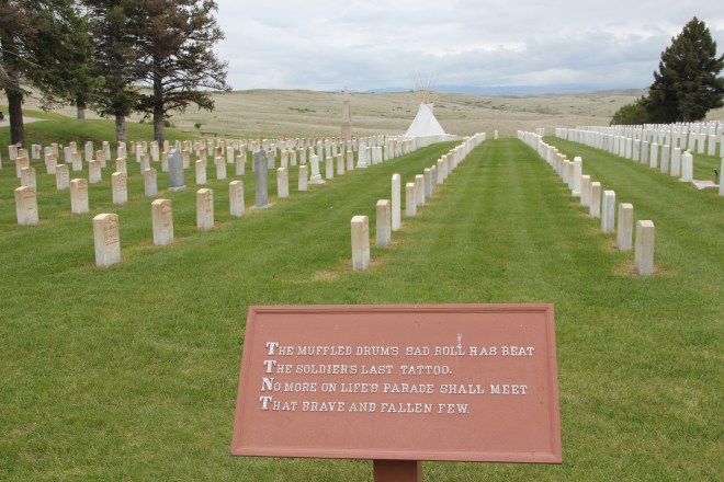
This quotation from Theodore O’Hara’s “Bivouac of the Dead” is found in many Civil War era national cemeteries.
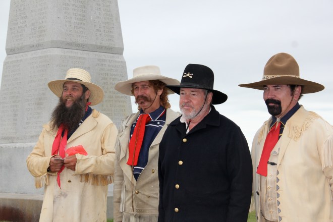 Over the decades I have returned to the battlefield numerous times, even once (by accident I hadn’t even thought that the day would be an anniversary) when re-enactors posed by the famous obelisk monument, creating a very odd juxtaposition between past and present. (I don’t think Custer and his men were smiling on that hill in 1876).
 By this time, meaning at the battlefield had shifted to a larger, more inclusive narrative, beginning with the actual name of the park, now Little Bighorn Battlefield. Public interpretation, fueled not only by the changing times but an intensive archaeological investigation of the park in the late 1980s, suddenly located Native Americans within the battle landscape. There was a growing feeling that yes this was a battle between enemies, but enemies with names, motivations, and their own sense of what it all meant.
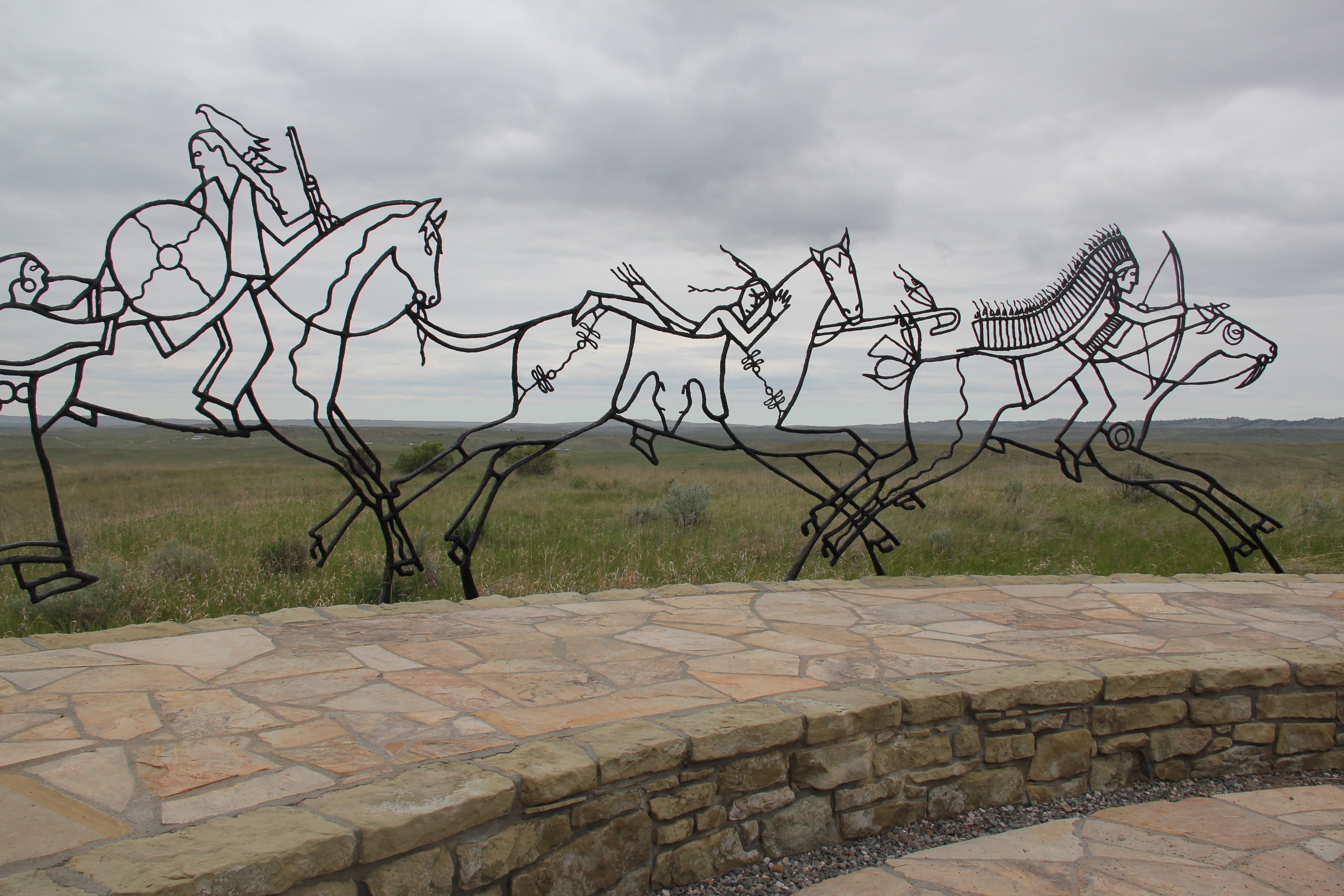
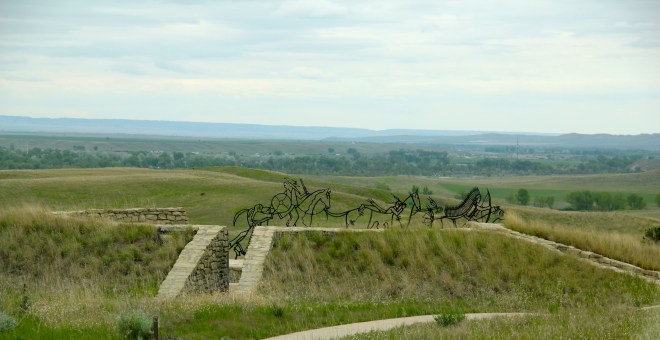
 Last Chance Hill was still a focal point in 2015 but now its narrative of unity and sacrifice was countered by a new monument, built to consider the story of Little Bighorn from the perspective of the Native American warriors who fought here.
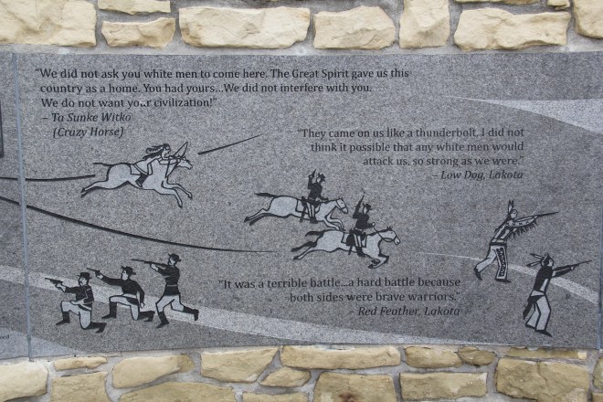
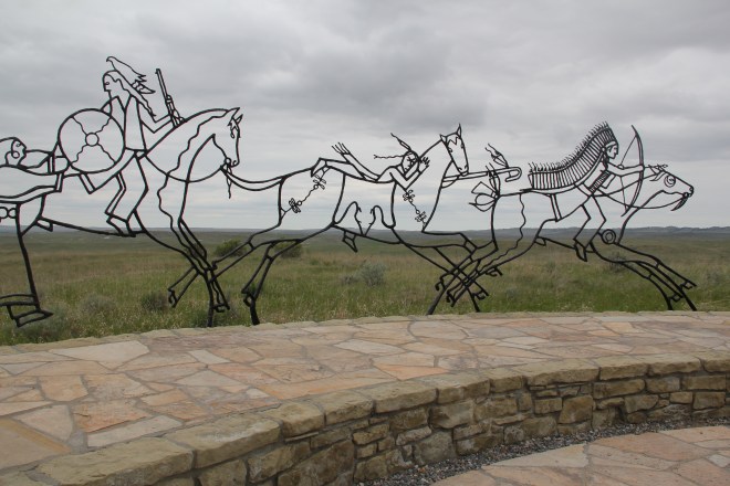 The monument compels reflection—the metal profiles of Native American warriors blend into the actual battlefield landscape as if ghosts of warriors past were again upon the field. Text and images add additional layers of interpretation and meaning to the battlefield, from a decided Native American perspective.
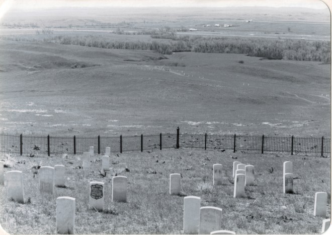
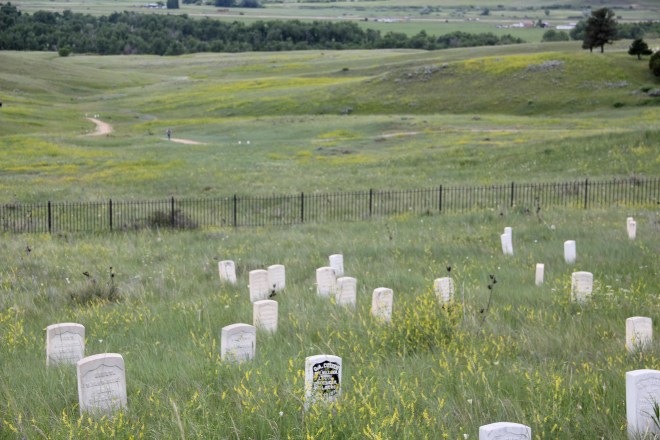
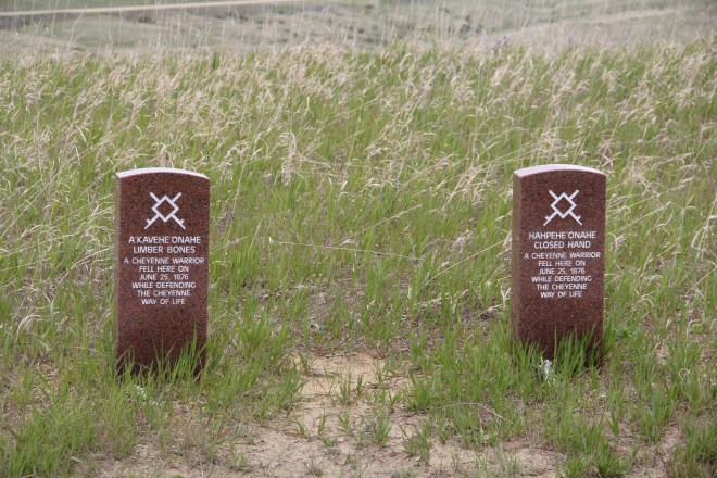
 Then new tombstones, in a brownish stone, distinguished fallen Cheyenne warriors from the marble tombstones for soldiers from the 7th Calvary. The place has been ennobled, transformed as a both a park and a place of reflection on what the Indian Wars of the 1870s have meant to the nation and to the peoples who fought in them.
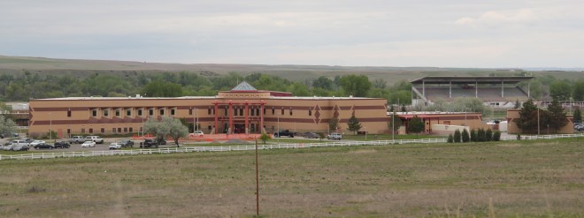
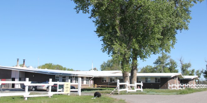
 Nearby within Crow Agency is a further addition to the public interpretation of the region’s military history: the exemplary Apsaalooke Veterans Park, an installation that celebrates veterans past and present.
 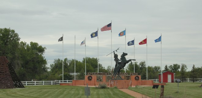 At the I-90 exit for U.S. 212 at Crow Agency, a new landscape has emerged through spaces such as the park, the new Apsaalooke casino, and especially the modernist styled medical center, located near the fairgrounds for the annual Crow fair.
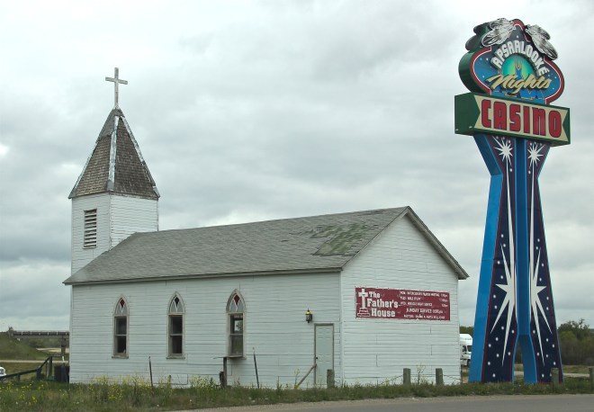
The sparking bright lights of casino sign stand in stark contrast to the old mission church, now The Father’s House place of worship.
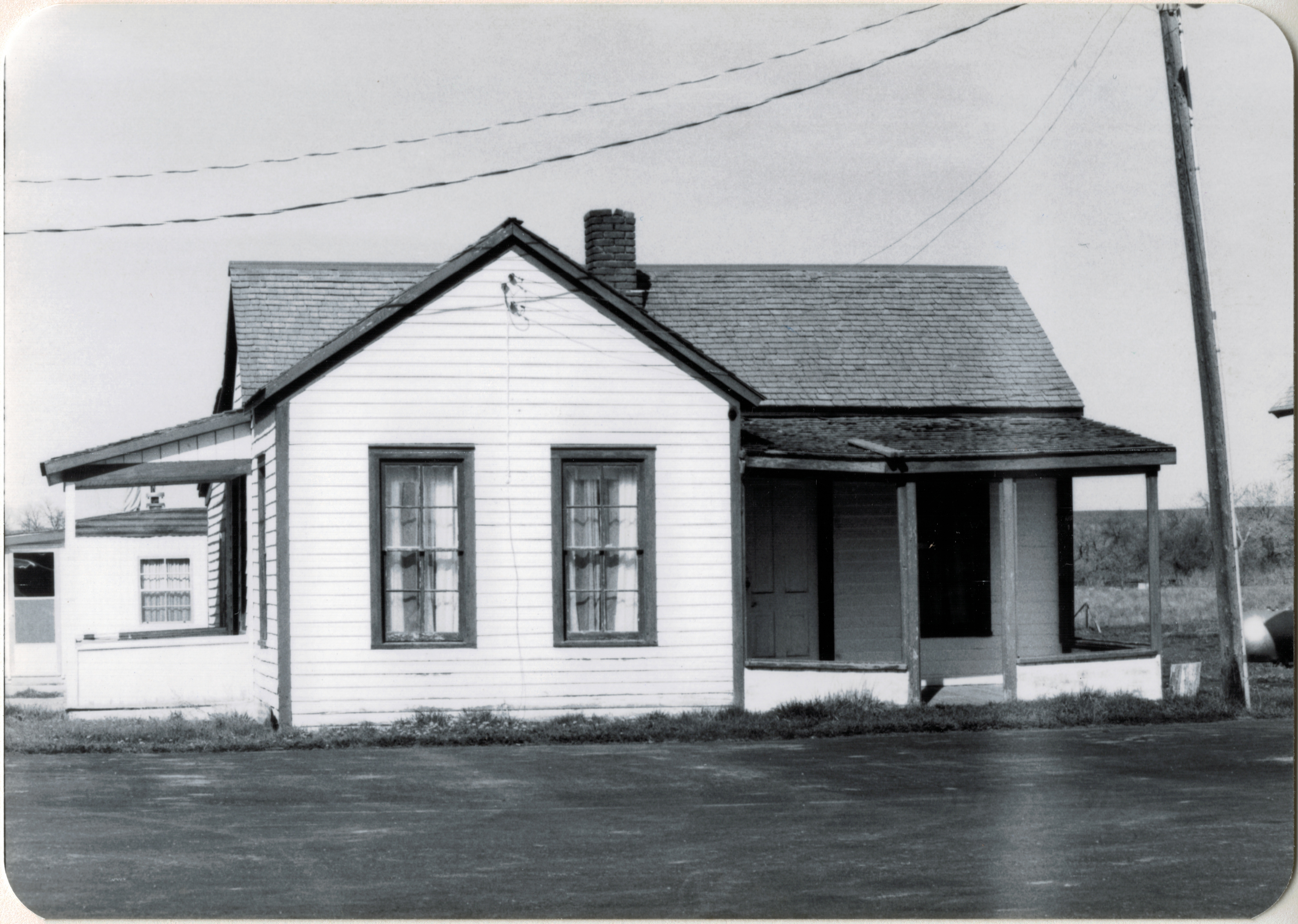
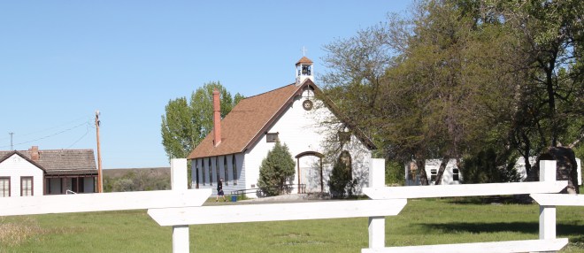
 In the middle of the Crow Indian Reservation is another landscape of change, one not so visited by tourists. St. Xavier was an important Catholic mission among the Crow Indians, established along the Big Horn River in 1887-1888 by Father Peter Prando. The understated Gothic-styled church was a building documented in my A Traveler’s Companion to Montana History book in 1986 and the survey included both the church and small gable-front residence built for the priests.
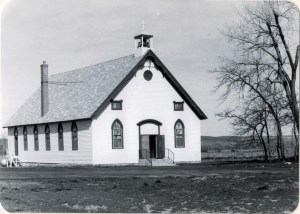
Those same buildings remain today, as does the nearby Pretty Eagle Catholic Academy, representing community continuity and the Catholic commitment to the reservation. But
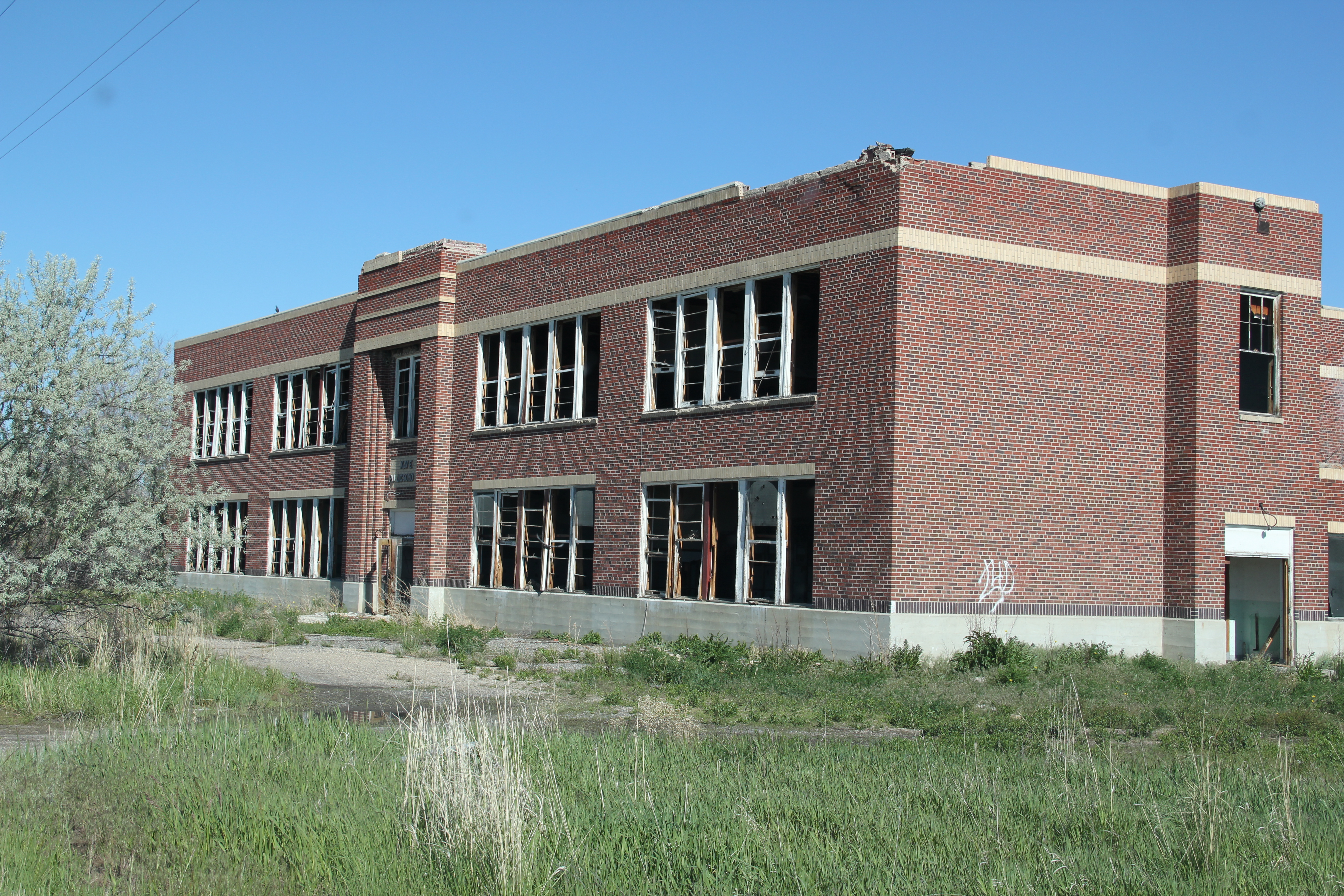
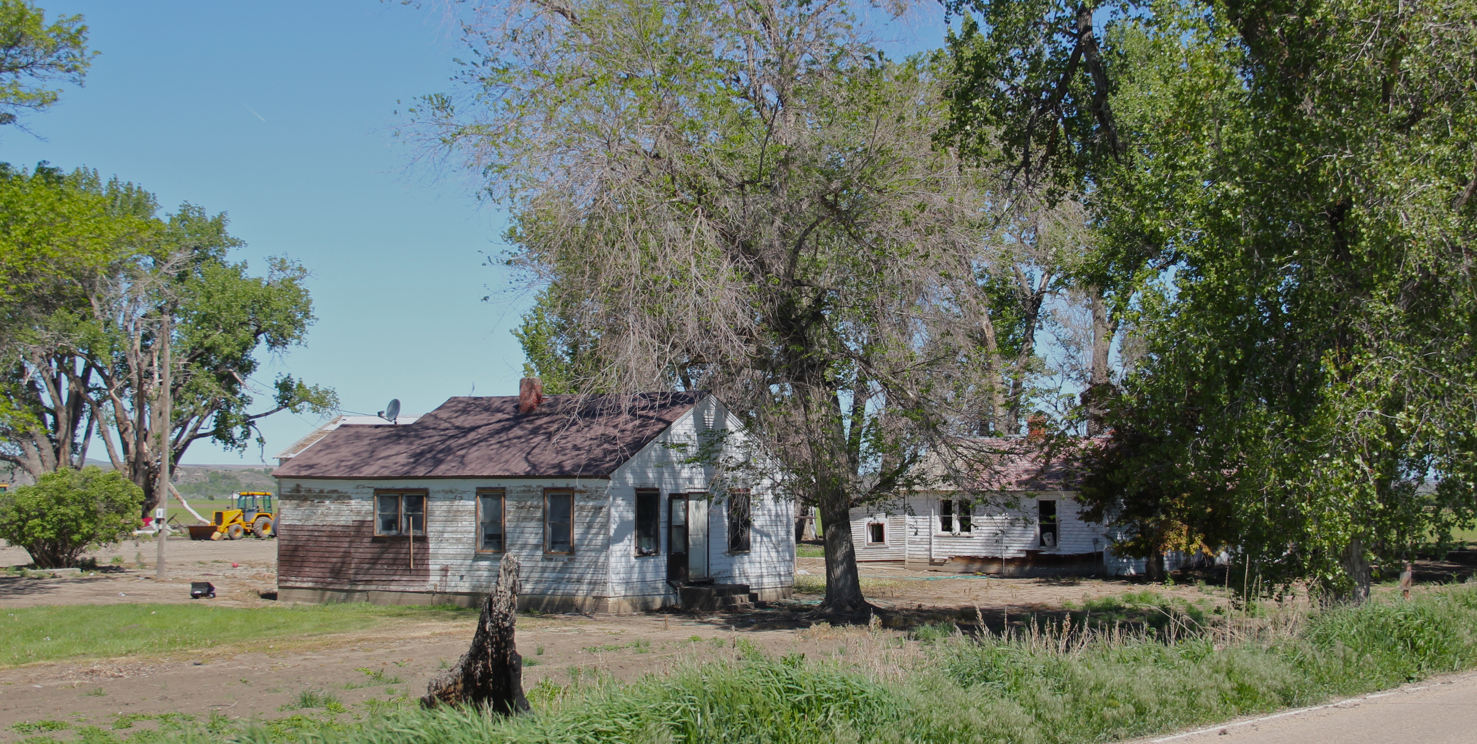
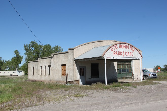
 the mid-20th century St. Xavier town site has not weathered the decades so well. Businesses have largely disappeared and the Art Deco-styled St. Xavier public school, a Public Works Administration project from the New Deal designed by Billings architect J.G. Link in 1938 is now abandoned and decaying.
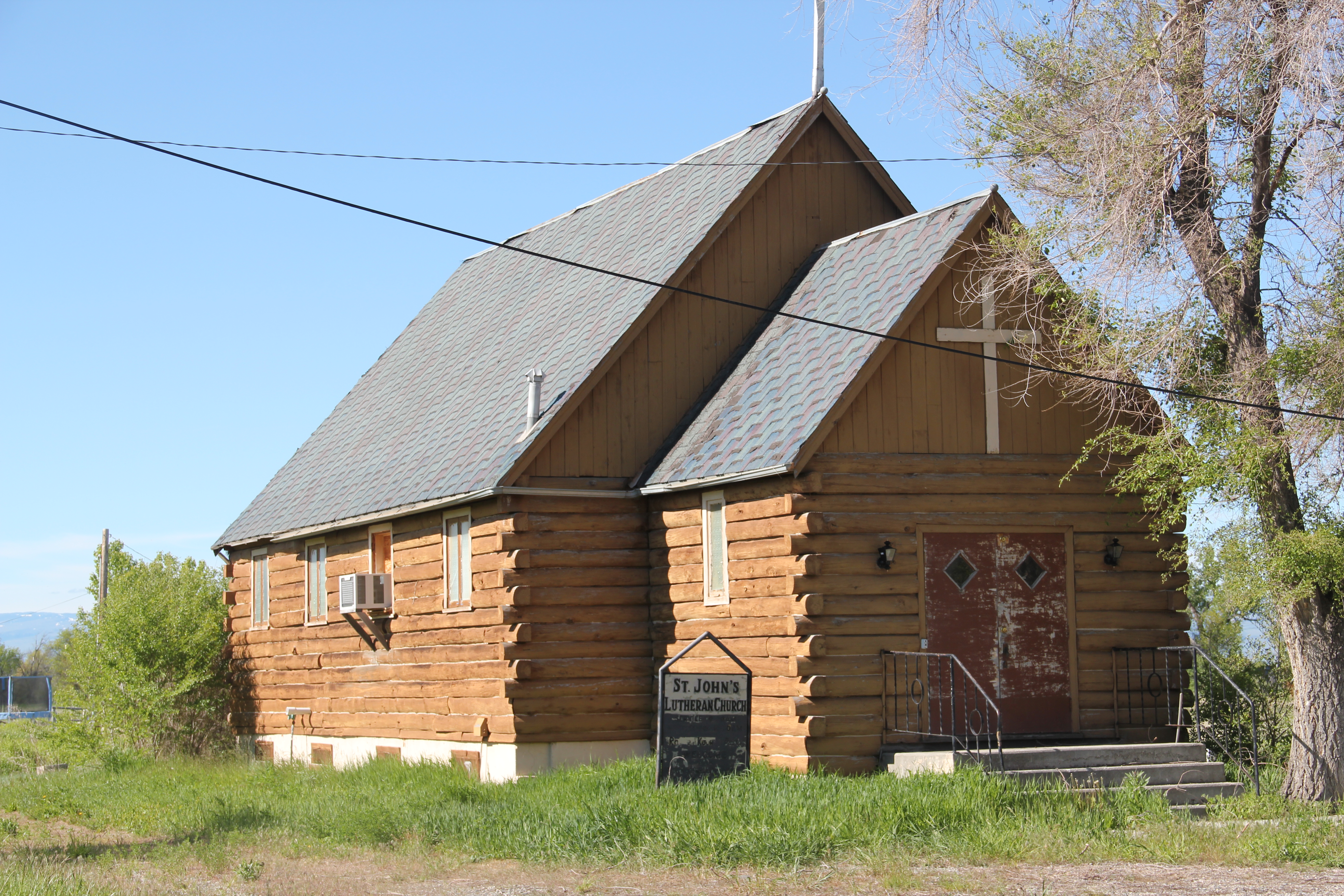
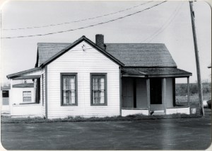
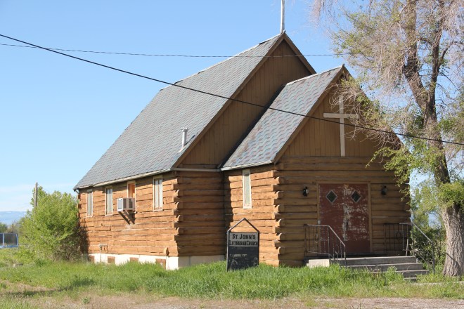
 Across the road from the school is St. John’s Lutheran Church, a weather- and time-worn, a 20th century log building speaking more to the past than the present. And running
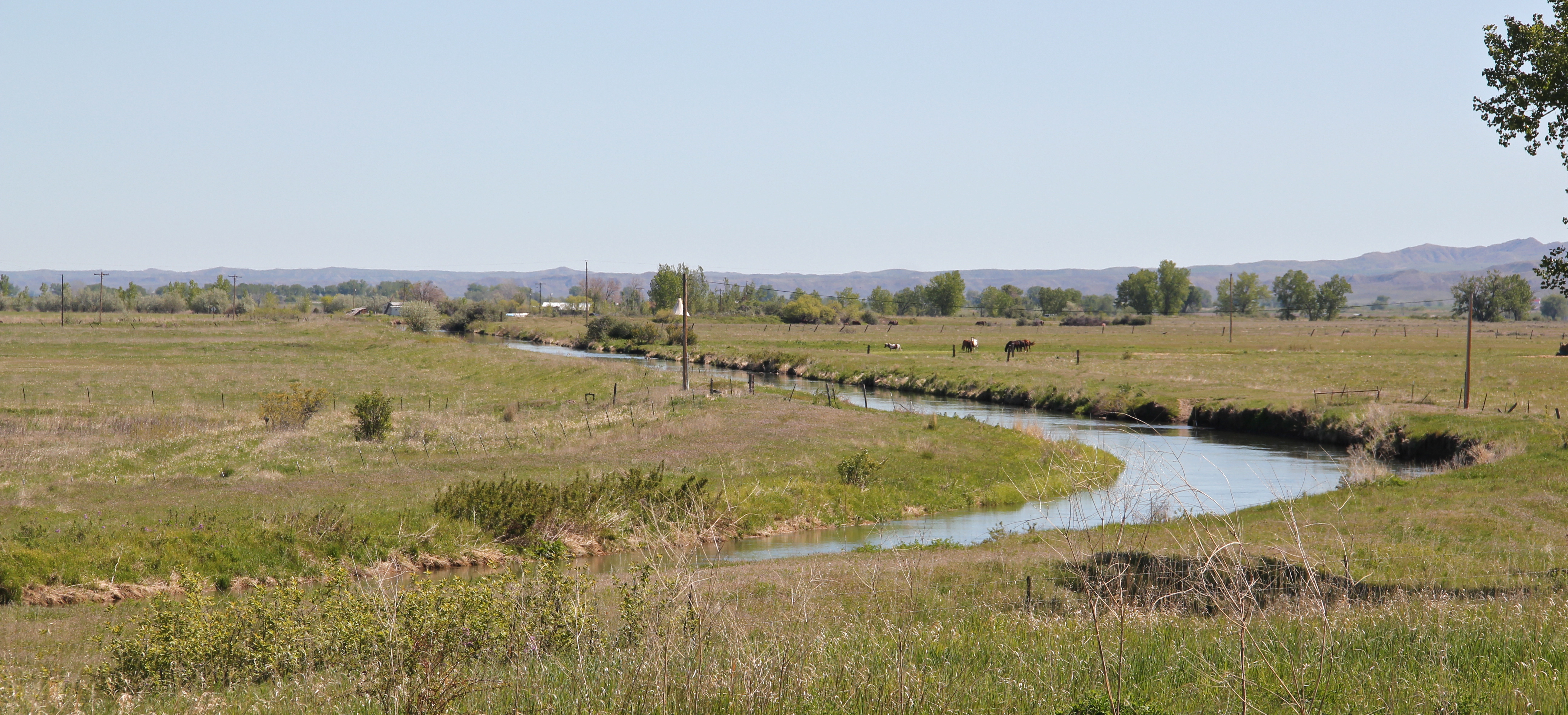
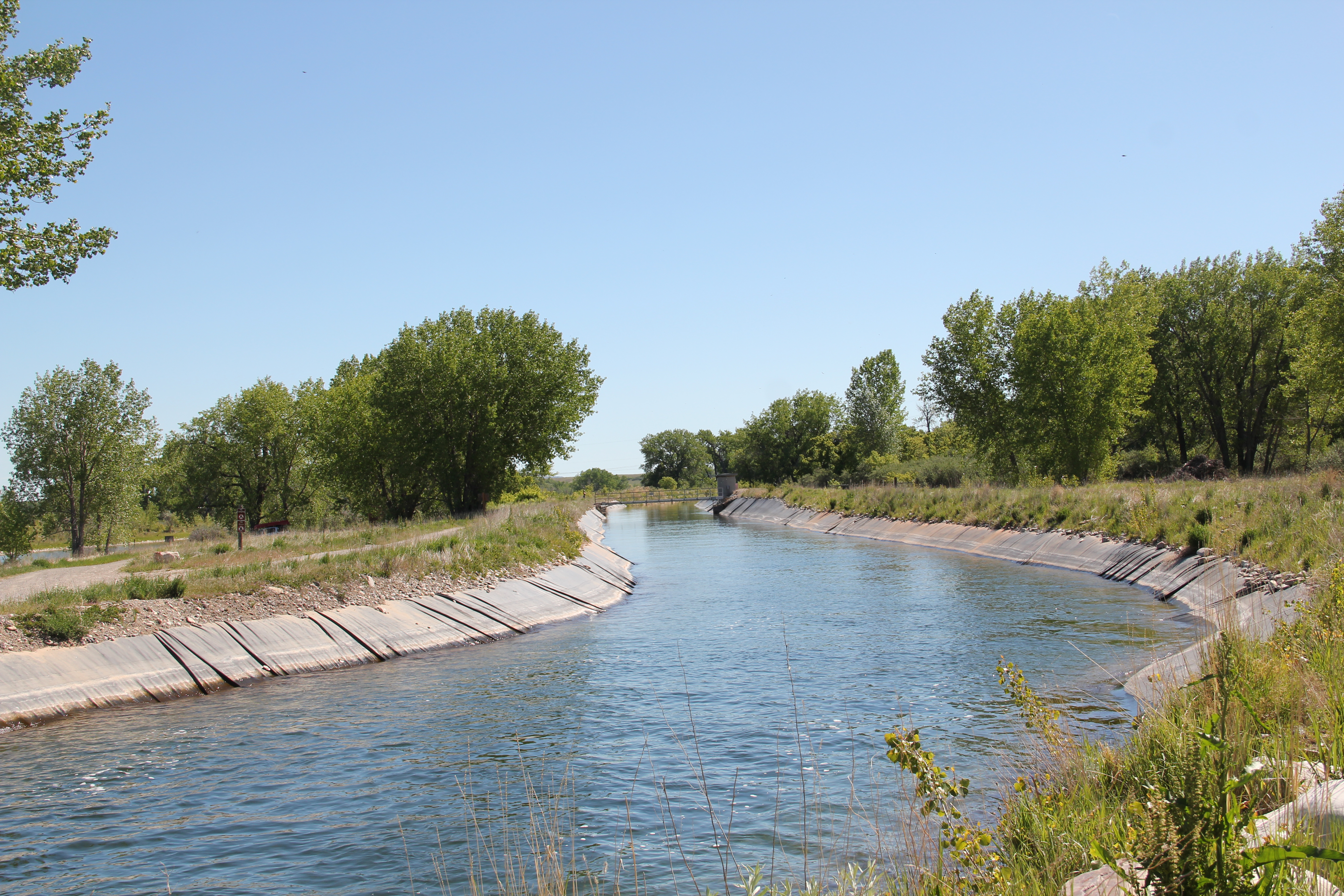
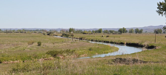
 nearby is one of many irrigation ditches that promised the transformation of the Big Horn Valley for 20th century homesteaders but as the forgotten ranches surrounding St. Xavier remind us, the irrigated empire of eastern Montana did not bring riches to everyone.
 Transformations and shifting meanings of the past from the perspective of the present make the Big Horn a fascinating place to explore.


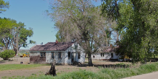
 Powell County’s Deer Lodge Valley is another favorite western Montana landscape. I visited there often during the 1980s, and in the years since I found myself often back in places like Deer Lodge, the county seat, if for nothing else to stop at the R&B Drive-In.
 Let’s start with the town of Deer Lodge, a place that has changed much in the last 30 years, a process that was underway in the early 1980s after the Milwaukee Road closed its division point and declared the entire line bankrupt. Besides Miles City, it is difficult to find a town more impacted by the Milwaukee’s failure than Deer Lodge.


 Yet, Deer Lodge was not a typical small town base for the Milwaukee Road; railroads typically wanted to create their own place. But Deer Lodge was one of the oldest places in the state, where ranchers in the 1850s first arrived–the early site is now interpreted at the Grant-Kohrs National Historic Site of the National Park Service–soon followed by Capt. John Mullan as he and his soldiers built the Mullan Road through this valley.

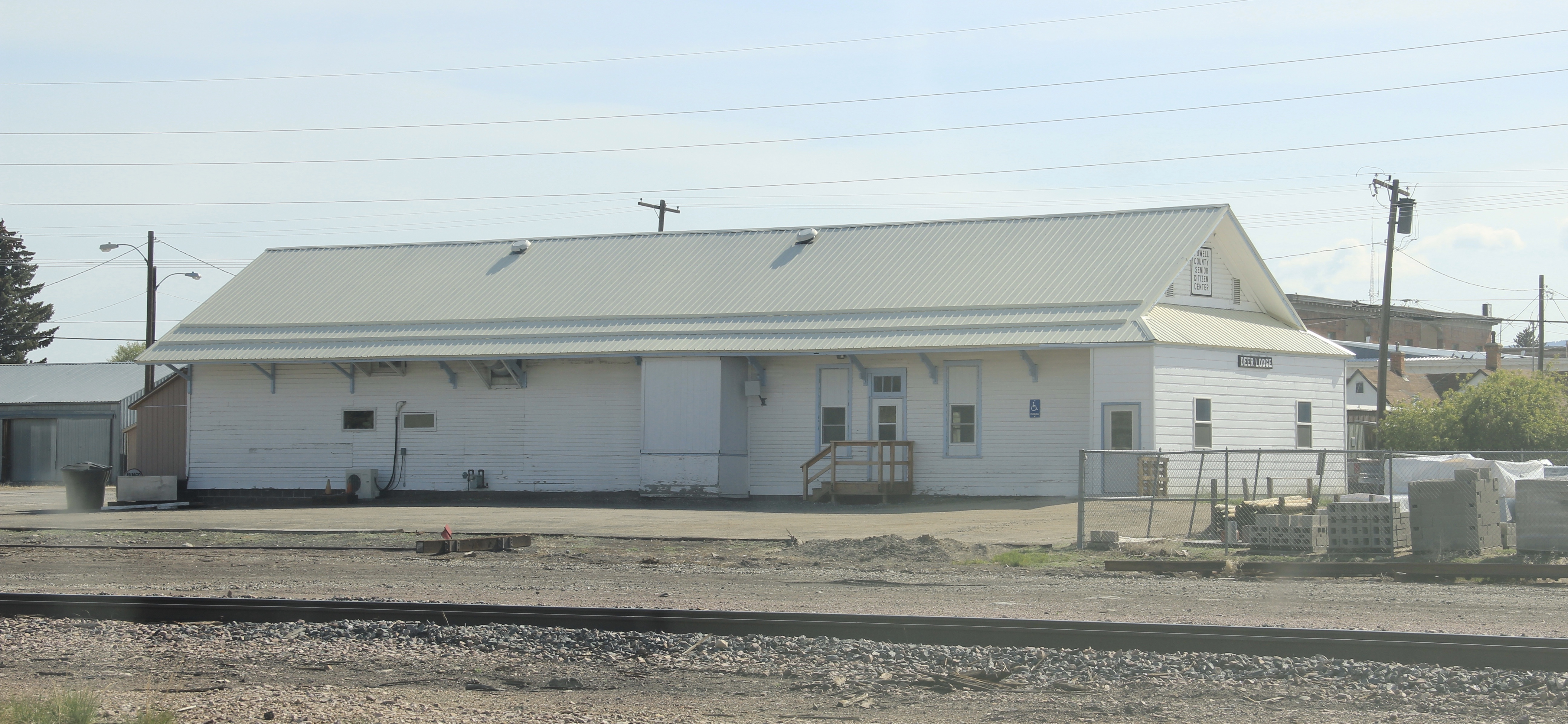 The Northern Pacific passenger depot exists across the tracks from the Milwaukee Road station. It too has a new use: the Northern Pacific depot is now the senior citizens center.

 Before Deer Lodge was a railroad town, it was a prison town, the location for the Territorial Prison, and later the state prison. Most of the buildings you can visit today are from the state prison era. It operated here until 1980 when it moved to a facility outside of town.

 Deer Lodge also was an early center for education, represented by Trask Hall (1870s), which, like the territorial prison, is listed in the National Register. So with the themes of settlement, ranching, railroads, education, prisons, and the beauty of the valley why has Deer Lodge struggled to be recognized as one of Montana’s premier heritage designations? As the next post will discuss, citizens are taking steps to remedy the situation.
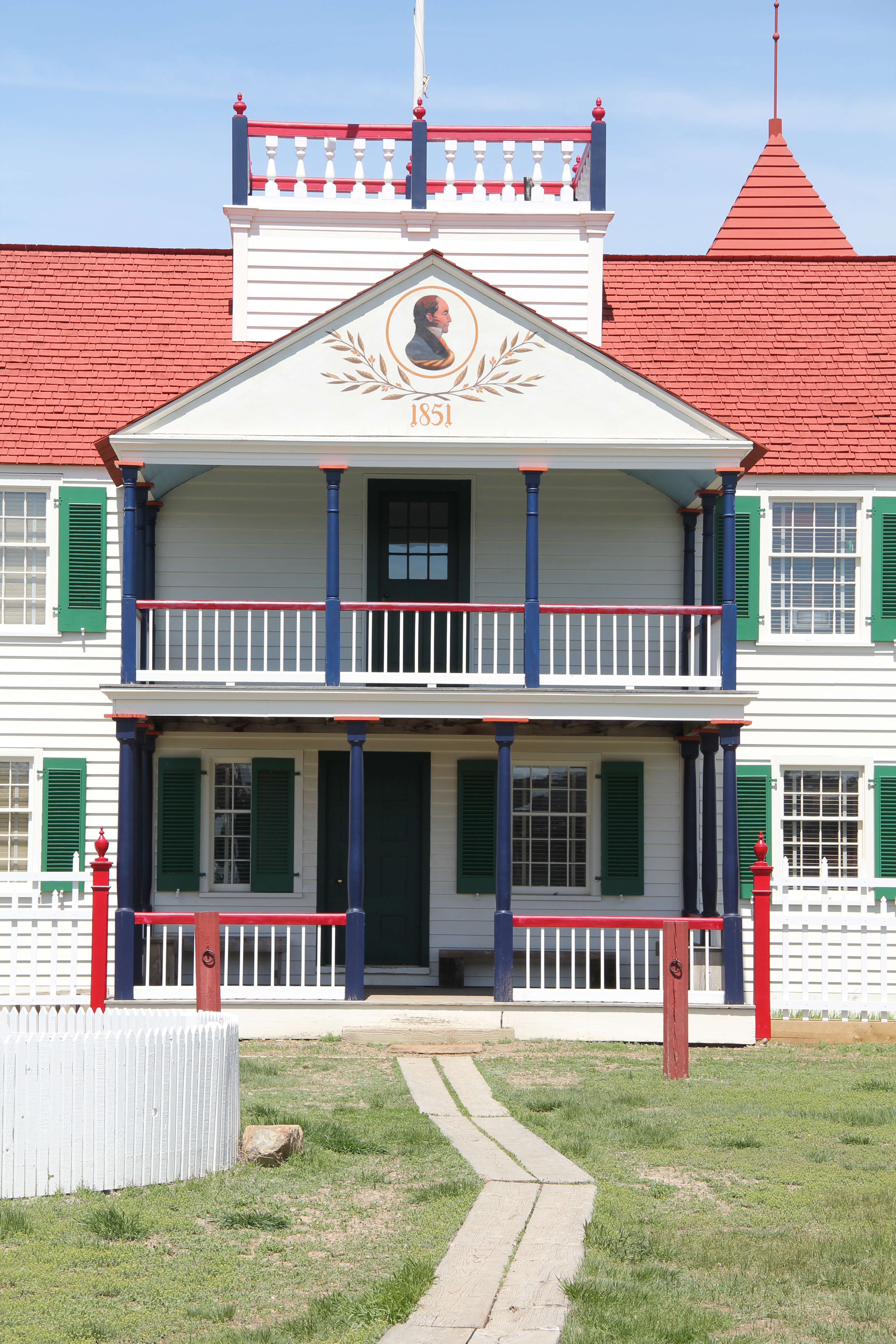
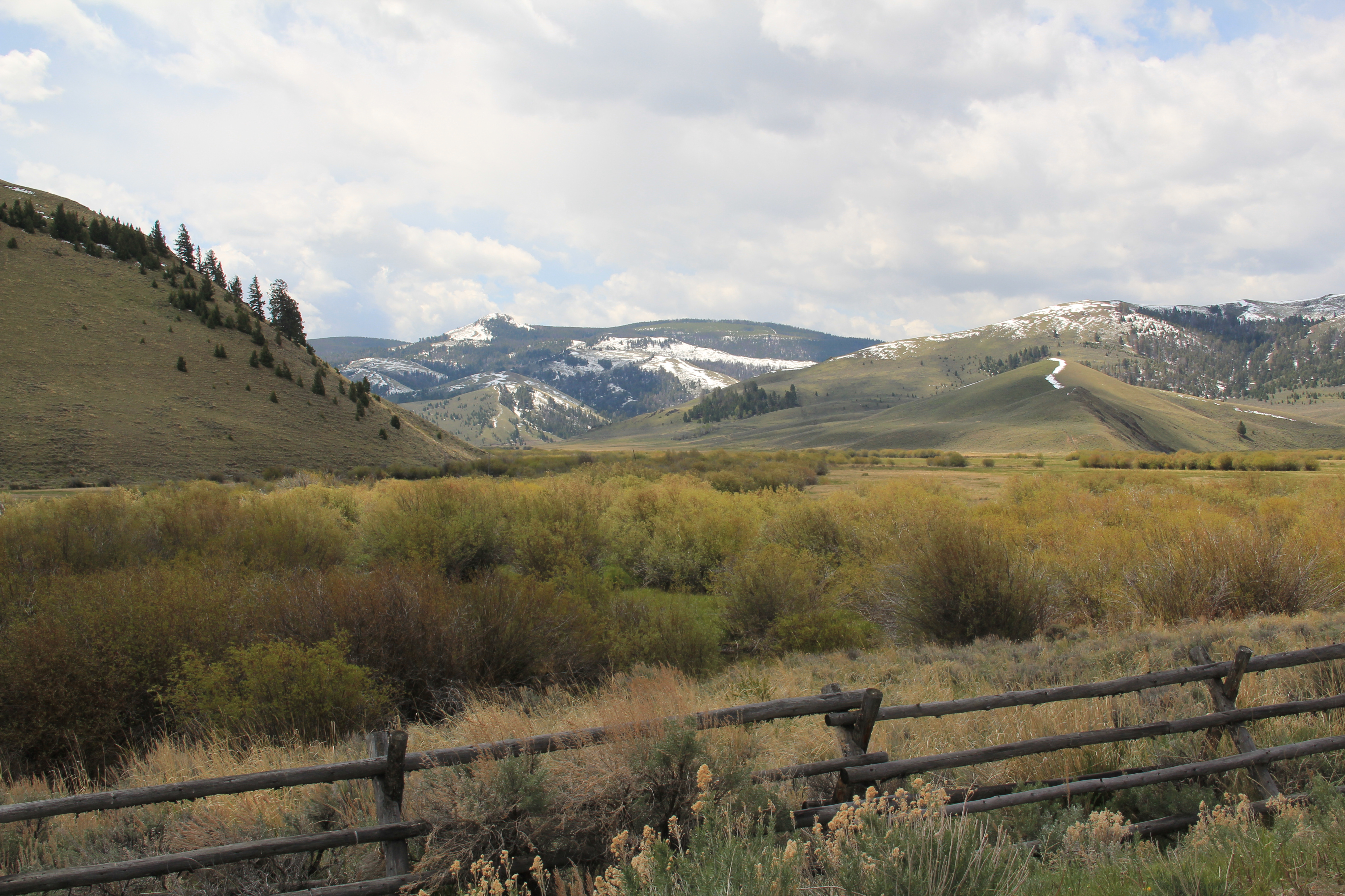 Beaverhead County’s history has deep roots, perhaps never deeper than at the high mountain passes that divide it from neighboring Idaho. We have already taken a look at Monida Pass, but now let’s shift to the western border and consider Lemhi Pass (Lemhi Road is the image above) and Bannock Pass, both at well over 7000 feet in elevation.
 Lemhi Pass is a magnificent place, reached by a wide dirt road that climbs up to 7300 feet. The roadbed is modern, and lies over a path worn by centuries of Native Americans who traveled this path between mountain valleys in present-day Montana and Idaho. That deep past is why the more famous Lewis and Clark Expedition took this route over the Bitterroot–and the Corps of Discovery connection is why the pass has been protected in the 20th century. The pass is also connected with Sacajawea, since her tribe, the Shoshone, often used it to cross the mountains.

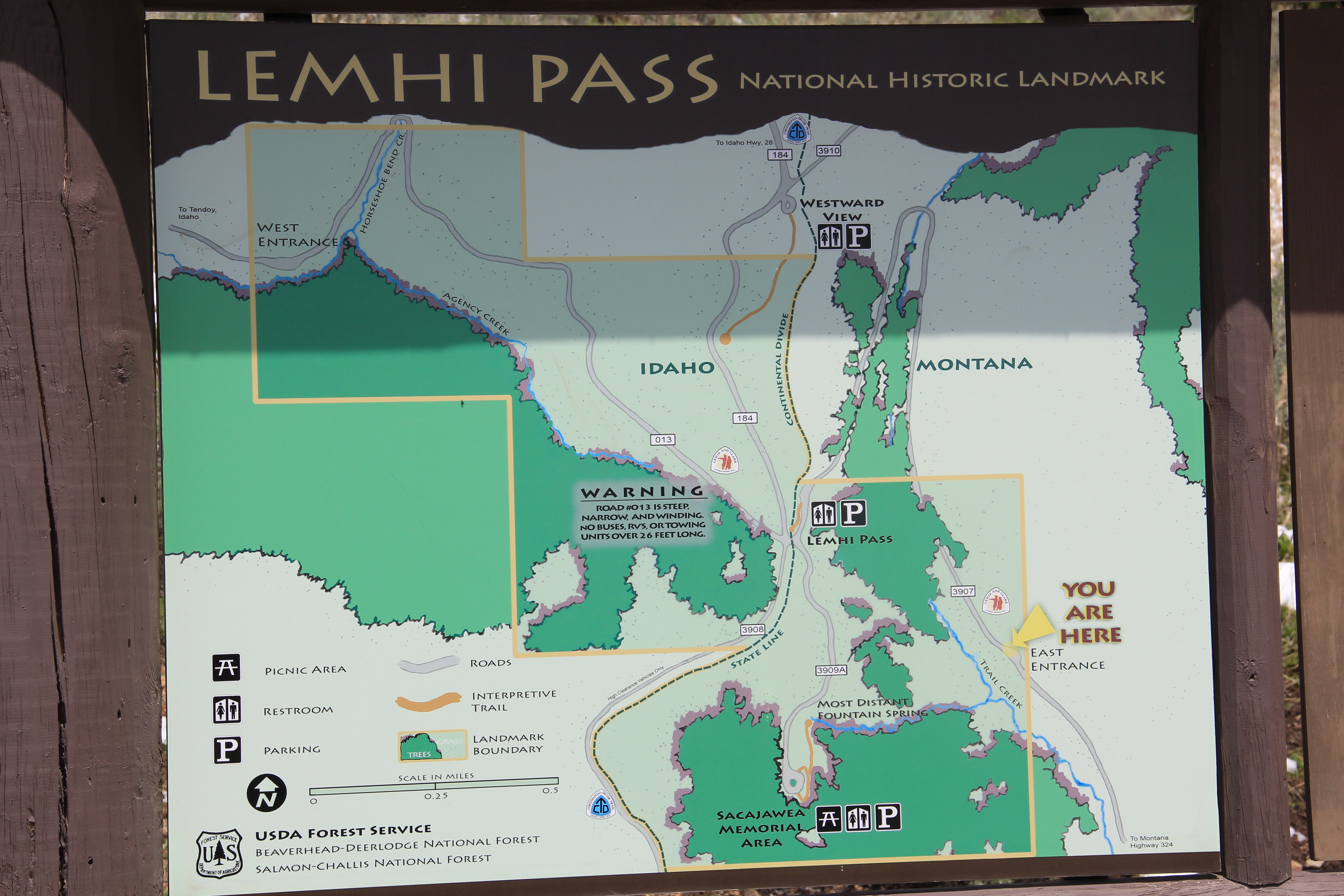 This kiosk by the U.S. Forest Service is part of the new public interpretation of the property, both at the start of the pass to the top of the mountain itself at the Sacajawea Memorial Area.
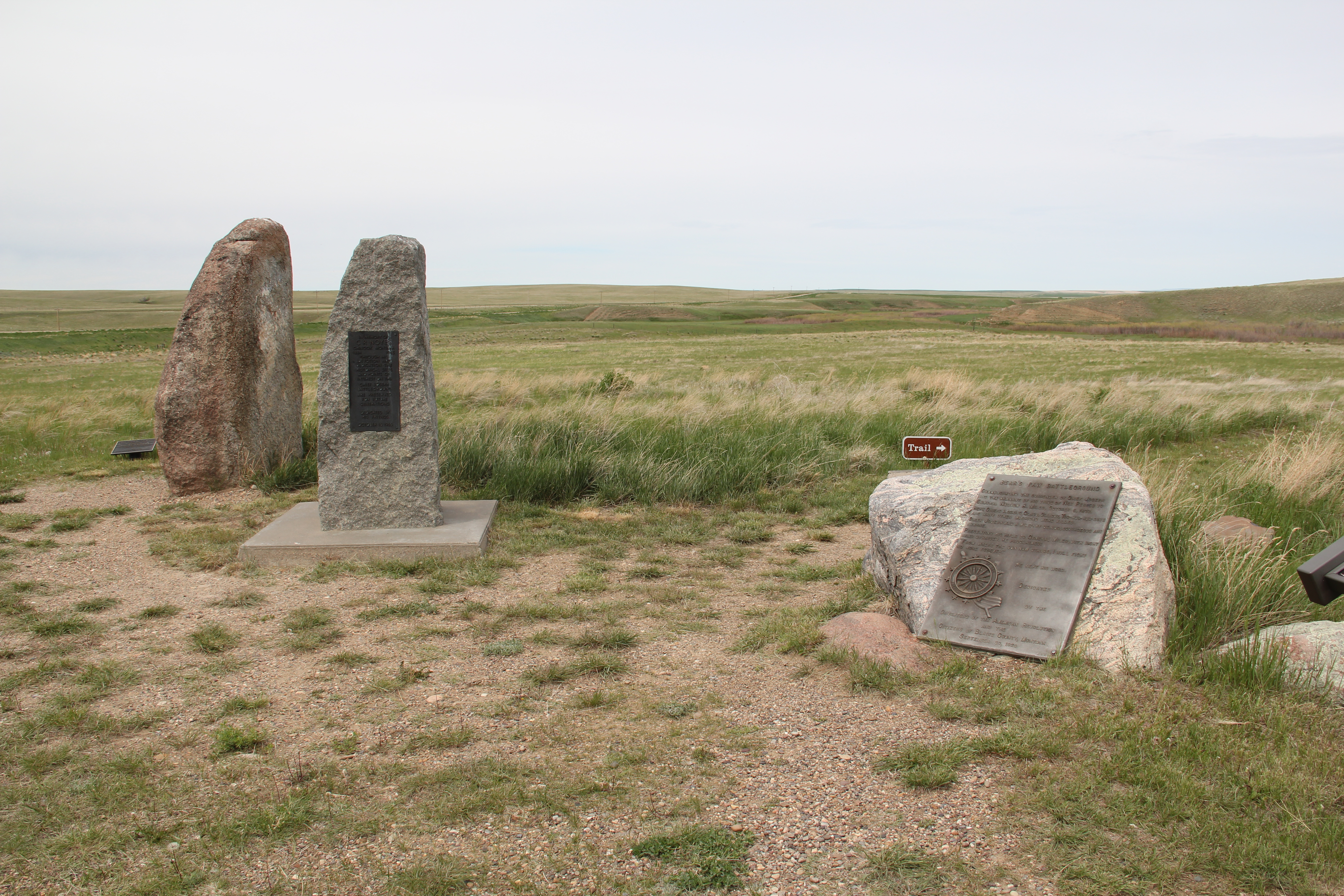
 Bannock Pass, comparatively has received little in public interpretation. Unlike Lemhi, it is not a National Historic Landmark associated with Lewis and Clark. For today’s travelers, however, it is a much more frequently used way to cross the Rockies despite its 300 foot higher elevation. A historic site directional sign leads to one interpretive
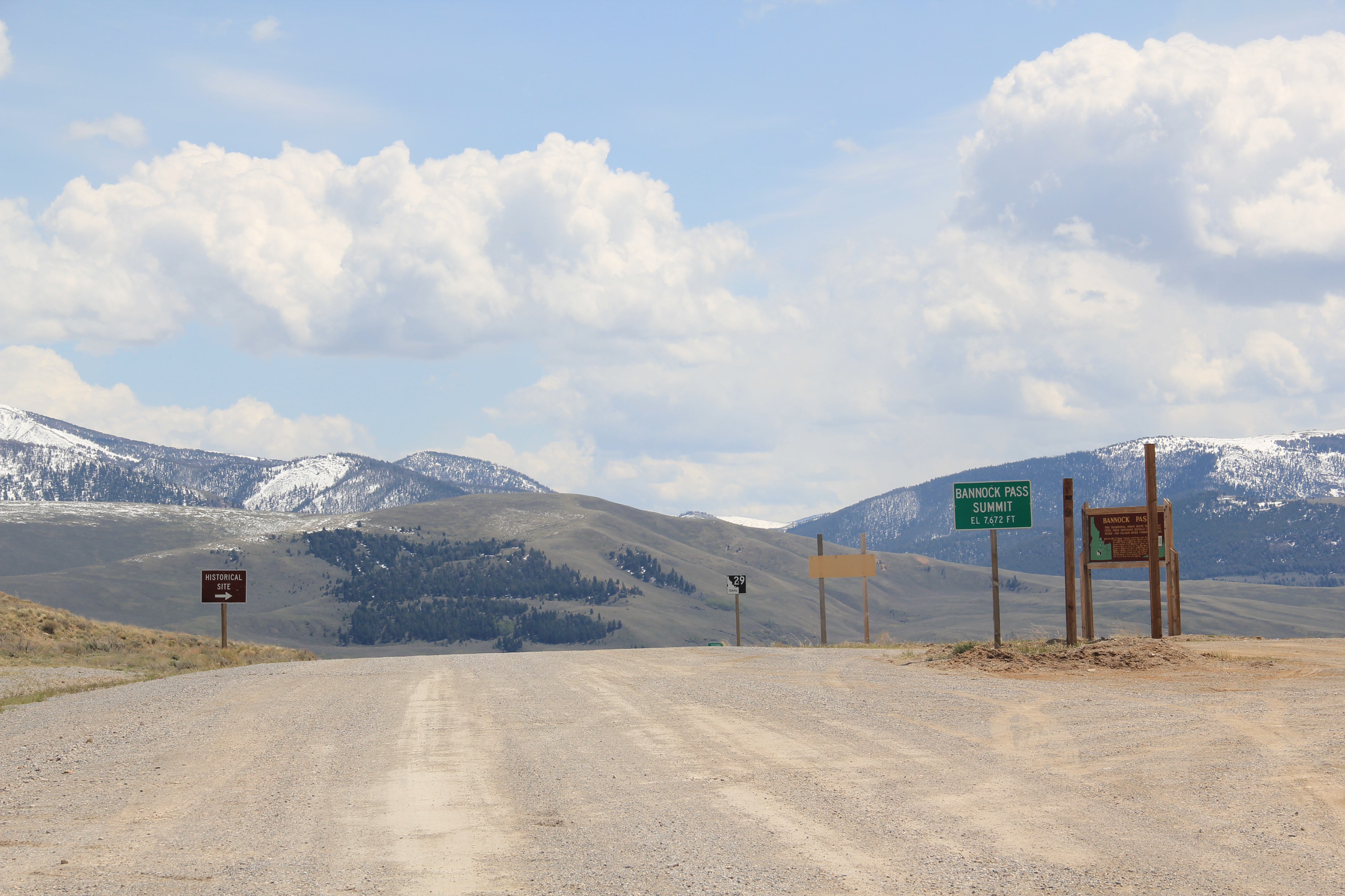


 It was a snowy Memorial Day when I crossed Lost Trail and Chief Joseph passes on my way to Big Hole Battlefield. Once again I was impressed by the recent efforts of the U.S. Forest Service to interpret the epic yet tragic journey of Chief Joseph and the Nez Perce in 1877, especially the Trail Creek Road that parallels Montana Highway 43.


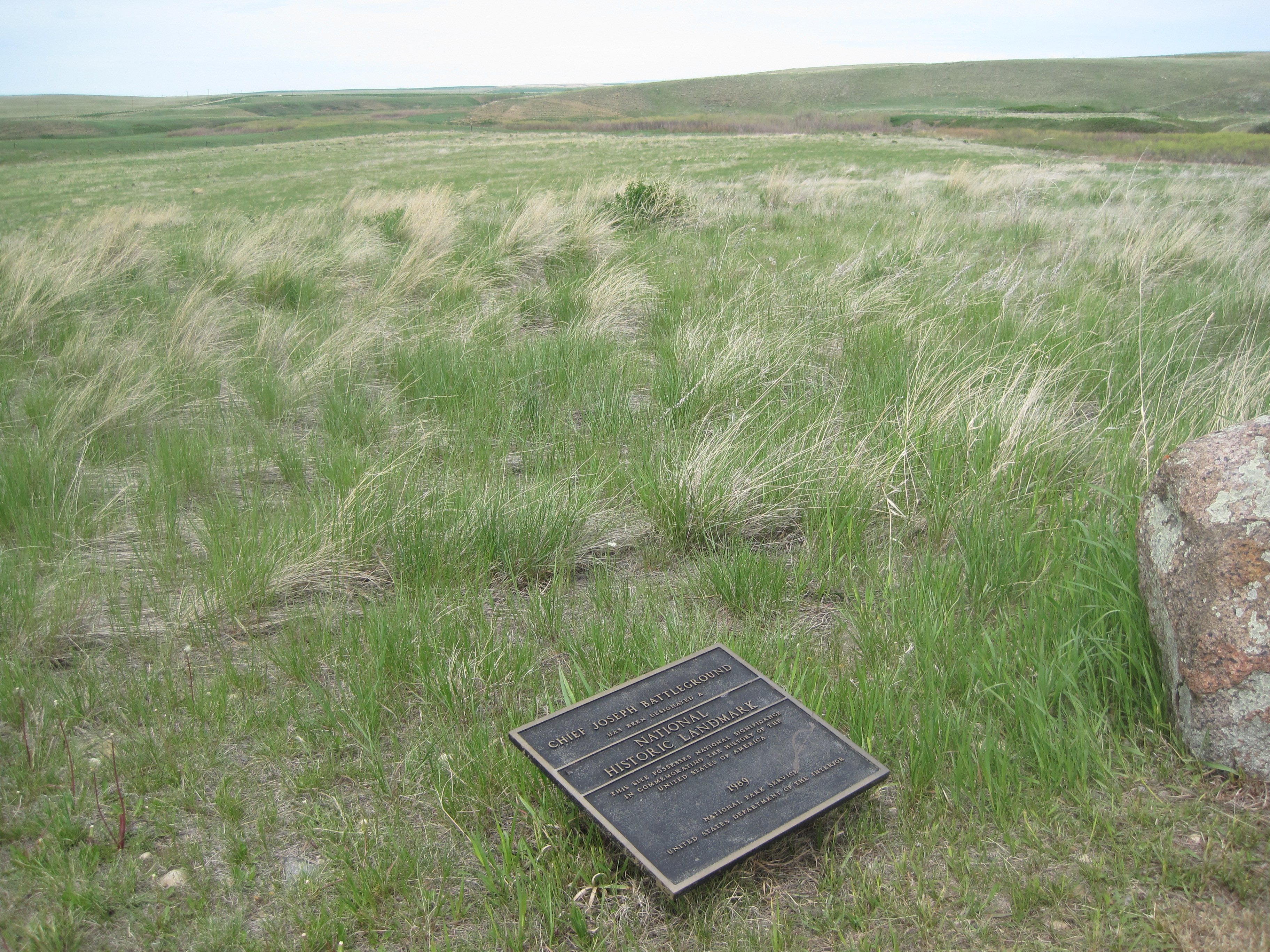
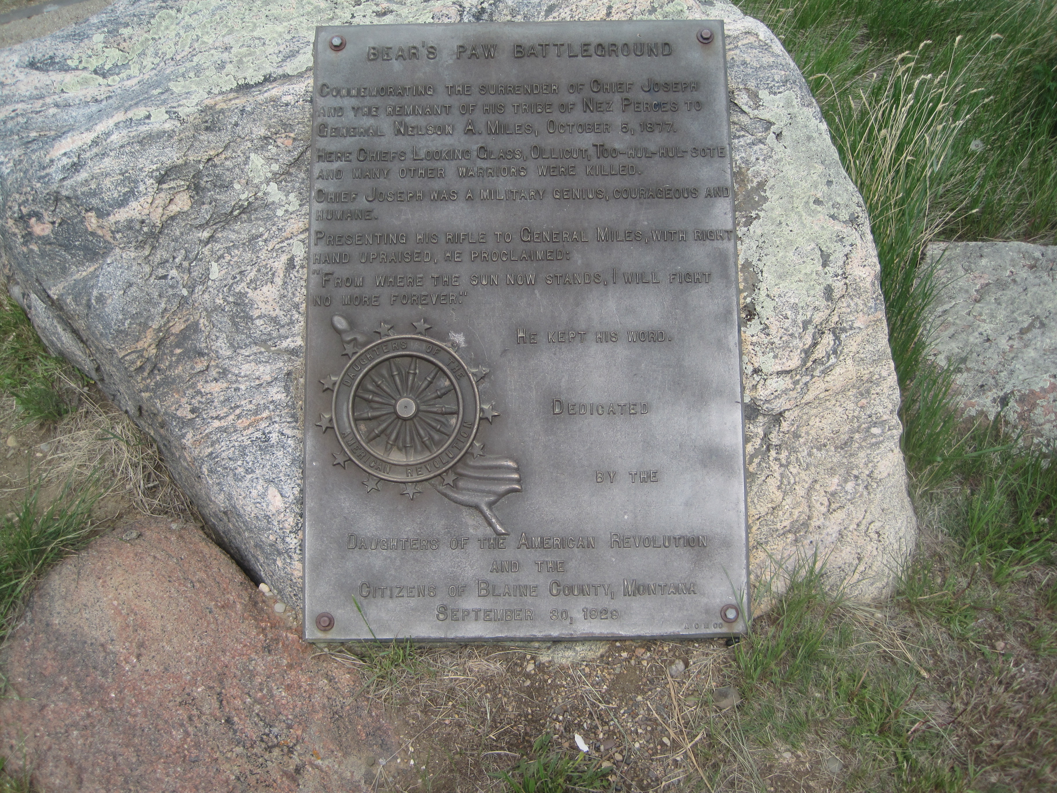
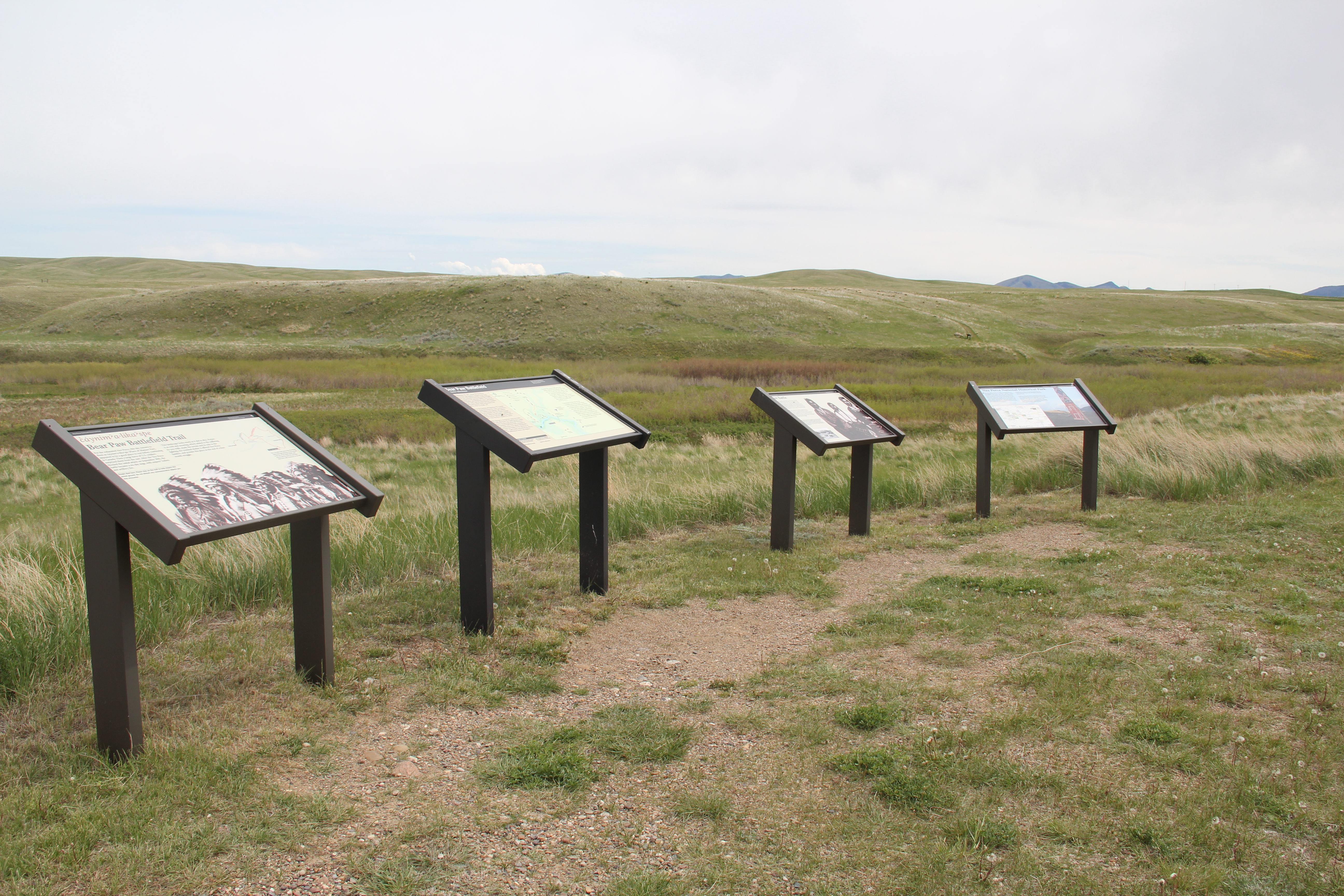
 Canada was underway. Today the Nez Perce National Historic Trail and Park mark that journey into history. The park today is frankly an amazing transformation, from a preserved battlefield in the early 1980s that only hinted at the true facts of history to a modern of battlefield interpretation, one that does justice to history and to the Nez Perce story. One only wishes that more western battlefields received similar treatment.