Townsend: A Railroad Town on the Missouri River

IMG_9524

Townsend is a classic Montana crossroads town, with its historic heart, and primary commercial district, centered on the intersection of U.S. Highways 12 and 287.  But a closer look reminds you of the town’s origins as a railroad town, part of the Northern Pacific route, as it moved westward from Bozeman to Helena, Montana, along the valley of the Missouri River.  The town’s layout is a good example of a T-town plan, with Front Street (now U.S. 287) forming the top of the “T” while Broadway (U.S. 12) forming the stem, as shown above.

IMG_9529

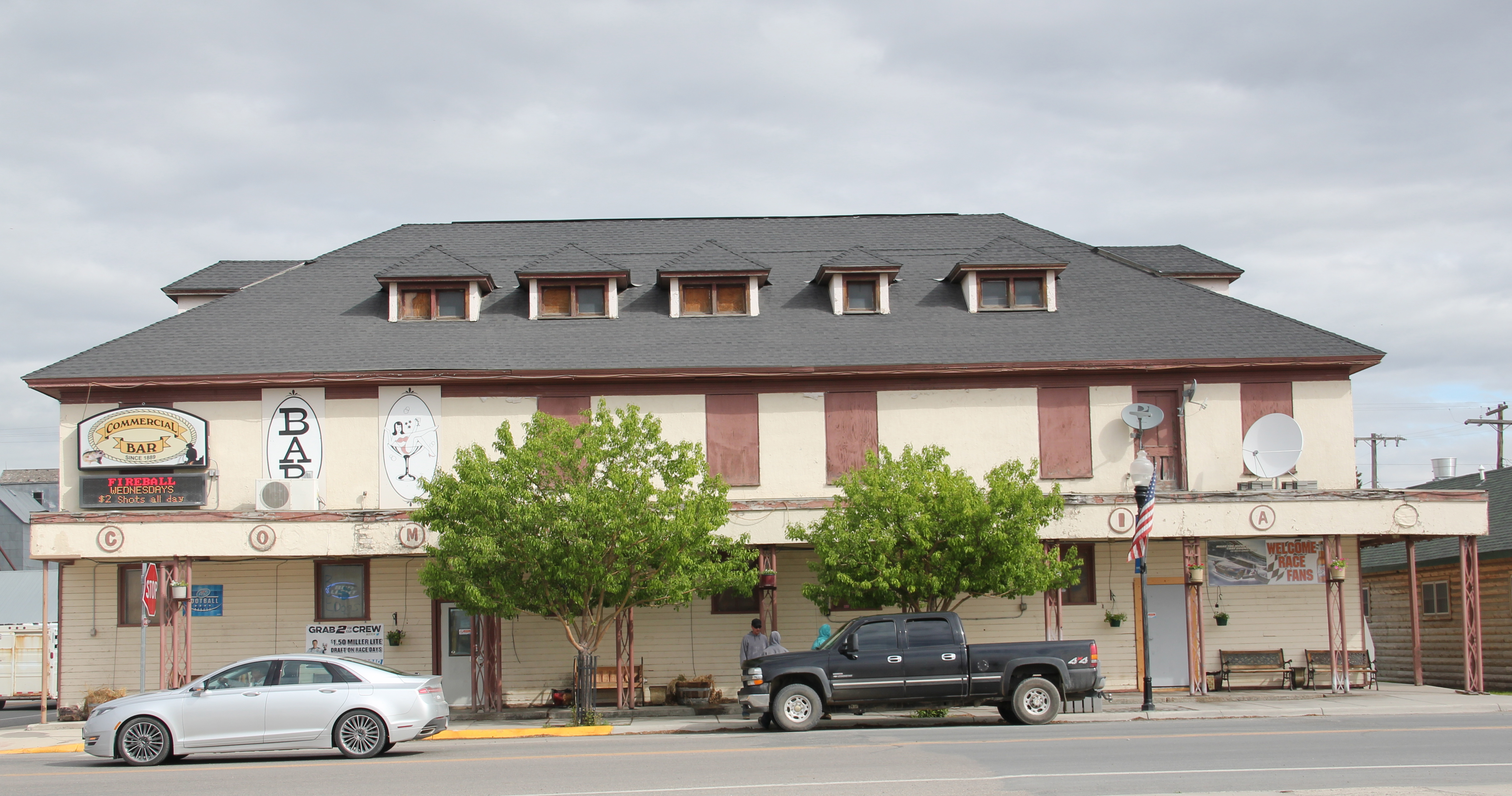
Grain elevators and other light industrial and transportation-related buildings the lots between the railroad tracks and Front Street.  At the corner of the highway junction is one of the town’s oldest buildings, the Commercial Hotel of 1889, which still operates today as

IMG_9528

a bar and restaurant.  Historically this large two-story frame building, with hipped roof dormers creating even additional rental space under the roof, would have been an attraction for travelers and business people looking for a place just off the tracks, or later the highway. It is among a handful of late 19th century railroad hotels left in Montana.
IMG_7092

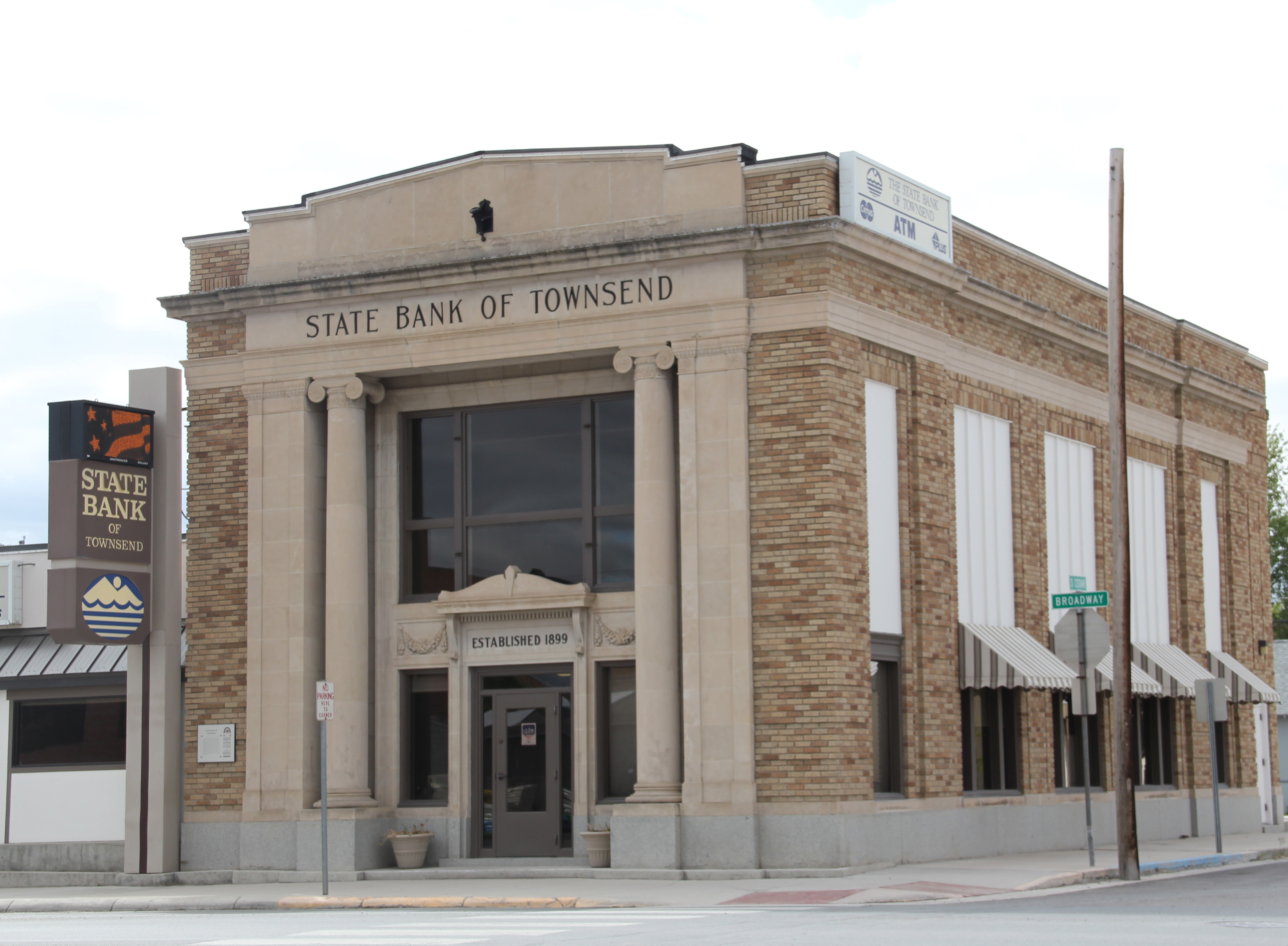
Broadway also had its historic landmarks, especially the neoclassical-styled State Bank of Townsend, which is listed in the National Register of Historic Places.  Dating to 1918, the building’s architect was the Albert Mooreman and Company firm from St. Paul, MN. The flanking two-story classical columns root the yellow brick building to its prominent corner lot–the bank’s survival into the twenty-first century is also a rarity in rural Montana.
IMG_7111

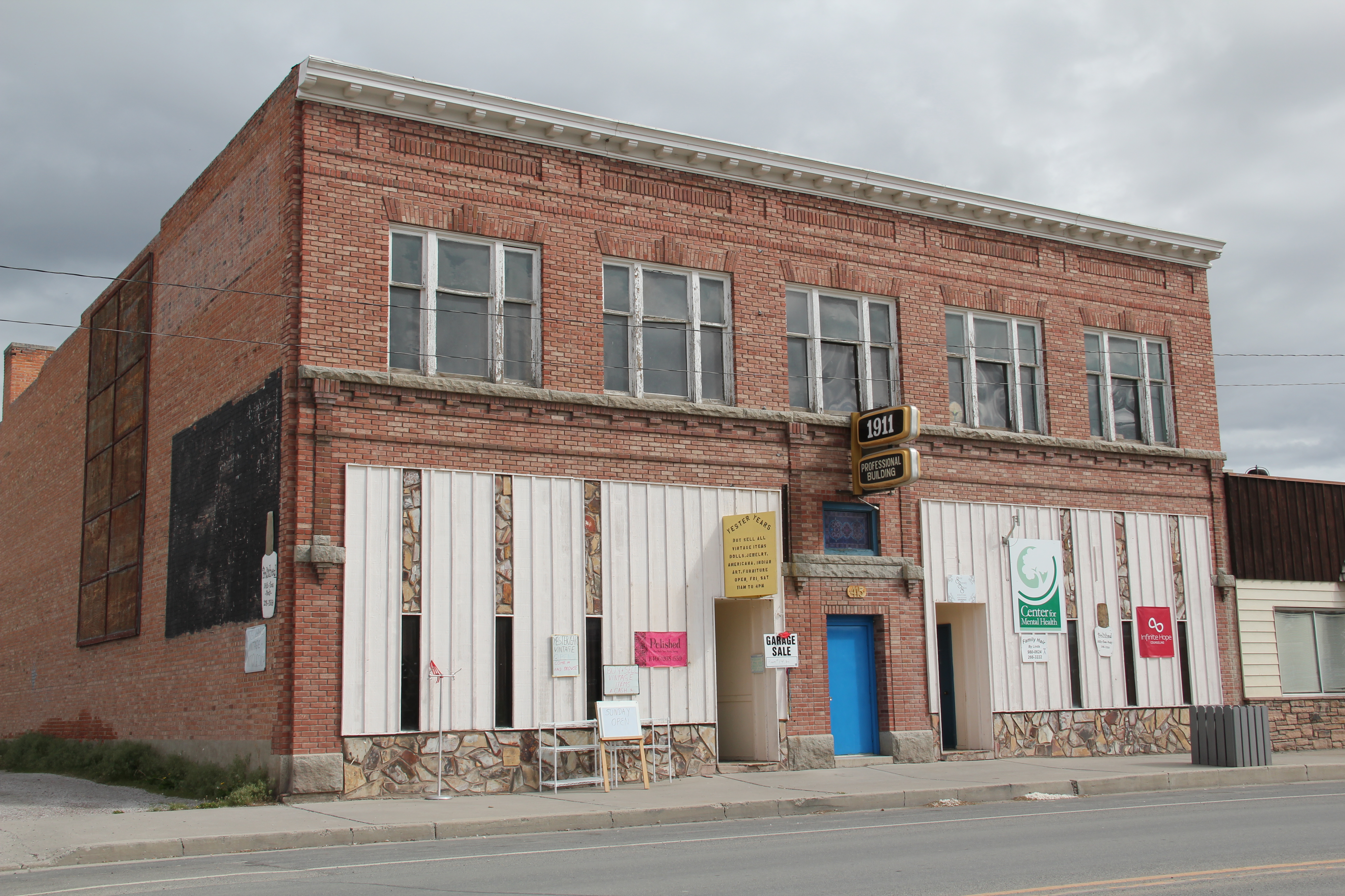
Broadway also has its mix of one- and two-story business buildings, from the American Legion and another Montana Mint Bar to the Professional Building of 1911.  Despite its proximity to both Helena and Bozeman, the town has retained its commercial vitality.

IMG_7107

IMG_7096

IMG_7112

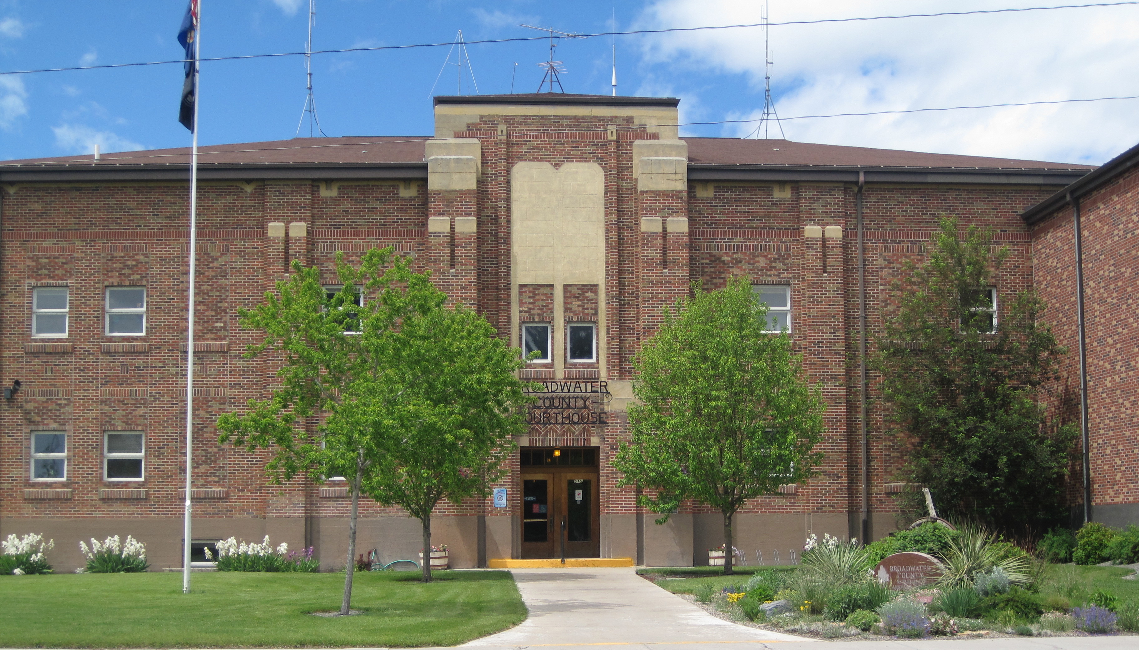
At the end of the commercial district is the Broadwater County Courthouse, a mid-1930s New Deal project that has expanded significantly in the three decades since I carried out the original historic preservation plan survey in 1984-1985.  Its understated Art-Deco styling fits well its highway location.  And as to be expected in a “T-town” plan, its location at the end of Broadway, meaning the end of the stem of the “T” reflected well the comparative power between local government and the corporate power of the railroad.

IMG_9521

IMG_9522

Being a resident of Helena from 1981 to 1985, I passed through Townsend many times on my way east since US 12 was a favorite trek.  I noticed these major landmarks and the patterns of railroad town plans but I must admit that I never strayed off of either Front Street or Broadway, and that was a mistake.
IMG_7099

IMG_7103

IMG_7102

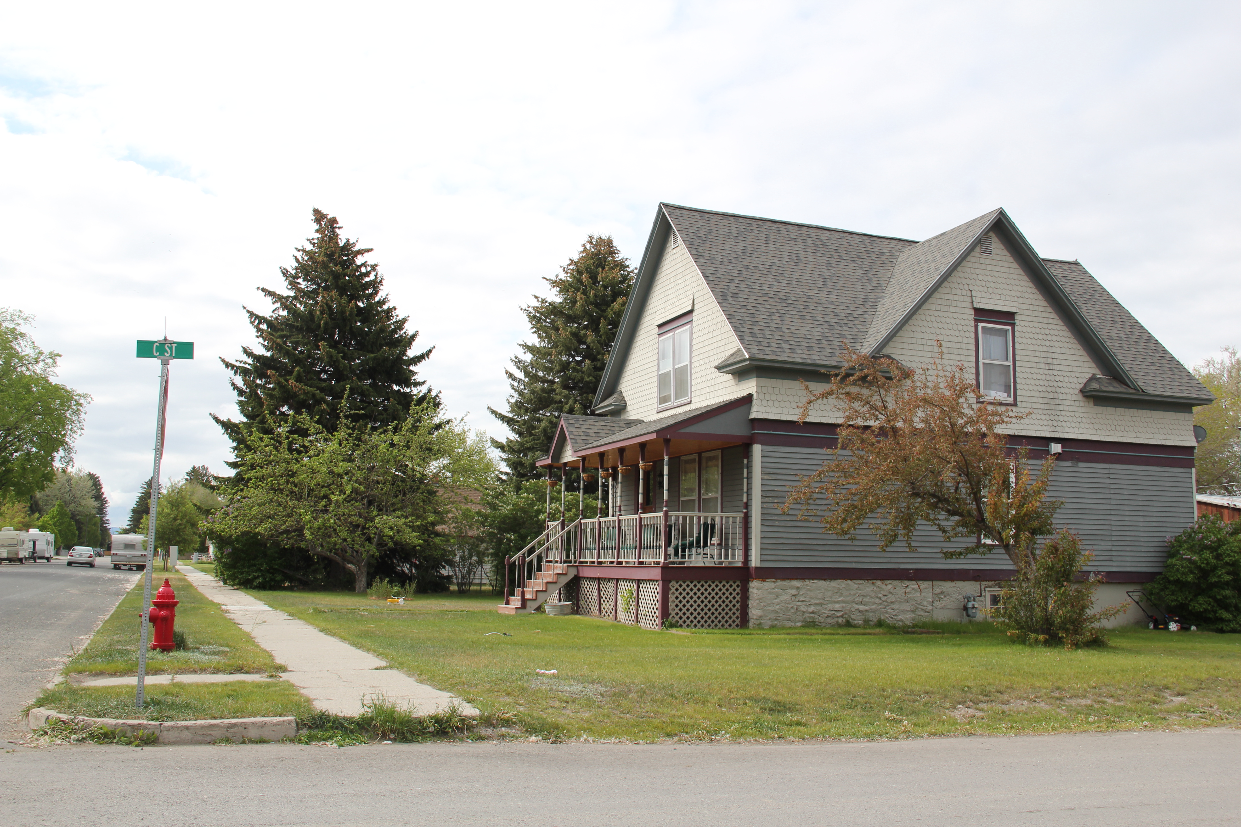
South of Broadway are several valuable late-19th or turn of the century Victorian-styled residences, some of which have found their champions and have been restored while others need that champion to see the potential jewel underneath decades of change.  One historic neighborhood school building–now a Masonic lodge–also remains, along with many different churches, most of which date to the second half of the twentieth century.

IMG_7105

North of Broadway is a notable exception, the Victorian Gothic styled Townsend United Methodist Church, again an important survivor from the town’s opening generation of history.

IMG_7110

Townsend also had a set of interesting bungalows from c. 1920 on U.S. 12 as it moves east of the courthouse.  These are made of concrete block, shaped to mimic stone masonry.  It was a popular technique to give a house a solid, permanent look, and you tend to find it more in the west than in the east.  Of course, Townsend was not far from the major concrete works at Trident–a topic for a later posting.

IMG_7119

IMG_7120

Last but not least Townsend, and Broadwater County, has an active historical society and local museum, established during the American Bicentennial in 1976–and expanding ever since at its location behind the county courthouse.

IMG_7123

A second look at Ringling

IMG_9499

Ringling, a stop along the Milwaukee Road in northern Meagher County just off U.S. Highway 89, served as the eastern gateway for the railroad’s move west into the Rocky Mountains along its electric line.  From Ringling the Milwaukee passed through the famous Sixteenmile Canyon then crossed the Missouri at Toston and began its ascent in the copper kingdom of Butte.

IMG_9512

I had last passed quickly through the village in 2011 and its iconic Milwaukee Road combination depot was weathered but appeared as if it would yet survive for sometime.  Within four years, however, its fate was much more uncertain.  Roof decking is missing–will this now rare survival of the railroad’s corporate stamp on the northern plains survive till the end of the decade?

IMG_9509

IMG_9508

Brumfield’s Garage is more an example of roadside architecture from the first half of the twentieth century than a building that dates back to the Milwaukee’s heyday.  Its vernacular interpretation of Art Deco styling by means of the four brick pilasters catches the eye–this adaptable property has been many things, and in my past visits has served as a store and as a bar.

IMG_9504

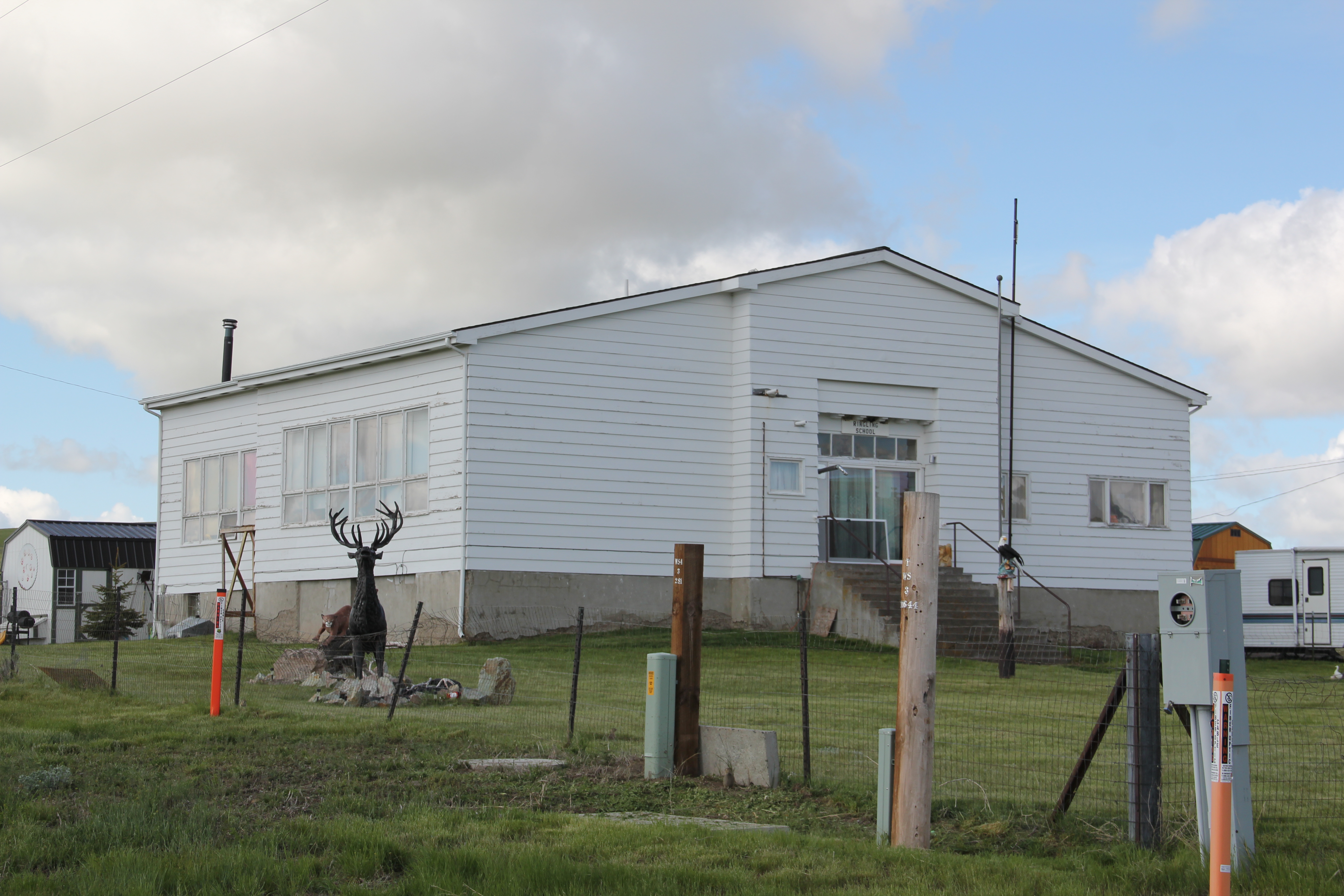
Ringling also retains its school–now a residence–another of the remarkable rural frame standardized designed schoolhouses found throughout central Montana. It sits south of the depot, as if the corporate and the public defined the north-south boundaries of the village.

IMG_9501

Still overlooking the town, and serving as an important landmark on U.S. Highway 89, is the historic Arts and Crafts-styled St. John’s Catholic Church, to which I have already devoted one post in this blog.  What I was pleased to find in 2015 is that some preservation work was underway–with weatherboards being repaired and replaced.  With a decent roof and a recent paint job, the church is in much better shape than many of its brethren across the region. The continued use of this Montana plains church as a “community church” is the best way to keep it alive in the 21st century even as the rest of Ringling shrinks and disappears from the Meagher County landscape.

IMG_9495

Geraldine: A Milwaukee Road Town that made it

IMG_8825

My last post looked at the disappearing towns of the Milwaukee Road in central Montana’s Meagher County.  Those themes of a railroad, town creation, and abandonment were constant in several posts as I traced the imprint  of the Milwaukee on Montana’s landscape in the 20th century.  However, not all central Montana plains towns tied to the Milwaukee Road have disappeared–Geraldine in Chouteau County is one of those exceptions.

Geraldine MR Depot Choteau Co

Milwaukee Road depot at Geraldine, c. 1998

Geraldine was established c. 1913 along a major spur line of the Milwaukee Road that connected its division point at Harlowtown to the much larger railroad transportation center of Great Falls to the north.  Due to the richness of the high plains agriculture of southern Chouteau County–the land south of the Missouri River–and the commitment of its citizens, Geraldine has remained generally solid through the decades.  According to census records, the town has never topped 400 residents, 375 being the largest number of residents, and now, according to the 2010 count, there are only about 100 less, a little over 260 residents.  Losing what amounts to 25-30% of the population over the 100 years sounds like a disappearing town, true, but in an eastern Montana perspective, it is not.  As this blog has documented at many places, too many plains country towns have lost 50% or more of their population in just the last 30 years.

IMG_8822

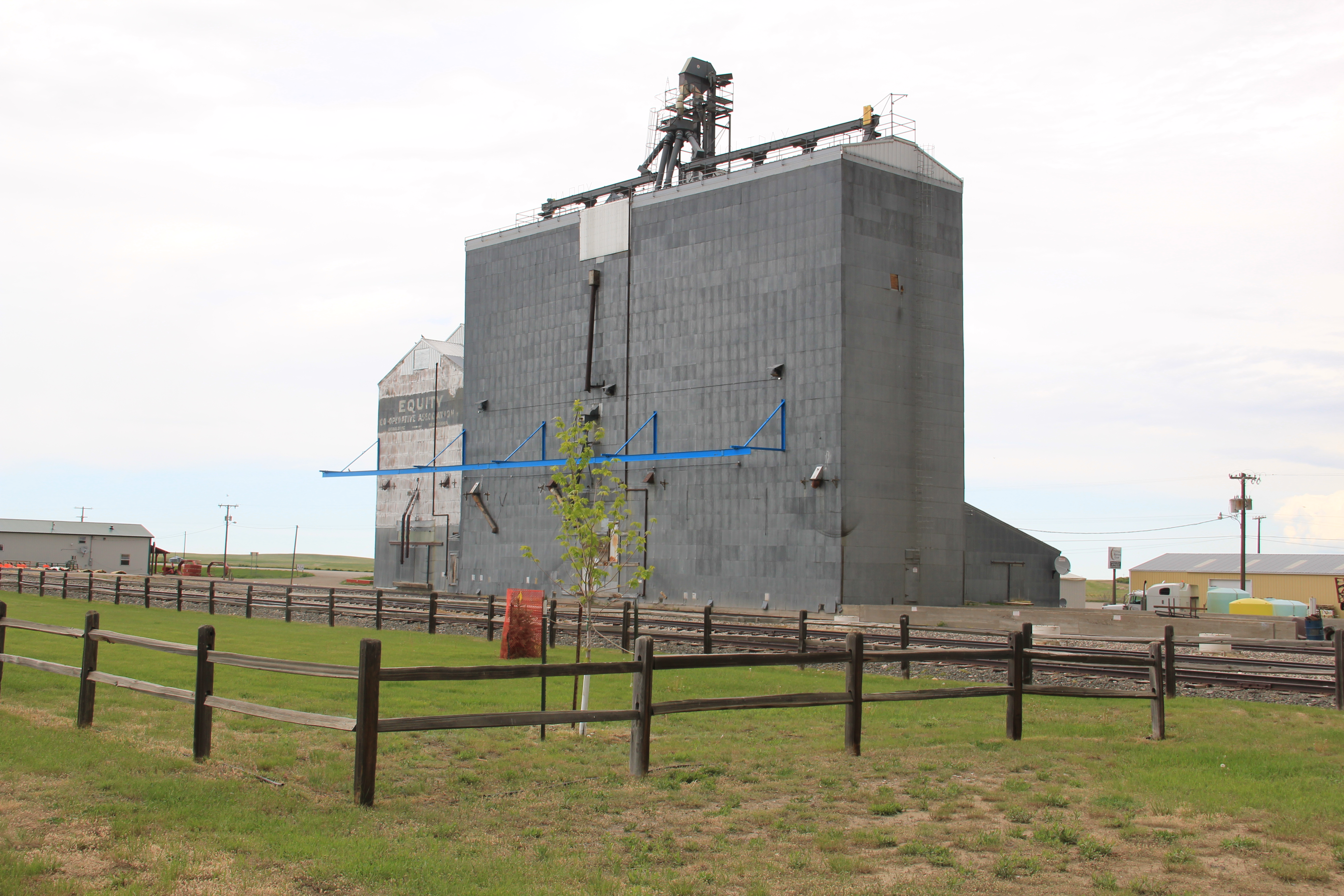
In the 1984-85 historic preservation survey, Geraldine impressed me for several reasons.  First was the dominating presence of the grain elevators, as seen above and with the first photo in this blog.  I had grown accustomed to Milwaukee Road towns where the corporate standardized design for the combination depot–a building that joined both freight and passenger operations–dominated the railroad corridor.  Here the elevators punctuate the skyline and loom over the town itself–the railroad created the need for them, certainly, but by the end of the 20th century the elevators were still viable businesses while the depot had become a local museum and community center.

IMG_8808

Then there was the town plan.  Milwaukee Road country towns were “T-plan” towns where the tracks, depot, and elevators defined the top of the T while the town’s business district formed the stem of the T.  Geraldine was a bit different, a tilted T-plan town, where the top

IMG_8818of the T, due to the railroad’s approach was slanted, giving Geraldine, compared to other Milwaukee towns, an off-kilter look.  Geraldine also still had business, although the number of independent places had diminished since 1984-1985.  Two key institutions today are

IMG_8817

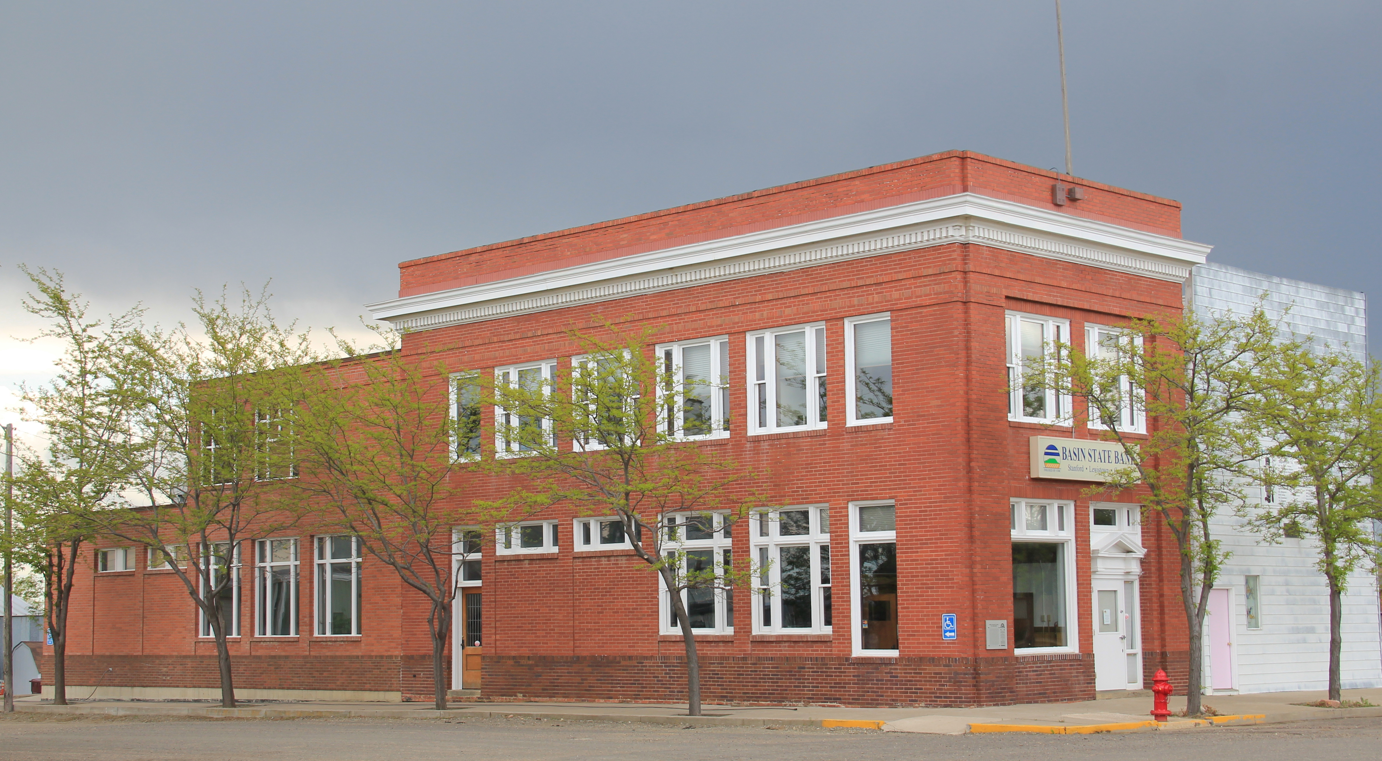
the local state bank, a Classical Revival-styled two-story building from c. 1914 that is listed in the National Register of Historic Places as the First National Bank of Geraldine.  Unlike scores of other local institutions in the 1920s and 1930s, the Geraldine bank did not close its doors and continues to serve ranchers and town residents today.  It is a rock from Geraldine’s past that surely helps to define its future.  The same can be said for the

IMG_8823

Geraldine school–home of the Tigers.  This local school has several different building periods, as this image of its facade indicates, but maintaining a school district is vital to the town–plains country towns that lose their schools soon become abandoned places.

IMG_8815

Geraldine touches upon many key theme of eastern Montana history–in subtle yet significant ways.  It even lightly touches on another theme of this blog–Montana Modernism.  No one was much looking at the contemporary styled buildings of the late 1950s and 1960s in 1984-1985.  I was no exception.  But in the 21st century, we want to document those buildings and appreciate how the new architecture expressed the hopes of the post World War II generation.  Geraldine’s contribution is its United Methodist

IMG_8816

Church, with its particularly notable tall concrete bell tower, mixing a bit of tradition with the new look of the postwar generation.

IMG_8820

Geraldine of course has a classic western watering hole–Rusty’s Bar and Grill, completed with its front glass block windows.  It is highly recommended–not much on the outside admittedly but a full community experience on the inside.  Historic depot and bank, modern-styled church, unique town plan, and great bar:  more than enough reasons to come to Geraldine, not once but whenever travels take you between Great Falls and the Musselshell River Valley.

The Disappearing Act of the Milwaukee Road

2011 MT Meagher County 052

Montana State 294 is one of my favorite highways.  For Montana it is a short route, just around 30 miles between Martinsdale and where the road junctions with US 89 and meets up with Ringling.  But these 30 miles are packed–well in a Montana sense–with resources of the original mainline of the Chicago, Milwaukee, St. Paul, and Pacific Railroad (the Milwaukee Road) as an electric line, such as the roadbed that parallels the state highway above at Lennep–it now serves as a secondary dirt road for residents.

MR station

The Milwaukee maintained transformer stations about every 30 miles of its electrified tracks so AC power could be converted into DC current for its trains.  I apologize for the poor quality of my 1984 image of the station along Montana 294 but then it was still generating power for local use.  Thirty years later that had ended–the power lines were gone, taking away context from the building itself and leaving those who don’t know any better wondering why a big two story brick building was out here by itself.

2011 MT Meagher County 054

The station is about five miles west of Lennep, which I described in 1986 as “a tiny village where residents have preserved an old store and where the schoolhouse is still in use.”

2011 MT Meagher County 046

The school is now a residence and the store is still there, though not in business.

2011 MT Meagher County 045

The true landmark of the entire road is the Trinity Lutheran Church, built in 1910.  Its soaring Gothic bell tower, gleaming bright in the sun, is a beacon for anyone traveling along the road. It is one of my absolute favorite rural Montana churches and clearly eligible for listing in the National Register–as would be the entire remaining hamlet of Lennep.

2011 MT Meagher County 049

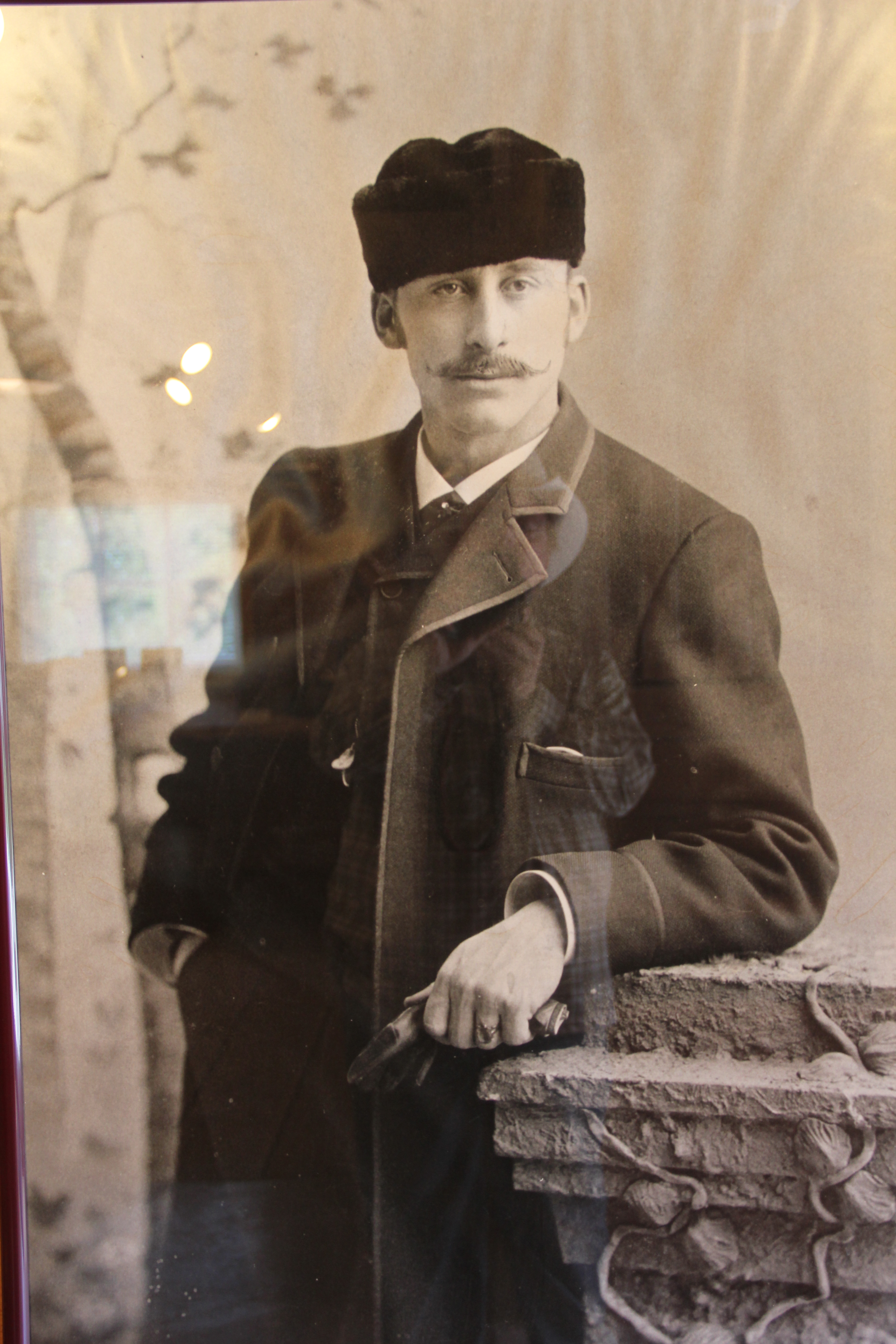
To the east of Lennep is Martinsdale, a tiny place that somehow has already managed two different blog posts about it.  Maybe that tells you that it too is a favorite place.  In 1984, its intact combination depot, what the Milwaukee called a “Standard Class A Passenger Station.”  This standardized design building, standing at the head of the town, spoke
IMG_9678

volumes of how the Milwaukee reshaped this landscape in the first decade of the twentieth century. But since this image from 2013 I have learned that the depot is gone–part of the roof decking was missing then so I am not surprised at the lost.  Just disappointed in the lack of vision of keeping this heritage asset together for the future.
IMG_1618

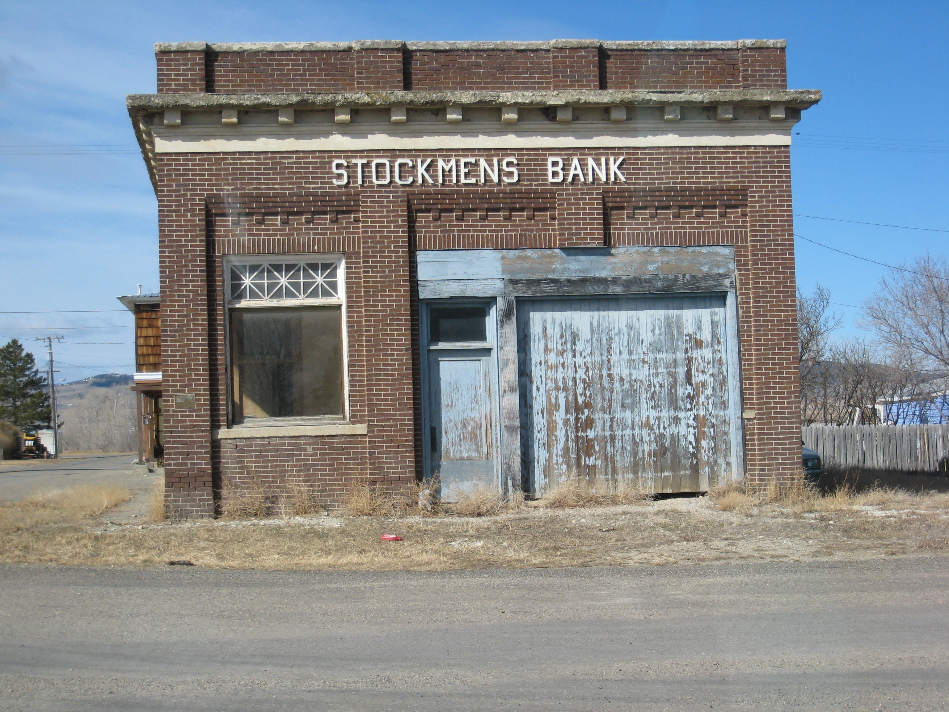
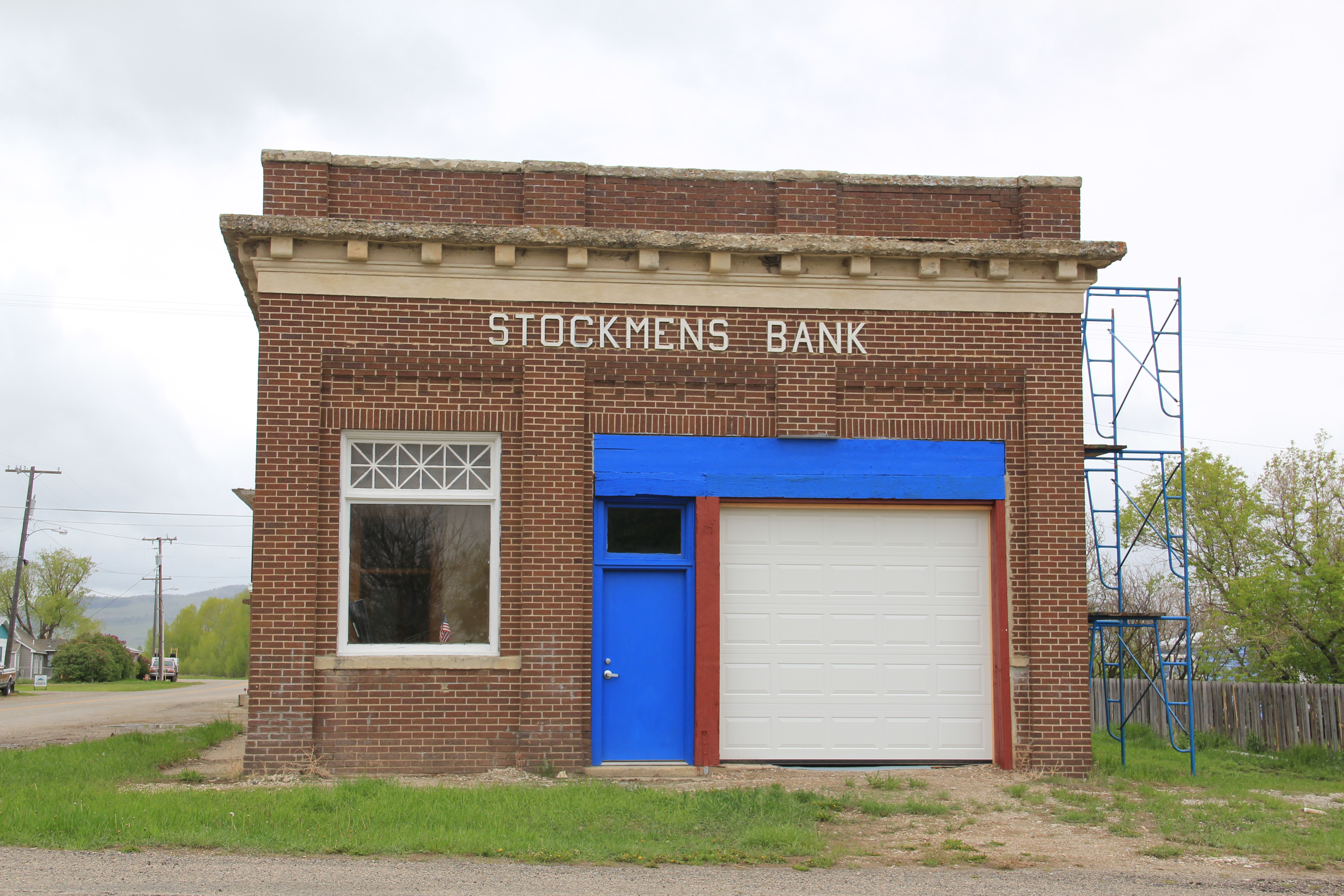
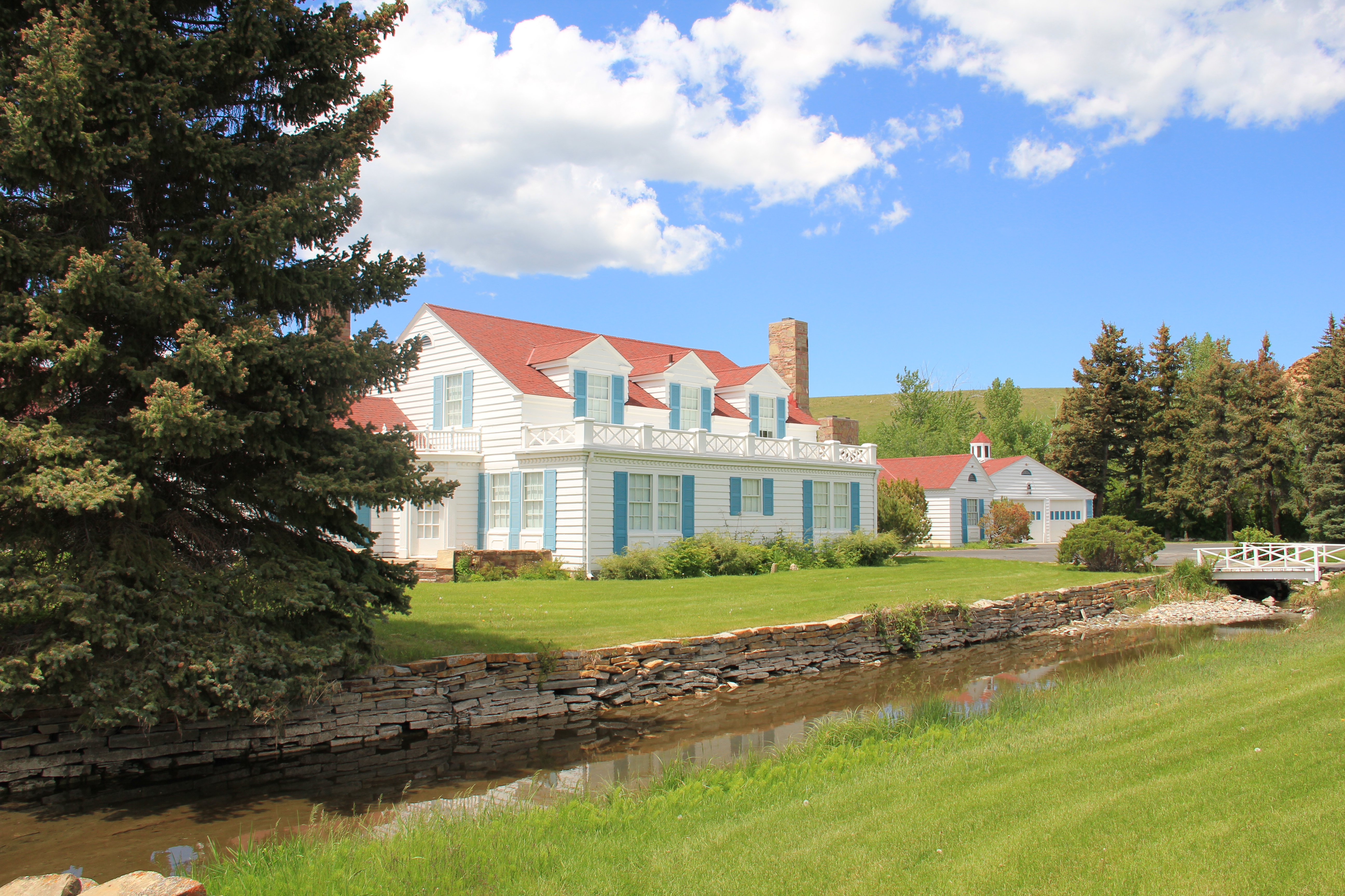
The news is not all bad from Martinsdale.  In 2013 the Stockmen’s Bank was listed in the National Register of Historic Places, only the sixth such place in Meagher County.  Yeah I know the photo above from 2007 shows it missing one entire bay from when it was converted from a bank into a garage.  But its brick construction and classical style made it

Renovations at the Stockman's Bank, 2013

Renovations at the Stockman’s Bank, 2013

a landmark in Martinsdale.  Can’t way to see its condition in 2015 because the town has several key buildings, and I just don’t mean the Mint Bar.

IMG_9679

I really mean the Martinsdale Community Center.  Rural reformers in the early 20th century pushed western communities to establish centers–where people could gather in a secular public space, vital for not only individual sanity but community togetherness in the dispersed population of the northern plains.  The center at Martinsdale has always been well maintained, and now that the depot is gone, it is the community landmark.

IMG_9675

Business, however, is not booming in Martinsdale.  The Crazy Mountain Inn serves as the local restaurant and lodging option, the older classic false-front Martinsdale Hotel is now shuttered.

IMG_9681

IMG_9676

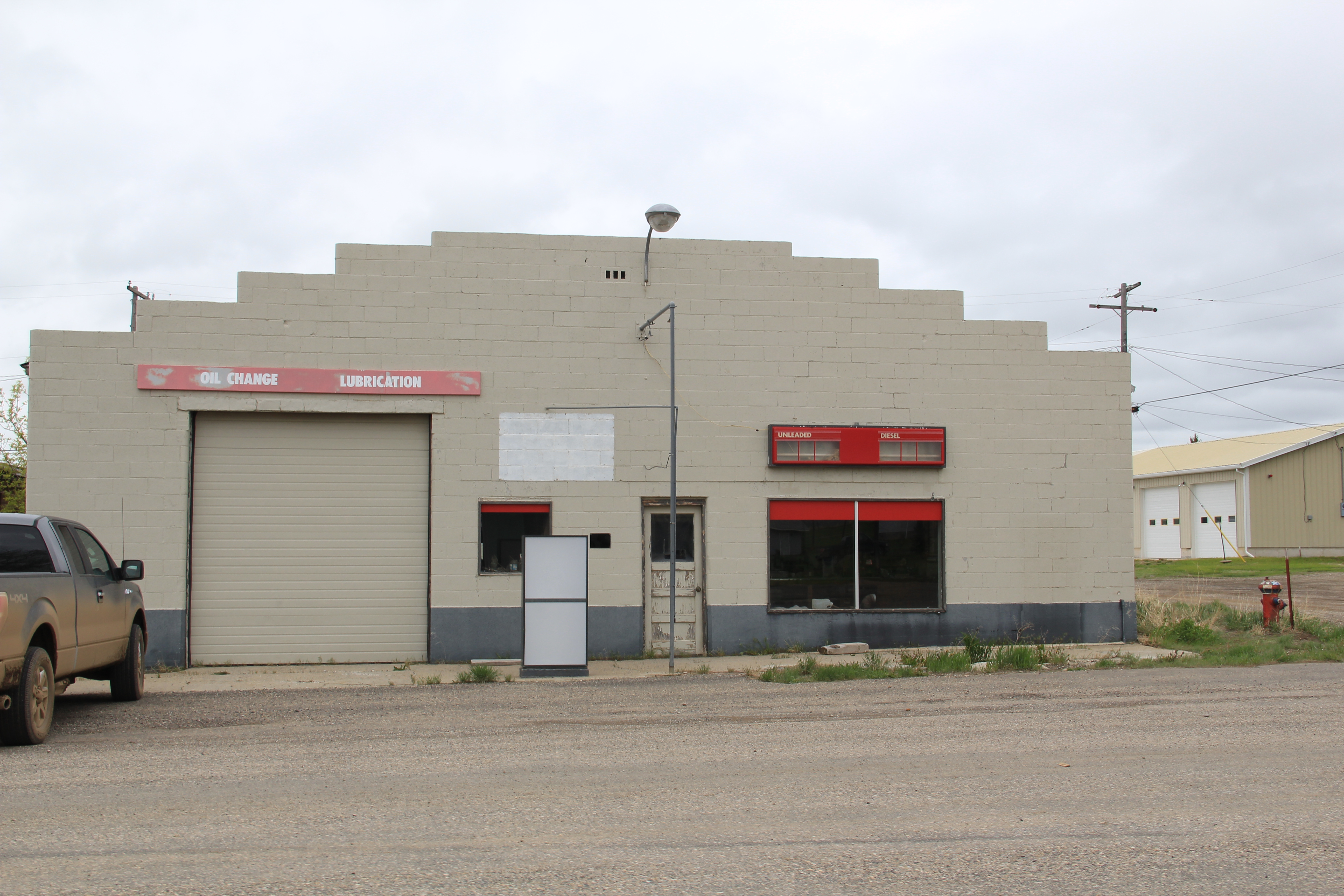
Even classic roadside institutions like the town’s two historic service stations/garages have closed–their mid-20th century designs are reminders of the days when automobiles came this way in numbers.

IMG_9683

IMG_9680

Now let’s shift attention to the “eastern end” of this route, the town of Ringling, a place once of high hopes founded by the circus master John Ringling.  Like Lennep, the Ringling townscape is dominated by two elements:  the Milwaukee Road standardized depot–in

2011 MT Meagher County 056

better shape in 2011 than the Martinsdale station–and the sacred landmark that dominates the view from U.S. Highway 89 for miles:  St. John’s Catholic Church.  The church dates c. 1910 and is a wonderful example of Arts and Crafts style in an otherwise basic gable-front rural church building.  Although used much more sparingly today, it has been restored and maintained well.  It too is eligible I would think for the National Register.

2011 MT Meagher County 057

Montana 294, like the Milwaukee Road itself, is no longer a major artery–it wasn’t really in 1984 and it is even moreso in 2015.  But what remains is a reminder of how the Milwaukee Road shaped the state’s landscape for 100 years, leaving in its wake landmarks of transportation, engineering, architecture, settlement, and faith.

The Bair Ranch of Martinsdale, Montana

Montana 2007 030

In the early 1980s the Bair Ranch outside of Martinsdale, Montana, was almost a mythical place.  Curators and historians told me of wonders to be found inside, of an outstanding western art collection surrounded by the most eclectic mix of European antiques and decorative arts imaginable, especially for such an isolated spot.  When I visited the area for the historic preservation plan in 1984, locals again repeated the stories of the wonders inside, but they were wondering what would happen to it all once Mrs. Alberta Bair passed–she was in her eighties then.

IMG_1606

The Bair Ranch was a landmark for not just what was alleged to be insider–and the compelling, striking Colonial Revival design of the ranch house–but for the man whose empire it represented, Charley Bair, who first showed the stockmen of eastern Montana

2011 MT Meagher County 036

that wealth could be gained from sheep–hundreds of thousands on ranches both on the Musselshell River valley near Lavina and along the Big Horn River near Hardin–but also by translating that agricultural wealth into investments in banks and industry.  Bair was a stockman but his wife and daughters were more urbanities–and their Martinsdale home, with its irrigation ditch just outside the front windows, was proof.  This house belonged more on Summit Avenue in St. Paul than it did on the plains of central Montana.

2011 MT Meagher County 028

When Alberta Bair, the last of the daughters, died in the early 1990s, she confounded many by leaving the ranch house and its contents not to the state museum but to a local foundation.  When I visited the place almost 15 years after her death in 2007 it was obvious that the foundation had maintained the property–it looked much as it did when I had been there in the late 1990s–but its hours of operation were sorta unknown and it was just there–still a powerful physical statement but little interpretation available.

Montana 2007 032

Montana 2007 033

In 2011 and 2013 it was a different world.  Rather than gathering people at the historic stock barn, there was a visitor center and a museum that could properly light and preserve not only key pieces of art and decorative arts from the collection but also serve as a place for small traveling exhibits, giving local residents a reason aways to return.

IMG_9689

IMG_9688

IMG_9687

The Bair Ranch was no longer just a mythic place–it was a destination.  And from talking with the educators and volunteers who were working there in those years, the obvious pride of place was apparent, but they also took great delight in seeing how outsiders reacted to this touch of elegance, in the middle of nowhere.

2011 MT Meagher County 015

Here was one of those places transformed between 1984 and 2014–and transformed into a huge heritage asset not only for residents but for heritage tourism throughout central Montana.  Certainly Alberta Bair left money–but it took some time for the foundation to find its legs and actually change the place from a preservation project into an education venue that could generate sustainable tourism.  By making a visit unique and special, the foundation has helped secure the future of the Bair Ranch and its story that sheep could pay, and pay big–for this century.  Just one of several stereotypes about the West and ranches smashed at this place outside of Martinsdale.

2011 MT Meagher County 024

Meagher County: Crossroads between East and West Montana

IMG_1629

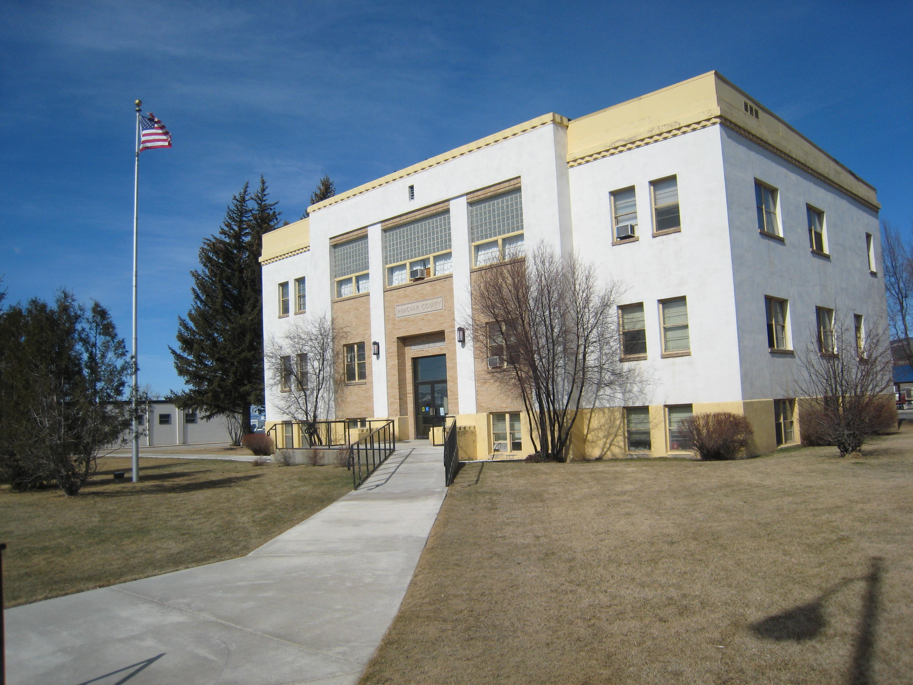
Meagher County Courthouse, White Sulphur Springs, 2007. One of the best New Deal era courthouses in the state.

Meagher County has been a place that I drive through rather constantly.  If you take U.S. Highway 12 east/west or U.S. Highway 89 north/south–both are important historic roads–you pass through this county where the central plains meet the mountains of the west.  The county seat of White Sulphur Springs is near the crossroads of the two federal highways, and home to one of the great roadside cafes of the state, what we always called the Eat Cafe, since the only marker it had was a large sign saying “Eat.”

IMG_0081

And the old historic bar, the Bucka-Roo Bar , was not a bad place either to grab a beer on a hot, dry day.  It is not the only commercial building of note.  The town has both the

IMG_1626

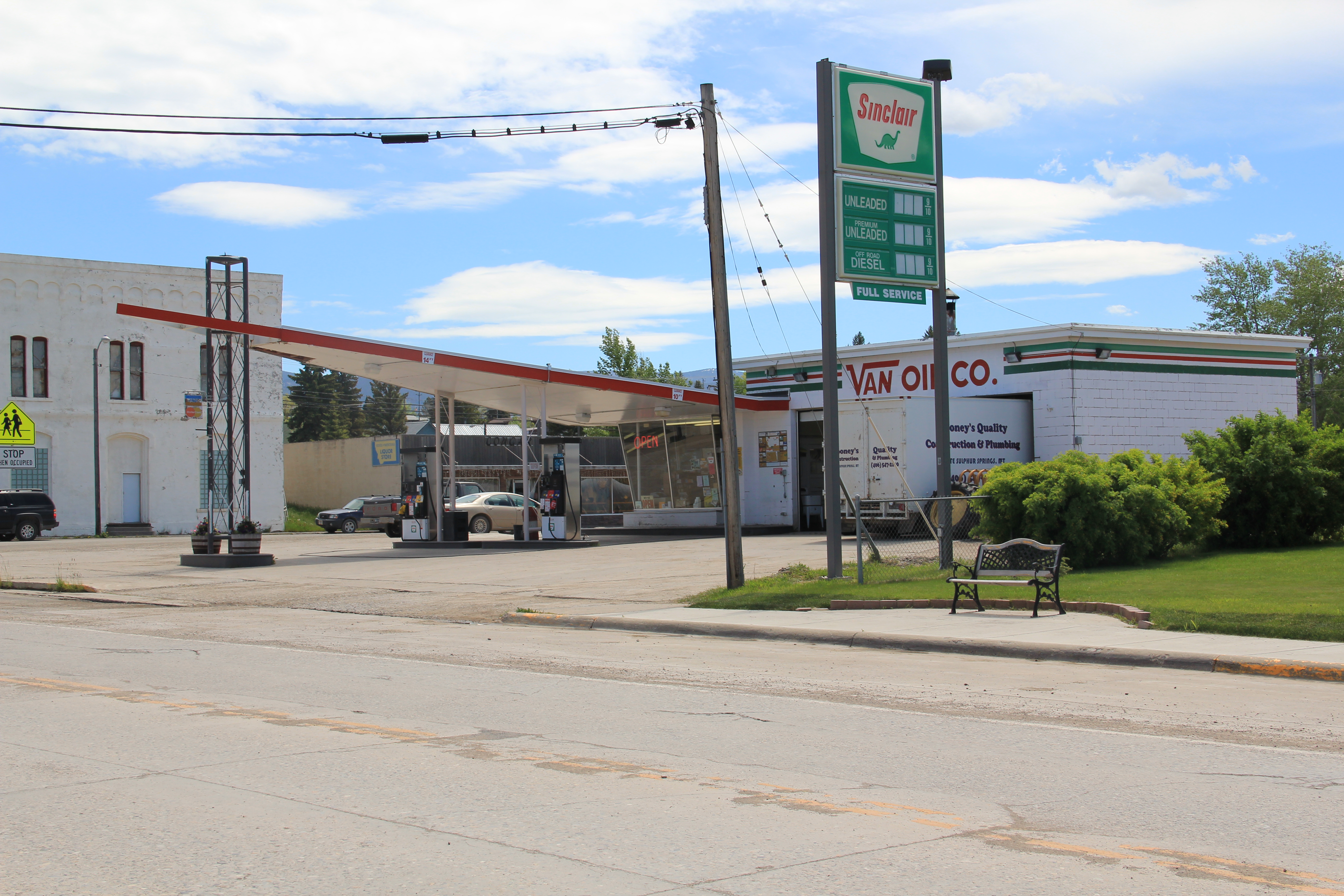
classic Victorian era commercial block but also the 1960s modernist 1960s gas station.

2011 MT Meagher County 005

2011 MT Meagher County 009

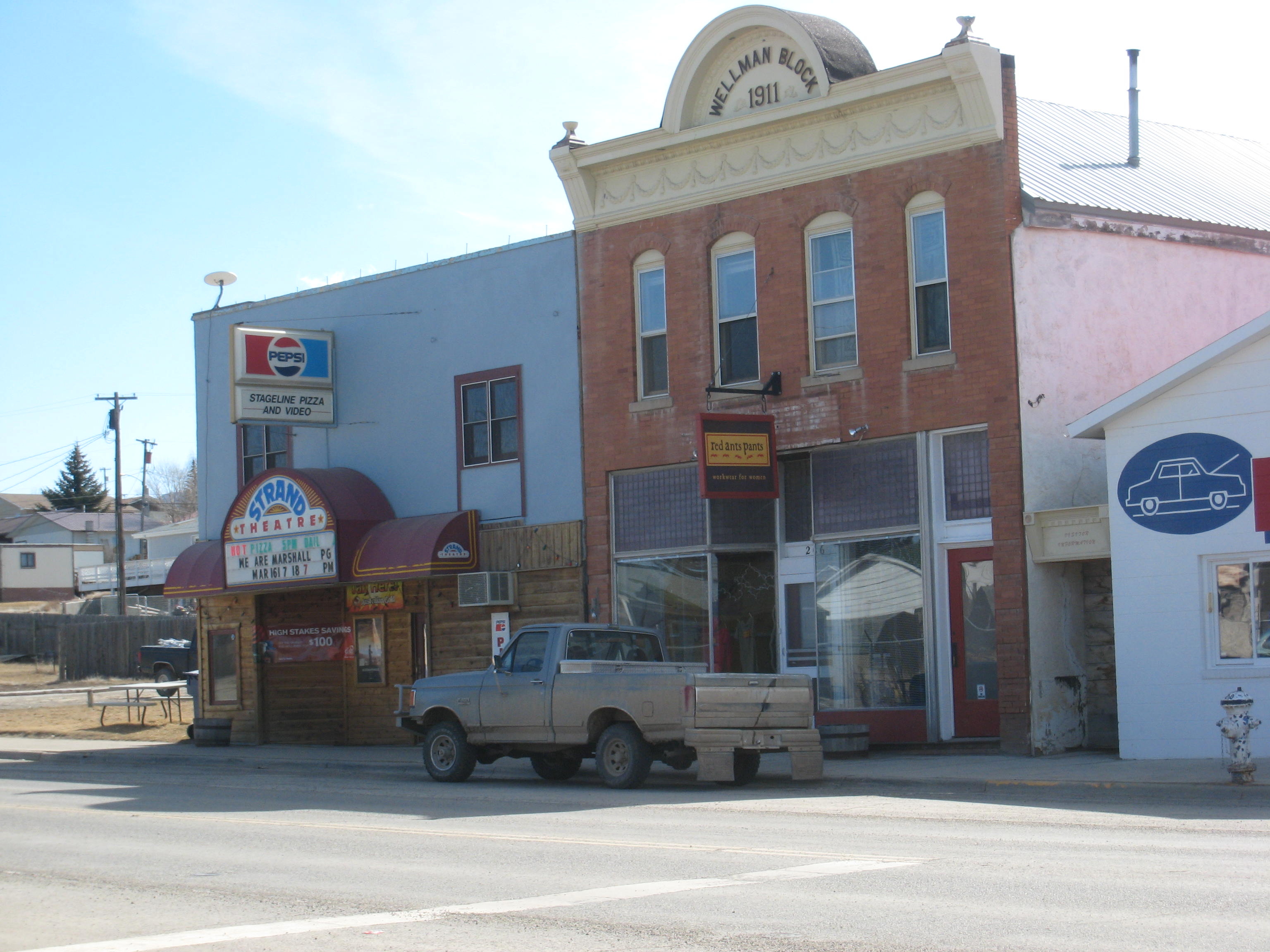
The Wellman Block, now home to Red Ants Pants, was built in 1911 and is listed in the National Register of Historic Places.  Red Ants Pants is the sponsor of an annual Americana music festival outside of the town that ranks as the highlight of the summer in this part of the state.  Next door to the Wellman Block is the historic Strand Theatre.

IMG_1625

The reason I came to White Sulphur Springs in 1984 was none of these places–it was to visit the local historic house museum, a granite stone Romanesque styled house known as The Castle.  It was rather amazing to everyone in preservation back then that a tiny town

2011 MT Meagher County 010

had tackled the tough task of preserving a historic house as a local museum–especially one so far away from the interstate visitor.  Byron Sherman had the house constructed in 1892, with rock taken from the nearby Castle Mountains.  This stockman wanted to show that livestock could pay, and pay well out in the wilds of central Montana.  It has been a tough go for The Castle over the last 30 years.  The local historical society built a new storage building adjacent to the house but the house itself doesn’t get enough visitors.  The town’s major landmark in 1984, it seems almost an afterthought today.

IMG_1622

IMG_1624

That neglect is really no fault of the house, its story, or its keepers.  It is the reality after a nearby ranch house–famous in 1984 but closed to visitors, even someone as intrepid as me, back then.  Of course I am speaking of the Bair Ranch, east of White Sulphur Springs in Martinsdale.  Its story comes in the next post.

IMG_1606

An Easter Greeting from St. Peter’s Catholic Mission

IMG_9510

In all of the justified and well-meaning excitement for a Great Falls of Missouri heritage area–an effort I fully support as an administrator of a statewide heritage area in Tennessee–let’s always remember the western end of Cascade County where so much started.  The First Nations Buffalo Jump State Park at Ulm is the reminder of the centuries old Native American shaping of the landscape.  Here, on a graveled road within a working ranch, stands another key National Register site where Catholic missionaries attempted to build a new world with Blackfeet Indian–St. Peter’s Catholic Mission.

IMG_9528

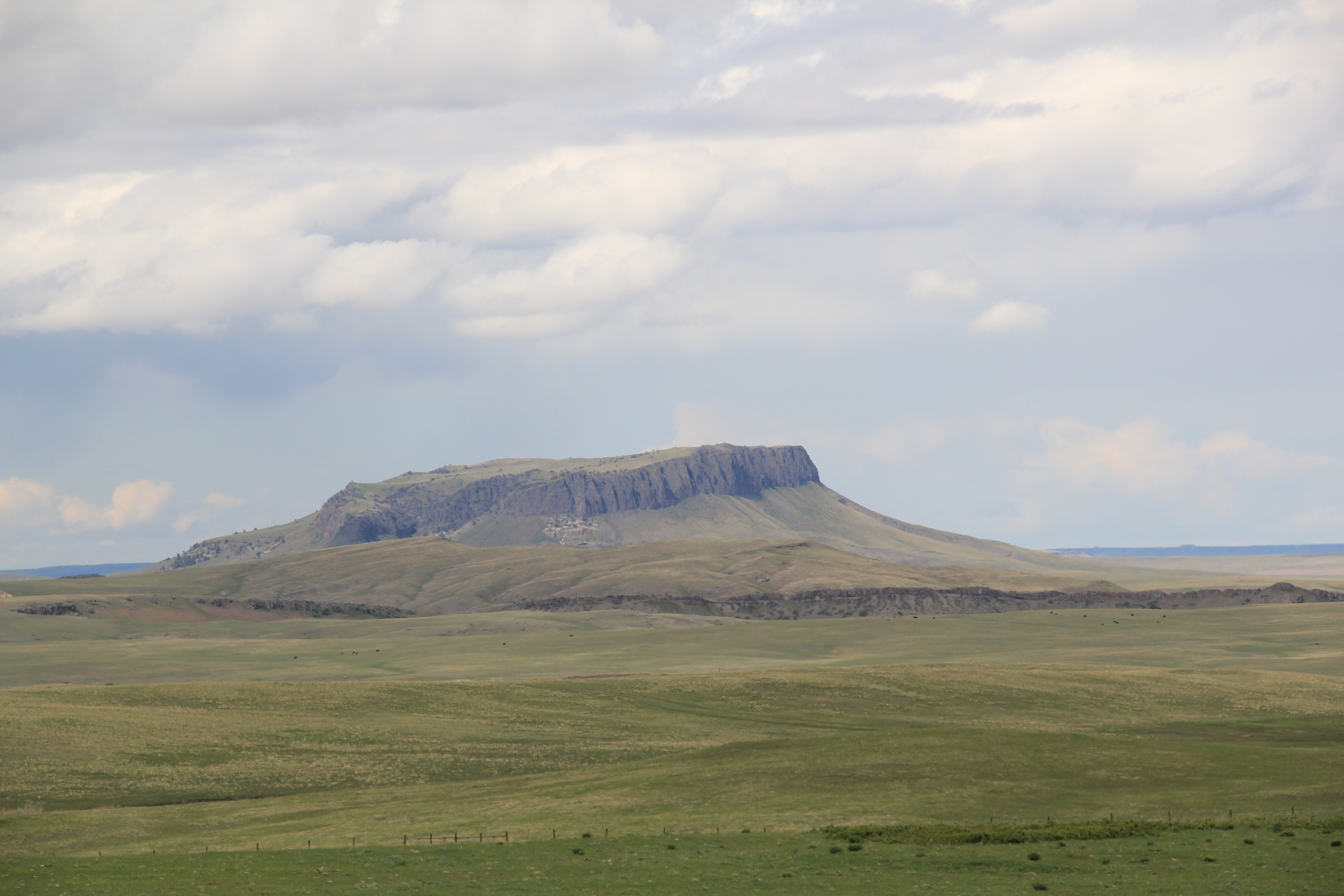
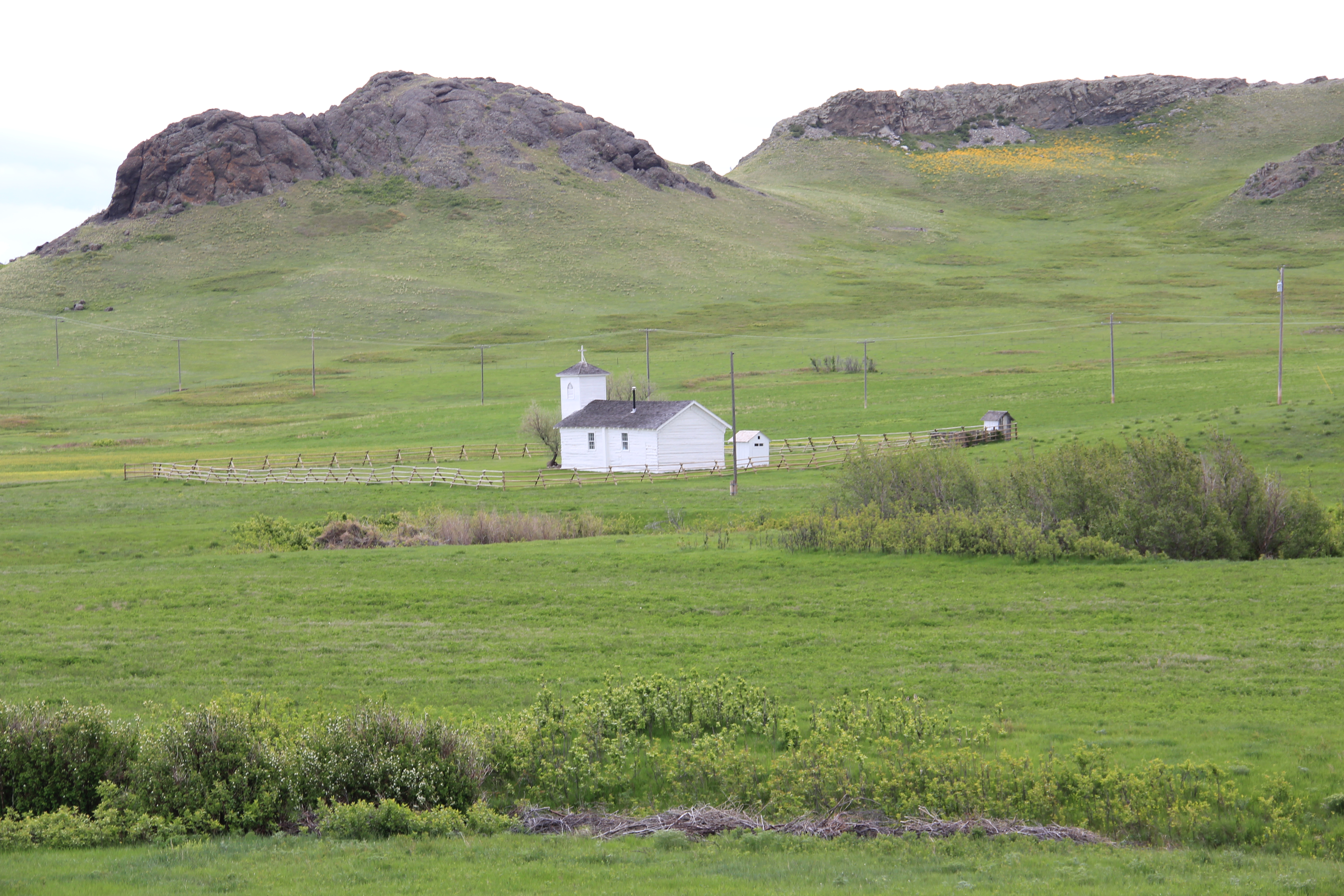
Just getting there is awe-inspiring as the road winds its way around Crown Butte and through dazzling landscape of where the plains meet the mountains in Montana.  St. Peter’s did not become a major settlement, despite its early founding–it seems in the middle of nowhere today, which it is, but in the mid-19th century it was right where it needed to be, at the intersection of Native American and white missionary culture.

IMG_9518

IMG_9525

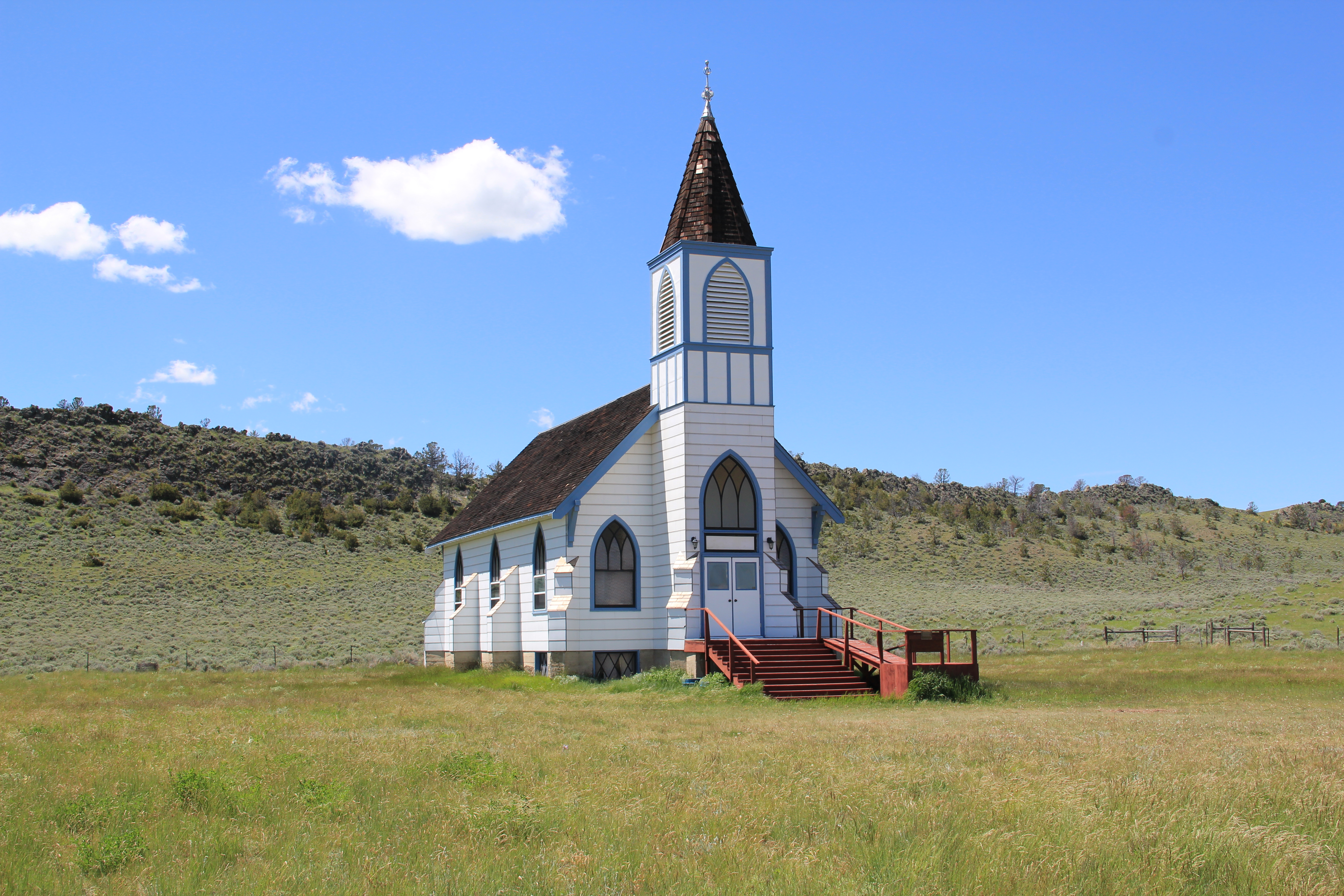
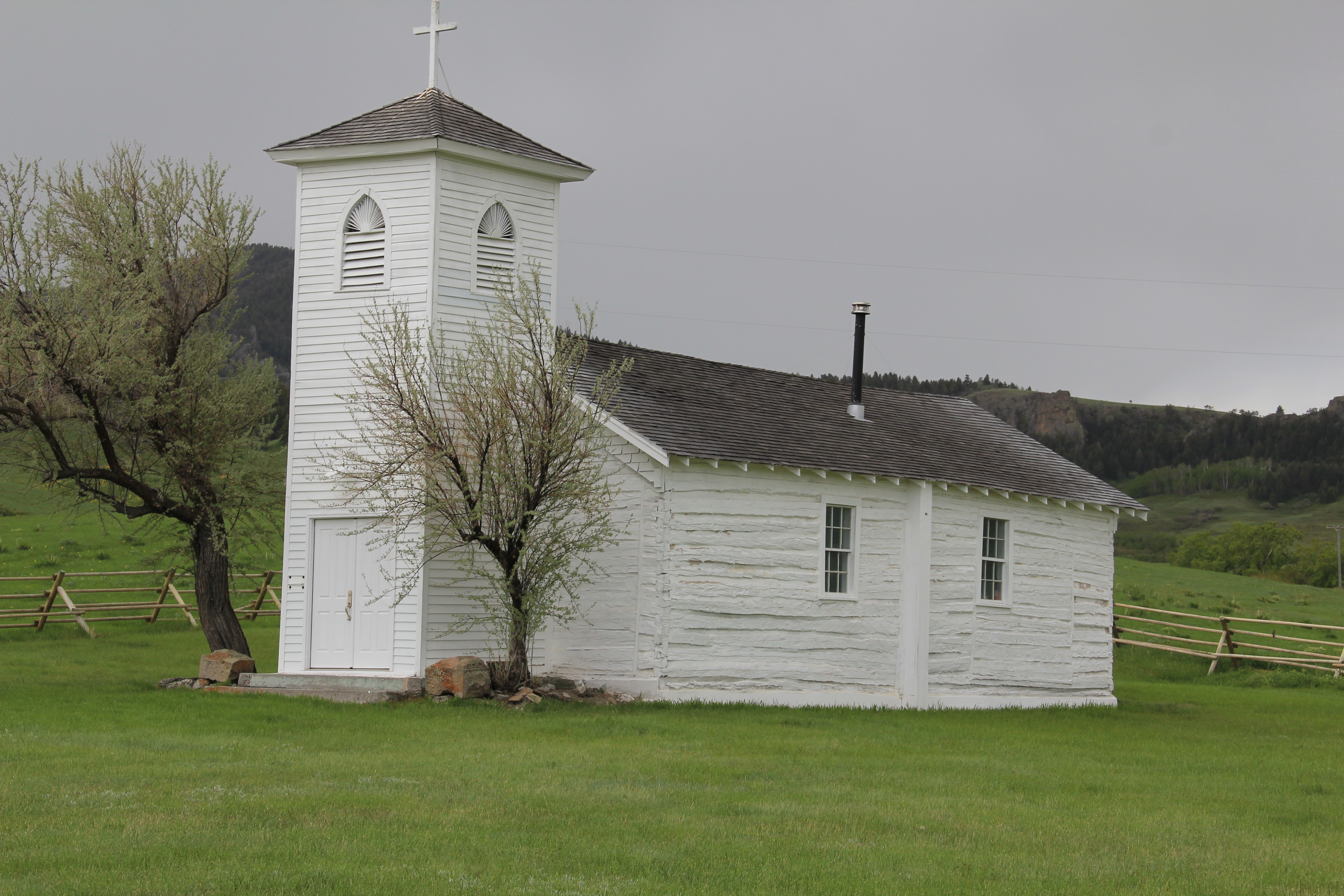
The church itself is an unassuming log building, c. 1878, with a frame bell tower later later. But it was an outpost in that missionary effort among the Blackfeet 150 years ago.  I wrote about this place and the later Holy Family Mission on the Blackfeet Reservation in en essay “Acculturation by Design” years ago so I won’t belabor the success and failure of those efforts here.  You can see for yourself. Other remnants of the old mission school survive,

IMG_9522

some barely hanging on, as they are still part of a working ranch.  The cemetery high above the church, and every other part of the old mission, is probably the most compelling site.  And a perfect place today, or any day for that matter, for contemplation of the story of men, culture, faith, and history on the northern plains.

IMG_9520

Reedpoint, Stillwater County, Montana

IMG_1213

Reedpoint, a tiny Yellowstone Valley town located between Columbus to the east and Big Timber to the west, typically never makes the news, except when a forest fire sweeps near the town boundary, as was the case a few years ago, or when it is Labor Day Weekend and the state’s big newspapers arrive, along with thousands of others, for the tongue-in-cheek “Great Sheep Drive” through the town’s main street.

IMG_1208

But the Great Sheep Drive, which has now been around for a generation, is more than what keeps Reedpoint on the map, and surviving.  The Reedpoint Community Club, established in 1979, keeps the community together and looks for opportunity.  Historic buildings such as the ones above and below have been remodeled or renovated for new uses, reflecting the railroad’s town greatest prosperity in the early 20th century.

IMG_1207

The local dive bar comes alive on weekend, when anglers come in greater numbers to fish along the Yellowstone.  Its ramshackle appearance is new “Old West” at its best.

IMG_1215

The Reedpoint School–a photo of the older historic building is featured here–remains a key to the town’s survival and its future.  With somewhere south of 200 residents, good schools are a must or the sinews of the place come apart.

IMG_1217So too are community institutions important.  The local library is small but still there, a place of valued interaction between young and old.

IMG_1209

I worry about the historic Occidental grain elevator.  For 30 plus years I have roared past this place going to and from Billings, but the elevator was a landmark.  Not only did it link

IMG_1210

the homesteaders of 100 years ago to the railroad, it also linked whatever grains from this part of the valley to that worldwide market accessed by the tracks of the Northern Pacific Railway.  Some years ago the old depot was moved off

IMG_1216

the tracks and found a new life in town.  That conversion is not so easy with an elevator.  When this tall landmark goes so too does a key part of Reedpoint’s history, and yet another link to its origins as a Northern Pacific railroad town.

Wheatland County’s Roadside Architecture

IMG_9695

My previous post focused on Harlowton, the seat of Wheatland County, and its railroad past as a key division point for the Milwaukee Road.  Now let’s consider that other half of the county’s transportation corridor–the one created by U.S. Highway 12.  The Two Dot Bar, shown above, was an early destination point for me in eastern Montana.  What other Montana town back in the early 1980s had a song about it by Hank Williams, Jr?  Hank’s verse, “I’m from Two Dot, Montana, and I don’t give a damn” was one of many theme songs on my boom box for those long drives across the state.

IMG_9742

The new highway visitor center, at the junction of U.S. 12 and U.S. 191 outside of Harlowton, speaks to the region’s dependency on the railroad, but to get around here anymore you need the roads.  Harlowton has several compelling properties along the highway, none moreso than this carefully preserved mid-20th century service station.

IMG_9741

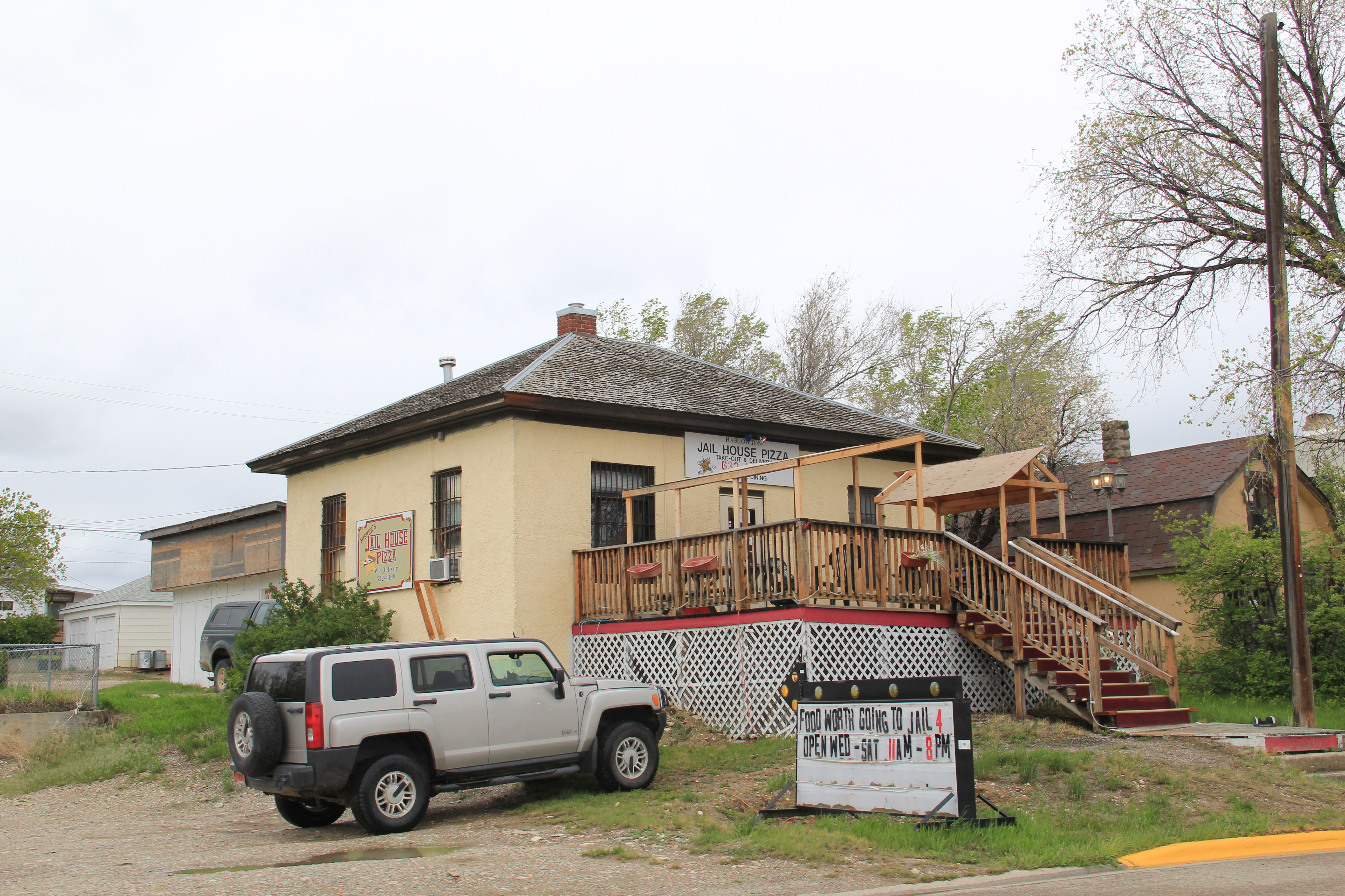
Nearby is the historic county jail, converted into a very casual and fun local eatery.  Indeed the public architecture of Harlowton is different from many rural Montana towns–the historic jail and courthouse are out on the highway, not down in the heart of the town, nearer to the railroad core.

IMG_9740

Montana 2007 024

The Corral Motel sign is one of my favorites of central Montana, and is a reminder of how historic highway motels that are not part of a major chain remain good travel options.

IMG_9745

Then there are the old garages and gas stations all around Harlowton that are still used in some way today–they too are reminders when U.S. 12 was a major artery.

IMG_9720

IMG_9756

IMG_9715

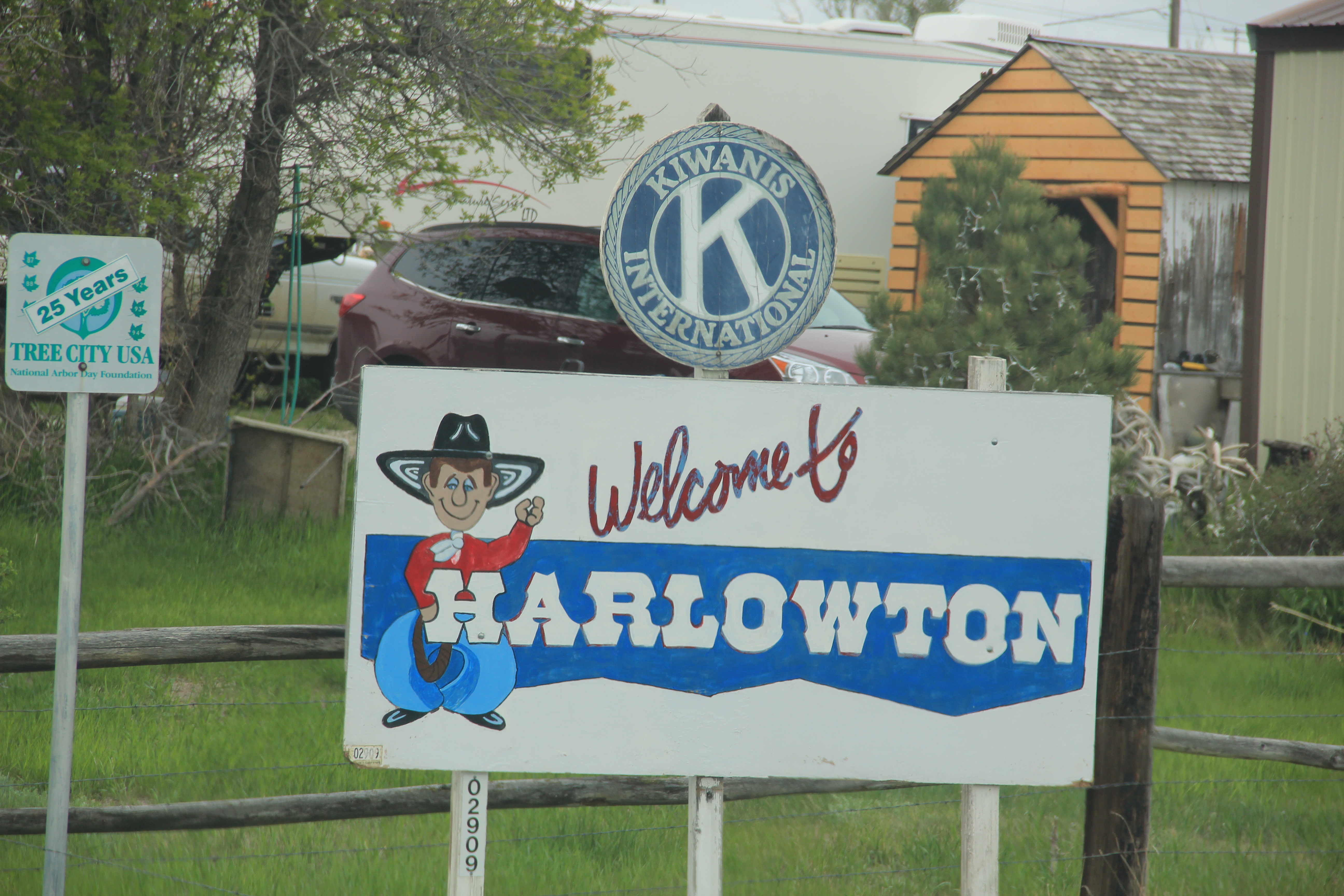
Then at the north end of the county, on U.S. Highway 191, is Judith Gap, and perhaps they have grabbed bragging rights for the most spectacular bit of roadside architecture.  Nope it is not the neat town sign–although I like it a lot.

IMG_9770

Nor is it the not-to-be-missed Hitchin’ Post Bar.

IMG_9772

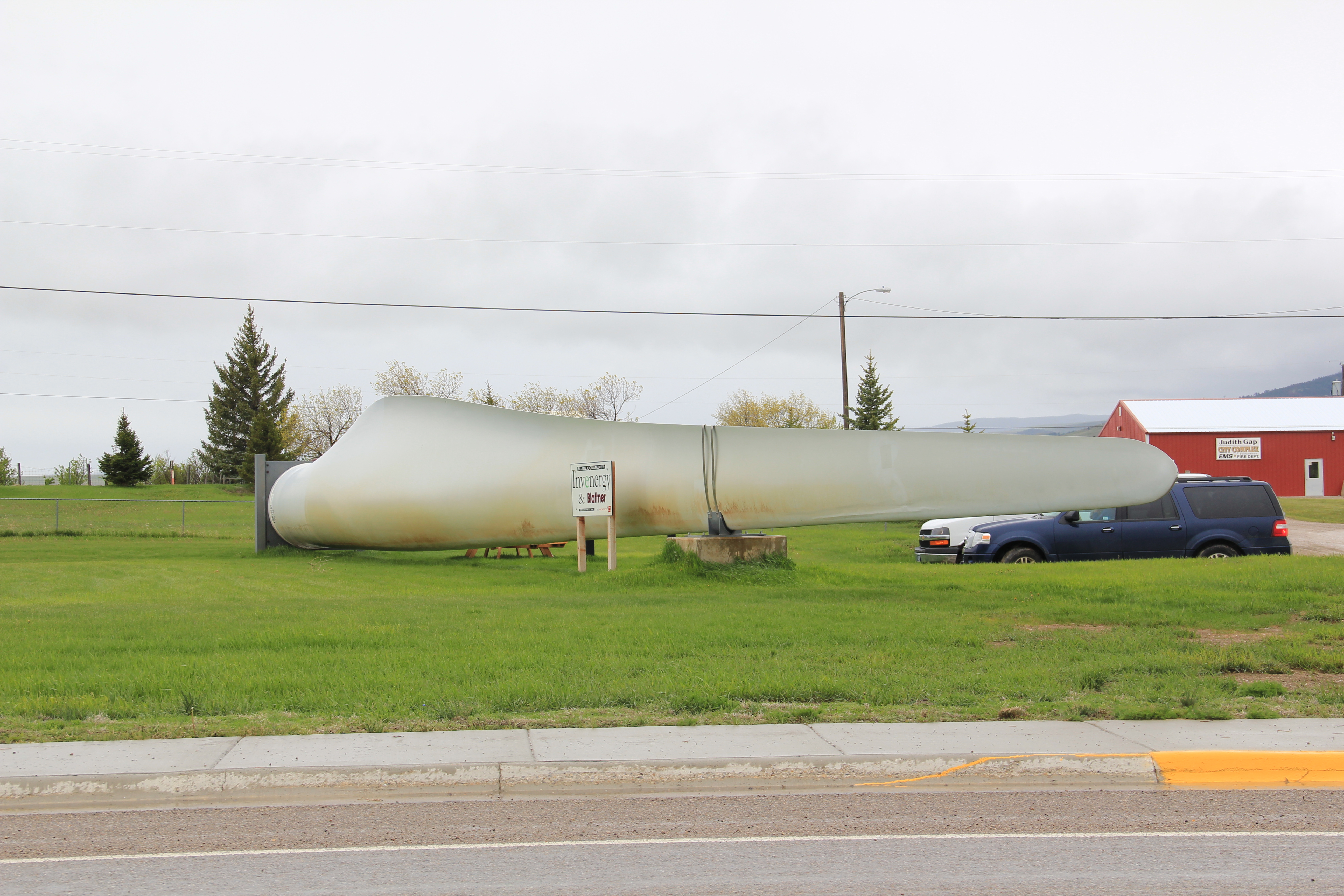
it is the interpretive site with one of the huge steel blades used on wind turbines found along both U.S. 12 and U.S. 191 in Wheatland County–wind turbines are defining elements now of the northern plains landscape–and here you can touch one.

IMG_9771

Harlowton: Lost Landmarks in a Milwaukee Road Town he

IMG_9748Harlowton is my favorite of Montana’s Milwaukee Road towns.  Its roots lay with the vision of Richard Harlow to build an independent central Montana railroad.  When the Milwaukee Road assumed control of Harlow’s mini-empire, it turned Harlowton into one of the line’s key division points, the place where steam engines switched to electric power for the journey up and over the Rocky Mountains.

IMG_1591 copy

Fischer Park with Milwaukee Road electric engine, Harlowton, 2006

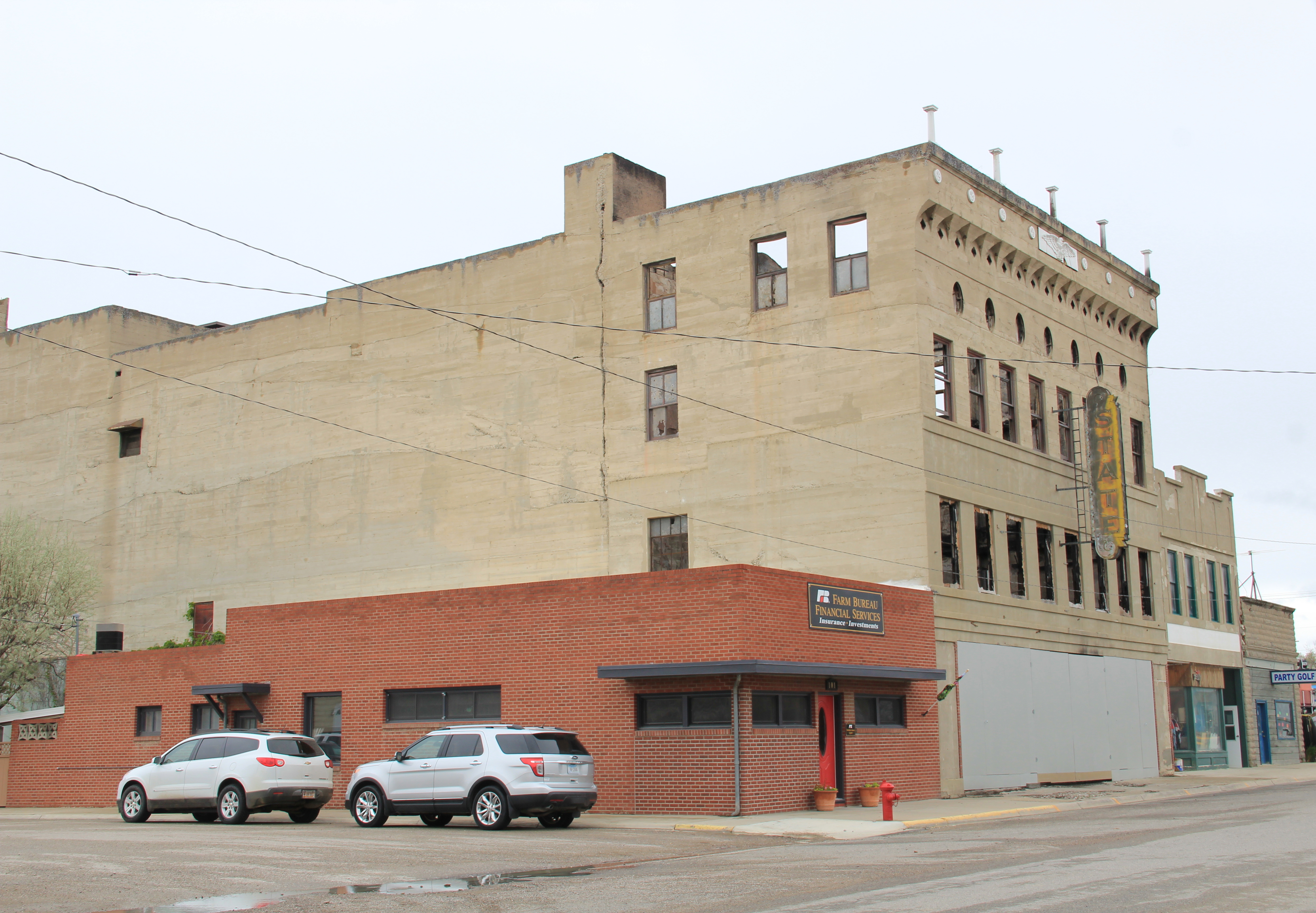
When I surveyed the town in 1984, I did so with the blessing and insight of Lon Johnson, then the historic architect of the Montana State Historic Preservation Office.  Harlowton was a special case for Lon, especially the dream of restoring and reopening the magnificent State Theatre (1917), a hallmark of its days when Milwaukee passenger traffic promised so much for this small plains town.

IMG_9739

IMG_9738

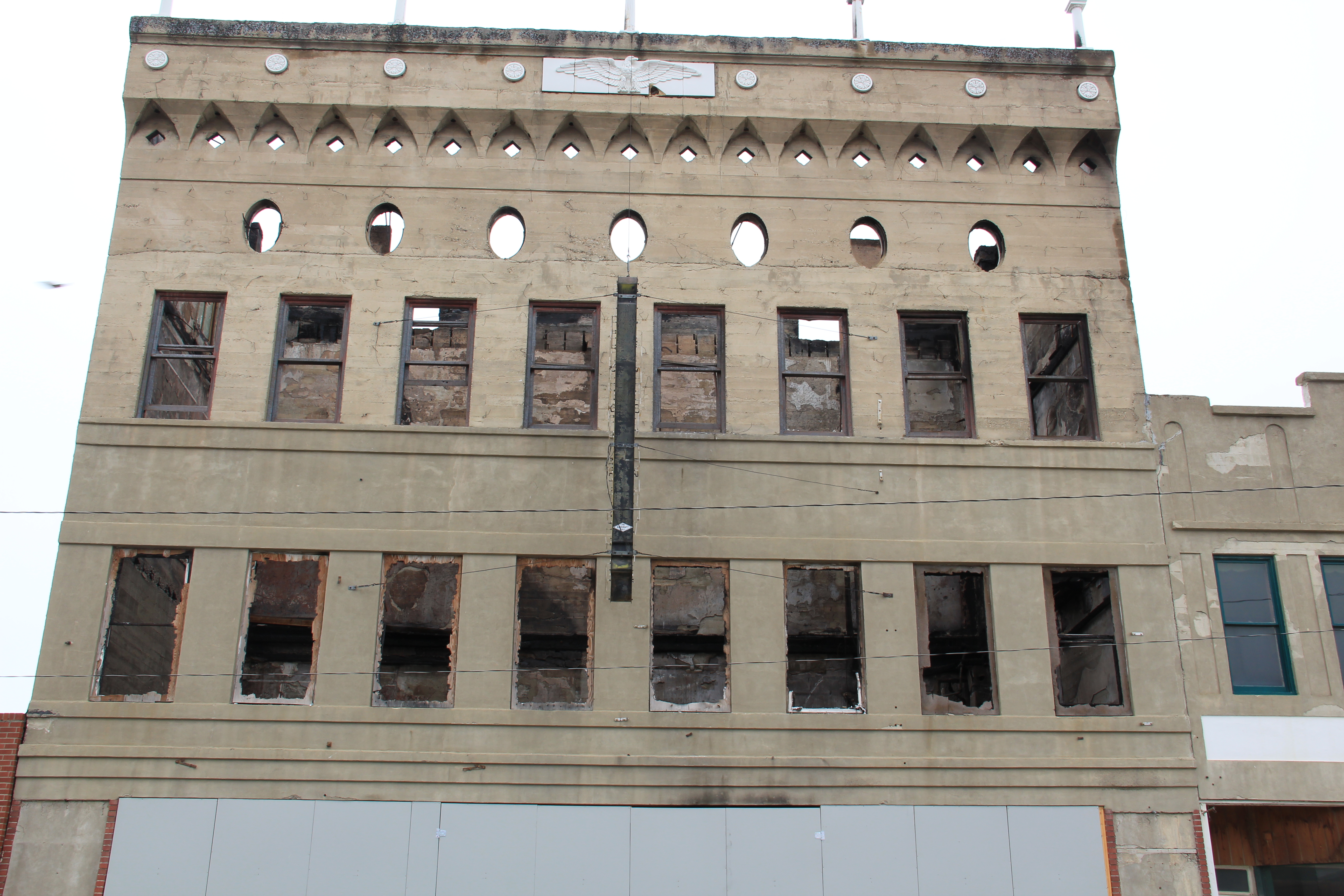
Before the restoration could take place, however, the theatre caught fire in 1997 and plans were set aside until 2011 when a new effort to restore the building occurred, but a second fire in 2012 again stopped progress.  The photos above from 2013 show that the hulk of the 1917 theatre remain but with the declining local population, renewal of the theatre will be difficult.

Milwaukee Road depot and offices, Harlowton, 2006

Milwaukee Road depot and offices, Harlowton, 2006

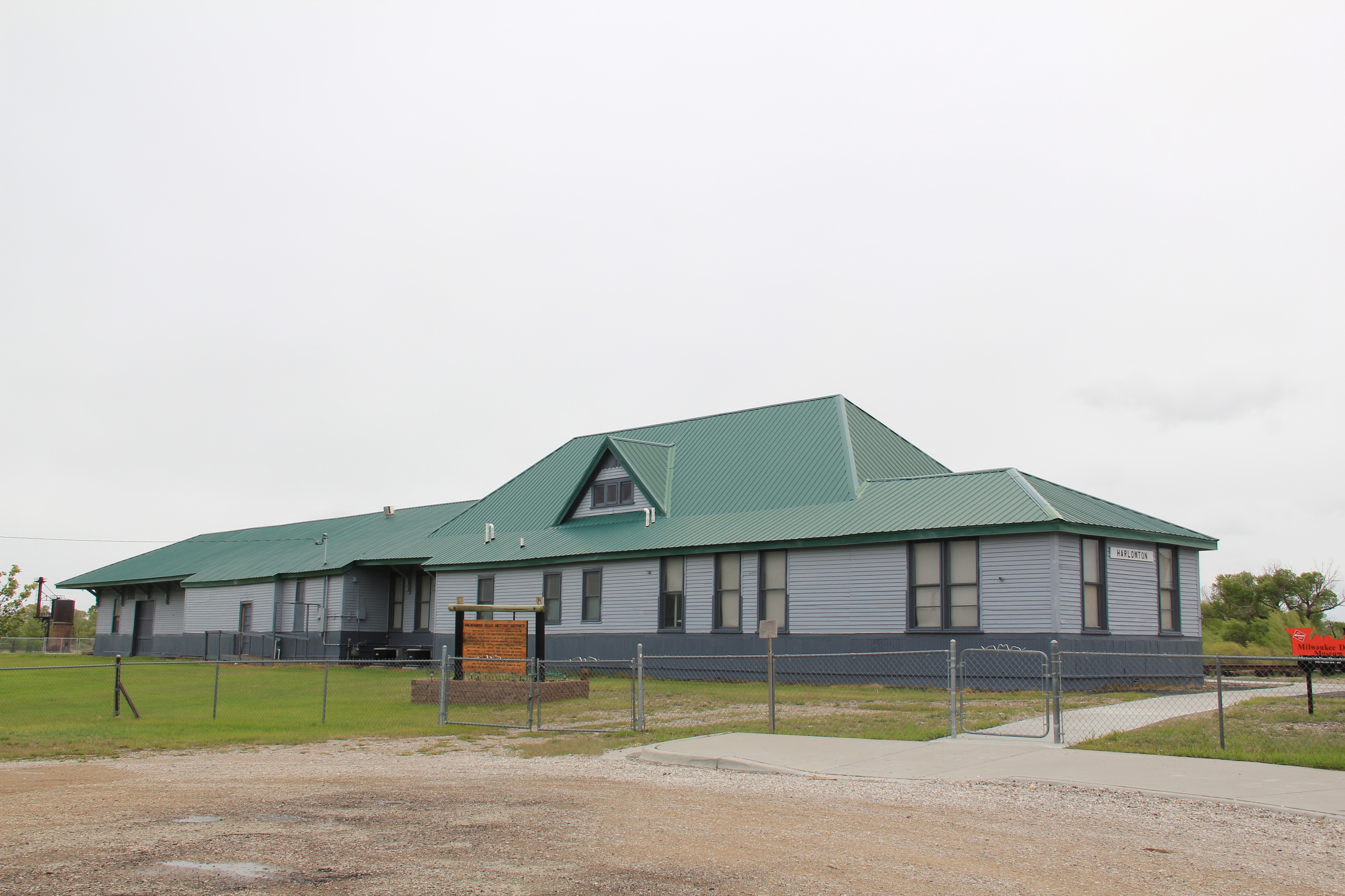
My great interest in Harlowton centered on the Milwaukee Road and its works.  In 1984, the company’s bankruptcy was only a few years old.  Down at the tracks, there was still the railroad line, the depot, the roundhouse, and other buildings.  I considered these remnants, especially in the local context, as extremely significant.  Afterwards, locals and the SHPO agreed and the Milwaukee Road depot historic district was created.  Over the next 25 years, I would stop by Harlowton periodically to monitor the district, and noted with approval how the depot had been repaired.  The roundhouse, unfortunately, was lost.

Harlowton depot and offices in 2013

Harlowton depot and offices in 2013

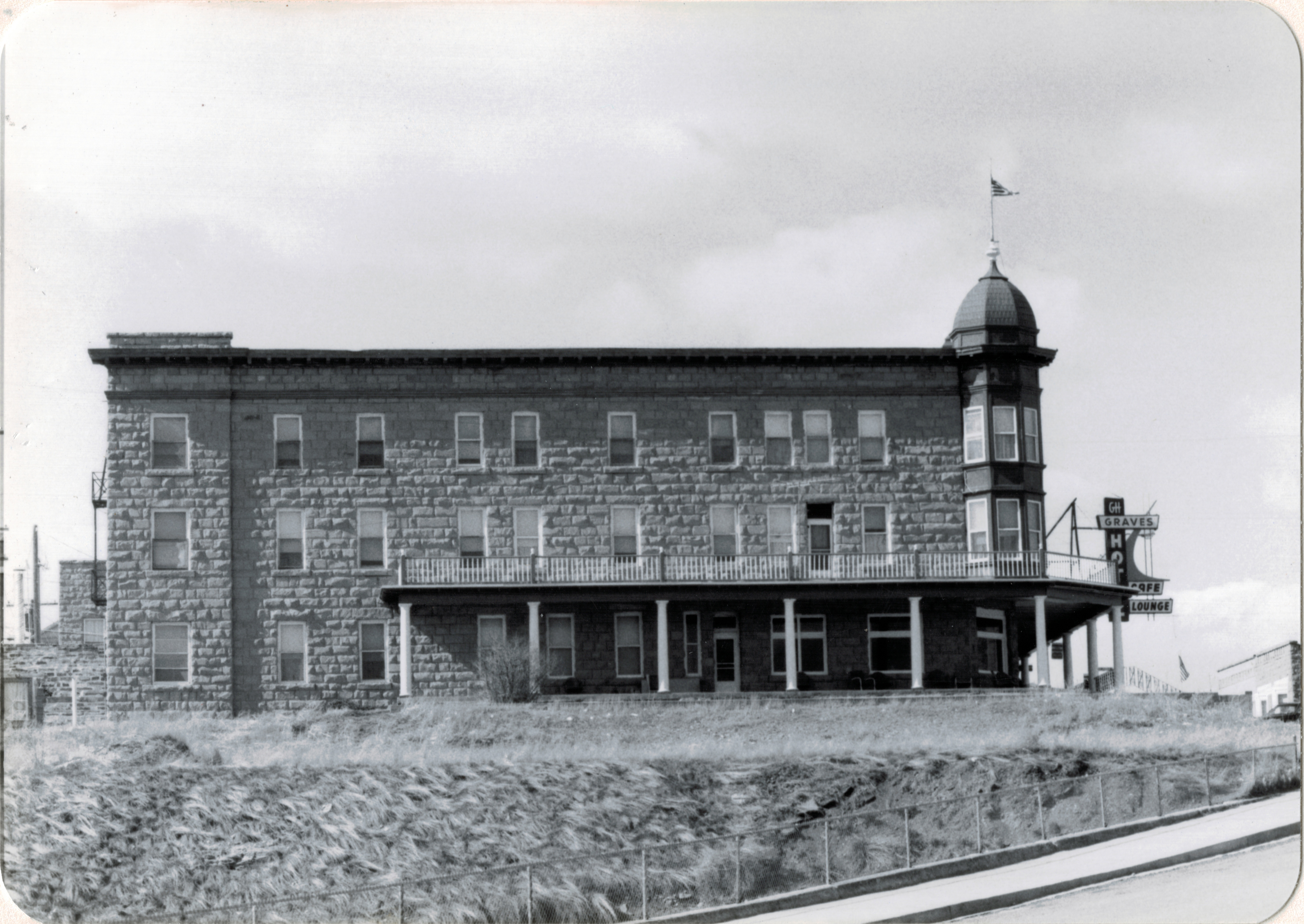
Looking north from the depot, on the bluffs of the Musselshell River overlooking the railroad tracks, stood a third key landmark, the Graves Hotel.  My colleague Lon Johnson also had

IMG_1594

Harlowton, from the railroad depot, 2006

been a big fan of this Queen Anne-styled stone railroad hotel, with the stone carved from the nearby bluffs.  I too fell in love with the Graves, staying here periodically in the 1980s.

Graves Hotel, Harlowton, MT, 1984

Graves Hotel, Harlowton, MT, 1984

When I visited in 2006, however, the Graves looked good–from a recent repainting of its late Victorian detailing–but it was closed, and so it has remained ever since.  I do not

Graves Hotel harlowton

pretend to have the answers on how do you maintain a large three-story National Register hotel that is miles from an interstate and located instead on a little-used-by-tourists route

Graves Hotel in 2013

Graves Hotel in 2013

(U.S. Highway 12), but even if the hotel can come partially back to life, it would be a real tourism boost to Harlowton.

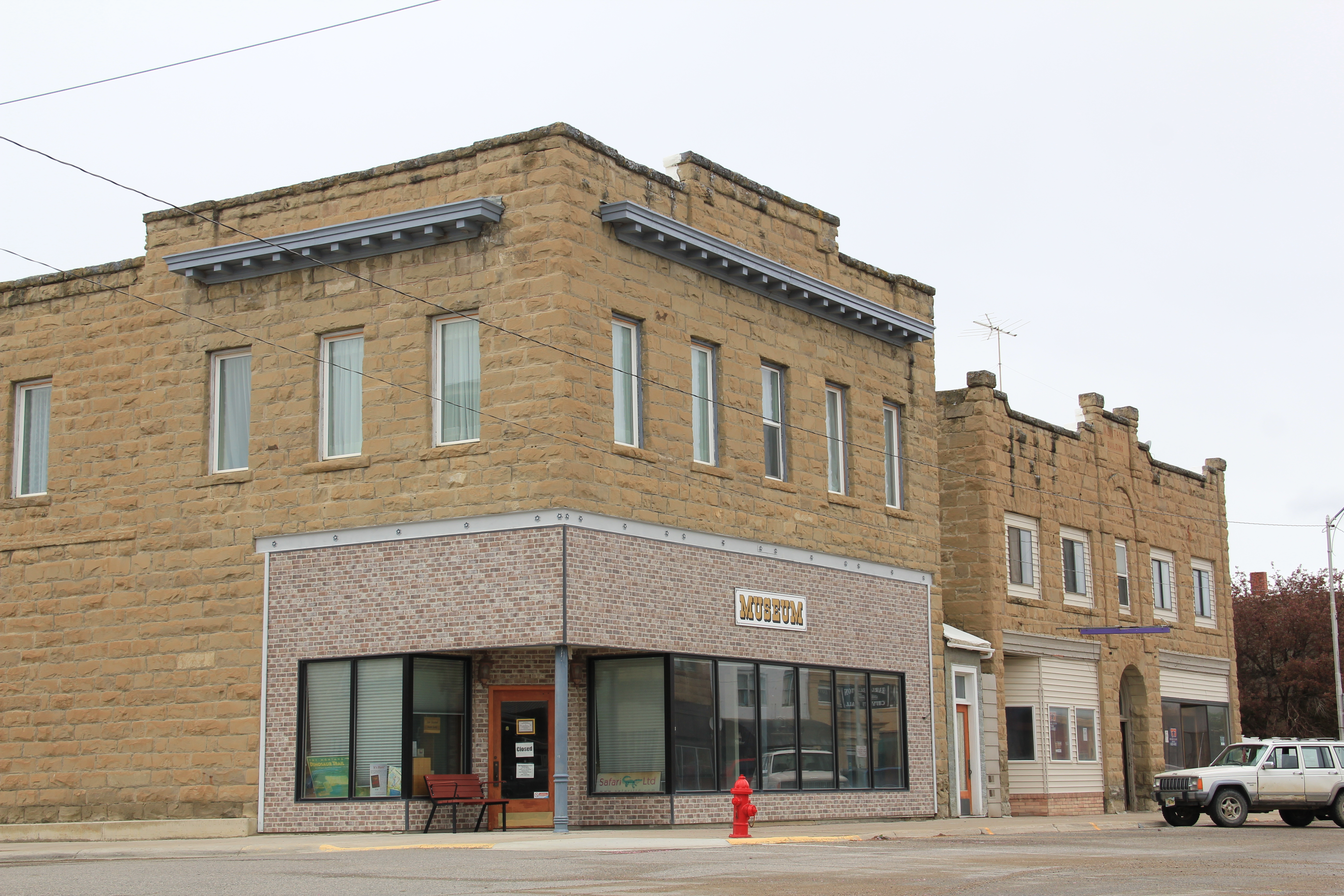
It’s not like the local residents aren’t in the game and trying.  The county museum, the Upper Musselshell Valley Museum, continues to grow its profile along Central Avenue.  The buildings made of locally quarried stone, with late Victorian cornices, harken to the turn of the 20th century when Harlowton held such promise with the Milwaukee Road’s arrival.

IMG_9719

IMG_9731

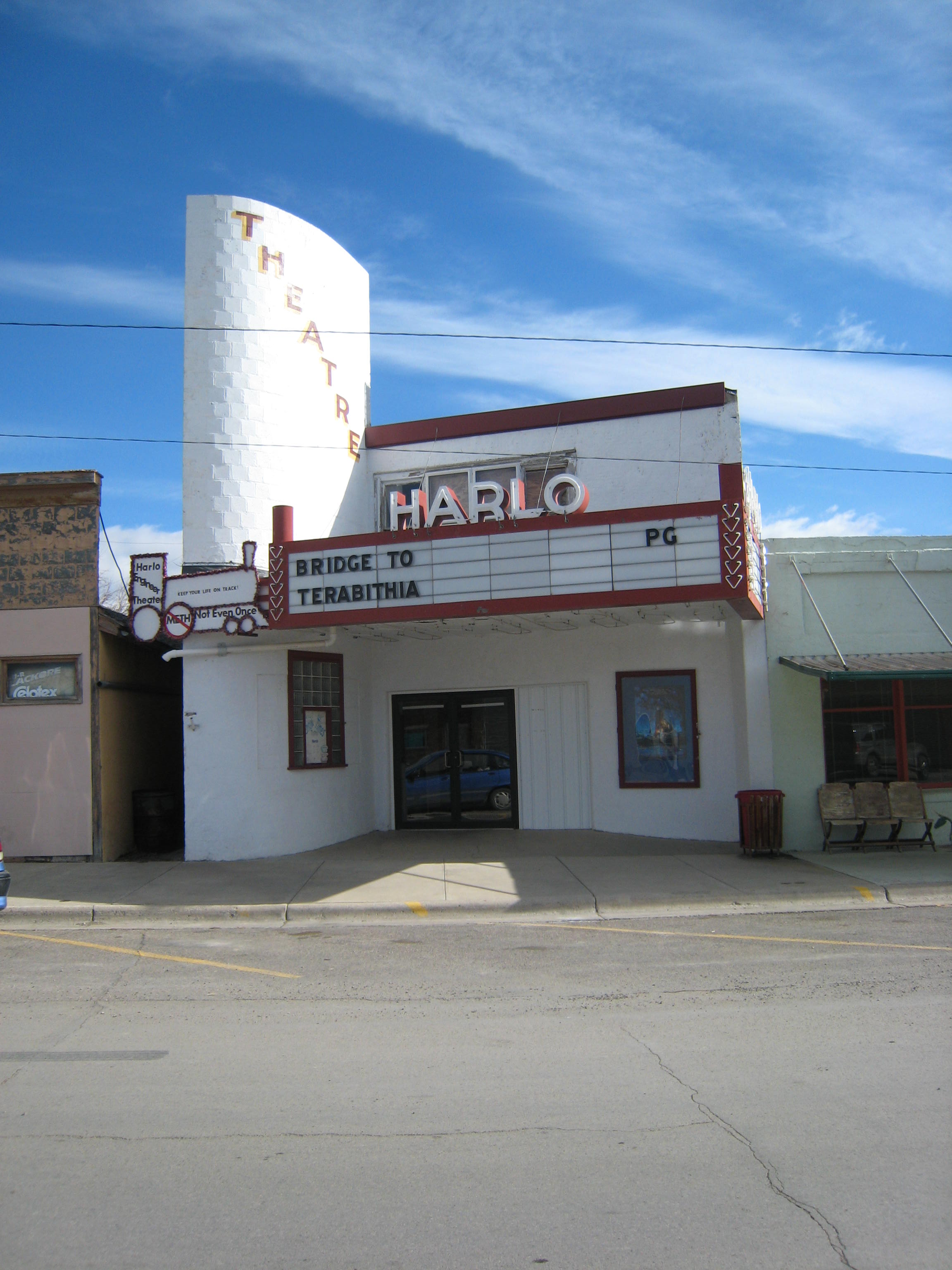
The Harlo Theatre remains in business too, and is a throwback to small town theaters, and a rare survivor in today’s home entertainment world.  Plus it is a cool building.

IMG_1592 copyDespite missing out on the interstate, losing a railroad, and dropping a lot of population, there is still something to Harlowton that makes me return, trip after trip.  More on that something in the next blog.