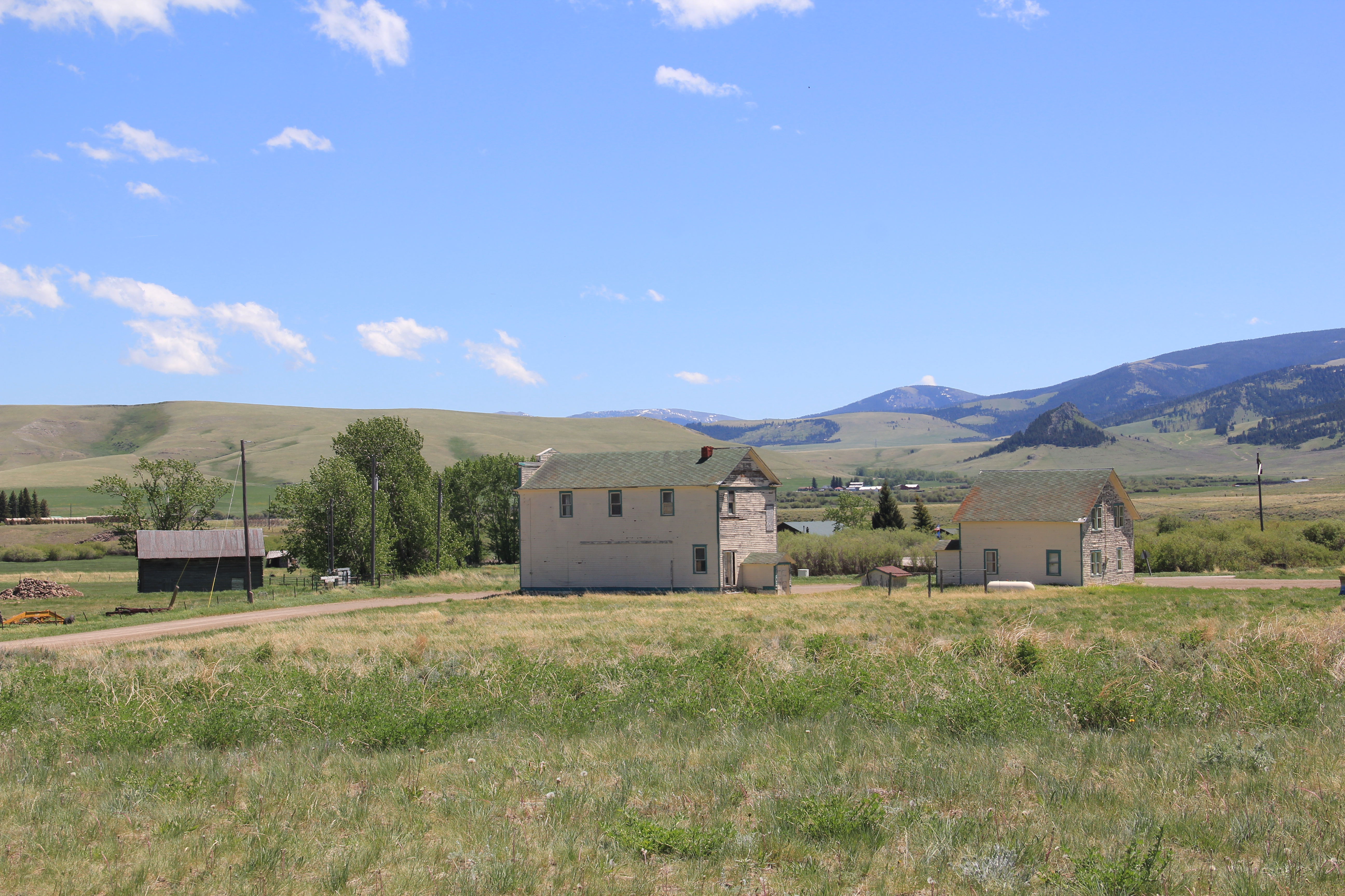
I had not been to Buffalo in Fergus County, Montana since 1984–some 37 years ago in the summer of 2021. The place dates to the late 19th century with a post office and trading post. In 1908 it took on the town plan you find today–elevation at the head of town along with railroad line and the public school at the other end of town–as it became part of the Great Northern Railroad route between Billings and Great Falls.
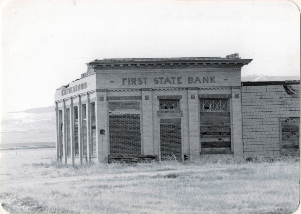
The same landmarks I found in 1984 still defined the town. The First State Bank of Buffalo (there was never a second one) was slowly ebbing away then; the bank had closed during the Great Depression, when so many Montana towns from the homesteading boom had their economic life sucked away. In 1921 I was frankly amazed that it still stood, missing a roof and part of a wall but still expressing its small-town neoclassical style with pride.
Buffalo bank in 1984Buffalo bank in 2021
The Buffalo school was another statement building from the homesteading era, its two-story brick construction expressing not only the need of a rapidly booming place but how the residents valued public education. The school was the community’s statement of pride.
The community church made a statement of faith and community spirit for the 21st century. The town numbers less than 200 inhabitants but actually that number had grown in recent years. The Craftsman-styled church is extremely intact for a 100 year old plus building–the maintenance of the church is a credit to its members.
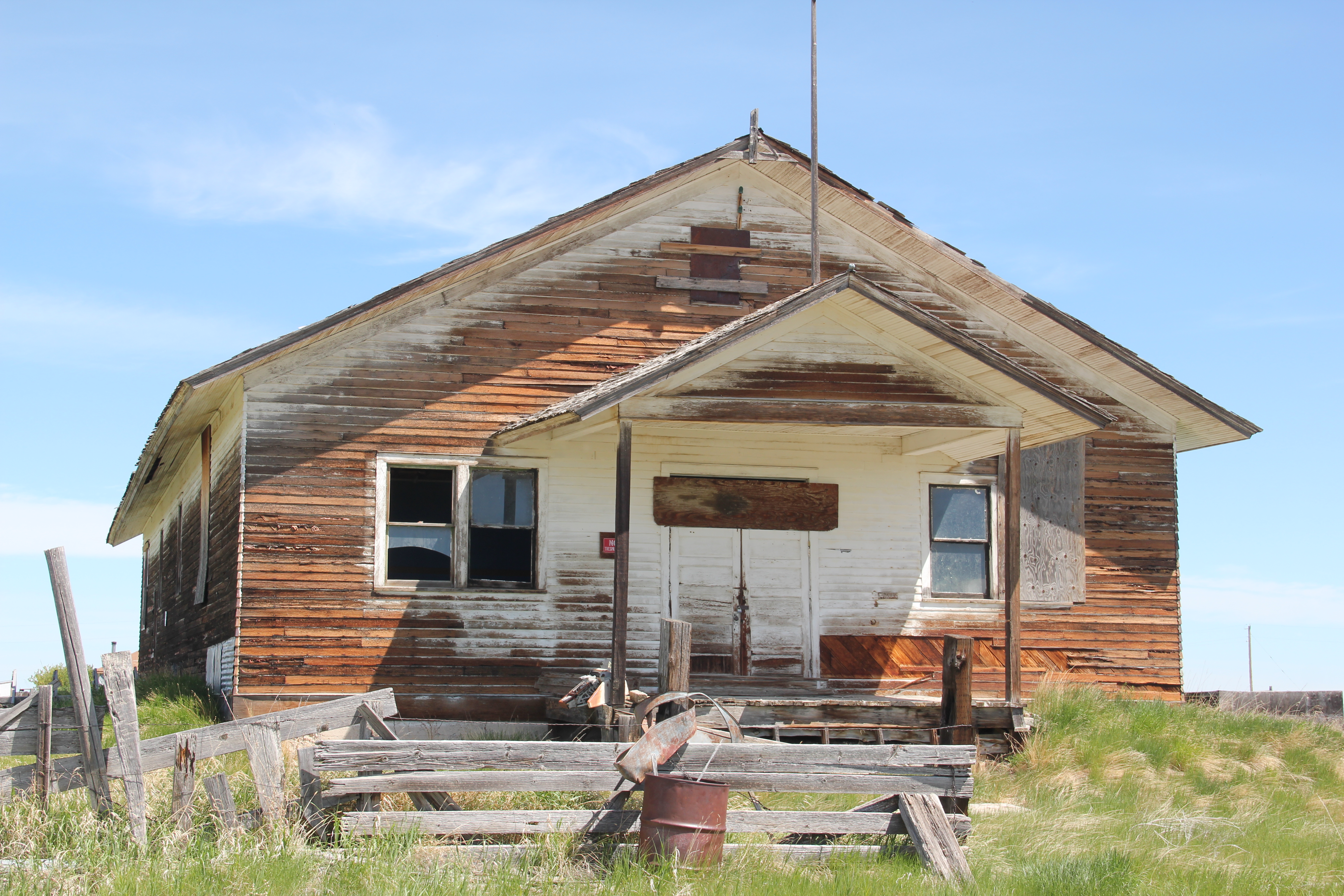
Not everything was as it had been in 1984. The community hall had fallen on lean times indeed.
But the hipped roof post office–the one civic building–hadn’t changed a bit. Here was a statement of continuity, and thanks to everyone who fought the good fight last decade to keep post offices alive in rural Montana.
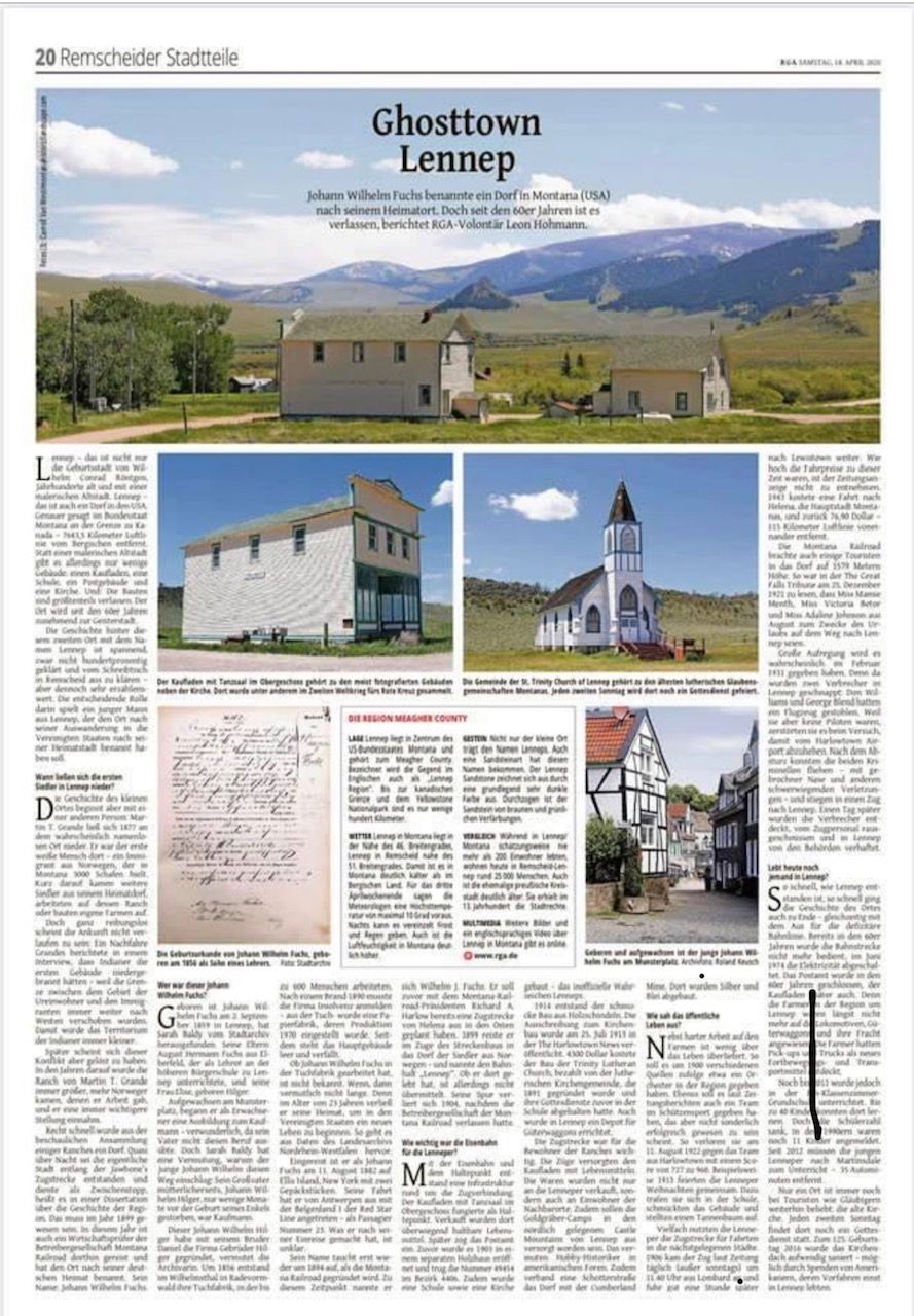
In the winter/spring of 2020, a new German newspaper contacted me about using several images from the website taken at Lennep, a small Milwaukee Road Town, along Montana 294 in Meagher County. The newspaper wanted to consider its American counterpoint, its isolated location in Montana, and is history. The editors named the story Ghostown Lennep.
I won’t provide a translation of the entire article, but the author Leon Hohmann provided me a transcript in English, from which I learned quite a bit about Lennep, Montana. The author wrote:
“But the history of the small town begins with another person: Martin T. Grande settled in 1877 in the place that was probably still nameless at that time. This is what history books tell us. He was the first white man in this area an immigrant from Norway who made his living by keeping 3000 sheep. Shortly afterwards, other settlers from Grande’s home village came to the mountain region, worked on his ranch or built their farms.
But this arrival does not seem to have gone very smoothly: A descendant of the first settler reported in an interview that Indians had burned down the first buildings because the border between the area of the natives and the immigrants was moved further and further to the west. Thus the territory of the Indians became smaller and smaller.
In the following years, Martin T. Grande’s ranch became bigger and bigger, more Norwegians came, whom he gave work, and he took an increasingly important position. His countrymen called him “good old patriarch”.
But quite fast the contemplative collection of some ranches and farms became a bigger village. Almost overnight the actual town of Lennep, west of Martinsdale, was built along the Jawbones railway line and served as a small stopover, according to a dissertation on the history of the region. That must have been in 1899. It was also the year that an auditor from the operating company Montana Railroad travelled there and named the place after his German homeland. His name: Johann Wilhelm Fuchs “
Since interest in Lennep, Montana, has an international audience and it has always been among my favorite Milwaukee Road places, I made plans to revisit in 2021–ten years since my last visit–and see the condition of the town.
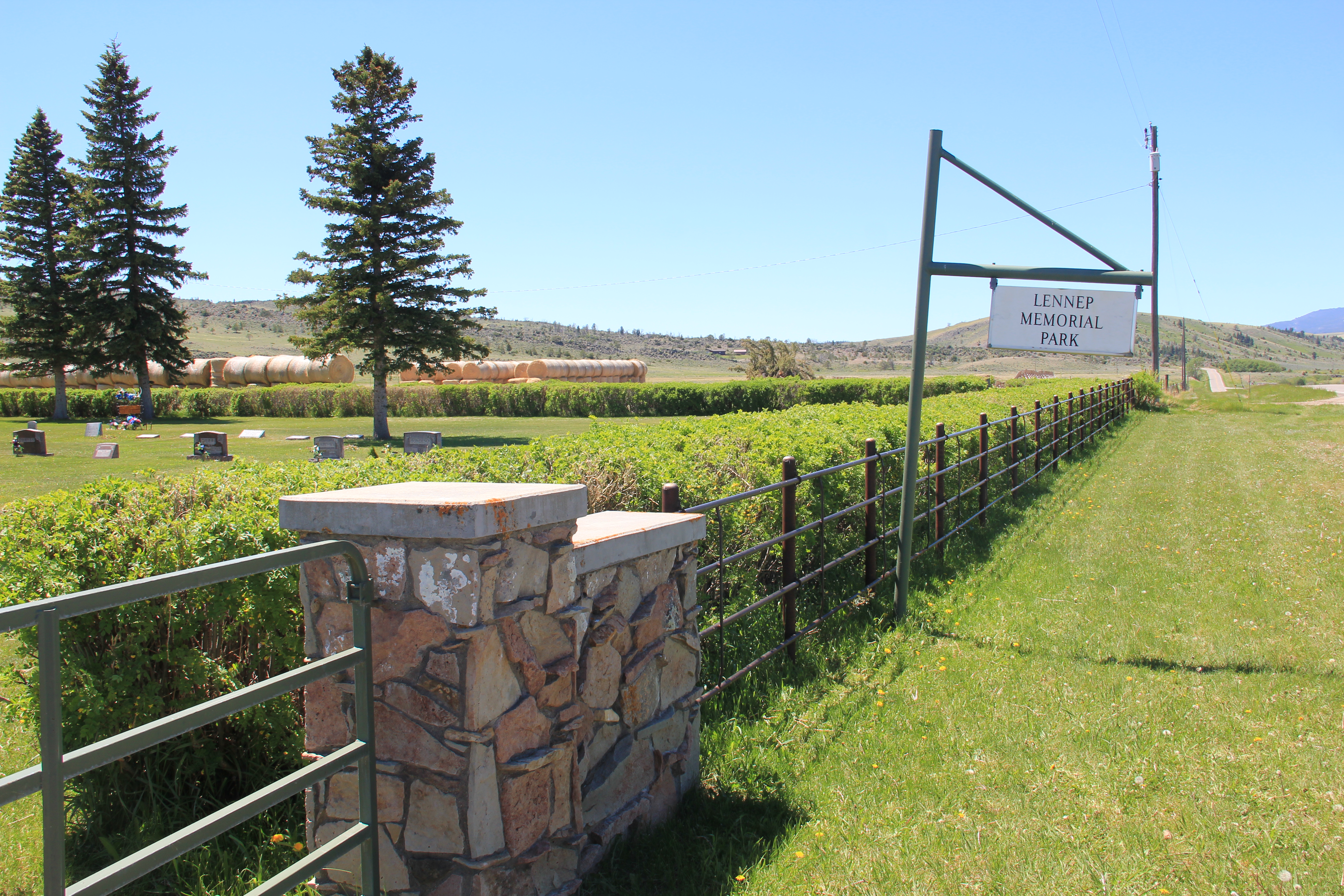
Lennep Memorial Park Cemetery
I started with a resource given a brief look in 2011–the town cemetery, which is well maintained as the Lennep Memorial Park. The names of the early settlers such as the Grande, Hoyem and Hereim families are prominent as are the Thompsons, who were Masons. The wives–not named–of Andrew Berg have a distinctive obelisk grave marker.
Martin and Karen Grande grave maker. Martin Grande founded the town in late 1870s.
Leon Hohmann continued with the story of Johann Fuchs–who became Wilhelm Fuchs in his new adopted town of Lennep, Montana. Hohmann wrote:
“Johann Wilhelm Fuchs was born on September 2, 1859, in Lennep, Sarah Baldy from the Remscheid town archive found out. His parents: Hermann Fuchs from Elberfeld, who was a teacher at the higher citizen school in Lennep, and his wife Elise a born Hilger.
Growing up on Munsterplatz, he was a young adult when he decided to train as a businessman, which was quite astonishing since his father did not have this profession. But Sarah Baldy has an idea why young Johann Wilhlem took this path: Because his maternal grandfather, Johann Wilhelm Hilger, who died only a few months before the birth of his grandson, was a merchant.
The archivist suspects that this Johann Wilhelm Hilger founded the company Gebrüder Hilger with his brother Daniel. Around 1856 the brothers built a large cloth factory in Wilhelmsthal in Radevormwald, where up to 600 people worked at times. After a fire in 1890, the company had to file for insolvency. Later, the cloth factory became a paper mill, whose production was only stopped on November 30 1970. Since then, the main building has been empty and neglected.
To what extent Johann Wilhelm Fuchs became active in his grandfather’s business has not been communicated. If he did, then probably not for too long. For at the age of 23, he left his home country to start a new life in the United States of America. This is the conclusion drawn from data in the North Rhine-Westphalia State Archive.
He arrived as Johann Fuchs on August 11, 1882, on Ellis Island, New York with two pieces of luggage. He started his journey from Antwerp on the Belgenland I of the Red Star Line as passenger number 23. What he did after his arrival is unclear.
His name only reappears around 1894, when Montana Railroad is founded as the third railway company in the state. At that time, however, he called himself Wilhelm J. Fuchs. He is said to have already planned a train route from Helena to the East with Montana Railroad President Richard A. Harlow. In 1899, in the course of the construction of the Jawbones Railroad, he also travelled to the village of the settlers from Norway. He named the railway station there “Lennep”. Whether he also lived in Lennep is not known, however. His trace is finally lost in 1904 after the operating company of the Montana Railroad had left.”
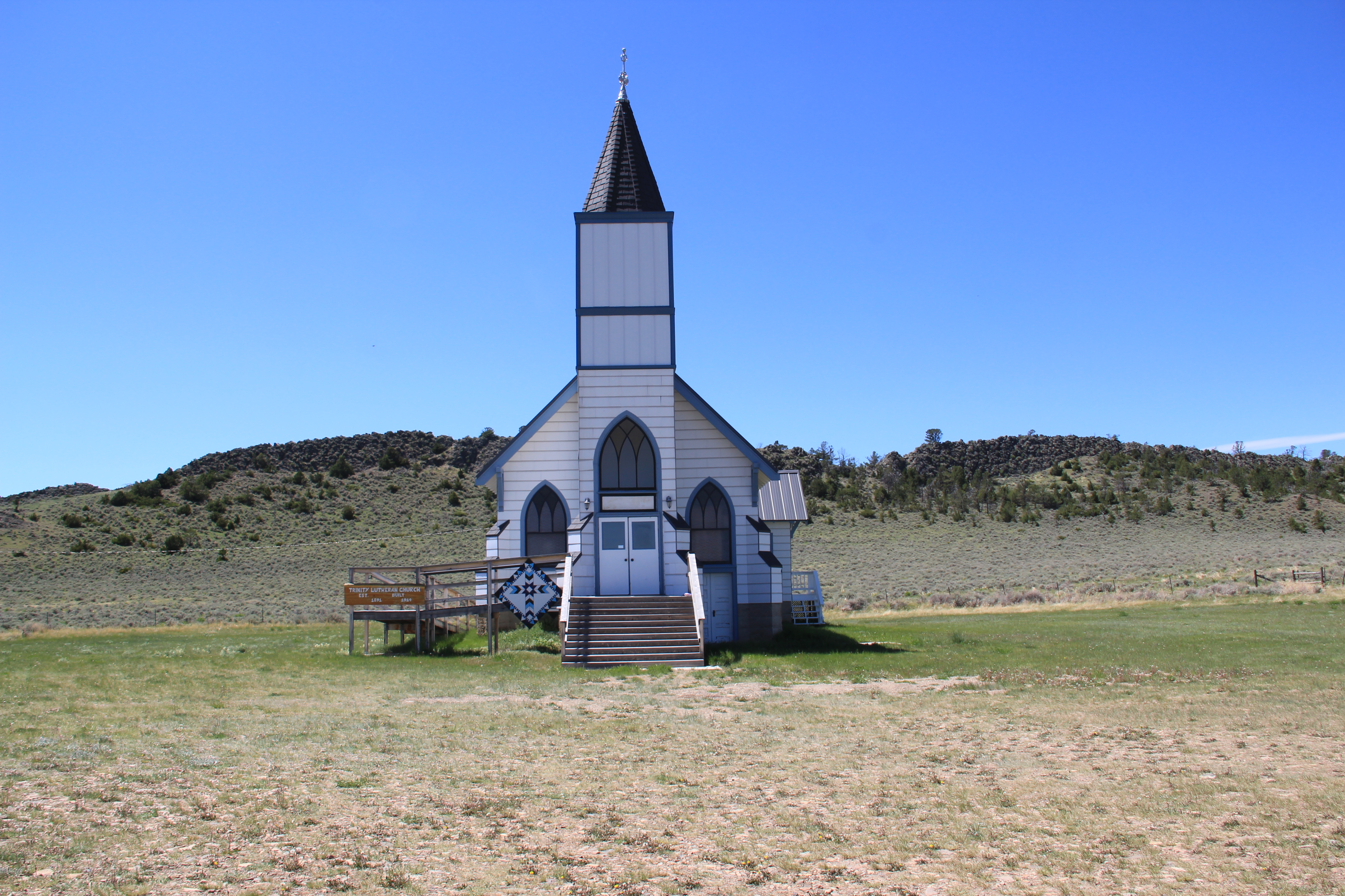
The buildings that remain today appear to date to the decade of the railroad’s arrival, from c. 1907 to 1917. Certainly that decade marked the height of population and activity here. The wind-swept setting of Trinity Lutheran Church is unchanged. This Gothic Revival church remains the town’s commanding landmark, and remains the active community center. Hohmann noted: “In 1914, the beautiful building was constructed from wooden shingles. The invitation to tender for the church was published in The Harlowtown News on 25 July 1913 with the aim that the construction should be completed by 15 November of the same year. But apparently, the structure of the Trinity Lutheran Church had been delayed. The new building cost 4300 dollars, paid by the Lutheran church congregation, which was founded in 1891.”
Trinity Lutheran Church. The handicap access ramp is an addition in the last 10 years.
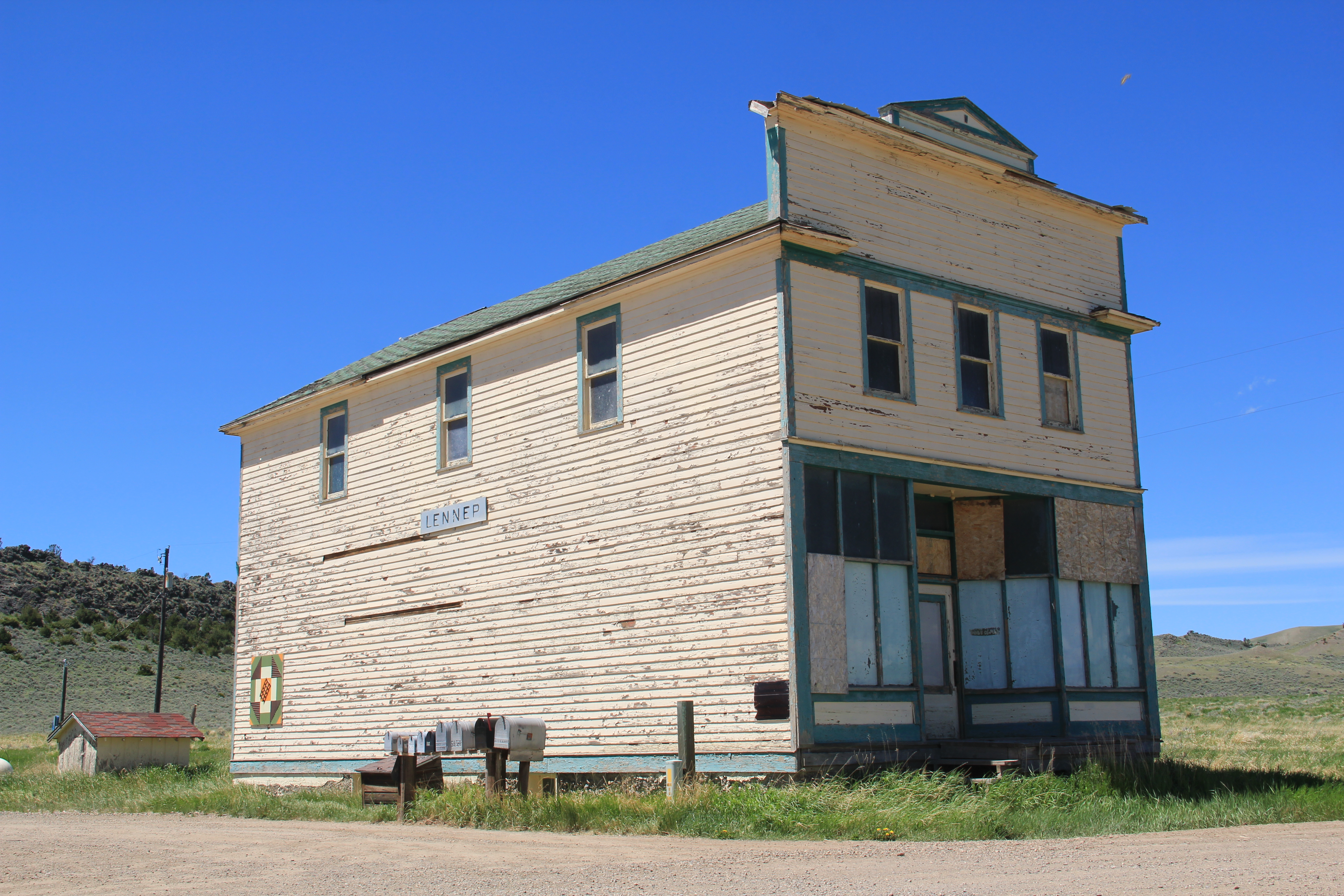
The old town general store remains closed, and it has been mothballed to a degree with plywood over damage windows, I suspect. Hohmann wrote about this building: “The train line was necessary for the inhabitants of the ranches around Lennep because the trains supplied the grocery store with food. The goods were not only sold to the people of Lennep, but also inhabitants of the neighbouring villages. Also, the gold-digger camps in the Castle Mountains to the north are said to have supplied from Lennep. At least some hobby historians in American internet forums suspect this. Furthermore, a gravel road connected the village with the Cumberland Mine. Silver and lead were mined there.” The building clearly was a center point for trade and communication. Some deterioration has occurred, but relative minor repairs and a new coat of paint would correct that. The congregation renovated the church in 2016 and at that time added the new porch and handicap access ramp.
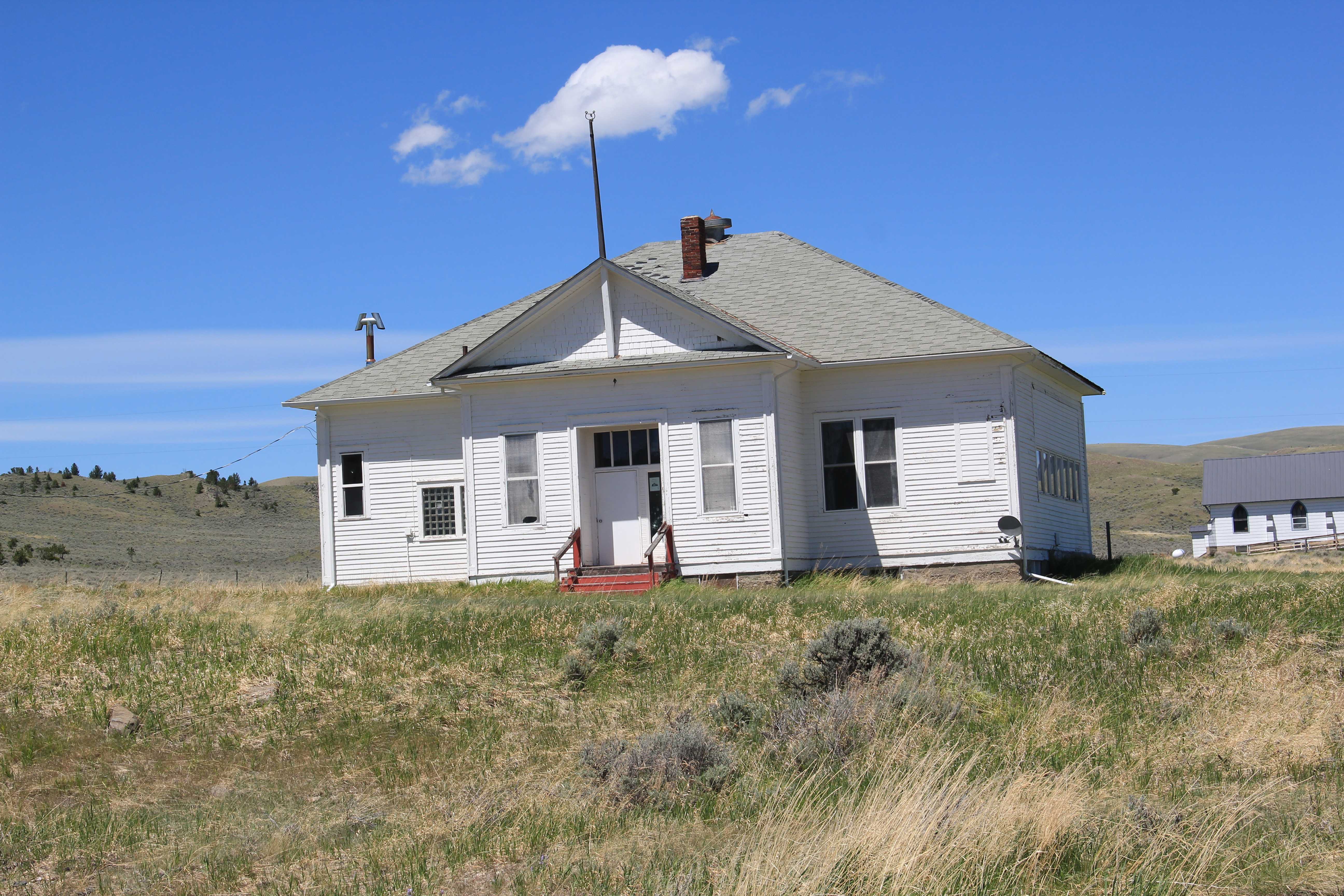
The school house–which has not had students since 2011– remains in decent condition although some missing roof shingles could pose water problems. Water and moisture is not the threat in this part of the west as I am accustomed to in the east but a leaky roof is never a good thing. A nearby dwelling has that modern replacement metal roof–it too stood quiet at the time of my visit in June 2021 but appears to be in solid condition.
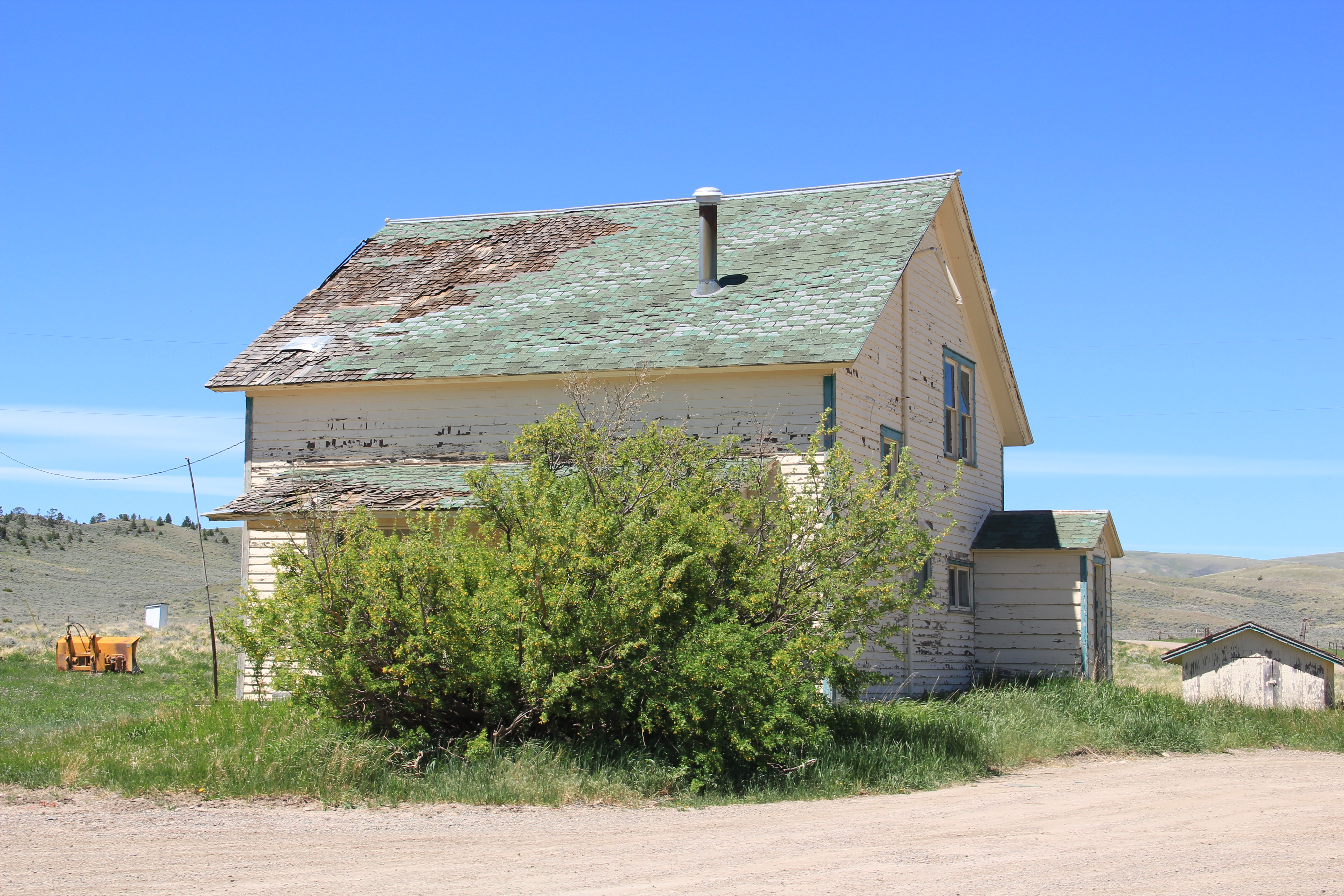
The dwelling between the store and school, however, is in danger of serious deterioration. Half of its shingles are missing–the deck is not in great shape. You wonder if this building is not the next to disappear from Lennep.
Yet, when you stand back at the church and took back southeast toward the railroad line and town, the view of the buildings and landscape is little changed in ten years. Lennep might be a ghost town but it is still there, as a marker of the impact of the Milwaukee Road on the Meagher County landscape.
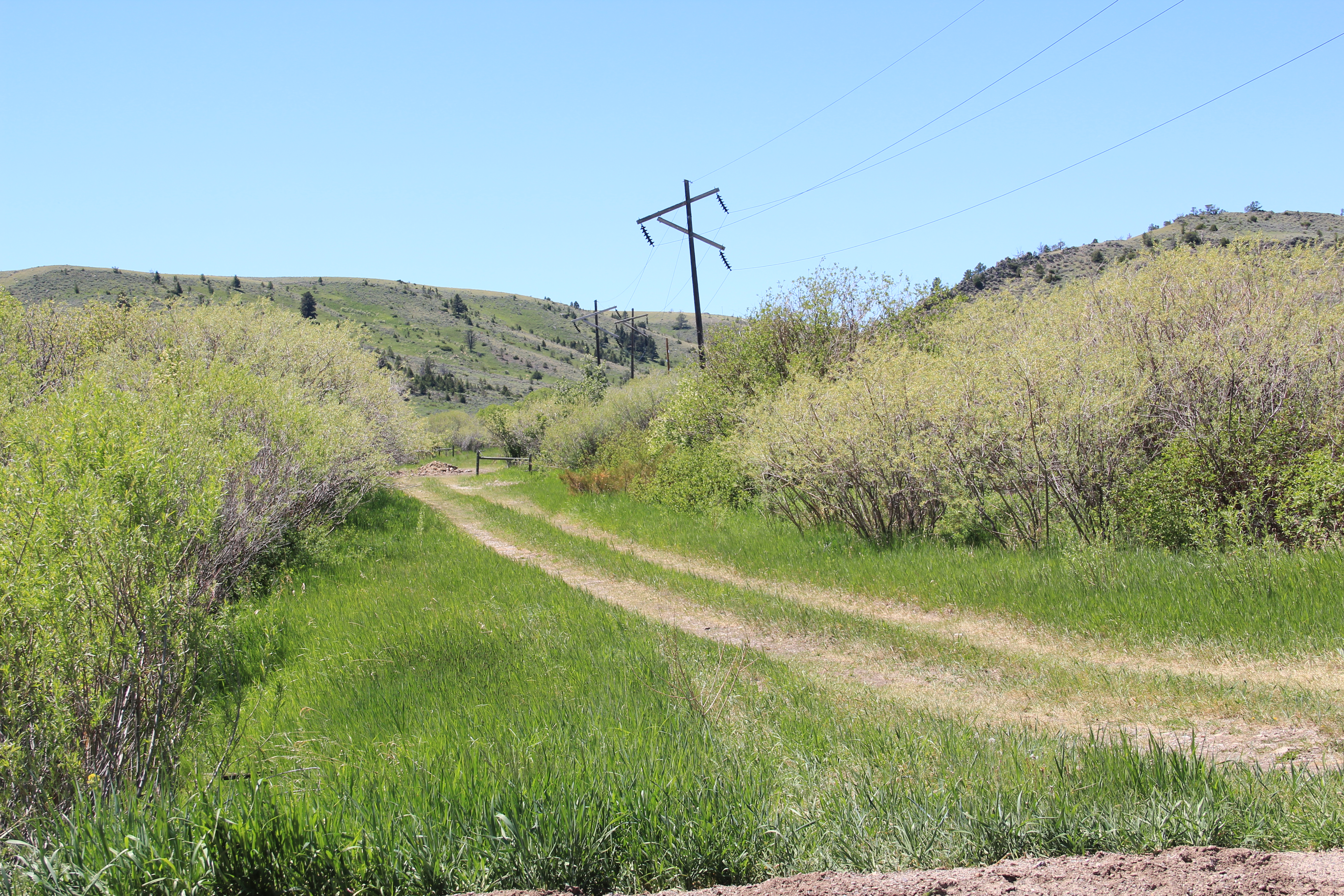
A final marker to the east can be found by continuing on Montana Highway 294, which closely follows the old Milwaukee Road corridor for several miles before the track and the highway diverge.
A portion of the Milwaukee Road corridor along Montana 294, now turned into a ranch road.
That would be the brick powerhouse necessary to power the electric engines that the Milwaukee Road used in this section of its route. Cows might surround it today but in the early 20th century the brick powerhouses scattered along the line were signs of modernity, of the electric power that distinguished the Milwaukee from all of the other transcontinental railroads in Montana.
The vast majority of my effort to document and think about the historic landscapes of Montana lie with two time periods, 1984-85 and 2012-16. But in between those two focused periods, other projects at the Western Heritage Center in Billings brought me back to the Big Sky Country. Almost always I found a way to carve out a couple of additional days to get away from the museum and study the many layers of history, and change, in the landscape by taking black and white images as I had in 1984-85. One such trip came in 1999, at the end of the 20th century.
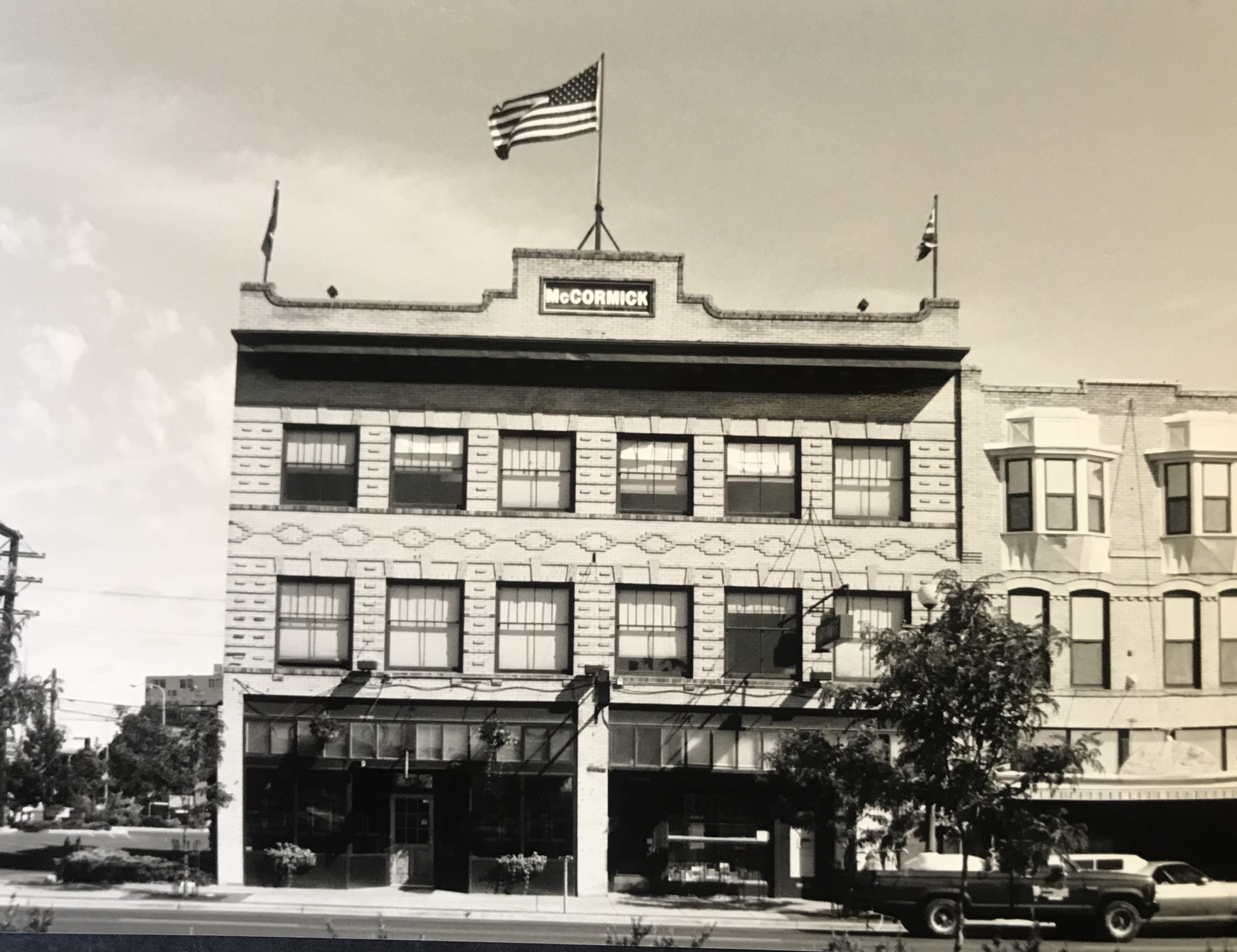
In Billings itself I marveled at the changes that historic preservation was bringing to the Minnesota Avenue district. The creation of an “Internet cafe” (remember those?) in the McCormick Block was a guaranteed stop.
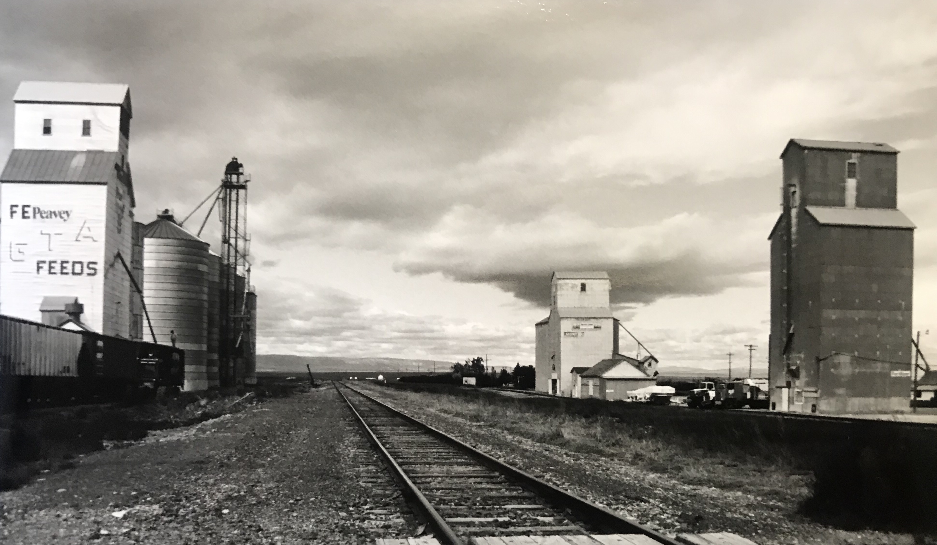
But my real goal was to jet up highways 191 and 80 to end up in Fort Benton. Along the way I had to stop at Moore, one of my favorite Central Montana railroad towns, and home to a evocative set of grain elevators.
Then a stop for lunch at the Geraldine bar and the recently restored Geraldine depot, along a historic spur of the Milwaukee Road. I have always loved a stop in this plains country town and this day was especially memorable as residents showed off what they had accomplished in the restoration. Another historic preservation plus!
Then it was Fort Benton, a National jewel seemingly only appreciated by locals, who faced an often overwhelming task for preserving and finding sustainable new uses for the riverfront buildings.
It was exciting to see the recent goal that the community eagerly discussed in 1984–rebuilding the historic fort.
A new era for public interpretation of the northern fur trade would soon open in the new century: what a change from 1984.
I beat a quick retreat back to the south, following the old Manitoba Road route along the Missouri and US Highway 87 and back via highway 89 to the Yellowstone Valley. I had to pay a quick tribute to Big Timber, and grab a brew at the Big Timber
Bar. The long Main Street in Big Timber was obviously changing–new residents and new businesses. Little did I know how much change would come in the new century.
One last detour came on the drive to see if the absolutely spectacular stone craftsmanship of the Absarokee school remained in place–it did, and still does.
My work in Tennessee had really focused in the late 1990s on historic schools: few matched the distinctive design of Absarokee. I had to see it again.
Like most trips in the 1990s to Billings I ended up in Laurel–I always felt this railroad town had a bigger part in the history of Yellowstone County than
generally accepted. The photos I took in 1999 are now striking– had any place in the valley changed more than Laurel in the 21st century?
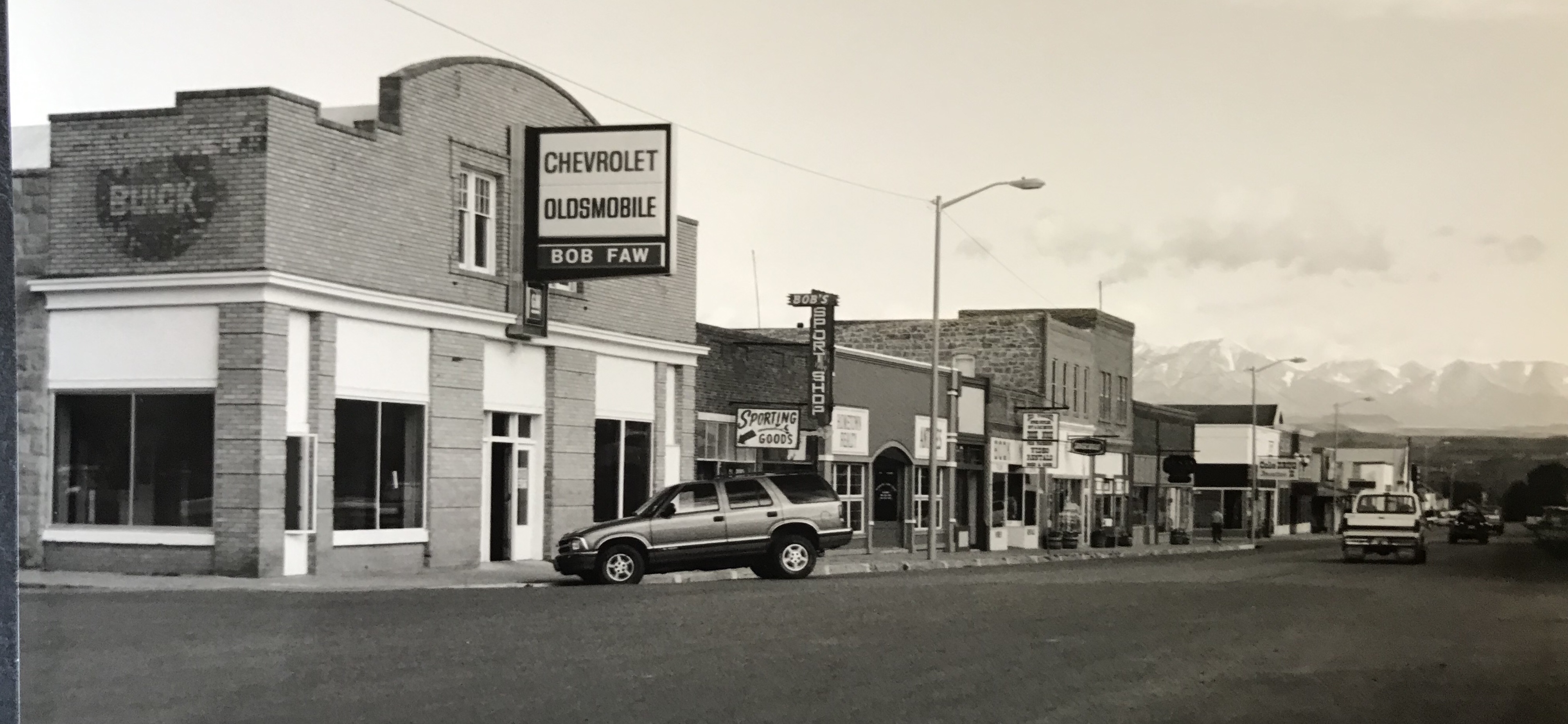
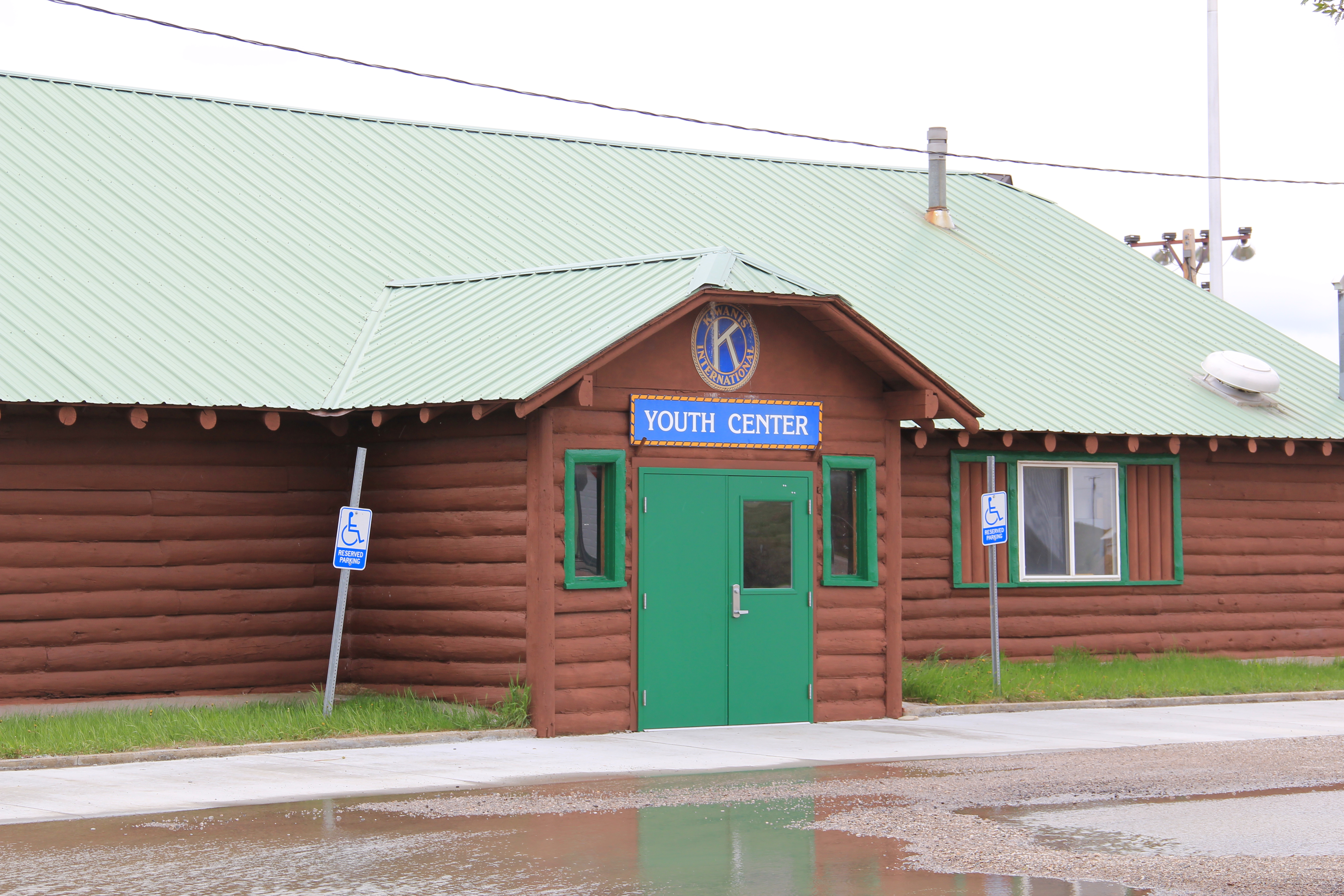
Over the weekend I received a message, asking for more on Harlowton, the seat of Wheatland County. I had developed three posts about Harlowton and other roadside properties in the county, but the reader was spot on–there is more than just the Milwaukee Road story in this central Montana town. Let’s start with the building above, originally built as the Harlowton Woman’s Club Youth Center in 1950.
The woman’s club began c. 1921 and had already made a major contribution to the town’s well-being in establishing its first library. After World War II, however, club members felt they should once again help build the community, by building a youth center and veterans memorial garden. Mrs. Norman Good proposed the project in 1946 and Mrs. G. D. Martin provided the first substantial donation. The club then held fundraisers of all sorts. By 1950, construction was underway, with contractor Clyde Wilson building the center with logs from Colby and Sons in Kila, Montana.
As the youth center was under construction, the woman’s club also reached an agreement with the school board to use land for the construction of a new football field, named McQuitty Field. Located behind the youth center, the field opened in 1950.
Steps from the Youth Center parking lot lead directly to the football field.
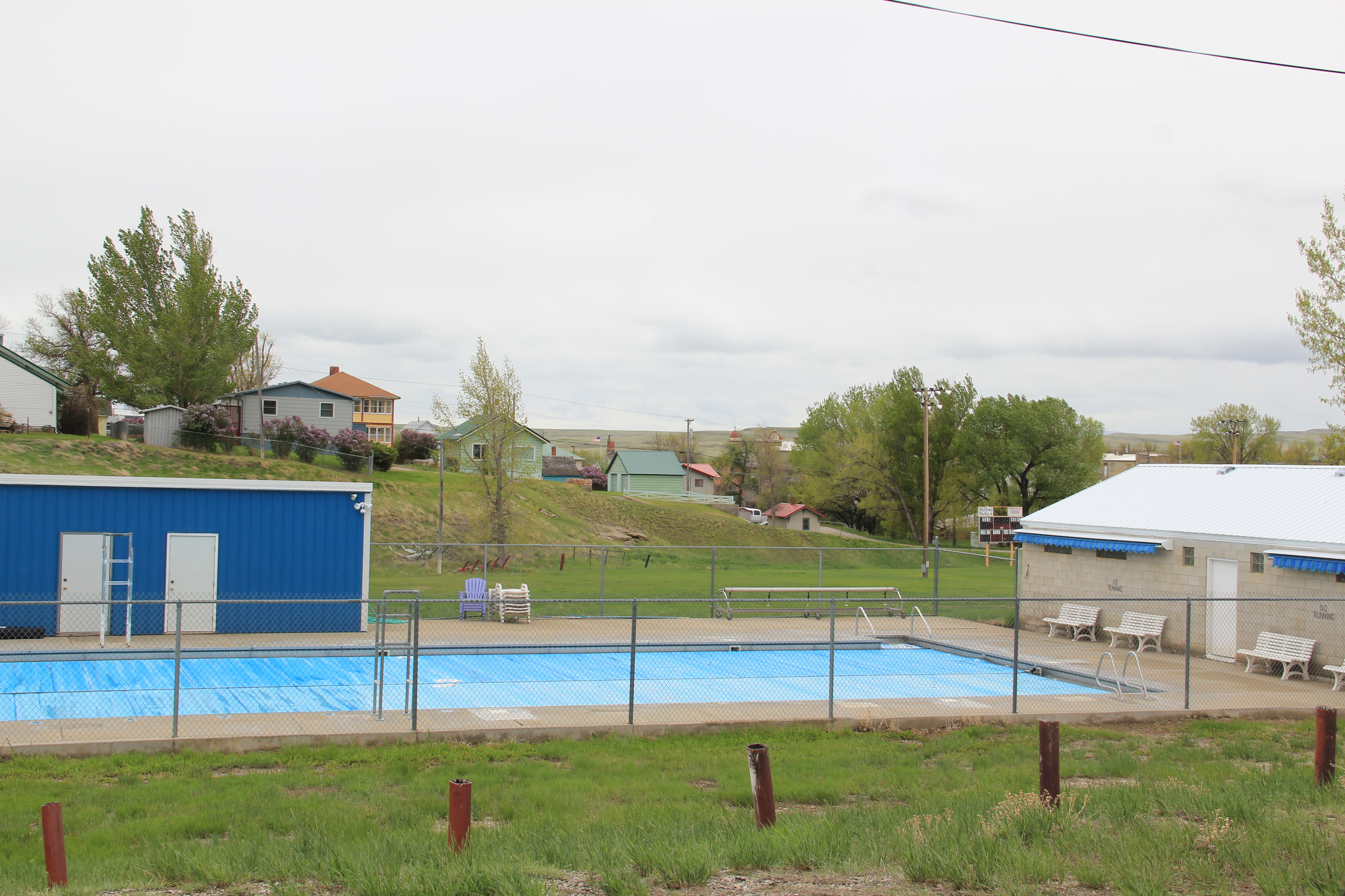
At about the same time, the woman’s club also reached an agreement with the Kiwanis Club to provide land for a community swimming pool. The women lost their initial vision of a memorial garden, but had gained for the community two institutions–the football field and the swimming pool–that continue to serve Harlowton’s children today.
Thus, on U.S. Highway 12 lies the public recreation heart of Harlowton–a postwar gift of residents and service clubs to the community. In 1956, the woman’s club deeded the Youth Center to the Kiwanis Club, which still manages it today.
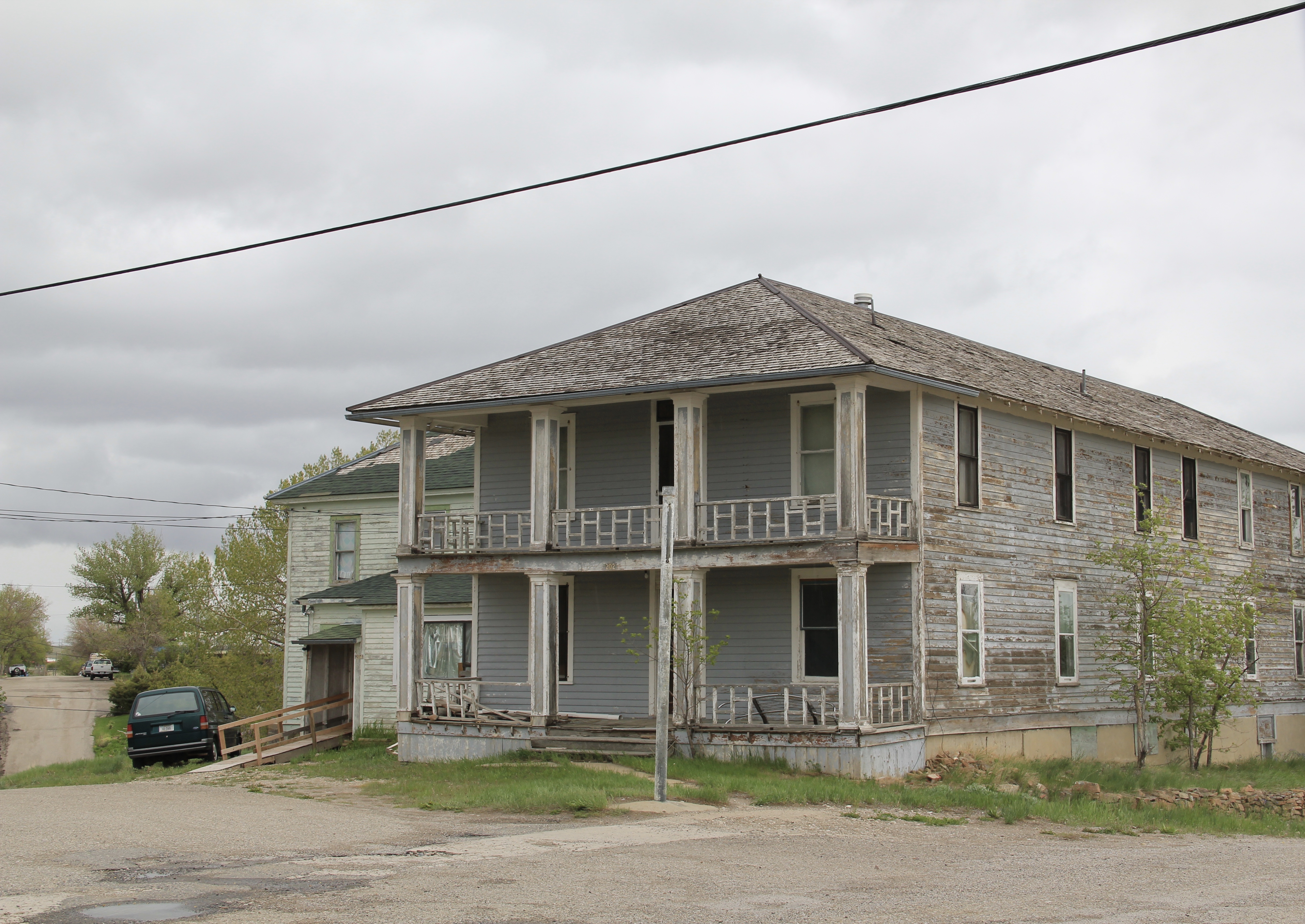
As the images of the football field show, the recreation centers are surrounded by housing, and yes, Harlowton has an interesting range of domestic architecture–centered in the c. 1910 to c. 1960 period as you might imagine. As a major railroad center for the Milwaukee
Road, it once also had several hotels and more short-term housing for workers and travelers–a good bit of that has disappeared, or is disappearing.
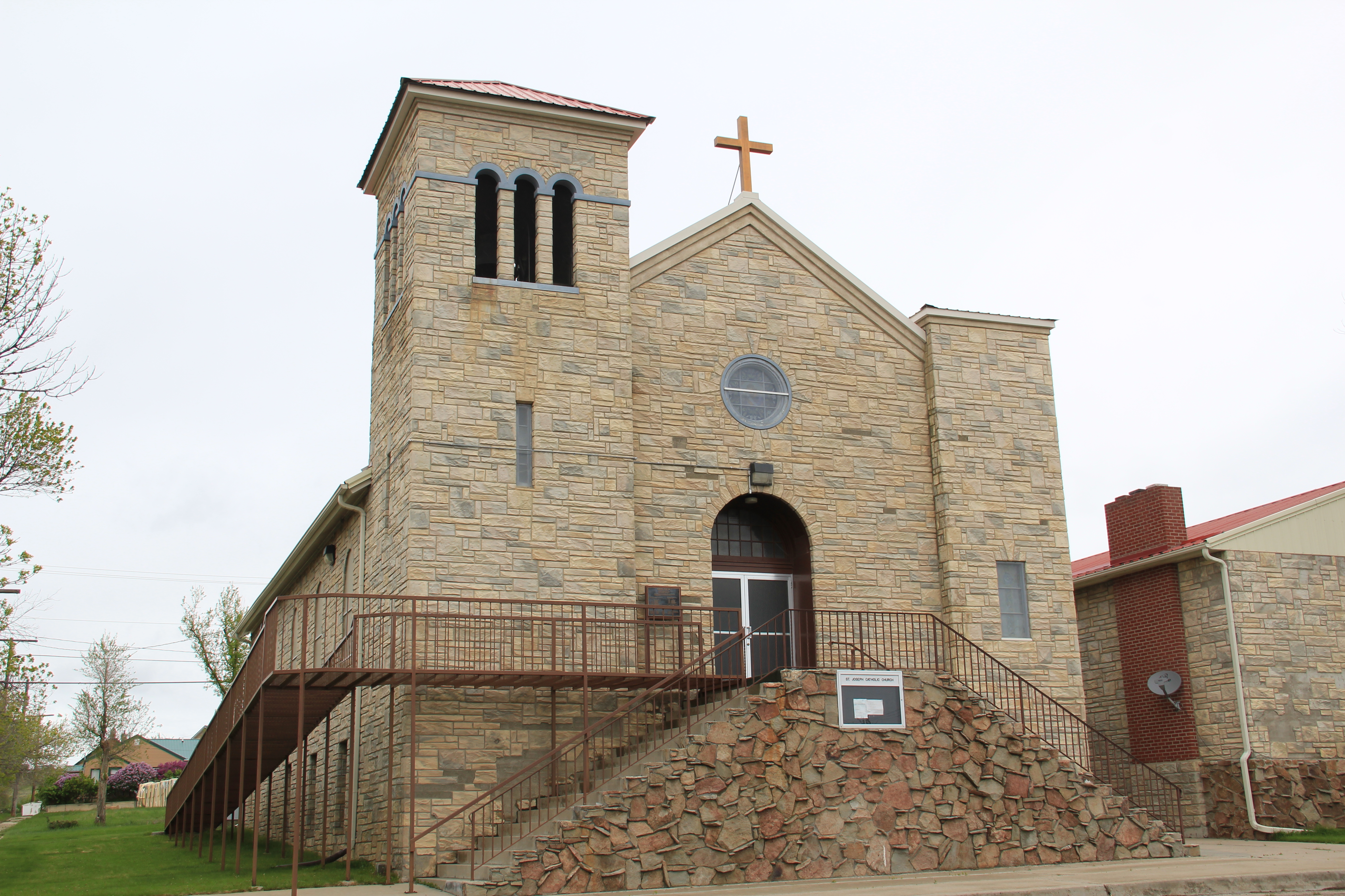
Gothic-styled churches also reflect the town’s early 20th century architectural aesthetic. The Harlowton Wesleyan Church (above) and St. Joseph’s Catholic Church (below) are good small town examples of Gothic style, especially the flashy mid-century permastone exterior of St. Joseph’s church.
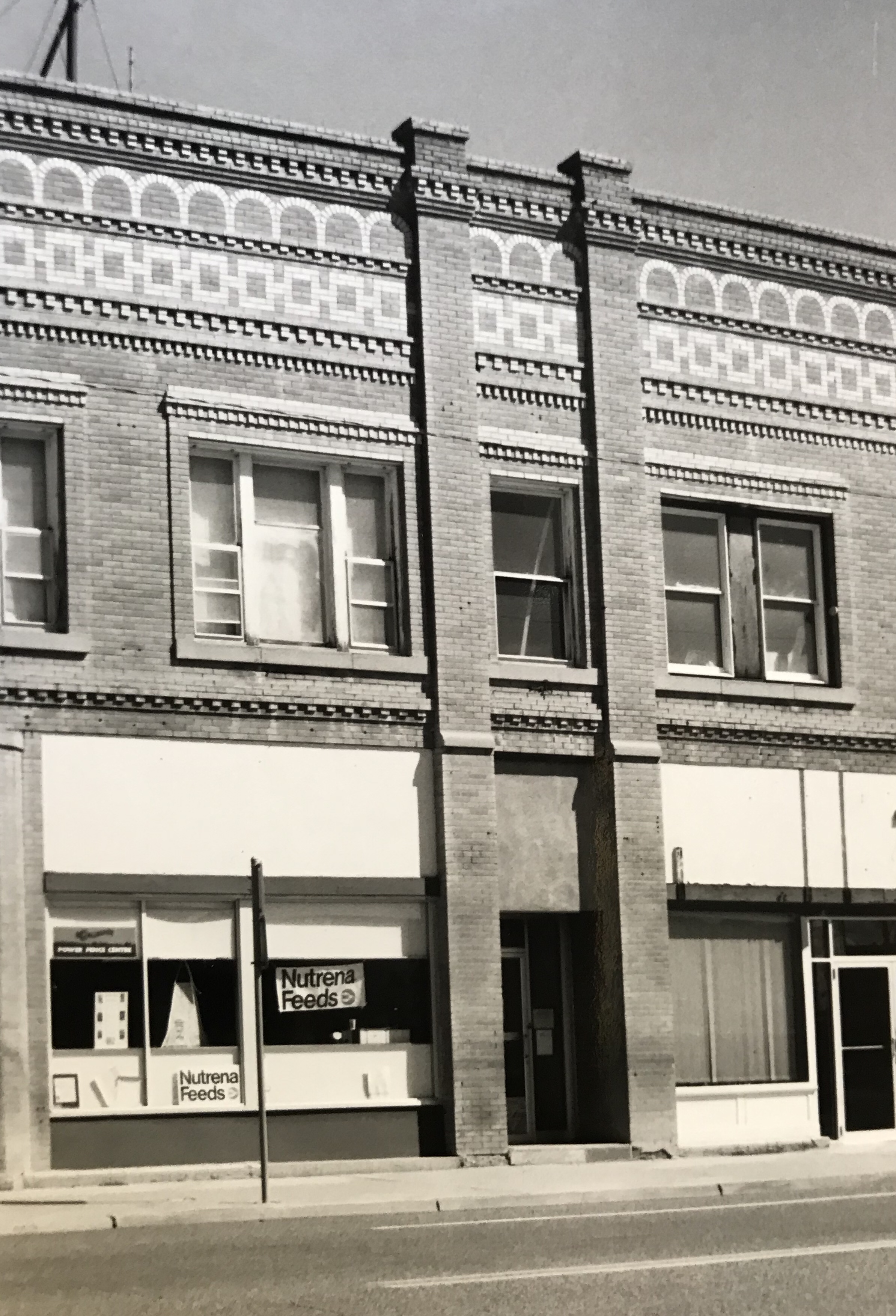
It is difficult to visit Harlowton and not notice the mammoth Montana Flour Mills set of concrete grain silos–today’s silent sentinels of what ranchers once produced in abundance in these lands.
The mill, made from locally quarried stone, came within months of the completion of the railroad to Harlowton–the concrete silos reflected the hopes of investors and local ranchers, as grain production soared in the 1910s–reaching some 1.2 million bushels in 1918. It wasn’t called Wheatland County for nothing. I still wish the big electric sign that once adorned the silos was still there.
The Harlowton Public School building is another valuable survivor from the homestead boom era in the town’s history, as other other scattered commercial buildings and bank buildings–none are architecturally overwhelming but they are express the western commercial look of the early 20th century–hopeful but not overly ambitious.
Harlowton today has even picked up another depot–a moved one, that once served on the Great Northern railroad spur–the Billings and Northern–that cut through the east side of Wheatland County. It is out of place on the highway–but glad it is still in use.
Let’s end with a shout out to classic taverns–in this case Central Avenue’s Oasis Bar and the Stockman Bar. Indeed, with its classic electric sign, the Stockman Bar begs the question–where are the state’s other Stockman Bars. Ah, the next post.
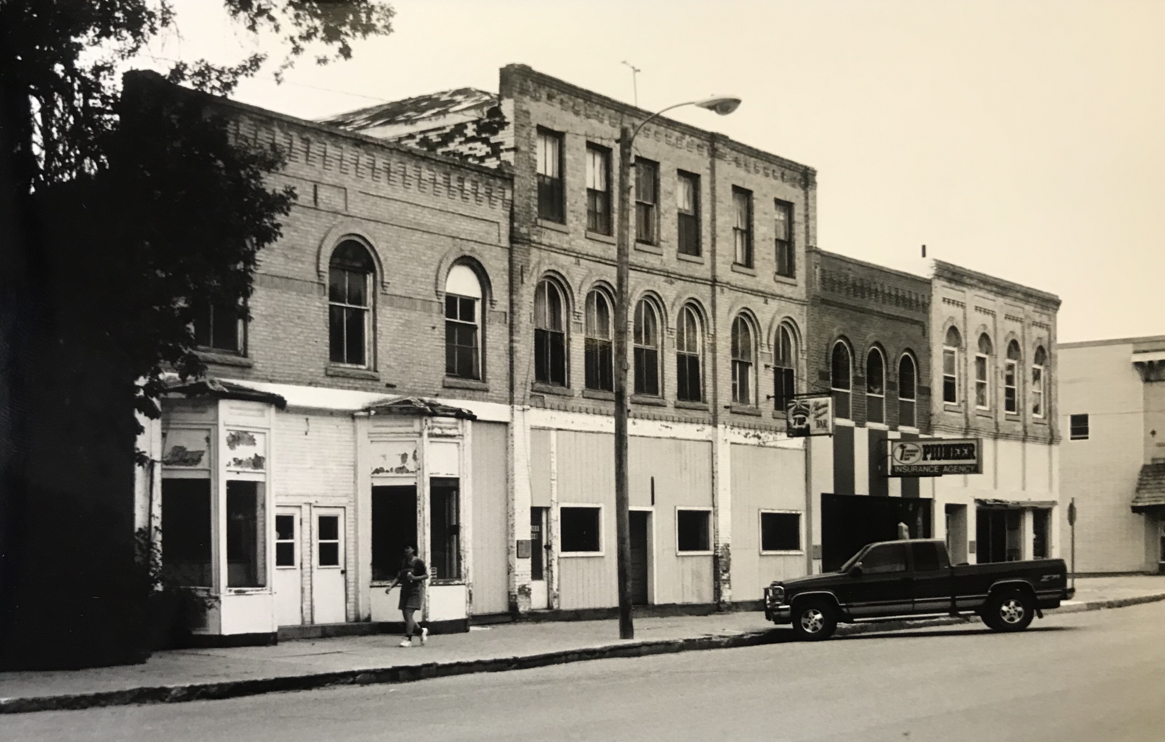
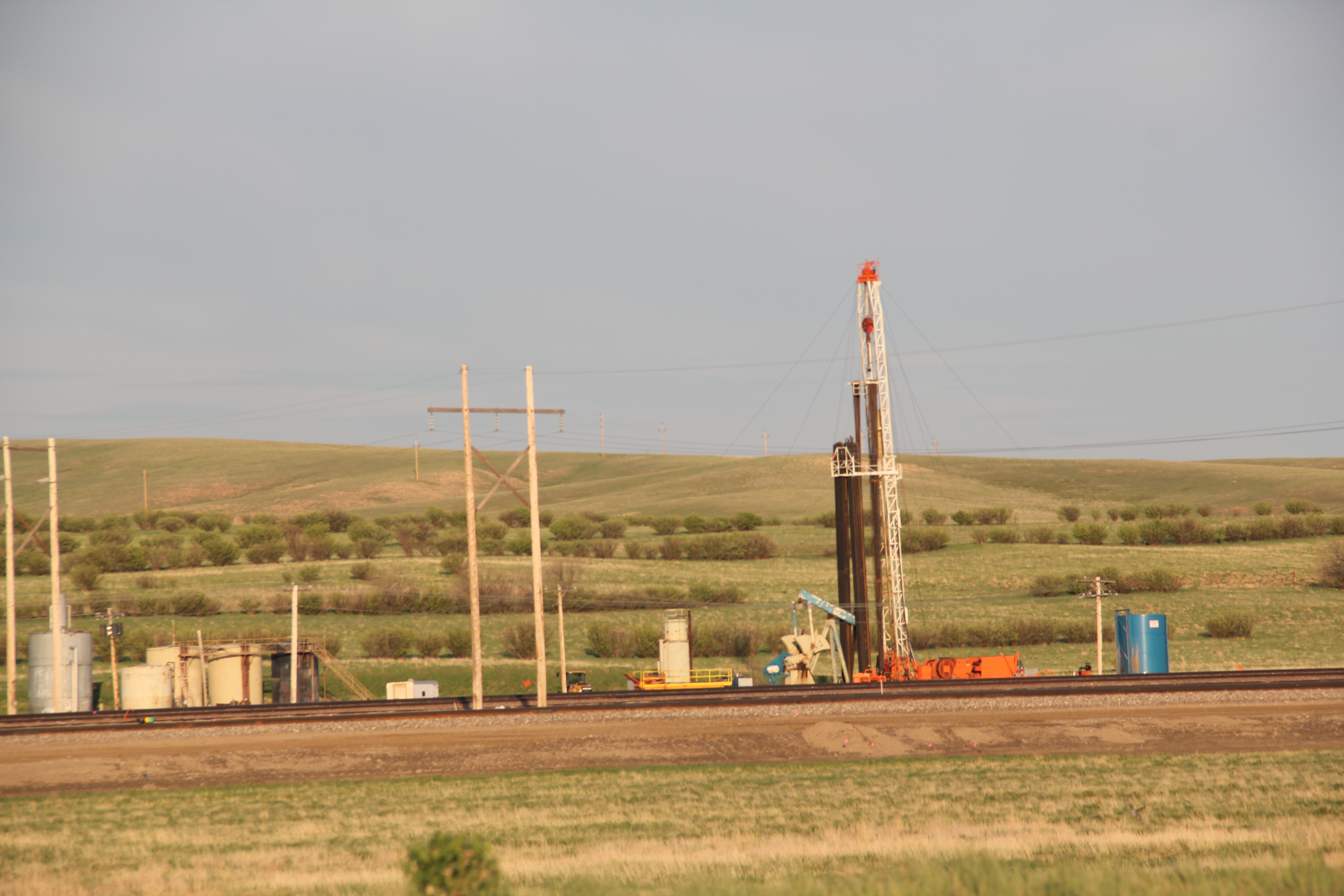
The 21st century boom in the Williston Basin has significantly reshaped western North Dakota, and as that region “fills up,” the boom has spread into far eastern Montana, especially along the Hi-Line corridor of U.S. Highway 2 and the historic Great Northern Railway. The photo above is along U.S. 2 on the outskirts of the tiny town of Bainville, the first place of any size you encounter as you travel west along the highway, or railroad, into Roosevelt County.
When I visited Bainville in early 1984 I recorded a town in decline. True, its 1950s modernist passenger depot was still there, but there had been a steady drop in population for decades. Thirty years later, the remnants of that decline were still there: abandoned brick neoclassical-styled bank; an elevator complex on the verge of collapse.
But signs of new growth were there as well in 2013. The recently expanded public school was one thing while the large man camp then under construction just east of the town was another–and a project that really concerned local residents since the camp’s population would be larger than the town itself.
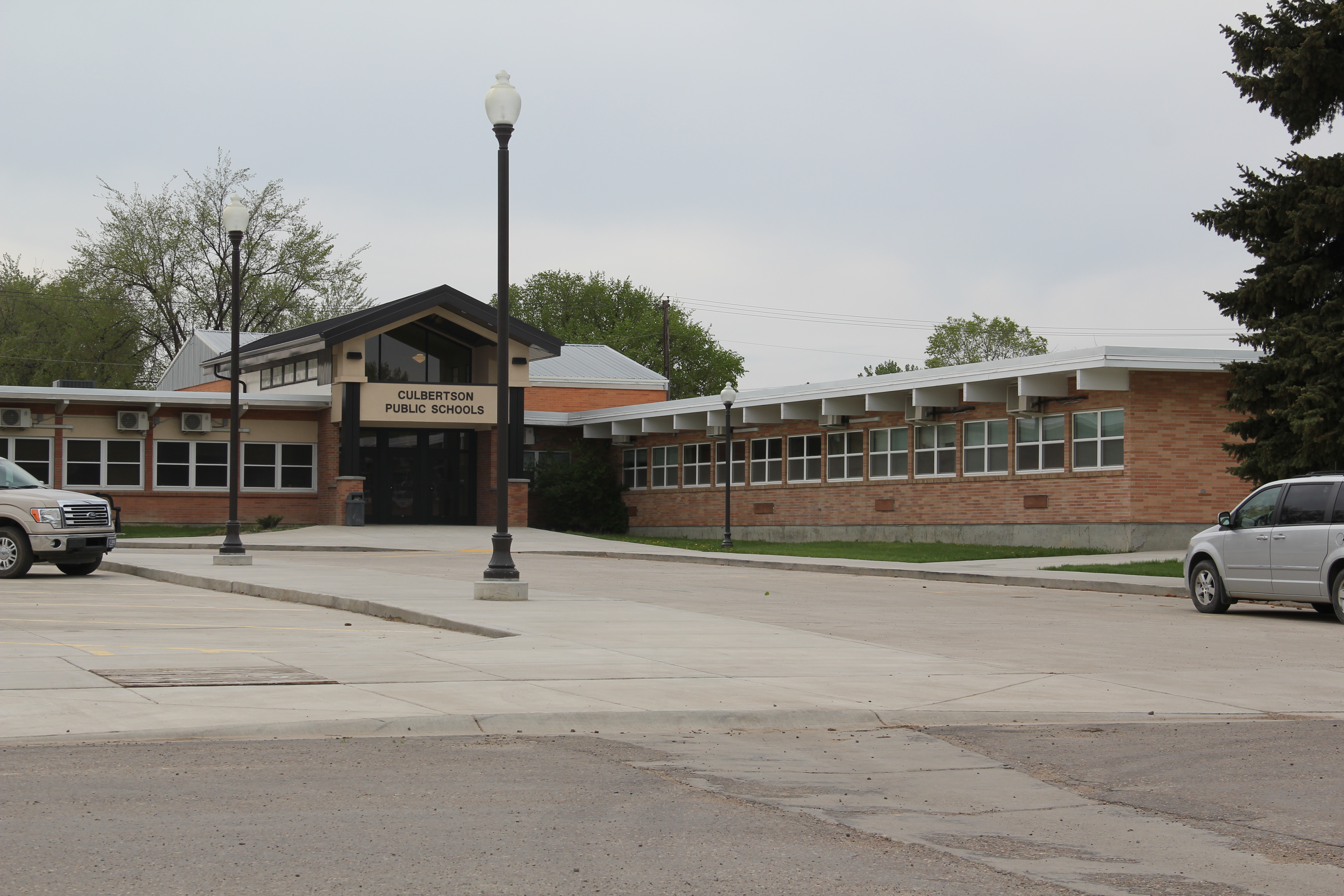
The next town west on the Hi-Line is Culbertson, where the impact of the Williston Basin was even more noticeable. A modern school complex had replaced one that dated to the New Deal. Indeed the New Deal’s once profound impact on Culbertson–a public office building and armory–had been eclipsed not only by the modern school but also a new county office building all shiny and bright.
The 1930s armory in Culbertson MT
New county office building in Culbertson
The man camps were already taking available land, even becoming a village in itself between the town’s historic cemetery and the railroad tracks. To capture the burial site of Civil War veteran Marcus A. Denney of the 6th Minnesota Infantry in the foreground and the man camp in the background by the elevators creates a snapshot, literally, of the periods of change in Culbertson over 150 years.
Truckers and workers flying along U.S. Highway 2 in past decades would have spied the metal sculptures of Lewis and Clark near the local museum–but these iconic figures are no longer what immediately captures your eyes as you speed along the corridor.
What you notice is everyone lined up for that human fuel that powers the commute between man camp and tracking well: the Frackin’ Java coffee stand. A true sign of the times along the eastern gateway of U.S. 2 in Montana.
U.S. Highway 2 east of Kalispell has grown into a four-lane highway (mostly–topography thus far has kept it as a two-lane stretch west of Hungry Horse) designed to move travelers back and forth from Kalispell to Glacier National Park. In my 1984-85 state historic preservation plan work, I thought of Columbia Falls, Hungry Horse, and Martin
City as one large tourism funnel. After spending a good part of 2006-2007 working with local residents and the Great Smoky Mountains National Park about the heritage and preservation of Gatlinburg, Tennessee–one of the most notorious gateways into any national park–I learned to look deeper than the highway landscape and find some real jewels in each of these Glacier National Park gateway communities.
There is much more than the highway to Columbia Falls, as the three building blocks above indicate, not to mention the lead image of this blog, the town’s Masonic Lodge which has been turned into one huge public art mural about the town’s history as well as its surrounding landscape. Go to the red brick Bandit’s Bar above, and you soon discover that Columbia Falls has a good sense of itself, and even confidence that it can survive new challenges as its population has soared by over 2,000 residents since the 1980s, totaling over 5,000 today.
Once solely dependent on the Montana Veterans’ Home (1896), which is now a historic district, and then relying on the Weyerhaeuser sawmill for year round employment, Columbia Falls faces a different future now once the mill closed in the summer of 2016, taking away 200 jobs. As the historic business buildings above indicate, historic preservation could be part of that future, as the downtown’s mix of classic Western Commercial blocks mesh with modern takes on Rustic and Contemporary design and are complemented, in turn, by historic churches and the Art Deco-influenced school.
Once you leave the highway, in other words, real jewels of turn of the 20th century to mid-20th century design are in the offing. In 1984–I never looked that deep.
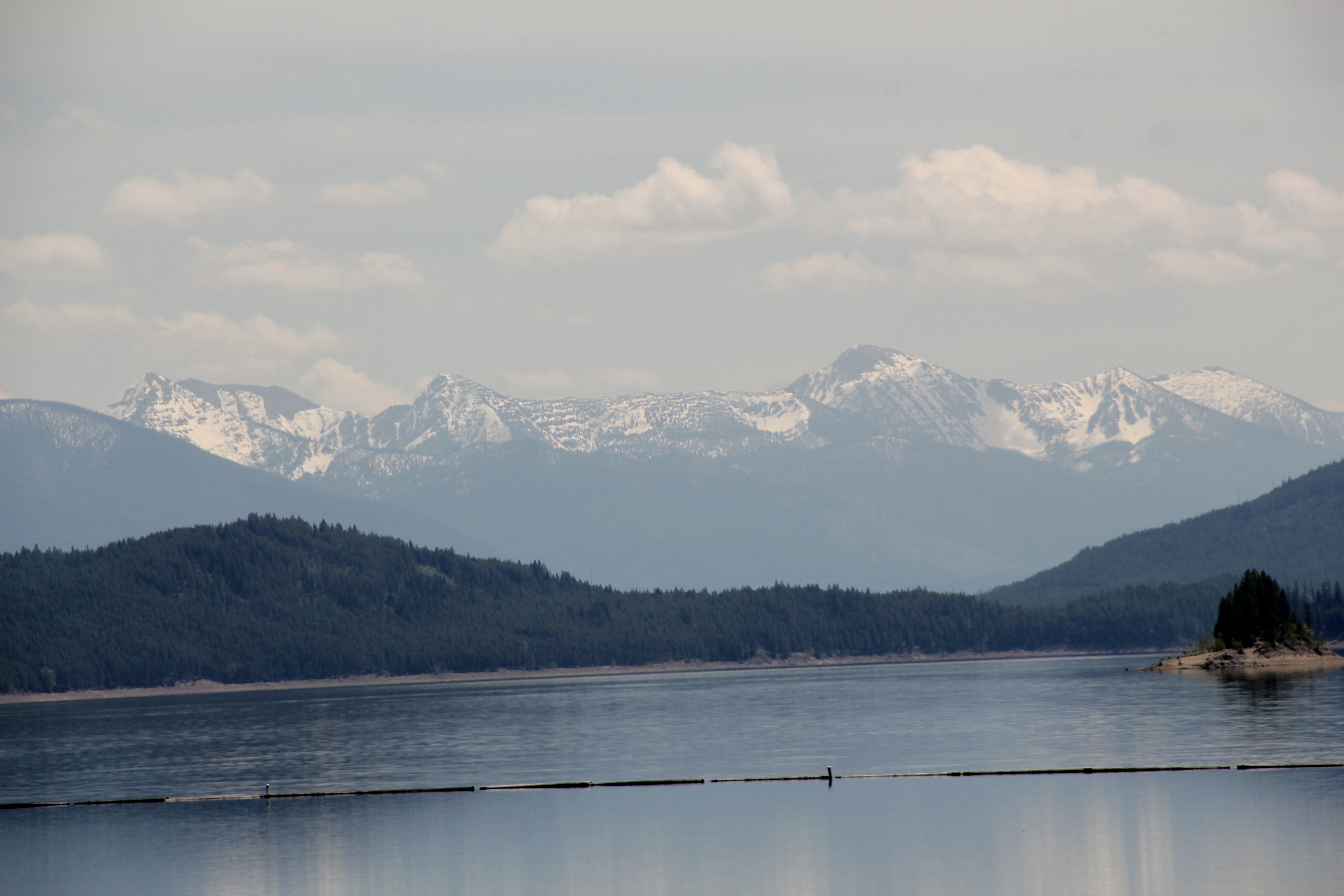
At Hungry Horse, however, I did leave the highway and explored the marvelous landscape created by the Hungry Horse Dam and Reservoir, a mid-20th century project by the U.S. Bureau of Reclamation. The agency justified the dam as a hydroelectric power project for a growing Flathead County and as a boost to local irrigation. The irrigation side of the project–the real reason the agency exists–never happened and Hungry Horse today is an electric power and recreational project.
I appreciated the vastness of the concrete arch dam–the 11th largest concrete dam in the United States–as well as the beauty of Hungry Horse Reservoir, an under-appreciated tourism asset as anyone in Flathead County will tell you. But again, I let just the size and impact of the dam distract me from some of the details of its construction that, today, are so striking.
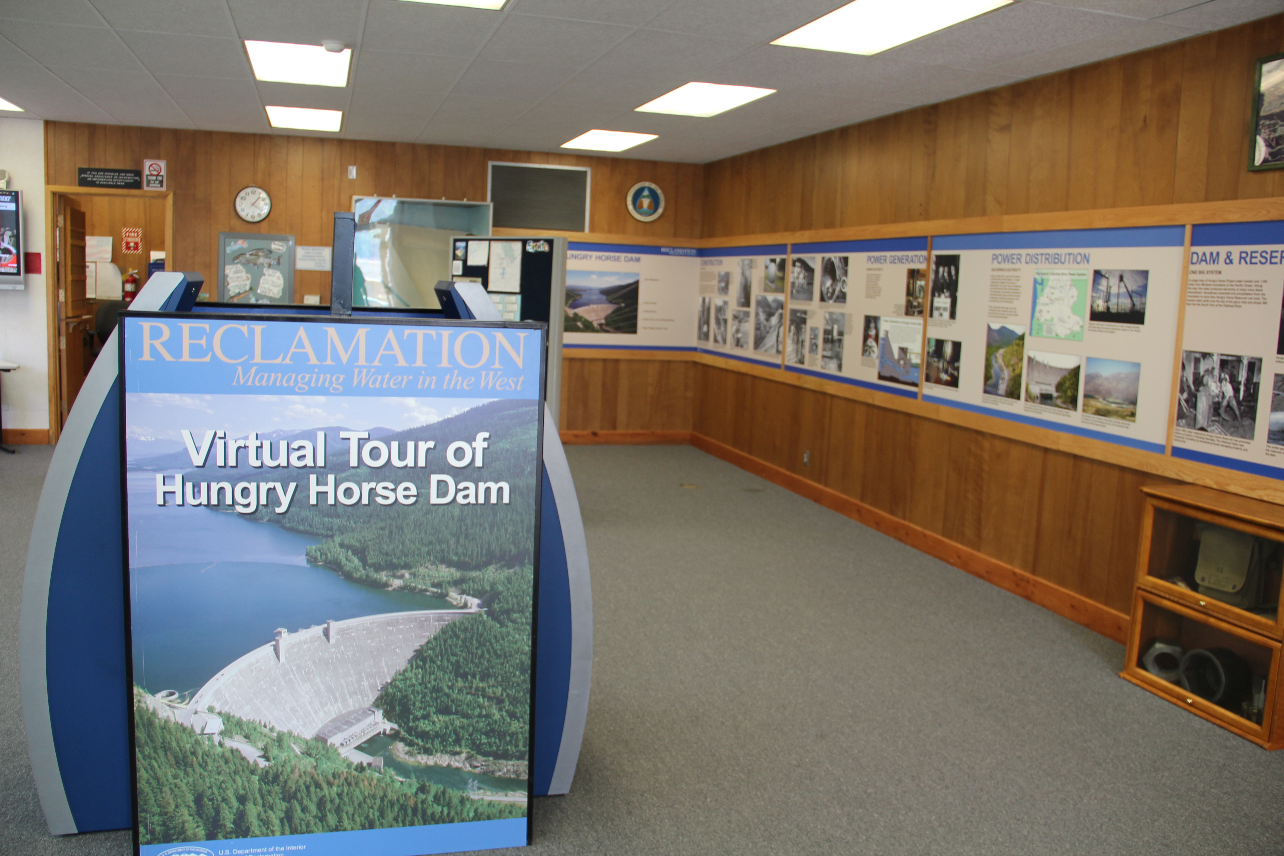
Here I am thinking primarily of the contemporary design of the Visitors Center–its stone facade suggesting its connection to the now covered river bluffs but the openness of its interior conveying the ideas of space associated with 1950s design.
I am concerned, however, about news in September 2015 that Reclamation has contracted for updates and renovation at the Visitor Center–let’s hope that the classic 1950s look of the property is not sacrificed.
Martin City is just enough off of U.S. Highway 2–it is situated more on the historic Great Northern Railroad corridor–to miss out on the gateway boom of the last 30 years, although with both the Southfork Saloon and the Deer Lick Saloon it retains its old reputation as a rough-edged place for locals.
For railroad travelers in the first half of the 20th century, West Glacier was THE west gateway into Glacier National Park. The Great Northern Railway developed both the classic Rustic-styled passenger station and the adjacent Arts and Crafts/Chalet styled Belton Chalet Hotel in 1909-1910, a year before Congress created Glacier National Park.
Architect Kirtland Cutter of Spokane was the architect and the chalet design was actually just a smaller scale and less adorned version of the Idaho State Exhibition Building that he had designed for the 1893 World’s Fair in Chicago. Cutter is one of the major figures of the Arts and Crafts Movement in the American Northwest and we will look at another of his buildings for the railroad and Glacier in the next post about Lake McDonald Lodge.
The Cutter buildings for the railroad between 1909-1913 set a design standard for West Glacier to follow, be it through a modern-day visitor center and a post office to the earlier mid-20th century era of the local school and then gas stations and general stores for tourists entering the national park by automobile.
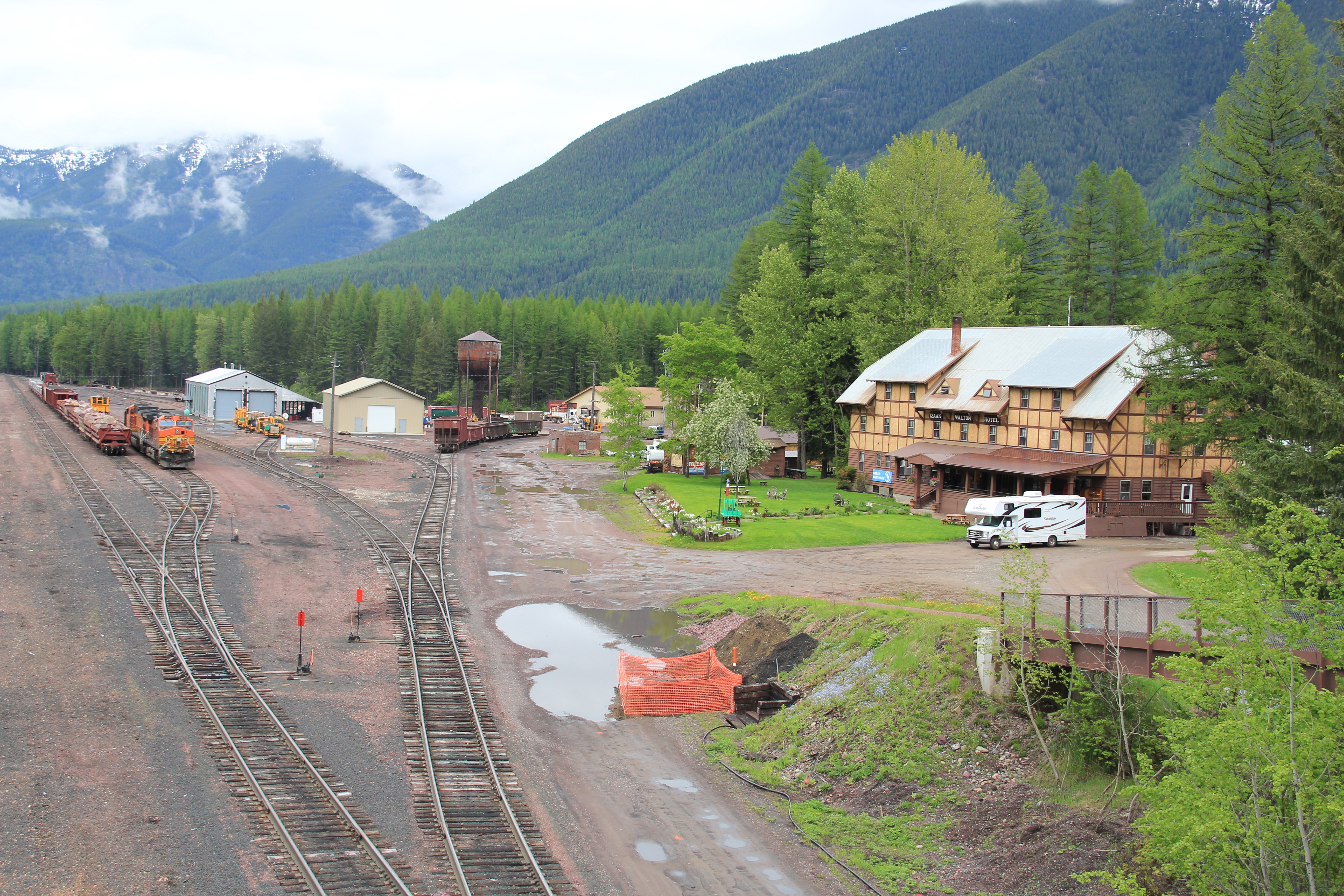
This blog has never hidden the fact, however, that my favorite Glacier gateway in Flathead County is miles to the east along U.S. Highway 2 at the old railroad town of Essex, where the railroad still maintains facilities to help push freight trains over the Continental Divide. The Izaak Walton Inn was one of the first National Register assignments given to
me by State Historic Preservation Officer Marcella Sherfy–find the facts, she asked, to show that this three story bunk house, railroad offices, and local post merited exceptional significance for the National Register. Luckily I did find those facts and shaped that argument–the owners then converted a forgotten building into a memorable historical experience. Rarely do I miss a chance to spend even a few minutes here, to watch and hear the noise of the passing trains coming from the east or from the west and to catch a sunset high in the mountains of Flathead County.
I arrived in Whitefish in May 2015 with my eyes wide open. I had not been there since 1988, and I knew that growth had enveloped and transformed the town, with a population that doubled, lots of west coast and east coast escapees having arrived, the ski lodge business booming, and “lone eagles” having nested here for two decades. The phrase
“lone eagles” was local–an attempt to describe those professionals “who fly to work as comfortably as most Americans drive, and whose use of computers in business lets them indulge their preference for life in the great outdoors,” as a June 19, 1994 story in the New York Times explained.
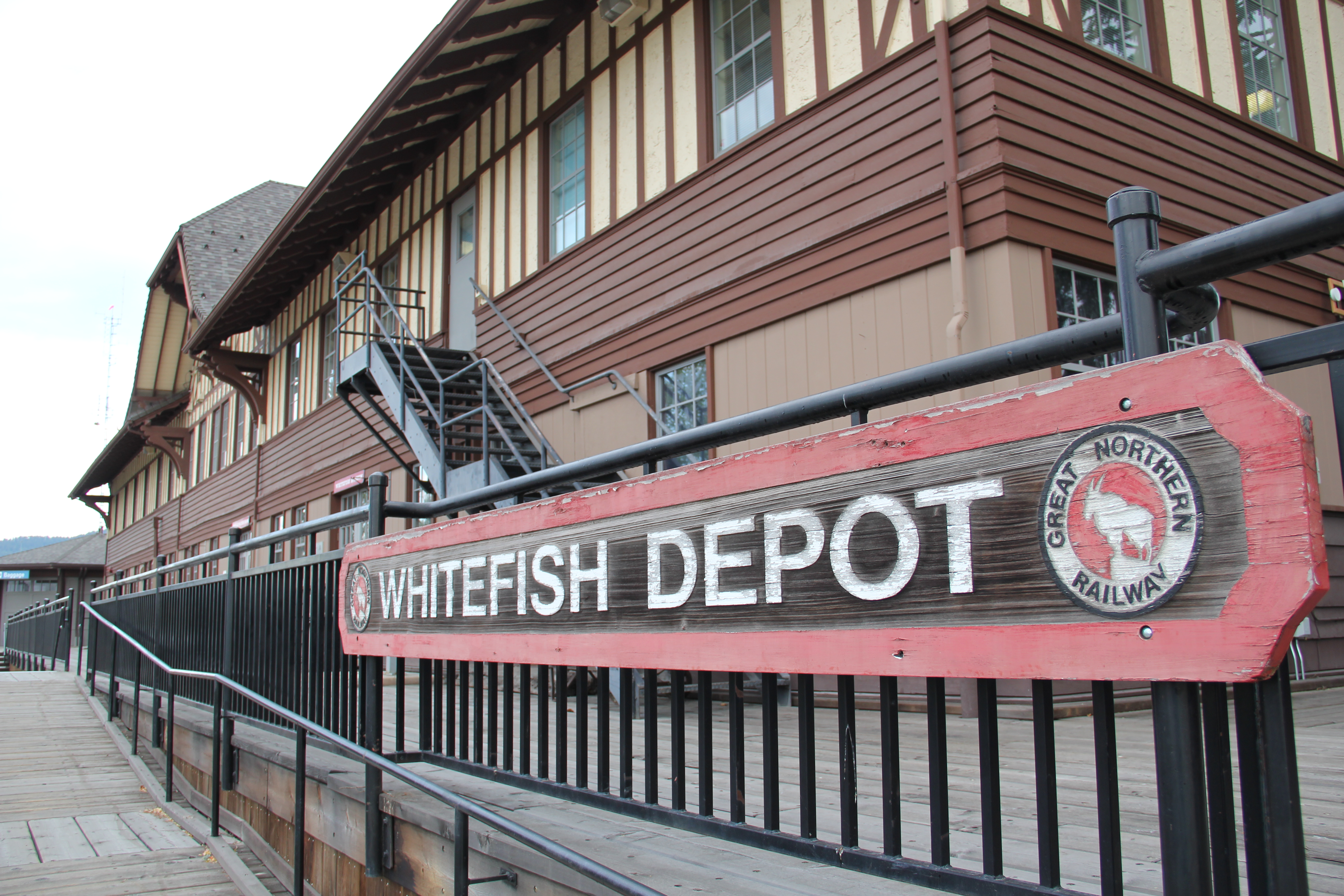
During my 1984-1985 survey for the state historic preservation plan, everyone probably tired of me touting the wonders of Whitefish, especially its mid-1920s Arts and Crafts/Chalet-styled Great Northern passenger depot and offices, designed by the railroad’s Thomas McMahon. If any building needed to be added to the National Register of Historic Places, it was this one, and not just for its impressive architectural statement.
The station along with the railroad tracks defined everything you saw in Whitefish–here in the classic Great Northern T-plan landscape was a classic railroad town–one that old-timers even called the best along the entire line. Whitefish developed and then prospered as a division point on the mainline from 1904 to 1955–and that corporate imprint was still there to be experienced, in 1984.
Thankfully in 2015, I still found all of my favorite landmarks from 30 years earlier, even though there was little doubt that the business district had been altered, sometimes in ways that left little original fabric in place but still some two-story brick blocks stood.
The Buffalo Cafe remained in business–a mainstay when I worked in the region in the 1980s as was the Palace Bar right around the corner. The Palace dated to c. 1915 and has a wonderful dark wood carved bar from that time–it began as a brewing company and has remained that throughout all of the recent changes.
The town still had its historic residential neighborhoods at the foot of Main Street and then both to the east and west. comprising one of the state’s best collections of bungalows, often found in railroad towns of the early 20th century.
Perhaps more importantly it still retained some of its distinctive domestic architecture–the railroad tie house (a log house made of railroad ties) and a row of shotgun houses for railroad workers. To all architectural historians who believe that the “shotgun” house is purely a southern thing–look closely: these houses were built quickly and cheaply to serve industrial laborers and can be found throughout the country.
Whitefish’s historic Lockridge medical center (1958) designed by Frank Lloyd Wright remains a distinctive modernist landmark within the business district, although now it houses professional offices. It was listed in the National Register in 2012.
A much earlier landmark, the Classical Revival Masonic Temple from the town’s first decade still stood, and it too found a new use through adaptive reuse.
Despite the population boom over the last 30 years, Whitefish still uses its Art Deco-styled school from the New Deal decade of the 1930s, although the auditorium has been restored and updated into a community performing arts center.
Certainly my favorite landmark was the Great Northern Railway station, which provided passenger service on the first floor and administrative offices on the second floor. In the last 30 years, the town has significantly enhanced the setting with a city park, various statues and interpretive signage, along with a historic bus that once moved passengers to Kalispell and environs and historic railroad engines.
The enhanced railroad station is clearly interested in drawing the attention of travelers who stop here for the nearby ski lodges or for a quick stop before entering Glacier National Park. It is viewed as the town’s center point, its primary attraction–which is as it should be because there are few more compelling Great Northern Railway towns than Whitefish.
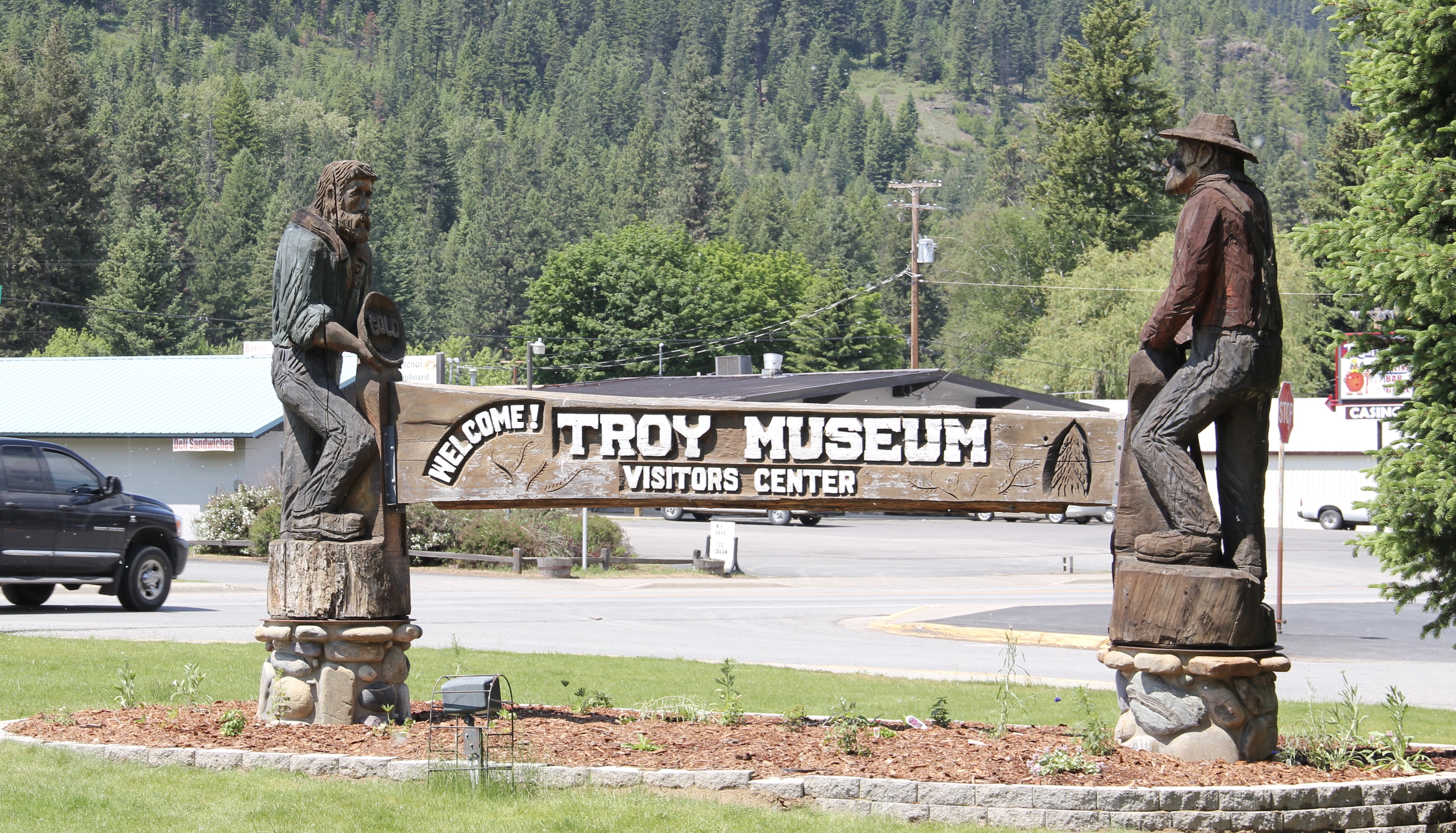
I love Montana town signs, and Troy, deep in the state’s logging country, has one of the best. The sign lures to a city park nestled along the Kootenai River. The focus point is a
historic Great Northern depot, which has been moved to the park. There is also an interpretive trail, part of a partnership with the U.S. Forest Service, that tells the story of the Callahan boom, which mining and logging combined to lure investors and residents to the area. It is a story arc that the forest service follows at other sites in a region the service describes as the Callahan Creek Historic Mining and Logging District. It is a very useful perspective on the town’s history, and not one that I pursued in 1984 when I explored this part of Lincoln County in the fieldwork for the state historic preservation plan. I paid attention to the historic railroad corridor–Troy (1892) after all was on
the Great Northern’s main line, and I documented the few historic buildings left facing the railroad tracks today. The Home Bar (c. 1914) and the Club Bar were institutions then, and remain so today. The Kootenai State Bank building still stands but has experienced a major change to its facade–made better in part by the American flag painted over some of the frame addition.
The Troy Jail, above, was listed in the National Register of Historic Places in 2006 and it remains the only building so listed in the town today. D.E. Crissey, a local contractor, built it out of concrete in 1924 during Troy’s boom from 1916 to 1926 when its population jumped from 300 to 1300. The Snowstorm mine, which produced lead, zinc, and silver, started to serve the demand for raw materials during World War I. The mine soon turned what had been a small railroad town into a mining camp best known for its brothels and bars. Then in the early 1920s the Great Northern decided to build a division point here, further booming the town. The Sandpoint Pole and Lumber Company began its logging business in 1923, and Troy suddenly was the largest town in the county
Perhaps the most impressive landmark left in the wake of the Troy boom is the public school, with the impressive central block flanked by classroom wings and a gymnasium built in later decades. Home to the Troy Trojans, the soldier statue in front of the school is also a public art landmark in Lincoln County.
Troy thus was much more than just a gateway into Montana from U.S. Highway 2–it was once a mining center, but one that went broke fast as the mines played out in the 1920s, the Great Northern closed its roundhouse, and the Great Depression hit in the 1930s.
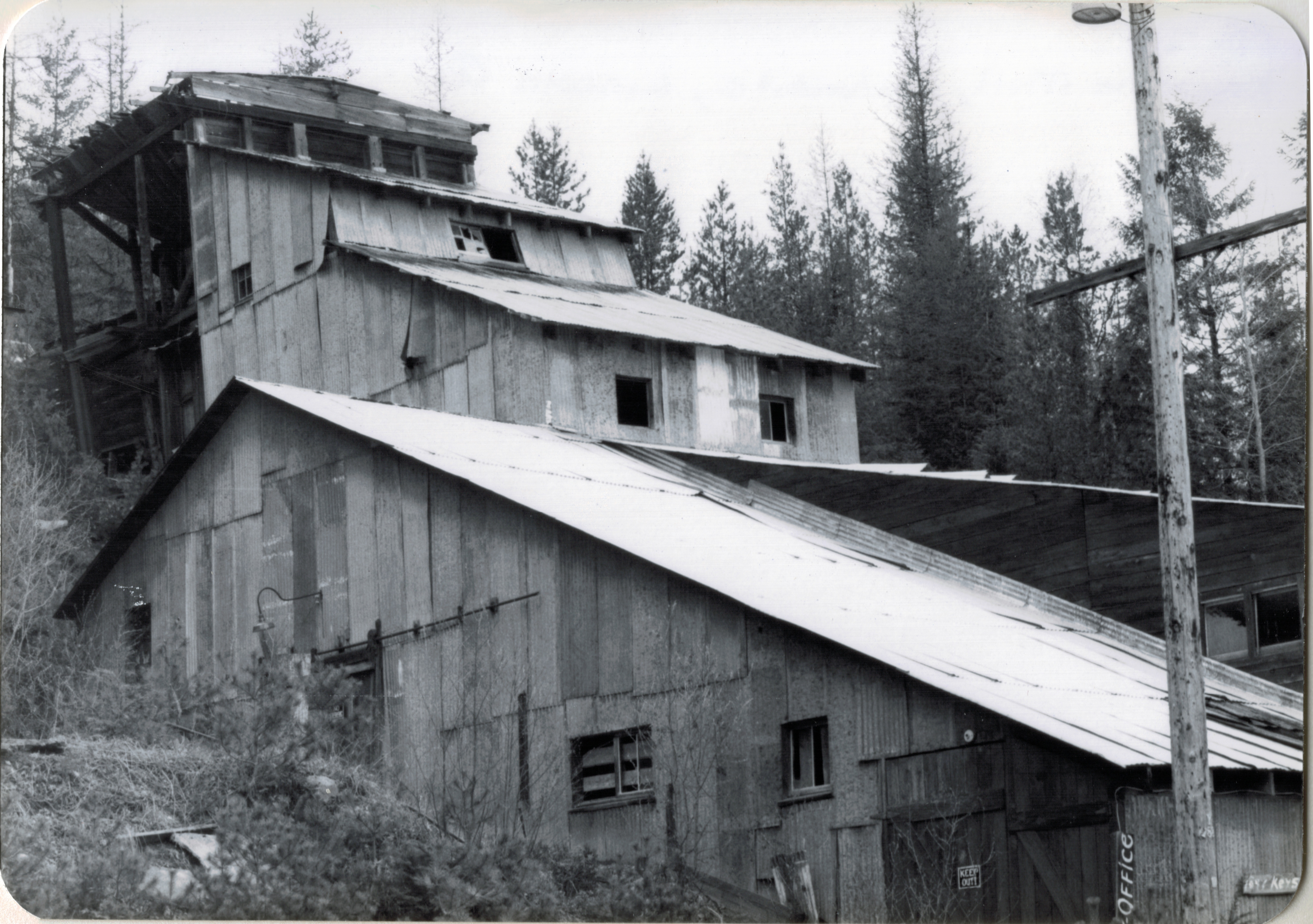
In 1984 as I traveled from Troy via Montana State Highway 508 to Yaak, the only “town” left in the state’s far northwest corner, you could still encounter key mining properties along the Yaak River, such as this concentrator at Sylvanite.
The Keystone Mill was barely hanging on to the side of the mountain then, now it is nowhere to be seen. Montana 508 has instead become a gateway to some of the some of the most open, untouched high mountain landscape, one that meanders back and forth with the river, bridges, and, perhaps most importantly, bars.
That would be the Dirty Shame Saloon–another institution that some back in the city thought that perhaps I should avoid. Glad I did not. Had a great meal there in 1984, and even though the bar’s dining area has been extended, it still had that vibe, of both a local place but also another remnant of the old logging and mining days along the Yaak.
Yaak by way of local paths and trails is a gateway too, between Idaho and Montana and Montana and British Columbia. More to the point it is a gateway between what was and what still is within the Montana landscape.
Yaak’s general store, service station, lodging, and whatever else you need is another throwback place, and can be found on the web as the Yaak River Tavern and Mercantile. You haven’t “done” Montana if you don’t make it to Yaak.
Nestled within the Tobacco Valley of northern Lincoln County is the town of Eureka, which serves as a northern gateway into Montana along U.S. Highway 93. I first encountered the town in 1982, as I returned from a jaunt into Alberta, and immediately thought here is a classic linear town plan, a landscape created by a spur line of the Great Northern Railway.
As I would come to find out, on two return trips here in 1984, the town was much more than that, it was a true bordertown between two nations and two cultures. The two trips came about from, first, a question about a public building’s eligibility for the National Register, and, second, the fieldwork for the state historic preservation plan, where such obvious landmarks as the National Hotel and Eureka passenger depot were noted. Thirty
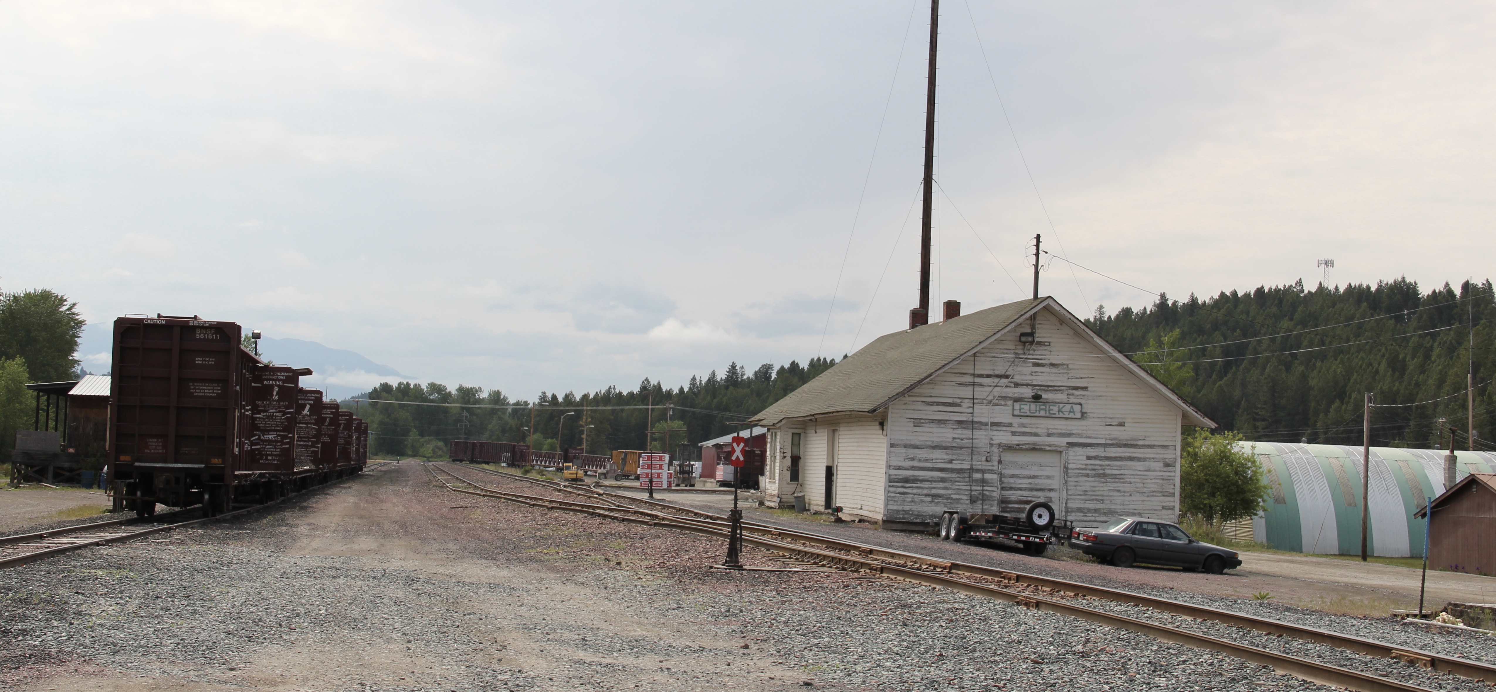
years later I was pleased to see the National Hotel in much better condition but dismayed to see the Great Northern passenger station–a classic example of its early 20th century standardized designs–is far worse condition that it had been in 1984.
Otherwise, Eureka has done an impressive job of holding together its historic core of downtown one and two-story commercial buildings. In 1995, owners had the Farmers and Merchants State Bank, built in 1907, placed in the National Register. Walking the town, however, you see the potential of a historic district of this turn of the 20th century place.
Oh yeah, what about that second reason for two trips in 1984? That would be the Eureka Community Hall, one of the last public buildings constructed by the Works Progress Administration in Montana in 1942.
Located on a hill perched over the town, the building was obviously a landmark–but in 1984 it also was just 42 years old, and that meant it needed to have exceptional significance to the local community to merit listing in the National Register of Historic Places. Eureka had been a logging community, and the depression hit hard. The new building not only reflected community pride but also local craftsmanship, and it became a
foundation for community resurgence in the decades to come. The building was listed in 1985, and was the first to have my name attached to it, working with Sally Steward of the local historical society. But credit has to go to Pat Bick and especially Marcella Sherfy of the State Historic Preservation Office for urging me to take it on, and to guide me through the maze of the National Register process. Today, it has experienced an adaptive reuse and serves as a rustic log furniture store.
During those visits in 1984 I also held a public meeting in Eureka for the state historic preservation plan, where I learned about the Tobacco Valley Historical Society and its efforts to preserve buildings destined for the chopping block through its museum village on the southern edge of town. Here the community gathered the Great Northern depot (1903) of Rexford, the same town’s 1926 Catholic Church, the Mt. Roberts lookout tower, the Fewkes Store, and a U.S. Forest Service big Creek Cabin from 1926.
But thirty years later I found new public interpretation not just in the museum village but in the town itself, as Eureka introduced visitors to its history and setting and also told its
border story of such fascinating people as Joseph Peltier, who built the first dwelling at the town site in 1891, and especially the cross-border entrepreneur Sophie Morigeau, who was trading in the area as early as 1863.
The Peltier log dwellings came within a year of each other, 1891 and 1892, and their size, finish, and log notching speak to the region’s rapid development. His 1891 low pitched roof, v-notched cabin is typical, throughout the mountain west, of first homes–quickly constructed shelter. The second house, with its hewn log exterior and crafted corner notching speaks to permanence. The settler was here to stay in 1892.
Eureka has held its population steady over 30 years, just a few families over 1,000 residents, a sizable achievement considering the change in both railroading and logging over that time. I think community pride and identity has to be contributors, because you see it everywhere, and I will close with two last examples. The town’s library and nearby veterans park, and then the magnificent Art Deco-influenced high school–yet another New Deal era contribution to this special gateway town.
Libby is the seat of Lincoln County, a typical railroad town along the historic Great Northern Railway corridor. The image above is from the town’s railroad depot, the symbolic beginning of town, from which runs a long main street of businesses, reflecting the T-plan town design, where the long railroad corridor defines the top of the T and the main street forms the stem of the T.
The depot is a good example of the railway’s “Chalet” style that it used in many of its Rocky Mountain properties, reflecting the influence of the early resorts in Glacier National Park and the railroad’s wish to connect such rural outposts as Libby with the tourism traffic it wished to generate along the line.
Libby was much like I remembered it from 1984. The town’s population had dropped by about 100, and some historic store buildings had been leveled, but a new brew pub was in operation and the historic Dome Theater was still going strong.
And I liked the New Deal impact on Libby’s public buildings, such as the WPA Deco City Hall, which is now solely the domain of the police department. Then there is the Lincoln County Courthouse, truly a story of two buildings in one as the mid-1930s Art Deco-styled
courthouse received a totally new front, in a contemporary style, in the 1970s as the town and county expanded in the wake of the federal spending in constructing Libby Dam. The rectangular blockiness, flat roof, and band of windows set within a symmetrical facade makes the courthouse one of the state’s best designs for a rural public building in the late 20th century.
I liked all of those things about Libby in 1984. Imagine my shock and disappointment to learn, as everyone else did, that Libby was one of the poisoned places in the west. In 1919, vermiculite, a natural material that contains asbestos, had been discovered outside of town, and the mines were still operating, producing 80 percent of the vermiculite in the world, under the control of the W.R. Grace company. Residue from the mines had been used in local yards and buildings for decades, a fact that was not known when I visited the town for the state historic preservation plan. When the discovery of the danger became public, and the federal Environmental Protection Agency entered into the fray in 1999, it was already too late for many residents. A federal Superfund project began, and did not conclude its work until 2015, spending some $425 million. Then in 2009 the Environmental Protection Agency announced a public health emergency, spending another $130 million to help residents and to leave a new health infrastructure in place. In a generation, Libby had been turned inside out. EPA announced in 2016 that the cleanup would continue to 2018, and that the project was the longest in the agency’s history.
The Cabinet Peak Medical Center (2014), designed by CTA Architects, represents the beginning of a new chapter in Libby’s history, as it starts its second century. It extends the city’s earlier healthcare history, represented by the historic St. John Lutheran Hospital, which opened in the 1952 and operated until 2014 when it was closed in favor of the new Cabinet Peaks center.
Despite the disaster, I saw many signs that Libby residents were determined to remain and rebuild their community. One of the most powerful examples is the conversion of one of the town’s historic schools into a new community arts center as well as school administration offices.
Then the public library–home to an active and lively genealogy group and collection–is still a point of pride and activity. The same is true for the mid-1970s Lincoln County Museum–a wonderful modern log building designed and built by the community during the American Bicentennial just outside of Libby–which remains an active part of the town’s heritage tourism offerings.
The asbestos crisis was a terrible disaster for Libby–yet residents refused to let it define their future. There are past accomplishments to acknowledge, an active railroad depot to cherish, a beautiful river and lake, the mountains all around, as celebrated in this public art mural on a downtown building. This place is here to stay, and the historic built environment is a large part of it.


 The woman’s club began c. 1921 and had already made a major contribution to the town’s well-being in establishing its first library. After World War II, however, club members felt they should once again help build the community, by building a youth center and veterans memorial garden. Mrs. Norman Good proposed the project in 1946 and Mrs. G. D. Martin provided the first substantial donation. The club then held fundraisers of all sorts. By 1950, construction was underway, with contractor Clyde Wilson building the center with logs from Colby and Sons in Kila, Montana.
 As the youth center was under construction, the woman’s club also reached an agreement with the school board to use land for the construction of a new football field, named McQuitty Field. Located behind the youth center, the field opened in 1950.
 Thus, on U.S. Highway 12 lies the public recreation heart of Harlowton–a postwar gift of residents and service clubs to the community. In 1956, the woman’s club deeded the Youth Center to the Kiwanis Club, which still manages it today.


 Road, it once also had several hotels and more short-term housing for workers and travelers–a good bit of that has disappeared, or is disappearing.
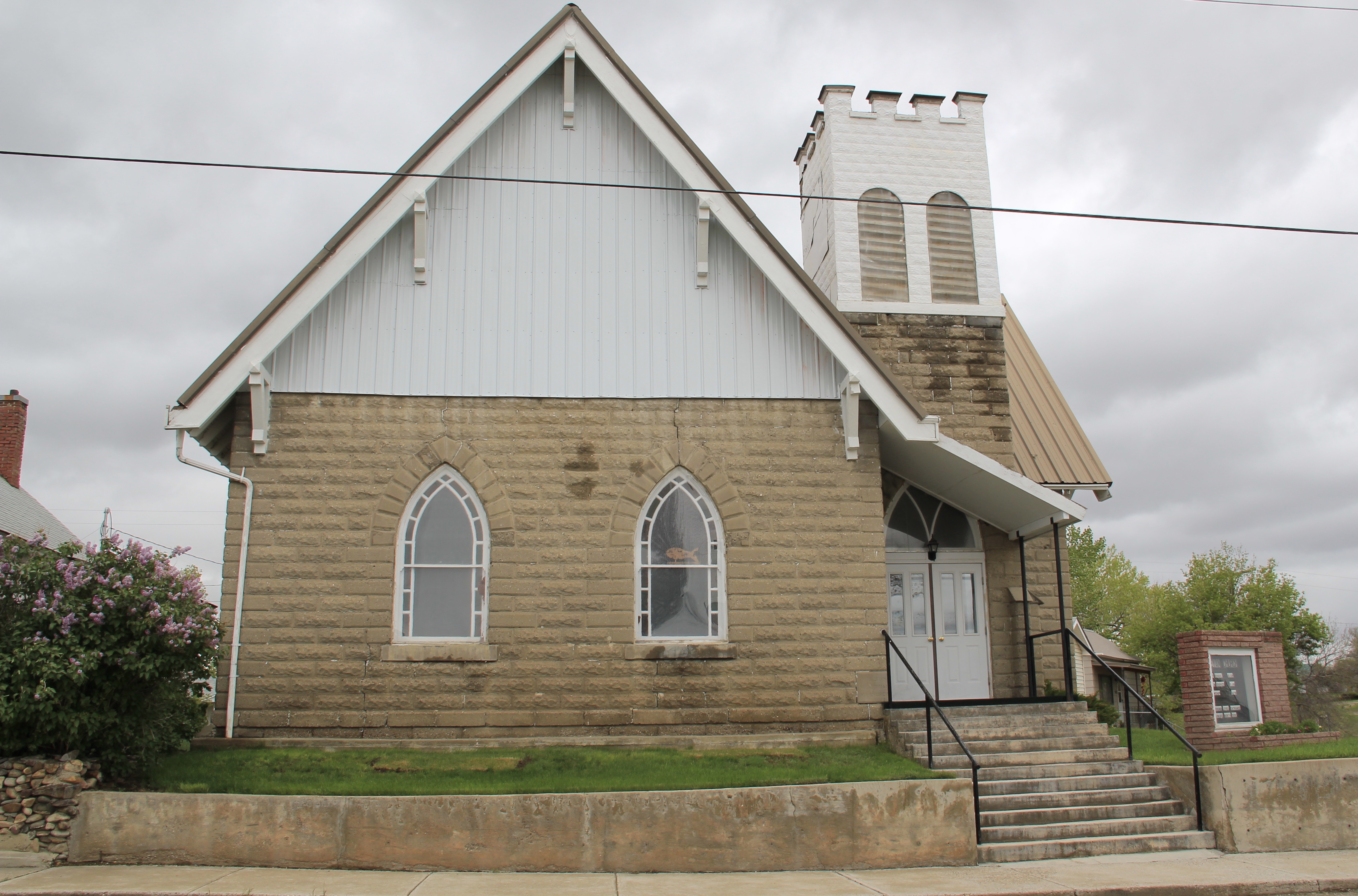
 It is difficult to visit Harlowton and not notice the mammoth Montana Flour Mills set of concrete grain silos–today’s silent sentinels of what ranchers once produced in abundance in these lands.
 The mill, made from locally quarried stone, came within months of the completion of the railroad to Harlowton–the concrete silos reflected the hopes of investors and local ranchers, as grain production soared in the 1910s–reaching some 1.2 million bushels in 1918. It wasn’t called Wheatland County for nothing. I still wish the big electric sign that once adorned the silos was still there.


 City as one large tourism funnel. After spending a good part of 2006-2007 working with local residents and the Great Smoky Mountains National Park about the heritage and preservation of Gatlinburg, Tennessee–one of the most notorious gateways into any national park–I learned to look deeper than the highway landscape and find some real jewels in each of these Glacier National Park gateway communities.


 At Hungry Horse, however, I did leave the highway and explored the marvelous landscape created by the Hungry Horse Dam and Reservoir, a mid-20th century project by the U.S. Bureau of Reclamation. The agency justified the dam as a hydroelectric power project for a growing Flathead County and as a boost to local irrigation. The irrigation side of the project–the real reason the agency exists–never happened and Hungry Horse today is an electric power and recreational project.
 I appreciated the vastness of the concrete arch dam–the 11th largest concrete dam in the United States–as well as the beauty of Hungry Horse Reservoir, an under-appreciated tourism asset as anyone in Flathead County will tell you. But again, I let just the size and impact of the dam distract me from some of the details of its construction that, today, are so striking.


 I am concerned, however, about news in September 2015 that Reclamation has contracted for updates and renovation at the Visitor Center–let’s hope that the classic 1950s look of the property is not sacrificed.


 Architect Kirtland Cutter of Spokane was the architect and the chalet design was actually just a smaller scale and less adorned version of the Idaho State Exhibition Building that he had designed for the 1893 World’s Fair in Chicago. Cutter is one of the major figures of the Arts and Crafts Movement in the American Northwest and we will look at another of his buildings for the railroad and Glacier in the next post about Lake McDonald Lodge.


 “lone eagles” was local–an attempt to describe those professionals “who fly to work as comfortably as most Americans drive, and whose use of computers in business lets them indulge their preference for life in the great outdoors,” as a June 19, 1994 story in the New York Times explained.

 The station along with the railroad tracks defined everything you saw in Whitefish–here in the classic Great Northern T-plan landscape was a classic railroad town–one that old-timers even called the best along the entire line. Whitefish developed and then prospered as a division point on the mainline from 1904 to 1955–and that corporate imprint was still there to be experienced, in 1984.
 Thankfully in 2015, I still found all of my favorite landmarks from 30 years earlier, even though there was little doubt that the business district had been altered, sometimes in ways that left little original fabric in place but still some two-story brick blocks stood.


 A much earlier landmark, the Classical Revival Masonic Temple from the town’s first decade still stood, and it too found a new use through adaptive reuse.
 Despite the population boom over the last 30 years, Whitefish still uses its Art Deco-styled school from the New Deal decade of the 1930s, although the auditorium has been restored and updated into a community performing arts center.


 I love Montana town signs, and Troy, deep in the state’s logging country, has one of the best. The sign lures to a city park nestled along the Kootenai River. The focus point is a


 the Great Northern’s main line, and I documented the few historic buildings left facing the railroad tracks today. The Home Bar (c. 1914) and the Club Bar were institutions then, and remain so today. The Kootenai State Bank building still stands but has experienced a major change to its facade–made better in part by the American flag painted over some of the frame addition.
 The Troy Jail, above, was listed in the National Register of Historic Places in 2006 and it remains the only building so listed in the town today. D.E. Crissey, a local contractor, built it out of concrete in 1924 during Troy’s boom from 1916 to 1926 when its population jumped from 300 to 1300. The Snowstorm mine, which produced lead, zinc, and silver, started to serve the demand for raw materials during World War I. The mine soon turned what had been a small railroad town into a mining camp best known for its brothels and bars. Then in the early 1920s the Great Northern decided to build a division point here, further booming the town. The Sandpoint Pole and Lumber Company began its logging business in 1923, and Troy suddenly was the largest town in the county


 As I would come to find out, on two return trips here in 1984, the town was much more than that, it was a true bordertown between two nations and two cultures. The two trips came about from, first, a question about a public building’s eligibility for the National Register, and, second, the fieldwork for the state historic preservation plan, where such obvious landmarks as the National Hotel and Eureka passenger depot were noted. Thirty
 years later I was pleased to see the National Hotel in much better condition but dismayed to see the Great Northern passenger station–a classic example of its early 20th century standardized designs–is far worse condition that it had been in 1984.
 Otherwise, Eureka has done an impressive job of holding together its historic core of downtown one and two-story commercial buildings. In 1995, owners had the Farmers and Merchants State Bank, built in 1907, placed in the National Register. Walking the town, however, you see the potential of a historic district of this turn of the 20th century place.
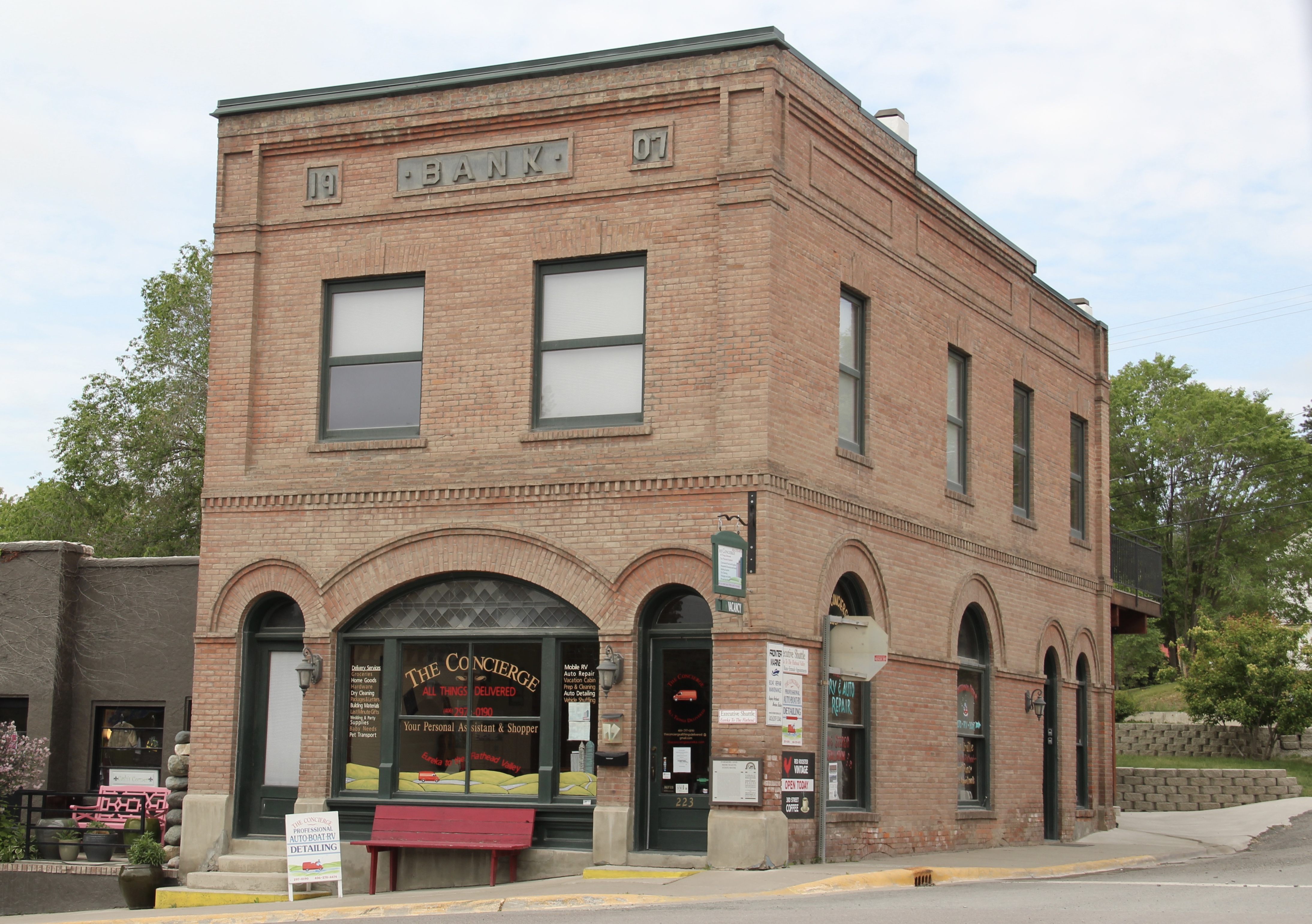


 Located on a hill perched over the town, the building was obviously a landmark–but in 1984 it also was just 42 years old, and that meant it needed to have exceptional significance to the local community to merit listing in the National Register of Historic Places. Eureka had been a logging community, and the depression hit hard. The new building not only reflected community pride but also local craftsmanship, and it became a
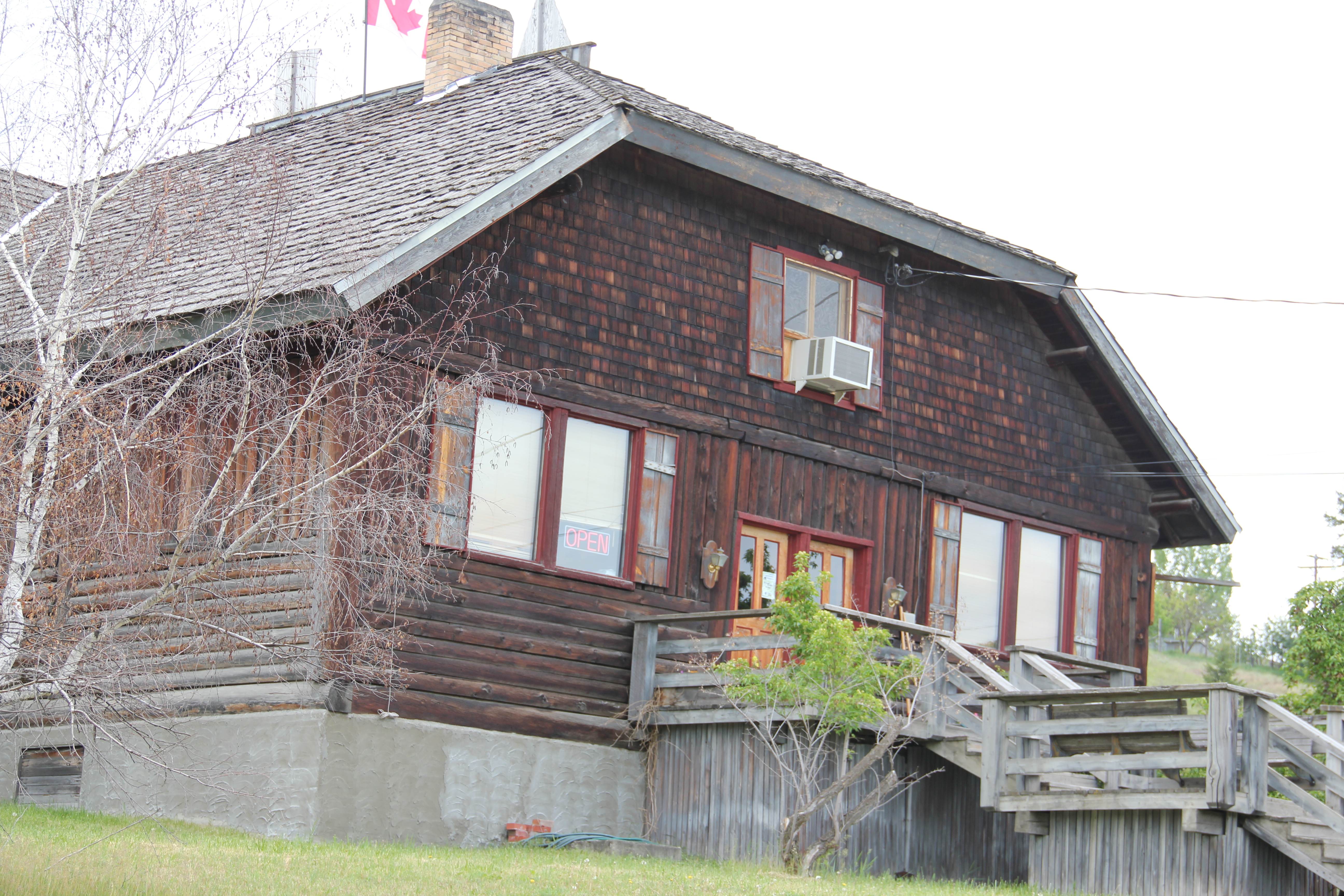 foundation for community resurgence in the decades to come. The building was listed in 1985, and was the first to have my name attached to it, working with Sally Steward of the local historical society. But credit has to go to Pat Bick and especially Marcella Sherfy of the State Historic Preservation Office for urging me to take it on, and to guide me through the maze of the National Register process. Today, it has experienced an adaptive reuse and serves as a rustic log furniture store.
 During those visits in 1984 I also held a public meeting in Eureka for the state historic preservation plan, where I learned about the Tobacco Valley Historical Society and its efforts to preserve buildings destined for the chopping block through its museum village on the southern edge of town. Here the community gathered the Great Northern depot (1903) of Rexford, the same town’s 1926 Catholic Church, the Mt. Roberts lookout tower, the Fewkes Store, and a U.S. Forest Service big Creek Cabin from 1926.


 Libby is the seat of Lincoln County, a typical railroad town along the historic Great Northern Railway corridor. The image above is from the town’s railroad depot, the symbolic beginning of town, from which runs a long main street of businesses, reflecting the T-plan town design, where the long railroad corridor defines the top of the T and the main street forms the stem of the T.


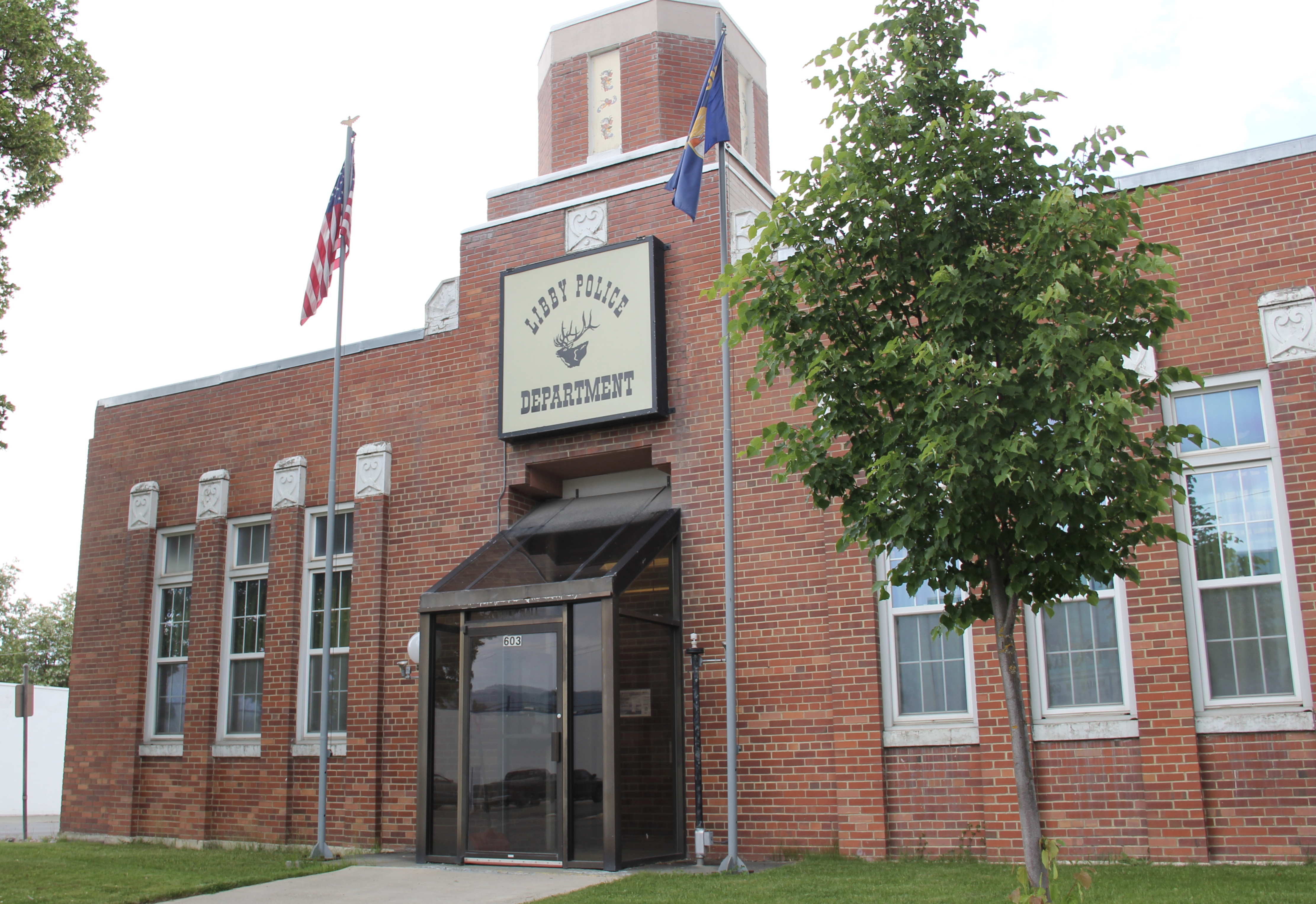

 courthouse received a totally new front, in a contemporary style, in the 1970s as the town and county expanded in the wake of the federal spending in constructing Libby Dam. The rectangular blockiness, flat roof, and band of windows set within a symmetrical facade makes the courthouse one of the state’s best designs for a rural public building in the late 20th century.
 I liked all of those things about Libby in 1984. Imagine my shock and disappointment to learn, as everyone else did, that Libby was one of the poisoned places in the west. In 1919, vermiculite, a natural material that contains asbestos, had been discovered outside of town, and the mines were still operating, producing 80 percent of the vermiculite in the world, under the control of the W.R. Grace company. Residue from the mines had been used in local yards and buildings for decades, a fact that was not known when I visited the town for the state historic preservation plan. When the discovery of the danger became public, and the federal Environmental Protection Agency entered into the fray in 1999, it was already too late for many residents. A federal Superfund project began, and did not conclude its work until 2015, spending some $425 million. Then in 2009 the Environmental Protection Agency announced a public health emergency, spending another $130 million to help residents and to leave a new health infrastructure in place. In a generation, Libby had been turned inside out. EPA announced in 2016 that the cleanup would continue to 2018, and that the project was the longest in the agency’s history.
 Despite the disaster, I saw many signs that Libby residents were determined to remain and rebuild their community. One of the most powerful examples is the conversion of one of the town’s historic schools into a new community arts center as well as school administration offices.


 The asbestos crisis was a terrible disaster for Libby–yet residents refused to let it define their future. There are past accomplishments to acknowledge, an active railroad depot to cherish, a beautiful river and lake, the mountains all around, as celebrated in this public art mural on a downtown building. This place is here to stay, and the historic built environment is a large part of it.
