

Nestled within the Tobacco Valley of northern Lincoln County is the town of Eureka, which serves as a northern gateway into Montana along U.S. Highway 93. I first encountered the town in 1982, as I returned from a jaunt into Alberta, and immediately thought here is a classic linear town plan, a landscape created by a spur line of the Great Northern Railway.
 As I would come to find out, on two return trips here in 1984, the town was much more than that, it was a true bordertown between two nations and two cultures. The two trips came about from, first, a question about a public building’s eligibility for the National Register, and, second, the fieldwork for the state historic preservation plan, where such obvious landmarks as the National Hotel and Eureka passenger depot were noted. Thirty

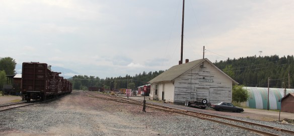 years later I was pleased to see the National Hotel in much better condition but dismayed to see the Great Northern passenger station–a classic example of its early 20th century standardized designs–is far worse condition that it had been in 1984.
 Otherwise, Eureka has done an impressive job of holding together its historic core of downtown one and two-story commercial buildings. In 1995, owners had the Farmers and Merchants State Bank, built in 1907, placed in the National Register. Walking the town, however, you see the potential of a historic district of this turn of the 20th century place.


Oh yeah, what about that second reason for two trips in 1984? That would be the Eureka Community Hall, one of the last public buildings constructed by the Works Progress Administration in Montana in 1942.
 Located on a hill perched over the town, the building was obviously a landmark–but in 1984 it also was just 42 years old, and that meant it needed to have exceptional significance to the local community to merit listing in the National Register of Historic Places. Eureka had been a logging community, and the depression hit hard. The new building not only reflected community pride but also local craftsmanship, and it became a
 foundation for community resurgence in the decades to come. The building was listed in 1985, and was the first to have my name attached to it, working with Sally Steward of the local historical society. But credit has to go to Pat Bick and especially Marcella Sherfy of the State Historic Preservation Office for urging me to take it on, and to guide me through the maze of the National Register process. Today, it has experienced an adaptive reuse and serves as a rustic log furniture store.
 During those visits in 1984 I also held a public meeting in Eureka for the state historic preservation plan, where I learned about the Tobacco Valley Historical Society and its efforts to preserve buildings destined for the chopping block through its museum village on the southern edge of town. Here the community gathered the Great Northern depot (1903) of Rexford, the same town’s 1926 Catholic Church, the Mt. Roberts lookout tower, the Fewkes Store, and a U.S. Forest Service big Creek Cabin from 1926.


But thirty years later I found new public interpretation not just in the museum village but in the town itself, as Eureka introduced visitors to its history and setting and also told its
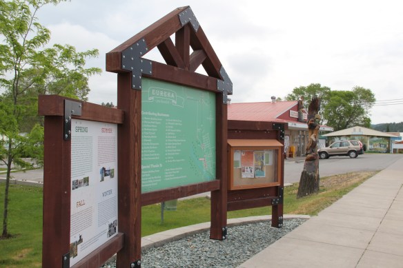
border story of such fascinating people as Joseph Peltier, who built the first dwelling at the town site in 1891, and especially the cross-border entrepreneur Sophie Morigeau, who was trading in the area as early as 1863.


The Peltier log dwellings came within a year of each other, 1891 and 1892, and their size, finish, and log notching speak to the region’s rapid development. His 1891 low pitched roof, v-notched cabin is typical, throughout the mountain west, of first homes–quickly constructed shelter. The second house, with its hewn log exterior and crafted corner notching speaks to permanence. The settler was here to stay in 1892.


Eureka has held its population steady over 30 years, just a few families over 1,000 residents, a sizable achievement considering the change in both railroading and logging over that time. I think community pride and identity has to be contributors, because you see it everywhere, and I will close with two last examples. The town’s library and nearby veterans park, and then the magnificent Art Deco-influenced high school–yet another New Deal era contribution to this special gateway town.


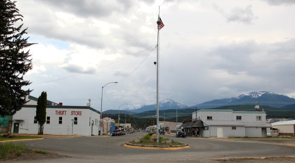 Libby is the seat of Lincoln County, a typical railroad town along the historic Great Northern Railway corridor. The image above is from the town’s railroad depot, the symbolic beginning of town, from which runs a long main street of businesses, reflecting the T-plan town design, where the long railroad corridor defines the top of the T and the main street forms the stem of the T.


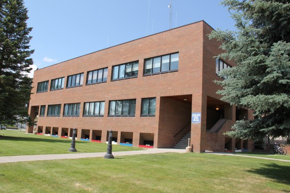
 courthouse received a totally new front, in a contemporary style, in the 1970s as the town and county expanded in the wake of the federal spending in constructing Libby Dam. The rectangular blockiness, flat roof, and band of windows set within a symmetrical facade makes the courthouse one of the state’s best designs for a rural public building in the late 20th century.
 I liked all of those things about Libby in 1984. Imagine my shock and disappointment to learn, as everyone else did, that Libby was one of the poisoned places in the west. In 1919, vermiculite, a natural material that contains asbestos, had been discovered outside of town, and the mines were still operating, producing 80 percent of the vermiculite in the world, under the control of the W.R. Grace company. Residue from the mines had been used in local yards and buildings for decades, a fact that was not known when I visited the town for the state historic preservation plan. When the discovery of the danger became public, and the federal Environmental Protection Agency entered into the fray in 1999, it was already too late for many residents. A federal Superfund project began, and did not conclude its work until 2015, spending some $425 million. Then in 2009 the Environmental Protection Agency announced a public health emergency, spending another $130 million to help residents and to leave a new health infrastructure in place. In a generation, Libby had been turned inside out. EPA announced in 2016 that the cleanup would continue to 2018, and that the project was the longest in the agency’s history.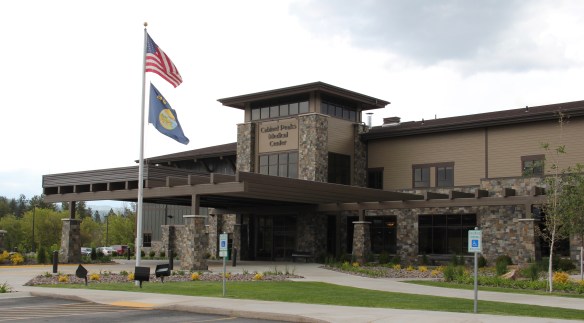
 Despite the disaster, I saw many signs that Libby residents were determined to remain and rebuild their community. One of the most powerful examples is the conversion of one of the town’s historic schools into a new community arts center as well as school administration offices.


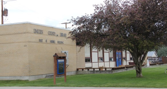
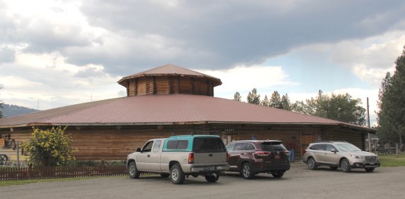 The asbestos crisis was a terrible disaster for Libby–yet residents refused to let it define their future. There are past accomplishments to acknowledge, an active railroad depot to cherish, a beautiful river and lake, the mountains all around, as celebrated in this public art mural on a downtown building. This place is here to stay, and the historic built environment is a large part of it.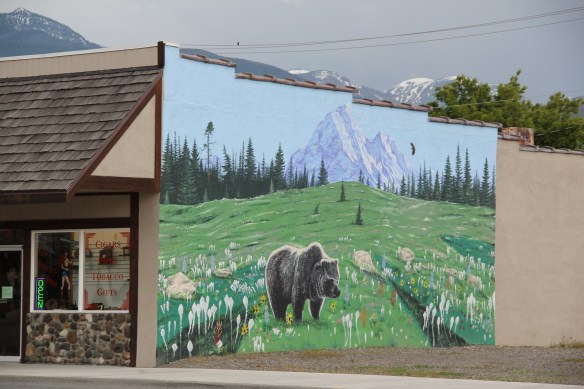
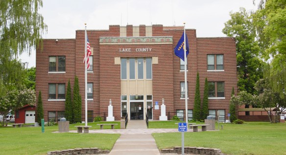


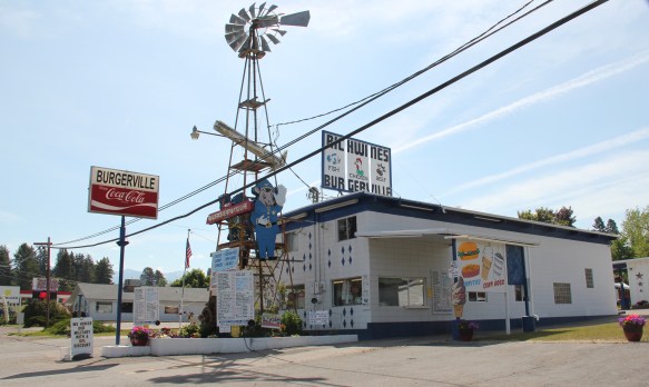 But in the last 30 years, Polson has boomed as a lakeside resort town, with a population of 4700 today compared to the 2800 of the 1980s. Key landmarks remain but nothing has been listed in the National Register of Historic Places since my 1984 visit, even the great New Deal modern courthouse above.


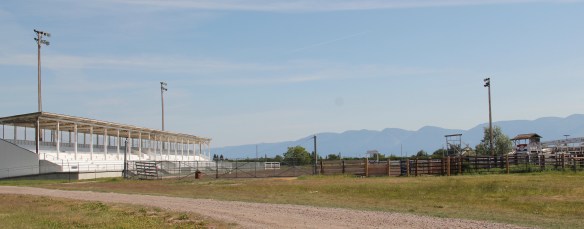
 These landmarks need to be treasured because a new Polson is emerging all around town–and could crowd out the places that frame the community’s identity. Right now there is a balance between old and new, but a tipping point is around the corner.


 Moiese is best known, by far, as the entrance to the National Bison Range, where a general store stands nearby the refuge gate. Created by Congress in 1908, the refuge took
 additional land–almost 19,000 acres- from the tribes, without their consent, to create a safe haven for the remaining bison in the region. A few hundred bison live within its boundaries today. In 2016 the National Park Service began discussions with the Consolidated Kootenai and Salish Tribe to transfer management of the refuge to the tribe.
 Eight miles north of Moiese along the railroad line is the town of Charlo, named in honor of Chief Charlo of the Bitterroot Salish, who was forced from the Bitterroot Valley to move to the reservation in 1891. Charlo served as head chief of the Bitterroot Salish from 1870-
 1910. As a railroad town, Charlo is like many along the Northern Pacific, with a brief strip of businesses facing the railroad tracks, marked by the town’s sole grain elevator. It has a classic rural bar, Tiny’s Tavern, with its brightly painted exterior of concrete block, with brick accents. Built in 1946 by Tiny Browne, it was both a motel and a tavern, and a local museum of items that Tiny thought were interesting. Browne died in 1977 and his sister, Celeste Fagan, next owned the tavern, managed by Edna Easterly who recalled in a story in the Missoulian of April 20, 2007 that Tiny “was known as the bank of Charlo. Tiny always carried a lot of money in his pocket and if you needed to cash a check, you went to Tiny.”
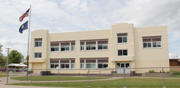
 Most important for its architecture, however, is the town’s public school, a wonderful example of Art Deco style from the New Deal decade of the 1930s.
 Ronan is a third town along the railroad corridor, named for a former white superintendent of the reservation. The town’s demographics today are mostly white, with a little more than a quarter Native American population. Ronan proudly proclaims its existence not only with a gate sign, connecting the business district to the sprawl along U.S. Highway 93 but also a log visitor center and interpretive park on the highway.


 The facade expresses a confident future, which is needed in today’s uncertain economic climate for rural hospitals across the state. But my favorite building in Ronan speaks to my love for adaptive reuse and mid-20th century modern design. The town library is an
 exquisite example of mid-century modern, and was once a local bank before being converted into the library.


 There is a new school and a really different lakefront of businesses, homes, and parks. The town’s population was over 1600 in 2010; it’s now 2700 and counting.


 To get the full meaning of Flathead Lake, however, you have to consider the lake’s deep time, and its long history with the Salish and Kootenai peoples. When I surveyed the county in 1984-1985, you came away impressed with the different vision that the tribes had for the region, and what was already happened at Pablo. In 2014, however, I left Lake County was a deeper impression on what the tribes have meant to the lake and vice versa.
 The People’s Center at Pablo is part of that lesson as it affords a powerful, lasting introduction to both the history and continuation of tribal traditions.


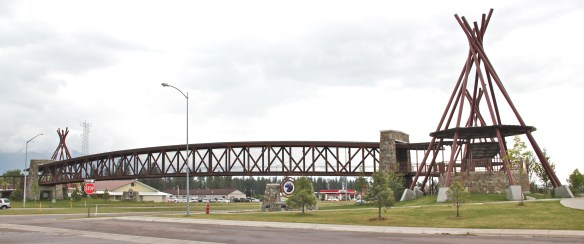
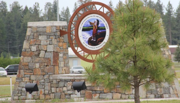
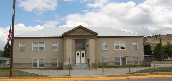 Plains is the second largest town in Sanders County, noted as the home of the county fairgrounds, the center of the local agricultural economy, and like Thompson Falls a significant place along the Clark’s Fork River and the Montana Highway 200 corridor.
 century feel, be it in institutions, such as the local Grange above, or the continuation of the local VFW hall and bowling alley, below.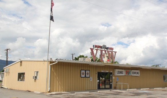


 The Noxon Dam was finished in 1959. It is a mile in length, 260 feet in height and 700 feet wide at its base. Its generators can power approximately 365,000 homes, making it the second-largest capacity hydroelectric facility in Montana.
 Today visitors can view the dam from various parking areas and short walking trails, one of which passes over the historic line of the Northern Pacific Railroad. The property has interpretive signs about the history of the project as well as about the engineering of hydroelectric power.
 Along the banks of the river/reservoir, a much more recent public park has opened–with public sculpture reminding everyone of the Native Americans who once camped along the
 river at this place. By bringing the deep past of the region in view of the modern, this site is a new favorite place–wherever you are in Montana, and there are many modern engineering marvels–the Indians were always there first, using those same natural resources in far different ways.
 In my state historic preservation plan work of 1984-1985, Thompson Falls became one of my favorite stops. No one much in the professional field had been surveyed here yet, and then I was particularly interested in how the Northern Pacific Railroad transformed the late territorial landscape. As the image above shows, Thompson Falls was a classic symmetrical-plan railroad town, with a mix of one and two-story buildings from the turn of the 20th century. I focused on this commercial core.
 The public meeting at the mid-20th century Sanders County Courthouse was well attended and most were engaged with the discussion: the pride, identity, and passion those in attendance had for their history and their interest in historic preservation was duly noted. The courthouse itself was not a concern–it dated to 1946 and wasn’t even 40 years old then. But now I appreciate it as a good example of Montana’s post-World War II modern movement, designed by Corwin & Company in association with Frederick A. Long
 Little did I understand, however, that the sparks of a local community effort were already burning–and within two years, in 1986, Thompson Falls had placed many of its key historic properties in the National Register of Historic Places.
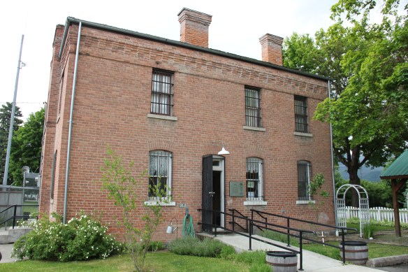 The old county jail (1907) has been transformed into a museum, both preserving one of the town’s oldest properties but also creating a valuable heritage tourism attraction. The contractors were Christian and Goblet, a local firm that had a part in the construction of the town’s building boom once it was designated as the county seat.

 The mid-20th century Sanders County Courthouse is to the west of the commercial core and it marks how the town stretched to the west in the latter decades of the century.
 Along with the conversion of businesses and the adaptive reuse of older buildings, Thompson Falls also has located key community institutions, such as the local library first established in 1921, along Main Street facing the railroad tracks.
 But many community institutions–fraternal lodges such as the Masonic Lodge above, the public schools, and churches are on the opposite side of the tracks along the bluffs facing the commercial core. Thompson Falls is a very good example of how a symmetrical plan could divide a railroad town into distinctive zones.


 Sanders County, like many of the places that are on the western side of the Rocky Mountains, has boomed in the last 25 years, from a population over 8,000 to the current estimated population of 11,300. It is close to Missoula, the eastern side is not far from Flathead Lake, Montana Highway 200 runs from Dixon to the end of the county at Heron. With wide valleys and narrow gorges created by both the Flathead and Clark’s Fork Rivers, which meet outside the town of Paradise, Sanders County is frankly a spectacular landscape, with dramatic mountain views framing open plains, such as the image above and the awesome gorge of Clark’s Fork River, below at Thompson Falls.
 The eastern side of the county is just as dramatic just in a far different way. For centuries First Peoples hunted game and dug the camas root in the broad upland prairie that became known as Camas Prairie, crossed now by Montana Highway 28.
 Then, leading from the county’s southeastern edge there is the beautiful Flathead River Valley, followed by Montana Highway 200, from Dixon to Paradise, and most importantly,
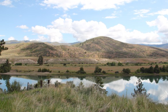 a transportation route initially carved as a trail by the First Peoples who became the nucleus of today’s Confederated Salish and Kootenai Tribe and much later engineered into a major corridor by the tracks of the Northern Pacific Railroad, as it stretched westward from Missoula to the west coast.
 In its wake, the Northern Pacific created most of the county’s townsites by locating sidings along the track. Substantial settlement arrived once the federal government opened lands for the homesteading boom in the early 20th century.
 Dixon, named for the former Montana governor Joseph Dixon, is one of the remaining railroad/homesteading towns along the Flathead River. The fate of the community bar, above, is symbolic of the recent history of the town, one of population decline.


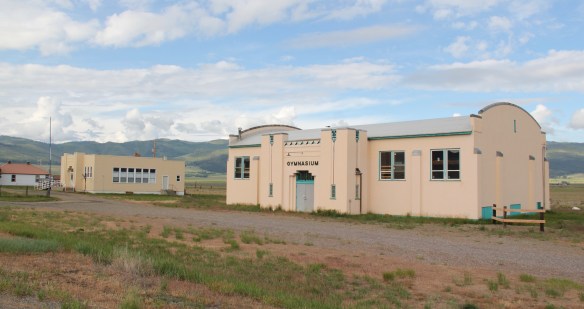
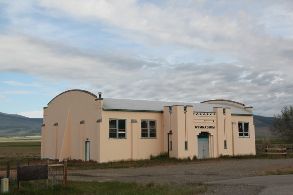
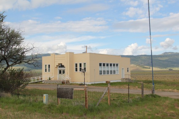 Local residents are being excellent stewards of this captivating property–certainly one of my favorite spots in the state combining landscape with architecture with history. The architect was the Missoula designer H. E. Kirkemo, and the school was completed in 1940, near the end of the New Deal school building programs.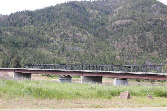

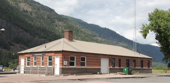

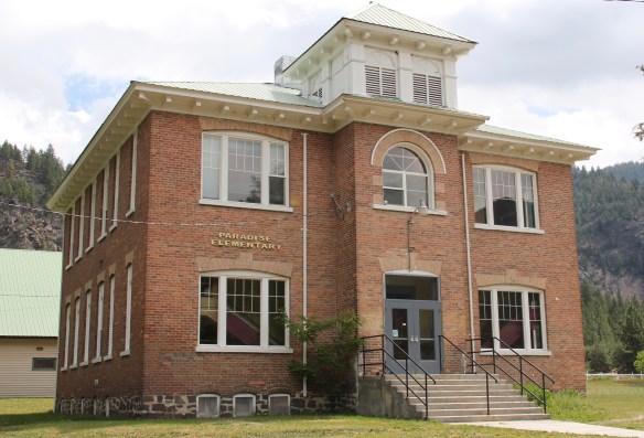 The school had just closed its doors for good when I lasted visited but the restoration planning has been underway ever since. I look forward to my next visit to Paradise to experience the final results. Near the school is another historic community property, the Paradise Cemetery, where tombstones mark the names of those who worked so long for the railroad and for the creation of this place within the Clark’s Fork River Valley.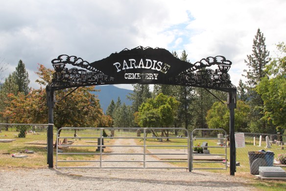
 Along Interstate I-90 as you travel northwest into Idaho, St. Regis is the last town of any size in Montana, and, at that it only counts just over 300 residents. The town has a long significant history in transportation. Old U.S. Highway 10 follows part of the historic Mullan Road–the Mullan monument above marks that route in St. Regis. The town lies at the confluence of the Clark’s Fork River and the St. Regis River. It is also the point where


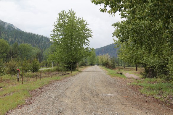
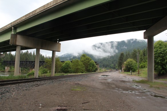 As the photos above show, one of the Milwaukee’s bridges over the Northern Pacific right-of-way has been cut while the interstate rises high above and dwarfs both earlier railroads along the Clark’s Fork River. From St. Regis to Taft, the Milwaukee Road route has new life. In the 21st century the U.S. Forest Service and local residents have worked diligently to preserve the corridor, not to restore the tracks but to find a new recreational use for the abandoned railroad bed.
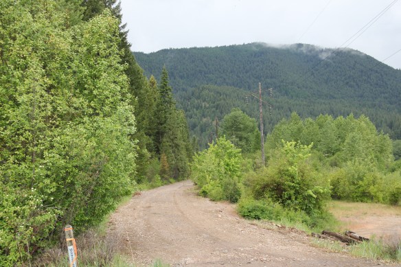 Note in the photograph above, how one of the distinctive electric power poles that carried electricity to the Milwaukee’s engines remains in place. In the central part of Montana, many of these poles are long gone from the corridor. The Milwaukee’s stretch of electrified track began in Harlowton and ended in Idaho–and the St. Regis to Idaho section has some of most intact features of this distinctive engineered landscape.
 The village of Haugan is also the location of the Savenac Nursery, which the U.S. Forest Service established here c. 1907, as the Milwaukee’s tracks were being constructed. Under the direction of Elers Koch of the forest service, Savenac’s became one of the largest seedling operations in the department of agriculture, yielding as many of 12 million seedlings in one year.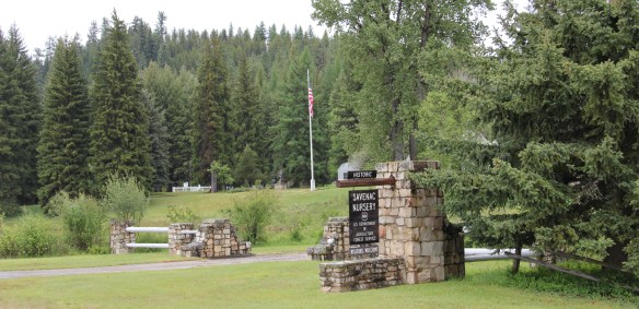
 The historic nursery is open to the public, another example of the important work that the Forest Service has carried out for both preservation and public interpretation in the last 30 years. Listed in the National Register of Historic Places, the property has a museum that operates in the tourist season.


 Haugan is also home to one of the state’s modern pieces of roadside architecture along the interstate, Silver’s truck stop, restaurant, bar, and casino.
 Saltese’s contemporary styled school from c. 1960 remains but has closed. Its historic motels and businesses, as well as an abandoned c. 1930 gas station on old U.S. Highway 10, welcome travelers from the west to Montana.


 The railroad trail route from Taft provides access to some of most spectacular industrial ruins of the old Milwaukee route left in the west.
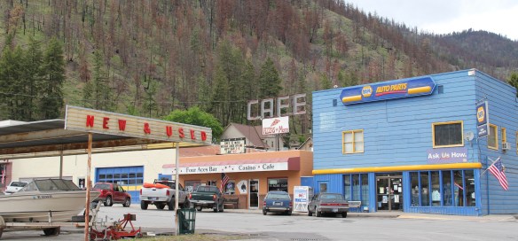 of the Milwaukee Road in 1980, the town has steadily lost population-2oo less residents in 2015 compared to my first visit 30 years earlier. Never a large place–the town’s top population was 1242 residents in 1960–Superior has several landmark buildings from its railroad days but only one has been listed in the National Register of Historic Places.
 That one place, the Superior School, is spectacular and its tall central tower has long served as a community beacon. Built 1915-16 by contractor Charles Augustine, the high school reflected Colonial Revival style, and later community growth led to wing additions in 1925, shown above, and in 1947.
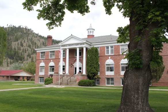 Another Colonial Revival-styled public building is the Mineral County Courthouse, 1920, complete with its colonial-inspired cupola. Mineral County was created in 1914. This building is more complete rural interpretation of Colonial Revival style than the school.

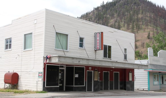 The historic Strand Theater (c. 1915) operated in 1984 but closed in 2013 and remained shuttered when I visited in 2015, no doubt a victim of not only the home theatre phenomenon but also the switch to digital delivery of movies in this decade. This theatre, however, is a rare and important building from the homesteading era of the 1910s.
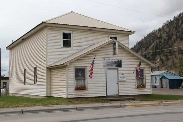 From the same decade, the historic Masonic Mountain Lodge still operates, serving as another community outlet and center in Superior. The town’s population height in the 1960s led to the construction of the institutional Ranch-style of the Superior High School, one of two bits of mid-century modernism in Superior.
 The other example dates to 1958 and represents yet another example of modern design in a rural Catholic Church in Montana. St Mary Queen of Heaven Catholic Church is also a
 Ranch-styled inspired design, although its stand-alone but visually and physically linked low bell tower is unique compared to other Montana Catholic churches from this era.
 The church is Superior’s best contribution to Montana modernism and complements well the Victorian influence found at the town’s historic United Methodist Church, built almost 50 years earlier. Note that both churches have low bell towers.

