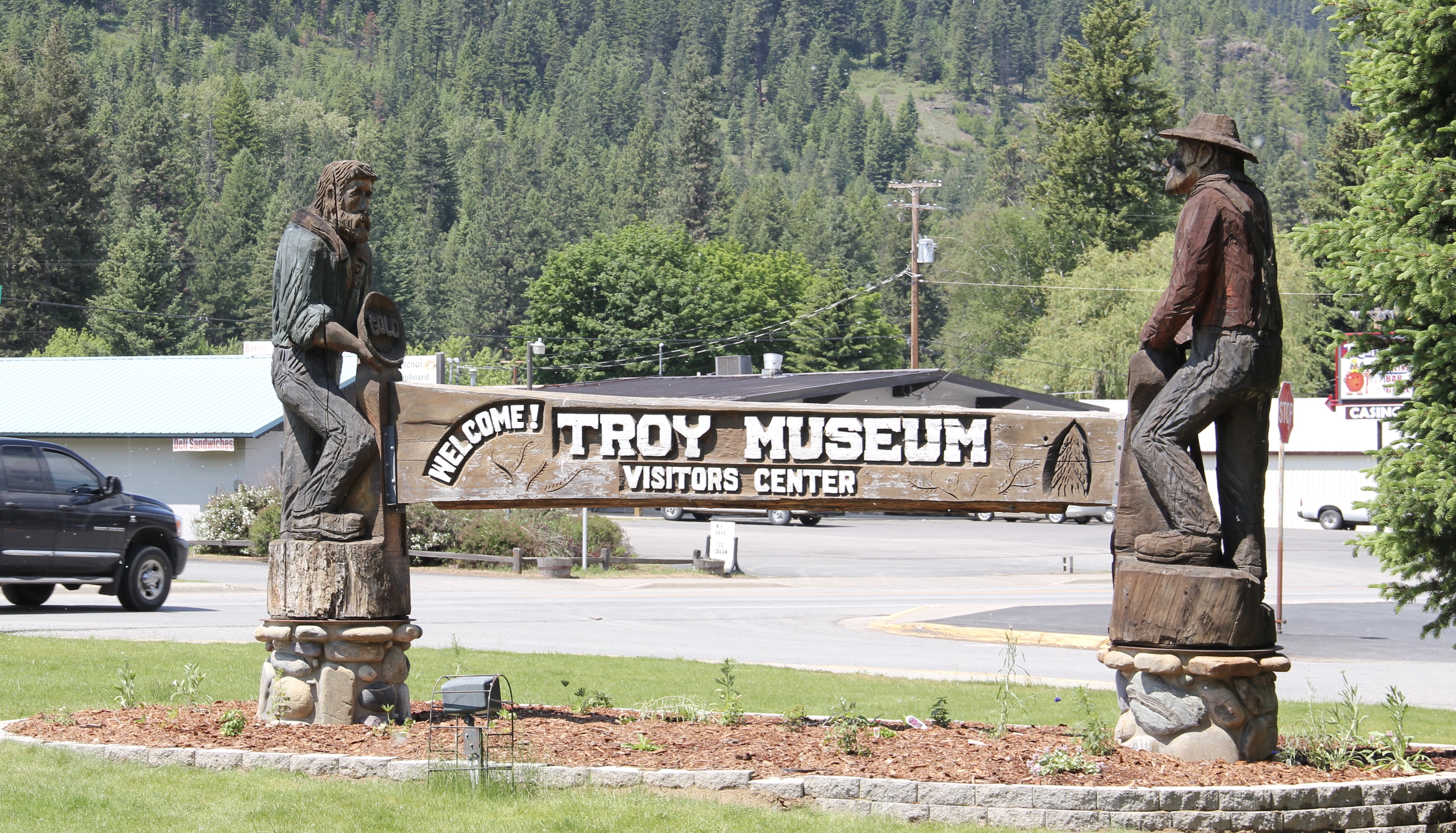
 I love Montana town signs, and Troy, deep in the state’s logging country, has one of the best. The sign lures to a city park nestled along the Kootenai River. The focus point is a
historic Great Northern depot, which has been moved to the park. There is also an interpretive trail, part of a partnership with the U.S. Forest Service, that tells the story of the Callahan boom, which mining and logging combined to lure investors and residents to the area. It is a story arc that the forest service follows at other sites in a region the service describes as the Callahan Creek Historic Mining and Logging District. It is a very useful perspective on the town’s history, and not one that I pursued in 1984 when I explored this part of Lincoln County in the fieldwork for the state historic preservation plan. I paid attention to the historic railroad corridor–Troy (1892) after all was on


 the Great Northern’s main line, and I documented the few historic buildings left facing the railroad tracks today. The Home Bar (c. 1914) and the Club Bar were institutions then, and remain so today. The Kootenai State Bank building still stands but has experienced a major change to its facade–made better in part by the American flag painted over some of the frame addition.
 The Troy Jail, above, was listed in the National Register of Historic Places in 2006 and it remains the only building so listed in the town today. D.E. Crissey, a local contractor, built it out of concrete in 1924 during Troy’s boom from 1916 to 1926 when its population jumped from 300 to 1300. The Snowstorm mine, which produced lead, zinc, and silver, started to serve the demand for raw materials during World War I. The mine soon turned what had been a small railroad town into a mining camp best known for its brothels and bars. Then in the early 1920s the Great Northern decided to build a division point here, further booming the town. The Sandpoint Pole and Lumber Company began its logging business in 1923, and Troy suddenly was the largest town in the county

Perhaps the most impressive landmark left in the wake of the Troy boom is the public school, with the impressive central block flanked by classroom wings and a gymnasium built in later decades. Home to the Troy Trojans, the soldier statue in front of the school is also a public art landmark in Lincoln County.
Troy thus was much more than just a gateway into Montana from U.S. Highway 2–it was once a mining center, but one that went broke fast as the mines played out in the 1920s, the Great Northern closed its roundhouse, and the Great Depression hit in the 1930s.

In 1984 as I traveled from Troy via Montana State Highway 508 to Yaak, the only “town” left in the state’s far northwest corner, you could still encounter key mining properties along the Yaak River, such as this concentrator at Sylvanite.
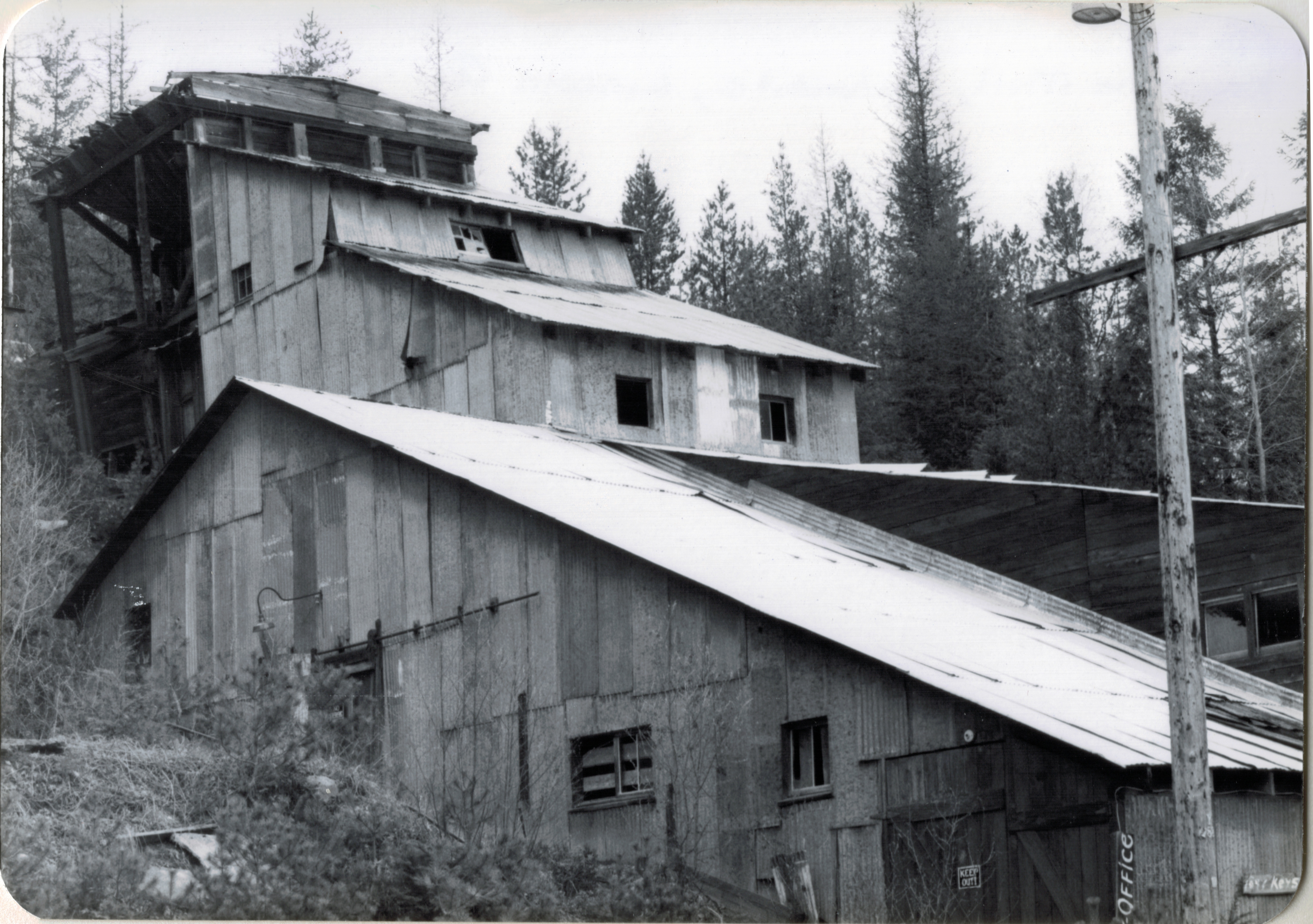
The Keystone Mill was barely hanging on to the side of the mountain then, now it is nowhere to be seen. Montana 508 has instead become a gateway to some of the some of the most open, untouched high mountain landscape, one that meanders back and forth with the river, bridges, and, perhaps most importantly, bars.
That would be the Dirty Shame Saloon–another institution that some back in the city thought that perhaps I should avoid. Glad I did not. Had a great meal there in 1984, and even though the bar’s dining area has been extended, it still had that vibe, of both a local place but also another remnant of the old logging and mining days along the Yaak.

Yaak by way of local paths and trails is a gateway too, between Idaho and Montana and Montana and British Columbia. More to the point it is a gateway between what was and what still is within the Montana landscape.

Yaak’s general store, service station, lodging, and whatever else you need is another throwback place, and can be found on the web as the Yaak River Tavern and Mercantile. You haven’t “done” Montana if you don’t make it to Yaak.


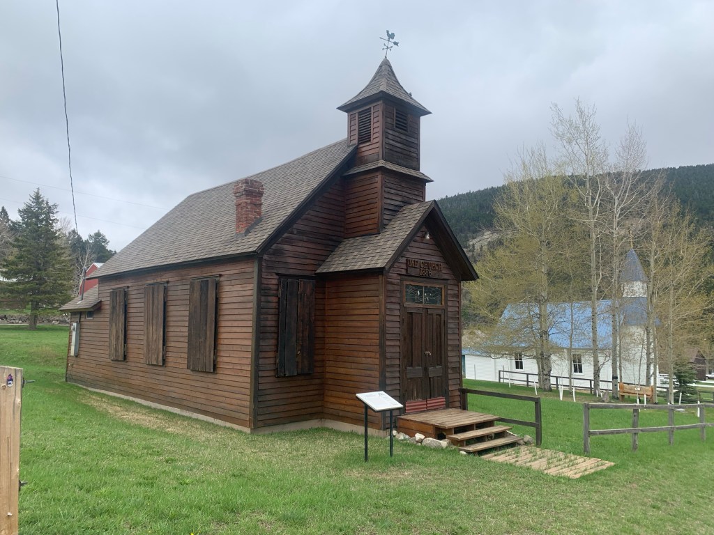
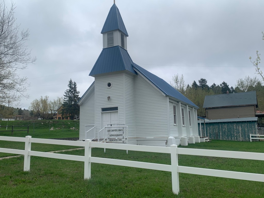
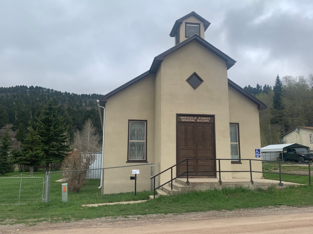
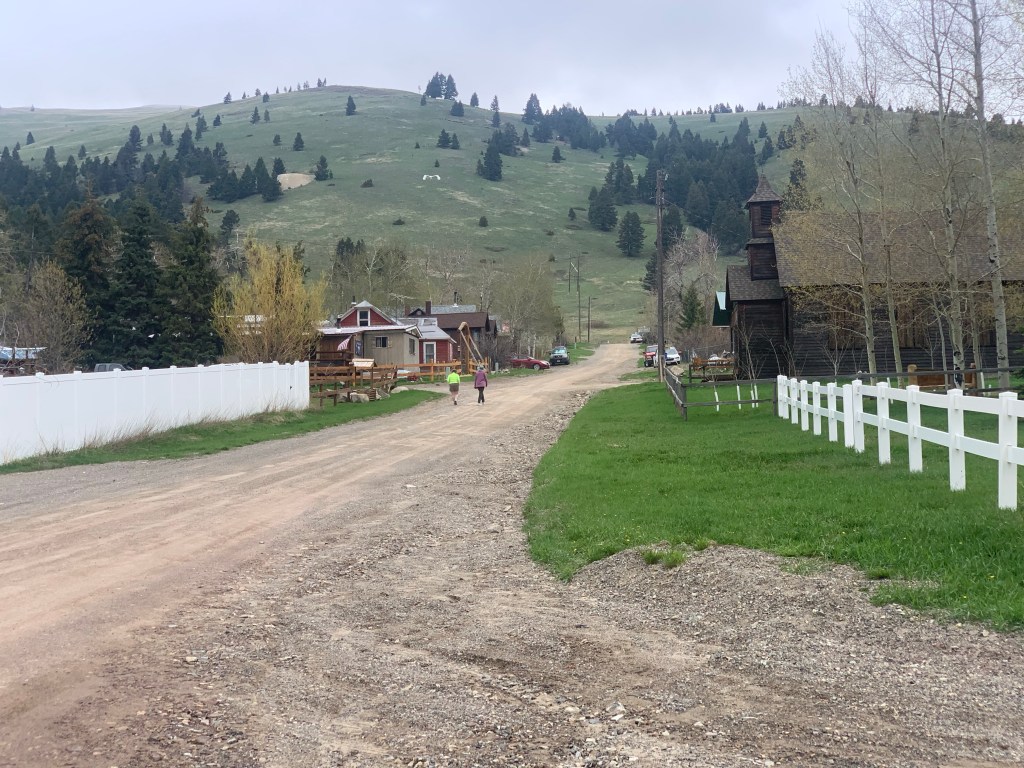


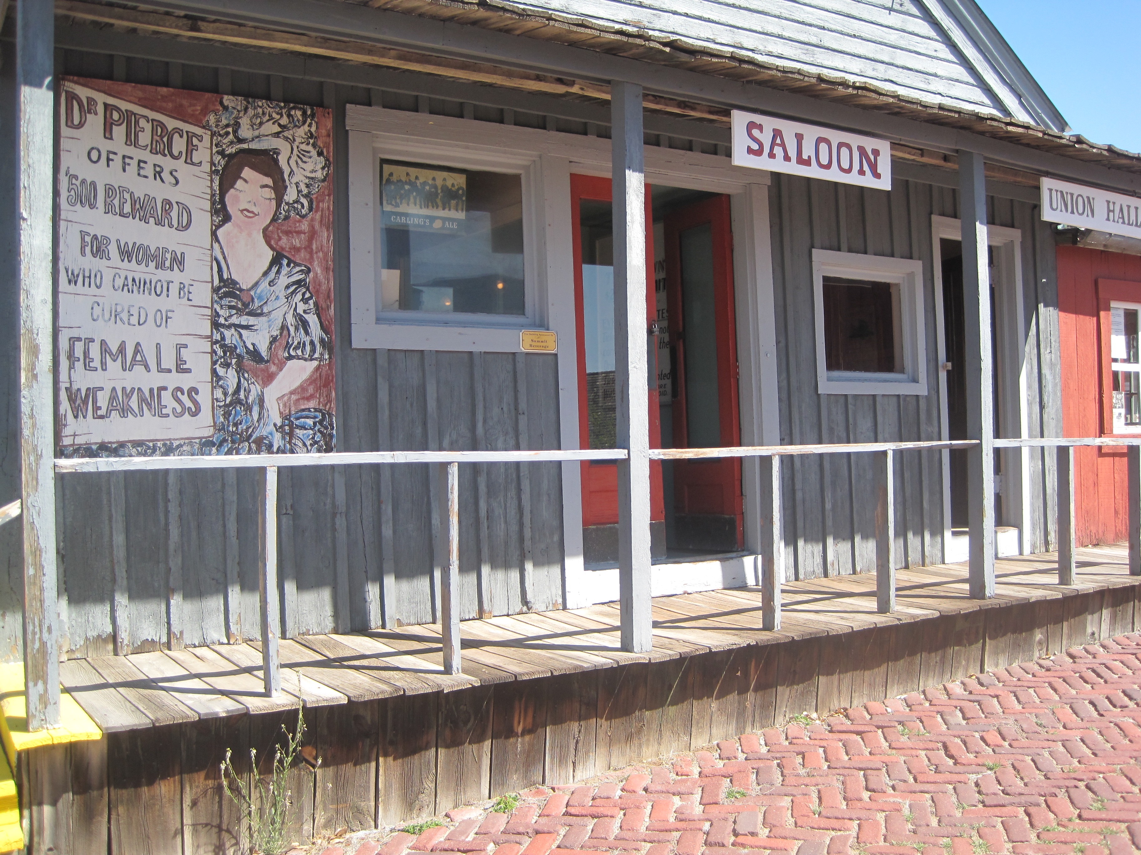
 The Hell Roaring’ Gulch part of the museum is in stark contrast to the mid-20th century engineered, technological landscape of the Orphan Girl Mine. It interprets the mining camp days of Butte from the late 1860s into the 1880s before the corporations stepped in and reshaped the totality of the copper mining industry and built environment of Butte.
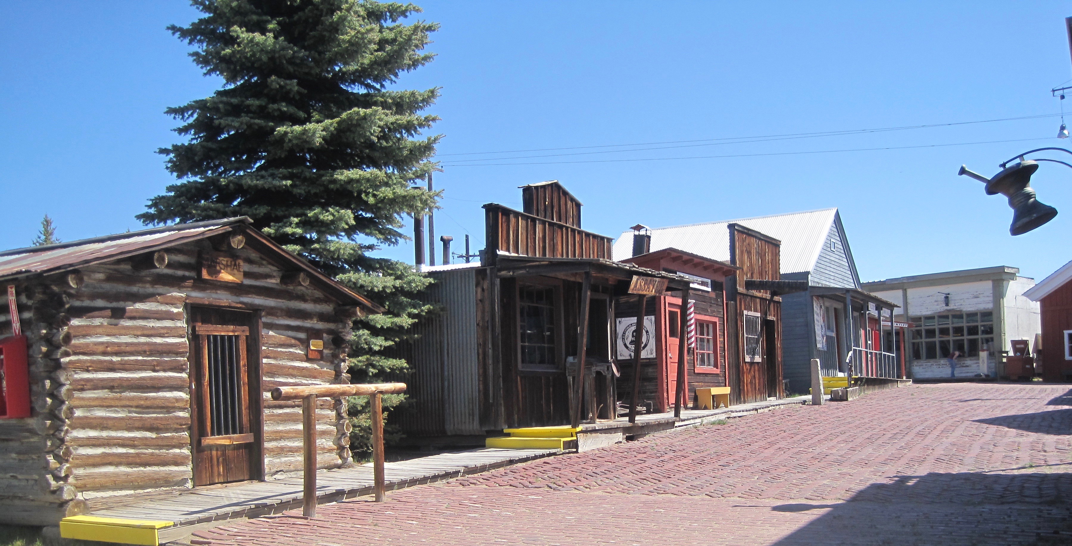


 artifacts and banners shown in this photo); the store, which displays common items sought by the miners and their families; and various offices that show the business of
 mapping the mines, registering claims, and assaying the metals .
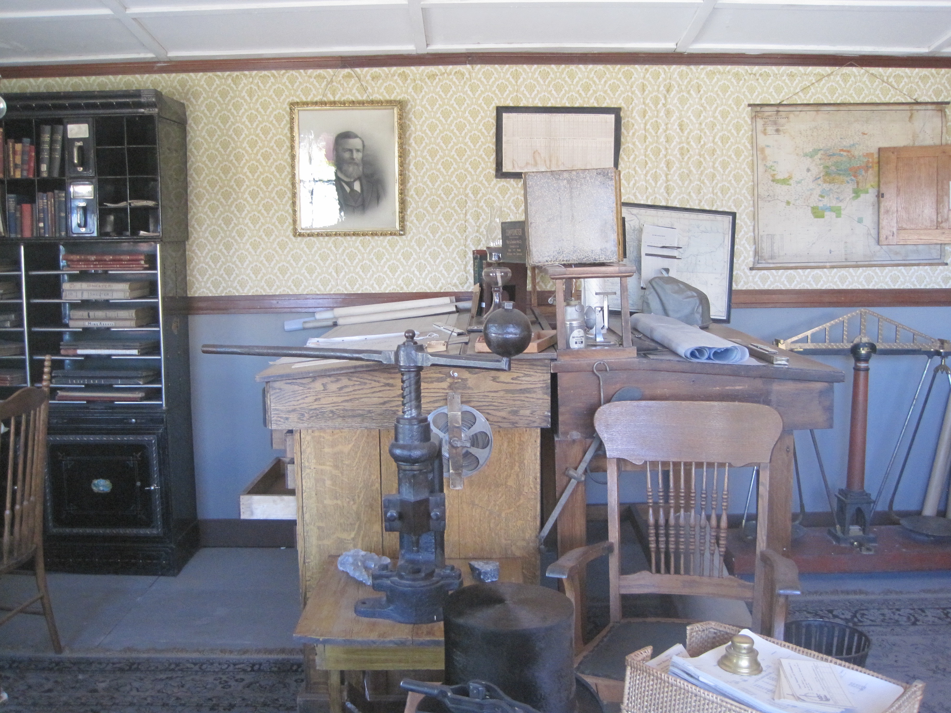 In my first post about the World Museum of Mining, I addressed this valuable collection of a historic mine, several historic buildings, and thousands of historic artifacts briefly. Properties like the impressive log construction of St. Patrick’s Catholic Church, shown below, are invaluable. The World Museum of Mining deserved more attention, and it deserves the attention of any serious heritage tourist to Montana.
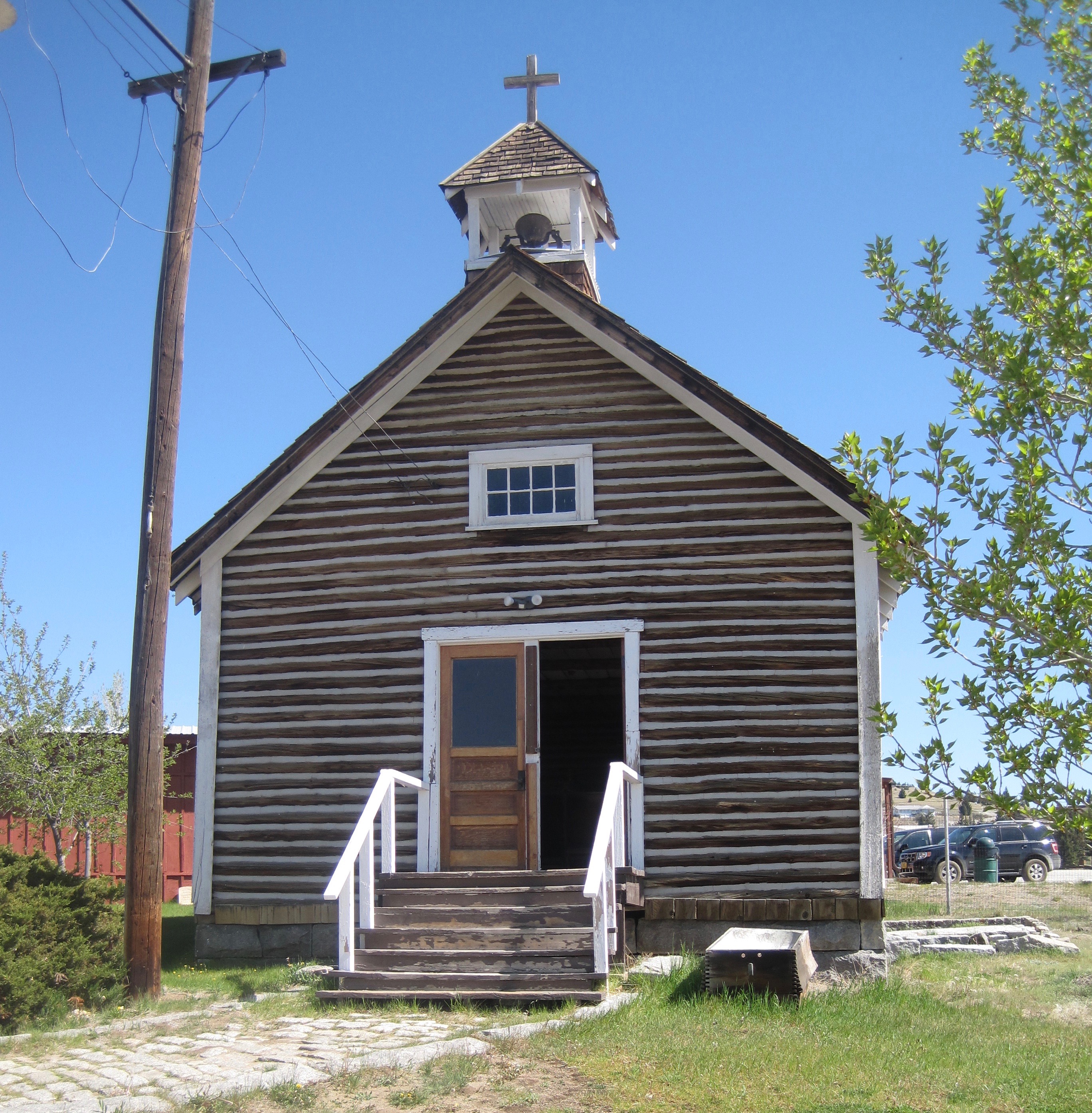
 Montana’s gateways into Yellowstone National Park are known far and wide. The most popular are associated with the trains that delivered mostly easterners to the wonderland of the park–West Yellowstone for the Union Pacific line and Gardiner for the Northern Pacific Railway.
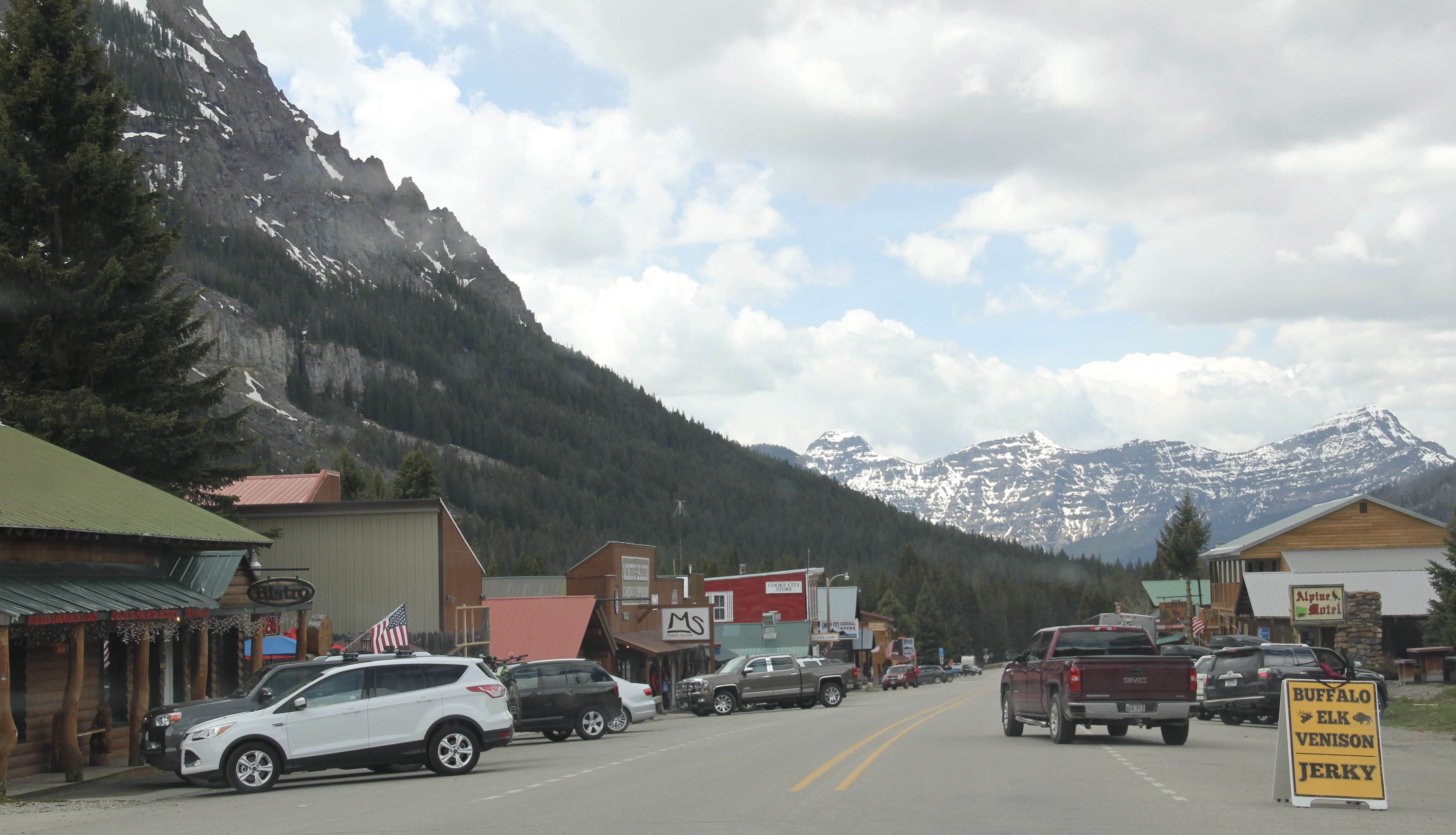 Cooke City, located in the corner of Park County, was never a railroad town but an overland connection that did not become popular until the development of the Beartooth Highway out of Red Lodge in the 1920s.
 It is all about the Beartooth Highway (U.S. 212) here–when it opens, Cooke City booms as a tourism oasis. When the highway closes for its long winter, business doesn’t end since the road to Mammoth Hot Springs far to the west is kept open as best as it can be, but the number of visitors drops remarkably. Snow mobile traffic in the winter has meant a lot to local business in the last 30 years.

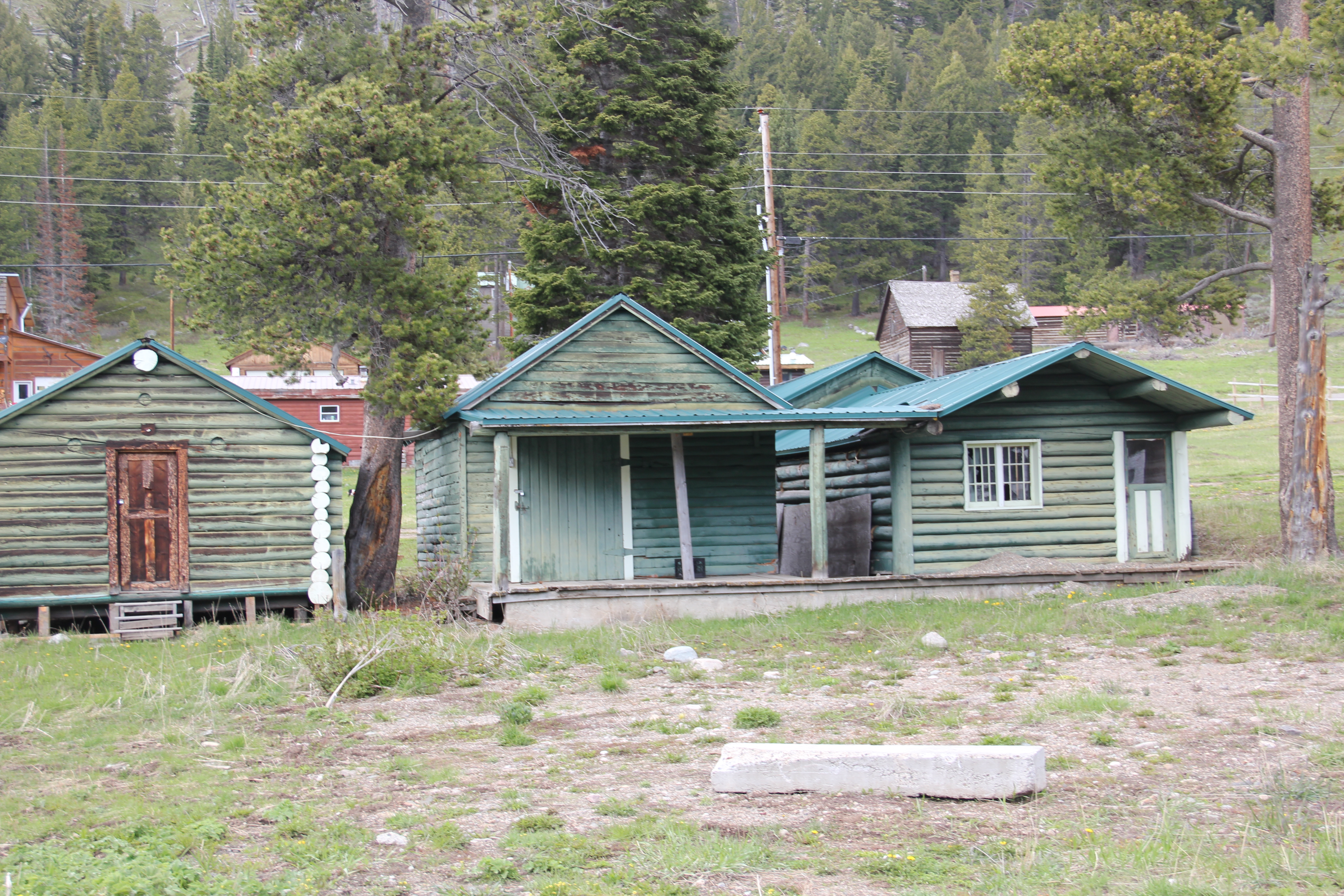 Cooke City uses its mining past to define its identity today, from moving log mining shacks and cabins into town, as shown above, for potential new lures for tourism, to the recently established visitor center and museum, which includes some of the local mining


 Perhaps the best example is the rustic yet modern styling of the Mt Republic Chapel of Peace between Silver Gate and Cooke City on U.S. 212. It is no match for the soaring mountains that surround it but its quiet dignity reflects well the people and environment of this part of Montana.

 The same can be said for Hoosier’s Bar–a favorite haunt here in Cooke City for several decades, easy to find with its neon sign, and then there is the throwback telephone booth–a good idea since many cell phones search for coverage in this area. Cooke City and Silver Gate are the smallest Montana gateways into Yellowstone National Park but they tell and preserve their story well.


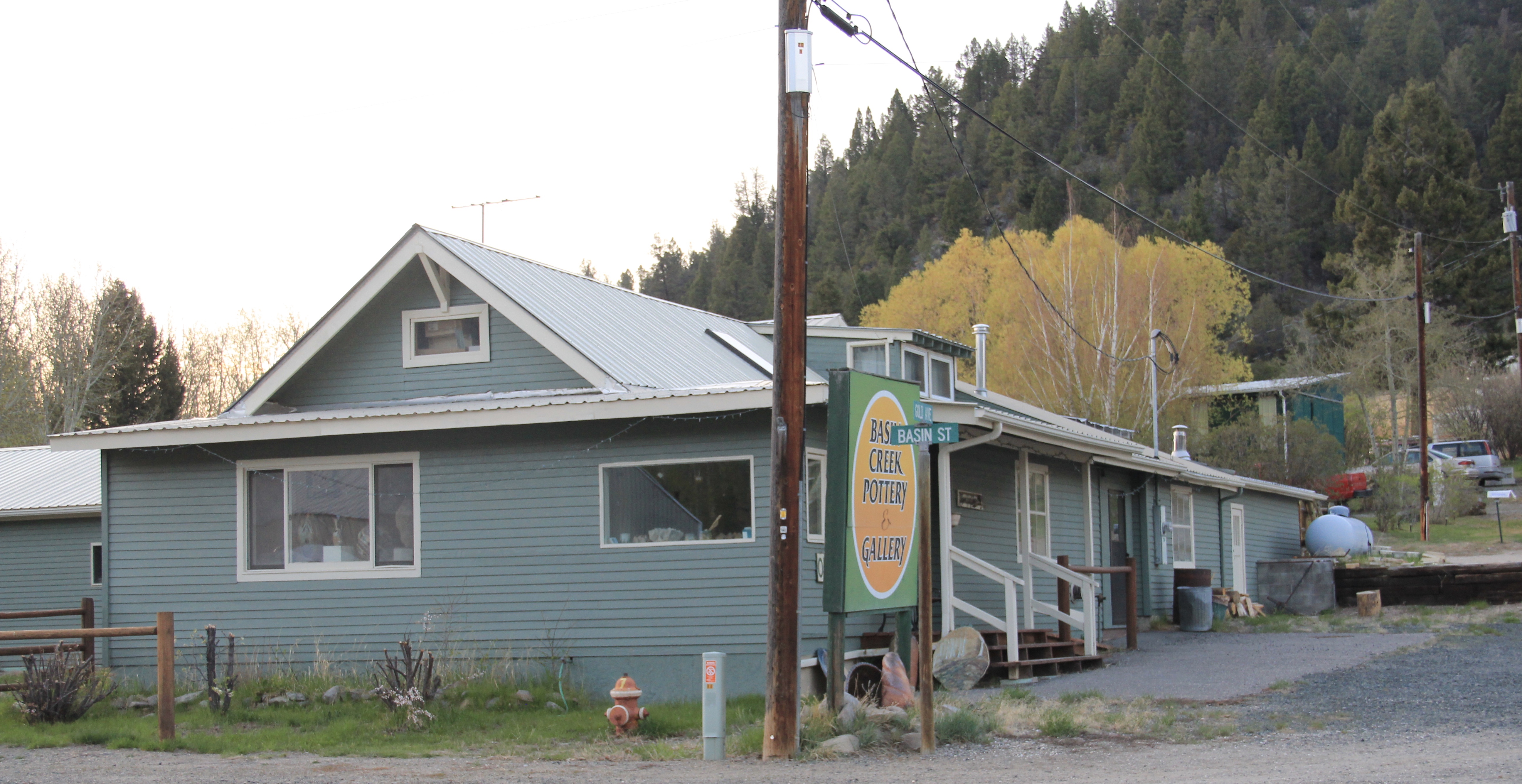
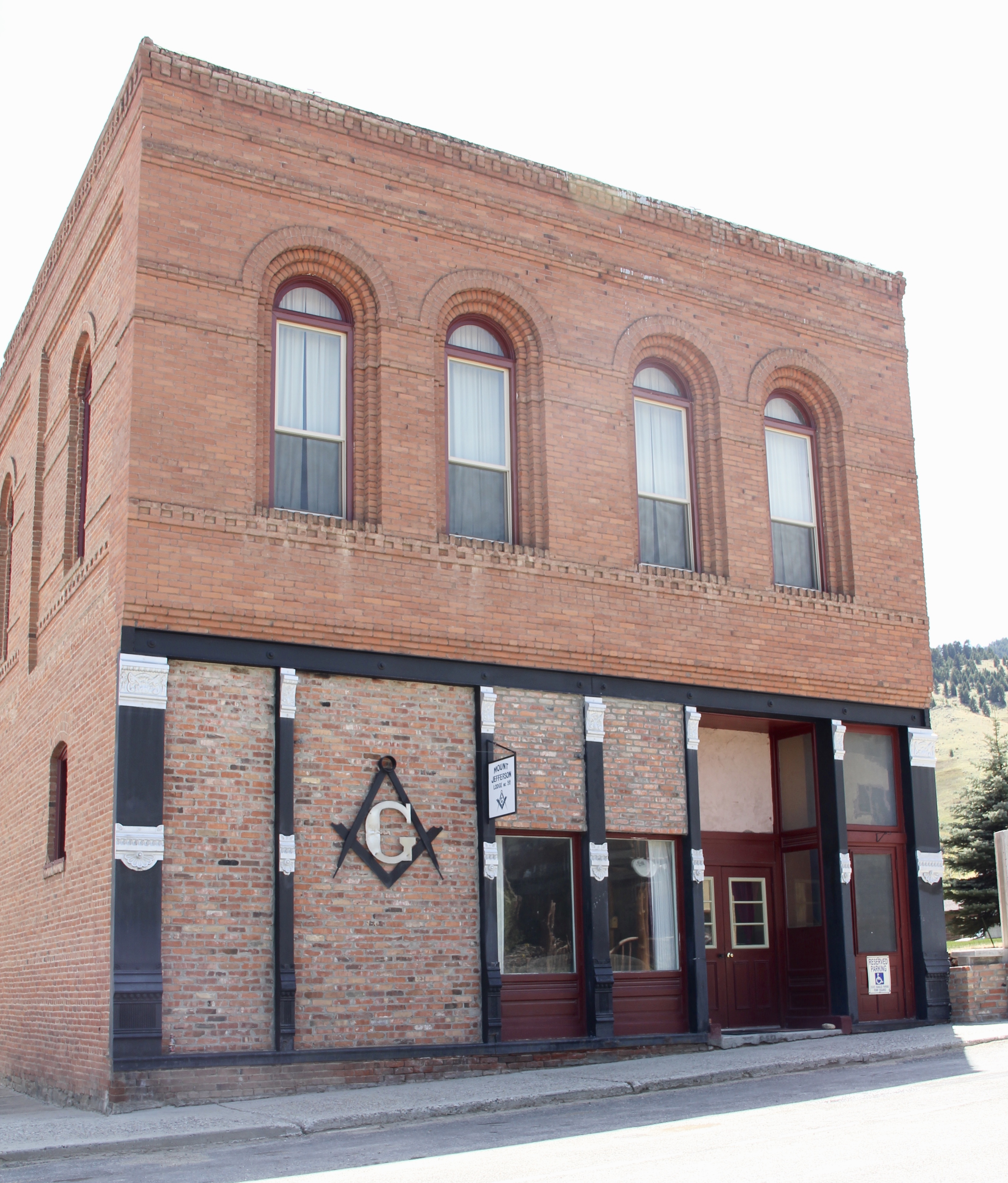
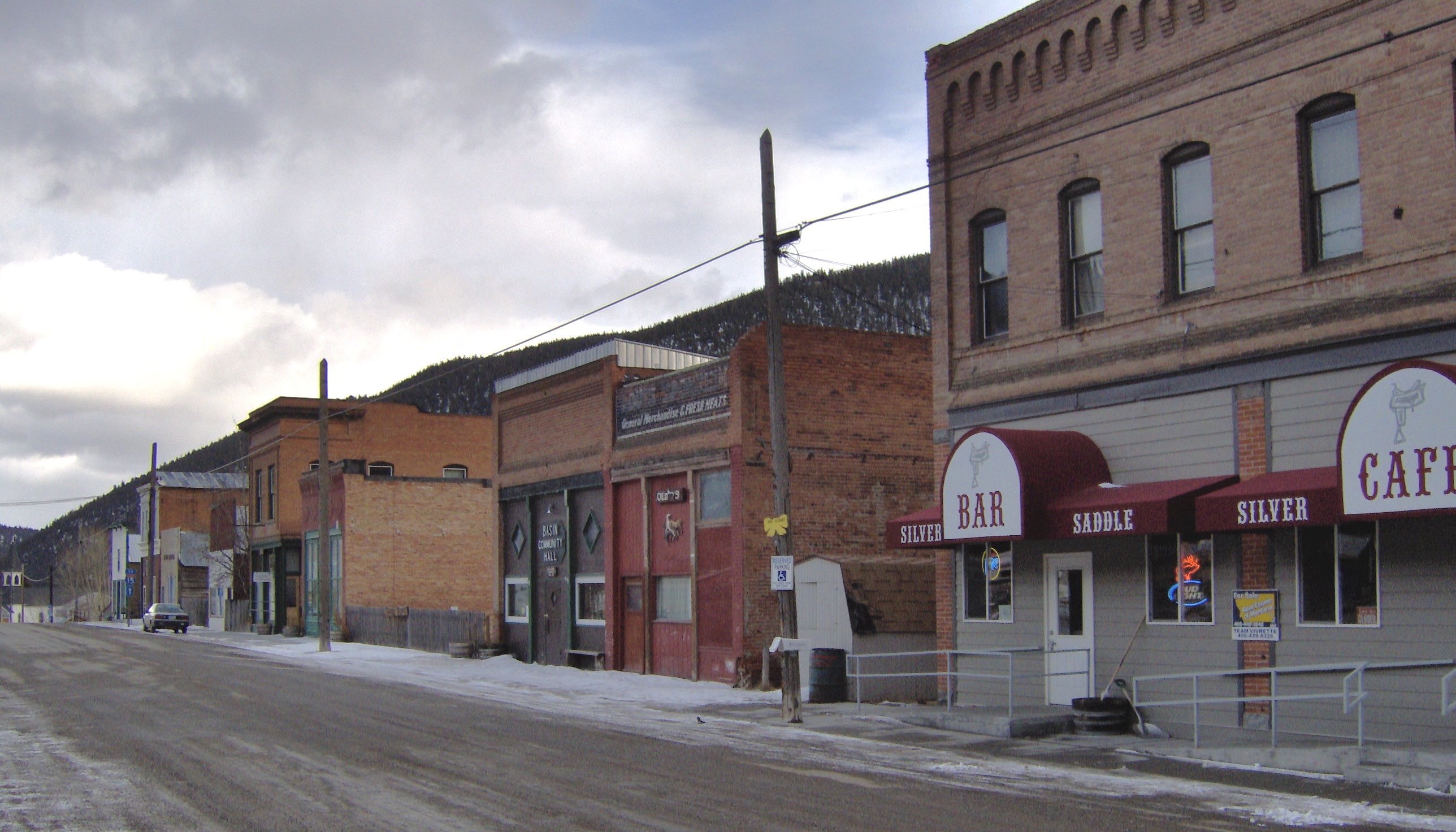 When I carried out the Montana State Historic Preservation Plan field work in 1984-1985 I passed through Basin Street in the heart of “downtown” Basin quite frequently, not because of the Silver Saddle Bar–fine place it is–but because I had no choice if headed
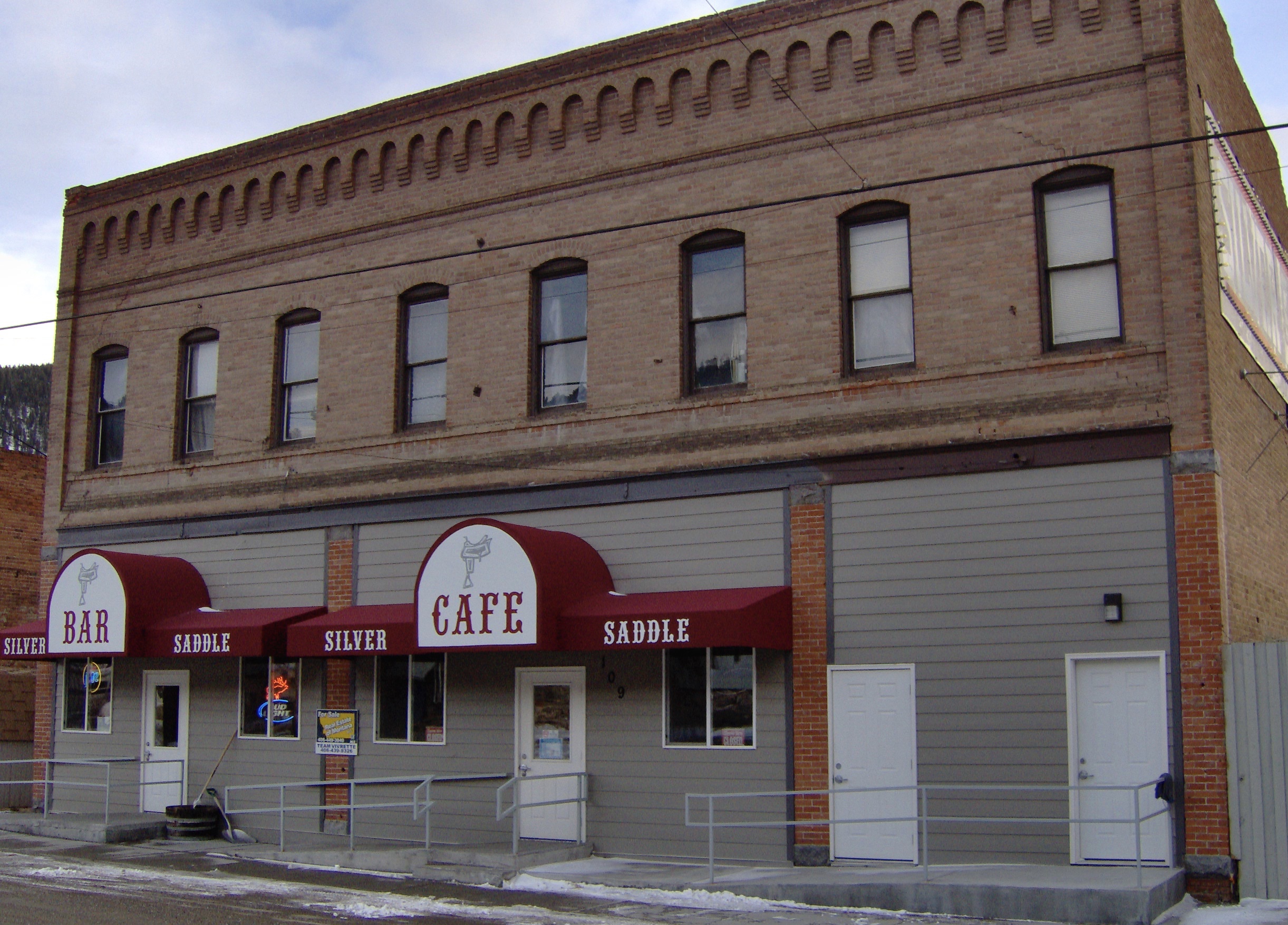
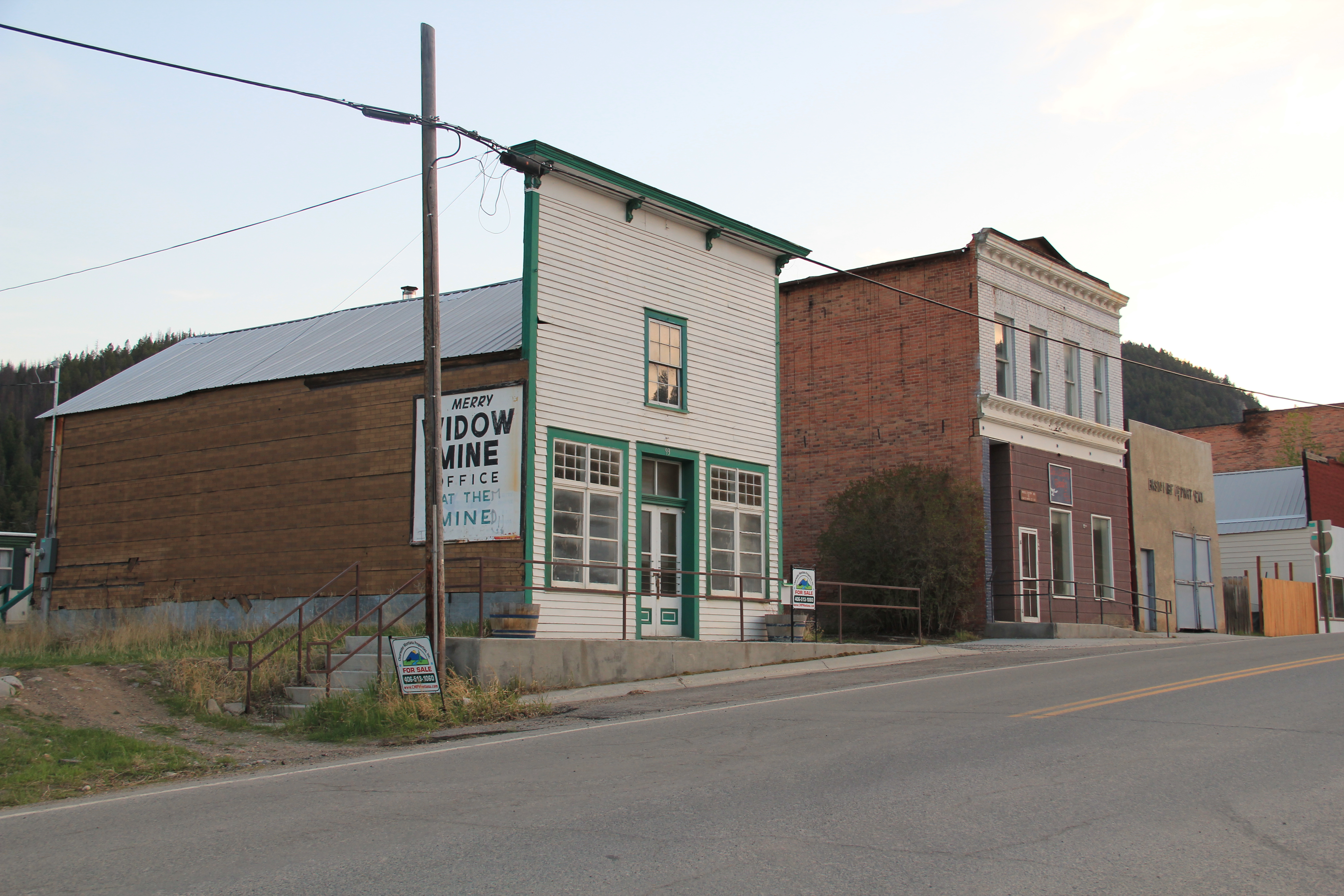 The glory days of Basin had long since passed, although some locals and visitors would go to the Merry Widow Mine for a dose of radon, thinking it could cure their ills (of course radon exposure is actually dangerous). Led by the Butte capitalist Augustus Heinze, the town from the mid-1890s to mid-1920s had been a quite thriving place, served as both the Great Northern and Northern Pacific Railroads with its Basin Street becoming the route for U.S. Highway 91. The numerous two-story brick commercial buildings reflected that era of prominence while a decaying c. 1930 garage on the town’s outskirts documents the impact of the federal highway.
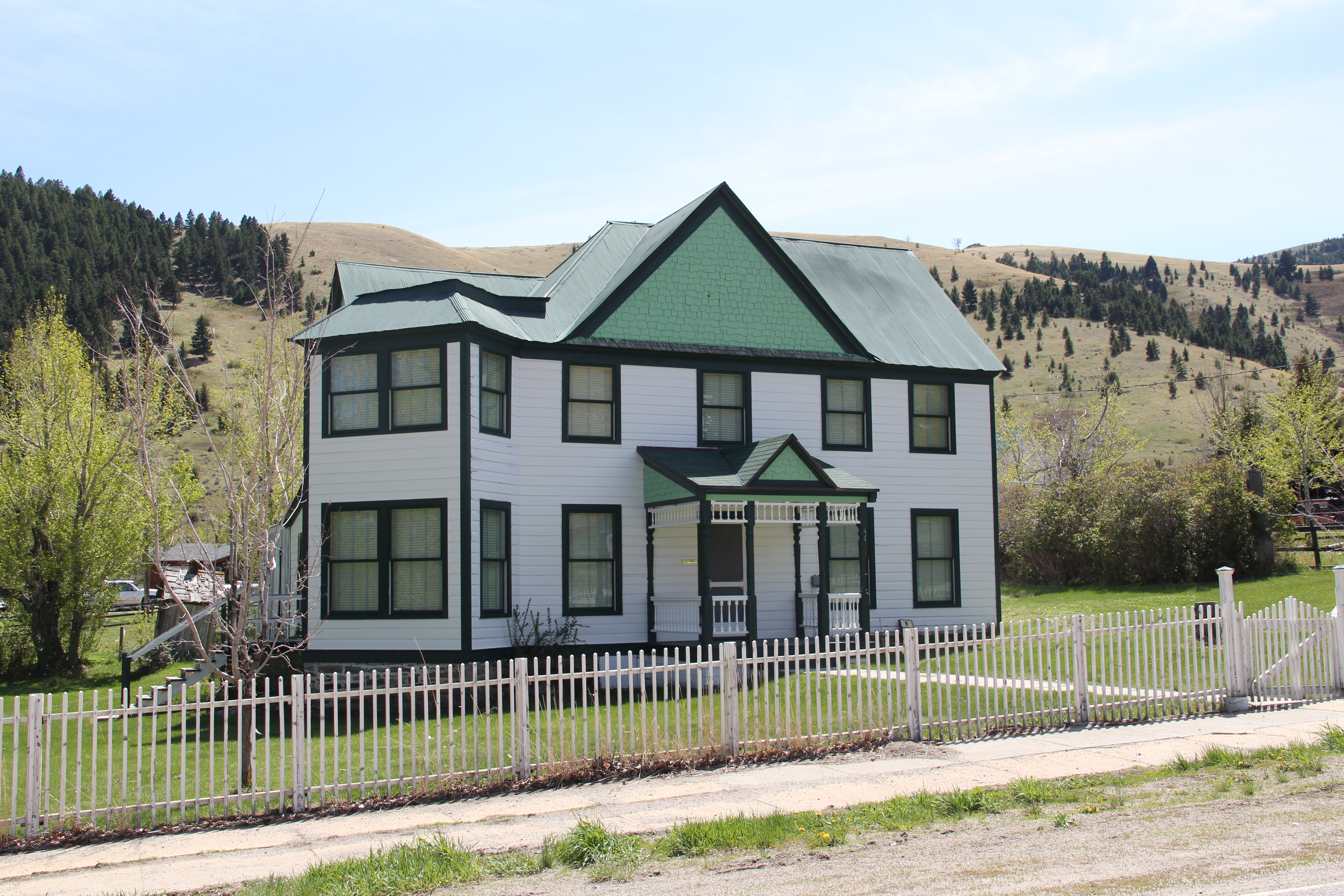
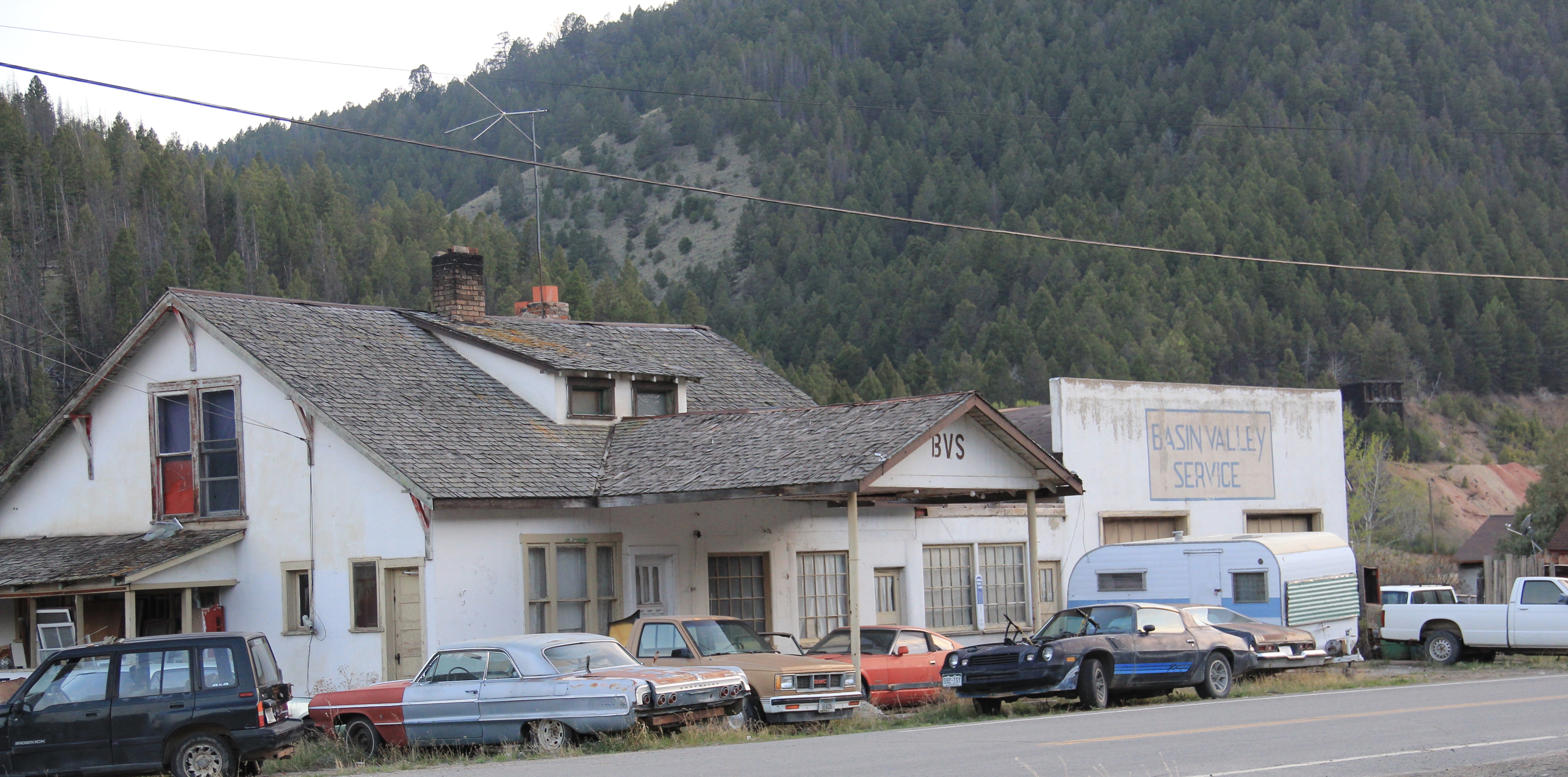 Several key community landmarks remain. The most impressive is the two-story frame Basin School, built in 1895 and still in use as a school today. Here is another great Montana rural school building–the state is so rich in this type of public architecture.
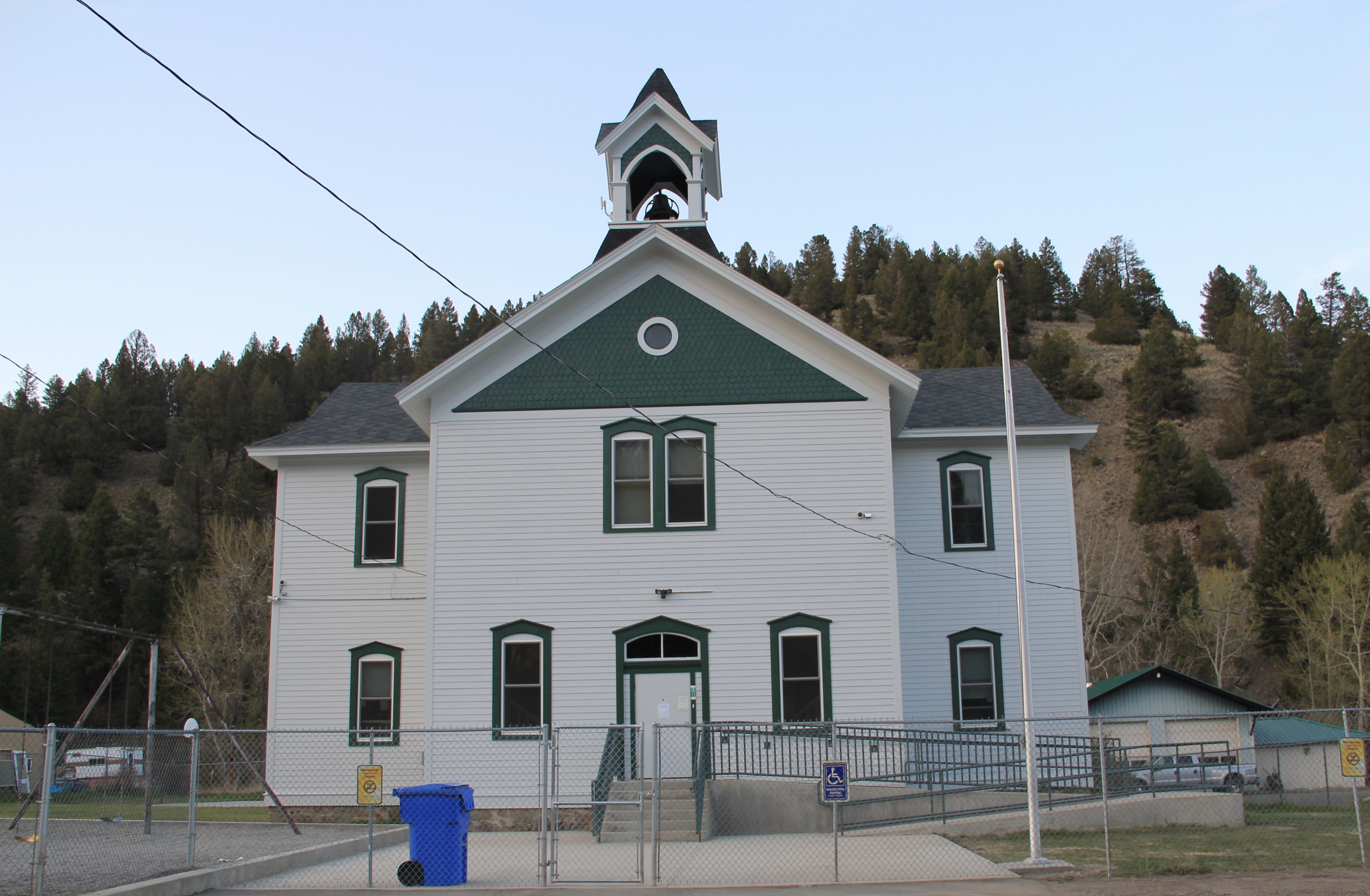 Nearby is the Community Church, another late Victorian-era styled building, with its tall bell tower and distinctive corner entrance.


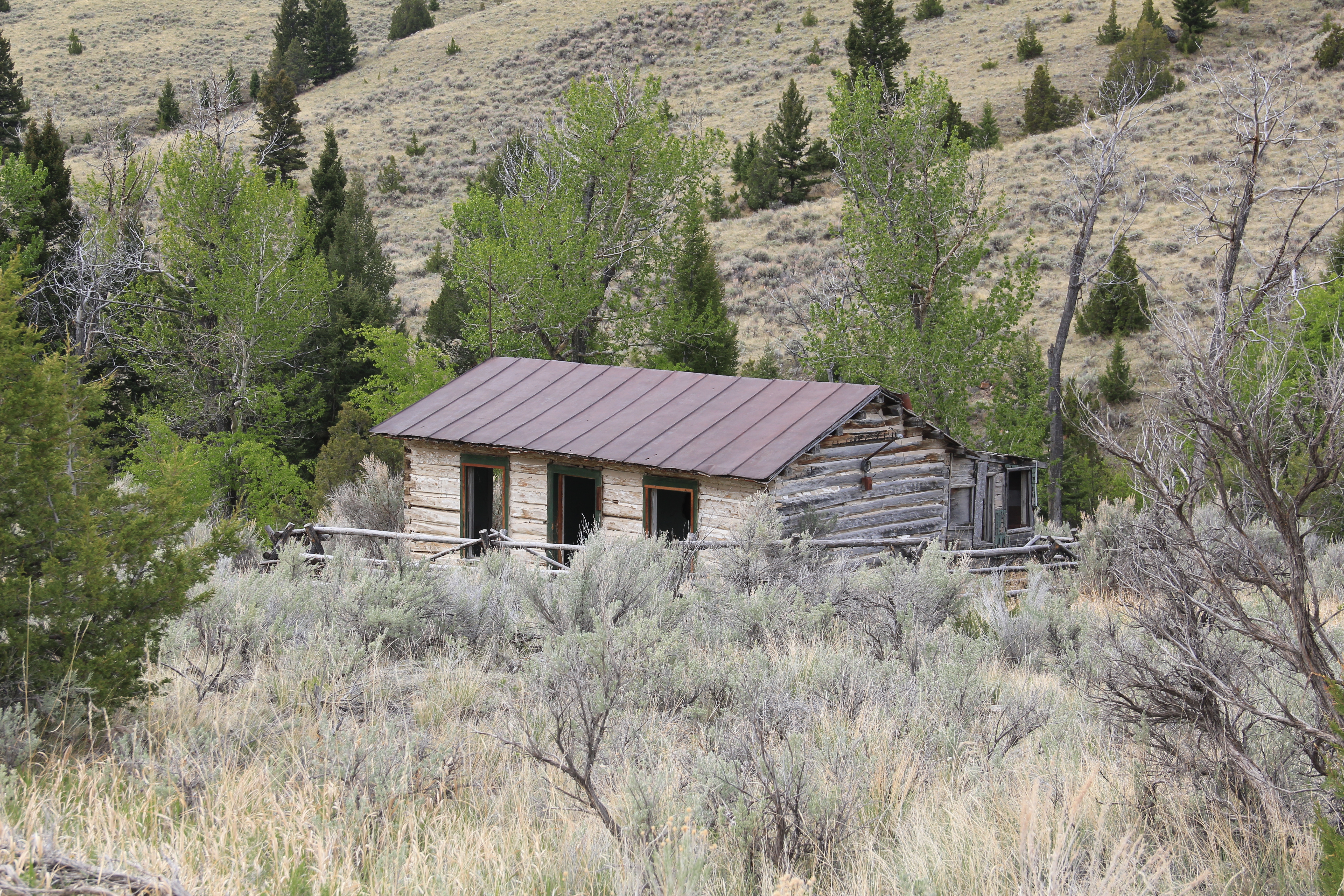
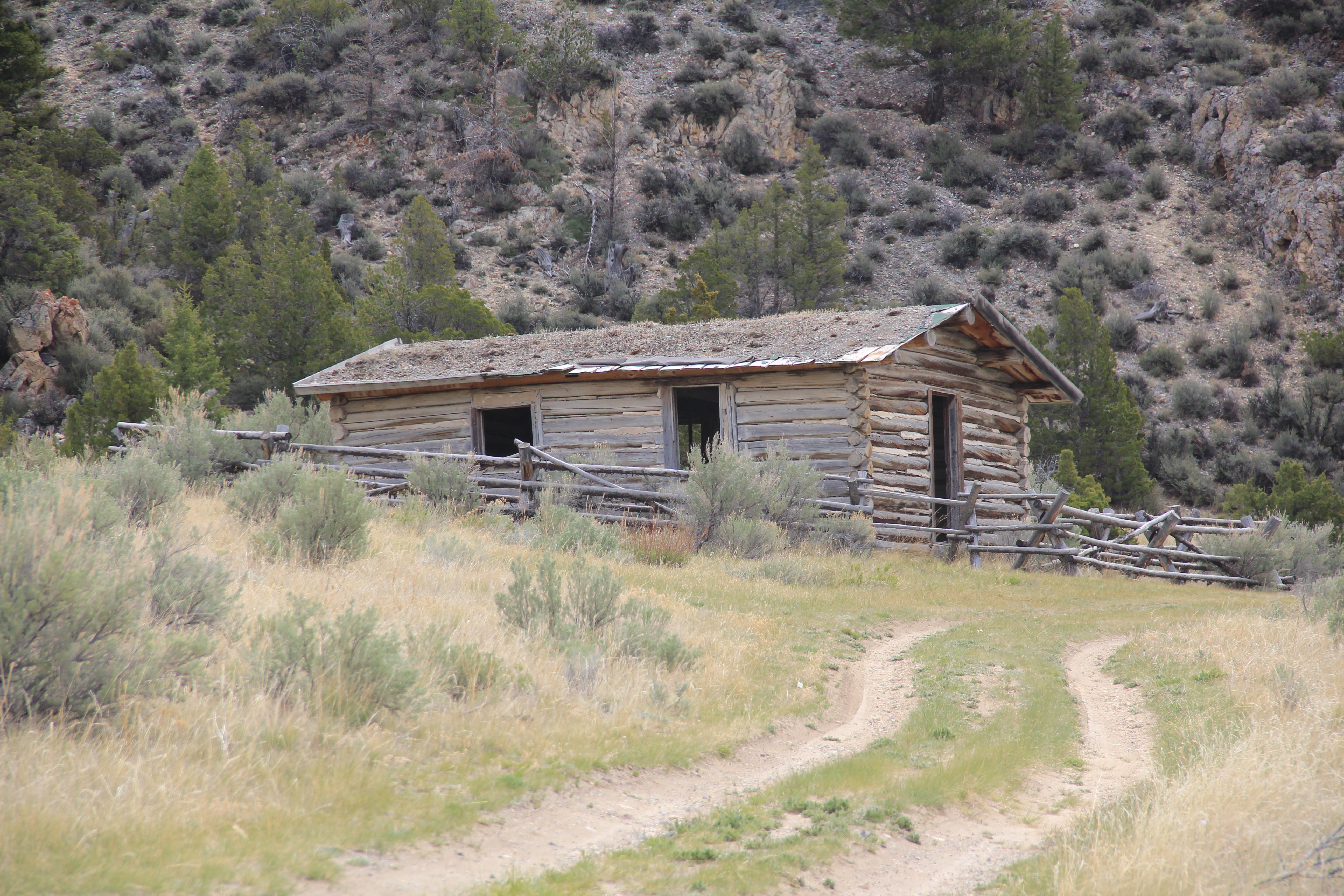

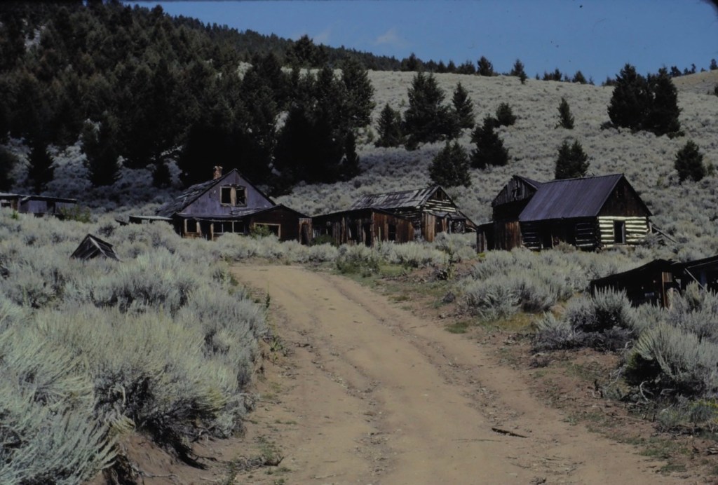
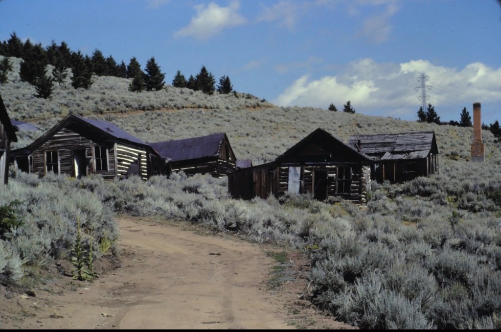
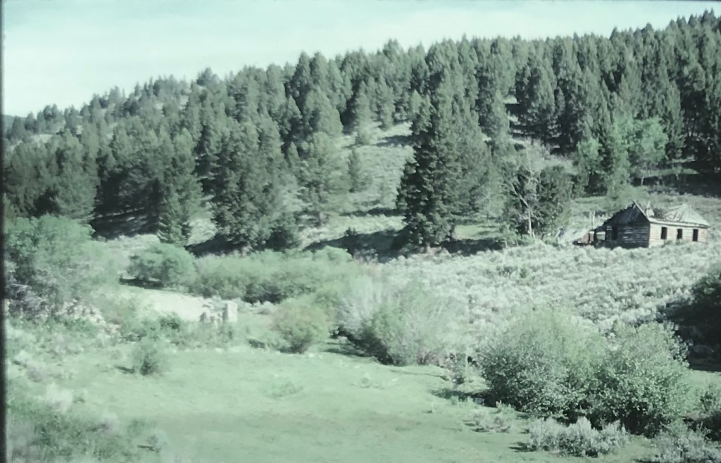
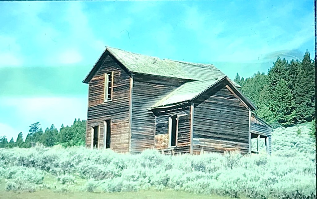
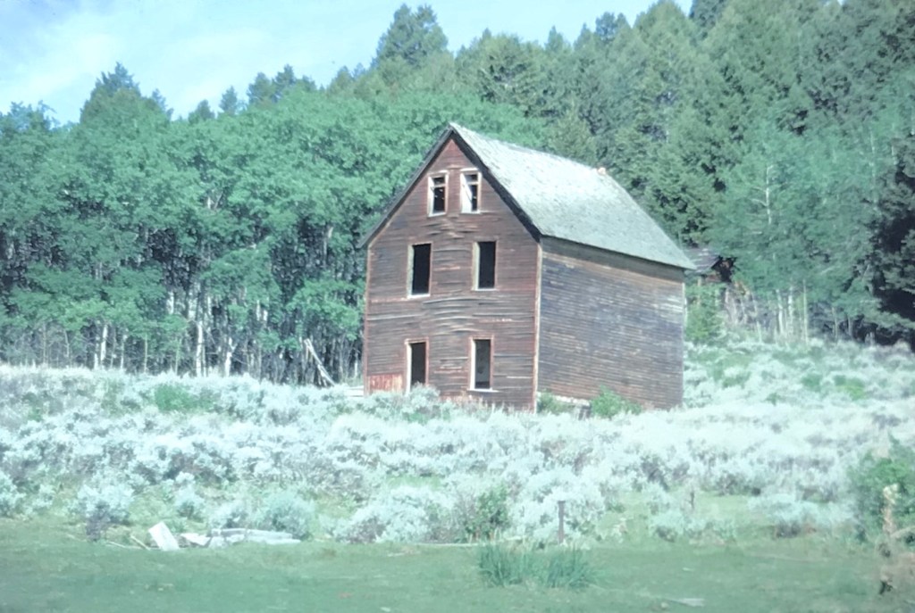
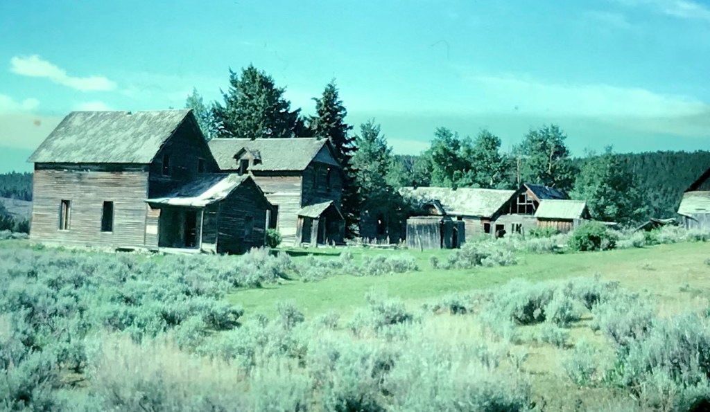
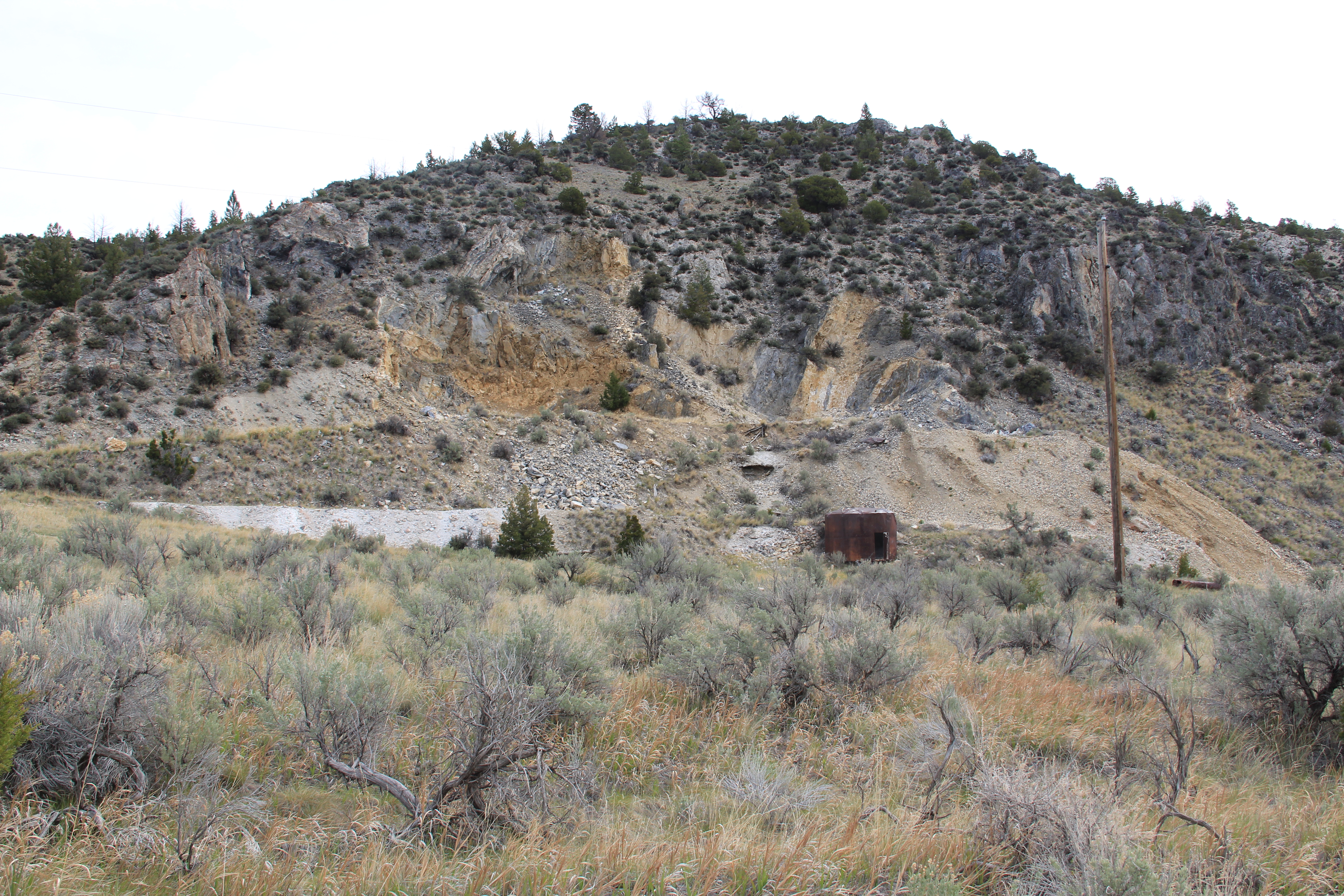 At Farlin, the scars of mining are everywhere, surrounded by sage grass, brush, and scattered trees, trying to recover in what was once a denuded landscape. Operations had ended by the time of the Great Depression. While never a huge place–population estimates top out at 500–Farlin is representative of the smaller mining operations that reshaped the rural western Montana landscape. Not every place became a Butte, or a Virginia City. Properties like Farlin help to tell us of the often lonely and exceedingly difficult search for opportunity in the Treasure State over 100 years ago.
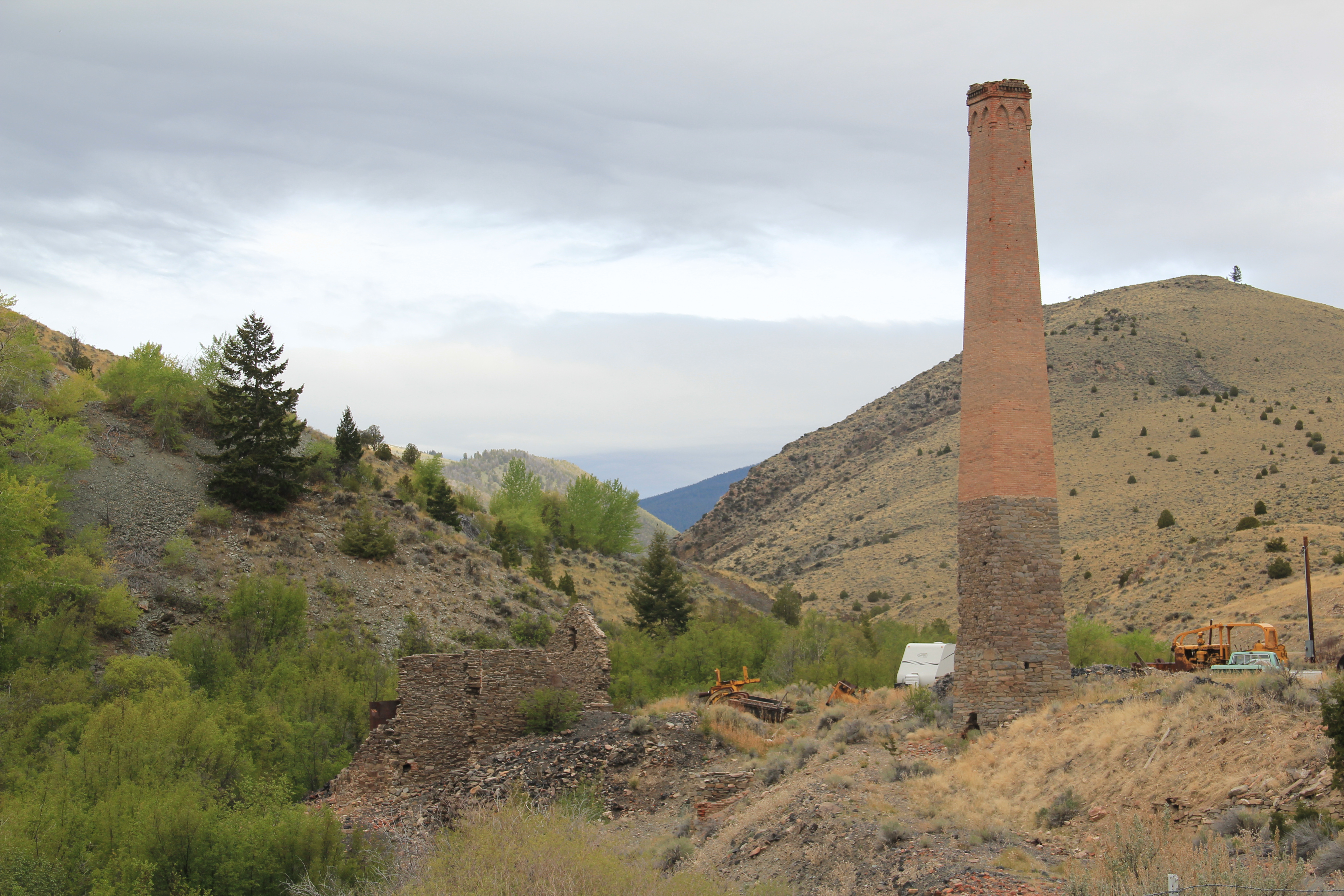 When I returned to Glendale in 2012, I made sure to take a replica shot of the place I had photographed almost 30 years earlier. But I also went father and did my best to document a mining landscape in danger of disappearing in the 21st century. Below is an image when the Hecla smelter was in full production.
 There are some intact buildings at Glendale, but also numerous parts of buildings, facades and foundations that convey how busy the Glendale Road was some 100 years ago.


 Hecla Mining Company operated 28 kilns at a site a few miles away. Within the Beaverhead-Deer Lodge National Forest, the Canyon Creek Kilns are a remarkable property, preserved and now interpreted through the efforts of the U.S. Forest Service. The Forest Service should be commended for this effort. As the images below suggest, this property is one of the best places in Montana to stop and think of the mining landscape of the turn of the twentieth century and imagine what a moonscape it would have been 100 years ago when the kilns consumed all of the surrounding timber.


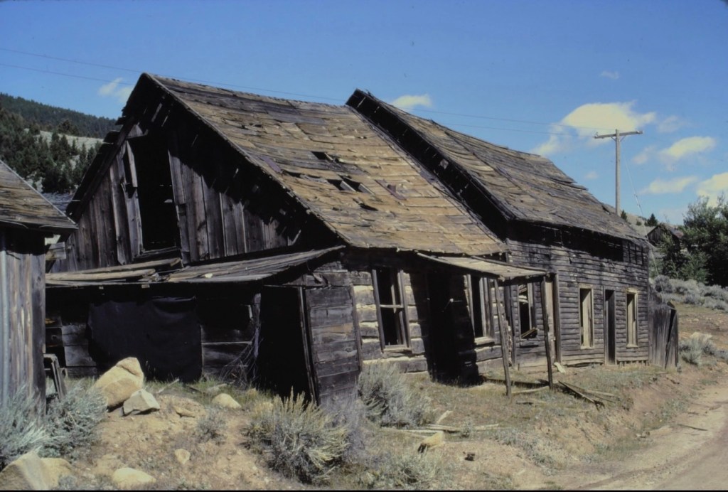
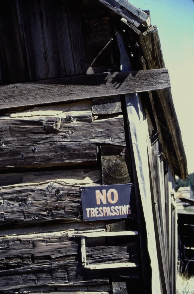
 Pony, as a gateway into the Tobacco Root Mountains, may be categorized as a ghost town in much of today’s literature about Montana, but it certainly has a lot of real people hanging around to be a ghost town. Established during the gold rush decade of the 1860s, mines here stayed in operation until World War II, and consequently, a wide range of historic buildings remain in the town today.


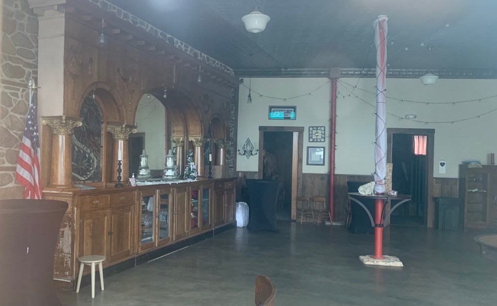
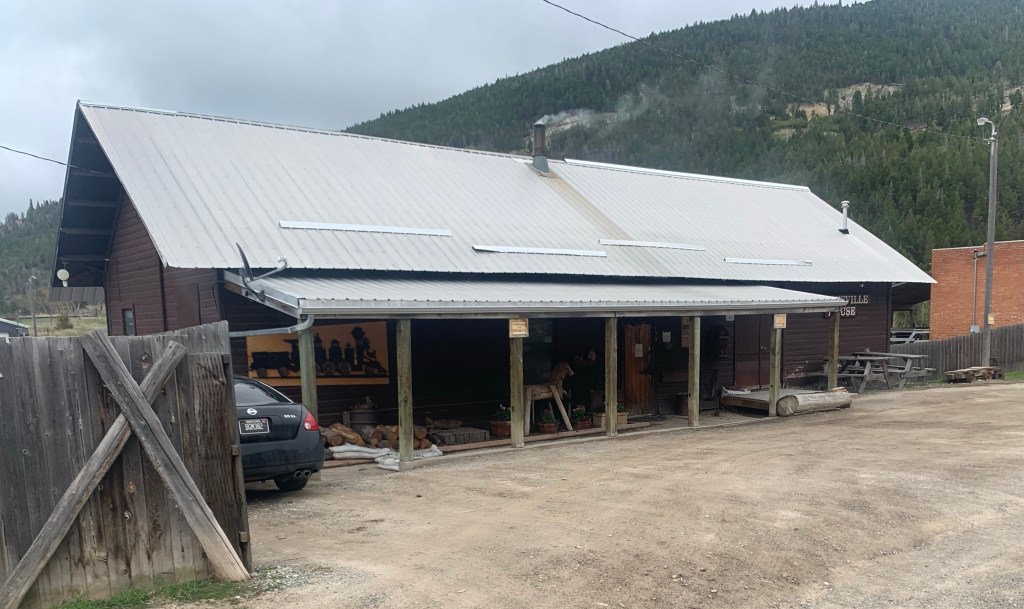
 Yes, Pony has a park, another of positive developments since my work in 1984-1985. The park is not only community space, but it also has various artifacts and machinery from the mining era, along with public interpretation of the district’s history and of the artifacts within the park.


