Riverside Cemetery, Fort Benton

Riverside Cemetery dates to 1883, a time of considerable change and expansion in Fort Benton’s history. Just 2 years earlier, summer 1881, the U.S. Army left the fort, and it began a rapid decline. In the following winter of 1881-1882 the town began a building boom that led to the construction of the Grand Union Hotel by the end of 1882.

Grand Union Hotel

Freight traffic on the Missouri River also boomed and the River Press, the city’s leading newspaper for the next 100 plus years, published its first edition. 1882 also witnessed the city’s first electric lights and the construction of many new residences. And by the year resident had formed the Riverside Cemetery Association.

Gate to Riverside Cemetery

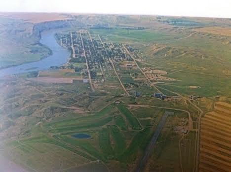
The loss of the Chouteau County Courthouse to fire in early 1883 didn’t seem to slow momentum at all. That spring voters incorporated Fort Benton—what had been a trading and military town was now a formally established town. Soon thereafter Riverside Cemetery was established on the Missouri River bluffs northeast of town.

The new town cemetery had approximately 40 fenced acres and was ready for use by Decoration Day (now known as Memorial Day) in 1883. The cemetery also had reinterred graves from earlier in-town cemeteries at approximately the location of First Christian Church and behind Haas and Associates and Farmers Union Oil Company.

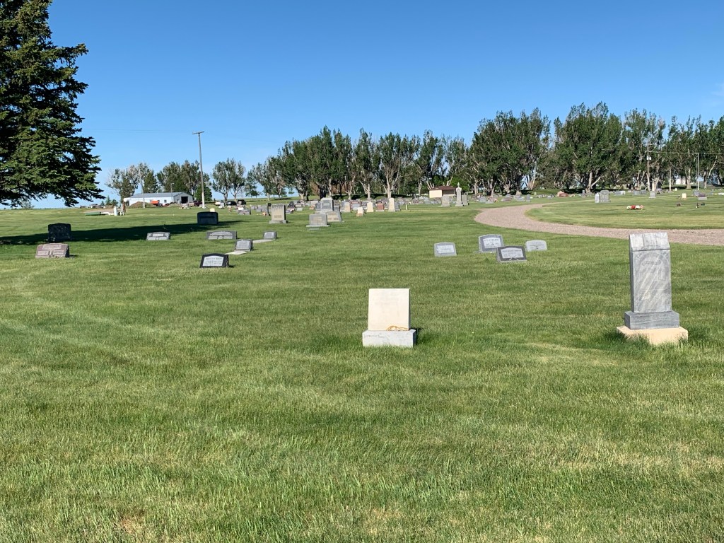
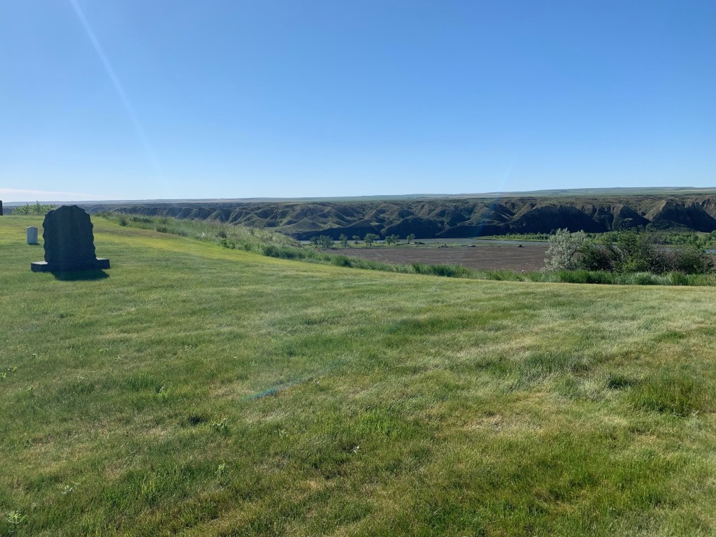
Today the gap between the initial cemetery and burials in the 20th century is noticeable. The early burials are on the east side while the modern section is on the east side clustered near a row of trees m. Clearly early tombstones have been lost—the number of grave depressions indicate that there are many additional burials that lack a grave marker.

East side of cemetery
Central section with the west section in the background among the trees. In general the west section dates to mid 20th century and later

The remaining grave markers from the late 19th century tell powerful stories. The Charles Fish (d. 1890) obelisk with urn marker below honored a Canadian native who served as a drummer boy with the 38th Wisconsin Infantry in the Civil War; he was only 15 years old when he joined.

The Patterson family section is one of the cemetery’s oldest, with the earliest tombstone dating to 1886.

Tombstones with cross themes mark the graves of Jane Jackson (d. 1885) and Edward Kelly (d. 1890).

This image of the Jackson tombstone is another visual example of the number of empty spaces in the east side of the cemetery. Existing depressions indicate that many burials without grave markers are in the section.

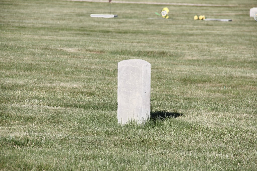
In 1891 the cemetery received its first U.S. military veterans markers. The one below was for Patrik (the spelling used on the tombstone) Fallon, a Civil War veteran. By now Fort Benton had grown to the point that its Decoration Day ceremony involved hundreds, led by the cemetery association, camps of the Grand Army of the Republic and soldiers from Fort Assiniboine.

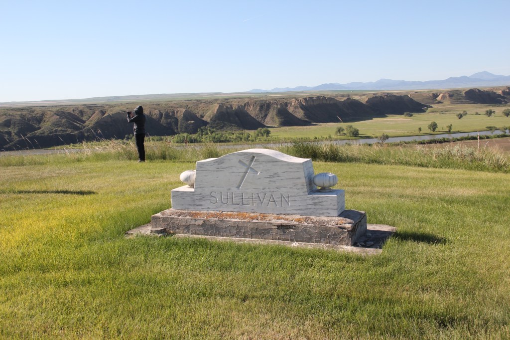
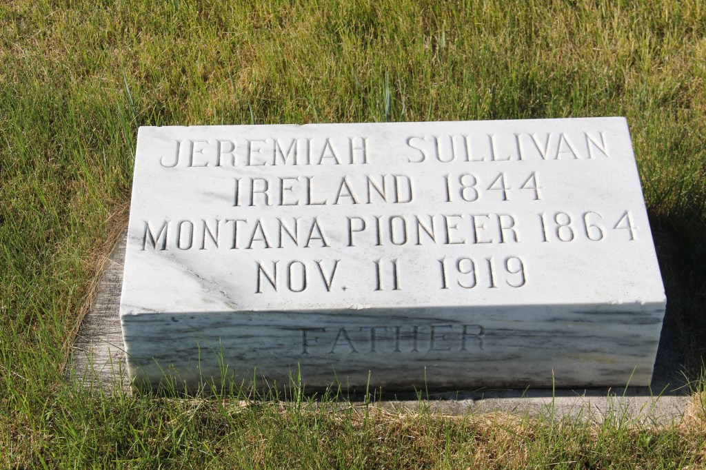
While the graves of many pioneers are unmarked, the Sullivan family located its graves near the edge of the bluff, truly an awe-inspiring setting overlooking the town, river, and railroad tracks.

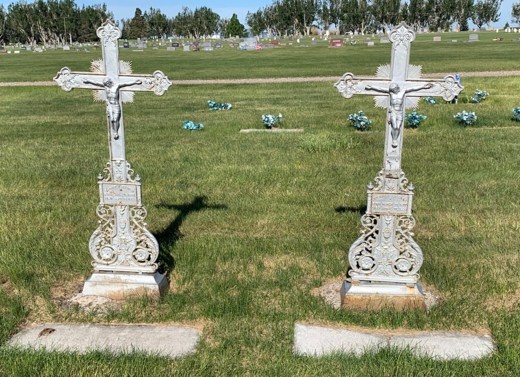
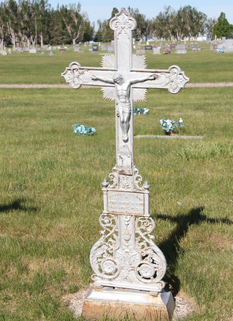
Impressive tombstone art is scattered throughout the cemetery. The unique yet beautiful pressed metal crosses for brothers Julius (d. 1923) and Henry (d. 1924) Bogner belong, stylistically to the Victorian era, but were commissioned and installed in the Jazz Age.

Julius and Henry Bogner
The Winfred and Margaret Stocking marker (c. 1910-12) is unusual in that a sizable base supports a triangular rock Boulder. Margaret Stocking upon her death in 1812 was identified as the first white woman to settle in Fort Benton in 1865.
The marker for Bessie Bright (d. 1917) has an open Bible motif, typically found in tombstones of the 19th century

Riverside Cemetery has an impressive veterans section, known as the Military Plot. Veterans from the Spanish American War of the 1890s to the conflicts of the 21st century are buried here.

The majestic flag pole was added in 2916.

An end of the century trip to Central Montana

The vast majority of my effort to document and think about the historic landscapes of Montana lie with two time periods, 1984-85 and 2012-16. But in between those two focused periods, other projects at the Western Heritage Center in Billings brought me back to the Big Sky Country. Almost always I found a way to carve out a couple of additional days to get away from the museum and study the many layers of history, and change, in the landscape by taking black and white images as I had in 1984-85. One such trip came in 1999, at the end of the 20th century.

In Billings itself I marveled at the changes that historic preservation was bringing to the Minnesota Avenue district. The creation of an “Internet cafe” (remember those?) in the McCormick Block was a guaranteed stop.

But my real goal was to jet up highways 191 and 80 to end up in Fort Benton. Along the way I had to stop at Moore, one of my favorite Central Montana railroad towns, and home to a evocative set of grain elevators.

Then a stop for lunch at the Geraldine bar and the recently restored Geraldine depot, along a historic spur of the Milwaukee Road. I have always loved a stop in this plains country town and this day was especially memorable as residents showed off what they had accomplished in the restoration. Another historic preservation plus!

Then it was Fort Benton, a National jewel seemingly only appreciated by locals, who faced an often overwhelming task for preserving and finding sustainable new uses for the riverfront buildings.

It was exciting to see the recent goal that the community eagerly discussed in 1984–rebuilding the historic fort.

A new era for public interpretation of the northern fur trade would soon open in the new century: what a change from 1984.

I beat a quick retreat back to the south, following the old Manitoba Road route along the Missouri and US Highway 87 and back via highway 89 to the Yellowstone Valley. I had to pay a quick tribute to Big Timber, and grab a brew at the Big Timber

Bar. The long Main Street in Big Timber was obviously changing–new residents and new businesses. Little did I know how much change would come in the new century.

One last detour came on the drive to see if the absolutely spectacular stone craftsmanship of the Absarokee school remained in place–it did, and still does.

My work in Tennessee had really focused in the late 1990s on historic schools: few matched the distinctive design of Absarokee. I had to see it again.

Like most trips in the 1990s to Billings I ended up in Laurel–I always felt this railroad town had a bigger part in the history of Yellowstone County than

generally accepted. The photos I took in 1999 are now striking– had any place in the valley changed more than Laurel in the 21st century?

Fort Benton and the National Stage

img_8791

In February 1984 one of my first assignments on the grand field study of Montana known as the state historic preservation plan survey was to check on the progress of the restoration and reopening of the Grand Union Hotel in Fort Benton.

Chouteau Co Ft Benton Grand Union Hotel 4

Chouteau Co Ft Benton Grand Union Hotel 1
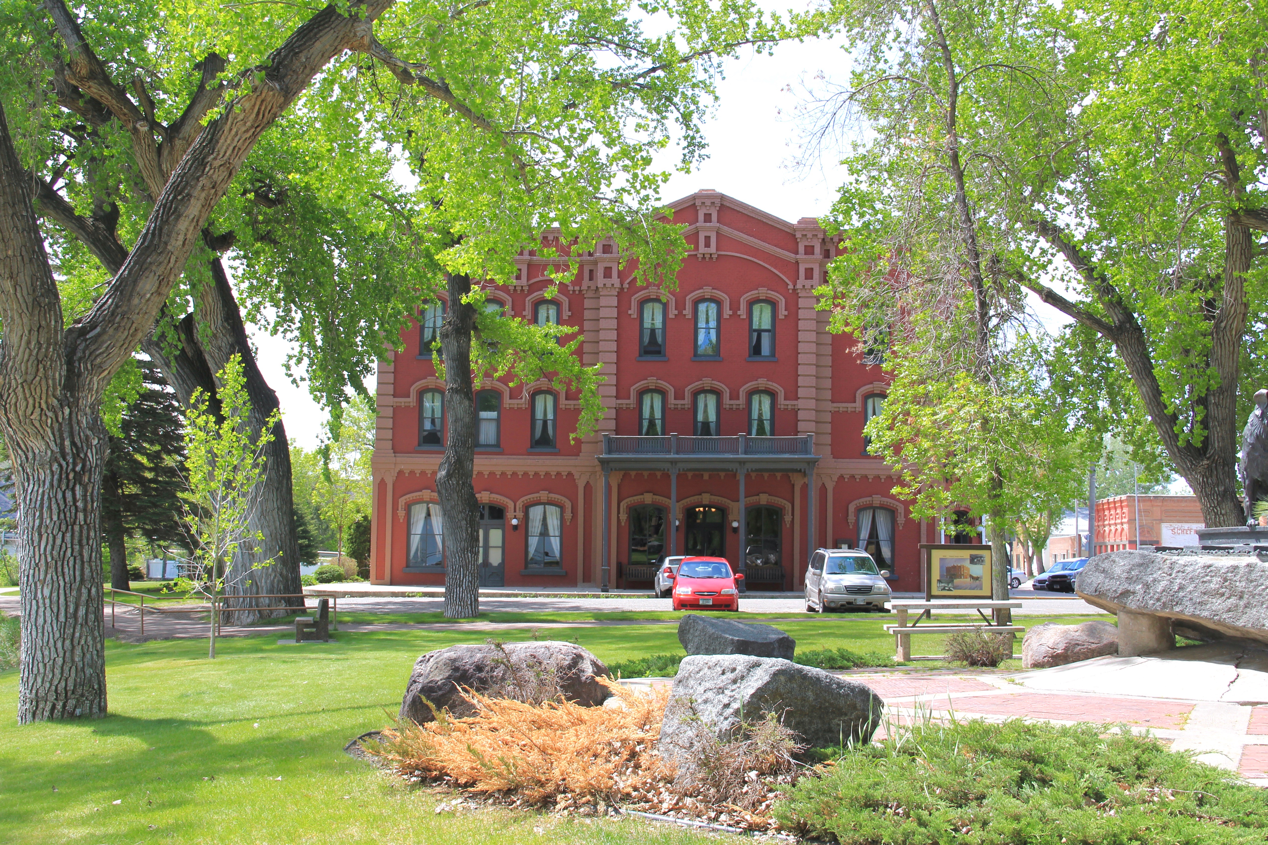
The work was still underway then, but the result after 30 years of local investment and engagement, assisted mightily by the state historic preservation office and other state groups, is impressive.  The Grand Union is a riverfront anchor on one of the nation’s most important river towns in all of U.S. history.

Chouteau Co Ft Benton Old Bridge 9
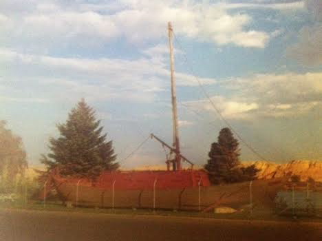
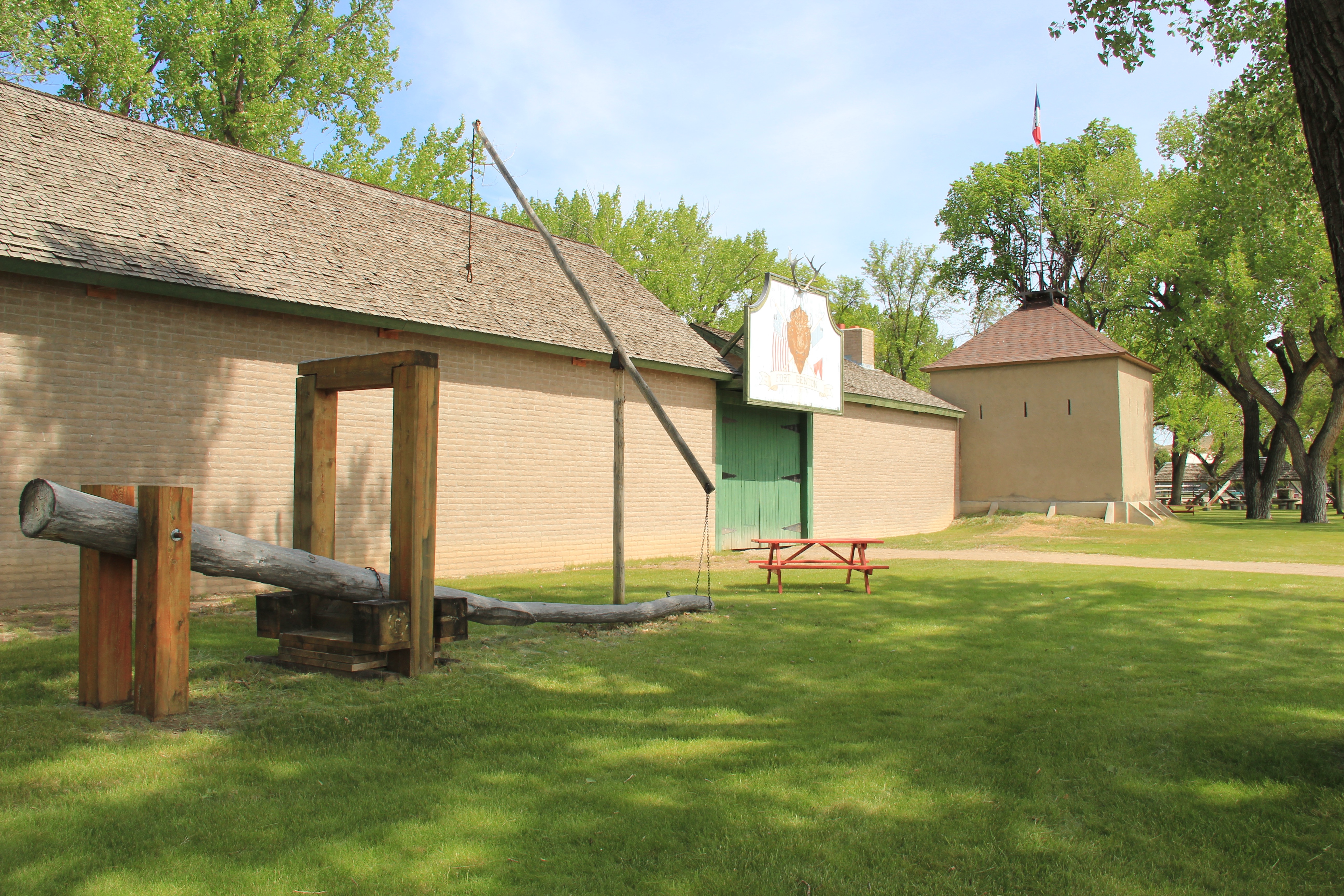
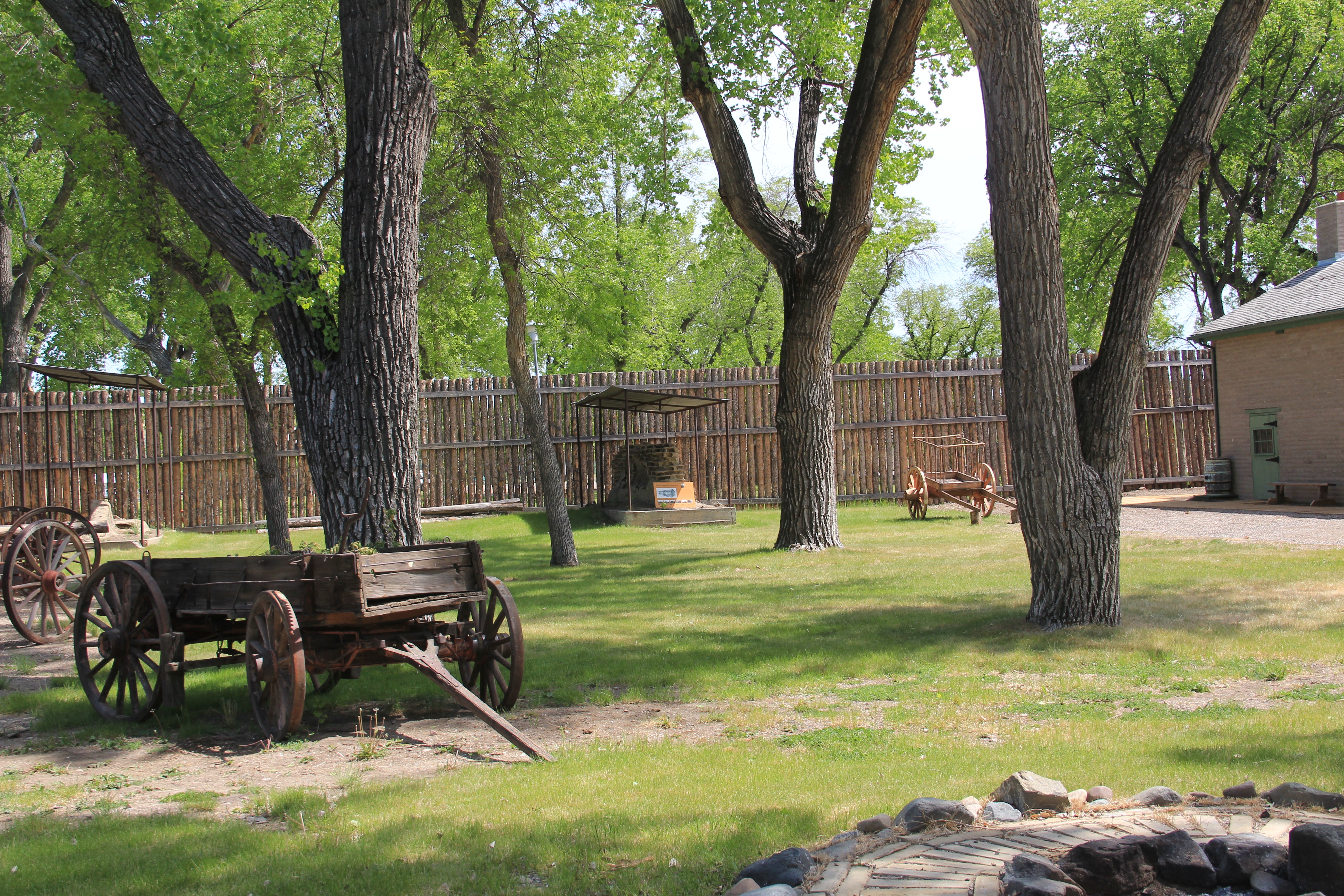
The success of the Grand Union is mirrored in another property I visited in my 1984 day and a half in Fort Benton:  the reconstructed Fort Benton.  There were bits of the adobe blockhouse and walls still standing in 1984, as they had for decades as shown in the old postcard below.

Unknown

What the locally administered Museum of the Upper Missouri managed to do was to protect a vitally important site of national significance, and then through its own museum exhibits, try to convey the significance of the place to those who happened to discover it.

Chouteau Co Ft Benton Front St museum

In the past 30 years, the museum and its supporters managed to continue protecting the archaeological remnants of the fort but also to rebuild the fort to its mid-19th century appearance.  This reconstruction is no small feat, and naturally requires staffing, commitment, and monies to keep the buildings and exhibits in good condition.

Chouteau Co Ft Benton old fort  and buffalo robe press


Chouteau Co Ft Benton old fort 19


A few steps away is another preserved historic building, the I. G. Baker House, built for one of the town’s leading merchants and traders, in weatherboard-disguised abode, in the traditional central hall plan of the mid-19th century.  For decades, it has been a passive historic site, opened to the public, with rooms and collections protected by plexiglass.  You already have to know much to appreciate the jewel this early bit of domestic architecture represents in understanding the building traditions of the territorial era.

Chouteau Co Ft Benton Front St Baker House

These successful heritage development of the hotel, the fort, and the preservation of the I.G. Baker House, however, has not spurred a greater recognition of the significance of Fort Benton to either national audiences or even residents of the Big Sky Country. When I mention Fort Benton here in the east I typically get blank stares or a quick change of topic.  But the town was the westernmost port on the Missouri River, the first interstate exit if you will into the northern plains and northwest.  From Fort Benton ran trails and roads into western Canada, Washington State, and into the mines of the Rocky Mountains.  The building of the Manitoba Road in the late 1980s eventually meant the town’s importance as a river port was bypassed, but from the mid-19th century into the 1880s, Fort Benton was THE place for commercial expansion, riverboat travel, economic exchange, and the deeper cultural exchanges of the fur trade, with all of those events shaping the national economy and culture.  How can such a legacy become diminished? Why? Is it the central Montana location?  The lack of national folklore heroes?

Chouteau Co Ft Benton Choteau Hotel 1

Chouteau Co Ft Benton Front St 35

Chouteau Co Ft Benton Front St 4

Fort Benton is doubly valuable because it is a town with layers, as I have discussed in earlier postings.  The town, unlike many of Montana’s early settlements, was no ghost town, instead it was a town with its frontier river port layer, its territorial layer, and its homestead boom layer all competing for attention. The past lives side to side with the present in Fort Benton and thus, it has the potential to shape the future of the town, and this region, in ways that cannot be replicated elsewhere.

Chouteau Co Ft Benton Front St 2

Now it is time to stress to our national representatives that it is time for America to cast its eyes, and its support, for the preservation and heritage enhancement of a place that tells so much of the nation’s story.  Here at Fort Benton is a living historic town, a place where you can stay a bit and learn how the country has grown, changed, and together can better face our uncertain futures. The residents have made a lasting commitment–it is now time for Fort Benton to reach the national stage.

Chouteau Co Ft Benton Front St 40


Doughboys across Montana

The First World War impacted Montana in both large and small ways.  The demand for metals drove production at Butte’s mines to record levels–thousands of men joined the Armed Services; too many of them never returned.  It was to their memory, and to commemorate victory in the world war, that Montana communities and families turned to monuments and memorials in the months and years after the United States joined the allies in 1917, one hundred years ago.

Davis, WW1, Valley Cemetery, Mullan Road, Granite CoPaul E. Davis’ gravemarker at Valley Cemetery, along the historic Mullan Road, in Powell County is an early example of the WWI doughboy bronzed and rooted in Montana soil.  The plaque says “America Over the Top,” a reference to the courage it took to jump out of the trenches and charge the enemy but also a reference to how the world war literally put America in a new position of world leadership.

The memorial at the front and to the side of the Missoula County Courthouse in Missoula is probably the best known First World War memorial.  The American Legion chapter sponsored this monument to the dozens from the county who died in the war in 1927.

Missoula Co Missoula WWI monument 3

An earlier monument was built south of Missoula in Hamilton, the seat of Ravalli County, in 1921.  It remains in front of the historic courthouse, which is now a museum.  Here the doughboy stands in salute to his fellow soldiers as he stands on a rocky base. The Service Star Legion sponsored the monument.

1921 WWI memorial at historic courthouse, Hamilton

WWI monument text, historic courthouse, Hamilton

My favorite doughboy monument is in Fort Benton, as the bronze soldiers raises a fist in defiance.  Unlike the other two, it is not located in front of the county courthouse, but is in a city park facing the Missouri River.  Fort Benton is a place where the stories of the early 19th century are told everywhere.  I like the monument because it reminds us that Montana communities, even its oldest, do have a 20th century history–one that was significant and is worth remembering.

Chouteau Co Ft Benton Front St WWI monument

The Big Sky’s Bowling Alleys

Hill Co Rudyard 1 bar bowling

The Bar and Bowling Alley, Rudyard

During the 1984-1985 fieldwork for the state historic preservation plan I gave little thought to mid-20th century recreational buildings.  Parks were on my mind, as well as my colleagues at the State Historic Preservation Office, but everyday, plain Jane architecture buildings for bowling and roller skating–not so much.  I didn’t even give much attention to public swimming pools, even though I knew that they were often a large component of New Deal building projects.

The photo above from Rudyard, a small railroad town along the Hi-Line in Hill County, tells you why I “missed” on these buildings 30 years ago.  Nothing National Register-quality there–or not?  When you think of the National Register criteria and the themes of recreation and social history such community gathering spots take on added significance, which extends well beyond the architecture.

Community Bowl 2 BH County HardinCommunity Center Bowl in Hardin, Big Horn County, is a wonderful recreational space, with its bays defined by c. 1960 styled “picture windows” framed in glass blocks.  The owners have refurbished the lanes two years ago–this institution still has years left in it.

Chouteau Co Ft Benton Front St 13 Jack's Bar bowling

Another great mid-20th century building is Jack’s Bar and Lanes–one historic building in Fort Benton that doesn’t get much attention that way I bet.  Gotta love the dual glass block entrances with neon signs. Since my visit in 2013 the owners have added a flat metal awning over the dual entrances–a poor choice in my humble opinion.  But don’t let that keep you from going insider–where a “see them dead” zoo of hunting trophies awaits.

Lincoln Co Troy bowling lanesFrom the southeast corner of the state to its northwest corner–the Trojan Lanes (so named for the school mascot) in Troy, Montana.  Here you find the type of alley that is common throughout the small towns of Big Sky Country.  Not only do you have a recreational center but you often have the best family restaurant in town.  That’s the

Powder River Co Broadus 18 bowlingcase where at Troy’s Trojan as well as–returning to the southeast corner–the Powder River Lanes in Broadus.  This tiny county seat has lost several of its classic cafes from the 1980s–the Montana Bar and Cafe on the opposite side of the town square being my favorite in 1984–but Powder River Lanes makes up for it.

Lake Co Ronan bowling theaterI am sorta partial to the small-town lanes, like the Lucky Strike above in Ronan, Lake County.  Located next door to “Entertainer Theatre,” this corner of the town is clearly its center for pop culture experience.

Whitehall bowling and bar
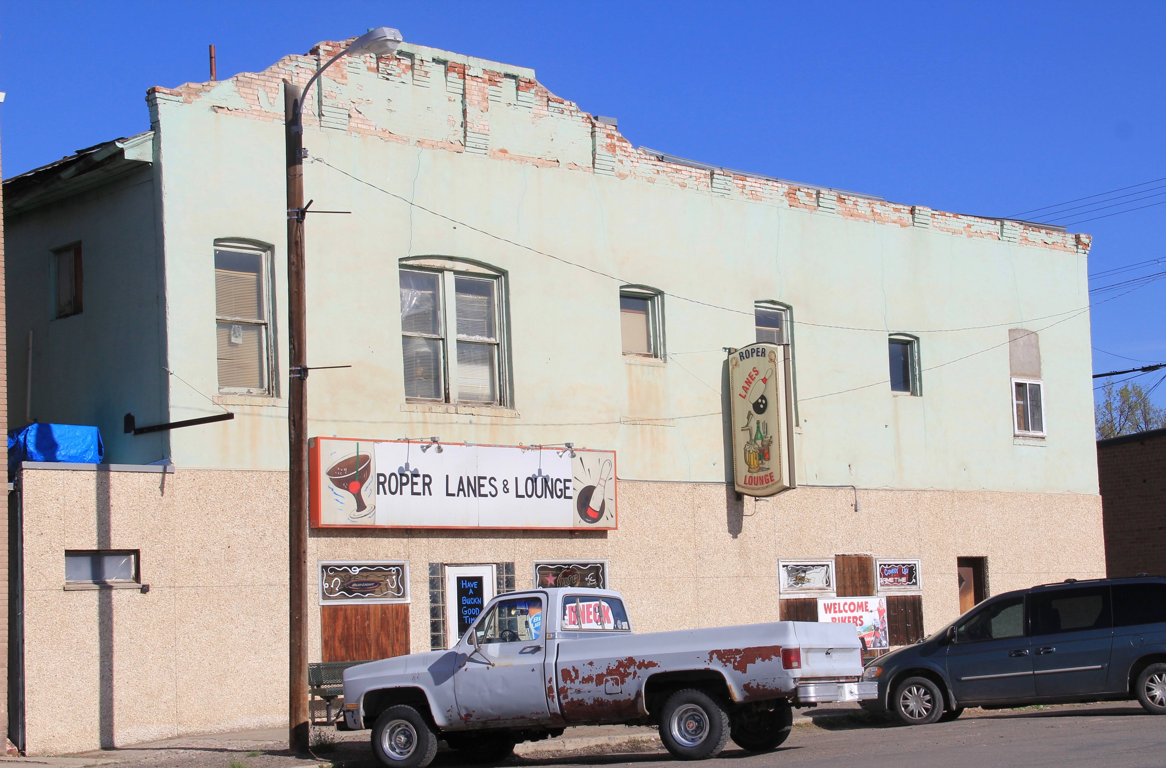
Another fav–admittedly in a beat-up turn of the 20th century building–is Roper Lanes and Lounge in Whitehall, Jefferson county, in the southwest corner of the state. Gotta love the painted sign over the entrance–emojis before they were called emojis.

Copper Bowl, E. Park, Anaconda roadside

Cedar Park Bowling Lanes, N side

Anaconda might be the small town bowling champ in Montana, with two excellent alleys, the Copper Bowl, from the mid-20th century and the more recent Cedar Park Lanes.  The alleys are located on the edge of town, between the business district and smelter–a great location to keep the bowling tradition alive.  Copper Bowl can also boast of the state’s best bowling sign–along Montana 1 and U.S. 10A, the Pintlar Route, a good place to catch commercial, roadside architecture.  If this bit of flash doesn’t catch your attention, you staring too much at the road in front.

Copper Bowl sign, E. Park, Anaconda roadside

These images do not capture all of the alleys across the big Sky–but they are enough to remind us that the bowling tradition is alive and kicking, and worthy of a closer look.


Fort Benton’s Heritage Development: 3 Museums, 3 Messages

Image


Fort Benton in 1984 had one dominant interpretive place:  The Museum of the Upper Missouri in the local city park facing the Missouri River.  The museum is still there and thriving–on an early Sunday afternoon in May 2013 it had plenty of visitors.  Still the same too were the exhibits–dioramas told much of the story, a reflection of the long, deep influence of the dioramas prepared for the Montana Historical Society’s museum installation almost 30 years earlier.  At MHS, as it installed a new exhibit in the late 1980s, dioramas and recreated villages disappeared in favor of more artifact-driven exhibits but at the local levels many museums still feature dioramas.  And to my mind, they are almost like bits of culture-laden folk art.

Image

The Museum of the Upper Missouri focused not just on Native American-white relations, the trade, and the creation of Fort Benton.  It spent just as much space exploring the post-gold rush steamboat era, the development of Fort Benton as an urban center, and the general frontier to settlement thesis that still dominates the narrative of northern plains history.  After all the museum was “the place” so naturally it captured all of the areas of possible historical interest, even extending into the region’s early ranching history.

Image


As the “place” it was also the logical location for federal trail programs to hand their hats, or at least trail markers, from displays about the Indian Wars to Lewis and Clark and to the Nez Perce Trail.

Image

The museum, outside of ranching, did not serve the region’s 20th century history that was tied much less to the river (except as a source of water to be dammed for irrigation) but to the land and its transformation through massive federal funded irrigation projects and the homesteading boom into the agricultural landscape that you immediately encounter in Chouteau County once you climb out of the Missouri River bottomlands and up to the plains landscape to the north.  Thus, at the north end of town, and actually closer for tourists exiting U.S. 87, came the Museum of the Northern Great Plains.

Image


Here is the typical 20th century technology museum, first depicted at the Greenfield Village Museum of Henry Ford in Dearborn, Michigan, and copied by literally hundreds of midwestern and western institutions.  A large building encloses a progression of agricultural technology from plows and tractors to automobiles and combines and onto the household.Image

And then outside of the museum doors are representative buildings–artifacts themselves of rural life, ethnic diversity, and corporate standardization, especially in the mini-gas station.  These museums are more like large-scale community attics–almost anything

Image


and everything is here, except for central unifying themes.  I arrived, somewhat excitedly, hoping that finally someone had the space and the wherewithal to tackle such major themes as the U.S. Reclamation Bureau and projects like the Milk River Project.  After all, the place markets itself as Montana’s agricultural history museum. Rather I found a celebration of the individual, those who stayed and made it– which then made sense when you stop and consider the isolation, the demanding climate, the difficulty of making an arid landscape bloom.  

Image


The latest addition to the museum landscape of Fort Benton comes courtesy of the federal government and the Bureau of Land Management–the Upper Missouri Breaks National Monument interpretive center for all things federal in this part of the Missouri River country.  The building attempts to compete with the White Cliffs of the Missouri itself, and it is a modernist architectural wonder, reflecting region, topography, materials, and culture.  

Image

As a homage to the river itself, the building may work, but it is difficult to compete with the beauty of the Missouri at Fort Benton, even if you are on the west end of town by the old public water works.

Image Image


The Upper Missouri museum, as you would expect from a 21st century installation, tells a big story, from natural resources to prehistory to Lewis and Clark, the Nez Perce, and large-scale recreations of steamboats.  And of the three museums it has the great, decisive advantage to my mind, of actually touching the Missouri.  It is the river at this location that made Fort Benton and here the river dominates the experience.

Image


All three museums reflect their time of creation and target specific audiences.  But you still end with the reality of three museums for just one place–the story is told loudly and often in Fort Benton, from three different vantage points and from multiple types of historical markers scattered across the town, especially at the riverfront.  Discerning heritage tourists will take it all in and get it.  But you wonder about those who stop by, in a rush to get to Great Falls, to Glacier, or heading home to some place back east.  Fort Benton in its historic riverfront buildings looks old but tired, and rather than constructing yet more new buildings to contain the history, one thinks–why not adapt the historic buildings–and tell the history in the actual places that it happened.  There is more to Fort Benton than meets the eye but how come a visit here makes you feel still like you are on the outside looking in, that just underneath the renovated surface may be a reality worth exploring.

Image


Image


Transformations in Fort Benton, part 1

Image


In the spring of 1984, there was no doubt that I would spend considerable time looking at the historic preservation issues at Fort Benton, a small county seat today but one of the most important places in all of the northern plains before the age of the railroad.  Here at this bend in the river, shown in a postcard I bought there in 1984, was basically the last stop for Missouri River boat traffic heading west.  The fort dated to the late fur trade era and as the rush for precious metals overtook Montana Territory in the 1860s and 1870s here developed a major trade and outfitting post, with roads running from Fort Benton in all directions.  But the place was a sleepy, almost forgotten town, as the railroads changed routes and the interstates bypassed it by miles and miles.  Landmarks too were there but the old fort had been slowly coming apart, only a recent determined effort by save what remained and then, ambitiously I thought 30 years ago, to rebuild the lost fort and tell fully the story of the fur trade and the significance of the Upper Missouri.

Image  Image


My guide was John Lepley, who was spearheading the local efforts and a member of the SHPO board.  Another key leader was Joel Overholser. And no doubt, there was some heritage tourism and historic interpretation infrastructure in place.  The Chouteau House, a classic river hotel, was still open, rough on the edges but the place where I stayed and took meals. (It was closed when I visited last in 2013).

Image


Nearby was the home of I. G. Baker, a pivotal figure in the region’s history.  It was open, and paneled interpretation in place but certainly a property that could “say” more.

Image


Various monuments and markers could be found throughout the riverfront:  the Mullan Road, the Whoop-Up Trail, and especially the recently installed (1976) State of Montana Lewis and Clark Memorial, a monument piece of public art, sculpted by Bob Scriver with the base by Shorty Shope, another well regarded Montana artist.  The memorial was an American bicentennial project led by the Fort Benton Improvement Association, which Lepley and Overholser served on as commissioners.  Indeed, the state also had donated one of the keelboats used in the film “Far Horizons,” a Hollywood take on the Lewis and Clark expedition.  The waterfront told a story, one dominated by Lewis and Clark.

Image  

Image

postcard of Far Horizons boat, c. 1984

Image


The amount and quality of the public art along the riverfront was impressive, but what struck me as speaking most strongly to the town’s future were two completed projects (the Museum of the Upper Missouri and the Missouri River Bridge) and the almost completed restoration of the Grand Hotel, a remarkable Victorian building that spoke to the town’s hopes in the late 19th century.

Image Image


Image


I left Fort Benton convinced of two things:  the town had clear preservation needs, not just the fort site but buildings from the Victorian era were decaying too.  But compared to other places that I would visit in 1984, I thought Fort Benton had the one key trait for success–vision, the realization that the steps of the 1970s were just first steps, and many more needed to be taken in the years to come.  Let’s next come back to Fort Benton 30 years later and see how far that vision has reached.

ImageWho