The evolution of Billings’ Montana Avenue

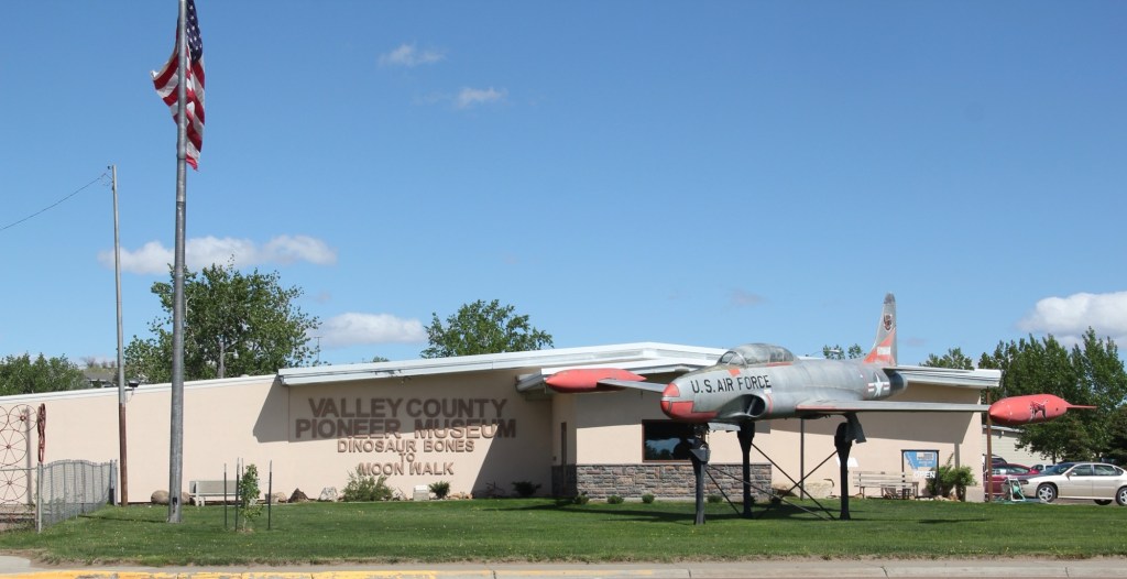
I was last in Billings in early July and, as usual, I immediately walked around Montana Avenue to see what was going on—doing that walk has been a tradition for me for over 40 years.

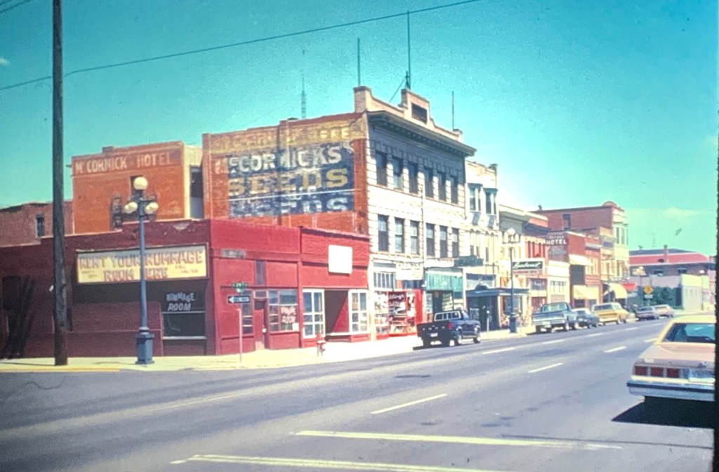
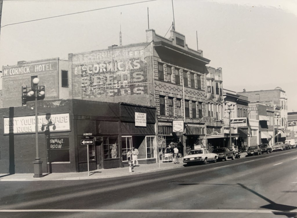
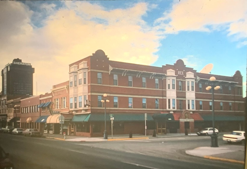
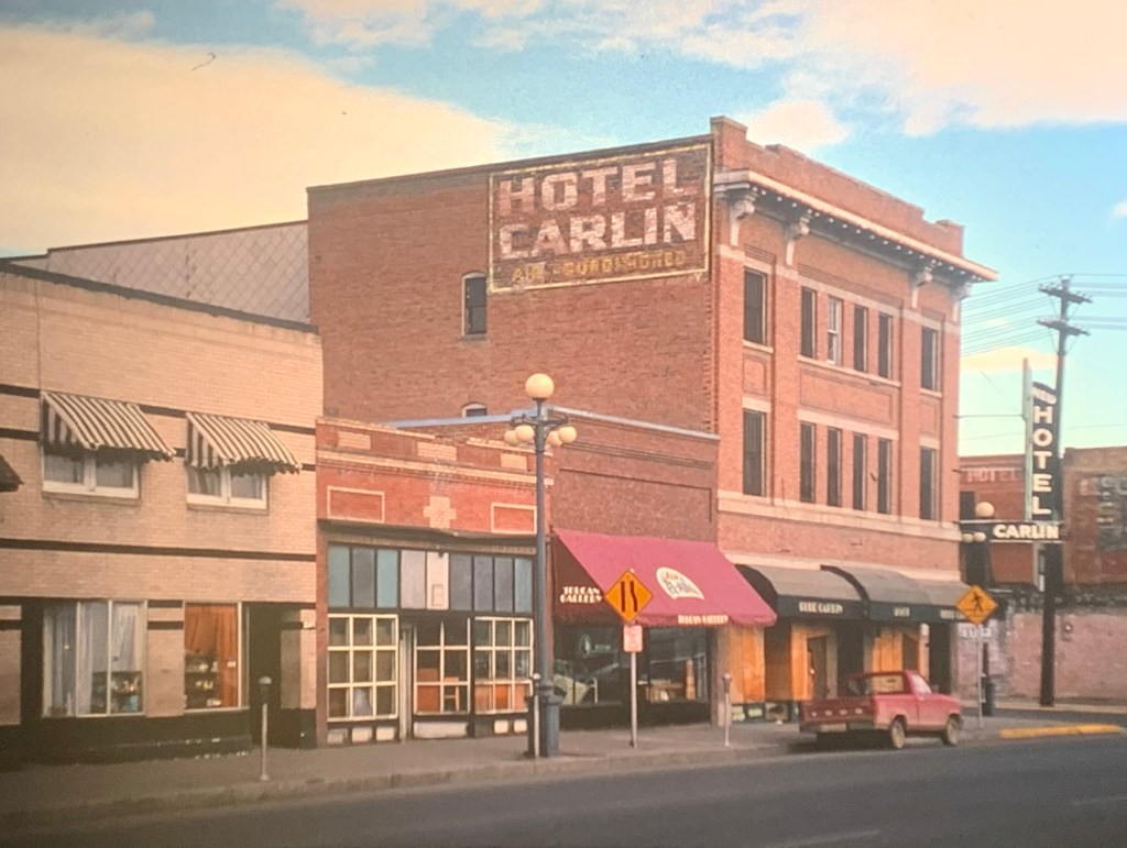
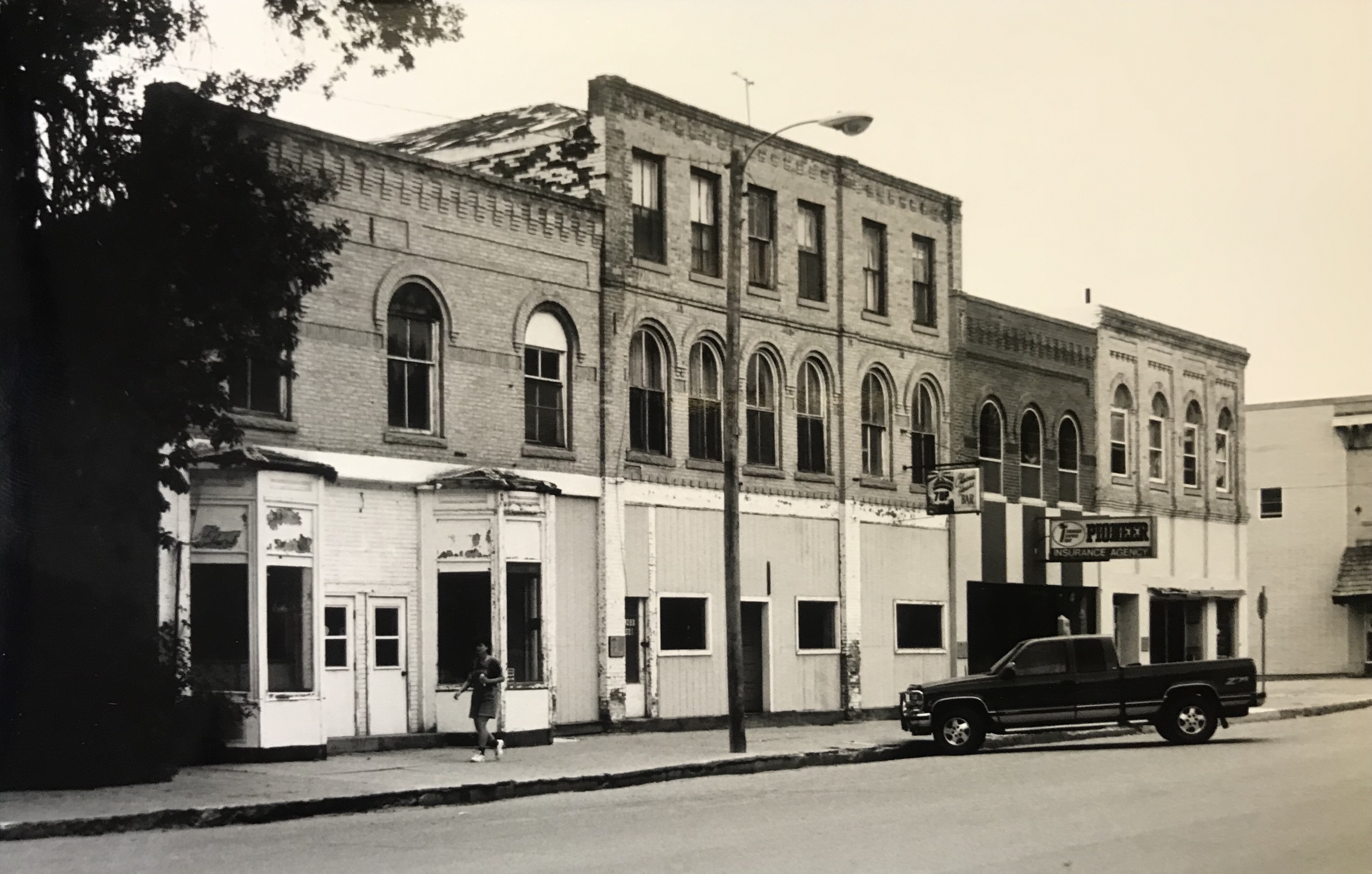
Do you remember what Montana Avenue was like in 1985–well here’s two views if you don’t recall, or were even around in 1985. It was a mix of second hand, rummage, stores, “antique” stores, flophouses, and an emerging galley scene, led by Toucan Gallery.

Rex Hotel 1985

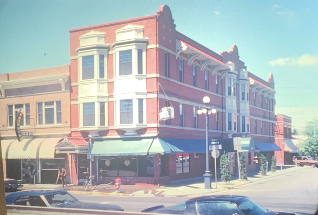
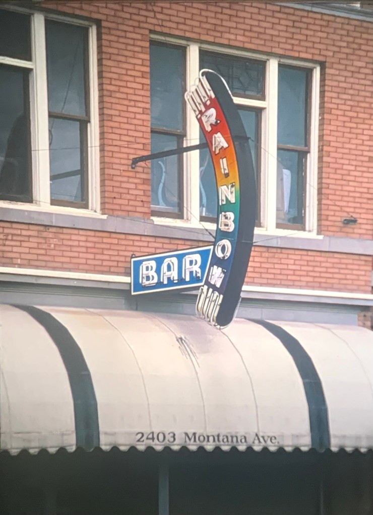
There was an oasis—the restored Rex Hotel, with one of the city’s best restaurants, and next door, the Rainbow Bar, an oasis of a far different type. Thankfully both businesses, with some changes, remain anchors to the district today.

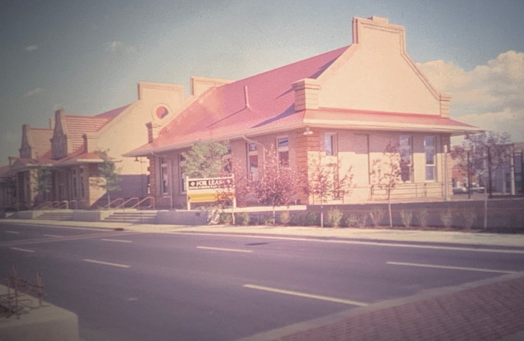
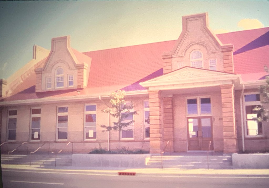
On the opposite side of the street—despair. The imposing 1907 Northern Pacific Railroad depot was boarded up, forgotten and deteriorating. The reality was a puzzle to me because already in Great Falls and Missoula investors had restored and reopened historic Milwaukee Road depots. Why not Billings?

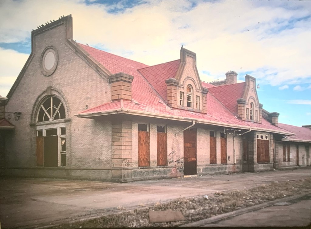
Five years later, 1990, it had gotten worse instead of better at the depot. When graffiti begins to mark a historic building the end is often near. On the other side of the street, however, new investment kept the historic buildings moving forward.

Rex Hotel and Montana Avenue 1990
Rainbow Bar 1990
Hotel Carlin block, 1990
McCormick Block, 1990

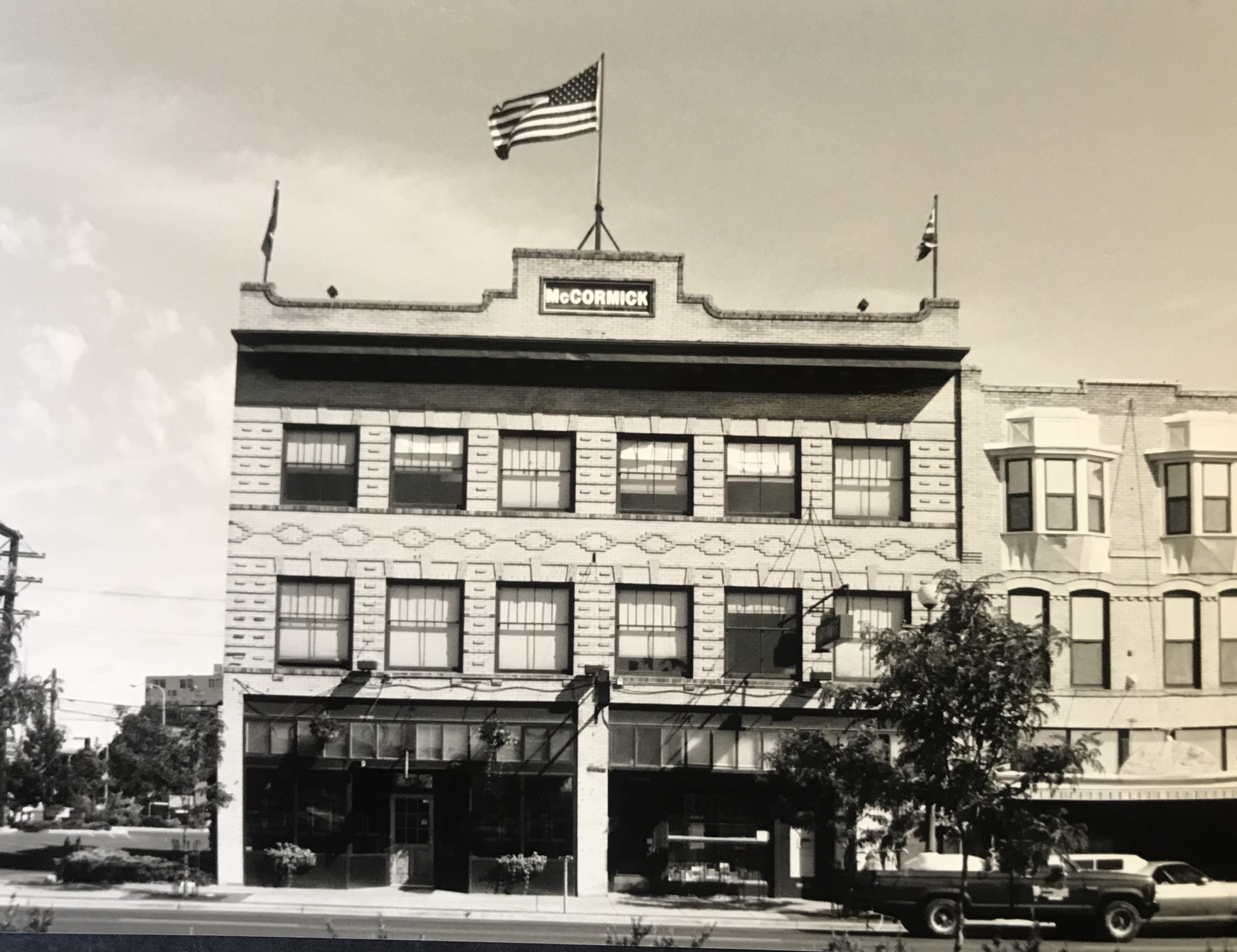
Changes were afoot at the McCormick Block where two adjacent one story 100 year old buildings had been torn away to create a parking lot.

And the district had a new east end, with the conversion of a 20th century building into the Coulson Bar. I loved the reference to the river town that was a precursor to Billings.

The 1990s was when the historic preservation movement transformed Montana Avenue. The Montana Avenue Historic District was listed in the National Register of Historic Places, thanks to the vision of property owners supported by the city and the State Historic Preservation Office and the work of Chere Jiusto.

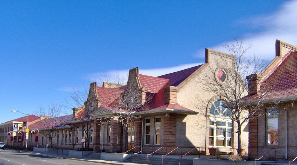
When I next visited in 1998, I found the depot, finally, restored and serving as a new anchor.

The new courtyard at the Rex was quite the place to be and be seen. I even saw Hollywood stars there in 1998. the 21st resurgence of Montana Avenue was ready to begin.

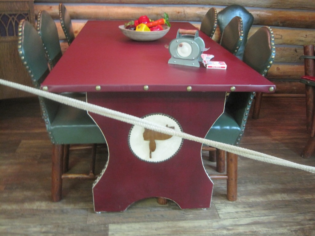
How many of you used the Internet cafe at the McCormick Block? I did in 2000 when I took the image above.

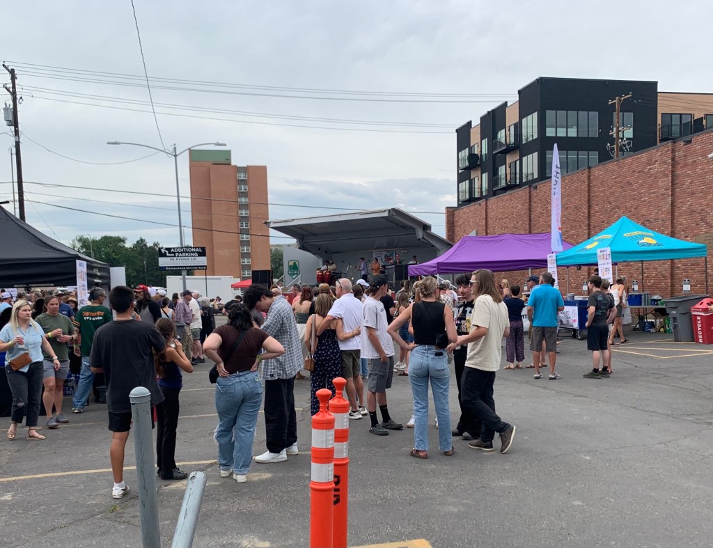
Fast forward to July 2025. The once neglected district is a city downtown hub, hosting a street event and businesses booming. What a change from 1985.

Medicine Lake, the place and town in Sheridan County

Montana Highway 16 stretches north from U.S. Highway 2 following a spur line of the Great Northern Railway laid about 1910. Following that railroad corridor first brought me to Medicine Lake, the actual lake and town of that name in February 1984.

Great Northern depot in 1984

When I returned over thirty years later, the depot was gone, but the lake and town were doing ok.

Depot is gone today

Medicine Lake is a very important place in northeast Montana and the 8,000 + acre lake has been protected as a National Wildlife Refuge since 1935.

Medicine Lake NWR
Medicine Lake NWR

Native Americans for centuries visited and hunted here, as hundreds of tipi rings along the lake bluffs documented. The lake remains a touchstone for several tribes today.

Medicine Lake, MT

The town is much more recent, established by the railroad in 1910, with the iconic Club Hotel and Bar in business within a year.

I have stopped at the Club Bar where the old neon sign was a bit weathered but hospitality was everywhere. Don’t know about the hotel—maybe rooms was still used during the hunting season.

The Medicine Lake K-12 school keeps the town of about 250 people together but since my last visit the school lost its distinctive mascot name of The Honkers. For sports the school has merged with Froid and took us nickname of Red-Hawks. Did that mean that town gathering spot would change its name from the Honker Pit? Absolutely not. Great place!

Medicine Lake, the town, has several buildings from its first generation of settlement, including a corner gas station (adapted into a new business) and classic false-front one-story commercial buildings, including a lumber business and a hardware store.

Yet a dwindling population has hurt the business core. For 40 years between 1940 and 1980 the town’s population stayed around 400. The next 40 years witnessed a decline—and in a small town a loss of 150 people can really hurt.

But the town began a slight rebound in population in between 2010 and 2020, with some of it fueled by fracking man-camps

The bones of an early 20th century homestead town are still there. I hope to visit again and see new changes in 2025.

Glasgow, Montana: It might be in the middle but it’s not nowhere

In 2024 I began to see media accounts, both regionally and nationally, of how Glasgow, the seat of Valley County, was the most isolated place you can imagine, truly in the Middle of nowhere.

Historic Great Northern Railroad corridor in Glasgow

I’m not one to argue with geographers and economists. I’m sure from their perspective, they got it right. But I never thought of Glasgow as isolated: it is on the Great Northern mainline, and part of the famed Empire Builder Amtrak route, and on U.S. Highway 2.

Great Northern depot, Glasgow

Then the town has always shown a great deal of pride and ambition, conveyed so effectively by its many historic buildings, starting with the First National Bank, built c. 1884 and listed in the National Register of Historic Places.

1st National Bank building, Glasgow

When you enter the town from the underpass of the railroad, the bank is the first landmark to catch your eye, appropriate too for the impact of local banks on a town’s economic prospects during the homesteading boom and bust of the 1910s and 1920s, respectively.

Rundle Hotel, during renovation in 2013

Another landmark from the homesteading era is the Rundle Building, once the Glasgow Hotel and restored in the last ten years as an upscale hotel in the heart of downtown. Built c. 1916 and designed by the important Billings firm of Link and Haire, the Rundle is a captivating statement of an Arts and Crafts-infused Mediterranean Revival style. I have been trying to get back to Glasgow to stay here for the last four years—maybe I will make it in 2025.

The 1930s transformed Valley County through the construction of the mammoth Fort Peck Dam on the Missouri River. Glasgow too has a major New Deal landmark in its U.S. post office and courthouse, built c. 1939 and designed by federal architect Louis A. Simon.

Post office/federal courthouse, Glasgow

Its understated New Deal Deco exterior obscures a jewel of an interior, highlighted by its New Deal-funded 1942 mural depicting local history and the changes brought about by the Fort Peck Dam by artist Forest Hill. This building too is listed in the National Register.

Glasgow post office mural

Another important New Deal supported building was all about the community, and providing new opportunities: the Glasgow Civic Center. It too has a New Deal Deco style, and its large public space has been used for almost every type of event or gathering you can imagine.

Glasgow Civic Center

Glasgow’s sense of itself today still respects it past, brilliantly conveyed by its large and expansive museum. When I first visited Glasgow 40 years

Valley County Museum

ago, I held a public meeting on the state historic preservation plan here, and the next morning residents gave me a detailed tour of the recently established museum. I was impressed with its collection then, now it sprawls through the building to the adjoining grounds.

Veterans section of the museum
The high school band section
Lewis and Clark mural, 2095, by Jessie Henderson, a Chippewa/Cree artist
The back bar at saloon exhibit

Indeed, the saloon exhibit underscores another fun part of Glasgow—across from the depot in the original route of Highway 2 is an amazing collection of bars, stores, and eateries, right out of the early 1900s.

Glasgow bars at depot

But back to the museum, and its important Montana decorative arts collection of the work of modern craftsman Thomas Molesworth, once in the town’s Carnegie library.

The newer exterior exhibits led the museum to move entire building to the property, including examples of the homestead shacks of the early 1900s that were followed by permanent homes such as this white painted bungalow.

Representative ranch house from homesteading boom

Pride of place, pride of the past. Glasgow might be in the middle but it is far from being nowhere as this small sampling of properties demonstrates.

Marysville, a Montana “ghost town”

Marysville was the first mining ghost town that I visited in Montana in 1982. Forty years ago it wasn’t really a ghost town—several families lived there year round. But many buildings were abandoned, in disrepair, even one of the historic churches. Whenever families or friends visited me in Helena, I always took them to Marysville to see what was left because I wondered just what the future of the place would be.

I need not have worried. I had not been in Marysville since 1985 when I visited in May 2023. Today about 80 people live in Marysville—again far from being a ghost town. But so much preservation work had taken place since the 1980s.

Today many historic buildings from c. 1880 to the 1920s help to tell the story of gold mining in Montana at the fabled Drumlummon Mine owned by Thomas Cruse, a mine that overlooked the town. But work remains—other key buildings need their champion to ensure their preservation.

Drumlummon concentrator ruins
Ruins only remain of this dwelling
Stone commercial building from 1895
The 1898 Masonic Lodge Building with its impressive brick exterior dates to 1898. Both Mountain Star 130 and Ottawa 51 met in the building.
Another important building was the general store, initially established by Ann and Blibal Betor (Betor was from Lebanon) c. 1898. When I lived in Helena the place was abandoned and in rough shape. A well planned restoration began in 2004 and was finished in 2018.
The general store interior speaks to its conversion into a saloon and dance hall c. 1940.
The former Northern Pacific railroad depot is now home to the town’s bar and cafe.
Another restoration was led by the Hollow family at the town’s Methodist Episcopal church. This 1886 building is listed in the National Register of Historic Places.
Our Lady of Lourdes Catholic Church also dates to 1886. Thomas Cruse later took some of his Drumlummon fortune and donated it for the construction of the Cathedral of St. Helena in Helena, MT.
The Marysville Pioneer Memorial Building contains a museum about the town and its mining history.

The people who call Marysville home have been remarkable stewards. By keeping the town alive they also have preserved a special place in Montana’s mining past.

Glendive In 1988: the Business District

In my 1988 work in Montana I sought out Glendive and spent the night there due to a new research project on the Yellowstone Valley (which would yield the book Capitalism on the Frontier in 1993). Glendive was a division point on the Northern Pacific Railroad and some 100 years later it remained a key to the Burlington Northern Line.

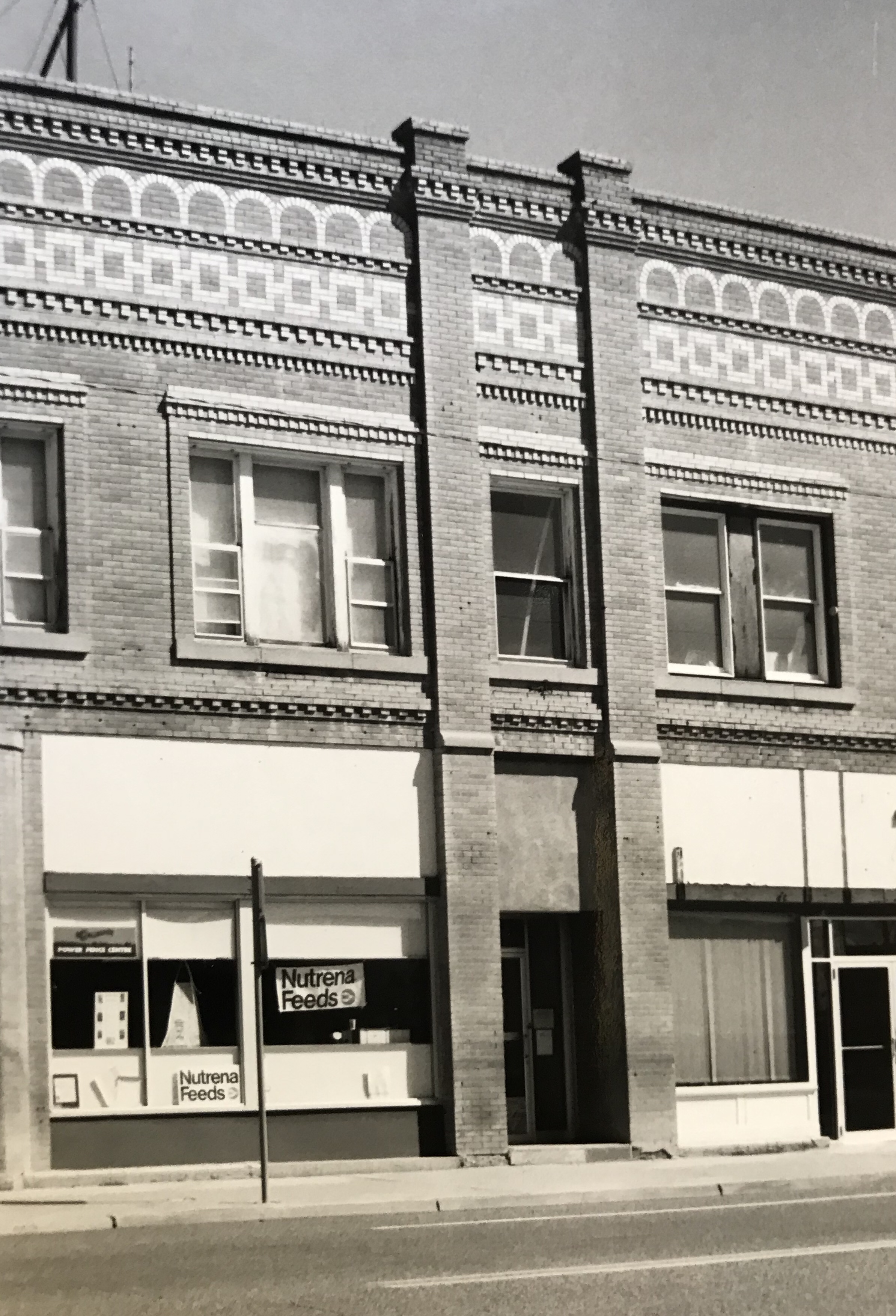
A good bit of the historic machine shops (above) still operated in 1988. The depot and railroad offices still dominated the Merrill Avenue business district (below).

The older Northern Pacific lunchroom had been converted to the Chamber of Commerce offices, and visitors center.

Many businesses remained focused on Merrill Avenue, which from the 1910s forward was also the historic route of the Yellowstone Trail and later US Highway 10.

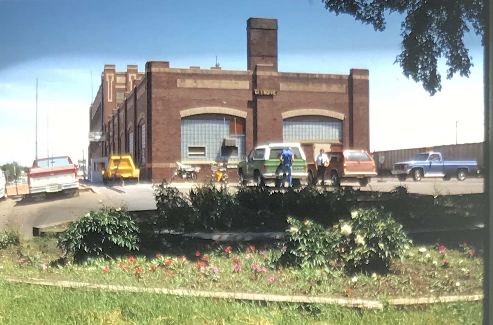
My favorite Merrill Avenue business was the wonderful Art Moderne style of the Luhaven Bar (below). You gots love the black carrera glass and glass block entrance.

Not all architectural delights were along Merrill Avenue. The Dawson County Courthouseis an excellent mid-century modern public building, a real contrast to the town’s traditional Colonial Revival-styled post office from the New Deal era.

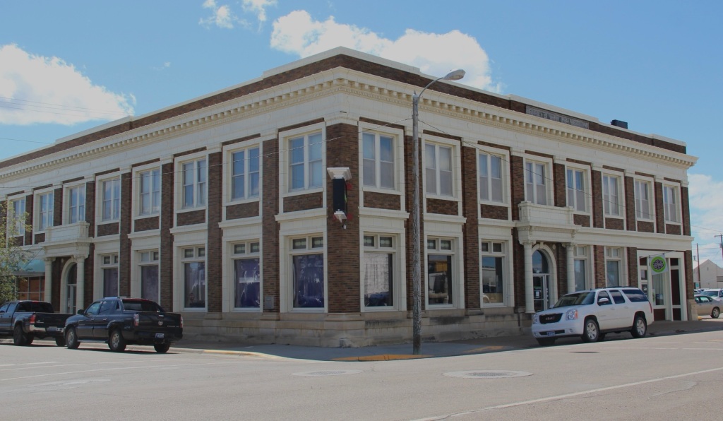
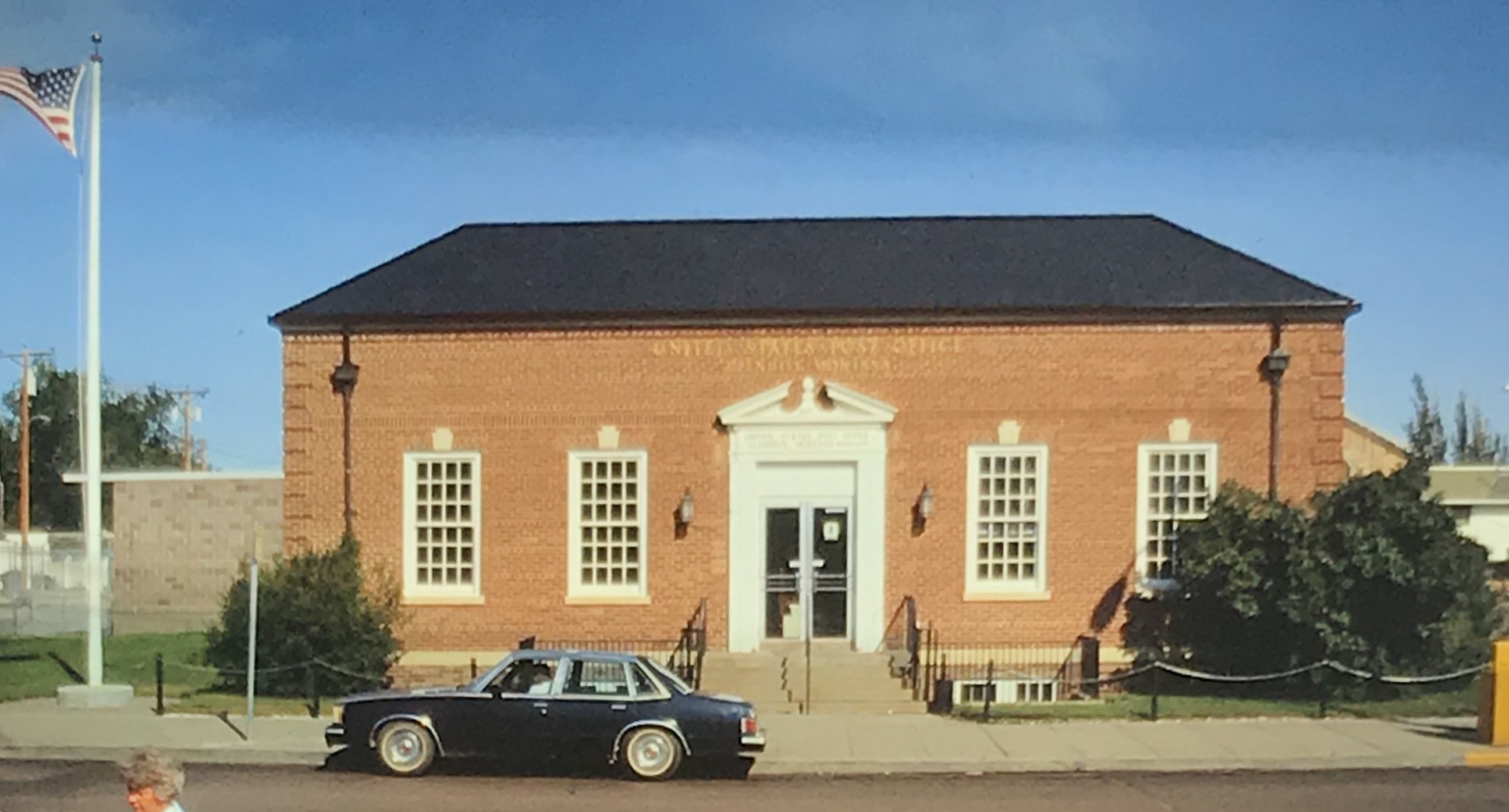
But my favorite modernist building was the First National Bank, which was later converted to the town’s public library.

Next posting will include homes from the town’s residential district from the early 20th century to the mid-century as I continue a look back to the Yellowstone River and its towns in 1988.

Sheridan County In 1988

After my comprehensive work in Montana from 1984-85 I returned in 1988 to revisit and add new places to my visual understanding of the state. Here are most of the color slides I took in Sheridan County on my second trip to Plentywood and environs.

I particularly looked at the railroad corridors–big surprise I know. Above is the Great Northern depot at Medicine Lake and below is a similar combination of Great Northern depot and elevators at Antelope.

The other railroad corridor I wanted to look at was the Soo Line, which operated a short spur line into the county in the early 20th century. I’m glad I did since hardly any buildings exist along this route today. Below is the T-town plan of Outlook.

Outlook in 1988 still had its classic Soo Line combination depot, with both passenger services, baggage warehouse and station office wrapped in one building. Below is the Outlook railroad corridor.

The station was in fair condition then (it is gone now) and I took a couple of images along with a close-up of the two-seat privy.

Other “towns” on the Soo Line had nothing left but deteriorating elevators. Here in 1988 was what was left in Raymond.

In Plentywood, the county seat, I took images of the great fairgrounds sign and the New Deal-era Sheridan County Courthouse.

I also was so happy to see the Orpheum movie theater still in operation.

Finally I always have found it fascinating that at Plentywood’s main intersection stood 3 bank buildings at the three corners–and at Montana’s best known socialist county in the early 20th century.

And in 1988 I also took care to document the town’s Northern Pacific depot. Railroads and banks dominated the county at its founding.

Last scenes: the Flandrem community monument on Highway 16 and a bit of badlands scenery along Highway 5 (the image is from my original trip in 1985, this the bit of snow, taken February 1985).

An end of the century trip to Central Montana

The vast majority of my effort to document and think about the historic landscapes of Montana lie with two time periods, 1984-85 and 2012-16. But in between those two focused periods, other projects at the Western Heritage Center in Billings brought me back to the Big Sky Country. Almost always I found a way to carve out a couple of additional days to get away from the museum and study the many layers of history, and change, in the landscape by taking black and white images as I had in 1984-85. One such trip came in 1999, at the end of the 20th century.

In Billings itself I marveled at the changes that historic preservation was bringing to the Minnesota Avenue district. The creation of an “Internet cafe” (remember those?) in the McCormick Block was a guaranteed stop.

But my real goal was to jet up highways 191 and 80 to end up in Fort Benton. Along the way I had to stop at Moore, one of my favorite Central Montana railroad towns, and home to a evocative set of grain elevators.

Then a stop for lunch at the Geraldine bar and the recently restored Geraldine depot, along a historic spur of the Milwaukee Road. I have always loved a stop in this plains country town and this day was especially memorable as residents showed off what they had accomplished in the restoration. Another historic preservation plus!

Then it was Fort Benton, a National jewel seemingly only appreciated by locals, who faced an often overwhelming task for preserving and finding sustainable new uses for the riverfront buildings.

It was exciting to see the recent goal that the community eagerly discussed in 1984–rebuilding the historic fort.

A new era for public interpretation of the northern fur trade would soon open in the new century: what a change from 1984.

I beat a quick retreat back to the south, following the old Manitoba Road route along the Missouri and US Highway 87 and back via highway 89 to the Yellowstone Valley. I had to pay a quick tribute to Big Timber, and grab a brew at the Big Timber

Bar. The long Main Street in Big Timber was obviously changing–new residents and new businesses. Little did I know how much change would come in the new century.

One last detour came on the drive to see if the absolutely spectacular stone craftsmanship of the Absarokee school remained in place–it did, and still does.

My work in Tennessee had really focused in the late 1990s on historic schools: few matched the distinctive design of Absarokee. I had to see it again.

Like most trips in the 1990s to Billings I ended up in Laurel–I always felt this railroad town had a bigger part in the history of Yellowstone County than

generally accepted. The photos I took in 1999 are now striking– had any place in the valley changed more than Laurel in the 21st century?

Kalispell: Growth and Preservation in Northwest Montana


Kalispell was a Montana jewel 0n the Great Northern Railway.  Despite that fact, in 1984 the preservation of the railroad’s historic passenger station was not certain.  This landmark, at the head of the T-plan town, still stood but was viewed as an impediment even an eyesore by some.  The depot (1892, 1899, 1914, 1929) was built when Kalispell was an important division point on the railroad’s main line then altered over the next three decades to the stuccoed exterior you find today.  It marked literally the beginnings of the town’s history.  Yet, when I held a public meeting at another landmark, the town’s historic Carnegie Library (1903) that had recently been through an adaptive reuse into the

Hockaday Art Museum, strong sentiments for more preservation were rarely heard. The depot was not listed in the National Register nor were many of the downtown buildings.  There were a few of the town’s rich stock of Victorian era houses listed. The success of the Hockaday and the Conrad Mansion (1892-1895) historic site seemed to be enough for many residents, or they thought preservation only meant pretty homes and buildings.

img_8606

Then came the work east of Kalispell in and around Glacier National Park to inventory and list eligible buildings to the National Register in the mid to late 1980s.  That, along with the loss of key downtown landmarks and new voices from preservationists and property owners, began to grow the interest in historic preservation.

The result was a massive multiple property study of Kalispell for the National Register of Historic Places, resulting in the listing of dozens of additional historical properties in 1994.  The historic railroad depot was listed and serves as home for the Chamber of Commerce and a visitor center, a front porch for the downtown. A new era in historic preservation had been launched, and the result today is impressive, as the next posts will explore.

Appreciating the town’s achievement in historic preservation over the last 20 years comes at an opportune time. The economic changes in the 1980s and 1990s are ready to be repeated again.  A federal grant, matched by local sources, will mean that the historic railroad corridor through the center of town will be moved–opening up acres for new construction.  Everyone knows this will be as fundamental of a change as when the Great Northern moved their division point to Whitefish in 1904. But now Kalispell has a strong historic core, identity, and purpose–the past has become fundamental to its future. Now let’s review that preservation achievement.

Flathead Co Kalispell Preserve America sign


Lincoln County’s Gateway Towns

Lincoln Co Troy 5
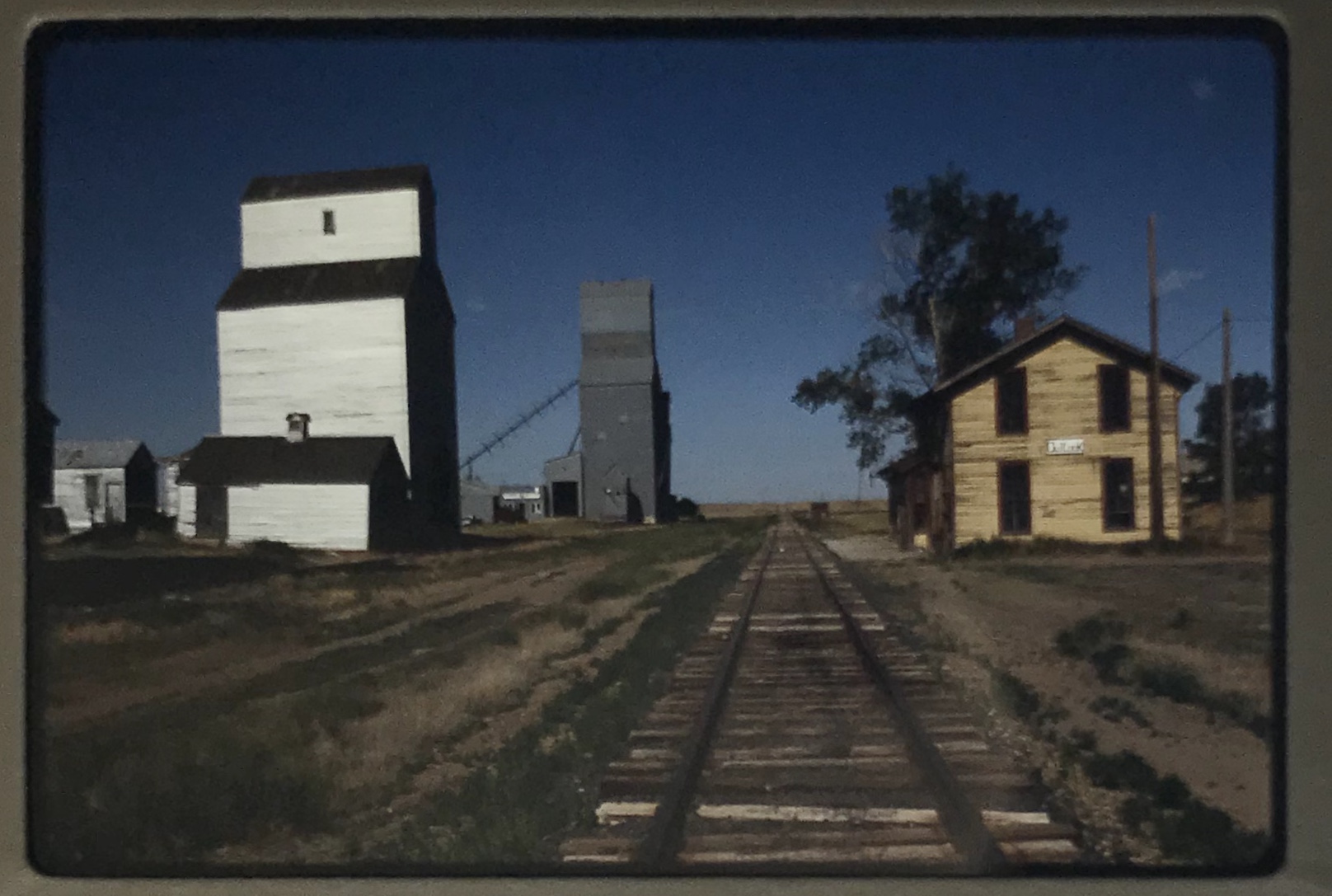
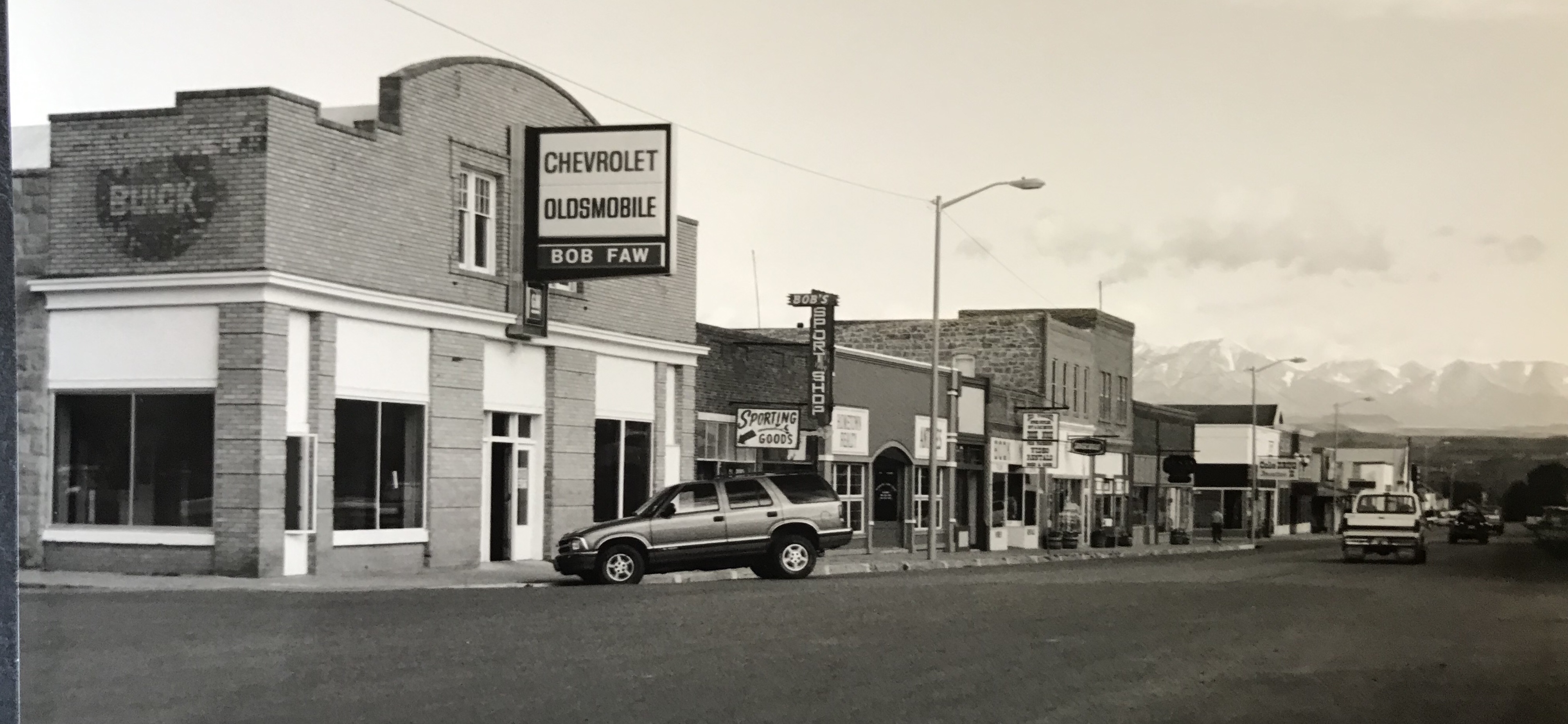
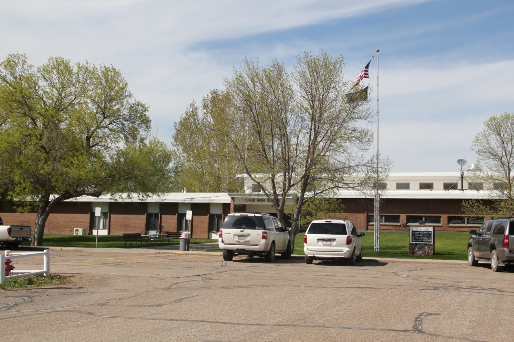
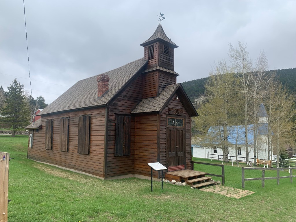
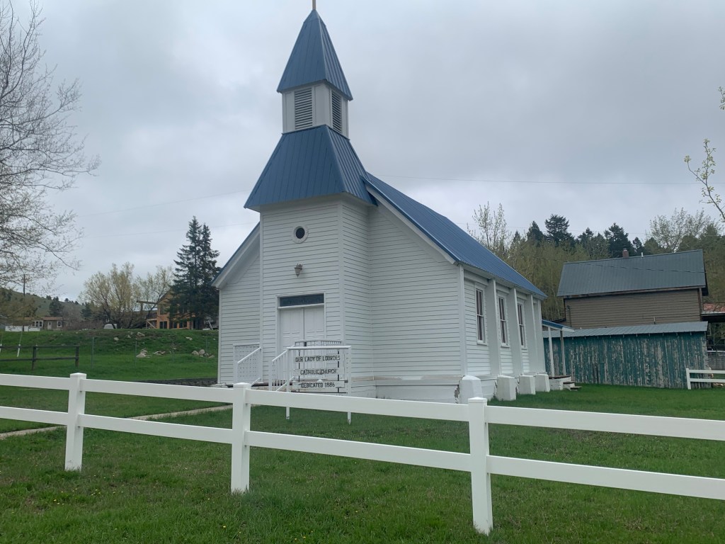
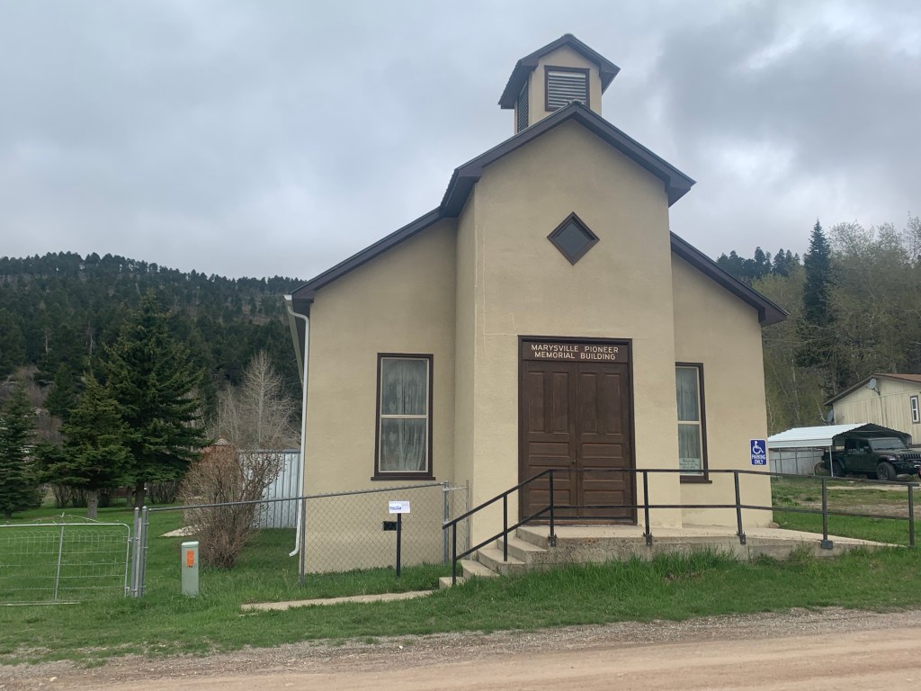
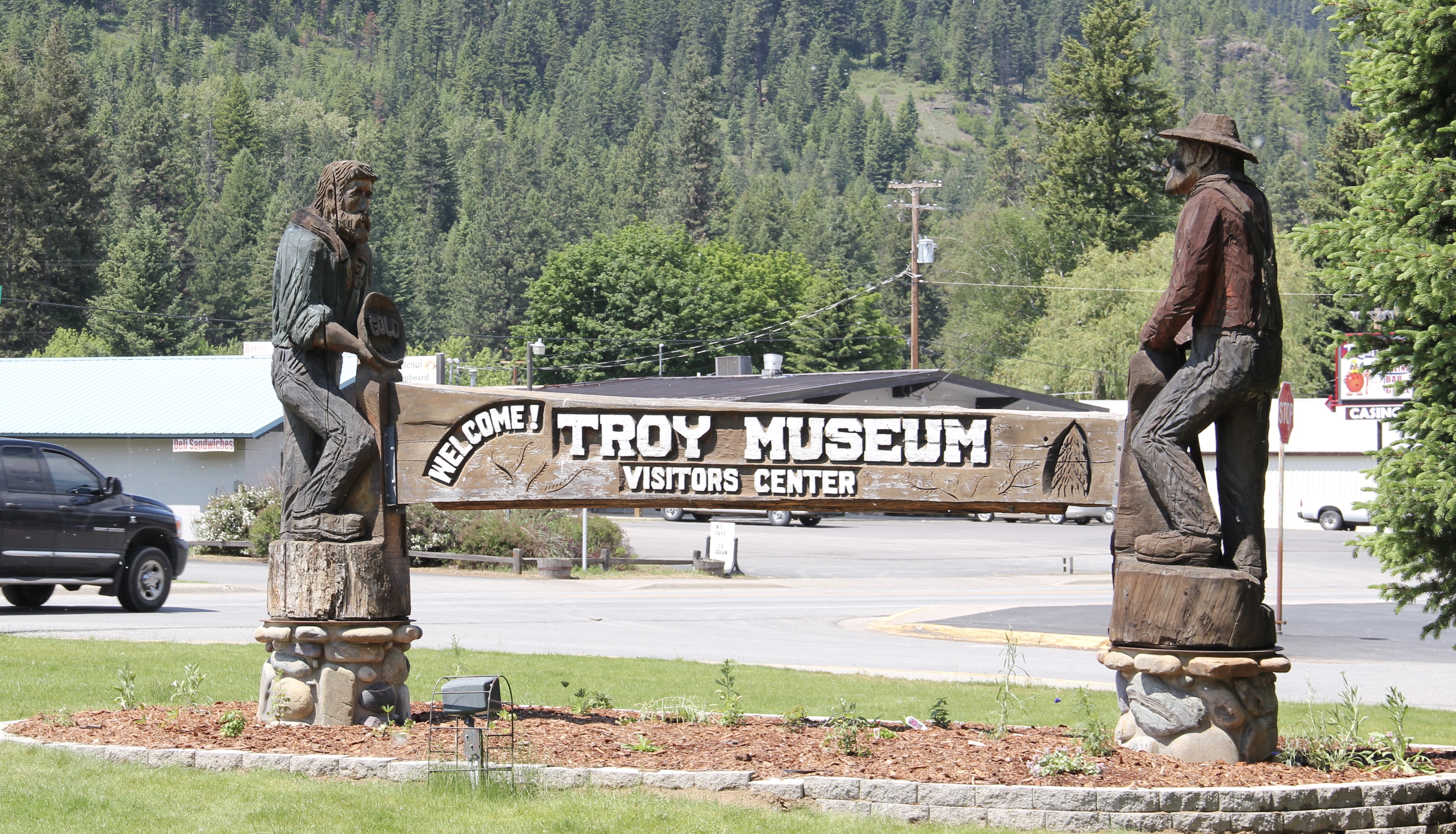
I love Montana town signs, and Troy, deep in the state’s logging country, has one of the best.  The sign lures to a city park nestled along the Kootenai River.  The focus point is a

historic Great Northern depot, which has been moved to the park.  There is also an interpretive trail, part of a partnership with the U.S. Forest Service, that tells the story of the Callahan boom, which mining and logging combined to lure investors and residents to the area.  It is a story arc that the forest service follows at other sites in a region the service describes as the Callahan Creek Historic Mining and Logging District. It is a very useful perspective on the town’s history, and not one that I pursued in 1984 when I explored this part of Lincoln County in the fieldwork for the state historic preservation plan.  I paid attention to the historic railroad corridor–Troy (1892) after all was on

Lincoln Co Troy RR corridor

Lincoln Co Troy facing RR

Lincoln Co Troy bar facing RR
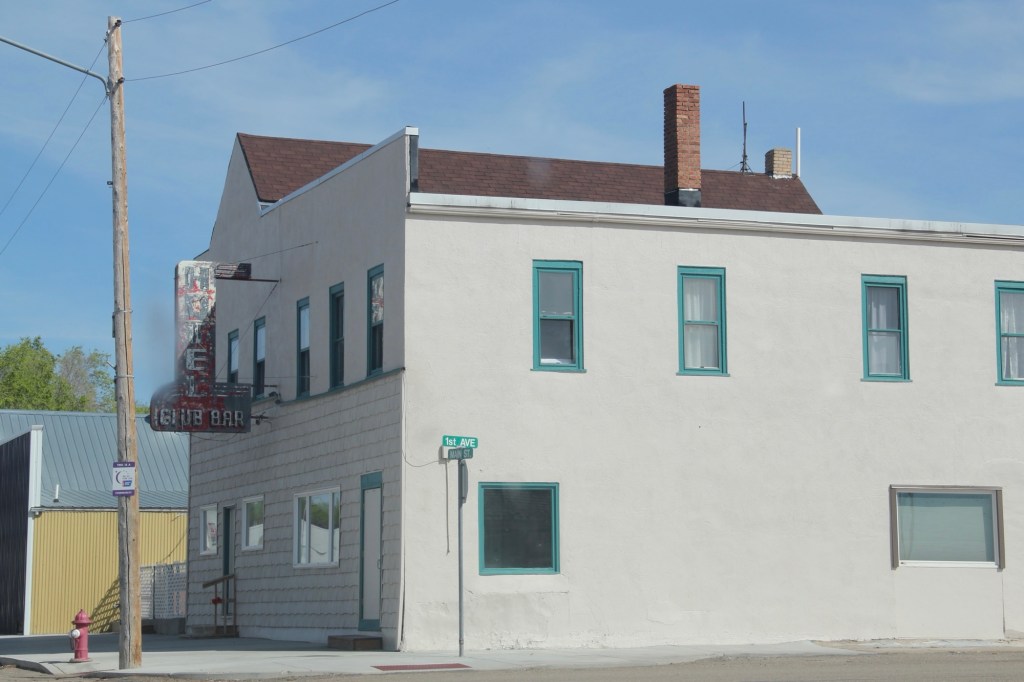
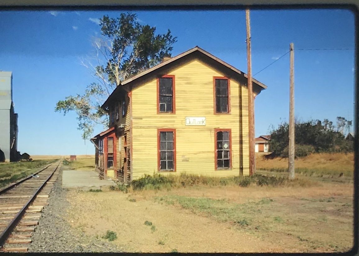
the Great Northern’s main line, and I documented the few historic buildings left facing the railroad tracks today.  The Home Bar (c. 1914) and the Club Bar were institutions then, and remain so today.  The Kootenai State Bank building still stands but has experienced a major change to its facade–made better in part by the American flag painted over some of the frame addition.

img_8425
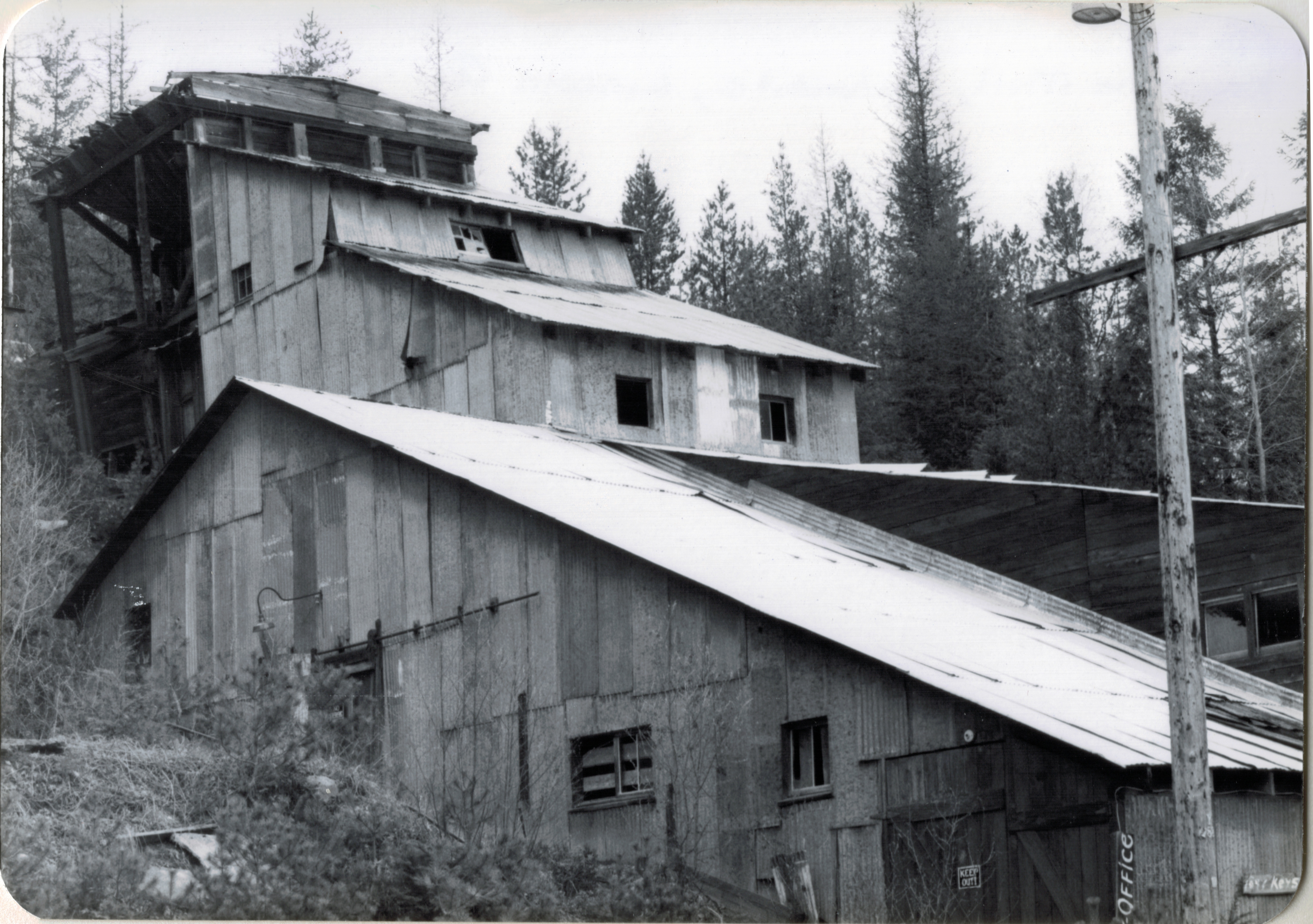
The Troy Jail, above, was listed in the National Register of Historic Places in 2006 and it remains the only building so listed in the town today.  D.E. Crissey, a local contractor, built it out of concrete in 1924 during Troy’s boom from 1916 to 1926 when its population jumped from 300 to 1300.  The Snowstorm mine, which produced lead, zinc, and silver, started to serve the demand for raw materials during World War I.  The mine soon turned what had been a small railroad town into a mining camp best known for its brothels and bars.  Then in the early 1920s the Great Northern decided to build a division point here, further booming the town. The Sandpoint Pole and Lumber Company began its logging business in 1923, and Troy suddenly was the largest town in the county

Lincoln Co Troy school 4

Perhaps the most impressive landmark left in the wake of the Troy boom is the public school, with the impressive central block flanked by classroom wings and a gymnasium built in later decades.  Home to the Troy Trojans, the soldier statue in front of the school is also a public art landmark in Lincoln County.

Troy thus was much more than just a gateway into Montana from U.S. Highway 2–it was once a mining center, but one that went broke fast as the mines played out in the 1920s, the Great Northern closed its roundhouse, and the Great Depression hit in the 1930s.

Lincoln Co Troy mural

In 1984 as I traveled from Troy via Montana State Highway 508 to Yaak, the only “town” left in the state’s far northwest corner, you could still encounter key mining properties along the Yaak River, such as this concentrator at Sylvanite.

keystone-mill-sylvanite-lincoln-co-66-120

The Keystone Mill was barely hanging on to the side of the mountain then, now it is nowhere to be seen.  Montana 508 has instead become a gateway to some of the some of the most open, untouched high mountain landscape, one that meanders back and forth with the river, bridges, and, perhaps most importantly, bars.

That would be the Dirty Shame Saloon–another institution that some back in the city thought that perhaps I should avoid.  Glad I did not.  Had a great meal there in 1984, and even though the bar’s dining area has been extended, it still had that vibe, of both a local place but also another remnant of the old logging and mining days along the Yaak.

Lincoln Co Yaak dirty Shame saloon 1

Yaak by way of local paths and trails is a gateway too, between Idaho and Montana and Montana and British Columbia.  More to the point it is a gateway between what was and what still is within the Montana landscape.

Lincoln Co Yaak store/bar

Yaak’s general store, service station, lodging, and whatever else you need is another throwback place, and can be found on the web as the Yaak River Tavern and Mercantile.  You haven’t “done” Montana if you don’t make it to Yaak.


Libby: Disaster and Persistence

Lincoln Co Libby stem of T plan
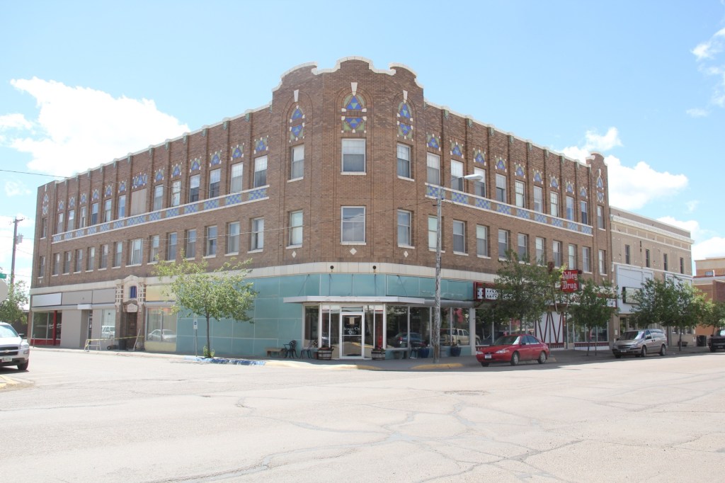
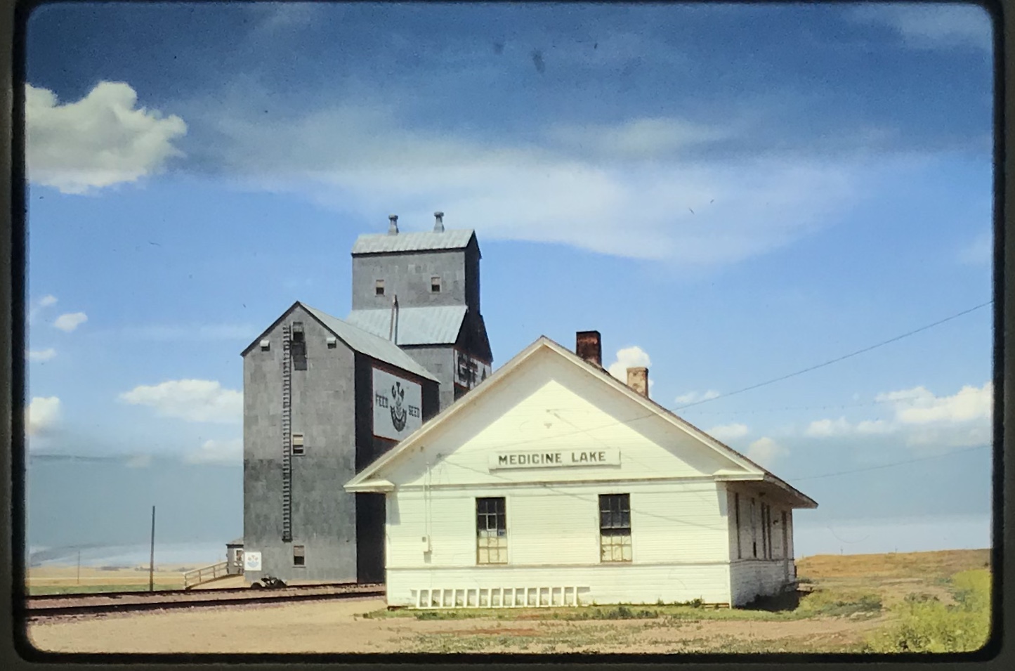
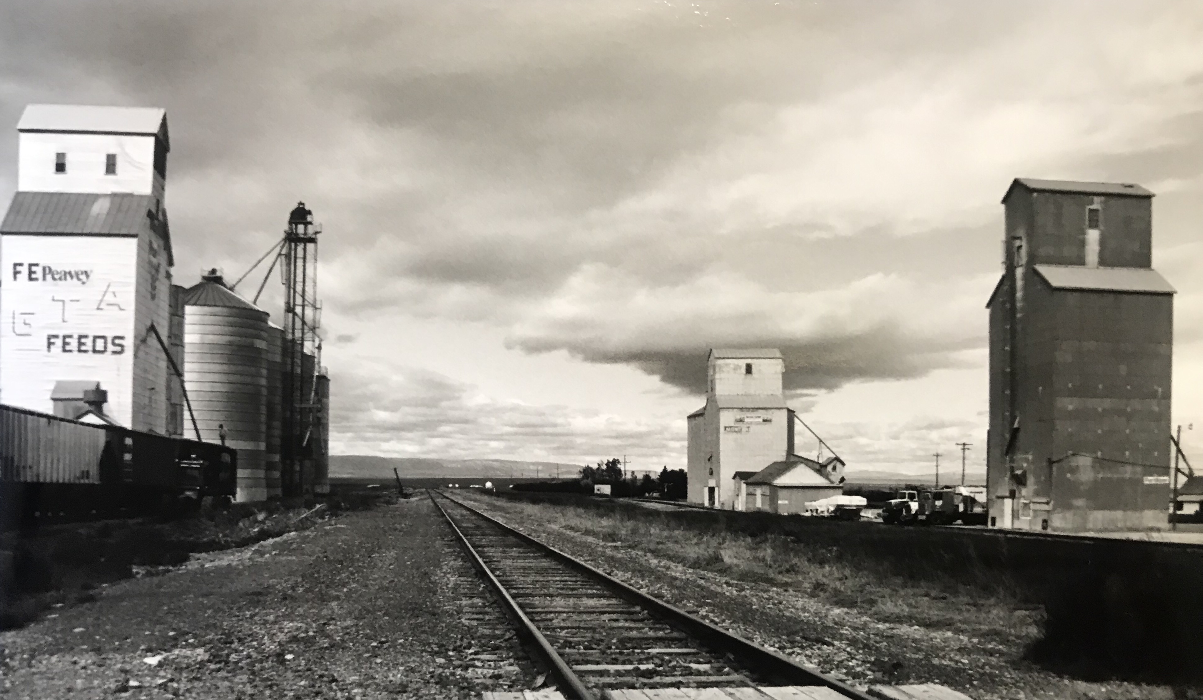
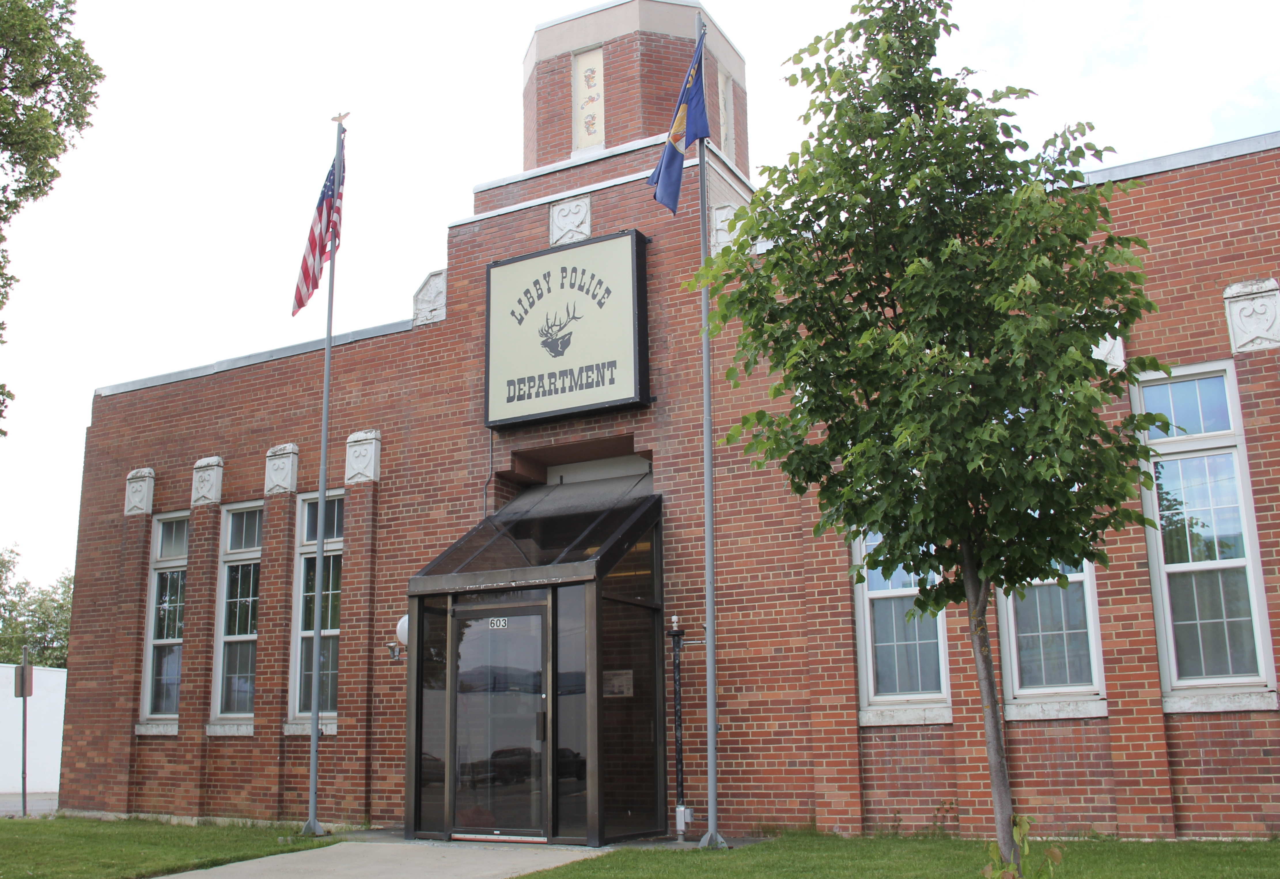
Libby is the seat of Lincoln County, a typical railroad town along the historic Great Northern Railway corridor.  The image above is from the town’s railroad depot, the symbolic beginning of town, from which runs a long main street of businesses, reflecting the T-plan town design, where the long railroad corridor defines the top of the T and the main street forms the stem of the T.

The depot is a good example of the railway’s “Chalet” style that it used in many of its Rocky Mountain properties, reflecting the influence of the early resorts in Glacier National Park and the railroad’s wish to connect such rural outposts as Libby with the tourism traffic it wished to generate along the line.

Libby was much like I remembered it from 1984.  The town’s population had dropped by about 100, and some historic store buildings had been leveled, but a new brew pub was in operation and the historic Dome Theater was still going strong.

Lincoln Co Libby old city hall police station

And I liked the New Deal impact on Libby’s public buildings, such as the WPA Deco City Hall, which is now solely the domain of the police department.  Then there is the Lincoln County Courthouse, truly a story of two buildings in one as the mid-1930s Art Deco-styled

Lincoln Co Libby New Deal courthouse 1

img_8345courthouse received a totally new front, in a contemporary style, in the 1970s as the town and county expanded in the wake of the federal spending in constructing Libby Dam. The rectangular blockiness, flat roof, and band of windows set within a symmetrical facade makes the courthouse one of the state’s best designs for a rural public building in the late 20th century.

img_8348 I liked all of those things about Libby in 1984. Imagine my shock and disappointment to learn, as everyone else did, that Libby was one of the poisoned places in the west.  In 1919, vermiculite, a natural material that contains asbestos, had been discovered outside of town, and the mines were still operating, producing 80 percent of the vermiculite in the world, under the control of the W.R. Grace company. Residue from the mines had been used in local yards and buildings for decades, a fact that was not known  when I visited the town for the state historic preservation plan.  When the discovery of the danger became public, and the federal Environmental Protection Agency entered into the fray in 1999, it was already too late for many residents.  A federal Superfund project began, and did not conclude its work until 2015, spending some $425 million. Then in 2009 the Environmental Protection Agency announced a public health emergency, spending another $130 million to help residents and to leave a new health infrastructure in place.  In a generation, Libby had been turned inside out.  EPA announced in 2016 that the cleanup would continue to 2018, and that the project was the longest in the agency’s history.

Lincoln Co Libby hospital 4

The Cabinet Peak Medical Center (2014), designed by CTA Architects, represents the beginning of a new chapter in Libby’s history, as it starts its second century. It extends the city’s earlier healthcare history, represented by the historic St. John Lutheran Hospital, which opened in the 1952 and operated until 2014 when it was closed in favor of the new Cabinet Peaks center.

Lincoln Co Libby hospitalDespite the disaster, I saw many signs that Libby residents were determined to remain and rebuild their community.  One of the most powerful examples is the conversion of one of  the town’s historic schools into a new community arts center as well as school administration offices.


Then the public library–home to an active and lively genealogy group and collection–is still a point of pride and activity.  The same is true for the mid-1970s Lincoln County Museum–a wonderful modern log building designed and built by the community during the American Bicentennial just outside of Libby–which remains an active part of the town’s heritage tourism offerings.

Lincoln Co Libby library

Lincoln Co Libby museum 5
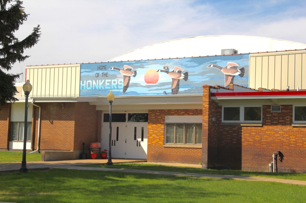
The asbestos crisis was a terrible disaster for Libby–yet residents refused to let it define their future.  There are past accomplishments to acknowledge, an active railroad depot to cherish, a beautiful river and lake, the mountains all around, as celebrated in this public art mural on a downtown building. This place is here to stay, and the historic built environment is a large part of it.

img_8462