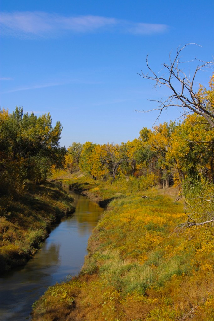
Montana Highway 246 is one of those “side” roads that few travel, unfortunately, because if you go that way from the west toward Glasgow it will take longer than US Highway 2. But the time is well worthwhile because once you cross the Milk River (by way of a modern concrete bridge) you step back to the turn of the 20th century.
Milk River crossing on Montana 246
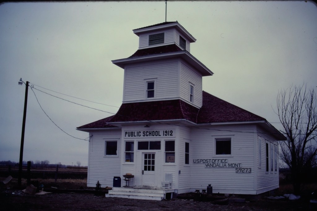
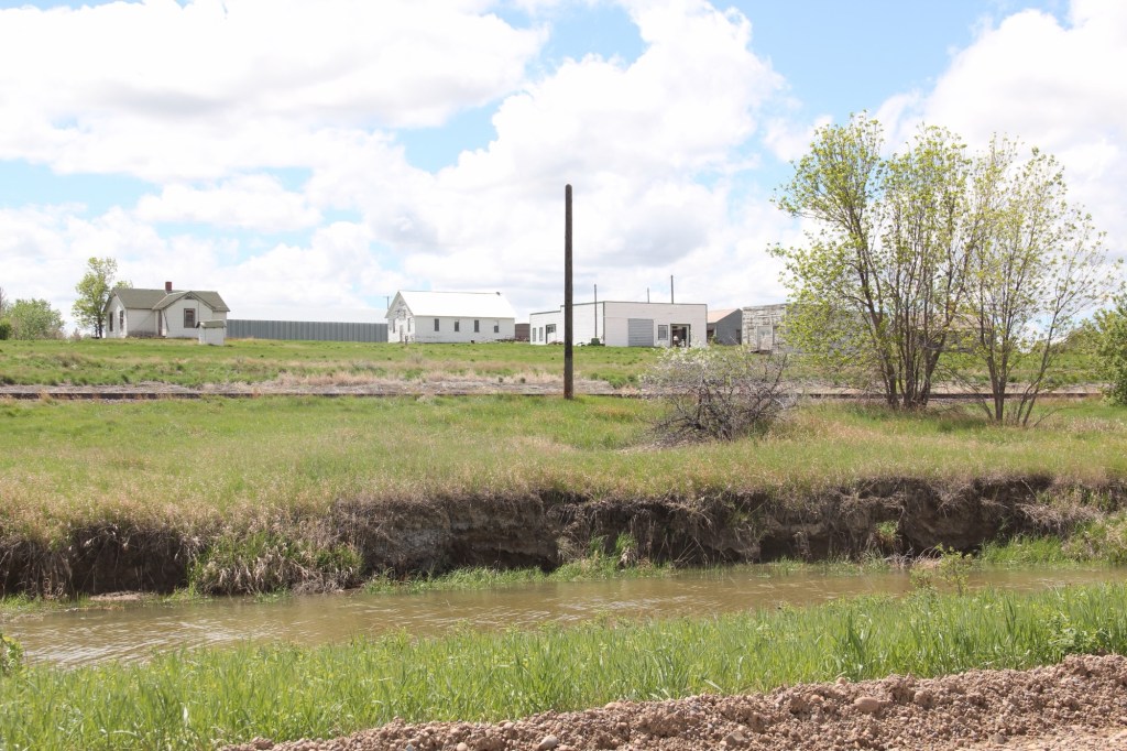
Vandalia has history as a late 19th century trading post at the crossing of the Milk River. Then it became one of the early milk River ranches. Once the Great Northern Railroad built its initial route westward the tracks came this way, following the river.
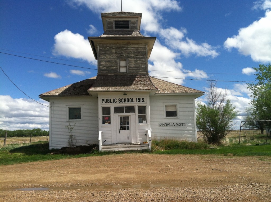
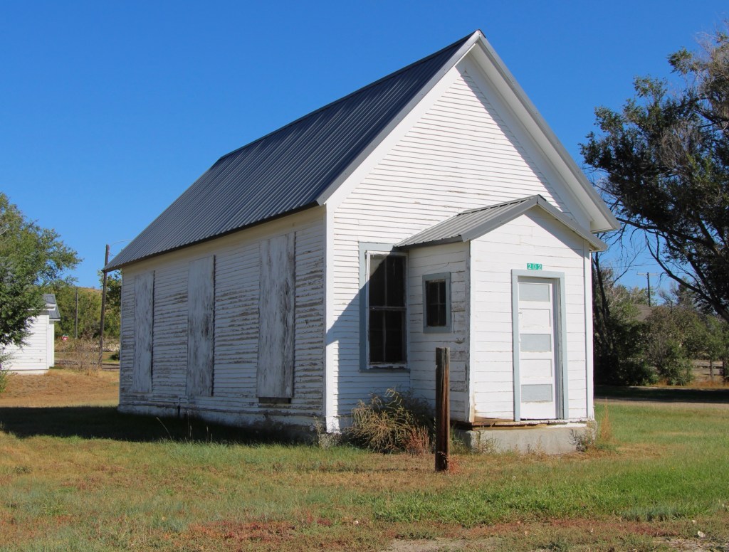
Vandalia school and post office in 1984
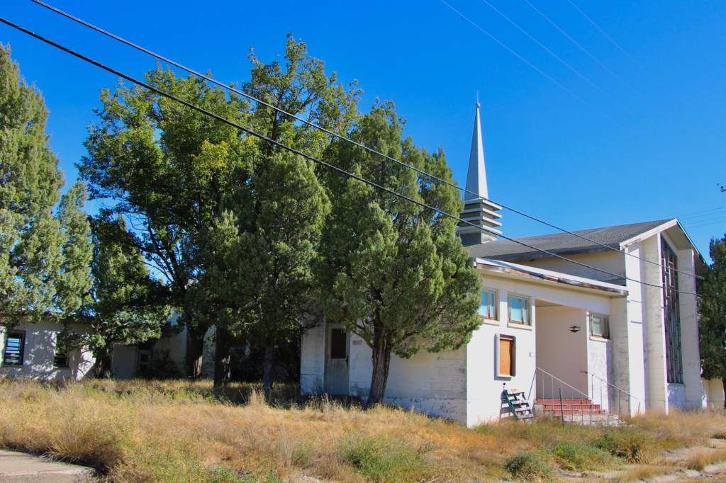
The tracks brought the first generation of homesteaders who built the white-painted frame school in 1912. The school later became the post office, and served that role when I first visited Vandalia in 1984.
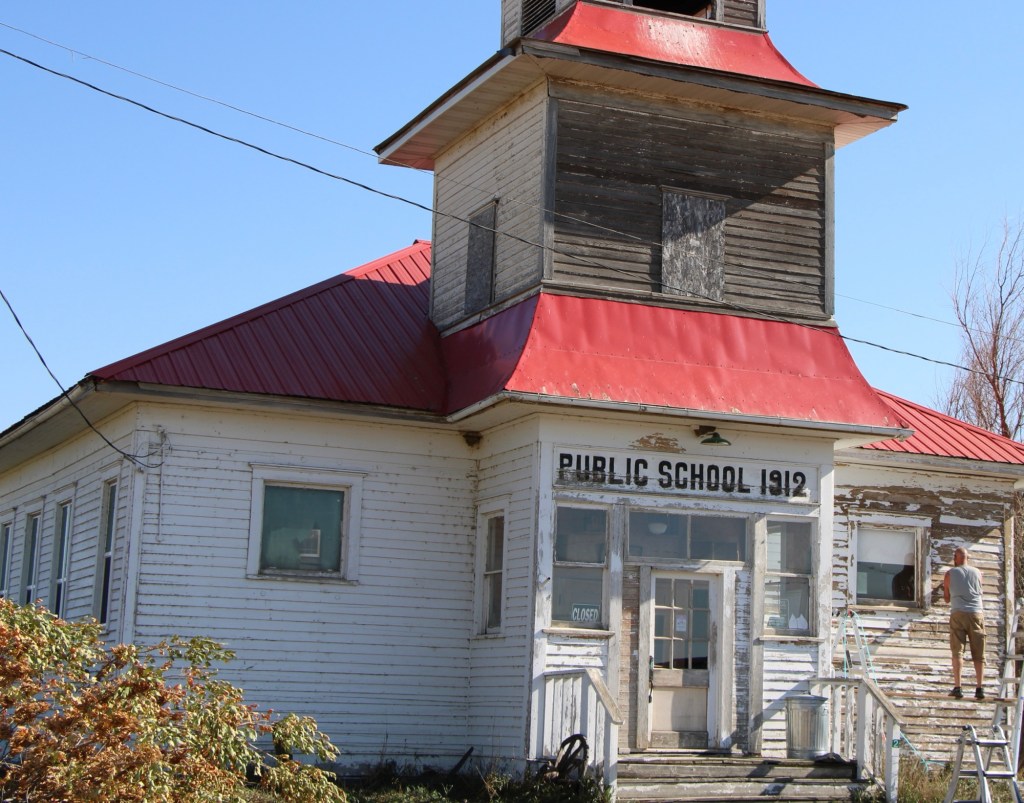
Vandalia school in 2013
When I next visited almost 30 years later, the post office had closed and the school was in rough condition. Imagine my delight when I next stopped in the fall of 2025. The school was taking on new life. The roof had been prepared and replaced, and prep work was underway to give it a fresh coat of paint.
Vandalia school in 2025Vandalia in 2025
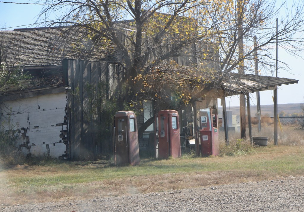
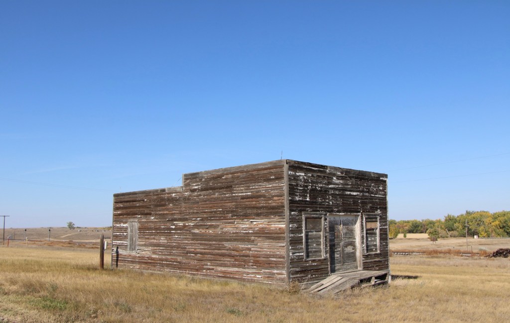
The story was not so bright for the old bar and store that was next door. The old gas pumps were still there but the porch roof was sagging and it looked forlorn.
Vandalia store in 2025Original route US Highway 2 heading east toward Tampico
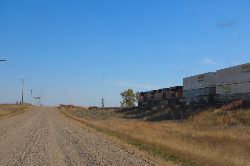
The drive remains fun, especially the graveled original route of US Highway 2 with the occasional Burlington Santa Fe freight train roaring by. Imagine driving cross country on this route when large sections of it remained unpaved.
Tampico in 2013
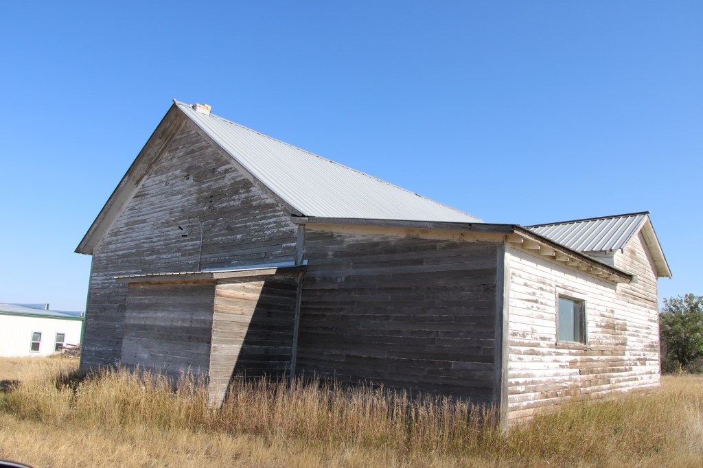
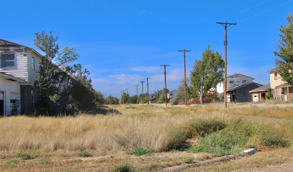
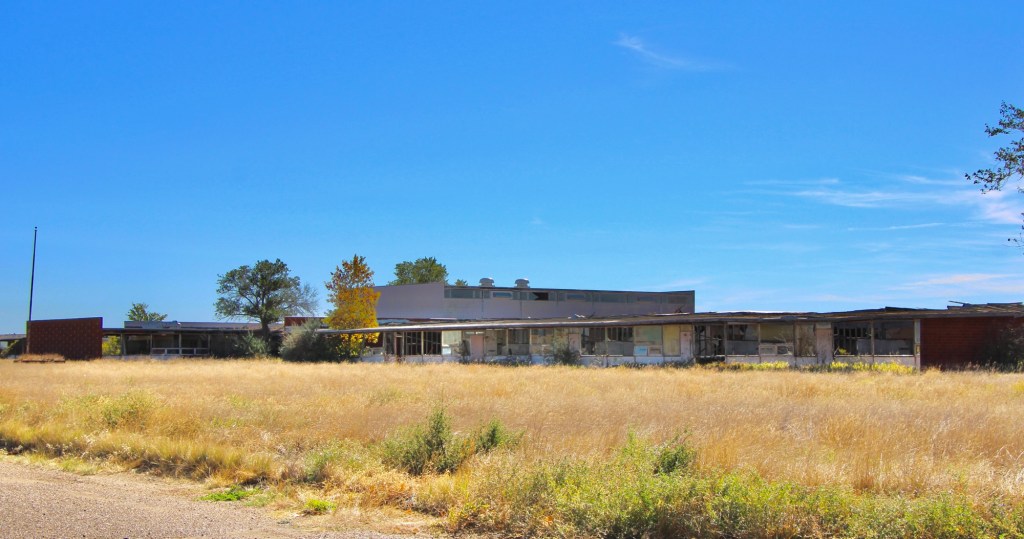
The next town to the east is Tampico, established around 1908. In 2013 the town was tiny but showed some life. Twelve years later, the abandonment was striking.
Tampico in 2025Tampico in 2025Leaning into oblivion, Tampico 2025
Most early 20th century railroad towns across the northern plains struggle one hundred years later but those off the major highways, like Vandalia and Tampico, could easily disappear.
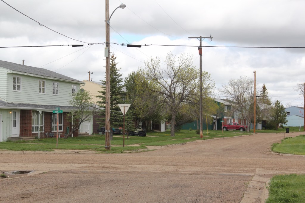
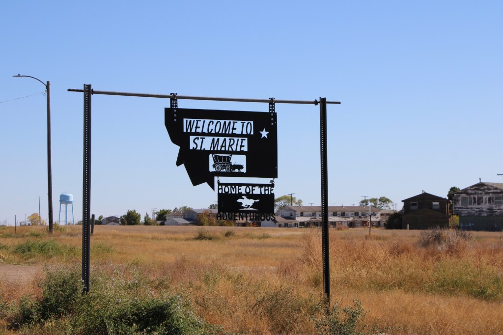
My first visit to what became known as St Marie came in 1984 when local Glasgow residents associated with the Valley county museum took me to the closed Glasgow Air Force Base, about 15 miles north of town. From the late 1950s to the 1970s, the base was an important cog in the Cold War military capabilities of the United States when huge B-52 bombers ruled the sky. Then suddenly it was not so important and the Air Force left.
Valley County Museum, Glasgow
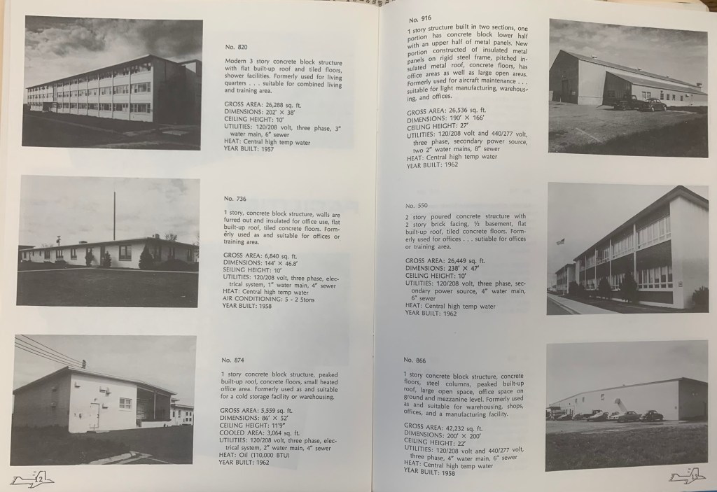
The locals in 1984 spoke of grand plans, of how the Air Force was in the process of selling the base, building by building. That part was true. They gave me a booklet that explained the past purpose of each building and the value of each building at that time.
In 1984 it seemed unlikely to me that a new use could be found because the base was so big—its population was once 50% of the entire county—and it was so isolated. If the Air Force didn’t have a use for it, who would?
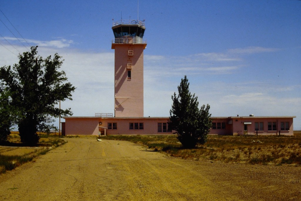
Control tower 1988
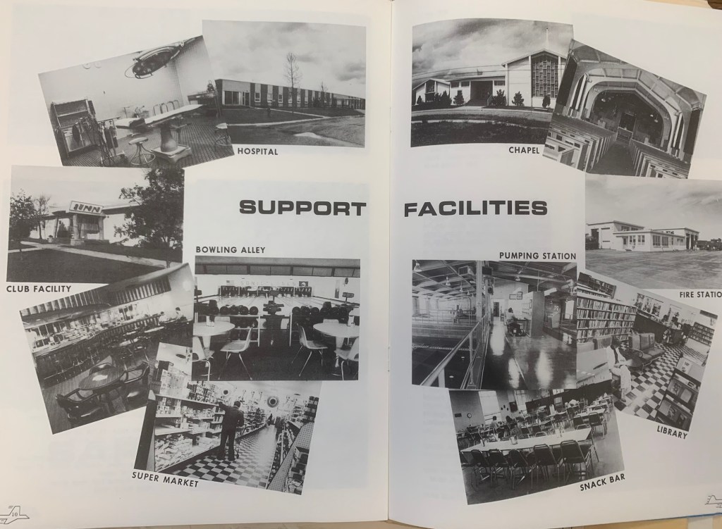
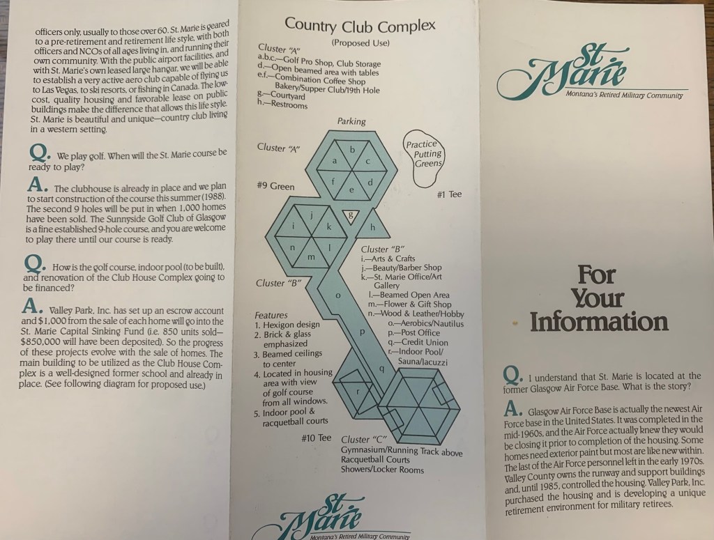
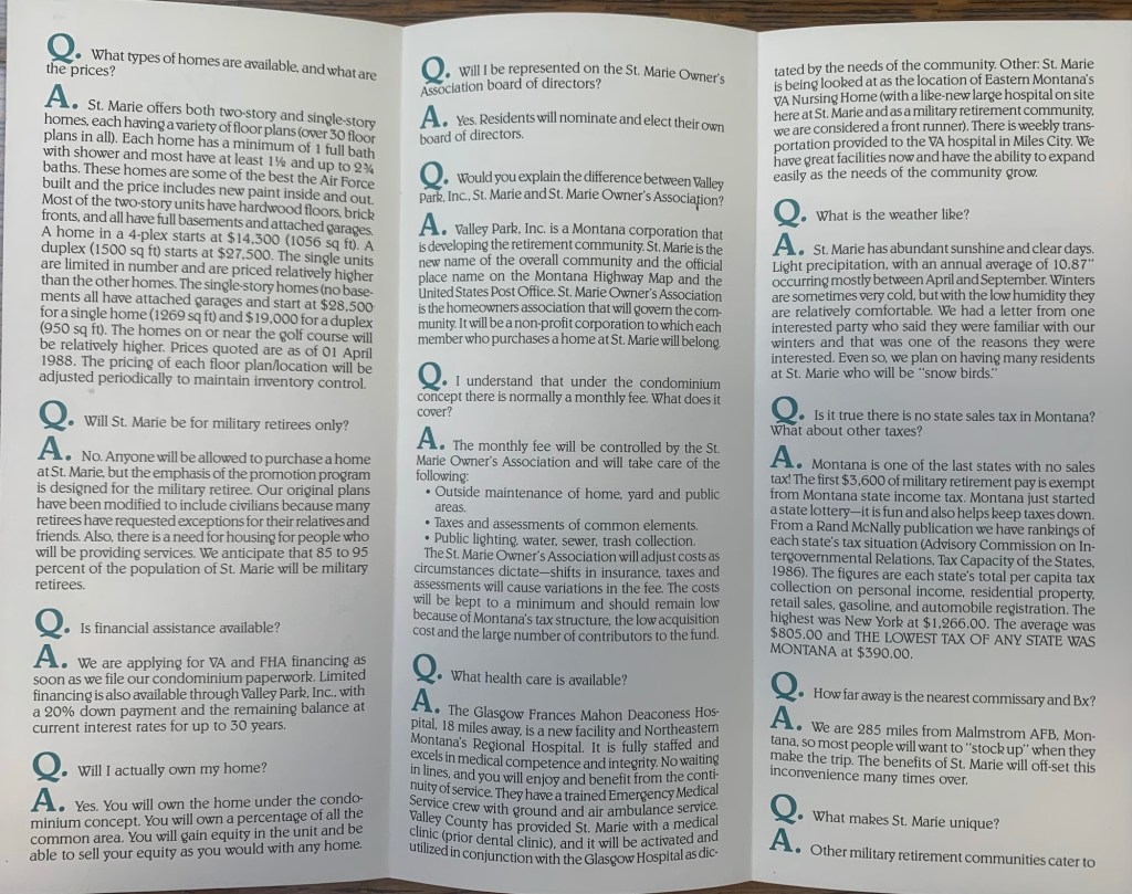
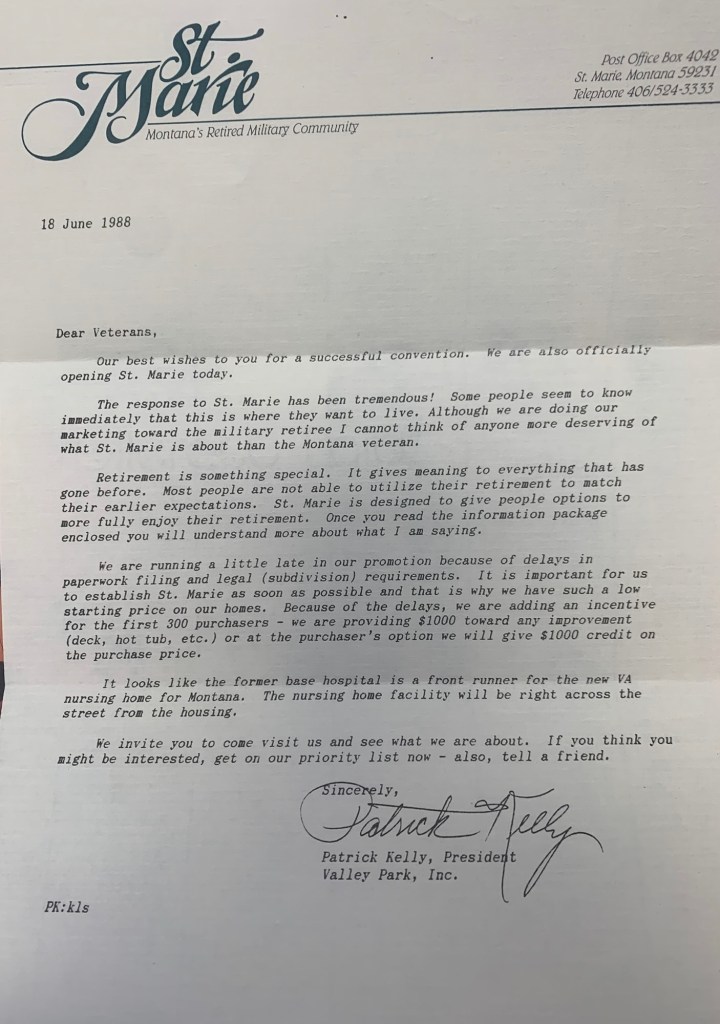
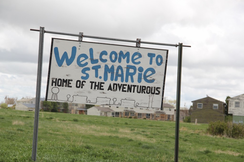
When I returned in 1988, the transformation of the base into civilian control was underway. Locals excitedly informed me of the new comprehensive plan to turn the base into a retirement community named St Marie, targeting veterans. The old support facilities would be humming once again and a golf course would be central to everything.
I was urged to invest now—get one of the officers homes, or half of a duplex for remarkably little—$27,500 for a 1,500 sq ft unit.
Obviously I passed on the opportunity, as did so many others who visited the community in the making over the next years. But enough said yes to give St Marie a fighting chance for a future. The promise didn’t last long, as several recent research articles detail. When I next visited Glasgow 25 years later in 2013, the folks at the museum didn’t urge me to buy—they told me to go and see what was left.
St Marie in 201320132013201320132013
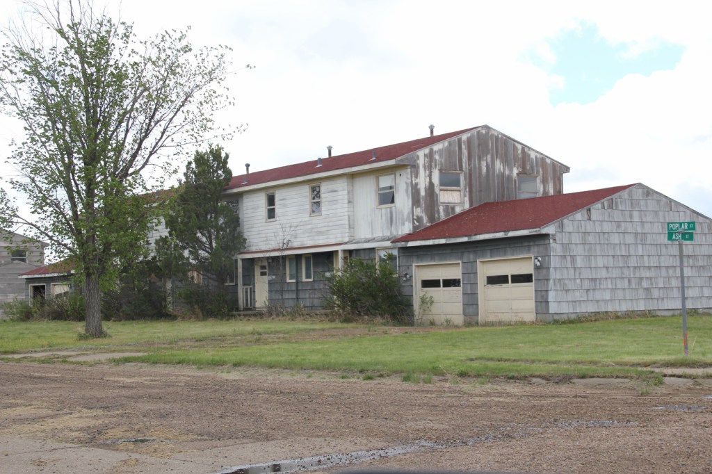
Rot, decay, mold were everywhere—but just like so many Montana ghost towns there remained a core group of residents who kept their homes well and expressed pride in what had been accomplished.
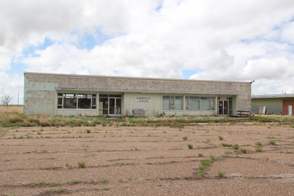
2013Community center 2013
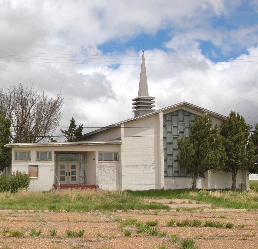
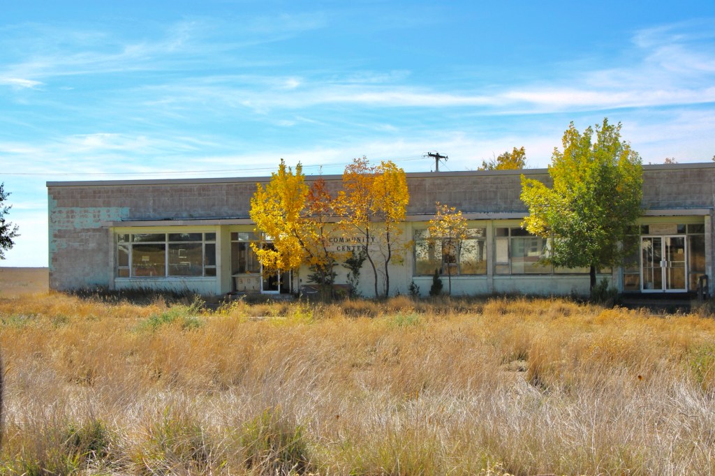
While key community buildings such as the chapel and post office/community center were closed, the flags were still flying proudly at the town hall. Officials spoke of a turnaround in the making.
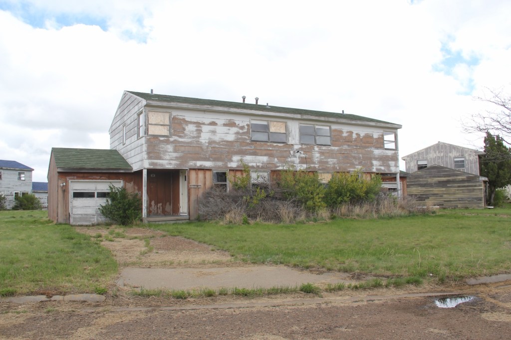
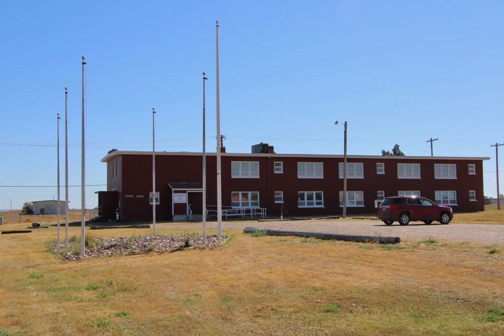
I returned in the fall of 2025–more than 40 years after my first visit—to find hopes mostly extinguished. The deterioration of the chapel, community center, and schools was shocking—little hope there.
October 2025October 2025October 2025October 2025
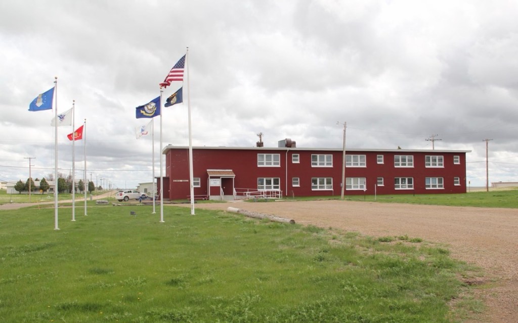
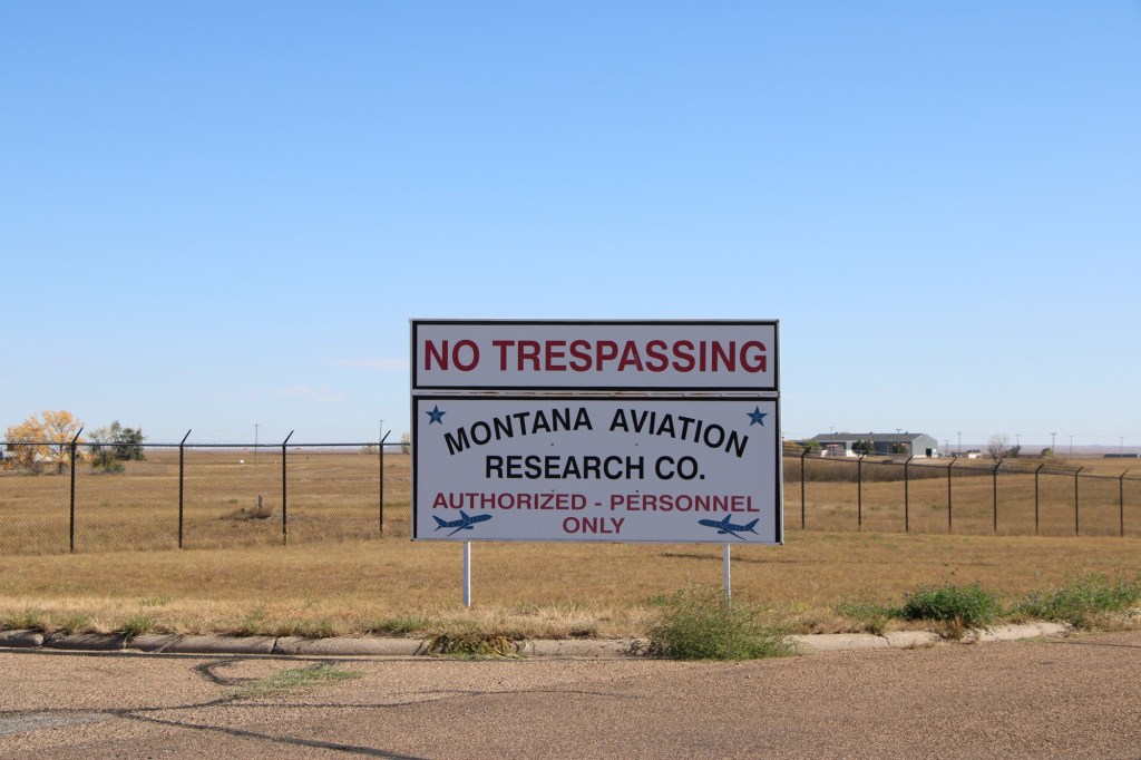
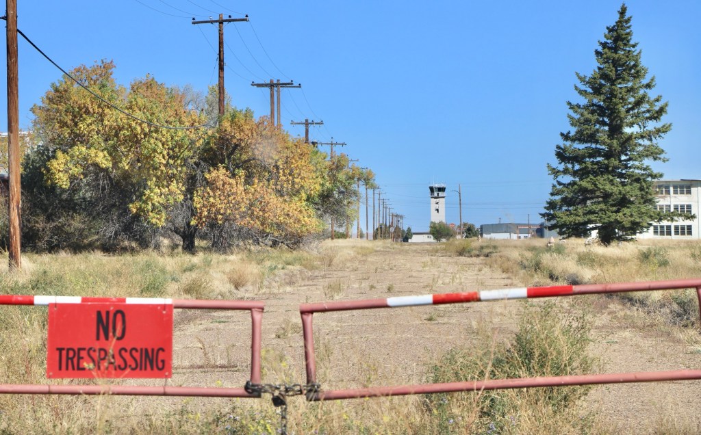
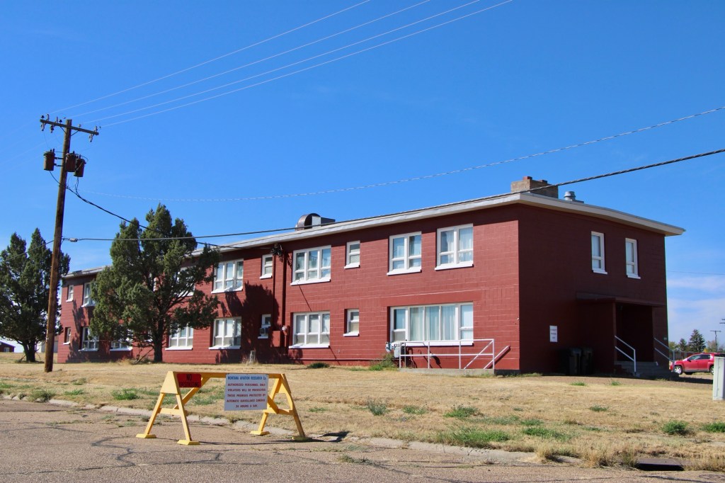
There were no flags flying at the town hall but everywhere it seemed there were new signs and barriers of the Montana Aviation Research Co. This private company was now using the runaways and had converted several buildings for employees’ use.
October 2025October 2025October 2025October 2025
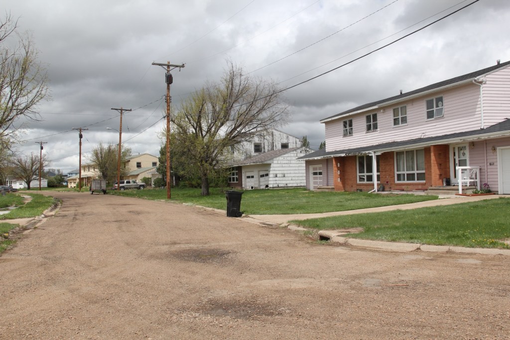
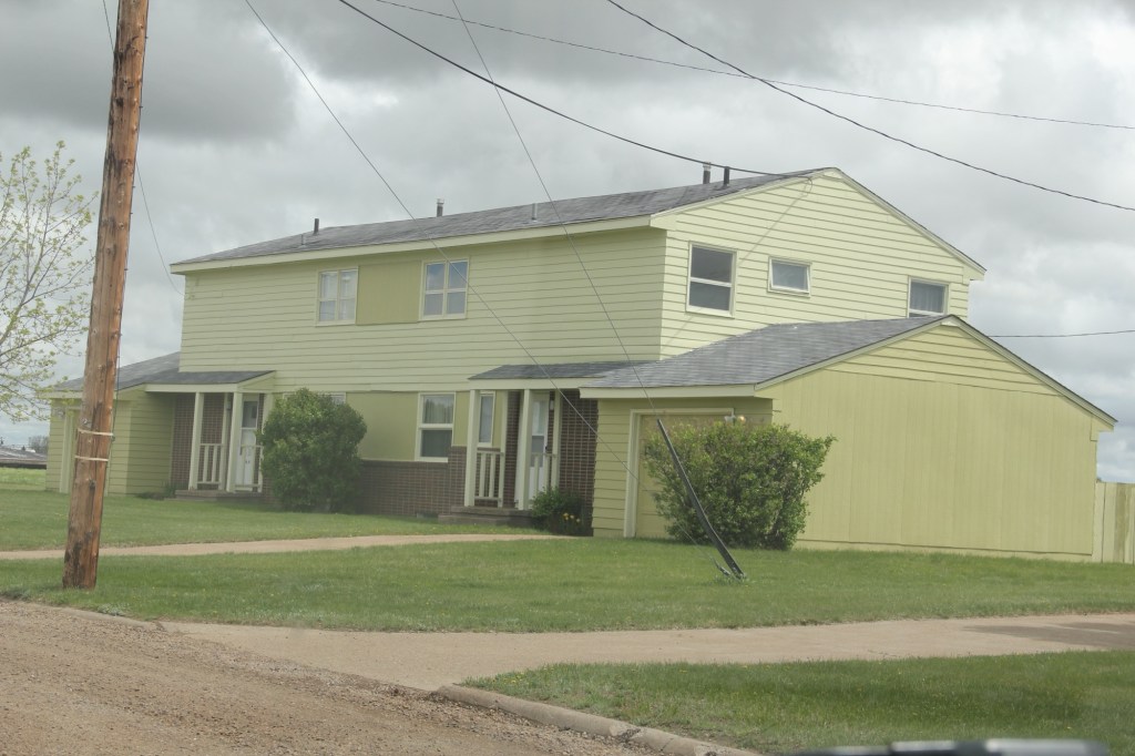
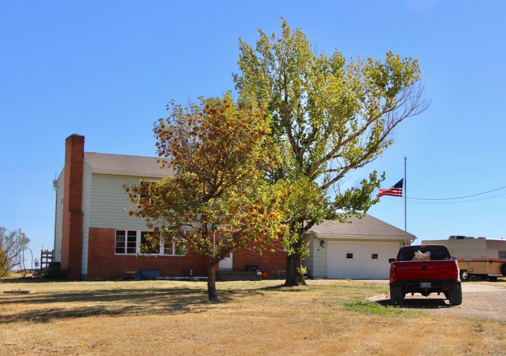
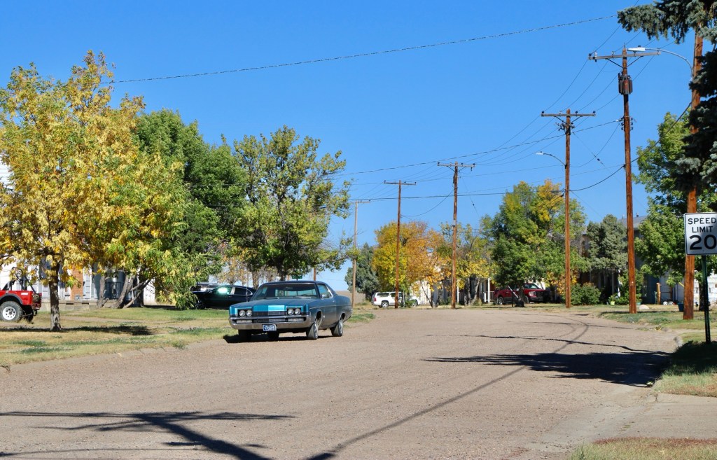
The population had cratered since 2013 but of those approximately 300 people who still called St Marie home, you have to admire their commitment to the place. Numerous homes were well maintained even with the signs of abandonment everywhere.
October 2025October 2025October 2025October 2025October 2025
What will be left when I next visit this modern-day ghost town of the northern plains?
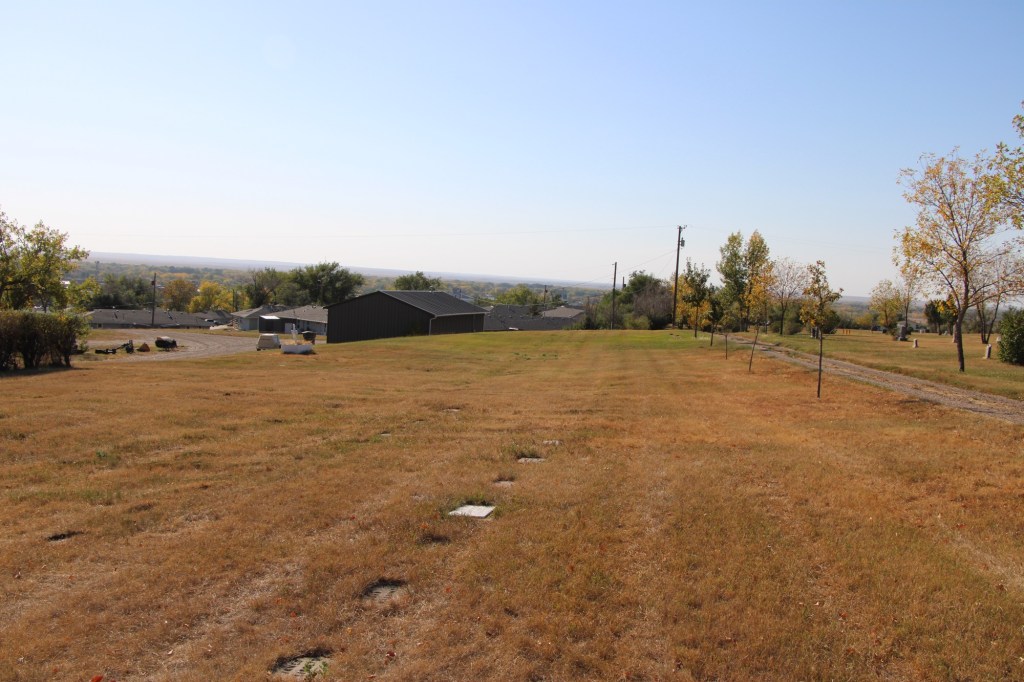
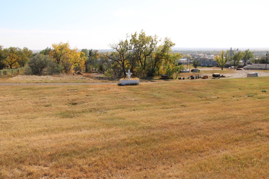
Glasgow, the seat of Valley County, dates to the late 1880s when the Manitoba Railroad (later named the Great Northern Railroad) entered the northeast corner of Montana Territory on its way west to its initial terminus in Great Falls. The first burials at what later became Highland Cemetery on a bluff northeast of the town center date to those years. The images above and below are of that first burial ground, known as Potter’s field, and part of what is designated at the first addition.
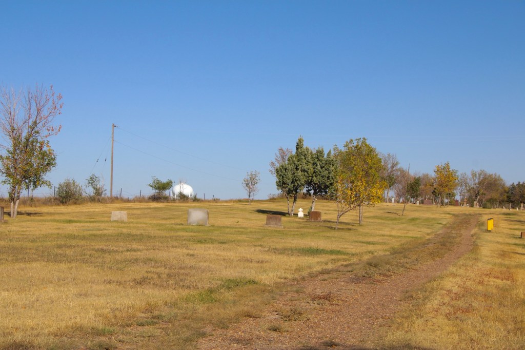
The next two images are of the cemetery’s second addition .
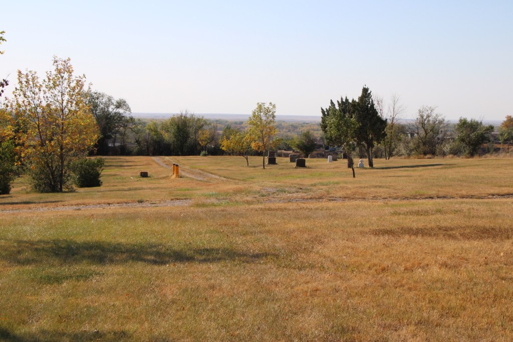
The section designated as Glasgow original cemetery also marks the beginning of the Highland Cemetery period. The Glasgow Montana Citizen reported on November 13, 1897: “Owing to the utter lack of system in locating the graves on the hill it was impossible to lay it [a city cemetery] out in lots so the county fathers located a strip of five acres of land adjoining the old burrying [sic] ground and laid it out into lots for future use. The cemetery is named Highland.” A couple of weeks later, the Glasgow Montana Citizen clarified the situation on December 11, 1897: The opinion prevails that the old cemetery is not a portion of the new one. This is wrong. The plat of Highland Cemetery includes a strip sixty feet wide of the old graveyard which takes in all the graves.”
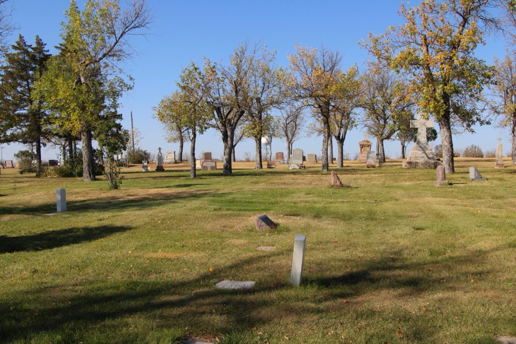
Within the boundaries of the original Highland are several remarkable gravestones, many of which have fascinating stories.
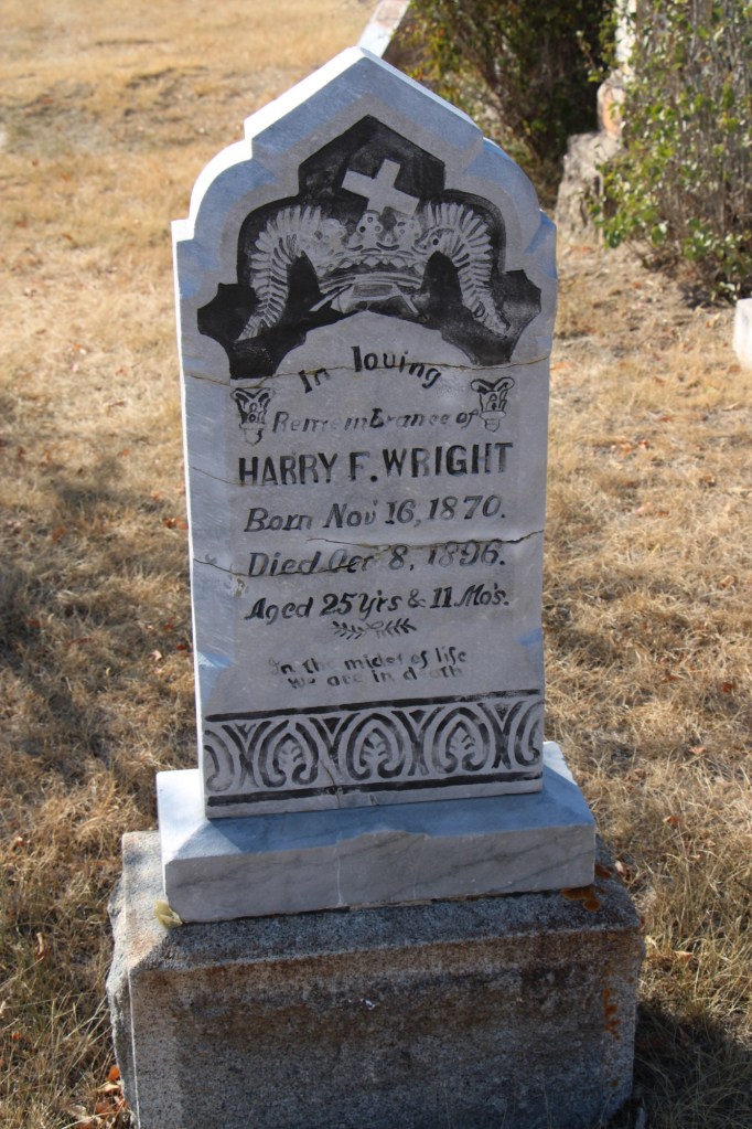
For instance, Harry Wright, according to the Glasgow Record of October 15, 1896, “was one of the best known ranchers around Saco and was a prosperous young man. He had quite a nice little bunch of cattle, a comfortable ranch and was always considered one of the most promising young men of Saco.” He was returning to England for a visit when he took ill in Buffalo, New York. He had kidney surgery which “proved most successful” but before resuming his travel Wright took a “Turkish bath” [a type of steam bath] and “death came a short while afterwards.” His sister lived in Hinsdale and had the body shipped to Glasgow to be buried in the cemetery in 1897.
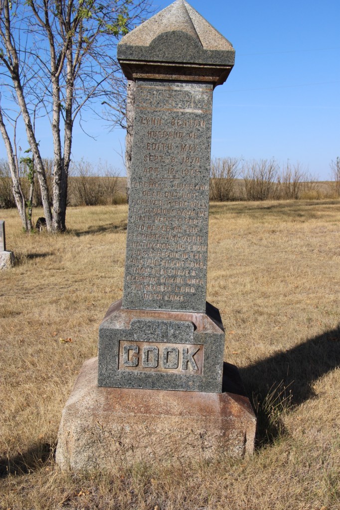
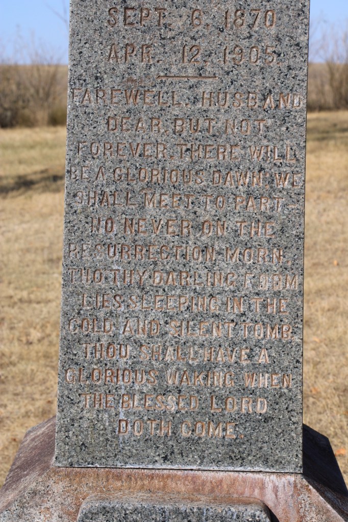
The tall obelisk marker for Lynn Benton Cook, who died at the age of 34 in 1905, has an unusually long dedication, beginning “Farewell Husband” composed by his wife Edith May.
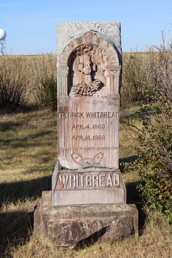
Fredrick Whitbread has a beautiful carved marker with a Richardsonian Romanesque arch framing a depiction of salvation. He was an Englishman who came to the USA in 1881. He worked as a locomotive fireman before becoming a Great Northern engineer. He left the railroad in 1897 and established a cattle ranch near Hinsdale. However in 1907 he reversed course to become the night foreman at the Great Northern’s roundhouse in Glasgow. He was a loyal member of the Odd Fellow lodge and his funeral “was the largest in the history of this city,” according to the Glasgow Montana Citizen of April 25, 1908.
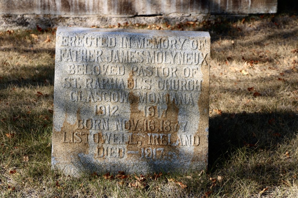
Another prominent citizen was Father James Molyneux, an Irish Catholic priest who pastored St RaphaelCatholic Church in Glasgow from 1912-1917 during the height of the county’s homesteading boom.
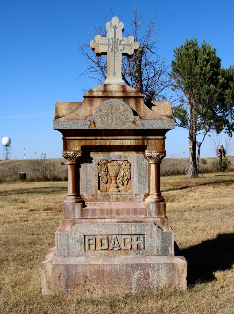
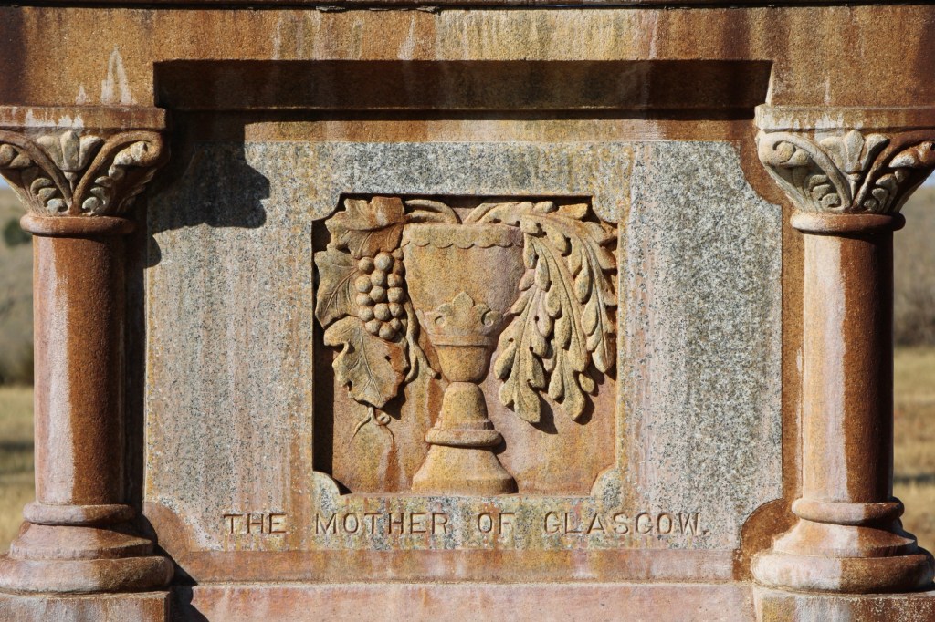
Perhaps the most compelling marker in the early history of Highland Cemetery is that of Mary Fitzpatrick Roach. She first came to Glasgow by 1890 when she worked as a cook at a local hotel before opening her own restaurant. During the railroad strike of 1895, she “became famous all along the Hi Line, by carrying her customers along whether they could pay or not.” (Glasgow Courier, June 5, 1931)
Her empathy and charity earned her the nickname “Mother of Glasgow,” which is carved in her gravestone. After the strike, her business grew and she owned a boarding house, a meat market, a large herd of cattle, and a lodging house. She married Porter Roach in 1907 and died two years later.
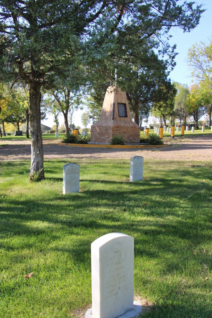
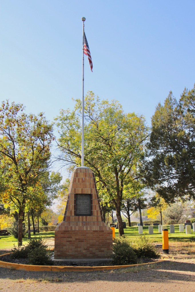
Highland Cemetery, like several other municipal cemeteries along the Hi Line, maintains an impressive Veterans section, with the four section arranged around a central flagpole.
Residents of Valley County are no doubt proud of what Highland Cemetery says about their respect for the past and those who came before. This post only begins to share the impressive grave markers and stories of this public space.
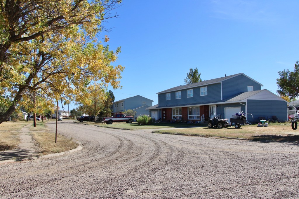
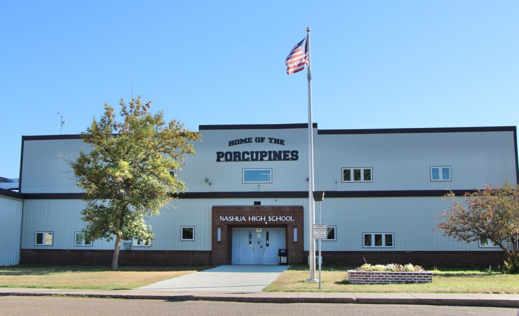
It had been over a decade since I last stopped in late September 2025 at the tiny railroad town of Nashua in Valley County. Recently in the state and regional press, there have been stories about the uptick in tourism in northern Montana. It’s about time, especially for intrepid heritage tourists. As my posts from over ten years ago emphasized, an amazing array of stories and places await those who venture beyond Havre on U.S. Highway 2.
Even tiny Nashua (probably less than 300 residents today) reflects virtues worth exploring—community pride especially as reflected at the recently renovated Nashua High School, above. Since the town had lost population since my last visit, I had wondered if the school was still there as an anchor. Indeed it was, and looked almost modern as its 1935 core from the New Deal had been layered over with a new facade.
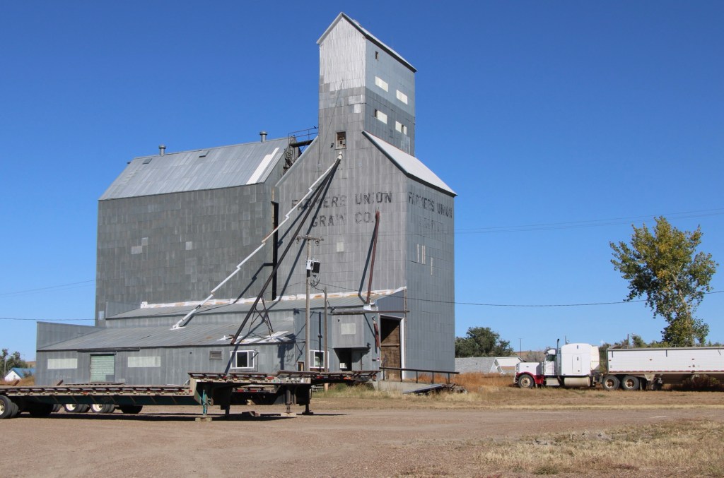
The railroad was the dominant influence in the town’s history—save for the 1930s boom during the construction of nearby Fort Peck Dam—and the town’s rail corridor is still defined by its grain elevators.
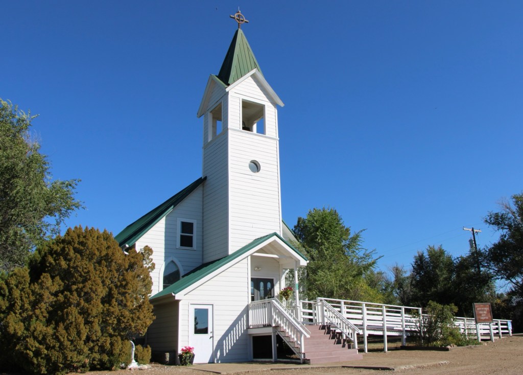
Queen of Angels Catholic Church
Competing for the Big Sky line of Nashua is the tall Gothic style bell tower of the Catholic Church. Established in 1917, Queen of Angeles Catholic Church began as a mission church. The Sisters of Charity worked with the diocese to establish an adjacent one-room school, below, as a way of growing and maintaining the congregation after the end of the Fort Peck Dam boom.
Then in 1953 Rev A. J. Schuh wrote an appeal to The Catholic Worker, a major newspaper, asking for the support for the construction of a rectory so that a more permanent foundation for the church’s work in Nashua could be laid. I had no idea if the appeal worked or not—but something happened. Queen of Angels Catholic Church was in great condition, and a major town landmark.
Front Street, Nashua
Along the old highway route was another landmark, of a quite different purpose: Vic’s Bar and Bowling Alley. Here is the private social center for the town. Great rural Montana towns always have at least one traditional watering hole. Vic’s is that place in Nashua.
Victor Dostert (1886-1961) homesteaded south of the town along the Milk River during the boom of the 1910s but when the bust came in the 1920s Dostert, his wife Anna, and their three sons stayed, making their mark with construction projects (from a theater to the Catholic Church) and taking advantage of the thousands of construction workers passing through by building and operating Vick’s Bar in 1935. He added the bowling alley in the 1950s—a decade when the bowling craze as a community institution reached its peak across the nation.
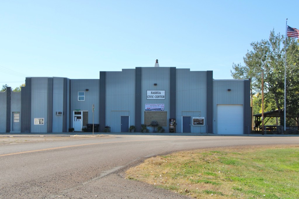
Dostert as Nashua’s town official had already been instrumental a few years earlier in the creation of the Nashua Civic Center, the public community center for this part of Valley County still today.
These places and brief stories hint at the richness of heritage experiences in Valley County. I’m glad I stopped at Nashua again (just too bad that it was early in the morning and Vic’s Bar was not yet opened). But give the residents much credit—they hung through another tough decade through commitment, community spirit, determination and faith.
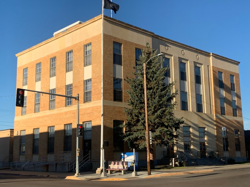
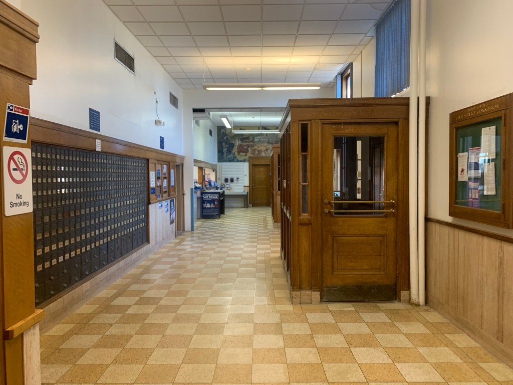
One of my favorite, if not #1 itself, Depression-era buildings in Montana is the amazing Federal building in Glasgow. First, this triumph of New Deal design from 1939 is a powerful statement in the public architecture of northeast Montana.
As you may know, Glasgow embraces its reputation as the most isolated place in the nation, that it is the definition of the middle of nowhere (a reputation however that I really challenge). But the restrained classicism of the building is refined and tasteful, perfect of the region.
Second, I really admire the building because it is so intact after 86 years of use. Yes, there are some alterations, but when you step into the post office lobby, you do feel like you stepped back in the 1930s.
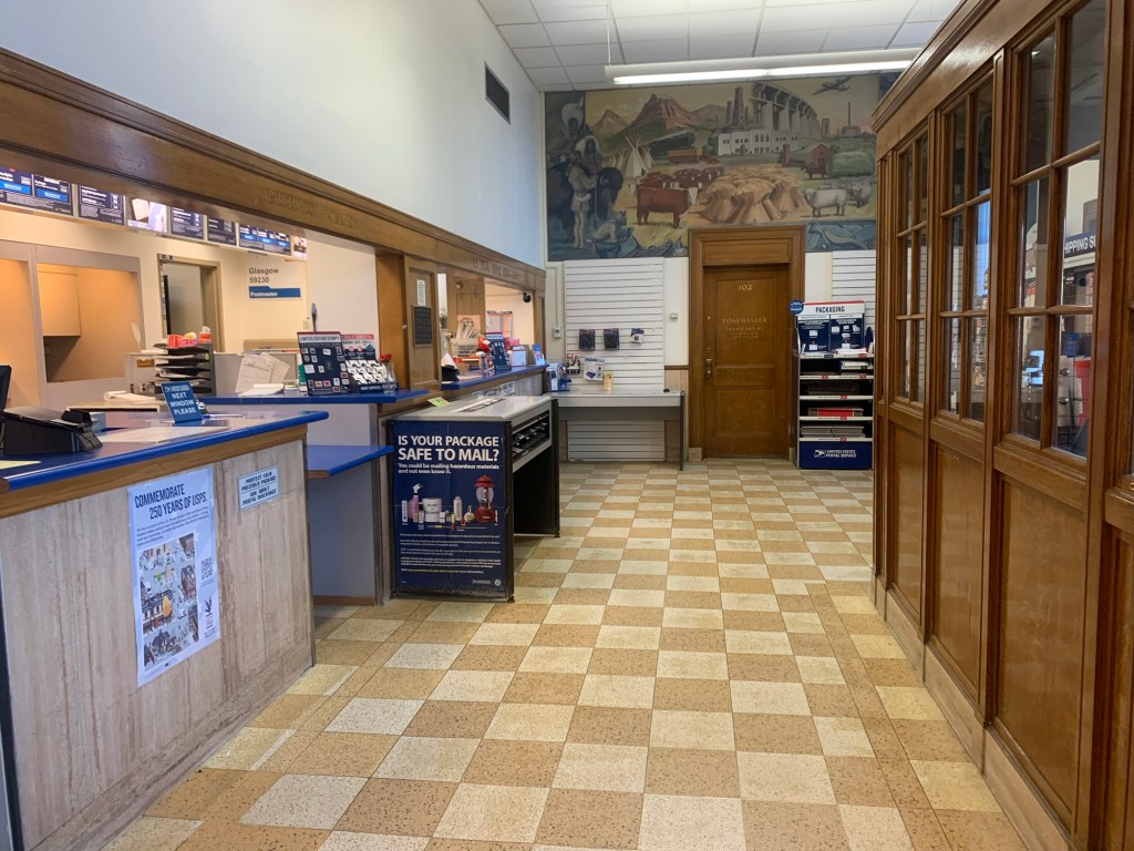
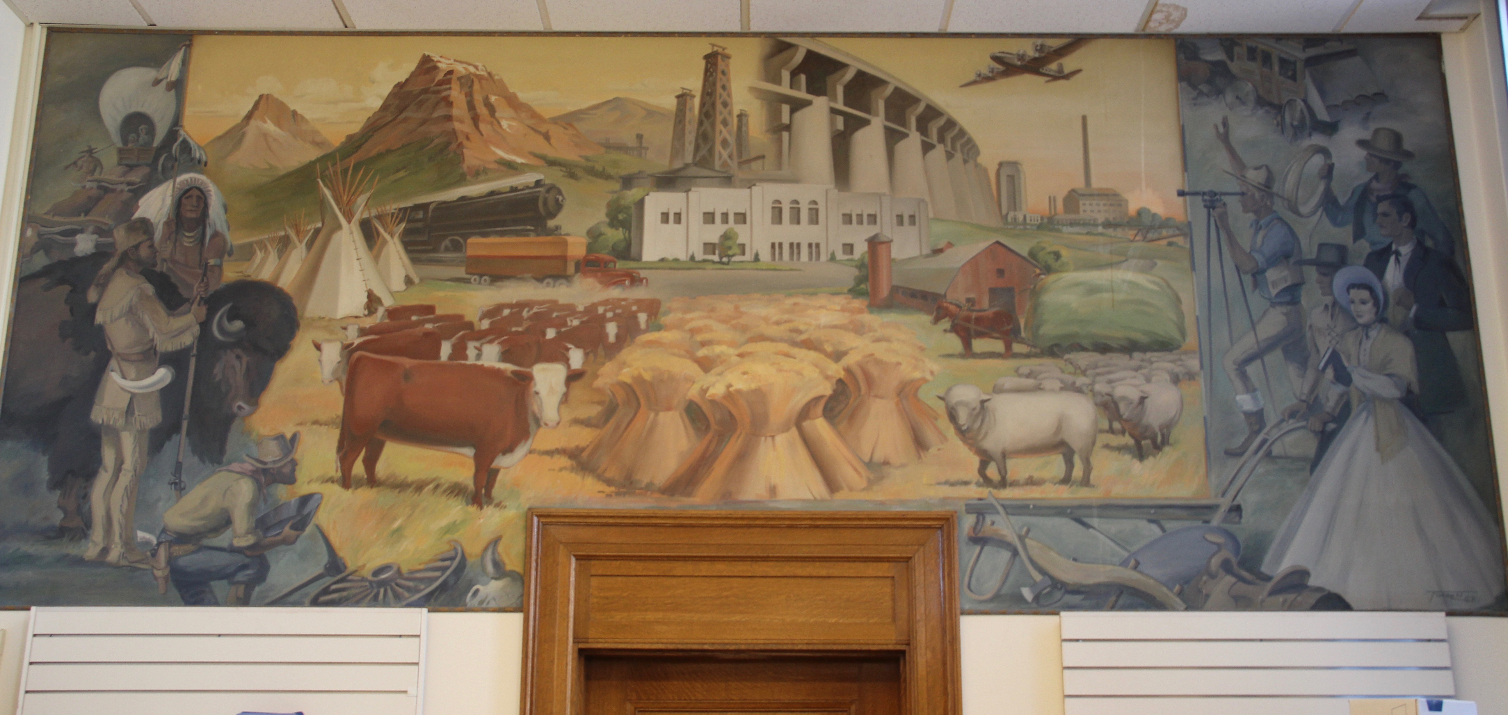
Then there is the wonderful mural, “Montana’s Progress,” by Forest Hill. Completed in 1942, as the county’s other major, and huge, New Deal project, Fort Peck Dam and powerhouse, was gearing up to maximum production for World War II.
The left side speaks to the Native American past and the nearby presence of Fort Peck Reservation. There’s even a reference to gold panning, which never happened along this section of the Missouri. Then the right side reference the coming of settlers and the parceling of once open land into regular measured surveys.
The center section speaks to the Progress, predicted to come, centered on railroads, agriculture (cattle, wheat, hay, sheep), and industry, with the commanding image of the amazing Fort Peck spillway ( already world famous to an earlier feature story in Life magazine) and in the top corner, a sugar beet refinery.
The bomber flying above it all of course spoke to the immediate present , of World War II, but it also correctly predicted the future. The town and county would have its greatest period of prosperity in the 1950s and 1960s with the Glasgow Air Force Base.
What a historic document of its time and what an amazing building, still serving the community almost 90 years later.
In 2024 I began to see media accounts, both regionally and nationally, of how Glasgow, the seat of Valley County, was the most isolated place you can imagine, truly in the Middle of nowhere.
Historic Great Northern Railroad corridor in Glasgow
I’m not one to argue with geographers and economists. I’m sure from their perspective, they got it right. But I never thought of Glasgow as isolated: it is on the Great Northern mainline, and part of the famed Empire Builder Amtrak route, and on U.S. Highway 2.
Great Northern depot, Glasgow
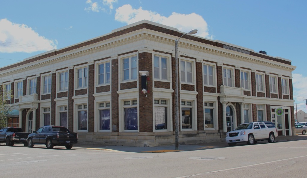
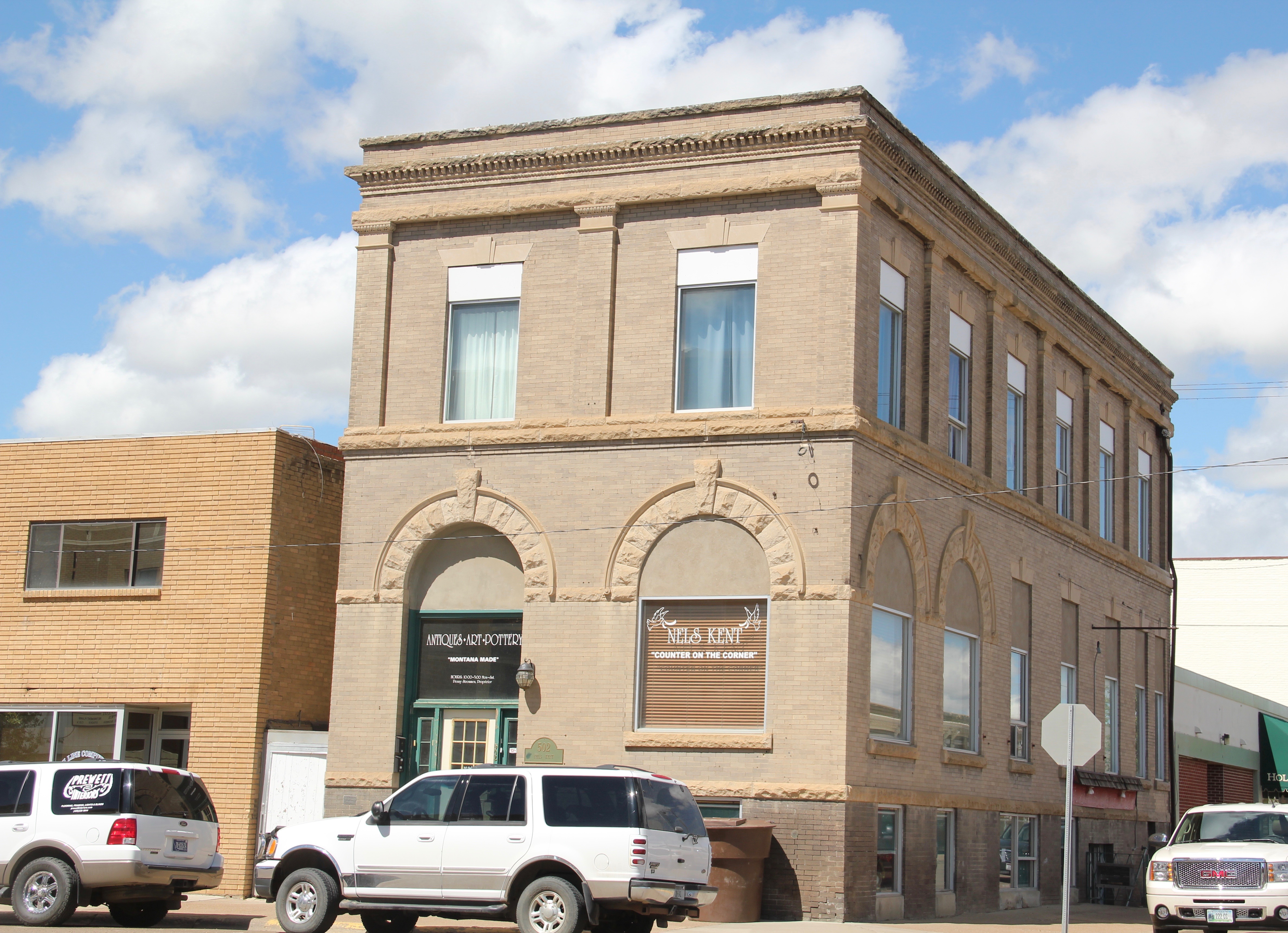
Then the town has always shown a great deal of pride and ambition, conveyed so effectively by its many historic buildings, starting with the First National Bank, built c. 1884 and listed in the National Register of Historic Places.
1st National Bank building, Glasgow
When you enter the town from the underpass of the railroad, the bank is the first landmark to catch your eye, appropriate too for the impact of local banks on a town’s economic prospects during the homesteading boom and bust of the 1910s and 1920s, respectively.
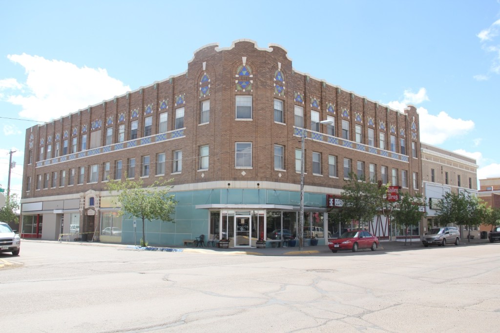
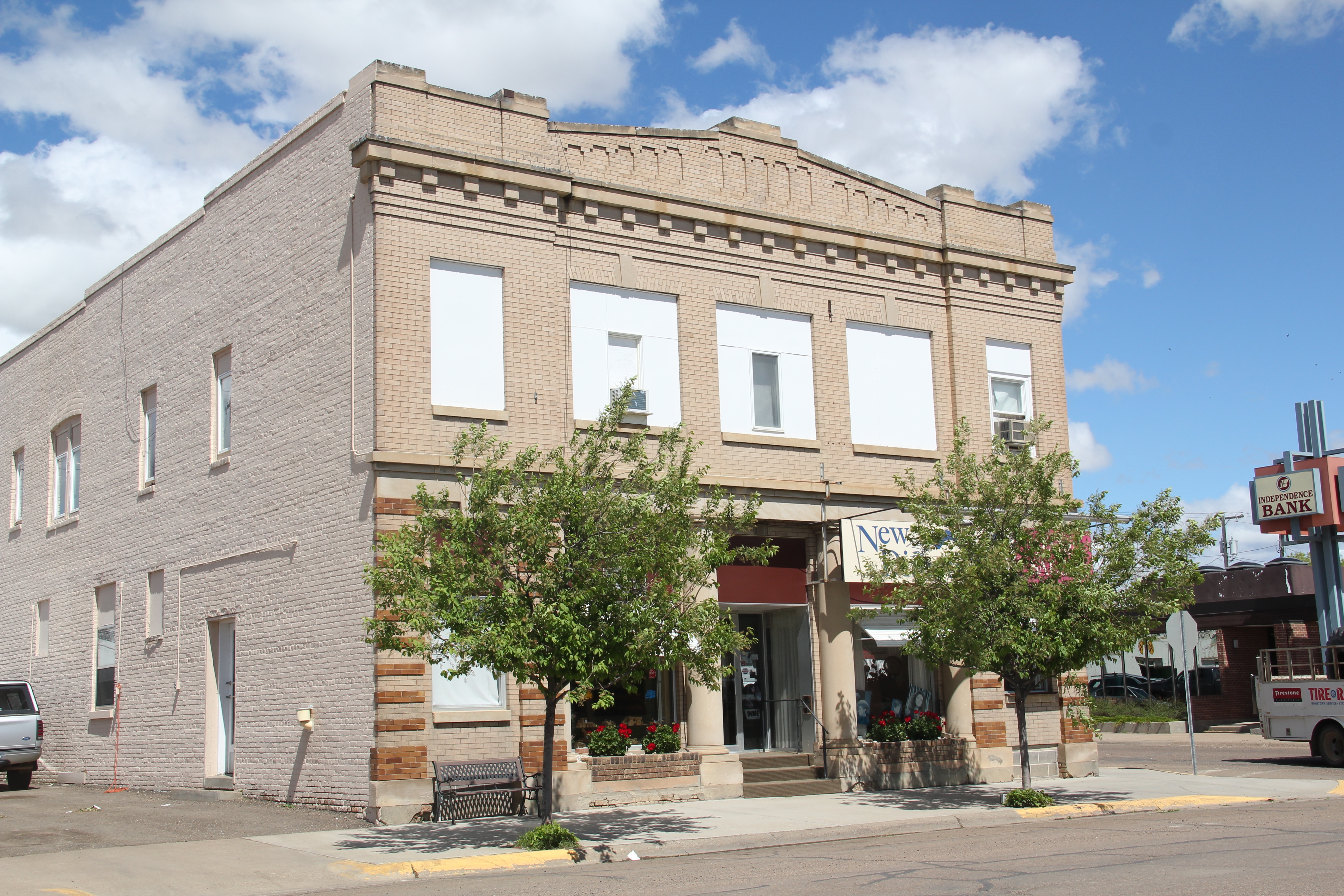
Rundle Hotel, during renovation in 2013
Another landmark from the homesteading era is the Rundle Building, once the Glasgow Hotel and restored in the last ten years as an upscale hotel in the heart of downtown. Built c. 1916 and designed by the important Billings firm of Link and Haire, the Rundle is a captivating statement of an Arts and Crafts-infused Mediterranean Revival style. I have been trying to get back to Glasgow to stay here for the last four years—maybe I will make it in 2025.
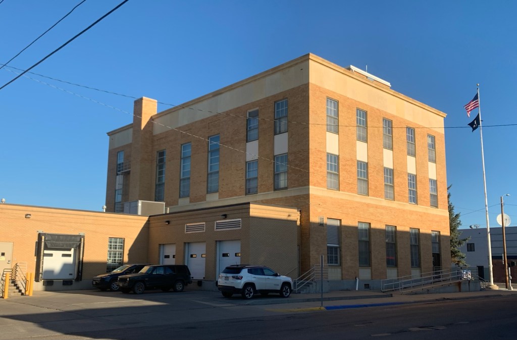
The 1930s transformed Valley County through the construction of the mammoth Fort Peck Dam on the Missouri River. Glasgow too has a major New Deal landmark in its U.S. post office and courthouse, built c. 1939 and designed by federal architect Louis A. Simon.
Post office/federal courthouse, Glasgow
Its understated New Deal Deco exterior obscures a jewel of an interior, highlighted by its New Deal-funded 1942 mural depicting local history and the changes brought about by the Fort Peck Dam by artist Forest Hill. This building too is listed in the National Register.
Glasgow post office mural
Another important New Deal supported building was all about the community, and providing new opportunities: the Glasgow Civic Center. It too has a New Deal Deco style, and its large public space has been used for almost every type of event or gathering you can imagine.
Glasgow Civic Center
Glasgow’s sense of itself today still respects it past, brilliantly conveyed by its large and expansive museum. When I first visited Glasgow 40 years
Valley County Museum
ago, I held a public meeting on the state historic preservation plan here, and the next morning residents gave me a detailed tour of the recently established museum. I was impressed with its collection then, now it sprawls through the building to the adjoining grounds.
Veterans section of the museumThe high school band sectionLewis and Clark mural, 2095, by Jessie Henderson, a Chippewa/Cree artistThe back bar at saloon exhibit
Indeed, the saloon exhibit underscores another fun part of Glasgow—across from the depot in the original route of Highway 2 is an amazing collection of bars, stores, and eateries, right out of the early 1900s.
Glasgow bars at depot
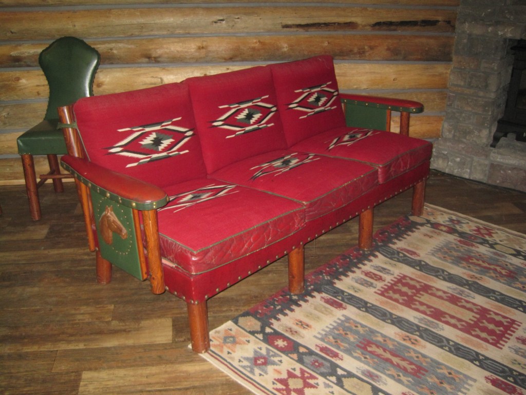
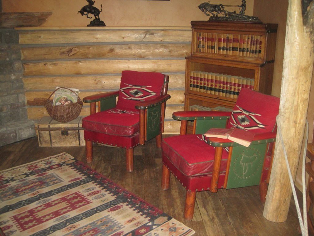
But back to the museum, and its important Montana decorative arts collection of the work of modern craftsman Thomas Molesworth, once in the town’s Carnegie library.
The newer exterior exhibits led the museum to move entire building to the property, including examples of the homestead shacks of the early 1900s that were followed by permanent homes such as this white painted bungalow.
Representative ranch house from homesteading boom
Pride of place, pride of the past. Glasgow might be in the middle but it is far from being nowhere as this small sampling of properties demonstrates.
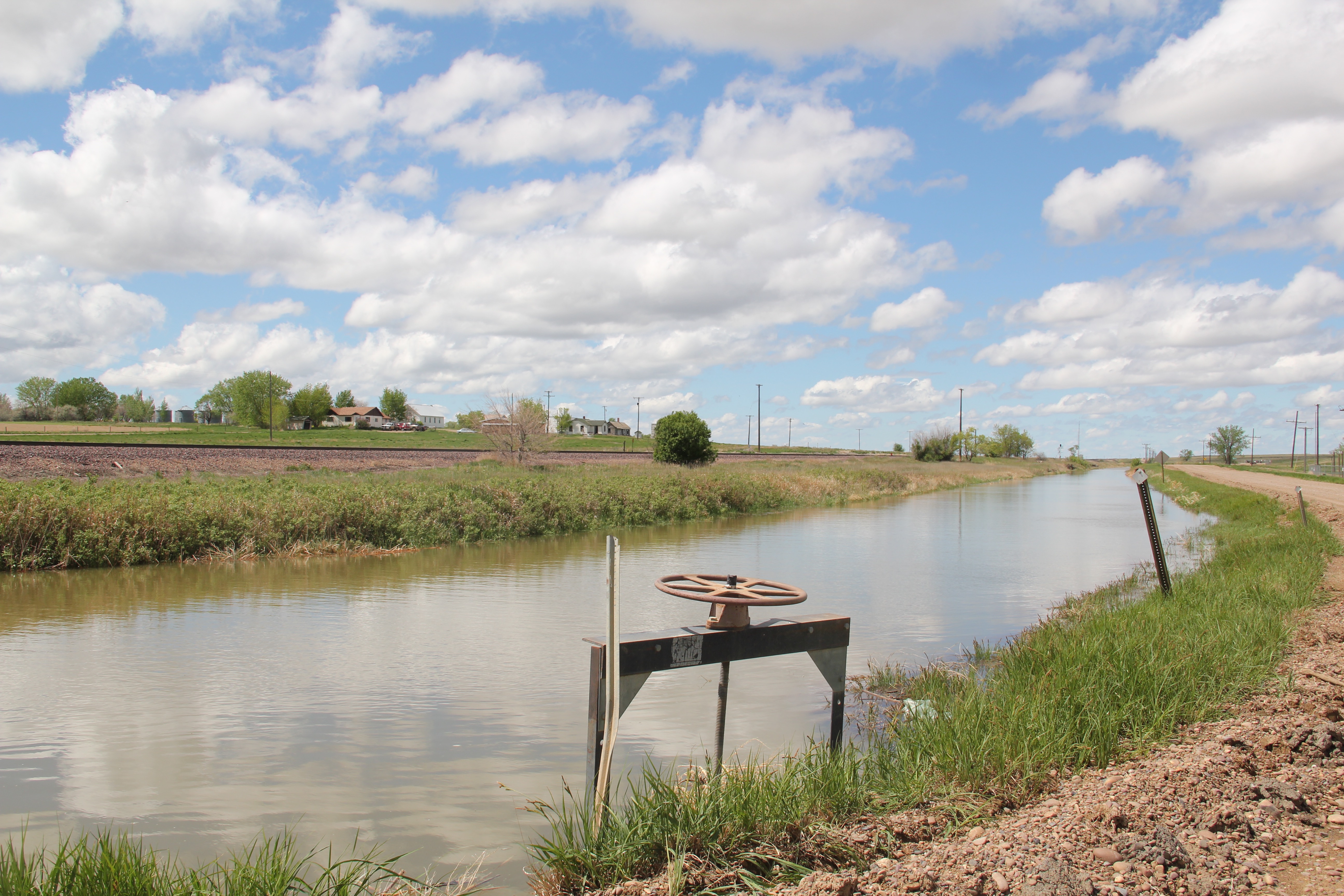
Milk River Irrigation Project Ditch at Dodson, Phillips County
In today’s New York Times (June 15, 2020), Montana Jim Robbins reported on the looming disaster facing Montana’s northern states if the St. Mary’s canal, which recently collapsed, is not repaired. The informative, insightful story focuses on the beginnings of the U.S. Bureau of Reclamation’s Milk River Irrigation Project, its pathway through southern Alberta, and its emergence in central Montana’s Hill County. It included several wonderful images of Havre, the seat of Hill County, and discussed the wide-ranging disaster faced by ranchers and small towns along the Hi-Line if the ditch did not get its long overdue repairs–to the tune of $200 million.
The Great Northern, the Milk River Project, and original U.S. 2 at Tampico
Robbins’ story immediately took my mind back to my travels throughout the Milk River Valley, from Hill County to Valley County, in 2013. The story of how modern transportation and engineering combined to transform the northern plains is so fundamental to the region’s history, yet it remains a story seldom told (another reason Robbins’ New York Times story matters). The image above represents the forces that led to the settlement and development of the Milk River Valley. Taken outside of the village of Tampico in Valley County, it centers the ditch between the two transportation systems–the Great Northern Railway on the left and the original route of U.S. Highway 2 on the right– that served the settlers drawn by the water. The image below shows the village of Tampico from the perspective of the ditch–the place would not exist without the ditch.
One of the very few historical markers in Montana that touches on the state’s irrigation history focuses about a historic bridge that once stood nearby at Tampico.
Large man-made lakes capture water to reserve it for use throughout the growing season. The images above are of Fresno Reservoir, on a rainy morning, in Hill County. While the two images below are of Nelson Reservoir, on a typically bright sunny day, many miles downstream in Phillips County.
The Milk River Project shapes so much of the Hi-Line, it has become just part of the scenery. I wonder how many travelers along U.S. Highway 2 in Phillips County even notice or consider the constant presence of the ditch along their route.
Not only are their scattered small towns along the Milk River Project, early agricultural institutions are often centered on the project. A great example is the Phillips County Fairgrounds, outside of Dodson, and the question may be well posed–why there? Dodson
is a tiny place, almost 20 miles from the county seat of Malta. But at the time of the Milk River Project, Dodson was vital; the ditch neatly divided the town into two halves, and a major diversion dam was just west of town. Here was a perfect place, at the turn of the century, for a fairgrounds. And it is a gorgeous historic fairgrounds.
My first encounter with the Milk River Project and the beautiful valley it serves came in February 1984 when Eleanor Clack took me on a tour of the bison kill historic site just west of downtown Havre. It remains an excellent place to see how the waters of the Milk have nurtured countless generations of peoples who called this place home.
Just last week I posted about two other Milk River Project towns–Lohman and Zurich–in Blaine County. My next post will continue this second look at the Milk River Project as I revisit Chinook, the Blaine County seat, where the ditch once again is almost everywhere, but rarely given a second thought.
Hinsdale (just over 200 people in Valley County) and Saco (just under 200 people in Phillips County) are two country towns along the Hi-Line between the much larger county seats of Glasgow and Malta. I have little doubt that few visitors ever stop, or even slow down much, as they speed along the highway. Both towns developed as railroad stops along the Great Northern Railway–the image above shows how close the highway and railroad tracks are along this section of the Hi-Line. Both largely served, and still
serve, historic ranches, such as the Robinson Ranch, established in 1891, in Phillips County. Both towns however have interesting buildings, and as long as they keep their community schools, both will survive in the future.
Hinsdale School, Valley County
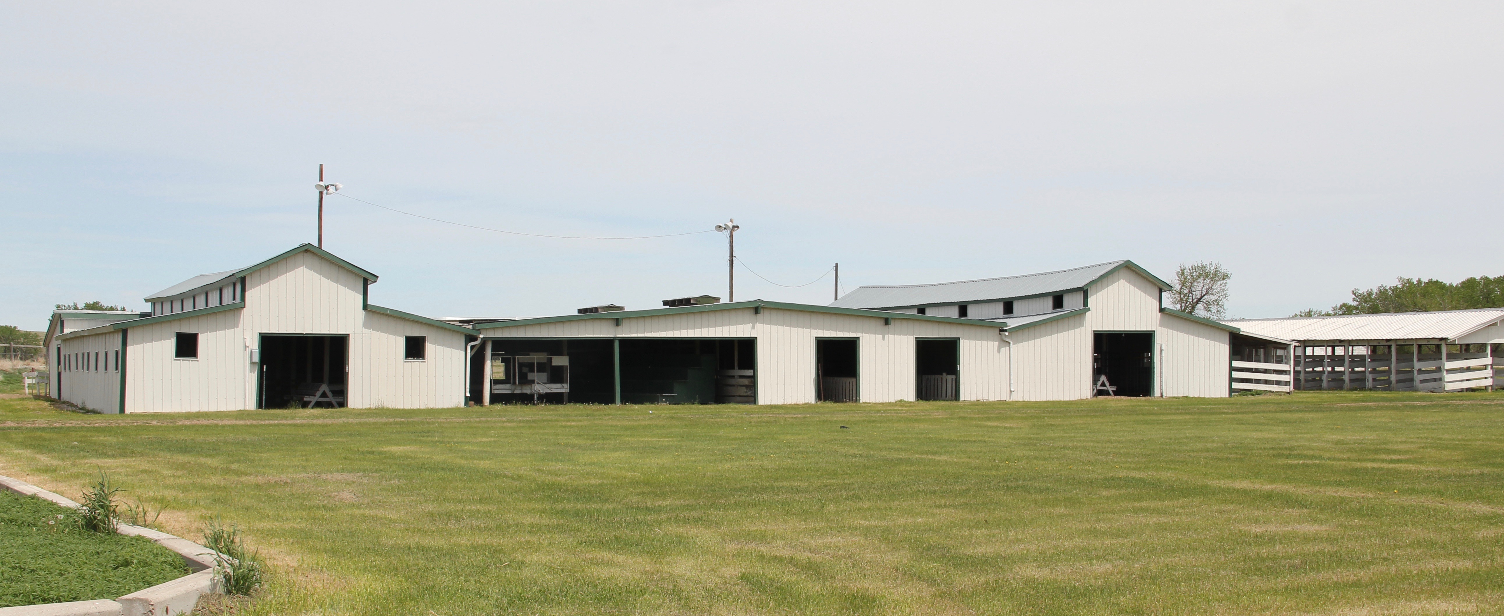
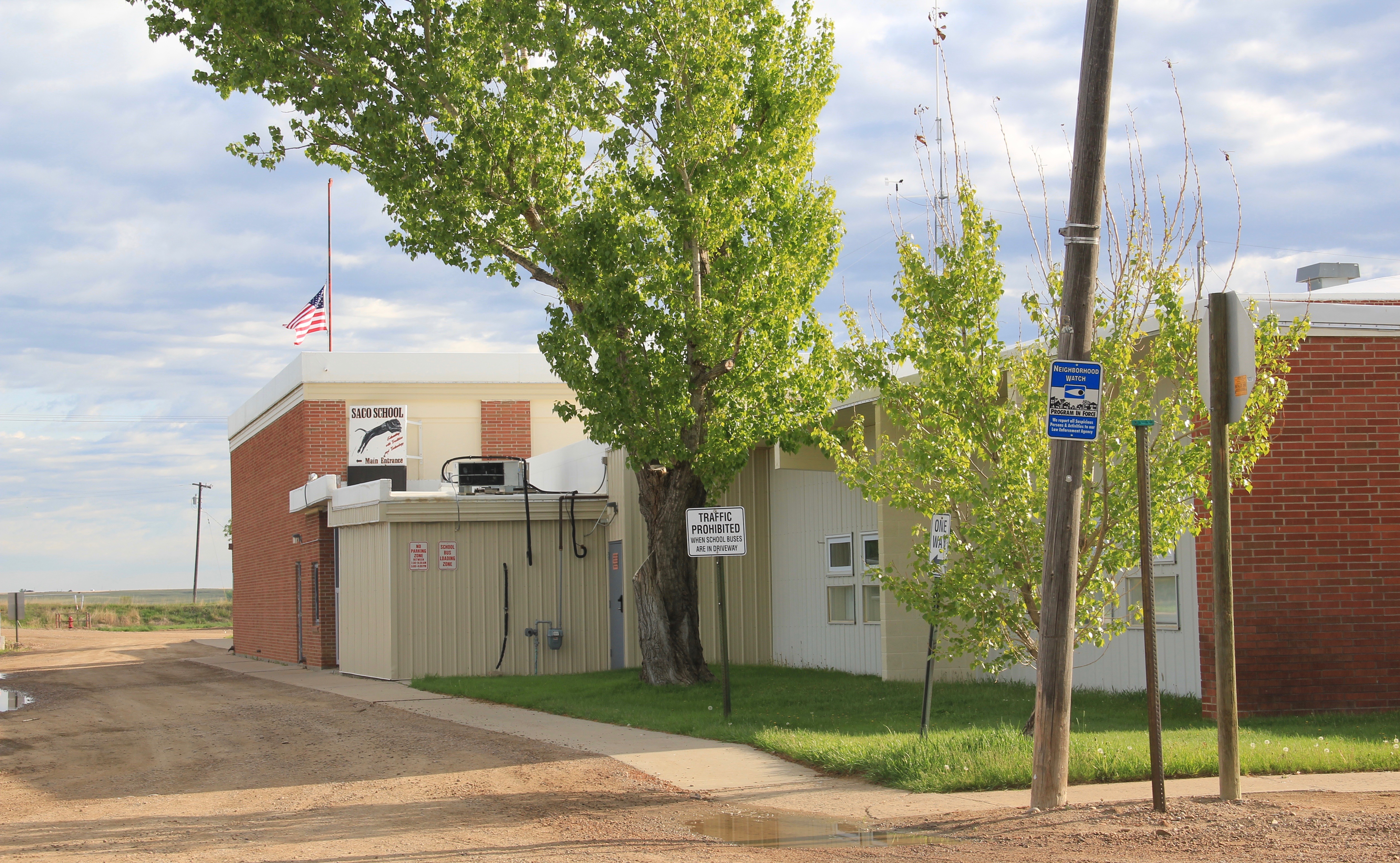
Saco School, Phillips County
Of the two towns, I have discussed Saco to a far greater extent in this blog because it was one of my “targeted” stops in the 1984 survey. The State Historic Preservation Office at the Montana Historical Society had received inquiries from local residents in Saco about historic preservation alternatives and I was there to take a lot of images to share back with the preservationists in Helena. But in my earlier posts, I neglected two community
buildings, the rather different design of the post office from the 1960s and the vernacular Gothic beauty of the historic Methodist Church, especially the Victorian brackets of its bell tower.
I ignored Hinsdale almost totally in its first posting, focusing on roadside murals. This Valley County town is worth a second look, if just for its two historic bank buildings. The former First National Bank and the former Valley County Bank both speak to the hopes for growth along this section of the Milk River Project of the U.S. Reclamation Service in the early 20th century. Architecturally both buildings were touched by the Classical Revival style, and both took the “strongbox” form of bank buildings that you can find throughout the midwest and northern plains in the first two decades of the 20th century.
The rest of Hinsdale’s “commercial district” has the one-story “false-front” buildings often found in country railroad towns along the Hi-Line.
Local residents clearly demonstrate their sense of community not only through the school, which stands at the of the commercial area. But community pride also comes through in such buildings as the c. 1960s American Legion Hall, the c. 1902 Methodist church (the separated cupola must be a good story), and St. Anthony’s Catholic Church.
These small railroad towns of the Hi-Line have been losing population for decades, yet they remain, and the persistence of these community institutions helps to explain why.
It has been five years since I revisited the historic built environment of northeast Montana. My last posting took a second look at Wolf Point, the seat of Roosevelt County. I thought a perfect follow-up would be second looks at the different county seats of the region–a part of the Treasure State that I have always enjoyed visiting, and would strongly encourage you to do the same.
Grain elevators along the Glasgow railroad corridor.
Like Wolf Point, Glasgow is another of the county seats created in the wake of the Manitoba Road/Great Northern Railway building through the state in the late 1880s. Glasgow is the seat of Valley County. The courthouse grounds include not only the modernist building above from 1973 but a WPA-constructed courthouse annex/ public building from 1939-1940 behind the courthouse.
The understated WPA classic look of this building fits into the architectural legacies of Glasgow. My first post about the town looked at its National Register buildings and the blending of classicism and modernism. Here I want to highlight other impressive properties that I left out of the original Glasgow entry. St. Michael’s Episcopal Church is an excellent late 19th century of Gothic Revival style in Montana.
The town has other architecturally distinctive commercial buildings that document its transition from late Victorian era railroad town to am early 20th century homesteading boom town.
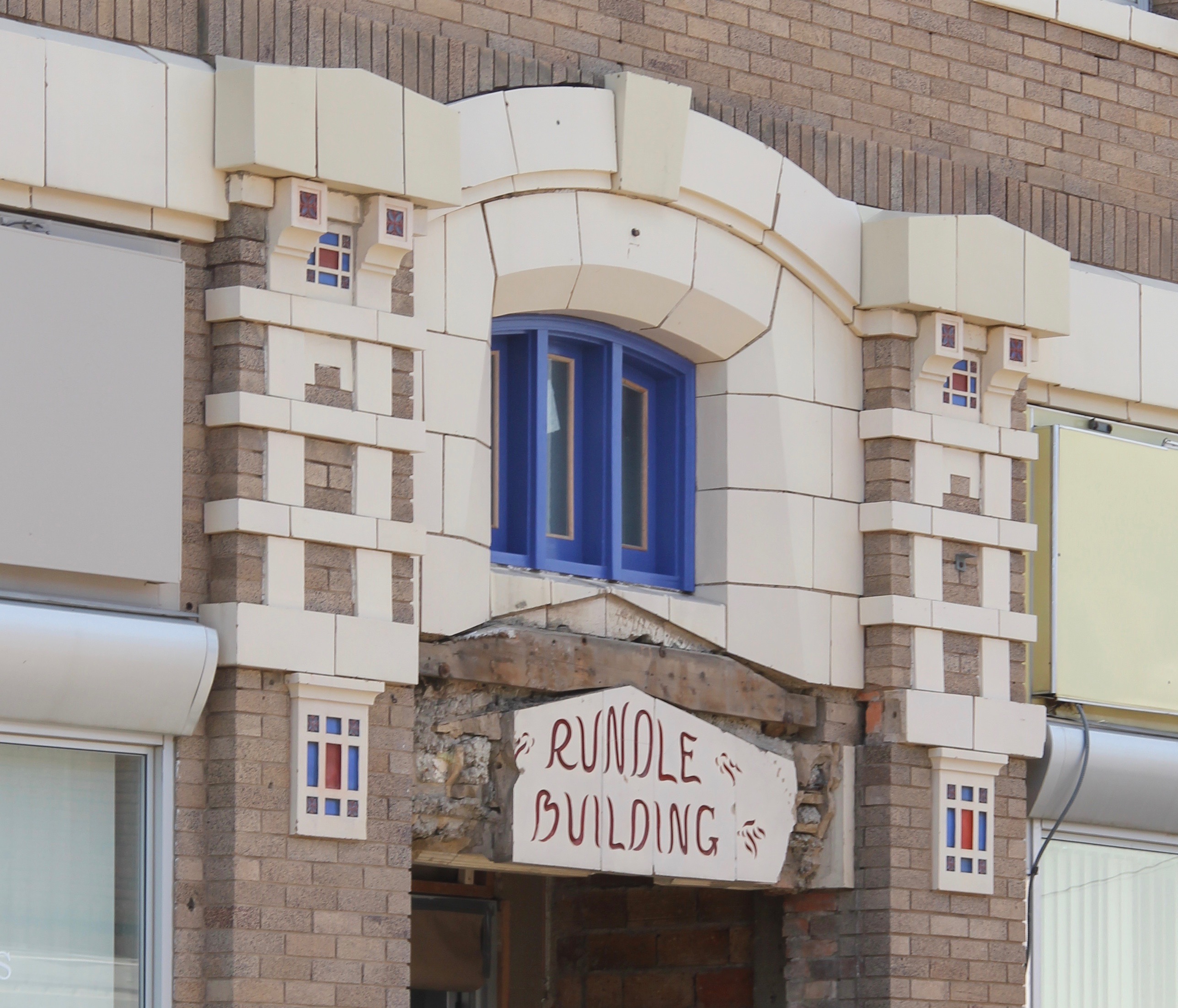
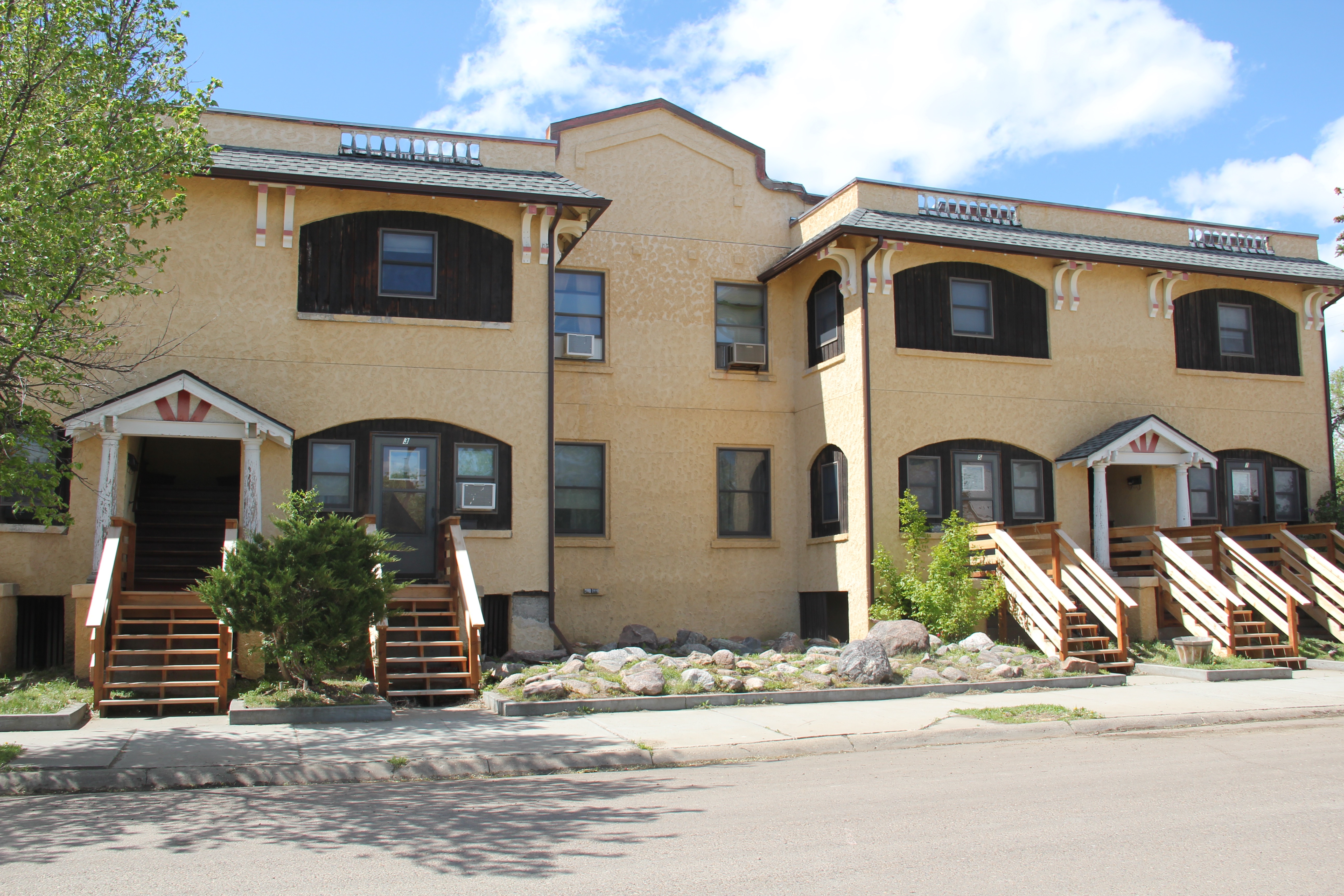
The fact that these buildings are well-kept and in use speaks to the local commitment to stewardship and effective adaptive reuse projects. As part of Glasgow’s architectural legacy I should have said more about its Craftsman-style buildings, beyond the National
Register-listed Rundle Building. The Rundle is truly eye-catching but Glasgow also has a Mission-styled apartment row and then its historic Masonic Lodge.
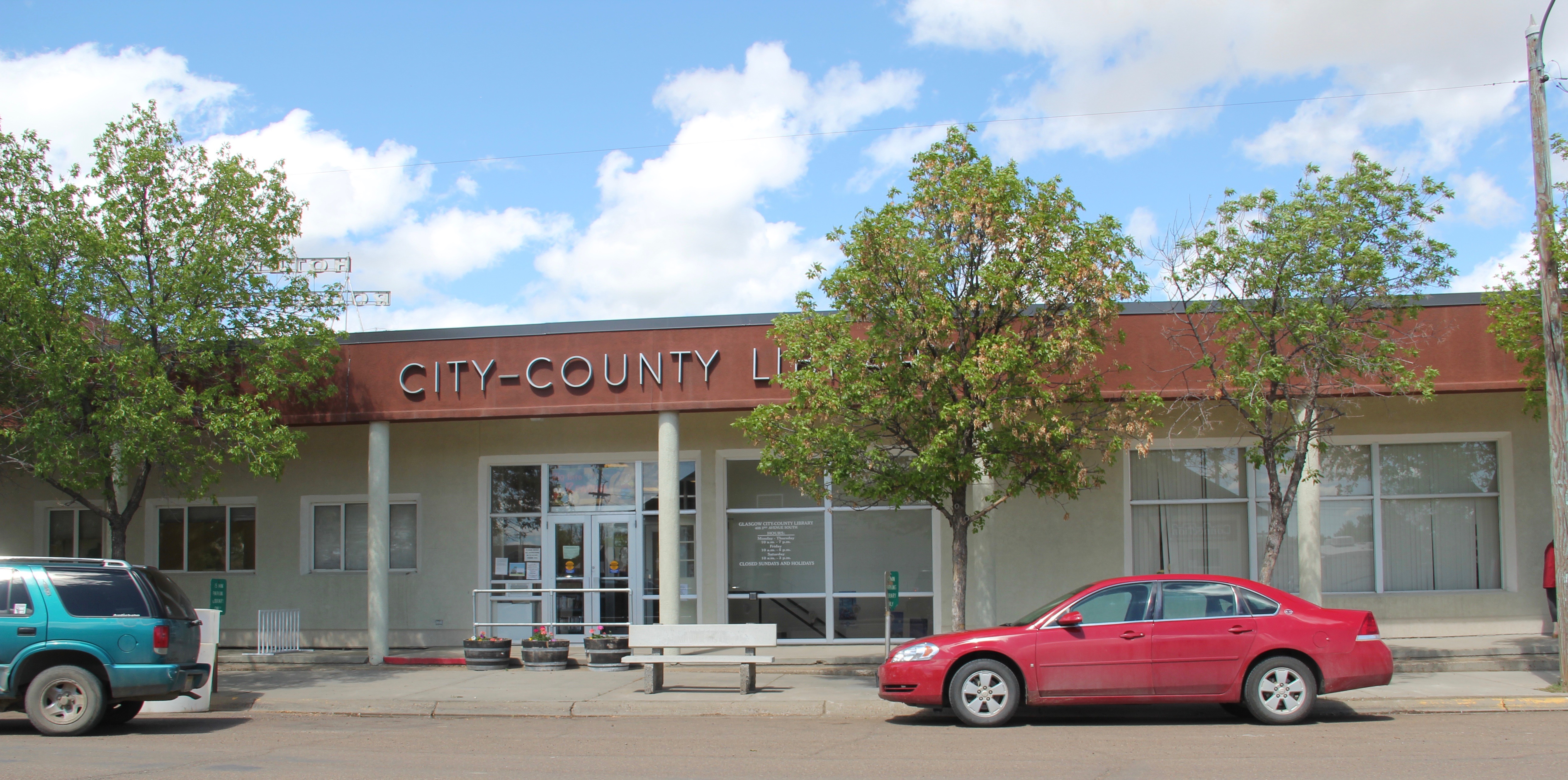
I have always been impressed with the public landscapes of Glasgow, from the courthouse grounds to the city-county library (and its excellent local history collection)
and on to Valley County Fairgrounds which are located on the boundaries of town.
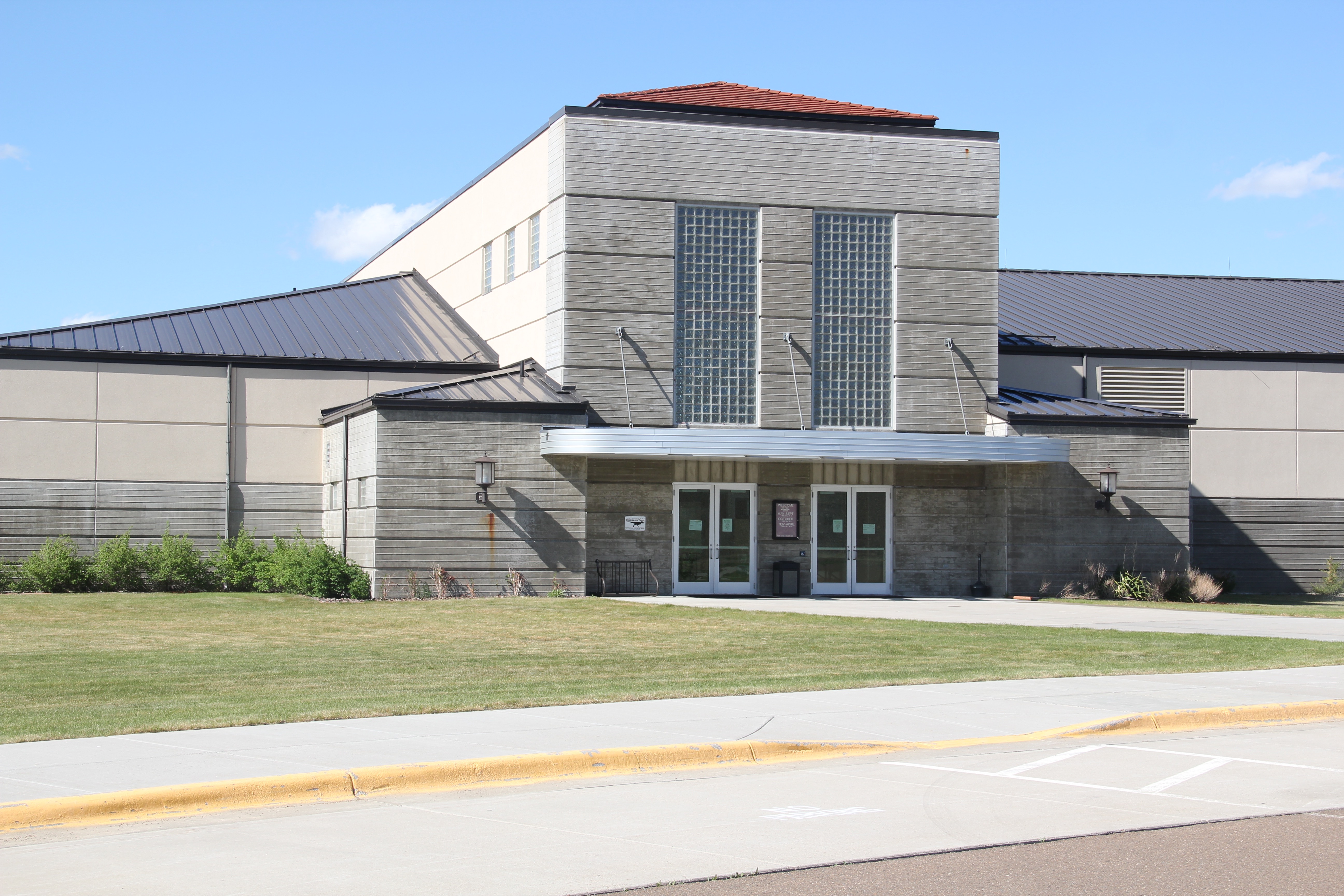
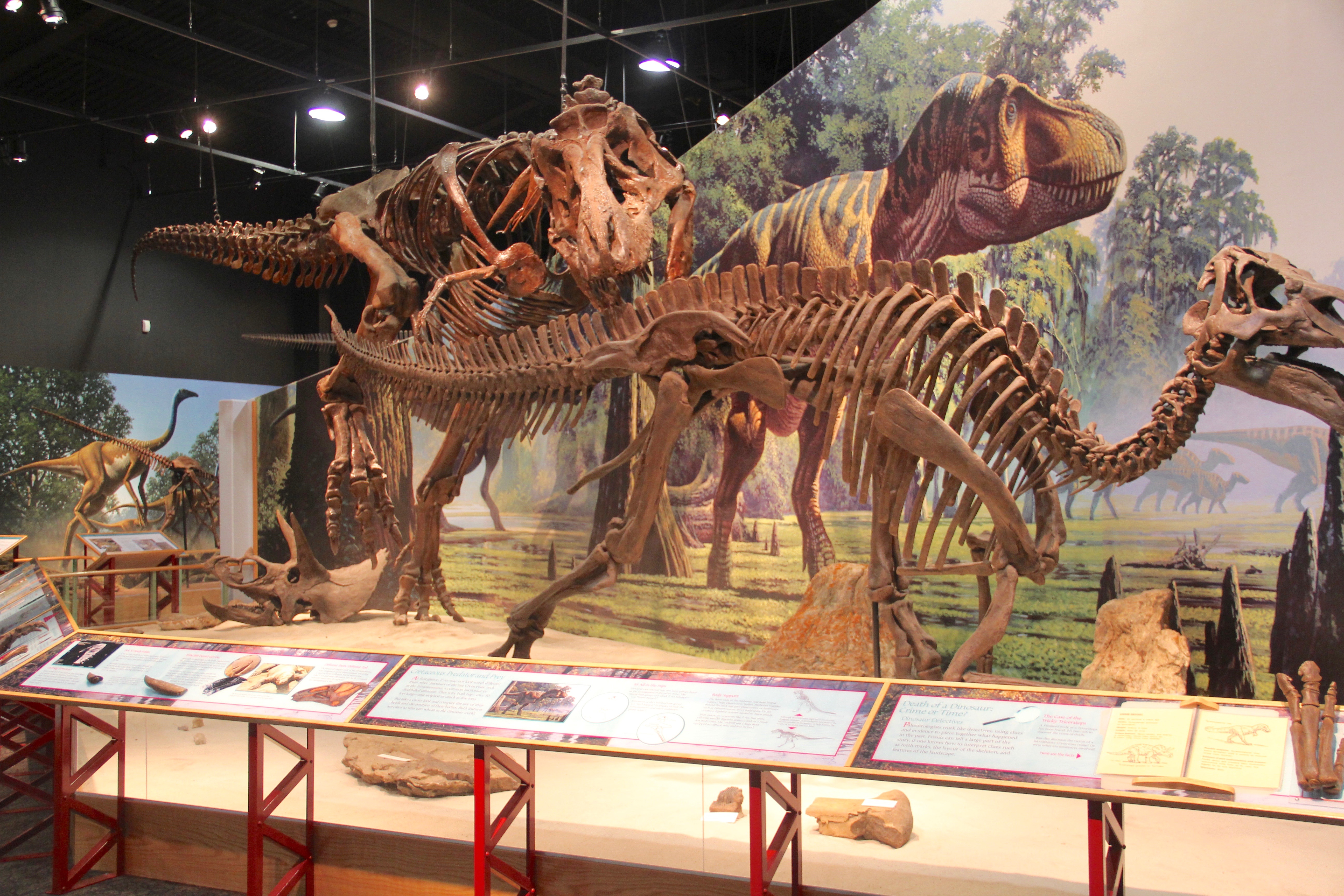
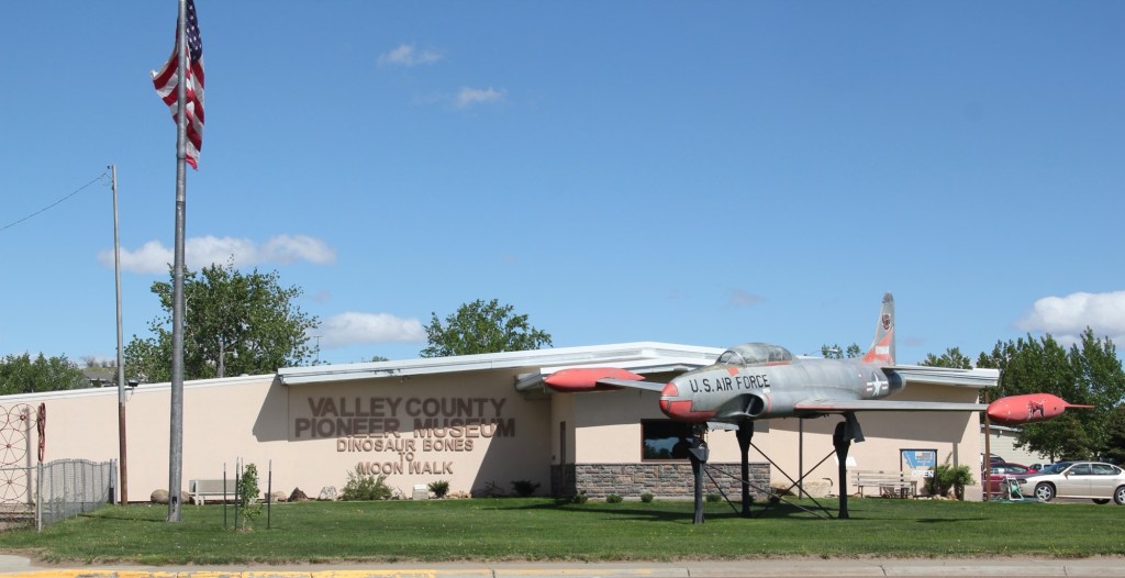
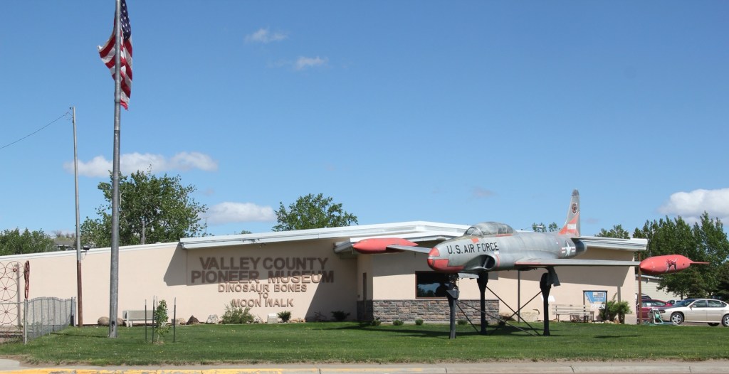
Another key public institution is the Valley County Pioneer Museum, which proudly emphasizes the theme of from dinosaur bones to moon walk–just see its entrance.
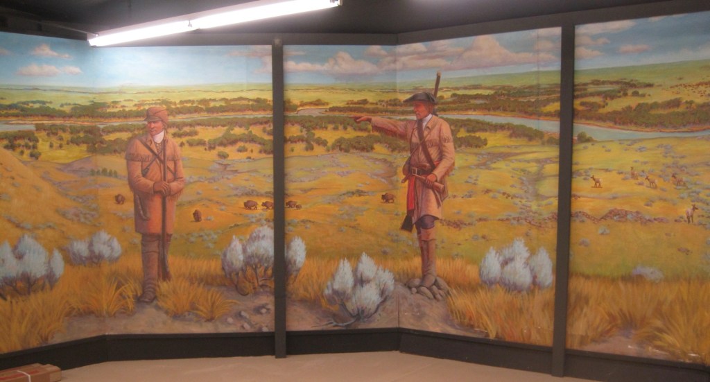
The museum was a fairly new institution when I first visited in 1984 and local leaders proudly took me through the collection as a way of emphasizing what themes and what places they wanted to be considered in the state historic preservation plan. Then I spoke with the community that evening at the museum. Not surprisingly then, the museum has ever since been a favorite place. Its has grown substantially in 35 years to include buildings and other large items on a lot adjacent to the museum collections. I have earlier discussed its collection of Thomas Moleworth furniture–a very important bit of western material culture from the previous town library. In the images below, I want to suggest its range–from the deep Native American past to the railroad era to the county’s huge veteran story and even its high school band and sports history.
A new installation, dating to the Lewis and Clark Bicentennial of 2003, is a mural depicting the Corps of Discovery along the Missouri River in Valley County. The mural is signed by artist Jesse W. Henderson, who also identifies himself as a Chippewa-Cree. The mural is huge, and to adequately convey its details I have divided my images into the different groups of people Henderson interprets in the mural.
The Henderson mural, together with the New Deal mural of the post office/courthouse discussed in my first Glasgow posting (below is a single image of that work by Forrest
Hill), are just two of the reasons to stop in Glasgow–it is one of those county seats where I discover something new every time I travel along U.S. Highway 2.
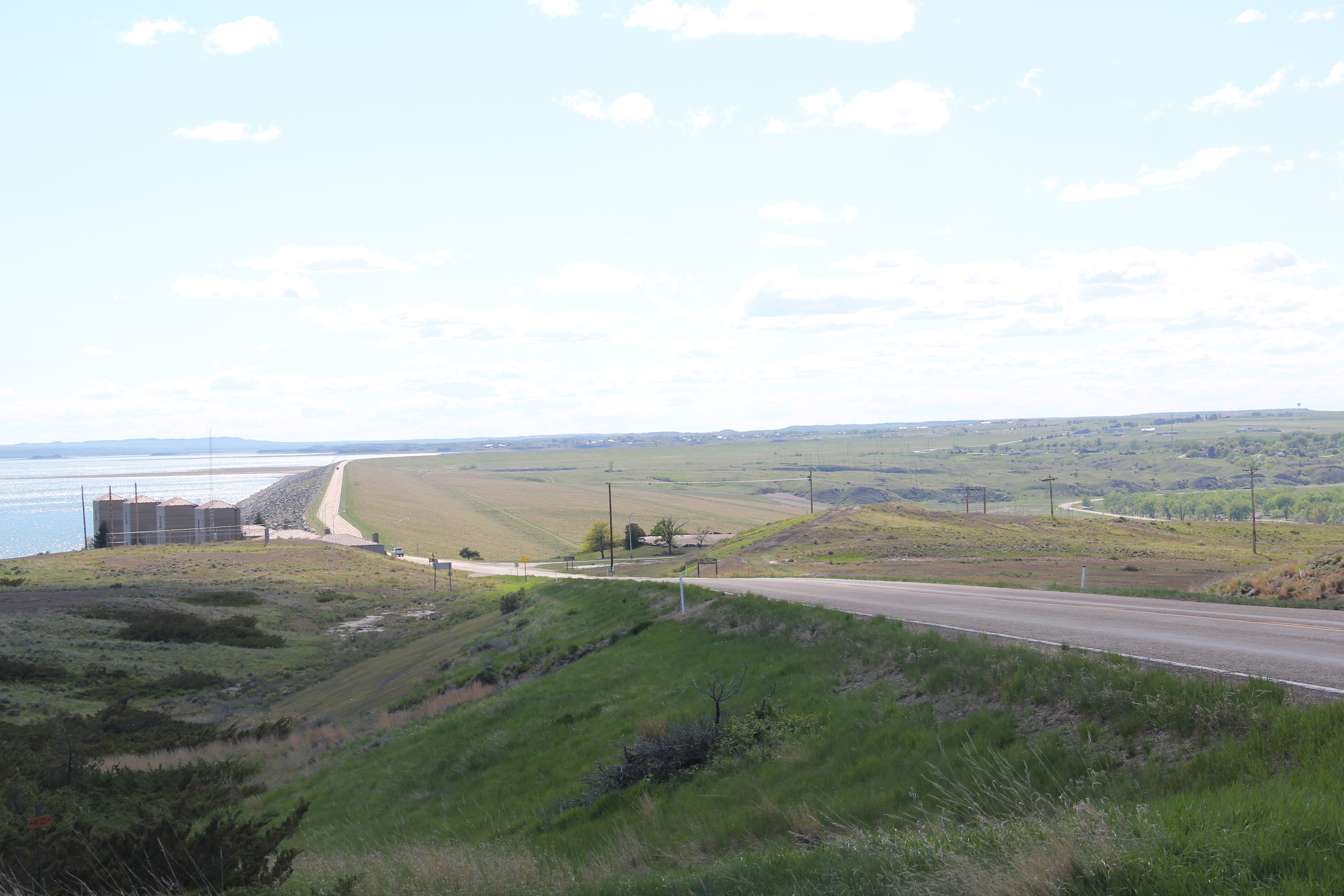
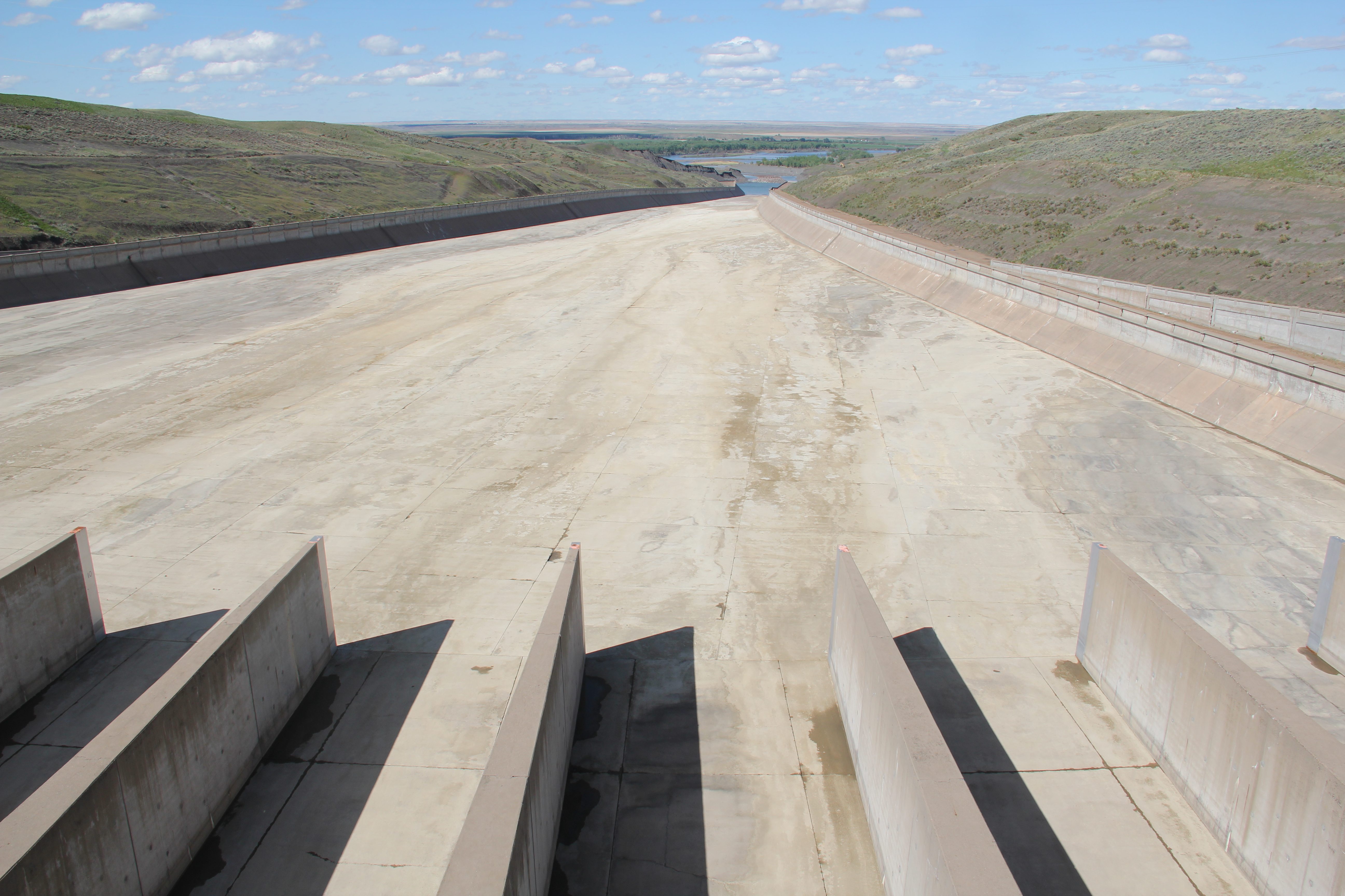
For sheer scale and audacity nothing in Montana built environment rivals the transformations wrought on the Missouri River and the peoples who for centuries had taken nourishment from it than the construction of Fort Peck Dam, spillway, powerhouse, reservoir, and a new federally inspired town from the 1930s to the early 1940s.
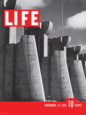
The mammoth size of the entire complex was just as jaw-dropping to me as it had been to the New Dealers and most Americans in the 1930s. That same spillway, for instance, had been the subject of the famous first cover of Life Magazine by Margaret Bourne-White in 1936.
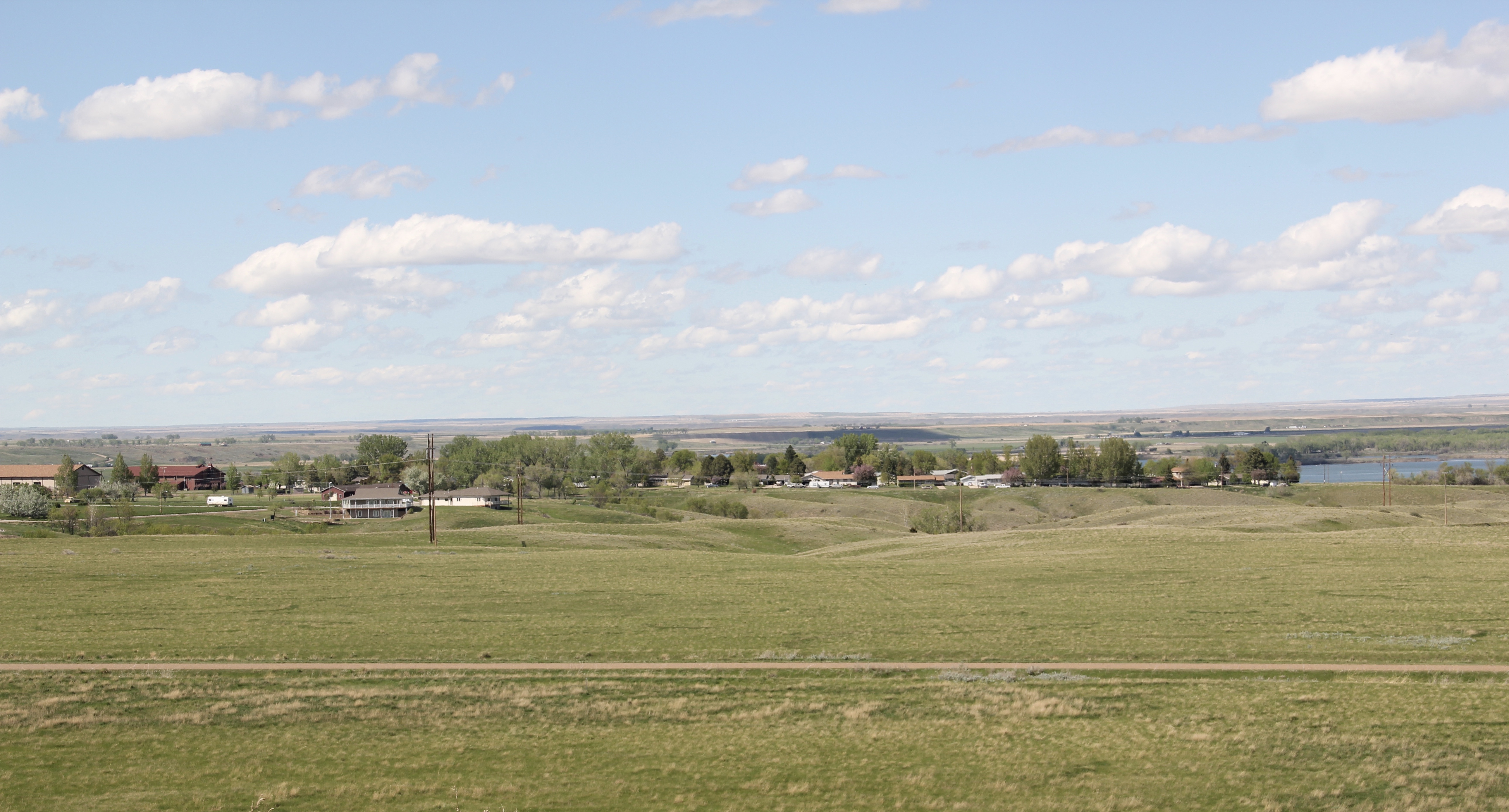
When she visited in 1936 the town of Fort Peck housed thousands but once the job was over, the town quickly diminished and when you take an overview of Fort Peck, the town, today it seems like a mere bump in what is otherwise an overpowering engineering achievement.
Coming from a state that had headquartered another New Deal era transformation of the landscape–the even larger Tennessee Valley Authority project–I understood a good bit of what Fort Peck meant as I started my work for the state historic preservation plan in 1984. A good thing I knew a little because outside of a Montana Historic Highway marker and a tour of the power plant there was little in the way of public interpretation at Fort Peck thirty years ago.
First came efforts to better interpret the Corps of Discovery and their travels through this section of the Missouri River 15-20 years ago. The theme was Lewis & Clark in the Missouri River Country, but by the 2010s the region’s demanding weather had taken its toll on the installation.
At the lake’s edge are additional markers encouraging visitors to imagine the time before the lake when the Big Dry River often meant exactly what it said–the reservoir keeps it full now.
New interpretive markers combine with a well-defined pull-off to encourage travelers to stop and think about the loss of life that occurred in building the dam. Many of the massive infrastructure projects of the New Deal have similarly sad stories to tell–but few of them do.
You can explore the landscape with the assistance of the highway markers to a far greater degree than in the past. Even if today it is difficult to “see” the transformation brought about by the massive earthen dam, there are informative markers to help you.
The new visitor center at the Fort Peck powerhouses takes the site’s public interpretation to a new level. Just reading the landscape is difficult; it is challenging to grasp the fact that tens of
workers and families were here in the worst of the Great Depression years and it is impossible to imagine this challenging landscape as once lush with thick vegetation and dinosaurs.
Through fossils, recreations, artwork, historic photographs, recreated buildings, and scores of artifacts, the new interpretive center and museum does its job well. Not only are the complications of the New Deal project spelled out–perhaps a bit too heavy on that score, I mean where else do you see what the “Alphabet Agencies” actually meant–but you get an understanding of worlds lost in the name of 20th century progress.
Is everything covered? Far from it–too much in the new public interpretations focuses on 1800 to 1940, and not how Fort Peck has the harbinger of the Cold War-era Pick-Sloan Missouri Basin reject that totally transformed the river and its historic communities. Nor is there enough exploration into the deep time of the Native Americans and what the transformation of the river and the valley meant and still means to the residents of the Fort Peck Indian Reservation. There’s still work to be done to adequately convey the lasting transformation that came to this section of Montana in the mid-1930s.


 One of the very few historical markers in Montana that touches on the state’s irrigation history focuses about a historic bridge that once stood nearby at Tampico.
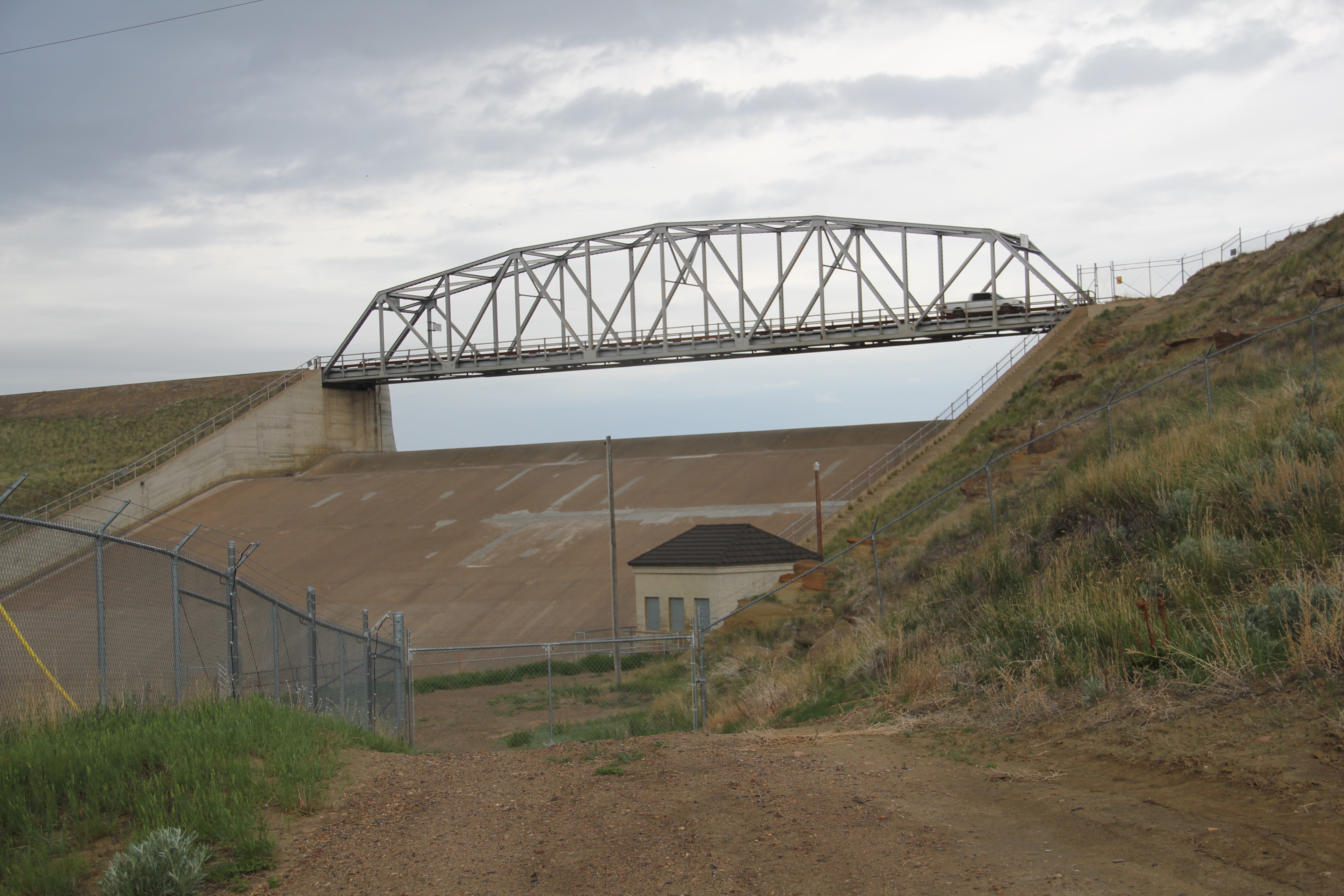
 Large man-made lakes capture water to reserve it for use throughout the growing season. The images above are of Fresno Reservoir, on a rainy morning, in Hill County. While the two images below are of Nelson Reservoir, on a typically bright sunny day, many miles downstream in Phillips County.
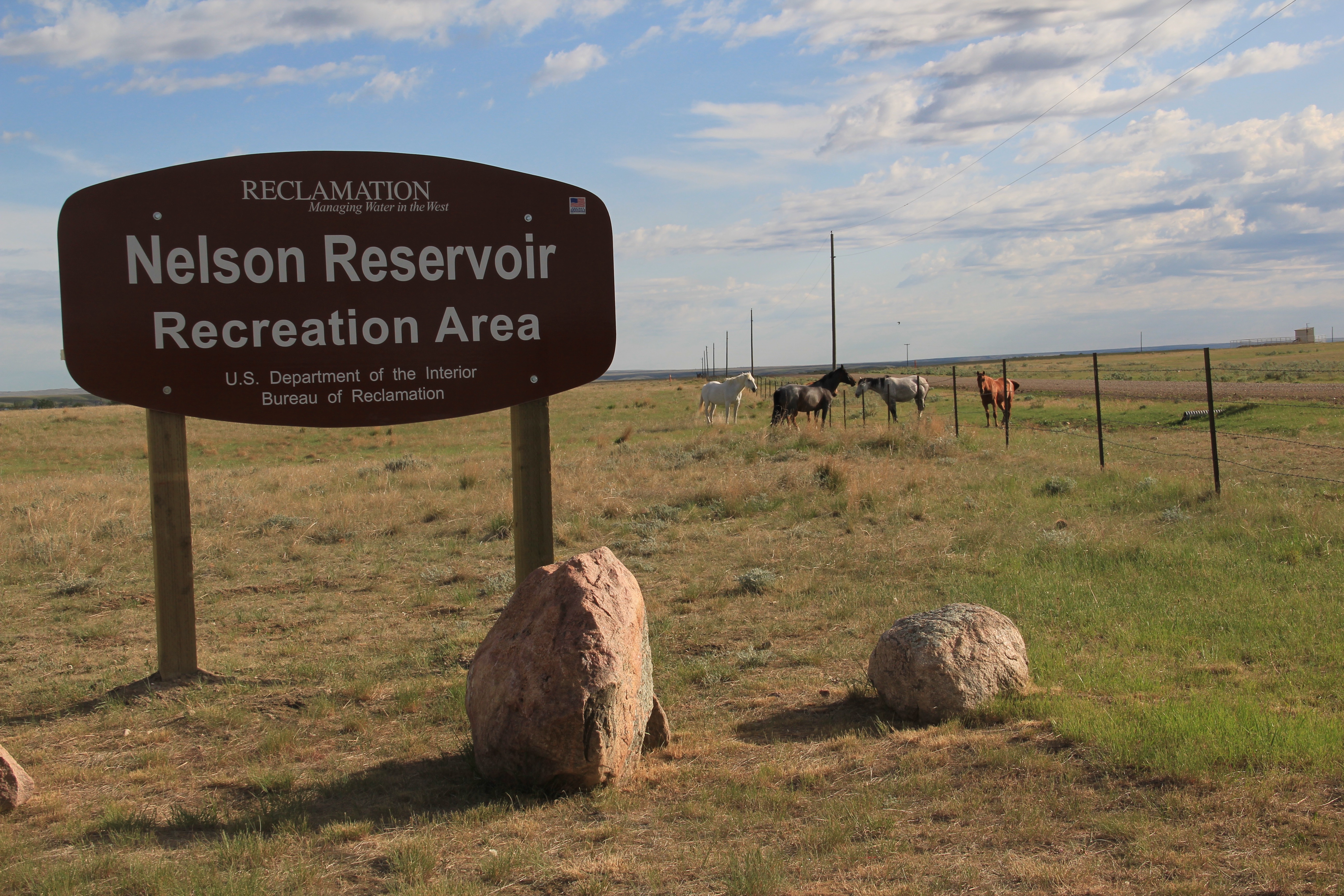
 The Milk River Project shapes so much of the Hi-Line, it has become just part of the scenery. I wonder how many travelers along U.S. Highway 2 in Phillips County even notice or consider the constant presence of the ditch along their route.

 is a tiny place, almost 20 miles from the county seat of Malta. But at the time of the Milk River Project, Dodson was vital; the ditch neatly divided the town into two halves, and a major diversion dam was just west of town. Here was a perfect place, at the turn of the century, for a fairgrounds. And it is a gorgeous historic fairgrounds.


 buildings, the rather different design of the post office from the 1960s and the vernacular Gothic beauty of the historic Methodist Church, especially the Victorian brackets of its bell tower.


 First came efforts to better interpret the Corps of Discovery and their travels through this section of the Missouri River 15-20 years ago. The theme was Lewis & Clark in the Missouri River Country, but by the 2010s the region’s demanding weather had taken its toll on the installation.
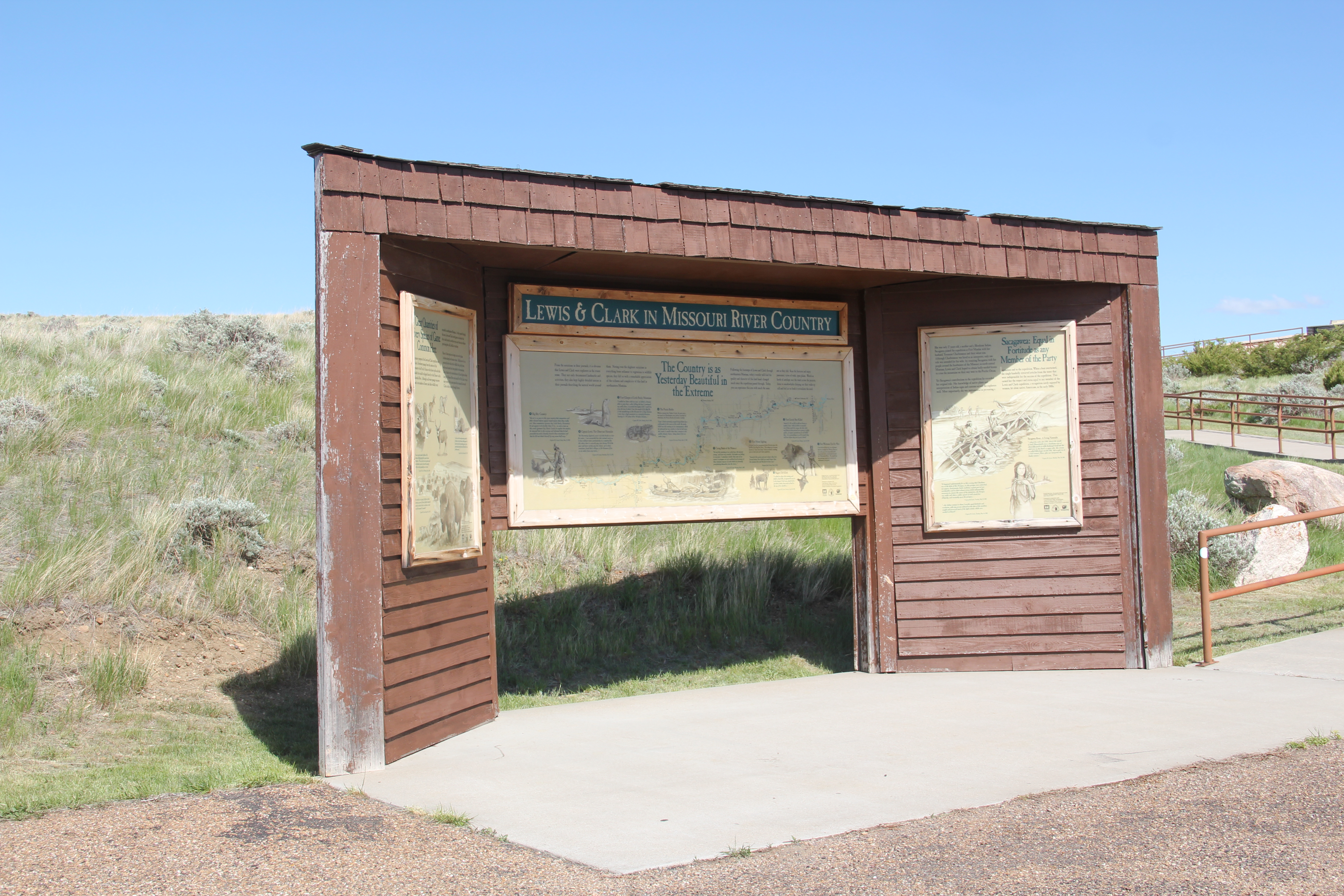


 At the lake’s edge are additional markers encouraging visitors to imagine the time before the lake when the Big Dry River often meant exactly what it said–the reservoir keeps it full now.
 New interpretive markers combine with a well-defined pull-off to encourage travelers to stop and think about the loss of life that occurred in building the dam. Many of the massive infrastructure projects of the New Deal have similarly sad stories to tell–but few of them do.
 You can explore the landscape with the assistance of the highway markers to a far greater degree than in the past. Even if today it is difficult to “see” the transformation brought about by the massive earthen dam, there are informative markers to help you.