
 In the 1984-1985 fieldwork for the state historic preservation plan, the impact of lodging chains in Montana was pretty limited to the larger towns, and gateways to the national parks. Many what I called “mom and pop” motels, largely from the pre-interstate highway era of the 1940s and 1950s, still operated. I was working with the state employee lodging rate of $24 a night (remember it was 1984!) and I found that the per diem eliminated the chains and I was left with the local establishments. During those months of intense travel I came to respect and really like the Moms and Pops. Several of the places I stayed in 1984-1985 are long gone–but ones like the Lazy J Motel in Big Timber remain. In this post I am merely sharing a range of historic motels from across Big Sky Country.
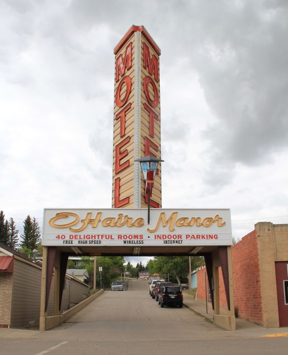 I began the fieldwork in February 1984 and the first stop was a public meeting at the Toole County Courthouse in Shelby. My first overnight was just as memorable–for good reasons–at the O’Haire Manor Motel. Its huge neon sign on the town’s main street, which was U.S. Highway 2, could not be missed, and actually the sign replaced a building that once stood along the commercial district, knocking it down so travelers would have a clear shot to the motel itself.

Motels along U.S. Highway 2 often had the grand statement to catch attention of those traveling at 80 miles a hour down the highway. Galata, which billed itself as a gateway to the Whitlash port of entry on the Canadian border to the north, had the tallest cowboy in the region to greet visitors.
 Cut Bank’s Glacier Gateway, on the other hand, reminded visitors that it was that “coldest place” in the United States that they had heard about in weather forecasts.


The Circle Inn Motel outside of Havre on U.S. Highway 2 reflected the classic design of separate duplexes–cabins–for guests while the gleaming white horse statue reminded them, if they needed the prod, that they were in the wild west.

Similar mid-20th century motels are found along Montana’s historic federal highways. Some, like the La Hood Motel, are now forgotten as the highway, once known as the Yellowstone Trail and then U.S. Highway 10, has been relegated to secondary use.
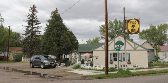
 Another example from the old Yellowstone Trail and U.S. Highway 10 is the Shade Tree Inn Motel in Forsyth–although coal and railroad workers help somewhat to keep it going in the 21st century.
 Just a block west of another historic section of U.S. Highway 10 in Deer Lodge is the Downtowner Motel, with its sloping roof and extended rafters representing the best in “contemporary” style from the 1960s. This place too was clean, cheap, and well located for a day of walking the town back in 1984.

Other motels have carried on, in a diminished role, dependent more on workers needing temporary quarters than on travelers. In Malta, on U.S. Highway 2, I expected easy to acquire and cheap lodging at the Maltana Motel–a favorite of mine from the 1980s–but even though the town was over 200 miles from Williston, North Dakota, demands for its rooms had risen with the oil boom of the early 2010s.

The Country Side Inn Motel in Harlowton once buzzed with travelers along either U.S. Highway 12 or U.S. Highway 191 but as interstate routes have become so dominant, these motels have struggled to attract customers.
 Not only have the changes in traffic patterns been important, the present generation’s preference for chain motels–and the proliferation of chains across the state–have shaped the future of the mid-20th century motel. A good example is the challenges facing the continuation of the Cherry Hill Motel in Polson, located along U.S. Highway 93. Here was a favorite spot in 1984–near a killer drive-in–a bit out of the noise of the town, and sorta fun surroundings with a great view of Flathead Lake.

 The place was up for sale in 2015–and the internet today tells me that it is “permanently closed.” I hope it can find a new owner and is still there when I next return to Polson but with the general boom in the Flathead Lake region, one assumes its days are numbered.
 The bear might be hugging the tree but does anyone else care enough–or want this type of lodging, complete with the “picture window” of the 1950s and 1960s, in the comfort obsessed 21st century?
I began this brief overview with the first place I stayed during the 1984-1985 fieldwork, and I will close with the last place I stayed as I finished the new statewide survey in May 2016: the Yodeler Inn in Red Lodge. Built in 1964 this wonder chalet-style property is listed in the National Register–of course in 1984 I never gave a thought about the motel as National Register worthy, I just loved the location, and thought it was cool.


It is still that–good rooms, great lobby, and a self-proclaimed “groovy” place. To the north of the historic downtown are all of the chains you might want–stay there if you must, and leave the Yodeler Motel to me!
 By the late 1980s there was little doubt that a substantial development boom was underway in Flathead County. In the town near the Flathead Lake, like Bigfork, above, the boom dramatically altered both the density and look of the town. In the northern half of the county Whitefish suddenly became a sky resort center. In 1988, during a return visit to Montana, I did not like what I encountered in Flathead County–and thus I stayed away for the next 27 years years, until the early summer of 2015.


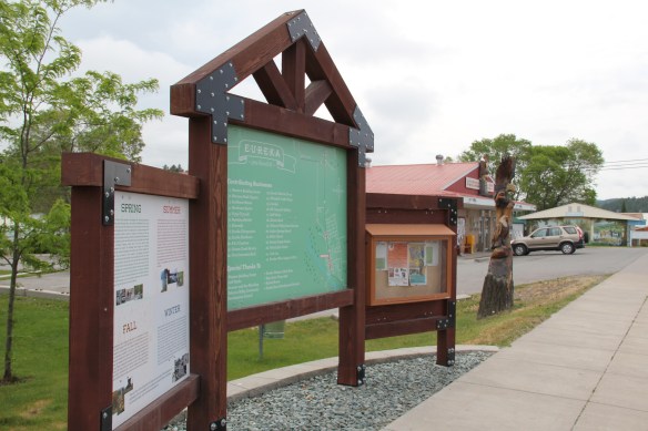
 As I would come to find out, on two return trips here in 1984, the town was much more than that, it was a true bordertown between two nations and two cultures. The two trips came about from, first, a question about a public building’s eligibility for the National Register, and, second, the fieldwork for the state historic preservation plan, where such obvious landmarks as the National Hotel and Eureka passenger depot were noted. Thirty
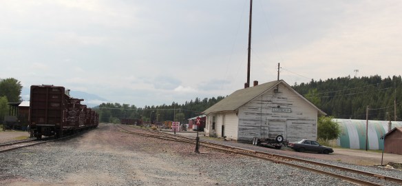 years later I was pleased to see the National Hotel in much better condition but dismayed to see the Great Northern passenger station–a classic example of its early 20th century standardized designs–is far worse condition that it had been in 1984.
 Otherwise, Eureka has done an impressive job of holding together its historic core of downtown one and two-story commercial buildings. In 1995, owners had the Farmers and Merchants State Bank, built in 1907, placed in the National Register. Walking the town, however, you see the potential of a historic district of this turn of the 20th century place.


 Located on a hill perched over the town, the building was obviously a landmark–but in 1984 it also was just 42 years old, and that meant it needed to have exceptional significance to the local community to merit listing in the National Register of Historic Places. Eureka had been a logging community, and the depression hit hard. The new building not only reflected community pride but also local craftsmanship, and it became a
 foundation for community resurgence in the decades to come. The building was listed in 1985, and was the first to have my name attached to it, working with Sally Steward of the local historical society. But credit has to go to Pat Bick and especially Marcella Sherfy of the State Historic Preservation Office for urging me to take it on, and to guide me through the maze of the National Register process. Today, it has experienced an adaptive reuse and serves as a rustic log furniture store.
 During those visits in 1984 I also held a public meeting in Eureka for the state historic preservation plan, where I learned about the Tobacco Valley Historical Society and its efforts to preserve buildings destined for the chopping block through its museum village on the southern edge of town. Here the community gathered the Great Northern depot (1903) of Rexford, the same town’s 1926 Catholic Church, the Mt. Roberts lookout tower, the Fewkes Store, and a U.S. Forest Service big Creek Cabin from 1926.


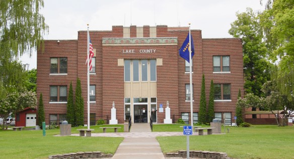


 But in the last 30 years, Polson has boomed as a lakeside resort town, with a population of 4700 today compared to the 2800 of the 1980s. Key landmarks remain but nothing has been listed in the National Register of Historic Places since my 1984 visit, even the great New Deal modern courthouse above.


 These landmarks need to be treasured because a new Polson is emerging all around town–and could crowd out the places that frame the community’s identity. Right now there is a balance between old and new, but a tipping point is around the corner.


 Moiese is best known, by far, as the entrance to the National Bison Range, where a general store stands nearby the refuge gate. Created by Congress in 1908, the refuge took
 additional land–almost 19,000 acres- from the tribes, without their consent, to create a safe haven for the remaining bison in the region. A few hundred bison live within its boundaries today. In 2016 the National Park Service began discussions with the Consolidated Kootenai and Salish Tribe to transfer management of the refuge to the tribe.
 Eight miles north of Moiese along the railroad line is the town of Charlo, named in honor of Chief Charlo of the Bitterroot Salish, who was forced from the Bitterroot Valley to move to the reservation in 1891. Charlo served as head chief of the Bitterroot Salish from 1870-
 1910. As a railroad town, Charlo is like many along the Northern Pacific, with a brief strip of businesses facing the railroad tracks, marked by the town’s sole grain elevator. It has a classic rural bar, Tiny’s Tavern, with its brightly painted exterior of concrete block, with brick accents. Built in 1946 by Tiny Browne, it was both a motel and a tavern, and a local museum of items that Tiny thought were interesting. Browne died in 1977 and his sister, Celeste Fagan, next owned the tavern, managed by Edna Easterly who recalled in a story in the Missoulian of April 20, 2007 that Tiny “was known as the bank of Charlo. Tiny always carried a lot of money in his pocket and if you needed to cash a check, you went to Tiny.”
 Most important for its architecture, however, is the town’s public school, a wonderful example of Art Deco style from the New Deal decade of the 1930s.
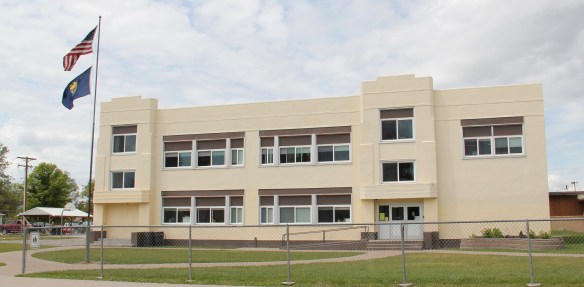 Ronan is a third town along the railroad corridor, named for a former white superintendent of the reservation. The town’s demographics today are mostly white, with a little more than a quarter Native American population. Ronan proudly proclaims its existence not only with a gate sign, connecting the business district to the sprawl along U.S. Highway 93 but also a log visitor center and interpretive park on the highway.


 The facade expresses a confident future, which is needed in today’s uncertain economic climate for rural hospitals across the state. But my favorite building in Ronan speaks to my love for adaptive reuse and mid-20th century modern design. The town library is an
 exquisite example of mid-century modern, and was once a local bank before being converted into the library.


 There is a new school and a really different lakefront of businesses, homes, and parks. The town’s population was over 1600 in 2010; it’s now 2700 and counting.


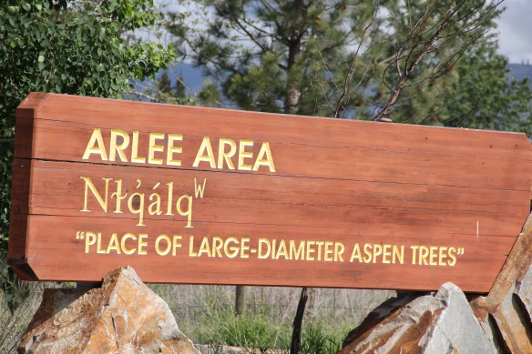
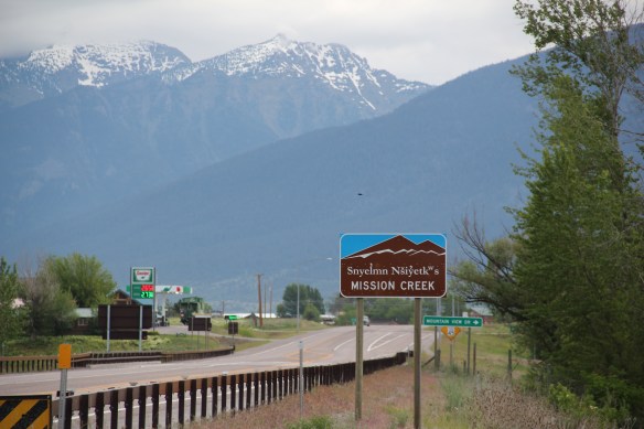
 To get the full meaning of Flathead Lake, however, you have to consider the lake’s deep time, and its long history with the Salish and Kootenai peoples. When I surveyed the county in 1984-1985, you came away impressed with the different vision that the tribes had for the region, and what was already happened at Pablo. In 2014, however, I left Lake County was a deeper impression on what the tribes have meant to the lake and vice versa.
 The People’s Center at Pablo is part of that lesson as it affords a powerful, lasting introduction to both the history and continuation of tribal traditions.


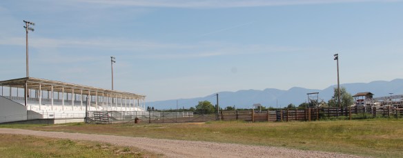
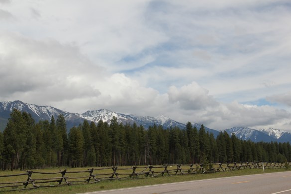 Missoula County has grown, a lot, since my state historic preservation plan work in 1984-1985, especially in the county seat of Missoula and surrounding suburbs. Yet Missoula County still has several spectacular rural drives, like Montana Highway 83 above at Condon, along with distinctive country towns. This post will share some of my favorites.


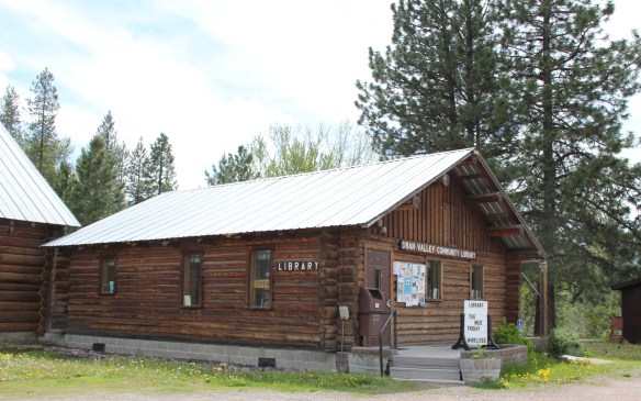 The Condon Community Center and adjacent Swan Valley Community Library serve as additional hubs for those living along the lakes and mountains of northeast Missoula County. Both buildings are excellent examples of mid-20th century Rustic style–a look that, in different variations, dominates the Highway 35 corridor.
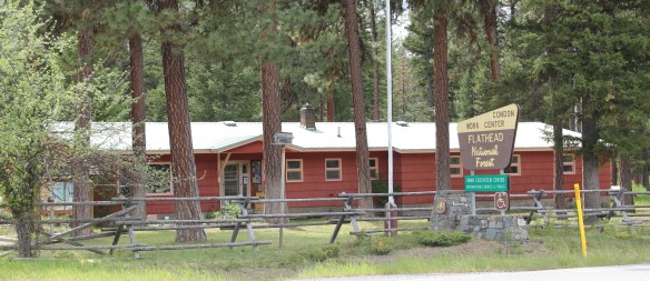
 Condon is also the base for the Condon Work Center, home to the Great Northern Fire Crew, of the Flathead National Forest. Here you can take a mile-long Swan Ecosystem Trail and learn of the diversity of life in this national forest region.
 South of Condon on Montana Highway 83 is Seeley Lake–a place that certainly has boomed in the last 30 years–witness the improved highway, new businesses, and population that has increased over 60 percent since my last visit in 1992. Yet it still had places rooted in the community’s earlier history such as the Sullivan Memorial Community Hall–a good example of mid-20th century Rustic style.
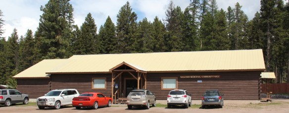 And it had added one of my favorite bits of roadside architecture in this part of Montana: the Chicken Coop Restaurant as well as opening a new Seeley Lake Historical Museum and Chamber of Commerce office at a spectacular highway location just outside of town.


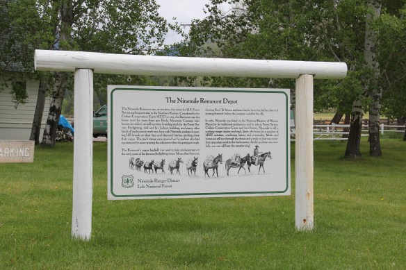
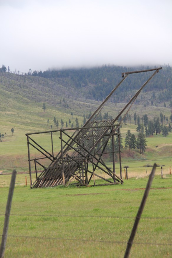
 I don’t recall even thinking about the forest service facility, but here was an entire complex devoted to the forest service’s use of mules and horses before the days of the ATV that was built by the Civilian Conservation Corps. The remount depot is an interesting


 The name Frenchtown dates to 1868 and is a reference to a number of French Canadians who moved here in the early settlement period. A National Register-listed church, the St. John the Baptist Catholic Church (1884) marks that first generation of settlers. Its classical-tinged cupola has long been the town’s most famous landmark.
 The Milwaukee Road built through here in 1907-1908 and there remains a handful of historic business buildings from the time of the Milwaukee boom. There is one landmark
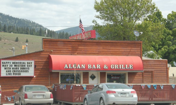
 another roadside landmark–the Bucksnort Bar, just further evidence to add to the Chicken Coop and the Alcan that you won’t go hungry if you explore the small towns of Missoula County.

 When most people think of Ravalli County they think of the ever suburbanizing northern half, as you take U.S. Highway 93 south–a four lane highway–from Missoula and encounter the new suburbs of Florence. But if you use U.S. Highway 93 from the southern end, you find a very different place, one that starts with Ross’ Hole.
 There are few more beautiful places in the state, even on this cloudy day in 2012, the hole beckoned, as it has for centuries. In western American history, its importance has multiple layers, from ancient Native American uses to the peaceful encounter between Flathead Indians and the Lewis and Clark Expedition in 1805. Without the horses the expedition acquired from the Flathead, its journey would have been much more difficult, if not impossible.
 Montana “cowboy” artist Charles M. Russell painted the scene as a prominent historical mural in the House of Representatives chamber at the Montana State Capitol in 1912. His composition, as I used to like to point out when I gave state capitol tours in 1982, emphasized the centrality of the Native Americans in the region–the expedition were minor characters, in the background of the painting’s right side. The place name Ross’s Hole refers to Hudson Bay Company trader Alexander Ross who traded there in 1824. Hole was a trader and trapper term for mountain valley.
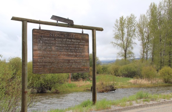 At the time of the 1984 survey, Ross’ Hole was interpreted by this single wooden sign, now much worse for the wear of the decades. But like many important landscapes in the state, today you find a rather full public interpretation in a series of markers sponsored by the Montana Department of Transportation, the U.S. Forest Service, and the Lewis and Clark National Historic Trail.


 Any trip to Ross’ Hole would not be complete with a stop, however brief, at the roadside architecture-a log bungalow–home to the Sula Community Store, which can basically provide you with about anything you might need while traveling on U.S. Highway 93.
 And the coffee is always hot, and strong.
 Beaverhead County’s history has deep roots, perhaps never deeper than at the high mountain passes that divide it from neighboring Idaho. We have already taken a look at Monida Pass, but now let’s shift to the western border and consider Lemhi Pass (Lemhi Road is the image above) and Bannock Pass, both at well over 7000 feet in elevation.
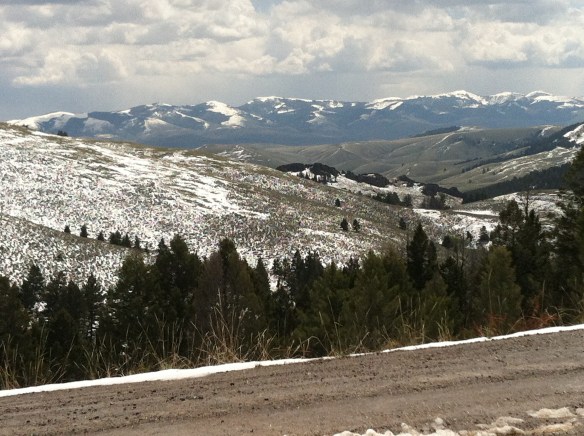
 Lemhi Pass is a magnificent place, reached by a wide dirt road that climbs up to 7300 feet. The roadbed is modern, and lies over a path worn by centuries of Native Americans who traveled this path between mountain valleys in present-day Montana and Idaho. That deep past is why the more famous Lewis and Clark Expedition took this route over the Bitterroot–and the Corps of Discovery connection is why the pass has been protected in the 20th century. The pass is also connected with Sacajawea, since her tribe, the Shoshone, often used it to cross the mountains.

 This kiosk by the U.S. Forest Service is part of the new public interpretation of the property, both at the start of the pass to the top of the mountain itself at the Sacajawea Memorial Area.
 Bannock Pass, comparatively has received little in public interpretation. Unlike Lemhi, it is not a National Historic Landmark associated with Lewis and Clark. For today’s travelers, however, it is a much more frequently used way to cross the Rockies despite its 300 foot higher elevation. A historic site directional sign leads to one interpretive


 It was a snowy Memorial Day when I crossed Lost Trail and Chief Joseph passes on my way to Big Hole Battlefield. Once again I was impressed by the recent efforts of the U.S. Forest Service to interpret the epic yet tragic journey of Chief Joseph and the Nez Perce in 1877, especially the Trail Creek Road that parallels Montana Highway 43.


 Canada was underway. Today the Nez Perce National Historic Trail and Park mark that journey into history. The park today is frankly an amazing transformation, from a preserved battlefield in the early 1980s that only hinted at the true facts of history to a modern of battlefield interpretation, one that does justice to history and to the Nez Perce story. One only wishes that more western battlefields received similar treatment.
