
 Here is a property category that could be, probably should be, a blog of its own–the ranching landscape of Big Sky Country. Historic family ranches are everywhere in the state, and being of rural roots myself, and a Tennessee Century Farm owner, the ways families have crafted their lives and livelihood out of the land and its resources is always of interest.

Wibaux ranch house, 1985.
When I carried out the 1984-1985 fieldwork for the Montana state historic preservation plan, a handful of ranches had been preserved as museums. On the eastern end of the state in Wibaux was the preserved ranch house of Pierre Wibaux, one of the 1880s cattle barons of eastern Montana and western North Dakota. The ranch house today remains as a historic site, and a state welcome center for interstate travelers–although you wish someone in charge would remove the rather silly awning from the gable end window.
 Preserving merely the ranch house, and adding other period buildings, is one thing. The massive preserved landscape of hundreds of acres of the Grant-Kohrs Ranch in the western end of Montana is a totally different experience. This National Park Service site


not only preserves one of the earliest settlement landscapes in the state it also shows how successful ranches change over time. John Grant began the place before the Civil War: he was as much an Indian trader than ranch man. Grant Kohrs however looked at the rich land, the railroad line that ran through the place, and saw the potential for becoming a cattle baron in the late 19th century. To reflect his prestige and for his family’s comfort, the old ranch house was even updated with a stylish Victorian brick addition. The layers of history within this landscape are everywhere–not surprisingly. There is a mix of 19th and 20th century buildings here that you often find at any historic ranch.


When I was working with the Montana Historical Society in 1984-1985 there were two additional grand ranches that we thought could be added to the earlier preservation achievements. Both are now landmarks, important achievements of the last 30 years.
 The Bitter Root Stock Farm, established in 1886 by soon-to-be copper magnate Marcus Daly outside of Hamilton, came first. I can recall early site visits in 1985–that started the ball rolling but the deal wasn’t finalized for several years. All of the work was worth it.


Here was one of the grand showplace ranches of the American West, with its own layers of a grand Queen Anne ranch house (still marked by the Shingle-style laundry house) of Daly’s time that was transformed into an even greater Classical Revival mansion by his Margaret Daly after her husband’s death. It is with us today largely due to the efforts of a determined local group, with support from local, state, and federal governments, a group of preservation non-profits, and the timely partnership of the University of Montana.


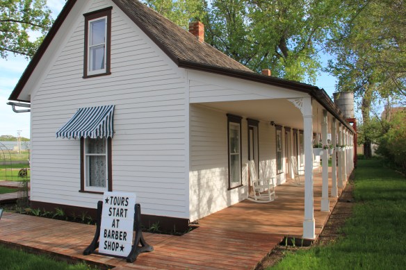
The second possibility was also of the grand scale but from more recent times–the Bair Ranch in Martinsdale, almost in the center of the state. Charles Bair had made his money in sheep and wise investments. His daughters traveled the world and brought treasures home to their Colonial Revival styled ranch house. To get a chance to visit with Alberta Bair here in the mid-1980s was a treat indeed.


Once again, local initiative preserved the ranch house and surrounding buildings and a local board operates both a house museum and a museum that highlights items from the family’s collections.


The success of the Bitter Root Stock Farm and the Bair Ranch was long in the making, and you hope that both can weather the many challenges faced by our public historic sites and museums today. We praise our past but far too often we don’t want to pay for it.
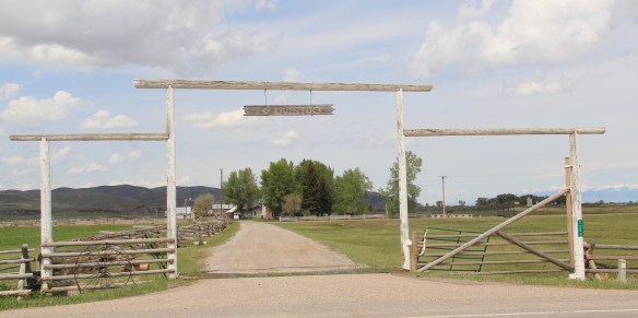
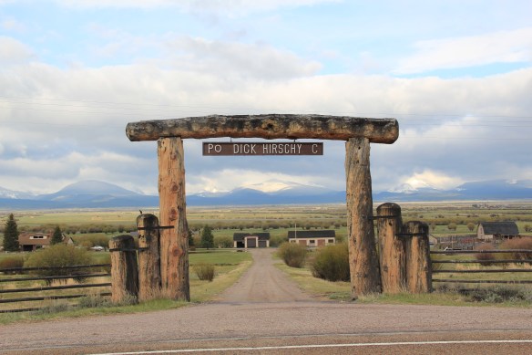
That is why family stewardship of the landscape is so important. Here are two examples from Beayerhead County. The Tash Ranch (above and below) is just outside of Dillon and is listed in the National Register of Historic Places. But is also still a thriving family ranch.


The same is true for the Bremmer Ranch, on the way to Lemhi Pass. Here is a family still using the past to forge their future and their own stories of how to use the land and its resources to maintain a life and a culture.


One family ranch that I highlighted in my book, A Traveler’s Companion to Montana History (1986), was the Simms-Garfield Ranch, located along the Musselshell River Valley in Golden Valley County, along U.S. Highway 12. This National Register-property was not, at
 first glance, architecturally magnificent as the properties above. But in its use of local materials–the timber, the rocks from the river bluffs–and its setting along a historic road, this ranch is far more typical of the Montana experience.


Similar traditions are expressed in another way at a more recent National Register-listed ranch, the Vogt-Nunberg Ranch south of Wibaux on Montana Highway 7. Actively farmed from 1911 to 1995, the property documents the changes large and small that happened in Montana agriculture throughout the 20th century.


The stories of these ranches are only a beginning. The Montana Preservation Alliance has done an admirable job of documenting the state’s historic barns, and the state historic preservation office has listed many other ranches to the National Register. But still the rural landscape of the Big Sky Country awaits more exploration and understanding.
 Beaverhead County’s history has deep roots, perhaps never deeper than at the high mountain passes that divide it from neighboring Idaho. We have already taken a look at Monida Pass, but now let’s shift to the western border and consider Lemhi Pass (Lemhi Road is the image above) and Bannock Pass, both at well over 7000 feet in elevation.
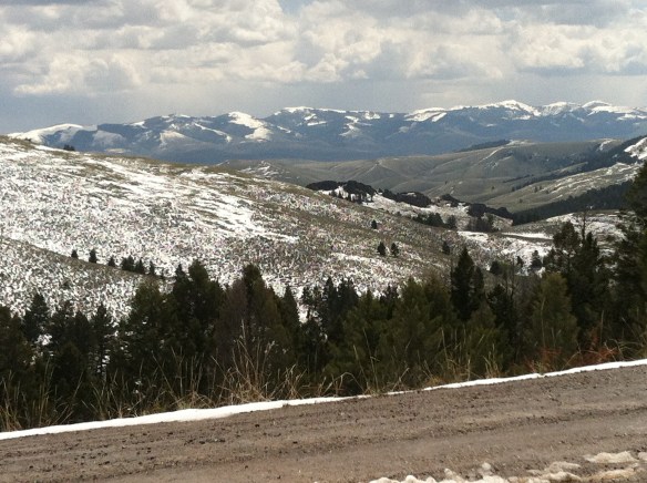
 Lemhi Pass is a magnificent place, reached by a wide dirt road that climbs up to 7300 feet. The roadbed is modern, and lies over a path worn by centuries of Native Americans who traveled this path between mountain valleys in present-day Montana and Idaho. That deep past is why the more famous Lewis and Clark Expedition took this route over the Bitterroot–and the Corps of Discovery connection is why the pass has been protected in the 20th century. The pass is also connected with Sacajawea, since her tribe, the Shoshone, often used it to cross the mountains.

 This kiosk by the U.S. Forest Service is part of the new public interpretation of the property, both at the start of the pass to the top of the mountain itself at the Sacajawea Memorial Area.
 Bannock Pass, comparatively has received little in public interpretation. Unlike Lemhi, it is not a National Historic Landmark associated with Lewis and Clark. For today’s travelers, however, it is a much more frequently used way to cross the Rockies despite its 300 foot higher elevation. A historic site directional sign leads to one interpretive


 It was a snowy Memorial Day when I crossed Lost Trail and Chief Joseph passes on my way to Big Hole Battlefield. Once again I was impressed by the recent efforts of the U.S. Forest Service to interpret the epic yet tragic journey of Chief Joseph and the Nez Perce in 1877, especially the Trail Creek Road that parallels Montana Highway 43.


 Canada was underway. Today the Nez Perce National Historic Trail and Park mark that journey into history. The park today is frankly an amazing transformation, from a preserved battlefield in the early 1980s that only hinted at the true facts of history to a modern of battlefield interpretation, one that does justice to history and to the Nez Perce story. One only wishes that more western battlefields received similar treatment.
