Northern Pacific Trestle at Moeise
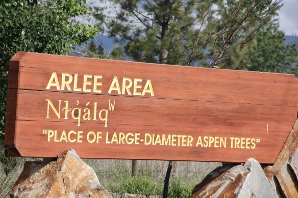
Once the Flathead Reservation was opened to homesteaders in 1904, tribal members were allocated acreage but lost control of much of their land to new development. The historic Northern Pacific Railroad corridor between Ronan and Dixon, followed roughly today by Montana Highway 212 and U.S. Highway 93 is one way to explore two almost forgotten towns in southern Lake County.


The first north of Dixon is the reservation town of Moiese, created by the federal government in the early 20th century as a “model” town of bungalows with a school. Several of the standardized design bungalows remain as does the school building, which is no longer in use.
 Moiese is best known, by far, as the entrance to the National Bison Range, where a general store stands nearby the refuge gate. Created by Congress in 1908, the refuge took

 additional land–almost 19,000 acres- from the tribes, without their consent, to create a safe haven for the remaining bison in the region. A few hundred bison live within its boundaries today. In 2016 the National Park Service began discussions with the Consolidated Kootenai and Salish Tribe to transfer management of the refuge to the tribe.
 Eight miles north of Moiese along the railroad line is the town of Charlo, named in honor of Chief Charlo of the Bitterroot Salish, who was forced from the Bitterroot Valley to move to the reservation in 1891. Charlo served as head chief of the Bitterroot Salish from 1870-
 1910. As a railroad town, Charlo is like many along the Northern Pacific, with a brief strip of businesses facing the railroad tracks, marked by the town’s sole grain elevator. It has a classic rural bar, Tiny’s Tavern, with its brightly painted exterior of concrete block, with brick accents. Built in 1946 by Tiny Browne, it was both a motel and a tavern, and a local museum of items that Tiny thought were interesting. Browne died in 1977 and his sister, Celeste Fagan, next owned the tavern, managed by Edna Easterly who recalled in a story in the Missoulian of April 20, 2007 that Tiny “was known as the bank of Charlo. Tiny always carried a lot of money in his pocket and if you needed to cash a check, you went to Tiny.”
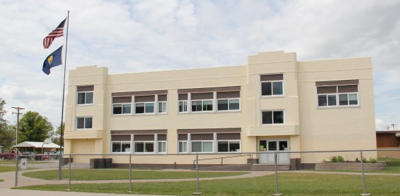
 Most important for its architecture, however, is the town’s public school, a wonderful example of Art Deco style from the New Deal decade of the 1930s.
 Ronan is a third town along the railroad corridor, named for a former white superintendent of the reservation. The town’s demographics today are mostly white, with a little more than a quarter Native American population. Ronan proudly proclaims its existence not only with a gate sign, connecting the business district to the sprawl along U.S. Highway 93 but also a log visitor center and interpretive park on the highway.


Ronan’s commercial area retains classic bars, like the 2nd Chance Bar, and a combination of recreational services that have been lost in too many communities–a bowling alley and movie theatre standing next to each other.


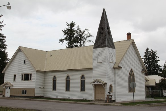
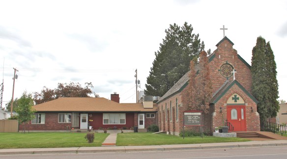
Historic church buildings from the early 20th century include the frame now covered in vinyl Methodist Church and the brick Gothic styled Sacred Heart Catholic Church, with an attached Ranch-style parsonage. St. Luke’s Community Hospital provides a much needed medical oasis in what is still a rural, agricultural area. Opened in 1953, the hospital is now an oddity–in that it is community owned and still serving its rural population. The building shown below was constructed c. 2008.
 The facade expresses a confident future, which is needed in today’s uncertain economic climate for rural hospitals across the state. But my favorite building in Ronan speaks to my love for adaptive reuse and mid-20th century modern design. The town library is an
 exquisite example of mid-century modern, and was once a local bank before being converted into the library.


 There is a new school and a really different lakefront of businesses, homes, and parks. The town’s population was over 1600 in 2010; it’s now 2700 and counting.


 To get the full meaning of Flathead Lake, however, you have to consider the lake’s deep time, and its long history with the Salish and Kootenai peoples. When I surveyed the county in 1984-1985, you came away impressed with the different vision that the tribes had for the region, and what was already happened at Pablo. In 2014, however, I left Lake County was a deeper impression on what the tribes have meant to the lake and vice versa.
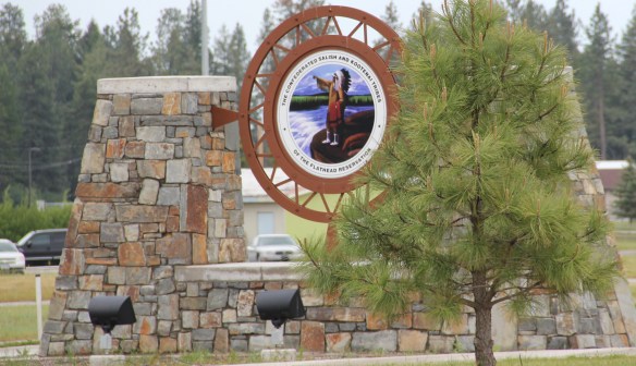
 The People’s Center at Pablo is part of that lesson as it affords a powerful, lasting introduction to both the history and continuation of tribal traditions.