The Montana State Capitol was my first heritage project in the state–the Montana Department of General Services worked with the Montana Historical Society to have me prepare an interpretive guide to the capitol, and then set up the interpretation program, following an excellent historic structures report prepared by the firm of Jim McDonald, a preservation architect based in Missoula.


The capitol was designed by the firm of Charles Bell and John Kent of Council Bluffs, Iowa, who moved to Helena to supervise the project. The first phase of construction dates from 1899 to 1902 and then between 1909 and 1912 the building was largely completed to its present form with additions from the Billings firm of Link and Haire. It was a splendid building and a joy to work with, and clearly a point of pride of the thousands of Montanans who would visit in a given year.
 When I worked at the capitol, of course I passed daily by other state government buildings, and rarely gave those “modern” buildings another thought, except perhaps for the museum exhibits and archival collections at the Montana Historical Society. Years later, however, what seemed unbearably recent in the early 1980s were now clearly historic. One of my MTSU graduate assistants, Sarah Jane Murray, spent part of a summer last decade helping develop a inventory of the buildings and then, finally, in 2016 the Montana State Capitol Campus historic district was listed in the National Register of Historic Places.


It is really a splendid grouping of buildings, reflecting both the growth of Montana in the middle decades of the 20th century and how state government has expanded its services to the citizens. The Scott Hart Building dates to 1958, an impressive bit of Montana modernism by the firm of Bordeleau, Pannell, and Amundsen. it was an addition to the original Montana Highway Building (1936), a New Deal project in PWA Moderne style from


the Great Falls architect George Shanley. The initial highway building now houses the departments of livestock and agriculture.
 The Capitol Annex (1910) was the first building added to the capitol campus, and its restrained classicism came from the firm of Link and Haire.
 The nearby Livestock Building (1918) is like the annex, complimentary of the capitol’s classicism but also distinguished in its own Renaissance Revival skin. Link and Haire were the architects.
 The mammoth Sam W. Mitchell Building (1948-50) reflected the post-World War II interpretation of institutional modernism and its mammoth scale challenged the capitol itself, especially once a large addition was completed at the rear of the building in 1977. The architect was Vincent H. Walsh of Helena.
 Another Link and Haire building on the campus is the Board of Health Building (1919-1920), which continues the pattern of more restrained architectural embellishment that shaped the look of the government buildings in the middle decades of the century.
  The Cogswell Building (1954-55, 1981) is another Vincent H. Walsh design, again reflecting the stripped classicism institution style often found in Cold War era public buildings.
 While the capitol campus took form on a hill about a mile east of Last Chance Gulch, the state’s governor still lived downtown, in the Queen Anne-style “mansion” originally built by miner and entrepreneur William Chessman and designed by the St. Paul firm of Hodgson, Stem and Welter. The state acquired the house in 1913 to serve as the residence for the governor and his family, and it remained the governor’s “mansion” until 1959.
 It was the opportunity to be the curator of this house museum that attracted my newlywed wife Mary Hoffschwelle that led me to come with her to Montana. She was born in Billings; I had never been west of Dallas. But then over 25,000 miles of driving, visiting, and looking in Montana transformed me, and led not only to the 1986 book A Traveler’s Companion to Montana History but now this Montana historic landscape blog. Fate, perhaps. Luck–I will take it any day.
 Somehow it is most appropriate that my 300th post for Revisiting the Montana Landscape would find me back at Glacier National Park, especially the west side or Flathead County part of the park. From the first visit in 1982, Glacier always intrigued me–at first because of the tie between park creation and railroad development, then the Arts and Crafts/Chalet architecture associated with the park, and then high mountain Alpine environment. In the years since, I have eagerly grabbed a chance to get a cabin by Lake McDonald and just re-charge for a few days.
 For the 1984-1985 state historic preservation plan work, however, I did not visit the west side of the park–the bulk of the travel took place between mid-February to mid-May 1984, meaning only the lower elevations such as Apgar Village were accessible. But already the state historic preservation office was aware that a major effort was underway to identify and nominate key properties within the park to the National Register of Historic Places, and by the end of the decade that process was largely complete. The National Park Service identified a range of historic resources from the turn of the 20th century to the Mission 66 program of the National Park Service during the 1960s–Glacier became one of the best studied historic landscapes in all of Montana.


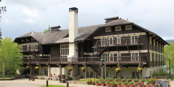
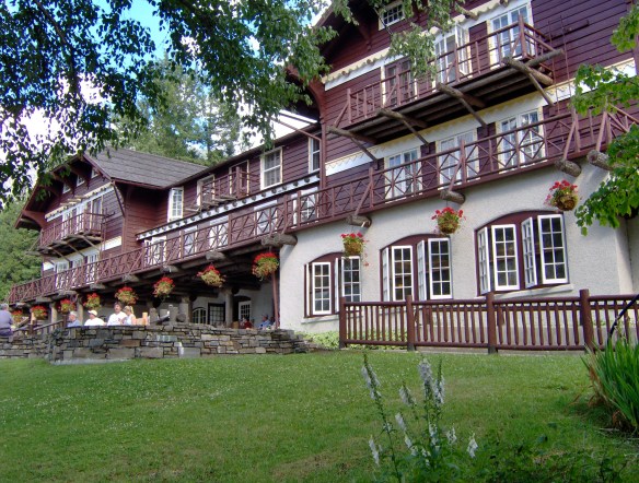


 Register as an excellent example of Mission 66-associated architecture within the park. Burt L. Gewalt of the Kalispell firm Brinkman and Lenon was the architect.
 Great Northern officials considered the lodge to be the center of the mountain experience on the park’s west side. From there visitors could take overnight hikes to two other facilities, shown below, the Granite Park Chalet to the northeast or the Sperry Chalet to the southeast of Lake McDonald, both of which are also listed in the National Register.

 City as one large tourism funnel. After spending a good part of 2006-2007 working with local residents and the Great Smoky Mountains National Park about the heritage and preservation of Gatlinburg, Tennessee–one of the most notorious gateways into any national park–I learned to look deeper than the highway landscape and find some real jewels in each of these Glacier National Park gateway communities.


 At Hungry Horse, however, I did leave the highway and explored the marvelous landscape created by the Hungry Horse Dam and Reservoir, a mid-20th century project by the U.S. Bureau of Reclamation. The agency justified the dam as a hydroelectric power project for a growing Flathead County and as a boost to local irrigation. The irrigation side of the project–the real reason the agency exists–never happened and Hungry Horse today is an electric power and recreational project.
 I appreciated the vastness of the concrete arch dam–the 11th largest concrete dam in the United States–as well as the beauty of Hungry Horse Reservoir, an under-appreciated tourism asset as anyone in Flathead County will tell you. But again, I let just the size and impact of the dam distract me from some of the details of its construction that, today, are so striking.


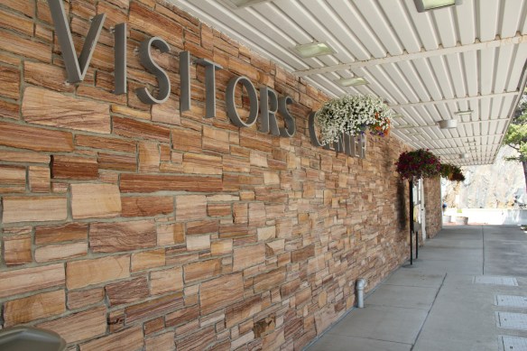

 I am concerned, however, about news in September 2015 that Reclamation has contracted for updates and renovation at the Visitor Center–let’s hope that the classic 1950s look of the property is not sacrificed.


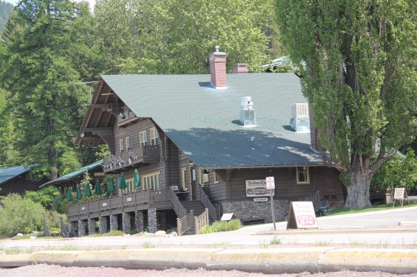 Architect Kirtland Cutter of Spokane was the architect and the chalet design was actually just a smaller scale and less adorned version of the Idaho State Exhibition Building that he had designed for the 1893 World’s Fair in Chicago. Cutter is one of the major figures of the Arts and Crafts Movement in the American Northwest and we will look at another of his buildings for the railroad and Glacier in the next post about Lake McDonald Lodge.




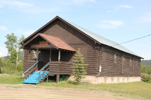 The answer was yes, to both questions. Here is an early 20th century log building landmark on a highway where the traffic seems to never end. It is also along the corridor of a new recreational system–the Great Northern Rails to Trails linear park that uses an old railroad corridor to connect the city to the country in Flathead County.
 The trail allows bikers to see the rural landscape, still dotted with family farms, of the Smith Valley as it stretches west to Kila, where the old Cottage Inn has been converted in the last few years into the Kila Pub, complete with the Arts and Crafts/Tudor theme associated with the railroad corridor.

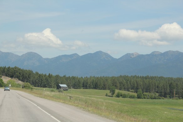
 To the north of Kalispell and Whitefish U.S. Highway 93 takes you past the ski developments into a thick forested area, managed in part as the Stillwater State Forest.
 from the 1920s into the 1960s. While several are from the Civilian Conservation Corps during the 1930s, state ranger Pete De Groat built his log residence in 1928 in the Rustic Style. Stillwater was Montana’s first state forest.


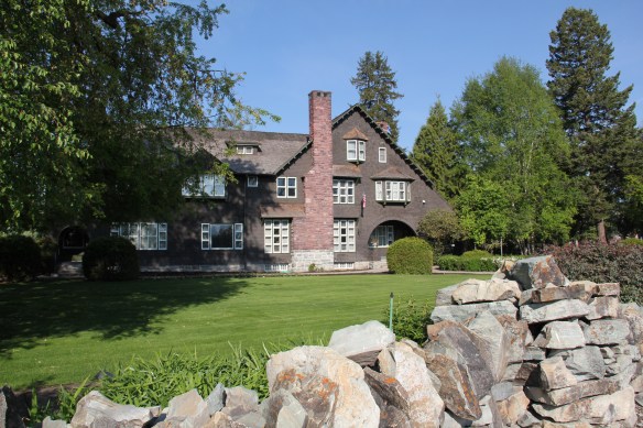


 The images above and those below come from those well maintained neighborhoods, where the sense of place and pride is so strongly stated.


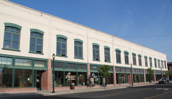
 Kalispell’s Main Street–the stem of the T-plan that dates to the town’s very beginning as a stop on the Great Northern Railway–has a different mix of businesses today than 30 years ago when I visited during my state historic preservation plan survey. It also now is a historic district within National Register of Historic Places, noted for its mix of one-story and two-story Western Commercial style businesses along with large historic hotels and an opera house for entertainment.
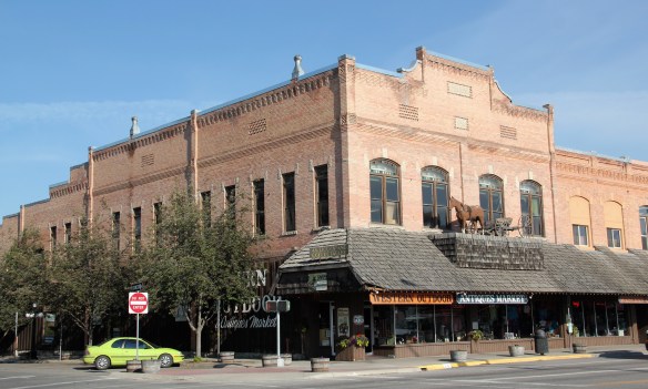 The Opera House, and I’m sorry you have to love the horse and buggy sign added to the front some years ago, dates to 1896 as the dream of merchant John MacIntosh to give the fledging community everything it needed. On the first floor was his store, which over the years sold all sorts of items, from thimbles to Studebakers. The second floor was a community space, for meetings, a gymnasium, and even from a brief period from 1905 to 1906 a skating rink. In this way, MacIntosh followed the ten-year-old model of a much larger building in a much larger city, the famous Auditorium Building in Chicago, providing Kalispell with a major indoor recreation space and landmark. Allegedly over 1000 people attended a performance of Uncle Tom’s Cabin soon after the opening.


 The Alpine Lighting Center dates to 1929 when local architect Fred Brinkman designed the store for Montgomery Ward, the famous Chicago-based catalog merchant. Its eye-catching facade distinguished it from many of the other more unadorned two-part commercial blocks on Main Street.


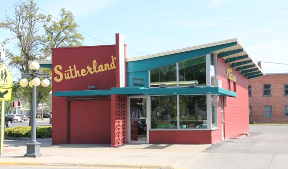





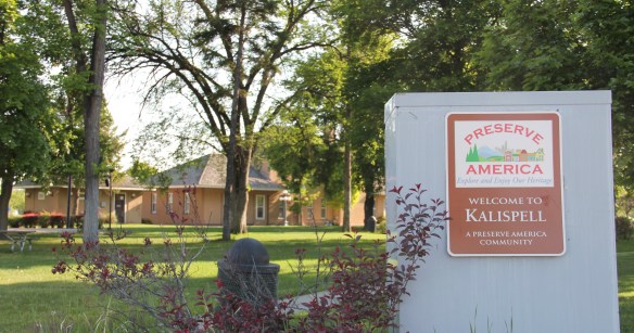
 I love Montana town signs, and Troy, deep in the state’s logging country, has one of the best. The sign lures to a city park nestled along the Kootenai River. The focus point is a


 the Great Northern’s main line, and I documented the few historic buildings left facing the railroad tracks today. The Home Bar (c. 1914) and the Club Bar were institutions then, and remain so today. The Kootenai State Bank building still stands but has experienced a major change to its facade–made better in part by the American flag painted over some of the frame addition.
 The Troy Jail, above, was listed in the National Register of Historic Places in 2006 and it remains the only building so listed in the town today. D.E. Crissey, a local contractor, built it out of concrete in 1924 during Troy’s boom from 1916 to 1926 when its population jumped from 300 to 1300. The Snowstorm mine, which produced lead, zinc, and silver, started to serve the demand for raw materials during World War I. The mine soon turned what had been a small railroad town into a mining camp best known for its brothels and bars. Then in the early 1920s the Great Northern decided to build a division point here, further booming the town. The Sandpoint Pole and Lumber Company began its logging business in 1923, and Troy suddenly was the largest town in the county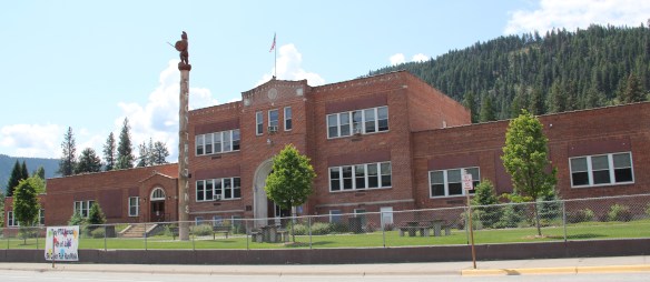







 As I would come to find out, on two return trips here in 1984, the town was much more than that, it was a true bordertown between two nations and two cultures. The two trips came about from, first, a question about a public building’s eligibility for the National Register, and, second, the fieldwork for the state historic preservation plan, where such obvious landmarks as the National Hotel and Eureka passenger depot were noted. Thirty
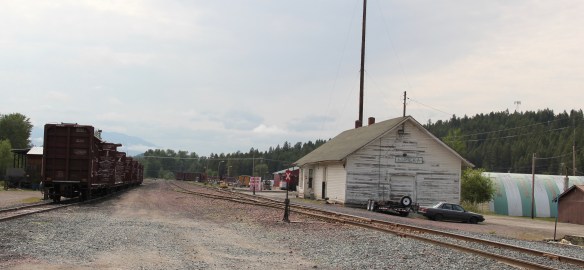 years later I was pleased to see the National Hotel in much better condition but dismayed to see the Great Northern passenger station–a classic example of its early 20th century standardized designs–is far worse condition that it had been in 1984.
 Otherwise, Eureka has done an impressive job of holding together its historic core of downtown one and two-story commercial buildings. In 1995, owners had the Farmers and Merchants State Bank, built in 1907, placed in the National Register. Walking the town, however, you see the potential of a historic district of this turn of the 20th century place.


 Located on a hill perched over the town, the building was obviously a landmark–but in 1984 it also was just 42 years old, and that meant it needed to have exceptional significance to the local community to merit listing in the National Register of Historic Places. Eureka had been a logging community, and the depression hit hard. The new building not only reflected community pride but also local craftsmanship, and it became a
 foundation for community resurgence in the decades to come. The building was listed in 1985, and was the first to have my name attached to it, working with Sally Steward of the local historical society. But credit has to go to Pat Bick and especially Marcella Sherfy of the State Historic Preservation Office for urging me to take it on, and to guide me through the maze of the National Register process. Today, it has experienced an adaptive reuse and serves as a rustic log furniture store.
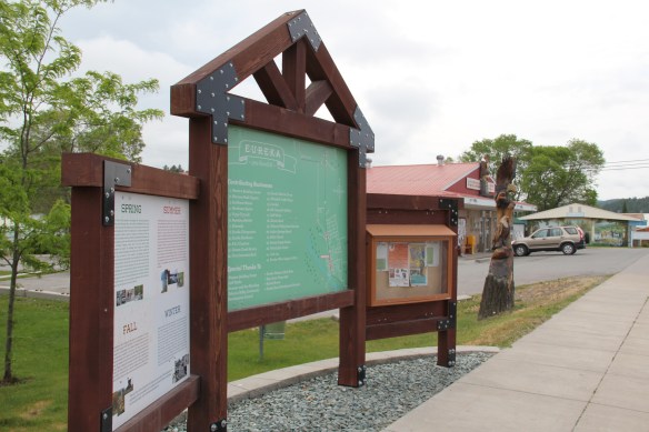
 During those visits in 1984 I also held a public meeting in Eureka for the state historic preservation plan, where I learned about the Tobacco Valley Historical Society and its efforts to preserve buildings destined for the chopping block through its museum village on the southern edge of town. Here the community gathered the Great Northern depot (1903) of Rexford, the same town’s 1926 Catholic Church, the Mt. Roberts lookout tower, the Fewkes Store, and a U.S. Forest Service big Creek Cabin from 1926.




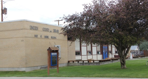
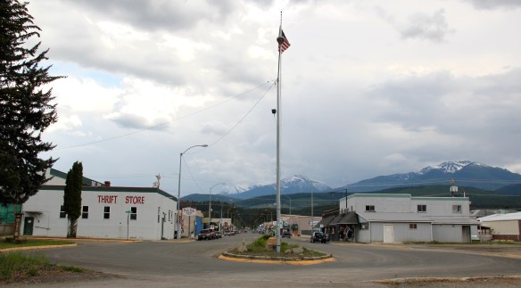 Libby is the seat of Lincoln County, a typical railroad town along the historic Great Northern Railway corridor. The image above is from the town’s railroad depot, the symbolic beginning of town, from which runs a long main street of businesses, reflecting the T-plan town design, where the long railroad corridor defines the top of the T and the main street forms the stem of the T.


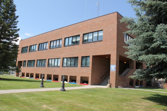
 courthouse received a totally new front, in a contemporary style, in the 1970s as the town and county expanded in the wake of the federal spending in constructing Libby Dam. The rectangular blockiness, flat roof, and band of windows set within a symmetrical facade makes the courthouse one of the state’s best designs for a rural public building in the late 20th century.
 I liked all of those things about Libby in 1984. Imagine my shock and disappointment to learn, as everyone else did, that Libby was one of the poisoned places in the west. In 1919, vermiculite, a natural material that contains asbestos, had been discovered outside of town, and the mines were still operating, producing 80 percent of the vermiculite in the world, under the control of the W.R. Grace company. Residue from the mines had been used in local yards and buildings for decades, a fact that was not known when I visited the town for the state historic preservation plan. When the discovery of the danger became public, and the federal Environmental Protection Agency entered into the fray in 1999, it was already too late for many residents. A federal Superfund project began, and did not conclude its work until 2015, spending some $425 million. Then in 2009 the Environmental Protection Agency announced a public health emergency, spending another $130 million to help residents and to leave a new health infrastructure in place. In a generation, Libby had been turned inside out. EPA announced in 2016 that the cleanup would continue to 2018, and that the project was the longest in the agency’s history.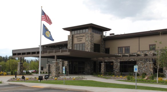
 Despite the disaster, I saw many signs that Libby residents were determined to remain and rebuild their community. One of the most powerful examples is the conversion of one of the town’s historic schools into a new community arts center as well as school administration offices.


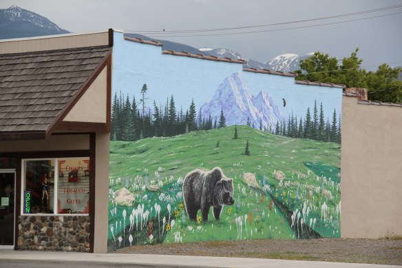
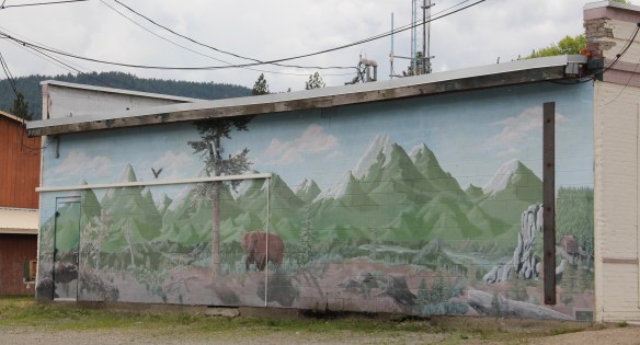
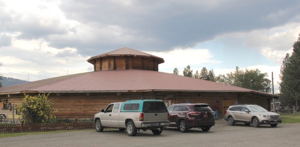 The asbestos crisis was a terrible disaster for Libby–yet residents refused to let it define their future. There are past accomplishments to acknowledge, an active railroad depot to cherish, a beautiful river and lake, the mountains all around, as celebrated in this public art mural on a downtown building. This place is here to stay, and the historic built environment is a large part of it.