
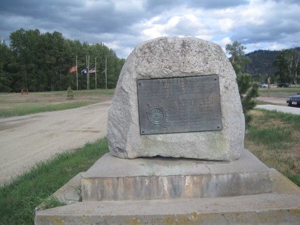
 Along Interstate I-90 as you travel northwest into Idaho, St. Regis is the last town of any size in Montana, and, at that it only counts just over 300 residents. The town has a long significant history in transportation. Old U.S. Highway 10 follows part of the historic Mullan Road–the Mullan monument above marks that route in St. Regis. The town lies at the confluence of the Clark’s Fork River and the St. Regis River. It is also the point where


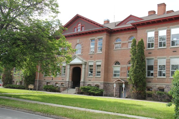
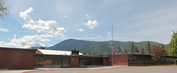
Since my last visit in 1984, school officials had expanded the St. Regis school and added a new entrance but the historic facade still commands attention.
the Milwaukee Road left the Clark’s Fork corridor that it had followed from southwest Montana–the Northern Pacific kept on that route however–while and tackled a much more demanding path through the Rockies–that of the St. Regis River towards Taft.

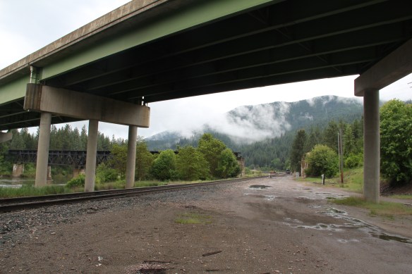 As the photos above show, one of the Milwaukee’s bridges over the Northern Pacific right-of-way has been cut while the interstate rises high above and dwarfs both earlier railroads along the Clark’s Fork River. From St. Regis to Taft, the Milwaukee Road route has new life. In the 21st century the U.S. Forest Service and local residents have worked diligently to preserve the corridor, not to restore the tracks but to find a new recreational use for the abandoned railroad bed.
 Note in the photograph above, how one of the distinctive electric power poles that carried electricity to the Milwaukee’s engines remains in place. In the central part of Montana, many of these poles are long gone from the corridor. The Milwaukee’s stretch of electrified track began in Harlowton and ended in Idaho–and the St. Regis to Idaho section has some of most intact features of this distinctive engineered landscape.

 The village of Haugan is also the location of the Savenac Nursery, which the U.S. Forest Service established here c. 1907, as the Milwaukee’s tracks were being constructed. Under the direction of Elers Koch of the forest service, Savenac’s became one of the largest seedling operations in the department of agriculture, yielding as many of 12 million seedlings in one year.
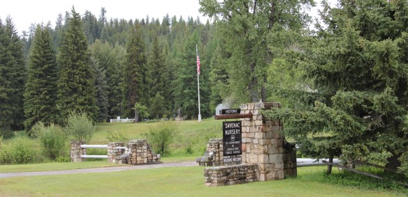
 The historic nursery is open to the public, another example of the important work that the Forest Service has carried out for both preservation and public interpretation in the last 30 years. Listed in the National Register of Historic Places, the property has a museum that operates in the tourist season.

The nursery is also among the most important landscapes in the state associated with the Civilian Conservation Corps, which built most of the extant historic buildings in the 1930s.


Thus it is most appropriate that a monument to the CCC workers has been located on land between the interstate highway and the nursery grounds.The monument, dedicated in 2005, notes that agency’s work in Montana from 1933 to 1942, a decade of transformation in the state’s public landscape that millions have experienced since then.


 Haugan is also home to one of the state’s modern pieces of roadside architecture along the interstate, Silver’s truck stop, restaurant, bar, and casino.

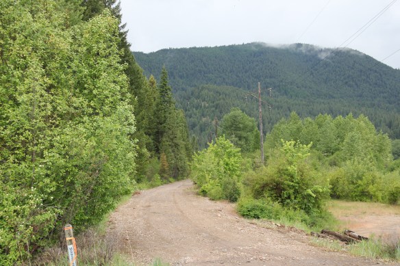
Saltese lacks the formal monuments found at its neighbor, but this small Milwaukee Road town has an industrial landmark in the high iron trestle that cuts through its residential side. There you can see one of the rectangular wooden catenary supports for the electric lines to the speeding trains. The route itself is part of recreational trail that takes bikers and hikers to the National Register-listed tunnel and railroad yards ending at the St. Pass Pass Tunnel (1908) at Taft near the Idaho border.
 Saltese’s contemporary styled school from c. 1960 remains but has closed. Its historic motels and businesses, as well as an abandoned c. 1930 gas station on old U.S. Highway 10, welcome travelers from the west to Montana.


 The railroad trail route from Taft provides access to some of most spectacular industrial ruins of the old Milwaukee route left in the west.
 The two railroads and the river that shaped Missoula also carved the landscape to the northwest. Following the Clark’s Fork River to the northwest, the Milwaukee Road passes through Mineral County, adding to a transportation corridor that, earlier, included the Mullan Road, and then later U.S. Highway 10. It is now the route of Interstate Highway I-90 as i heads west to Idaho and then Washington State.


 As the interstate crosses the Clark’s Fork River near Tarkio it bypasses the earlier transportation network. A particular marvel is the Scenic Bridge, listed in the National Register in 2010, especially how the bridge of U.S. 10, built in 1928, was designed in dialogue with the earlier high-steel bridge of the Milwaukee Road.
 The Scenic Bridge has been closed to traffic but is safe to walk across, creating great views of both bridges and the Clark’s Fork River–travel here has always been challenging.


 Twenty years historic preservationists stepped up to add numerous properties to the National Register throughout the county. In addition to the passenger depot, the Montana Valley Book Store, above, was listed. This two-story false front building, with attached one-story building, was once the town’s commercial heart and known as Bestwick’s Market–it has been close to the heart of book lovers for years now. Montana Valley Book Store was a relatively new business when I first visited in 1984 but now it is one of the region’s cultural institutions, especially when a visit is combined with a quick stop at the adjacent Trax Bar.
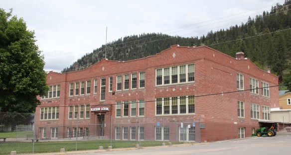
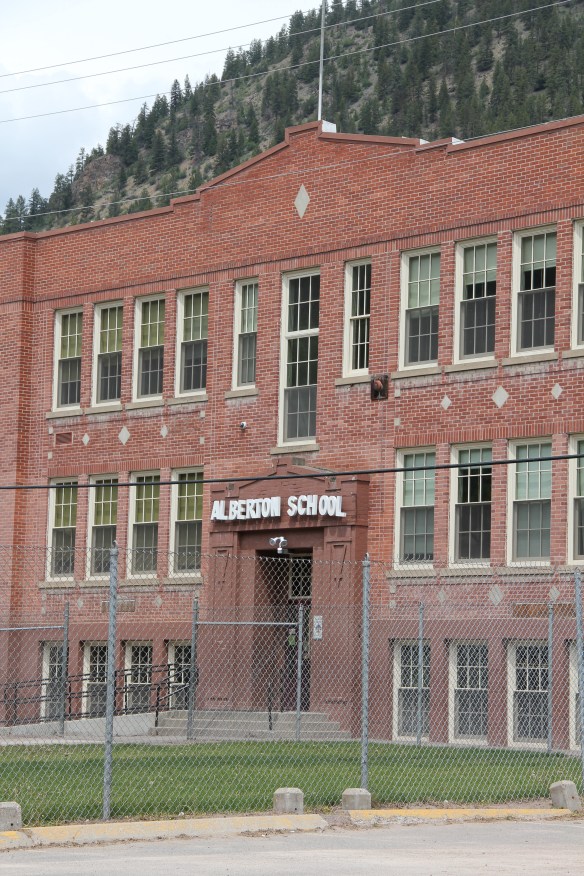 The historic three-story brick Alberton High School (now the Alberton School) operated from 1919 to 1960 as the only high school facility within miles of the railroad corridor. It too is listed in the National Register and was one of the community landmarks I noted in the 1984-1985 state historic preservation plan work.
 I gave no notice to the replacement school, the modern Alberton High School, c. 1960. That was a mistake–this building too reflects school design ideas of its time–the Space Age of the late 1950s and 1960s, when open classrooms, circular designs, and a space-age aesthetic were all the rage. Alberton High School is one of my favorite small-town examples of Montana modernism.
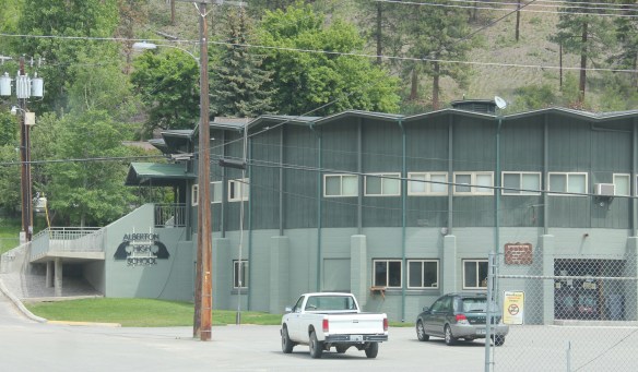 The school is a modern marvel just as the high school football field and track are reminders of how central the schools are to rural community and identity in Montana. Alberton has held its own in population in the decades since the closing of the Milwaukee Road, largely due to its proximity to Missoula and the dramatic gorges created by the Clark’s Fork River. Change is probably coming, and hopefully these landmarks will remain in service for years to come.
 To wrap up this multi-post look at Missoula and Missoula County, let’s take a brief look at the city’s historic neighborhoods. With seven historic districts, Missoula is rich in domestic architecture, and not only the homes built during its rise and boom from the early 1880s to the 1920s–there also are strong architectural traditions from the post-World War II era. This post, however, will focus on the early period, using the South Side and East Pine historic districts as examples.
 Listed in the National Register of Historic Places 25 years ago, the south side district was platted in 1890, with development especially booming after the turn of the century and the arrival of the Milwaukee Road depot by 1910. Within that 20 year period, an impressive grouping of domestic architecture, shaped by such leading architects as A. J. Gibson, was constructed, and much of it remains today. When the state historic preservation office designated the district in 1991, there were over 200 contributing buildings.
 The neighborhood contains some of the city’s best examples of Queen Anne style, as seen above but also has many different examples of other popular domestic styles of the era, such as the American Four-square and variations on the various commonplace turn of the century types as the bungalow.


 Apartment blocks and duplexes from the turn of the century also are important contributing buildings to the neighborhood. They reflect the demand for housing in a rapidly growing early 20th century western city.


 Before we leave Missoula, I want to also briefly consider its historic 1884 cemetery, an often forgotten place as it is located on the northside of the Northern Pacific Railroad corridor, and a property, like so many in 1984-1985, I gave no consideration to as I carried out the fieldwork for the state historic preservation plan.
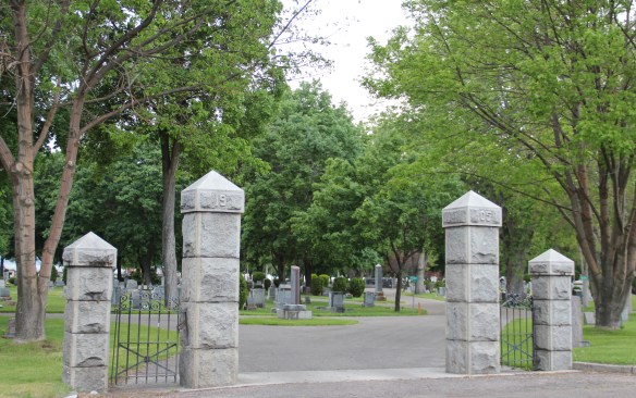
 A large concrete cross and adjacent river rock stone lined marker pay homage to the cemetery’s earliest burials as well as the many first citizens interred here.


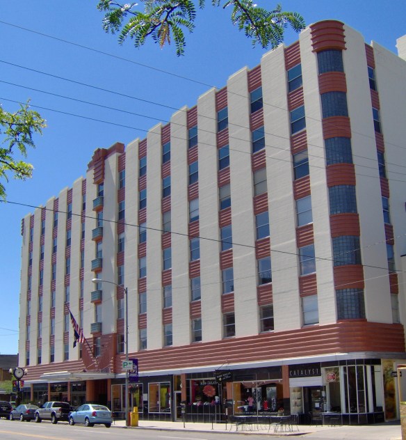 Downtown Missoula’s architectural wonders make it a distinctive urban Western place. Let’s start with my favorite, the striking Art Moderne styled Florence Hotel (1941) designed by architect G.A. Pehrson. Located between the two railroad depots on Higgins Street, the hotel served tourists and residents as a symbol of the town’s classy arrival on the scene–it was the first place with air-conditioning–of a region transforming in the 1940s and 1950s.
 With the coming of the interstate highway in the 1970s, tourist traffic declined along Higgins Street and the Florence Hotel was turned into offices and shops, a function that it still serves today.
 Next door is another urban marvel, the Wilma Theatre, which dates to 1921 and like the Florence it is listed in the National Register of Historic Places. The building was the city’s first great entertainment landmark (even had an indoor swimming pool at one time) but with offices and other business included in this building that anchored the corner where Higgins Street met the Clark’s Fork River. Architects Ole Bakke and H. E. Kirkemo designed the theatre in the fashionable Renaissance Revival style, with a hint towards the “tall buildings” form popularized by architect Louis Sullivan, the building later received an Art Deco update, especially with the use of glass block in the ticket booth and the thin layer of marble highlighting the entrance.


 Missoula’s first major department store and entrepreneurial center. The late Victorian era architectural styling of the two-story building also set a standard for many other downtown businesses from 1890 to 1920. These can be categorized as two-part commercial fronts, with the first floor serving as the primary commercial space and the second floor could be offices, dwelling space for the owner, or most common today storage space.


 Gibson, the building is one of the state’s best examples of what is called “Beaux Arts classicism,” a movement in the west so influenced by the late 1890s Minnesota State Capitol by architect Cass Gilbert.

 Just as impressive, but in a more Renaissance Revival style, is the Elks Lodge (1911), another building that documents the importance of the city’s working and middle class fraternal lodges in the early 20th century.
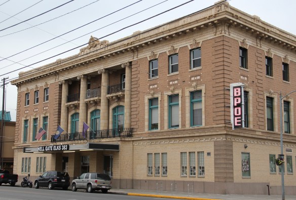


 Of more recent construction is another federal courthouse, the modernist-styled Russell Smith Federal Courthouse, which was originally constructed as a bank. In 2012, another judicial chamber was installed on the third floor. Although far removed from the classic
 look, the Russell Smith Courthouse is not out-of-place in downtown Missoula. There are several other buildings reflecting different degrees of American modern design, from the Firestone building from the 1920s (almost forgotten today now that is overwhelmed by its neighbor the Interstate Bank Building) to the standardized designed of gas stations of
 1930s and 1940s, complete with enamel panels and double garage bays, standing next to the Labor Temple.
 Modernism is alive and well in 21st century Missoula, with a office tower at St. Patrick’s Hospital, a new city parking garage, and the splashy Interstate Bank building, which overwhelms the scale of the adjacent Missoula Mercantile building–which had been THE place for commerce over 100 years earlier.


 The Silver Dollar, like the Double Front, were meccas not just for railroad workers but also travelers weary of life on the rails and looking for a bit of liquid refreshment. It remains a drinkers’ bar today.
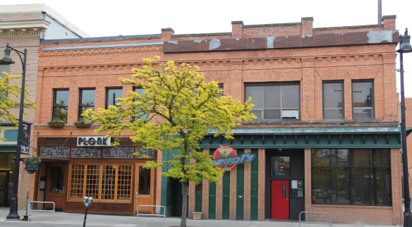 I realize that Missoula now has a wide range of downtown establishments–even a wine bar for a good measure–and I wish them well. But give me the Ox, the Double Front, or the Club any day, any time.
 The Clark’s Fork River and transportation through the valleys and over the Rocky Mountains lie at the core of Missoula’s early history. Captain John Mullan blazed his road through here immediately before the Civil War, and a Mullan Road marker is downtown.
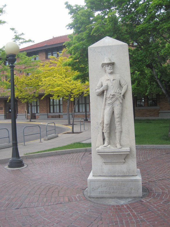 White settlement first arrived in the initial territorial years and a sawmill was the first major business. As a river crossroads town, Missoula grew, and then became a permanent dot on the federal map with the arrival of Fort Missoula, established in 1877. The fort, largely neglected when I conducted my work for the state historic preservation plan in 1984, is now a regional heritage center.

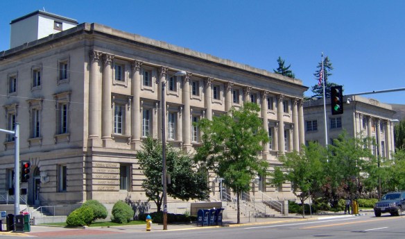
 Built in 1901, the Northern Pacific passenger station is an impressive example of Renaissance Revival style, designed by the architectural firm of Reed and Stem, and symbolized the turn of the century dominance of the railroad over the region’s transportation and the importance of Missoula to the railroad as a major train yard. The station, listed in the National Register of Historic Places in 1985, stands at the historic “top” of downtown Missoula, which at its bare bones has the classic T-plan of a railroad hub of the late 19th century. The Northern Pacific tracks and related railroad warehouses are the top of the “T” stretching in both directions with Interstate I-90 crossing the river bluffs to the northeast. Two reminders of the historic railroad traffic are adjacent to the station–a steam Northern Pacific engine and a diesel Burlington Northern engine.


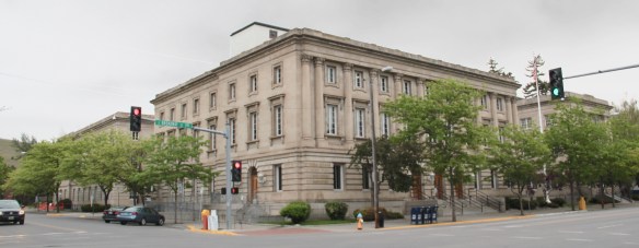
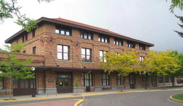
 The Milwaukee was not to be out-done by the Northern Pacific when it arrived in Missoula in 1908. Railroad architect J. J. Lindstrand gave the line a fashionable Misson-style passenger station and offices, which opened in 1910. It too is listed in the National Register. Like the company’s stations in Great Falls and Butte, built approximately at the same time, the station has a tall tower that commanded the city’s early 20th century skyline, and made the depot easy to find. Located dramatically along the Clark’s Fork River, the arrival of the railroad and the construction of the depot led to a new frenzy of building on South Higgins Street, and a good many of those one-story and two-story buildings remain in use today.
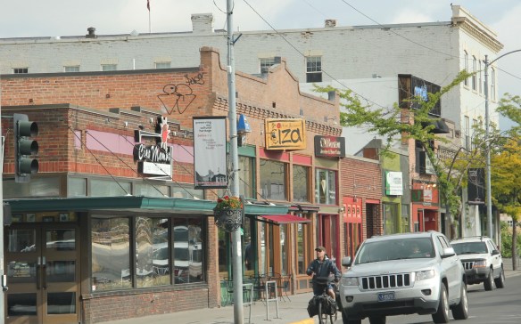
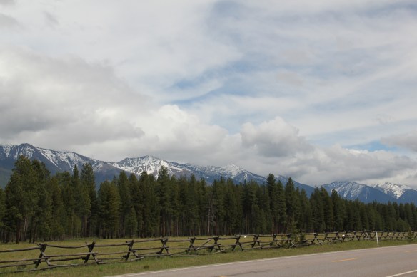 Missoula County has grown, a lot, since my state historic preservation plan work in 1984-1985, especially in the county seat of Missoula and surrounding suburbs. Yet Missoula County still has several spectacular rural drives, like Montana Highway 83 above at Condon, along with distinctive country towns. This post will share some of my favorites.


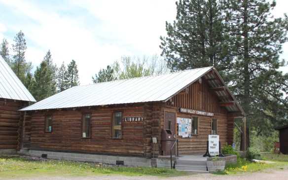 The Condon Community Center and adjacent Swan Valley Community Library serve as additional hubs for those living along the lakes and mountains of northeast Missoula County. Both buildings are excellent examples of mid-20th century Rustic style–a look that, in different variations, dominates the Highway 35 corridor.
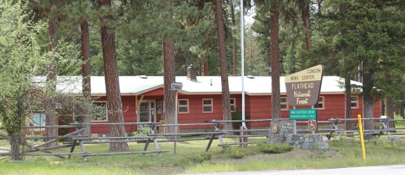
 Condon is also the base for the Condon Work Center, home to the Great Northern Fire Crew, of the Flathead National Forest. Here you can take a mile-long Swan Ecosystem Trail and learn of the diversity of life in this national forest region.
 South of Condon on Montana Highway 83 is Seeley Lake–a place that certainly has boomed in the last 30 years–witness the improved highway, new businesses, and population that has increased over 60 percent since my last visit in 1992. Yet it still had places rooted in the community’s earlier history such as the Sullivan Memorial Community Hall–a good example of mid-20th century Rustic style.
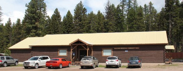 And it had added one of my favorite bits of roadside architecture in this part of Montana: the Chicken Coop Restaurant as well as opening a new Seeley Lake Historical Museum and Chamber of Commerce office at a spectacular highway location just outside of town.


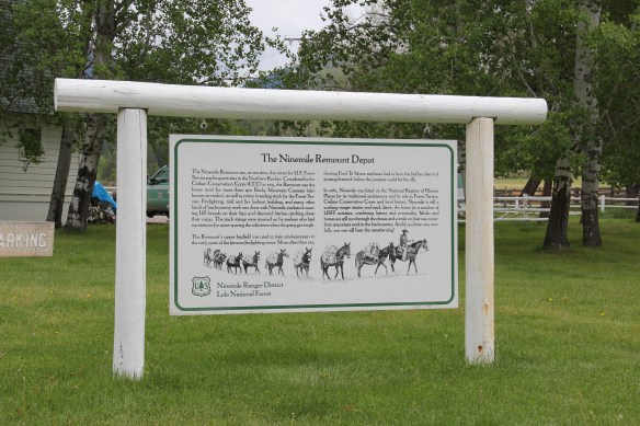
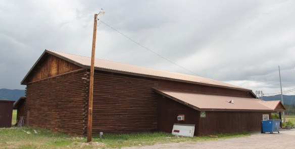
 I don’t recall even thinking about the forest service facility, but here was an entire complex devoted to the forest service’s use of mules and horses before the days of the ATV that was built by the Civilian Conservation Corps. The remount depot is an interesting


 The name Frenchtown dates to 1868 and is a reference to a number of French Canadians who moved here in the early settlement period. A National Register-listed church, the St. John the Baptist Catholic Church (1884) marks that first generation of settlers. Its classical-tinged cupola has long been the town’s most famous landmark.
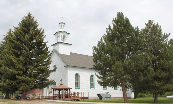 The Milwaukee Road built through here in 1907-1908 and there remains a handful of historic business buildings from the time of the Milwaukee boom. There is one landmark
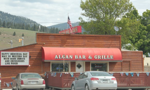
 another roadside landmark–the Bucksnort Bar, just further evidence to add to the Chicken Coop and the Alcan that you won’t go hungry if you explore the small towns of Missoula County.


 Since I last visited in 2012 efforts have been underway to secure additional acres and to preserve a buffer around the property since growth and highway expansion between Missoula and Stevensville has engulfed Lolo. The park now has 51 acres and represents quite an achievement by the non-profit Travelers Rest Preservation and Heritage Association, local government, and Montana State Parks.
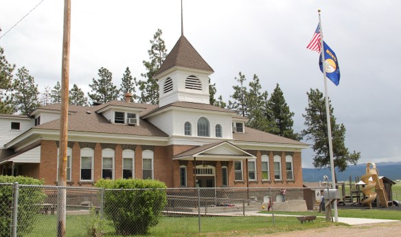
 It is a land watered by the river, framed by the mountains, and famous for its beef–which they even brag about at the crossroads of Montana Highways 200 and 83.
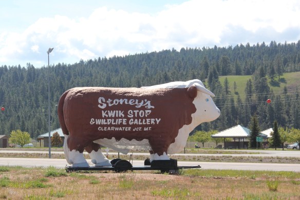 But soon after passing the junction, you enter a much different landscape, particularly at the point where the Blackfoot River meets the Clark’s Fork River. This is an industrial world, defined by the company town design of Bonner and the active transportation crossroads at Milltown. Suddenly you shift from an agricultural landscape into the timber industry, which has long played a major role in the history of Missoula and northwest Montana.
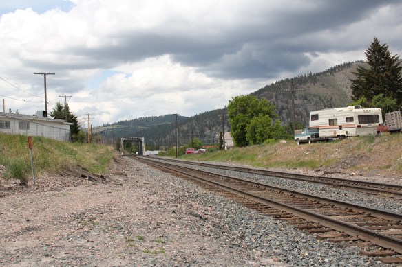 In 1881 the Northern Pacific Railroad was approaching the river confluence. It contracted with a company led by E. L. Bonner, Andrew Hammond, and Richard Eddy to supply everything the railroad needed but steel as it passed through the region. Two years later the railroad provided the capital for Bonner, Hammond, Eddy, and M.J. Connell to establish the Montana Improvement Company. In c. 1886 the improvement company dammed the rivers and built a permanent sawmill–the largest in the northern Rockies, and created the town of Bonner. The sawmill works and town would later become the Blackfoot Milling and Manufacturing Company and eventually by the late 1890s it was under the control of Marcus Daly and his Anaconda Copper Company. Anaconda ran Bonner as a company town until the 1970s.
 Although buildings have been lost in the last 30 years, especially at the sawmill complex which had a disastrous fire in 2008 and a heavy snow damaged another historic structure in 2011, I found Bonner in 2014 to remain a captivating place, and one of the best extant company towns left in Montana.
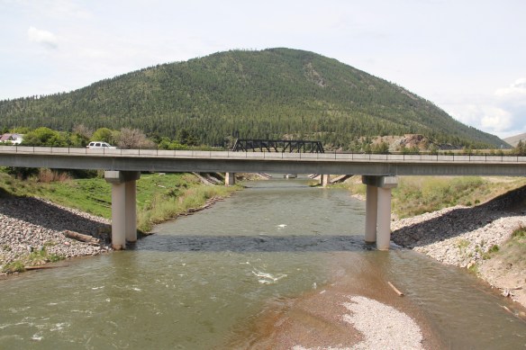 Montana Highway 200 passes through the heart of Bonner while Interstate I-90 took a good bit of Milltown when it was constructed in the 1970s. Both Bonner and Milltown are heavily influenced by transportation and bridges needed to cross the Blackfoot and Clark’s Fork rivers.
 The Milltown Bridge has been restored as a pedestrian walkway over the Blackfoot River. It is the best place to survey the Blackfoot Valley and the old sawmill complex.
 The pedestrian bridge and heritage trail serve as a focal point for public interpretation, for the Lewis and Clark Expedition, the Mullan Road, and then the lumber industry, which all passed this way over time, a conjunction of rivers and history that lie at the heart of the local and state (Milltown State Park) effort to interpret this important place.


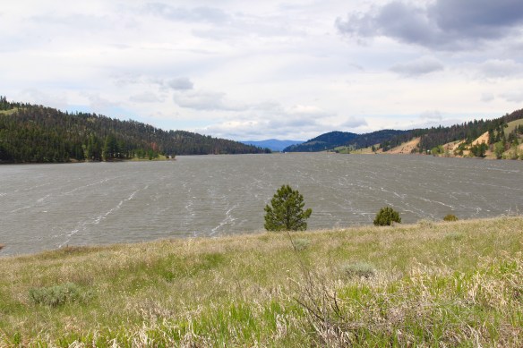
 Montana Highway 141 cuts north from Avon On U. S. Highway 12 to halfway between the towns of Ovando and Lincoln on Montana Highway 200. Its is high mountains prairie travel at its best, although the height of ranching along this route disappeared a while back. About 12-13 miles north of Avon you cross into the Nevada Creek drainage, which has long watered the land, enhanced after the New Deal added the Nevada Creek earthen dam that created Nevada Creek Reservoir in 1938.
 Along the east banks of the lake are remnants of the Fitzpatrick Ranch, which is listed in the National Register of Historic Places. I highlighted the property in my book A Traveler’s Companion to Montana History (1986). Jimmy Isbel established the property in 1872,
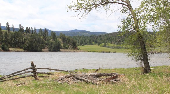
 Thirty years ago, this significant collection of vernacular buildings was in good condition, but the years since have been hard on the property, and the complex now needs serious preservation attention. The loss of the roof on the log barn, and the general poor condition of the roofs of the outbuildings are major concerns.


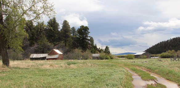
 Between the Fitzpatrick Ranch and Helmville is the Barger Ranch, also from the late 19th century judging from the more polished example of Queen Anne style in the ranch house. It is living proof that not all of the Nevada Creek ranches have passed away. The Nevada Creek Water Users Association at Helmville still operates to distribute the invaluable water from the reservoir.
  Helmville was another topic in my 1986 book. Throughout the Nevada Creek drainage, you could help but be impressed with the log construction, and the various types of notching used for the buildings. Helmville had a particular interesting grouping of wood frame and log buildings, which were highlighted by a 1984 photograph in the book. That exact view could not be replicated 30 years later but several of the old buildings still stood.
 Helmville has a good bit of continuity. Along with the row of buildings on Montana 271 there is a turn of the 20th century gable-front cottage and a two-story lodge building that has been turned into a garage.


 Trixie’s was the same fun dive that I always recalled, but the village’s historic buildings had been restored, looking good. Business appeared to be brisk. A new community church has been opened, and a major interpretive place for the “Lewis Minus Clark” expedition had been installed. Kudos to both the U.S. Forest Service and the Lewis and Clark National Historic Trail for allowing a bit of humor in this marker.


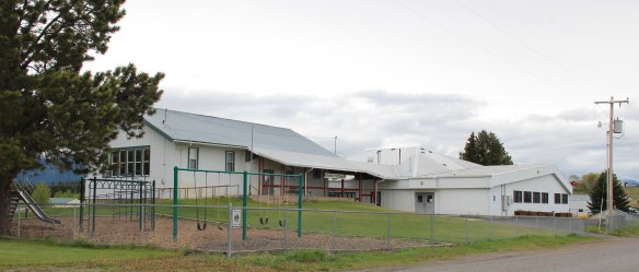 The school had also expanded from its New Deal core of the 1930s, courtesy of the Works Progress Administration. But the most noticeable change was the town’s street signs–first the fact that a small place had street signs but then the nostalgic backpacker theme of these cast iron marvels.
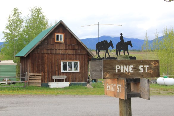 Ovando is a good location on the Blackfoot River for sportsmen, anglers, and hikers headed into the Bob Marshall Wilderness–its recent change demonstrates the influence on those groups on the 21st century Montana landscape.
