In thinking about returning to Montana in 2012 and carrying out a huge “re-survey” of the places I had explored for the state historic preservation plan process 30 years earlier, Butte was high on my list of priorities. Not that the city and its surroundings had been given little attention in the early 1980s–the Copper City was already recognized as a National Historic Landmark, and a team of historians, architects, and engineers had just finished a large study of its built environment for the Historic American Building Survey and the Historic American Engineering Record. No, I wanted to go back because by 1985 many people counted Butte down and out, yet it had survived and started to reinvent itself. Not
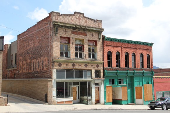 as a ghost town or the skeleton of a great mining city but as a revitalized place, both economically and culturally, centered in a strong core community, even though the challenges in front of it remain daunting, even overwhelming at times.
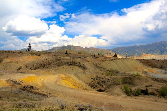 The environmental degradation left when the hard rock mines shut down is one burden that Butte has shouldered, with the help of the federal superfund program. Still, no matter how scientifically this landscape has been “cleaned up,” it remained scarred, and it is a far different challenge to build back hope into a place stripped of its life. Yet high over the city is a sign of the change to come in the Mountain Con Mine site.
 Still labeled as a Mile High and a Mile Deep place, the mine property is stunning, not only for its technological assertion–imagine working that high, and going that deep–but for its conversion into the walking/hiking/biking trails that encircle the city and present it with such potential as a recreational landscape.
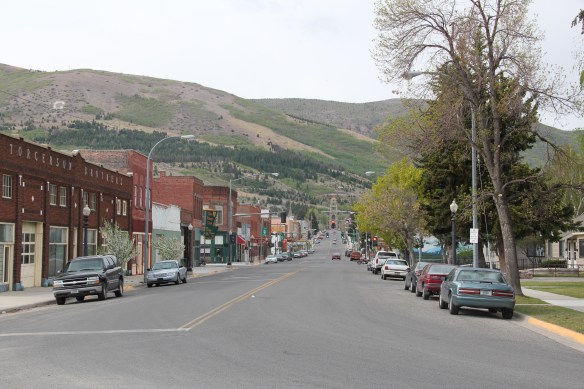
Transformation, that it is what strikes me as I wander down the trail and into Butte’s famous, or is it infamous, “Uptown” district. Butte is far from the place it was 30 years
 ago, with all sorts of signs of new investment, new pride, and community identity. It may have lost a step, or two, and its swagger may not be quite as exaggerated as it was in the mid-20th century, but it remains a place with its own feel, its own funk. For me, the reopening of the M&M Bar on Main Street–a legendary dive once shuttered, reopened, and shuttered again–gives me hope for Butte in the 21st century. Around the corner is
another institution, Gamer’s Cafe, which is situated within the marvelous Victorian eclecticism of the Curtis Music Hall of 1892.
Both establishments are for locals but visitors are tolerated, even welcomed. Indeed a degree of openness and acceptance have grown in Butte, a marked change from when the city’s Chinese residents lived and operated businesses on the edge of Uptown, along
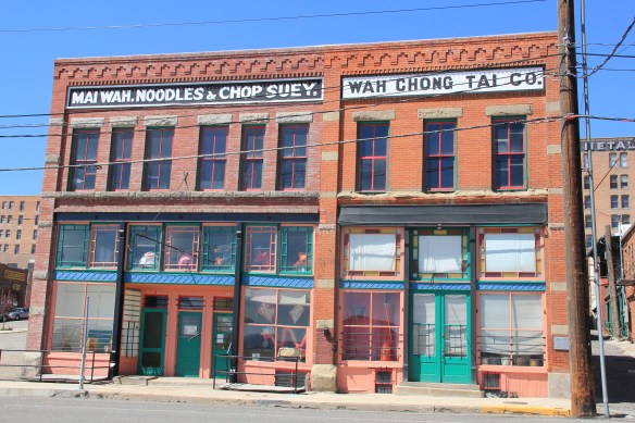 Mercury Street; at the same time the sex trade was alive and well to the east of that same street in a series of boarding houses and hotels. The Dumas Brothel, discussed in an earlier post, is listed in the National Register and its future as an adaptive reuse project and place for public interpretation is promising but not yet realized. African Americans in
early 20th century Butte lived even farther down the hill from Uptown, in a small neighborhood around Idaho Street and the Shaffers African Methodist Episcopal Church, now a pentecostal meeting house.

Uptown today is more a place for everyone, and has become the center of the community’s identity. It is easy to see why: massive, soaring buildings like the Metals Bank and Trust Tower and Hotel Finlen lend architectural dignity to the surroundings. Early 20th century classicism gives character and substance to Metals Bank whereas the Finlen has a classy
Renaissance Revival-style skin but then it has a spectacular contemporary Colonial Revival interior design, reminding us of Butte’s resurgence during the heyday of the Berkeley Pit boom from the mid-1950s through the turbulent 1960s.
The Hennessy Block is another commercial landmark, from the city’s founding generation, that has looked for a long-term solution for decades now. Built in 1898 with support from mine magnate Marcus Daly, the building housed what most consider to be the state’s first full-fledged department store, headed by and named for Daniel Hennessy. Minneapolis architect Frederick Kees designed it in a Renaissance Revival style. In 1901 the Anaconda Copper Company moved its executive offices to the top of the building, making it perhaps the leading corporate landmark in the city.
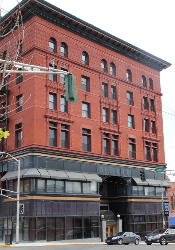
 The massive building still dominates the Uptown building, making its closure in Butte in 1980 that more disturbing for residents. When I did my preservation plan work in 1984-1985 the issue of what to do with the Hennessy was at the forefront. By the end of the decade, ENTECH renovated the building and reopened it fully for business. In 2010 came the popular Hennessy Market–giving the growing number of Uptown residents a grocery store once again.
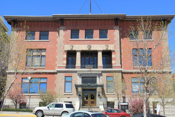 The Sliver Bow Club building (1906-7) also has shifted its purpose, from being the stately and eloquent clubhouse of the city’s elite to becoming a place for public offices and meetings in its once exclusive spaces. Originally conceived by the same Spokane architects who designed the Lake McDonald Lodge in Glacier National Park, according to recent research by museum curator and preservationist Patty Dean, the building’s architects ended up being Link and Haire, the noted Montana architectural firm.
The interior design came yet from another important firm, William A. French and Company of St. Paul, Minnesota. Here you find one of the state’s best “Arts and Crafts Movement” themed interiors–and one of the best in the entire West.
The interior design speaks loudly to the gender and class focus of the social club. Its success set there table for Link and Haire’s next Butte masterpiece, the Beaux Arts-styled Silver Bow County Courthouse (1910-1912). Few public spaces in the state, save, perhaps the State Capitol, rival the Butte courthouse for its ornate exterior and interior, representing an overstatement of public authority and power in a city where a handful of mining interests made so many of the decisions.
Two years after it opened, the courthouse was not a refuge for those in need but a barracks for the state militia during the violence of 1914. Today, however, it is most definitely the people’s house, and was duly celebrated during its 100th birthday in 2012. It is part of the city’s distinguished public landscape, including the Victorian City Hall and the Beaux Arts classicism of the Police Department.
Of course, there is much more to see and say about Uptown Butte, but hopefully this is enough to show community pride at work, the value of historic preservation, and a proud city on the upswing, despite the obstacles before it.

 Pony, as a gateway into the Tobacco Root Mountains, may be categorized as a ghost town in much of today’s literature about Montana, but it certainly has a lot of real people hanging around to be a ghost town. Established during the gold rush decade of the 1860s, mines here stayed in operation until World War II, and consequently, a wide range of historic buildings remain in the town today.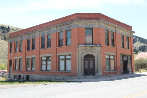


 Yes, Pony has a park, another of positive developments since my work in 1984-1985. The park is not only community space, but it also has various artifacts and machinery from the mining era, along with public interpretation of the district’s history and of the artifacts within the park.

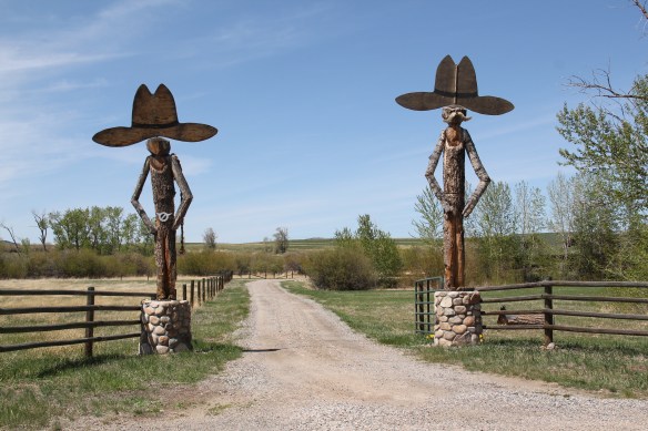
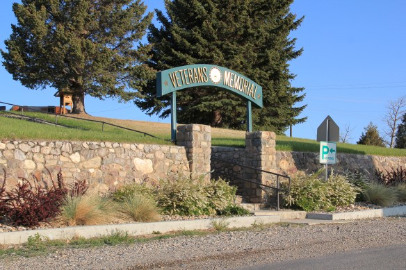 Nestled where Montana Highway 287 encounters U.S. Highway 287 in the southern end of Madison County, Ennis has changed in significant ways in the last 30 years. Its earlier dependence on automobile tourism to Yellowstone National Park has shifted into the favor of population growth and development in this portion of the county.
 The iconic Ennis Cafe, always a favorite place back in the day of the statewide work, remains, with a new false front emphasizing the wildlife and open spaces of this area. That place, along with several classic watering holes, served not only locals but the


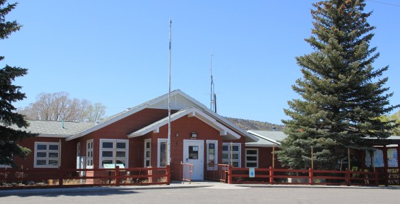




 of a section of the highway where you will encounter magnificent views of the Madison River Valley and open ranch lands.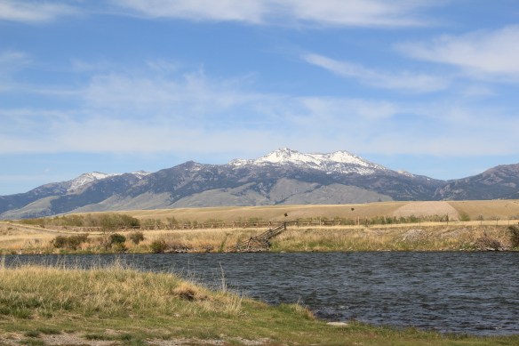
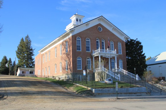 In restoring Virginia City, the Bovey family thus worked within a local government context. The Montana Heritage Foundation also works within that context today.
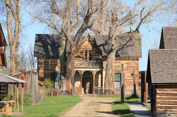 There was no living community here to speak of. It presented the opportunity for the Boveys to acquire and save other buildings from the area, however. The Finney property became the historic foundation of one of the state’s first “building zoos”–a collection of historic buildings moved together to tell a local history story. In 1984, when I was surveying Montana for the state historic preservation plan process, I paid little to no attention to Nevada City–here, I thought, was fake western history, with a bunch of moved buildings, which by definition are rarely eligible for the National Register.

 Nevada City tells multiple stories. One of the most apparent is how heritage tourism has shaped the late 20th century historic preservation movement. The lodging and restaurant at Nevada City is part of the general sustainability plan for the entire operation. The authentic environment and ease of highway access are major draws for tourists.
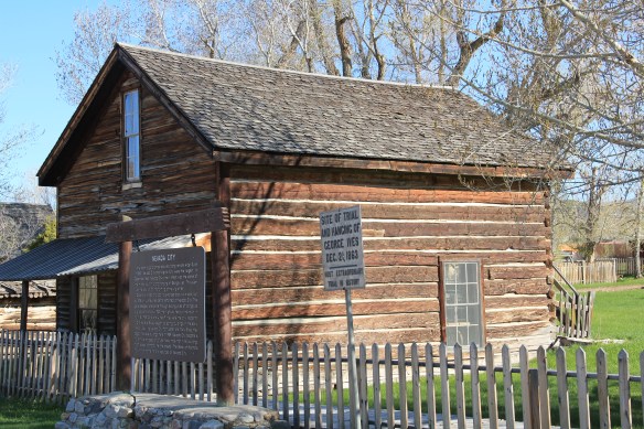
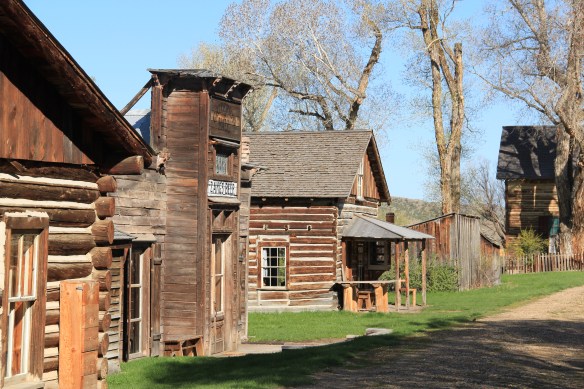

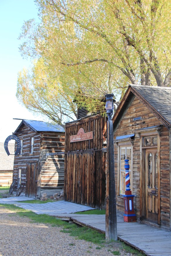 Another way to consider Nevada City is how heritage tourism ideas of the 1960s–especially the idea of excursion passenger trains–impacted the built environment. What is now known as Alder Gulch Railroad started c. 1964, a way of attracting visitors to stop in Nevada City where then they could take the short ride to Virginia City.

 telling example of how historic preservation worked in the West, a true public-private partnership, in the years immediately before the passage of the National Historic Preservation Act in 1966.

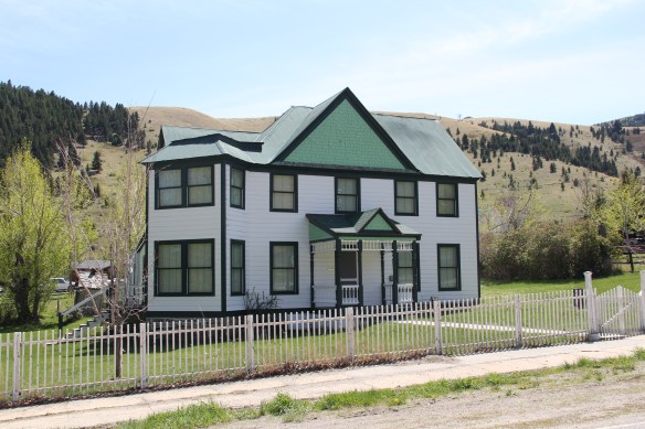
 For travelers along Montana Highway 287 the villages of Laurin and Alder are a mere diversion as you motor along from Sheridan to Virginia City. From those towns the Ruby River winds into the mountains, and they were the “end of the line” for the railroad spur that tied the southern part of Madison County to the state’s rail system. About two miles south of Sheridan is a former late 19th century Queen-Anne style ranch house that now houses the Ruby Valley Inn, a bed and breakfast establishment.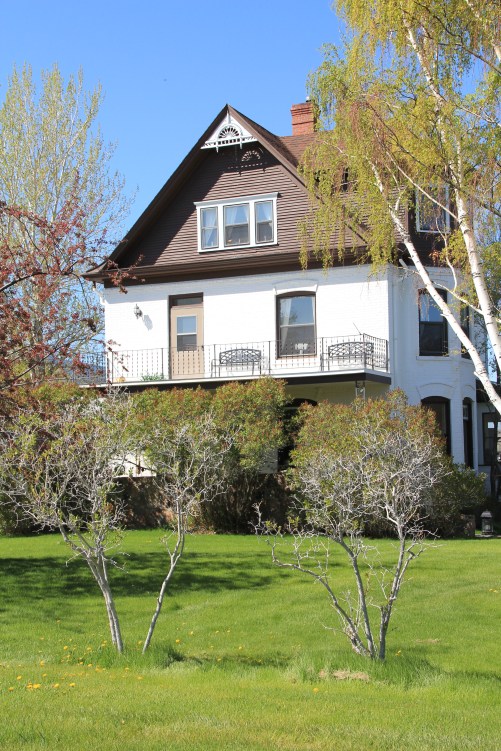
 At Laurin, St. Mary of the Assumption Catholic Church is a major Ruby River Valley landmark. It roots the settlement history of this place deep in the valley; John Batiste Laurin, for whom the village is named, established the place in July 1863. The church is listed in the National Register of Historic Places. Laurin was never large and a few repurposed commercial buildings indicate that. The historic Laurin School is now a private home, an excellent example of adaptive reuse of a historic rural school.
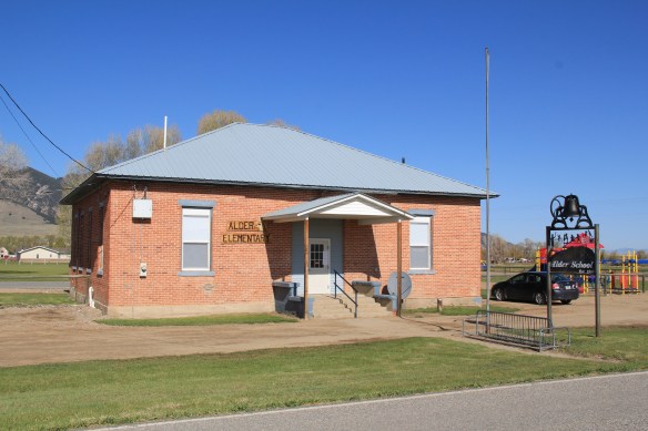
 While Laurin has a reserved, calm feel to it, Alder feels like the highway road-stop it has been for decades. Its historic brick school is not as architecturally elaborate as Laurin but in 2012 it was still open and serving local students.
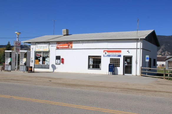
 Other commercial buildings from the early 20th century were now abandoned, including the eye-popping, yellow-painted false front bar and steakhouse, which I understand has moved its business elsewhere since 2012.

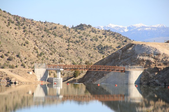
 At Alder you can go south on Montana Highway 357 and follow a good, paved road to the Ruby Dam and Reservoir. Part of the New Deal’s contributions to reshaping rural Montana through new or expanded irrigation projects, the Ruby Dam is not an awe-inspiring engineering feat on par with Fort Peck Dam. But the views are striking and here is another engineered landscape created by mid-20th century irrigation projects from the Bureau of Reclamation.

 Back on Montana 287 is one of the first log buildings that I visited in Montana, known as Robber’s Roost. Listed in the National Register, this two-story log building dates to 1863, constructed by Pete Daly as a road house for travelers to the Virginia City mines. Tradition has it that it also became a hang-out for road agents who stole from travelers, thus the name. It is an important part of the vernacular log construction tradition of the territorial era in Montana history.
 Cutting through Montana’s southeast corner is state highway 287, not a particularly long route at a little over 40 miles in length, but a spectacular one nonetheless as it connects the Madison River Valley (seen above) with the Ruby River Valley, with the famous mining town of Virginia City in the mountains in between.
 We have already talked about the western gateway to the highway, the town of Twin Bridges. Now I wish to move from west to east, stopping first Sheridan and its Bethel United Methodist Church, a brick late 19th century Gothic Revival church, which is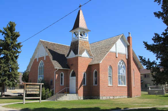
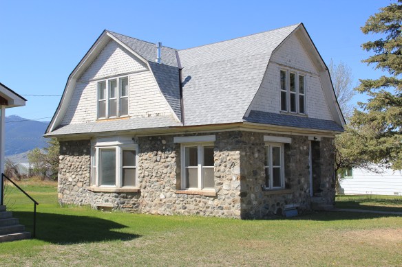 The O’Brien House is also listed in the National Register. Built in 1894, this two-story brick home is another example of Sheridan’s boom following railroad development. It is a rather late example of Italianate style (typically more popular in Montana in the 1870s).

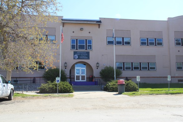 This Craftsman-style building dates c. 1920. Along the street are several interesting examples of domestic architecture from the early 20th century. You wonder if Mill Street might not be a possible National Register historic district.



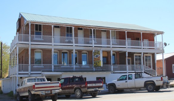
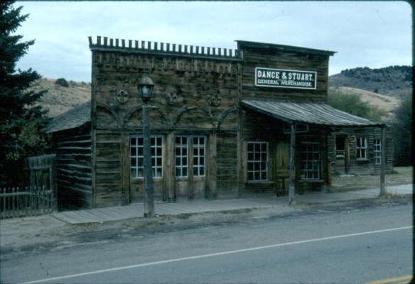
 Montana Highway 41 and the western side of the county is where I start, with the town of Silver Star, nestled between a spur line of the Northern Pacific Railroad, Highway 41, and Jefferson River. Gold was discovered nearby in 1866 and the town is named for a mine, but growth came more from transportation, with Silver Star serving as an early transportation stop between Virginia City and Helena in the 1870s. Today the place is best known for a privately held massive collection of mining machines, tools, and artifacts established by Lloyd Harkins, and for its rural post office that is nestled within the town’s general store.

 valley and its irrigation systems helped to produce one of the most famous barns in the state: the Round Barn, just north of Twin Bridges. In 1882 Noah Armstrong, who had made a fortune in mining, built the barn as part of his Doncaster Stable and Stud Farm. In 1933
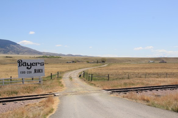 the Bayers family acquired the barn and incorporated it into their cattle business. When I visited in 1912 the barn was still an agricultural structure, with its wedding cake shape casting a distinct profile on the landscape. In 2015, the barn was restored to a new use: as a wedding and event reception space.


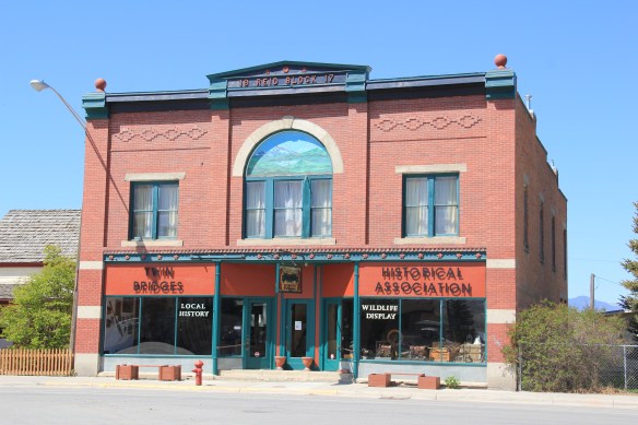
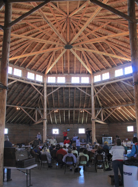 The result is spectacular, and with their restoration in the last 30 years, the buildings are not just landmarks but busy throughout the spring, summer, and fall.


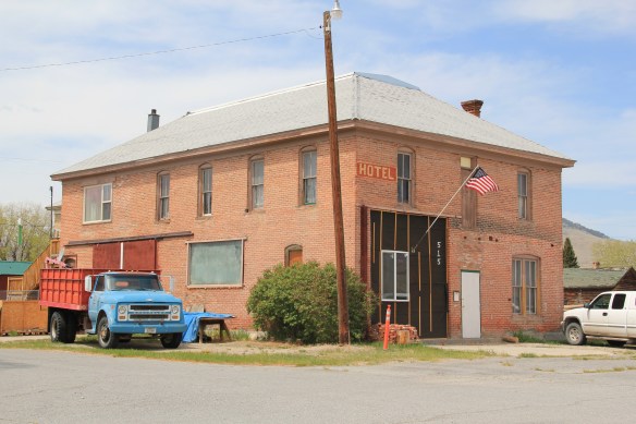
 The Old Hotel, a brick two-story gable-front building, also marks the town’s ascent during the early 20th century when the town achieved its highest population, about 750 in 1920. Today about half of that number call Twin Bridges home.
 My personal favorite, and a frequent stop during the 1980s, is the Blue Anchor Bar, nestled on the first floor, with an Art Deco style redesign, in a two-story commercial block.
 Twin Bridges is a very important river junction, thus the name, where the Beaverhead, Big Hole, and Ruby rivers all meet to form the Jefferson River. A public park near the confluence just south of the Montana 41/287 helps to tell that story. Nearby is the Twin Bridges School and its amazing modernist styled gymnasium.


 When travelers, and most Montana residents even, speak of Silver Bow County, they think of Butte. Outside of the Copper City, however, are small towns and a very different way of life. To the west we have already discussed Ramsay and its beginnings as a munitions factory town during World War I. Let’s shift attention now to the southern tip of the county and two places along the historic Union Pacific spur line, the Utah Northern Railroad, into Butte.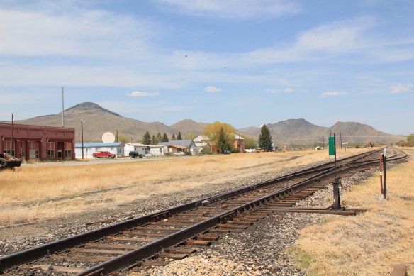


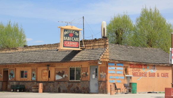
 when Melrose was a substantial, busy place. This 1870s-1880s history is largely forgotten today as the town has evolved into a sportsmen’s stop off Interstate I-15 due to its great access to the Big Hole River and surrounding national forests as well as the quite marvy Melrose Bar and Cafe, a classic western watering hole.
 Community institutions help to keep Melrose’s sense of itself alive in the 21st century. Its school, local firehall, the historic stone St John the Apostle Catholic Mission and the modernist styled Community Presbyterian Church are statements of stability and purpose.


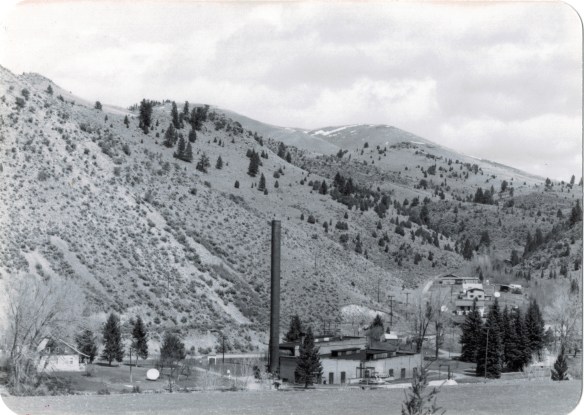 The photo above was published in A Traveler’s Companion to Montana History, in part because of the preservation excitement over this landmark but also because it documented how the boom in Butte helped to transform the historic landscape on the “other side of the divide.” The pump station took water from the Big Hole River and pumped it over the mountains to the Butte Water Company–without the pump station, expansion of the mines and the city would have been difficult perhaps impossible in the early 20th century.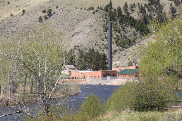
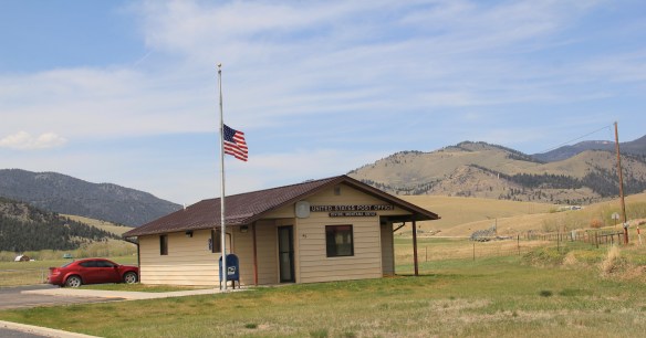 In 2014, in reaction to the listing of Montana rural schools as a threatened national treasure by the National Trust of Historic Preservation, CBS Sunday Morning visited Divide School for a feature story. Teacher Judy Boyle told the Montana Standard of May 16, 2014: “The town of Divide is pretty proud of its school and they want to keep it running. We have a Post Office, the Grange and the school — and if you close the school, you basically close the town.”
 Divide is one of many Montana towns where residents consider their schools to the foundation for their future–helping to explain why Montanans are so passionate about their local schools.


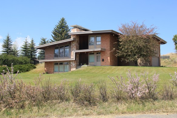 You don’t think Montana modernism when you think of Butte, but as this overview will demonstrate, you should think about it. I have already pinpointed contemporary homes on Ophir Street (above). The copper mines remained in high production during the Cold War era and many key resources remain to document that time in the city. For discussion sake, I will introduce some of my favorites.


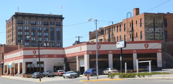 I looked at schools constantly across the state in 1984-1985 but did not give enough attention to the late 1930s Butte High School, a classic bit of New Deal design combining International and Deco styles in red brick. Nor did I pay attention to the modernist buildings associated with Butte Central (Catholic) High School.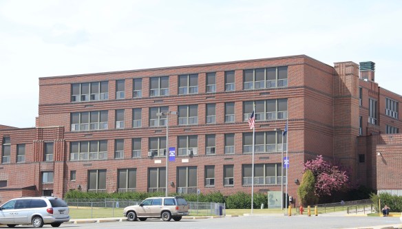


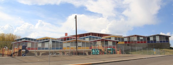


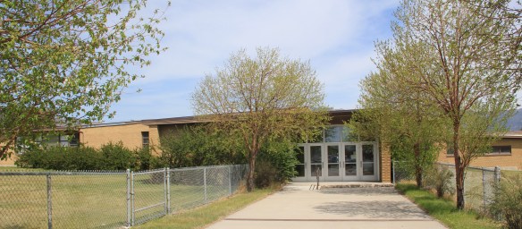

 You would think that I would have paid attention to the Walker-Garfield School since I stopped in at the nearby Bonanza Freeze, not once but twice in the Butte work of 1984. I
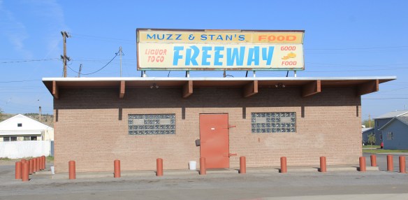
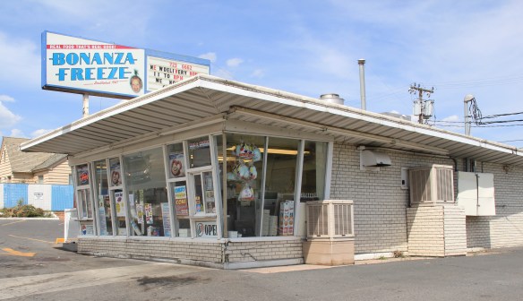 never gave a thought about recording this classic bit of roadside architecture either. Same too for Muzz and Stan’s Freeway Bar, although maybe I should not recount the number of stops at this classic liquor-to-go spot.